Introduc)on*to*Asia/RiCE* Technical*Demonstra)on*Sites*II.** Japan,*Indonesia,*Vietnam*
|
|
|
- Terence Parks
- 5 years ago
- Views:
Transcription

1 Introduc)on*to*Asia/RiCE* Technical*Demonstra)on*Sites*II.** Japan,*Indonesia,*Vietnam* Kei$Oyoshi 1,$Nobuhiro$Tomiyama 2,$Toshio$Okumura 2,$Shinichi$Sobue 1,2,$ Wahyu$Supriatna 3,$Rizatus$Shofiya? 3,$Lam$Dao$Nguyen 4 $and$thuy$le$toan 5 *! 1$ Japan$Aerospace$Explora?on$Agency$(JAXA) 2$ Remote$Sensing$Technology$Center$(RESTEC) 2$ Indonesian$Center$for$Agricultural$Land$Resources$Research$and$Development$(ICALRD) 4$ Vietnam$Southern$Satellite$Technology$Applica?on$Center$(VAST/STAC) 5 Centre$d'Etudes$Spa?ales$de$la$BIOsphère$(CESBIO) 7th$GEOSSYAP$Symposium@Tokyo,$Japan 27$May$2014
2 AsiaYRiCE$:$Aims$of$TDS$Ac?vi?es! Each$technical$demonstra?on$site$covers$approximately$100$ square$kilometers$or$a$single$province$and$represents$one$of$the$ key$components$of$asiayrice.$! $They$seek$to$develop,$exercise$and$refine$the$process$ $from$ stakeholder$engagement,$through$resource$marshalling$and$ deployment,$and$on$to$trial$implementa?on$and$product$ genera?on$using$sar$and$other$earth$observa?on$data$for$rice$ crop$monitoring.$ [AsiaYRiCE$GEOGLAM$Phase$1$Space$Data$ Requirements$Technical$Demonstrator$Site$ Characteriza?on,$2013]$ 2
3 Target$Products$for$AsiaYRiCE Enhance$our$rice$monitoring$ability$through$the$use$of$blending$ various$earth$observa?on$data,$especially$the$u?liza?on$of$sar$data$ ID Product Descrip)on P1 P2 P3 P4 P5 Rice*Crop*Area*Map Crop*Calendars Crop*Damage*Assessment Agro/met*informa)on @Nowcast$and$anomaly$of$radia?on,$land$ surface$temperature,$precipita?on,$soil$ with$satellite$derived$agroymet$ [AsiaYRiCE$Team,$2012,$$hdp:// 3
")

4 Technical*Demonstra)on*Sites Japan India China Taiwan Thailand Laos Vietnam*(North) Philippines Vietnam*(South) Malaysia Indonesia Phase*1A:*Jun*2013*/ Phase*1B:*Apr*2014*/ 4 4
5 World$Rice$Produc?on$(2011)! Asian$countries$produce$and$consume$90%$of$global$rice.$ Top*20*Rice*Produc)on*Countries*in*2011 China India Indonesia Bangladesh Vietnam Thailand Myanmar Philippines Brazil Cambodia Japan [FAOSTAT,$2012] 5
6 Overview$of$Progress$in$TDS$Ac?vi?es! Japan*(Yamagata*Pref.) Y$Field$survey$and$installing$AWS$system$with$camera Y$Acquisi?on$of$SAR$data$(RadarsatY2)$ Y$Development$of$paddy$field$mapping$sojware! Indonesia*(West*Java,*South*Kalimantan) Y$Field$Survey Y$Acquisi?on$of$SAR$data$(RadarsatY2) Y$Airborne$SAR$observa?on$and$phenology$classifica?on Y$Preparing$SAR$data$processing$for$paddy$field$mapping$!! Vietnam/South*(An*Giang*Prov.) Y$Field$Survey Y$Acquisi?on$of$SAR$data$(CSK,$RadarsatY2) Y$Paddy$field$mapping$by$SAR$(CSK)$and$valida?on Y$Yield$es?ma?on$by$SAR$(CSK)$and$valida?on 6
7 Japan: Yamagata Pref.
on*Prefecture*(t)* 700,000\"\"")


8 Loca?on$of$Technical$Demonstra?on$Site 90x150km Top*10 Rice*Produc)on*Prefecture*(t)* 700,000"" 600,000"" ,000"" 400,000"" 300,000"" 200,000"" 100,000"" 0"" Nigata" Hokkaido" Akita" Ibaraki" Yamagata" Miyagi" Fukushima" Tochigi" Chiba" Iwate" Tokyo" Rice*Crop*Calendar*in*Yamagata*Prefecture* Month Jan Feb Mar Apr May Jun Jul Aug Sep Oct Nov Dec Calendar Plan?ng Harves?ng Transplan?ng,$Irrigated$cropping,$Yield$=$approx$6.0$t/ha 8


9 Rice$Cul?vated$Area$Mapping$Sojware! INAHOR$:$INterna?onal$Asian$Harvest$mOnitoring$system$for$Rice 1.$Main$Window 2.$Select$SAR$data$for$Processing 3.$Rice$Cul?vated$Area$Mapping$ 4.$Calculate$Mapping$Area This*so]ware*enable*us*to*easily*map*rice*cul)vated*area*from*)me/series*SAR*data. 9

10 Paddy$Field$Mapping$by$ALOS$PALSAR$over$Yamagata Google$Eearth Tsuruoaka*City
11 Paddy$Field$Mapping$by$ALOS$PALSAR$over$Yamagata ALOS$PALSAR$FBS$ 2009 :$Planting$Season$(Min) Tsuruoaka*City
12 Paddy$Field$Mapping$by$ALOS$PALSAR$over$Yamagata ALOS$PALSAR$FBS$ 2009 :$Vegetative$Season$(Max) Tsuruoaka*City
13 Paddy$Field$Mapping$by$ALOS$PALSAR$over$Yamagata ALOS$PALSAR$FBS$ 2009 :$Range$(Max$Y$Min) Tsuruoaka*City

14 Paddy$Field$Mapping$by$ALOS$PALSAR$over$Yamagata ALOS$PALSAR$FBS$ 2009 Tsuruoaka*City


15 Field$Survey$for$Valida?on! Landcover$PreYsurvey$(Apr$2014)$ Paddy$field,$soybeans,$agricultural$land$abandonment$etc. Landcover*survey*will*be*conducted*in*the*beginning*of*Jun. 15
 Y$Powered$by$solar$panel!")

16 Field$Router$(Automa?c$Weather$Sta?on)! Characteris?cs Y$Automa?c$data$collec?on Y$Wireless$communica?on$(daily) Y$Powered$by$solar$panel! Meteorological$sensor Y$Air$Temperature Y$Precipita?on$(rain$gauge) Y$Radia?on Y$Wind$direc?on$and$velocity! Image$sensor Y$CMOS$camera$(120$M) [Developed$by Prof.$Mizoguchi,$U.Tokyo] 16


17 Near$realY?me$inYsitu$and$Satellite$Monitoring$System! Tsuruoka$City$in$Yamagata$Prefecture$ NDVI$(Vegeta?on)$ NDWI$(Water)$ NDSI$(Snow) AWS*with*Camera Near*real/)me*photo*and*satellite*monitoring*system 17


18 NDVI$(MOD13A1$500m)$vs$FR$Photo N ! E DOY = 348! (Snowing) DOY = 296! (tiller) DOY = 162! (installing syatem) DOY = 195! (Max NDVI) DOY = 244! DOY = 264! (Harvest) SAR*observa)on*data*(ALOS/2*etc.)*will*be*included*in*this*comparison*in*


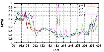


19 Current$TDS$Tsuruoka$Site$:$20th$May$2014 NDVI Planting Stage NDWI NDSI NDVI NDWI 19
20 RADARSATY2$Acquisi?on$Plan$Over$Tsuruoka Date UTC Site Beam Pass 16YAprY2014 $08:36: Japan Wide$Fine$ Ascending 23YAprY2014 $20:46: Japan Wide$Fine$ Descending 10YMayY2014 $08:36: Japan Wide$Fine$ Ascending 17YMayY2014 $20:46: Japan Wide$Fine$ Descending 3YJunY2014 $08:36: Japan Wide$Fine$ Ascending 10YJunY2014 $20:46: Japan Wide$Fine$ Descending 27YJunY2014 $08:36: Japan Wide$Fine$ Ascending 4YJulY2014 $20:46: Japan Wide$Fine$ Descending 21YJulY2014 $08:36: Japan Wide$Fine$ Ascending 28YJulY2014 $20:46: Japan Wide$Fine$ Descending 14YAugY2014 $08:36: Japan Wide$Fine$ Ascending 21YAugY2014 $20:46: Japan Wide$Fine$ Descending 7YSepY2014 $08:36: Japan Wide$Fine$ Ascending 14YSepY2014 $20:46: Japan Wide$Fine$ Descending 1YOctY2014 $08:36: Japan Wide$Fine$ Ascending 8YOctY2014 $20:46: Japan Wide$Fine$ Descending 25YOctY2014 $08:36: Japan Wide$Fine$ Ascending 1YNovY2014 $20:46: Japan Wide$Fine$ Descending 18YNovY2014 $08:36: Japan Wide$Fine$ Ascending 25YNovY2014 $20:46: Japan Wide$Fine$ Descending Wide Fine Mode! - 5.2x7.7 m! - 170x150 km! - Inc deg! - VV+VH 20
21 Indonesia: West Java


22 Loca?on$of$Technical$Demonstra?on$Site West$Java$ (Subang,$Karawang,$Indramayu) 22


23 Airborne$SAR$Observa?on$Campaign$(PiYSARYL2) 4*August*2012 Azimuth Range 20*km 90*km 23
24 Rice Phenological Mapping by Airborne SAR Airborne SAR (Pi-SAR-L2) data analysis - Pi-SAR-L2 carries similar SAR sensor as ALOS-2


25 Phenological Stages Each sampling area was classified into 6 phenological stages based on the visual interpretation of photos. Planting Vegetated1 Vegetated2 Harvesting Harvested Drought 25


26 SAR Images of Phenological Stages R:G:B = HH:HV:VV VV HH HV Planting Vegetated1 Vegetated2 Harvesting Harvested Drought 26

27 27

28 Rice Phenology Mapping by Airborne SAR 18 Planting Vegetated$1 Vegetated$2 RIpening 28
$=$$82.3%$ Kappa$Statistic$(X100)$=$$73.")
29 Classification Result in Batola, South Kalimantan Courtesy:$Wahyu$Supriatna$ and$$rizatus$shofiya?$ Class$distribution$for$selected$area No Class Percent 1 rice150days_kb rice105days_kb rice140days_kb water mixedtreecrops others nodata Total Overall$Class$Performance$:$ (13953$/$16954$)$=$$82.3%$ Kappa$Statistic$(X100)$=$$73.4% 29
30 Dry$Biomass$vs$Backscadering$Coef. HH HV r=0.85 r=0.62 VV Dry*Biomass n$=$37 Backsca`ering*Coef.*(dB) r=0.74 HH*showed*highest*correla)on*coefficient. ALOS/2*ScanSAR*mode*has*HH*mode. 30


31 SAR Data Collection : Radarsat-2 RADARSAT-2 Data (Ascending) Obs.*date Orbit Mode Beam 01#Dec#2013 Asc Fine W2 15#Dec#2013 Asc Fine W2 18#Jan#2014 Asc Fine W2 11#Feb#2014 Asc Fine W2 RADARSAT-2 Data (Descending) Obs.*date Orbit Mode Beam 23#Aug#2013 Des Fine W2 03#Nov#2013 Des Fine W2 27#Nov#2013 Des Fine W2 21#Dec#2013 Des Fine W2 14#Jan#2014 Des Fine W2 07#Feb#2014 Des Fine W2 Preliminary result Processed by INAHOR Rice cultivated area mapping 31
32 Vietnam: An Giang Prov.


33 6 th SAFE Workshop Kuala Lumpur, 23 rd April 2014 Background: Vietnam*is*one*of*the*leading* rice*producers*and*exporters*in*the*world.* Monitoring,*distribution*mapping,*and*yield* estimating*of*rice*crop,*hence,*have*become* the*imperative*tasks.*remote*sensing/based* technology*has*not*been*applied*in*practice* to*replace*traditional*ground/based*survey* methods.*this*is*because*of**limitations*of* image*processing*techniques,*and*available* EO*data*obtained,**which*have*a*remarkable* influence*on*results*achieved.* Objectives: Monitoring*of*rice*cropping*area* and*rice*growth;*and*estimating*rice*yield* and*production,*based*on*realistic*eo*data* acquisition*plan. Mekong*Delta,*Vietnam 13*provinces*and*city; Area:*40,553*Km 2 * (12%*or*1/8); Population:*17.39*M* (20%*or*1/5); Rice*production:** *Mton**************** (>*50%*or*1/2). ******Source:*GSO,* [Dr.*Lam*Dao*Nguyen*et*al.]
34 6 th SAFE Workshop Kuala Lumpur, 23 rd April 2014 AW 2013 and WS 2014 rice crop SAR data Dates of satellite data acquired: Cosmo-Skymed: 13 dates Radarsat-2: 12 dates Sensor Date*of*required Pass Cosmod\Skymed 2013\Aug\19 *DES Cosmod\Skymed 2013\Sep\04 *DES Cosmod\Skymed 2013\Sep\20 *DES Cosmod\Skymed 2013\Oct\06 *DES Cosmod\Skymed 2013\Oct\14 *DES Cosmod\Skymed 2013\Oct\22 *DES Cosmod\Skymed 2013\Oct\30 *DES Cosmod\Skymed 2013\Nov\07 *DES Cosmod\Skymed 2013\Nov\15 *DES Cosmod\Skymed 2013\Nov\23 *DES Cosmod\Skymed 2014\Jan\26 *DES Cosmod\Skymed 2014\Feb\11 *DES Cosmod\Skymed 2014\Feb\27 *DES Sensor Date*of*required Pass RADARSAT\2 2013\Aug\29 *DES RADARSAT\2 2013\Sep\22 *DES RADARSAT\2 2013\Oct\16 *DES RADARSAT\2 2013\Nov\09 *DES RADARSAT\2 2013\Dec\03 *DES RADARSAT\2 2013\Dec\08 *ASC RADARSAT\2 2013\Dec\27 *DES RADARSAT\2 2014\Jan\01 *ASC RADARSAT\2 2014\Jan\20 *DES RADARSAT\2 2014\Jan\25 *ASC RADARSAT\2 2014\Feb\13 *DES RADARSAT\2 2014\Apr\07 ASC [Dr.*Lam*Dao*Nguyen*et*al.]

35 6 th SAFE Workshop Kuala Lumpur, 23 rd April Field samples: 40 - Check points: 40 rice points, 24 non-rice points 9 [Dr.*Lam*Dao*Nguyen*et*al.]
 Sample rice field MPD3 sown on 17 Aug 2013 19")
!")
 4 Sep 2013 10 [Dr.")
36 6 th SAFE Workshop Kuala Lumpur, 23 rd April Aug 2013 (2) Sample rice field MPD3 sown on 17 Aug Aug 2013 Cosmo SkyMed data: StripMap Pingpong: HHVV 10 dates (19 Aug 23 Nov)! An Giang (Thoai Son & Chau Thanh districts): samples in red. 4 Sep 2013 (18) 4 Sep [Dr.*Lam*Dao*Nguyen*et*al.] 13 Sep 2013 (27) 20 Sep 2013
37 6 th SAFE Workshop Kuala Lumpur, 23 rd April 2014 HH/VV HH/VV*(dB) \3.5 CSK_PP_ CSK_PP_ CSK_PP_ CSK_PP_ CSK_PP_ CSK_PP_ CSK_PP_ CSK_PP_ \7.0 \ Ngày*sau*khi*sạ Days after sowing 15 [Dr.*Lam*Dao*Nguyen*et*al.]

38 6 th SAFE Workshop Kuala Lumpur, 23 rd April 2014 Methods used for rice/non-rice mapping using multi-temporal CSK radar imagery 16 [Dr.*Lam*Dao*Nguyen*et*al.]
39 6 th SAFE Workshop Kuala Lumpur, 23 rd April 2014 Commune* Estimated*area* Agency*data* Percentage*error* Name (ha) (ha) (%) An*Bình 2,274 2,287 \0.55 Bình*Thành 2,313 2,325 \0.52 Định*Mỹ 3,178 2, Định*Thành 2,613 2, Mỹ Phú*Đông 2,676 2,740 \2.39 Phú*Thuận 1, Thoại*Giang 2,203 2,248 \2.03 Núi*Sập ,000 Óc*Eo \13.46 Phú*Hòa \5.48 Vĩnh*Khánh 2,500 2,810 \12.39 Vĩnh*Phú 3,069 3,153 \2.73 3,000 Vĩnh*Trạch 1,269 1,424 \12.19 Vĩnh*Chánh 2,357 1, Vọng*Đông 2,601 2, Agency*data*(ha) 2,000 Accuracy assessment of rice/non-rice mapping method for AW 2013 crop in Thoai Son district using two-date CSK data (20 Sep and 14 Nov) based on statistical data y*=*0.9639x*+* R²*=* , [Dr.*Lam*Dao*Nguyen*et*al.] 0 0 1,000 2,000 3,000 4,000 Es)mated*area*(ha)


40 6 th SAFE Workshop Kuala Lumpur, 23 rd April 2014 Y Ra = *Ra *Ra *Ra 3 r 2 = 0.802, se y = ton/ha Where: Y Ra : rice yield (ton/ha), Ra 1 : polarisation ratio of first date image, Ra 2 : polarisation ratio of second date image, Ra 3 : polarisation ratio of third date image, 25 r 2 : the coefficient of determination, se y : the standard error for the y estimate. A*distribution*map*of*estimated*rice*yield*in*AW* 2013*crop*at*Chau*Thanh*and*Thoai*Son*district* using*three\date*polarisation*ratios: *CSK*04*Sep*013* *CSK*20*Sep*2013 *CSK*06*Oct*2013 [Dr.*Lam*Day*Nguyen*et*al.]

 :*14*days :*12:00*+/\*15*mi")
41 ALOS\2*:*New*SAR*Satellite ALOS/2*satellite* *Launch** *Orbit*type** Altitude** *Revisit*time** LSDN* * :*24th*May*2014* :*Sun\synchronous :*628*km*+/\*500*m*(for*reference*orbit) :*14*days :*12:00*+/\*15*min Solar*paddles SAR*antenna Z Y X 12:05 p.m. on May 24 PALSAR/2** *L/band*Synthetic*Aperture*Radar *Active*Phased*Array*Antenna*type ****two*dimensions*scan*(range*and*azimuth) *Antenna*size*:*3m(El)*x*10m(Az) *Bandwidth*:*14* *84MHz *Peak*transmit*Power**:*5100W *Observation*swath*:*25* *490km *Resolution*:*Range:*3*m*to*100*m Azimuth:*1*m*to*100*m Successfully*launched*on*24th*May*2014*and*antenna*deployment*was*completed. 41
42 ALOS\2*Observaton*Mode! ALOS*has*several*observaton*modes*different*in*polarizaton,** spatal*and*actual*temporal*resolutons.* Spotlight Ultra Fine High sensitive Fine ScanSAR nominal ScanSAR wide Bandwidth 84MHz 84MHz 42MHz 28MHz 14MHz 28MHz 14MHz Resolution Swath Rg Az 3 1m Rg Az 25 25km 3m 6m 10m 100m 60m 50km 50km 70km 350km (5-scan) 490km (7-scan) Polarization SP SP/DP SP/DP/FP/CP SP/DP S/A NESZ -24dB -24dB -28dB -26dB -26dB -23dB -23dB SP : HH or VV or HV, DP : HH+HV or VV+VH, FP : HH+HV+VH+VV, CP : Compact pol Rg 25dB 25dB 23dB 25dB 25dB 20dB Az 20dB 25dB 20dB 23dB 20dB 20dB FP 1 cov/yr HH+HV 6 cov/yr (SE Asia) HH+HV 9 cov/yr (SE Asia) ScanSAR*mode*can*provide*data*every*42/day,* *ScanSAR*is*useful*for*periodical**monitoring*with*provincial/country/level. 42
43 ! Progress* Summary! Field*survey*is*conductng*periodically*in*three*TDS.*! Preliminary*paddy*field*map*were*generated*and*in*validaton.*! Rice*yield*estmaton*by*SAR*was*conducted*(Vietnam).*! Radarsat\2*(wide*fine*mode)*data*are*acquired.*!! Future*Works*! Contnuaton*of*acquiring*satellite*and*in\situ*data*! Refinement*of*the*algorithms*to*estmate*paddy*field*area* and*yield*estmaton*based*on*the*in\situ*data*! Demonstraton*of*INAHOR*for*paddy*field*mapping*! Preparaton*of*the*utlizing*new*SAR*data*including*ALOS\2* Sentnel\1*and*RISAT\1 43

44 Thank You for Your Attention!!
The Current Status and Brief Results of Engineering Model for PALSAR-2 onboard ALOS-2 and Science Project
 The Current Status and Brief Results of Engineering Model for PALSAR-2 onboard ALOS-2 and Science Project + The 16 th KC meeting Japan Aerospace Exploration Agency Masanobu Shimada, Yukihiro KANKAKU The
JAXA Mission Updates
 JAXA Mission Updates JECAM/GEOGLAM Science Meeting Ottawa, Canada 21 23 July 2014 Presenter: Kei OYOSHI Earth Observation Research Center, JAXA Shin-ichi Sobue, Yutaka Kaneko, Masanobu Shimada, Shinichi
RADARSAT-2 Program Update Daniel De Lisle Canadian Space Agency
 RADARSAT-2 Program Update Daniel De Lisle Canadian Space Agency Presentation outline RADARSAT-1 Update RADARSAT-2 Mission description Mission Objectives System Characteristics Data Commercialization/Allocation
Global 25 m Resolution PALSAR-2/PALSAR Mosaic. and Forest/Non-Forest Map (FNF) Dataset Description
 Dataset Description") Global 25 m Resolution PALSAR-2/PALSAR Mosaic and Forest/Non-Forest Map (FNF) Dataset Description Japan Aerospace Exploration Agency (JAXA) Earth Observation Research Center (EORC) 1 Revision history Version
Global 25 m Resolution PALSAR-2/PALSAR Mosaic and Forest/Non-Forest Map (FNF) Dataset Description Japan Aerospace Exploration Agency (JAXA) Earth Observation Research Center (EORC) 1 Revision history Version
Contribution of Sentinel-1 data for the monitoring of seasonal variations of the vegetation
 Contribution of Sentinel-1 data for the monitoring of seasonal variations of the vegetation P.-L. Frison, S. Kmiha, B. Fruneau, K. Soudani, E. Dufrêne, T. Koleck, L. Villard, M. Lepage, J.-F. Dejoux, J.-P.
Application and potentials of RADAR and LiDAR technologies for forest carbon assessment in Pacific Island Countries
 Application and potentials of RADAR and LiDAR technologies for forest carbon assessment in Pacific Island Countries June 19th, 2012 PNGFA-JICA Workshop Masamichi HARAGUCHI (Kokusai Kogyo Co., Ltd.) Consultant
Global 25 m Resolution PALSAR-2/PALSAR Mosaic. and Forest/Non-Forest Map (FNF) Dataset Description
 Dataset Description") Global 25 m Resolution PALSAR-2/PALSAR Mosaic and Forest/Non-Forest Map (FNF) Dataset Description Japan Aerospace Exploration Agency (JAXA) Earth Observation Research Center (EORC) 1 Revision history Version
Global 25 m Resolution PALSAR-2/PALSAR Mosaic and Forest/Non-Forest Map (FNF) Dataset Description Japan Aerospace Exploration Agency (JAXA) Earth Observation Research Center (EORC) 1 Revision history Version
ALOS and PALSAR. Masanobu Shimada
 ALOS and PALSAR Masanobu Shimada Earth Observation Research Center, National Space Development Agency of Japan, Harumi 1-8-10, Harumi island triton square office tower X 22, Chuo-Ku, Tokyo-To, Japan, 104-6023,
The Role of RADARSAT-2 for Flood and Agriculture Monitoring
 The Role of RADARSAT-2 for Flood and Agriculture Monitoring Gordon Staples MDA Richmond, BC, CANADA gstaples@mda.ca RESTRICTION ON USE, PUBLICATION OR DISCLOSURE OF PROPRETIARY INFORMATION This document
Concept of the future L-band SAR mission for wide swath SAR observation
 Concept of the future SAR mission for wide swath SAR observation A.Karasawa 1, Y.Okada 1, Y.Yokota 1, S.Nakamura 1 1) Mitsubishi Electric Corporation 1 Outline 1:Development of SAR systems in MELCO 2:Development
RADARSAT-2 Modes and Applications
 RADARSAT-2 Modes and Applications Gordon Staples MDA Geospatial Services February 6, 2017 1 Introduction RADARSAT-2 was developed to meet operational needs via a versatile space segment and a responsive
Introduction to KOMPSAT
 Introduction to KOMPSAT September, 2016 1 CONTENTS 01 Introduction of SIIS 02 KOMPSAT Constellation 03 New : KOMPSAT-3 50 cm 04 New : KOMPSAT-3A 2 KOMPSAT Constellation KOMPSAT series National space program
Review. Guoqing Sun Department of Geography, University of Maryland ABrief
 Review Guoqing Sun Department of Geography, University of Maryland gsun@glue.umd.edu ABrief Introduction Scattering Mechanisms and Radar Image Characteristics Data Availability Example of Applications
Polarisation Capabilities and Status of TerraSAR-X
 Polarisation Capabilities and Status of TerraSAR-X Irena Hajnsek, Josef Mittermayer, Stefan Buckreuss, Kostas Papathanassiou German Aerospace Center Microwaves and Radar Institute irena.hajnsek@dlr.de
GMES Sentinel-1 Transponder Development
 GMES Sentinel-1 Transponder Development Paul Snoeij Evert Attema Björn Rommen Nicolas Floury Malcolm Davidson ESA/ESTEC, European Space Agency, Noordwijk, The Netherlands Outline 1. GMES Sentinel-1 overview
The Sentinel-1 Constellation
 The Sentinel-1 Constellation Evert Attema, Sentinel-1 Mission & System Manager AGRISAR and EAGLE Campaigns Final Workshop 15-16 October 2007 ESA/ESTECNoordwijk, The Netherlands Sentinel-1 Programme Sentinel-1
TerraSAR-X Calibration Status 2 Years in Flight
 2 Years in Flight Dirk Schrank, Marco Schwerdt, Markus Bachmann, Björn Döring, Clemens Schulz November 2009 CEOS 09 VG 1 Calibration Tasks Performed 2009 Introduction Challenge Schedule Re-Calibration
SAOCOM MISSION OVERVIEW
 COMISION NACIONAL DE ACTIVIDADES ESPACIALES (The Argentinean National Commission of Space Activities) SAOCOM MISSION OVERVIEW Laura Frulla, J. Medina, J. Milovich, G. R. Ortega, Marc Thibeault CONAE November
Synthetic aperture RADAR (SAR) principles/instruments October 31, 2018
 principles/instruments October 31, 2018") GEOL 1460/2461 Ramsey Introduction to Remote Sensing Fall, 2018 Synthetic aperture RADAR (SAR) principles/instruments October 31, 2018 I. Reminder: Upcoming Dates lab #2 reports due by the start of next
GEOL 1460/2461 Ramsey Introduction to Remote Sensing Fall, 2018 Synthetic aperture RADAR (SAR) principles/instruments October 31, 2018 I. Reminder: Upcoming Dates lab #2 reports due by the start of next
Soil moisture retrieval using ALOS PALSAR
 Soil moisture retrieval using ALOS PALSAR T. J. Jackson, R. Bindlish and M. Cosh USDA ARS Hydrology and Remote Sensing Lab, Beltsville, MD J. Shi University of California Santa Barbara, CA November 6,
GFOI Expert Workshop. Sensor interoperability, complementarity, and the temporal component. Francesco Holecz
 GFOI Expert Workshop Sensor interoperability, complementarity, and the temporal component Francesco Holecz Woods Hole Research Centre, MA, USA 10-11 June, 2014 On sensor interoperability Single-date vs.
Affordable space based radar for homeland security
 Changing the economics of space Affordable space based radar for homeland security Adam Baker Brent Abbott Phil Whittaker Rachel Bird Luis Gomes Summary Why Radar? However: Radar data is expensive Users
TerraSAR-X Mission: Application and Data Access
 TerraSAR-X Mission: Application and Data Access Irena Hajnsek & TSX TEAM German Aerospace Center Microwaves and Radar Institute Pol-InSAR Research Group 2 years in Orbit (since June 2007) irena.hajnsek@dlr.de
COSMO-skymed, TerraSAR-X, and RADARSAT-2 geolocation accuracy after compensation for earth-system effects
 Zurich Open Repository and Archive University of Zurich Main Library Strickhofstrasse 9 CH-857 Zurich www.zora.uzh.ch Year: COSMO-skymed, TerraSAR-X, and RADARSAT- geolocation accuracy after compensation
SAR Multi-Temporal Applications
 SAR Multi-Temporal Applications 83230359-DOC-TAS-EN-001 Contents 2 Advantages of SAR Remote Sensing Technology All weather any time Frequencies and polarisations Interferometry and 3D mapping Change Detection
European Space Agency and IPY
 European Space Agency and IPY ESA supports IPY 2007-2008 activities: First ESA step was a dedicated Announcement Opportunity (AO) for EO data provision in support IPY, released in 2006, with data provision
Development of normalized vegetation, soil and water indices derived from satellite remote sensing data
 Development of normalized vegetation, soil and water indices derived from satellite remote sensing data Takeuchi, W. & Yasuoka, Y. IIS/UT, Japan E-mail: wataru@iis.u-tokyo.ac.jp Nov. 25th, 2004 ACRS2004
SAR Remote Sensing (Microwave Remote Sensing)
") iirs SAR Remote Sensing (Microwave Remote Sensing) Synthetic Aperture Radar Shashi Kumar shashi@iirs.gov.in Electromagnetic Radiation Electromagnetic radiation consists of an electrical field(e) which
iirs SAR Remote Sensing (Microwave Remote Sensing) Synthetic Aperture Radar Shashi Kumar shashi@iirs.gov.in Electromagnetic Radiation Electromagnetic radiation consists of an electrical field(e) which
PAZ Product Definition
 PAZ Product Definition CALVAL Centre Juan Manuel Cuerda Muñoz, Javier del Castillo Mena, Adolfo López Pescador, Nuria Gimeno Martínez, Nuria Casal Vázquez, Patricia Cifuentes Revenga, Marcos García Rodríguez,
Futrajaya, Malaysia JULY 12, Jeong Heon SONG. Korea Aerospace Research Institution
 J P T M 2 0 1 1 Futrajaya, Malaysia JULY 12, 2011 Jeong Heon SONG Korea Aerospace Research Institution Outline Contribution of KARI Sentinel Asia / Data Provider Node International Charter KARI Space Activities
Canadian Space Agency Contribution to STG
 Canadian Space Agency Contribution to STG Canadian Space Agency 1 STG5 Geneva, Nov 30 to Dec 2, 2009 2 Canadian Space Agency ASAP Portefolio: Name Frozen Baseline Sea Ice Min and Max Snapshots Fine Image
Recreation Facility Hours
 NORMAL HOURS Recreation Facility Hours August 1, 2016 July 31, 2017 Last Revised: July 29, 2016 Effective Dates 2016: AUG 23 31, SEP 1 2, SEP 6 16, SEP 18 23, SEP 25 30, OCT 1 7, OCT 9 18, OCT 24 30, NOV
PALSAR SCANSAR SCANSAR Interferometry
 PALSAR SCANSAR SCANSAR Interferometry Masanobu Shimada Japan Aerospace Exploration Agency Earth Observation Research Center ALOS PI symposium, Greece Nov. 6 2008 1 Introduction L-band PALSAR strip mode
Disaster monitoring utilizing EO satellite system and DMS-Net
 Asia Geoinformation Forum 2012 Hanoi Vietnam, 19 th Sep. Disaster monitoring utilizing EO satellite system and DMSNet Susumu TAKAGISHI General Manager Satellite Business Division PASCO CORPORATION Agenda
Data Requirements Definition and Data Services Options for RAPP
 Data Requirements Definition and Data Services Options for RAPP Brian Killough CEOS Systems Engineering Office (SEO) 5 th GEOGLAM RAPP Workshop Frascati, Italy May 16-17, 2017 Requirements Update The observation
KOMPSAT Constellation. November 2012 Satrec Initiative
 KOMPSAT Constellation November 2012 Satrec Initiative KOMPSAT Constellation KOMPSAT National program Developed and operated by KARI (Korea Aerospace Research Institute) Dual use : Government & commercial
The Biomass Mission, status of the satellite system
 The Biomass Mission, status of the satellite system M. Arcioni, P. Bensi, M. Fehringer, F. Fois, F. Heliere, K. Scipal PolInSAR/Biomass Meeting 2015, ESRIN 29/01/2015 1. Key facts (lifetime, duty cycle
Introduction Active microwave Radar
 RADAR Imaging Introduction 2 Introduction Active microwave Radar Passive remote sensing systems record electromagnetic energy that was reflected or emitted from the surface of the Earth. There are also
The Global Financial Crisis and Its Impact on China and East Asia
 The Global Financial Crisis and Its Impact on China and East Asia Lawrence J. Lau, Ph. D. President and Ralph and Claire Landau Professor of Economics The Chinese University of Hong Kong and Kwoh-Ting
SAR Interferometry Capabilities of Canada's planned SAR Satellite Constellation
 SAR Interferometry Capabilities of Canada's planned SAR Satellite Constellation Dirk Geudtner, Guy Séguin,, Ralph Girard Canadian Space Agency RADARSAT Follow-on Program CSA is in the middle of a Phase
The Global Imager (GLI)
") The Global Imager (GLI) Launch : Dec.14, 2002 Initial check out : to Apr.14, 2003 (~L+4) First image: Jan.25, 2003 Second image: Feb.6 and 7, 2003 Calibration and validation : to Dec.14, 2003(~L+4) for
The Global Imager (GLI) Launch : Dec.14, 2002 Initial check out : to Apr.14, 2003 (~L+4) First image: Jan.25, 2003 Second image: Feb.6 and 7, 2003 Calibration and validation : to Dec.14, 2003(~L+4) for
Introduction to Radar
 National Aeronautics and Space Administration ARSET Applied Remote Sensing Training http://arset.gsfc.nasa.gov @NASAARSET Introduction to Radar Jul. 16, 2016 www.nasa.gov Objective The objective of this
ENVISAT ASAR MONTHLY REPORT MARCH 2012
 ENVISAT ASAR MONTHLY REPORT MARCH 2012 PUBLIC SUMMARY prepared by/préparé par IDEAS SAR Team reference/réference ENVI-CLVL-EOPG-TN-04-0009 issue/édition 73 revision/révision 0 date of issue/date d édition
Ionospheric Structure Imaging with ALOS PALSAR
 The Second ALOS PI Symposium Rhodes, Greece November 3 7, 008 Ionospheric Structure Imaging with ALOS PALSAR PI Number: 37 JAXA-RA PI: Jong-Sen Lee, Thomas L. Ainsworth and Kun-Shan Chen CSRSR, National
RADARSAT-1: An End-of-Mission Review of the Imaging and Calibration Performance of a Magnificent Canadian Instrument
 RADARSAT-1: An End-of-Mission Review of the Imaging and Calibration Performance of a Magnificent Canadian Instrument S. Cote, S. Srivastava Canadian Space Agency S. Muir Calian Technologies Ltd 1 RADARSAT-1
Biomass, a polarimetric interferometric P-band SAR mission
 Biomass, a polarimetric interferometric P-band SAR mission M. Arcioni, P. Bensi, M. Fehringer, F. Fois, F. Heliere, N. Miranda, K. Scipal Fringe 2015, ESRIN 27/03/2015 The Biomass Mission 1. Biomass was
ACTIVE MICROWAVE REMOTE SENSING OF LAND SURFACE HYDROLOGY
 Basics, methods & applications ACTIVE MICROWAVE REMOTE SENSING OF LAND SURFACE HYDROLOGY Annett.Bartsch@polarresearch.at Active microwave remote sensing of land surface hydrology Landsurface hydrology:
EMSA Additional Dataset Status 31 st March 2015
 EMSA Additional Dataset Status 31 st March 2015 DWH_MG2_EMSA_ADD_001a: _rush_optical_hr1... 2 DWH_MG2_EMSA_ADD_001b: _rush_optical_hr2... 3 DWH_MG2_EMSA_ADD_002a: ew acquisition_rush_optical_hr1... 4 DWH_MG2_EMSA_ADD_002b:
Francesco Holecz. TUBE II meeting - 17 June Land Degradation. Land Degradation
 Land Degradation Francesco Holecz Objective To identify and monitor land degraded areas, in particular those related to agricultural and pastoral activities. Following products are generated: Land cover
Earth Observation and Sensing Technologies: a focus on Radar Imaging Developments. Riccardo Lanari
 Earth Observation and Sensing Technologies: a focus on Radar Imaging Developments Riccardo Lanari Institute for Electromagnetic Sensing of the Environment (IREA) National Research Council of Italy (CNR)
Big picture with KOMPSAT KOMPSAT-3A / KOMPSAT-3 / KOMPSAT-5 / KOMPSAT-2
 Big picture with KOMPSAT KOMPSAT-3A / KOMPSAT-3 / KOMPSAT-5 / KOMPSAT-2 Big picture with KOMPSAT Introduction SI Imaging Services (SIIS) is the exclusive worldwide marketing and sales representative of
Estimation of soil moisture using radar and optical images over Grassland areas
 Estimation of soil moisture using radar and optical images over Grassland areas Mohamad El Hajj*, Nicolas Baghdadi*, Gilles Belaud, Mehrez Zribi, Bruno Cheviron, Dominique Courault, Olivier Hagolle, François
LANDSCAPES IN TRANSITION
 LANDSCAPES IN TRANSITION A photographic reminder of the future to come, each month a pause for reflection on our changing planet. As seen from our satellites, Earth s beauty is overwhelming. Yet the messages
Airborne and Space borne SAR Missions Shefali Agrawal Photogrammetry and Remote Sensing Department
 Airborne and Space borne SAR Missions Shefali Agrawal Photogrammetry and Remote Sensing Department EDUSAT Short Course on Microwave Remote Sensing and its Application (5th February 2014) Microwave Remote
Remote Sensing : An overview
 Remote Sensing : An overview Contents Introduction Historical review Applications Electromagnetic spectrum Interaction with atmosphere- Atmospheric windows Spectral signature Multispectral Space Multispectral
Time Trend Evaluations of Absolute Accuracies for PRISM and AVNIR-2
 The 3 rd ALOS Joint PI Symposium, Kona, Hawaii, US Nov. 9-13, 2009 Time Trend Evaluations of Absolute Accuracies for PRISM and AVNIR-2 Takeo Tadono*, Masanobu Shimada*, Hiroshi Murakami*, Junichi Takaku**,
7.7 TerraSAR-X & TanDEM-X
 7.7 TerraSAR-X & TanDEM-X Two Innovative Remote Sensing Stars for space-borne Earth Observation Vorlesung Wolfgang Keydel Microwaves and Radar Institute, German Aerospace Research Center (DLR), D-82230
TanDEM-X: Mission Status & Scientific Contribution
 TanDEM-X: Mission Status & Scientific Contribution Irena Hajnsek 1/2, Gerhard Krieger 1, Kostas Papathanassiou 1, Stefan Baumgartner 1, Marc Rodriguez-Cassola 1, Pau Prats 1, Maria Sanjuan Ferrer 1, Florian
Advanced Optical Satellite (ALOS-3) Overviews
 Overviews") K&C Science Team meeting #24 Tokyo, Japan, January 29-31, 2018 Advanced Optical Satellite (ALOS-3) Overviews January 30, 2018 Takeo Tadono 1, Hidenori Watarai 1, Ayano Oka 1, Yousei Mizukami 1, Junichi
K&C Science Team meeting #24 Tokyo, Japan, January 29-31, 2018 Advanced Optical Satellite (ALOS-3) Overviews January 30, 2018 Takeo Tadono 1, Hidenori Watarai 1, Ayano Oka 1, Yousei Mizukami 1, Junichi
Sentinel-1 Calibration and Performance
 Sentinel-1 Calibration and Performance Paul Snoeij Evert Attema Björn Rommen Nicolas Floury Berthyl Duesmann Malcolm Davidson Ramon Torres European Space Agency Sentinel-1 Mission Objectives Component
ALOS-Indonesia POLinSAR Experiment (AIPEX): First Result*
: First Result*") ALOS-Indonesia POLinSAR Experiment (AIPEX): First Result* Mahmud Raimadoya(1), Ludmila Zakharova(2), Bambang Trisasongko(1), Nurwadjedi(3) (1) Bogor Agricultural University (IPB), P.O. Box 2049, Bogor
ALOS-Indonesia POLinSAR Experiment (AIPEX): First Result* Mahmud Raimadoya(1), Ludmila Zakharova(2), Bambang Trisasongko(1), Nurwadjedi(3) (1) Bogor Agricultural University (IPB), P.O. Box 2049, Bogor
Sentinel-1 System Overview
 Sentinel-1 System Overview Dirk Geudtner, Rámon Torres, Paul Snoeij, Malcolm Davidson European Space Agency, ESTEC Global Monitoring for Environment and Security (GMES) EU-led program aiming at providing
SARscape for ENVI. A Complete SAR Analysis Solution
 SARscape for ENVI A Complete SAR Analysis Solution IDL and ENVI A Foundation for SARscape IDL The Data Analysis & Visualization Platform Data Access: IDL supports virtually every data format, type and
XSAT Ground Segment at CRISP
 XSAT Ground Segment at CRISP LIEW Soo Chin Head of Research, CRISP http://www.crisp.nus.edu.sg 5 th JPTM for Sentinel Asia Step-2, 14-16 Nov 2012, Daejeon, Korea Centre for Remote Imaging, Sensing and
Application Potential of Planned SAR Satellites a Preview
 PREPRINT/PRÉTIRAGE Application Potential of Planned SAR Satellites a Preview J.J. van der Sanden 1, P. Budkewitsch 1, R. Landry 1, M.J. Manore 2, H. McNairn 1, T.J. Pultz 1, and P.W. Vachon 1 1 Canada
NovaSAR-S - Bringing Radar Capability to the Disaster Monitoring Constellation
 Changing the economics of space NovaSAR-S - Bringing Radar Capability to the Disaster Monitoring Constellation SSTL: Philip Davies, Phil Whittaker, Rachel Bird, Luis Gomes, Ben Stern, Prof Sir Martin Sweeting
ERS/ENVISAT ASAR Data Products and Services
 ERS/ENVISAT ASAR Data Products and Services Andrea Celentano Business Manager celentan@eurimage.com What is Eurimage? Founded in 1989 Current shareholders: Since 1989 Commercial Partner of the European
COMBINED ANALYSIS OF OPTICAL AND SAR REMOTE SENSING DATA FOR FOREST MAPPING AND MONITORING
 7 th International Symposium on Digital Earth Perth, Australia 23-25 August 2011 COMBINED ANALYSIS OF OPTICAL AND SAR REMOTE SENSING DATA FOR FOREST MAPPING AND MONITORING E. LEHMANN 1, Z.-S. ZHOU 1, P.
CSA Report on Earth Observation
 CSA Report on Earth Observation Dr. Satish K. Srivastava WGCV Chair & CSA Member of WGCV Canadian Space Agency Presented at College Park, MD, USA Sep 30 th to Oct 2 nd, 2014 RADARSAT-2 Spacecraft Health
DLR contribution and perspectives for JECAM
 DLR contribution and perspectives for JECAM Dr. Helmut Staudenrausch 1, Dr. Achim Roth 2 1 DLR Space Administration, Earth Observations helmut.staudenrausch@dlr.de 2 DLR, German Remote Sensing Data Center
The Radar Ortho Suite is an add-on to Geomatica. It requires Geomatica Core or Geomatica Prime as a pre-requisite.
 Technical Specifications Radar Ortho Suite The Radar Ortho Suite includes rigorous and rational function models developed to compensate for distortions and produce orthorectified radar images. Distortions
ASAR, MERIS and AATSR products
 ASAR, MERIS and AATSR products Francesco Sarti and Steffen Dransfeld ESA/ESRIN 25 February 2008 ENVISAT http://envisat.esa.int/ Launched in 2002. Sun-synchronous polar orbit (SSO): Nominal reference orbit
SPACE TECHNOLOGY INSTITUTE AND VNREDSat-1
 The First Steering Committee (FSC) of The Sentinel Asia Step 3 13-15 Oct 2015 SPACE TECHNOLOGY INSTITUTE AND VNREDSat-1 Ngo Duy Tan Deputy Director, Centre for Small Satellite Control and Exploitation,
RADARSAT-2 Image Quality and Calibration Update
 RADARSAT-2 Image Quality and Calibration Update by Dan Williams, Yiman Wang, Marielle Chabot, Pierre Le Dantec, Ron Caves, Yan Wu, Kenny James, Alan Thompson, Cathy Vigneron www.mdacorporation.com Image
Sub-Mesoscale Imaging of the Ionosphere with SMAP
 Sub-Mesoscale Imaging of the Ionosphere with SMAP Tony Freeman Xiaoqing Pi Xiaoyan Zhou CEOS Workshop, ASF, Fairbanks, Alaska, December 2009 1 Soil Moisture Active-Passive (SMAP) Overview Baseline Mission
High resolution ground deformations monitoring by COSMO-SkyMed PSP SAR interferometry
 High resolution ground deformations monitoring by COSMO-SkyMed PSP SAR interferometry Mario Costantini e-geos - an ASI/Telespazio Company, Rome, Italy mario.costantini@e-geos.it Summary COSMO-SkyMed satellite
Alos PALSAR polarimetric data for land land cover classification in Amazon.
 Alos PALSAR polarimetric data for land land cover classification in Amazon. An emphasis on phase information. Investigators: Luciano Vieira Dutra (dutra@dpi.inpe.br) Corina C. Freitas Associate Res: Graziela
Climate Update September 24, 2003 WATF meeting
 Climate Update September 24, 2003 WATF meeting Nolan Doesken Colorado Climate Center Prepared by Odie Bliss http://ccc.atmos.colostate.edu August 2003 Precipitation as a percent of the 1971-2000 average.
RADARSAT-2 PRODUCT DESCRIPTION
 RADARSAT-2 PRODUCT DESCRIPTION Summary: This document defines the characteristics of RADARSAT-2 products. IMPORTANT NOTES: This document describes the characteristics of RADARSAT-2 Products. The product
KEY TECHNOLOGY DEVELOPMENT FOR THE ADVENACED LAND OBSERVING SATELLITE
 KEY TECHNOLOGY DEVELOPMENT FOR THE ADVENACED LAND OBSERVING SATELLITE Takashi HAMAZAKI, and Yuji OSAWA National Space Development Agency of Japan (NASDA) hamazaki.takashi@nasda.go.jp yuji.osawa@nasda.go.jp
WHAT IS NEXT IN EARTH OBSERVATION. SkyMed Mission
 WHAT IS NEXT IN EARTH OBSERVATION COSMO-SkyMed SkyMed Mission Paolo Ammendola Italian Space Agency Florence, Sept. 19, 2001 ammendola@asi asi.it THE NEEDS Market studies indicate that the value of the
9/12/2011. Training Course Remote Sensing Basic Theory & Image Processing Methods September 2011
 Training Course Remote Sensing Basic Theory & Image Processing Methods 19 23 September 2011 Popular Remote Sensing Sensors & their Selection Michiel Damen (September 2011) damen@itc.nl 1 Overview Low resolution
New capabilities in Earth Observation for agriculture
 New capabilities in Earth Observation for agriculture Prof. Katarzyna Dabrowska-Zielinska Head of Remote Sensing Department Institute of Geodesy and Cartography Modzelewskiego 27 Street 02-679 Warsaw Poland
KONGSBERG SATELLITE SERVICES 2017 Line Steinbakk, Director Programs. Himmel og hav - Ålesund 3. Oktober 2017
 KONGSBERG SATELLITE SERVICES 2017 Line Steinbakk, Director Programs Himmel og hav - Ålesund 3. Oktober 2017 KSAT HQ IN TROMSØ 69N Established in 1967 Kongsberg Satellite Services since 2002 World leading
Sentinel-1A Tile #11 Failure
 MPC-S1 Reference: Nomenclature: MPC-0324 OI-MPC-ACR Issue: 1. 2 Date: 2016,Oct.13 FORM-NT-GB-10-1 MPC-0324 OI-MPC-ACR V1.2 2016,Oct.13 i.1 Chronology Issues: Issue: Date: Reason for change: Author 1.0
GNSS Education Activities The University of Tokyo
 GNSS Education Activities The University of Tokyo Dinesh MANANDHAR, Associate Professor Center for Spatial Information Science, The University of Tokyo 6 th NOV 2018 dinesh@iis.u-tokyo.ac.jp Slide : 1
TerraSAR-X Image Product Guide
 [Texte] TerraSAR-X Image Product Guide Page 1 of 24 Ref.: OP00xxxxxxxxxx Commercial in Confidence 1 Introduction TerraSAR-X and TanDEM-X are commercial German Synthetic Aperture Radar (SAR) Earth observation
Utilization of Radar data for Maritime Surveillance
 INDESO Project Utilization of Radar data for Maritime Surveillance DENDY MAHABROR MARINE RESEARCH CENTER INDESO RADAR GROUND STATION RADARSAT-2 AND COSMO-SKYMED BALI INDESO satelit VMS satelite radar vessel
Light penetration within a clear water body. E z = E 0 e -kz
 THE BLUE PLANET 1 2 Light penetration within a clear water body E z = E 0 e -kz 3 4 5 Pure Seawater Phytoplankton b w 10-2 m -1 b w 10-2 m -1 b w, Morel (1974) a w, Pope and Fry (1997) b chl,loisel and
Developing land cover products in Monsoon Asia through integration of Landsat (GLS2005) and L-band PALSAR imagery: --- An Update
 and L-band PALSAR imagery: --- An Update") Developing land cover products in Monsoon Asia through integration of Landsat (GLS2005) and L-band PALSAR imagery: --- An Update Landsat 7 ETM+ PALSAR Xiangming Xiao Center for Spatial Analysis, University
Developing land cover products in Monsoon Asia through integration of Landsat (GLS2005) and L-band PALSAR imagery: --- An Update Landsat 7 ETM+ PALSAR Xiangming Xiao Center for Spatial Analysis, University
SARscape 4.1 Supported Sensors/Products (October 2008)
") SARscape 4.1 Supported Sensors/Products (October 2008) ALOS PALSAR (provided by JAXA) In case of RAW (level 1.0) data, import is carried out within the Focusing Module. PALSAR RAW data in CEOS standard
SARscape 4.1 Supported Sensors/Products (October 2008) ALOS PALSAR (provided by JAXA) In case of RAW (level 1.0) data, import is carried out within the Focusing Module. PALSAR RAW data in CEOS standard
ERS-2 SAR CYCLIC REPORT
 ERS-2 SAR CYCLIC REPORT C YCLE 101 14-DEC-2004 to 18-JAN-2005 Orbit 50456 to 50957 Prepared by: PCS SAR TEAM Issue: 1.0 Reference: Date of Issue Status: Document type: Technical Note Approved by: T A B
Aquarius/SAC-D and Soil Moisture
 Aquarius/SAC-D and Soil Moisture T. J. Jackson P. O Neill February 24, 2011 Aquarius/SAC-D and Soil Moisture + L-band dual polarization + Combined active and passive Coarse spatial resolution (~100 km)
Exploring the Potential Pol-InSAR Techniques at X-Band: First Results & Experiments from TanDEM-X
 Exploring the Potential Pol-InSAR Techniques at X-Band: First Results & Experiments from TanDEM-X K. Papathanassiou, F. Kugler, J-S. Kim, S-K. Lee, I. Hajnsek Microwaves and Radar Institute (DLR-HR) German
Status of Sentinel-1 and acquisition plans for GFOI
 Status of Sentinel-1 and acquisition plans for GFOI Frank Martin Seifert, Pierre Potin, Johannes Roeder, ESA Earth Observation Programme 5 th Space Data Coordination, ESRIN, Frascati, 24 February 2014
NATIONAL INSTITUTE OF ECONOMIC AND SOCIAL RESEARCH ESTIMATES OF MONTHLY GDP. Embargo until hours on 11 th January 2013
 NATIONAL INSTITUTE OF ECONOMIC AND SOCIAL RESEARCH ESTIMATES OF MONTHLY GDP Embargo until 15.00 hours on 11 th January 2013 Our monthly estimates of GDP suggest that output declined by 0.3 per cent in
SAR missions for oceanography at the European Space Agency
 SAR missions for oceanography at the European Space Agency ERS-1, ERS-2, Envisat, Sentinel-1A, Sentinel-1B, ESA 3 rd Party Missions (ALOS) Prepared by ESA teams and ESA supporting companies ESA and SAR
SAR Imagery: Airborne or Spaceborne? Presenter: M. Lorraine Tighe PhD
 SAR Imagery: Airborne or Spaceborne? Presenter: M. Lorraine Tighe PhD Introduction The geospatial community has seen a plethora of spaceborne SAR imagery systems where there are now extensive archives
SCANSAR AND SPOTLIGHT IMAGING OPERATION STUDY FOR SAR SATELLITE MISSION
 SCANSAR AND SPOTLIGHT IMAGING OPERATION STUDY FOR SAR SATELLITE MISSION Bor-Han Wu, Meng-Che Wu and Ming-Hwang Shie National Space Organization, National Applied Research Laboratory, Taiwan *Corresponding
Maximize Utilization of the performance of EOSs and strengthen. The First Steering Committee Secretariat JAXA
 Maximize Utilization of the performance of EOSs and strengthen cooperation among DPN/DAN The First Steering Committee Secretariat JAXA ALOS 2 observation is strong tool for disaster monitoring Wide area/range