Contribution of Sentinel-1 data for the monitoring of seasonal variations of the vegetation
|
|
|
- Rolf McKenzie
- 5 years ago
- Views:
Transcription


1 Contribution of Sentinel-1 data for the monitoring of seasonal variations of the vegetation P.-L. Frison, S. Kmiha, B. Fruneau, K. Soudani, E. Dufrêne, T. Koleck, L. Villard, M. Lepage, J.-F. Dejoux, J.-P. Rudant, Th. Le Toan Bruges, May


2 Spaceborne Radar Sensors ERS1 SAR Diffusiomètre Bande C JERS SAR Bande L RADARSAT SAR Bande C ERS2 SAR Scatterometer Bande C Quikscat Scatterometer Bande Ku RADARSAT2 SAR Bande C TerraSAR X SAR Bande X ENVISAT SAR Bande C METOP Scatterometer Bande C ALOS AR Bande L COSMO-SkyMed SAR Bande X Tandem X SAR Bande X Sentinel-1 SAR Bande C ALOS 2 SAR Bande L
 Temperate Forest o: Winter wheat : rape Wooding et al., 1993 -.")
3 Vegetation monitoring with ERS SAR Crops (Spat. Res. 20 m - Temp. Res. 35 days, VV pol.) Temperate Forest o: Winter wheat : rape Wooding et al., : oaks : beeches pine grassland Day of Year Proisy et al., 1999

4 ERS Scatterometer (50 km / 4 days) Global image of Radar backscattering coefficient s 0

 Dry year Wet year ESCAT scatterometer - incidence: 45 - l = 6 cm")
5 ERS scatterometer (Spat. res. 50 km - Temp. res. 5 days) Temporal monitoring over large homogeneous areas (Sahelian steps) Dry year Wet year ESCAT scatterometer - incidence: 45 - l = 6 cm High variability of the inter annual yearly amplitude ==> linked to annual biomass (annual grasses)
6 SAR SENTINEL-1 Scatterometers Acquisitions period: 12 days (S1-A) 6 days( S1- A+B) Planned mode over land surfaces: Interferometric Wide (IW) 2 Polarisations: VV VH Swath: 250 km (3 sub-swaths) GRD Products : Spatial resolution: Pixel: 10 m 20 m SLC Products Source: ESA Spatial resolution: 3 x 20 m; Pixel: 2 x 14 m (rge x az.) Temporal monitoring of seasonal variations of land surfaces Radar Backscattering Coefficient s 0 Interferometric Coherence r

7 SAR SENTINEL-1 Scatterometers Acquisitions period: 12 days (S1-A) 6 days( S1- A+B) Planned mode over land surfaces: Interferometric Wide (IW) 2 Polarisations: VV VH Swath: 250 km (3 sub-swaths) GRD Products : Spatial resolution: Pixel: 10 m 20 m SLC Products Source: ESA Spatial resolution: 3 x 20 m; Pixel: 2 x 14 m (rge x az.) Temporal monitoring of seasonal variations of land surfaces Radar Backscattering Coefficient s 0 Interferometric Coherence r
8 Cohérence ρ = z 1 z 2 z 1 2 z 2 2 Complex radar data: ==> Geometrical stability ( l) of el. scat. within res. cell between 2 acquisitions (6 or 12 days) Im Im Im z 1 z 1 Re Re Re z 2 z 2 z 1 z r = 1 r = 0.9 r = 0.1 Vegetation phenological stages?


9 IW mode Acquisition: VV + VH Radar backscattering coeffcient s 0 cohérence March March 2015 s 0 VV - s 0 VH s 0 VH / s 0 VV r VV - r VH r VV / r VH


10 s 0 multitemporal color composite image May 5 - Sept. 2 Dec VV Polarisation VH Polarisation


11 r multitemporal Color composite image May 5 / 17 - Sept. 2 / 14 Dec. 19 / VVPolarisation VHPolarisation


12 Orbite 59 Acquisitions over Parisian Region Fontainebleau Forest Orbite 110 ONF management, oaks, beeches, pines plots Coll. ESE / Paris Sud Remote Sensing + forest models: ==> better understanting functioning + interaction with climate / hazard
13 Precipitations (mm) Temperature ( C) Oaks Radar Backscat. Coeff. s 0 Coherence r Asc. orbit Desc. orbit VV/VH Day of Year Day of Year Seasonal cycles 0 VH ==> s 0 VV / s 0 VH (yearly amplitude 3 db) signal low and constant (Marchs-Nov.) r VV et r VH Identical higher values for low temperatures
14 Precipitations (mm) Oaks Radar Backscat. Coeff. s 0 Asc. orbit Desc. orbit ERS (VV) temporal signature -.: Oaks : Beeches Pine VV/VH Grassland no seasonal cycle in VV pol. Seasonal cycle s 0 VH ==> s 0 VV / s 0 VH Proisy et al., 1999
15 Oaks Radar Backscat. Coeff. s 0 Asc. orbit Desc. orbit NDVI VV/VH s 0 VV / s 0 VH Day of Year Day of Year s 0 VV / s 0 VH and NDVI in phase C band sensitive to foliar activity
16 Precipitations (mm) Oaks Radar Backscattering Coefficient s 0 Asc. orbit Desc. orbit Day of Year Low correlation with precipitations C band: low soil contribution over forest

17 Precipitations (mm) Grassland Radar Backscattering Coefficient s 0 Asc. orbit Desc. orbit Day of Year highercorrelation with precipitations
18 Precipitations (mm) Temperature ( C) Pine trees Radar Backscat. Coeff. s 0 Coherence r Asc. orbit Desc. orbit VV/VH Day of Year Day of Year
19 Pine trees Radar Backscat. Coeff. s 0 Coherence r NDVI VV/VH Day of Year Day of Year


20 High temporal frequency... to detect erroneous data!
21 Temperate Forests Radar Backscattering Coeff. s 0 Dt = 12-6 days VV + VH Well suited for seasonal variation monitoring s 0 VV / s 0 VH in phase with foliar activity No seasonal cycle s 0 VV Low correlation with precipitations Coherence: r VV and r VH identical low ( r = 0.2 noise) and constant from March to Nov. higher values during winter with low temperatures
 Winter")

22 Crops monitoring Lamasquère region in situ survey (CESBIO) Winter crops: wheat, barley, rapeseed Summer crops: soybean, sorghum, maïze, sunflower


23 Lamasquère Region multi-temporal Color Composite images Radar Backscat. Coeff. s 0 Coherence r 10 Jun- 14 Sept. 7 Dec Jul Aug Dec.


24 Harvest Harvest Sowing CROPS: TEMPORAL PROFILES s 0 Sowing Sowing Sowing Harvest Harvest WHEAT - BARLEY MAIZE SOYBEAN - SORGHUM RAPESEED SUNFLOWERS
25 Harvest Harvest Sowing CROPS: COHERENCE TEMPORAL PROFILES r Sowing Sowing Sowing Harvest Harvest WHEAT - BARLEY MAIZE SOYBEAN - SORGHUM RAPESEED SUNFLOWERS
26 Crops areas Strong seasonal variations due to contrasted landscapes (tillages, vegetation dev ) Radar Backscattering Coefficient s 0 : Strong seasonal cycle s 0 VV / s 0 VH Not visible in VV polarisation Coherence: low ( r = 0.2) when vegetation fully developped high contrasts for other stages s 0 VV / s 0 VH and r complementary onformations Accurate in situ surveys (tillage) for deeper interpretation Dt = 12 days (1 satellite) limitations for reliable information ==> Sentinel-1A+B
27 CONCLUSION Monitoring of seasonal variations of vegetation: Strong contribtion of Sentinel-1: DT = 6-12 days s 0 VH / s 0 VV forests deciduous species (foliar activity) low correlation with precipitations r no meaningful information Agricultural areas s 0 VH / s 0 VV r DT = 12 days nice, DT = 6 days better Strong seasonal variations Complemetary informations Results to be extended with additional observations + Modelisation!!! (sites + longer period)

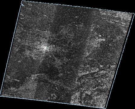
28 Sentinel-1 RADAR BACKSCATTERING IMAGE : Acquisition 2015/03/02 Parisian region VV VH VH/VV

29 Sentinel-1 RADAR BACKSCATTERING IMAGE : Temporal average 2015/03/ /01/26 Parisian region VV VH VH/VV

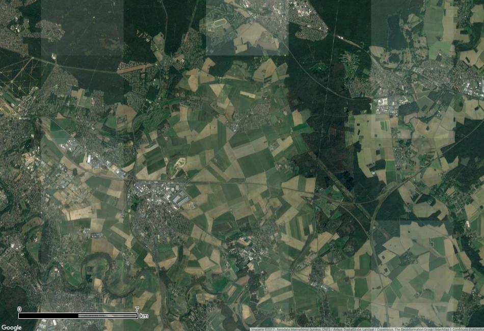
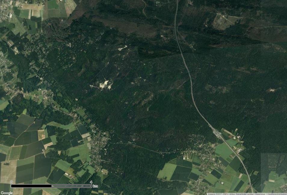
30 GoogleEarth Image Parisian region

31 Sentinel-1 RADAR BACKSCATTERING IMAGE : Acquisition 2015/03/02 Fontainebleau Forest VV VV VH VH VH/VV VH/VV

32 Sentinel-1 RADAR BACKSCATTERING IMAGE : Temporal average 2015/03/ /01/26 Fontainebleau Forest VV VH VH/VV

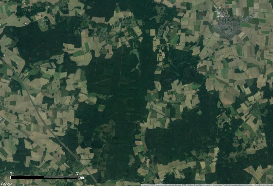
33 GoogleEarth Image Fontainebleau Forest

34 Sentinel-1 RADAR BACKSCATTERING IMAGE : Acquisition 2015/03/02 Parisian region VV VV VH VH VH/VV VH/VV

35 Sentinel-1 RADAR BACKSCATTERING IMAGE : Temporal average 2015/03/ /01/26 Parisian region VV VV VH VH VH/VV VH/VV
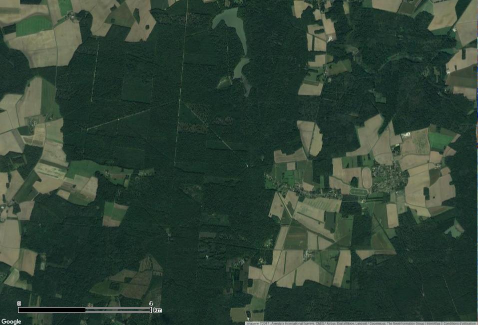
36 GoogleEarth Image

37 Sentinel-1 RADAR BACKSCATTERING IMAGE : Acquisition 2015/03/02 VV VH VH/VV

38 Sentinel-1 RADAR BACKSCATTERING IMAGE : Temporal average 2015/03/ /01/26 VV VH VH/VV
39 GoogleEarth Image

40 Sentinel-1 RADAR BACKSCATTERING IMAGE : Acquisition 2015/03/02 VV VH VH/VV

41 Sentinel-1 RADAR BACKSCATTERING IMAGE : Temporal average 2015/03/ /01/26 VV VH VH/VV
42 GoogleEarth Image

43 Sentinel-1 RADAR BACKSCATTERING IMAGE : Acquisition 2015/03/02 VV VH VH/VV

44 Sentinel-1 RADAR BACKSCATTERING IMAGE : Temporal average 2015/03/ /01/26 VV VH VH/VV
45 GoogleEarth Image
ACTIVE MICROWAVE REMOTE SENSING OF LAND SURFACE HYDROLOGY
 Basics, methods & applications ACTIVE MICROWAVE REMOTE SENSING OF LAND SURFACE HYDROLOGY Annett.Bartsch@polarresearch.at Active microwave remote sensing of land surface hydrology Landsurface hydrology:
Fringe 2015 Workshop
 Fringe 2015 Workshop On the Estimation and Interpretation of Sentinel-1 TOPS InSAR Coherence Urs Wegmüller, Maurizio Santoro, Charles Werner and Oliver Cartus Gamma Remote Sensing AG - S1 IWS InSAR and
SAR Remote Sensing (Microwave Remote Sensing)
") iirs SAR Remote Sensing (Microwave Remote Sensing) Synthetic Aperture Radar Shashi Kumar shashi@iirs.gov.in Electromagnetic Radiation Electromagnetic radiation consists of an electrical field(e) which
iirs SAR Remote Sensing (Microwave Remote Sensing) Synthetic Aperture Radar Shashi Kumar shashi@iirs.gov.in Electromagnetic Radiation Electromagnetic radiation consists of an electrical field(e) which
Earth Observation and Sensing Technologies: a focus on Radar Imaging Developments. Riccardo Lanari
 Earth Observation and Sensing Technologies: a focus on Radar Imaging Developments Riccardo Lanari Institute for Electromagnetic Sensing of the Environment (IREA) National Research Council of Italy (CNR)
Review. Guoqing Sun Department of Geography, University of Maryland ABrief
 Review Guoqing Sun Department of Geography, University of Maryland gsun@glue.umd.edu ABrief Introduction Scattering Mechanisms and Radar Image Characteristics Data Availability Example of Applications
Synthetic Aperture Radar for Rapid Flood Extent Mapping
 National Aeronautics and Space Administration ARSET Applied Remote Sensing Training http://arset.gsfc.nasa.gov @NASAARSET Synthetic Aperture Radar for Rapid Flood Extent Mapping Sang-Ho Yun ARIA Team Jet
SAR Multi-Temporal Applications
 SAR Multi-Temporal Applications 83230359-DOC-TAS-EN-001 Contents 2 Advantages of SAR Remote Sensing Technology All weather any time Frequencies and polarisations Interferometry and 3D mapping Change Detection
Towards Sentinel-1 Soil Moisture Data Services: The Approach taken by the Earth Observation Data Centre for Water Resources Monitoring
 Towards Sentinel-1 Soil Moisture Data Services: The Approach taken by the Earth Observation Data Centre for Water Resources Monitoring Wolfgang Wagner wolfgang.wagner@geo.tuwien.ac.at Department of Geodesy
Estimation of soil moisture using radar and optical images over Grassland areas
 Estimation of soil moisture using radar and optical images over Grassland areas Mohamad El Hajj*, Nicolas Baghdadi*, Gilles Belaud, Mehrez Zribi, Bruno Cheviron, Dominique Courault, Olivier Hagolle, François
Sentinel-2 : A New Perspective for Research and Operational Applications in the Areas of Agriculture and Environment
 Sentinel-2 : A New Perspective for Research and Operational Applications in the Areas of Agriculture and Environment Dedieu, G.; Hagolle, O.; Demarez, V.; Ducrot, D.; Dejoux, J.-F.; Claverie, M.; Marais-
Image transformations
 Image transformations Digital Numbers may be composed of three elements: Atmospheric interference (e.g. haze) ATCOR Illumination (angle of reflection) - transforms Albedo (surface cover) Image transformations
EE 529 Remote Sensing Techniques. Introduction
 EE 529 Remote Sensing Techniques Introduction Course Contents Radar Imaging Sensors Imaging Sensors Imaging Algorithms Imaging Algorithms Course Contents (Cont( Cont d) Simulated Raw Data y r Processing
NASA Missions and Products: Update. Garik Gutman, LCLUC Program Manager NASA Headquarters Washington, DC
 NASA Missions and Products: Update Garik Gutman, LCLUC Program Manager NASA Headquarters Washington, DC 1 JPSS-2 (NOAA) SLI-TBD Formulation in 2015 RBI OMPS-Limb [[TSIS-2]] [[TCTE]] Land Monitoring at
Introduction to Radar
 National Aeronautics and Space Administration ARSET Applied Remote Sensing Training http://arset.gsfc.nasa.gov @NASAARSET Introduction to Radar Jul. 16, 2016 www.nasa.gov Objective The objective of this
Detection of a Point Target Movement with SAR Interferometry
 Journal of the Korean Society of Remote Sensing, Vol.16, No.4, 2000, pp.355~365 Detection of a Point Target Movement with SAR Interferometry Jung-Hee Jun* and Min-Ho Ka** Agency for Defence Development*,
CEGEG046 / GEOG3051 Principles & Practice of Remote Sensing (PPRS) 8: RADAR 1
 8: RADAR 1") CEGEG046 / GEOG3051 Principles & Practice of Remote Sensing (PPRS) 8: RADAR 1 Dr. Mathias (Mat) Disney UCL Geography Office: 113, Pearson Building Tel: 7670 05921 Email: mdisney@ucl.geog.ac.uk www.geog.ucl.ac.uk/~mdisney
CEGEG046 / GEOG3051 Principles & Practice of Remote Sensing (PPRS) 8: RADAR 1 Dr. Mathias (Mat) Disney UCL Geography Office: 113, Pearson Building Tel: 7670 05921 Email: mdisney@ucl.geog.ac.uk www.geog.ucl.ac.uk/~mdisney
SARscape Modules for ENVI
 Visual Information Solutions SARscape Modules for ENVI Read, process, analyze, and output products from SAR data. ENVI. Easy to Use Tools. Proven Functionality. Fast Results. DEM, based on TerraSAR-X-1
Change detection in cultural landscapes
 9-11 November 2015 ESA-ESRIN, Frascati (Rome), Italy 3 rd ESA-EARSeL Course on Remote Sensing for Archaeology Day 3 Change detection in cultural landscapes DeodatoTapete (1,2) & Francesca Cigna (1,2) (1)
Application Potential of Planned SAR Satellites a Preview
 PREPRINT/PRÉTIRAGE Application Potential of Planned SAR Satellites a Preview J.J. van der Sanden 1, P. Budkewitsch 1, R. Landry 1, M.J. Manore 2, H. McNairn 1, T.J. Pultz 1, and P.W. Vachon 1 1 Canada
SAR Remote Sensing. Introduction into SAR. Data characteristics, challenges, and applications.
 SAR Remote Sensing Introduction into SAR. Data characteristics, challenges, and applications. PD Dr. habil. Christian Thiel, Friedrich-Schiller-University Jena DLR-HR Jena & Friedrich-Schiller-University
Determining the green vegetation fraction from RapidEye data for use in regional climate simulations
 Research Unit 1695 Determining the green vegetation fraction from RapidEye data for use in regional climate simulations Kristina Imukova, Joachim Ingwersen and Thilo Streck Institute of Soil Science and
GFOI Expert Workshop. Sensor interoperability, complementarity, and the temporal component. Francesco Holecz
 GFOI Expert Workshop Sensor interoperability, complementarity, and the temporal component Francesco Holecz Woods Hole Research Centre, MA, USA 10-11 June, 2014 On sensor interoperability Single-date vs.
The Sentinel-1 Constellation
 The Sentinel-1 Constellation Evert Attema, Sentinel-1 Mission & System Manager AGRISAR and EAGLE Campaigns Final Workshop 15-16 October 2007 ESA/ESTECNoordwijk, The Netherlands Sentinel-1 Programme Sentinel-1
Synthetic aperture RADAR (SAR) principles/instruments October 31, 2018
 principles/instruments October 31, 2018") GEOL 1460/2461 Ramsey Introduction to Remote Sensing Fall, 2018 Synthetic aperture RADAR (SAR) principles/instruments October 31, 2018 I. Reminder: Upcoming Dates lab #2 reports due by the start of next
GEOL 1460/2461 Ramsey Introduction to Remote Sensing Fall, 2018 Synthetic aperture RADAR (SAR) principles/instruments October 31, 2018 I. Reminder: Upcoming Dates lab #2 reports due by the start of next
Sentinel-1 Overview. Dr. Andrea Minchella
 Dr. Andrea Minchella 21-22/01/2016 ESA SNAP-Sentinel-1 Training Course Satellite Applications Catapult - Electron Building, Harwell, Oxfordshire Contents Sentinel-1 Mission Sentinel-1 SAR Modes Sentinel-1
Introduction to RADAR Remote Sensing for Vegetation Mapping and Monitoring. Wayne Walker, Ph.D.
 Introduction to RADAR Remote Sensing for Vegetation Mapping and Monitoring Wayne Walker, Ph.D. Outline What is RADAR (and what does it measure)? RADAR as an active sensor Applications of RADAR to vegetation
 Performance Comparison between Dual Polarimetric and Fully Polarimetric data for DInSAR Subsidence monitoring Dani Monells, Jordi J. Mallorquí Universitat Politècnica de Catalunya, Departament de Teoria
Introduc)on*to*Asia/RiCE* Technical*Demonstra)on*Sites*II.** Japan,*Indonesia,*Vietnam*
on*to*Asia/RiCE* Technical*Demonstra)on*Sites*II.** Japan,*Indonesia,*Vietnam*") Introduc)on*to*Asia/RiCE* Technical*Demonstra)on*Sites*II.** Japan,*Indonesia,*Vietnam* Kei$Oyoshi 1,$Nobuhiro$Tomiyama 2,$Toshio$Okumura 2,$Shinichi$Sobue 1,2,$ Wahyu$Supriatna 3,$Rizatus$Shofiya? 3,$Lam$Dao$Nguyen
Introduc)on*to*Asia/RiCE* Technical*Demonstra)on*Sites*II.** Japan,*Indonesia,*Vietnam* Kei$Oyoshi 1,$Nobuhiro$Tomiyama 2,$Toshio$Okumura 2,$Shinichi$Sobue 1,2,$ Wahyu$Supriatna 3,$Rizatus$Shofiya? 3,$Lam$Dao$Nguyen
SAR Imagery: Airborne or Spaceborne? Presenter: M. Lorraine Tighe PhD
 SAR Imagery: Airborne or Spaceborne? Presenter: M. Lorraine Tighe PhD Introduction The geospatial community has seen a plethora of spaceborne SAR imagery systems where there are now extensive archives
Specificities of Near Nadir Ka-band Interferometric SAR Imagery
 Specificities of Near Nadir Ka-band Interferometric SAR Imagery Roger Fjørtoft, Alain Mallet, Nadine Pourthie, Jean-Marc Gaudin, Christine Lion Centre National d Etudes Spatiales (CNES), France Fifamé
Biomass, a polarimetric interferometric P-band SAR mission
 Biomass, a polarimetric interferometric P-band SAR mission M. Arcioni, P. Bensi, M. Fehringer, F. Fois, F. Heliere, N. Miranda, K. Scipal Fringe 2015, ESRIN 27/03/2015 The Biomass Mission 1. Biomass was
Aquarius/SAC-D and Soil Moisture
 Aquarius/SAC-D and Soil Moisture T. J. Jackson P. O Neill February 24, 2011 Aquarius/SAC-D and Soil Moisture + L-band dual polarization + Combined active and passive Coarse spatial resolution (~100 km)
AGRICULTURE LAND USE MAPPING USING MULTI-SENSOR AND MULTI- TEMPORAL EARTH OBSERVATION DATA INTRODUCTION
 AGRICULTURE LAND USE MAPPING USING MULTI-SENSOR AND MULTI- TEMPORAL EARTH OBSERVATION DATA Jiali Shang Catherine Champagne Heather McNairn Agriculture and Agri-Food Canada 960 Carling Avenue, Ottawa, ON,
Soil moisture retrieval using ALOS PALSAR
 Soil moisture retrieval using ALOS PALSAR T. J. Jackson, R. Bindlish and M. Cosh USDA ARS Hydrology and Remote Sensing Lab, Beltsville, MD J. Shi University of California Santa Barbara, CA November 6,
CURRENT SCENARIO AND CHALLENGES IN THE ANALYSIS OF MULTITEMPORAL REMOTE SENSING IMAGES
 Remote Sensing Laboratory Dept. of Information Engineering and Computer Science University of Trento Via Sommarive, 14, I-38123 Povo, Trento, Italy CURRENT SCENARIO AND CHALLENGES IN THE ANALYSIS OF MULTITEMPORAL
Outline. From AGEA-JRC I (2007) to AGEA-JRC II ( ) COSMO-SkyMed constellation for Earth observation and applications
 to AGEA-JRC II ( ) COSMO-SkyMed constellation for Earth observation and applications") Outline From AGEA-JRC I (2007) to AGEA-JRC II (2008-09) COSMO-SkyMed constellation for Earth observation and applications COSMO-SkyMed GeoAccuracy assessment o Geometric o Parcels measurements performances
Outline From AGEA-JRC I (2007) to AGEA-JRC II (2008-09) COSMO-SkyMed constellation for Earth observation and applications COSMO-SkyMed GeoAccuracy assessment o Geometric o Parcels measurements performances
Observing Dry-Fallen Intertidal Flats in the German Bight Using ALOS PALSAR Together With Other Remote Sensing Sensors
 Observing Dry-Fallen Intertidal Flats in the German Bight Using ALOS PALSAR Together With Other Remote Sensing Sensors Martin Gade, Institut für Meereskunde & Kerstin Stelzer Brockmann Consult Outline
Examples of FORMOSAT-2 data use Sudouest Data set
 Examples of FORMOSAT-2 data use Sudouest Data set M. Claverie, F. Baup, P. Béziat, E. Ceschia, G. Dedieu, J.F. Dejoux, V. Demarez, B. Duchemin, D. Ducrot, R. Fieuzal, O. Hagolle, C. Marais-Sicre, V. Rivalland
RADAR REMOTE SENSING
 RADAR REMOTE SENSING Jan G.P.W. Clevers & Steven M. de Jong Chapter 8 of L&K 1 Wave theory for the EMS: Section 1.2 of L&K E = electrical field M = magnetic field c = speed of light : propagation direction
AGRISAR Airborne SAR & Optics Campaigns for an improved monitoring of agri. processes & practices
 AGRISAR 2007 - Airborne SAR & Optics Campaigns for an improved monitoring of agri. processes & practices Irena Hajnsek & AGRISAR Team (124 participants), German Aerospace Center Folie 1 irena.hajnsek@dlr.de
School of Rural and Surveying Engineering National Technical University of Athens
 Laboratory of Photogrammetry National Technical University of Athens Combined use of spaceborne optical and SAR data Incompatible data sources or a useful procedure? Charalabos Ioannidis, Dimitra Vassilaki
Preparing for the exploitation of Sentinel-2 data for agriculture monitoring. JACQUES Damien, DEFOURNY Pierre UCL-Geomatics Lab 2 octobre 2013
 Preparing for the exploitation of Sentinel-2 data for agriculture monitoring JACQUES Damien, DEFOURNY Pierre UCL-Geomatics Lab 2 octobre 2013 Agriculture monitoring, why? - Growing speculation on food
RADAR (RAdio Detection And Ranging)
") RADAR (RAdio Detection And Ranging) CLASSIFICATION OF NONPHOTOGRAPHIC REMOTE SENSORS PASSIVE ACTIVE DIGITAL CAMERA THERMAL (e.g. TIMS) VIDEO CAMERA MULTI- SPECTRAL SCANNERS VISIBLE & NIR MICROWAVE Real
RADAR (RAdio Detection And Ranging) CLASSIFICATION OF NONPHOTOGRAPHIC REMOTE SENSORS PASSIVE ACTIVE DIGITAL CAMERA THERMAL (e.g. TIMS) VIDEO CAMERA MULTI- SPECTRAL SCANNERS VISIBLE & NIR MICROWAVE Real
SUGAR_GIS. From a user perspective. Provides spatial distribution of a wide range of sugarcane production data in an easy to use and sensitive way.
 SUGAR_GIS From a user perspective What is Sugar_GIS? A web-based, decision support tool. Provides spatial distribution of a wide range of sugarcane production data in an easy to use and sensitive way.
ASAR Training Course, Hanoi, 25 February 7 March 2008 Introduction to Radar Interferometry
 Introduction to Radar Interferometry Presenter: F.Sarti (ESA/ESRIN) 1 Imaging Radar : reminder 2 Physics of radar Potentialities of radar All-weather observation system (active system) Penetration capabilities
SAR Training Course, MCST, Kalkara, Malta, November SAR Maritime Applications. History and Basics
 SAR Maritime Applications History and Basics Martin Gade Uni Hamburg, Institut für Meereskunde SAR Maritime Applications Thursday, 13 Nov.: 1 - History & Basics Introduction Radar/SAR History Basics Scatterometer
Application and potentials of RADAR and LiDAR technologies for forest carbon assessment in Pacific Island Countries
 Application and potentials of RADAR and LiDAR technologies for forest carbon assessment in Pacific Island Countries June 19th, 2012 PNGFA-JICA Workshop Masamichi HARAGUCHI (Kokusai Kogyo Co., Ltd.) Consultant
KONGSBERG SATELLITE SERVICES 2017 Line Steinbakk, Director Programs. Himmel og hav - Ålesund 3. Oktober 2017
 KONGSBERG SATELLITE SERVICES 2017 Line Steinbakk, Director Programs Himmel og hav - Ålesund 3. Oktober 2017 KSAT HQ IN TROMSØ 69N Established in 1967 Kongsberg Satellite Services since 2002 World leading
MULTI-TEMPORAL OBSERVATIONS OF SUGARCANE BY TERRASAR-X IMAGES
 MULTI-TEMPORAL OBSERVATIONS OF SUGARCANE BY TERRASAR-X IMAGES Nicolas BAGHDADI 1, Pierre TODOROFF 2, Thierry RABAUTE 3 and Claire TINEL 4 (1) CEMAGREF, UMR TETIS, 5 rue François Breton, 3493 Montpellier
TanDEM-X Mission Status & Commissioning Phase Overview
 TanDEM-X Mission Status & Commissioning Phase Overview M. Zink TanDEM-X Ground Segment Manager 17-February-2011 TanDEM-X Science Team Meeting 17-Feb-2011 - OP TerraSAR-X-Add-on for Digital Elevation Measurements
SAOCOM-CS Mission and ESA Airborne Campaign Data
 SAOCOM-CS Mission and ESA Airborne Campaign Data Malcolm Davidson Head of the EOP Campaign Section Malcolm.Davidson@esa.int Objectives of presentation Introduce a new type of ESA SAR mission with Polarimetrice,
The Radar Ortho Suite is an add-on to Geomatica. It requires Geomatica Core or Geomatica Prime as a pre-requisite.
 Technical Specifications Radar Ortho Suite The Radar Ortho Suite includes rigorous and rational function models developed to compensate for distortions and produce orthorectified radar images. Distortions
PROGRESS IN ADDRESSING SCIENCE GOALS FOR GLACIER OBSERVATIONS BY MEANS OF SAR. Frank Paul & Thomas Nagler
 PROGRESS IN ADDRESSING SCIENCE GOALS FOR GLACIER OBSERVATIONS BY MEANS OF SAR Frank Paul & Thomas Nagler SAR Coordination Working Group Meeting, 13/11/2016 Observed glacier products and sensors Product
RADAR INTERFEROMETRY FOR SAFE COAL MINING IN CHINA
 RADAR INTERFEROMETRY FOR SAFE COAL MINING IN CHINA L. Ge a, H.-C. Chang a, A. H. Ng b and C. Rizos a Cooperative Research Centre for Spatial Information School of Surveying & Spatial Information Systems,
Use of Synthetic Aperture Radar images for Crisis Response and Management
 2012 IEEE Global Humanitarian Technology Conference Use of Synthetic Aperture Radar images for Crisis Response and Management Gerardo Di Martino, Antonio Iodice, Daniele Riccio, Giuseppe Ruello Department
Remote Sensing : An overview
 Remote Sensing : An overview Contents Introduction Historical review Applications Electromagnetic spectrum Interaction with atmosphere- Atmospheric windows Spectral signature Multispectral Space Multispectral
Introduction to radar. interferometry
 Introduction to radar Introduction to Radar Interferometry interferometry Presenter: F.Sarti (ESA/ESRIN) With kind contribution by the Radar Department of CNES All-weather observation system (active system)
European Space Agency and IPY
 European Space Agency and IPY ESA supports IPY 2007-2008 activities: First ESA step was a dedicated Announcement Opportunity (AO) for EO data provision in support IPY, released in 2006, with data provision
SARscape for ENVI. A Complete SAR Analysis Solution
 SARscape for ENVI A Complete SAR Analysis Solution IDL and ENVI A Foundation for SARscape IDL The Data Analysis & Visualization Platform Data Access: IDL supports virtually every data format, type and
ERS/ENVISAT ASAR Data Products and Services
 ERS/ENVISAT ASAR Data Products and Services Andrea Celentano Business Manager celentan@eurimage.com What is Eurimage? Founded in 1989 Current shareholders: Since 1989 Commercial Partner of the European
GMES Sentinel-1 Transponder Development
 GMES Sentinel-1 Transponder Development Paul Snoeij Evert Attema Björn Rommen Nicolas Floury Malcolm Davidson ESA/ESTEC, European Space Agency, Noordwijk, The Netherlands Outline 1. GMES Sentinel-1 overview
Seasonal Progression of the Normalized Difference Vegetation Index (NDVI)
") Seasonal Progression of the Normalized Difference Vegetation Index (NDVI) For this exercise you will be using a series of six SPOT 4 images to look at the phenological cycle of a crop. The images are SPOT
Seasonal Progression of the Normalized Difference Vegetation Index (NDVI) For this exercise you will be using a series of six SPOT 4 images to look at the phenological cycle of a crop. The images are SPOT
Remote Sensing. Ch. 3 Microwaves (Part 1 of 2)
") Remote Sensing Ch. 3 Microwaves (Part 1 of 2) 3.1 Introduction 3.2 Radar Basics 3.3 Viewing Geometry and Spatial Resolution 3.4 Radar Image Distortions 3.1 Introduction Microwave (1cm to 1m in wavelength)
Remote Sensing Ch. 3 Microwaves (Part 1 of 2) 3.1 Introduction 3.2 Radar Basics 3.3 Viewing Geometry and Spatial Resolution 3.4 Radar Image Distortions 3.1 Introduction Microwave (1cm to 1m in wavelength)
Use of FORMOSAT images over the Gourma site (Mali)
") Use of FORMOSAT images over the Gourma site (Mali) E. Mougin, V. Demarez, P. Hiernaux, L. Kergoat, V. Le Dantec, M. Grippa, Y. Auda, F. Timouk Photo: Doug Parker Content The study site FORMOSAT data Field
Use of FORMOSAT images over the Gourma site (Mali) E. Mougin, V. Demarez, P. Hiernaux, L. Kergoat, V. Le Dantec, M. Grippa, Y. Auda, F. Timouk Photo: Doug Parker Content The study site FORMOSAT data Field
Playa del Rey, California InSAR Ground Deformation Monitoring Interim Report H
 Playa del Rey, California InSAR Ground Deformation Monitoring Interim Report H Ref.: RV-14524 Doc.: CM-168-01 January 31, 2013 SUBMITTED TO: Southern California Gas Company 555 W. Fifth Street (Mail Location
Copernicus Introduction Lisbon, Portugal 13 th & 14 th February 2014
 Copernicus Introduction Lisbon, Portugal 13 th & 14 th February 2014 Contents Introduction GMES Copernicus Six thematic areas Infrastructure Space data An introduction to Remote Sensing In-situ data Applications
Detecting and Mapping Invasive Phragmites australis in the coastal Great Lakes with ALOS PALSAR imagery
 Detecting and Mapping Invasive Phragmites australis in the coastal Great Lakes with ALOS PALSAR imagery Laura L. Bourgeau-Chavez, Kirk Scarbrough, Liza Jenkins, Kevin Riordan, Richard Powell, Colin Brooks,
RADARSAT-2 Program Update Daniel De Lisle Canadian Space Agency
 RADARSAT-2 Program Update Daniel De Lisle Canadian Space Agency Presentation outline RADARSAT-1 Update RADARSAT-2 Mission description Mission Objectives System Characteristics Data Commercialization/Allocation
Towards Global Monitoring of Soil Moisture at 1 km Spatial Resolution using Sentinel-1: Initial Results
 Towards Global Monitoring of Soil Moisture at 1 km Spatial Resolution using Sentinel-1: Initial Results W. Wagner, V. Naeimi, B. Bauer-Marschallinger, S. Cao, A. Dostalova, C. Notarnicola, F. Greifeneder,
SAOCOM MISSION OVERVIEW
 COMISION NACIONAL DE ACTIVIDADES ESPACIALES (The Argentinean National Commission of Space Activities) SAOCOM MISSION OVERVIEW Laura Frulla, J. Medina, J. Milovich, G. R. Ortega, Marc Thibeault CONAE November
EKATERINA TYMOFYEYEVA GMTSAR BATCH PROCESSING
 EKATERINA TYMOFYEYEVA GMTSAR BATCH PROCESSING THANK YOU! Xiaopeng Tong Xiaohua (Eric) Xu David Sandwell Yuri Fialko OUTLINE Batch processing scripts in GMTSAR (focus on Sentinel-1) SBAS: a method for calculating
TanDEM-X: Mission Status & Scientific Contribution
 TanDEM-X: Mission Status & Scientific Contribution Irena Hajnsek 1/2, Gerhard Krieger 1, Kostas Papathanassiou 1, Stefan Baumgartner 1, Marc Rodriguez-Cassola 1, Pau Prats 1, Maria Sanjuan Ferrer 1, Florian
Environmental Impact Assessment of Mining Subsidence by Using Spaceborne Radar Interferometry
 Environmental Impact Assessment of Mining Subsidence by Using Spaceborne Radar Interferometry Hsing-Chung CHANG, Linlin GE and Chris RIZOS, Australia Key words: Mining Subsidence, InSAR, DInSAR, DEM. SUMMARY
All rights reserved. ENVI, IDL and Jagwire are trademarks of Exelis, Inc. All other marks are the property of their respective owners.
 SAR Analysis Made Easy with SARscape 5.1 All rights reserved. ENVI, IDL and Jagwire are trademarks of Exelis, Inc. All other marks are the property of their respective owners. 2014, Exelis Visual Information
Detecting and Mapping Invasive Phragmites australis in the Coastal Great Lakes with ALOS PALSAR Imagery
 Detecting and Mapping Invasive Phragmites australis in the Coastal Great Lakes with ALOS PALSAR Imagery Brian Huberty U.S Fish & Wildlife Service Region 3 Ecological Services Laura L. Bourgeau-Chavez,
PROGRESS IN ICESHEET MONITORING USING SENTINEL SATELLITES
 Polar Space Task Group PROGRESS IN ICESHEET MONITORING USING SENTINEL SATELLITES Thomas Nagler, Helmut Rott, Markus Hetzenecker, Jan Wuite / ENVEO Contributions by Dana Floricioiu / DLR Anders Kusk / DTU
On the stability of Amazon rainforest backscattering during the ERS-2 Scatterometer mission lifetime
 On the stability of Amazon rainforest backscattering during the ERS- Scatterometer mission lifetime R. Crapolicchio (), P. Lecomte () () Serco S.p.A. c/o ESA-ESRIN Via Galileo Galilei 44 Frascati Italy
Radar remote sensing from space for monitoring deformations affecting urban areas and infrastructures
 Radar remote sensing from space for monitoring deformations affecting urban areas and infrastructures Riccardo Lanari IREA-CNR Napoli EGU2014, Vienna 30 April, 2014 Why Radar (SAR) Imaging from space?
Microwave Sensors Subgroup (MSSG) Report
 Report") Microwave Sensors Subgroup (MSSG) Report Feb 17-20, 2014, ESA ESRIN, Frascati, Italy DONG, Xiaolong, MSSG Chair National Space Science Center Chinese Academy of Sciences (MiRS,NSSC,CAS) Email: dongxiaolong@mirslab.cn
Microwave Sensors Subgroup (MSSG) Report Feb 17-20, 2014, ESA ESRIN, Frascati, Italy DONG, Xiaolong, MSSG Chair National Space Science Center Chinese Academy of Sciences (MiRS,NSSC,CAS) Email: dongxiaolong@mirslab.cn
The use of satellite images to forecast agricultural
 The use of satellite images to forecast agricultural Luxembourg, 12.03.2014 r. Tomasz Milewski NUTS for Poland: NUTS 1 macro-regions (grup of province, voivodships) (6), NUTS 2 - regions (province,
TerraSAR-X Calibration Status 2 Years in Flight
 2 Years in Flight Dirk Schrank, Marco Schwerdt, Markus Bachmann, Björn Döring, Clemens Schulz November 2009 CEOS 09 VG 1 Calibration Tasks Performed 2009 Introduction Challenge Schedule Re-Calibration
The Biomass Mission, status of the satellite system
 The Biomass Mission, status of the satellite system M. Arcioni, P. Bensi, M. Fehringer, F. Fois, F. Heliere, K. Scipal PolInSAR/Biomass Meeting 2015, ESRIN 29/01/2015 1. Key facts (lifetime, duty cycle
Remote Sensing Phenology. Bradley Reed Principal Scientist USGS National Center for Earth Resources Observation and Science Sioux Falls, SD
 Remote Sensing Phenology Bradley Reed Principal Scientist USGS National Center for Earth Resources Observation and Science Sioux Falls, SD Remote Sensing Phenology Potential to provide wall-to-wall phenology
RADARSAT-2 Modes and Applications
 RADARSAT-2 Modes and Applications Gordon Staples MDA Geospatial Services February 6, 2017 1 Introduction RADARSAT-2 was developed to meet operational needs via a versatile space segment and a responsive
Restoration of Missing Data due to Clouds on Optical Satellite Imagery Using Neural
 Restoration of Missing Data due to Clouds on Optical Satellite Imagery Using Neural Sergii Skakun 1, Nataliia Kussul 1, Ruslan Basarab 2 1 Space Research Institute NAS and SSA Ukraine 2 National University
INTEGRATION OF MULTITEMPORAL ERS SAR AND LANDSAT TM DATA FOR SOIL MOISTURE ASSESSMENT
 INTEGRATION OF MULTITEMPORAL ERS SAR AND LANDSAT TM DATA FOR SOIL MOISTURE ASSESSMENT Beata HEJMANOWSKA, Stanisław MULARZ University of Mining and Metallurgy, Krakow, Poland Department of Photogrammetry
DLR contribution and perspectives for JECAM
 DLR contribution and perspectives for JECAM Dr. Helmut Staudenrausch 1, Dr. Achim Roth 2 1 DLR Space Administration, Earth Observations helmut.staudenrausch@dlr.de 2 DLR, German Remote Sensing Data Center
High-Resolution Enhanced Product Based on SMAP Active-Passive Approach using Sentinel 1A and 1B SAR Data
 High-Resolution Enhanced Product Based on SMAP Active-Passive Approach using Sentinel 1A and 1B SAR Data Narendra N. Das 1, Dara Entekhabi 2, Seungbum Kim 1, Scott Dunbar 1, Andreas Colliander 1 Simon
Sentinel-1 System Overview
 Sentinel-1 System Overview Dirk Geudtner, Rámon Torres, Paul Snoeij, Malcolm Davidson European Space Agency, ESTEC Global Monitoring for Environment and Security (GMES) EU-led program aiming at providing
Microwave Remote Sensing (1)
") Microwave Remote Sensing (1) Microwave sensing encompasses both active and passive forms of remote sensing. The microwave portion of the spectrum covers the range from approximately 1cm to 1m in wavelength.
Microwave Remote Sensing (1) Microwave sensing encompasses both active and passive forms of remote sensing. The microwave portion of the spectrum covers the range from approximately 1cm to 1m in wavelength.
Global 25 m Resolution PALSAR-2/PALSAR Mosaic. and Forest/Non-Forest Map (FNF) Dataset Description
 Dataset Description") Global 25 m Resolution PALSAR-2/PALSAR Mosaic and Forest/Non-Forest Map (FNF) Dataset Description Japan Aerospace Exploration Agency (JAXA) Earth Observation Research Center (EORC) 1 Revision history Version
Global 25 m Resolution PALSAR-2/PALSAR Mosaic and Forest/Non-Forest Map (FNF) Dataset Description Japan Aerospace Exploration Agency (JAXA) Earth Observation Research Center (EORC) 1 Revision history Version
Introduction Active microwave Radar
 RADAR Imaging Introduction 2 Introduction Active microwave Radar Passive remote sensing systems record electromagnetic energy that was reflected or emitted from the surface of the Earth. There are also
COSMO-skymed, TerraSAR-X, and RADARSAT-2 geolocation accuracy after compensation for earth-system effects
 Zurich Open Repository and Archive University of Zurich Main Library Strickhofstrasse 9 CH-857 Zurich www.zora.uzh.ch Year: COSMO-skymed, TerraSAR-X, and RADARSAT- geolocation accuracy after compensation
An end-user-oriented framework for RGB representation of multitemporal SAR images and visual data mining
 An end-user-oriented framework for RGB representation of multitemporal SAR images and visual data mining Donato Amitrano a, Francesca Cecinati b, Gerardo Di Martino a, Antonio Iodice a, Pierre-Philippe
Microwave Sensors Subgroup (MSSG) Report
 Report") Microwave Sensors Subgroup (MSSG) Report CEOS WGCV-35 May 13-17, 2013, Shanghai, China DONG, Xiaolong, MSSG Chair CAS Key Laboratory of Microwave Remote Sensing National Space Science Center Chinese Academy
Microwave Sensors Subgroup (MSSG) Report CEOS WGCV-35 May 13-17, 2013, Shanghai, China DONG, Xiaolong, MSSG Chair CAS Key Laboratory of Microwave Remote Sensing National Space Science Center Chinese Academy
High resolution ground deformations monitoring by COSMO-SkyMed PSP SAR interferometry
 High resolution ground deformations monitoring by COSMO-SkyMed PSP SAR interferometry Mario Costantini e-geos - an ASI/Telespazio Company, Rome, Italy mario.costantini@e-geos.it Summary COSMO-SkyMed satellite
REMOTE SENSING FOR FLOOD HAZARD STUDIES.
 REMOTE SENSING FOR FLOOD HAZARD STUDIES. OPTICAL SENSORS. 1 DRS. NANETTE C. KINGMA 1 Optical Remote Sensing for flood hazard studies. 2 2 Floods & use of remote sensing. Floods often leaves its imprint
CSA Report on Earth Observation
 CSA Report on Earth Observation Dr. Satish K. Srivastava WGCV Chair & CSA Member of WGCV Canadian Space Agency Presented at College Park, MD, USA Sep 30 th to Oct 2 nd, 2014 RADARSAT-2 Spacecraft Health
MODULE 9 LECTURE NOTES 2 ACTIVE MICROWAVE REMOTE SENSING
 MODULE 9 LECTURE NOTES 2 ACTIVE MICROWAVE REMOTE SENSING 1. Introduction Satellite sensors are capable of actively emitting microwaves towards the earth s surface. An active microwave system transmits
An intercomparison of SMAP, SMOS, AMSR2, FY3B and ESA CCI soil moisture products at different spatial scales over two dense network regions
 An intercomparison of SMAP, SMOS, AMSR2, FY3B and ESA CCI soil moisture products at different spatial scales over two dense network regions Jiangyuan Zeng 1, Kun-Shan Chen 1, Chenyang Cui 2, Haiyun Bi