Canadian Space Agency Contribution to STG
|
|
|
- Kristopher Haynes
- 5 years ago
- Views:
Transcription

1 Canadian Space Agency Contribution to STG Canadian Space Agency 1 STG5 Geneva, Nov 30 to Dec 2, 2009


2 2 Canadian Space Agency
3 ASAP Portefolio: Name Frozen Baseline Sea Ice Min and Max Snapshots Fine Image Type Descending orbits only ScanSAR Wide A&B Geographical coverage North of 60 + coastal regions of Hudson and James Bay and Arctic Archipelago Circum-Polar Basin Mission Canadian Interferometric mission Extended Background Mission Start date Sept 2000 Sept End date Feb 2001 March Product Individual mage product Include only data received as real-time or playback data in Gatineau or Prince Albert. Individual image products only over Canadian waters Mosaics of annual min and max ice extent Number Extension of scenes 3106 Processing of multiple passes over site-specific areas RSAT 1 and 2 new acquisitions 358 Continued the snapshots in time with RSAT 1 and 2 Processing of circum-polar data sets require the archive content of ASF and Tromso Map 1 2 Arctic Supersites Site 1-7 ScanSAR Wide A&B ArcticNet research sites Shoulder seasons to capture freeze and thaw cycles 1996 Individual image products 2878 RSAT 1 and 2 new acquisitions 3 Great Slave Site 8 ScanSAR Wide A&B Great Slave Lake Shoulder seasons to capture freeze and thaw cycles 1996 Individual image products 237 RSAT 1 and 2 new acquisitions 3 Great Bear Site 9 ScanSAR Wide A&B Great Bear Lake Shoulder seasons to capture freeze and thaw cycles 1996 Individual image products 221 RSAT 1 and 2 new acquisitions 3 NWT Site 10 Standard Radargrammetry mission S2, S Individual image products 117 RSAT 1 and 2 new acquisitions 3 Mackenzie Delta Site 11 Axel Heidberg Site 12 Fine, Wide and Scansar Fine 1 Descending Mackenzie Delta RSAT 1 and 2 new acquisitions 3 Axel Heidberg Island Canadian Interferometric Mission Sept 2000 Feb 2001 Individual image products Single-look complex 389 RSAT 1 and 2 new acquisitions 3 CIS Image Archive Scansar Wide Canadian waters Normal operations March 1997 Block-averaged images (2x2) and full res. Images RSAT 1 and 2 new acquisitions 4 Canadian Arctic Land masses mosaics RAMP AMM RAMP MAMM 3 Scansar Narrow Mixed Canadian Arctic CSA background Winter 1998,99 Antarctica full coverage Fine Antarctica partial coverage Antarctic Mapping Mission Modified Antarctic Mapping Mission Sept 1997 Sept 2000 Oct 1997 Oct 2000 Single images and mosaics at 250, 500 and 1000m pixel size. Continental mosaic produced by the Polar Byrd Laboratory. Individual images Continental mosaic produced by the Polar Byrd Laboratory. Individual images No plans MiniMAMM 2 MiniMAMM 2

4 4 CSA Background Mission Schedule
 (Total SAR On-Time) (Total SAR On-Time)")

5 Antarctica Mosaic Coverage Wide 2 (left) Extended High 4 (left) (Total SAR On-Time) (Total SAR On-Time) Acquisitions 15:44:04 00:42:15 COMPLETED! Polarisations HH+HV HH Dates Oct. 14 to Dec. 03, 2008 Nov. 1-25,

 05:50:24 00:57:08 05:15:44 00:58:20 05:40:25 00:58:12 3")
6 Antarctica Interferometric Coverage COMPLETED! Cycle «A» 17-FEB-09 to 27-FEB-09 Cycle «B» 12-MAR-09 to 23-MAR-09 Cycle «C» 05-APR-09 to 16-APR-09 Standard 5 (Total SAR On-Time) Extended High 4 (Total SAR On-Time) 05:50:24 00:57:08 05:15:44 00:58:20 05:40:25 00:58:12 3 consecutive cycles starting Feb 17,


7 Arctic Basin Coverage RADARSAT-1 + On Going! WINTER Jan 2 12, SPRING Apr 6 13, 2009 RADARSAT-1 ScanSAR Wide A / B 7
 Standard 5 (Total SAR")
8 Greenland Interferometric Coverage COMPLETED! Cycle «A» 20-DEC-08 to 12-JAN-09 Cycle «B» 13-JAN-09 to 05-FEB-09 Cycle «C» 06-FEB-09 to 26-FEB-09 RADARSAT-1 Fine 1 (Total SAR On-Time) Standard 5 (Total SAR On-Time) 03:18:29 00:03:02 03:21:53 00:01:31 02:57:38 00:03:46 is complementary to RADARSAT-1 RADARSAT-1 Cycle C F1 Cycle C S5 8

 04:49:19 00:29:26 05:40:10 00:22:23 05:34:16 00:18:16 04:59:50 00:16:12")
9 Cycle C F1 CIM-2 Interferometric Coverage COMPLETED! Cycle «A» 01-DEC-08 to 09-MAR-09 Cycle «B» 11-MAR-09 to 02-APR-09 Cycle «C» 06-APR-09 to 26-APR-09 Cycle «D» 27-APR-09 to 06-MAY-09 RADARSAT-1 Fine 1 (Total SAR On-Time) Fine 1 (Total SAR On-Time) 04:49:19 00:29:26 05:40:10 00:22:23 05:34:16 00:18:16 04:59:50 00:16:12 RADARSAT-1 Cycle C F1 is complementary to RADARSAT-1 9
10 RADARSAT-1 3-day Arctic Basin Snapshot Pole to Coast InSAR Greenland Ice Fields SuperSites PROPOSED Requires the participation and agreement of ASF and KSAT. Canadian and Norwegian waters well covered under background and operational missions. Back-up in case of conflicts. Not possible due to the lack of receiving station. Presence of NASA and KSAT station in area. No rotation planned. Not possible without the participation of foreign receiving stations requires $$$ contribution. Historical coverage covered 2- times in InSAR data are in ASF archive 2007 coverage. Available for supersite monitoring under Canadian mask should not be in conflict with the operational users and thus avoid the costal areas. DELIVERED No downlink capability was available until May. Not possible due to the lack of receiving station. See Data acquired for 3 consecutive cycles and downlinked to Tromsø DRF. Fine 1 Dec Feb Data acquired and archived in Canada 10
11 3-day Arctic Basin Snapshot Pole to Coast InSAR Greenland Ice Fields SuperSites PROPOSED Planned background mission. 8 times 3-day snapshot over 24-day cycle. Action ESA and CSA background mission mangers define optimal mission coverage. Current plan is to acquire entire leftlooking in cycle 12 (Wide Asc) starting Oct. 14. Plan to acquire Pole Hole left-looking interferometry. Background mission planning InSAR coverage. 3 cycles in Fine mode, descending orbits in Nov-Dec. Could end after December (to February). Sites may require polarimetric capabilities of. Need input from PIs. See SOAR reference. DELIVERED Not possible due to operational constraints. All data acquired and archived in Canada. Mosaic: W2+EH4 Oct. to Dec 08 Interferometry (3 cons. cycles): S5+EH4 Feb. to Apr. 09 Barely possible with due to large number of conflicts. Data acquired mostly with RADARSAT-1 Data acquired through Background Mission. Data archived in Canada 11
12 CSA Contribution Acquisition RSAT 1 InSAR high resolution coverage of Greenland Info Product Ice velocity coverage Agreement with NASA for the generation of the product RADARSAT 2 high resolution SAR full Antarctic coverage in multi-polarization Multi-polarisation mosaic compatible with RAMP Visual and Science Product RADARSAT 2 InSAR high resolution coverage of Pole to 76 degrees south last one was with RSAT 1 in 1997 Canadian Ice caps and Canadian Arctic (over 25,000 scenes) Ice velocity coverage source data distribution to be negotiated with MDA. Need coordination with ESA for full continental coverage Data hosted on Thematically relevant Portals Canadian Cryospheric Information Network PolarVIEW portal ASF IPY portal 12
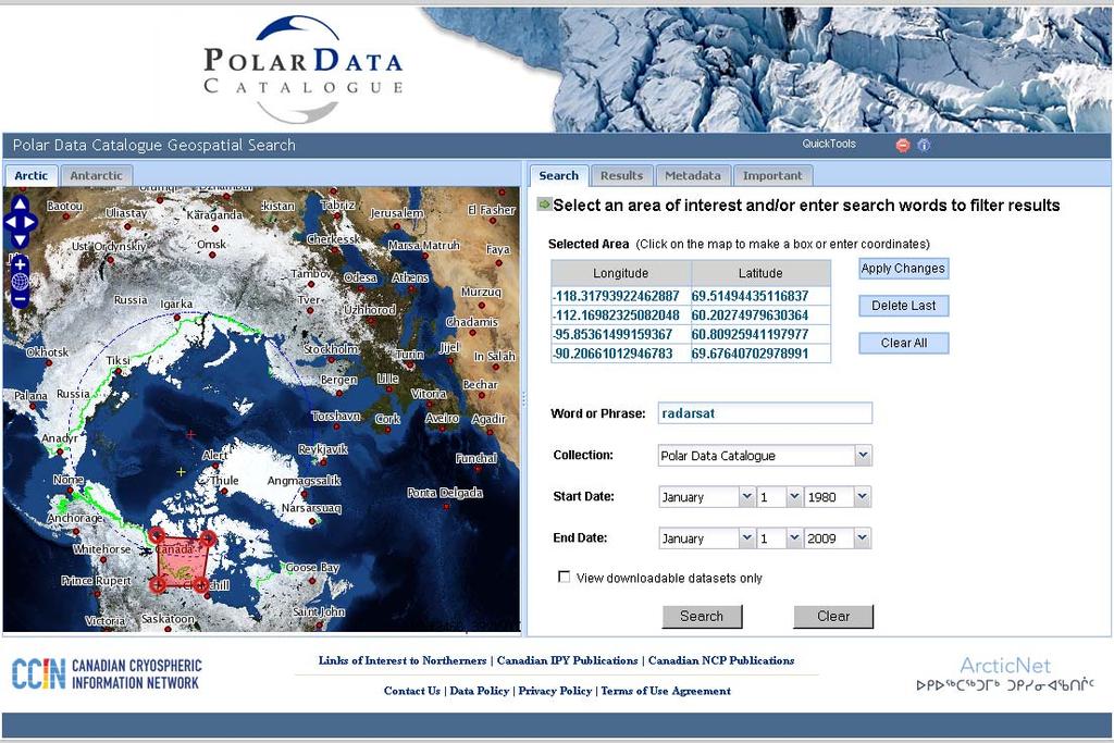
13 CSA Contribution Summary Working together with NASA to develop an velocity map over Greenland Working together with Canadian industry to develop a high resolution dual pol mosaic of Antarctic Initiate discussion with ESA for a Pole to Coast Antarctic Velocity product The kick-off of the Polar Data catalogue with the CCIN (U of Waterloo and ArcticNet) We are open to take more if necessary... 13
14 14

15 15 RADARSAT 2 Multi-pol color composite HH, HV, HH-HV
ASAR acquisition strategy for IPY -Update-
 ASAR acquisition strategy for IPY -Update- Jorge Del Rio Vera Henri Laur Presentation contents: 1. Background 2. ASAR Acquisition strategy update Tandem Campaign ICESat support campaign Wilkins Iceshelf
European Space Agency and IPY
 European Space Agency and IPY ESA supports IPY 2007-2008 activities: First ESA step was a dedicated Announcement Opportunity (AO) for EO data provision in support IPY, released in 2006, with data provision
RADARSAT-2 Program Update Daniel De Lisle Canadian Space Agency
 RADARSAT-2 Program Update Daniel De Lisle Canadian Space Agency Presentation outline RADARSAT-1 Update RADARSAT-2 Mission description Mission Objectives System Characteristics Data Commercialization/Allocation
SAR missions for oceanography at the European Space Agency
 SAR missions for oceanography at the European Space Agency ERS-1, ERS-2, Envisat, Sentinel-1A, Sentinel-1B, ESA 3 rd Party Missions (ALOS) Prepared by ESA teams and ESA supporting companies ESA and SAR
PROGRESS IN ICESHEET MONITORING USING SENTINEL SATELLITES
 Polar Space Task Group PROGRESS IN ICESHEET MONITORING USING SENTINEL SATELLITES Thomas Nagler, Helmut Rott, Markus Hetzenecker, Jan Wuite / ENVEO Contributions by Dana Floricioiu / DLR Anders Kusk / DTU
SAR Interferometry Capabilities of Canada's planned SAR Satellite Constellation
 SAR Interferometry Capabilities of Canada's planned SAR Satellite Constellation Dirk Geudtner, Guy Séguin,, Ralph Girard Canadian Space Agency RADARSAT Follow-on Program CSA is in the middle of a Phase
Envisat and ERS missions: data and services
 FRINGE 2005 Workshop Envisat and ERS missions: and services Henri LAUR Envisat Mission Manager Our top objective: ease access to Earth Observation Common objective for all missions handled by ESA: Envisat,
Data Warehouse Phase 2 CORE Datasets Status 15 th May 2018
 Data Warehouse Phase 2 CORE Datasets Status 15 th May 2018 The document presents the status of the open CORE datasets, for which data provision is on-going. Once closed, content of the datasets can be
Sentinel-1 System Overview
 Sentinel-1 System Overview Dirk Geudtner, Rámon Torres, Paul Snoeij, Malcolm Davidson European Space Agency, ESTEC Global Monitoring for Environment and Security (GMES) EU-led program aiming at providing
CSA Report on Earth Observation
 CSA Report on Earth Observation Presented at Shanghai, China May 13 17, 2013 Dr. Satish K. Srivastava WGCV Chair & CSA Member of WGCV Page 1 RADARSAT-1 Program Status Since 22:30 UTC March 29, 2013, it
KONGSBERG SATELLITE SERVICES Earth Observation for Maritime Operations Current Capabilities and Future Potential
 KONGSBERG SATELLITE SERVICES 2017 Earth Observation for Maritime Operations Current Capabilities and Future Potential Andreas Hay Kaljord Project Manager KSAT HQ IN TROMSØ - 69N WELCOME TO TROMSØ Established
Review. Guoqing Sun Department of Geography, University of Maryland ABrief
 Review Guoqing Sun Department of Geography, University of Maryland gsun@glue.umd.edu ABrief Introduction Scattering Mechanisms and Radar Image Characteristics Data Availability Example of Applications
Cristina M. Surdu 1, Claude R. Duguay 2 and Diego Fernández Prieto 1
 Cristina M. Surdu 1, Claude R. Duguay 2 and Diego Fernández Prieto 1 1 European Space Agency, ESRIN, Italy 2 University of Waterloo, Ontario, Canada Objectives To document and analyze the response of High
Status of Sentinel-1 and acquisition plans for GFOI
 Status of Sentinel-1 and acquisition plans for GFOI Frank Martin Seifert, Pierre Potin, Johannes Roeder, ESA Earth Observation Programme 5 th Space Data Coordination, ESRIN, Frascati, 24 February 2014
KONGSBERG. WORLD CLASS through people, technology and dedication WORLD CLASS through people, technology and dedication
 WORLD CLASS through people, technology and dedication WORLD CLASS through people, technology and dedication Skipsdeteksjon fra radarsatellitter SkipSat Richard Hallr Kongsberg Satellite Services AS (KSAT)
ALOS and PALSAR. Masanobu Shimada
 ALOS and PALSAR Masanobu Shimada Earth Observation Research Center, National Space Development Agency of Japan, Harumi 1-8-10, Harumi island triton square office tower X 22, Chuo-Ku, Tokyo-To, Japan, 104-6023,
PALSAR SCANSAR SCANSAR Interferometry
 PALSAR SCANSAR SCANSAR Interferometry Masanobu Shimada Japan Aerospace Exploration Agency Earth Observation Research Center ALOS PI symposium, Greece Nov. 6 2008 1 Introduction L-band PALSAR strip mode
KONGSBERG SATELLITE SERVICES 2017 Line Steinbakk, Director Programs. Himmel og hav - Ålesund 3. Oktober 2017
 KONGSBERG SATELLITE SERVICES 2017 Line Steinbakk, Director Programs Himmel og hav - Ålesund 3. Oktober 2017 KSAT HQ IN TROMSØ 69N Established in 1967 Kongsberg Satellite Services since 2002 World leading
Affordable space based radar for homeland security
 Changing the economics of space Affordable space based radar for homeland security Adam Baker Brent Abbott Phil Whittaker Rachel Bird Luis Gomes Summary Why Radar? However: Radar data is expensive Users
Introduction to Radar
 National Aeronautics and Space Administration ARSET Applied Remote Sensing Training http://arset.gsfc.nasa.gov @NASAARSET Introduction to Radar Jul. 16, 2016 www.nasa.gov Objective The objective of this
Earth Observation and Sensing Technologies: a focus on Radar Imaging Developments. Riccardo Lanari
 Earth Observation and Sensing Technologies: a focus on Radar Imaging Developments Riccardo Lanari Institute for Electromagnetic Sensing of the Environment (IREA) National Research Council of Italy (CNR)
Satellite data for Maritime Operations. Andreas Hay Kaljord Project Manager Energy, Environment & Security
 Satellite data for Maritime Operations Andreas Hay Kaljord Project Manager Energy, Environment & Security Kongsberg Satellite Services (KSAT) World leading provider within our business area Supports 85
CSA Report on Earth Observation
 CSA Report on Earth Observation Dr. Satish K. Srivastava WGCV Chair & CSA Member of WGCV Canadian Space Agency Presented at College Park, MD, USA Sep 30 th to Oct 2 nd, 2014 RADARSAT-2 Spacecraft Health
RADARSAT-2 Modes and Applications
 RADARSAT-2 Modes and Applications Gordon Staples MDA Geospatial Services February 6, 2017 1 Introduction RADARSAT-2 was developed to meet operational needs via a versatile space segment and a responsive
The Sentinel-1 Constellation
 The Sentinel-1 Constellation Evert Attema, Sentinel-1 Mission & System Manager AGRISAR and EAGLE Campaigns Final Workshop 15-16 October 2007 ESA/ESTECNoordwijk, The Netherlands Sentinel-1 Programme Sentinel-1
The availability of cloud free Landsat TM and ETM+ land observations and implications for global Landsat data production
 14475 The availability of cloud free Landsat TM and ETM+ land observations and implications for global Landsat data production *V. Kovalskyy, D. Roy (South Dakota State University) SUMMARY The NASA funded
Session I: Status Reports on Ongoing and Future Missions Chairs: M.Shimada (JAXA) and P. Snoeij (ESA)
 and P. Snoeij (ESA)") Session I: Status Reports on Ongoing and Future Missions Chairs: M.Shimada (JAXA) and P. Snoeij (ESA) Canadian Radarsat Mission status-s. Cote Operating far beyond design lifetime (RSAT-1: 16 years, ASAR:
Session I: Status Reports on Ongoing and Future Missions Chairs: M.Shimada (JAXA) and P. Snoeij (ESA) Canadian Radarsat Mission status-s. Cote Operating far beyond design lifetime (RSAT-1: 16 years, ASAR:
ENVISAT ASAR MONTHLY REPORT MARCH 2012
 ENVISAT ASAR MONTHLY REPORT MARCH 2012 PUBLIC SUMMARY prepared by/préparé par IDEAS SAR Team reference/réference ENVI-CLVL-EOPG-TN-04-0009 issue/édition 73 revision/révision 0 date of issue/date d édition
IMPACT OF BAQ LEVEL ON INSAR PERFORMANCE OF RADARSAT-2 EXTENDED SWATH BEAM MODES
 IMPACT OF BAQ LEVEL ON INSAR PERFORMANCE OF RADARSAT-2 EXTENDED SWATH BEAM MODES Jayson Eppler (1), Mike Kubanski (1) (1) MDA Systems Ltd., 13800 Commerce Parkway, Richmond, British Columbia, Canada, V6V
Framework for Satellite-Based EO Monitoring in the Government 2nd Arctic and High-Latitude Products Evolution and Validation Workshop
 Framework for Satellite-Based EO Monitoring in the Government 2nd Arctic and High-Latitude Products Evolution and Validation Workshop Norrkoping, October 27-28, 2015 Yves Crevier, Guy Aube yves.crevier@asc-csa.gc.ca
RADARSAT-1 Satellite
 RADARSAT-1 Satellite Summary: RADARSAT-1 is an advanced Earth observation satellite project developed by the Canadian Space Agency (CSA) to monitor environmental change and to support resource sustainability.
Francesco Holecz. TUBE II meeting - 17 June Land Degradation. Land Degradation
 Land Degradation Francesco Holecz Objective To identify and monitor land degraded areas, in particular those related to agricultural and pastoral activities. Following products are generated: Land cover
The Role of RADARSAT-2 for Flood and Agriculture Monitoring
 The Role of RADARSAT-2 for Flood and Agriculture Monitoring Gordon Staples MDA Richmond, BC, CANADA gstaples@mda.ca RESTRICTION ON USE, PUBLICATION OR DISCLOSURE OF PROPRETIARY INFORMATION This document
Microwave remote sensing. Rudi Gens Alaska Satellite Facility Remote Sensing Support Center
 Microwave remote sensing Alaska Satellite Facility Remote Sensing Support Center 1 Remote Sensing Fundamental The entire range of EM radiation constitute the EM Spectrum SAR sensors sense electromagnetic
Kongsberg Satellite Services, KSAT
 SvalSat, Earth Station at 78 North Kongsberg Satellite Services, KSAT Making Sense of Space Sigmund Dehli International Sales Manager WORLD CLASS through people, technology and dedication My plan KSAT
Landsat Program. Science Activities. Polar Space Task Group 4 Meeting, NASA/GSFC, Greenbelt, MD
 Landsat Program Science Activities Polar Space Task Group 4 Meeting, NASA/GSFC, Greenbelt, MD Larry Hothem Senior Physical Scientist USGS Land Remote Sensing Program September 30, 2014 USGS Science Mission
Sentinel-1 Overview. Dr. Andrea Minchella
 Dr. Andrea Minchella 21-22/01/2016 ESA SNAP-Sentinel-1 Training Course Satellite Applications Catapult - Electron Building, Harwell, Oxfordshire Contents Sentinel-1 Mission Sentinel-1 SAR Modes Sentinel-1
TanDEM-X: Mission Status & Scientific Contribution
 TanDEM-X: Mission Status & Scientific Contribution Irena Hajnsek 1/2, Gerhard Krieger 1, Kostas Papathanassiou 1, Stefan Baumgartner 1, Marc Rodriguez-Cassola 1, Pau Prats 1, Maria Sanjuan Ferrer 1, Florian
Downloaded by on April 16, DOI: /
 Polar Epsilon: Joint Space-Based Wide Area Surveillance and Support Project LCdr Robert Quinn Project Director Polar Epsilon Directorate of Space Development Phone: +1(613)945-5212 Quinn.rj2@forces.gc.ca
The Tandem-L Formation
 The Tandem-L Formation G. Krieger, I. Hajnsek, K. Papathanassiou, M. Eineder, M. Younis, F. De Zan, P. Prats, S. Huber, M. Werner, A. Freeman +, P. Rosen +, S. Hensley +, W. Johnson +, L. Veilleux +, B.
SARscape Modules for ENVI
 Visual Information Solutions SARscape Modules for ENVI Read, process, analyze, and output products from SAR data. ENVI. Easy to Use Tools. Proven Functionality. Fast Results. DEM, based on TerraSAR-X-1
Commissioning the TanDEM-X Ground Segment An Interim Commissioning Phase Perspective
 Commissioning the TanDEM-X Ground Segment An Interim Commissioning Phase Perspective B. Schättler, R. Kahle, R. Metzig, T. Fritz, U. Steinbrecher, M. Wermuth, M. Zink, and TanDEM-X Ground Segment Team
Polarisation Capabilities and Status of TerraSAR-X
 Polarisation Capabilities and Status of TerraSAR-X Irena Hajnsek, Josef Mittermayer, Stefan Buckreuss, Kostas Papathanassiou German Aerospace Center Microwaves and Radar Institute irena.hajnsek@dlr.de
Biomass, a polarimetric interferometric P-band SAR mission
 Biomass, a polarimetric interferometric P-band SAR mission M. Arcioni, P. Bensi, M. Fehringer, F. Fois, F. Heliere, N. Miranda, K. Scipal Fringe 2015, ESRIN 27/03/2015 The Biomass Mission 1. Biomass was
The Global Imager (GLI)
") The Global Imager (GLI) Launch : Dec.14, 2002 Initial check out : to Apr.14, 2003 (~L+4) First image: Jan.25, 2003 Second image: Feb.6 and 7, 2003 Calibration and validation : to Dec.14, 2003(~L+4) for
The Global Imager (GLI) Launch : Dec.14, 2002 Initial check out : to Apr.14, 2003 (~L+4) First image: Jan.25, 2003 Second image: Feb.6 and 7, 2003 Calibration and validation : to Dec.14, 2003(~L+4) for
Canadian Space Agency program update
 Canadian Space Agency program update Briefing to the meeting of the Expert Team on Satellite Systems (ET-SAT-11) Geneva, 4 April 2017 Guennadi Kroupnik Canadian Space Agency RADARSAT-2: CURRENT OPERATIONAL
The Convair 580 SAR Facility Recent Activities and Future Opportunities
 The Convair 580 SAR Facility Recent Activities and Future Opportunities Dr. Carl E. Brown Emergencies Science and Technology Section Environment Canada Ottawa, Ontario ESTS Airborne Remote Sensing DC-3,
The Current Status and Brief Results of Engineering Model for PALSAR-2 onboard ALOS-2 and Science Project
 The Current Status and Brief Results of Engineering Model for PALSAR-2 onboard ALOS-2 and Science Project + The 16 th KC meeting Japan Aerospace Exploration Agency Masanobu Shimada, Yukihiro KANKAKU The
ERS/ENVISAT ASAR Data Products and Services
 ERS/ENVISAT ASAR Data Products and Services Andrea Celentano Business Manager celentan@eurimage.com What is Eurimage? Founded in 1989 Current shareholders: Since 1989 Commercial Partner of the European
Data Requirements Definition and Data Services Options for RAPP
 Data Requirements Definition and Data Services Options for RAPP Brian Killough CEOS Systems Engineering Office (SEO) 5 th GEOGLAM RAPP Workshop Frascati, Italy May 16-17, 2017 Requirements Update The observation
RADARSAT-1 Left Looking RAMP SAR Images
 Summary: RADARSAT-1 Left Looking RAMP SAR Images This data set is derived from the Alaska SAR Facility's archive of RADARSAT-1 Standard Beam Left-Looking SAR data and Extended High Incidence Left-Looking
WorldDEM4Ortho. Technical Product Specification. Version 1.4. AIRBUS DEFENCE AND SPACE Intelligence
 Technical Product Specification Version 1.4 AIRBUS DEFENCE AND SPACE Intelligence Table of Contents Table of Contents... 2 List of Figures... 3 List of Tables... 3 Abbreviations... 4 References... 4 1
Global 25 m Resolution PALSAR-2/PALSAR Mosaic. and Forest/Non-Forest Map (FNF) Dataset Description
 Dataset Description") Global 25 m Resolution PALSAR-2/PALSAR Mosaic and Forest/Non-Forest Map (FNF) Dataset Description Japan Aerospace Exploration Agency (JAXA) Earth Observation Research Center (EORC) 1 Revision history Version
Global 25 m Resolution PALSAR-2/PALSAR Mosaic and Forest/Non-Forest Map (FNF) Dataset Description Japan Aerospace Exploration Agency (JAXA) Earth Observation Research Center (EORC) 1 Revision history Version
RADARSAT-1: An End-of-Mission Review of the Imaging and Calibration Performance of a Magnificent Canadian Instrument
 RADARSAT-1: An End-of-Mission Review of the Imaging and Calibration Performance of a Magnificent Canadian Instrument S. Cote, S. Srivastava Canadian Space Agency S. Muir Calian Technologies Ltd 1 RADARSAT-1
ERS-2 SAR CYCLIC REPORT
 ERS-2 SAR CYCLIC REPORT C YCLE 90 24-November-2003-29-December-2003 Prepared by: PCS SAR TEAM Issue: 1.0 Reference: Date of Issue Status: Document type: Technical Note Approved by: T A B L E L E O F C
Sentinel-1 Data Border Noise Removal and Seamless Synthetic Aperture Radar Mosaic Generation
 Proceedings Sentinel-1 Data Border Noise Removal and Seamless Synthetic Aperture Radar Mosaic Generation Yi Luo * and Dean Flett Canadian Ice Service, Environment and Climate Change Canada, Ottawa, ON
RADARSAT-2 Image Quality and Calibration Update
 RADARSAT-2 Image Quality and Calibration Update by Dan Williams, Yiman Wang, Marielle Chabot, Pierre Le Dantec, Ron Caves, Yan Wu, Kenny James, Alan Thompson, Cathy Vigneron www.mdacorporation.com Image
RESERVOIR MONITORING USING RADAR SATELLITES
 RESERVOIR MONITORING USING RADAR SATELLITES Alain Arnaud, Johanna Granda, Geraint Cooksley ALTAMIRA INFORMATION S.L., Calle Córcega 381-387, E-08037 Barcelona, Spain. Key words: Reservoir monitoring, InSAR,
Global 25 m Resolution PALSAR-2/PALSAR Mosaic. and Forest/Non-Forest Map (FNF) Dataset Description
 Dataset Description") Global 25 m Resolution PALSAR-2/PALSAR Mosaic and Forest/Non-Forest Map (FNF) Dataset Description Japan Aerospace Exploration Agency (JAXA) Earth Observation Research Center (EORC) 1 Revision history Version
Global 25 m Resolution PALSAR-2/PALSAR Mosaic and Forest/Non-Forest Map (FNF) Dataset Description Japan Aerospace Exploration Agency (JAXA) Earth Observation Research Center (EORC) 1 Revision history Version
RADARSAT: A CANADIAN AND G LOBAL SUCCESS
 RADARSAT: A CANADIAN AND G LOBAL SUCCESS It is with great pride that I introduce the Second Annual RADARSAT Review of what is truly a Canadian and global success story. Since its launch in November 1995,
UNISCAN AND ALICE-SC GROUND STATIONS AND DEVELOPMENT OF THEIR NETWORKS
 UNISCAN AND ALICE-SC GROUND STATIONS AND DEVELOPMENT OF THEIR NETWORKS Gershenzon V.E., Gershenzon O.N. R&D Center ScanEx Commission WG IV/9 KEY WORDS: Uniscan, Alice-SC, Stations, Geo-Portals ABSTRACT:
SARscape for ENVI. A Complete SAR Analysis Solution
 SARscape for ENVI A Complete SAR Analysis Solution IDL and ENVI A Foundation for SARscape IDL The Data Analysis & Visualization Platform Data Access: IDL supports virtually every data format, type and
GFOI Expert Workshop. Sensor interoperability, complementarity, and the temporal component. Francesco Holecz
 GFOI Expert Workshop Sensor interoperability, complementarity, and the temporal component Francesco Holecz Woods Hole Research Centre, MA, USA 10-11 June, 2014 On sensor interoperability Single-date vs.
ACTIVE MICROWAVE REMOTE SENSING OF LAND SURFACE HYDROLOGY
 Basics, methods & applications ACTIVE MICROWAVE REMOTE SENSING OF LAND SURFACE HYDROLOGY Annett.Bartsch@polarresearch.at Active microwave remote sensing of land surface hydrology Landsurface hydrology:
ABSTRACT. Keywords: ESSP, Earth Venture, program management, NASA Science Mission Directorate, Class-D mission, Instrument-first 1.
 SSC14-VI-10 Opportunities for Small Satellites in NASA s Earth System Science Pathfinder (ESSP) Program Frank Peri, Richard, C. Law, James E. Wells NASA Langley Research Center, 9 Langley Boulevard, Hampton,
2016 Winter. / ASF News & Notes / 2016 Winter
 Home Get Data Datasets Data Tools About SAR News About ASF / ASF News & Notes / 2016 Winter Latest News 2016 Winter 2014 Fall 2014 Spring 2013 Summer 2013 Spring 2012 Winter 2012 Fall 2012 Summer 2012
The ERS contribution to Oil Spill Monitoring - From R&D towards an operational service -
 The ERS contribution to Oil Spill Monitoring - From R&D towards an operational service - J.P. Pedersen, T.Bauna, L.G. Seljelv, L. Steinbakk, R.T.Enoksen Tromsø Satellite Station, N-9291 Tromsø, Norway
Copernicus Introduction Lisbon, Portugal 13 th & 14 th February 2014
 Copernicus Introduction Lisbon, Portugal 13 th & 14 th February 2014 Contents Introduction GMES Copernicus Six thematic areas Infrastructure Space data An introduction to Remote Sensing In-situ data Applications
 Performance Comparison between Dual Polarimetric and Fully Polarimetric data for DInSAR Subsidence monitoring Dani Monells, Jordi J. Mallorquí Universitat Politècnica de Catalunya, Departament de Teoria
How to Access EO Data
 How to Access EO Data Andrea Minchella 29 June 2009, D1L1 ESA CAT-1 EO Principal Investigator ESA PIs and Projects 1-10 projects 11-20 projects 21-40 projects 41-60 projects 61-100 projects 101-200 projects
SMOS Daily Polar Gridded Brightness Temperatures (L3B)
") SMOS Daily Polar Gridded Brightness Temperatures (L3B) Xiangshan Tian-Kunze, Lars Kaleschke, Nina Maass, and Amelie Schmitt Institute of Oceanography, KlimaCampus, University of Hamburg, Germany December
SMOS Daily Polar Gridded Brightness Temperatures (L3B) Xiangshan Tian-Kunze, Lars Kaleschke, Nina Maass, and Amelie Schmitt Institute of Oceanography, KlimaCampus, University of Hamburg, Germany December
Space Based Vessel Detection - Combining Earth Observation and AIS for Maritime surveillance TEXAS V and C-Σ III
 Space Based Vessel Detection - Combining Earth Observation and AIS for Maritime surveillance TEXAS V and C-Σ III Tony Bauna Director, Product and Service Development, Kongsberg Satellite Services, Tromsø,
How to access EO data
 How to access EO data PAC USF USF PDHS LRAC USCF PDCC Europe s expanding EO Capability Continuity & Evolution Wind Scatterometer (Low rate) all weather; day and night SAR Antenna (C-Band, 5.3 GHz) image
Earth Remote Sensing using Surface-Reflected GNSS Signals (Part II)
") Jet Propulsion Laboratory California Institute of Technology National Aeronautics and Space Administration Jet Propulsion Laboratory California Institute of Technology Pasadena, California Earth Remote
Jet Propulsion Laboratory California Institute of Technology National Aeronautics and Space Administration Jet Propulsion Laboratory California Institute of Technology Pasadena, California Earth Remote
S3 Product Notice Altimetry
 S3 Product Notice Altimetry Mission Sensor Product S3-A SRAL / MWR LAND L2 NRT, STC and NTC Product Notice ID Issue/Rev Date Version 1.0 Preparation S3A.PN-STM-L2L.04 13-Dec-2017 This Product Notice was
RADARSAT-1 Standard Beam SAR Images
 Summary: RADARSAT-1 Standard Beam SAR Images This data set is derived from the Alaska SAR Facility's archive of RADARSAT-1 Standard Beam SAR data. These data have been archived since shortly after the
ERS-2 SAR CYCLIC REPORT
 ERS-2 SAR CYCLIC REPORT C YCLE 96 22-JUN-2004 to 27-JUL-2004 Orbit 47951 to 48452 Prepared by: PCS SAR TEAM Issue: 1.0 Reference: Date of Issue Status: Document type: Technical Note Approved by: T A B
The Landsat Legacy: Monitoring a Changing Earth. U.S. Department of the Interior U.S. Geological Survey
 The Landsat Legacy: Monitoring a Changing Earth U.S. Department of the Interior U.S. Geological Survey Tom Loveland March 17, 2001 Landsat Science Mission Change is occurring at rates unprecedented in
The Biomass Mission, status of the satellite system
 The Biomass Mission, status of the satellite system M. Arcioni, P. Bensi, M. Fehringer, F. Fois, F. Heliere, K. Scipal PolInSAR/Biomass Meeting 2015, ESRIN 29/01/2015 1. Key facts (lifetime, duty cycle
SDCG-5 Session 2. Landsat 7/8 status and 2013 Implementation Plan (Element 1)
") Session 2 Landsat 7/8 status and 2013 Implementation Plan (Element 1) Gene Fosnight Mission Landsat Launch and commissioning Landsat 7 Operational: since 15 April 1999 Expected life time:; anticipate decommissioning
Session 2 Landsat 7/8 status and 2013 Implementation Plan (Element 1) Gene Fosnight Mission Landsat Launch and commissioning Landsat 7 Operational: since 15 April 1999 Expected life time:; anticipate decommissioning
ASAR, MERIS and AATSR products
 ASAR, MERIS and AATSR products Francesco Sarti and Steffen Dransfeld ESA/ESRIN 25 February 2008 ENVISAT http://envisat.esa.int/ Launched in 2002. Sun-synchronous polar orbit (SSO): Nominal reference orbit
TerraSAR-X Mission: Application and Data Access
 TerraSAR-X Mission: Application and Data Access Irena Hajnsek & TSX TEAM German Aerospace Center Microwaves and Radar Institute Pol-InSAR Research Group 2 years in Orbit (since June 2007) irena.hajnsek@dlr.de
Sub-Mesoscale Imaging of the Ionosphere with SMAP
 Sub-Mesoscale Imaging of the Ionosphere with SMAP Tony Freeman Xiaoqing Pi Xiaoyan Zhou CEOS Workshop, ASF, Fairbanks, Alaska, December 2009 1 Soil Moisture Active-Passive (SMAP) Overview Baseline Mission
MULTI-CHANNEL SAR EXPERIMENTS FROM THE SPACE AND FROM GROUND: POTENTIAL EVOLUTION OF PRESENT GENERATION SPACEBORNE SAR
 3 nd International Workshop on Science and Applications of SAR Polarimetry and Polarimetric Interferometry POLinSAR 2007 January 25, 2007 ESA/ESRIN Frascati, Italy MULTI-CHANNEL SAR EXPERIMENTS FROM THE
Amherst, MA I This document has been appmoved. idistribution is unlimited.
 AD-A273 568 USE OF MICROWAVE POLARIMETRY TO ENHANCE SAR IMAGES OF THE OCEAN SURFACE r T IC (Y. -i ECTE DEC091993" T Dr. Robert E. McIntosh omnet: R.MCINTOSH Department of Electrical and Computer Engineering
TerraSAR-X Calibration Status 2 Years in Flight
 2 Years in Flight Dirk Schrank, Marco Schwerdt, Markus Bachmann, Björn Döring, Clemens Schulz November 2009 CEOS 09 VG 1 Calibration Tasks Performed 2009 Introduction Challenge Schedule Re-Calibration
Contribution of Sentinel-1 data for the monitoring of seasonal variations of the vegetation
 Contribution of Sentinel-1 data for the monitoring of seasonal variations of the vegetation P.-L. Frison, S. Kmiha, B. Fruneau, K. Soudani, E. Dufrêne, T. Koleck, L. Villard, M. Lepage, J.-F. Dejoux, J.-P.
DLR contribution and perspectives for JECAM
 DLR contribution and perspectives for JECAM Dr. Helmut Staudenrausch 1, Dr. Achim Roth 2 1 DLR Space Administration, Earth Observations helmut.staudenrausch@dlr.de 2 DLR, German Remote Sensing Data Center
 ABSTRACT Global Analysis of EnviSat Burst Echoes over Inland Water Berry, P.A.M (1)., Freeman, J.A. (1) (1) E.A.P.R.S Laboratory, De Montfort University, The Gateway, Leicester, LE1 9BH, UK Email: pamb@dmu.ac.uk,
RADARSAT-2 and RCM Conjunction Analysis and Mitigation Operations
 RADARSAT-2 and RCM Conjunction Analysis and Mitigation Operations Casey Lambert (MDA), Camille Decoust (MDA), Bryan Cooke (SED) www.mdacorporation.com Presentation Outline Introduction to RADARSAT-2 Collision
DESDynI A NASA Mission for Ecosystems, Solid Earth and Cryosphere Science
 DESDynI A NASA Mission for Ecosystems, Solid Earth and Cryosphere Science Tony Freeman (with a lot of help from the DESDynI team, especially Paul Rosen, Bill Johnson, Rolando Jordan, Yuyshen Shen) Jet
COSMO-SkyMed Mission Status Presented by Fabrizio BATTAZZA (ASI)
") COSMO-SkyMed Mission Status Presented by Fabrizio BATTAZZA (ASI) COSMO-1 & COSMO-2 LAUNCHES FIRST SATELLITE OF THE CONSTELLATION SUCCESSFULLY LAUNCHED 08 June 2007 03:35 (GMT) Vandenberg U.S.A. Air Force
COSMO-SkyMed Mission Status Presented by Fabrizio BATTAZZA (ASI) COSMO-1 & COSMO-2 LAUNCHES FIRST SATELLITE OF THE CONSTELLATION SUCCESSFULLY LAUNCHED 08 June 2007 03:35 (GMT) Vandenberg U.S.A. Air Force
Generation of Fine Resolution DEM at Test Areas in Alaska Using ERS SAR Tandem Pairs and Precise Orbital Data *
 Generation of Fine Resolution DEM at Test Areas in Alaska Using ERS SAR Tandem Pairs and Precise Orbital Data * O. Lawlor, T. Logan, R. Guritz, R. Fatland, S. Li, Z. Wang, and C. Olmsted Alaska SAR Facility
XSAT Ground Segment at CRISP
 XSAT Ground Segment at CRISP LIEW Soo Chin Head of Research, CRISP http://www.crisp.nus.edu.sg 5 th JPTM for Sentinel Asia Step-2, 14-16 Nov 2012, Daejeon, Korea Centre for Remote Imaging, Sensing and
SAOCOM-CS Mission and ESA Airborne Campaign Data
 SAOCOM-CS Mission and ESA Airborne Campaign Data Malcolm Davidson Head of the EOP Campaign Section Malcolm.Davidson@esa.int Objectives of presentation Introduce a new type of ESA SAR mission with Polarimetrice,
Introduc)on*to*Asia/RiCE* Technical*Demonstra)on*Sites*II.** Japan,*Indonesia,*Vietnam*
on*to*Asia/RiCE* Technical*Demonstra)on*Sites*II.** Japan,*Indonesia,*Vietnam*") Introduc)on*to*Asia/RiCE* Technical*Demonstra)on*Sites*II.** Japan,*Indonesia,*Vietnam* Kei$Oyoshi 1,$Nobuhiro$Tomiyama 2,$Toshio$Okumura 2,$Shinichi$Sobue 1,2,$ Wahyu$Supriatna 3,$Rizatus$Shofiya? 3,$Lam$Dao$Nguyen
Introduc)on*to*Asia/RiCE* Technical*Demonstra)on*Sites*II.** Japan,*Indonesia,*Vietnam* Kei$Oyoshi 1,$Nobuhiro$Tomiyama 2,$Toshio$Okumura 2,$Shinichi$Sobue 1,2,$ Wahyu$Supriatna 3,$Rizatus$Shofiya? 3,$Lam$Dao$Nguyen
Marine Weather Program
 Marine Weather Program Shipping Federation of Canada Marine Workshop 2018 Montreal daniel.huang@canada.ca Meteorological Service of Canada Jan 31, 2018 ECCC is actively adapting its marine weather observing
School of Rural and Surveying Engineering National Technical University of Athens
 Laboratory of Photogrammetry National Technical University of Athens Combined use of spaceborne optical and SAR data Incompatible data sources or a useful procedure? Charalabos Ioannidis, Dimitra Vassilaki
MERIS data access over diagnostic sites for calibration and validation purposes
 MERIS data access over diagnostic sites for calibration and validation purposes Philippe Goryl ESA / ESRIN Philippe.Goryl@esa.int Carsten Brockman Brockman Consult Workshop on Inter-Comparison of Large
Sea Ice Classification using RADARSAT 2 Dual Polarisation data
 Sea Ice Classification using RADARSAT 2 Dual Polarisation data Stein Sandven (1), Vitaly Alexandrov (2), Natalia Zakhvatkina (2) and Mohamed Babiker (1) (1)Nansen Environmental and Remote Sensing Center,