Space Based Vessel Detection - Combining Earth Observation and AIS for Maritime surveillance TEXAS V and C-Σ III
|
|
|
- Evan Gallagher
- 6 years ago
- Views:
Transcription

1 Space Based Vessel Detection - Combining Earth Observation and AIS for Maritime surveillance TEXAS V and C-Σ III Tony Bauna Director, Product and Service Development, Kongsberg Satellite Services, Tromsø, Norway WORLD CLASS through people, technology and dedication
")
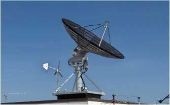
2 Kongsberg Satellite Services KSAT established in 1967 World leading commercial satellite centre Head office located in Tromsø Round the clock near real-time operations (24h/365d) Tromsø city


3 KSAT Missions Objectives KSAT is a service provider dedicated to satellite operation and utilzation of satellite data


4 KSAT s products and services Courtesy DigitalGlobe


5 / 5 / 9-Nov-12 KSAT s Extended Polar and Mid-Latitude Network


6 Norway and the High North Vast ocean areas appr 7x mainland Weather; wind, darkness, cloudcover Increasing oil and gas activity IUU fishing Increasing vessel traffic Shipment of russian oil Gas and LNG Transport of goods and chemicals Ecotourism Northern Sea Route In a vulnerable arctic environment
 at the end.")

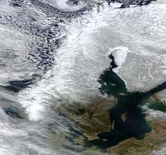
7 Oil spill detection by analysis of SAR images Typical oil spill, black defined feature on the sea surface, a long tail combined with ship (small white spot) at the end. The black colour is due to the SAR technology and is not true colour. Ships marked by white circles. ENVISAT Data ESA/TSS. ENVISAT Data ESA/TSS. Oil spill in the south of Norway. Oil spill in Brazilian coastal water.

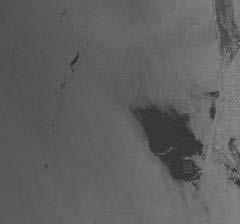
8 Identification of polluting source using AIS ENVISAT Data ESA/TSS. Detected oil spill ENVISAT Data ESA/TSS. Combined with AIS
9 Oil spill detection: From single users towards multiuser model (authorities) Initial stages Service provider vs. single users, on a yearly basis Neighbouring users not coordinated (e.g. on coverage requirements) Spills reported only to buying customer, not to the neighbour KSAT multi-user approach: Utilize satellite large area coverage for information and cost-sharing among neighbouring users Users encouraged to coordinate needs for coverage in area Data and information available to all contributing users Result: A more cost-effective utilization of aircrafts and an improved surveillance for the whole area Multi-user model baseline for a pan-european service for EMSA - CleanSeaNet service since 2007

10 SAR based Vessel Detection Snapshot in time that provides the following information on the vessels detected: Location (lat/lon) Estimation of size* Estimation of heading* Estimation of speed* Estimation of confidence *may not always be possible to estimate due to environmental factors RADARSAT-2 Data and Products MacDONALD, DETTWILER AND ASSOCIATES LTD., 2011 All Rights Reserved RADARSAT is an official mark of the Canadian Space Agency
11 Vessel/target detection and identification - a core application for: Oil spill pollution Identification of source Risk assessment Fisheries control Illegal fishing Fishing pattern Effort estimation Safety Maritime traffic density Accident risk Compliance with traffic separation schemes Security Border control, illegal immigration, smuggling Piracy

12 SAR image /Sat-AIS integration Detecting non-reporting vessels RADARSAT-2 Data and Products MacDONALD, DETTWILER AND ASSOCIATES LTD., 2009 All Rights Reserved RADARSAT is an official mark of the Canadian Space Agency SAT-AIS data provided by LuxSpace/ORBCOMM

13 PIRASAT-2: RADARSAT-2 Vessel Detection + SatAIS + LRIT RADARSAT-2 Data and Products MacDONALD, DETTWILER AND ASSOCIATES LTD., 2009 All Rights Reserved RADARSAT is an official mark of the Canadian Space Agency
14 PIRASAT-2: RADARSAT-2 Correlation RADARSAT-2 Data and Products MacDONALD, DETTWILER AND ASSOCIATES LTD., 2009 All Rights Reserved RADARSAT is an official mark of the Canadian Space Agency


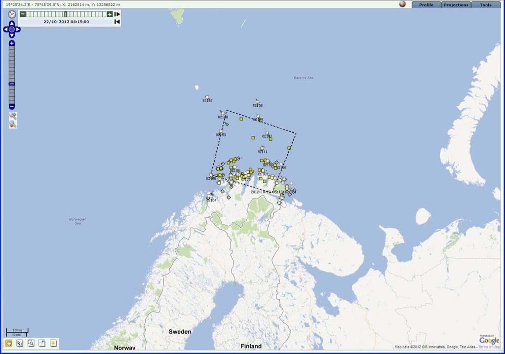
15 MARISS: Barents Sea monitoring; RADARSAT-2 and AISSAT-1 AISSat-1 / 15 / 9-Nov-12 RADARSAT-2 Data and Products MacDONALD, DETTWILER AND ASSOCIATES LTD., 2011 All Rights Reserved RADARSAT is an official mark of the Canadian Space Agency


16 Transhipment activity RADARSAT-2 Data and Products MacDONALD, DETTWILER AND ASSOCIATES LTD., 2011 All Rights Reserved RADARSAT is an official mark of the Canadian Space Agency


17 Vessel Detection and SAT-AIS integration TerraSAR-X Data and Product IAstrium Services / Infoterra GmbH2011. RADARSAT-2 Data and Products MacDONALD, DETTWILER AND ASSOCIATES LTD., 2011 All Rights Reserved RADARSAT is an official mark of the Canadian Space Agency Radarsat-2 and TerraSAR-X detections integrated with data from AISSat-1 and ExactEarth
18 Data fusion and tracking FFI has developed a web-based application for fusion of sensor data from different sources that is presented in a map viewer Integrates ship detection from KSAT with AIS (terrestrial and Sat-AIS) and VMS at the moment LRIT and coastal radar other possible sources Other information like met-ocean, ship lanes, etc. are also available as layers Being rolled out for demonstration at the Defence Joint HQ and an interdepartmental group fighting IUU (Coastguard, Fisheries Directorate, Customs, Police, Ministry of Justice)
19 Overview
20 KSAT ship detections from RADARSAT-2
21 + AIS, SAT-AIS, VMS

22 Fusion and tracking

23 Fusion and tracking

24 Result, red targets are unidentified
25 SAT-AIS in the Barents Sea Current demonstartion and data collection from the main SAT- AIS resources covering the area AISSat-1 exactais LuxSpace/ORBCOMM Aim is to evaluate how more frequent coverage of the area improves the maritime situational awareness for Norwegian authorities: Norwegian Coastal Administration, Vardø-VTS Coast Guard Defence Joint HQ Fisheries control dept.
26 AISSat-1
27 exactais
28 LuxSpace/ORBCOMM

29 All combined
30 Conclusions Satellite based vessel detection (earth observation and SAT- AIS) is an obvious source of infomation for Maritime Domain Awareness History (in Europe) has proven that governments can cooperate in sharing information and costs for oil spill detection Lots of ongoing actitivities in Europe for defining the role of earth observation in Maritime Security C-Σ Information and data sharing: technology is in place, policy and legal framework is not Who s gonna pay?

31 My contact information: Tony Bauna Director, Product and Service Development Kongsberg Satellite Services AS Phone: Mobile: Fax: Main office visiting adress: Kongsberg Satellite Services AS Prestvannvaien 38 N-9291 Tromsø Norway Oslo-office visiting adress: Kongsberg Satellite Services c/o Norwegian Space Centre Drammensveien 165 N-0212 Oslo Norway
32
Satellite data for Maritime Operations. Andreas Hay Kaljord Project Manager Energy, Environment & Security
 Satellite data for Maritime Operations Andreas Hay Kaljord Project Manager Energy, Environment & Security Kongsberg Satellite Services (KSAT) World leading provider within our business area Supports 85
KONGSBERG SATELLITE SERVICES 2017 Line Steinbakk, Director Programs. Himmel og hav - Ålesund 3. Oktober 2017
 KONGSBERG SATELLITE SERVICES 2017 Line Steinbakk, Director Programs Himmel og hav - Ålesund 3. Oktober 2017 KSAT HQ IN TROMSØ 69N Established in 1967 Kongsberg Satellite Services since 2002 World leading
KONGSBERG. WORLD CLASS through people, technology and dedication WORLD CLASS through people, technology and dedication
 WORLD CLASS through people, technology and dedication WORLD CLASS through people, technology and dedication Skipsdeteksjon fra radarsatellitter SkipSat Richard Hallr Kongsberg Satellite Services AS (KSAT)
PMAR Piracy, Maritime Awareness & Risks
 PMAR Piracy, Maritime Awareness & Risks Maritime Situational Awareness for Counter-Piracy European Commission Joint Research Centre 13 June 2012 GeoMaritime, London 1 MSA for counter-piracy study Key elements
Kongsberg Satellite Services, KSAT
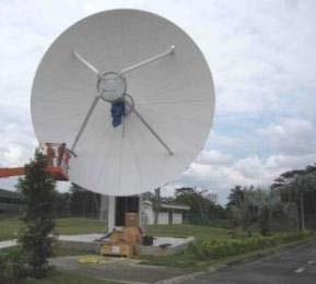
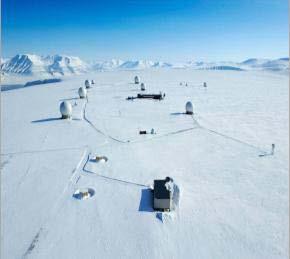
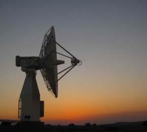
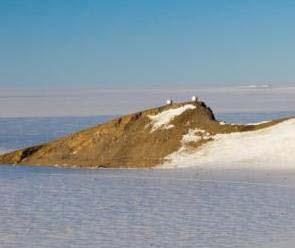
 SvalSat, Earth Station at 78 North Kongsberg Satellite Services, KSAT Making Sense of Space Sigmund Dehli International Sales Manager WORLD CLASS through people, technology and dedication My plan KSAT
KONGSBERG SATELLITE SERVICES Earth Observation for Maritime Operations Current Capabilities and Future Potential
 KONGSBERG SATELLITE SERVICES 2017 Earth Observation for Maritime Operations Current Capabilities and Future Potential Andreas Hay Kaljord Project Manager KSAT HQ IN TROMSØ - 69N WELCOME TO TROMSØ Established
Satellite services for maritime security
 Satellite services for ITS-T Sophia Antipolis 6 June 2007 Jean-Pierre Cauzac, CLS - Collecte Localisation Satellites 35 Are the seas becoming more dangerous? IMB report 2006 shows improvement: 239 piracy
Satellite Technologies for Fisheries Monitoring, Control and Surveillance (MCS)
") JRC IPSC Maritime Affairs 1 Satellite Technologies for Fisheries Monitoring, Control and Surveillance (MCS) Juan Cicuendez, Marlene Alvarez JRC Info Day Madrid, 2 June 2010 IPSC - Institute for the Protection
JRC IPSC Maritime Affairs 1 Satellite Technologies for Fisheries Monitoring, Control and Surveillance (MCS) Juan Cicuendez, Marlene Alvarez JRC Info Day Madrid, 2 June 2010 IPSC - Institute for the Protection
*For International Stewardship of the Maritime Environment and its Resources. Photo
 *For International Stewardship of the Maritime Environment and its Resources *For Maritime Safety *For Security Photo # Providing Environmental Monitoring* # Increasing Security* # Enabling Safety Efforts*
Operational use of satellite SAR at EMSA
 Operational use of satellite SAR at EMSA 25 January 2010 SEASAR Workshop ESRIN, Frascati 1 Marin Chintoan-Uta Head of Unit Satellite Based Monitoring Services The structure of the presentation Introduction
Demonstrator of a Data Processing Centre (DPC) for satellite-based AIS services
 for satellite-based AIS services") Page 1 Demonstrator of a Data Processing Centre (DPC) for satellite-based AIS services 19/20 April 2012 gfabritius@cls.fr Overview of the presentation Page 2 Introducing CLS Introducing AIS / SAT-AIS Scope
Page 1 Demonstrator of a Data Processing Centre (DPC) for satellite-based AIS services 19/20 April 2012 gfabritius@cls.fr Overview of the presentation Page 2 Introducing CLS Introducing AIS / SAT-AIS Scope
The ERS contribution to Oil Spill Monitoring - From R&D towards an operational service -
 The ERS contribution to Oil Spill Monitoring - From R&D towards an operational service - J.P. Pedersen, T.Bauna, L.G. Seljelv, L. Steinbakk, R.T.Enoksen Tromsø Satellite Station, N-9291 Tromsø, Norway
satellite based maritime awareness and surveillance Italian Coast Guard Headquarters
 satellite based maritime awareness and surveillance THE ITCG S ACTIVITIES ARE PERFORMED FOR: BY LAW ITALIAN COAST GUARD IS RESPONSIBLE FOR: PERFORMING AND COORDINATING MARITIME SEARCH AND RESCUE OPERATIONS
Abstract. 1. Introduction
 Title: Satellite surveillance for maritime border monitoring Author: H. Greidanus Number: File: GMOSSBordMon1-2.doc Version: 1-2 Project: GMOSS Date: 25 Aug 2004 Distribution: Abstract Present day remote
ESA IAP Blue Belt demonstration project:
 Page 1 ESA IAP Blue Belt demonstration project: supporting the European Maritime Safety Agency (EMSA) Blue Belt Project, by providing a service based on satellite based AIS data complementing the terrestrial
Integration of AIS functionalities
 Integration of AIS functionalities by John O. Klepsvik FARGIS 05 March 01, 2005 WORLD CLASS through people, technology and dedication WORLD CLASS through people, technology and dedication KONGSBERG March
Cost Effective Control of your Coastal Waters
 Cost Effective Control of your Coastal Waters Olov Fäst SSC Airborne Systems 2013-07-03 SSC: A comprehensive space industry Founded in 1972 ~650 employees (2012) ~100 M turnover (2012) Since the start
*For International Stewardship of the Maritime Environment and its Resources. Photo
 *For International Stewardship of the Maritime Environment and its Resources *For Maritime Safety *For Security Photo # Providing Environmental Monitoring* # Increasing Security* # Enabling Safety Efforts*
Graham Stickler Esri Ocean GIS Forum, Redlands, CA, 5-7 November 2013
 Graham Stickler Esri Ocean GIS Forum, Redlands, CA, 5-7 November 2013 Imagine.. A world with no horizons Coastal Coverage Space View Satellite Constellation 6 satellite polar orbiting + 1 equatorial constellation
SAR Interferometry Capabilities of Canada's planned SAR Satellite Constellation
 SAR Interferometry Capabilities of Canada's planned SAR Satellite Constellation Dirk Geudtner, Guy Séguin,, Ralph Girard Canadian Space Agency RADARSAT Follow-on Program CSA is in the middle of a Phase
The Ability of a Small Satellite Constellation to Tip and Cue Other Commercial Assets
 Changing the economics of space The Ability of a Small Satellite Constellation to Tip and Cue Other Commercial Assets Becky Cudzilo - Surrey Satellite US, LLC K.C. Foley - GeoEye, Inc. Chandler Smith -
Coastal Surveillance. SCANTER Radar Solutions
 Coastal Surveillance SCANTER Radar Solutions Protecting Your Coastlines and Maritime Domain We provide radar coverage of the coastline to detect and track all types of surface vessels and air targets.
Remote Sensing Analysis Framework for Maritime Surveillance Application
 Remote Sensing Analysis Framework for Maritime Surveillance Application Olaf Frauenberger, Egbert Schwarz, Sergey Voinov Maritime Security Lab Neustrelitz (DFD) Maritime Big Data Workshop, 9-11 May, La
Utilization of Radar data for Maritime Surveillance
 INDESO Project Utilization of Radar data for Maritime Surveillance DENDY MAHABROR MARINE RESEARCH CENTER INDESO RADAR GROUND STATION RADARSAT-2 AND COSMO-SKYMED BALI INDESO satelit VMS satelite radar vessel
Innovative Maritime Surveillance Capabilities. Pre-operational Services for Highly. Development of. Maria Angelucci, e-geos
 Development of Pre-operational Services for Highly Innovative Maritime Surveillance Capabilities ASI Workshop - 7 th Framework Program Rome, June 27 th, 2012 Maria Angelucci, e-geos 1 Figures Start date:
Enhanced Maritime Traffic Picture for the Canadian Arctic
 Enhanced Maritime Traffic Picture for the Canadian Arctic Giulia Battistello*, Martin Ulmke*, Camilla Mohrdieck** (*) Fraunhofer FKIE - Sensor Data and Information Fusion Department - Wachtberg, Germany
Copyright 2016 Raytheon Company. All rights reserved. Customer Success Is Our Mission is a registered trademark of Raytheon Company.
 Make in India Paradigm : Roadmap for a Future Ready Naval Force Session 9: Coastal Surveillance, Response Systems and Platforms Nik Khanna, President, India April 19, 2016 "RAYTHEON PROPRIETARY DATA THIS
Multi Sensor Data Fusion
 Multi Sensor Data Fusion for improved maritime traffic monitoring in the Canadian Arctic Giulia Battistello*, Martin Ulmke*, Javier Gonzalez*, Camilla Mohrdieck** (*) Fraunhofer FKIE Sensor Data and Information
SPACE OBSERVATIONS FOR MARITIME DOMAIN AWARENESS
 SPACE OBSERVATIONS FOR MARITIME DOMAIN AWARENESS Review and succes stories Tools : Positionning (GNSS) Identification ( VMS, S-AIS,..) Detection (SAR) Oil spill - IUU (INN) - Illegal transhipment Safety
The EU and Norway: addressing Arctic and maritime challenges
 SPEECH/11/673 Maria Damanaki European Commissioner for Maritime Affairs and Fisheries The EU and Norway: addressing Arctic and maritime challenges Seminar High North Oslo, 17 October 2011 Ladies and Gentlemen,
A Space-Based Solution for Illegal, Unregulated & Unreported Fishing. Emmanouil Detsis, International Space University
 Project Catch A Space-Based Solution for Illegal, Unregulated & Unreported Fishing Emmanouil Detsis, International Space University Project Catch COPUOS Presentation Team Project Oceans International Intercultural
Using satellite technology to monitor illegal, unreported, and unregulated (IUU) fishing
 fishing") Using satellite technology to monitor illegal, unreported, and unregulated (IUU) fishing Mark Richardson The Pew Charitable Trusts Blue Planet Symposium, June 2, 2017 The global threat of IUU fishing Illegal,
Using satellite technology to monitor illegal, unreported, and unregulated (IUU) fishing Mark Richardson The Pew Charitable Trusts Blue Planet Symposium, June 2, 2017 The global threat of IUU fishing Illegal,
Space-Based AIS: Contributing to Global Safety and Security
 Space-Based AIS: Contributing to Global Safety and Security J.S. Cain 1, E. Meger 2, COM DEV Limited 155 Sheldon Ave, Cambridge, Ontario, Canada. Abstract Global trade continues to increase and today more
the use of satellite radar to improve surveillance of oil pollution over large areas
 Groupe de travail ORFEO - Mer et Littoral Réunion du 14 octobre 2004 the use of satellite radar to improve surveillance of oil pollution over large areas François Parthiot Cedre - Delegate for the Mediterranean
Co-ReSyF RA lecture: Vessel detection and oil spill detection
 This project has received funding from the European Union s Horizon 2020 Research and Innovation Programme under grant agreement no 687289 Co-ReSyF RA lecture: Vessel detection and oil spill detection
GNSS in the Arctic. by Arne Rinnan, Kongsberg Seatex AS. WORLD CLASS through people, technology and dedication
 GNSS in the Arctic by Arne Rinnan, Kongsberg Seatex AS WORLD CLASS through people, technology and dedication Outline Introduction Weather conditions Satellite coverage Aurora impact GNSS corrections Test
RADARSAT-2 Modes and Applications
 RADARSAT-2 Modes and Applications Gordon Staples MDA Geospatial Services February 6, 2017 1 Introduction RADARSAT-2 was developed to meet operational needs via a versatile space segment and a responsive
Arctic Shipping Navigating the Legal Landscape for marine infrastructure and Off-Shore Development
 Arctic Shipping Navigating the Legal Landscape for marine infrastructure and Off-Shore Development Peter G. Pamel Partner Connecticut Maritime Association SHIPPING 2012 Hilton Stamford March 21 st, 2012
Downloaded by on April 16, DOI: /
 Polar Epsilon: Joint Space-Based Wide Area Surveillance and Support Project LCdr Robert Quinn Project Director Polar Epsilon Directorate of Space Development Phone: +1(613)945-5212 Quinn.rj2@forces.gc.ca
Juan GAVIRIA, Sector Leader AFTTR
 Earth Observation in support of the Western Indian Ocean Marine Highway Development and Coastal and Marine Contamination Prevention Project - Oil spill detection & Coral reef monitoring Juan GAVIRIA, Sector
Western Indian Ocean Marine Highway Development and Coastal and Marine Contamination Prevention Project - Oil spill detection & Coral reef monitoring
 Earth Observation in support of the Western Indian Ocean Marine Highway Development and Coastal and Marine Contamination Prevention Project - Oil spill detection & Coral reef monitoring Juan GAVIRIA, Sector
Security Systems Division
 Security Systems Division SIVE A PIONEER MARITIME BORDER SURVEILLANCE SYSTEM. WHAT IS BEYOND? Pros and cons of the SIVE system today in the new coastal and deepwater border scenario and our vision of a
SAR missions for oceanography at the European Space Agency
 SAR missions for oceanography at the European Space Agency ERS-1, ERS-2, Envisat, Sentinel-1A, Sentinel-1B, ESA 3 rd Party Missions (ALOS) Prepared by ESA teams and ESA supporting companies ESA and SAR
HSE and Quality. Sisimiut, 10th December FING: Arctic Region Oil & Gas Seminar in Training and Education
 HSE and Quality Sisimiut, 10th December 2013 FING: Arctic Region Oil & Gas Seminar in Training and Education 1 Arctic Issues Above ground challenges FING: Arctic Region Oil & Gas Seminar in Training and
Rutter High Resolution Radar Solutions
 Rutter High Resolution Radar Solutions High Resolution Imagery, Target Detection, and Tracking At the core of our enhanced radar capabilities are proprietary radar processing and imaging technologies.
RADAR SATELLITES AND MARITIME DOMAIN AWARENESS
 RADAR SATELLITES AND MARITIME DOMAIN AWARENESS J.K.E. Tunaley Corporation, 114 Margaret Anne Drive, Ottawa, Ontario K0A 1L0 (613) 839-7943 Report Documentation Page Form Approved OMB No. 0704-0188 Public
Government Agency Perspectives & Initiatives Canadian Coast Guard Laurent Tardif, Director, Safe Shipping
 Unclassified Government Agency Perspectives & Initiatives Canadian Coast Guard Laurent Tardif, Director, Safe Shipping Mariner s Workshop January 23, 2019 1 Overview 1 Context 2 Marine Fees 3 4 5 Update
White Paper No. 8 ( )
") White Paper No. 8 (2005-2006) Integrated Management of the Marine Environment of the Barents Sea and the Sea Areas off Lofoten (Integrated Management Plan) The World s Large Marine Ecosystems 2 Minister
White Paper No. 8 (2005-2006) Integrated Management of the Marine Environment of the Barents Sea and the Sea Areas off Lofoten (Integrated Management Plan) The World s Large Marine Ecosystems 2 Minister
S. Africa Cape Town. S. Africa Australia miles. Maritime Interest 31/07/2013. NAV 2013 Navigation Symposium
 NAV 2013 Navigation Symposium S. Africa Cape Town SESSION 10: Expanding role of Vessel Traffic Services (VTS) Vessel Monitoring in South Africa and Beyond - Why Safety of Navigation? Centre for Sea Watch
09 Apr 2013 Commodore Mark Mellett DSM; PhD; FNI
 Cooperation in the Atlantic Basin Realities and Possibilities - Atlantic 5 09 Apr 2013 Commodore Mark Mellett DSM; PhD; FNI mark.mellett@defenceforces.ie AGENDA Context Governance Challenges Atlantic Realities
Earth Observation Opportunities to Enhance Maritime Safety
 http://www.transnav.eu the International Journal on Marine Navigation and Safety of Sea Transportation Volume 11 Number 4 December 2017 DOI: 10.12716/1001.11.04.17 Earth Observation Opportunities to Enhance
Sensors, Tools and the Common Operating Picture. Sensors, Tools and the Common Operating Picture 14 th April Middleburg
 Sensors, Tools and the Common Operating Picture 14 th April 2015 - Middleburg Aptomar Established in 2005 Owned by Statoil, Investinor, Proventure Seed, Verdane Capitol Have developed and control all IPR
CHAPTER 1 INTRODUCTION
 1 CHAPTER 1 INTRODUCTION In maritime surveillance, radar echoes which clutter the radar and challenge small target detection. Clutter is unwanted echoes that can make target detection of wanted targets
SUMMARY REPORT AND RECOMMENDATIONS ON THE PREVENTION OF MARINE OIL POLLUTION IN THE ARCTIC.
 Arctic Council Open Access Repository Arctic Council http://www.arctic-council.org/ 1.8 Sweden Chairmanship I (May 2011 - May 2013) 4. SAO Meeting, March 2013, Stockholm, Sweden SUMMARY REPORT AND RECOMMENDATIONS
COPERNICUS COLLABORATIVE GROUND SEGMENT TO SUPPORT MARITIME SITUATIONAL AWARENESS
 COPERNICUS COLLABORATIVE GROUND SEGMENT TO SUPPORT MARITIME SITUATIONAL AWARENESS D. Krause*, E. Schwarz, H. Damerow, German Aerospace Center (DLR), German Remote Sensing Data Center (DFD), Kalkhorstweg
ERS/ENVISAT ASAR Data Products and Services
 ERS/ENVISAT ASAR Data Products and Services Andrea Celentano Business Manager celentan@eurimage.com What is Eurimage? Founded in 1989 Current shareholders: Since 1989 Commercial Partner of the European
CJ Jagadeesha,NDRF-IEI, Bangalore RM Vasagam,Chairman Aerospace Division Board,IEI LVM Reddy,Vice-President,IEI
 CJ Jagadeesha,NDRF-IEI, Bangalore RM Vasagam,Chairman Aerospace Division Board,IEI LVM Reddy,Vice-President,IEI D] Geo informatics for assessing EWS in watersheds E] DSS for EW communication and policy
,-+!,. !"#$"%$&'($)$*&+ ! The Utilisation of Satellite Images! for the Oil in Ice Experiment in the Barents Sea, May 2009!!!
$*&+ ! The Utilisation of Satellite Images! for the Oil in Ice Experiment in the Barents Sea, May 2009!!!") ,-+,. "#$"%$&'($)$*&+ Report no.: 29 The Utilisation of Satellite Images for the Oil in Ice Experiment in the Barents Sea, May 2009 Mohamed Babiker, Kjell Kloster and Stein Sandven (NERSC) and Richard
,-+,. "#$"%$&'($)$*&+ Report no.: 29 The Utilisation of Satellite Images for the Oil in Ice Experiment in the Barents Sea, May 2009 Mohamed Babiker, Kjell Kloster and Stein Sandven (NERSC) and Richard
Warren Cartwright, Product Manager MDA Geospatial Services, Canada
 Advanced InSAR Techniques for Urban Infrastructure Monitoring Warren Cartwright, Product Manager MDA Geospatial Services, Canada www.mdacorporation.com RESTRICTION ON USE, PUBLICATION OR DISCLOSURE OF
Commercial Marine Shipping in Canada: Understanding the Risks
 Commercial Marine Shipping in Canada: Understanding the Risks Dr. Richard Wiefelspuett Executive Director GREENTECH 2016 Conference, Quebec City June 1, 2016 CENTRE FOR RESPONSIBLE MARINE SHIPPING Overview:
COMMUNICATIONS FOR MARITIME SAFETY AND EFFICIENCY. Francis Zachariae, Secretary-General, IALA
 COMMUNICATIONS FOR MARITIME SAFETY AND EFFICIENCY Francis Zachariae, Secretary-General, IALA IALA and its Purpose Non profit, international technical association established in 1957 Two Goals aimed at
Canadian Space Agency program update
 Canadian Space Agency program update Briefing to the meeting of the Expert Team on Satellite Systems (ET-SAT-11) Geneva, 4 April 2017 Guennadi Kroupnik Canadian Space Agency RADARSAT-2: CURRENT OPERATIONAL
Integrating Spaceborne Sensing with Airborne Maritime Surveillance Patrols
 22nd International Congress on Modelling and Simulation, Hobart, Tasmania, Australia, 3 to 8 December 2017 mssanz.org.au/modsim2017 Integrating Spaceborne Sensing with Airborne Maritime Surveillance Patrols
TerraSAR-X Applications Guide
 TerraSAR-X Applications Guide Extract: Maritime Monitoring: Ship Detection April 2015 Airbus Defence and Space Geo-Intelligence Programme Line Maritime Monitoring: Ship Detection Issue Maritime security
International Collaborative Engagement Program for Polar Research ICE-PPR. Ministry of Defence Denmark Charlotte Havsteen
 International Collaborative Engagement Program for Polar Research ICE-PPR Ministry of Defence Denmark Charlotte Havsteen Situational Awareness Status Situational awareness Underwater Subsurface Acoustic/Long
Port Security and Technology - the U.S. Perspective. Michael S. Bruno Stevens Institute of Technology March 14, 2012
 Port Security and Technology - the U.S. Perspective Michael S. Bruno Stevens Institute of Technology March 14, 2012 CSR A Department of Homeland Security National Center of Excellence for Port Security
European Commission Workshop «SATELLITE IMAGERY AND ILLEGAL OIL SPILLS IN EUROPE AND IN THE MEDITERRANEAN» Round table 1 : «DETECTION TECHNIQUES»
 European Commission Workshop «SATELLITE IMAGERY AND ILLEGAL OIL SPILLS IN EUROPE AND IN THE MEDITERRANEAN» Round table 1 : «DETECTION TECHNIQUES» Round table 2 : «MUTUAL INFORMATION AND PROSECUTION PROCEDURES»
Copernicus Introduction Lisbon, Portugal 13 th & 14 th February 2014
 Copernicus Introduction Lisbon, Portugal 13 th & 14 th February 2014 Contents Introduction GMES Copernicus Six thematic areas Infrastructure Space data An introduction to Remote Sensing In-situ data Applications
Commercial Marine Shipping in Canada: Understanding the Risks
 Commercial Marine Shipping in Canada: Understanding the Risks Dr. Richard Wiefelspuett Executive Director North Shore Waterfront Liaison Committee June 30, 2016 CENTRE FOR RESPONSIBLE MARINE SHIPPING Outcomes:
ROUTEING OF SHIPS, SHIP REPORTING AND RELATED MATTERS. New traffic separation schemes and two-way routes in Norra Kvarken
 E SUB-COMMITTEE ON SAFETY OF NAVIGATION 57th session Agenda item 3 NAV 57/3/7 11 March 2011 Original: ENGLISH ROUTEING OF SHIPS, SHIP REPORTING AND RELATED MATTERS New traffic separation schemes and two-way
At the heart of sea, air and land rescues
 At the heart of sea, air and land rescues 24 7 00:43 01:25 12:55 15:32 19:05 NEW ZEALAND w What we do Co-ordinate major maritime, aviation and land-based search and rescue operations (SAROPs) in New Zealand.
Mission Solution 100
 Mission Solution 100 Standard configuration for littoral security Member of the Thales Mission Solution family Standard configuration of integrated sensors, effectors, CMS, communication system and navigation
Ian D Souza (1), David Martin (2)
, David Martin (2)") NANO-SATTELITE DEMONSTRATION MISSION: THE DETECTION OF MARITIME AIS SIGNALS FROM LOW EARTH ORBIT SMALL SATELLITE SYSTEMS AND SERVICES SYMPOSIUM Pestana Conference Centre Funchal, Madeira - Portugal 31
NANO-SATTELITE DEMONSTRATION MISSION: THE DETECTION OF MARITIME AIS SIGNALS FROM LOW EARTH ORBIT SMALL SATELLITE SYSTEMS AND SERVICES SYMPOSIUM Pestana Conference Centre Funchal, Madeira - Portugal 31
NEREIDS: New concepts in maritime surveillance for consolidating operational developments
 SEASAR12 WORKSHOP, TROMSO, 06-12 NEREIDS: New concepts in maritime surveillance for consolidating operational developments Property of GMV All rights reserved SUMMARY NEREIDS PROJECT NEREIDS CHALLENGES
Challenges and opportunities in the e-navigation Development. Actual projects.
 Challenges and opportunities in the e-navigation Development. Actual projects. John Erik Hagen, Regional Director Oslo, September 2018 What is e-navigation? Efficient transfer of marine information and
Evaluation of Vessel Detection System Use for Monitoring of Fisheries Activities
 Not to be cited without prior reference to the author Evaluation of Vessel Detection System Use for Monitoring of Fisheries Activities Guido Lemoine, Marte Indregard, Christian Cesena, Francois Xavier
AN OVERVIEW OF THE STATE OF MARINE SPATIAL PLANNING IN THE MEDITERRANEAN COUNTRIES MALTA REPORT
 AN OVERVIEW OF THE STATE OF MARINE SPATIAL PLANNING IN THE MEDITERRANEAN COUNTRIES MALTA REPORT Malta Environment & Planning Authority May 2007 AN OVERVIEW OF THE STATE OF MARINE SPATIAL PLANNING IN THE
Fig. 1. Overview map of promising areas of the Russian shelf.
 IMPLEMENTATION OF THE SCHTOKMAN PROJECT START OF HYDROCARBON RESOURCES DEVELOPMENT ON THE ARCTIC SHELF OF RUSSIA V.S. Vovk (Gazprom), A.Ya. Mandel (Gazprom dobycha shelf), R.O. Samsonov (Gazprom VNIIGAZ)
It is an Interconnected World. Except in the Maritime Domain In 2008 Satellite AIS (S-AIS) Changed All that!
 Changed All that!") It is an Interconnected World Except in the Maritime Domain In 2008 Satellite AIS (S-AIS) Changed All that! Background This brief is the result of that Research, which continues to this day. Makes Regional
It is an Interconnected World Except in the Maritime Domain In 2008 Satellite AIS (S-AIS) Changed All that! Background This brief is the result of that Research, which continues to this day. Makes Regional
10th Barents Industrial Partnership meeting Oulu
 10th Barents Industrial Partnership meeting 15.10.2015 Oulu Kolarctic CBC Programme is a multilateral ENI CBC programme: Finland, Norway, Russia and Sweden Regional Council of Lapland will be the Managing
Satellite SAR ship detections from PMAR in support of Cutlass Express
 Satellite SAR ship detections from PMAR in support of Cutlass Express Harm Greidanus, Marlene Alvarez, Tulay Cokacar, Andrea Pesaresi, Carlos Santamaria, Vladimir Kyovtorov EUR 25140 EN - 2011 The mission
1. Detect and locate potentially illegal fishing ship using satellite image, AIS data, and external sources.
 Title: Development of Microsatellite to Detect Illegal Fishing MS-SAT Primary Point of Contact (POC) & email: Dr. Ridanto Eko Poetro; ridanto@ae.itb.ac.id Co-authors: Ernest Sebastian C., Bintang A.S.W.A.M.
Summary report RCN project no /I40
 Summary report RCN project no. 188913/I40 Construction and intervention vessel for Arctic conditions Project period: September 2008 December 2011 Project partners: MARINTEK CeSOS, Norwegian University
Contact information: (prime contractor) or (project manager),
 or (project manager),") The main objective of MarSafe North is to identify the user requirements and technological possibilities to be able to perform safe and efficient operations in the High North. The study areas covered by
The main objective of MarSafe North is to identify the user requirements and technological possibilities to be able to perform safe and efficient operations in the High North. The study areas covered by
Earth Observation and Sensing Technologies: a focus on Radar Imaging Developments. Riccardo Lanari
 Earth Observation and Sensing Technologies: a focus on Radar Imaging Developments Riccardo Lanari Institute for Electromagnetic Sensing of the Environment (IREA) National Research Council of Italy (CNR)
Vessel Traffic Generator. Agent based maritime traffic generator
 Vessel Traffic Generator Agent based maritime traffic generator Motivation Why (I) Need for data sets to develop and validate Maritime Situational Awareness algorithms Problem Real-world data (e.g. AIS
Teresa Mira H2020 Pre-Commercial Procurement Project No
 MARINE-EO: Bridging Innovative Downstream Earth Observation and Copernicus enabled Services for Integrated maritime environment, surveillance and security Teresa Mira (teresa.mira@dgpm.mam.gov.pt) H2020
Marine. Status of the Copernicus Marine service with MyOcean2. Pierre Bahurel, Mercator Ocean FP7 MyOcean2 coordinator
 Marine Status of the Copernicus Marine service with MyOcean2 Pierre Bahurel, Mercator Ocean FP7 MyOcean2 coordinator Geneva, 16/01/2014 http:// (1) Status of the Copernicus Marine service demonstrated
EDA s PROJECT TEAM EUROPEAN MARITIME CAPABILITIES IN THE ARCTIC PT EMCA
 EDA s PROJECT TEAM EUROPEAN MARITIME CAPABILITIES IN THE ARCTIC PT EMCA WHY EU IN THE ARCTIC? - Climate Change still a puzzle -> to gain better understanding - Arctic s economical importance growing ->
istockphoto.com/ryasick 44 The Journal of Ocean Technology, Vol. 10, No. 2, 2015
 istockphoto.com/ryasick 44 The Journal of Ocean Technology, Vol. 10, No. 2, 2015 Copyright Journal of Ocean Technology 2015 Copyright Journal of Ocean Technology 2015 Leveraging Advanced Technologies in
European Maritime Day 2019, Burgas, Bulgaria. 31 May & 1 June. List of exhibitors
 European Maritime Day 2019, Burgas, Bulgaria 31 May & 1 June List of exhibitors 1 Name Description Logo ACTeon We will present H2020 project on ocean literacy - Responseable and different ocean literacy
L AGENCE NATIONALE DES FREQUENCES (ANFR) From Titanic to satellite from Morse to digital Entry in a new era for the maritime community
 From Titanic to satellite from Morse to digital Entry in a new era for the maritime community") L AGENCE NATIONALE DES FREQUENCES (ANFR) From Titanic to satellite from Morse to digital Entry in a new era for the maritime community ITU regional seminar 6-8 June 2018 St-Petersburg, Russian Federation
L AGENCE NATIONALE DES FREQUENCES (ANFR) From Titanic to satellite from Morse to digital Entry in a new era for the maritime community ITU regional seminar 6-8 June 2018 St-Petersburg, Russian Federation
FEASIBILITY OF SENTINEL-1 DATA FOR ENHANCED MARITIME SAFETY AND SITUATIONAL AWARENESS
 FEASIBILITY OF SENTINEL-1 DATA FOR ENHANCED MARITIME SAFETY AND SITUATIONAL AWARENESS ABSTRACT O. Nevalainen 1, S. Thombre 1, H. Kuusniemi 1, L. Chen 1, S. Kaasalainen 1, M. Karjalainen 1 1 Finnish Geospatial
Limitations of Satellite AIS: Time Machine Wanted!
 Limitations of Satellite AIS: Time Machine Wanted! Eric Meger CEO, Maerospace Corporation eric.meger@!maerospace.com 3 October 2013 Maritime Domain Awareness is one of the most significant national and
SAR Symposium Keynote Address *
 SAR SYMPOSIUM KEYNOTE ADDRESS SAR Symposium Keynote Address * Robert S. Winokur Spaceborne synthetic aperture radar (SAR) can provide a perspective of the Earth s surface that is nearly unique in scientific
Galileo and GMES Technologies for Maritime Navigation Christoph Günther, DLR
 Galileo and GMES Technologies for Maritime Navigation Christoph Günther, DLR Institut für Kommunikation und Navigation Seite 1 Maritime Safety and Efficiency Avoidance of Collisions based on known position
e-navigation Underway International February 2016 Kilyong Kim(GMT Co., Ltd.) Co-author : Seojeong Lee(Korea Maritime and Ocean University)
 Co-author : Seojeong Lee(Korea Maritime and Ocean University)") e-navigation Underway International 2016 2-4 February 2016 Kilyong Kim(GMT Co., Ltd.) Co-author : Seojeong Lee(Korea Maritime and Ocean University) Eureka R&D project From Jan 2015 to Dec 2017 15 partners
e-navigation Underway International 2016 2-4 February 2016 Kilyong Kim(GMT Co., Ltd.) Co-author : Seojeong Lee(Korea Maritime and Ocean University) Eureka R&D project From Jan 2015 to Dec 2017 15 partners
Marine Earth Observation & Applications at University College Cork
 Marine Earth Observation & Applications at University College Cork Rory Scarrott, with input from Eimear Tuohy & Chiara Pratola 2 nd Irish Industry Space Day, Hibernian Club, Dublin, September 2 nd 2015
REFERENCES FAO FAO FAO/FishCode Flewwelling, P Flewwelling, P., Cullinan, C., Balton, D. & Reynolds, J.E Gallagher, R Kelleher, K
 40 REFERENCES FAO. 1998. Fish operations. 1. Vessel monitoring systems. FAO Technical Guidelines for Responsible Fisheries No. 1, Suppl. 1. Rome. 58 pp. FAO. 2007. Report of the Expert Consultation on
MARINE ELECTRONIC HIGHWAY IN STRAITS OF MALACCA AND SINGAPORE. Development of Supporting Element for Future & Sustainable Operation
 COOPERATION FORUM UNDER THE COOPERATIVE MECHANISM ON SAFETY OF NAVIGATION AND ENVIRONMENTAL PROTECTION IN THE STRAITS OF MALACCA AND SINGAPORE 7th SESSION Agenda Item... CF 7/... 22-23 September 2014 Original.