Data Warehouse Phase 2 CORE Datasets Status 15 th May 2018
|
|
|
- Andrea Elliott
- 6 years ago
- Views:
Transcription
1 Data Warehouse Phase 2 CORE Datasets Status 15 th May 2018 The document presents the status of the open CORE datasets, for which data provision is on-going. Once closed, content of the datasets can be found at Table of Contents HR_IMAGE_ Optical HR Pan Europe Coverages... 2 VHR_IMAGE_ Optical VHR multispectral and panchromatic coverage over Europe... 4 MR_OPTICAL_GLOBAL Optical MR2 worldwide coverage... 7 LR_OPTICAL_GLOBAL Optical LR worldwide coverage... 8 HR2-MR1_SAR_GLOBAL SAR HR2/MR1 Worldwide coverage SAR_SEA_ICE Sea Ice Monitoring HR2/MR
2 HR_IMAGE_ Optical HR Pan Europe Coverages Dataset description: Up to two High Resolution (10-20m) optical coverages of 39 European States (EEA-39) including all islands of those countries plus French Overseas Departments (DOMs) acquired within predefined windows corresponding to the vegetation season in Each coverage is delivered in two processing levels: level 1 and level 3. Ortho-rectified products are provided in both national projection (national coordinate reference systems) and European projection (ETRS89-LAEA, EPSG code 3035), except DOMs (only national projection). Contributing data providers: GAF, Airbus Defence and Space, ESA. Dataset implementation status: closed Gap filling activities with Sentinel-2 data have been completed. Contributing Mission SPOT-5 Data Provider Airbus Defence and Space Implementation Status Airbus DS delivered all available SPOT archive over EEA-39 countries and one coverage with SPOT-6 and Spot-7 over the French DOMs. Resourcesat-2 GAF GAF AG completed on 6 December 2016 the delivery of the 1129 Resourcesat-2 products being part of the final optimised coverages as a result of data assessment by EEA. Sentinel-2A ESA About 650 and 1800 S-2A tiles have been selected to cover the gaps of COV#1 and COV#2 respectively, resulting in a coverage achievement of 99.8% and 77.6% excluding the French DOMs (see maps below). The lists of selected products (including the CopHub links) are available at: Table 1: HR_IMAGE_2015 dataset implementation status

")

3 Figure 1 and Figure 2 show the final status of HR_IMAGE_2015, as a result of CCMEs and Sentinel-2A data selection. Figure 1: HR_IMAGE_2015 coverage achievement a) COV#1; b) COV#2. Figure 2: Cloud-free coverage composition Quick-looks mosaic maps: a) COV#1; b) COV#2 including Sentinel-2 selected data
4 VHR_IMAGE_ Optical VHR multispectral and panchromatic coverage over Europe Dataset description: One Very High Resolution (<=1m pan, 2-4m MS) optical coverage of 39 European States (EEA-39) including all islands of those countries plus French Overseas Departments acquired within predefined windows corresponding to the vegetation season in Each coverage is delivered in two processing levels: level 1 and level 3. Ortho-rectified products are provided in both national projection (national coordinate reference systems) and European projection (ETRS89-LAEA, EPSG code 3035), except DOMs (only national projection). Contributing data providers: Airbus Defence and Space, EUSI, Deimos Imaging (see large regions allocation and scenes accepted in Figure 3). Dataset implementation status: closed The dataset was implemented as follows: - Delivery of compliant approved data by the pre-assigned CCMEs - Gap filling phase 1, including partially compliant data from the pre-assigned mission plus archive compliant data from back-up missions. After data assessment, the cloud free coverage achievement for the entire AOI (39 European States) was about 91%. - Gap filling phase 2, including additional Pleiades data as well as SPOT-6/7 data where no compliant data could be found. Final cloud-free coverage achievement is about 98.5% (excluding the French DOMs). Detailed information for each large region is included in table 2. All data, including coverage DOMs, were delivered to the CDS archive by 23 April 2018 and are available to users.
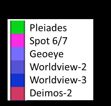
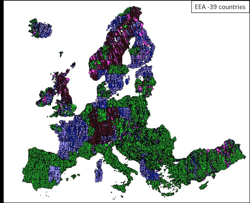
5 Figure 3: VHR_IMAGE_2015: Large Regions allocation and scenes delivered


6 Table 2: Coverage achieved for the 141 Large Regions, final status
7 MR_OPTICAL_GLOBAL Optical MR2 worldwide coverage Dataset Description: Worldwide Medium Resolution systematic optical coverage between Lat. 35 N and 75 N, and between 35 S and 56 S, with PROBA-V. The available product is the S1 TOC at 100m resolution, a daily synthesis product with atmospheric corrections applied. Contributing data provider: VITO Dataset implementation status: Contributing Mission Data Provider Implementation Status PROBA-V (100m) VITO On-going systematic data delivery; number of products delivered quarterly is included in Table4 Table 3: MR_OPTICAL_GLOBAL dataset implementation status Period PROBA-V S1-TOC April June July September October December January March April June July September October December January March April June July September October December January March April June Table 4: Number of PROBA-V 100m products delivered quarterly
8 LR_OPTICAL_GLOBAL Optical LR worldwide coverage Dataset Description: Worldwide Low Resolution systematic optical coverage between Lat. 35 N and 75 N, and between 35 S and 56 S, with PROBA-V. The following products are available: Level 1C: Raw data, no atmospheric correction, no projection, no radiometric correction applied, daily product (333m res. only) S1 TOA: no atmospheric corrections applied, daily synthesis product (333m and 1km res) S1 TOC: atmospheric corrections applied, daily synthesis product (333m and 1km res) S10 TOC: atmospheric corrections applied, 10 days synthesis product (333m and 1km res) Contributing data provider: VITO Dataset implementation status: Contributing Mission Data Provider Implementation Status PROBA-V (333m and 1km) VITO On-going systematic data delivery; number of products delivered on a quarterly basis is included in Table 6 and Table 7 Table 5: LR_OPTICAL_GLOBAL dataset implementation status Period Level 1C S1 TOA S1 TOC S10 TOC April June July September October - December January March April June July September October December January March April June July September October December January March April June Table 6: Number of 333m PROBA-V products delivered
9 Period S1 TOA S1 TOC S10 TOC April June July September October December January March April June July September October December January March April June July September October December January March April June Table 7: Number of 1km PROBA-V products delivered
10 HR2-MR1_SAR_GLOBAL SAR HR2/MR1 Worldwide coverage Dataset Description: Worldwide SAR coverage in High Resolution (20 m) Contributing data provider: ESA Dataset implementation status: Contributing Mission Sentinel-1 Data Provider ESA Implementation Status Systematic data availability via the Copernicus Open Access Hub and Copernicus Services Hub Table 8: HR2-MR1_SAR_GLOBAL dataset implementation status
11 SAR_SEA_ICE Sea Ice Monitoring HR2/MR1 Dataset Description: Systematic SAR coverage of predefined sea ice zones (Baltic, Eurarctic, Arctic ocean, Greenland and Antarctic) with Sentinel-1 complemented by Radarsat-2, COSMO-SkyMed and TerraSAR-X acquisitions in response to Copernicus Marine Environment Monitoring Service data requests. Contributing data providers: ESA, MDA, e-geos, Airbus Defence and Space Dataset implementation status: Contributing Mission Data Provider Implementation Status Sentinel-1 ESA Systematic data delivery over selected AOIs RADARSAT-2 COSMO-SkyMed TERRASAR-X MDA e-geos Airbus Defence and Space Data delivery according to CMEMS order submission (see status of quota consumption in Table 10) Table 9: SAR_SEA_ICE dataset implementation status Mission Instrument Acquisition Mode RADARSAT-2 SAR ScanSAR Narrow ScanSAR Wide Assigned Quota Remaining Quota Remaining Quota till 2020 till 2020 for , TERRASAR-X X-SAR ScanSAR Wide 1, COSMO-SkyMed SAR ScanSAR Wide ScanSAR Huge StripMap HIMAGE 6, Table 10: SAR_SEA_ICE dataset quota (products) usage summary
12 Sea ice zones RADARSAT-2 TERRASAR-X COSMO-SkyMed Baltic Eurarctic Greenland Table 11: SAR_SEA_ICE dataset 2018 remaining quota per sea ice zone
GMES DA COPERNICUS
 2014 Airbus Defence and Space All rights reserved. The reproduction, distribution and utilization of this document as well as the communication of its contents to others without express authorization is
esrin DOCUMENT Copernicus Space Component Data Access Portfolio: Data Warehouse
 esrin DOCUMENT Copernicus Space Component Data Access Portfolio: Data Warehouse 2014-2020 Prepared by G. Ottavianelli Reference COPE-PMAN-EOPG-TN-15-0004 Issue/Revision 2.5 Date of Issue 14/12/2018 Status
esrin DOCUMENT Copernicus Space Component Data Access Portfolio: Data Warehouse
 esrin DOCUMENT Copernicus Space Component Data Access Portfolio: Data Warehouse 2014-2020 Prepared by G. Ottavianelli Reference COPE-PMAN-EOPG-TN-15-0004 Issue/Revision 2.3 Date of Issue 16/03/2018 Status
EMSA Additional Dataset Status 31 st March 2015
 EMSA Additional Dataset Status 31 st March 2015 DWH_MG2_EMSA_ADD_001a: _rush_optical_hr1... 2 DWH_MG2_EMSA_ADD_001b: _rush_optical_hr2... 3 DWH_MG2_EMSA_ADD_002a: ew acquisition_rush_optical_hr1... 4 DWH_MG2_EMSA_ADD_002b:
DOCUMENT. esrin. Copernicus Space Component Data Access Portfolio: Data Warehouse ESA UNCLASSIFIED - For Official Use
 DOCUMENT esrin Via Galileo Galilei Casella Postale 64 00044 Frascati Italy Copernicus Space Component Data Access Portfolio: Data Warehouse 2014-2020 Prepared by B. Hoersch, V. Amans Reference COPE-PMAN-EOPG-TN-15-0004
Introduction to KOMPSAT
 Introduction to KOMPSAT September, 2016 1 CONTENTS 01 Introduction of SIIS 02 KOMPSAT Constellation 03 New : KOMPSAT-3 50 cm 04 New : KOMPSAT-3A 2 KOMPSAT Constellation KOMPSAT series National space program
The use of satellite images to forecast agricultural
 The use of satellite images to forecast agricultural Luxembourg, 12.03.2014 r. Tomasz Milewski NUTS for Poland: NUTS 1 macro-regions (grup of province, voivodships) (6), NUTS 2 - regions (province,
Operational Space-Based Imaging Systems
 Operational Space-Based Imaging Systems R E M O T E S E N S I N G & G E O S PAT I A L A N A LY S I S L A B D O I : 2 0 A U G U S T, 2 0 1 6 Earth Observation Systems U.S. or foreign government systems
Airbus Airbus Defence and Space - Intelligence. Price List North America
 Airbus Airbus Defence and Space - Intelligence Price List North America Effective: January 1, 2018 Pléiades and SPOT 1-7 Archive Prices are per square kilometer. Prices and minimum order size apply for
Satellite Imagery Characteristics, Uses and Delivery to GIS Systems. Wayne Middleton April 2014
 Satellite Imagery Characteristics, Uses and Delivery to GIS Systems Wayne Middleton April 2014 About Geoimage Founded in Brisbane 1988 Leading Independent company Specialists in satellite imagery and geospatial
SAR missions for oceanography at the European Space Agency
 SAR missions for oceanography at the European Space Agency ERS-1, ERS-2, Envisat, Sentinel-1A, Sentinel-1B, ESA 3 rd Party Missions (ALOS) Prepared by ESA teams and ESA supporting companies ESA and SAR
Title of presentation runs here on two lines / Arial Regular 30 pt
 Title of presentation runs here on two lines / Arial Regular 30 pt Subtitle goes here / Arial Regular 20 pt Airbus Defense and Space Geo-Intelligence PIONEERING THE FUTURE TOGETHER Name Here / Arial Regular
Copernicus Introduction Lisbon, Portugal 13 th & 14 th February 2014
 Copernicus Introduction Lisbon, Portugal 13 th & 14 th February 2014 Contents Introduction GMES Copernicus Six thematic areas Infrastructure Space data An introduction to Remote Sensing In-situ data Applications
WHAT IS NEXT IN EARTH OBSERVATION. SkyMed Mission
 WHAT IS NEXT IN EARTH OBSERVATION COSMO-SkyMed SkyMed Mission Paolo Ammendola Italian Space Agency Florence, Sept. 19, 2001 ammendola@asi asi.it THE NEEDS Market studies indicate that the value of the
Satellite imagery for CWRS from Irish perspective. Speaker: Aleksandra Kocon Author: Aleksandra Kocon
 Satellite imagery for CWRS from Irish perspective Speaker: Aleksandra Kocon Author: Aleksandra Kocon aleksandra@icon.ie Introduction Long acquisition windows / windows fitting with crop cycle problem Main
Satellite Data Requirements - Copernicus Security Requirements focused on Support to EU External Actions
 European Union Satellite Centre Satellite Data Requirements - Copernicus Security Requirements focused on Support to EU External Actions Brussels, 17 May 2013 Gracia Joyanes Gracia.joyanes@satcen.europa.eu
JECAM Guidelines: Definition of the Minimum Earth Observation Dataset Requirements
 JECAM Guidelines: Definition of the Minimum Earth Observation Dataset Requirements This document is version 1.0 of the JECAM minimum dataset requirements. It has been prepared based on 20 JECAM site reports,
TerraSAR-X Applications Guide
 TerraSAR-X Applications Guide Extract: Maritime Monitoring: Ship Detection April 2015 Airbus Defence and Space Geo-Intelligence Programme Line Maritime Monitoring: Ship Detection Issue Maritime security
Canadian Space Agency Contribution to STG
 Canadian Space Agency Contribution to STG Canadian Space Agency 1 STG5 Geneva, Nov 30 to Dec 2, 2009 2 Canadian Space Agency ASAP Portefolio: Name Frozen Baseline Sea Ice Min and Max Snapshots Fine Image
Data Requirements Definition and Data Services Options for RAPP
 Data Requirements Definition and Data Services Options for RAPP Brian Killough CEOS Systems Engineering Office (SEO) 5 th GEOGLAM RAPP Workshop Frascati, Italy May 16-17, 2017 Requirements Update The observation
KONGSBERG SATELLITE SERVICES 2017 Line Steinbakk, Director Programs. Himmel og hav - Ålesund 3. Oktober 2017
 KONGSBERG SATELLITE SERVICES 2017 Line Steinbakk, Director Programs Himmel og hav - Ålesund 3. Oktober 2017 KSAT HQ IN TROMSØ 69N Established in 1967 Kongsberg Satellite Services since 2002 World leading
Oil & Gas / EO Service Industry Workshop September 2010
 Oil & Gas / EO Service Industry Workshop 14-15 September 2010 Stephen Coulson, Philppe Bally, Gordon Campbell, Ben Koetz, Pierre-Philippe Mathieu, Ola Grabak, (ESA) Ana Belen Ruescas (Serco) Introduction
CURRENT SCENARIO AND CHALLENGES IN THE ANALYSIS OF MULTITEMPORAL REMOTE SENSING IMAGES
 Remote Sensing Laboratory Dept. of Information Engineering and Computer Science University of Trento Via Sommarive, 14, I-38123 Povo, Trento, Italy CURRENT SCENARIO AND CHALLENGES IN THE ANALYSIS OF MULTITEMPORAL
COSMO-SkyMed Mission Status Presented by Giovanni VALENTINI (ASI)
") COSMO-SkyMed Mission Status Presented by Giovanni VALENTINI (ASI) FIRST SATELLITE FIRST SATELLITE OF THE CONSTELLATION SUCCESSFULLY LAUNCHED 08 June 2007 03:35 (GMT) Vandenberg U.S.A. Air Force Base SECOND
COSMO-SkyMed Mission Status Presented by Giovanni VALENTINI (ASI) FIRST SATELLITE FIRST SATELLITE OF THE CONSTELLATION SUCCESSFULLY LAUNCHED 08 June 2007 03:35 (GMT) Vandenberg U.S.A. Air Force Base SECOND
Satellite data for Maritime Operations. Andreas Hay Kaljord Project Manager Energy, Environment & Security
 Satellite data for Maritime Operations Andreas Hay Kaljord Project Manager Energy, Environment & Security Kongsberg Satellite Services (KSAT) World leading provider within our business area Supports 85
ASAR acquisition strategy for IPY -Update-
 ASAR acquisition strategy for IPY -Update- Jorge Del Rio Vera Henri Laur Presentation contents: 1. Background 2. ASAR Acquisition strategy update Tandem Campaign ICESat support campaign Wilkins Iceshelf
Price List. October 20 th, of 52. PRICE LIST October 20th 2017 BDS-COM
 Price List October 20 th, 2017 1 of 52 INDEX INDEX... 2 COSMO-SKYMED... 4 WORLDVIEW-1/2/3/4... 10 GEOEYE-1... 10 QUICKBIRD... 10 IKONOS... 10 RADARSAT-1... 19 RADARSAT-2... 19 IRS P6... 25 IRS P5... 25
Earth Observation Opportunities to Enhance Maritime Safety
 http://www.transnav.eu the International Journal on Marine Navigation and Safety of Sea Transportation Volume 11 Number 4 December 2017 DOI: 10.12716/1001.11.04.17 Earth Observation Opportunities to Enhance
Monitoring Natural Disasters with Small Satellites Smart Satellite Based Geospatial System for Environmental Protection
 Monitoring Natural Disasters with Small Satellites Smart Satellite Based Geospatial System for Environmental Protection Krištof Oštir, Space-SI, Slovenia Contents Natural and technological disasters Current
SUGAR_GIS. From a user perspective. Provides spatial distribution of a wide range of sugarcane production data in an easy to use and sensitive way.
 SUGAR_GIS From a user perspective What is Sugar_GIS? A web-based, decision support tool. Provides spatial distribution of a wide range of sugarcane production data in an easy to use and sensitive way.
MERIS instrument. Muriel Simon, Serco c/o ESA
 MERIS instrument Muriel Simon, Serco c/o ESA Workshop on Sustainable Development in Mountain Areas of Andean Countries Mendoza, Argentina, 26-30 November 2007 ENVISAT MISSION 2 Mission Chlorophyll case
High resolution satellite imagery a shared and collective data source
 High resolution satellite imagery a shared and collective data source Jean-Philippe Cantou IGN France EFGS forum - Helsinki 16-18 october 2018 1 / 25 ign.fr IGN duties Produce and update the large scale
Warren Cartwright, Product Manager MDA Geospatial Services, Canada
 Advanced InSAR Techniques for Urban Infrastructure Monitoring Warren Cartwright, Product Manager MDA Geospatial Services, Canada www.mdacorporation.com RESTRICTION ON USE, PUBLICATION OR DISCLOSURE OF
Geospatial Vision and Policies Korean Industry View 26 November, 2014 SI Imaging Services
 Geospatial Vision and Policies Korean Industry View 26 November, 2014 SI Imaging Services Distribution Limitation, SI Imaging Services Proprietary Data : The data contained in this document, without the
Application of Satellite Remote Sensing for Natural Disasters Observation
 Application of Satellite Remote Sensing for Natural Disasters Observation Prof. Krištof Oštir, Ph.D. University of Ljubljana Faculty of Civil and Geodetic Engineering Outline Earth observation current
KOMPSAT Constellation. November 2012 Satrec Initiative
 KOMPSAT Constellation November 2012 Satrec Initiative KOMPSAT Constellation KOMPSAT National program Developed and operated by KARI (Korea Aerospace Research Institute) Dual use : Government & commercial
EO Data Today and Application Fields. Denise Petala
 EO Data Today and Application Fields Denise Petala ! IGD GROUP AE "Infotop SA, Geomet Ltd., Dynatools Ltd. "Equipment and know how in many application fields, from surveying till EO data and RS. # Leica,
Sentinel-1 System Overview
 Sentinel-1 System Overview Dirk Geudtner, Rámon Torres, Paul Snoeij, Malcolm Davidson European Space Agency, ESTEC Global Monitoring for Environment and Security (GMES) EU-led program aiming at providing
9/12/2011. Training Course Remote Sensing Basic Theory & Image Processing Methods September 2011
 Training Course Remote Sensing Basic Theory & Image Processing Methods 19 23 September 2011 Popular Remote Sensing Sensors & their Selection Michiel Damen (September 2011) damen@itc.nl 1 Overview Low resolution
Synthetic Aperture Radar for Rapid Flood Extent Mapping
 National Aeronautics and Space Administration ARSET Applied Remote Sensing Training http://arset.gsfc.nasa.gov @NASAARSET Synthetic Aperture Radar for Rapid Flood Extent Mapping Sang-Ho Yun ARIA Team Jet
GROßFLÄCHIGE UND HOCHFREQUENTE BEOBACHTUNG VON AGRARFLÄCHEN DURCH OPTISCHE SATELLITEN (RAPIDEYE, LANDSAT 8, SENTINEL-2)
") GROßFLÄCHIGE UND HOCHFREQUENTE BEOBACHTUNG VON AGRARFLÄCHEN DURCH OPTISCHE SATELLITEN (RAPIDEYE, LANDSAT 8, SENTINEL-2) Karsten Frotscher Produktmanager Landwirtschaft Slide 1 A Couple Of Words About The
GROßFLÄCHIGE UND HOCHFREQUENTE BEOBACHTUNG VON AGRARFLÄCHEN DURCH OPTISCHE SATELLITEN (RAPIDEYE, LANDSAT 8, SENTINEL-2) Karsten Frotscher Produktmanager Landwirtschaft Slide 1 A Couple Of Words About The
KONGSBERG SATELLITE SERVICES Earth Observation for Maritime Operations Current Capabilities and Future Potential
 KONGSBERG SATELLITE SERVICES 2017 Earth Observation for Maritime Operations Current Capabilities and Future Potential Andreas Hay Kaljord Project Manager KSAT HQ IN TROMSØ - 69N WELCOME TO TROMSØ Established
Landsat 8 and Sentinel 2 higher order products: input to S2DUP. Chris Justice (UMD) Curtis Woodcock (BU), Martin Claverie (UMD/GSFC)
 Curtis Woodcock (BU), Martin Claverie (UMD/GSFC)") Landsat 8 and Sentinel 2 higher order products: input to S2DUP Chris Justice (UMD) Curtis Woodcock (BU), Martin Claverie (UMD/GSFC) MODIS Land Products Energy Balance Product Suite Surface Reflectance
Landsat 8 and Sentinel 2 higher order products: input to S2DUP Chris Justice (UMD) Curtis Woodcock (BU), Martin Claverie (UMD/GSFC) MODIS Land Products Energy Balance Product Suite Surface Reflectance
Downloaded by on April 16, DOI: /
 Polar Epsilon: Joint Space-Based Wide Area Surveillance and Support Project LCdr Robert Quinn Project Director Polar Epsilon Directorate of Space Development Phone: +1(613)945-5212 Quinn.rj2@forces.gc.ca
COSMO-SkyMed Mission Status Presented by Fabrizio BATTAZZA (ASI)
") COSMO-SkyMed Mission Status Presented by Fabrizio BATTAZZA (ASI) COSMO-1 & COSMO-2 LAUNCHES FIRST SATELLITE OF THE CONSTELLATION SUCCESSFULLY LAUNCHED 08 June 2007 03:35 (GMT) Vandenberg U.S.A. Air Force
COSMO-SkyMed Mission Status Presented by Fabrizio BATTAZZA (ASI) COSMO-1 & COSMO-2 LAUNCHES FIRST SATELLITE OF THE CONSTELLATION SUCCESSFULLY LAUNCHED 08 June 2007 03:35 (GMT) Vandenberg U.S.A. Air Force
Sentinel-2 Products and Algorithms
 Sentinel-2 Products and Algorithms Ferran Gascon (Sentinel-2 Data Quality Manager) Workshop Preparations for Sentinel 2 in Europe, Oslo 26 November 2014 Sentinel-2 Mission Mission Overview Products and
Products systematically generated and available via fast registration - release 27 November 2017
 Products systematically generated and available via fast registration - release 27 November 2017 Internet Mission Sensor Product Dataset Collection Archived or Reprocessed NRT and Recent ENVISAT ASAR MERIS
MUSCATE : Operational Production Atmospheric
 MUSCATE : Operational Production Atmospheric Corrections and Monthly Composites Sentinel-2 Marc Leroy 1, Olivier Hagolle 2, Mireille Huc 2, Mohamed Kadiri 2, Gérard Dedieu 2, Joëlle Donadieu 1, Philippe
Fiducial Reference Measurement for Cal/Val
 Fiducial Reference Measurement for Cal/Val Philippe Goryl Sensor Performance Product Algorithm ESA/ESRIN Issue/Revision: 0.0 Reference: Status: ESA UNCLASSIFIED - For Official Use Copernicus European Leadership
The ESA Scientific Exploitation of Operational Missions element
 The ESA Scientific Exploitation of Operational Missions element Yves-Louis DESNOS, Marcus ENGDAHL, Michael FOUMELIS, Claus Zehner, Jerome BENVENISTE, Steven DELWART, Peter REGNER, Craig DONLON, Philippe
From Proba-V to Proba-MVA
 From Proba-V to Proba-MVA Fabrizio Niro ESA Sensor Performances Products and Algorithm (SPPA) ESA UNCLASSIFIED - For Official Use Proba-V extension in the Copernicus era Proba-V was designed with the main
TerraSAR-X Applications Guide
 TerraSAR-X Applications Guide Extract: Change Detection and Monitoring: Geospatial / Image Intelligence April 2015 Airbus Defence and Space Geo-Intelligence Programme Line Change Detection and Monitoring:
DLR contribution and perspectives for JECAM
 DLR contribution and perspectives for JECAM Dr. Helmut Staudenrausch 1, Dr. Achim Roth 2 1 DLR Space Administration, Earth Observations helmut.staudenrausch@dlr.de 2 DLR, German Remote Sensing Data Center
TerraSAR-X Change SAR Basic Product
 TerraSAR-X Change SAR Basic Product Version I 1.1 Introduction SAR and its Change Detection Potential Targets: Change in the location / existence of 1. Visual Intelligence Analysis through interpreter
Application and potentials of RADAR and LiDAR technologies for forest carbon assessment in Pacific Island Countries
 Application and potentials of RADAR and LiDAR technologies for forest carbon assessment in Pacific Island Countries June 19th, 2012 PNGFA-JICA Workshop Masamichi HARAGUCHI (Kokusai Kogyo Co., Ltd.) Consultant
SDCG-5 Session 2. Landsat 7/8 status and 2013 Implementation Plan (Element 1)
") Session 2 Landsat 7/8 status and 2013 Implementation Plan (Element 1) Gene Fosnight Mission Landsat Launch and commissioning Landsat 7 Operational: since 15 April 1999 Expected life time:; anticipate decommissioning
Session 2 Landsat 7/8 status and 2013 Implementation Plan (Element 1) Gene Fosnight Mission Landsat Launch and commissioning Landsat 7 Operational: since 15 April 1999 Expected life time:; anticipate decommissioning
European Space Agency and IPY
 European Space Agency and IPY ESA supports IPY 2007-2008 activities: First ESA step was a dedicated Announcement Opportunity (AO) for EO data provision in support IPY, released in 2006, with data provision
Terms and Conditions for the Utilisation of Data under ESA s Third Party Missions scheme
 Terms and Conditions for the Utilisation of Data under ESA s Third Party Missions scheme between the EUROPEAN SPACE AGENCY and the Principal Investigator Project ID: Issued on: As the duly empowered representative
Description of the SPOTMaps 1.5 product
 Reference: S-ST-CA8-06-ADSI Issue: 1 Revision: 0 Date: 18/12/2015 CM chronology: 6899 First issued: 18/12/2015 Intelligence Operations / Exploitation Department Description of the SPOTMaps 1.5 product
The Radar Ortho Suite is an add-on to Geomatica. It requires Geomatica Core or Geomatica Prime as a pre-requisite.
 Technical Specifications Radar Ortho Suite The Radar Ortho Suite includes rigorous and rational function models developed to compensate for distortions and produce orthorectified radar images. Distortions
Lecture 6: Multispectral Earth Resource Satellites. The University at Albany Fall 2018 Geography and Planning
 Lecture 6: Multispectral Earth Resource Satellites The University at Albany Fall 2018 Geography and Planning Outline SPOT program and other moderate resolution systems High resolution satellite systems
How to Access EO Data
 How to Access EO Data Andrea Minchella 29 June 2009, D1L1 ESA CAT-1 EO Principal Investigator ESA PIs and Projects 1-10 projects 11-20 projects 21-40 projects 41-60 projects 61-100 projects 101-200 projects
Impact toolbox. ZIP/DN to TOA reflectance. Principles and tutorial
 Impact toolbox ZIP/DN to TOA reflectance Principles and tutorial ZIP/DN to TOA reflectance principles RapidEye, Landsat and Sentinel 2 are distributed by their owner in a specific format. The file itself
UNOSAT Satellite Imagery and GIS Solutions for DRR and Emergency Management
 UNOSAT Satellite Imagery and GIS Solutions for DRR and Emergency Management Francesco Pisano Director, Research, Technology Applications & Knowledge Systems January 2013 Introduction to UNOSAT 2 About
Remote Sensing Analysis Framework for Maritime Surveillance Application
 Remote Sensing Analysis Framework for Maritime Surveillance Application Olaf Frauenberger, Egbert Schwarz, Sergey Voinov Maritime Security Lab Neustrelitz (DFD) Maritime Big Data Workshop, 9-11 May, La
Integrating Spaceborne Sensing with Airborne Maritime Surveillance Patrols
 22nd International Congress on Modelling and Simulation, Hobart, Tasmania, Australia, 3 to 8 December 2017 mssanz.org.au/modsim2017 Integrating Spaceborne Sensing with Airborne Maritime Surveillance Patrols
EUROPEAN SPACE IMAGING: AERIAL PHOTOGRAPHY QUALITY FROM SPACE ALL TIME ALL CONTINENT
 Senior Adviser to the European Space Imaging GmbH, Munich / Germany European Delegate of DDGI (German Geo-Information Umbrella Association) Member of the Executive Committee of EUROGI (European Umbrella
Status of Sentinel-1 and acquisition plans for GFOI
 Status of Sentinel-1 and acquisition plans for GFOI Frank Martin Seifert, Pierre Potin, Johannes Roeder, ESA Earth Observation Programme 5 th Space Data Coordination, ESRIN, Frascati, 24 February 2014
Bulk-processing of ESA s Unique Landsat Archive
 Bulk-processing of ESA s Unique Landsat Archive Landsat MSS, TM and ETM+ archive (1974 2011) Biasutti, Roberto - Gascon, Ferran - Fischer, Peggy - Hoersch, Bianca (1) Pinori, Sabrina - Paciucci, Alessandra
How to access EO data
 How to access EO data PAC USF USF PDHS LRAC USCF PDCC Europe s expanding EO Capability Continuity & Evolution Wind Scatterometer (Low rate) all weather; day and night SAR Antenna (C-Band, 5.3 GHz) image
GEOSPATIAL CLOUD COMPUTING SOLUTION APPLIED TO NEW CALEDONIA FOREST MONITORING
 GEOSPATIAL CLOUD COMPUTING SOLUTION APPLIED TO NEW CALEDONIA FOREST MONITORING Worldview-3 30 cm Forgotten Coast New Caledonia DigitalGLobe 2016, Distribution and processing BLUECHAM SAS BLUECHAM SAS 101
ROLE OF SATELLITE DATA APPLICATION IN CADASTRAL MAP AND DIGITIZATION OF LAND RECORDS DR.T. RAVISANKAR GROUP HEAD (LRUMG) RSAA/NRSC/ISRO /DOS HYDERABAD
 RSAA/NRSC/ISRO /DOS HYDERABAD") ROLE OF SATELLITE DATA APPLICATION IN CADASTRAL MAP AND DIGITIZATION OF LAND RECORDS DR.T. RAVISANKAR GROUP HEAD (LRUMG) RSAA/NRSC/ISRO /DOS HYDERABAD WORKSHOP on Best Practices under National Land Records
ROLE OF SATELLITE DATA APPLICATION IN CADASTRAL MAP AND DIGITIZATION OF LAND RECORDS DR.T. RAVISANKAR GROUP HEAD (LRUMG) RSAA/NRSC/ISRO /DOS HYDERABAD WORKSHOP on Best Practices under National Land Records
European Space Imaging
 European Space Imaging Use cases of Very High Resolution satellite imagery in support of crop management GEO-CRADLE Regional Workshop, 7/12/2017, Tunis Arnaud Durand adurand@euspaceimaging.com COMPANY
Pléiades. Access to data. Charlotte Gabriel-Robez. January Pléiades product manager
 Pléiades Access to data Charlotte Gabriel-Robez Pléiades product manager January 2012 A variety of users 2008: Delegation of Public Service Granted by CNES to Spot Image Astrium Services (ex. Spot Image)
Space for Europe: A collection of case studies
 Space for Europe: A collection of case studies Introduction Klaus Becher Knowledge & Analysis LLP 1 26/10/2009 Space as a Problem Solver Practical benefits from investments in space technology Cost-saving
NON-PHOTOGRAPHIC SYSTEMS: Multispectral Scanners Medium and coarse resolution sensor comparisons: Landsat, SPOT, AVHRR and MODIS
 NON-PHOTOGRAPHIC SYSTEMS: Multispectral Scanners Medium and coarse resolution sensor comparisons: Landsat, SPOT, AVHRR and MODIS CLASSIFICATION OF NONPHOTOGRAPHIC REMOTE SENSORS PASSIVE ACTIVE DIGITAL
SARscape 4.1 Supported Sensors/Products (October 2008)
") SARscape 4.1 Supported Sensors/Products (October 2008) ALOS PALSAR (provided by JAXA) In case of RAW (level 1.0) data, import is carried out within the Focusing Module. PALSAR RAW data in CEOS standard
SARscape 4.1 Supported Sensors/Products (October 2008) ALOS PALSAR (provided by JAXA) In case of RAW (level 1.0) data, import is carried out within the Focusing Module. PALSAR RAW data in CEOS standard
Landsat 8. Snabba leveranser av bilder till användarna. Lars-Åke Edgardh. tisdag 9 april 13
 Landsat 8 Snabba leveranser av bilder till användarna Lars-Åke Edgardh Keystone A single system for: Many sensors Many types of clients Hides the complexity of sensors. Specialised on: Services High volume
COPERNICUS COLLABORATIVE GROUND SEGMENT TO SUPPORT MARITIME SITUATIONAL AWARENESS
 COPERNICUS COLLABORATIVE GROUND SEGMENT TO SUPPORT MARITIME SITUATIONAL AWARENESS D. Krause*, E. Schwarz, H. Damerow, German Aerospace Center (DLR), German Remote Sensing Data Center (DFD), Kalkhorstweg
The studies began when the Tiros satellites (1960) provided man s first synoptic view of the Earth s weather systems.
 provided man s first synoptic view of the Earth s weather systems.") Remote sensing of the Earth from orbital altitudes was recognized in the mid-1960 s as a potential technique for obtaining information important for the effective use and conservation of natural resources.
Remote sensing of the Earth from orbital altitudes was recognized in the mid-1960 s as a potential technique for obtaining information important for the effective use and conservation of natural resources.
Earth Observation and Sensing Technologies: a focus on Radar Imaging Developments. Riccardo Lanari
 Earth Observation and Sensing Technologies: a focus on Radar Imaging Developments Riccardo Lanari Institute for Electromagnetic Sensing of the Environment (IREA) National Research Council of Italy (CNR)
MERIS US Workshop. 14 July 2008
 MERIS US Workshop 14 July 2008 MERIS US Workshop 08:10-08:55 08:55-09:10 H. Laur (ESA) Agenda a.m. ENVISAT/MERIS mission status, access to MERIS data and distribution policy Discussion 09:10-09:40 09:40-10:00
Sentinels Data Collection
 H2020-EO-1-2014 Sentinels Data Collection AUTHOR Mattia Marconcini (DLR) DATE 19 January 2017 ISSUE 1.0 GRANT AGREEMENT no 637519 DISSEMINATION LEVEL PU CONTRIBUTORS Page 2 of 20 CONTENTS 1 Introduction...
ESA Agency Report. Bojan R. Bojkov
 Sentinel-3 ESA Agency Report Bojan R. Bojkov Head, Sensor Performance, Products and Algorithms Directorate of Earth Observation Programmes European Space Agency (ESA/ESRIN) ESA Earth Observation missions
Prague - 29 June 2009 A. COLETTA COLETTA. COSMO-SkyMed Mission: COSMO-SkyMed Mission. Application and Data Access
 A. A. COLETTA COLETTA COSMO-SkyMed COSMO-SkyMed Mission Mission Manager Manager ITALIAN ITALIAN SPACE SPACE AGENCY AGENCY COSMO-SkyMed Mission: Application and Data Access The COSMO-SkyMed PROGRAMME The
Marine. Status of the Copernicus Marine service with MyOcean2. Pierre Bahurel, Mercator Ocean FP7 MyOcean2 coordinator
 Marine Status of the Copernicus Marine service with MyOcean2 Pierre Bahurel, Mercator Ocean FP7 MyOcean2 coordinator Geneva, 16/01/2014 http:// (1) Status of the Copernicus Marine service demonstrated
CSA Report on Earth Observation
 CSA Report on Earth Observation Dr. Satish K. Srivastava WGCV Chair & CSA Member of WGCV Canadian Space Agency Presented at College Park, MD, USA Sep 30 th to Oct 2 nd, 2014 RADARSAT-2 Spacecraft Health
TechTime New Mapping Tools for Transportation Engineering
 GeoEye-1 Stereo Satellite Imagery Presented by Karl Kliparchuk, M.Sc., GISP kkliparchuk@mcelhanney.com 604-683-8521 All satellite imagery are copyright GeoEye Corp GeoEye-1 About GeoEye Corp Headquarters:
KONGSBERG. WORLD CLASS through people, technology and dedication WORLD CLASS through people, technology and dedication
 WORLD CLASS through people, technology and dedication WORLD CLASS through people, technology and dedication Skipsdeteksjon fra radarsatellitter SkipSat Richard Hallr Kongsberg Satellite Services AS (KSAT)
Rapideye (2008 -> ) Not just another high resolution satellite sensor. 5 satellites RapidEye constellation. 5 million km² daily collection capacity
 Not just another high resolution satellite sensor. 5 satellites RapidEye constellation. 5 million km² daily collection capacity") Rapideye (2008 -> ) Not just another high resolution satellite sensor 5 satellites RapidEye constellation 5 million km² daily collection capacity Price: $1.40 / sq km ($2.50 rectified) Orbit: http://www.youtube.com/watch?feature=player_embedded&v=ovpulctoqgs
Rapideye (2008 -> ) Not just another high resolution satellite sensor 5 satellites RapidEye constellation 5 million km² daily collection capacity Price: $1.40 / sq km ($2.50 rectified) Orbit: http://www.youtube.com/watch?feature=player_embedded&v=ovpulctoqgs
WorldDEM4Ortho. Technical Product Specification. Version 1.4. AIRBUS DEFENCE AND SPACE Intelligence
 Technical Product Specification Version 1.4 AIRBUS DEFENCE AND SPACE Intelligence Table of Contents Table of Contents... 2 List of Figures... 3 List of Tables... 3 Abbreviations... 4 References... 4 1
E m e r g e n c y M a n a g e m e n t S e r v i c e. C o p e r n i c u s A e r i a l c o m p o n e n t s t a t u s s t u d y
 E m e r g e n c y M a n a g e m e n t S e r v i c e C o p e r n i c u s A e r i a l c o m p o n e n t s t a t u s s t u d y Peter Spruyt European Commission Joint Research Centre EMS Mapping User Workshop
NovaSAR-S - Bringing Radar Capability to the Disaster Monitoring Constellation
 Changing the economics of space NovaSAR-S - Bringing Radar Capability to the Disaster Monitoring Constellation SSTL: Philip Davies, Phil Whittaker, Rachel Bird, Luis Gomes, Ben Stern, Prof Sir Martin Sweeting
Image Acquisition Campaign 2008
 Madrid, 12-14 November, 2007 Geomatics in Support of the CAP 1 Image Acquisition Campaign 2008 Pär Johan Åstrand, Maria Erlandsson Mihaela Fotin, Cherith Aspinall JRC, CID JRC, CID Madrid, 12-14 November,
GNSS-Reflectometry for Observation and Monitoring of Earth surface
 GNSS-Reflectometry for Observation and Monitoring of Earth surface Global Navigation meets Geoinformation ESA ESOC Darmstadt, 28-04-2017 Dr. Ing. Domenico Schiavulli INR engineer support at EUMETSAT Outline
VITO - Remote Sensing and Coastal Zone Management 18/02/ , VITO NV
 VITO - Remote Sensing and Coastal Zone Management 18/02/2016 1 VITO IN NUMBERS» 750 employees» 26 nationalities» More than 400 patents worldwide» HQ in Mol, België. Offices in Ostend, Berchem, Ghent, Genk»
PLANET IMAGERY PRODUCT SPECIFICATIONS PLANET.COM
 PLANET IMAGERY PRODUCT SPECIFICATIONS SUPPORT@PLANET.COM PLANET.COM LAST UPDATED JANUARY 2018 TABLE OF CONTENTS LIST OF FIGURES 3 LIST OF TABLES 4 GLOSSARY 5 1. OVERVIEW OF DOCUMENT 7 1.1 Company Overview
Global Land Survey Update. Jeff Masek, NASA GSFC Rachel Headley, USGS EROS
 Global Land Survey Update Jeff Masek, NASA GSFC Rachel Headley, USGS EROS Outline Global Land Survey 2010 USGS Landsat Global Archive Consolidation NGA Commercial Imagery Background: Global Land Survey
Mercator Ocean, France
 Mercator Ocean, France 4-6 July 2018 Toulouse, France Development of information services: example from the Copernicus Marine Environment Monitoring Service (CMEMS) P.Y. Le Traon Mercator Ocean with Mercator
GAF AG Arnulfstr. 199, München, Germany
 AN ENHANCED ALGORITHM FOR AUTOMATIC RADIOMETRIC HARMONIZATION OF HIGH-RESOLUTION OPTICAL SATELLITE IMAGERY USING PSEUDO- INVARIANT FEATURES AND LINEAR REGRESSION Maximilian Langheinrich* a, Peter Fischer