NON-PHOTOGRAPHIC SYSTEMS: Multispectral Scanners Medium and coarse resolution sensor comparisons: Landsat, SPOT, AVHRR and MODIS
|
|
|
- Ezra Harris
- 6 years ago
- Views:
Transcription


1 NON-PHOTOGRAPHIC SYSTEMS: Multispectral Scanners Medium and coarse resolution sensor comparisons: Landsat, SPOT, AVHRR and MODIS


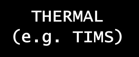


2 CLASSIFICATION OF NONPHOTOGRAPHIC REMOTE SENSORS PASSIVE ACTIVE DIGITAL CAMERA VIDEO CAMERA MULTI- SPECTRAL SCANNERS MICROWAVE SAR LASER THERMAL (e.g. TIMS) VISIBLE & NIR HYPERSPECTRAL (e.g. AVIRIS) ACROSS TRACK (sweep) e.g. Landsat, AVHRR ALONG TRACK (push) e.g. SPOT

3 ACROSS-TRACK / MULTISPECTRAL SCANNING OPERATION scan angle (IFOV) An oscillating mirror scans across the terrain at right angles to the flight path mirrors direct the radiation from the IFOV to spectrum-separating devices which divide the signal into discrete bands or channels the signal from each band is focused on detector elements that transform the radiation into an electrical signal, which is recorded and stored digitally scan lines pixel
 each spectral band (channel) requires its own CCD array each scan line is viewed by all channel arrays")
4 ALONG-TRACK SCANNING OPERATION linear array of CCDs scan perpendicular to the flight line (no mirrors) each CCD senses energy from a single ground resolution cell (pixel) each spectral band (channel) requires its own CCD array each scan line is viewed by all channel arrays simultaneously
, a linear array system has a higher reliability and longer life expectancy")
5 NON-PHOTOGRAPHIC SYSTEMS Advantages of along-track scanners linear arrays afford longer residence time for which to measure energy from each ground resolution cell, resulting in a stronger signal fixed relationship of CCDs along each scan line results in improved geometric integrity CCDs small in size and require less power for operation w/o moving parts (e.g. oscillating mirrors), a linear array system has a higher reliability and longer life expectancy

6 LANDSAT PROGRAM (USA) The Landsat Concept (emerged in late 1960s) Launch a dedicated, unmanned land-observing satellite to collect, archive and distribute remotely sensed data to users in agriculture, forestry, environmental science, geology, land cover/use, water resources, and marine science. History Landsat-1 launched in July, 1972 Landsats 1-3 carried RBV and MSS sensor Landsat-4, launched 1982, carried new Thematic Mapper (TM) sensor, Landsat 5 also carries TM. Landsat 5 recently decommissioned (November 2012) Landsat 6 launch failed Landsat-7, with Enhanced TM sensor, launched April 1999, but developed a line scan anomaly problem that compromised the data and made it unusable for most users Landsat 8 Operational Land Imager (OLI) launched February 2013

 8 bit data (0-255 DNs)")


7 TM Bands: Wavelength (mm) TM scene: bands 4,5,3 color composite (Sioux Falls, SD) 8 bit data (0-255 DNs) data strips framed into a 185x185 km scene 30m ground resolution per pixel with non-thermal detectors (120m for thermal band 6) Landsat 8 OLI bands are similar to Landsat TM except two visible blue bands so band 1 TM is band 2 OLI, TM 3 is OLI 4, etc.
, veg. ID and vigor, cultural feature ID 4 3 0.63-0.")
8 LANDSAT TM: sensor applications OLI band TM Band Wavelength Range (mm) Spectral Region Applications Blue water penetration, coastal mapping, soil/veg. discrimination, cultural feature ID Green Chlorophyll reflection band (peak green reflectance of veg.), veg. ID and vigor, cultural feature ID Red Chlorophyll absorption band (Vegetation discrimination), cultural feature ID Near IR Veg. types, plant stress, biomass content, soil mositure discrimination, water delineation Mid-IR Soil and veg. moisture content, clouds vs. snow Thermal IR Vegetation stress, soil mositure discrimination, thermal mapping Mid-IR Veg. moisture content, rock and mineral discrimination
9 Landsat 8 Operational Land Imager (OLI) Landsat Data Continuity Mission (LDCM) Bands Wavelength (micrometers) Band 1 - Coastal aerosol Band 2 - Blue Band 3 - Green Band 4 - Red Band 5 - Near Infrared (NIR) Band 6 - SWIR Band 7 - SWIR Band 8 - Panchromatic Band 9 - Cirrus Resolution (meters) Band 10 - Thermal Infrared (TIRS) Band 11 - Thermal Infrared (TIRS) Worldwide Reference System-2 (WRS-2) path/row system Sun-synchronous orbit at an altitude of 705 km (438 mi) 233 orbit cycle; covers the entire globe every 16 days (except for the highest polar latitudes) Inclined 98.2 (slightly retrograde) Circles the Earth every 98.9 minutes Equatorial crossing time: 10:00 a.m. +/- 15 minutes
- 8 scenes Imagery archived and catalogued by USGS EROS Data")

10 LANDSAT TM data acquisition for Maine Worldwide Reference System (WRS)- 8 scenes Imagery archived and catalogued by USGS EROS Data Center (Sioux Falls) Glovis Search archive on web for available imagery Search parameters: WRS Path / Row date maximum cloud cover browse images
 + Panchromatic band (10m) SPOT-4 (1998), adds 20m Middle Infrared (MI) or Short Wave Infrared (SWIR) band SPOT-5 (2002), 10 m multispectral (3 bands), 20m MI or")
11 SPOT Sensor System (French) Systeme Pour l Observation de la Terre (SPOT) French Space Agency, along-track (pushbroom) scanner SPOT-1, SPOT-2 and -3 (launched 1986, 90 and 93, respectively): 3 spectral bands (20m ground resolution) + Panchromatic band (10m) SPOT-4 (1998), adds 20m Middle Infrared (MI) or Short Wave Infrared (SWIR) band SPOT-5 (2002), 10 m multispectral (3 bands), 20m MI or short wave, 5m panchromatic (2 sensors capable of 2.5 m panchromatic) Two identical High Resolution Visible (HRV) imaging systems (using CCD detector arrays): 1 Panchromatic, 1 multispectral pointable optics enable nadir and off-nadir scanning for greater repeat coverage and stereo viewing used in forestry, agriculture, ecological, land cover/use, and topographic mapping applications


 repeat coverage")


12 SPOT PROGRAM orbital and sensor characteristics sun-synchronous orbit altitude: 822 km orbital period: 101 minutes (14+ orbits/day) repeat coverage (nadir): 26 days however off-nadir:approx. 5 days swath: 60km at nadir, 80km on west and east off-nadir High Resolution Visual (HRV) sensor

13 NOAA SATELLITES (USA) Advanced Very High Resolution Radiometer (AVHRR) sensor National Atmospheric and Oceanic Administration meteorological satellites (7 in series) now with 5 spectral bands: 1 visible, 1 near-ir, 3 thermal-ir applications: weather and climate; water surface temperature measurement; snow cover mapping; flood monitoring; global vegetation mapping and changes; regional soil moisture, fire, storm, and volcanic monitoring; mapping regional drainage and physiographic features


14 AVHRR orbital characteristics Altitude: 833km 2400 km swath width 1.1 km ground resolution at nadir twice daily coverage Daylight and nighttime orbits
15 SENSOR COMPARISONS spectral resolution (#bands and location) Thermal 4 Reflected Mid_infrared
16 MODIS (USA) Orbit: Swath Dimension Orbit, swath width and sensor resolution Multi-resolution (250, 500, 1000m) and hyperspectral at 1000m resolution 705 km, 10:30 a.m. descending node (Terra) or 1:30 p.m. ascending node (Aqua), sun synchronous, near-polar, circular 2330 km (cross track) by 10 km (along track at nadir) Launch Dates Spatial Resolution TERRA_MODIS December 1999 AQUA_ MODIS May m (bands 1-2) 500 m (bands 3-7) 1000 m (bands 8-36)


17 MODIS (250m,500m) and Landsat TM and Reflected Bands Comparison Band/Sensor MODIS Landsat Red µm µm NIR µm µm Blue µm µm Green µm µm Middle-IR µm Middle-IR µm µm Middle-IR µm µm Resolution 250m, 500m 30 m Swath width 2330 km 185 km Temporal Daily 16 days Price Free $600/scene Landsat 8 OLI Free as of 2009
18 SENSOR COMPARISONS area covered by one scene
 = Free")
= $3375?")
19 SENSOR COMPARISONS and Data Costs Cost Update (4/2009) Old! Costs MSS free if available TM/ETM+/OLI(30m) = Free (ETM+ includes 15m Pan) SPOT-4(MS or Pan)= $1900? SPOT-5(10m or 5m)= $3375? AVHRR/MODIS are Free- Internet download
20 Ecosystem Sensor System Spatial Extent Grain Size Plant ID Level Biome, continent Regional, country State, ecoregion, watersheds Local landscape, forest stands Forest plot AVHRR, MODIS 1000m MODIS 250m, Landsat TM and OLI Landsat, TM and OLI, SPOT, others, SAR Spot, IKONOS, LIDAR, Digital Cameras, Aircraft Hyperspectral Highest resolution sensors, ground Hundreds of thousands sq. km. Thousands of sq. km. Hundreds of sq. km. Tens to low hundreds of sq. km. < ten sq. km. to one-ten ha or less 1 km 500m General land cover (Level 1) m General land cover (level 1-2) m Forest type (level 2-3) 10 1m Forest type/species group and detailed land cover (Level 3-4) 1m 1 ft Tree or canopy measurement, some single species ID
.")
21 SENSOR COMPARISONS Landsat MSS archival, historical (no longer collected), oldest earth resource satellite at medium spatial resolution (1972) Landsat TM, ETM+& Landsat 8 OLI improved multispectral resolution (7 bands (more for OLI). Older TM historical archive than SPOT Has visible blue & thermal band (SPOT does not) larger area coverage and less cost (free) /area (than SPOT) SPOT HRV Improved geometric quality (along track scanner, but Landsat 8 OLI now has along track scanning) off-nadir viewing (stereo possible) and more frequent revisit than Landsat Better spatial (5m -Pan and 10m Multispectral) than Landsat NOAA AVHRR and MODIS Huge area covered, twice daily repeat coverage, better temporal resolution than Landsat or SPOT MODIS at 1000m has highest spectral resolution (36 bands) regional applications and global vegetation monitoring May be too coarse for many applications but free data
746A27 Remote Sensing and GIS. Multi spectral, thermal and hyper spectral sensing and usage
 746A27 Remote Sensing and GIS Lecture 3 Multi spectral, thermal and hyper spectral sensing and usage Chandan Roy Guest Lecturer Department of Computer and Information Science Linköping University Multi
Lecture 6: Multispectral Earth Resource Satellites. The University at Albany Fall 2018 Geography and Planning
 Lecture 6: Multispectral Earth Resource Satellites The University at Albany Fall 2018 Geography and Planning Outline SPOT program and other moderate resolution systems High resolution satellite systems
Satellite Remote Sensing: Earth System Observations
 Satellite Remote Sensing: Earth System Observations Land surface Water Atmosphere Climate Ecosystems 1 EOS (Earth Observing System) Develop an understanding of the total Earth system, and the effects of
Remote Sensing Platforms
 Types of Platforms Lighter-than-air Remote Sensing Platforms Free floating balloons Restricted by atmospheric conditions Used to acquire meteorological/atmospheric data Blimps/dirigibles Major role - news
REMOTE SENSING. Topic 10 Fundamentals of Digital Multispectral Remote Sensing MULTISPECTRAL SCANNERS MULTISPECTRAL SCANNERS
 REMOTE SENSING Topic 10 Fundamentals of Digital Multispectral Remote Sensing Chapter 5: Lillesand and Keifer Chapter 6: Avery and Berlin MULTISPECTRAL SCANNERS Record EMR in a number of discrete portions
Remote Sensing Platforms
 Remote Sensing Platforms Remote Sensing Platforms - Introduction Allow observer and/or sensor to be above the target/phenomena of interest Two primary categories Aircraft Spacecraft Each type offers different
The studies began when the Tiros satellites (1960) provided man s first synoptic view of the Earth s weather systems.
 provided man s first synoptic view of the Earth s weather systems.") Remote sensing of the Earth from orbital altitudes was recognized in the mid-1960 s as a potential technique for obtaining information important for the effective use and conservation of natural resources.
Remote sensing of the Earth from orbital altitudes was recognized in the mid-1960 s as a potential technique for obtaining information important for the effective use and conservation of natural resources.
An Introduction to Remote Sensing & GIS. Introduction
 An Introduction to Remote Sensing & GIS Introduction Remote sensing is the measurement of object properties on Earth s surface using data acquired from aircraft and satellites. It attempts to measure something
9/12/2011. Training Course Remote Sensing Basic Theory & Image Processing Methods September 2011
 Training Course Remote Sensing Basic Theory & Image Processing Methods 19 23 September 2011 Popular Remote Sensing Sensors & their Selection Michiel Damen (September 2011) damen@itc.nl 1 Overview Low resolution
Introduction of Satellite Remote Sensing
 Introduction of Satellite Remote Sensing Spatial Resolution (Pixel size) Spectral Resolution (Bands) Resolutions of Remote Sensing 1. Spatial (what area and how detailed) 2. Spectral (what colors bands)
Outline. Introduction. Introduction: Film Emulsions. Sensor Systems. Types of Remote Sensing. A/Prof Linlin Ge. Photographic systems (cf(
 GMAT x600 Remote Sensing / Earth Observation Types of Sensor Systems (1) Outline Image Sensor Systems (i) Line Scanning Sensor Systems (passive) (ii) Array Sensor Systems (passive) (iii) Antenna Radar
Int n r t o r d o u d c u ti t on o n to t o Remote Sensing
 Introduction to Remote Sensing Definition of Remote Sensing Remote sensing refers to the activities of recording/observing/perceiving(sensing)objects or events at far away (remote) places. In remote sensing,
The studies began when the Tiros satellites (1960) provided man s first synoptic view of the Earth s weather systems.
 provided man s first synoptic view of the Earth s weather systems.") Remote sensing of the Earth from orbital altitudes was recognized in the mid-1960 s as a potential technique for obtaining information important for the effective use and conservation of natural resources.
Remote sensing of the Earth from orbital altitudes was recognized in the mid-1960 s as a potential technique for obtaining information important for the effective use and conservation of natural resources.
IKONOS High Resolution Multispectral Scanner Sensor Characteristics
 High Spatial Resolution and Hyperspectral Scanners IKONOS High Resolution Multispectral Scanner Sensor Characteristics Launch Date View Angle Orbit 24 September 1999 Vandenberg Air Force Base, California,
Some Basic Concepts of Remote Sensing. Lecture 2 August 31, 2005
 Some Basic Concepts of Remote Sensing Lecture 2 August 31, 2005 What is remote sensing Remote Sensing: remote sensing is science of acquiring, processing, and interpreting images and related data that
An Introduction to Geomatics. Prepared by: Dr. Maher A. El-Hallaq خاص بطلبة مساق مقدمة في علم. Associate Professor of Surveying IUG
 An Introduction to Geomatics خاص بطلبة مساق مقدمة في علم الجيوماتكس Prepared by: Dr. Maher A. El-Hallaq Associate Professor of Surveying IUG 1 Airborne Imagery Dr. Maher A. El-Hallaq Associate Professor
Spectral Signatures. Vegetation. 40 Soil. Water WAVELENGTH (microns)
") Spectral Signatures % REFLECTANCE VISIBLE NEAR INFRARED Vegetation Soil Water.5. WAVELENGTH (microns). Spectral Reflectance of Urban Materials 5 Parking Lot 5 (5=5%) Reflectance 5 5 5 5 5 Wavelength (nm)
Spectral Signatures % REFLECTANCE VISIBLE NEAR INFRARED Vegetation Soil Water.5. WAVELENGTH (microns). Spectral Reflectance of Urban Materials 5 Parking Lot 5 (5=5%) Reflectance 5 5 5 5 5 Wavelength (nm)
CHAPTER 7: Multispectral Remote Sensing
 CHAPTER 7: Multispectral Remote Sensing REFERENCE: Remote Sensing of the Environment John R. Jensen (2007) Second Edition Pearson Prentice Hall Overview of How Digital Remotely Sensed Data are Transformed
Sources of Geographic Information
 Sources of Geographic Information Data properties: Spatial data, i.e. data that are associated with geographic locations Data format: digital (analog data for traditional paper maps) Data Inputs: sampled
Introduction to Remote Sensing Fundamentals of Satellite Remote Sensing. Mads Olander Rasmussen
 Introduction to Remote Sensing Fundamentals of Satellite Remote Sensing Mads Olander Rasmussen (mora@dhi-gras.com) 01. Introduction to Remote Sensing DHI What is remote sensing? the art, science, and technology
Introduction to Remote Sensing
 Introduction to Remote Sensing Spatial, spectral, temporal resolutions Image display alternatives Vegetation Indices Image classifications Image change detections Accuracy assessment Satellites & Air-Photos
Lecture 13: Remotely Sensed Geospatial Data
 Lecture 13: Remotely Sensed Geospatial Data A. The Electromagnetic Spectrum: The electromagnetic spectrum (Figure 1) indicates the different forms of radiation (or simply stated light) emitted by nature.
Aral Sea profile Selection of area 24 February April May 1998
 250 km Aral Sea profile 1960 1960 1985 1986 1987 1988 1989 1990 1991 1992 1993 1994 1995 1996 1997 1998 2010? Selection of area Area of interest Kzyl-Orda Dried seabed 185 km Syrdarya river Aral Sea Salt
On the use of water color missions for lakes in 2021
 Lakes and Climate: The Role of Remote Sensing June 01-02, 2017 On the use of water color missions for lakes in 2021 Cédric G. Fichot Department of Earth and Environment 1 Overview 1. Past and still-ongoing
Remote Sensing of the Environment An Earth Resource Perspective John R. Jensen Second Edition
 Remote Sensing of the Environment An Earth Resource Perspective John R. Jensen Second Edition Pearson Education Limited Edinburgh Gate Harlow Essex CM20 2JE England and Associated Companies throughout
Remote Sensing and GIS
 Remote Sensing and GIS Atmosphere Reflected radiation, e.g. Visible Emitted radiation, e.g. Infrared Backscattered radiation, e.g. Radar (λ) Visible TIR Radar & Microwave 11/9/2017 Geo327G/386G, U Texas,
29 th Annual Louisiana RS/GIS Workshop April 23, 2013 Cajundome Convention Center Lafayette, Louisiana
 Landsat Data Continuity Mission 29 th Annual Louisiana RS/GIS Workshop April 23, 2013 Cajundome Convention Center Lafayette, Louisiana http://landsat.usgs.gov/index.php# Landsat 5 Sets Guinness World Record
Ghazanfar A. Khattak National Centre of Excellence in Geology University of Peshawar
 INTRODUCTION TO REMOTE SENSING Ghazanfar A. Khattak National Centre of Excellence in Geology University of Peshawar WHAT IS REMOTE SENSING? Remote sensing is the science of acquiring information about
Remote sensing in archaeology from optical to lidar. Krištof Oštir ModeLTER Scientific Research Centre of the Slovenian Academy of Sciences and Arts
 Remote sensing in archaeology from optical to lidar Krištof Oštir ModeLTER Scientific Research Centre of the Slovenian Academy of Sciences and Arts Introduction Optical remote sensing Systems Search for
REMOTE SENSING INTERPRETATION
 REMOTE SENSING INTERPRETATION Jan Clevers Centre for Geo-Information - WU Remote Sensing --> RS Sensor at a distance EARTH OBSERVATION EM energy Earth RS is a tool; one of the sources of information! 1
Remote Sensing for Rangeland Applications
 Remote Sensing for Rangeland Applications Jay Angerer Ecological Training June 16, 2012 Remote Sensing The term "remote sensing," first used in the United States in the 1950s by Ms. Evelyn Pruitt of the
Introduction to Satellite Remote Sensing
 Introduction to Satellite Remote Sensing Remote sensing of the Earth from orbital altitudes was recognized in the mid-1960 s as a potential technique for obtaining information important for the effective
3/31/03. ESM 266: Introduction 1. Observations from space. Remote Sensing: The Major Source for Large-Scale Environmental Information
 Remote Sensing: The Major Source for Large-Scale Environmental Information Jeff Dozier Observations from space Sun-synchronous polar orbits Global coverage, fixed crossing, repeat sampling Typical altitude
Remote Sensing in Daily Life. What Is Remote Sensing?
 Remote Sensing in Daily Life What Is Remote Sensing? First time term Remote Sensing was used by Ms Evelyn L Pruitt, a geographer of US in mid 1950s. Minimal definition (not very useful): remote sensing
Remote Sensing Exam 2 Study Guide
 Remote Sensing Exam 2 Study Guide Resolution Analog to digital Instantaneous field of view (IFOV) f ( cone angle of optical system ) Everything in that area contributes to spectral response mixels Sampling
Sommersemester Prof. Dr. Christoph Kleinn Institut für Waldinventur und Waldwachstum Arbeitsbereich Fernerkundung und Waldinventur.
 Basics of Remote Sensing Some literature references Franklin, SE 2001 Remote Sensing for Sustainable Forest Management Lewis Publishers 407p Lillesand, Kiefer 2000 Remote Sensing and Image Interpretation
RADAR (RAdio Detection And Ranging)
") RADAR (RAdio Detection And Ranging) CLASSIFICATION OF NONPHOTOGRAPHIC REMOTE SENSORS PASSIVE ACTIVE DIGITAL CAMERA THERMAL (e.g. TIMS) VIDEO CAMERA MULTI- SPECTRAL SCANNERS VISIBLE & NIR MICROWAVE Real
RADAR (RAdio Detection And Ranging) CLASSIFICATION OF NONPHOTOGRAPHIC REMOTE SENSORS PASSIVE ACTIVE DIGITAL CAMERA THERMAL (e.g. TIMS) VIDEO CAMERA MULTI- SPECTRAL SCANNERS VISIBLE & NIR MICROWAVE Real
Lecture Notes Prepared by Prof. J. Francis Spring Remote Sensing Instruments
 Lecture Notes Prepared by Prof. J. Francis Spring 2005 Remote Sensing Instruments Material from Remote Sensing Instrumentation in Weather Satellites: Systems, Data, and Environmental Applications by Rao,
REMOTE SENSING FOR FLOOD HAZARD STUDIES.
 REMOTE SENSING FOR FLOOD HAZARD STUDIES. OPTICAL SENSORS. 1 DRS. NANETTE C. KINGMA 1 Optical Remote Sensing for flood hazard studies. 2 2 Floods & use of remote sensing. Floods often leaves its imprint
GIS Data Collection. Remote Sensing
 GIS Data Collection Remote Sensing Data Collection Remote sensing Introduction Concepts Spectral signatures Resolutions: spectral, spatial, temporal Digital image processing (classification) Other systems
Passive Microwave Sensors LIDAR Remote Sensing Laser Altimetry. 28 April 2003
 Passive Microwave Sensors LIDAR Remote Sensing Laser Altimetry 28 April 2003 Outline Passive Microwave Radiometry Rayleigh-Jeans approximation Brightness temperature Emissivity and dielectric constant
Remote Sensing. Measuring an object from a distance. For GIS, that means using photographic or satellite images to gather spatial data
 Remote Sensing Measuring an object from a distance For GIS, that means using photographic or satellite images to gather spatial data Remote Sensing measures electromagnetic energy reflected or emitted
Update on Landsat Program and Landsat Data Continuity Mission
 Update on Landsat Program and Landsat Data Continuity Mission Dr. Jeffrey Masek LDCM Deputy Project Scientist NASA GSFC, Code 923 November 21, 2002 Draft LDCM Implementation Phase RFP Overview Page 1 Celebrate!
9/12/2011. Training Course Remote Sensing Basic Theory & Image Processing Methods September 2011
 Training Course Remote Sensing Basic Theory & Image Processing Methods 19 23 September 2011 Remote Sensing Platforms Michiel Damen (September 2011) damen@itc.nl 1 Overview Platforms & missions aerial surveys
Geo/SAT 2 INTRODUCTION TO REMOTE SENSING
 Geo/SAT 2 INTRODUCTION TO REMOTE SENSING Paul R. Baumann, Professor Emeritus State University of New York College at Oneonta Oneonta, New York 13820 USA COPYRIGHT 2008 Paul R. Baumann Introduction Remote
Module 3 Introduction to GIS. Lecture 8 GIS data acquisition
 Module 3 Introduction to GIS Lecture 8 GIS data acquisition GIS workflow Data acquisition (geospatial data input) GPS Remote sensing (satellites, UAV s) LiDAR Digitized maps Attribute Data Management Data
Satellite/Aircraft Imaging Systems Imaging Sensors Standard scanner designs Image data formats
 CEE 6150: Digital Image Processing 1 Satellite/Aircraft Imaging Systems Imaging Sensors Standard scanner designs Image data formats CEE 6150: Digital Image Processing 2 CEE 6150: Digital Image Processing
A map says to you, 'Read me carefully, follow me closely, doubt me not.' It says, 'I am the Earth in the palm of your hand. Without me, you are alone
 A map says to you, 'Read me carefully, follow me closely, doubt me not.' It says, 'I am the Earth in the palm of your hand. Without me, you are alone and lost. Beryl Markham (West With the Night, 1946
US Commercial Imaging Satellites
 US Commercial Imaging Satellites In the early 1990s, Russia began selling 2-meter resolution product from its archives of collected spy satellite imagery. Some of this product was down-sampled to provide
Remote Sensing 1 Principles of visible and radar remote sensing & sensors
 Remote Sensing 1 Principles of visible and radar remote sensing & sensors Nick Barrand School of Geography, Earth & Environmental Sciences University of Birmingham, UK Field glaciologist collecting data
remote sensing? What are the remote sensing principles behind these Definition
 Introduction to remote sensing: Content (1/2) Definition: photogrammetry and remote sensing (PRS) Radiation sources: solar radiation (passive optical RS) earth emission (passive microwave or thermal infrared
Lesson 3: Working with Landsat Data
 Lesson 3: Working with Landsat Data Lesson Description The Landsat Program is the longest-running and most extensive collection of satellite imagery for Earth. These datasets are global in scale, continuously
Final Examination Introduction to Remote Sensing. Time: 1.5 hrs Max. Marks: 50. Section-I (50 x 1 = 50 Marks)
") Final Examination Introduction to Remote Sensing Time: 1.5 hrs Max. Marks: 50 Note: Attempt all questions. Section-I (50 x 1 = 50 Marks) 1... is the technology of acquiring information about the Earth's
Final Examination Introduction to Remote Sensing Time: 1.5 hrs Max. Marks: 50 Note: Attempt all questions. Section-I (50 x 1 = 50 Marks) 1... is the technology of acquiring information about the Earth's
Coral Reef Remote Sensing
 Coral Reef Remote Sensing Spectral, Spatial, Temporal Scaling Phillip Dustan Sensor Spatial Resolutio n Number of Bands Useful Bands coverage cycle Operation Landsat 80m 2 2 18 1972-97 Thematic 30m 7
Introduction. Introduction. Introduction. Introduction. Introduction
 Identifying habitat change and conservation threats with satellite imagery Extinction crisis Volker Radeloff Department of Forest Ecology and Management Extinction crisis Extinction crisis Conservationists
Satellite Imagery and Remote Sensing. DeeDee Whitaker SW Guilford High EES & Chemistry
 Satellite Imagery and Remote Sensing DeeDee Whitaker SW Guilford High EES & Chemistry whitakd@gcsnc.com Outline What is remote sensing? How does remote sensing work? What role does the electromagnetic
INF-GEO Introduction to remote sensing
 INF-GEO 4310 Introduction to remote sensing Anne Solberg (anne@ifi.uio.no) Satellites, orbits and repeat cycles Optical remote sensings Based on a tutorial adapted from Canadian Center for Remote Sensing,
Platforms, Sensors & Data Products
 Platforms, Sensors & Data Products Introduction Remote sensing is defined as the science which deals with obtaining information about objects on earth surface by analysis of data, received from a remote
Earth s Gravitational Pull
 Satellite & Sensors Space Countries Earth s Gravitational Pull The Earth's gravity pulls everything toward the Earth. In order to orbit the Earth, the velocity of a body must be great enough to overcome
Geo/SAT REMOTE SENSING: LANDSAT PROGRAM
 Geo/SAT 2 REMOTE SENSING: LANDSAT PROGRAM Paul R. Baumann Professor of Geography (Emeritus) State University of New York College at Oneonta Oneonta, New York 13820 USA Remote Sensing: Landsat Program Page
Interpreting land surface features. SWAC module 3
 Interpreting land surface features SWAC module 3 Interpreting land surface features SWAC module 3 Different kinds of image Panchromatic image True-color image False-color image EMR : NASA Echo the bat
Geostationary satellites
 Polar satellites 800 km. 99 relative to the Equator S-N during ascending leg & N-S during descending leg Each orbit 100 minutes 14 orbits a day. Sun-Synchronous provides consistent lighting of Earth-scan
Blacksburg, VA July 24 th 30 th, 2010 Remote Sensing Page 1. A condensed overview. For our purposes
 A condensed overview George McLeod Prepared by: With support from: NSF DUE-0903270 in partnership with: Geospatial Technician Education Through Virginia s Community Colleges (GTEVCC) The art and science
Using Freely Available. Remote Sensing to Create a More Powerful GIS
 Using Freely Available Government Data and Remote Sensing to Create a More Powerful GIS All rights reserved. ENVI, E3De, IAS, and IDL are trademarks of Exelis, Inc. All other marks are the property of
Introduction to Remote Sensing
 Introduction to Remote Sensing Daniel McInerney Urban Institute Ireland, University College Dublin, Richview Campus, Clonskeagh Drive, Dublin 14. 16th June 2009 Presentation Outline 1 2 Spaceborne Sensors
Important Missions. weather forecasting and monitoring communication navigation military earth resource observation LANDSAT SEASAT SPOT IRS
 Fundamentals of Remote Sensing Pranjit Kr. Sarma, Ph.D. Assistant Professor Department of Geography Mangaldai College Email: prangis@gmail.com Ph. No +91 94357 04398 Remote Sensing Remote sensing is defined
Introduction to Remote Sensing
 Introduction to Remote Sensing Outline Remote Sensing Defined Resolution Electromagnetic Energy (EMR) Types Interpretation Applications Remote Sensing Defined Remote Sensing is: The art and science of
Fundamentals of Remote Sensing
 Climate Variability, Hydrology, and Flooding Fundamentals of Remote Sensing May 19-22, 2015 GEO-Latin American & Caribbean Water Cycle Capacity Building Workshop Cartagena, Colombia 1 Objective To provide
Introduction to Remote Sensing. Electromagnetic Energy. Data From Wave Phenomena. Electromagnetic Radiation (EMR) Electromagnetic Energy
 Electromagnetic Energy") A Basic Introduction to Remote Sensing (RS) ~~~~~~~~~~ Rev. Ronald J. Wasowski, C.S.C. Associate Professor of Environmental Science University of Portland Portland, Oregon 1 September 2015 Introduction
A Basic Introduction to Remote Sensing (RS) ~~~~~~~~~~ Rev. Ronald J. Wasowski, C.S.C. Associate Professor of Environmental Science University of Portland Portland, Oregon 1 September 2015 Introduction
Lecture 7 Earth observation missions
 Remote sensing for agricultural applications: principles and methods (2013-2014) Instructor: Prof. Tao Cheng (tcheng@njau.edu.cn). Nanjing Agricultural University Lecture 7 Earth observation missions May
1. Theory of remote sensing and spectrum
 1. Theory of remote sensing and spectrum 7 August 2014 ONUMA Takumi Outline of Presentation Electromagnetic wave and wavelength Sensor type Spectrum Spatial resolution Spectral resolution Mineral mapping
INTRODUCTION TO REMOTE SENSING AND ITS APPLICATIONS
 INTRODUCTION TO REMOTE SENSING AND ITS APPLICATIONS Prof. Dr. Abudeif A. Bakheit Geology Department. Faculty of Science Assiut University This representation was prepared from different power point representations
UNERSITY OF NAIROBI UNIT: PRICIPLES AND APPLICATIONS OF REMOTE SENSING AND APLLIED CLIMATOLOGY
 UNERSITY OF NAIROBI DEPARTMENT OF METEOROLOGY UNIT: PRICIPLES AND APPLICATIONS OF REMOTE SENSING AND APLLIED CLIMATOLOGY COURSE CODE: SMR 308 GROUP TWO: SENSORS MEMBERS OF GROUP TWO 1. MUTISYA J.M I10/2784/2006
Landsat 8. Snabba leveranser av bilder till användarna. Lars-Åke Edgardh. tisdag 9 april 13
 Landsat 8 Snabba leveranser av bilder till användarna Lars-Åke Edgardh Keystone A single system for: Many sensors Many types of clients Hides the complexity of sensors. Specialised on: Services High volume
MODULE 2 Sensors and Platforms
 MODULE 2 Sensors and Platforms Eric C. Wood, USGS / EROS Kim E. Keith, CEOS SEO (NASA) March 25, 2013 (Week #6) Outline of Presentation Introduction Satellite Earth orbits Mission operations overview Sensors
typical spectral signatures of photosynthetically active and non-photosynthetically active vegetation (Beeri et al., 2007)
") typical spectral signatures of photosynthetically active and non-photosynthetically active vegetation (Beeri et al., 2007) Xie, Y. et al. J Plant Ecol 2008 1:9-23; doi:10.1093/jpe/rtm005 Copyright restrictions
typical spectral signatures of photosynthetically active and non-photosynthetically active vegetation (Beeri et al., 2007) Xie, Y. et al. J Plant Ecol 2008 1:9-23; doi:10.1093/jpe/rtm005 Copyright restrictions
Atmospheric interactions; Aerial Photography; Imaging systems; Intro to Spectroscopy Week #3: September 12, 2018
 GEOL 1460/2461 Ramsey Introduction/Advanced Remote Sensing Fall, 2018 Atmospheric interactions; Aerial Photography; Imaging systems; Intro to Spectroscopy Week #3: September 12, 2018 I. Quick Review from
Dr. P Shanmugam. Associate Professor Department of Ocean Engineering Indian Institute of Technology (IIT) Madras INDIA
 Madras INDIA") Dr. P Shanmugam Associate Professor Department of Ocean Engineering Indian Institute of Technology (IIT) Madras INDIA Biography Ph.D (Remote Sensing and Image Processing for Coastal Studies) - Anna University,
Dr. P Shanmugam Associate Professor Department of Ocean Engineering Indian Institute of Technology (IIT) Madras INDIA Biography Ph.D (Remote Sensing and Image Processing for Coastal Studies) - Anna University,
Remote Sensing. Division C. Written Exam
 Remote Sensing Division C Written Exam Team Name: Team #: Team Members: _ Score: /132 A. Matching (10 points) 1. Nadir 2. Albedo 3. Diffraction 4. Refraction 5. Spatial Resolution 6. Temporal Resolution
NORMALIZING ASTER DATA USING MODIS PRODUCTS FOR LAND COVER CLASSIFICATION
 NORMALIZING ASTER DATA USING MODIS PRODUCTS FOR LAND COVER CLASSIFICATION F. Gao a, b, *, J. G. Masek a a Biospheric Sciences Branch, NASA Goddard Space Flight Center, Greenbelt, MD 20771, USA b Earth
Detection and Monitoring Through Remote Sensing....The Need For A New Remote Sensing Platform
 WILDFIRES Detection and Monitoring Through Remote Sensing...The Need For A New Remote Sensing Platform Peter Kimball ASEN 5235 Atmospheric Remote Sensing 5/1/03 1. Abstract This paper investigates the
APCAS/10/21 April 2010 ASIA AND PACIFIC COMMISSION ON AGRICULTURAL STATISTICS TWENTY-THIRD SESSION. Siem Reap, Cambodia, April 2010
 APCAS/10/21 April 2010 Agenda Item 8 ASIA AND PACIFIC COMMISSION ON AGRICULTURAL STATISTICS TWENTY-THIRD SESSION Siem Reap, Cambodia, 26-30 April 2010 The Use of Remote Sensing for Area Estimation by Robert
Introduction to Remote Sensing Part 1
 Introduction to Remote Sensing Part 1 A Primer on Electromagnetic Radiation Digital, Multi-Spectral Imagery The 4 Resolutions Displaying Images Corrections and Enhancements Passive vs. Active Sensors Radar
Radiometric performance of Second Generation Global Imager (SGLI) using integrating sphere
 using integrating sphere") Radiometric performance of Second Generation Global Imager (SGLI) using integrating sphere Taichiro Hashiguchi, Yoshihiko Okamura, Kazuhiro Tanaka, Yukinori Nakajima Japan Aerospace Exploration Agency
Radiometric performance of Second Generation Global Imager (SGLI) using integrating sphere Taichiro Hashiguchi, Yoshihiko Okamura, Kazuhiro Tanaka, Yukinori Nakajima Japan Aerospace Exploration Agency
Copernicus Introduction Lisbon, Portugal 13 th & 14 th February 2014
 Copernicus Introduction Lisbon, Portugal 13 th & 14 th February 2014 Contents Introduction GMES Copernicus Six thematic areas Infrastructure Space data An introduction to Remote Sensing In-situ data Applications
INF-GEO Introduction to remote sensing. Anne Solberg
 INF-GEO 4310 Introduction to remote sensing Anne Solberg (anne@ifi.uio.no) Satellites, orbits and repeat cycles Optical remote sensing Useful links: Glossary for remote sensing terms: http://www.ccrs.nracn.gc.ca/glossary/index_e.php
Outline for today. Geography 411/611 Remote sensing: Principles and Applications. Remote sensing: RS for biogeochemical cycles
 Geography 411/611 Remote sensing: Principles and Applications Thomas Albright, Associate Professor Laboratory for Conservation Biogeography, Department of Geography & Program in Ecology, Evolution, & Conservation
How to Access Imagery and Carry Out Remote Sensing Analysis Using Landsat Data in a Browser
 How to Access Imagery and Carry Out Remote Sensing Analysis Using Landsat Data in a Browser Including Introduction to Remote Sensing Concepts Based on: igett Remote Sensing Concept Modules and GeoTech
INF-GEO Introduction to remote sensing
 INF-GEO 4310 Introduction to remote sensing Anne Solberg (anne@ifi.uio.no) Satellites, orbits and repeat cycles Optical remote sensing Based on a tutorialt adapted d from Canadian Center for Remote Sensing,
Monitoring agricultural plantations with remote sensing imagery
 MPRA Munich Personal RePEc Archive Monitoring agricultural plantations with remote sensing imagery Camelia Slave and Anca Rotman University of Agronomic Sciences and Veterinary Medicine - Bucharest Romania,
Abstract Quickbird Vs Aerial photos in identifying man-made objects
 Abstract Quickbird Vs Aerial s in identifying man-made objects Abdullah Mah abdullah.mah@aramco.com Remote Sensing Group, emap Division Integrated Solutions Services Department (ISSD) Saudi Aramco, Dhahran
Active and Passive Microwave Remote Sensing
 Active and Passive Microwave Remote Sensing Passive remote sensing system record EMR that was reflected (e.g., blue, green, red, and near IR) or emitted (e.g., thermal IR) from the surface of the Earth.
Data acquisition and integration 6.
 University of West Hungary, Faculty of Geoinformatics Malgorzata Verőné Wojtaszek Data acquisition and integration 6. module DAI6 Remote Sensing SZÉKESFEHÉRVÁR 2010 The right to this intellectual property
Textbook, Chapter 15 Textbook, Chapter 10 (only 10.6)
") AGOG 484/584/ APLN 551 Fall 2018 Concept definition Applications Instruments and platforms Techniques to process hyperspectral data A problem of mixed pixels and spectral unmixing Reading Textbook, Chapter
AGOG 484/584/ APLN 551 Fall 2018 Concept definition Applications Instruments and platforms Techniques to process hyperspectral data A problem of mixed pixels and spectral unmixing Reading Textbook, Chapter
Chapter 3. Data Acquisition Systems. Ayman F. Habib. Remote Sensing
 Chapter 3 Data Acquisition Systems 1 Overview Utilized portions of the electro-magnetic radiation. Visible band. Infrared band. LIDAR systems. Microwave band (RADAR). Optical sensors (scanning operational
Development of normalized vegetation, soil and water indices derived from satellite remote sensing data
 Development of normalized vegetation, soil and water indices derived from satellite remote sensing data Takeuchi, W. & Yasuoka, Y. IIS/UT, Japan E-mail: wataru@iis.u-tokyo.ac.jp Nov. 25th, 2004 ACRS2004
Indian Remote Sensing Satellites
 Resourcesat-1 Indian Remote Sensing Satellites -Current & Future Resourcesat Missions - Presented by: Timothy J. Puckorius Chairman & CEO EOTec 1 Presentation Topics India s Earth Observation Heritage
Environmental and Natural Resources Issues in Minnesota. A Remote Sensing Overview: Principles and Fundamentals. Outline. Challenges.
 A Remote Sensing Overview: Principles and Fundamentals Marvin Bauer Remote Sensing and Geospatial Analysis Laboratory College of Natural Resources University of Minnesota Remote Sensing for GIS Users Workshop,
Remote Sensing (Test) Topic: Climate Change Processes*
 Topic: Climate Change Processes*") Scioly Summer Study Session 2017 Remote Sensing (Test) Topic: Climate Change Processes* By user whythelongface (merge) Name(s): Test format: This test is worth 150 points. There are four sections: 1. Remote
Scioly Summer Study Session 2017 Remote Sensing (Test) Topic: Climate Change Processes* By user whythelongface (merge) Name(s): Test format: This test is worth 150 points. There are four sections: 1. Remote
Sensors and Data Interpretation II. Michael Horswell
 Sensors and Data Interpretation II Michael Horswell Defining remote sensing 1. When was the last time you did any remote sensing? acquiring information about something without direct contact 2. What are