Landsat 8. Snabba leveranser av bilder till användarna. Lars-Åke Edgardh. tisdag 9 april 13
|
|
|
- Lorraine Dixon
- 6 years ago
- Views:
Transcription


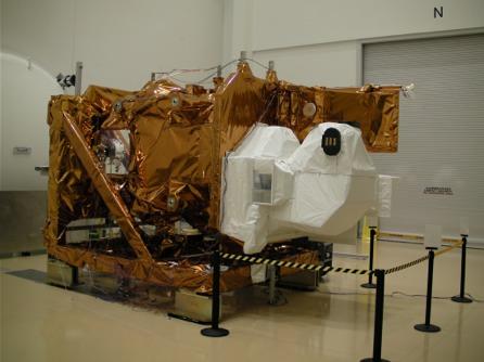
1 Landsat 8 Snabba leveranser av bilder till användarna Lars-Åke Edgardh

2 Keystone A single system for: Many sensors Many types of clients Hides the complexity of sensors. Specialised on: Services High volume productin tin
3 Keystone = Near Real Time (minutes) Acquisition planning Acquisition T0 Downlink Services and Products User T1 T1+ minutes T1+ minutes

4 LDCM + Keystone = ESA Near Real Time (3 hrs) Acquisition Products User Acquisition planning Downlink T1 T1+ T0 3 hrs T1+ 3 hrs + download


5 LDCM + Keystone = Near Real Time Spacecraft GNE Mission data Ingest L0Ra DPAS Subsetter L0Rp LPGS L1T/L1G Keystone Server Portal Worldwind client WMS Keystone Workflow FTP NRT < 3 hrs
6 Landsat 7 Launched April 1999 Landsat Enhanced Thematic Mapper Plus (ETM+) Eight spectral bands Bands 1-7 has a resolution of 30m Band 8 has 15m resolution Scen size 170km x 183km Landsat 7 Wavelength (micrometers) Resolution (meters) Band 1 - Visible band 2 - Visible band 3 - Visible band 4 - Near-Infrared band 5 Near-Infrared band 6 - Thermal band 7 - Mid-Infrared (30) band 8 -Panchromatic (Band 6 is acquired at 60m and processed to 30 m)
 and 9 (cirrus cloud detection) Wavelength (micrometers) Resolution (meters) Band 1 - Visible (Coastal aerosol) 0.43-0.45 30 band 2 - Visible 0.")
7 Landsat 8 Launched February 2013 Also called Landsat Data Continuity Mission (LDCM) Two sensors: Operational Land Imager OLI (band 1-9) Thermal Infrared Sensor TIRS (band 10-11) Landsat 8 OLI has added "ultra-blue" band 1 (coastal and aerosol studies) and 9 (cirrus cloud detection) Wavelength (micrometers) Resolution (meters) Band 1 - Visible (Coastal aerosol) band 2 - Visible band 3 - Visible band 4 - Near-Infrared band 5 - Near-Infrared band 6 - SWIR band 7 - SWIR band 8 - Panchromatic band 9 - Cirrus band 10 - Thermal Infrared (TIRS) Band 11 - Thermal Infrared (TIRS)

8 Landsat 7 vs Landsat 8

9 Processing details of LDCM Level 1 Products Processing: Level 1 T (Terrain corrected) Pixel Size: OLI multispectral bands: 30-meters OLI panchromatic band: 15-meters TIRS bands: resampled to 30 meters to match OLI multispectral bands Also an additional data quality band indicating clouds, snow etc Three decades of changes in the Birdsfoot delta of Mississippi River, USGS


10 Standard Terrain Correction - Level 1T Geometric and radiometric accuracy by applying ground control points (GCP s) and digital elevation models (DTM s) Aral sea 1973 and 2009 GCP s from GLS2000 dataset DEM include SRTM, NED, CDED, DTED, GTOPO30
,")
11 Systematic Correction - Level 1TQ Systematic geometric and radiometric accuracy by applying data from the sensor and spacecraft Geometric accuracy within 250m Only used when GCP s not available Chernobyl 1975, 1986 (accident), 2011
12 Data characteristics GeoTIFF data format Cubic Convolution (CC) resampling North Up (MAP) orientation Universal Transverse Mercator (UTM) map projection World Geodetic System (WGS) 84 datum 12 bit dynamic range delivered in 16-bit pixel values (Landsat 7 used 8 bit) 12 meter circular error, 90% confidence global accuracy for OLI 41 meter circular error, 90% confidence global accuracy for TIRS
13 Data delivery All files will be delivered in a tar.gz compressed file Compressed Uncompressed Landsat 8 1 GB 2 GB Landsat MB 450 MB


14 USGS Landsat 8 archives Available from May Each day 400 scenes from the OLI and TIRS will be acquired Archived at the USGS EROS data center Processing to be consistent with existing Landsat archive Data ready for public download within 24 hrs
15 ESA Landsat 8 archives Available from May Each day 120 scenes from the OLI and TIRS will be received Archived at the ESA Landsat archive Processing to be consistent with existing Landsat archive Data ready for public download within 3 hrs
16 Free and open access Access to L1 products is free and open for all GMES and not GMES users registered using the standard EOPI registration. Free and open: The ESA catalogue consultation is open in the sense that it is not necessary to be a registered user to perform it. To access the data, users need to be registered and identified, providing their access credential, by ESA systems. In this context open means that the users have no restriction on the catalogue consultation and, after being identified by the system, on the Landsat-8 product that they can access. The access to the data is not subject to a fee, therefore is free.
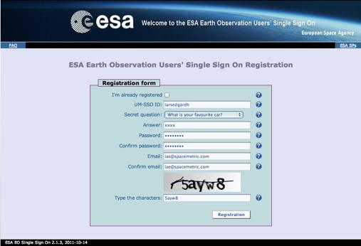

17 Registration URL: earth.esa.int Step 1 Step 2
, 3 (green), and 4 (red) Second image was created using data from OLI bands 3 (green), 5 (near infrared),")
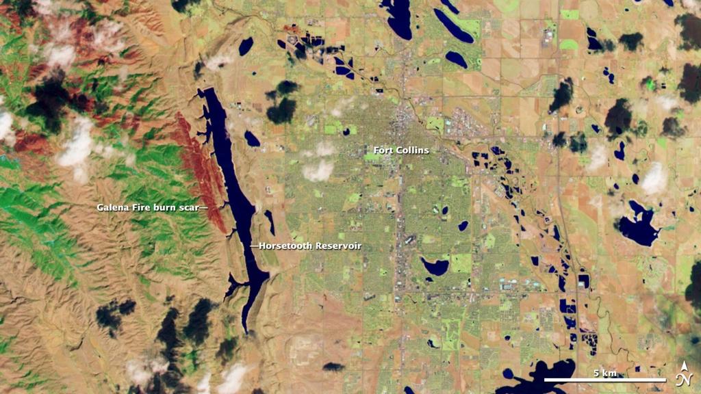
18 First image March 18, 2013 Rocky Mountains in Wyoming and Colorado Two images: First image is shown in natural color, created using data from OLI spectral bands 2 (blue), 3 (green), and 4 (red) Second image was created using data from OLI bands 3 (green), 5 (near infrared), and 7

19
20

21
29 th Annual Louisiana RS/GIS Workshop April 23, 2013 Cajundome Convention Center Lafayette, Louisiana
 Landsat Data Continuity Mission 29 th Annual Louisiana RS/GIS Workshop April 23, 2013 Cajundome Convention Center Lafayette, Louisiana http://landsat.usgs.gov/index.php# Landsat 5 Sets Guinness World Record
Landsat and LDCM Status
 Landsat and LDCM Status Tom Loveland USGS Earth Resources Observation and Science (EROS) Center Sioux Falls, SD May 1, 2008 U.S. Department of the Interior U.S. Geological Survey Landsat Data Continuity
The Landsat Legacy: Monitoring a Changing Earth. U.S. Department of the Interior U.S. Geological Survey
 The Landsat Legacy: Monitoring a Changing Earth U.S. Department of the Interior U.S. Geological Survey Tom Loveland March 17, 2001 Landsat Science Mission Change is occurring at rates unprecedented in
Landsat Data Continuity Mission: Overview and Status
 National Aeronautics and Space Administration Landsat Data Continuity Mission: Overview and Status Brian Markham, LDCM Cal/Val Manager March 29, 2011 JACIE www.nasa.gov www.usgs.gov Mission Objectives
NON-PHOTOGRAPHIC SYSTEMS: Multispectral Scanners Medium and coarse resolution sensor comparisons: Landsat, SPOT, AVHRR and MODIS
 NON-PHOTOGRAPHIC SYSTEMS: Multispectral Scanners Medium and coarse resolution sensor comparisons: Landsat, SPOT, AVHRR and MODIS CLASSIFICATION OF NONPHOTOGRAPHIC REMOTE SENSORS PASSIVE ACTIVE DIGITAL
Update on Landsat Program and Landsat Data Continuity Mission
 Update on Landsat Program and Landsat Data Continuity Mission Dr. Jeffrey Masek LDCM Deputy Project Scientist NASA GSFC, Code 923 November 21, 2002 Draft LDCM Implementation Phase RFP Overview Page 1 Celebrate!
Landsat 8, Level 1 Product Performance Cyclic Report July 2016
 Landsat 8, Level 1 Product Performance Cyclic Report July 2016 Author(s) : Sébastien Saunier (IDEAS+, Telespazio VEGA) Amy Northrop (IDEAS+, Telespazio VEGA) IDEAS+-VEG-OQC-REP-2647 Issue July 2016 1 September
LANDSAT 8 Level 1 Product Performance
 Réf: IDEAS-TN-10-CyclicReport LANDSAT 8 Level 1 Product Performance Cyclic Report Month/Year: May 2015 Date: 25/05/2015 Issue/Rev:1/0 1. Scope of this document On May 30, 2013, data from the Landsat 8
Landsat 8, Level 1 Product Performance Cyclic Report November 2016
 Landsat 8, Level 1 Product Performance Cyclic Report November 2016 Author(s) : Sébastien Saunier (IDEAS+, Telespazio VEGA) Amy Northrop (IDEAS+, Telespazio VEGA) IDEAS+-VEG-OQC-REP-2647 Issue November
Landsat 8, Level 1 Product Performance Cyclic Report February 2017
 Landsat 8, Level 1 Product Performance Cyclic Report February 2017 Author(s) : Sébastien Saunier (IDEAS+, Telespazio VEGA) Amy Northrop (IDEAS+, Telespazio VEGA) IDEAS+-VEG-OQC-REP-2647 Issue February
TEMPORAL ANALYSIS OF MULTI EPOCH LANDSAT GEOCOVER IMAGES IN ZONGULDAK TESTFIELD
 TEMPORAL ANALYSIS OF MULTI EPOCH LANDSAT GEOCOVER IMAGES IN ZONGULDAK TESTFIELD Şahin, H. a*, Oruç, M. a, Büyüksalih, G. a a Zonguldak Karaelmas University, Zonguldak, Turkey - (sahin@karaelmas.edu.tr,
CanImage. (Landsat 7 Orthoimages at the 1: Scale) Standards and Specifications Edition 1.0
 Standards and Specifications Edition 1.0") CanImage (Landsat 7 Orthoimages at the 1:50 000 Scale) Standards and Specifications Edition 1.0 Centre for Topographic Information Customer Support Group 2144 King Street West, Suite 010 Sherbrooke, QC
CanImage (Landsat 7 Orthoimages at the 1:50 000 Scale) Standards and Specifications Edition 1.0 Centre for Topographic Information Customer Support Group 2144 King Street West, Suite 010 Sherbrooke, QC
Landsat 8, Level 1 Product Performance Cyclic Report August 2017
 Landsat 8, Level 1 Product Performance Cyclic Report August 2017 Author(s) : Sébastien Saunier (IDEAS+, Telespazio VEGA) Amy Beaton (IDEAS+, Telespazio VEGA) IDEAS+-VEG-OQC-REP-2647 Issue August 2017 21
Landsat 8, Level 1 Product Performance Cyclic Report January 2017
 Landsat 8, Level 1 Product Performance Cyclic Report January 2017 Author(s) : Sébastien Saunier (IDEAS+, Telespazio VEGA) Amy Northrop (IDEAS+, Telespazio VEGA) IDEAS+-VEG-OQC-REP-2647 Issue January 2017
Satellite Remote Sensing: Earth System Observations
 Satellite Remote Sensing: Earth System Observations Land surface Water Atmosphere Climate Ecosystems 1 EOS (Earth Observing System) Develop an understanding of the total Earth system, and the effects of
Planet Labs Inc 2017 Page 2
 SKYSAT IMAGERY PRODUCT SPECIFICATION: ORTHO SCENE LAST UPDATED JUNE 2017 SALES@PLANET.COM PLANET.COM Disclaimer This document is designed as a general guideline for customers interested in acquiring Planet
366 Glossary. Popular method for scale drawings in a computer similar to GIS but without the necessity for spatial referencing CEP
 366 Glossary GISci Glossary ASCII ASTER American Standard Code for Information Interchange Advanced Spaceborne Thermal Emission and Reflection Radiometer Computer Aided Design Circular Error Probability
Grant Boxer Consultant Geologist March 10th 2014 (Updated Nov 2014)
") Grant Boxer Consultant Geologist March 10th 2014 (Updated Nov 2014) Work flow for Landsat 8 Landgate Data Selecting and processing basic data Importing into MapInfo Applications SLIP Portal WMS access
Grant Boxer Consultant Geologist March 10th 2014 (Updated Nov 2014) Work flow for Landsat 8 Landgate Data Selecting and processing basic data Importing into MapInfo Applications SLIP Portal WMS access
Lesson 3: Working with Landsat Data
 Lesson 3: Working with Landsat Data Lesson Description The Landsat Program is the longest-running and most extensive collection of satellite imagery for Earth. These datasets are global in scale, continuously
White Paper. Medium Resolution Images and Clutter From Landsat 7 Sources. Pierre Missud
 White Paper Medium Resolution Images and Clutter From Landsat 7 Sources Pierre Missud Medium Resolution Images and Clutter From Landsat7 Sources Page 2 of 5 Introduction Space technologies have long been
USGS Report to the CEOS WGCV 36 May 13 17, 2013
 USGS Report to the CEOS WGCV 36 May 13 17, 2013 Shanghai, China Greg Stensaas USGS U.S. Department of the Interior U.S. Geological Survey LDCM Successful Lunch! Contributors: The slides in this presentation
Automatic geo-registration of satellite imagery
 Fjärranalysdagarna 10-11 mars 2009 Automatic geo-registration of satellite imagery Torbjörn Westin Lars-Åke Edgardh Ian Spence Spacemetric AB www.spacemetric.com Keystone Image Server Keystone is an automatic
MAPS AND SATELLITE IMAGES TOOLS FOR AN EFFECTIVE MANAGEMENT OF THE HISTORIC CENTER OF SIGHISOARA, AN UNESCO WORLD HERITAGE SITE
 Journal of Young Scientist, Volume VI, 2018 ISSN 2344-1283; ISSN CD-ROM 2344-1291; ISSN Online 2344-1305; ISSN-L 2344 1283 MAPS AND SATELLITE IMAGES TOOLS FOR AN EFFECTIVE MANAGEMENT OF THE HISTORIC CENTER
Bulk-processing of ESA s Unique Landsat Archive
 Bulk-processing of ESA s Unique Landsat Archive Landsat MSS, TM and ETM+ archive (1974 2011) Biasutti, Roberto - Gascon, Ferran - Fischer, Peggy - Hoersch, Bianca (1) Pinori, Sabrina - Paciucci, Alessandra
Downloading and formatting remote sensing imagery using GLOVIS
 Downloading and formatting remote sensing imagery using GLOVIS Students will become familiarized with the characteristics of LandSat, Aerial Photos, and ASTER medium resolution imagery through the USGS
PLANET IMAGERY PRODUCT SPECIFICATION: PLANETSCOPE & RAPIDEYE
 PLANET IMAGERY PRODUCT SPECIFICATION: PLANETSCOPE & RAPIDEYE LAST UPDATED FEBRUARY 2017 SALES@PLANET.COM PLANET.COM Table of Contents LIST OF FIGURES 3 LIST OF TABLES 3 GLOSSARY 5 1. OVERVIEW OF DOCUMENT
GeoBase Raw Imagery Data Product Specifications. Edition
 GeoBase Raw Imagery 2005-2010 Data Product Specifications Edition 1.0 2009-10-01 Government of Canada Natural Resources Canada Centre for Topographic Information 2144 King Street West, suite 010 Sherbrooke,
PLANET IMAGERY PRODUCT SPECIFICATIONS PLANET.COM
 PLANET IMAGERY PRODUCT SPECIFICATIONS SUPPORT@PLANET.COM PLANET.COM LAST UPDATED JANUARY 2018 TABLE OF CONTENTS LIST OF FIGURES 3 LIST OF TABLES 4 GLOSSARY 5 1. OVERVIEW OF DOCUMENT 7 1.1 Company Overview
MRLC 2001 IMAGE PREPROCESSING PROCEDURE
 MRLC 2001 IMAGE PREPROCESSING PROCEDURE The core dataset of the MRLC 2001 database consists of Landsat 7 ETM+ images. Image selection is based on vegetation greenness profiles defined by a multi-year normalized
(Presented by Jeppesen) Summary
 Summary") International Civil Aviation Organization SAM/IG/6-IP/06 South American Regional Office 24/09/10 Sixth Workshop/Meeting of the SAM Implementation Group (SAM/IG/6) - Regional Project RLA/06/901 Lima, Peru,
International Civil Aviation Organization SAM/IG/6-IP/06 South American Regional Office 24/09/10 Sixth Workshop/Meeting of the SAM Implementation Group (SAM/IG/6) - Regional Project RLA/06/901 Lima, Peru,
ASTER GDEM Readme File ASTER GDEM Version 1
 I. Introduction ASTER GDEM Readme File ASTER GDEM Version 1 The Advanced Spaceborne Thermal Emission and Reflection Radiometer (ASTER) Global Digital Elevation Model (GDEM) was developed jointly by the
GEOMETRIC PERFORMANCE COMPARISON BETWEEN THE OLI AND THE ETM+ INTRODUCTION
 GEOMETRIC PERFORMANCE COMPARISON BETWEEN THE OLI AND THE ETM+ James Storey, Michael Choate Stinger Ghaffarian Technologies, contractor to USGS EROS, Sioux Falls, SD Work performed under USGS Contract Number
PLANET IMAGERY PRODUCT SPECIFICATION: PLANETSCOPE & RAPIDEYE
 PLANET IMAGERY PRODUCT SPECIFICATION: PLANETSCOPE & RAPIDEYE LAST UPDATED OCTOBER 2016 SALES@PLANET.COM PLANET.COM Table of Contents LIST OF FIGURES 3 LIST OF TABLES 3 GLOSSARY 5 1. OVERVIEW OF DOCUMENT
Introduction of Satellite Remote Sensing
 Introduction of Satellite Remote Sensing Spatial Resolution (Pixel size) Spectral Resolution (Bands) Resolutions of Remote Sensing 1. Spatial (what area and how detailed) 2. Spectral (what colors bands)
Sentinel-2 Products and Algorithms
 Sentinel-2 Products and Algorithms Ferran Gascon (Sentinel-2 Data Quality Manager) Workshop Preparations for Sentinel 2 in Europe, Oslo 26 November 2014 Sentinel-2 Mission Mission Overview Products and
News on Image Acquisition for the CwRS Campaign new sensors and changes
 Control Methods Workshop: 6-8 / 4 / 2009 [CwRS KO Meeting Campaign 2009] 1 News on Image Acquisition for the CwRS Campaign 2009 - new sensors and changes Pär Johan Åstrand, Joanna Nowak, Maria Erlandsson
9/12/2011. Training Course Remote Sensing Basic Theory & Image Processing Methods September 2011
 Training Course Remote Sensing Basic Theory & Image Processing Methods 19 23 September 2011 Popular Remote Sensing Sensors & their Selection Michiel Damen (September 2011) damen@itc.nl 1 Overview Low resolution
National Aeronautics and Space Administration. Landsat Update. Jeff Masek, NASA GSFC Jim Irons, NASA GSFC. April 3, 2012 LCLUC Meeting.
 National Aeronautics and Space Administration Landsat Update Jeff Masek, NASA GSFC Jim Irons, NASA GSFC April 3, 2012 LCLUC Meeting www.nasa.gov Agenda Landsat-5/7 Update LDCM / Landsat-8 Mission Status
Landsat Products, Algorithms and Processing (MSS, TM & ETM+)
") Landsat Products, Algorithms and Processing Author(s) : Sébastien Saunier (Magellium) Amy Northrop, Sam Lavender (Telespazio VEGA UK) IDEAS+-MAG-SRV-REP-2266 7 May 2015 Page 2 of 13 AMENDMENT RECORD SHEET
Landsat Products, Algorithms and Processing Author(s) : Sébastien Saunier (Magellium) Amy Northrop, Sam Lavender (Telespazio VEGA UK) IDEAS+-MAG-SRV-REP-2266 7 May 2015 Page 2 of 13 AMENDMENT RECORD SHEET
Spectral Signatures. Vegetation. 40 Soil. Water WAVELENGTH (microns)
") Spectral Signatures % REFLECTANCE VISIBLE NEAR INFRARED Vegetation Soil Water.5. WAVELENGTH (microns). Spectral Reflectance of Urban Materials 5 Parking Lot 5 (5=5%) Reflectance 5 5 5 5 5 Wavelength (nm)
Spectral Signatures % REFLECTANCE VISIBLE NEAR INFRARED Vegetation Soil Water.5. WAVELENGTH (microns). Spectral Reflectance of Urban Materials 5 Parking Lot 5 (5=5%) Reflectance 5 5 5 5 5 Wavelength (nm)
INTERNATIONAL JOURNAL OF ENVIRONMENTAL SCIENCES Volume 6, No 5, Copyright by the authors - Licensee IPA- Under Creative Commons license 3.
 INTERNATIONAL JOURNAL OF ENVIRONMENTAL SCIENCES Volume 6, No 5, 2016 Copyright by the authors - Licensee IPA- Under Creative Commons license 3.0 Research article ISSN 0976 4402 Normalised difference water
The studies began when the Tiros satellites (1960) provided man s first synoptic view of the Earth s weather systems.
 provided man s first synoptic view of the Earth s weather systems.") Remote sensing of the Earth from orbital altitudes was recognized in the mid-1960 s as a potential technique for obtaining information important for the effective use and conservation of natural resources.
Remote sensing of the Earth from orbital altitudes was recognized in the mid-1960 s as a potential technique for obtaining information important for the effective use and conservation of natural resources.
Remote sensing image correction
 Remote sensing image correction Introductory readings remote sensing http://www.microimages.com/documentation/tutorials/introrse.pdf 1 Preprocessing Digital Image Processing of satellite images can be
Sentinels Data Collection
 H2020-EO-1-2014 Sentinels Data Collection AUTHOR Mattia Marconcini (DLR) DATE 19 January 2017 ISSUE 1.0 GRANT AGREEMENT no 637519 DISSEMINATION LEVEL PU CONTRIBUTORS Page 2 of 20 CONTENTS 1 Introduction...
Aral Sea profile Selection of area 24 February April May 1998
 250 km Aral Sea profile 1960 1960 1985 1986 1987 1988 1989 1990 1991 1992 1993 1994 1995 1996 1997 1998 2010? Selection of area Area of interest Kzyl-Orda Dried seabed 185 km Syrdarya river Aral Sea Salt
Lab 1 Introduction to ENVI
 Remote sensing for agricultural applications: principles and methods (2013-2014) Instructor: Prof. Tao Cheng (tcheng@njau.edu.cn) Nanjing Agricultural University Lab 1 Introduction to ENVI April 1 st,
Landsat 8 Operational Land Imager On-Orbit Geometric Calibration and Performance
 Remote Sens. 2014, 6, 11127-11152; doi:10.3390/rs61111127 Article OPEN ACCESS remote sensing ISSN 2072-4292 www.mdpi.com/journal/remotesensing Landsat 8 Operational Land Imager On-Orbit Geometric Calibration
Pléiades. Access to data. Charlotte Gabriel-Robez. January Pléiades product manager
 Pléiades Access to data Charlotte Gabriel-Robez Pléiades product manager January 2012 A variety of users 2008: Delegation of Public Service Granted by CNES to Spot Image Astrium Services (ex. Spot Image)
Remote Sensing in Daily Life. What Is Remote Sensing?
 Remote Sensing in Daily Life What Is Remote Sensing? First time term Remote Sensing was used by Ms Evelyn L Pruitt, a geographer of US in mid 1950s. Minimal definition (not very useful): remote sensing
LANDSAT DATA CONTINUITY MISSION (LDCM) LEVEL 1 (L1) DATA FORMAT CONTROL BOOK (DFCB)
 LEVEL 1 (L1) DATA FORMAT CONTROL BOOK (DFCB)") LDCM-DFCB-004 Department of the Interior U.S. Geological Survey LANDSAT DATA CONTINUITY MISSION (LDCM) LEVEL 1 (L1) DATA FORMAT CONTROL BOOK (DFCB) August 2012 LANDSAT DATA CONTINUITY MISSION (LDCM) LEVEL
LDCM-DFCB-004 Department of the Interior U.S. Geological Survey LANDSAT DATA CONTINUITY MISSION (LDCM) LEVEL 1 (L1) DATA FORMAT CONTROL BOOK (DFCB) August 2012 LANDSAT DATA CONTINUITY MISSION (LDCM) LEVEL
Remote sensing in archaeology from optical to lidar. Krištof Oštir ModeLTER Scientific Research Centre of the Slovenian Academy of Sciences and Arts
 Remote sensing in archaeology from optical to lidar Krištof Oštir ModeLTER Scientific Research Centre of the Slovenian Academy of Sciences and Arts Introduction Optical remote sensing Systems Search for
The studies began when the Tiros satellites (1960) provided man s first synoptic view of the Earth s weather systems.
 provided man s first synoptic view of the Earth s weather systems.") Remote sensing of the Earth from orbital altitudes was recognized in the mid-1960 s as a potential technique for obtaining information important for the effective use and conservation of natural resources.
Remote sensing of the Earth from orbital altitudes was recognized in the mid-1960 s as a potential technique for obtaining information important for the effective use and conservation of natural resources.
Introduction to Remote Sensing
 Introduction to Remote Sensing Spatial, spectral, temporal resolutions Image display alternatives Vegetation Indices Image classifications Image change detections Accuracy assessment Satellites & Air-Photos
Managing Imagery and Raster Data. Peter Becker
 Managing Imagery and Raster Data Peter Becker ArcGIS is a Comprehensive Imagery Platform Empowering you to make informed decisions System of Engagement System of Insight Extract Information from Imagery
USGS Welcome. 38 th CEOS Working Group on Calibration and Validation Plenary (WGCV-38)
") Landsat 5 USGS Welcome Prepared for 38 th CEOS Working Group on Calibration and Validation Plenary (WGCV-38) Presenter Tom Cecere International Liaison USGS Land Remote Sensing Program Elephant Butte Reservoir
Landsat 5 USGS Welcome Prepared for 38 th CEOS Working Group on Calibration and Validation Plenary (WGCV-38) Presenter Tom Cecere International Liaison USGS Land Remote Sensing Program Elephant Butte Reservoir
NORMALIZING ASTER DATA USING MODIS PRODUCTS FOR LAND COVER CLASSIFICATION
 NORMALIZING ASTER DATA USING MODIS PRODUCTS FOR LAND COVER CLASSIFICATION F. Gao a, b, *, J. G. Masek a a Biospheric Sciences Branch, NASA Goddard Space Flight Center, Greenbelt, MD 20771, USA b Earth
An Introduction to Remote Sensing & GIS. Introduction
 An Introduction to Remote Sensing & GIS Introduction Remote sensing is the measurement of object properties on Earth s surface using data acquired from aircraft and satellites. It attempts to measure something
REMOTE SENSING. Topic 10 Fundamentals of Digital Multispectral Remote Sensing MULTISPECTRAL SCANNERS MULTISPECTRAL SCANNERS
 REMOTE SENSING Topic 10 Fundamentals of Digital Multispectral Remote Sensing Chapter 5: Lillesand and Keifer Chapter 6: Avery and Berlin MULTISPECTRAL SCANNERS Record EMR in a number of discrete portions
Remote Sensing Platforms
 Types of Platforms Lighter-than-air Remote Sensing Platforms Free floating balloons Restricted by atmospheric conditions Used to acquire meteorological/atmospheric data Blimps/dirigibles Major role - news
PROGRESS IN ADDRESSING SCIENCE GOALS FOR GLACIER OBSERVATIONS BY MEANS OF SAR. Frank Paul & Thomas Nagler
 PROGRESS IN ADDRESSING SCIENCE GOALS FOR GLACIER OBSERVATIONS BY MEANS OF SAR Frank Paul & Thomas Nagler SAR Coordination Working Group Meeting, 13/11/2016 Observed glacier products and sensors Product
LANDSAT 8 (L8) DATA USERS HANDBOOK
 DATA USERS HANDBOOK") LSDS-1574 Department of the Interior U.S. Geological Survey LANDSAT 8 (L8) DATA USERS HANDBOOK June 2015 Any use of trade, firm, or product names is for descriptive purposes only and does not imply endorsement
LSDS-1574 Department of the Interior U.S. Geological Survey LANDSAT 8 (L8) DATA USERS HANDBOOK June 2015 Any use of trade, firm, or product names is for descriptive purposes only and does not imply endorsement
Lecture 6: Multispectral Earth Resource Satellites. The University at Albany Fall 2018 Geography and Planning
 Lecture 6: Multispectral Earth Resource Satellites The University at Albany Fall 2018 Geography and Planning Outline SPOT program and other moderate resolution systems High resolution satellite systems
SDCG-5 Session 2. Landsat 7/8 status and 2013 Implementation Plan (Element 1)
") Session 2 Landsat 7/8 status and 2013 Implementation Plan (Element 1) Gene Fosnight Mission Landsat Launch and commissioning Landsat 7 Operational: since 15 April 1999 Expected life time:; anticipate decommissioning
Session 2 Landsat 7/8 status and 2013 Implementation Plan (Element 1) Gene Fosnight Mission Landsat Launch and commissioning Landsat 7 Operational: since 15 April 1999 Expected life time:; anticipate decommissioning
GMES Sentinel-2. The Optical High Resolution Mission for GMES Operational Services
 GMES Sentinel-2 The Optical High Resolution Mission for GMES Operational Services Philippe Martimort GMES Sentinel-2 Mission and Payload Manager, ESA/ESTEC 15 October 2007, AGRISAR Workshop, Noordwijk
2. DATA AND METHOD Data and Research Sites
 International Journal of Remote Sensing and Earth Sciences Vol.13 No.1 Juni 2016 : hal 51 60 DEVELOPMENT OF ANNUAL LANDSAT-8 COMPOSITE OVER CENTRAL KALIMANTAN, INDONESIA USING AUTOMATIC ALGORITHM TO MINIMIZES
Geo/SAT REMOTE SENSING: LANDSAT PROGRAM
 Geo/SAT 2 REMOTE SENSING: LANDSAT PROGRAM Paul R. Baumann Professor of Geography (Emeritus) State University of New York College at Oneonta Oneonta, New York 13820 USA Remote Sensing: Landsat Program Page
Abstract Quickbird Vs Aerial photos in identifying man-made objects
 Abstract Quickbird Vs Aerial s in identifying man-made objects Abdullah Mah abdullah.mah@aramco.com Remote Sensing Group, emap Division Integrated Solutions Services Department (ISSD) Saudi Aramco, Dhahran
Please show the instructor your downloaded index files and orthoimages.
 Student Exercise 1: Sandia Forest Infestation Acquiring Orthophotos and Satellite Imagery Please show the instructor your downloaded index files and orthoimages. Objectives: Determine appropriate imagery
Relationship Between Landsat 8 Spectral Reflectance and Chlorophyll-a in Grand Lake, Oklahoma
 Relationship Between Landsat 8 Spectral Reflectance and Chlorophyll-a in Grand Lake, Oklahoma Presented by: Abu Mansaray Research Team Dr. Andrew Dzialowski (PI), Oklahoma State University Dr. Scott Stoodley
Global Land Survey 2005
 Global Land Survey 2005 Jeff Masek, Shannon Franks, Terry Arvidson NASA GSFC Rachel Headley, Steve Covington USGS EROS April, 2008 1 Global Land Survey (GLS 2005) Follow-on to the GeoCover orthorectified
Standing Up NAIP and Landsat Image Services as a Processing Resource. Andrew Leason
 Standing Up NAIP and Landsat Image Services as a Processing Resource Andrew Leason NAIP and Landsat services Differences Different general uses - Landsat - Available from USGS - Designed as an analytical
RapidEye Initial findings of Geometric Image Quality Analysis. Joanna Krystyna Nowak Da Costa
 RapidEye Initial findings of Geometric Image Quality Analysis Joanna Krystyna Nowak Da Costa EUR 24129 EN - 2009 The mission of the JRC-IPSC is to provide research results and to support EU policy-makers
remote sensing? What are the remote sensing principles behind these Definition
 Introduction to remote sensing: Content (1/2) Definition: photogrammetry and remote sensing (PRS) Radiation sources: solar radiation (passive optical RS) earth emission (passive microwave or thermal infrared
A map says to you, 'Read me carefully, follow me closely, doubt me not.' It says, 'I am the Earth in the palm of your hand. Without me, you are alone
 A map says to you, 'Read me carefully, follow me closely, doubt me not.' It says, 'I am the Earth in the palm of your hand. Without me, you are alone and lost. Beryl Markham (West With the Night, 1946
Outline. Introduction. Introduction: Film Emulsions. Sensor Systems. Types of Remote Sensing. A/Prof Linlin Ge. Photographic systems (cf(
 GMAT x600 Remote Sensing / Earth Observation Types of Sensor Systems (1) Outline Image Sensor Systems (i) Line Scanning Sensor Systems (passive) (ii) Array Sensor Systems (passive) (iii) Antenna Radar
Airbus Airbus Defence and Space - Intelligence. Price List North America
 Airbus Airbus Defence and Space - Intelligence Price List North America Effective: January 1, 2018 Pléiades and SPOT 1-7 Archive Prices are per square kilometer. Prices and minimum order size apply for
Orthoimagery Standards. Chatham County, Georgia. Jason Lee and Noel Perkins
 1 Orthoimagery Standards Chatham County, Georgia Jason Lee and Noel Perkins 2 Table of Contents Introduction... 1 Objective... 1.1 Data Description... 2 Spatial and Temporal Environments... 3 Spatial Extent
Using Freely Available. Remote Sensing to Create a More Powerful GIS
 Using Freely Available Government Data and Remote Sensing to Create a More Powerful GIS All rights reserved. ENVI, E3De, IAS, and IDL are trademarks of Exelis, Inc. All other marks are the property of
6th Beirut Water Week 27th February - 1st March 2017
 Assessment of chlorophyll-a concentration using Landsat Operational Land Imager in Lake Qaraoun, Lebanon Ali Fadel 6th Beirut Water Week 27th February - 1st March 2017 Introduction & problematic Worldwide
Virtual sensor modelling and near real-time satellite image services
 Virtual sensor modelling and near real-time satellite image services Lars Edgardh 1, Ian Spence 2 and Oscar Haglund 3 Spacemetric AB, Sollentuna, SE-19161, Sweden Jonas Åslund 4 SSC, Kiruna, SE-981 28,
WARSC LS7 Metadata Template v1.0 Ver 1.0-4/16/02
 WARSC DRAFT DOCUMENT 05/06/02 1 OF 5 WARSC LS7 Metadata Template v1.0 Ver 1.0-4/16/02 Identification_Information: Citation: Originator: Washington State Remote Sensing Consortium (WARSC) - Olympia, WA
THREE-DIMENSIONAL MAPPING USING BOTH AIRBORNE AND SPACEBORNE IFSAR TECHNOLOGIES ABSTRACT INTRODUCTION
 THREE-DIMENSIONAL MAPPING USING BOTH AIRBORNE AND SPACEBORNE IFSAR TECHNOLOGIES Trina Kuuskivi Manager of Value Added Products and Services, Intermap Technologies Corp. 2 Gurdwara Rd, Suite 200, Ottawa,
LANDSAT 8 (L8) DATA USERS HANDBOOK
 DATA USERS HANDBOOK") LSDS-1574 Department of the Interior U.S. Geological Survey LANDSAT 8 (L8) DATA USERS HANDBOOK October 2018 LANDSAT 8 (L8) DATA USERS HANDBOOK October 2018 Approved By: K. Zanter Date LSDS CCB Chair USGS
LSDS-1574 Department of the Interior U.S. Geological Survey LANDSAT 8 (L8) DATA USERS HANDBOOK October 2018 LANDSAT 8 (L8) DATA USERS HANDBOOK October 2018 Approved By: K. Zanter Date LSDS CCB Chair USGS
The Next Landsat The Landsat Data Continuity Mission (LDCM) ASPRS Potomac Region Tour of GSFC March 12, 2010
 ASPRS Potomac Region Tour of GSFC March 12, 2010") LDCM SRR/MDR/PNAR 22-24 April 2008 The Next Landsat The Landsat Data Continuity Mission (LDCM) ASPRS Potomac Region Tour of GSFC March 12, 2010 Jim Irons Landsat Data Continuity Mission (LDCM) Project
LDCM SRR/MDR/PNAR 22-24 April 2008 The Next Landsat The Landsat Data Continuity Mission (LDCM) ASPRS Potomac Region Tour of GSFC March 12, 2010 Jim Irons Landsat Data Continuity Mission (LDCM) Project
RADIOMETRIC CHARACTERIZATION AND PERFORMANCE ASSESSMENT OF THE ALI USING BULK TRENDED DATA
 RADIOMETRIC CHARACTERIZATION AND PERFORMANCE ASSESSMENT OF THE ALI USING BULK TRENDED DATA Tim Ruggles*, Imaging Engineer Dennis Helder*, Director Image Processing Laboratory, Department of Electrical
Lecture 13: Remotely Sensed Geospatial Data
 Lecture 13: Remotely Sensed Geospatial Data A. The Electromagnetic Spectrum: The electromagnetic spectrum (Figure 1) indicates the different forms of radiation (or simply stated light) emitted by nature.
Active and Passive Microwave Remote Sensing
 Active and Passive Microwave Remote Sensing Passive remote sensing system record EMR that was reflected (e.g., blue, green, red, and near IR) or emitted (e.g., thermal IR) from the surface of the Earth.
Lab 3: Image Acquisition and Geometric Correction
 Geography 309 Lab 3 Answer Page 1 Objectives Preparation Lab 3: Image Acquisition and Geometric Correction Due Date: October 22 to introduce you to digital imagery and how it can be displayed and manipulated
Potential of ASTER and LANDSAT Images for Mapping Features in Western Desert
 522 Potential of ASTER and LANDSAT Images for Mapping Features in Western Desert Mahmoud El Nokrashy Osman Ali, Ibrahim Fathy Mohamed Shaker, Nasr Mohammady Saba Abstract: In Egypt, most of the topographic
Department of the Interior U.S. Geological Survey PRODUCT GUIDE PROVISIONAL LANDSAT 8 SURFACE REFLECTANCE PRODUCT. Version 1.7
 Department of the Interior U.S. Geological Survey PRODUCT GUIDE PROVISIONAL LANDSAT 8 SURFACE REFLECTANCE PRODUCT Version 1.7 September 2015 Executive Summary This document describes relevant characteristics
European Space Agency (ESA) Landsat MSS/TM/ETM+/OLI Archive: 42 years of our history
 Landsat MSS/TM/ETM+/OLI Archive: 42 years of our history") This image cannot currently be displayed. European Space Agency (ESA) Landsat MSS/TM/ETM+/OLI Archive: 42 years of our history Landsat MSS Dataset Improvements and Multi Temporal Analysis Sébastien Saunier,
This image cannot currently be displayed. European Space Agency (ESA) Landsat MSS/TM/ETM+/OLI Archive: 42 years of our history Landsat MSS Dataset Improvements and Multi Temporal Analysis Sébastien Saunier,
The availability of cloud free Landsat TM and ETM+ land observations and implications for global Landsat data production
 14475 The availability of cloud free Landsat TM and ETM+ land observations and implications for global Landsat data production *V. Kovalskyy, D. Roy (South Dakota State University) SUMMARY The NASA funded
Sources of Geographic Information
 Sources of Geographic Information Data properties: Spatial data, i.e. data that are associated with geographic locations Data format: digital (analog data for traditional paper maps) Data Inputs: sampled
PROGRESS IN ADDRESSING SCIENCE GOALS FOR GLACIER OBSERVATIONS BY MEANS OF SAR
 PROGRESS IN ADDRESSING SCIENCE GOALS FOR GLACIER OBSERVATIONS BY MEANS OF SAR Frank Paul, Thomas Nagler, Dana Floricioiu, et al. PSTG, 13/9/2016 Panmah, Karakoram Observed glacier products and sensors
Landsat 8 Pansharpen and Mosaic Geomatica 2015 Tutorial
 Landsat 8 Pansharpen and Mosaic Geomatica 2015 Tutorial On February 11, 2013, Landsat 8 was launched adding to the constellation of Earth imaging satellites. It is the seventh satellite to reach orbit
Remote Sensing for Rangeland Applications
 Remote Sensing for Rangeland Applications Jay Angerer Ecological Training June 16, 2012 Remote Sensing The term "remote sensing," first used in the United States in the 1950s by Ms. Evelyn Pruitt of the
ATCOR Workflow for IMAGINE 2016
 ATCOR Workflow for IMAGINE 2016 Version 1.0 Step-by-Step Guide January 2017 ATCOR Workflow for IMAGINE Page 2/24 The ATCOR trademark is owned by DLR German Aerospace Center D-82234 Wessling, Germany URL:
ADVANCED LAND IMAGER (ALI) LEVEL 1G (L1G) PRODUCT OUTPUT FILES DATA FORMAT CONTROL BOOK (DFCB)
 LEVEL 1G (L1G) PRODUCT OUTPUT FILES DATA FORMAT CONTROL BOOK (DFCB)") EO1-DFCB-0001 Department of the Interior U.S. Geological Survey ADVANCED LAND IMAGER (ALI) LEVEL 1G (L1G) PRODUCT OUTPUT FILES DATA FORMAT CONTROL BOOK (DFCB) Earth Observing-1 (EO-1) October 2005 ADVANCED
EO1-DFCB-0001 Department of the Interior U.S. Geological Survey ADVANCED LAND IMAGER (ALI) LEVEL 1G (L1G) PRODUCT OUTPUT FILES DATA FORMAT CONTROL BOOK (DFCB) Earth Observing-1 (EO-1) October 2005 ADVANCED
PLANET: IMAGING THE EARTH EVERY DAY
 PLANET: IMAGING THE EARTH EVERY DAY Benjamin Trigona-Harany Mailiao Refinery, Taiwan May 31, 2016 To image the whole world every day, making change visible, accessible and actionable. HONG KONG January
Remote Sensing of Environment
 Remote Sensing of Environment 122 (2012) 11 21 Contents lists available at SciVerse ScienceDirect Remote Sensing of Environment journal homepage: www.elsevier.com/locate/rse The next Landsat satellite: