JAXA Mission Updates
|
|
|
- Melvyn Wood
- 5 years ago
- Views:
Transcription

1 JAXA Mission Updates JECAM/GEOGLAM Science Meeting Ottawa, Canada July 2014 Presenter: Kei OYOSHI Earth Observation Research Center, JAXA Shin-ichi Sobue, Yutaka Kaneko, Masanobu Shimada, Shinichi Suzuki, Fumi Ohgushi, Hiroki Nishi, Kaoru Tsuzuku, Tomohiro Watanabe, Ake Rosenqvist

 ALOS-2")
2 Successfully launched from Tanegashima Space Center on 24 May 2014 (JST) ALOS-2 Launch


")
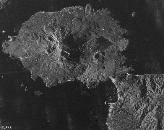
3 Text First Images (19-21 June 2014)

4 Text Title
5 ALOS-2 Successor mission of the ALOS, the mission objectives include disaster monitoring, monitoring of global forests, land, and agriculture (rice), as well as natural resources exploration. The critical operation phase1 (the deployment of antennas for direct communications and mission instruments) was completed on May 27, Move to the phase2 to verify the function of the satellite onboard instruments for about two and half months Dbservation data will be provided to the public in the late November.
 Antenna size : 3m(El) x 10m(Az) Bandwidth : 14 84MHz")
6 ALOS-2 satellite ALOS-2 Specifications Launch : 24th May 2014 Orbit type : Sun-synchronous Altitude : 628 km +/- 500 m (for reference orbit) Revisit time : 14 days LSDN : 12:00 +/- 15 min Solar array paddles L-band SAR antenna Z Y X PALSAR-2 L-band Synthetic Aperture Radar Active Phased Array Antenna type two dimensions scan (range and azimuth) Antenna size : 3m(El) x 10m(Az) Bandwidth : 14 84MHz Peak transmit Power : 5100W Observation swath : km Resolution : Range: 3 m to 100 m Azimuth: 1 m to 100 m
7 ALOS-2 Observation Modes Spotlight Ultra Fine High sensitive Fine ScanSAR nominal ScanSAR wide Bandwidth 84MHz 84MHz 42MHz 28MHz 14MHz 28MHz 14MHz Resolution Swath Rg Az: 3 1m Rg Az: 25 25km 3m 6m 10m 100m 60m 50km 50km 70km 350km (5-scan) Polarization SP SP/DP SP/DP/FP/CP SP/DP 490km (7-scan) NESZ -24dB -24dB -28dB -26dB -26dB -23dB -23dB S/A Rg 25dB 25dB 23dB 25dB 25dB 20dB Az 20dB 25dB 20dB 23dB 20dB 20dB SP : HH or VV or HV, DP : HH+HV or VV+VH, FP : HH+HV+VH+VV, CP : Compact pol
, but with enhanced image characteristics (spatial resolution, polarizations, radiometric")
8 ALOS-2 BOS A global systematic acquisition strategy ( Basic Observation Scenario BOS) has been developed. Continuous acquisitions with the acquisition strategy of ALOS ( ), but with enhanced image characteristics (spatial resolution, polarizations, radiometric sensitivity). [Rosenqvist and Shimada et al. RSE, in press]
")

9 Observation Pattern for Annual Acquisitions* Super sites (TBD) * 3m SP and 6m QP modes require 3 and 5 years for global coverage

10 ScanSAR regular monitoring: Temporal repeat: 9 cov/year GSD: 100 m (off-nadir ) Mode: ScanSAR 350km Dual-pol (HH+HV)

11 Forest monitoring: Temporal repeat: 6 cov/year GSD: 10 m (off-nadir ) Mode: Stripmap Dual-pol (HH+HV/28MHz)
 Mode: Stripmap Quad-pol (HH+HV+VV+VH) 1 st year 2 nd year 3 rd year 4 th year 5 th year * 5 years required for global")
12 Global Quad-pol baseline: Temporal repeat: 1 cov/ 5 years GSD: 6 m (off-nadir ) Mode: Stripmap Quad-pol (HH+HV+VV+VH) 1 st year 2 nd year 3 rd year 4 th year 5 th year * 5 years required for global coverage in 6m QP mode Areas observed every year
13 Summary : ALOS-2 Observation for Asia-RiCE Spotlight Ultra Fine High sensitive Fine ScanSAR nominal ScanSAR wide Bandwidth 84MHz 84MHz 42MHz 28MHz 14MHz 28MHz 14MHz Resolution Swath Rg Az: 3 1m Rg Az: 25 25km 3m 6m 10m 100m 60m 50km 50km 70km 350km (5-scan) Polarization SP SP/DP SP/DP/FP/CP SP/DP 490km (7-scan) NESZ -24dB -24dB -28dB -26dB -26dB -23dB -23dB S/A Rg 25dB 25dB 23dB 25dB 25dB 20dB Az 20dB 25dB 20dB 23dB 20dB 20dB SP : HH or VV or HV, DP : HH+HV or VV+VH, FP : HH+HV+VH+VV, CP : Compact pol FP 1 cov/5yr HH+HV 6 cov/yr (SE Asia) HH+HV 9 cov/yr (SE Asia)
14 ALOS-2 Data for GEOGLAM/Asia-RiCE ALOS-2 data will be provided and utilized among the Asia-RiCE team under the framework of the Kyoto and Carbon 4 (K&C 4) Initiative, which is the scientific program lead by JAXA. K&C 4 is scheduled to start from the end of this year (or early next year). Shin-ichi coordinated and submitted the proposal for K&C 4 initiative and will serve as the representative PI, and each participating country also needs co-pi for the initiative.
")

15 Technical Demonstra on Sites Japan India China Taiwan Thailand Laos Vietnam (North) Philippines Vietnam (South) Malaysia Indonesia Phase 1A: Jun Phase 1B: Apr


16 Paddy Field Identification Software
 GMI (Microwave Imager) KuPR: 13.")

 developed by JAXA and NICT in Japan the most sophisticated precipitation radar 3D")
17 Global Precipitatin Measurement (GPM)/ Dual-frequency Precipitation Radar (DPR) GPM Core Observatory Lunched on 28 Feb 2014 Core Observatory by NASA-JAXA KaPR: 35.5GHz radar (phased array) GMI (Microwave Imager) KuPR: 13.6GHz radar (phased array) Constellation Satellites by international partners GPM is an international mission consisting of the GPM Core Observatory and Constellation Satellites for high accurate and frequent global rainfall observation. Core Observatory: developed under NASA and JAXA equal partnership. Dual-frequency Precipitation Radar (DPR) developed by JAXA and NICT in Japan the most sophisticated precipitation radar 3D structure of rainfall simultaneous dual-frequency observation to detect even weak rainfall and snowfall. 17 Global Rainfall Map (GSMaP)


18 Satellite Based Global Rainfall Product Rain RADAR Microwave Radiometer Geostationary TRMM PR/TMI GPM DPR/GMI GCOM-W1 AMSR2 DMSP SSM/I, SSMIS NOAA & MetOp AMSU-A/MHS MTSAT, GOES, Meteosat Hourly 0.1-deg grid rainfall
. Frequency channel set is identical to that of AMSR-E except 7.3GHz channel for RFI mitigation.")

![7-340K Polarization Vertical and horizontal Center Freq. [GHz] 6.925/ 7.3 Band width [MHz] 350 AMSR2 Channel Set Pol.](/docs-images/87/96046679/images/19-2.jpg "Beam width [deg] (Ground res. [km]) 1.8 (35 x 62) 10.65 100 V 1.2 (24 x 42) 18.7 200 and 0.65 (14 x 22) 23.8 400 H 0.")
19 GCOM-W1 AMSR2 Lunched on 5 May 2012 Successor of AMSR-E on Aqua and AMSR on ADEOS-II. Deployable main reflector system with 2.0m diameter (1.6m for AMSR-E). Frequency channel set is identical to that of AMSR-E except 7.3GHz channel for RFI mitigation. GCOM-W1/AMSR2 characteristics Scan and rate Conical scan at 40 rpm Antenna Offset parabola with 2.0m dia. Swath width 1450km Incidence angle Nominal 55 degrees Digitization 12bits Dynamic range K Polarization Vertical and horizontal Center Freq. [GHz] 6.925/ 7.3 Band width [MHz] 350 AMSR2 Channel Set Pol. Beam width [deg] (Ground res. [km]) 1.8 (35 x 62) V 1.2 (24 x 42) and 0.65 (14 x 22) H 0.75 (15 x 26) (7 x 12) Sampling interval [km] (3 x 5)


20 GCOM-W1 AMSR2 Products for Agriculture Relevant to Agriculture Monitoring Soil moisture Snow depth Precipitation etc. Soil Moisture 1-15 June
 Provides agro-met information of")
 for")
21 Agro-met Data Distribution System (JASMIN) Provides agro-met information of GEOGAM/Asia-RiCE Phase1a countries (Thailand, Vietnam and Indonesia) for FAO/AMIS outlook


22 Anomaly Current Condition Examples of Agro-met Information Each parameter is updated twice a month and users can access and get latest data any time. Precipitation PAR Soil Moisture NDVI + LST and Drought Index 2

 Scanner (IRS) Polarization (along-track slant) radiometer (P) Visible & Near infrared pushbroom Radiometer (VNR) GCOM-C SGLI")
 Push-broom electric scan (VNR: VN & P) Wisk-broom mechanical scan (IRS: SW & T) 1150km cross track (VNR: VN & P) 1400km cross track (IRS: SW & T)")
23 GCOM Second generation Global Imager GCOM-C1 SGLI (Launch: FY2016) Targets are carbon cycle and radiation budget relating to the global environmental change. SGLI ll observe aerosols, cloud, vegetation, ocean color, sea/land surface temperature, snow/ice, and so on for more than 13 years. The SGLI features are finer spatial resolution (250m (VNI) and 500m (T)) and polarization/alongtrack slant view channels (P), which will improve land, coastal, and aerosol observations. SGLI : Second generation GLobal Imager shortwave & thermal InfraRed (T) Scanner (IRS) Polarization (along-track slant) radiometer (P) Visible & Near infrared pushbroom Radiometer (VNR) GCOM-C SGLI characteristics (baseline of GCOM-C1 BBM design) Orbit (TBD) Launch Date 2016 (target) Mission Life Scan Scan width Sun-synchronous (descending local time: 10:30) Altitude: 798km, Inclination: 98.6deg 5 years (3 satellites; total 13 years) Push-broom electric scan (VNR: VN & P) Wisk-broom mechanical scan (IRS: SW & T) 1150km cross track (VNR: VN & P) 1400km cross track (IRS: SW & T) Digitalization 12bit Polarization 3 polarization angles for P Along track direction Nadir for VN, SW and T, +45 deg and -45 deg for P On-board calibration VN: Solar diffuser, Internal lamp (PD), Lunar by pitch maneuvers, and dark current by masked pixels and nighttime obs. SW: Solar diffuser, Internal lamp, Lunar, and dark current by deep space window T: Black body and dark current by deep space window All: Electric calibration
24 Summary ALOS-2 have been successfully launched and the data will be utilized among the Asia-RiCE team under the framework of K&C. ALOS-2 ScanSAR mode would be a promising tool to monitor rice in the country-level. Other agro-met information (e.g. rainfall, soil moisture) is also available and currently utilized for the development of monthly rice outlook for the FAO/AMIS. International programs including Asia-RiCE are ongoing.


25 Thank You for Your Attention!
26 Appendix
27 PALSAR-2 Observation for Asia-RiCE/GEOGLAM Pan-tropical, incl. Asia-RiCE regions ScanSAR (100 m HH+HV) 9 times/year (every 42 days) Desc: Jan + Feb + Mar/Apr + May + Jun + Jul + Aug/Sep + Oct + Nov Fine Beam (10 m HH+HV) 6 times/year Asc: Jan/Feb + Jun/Jul + Aug/Sep + Nov/Dec Desc: Mar-Jun (14-day InSAR pair) Quad-pol (6 m QP) 1 time/year Asc: Mar-May window
28 Assessment Source for Rice Growth Outlook Provides Current Condition and Anomaly information Parameters Interval Spatial Resolution Data Period (anomaly calc.) Satellite Data Source Precipitation Cumulative (15-day) 10 km ( ) GSMaP (GCOM-W1, TRMM, MTSAT etc.) Solar Radiation 15-day Average 5 km ( ) MODIS with JAXA s algorithm Land Surface Temperature 15-day Average 5 km ( ) MODIS Product Soil Moisture 15-day Average 50 km ( ) AMSR-E, WINDSAT Drought Index 15th /31[30]th day of month 10 km ( ) GSMaP, MTSAT Vegetation Index 15th /31[30]th day of month 5 km ( ) MODIS with JAXA s algorithm 28
29 Agricultural Monitoring and Research Programs Asia-RiCE (Asia-Rice Crop Monitoring & Estimation) SAFE (Space Applications for SAFE) Initiative Indonesia ( ) : Dr. Rizatus Shofiyati Vietnam ( ) : Dr. Lam Dao Nguyen, Dr. Thuy Le Toan ADB Technical Assistance Project ( ) Lao PDR, Vietnam, Philippines, Thailand
The Current Status and Brief Results of Engineering Model for PALSAR-2 onboard ALOS-2 and Science Project
 The Current Status and Brief Results of Engineering Model for PALSAR-2 onboard ALOS-2 and Science Project + The 16 th KC meeting Japan Aerospace Exploration Agency Masanobu Shimada, Yukihiro KANKAKU The
Introduc)on*to*Asia/RiCE* Technical*Demonstra)on*Sites*II.** Japan,*Indonesia,*Vietnam*
on*to*Asia/RiCE* Technical*Demonstra)on*Sites*II.** Japan,*Indonesia,*Vietnam*") Introduc)on*to*Asia/RiCE* Technical*Demonstra)on*Sites*II.** Japan,*Indonesia,*Vietnam* Kei$Oyoshi 1,$Nobuhiro$Tomiyama 2,$Toshio$Okumura 2,$Shinichi$Sobue 1,2,$ Wahyu$Supriatna 3,$Rizatus$Shofiya? 3,$Lam$Dao$Nguyen
Introduc)on*to*Asia/RiCE* Technical*Demonstra)on*Sites*II.** Japan,*Indonesia,*Vietnam* Kei$Oyoshi 1,$Nobuhiro$Tomiyama 2,$Toshio$Okumura 2,$Shinichi$Sobue 1,2,$ Wahyu$Supriatna 3,$Rizatus$Shofiya? 3,$Lam$Dao$Nguyen
Kazuhiro TANAKA GCOM project team/jaxa April, 2016
 Kazuhiro TANAKA GCOM project team/jaxa April, 216 @ SPIE Asia-Pacific 216 at New Dehli, India 1 http://suzaku.eorc.jaxa.jp/gcom_c/index_j.html GCOM mission and satellites SGLI specification and IRS overview
Radiometric performance of Second Generation Global Imager (SGLI) using integrating sphere
 using integrating sphere") Radiometric performance of Second Generation Global Imager (SGLI) using integrating sphere Taichiro Hashiguchi, Yoshihiko Okamura, Kazuhiro Tanaka, Yukinori Nakajima Japan Aerospace Exploration Agency
Radiometric performance of Second Generation Global Imager (SGLI) using integrating sphere Taichiro Hashiguchi, Yoshihiko Okamura, Kazuhiro Tanaka, Yukinori Nakajima Japan Aerospace Exploration Agency
The Global Imager (GLI)
") The Global Imager (GLI) Launch : Dec.14, 2002 Initial check out : to Apr.14, 2003 (~L+4) First image: Jan.25, 2003 Second image: Feb.6 and 7, 2003 Calibration and validation : to Dec.14, 2003(~L+4) for
The Global Imager (GLI) Launch : Dec.14, 2002 Initial check out : to Apr.14, 2003 (~L+4) First image: Jan.25, 2003 Second image: Feb.6 and 7, 2003 Calibration and validation : to Dec.14, 2003(~L+4) for
RADARSAT-2 Program Update Daniel De Lisle Canadian Space Agency
 RADARSAT-2 Program Update Daniel De Lisle Canadian Space Agency Presentation outline RADARSAT-1 Update RADARSAT-2 Mission description Mission Objectives System Characteristics Data Commercialization/Allocation
The Sentinel-1 Constellation
 The Sentinel-1 Constellation Evert Attema, Sentinel-1 Mission & System Manager AGRISAR and EAGLE Campaigns Final Workshop 15-16 October 2007 ESA/ESTECNoordwijk, The Netherlands Sentinel-1 Programme Sentinel-1
Global 25 m Resolution PALSAR-2/PALSAR Mosaic. and Forest/Non-Forest Map (FNF) Dataset Description
 Dataset Description") Global 25 m Resolution PALSAR-2/PALSAR Mosaic and Forest/Non-Forest Map (FNF) Dataset Description Japan Aerospace Exploration Agency (JAXA) Earth Observation Research Center (EORC) 1 Revision history Version
Global 25 m Resolution PALSAR-2/PALSAR Mosaic and Forest/Non-Forest Map (FNF) Dataset Description Japan Aerospace Exploration Agency (JAXA) Earth Observation Research Center (EORC) 1 Revision history Version
Soil moisture retrieval using ALOS PALSAR
 Soil moisture retrieval using ALOS PALSAR T. J. Jackson, R. Bindlish and M. Cosh USDA ARS Hydrology and Remote Sensing Lab, Beltsville, MD J. Shi University of California Santa Barbara, CA November 6,
Global 25 m Resolution PALSAR-2/PALSAR Mosaic. and Forest/Non-Forest Map (FNF) Dataset Description
 Dataset Description") Global 25 m Resolution PALSAR-2/PALSAR Mosaic and Forest/Non-Forest Map (FNF) Dataset Description Japan Aerospace Exploration Agency (JAXA) Earth Observation Research Center (EORC) 1 Revision history Version
Global 25 m Resolution PALSAR-2/PALSAR Mosaic and Forest/Non-Forest Map (FNF) Dataset Description Japan Aerospace Exploration Agency (JAXA) Earth Observation Research Center (EORC) 1 Revision history Version
Sub-Mesoscale Imaging of the Ionosphere with SMAP
 Sub-Mesoscale Imaging of the Ionosphere with SMAP Tony Freeman Xiaoqing Pi Xiaoyan Zhou CEOS Workshop, ASF, Fairbanks, Alaska, December 2009 1 Soil Moisture Active-Passive (SMAP) Overview Baseline Mission
ALOS and PALSAR. Masanobu Shimada
 ALOS and PALSAR Masanobu Shimada Earth Observation Research Center, National Space Development Agency of Japan, Harumi 1-8-10, Harumi island triton square office tower X 22, Chuo-Ku, Tokyo-To, Japan, 104-6023,
Time Trend Evaluations of Absolute Accuracies for PRISM and AVNIR-2
 The 3 rd ALOS Joint PI Symposium, Kona, Hawaii, US Nov. 9-13, 2009 Time Trend Evaluations of Absolute Accuracies for PRISM and AVNIR-2 Takeo Tadono*, Masanobu Shimada*, Hiroshi Murakami*, Junichi Takaku**,
Lecture 6: Multispectral Earth Resource Satellites. The University at Albany Fall 2018 Geography and Planning
 Lecture 6: Multispectral Earth Resource Satellites The University at Albany Fall 2018 Geography and Planning Outline SPOT program and other moderate resolution systems High resolution satellite systems
Sea surface temperature observation through clouds by the Advanced Microwave Scanning Radiometer 2
 Sea surface temperature observation through clouds by the Advanced Microwave Scanning Radiometer 2 Akira Shibata Remote Sensing Technology Center of Japan (RESTEC) Tsukuba-Mitsui blds. 18F, 1-6-1 Takezono,
Defence Meteorological Satellite Program Japan Fisheries Information Service Center
 Abbreviations ADEOS- : Advanced Earth Observing Satellite EOS : Earth Observing System AMSR : AMSR-E : ASSH : AVHRR : AWS : Advanced Microwave Scanning Radiometer Advanced Microwave Scanning Radiometer
9/12/2011. Training Course Remote Sensing Basic Theory & Image Processing Methods September 2011
 Training Course Remote Sensing Basic Theory & Image Processing Methods 19 23 September 2011 Popular Remote Sensing Sensors & their Selection Michiel Damen (September 2011) damen@itc.nl 1 Overview Low resolution
Advanced Optical Satellite (ALOS-3) Overviews
 Overviews") K&C Science Team meeting #24 Tokyo, Japan, January 29-31, 2018 Advanced Optical Satellite (ALOS-3) Overviews January 30, 2018 Takeo Tadono 1, Hidenori Watarai 1, Ayano Oka 1, Yousei Mizukami 1, Junichi
K&C Science Team meeting #24 Tokyo, Japan, January 29-31, 2018 Advanced Optical Satellite (ALOS-3) Overviews January 30, 2018 Takeo Tadono 1, Hidenori Watarai 1, Ayano Oka 1, Yousei Mizukami 1, Junichi
Introduction to KOMPSAT
 Introduction to KOMPSAT September, 2016 1 CONTENTS 01 Introduction of SIIS 02 KOMPSAT Constellation 03 New : KOMPSAT-3 50 cm 04 New : KOMPSAT-3A 2 KOMPSAT Constellation KOMPSAT series National space program
Passive Microwave Sensors LIDAR Remote Sensing Laser Altimetry. 28 April 2003
 Passive Microwave Sensors LIDAR Remote Sensing Laser Altimetry 28 April 2003 Outline Passive Microwave Radiometry Rayleigh-Jeans approximation Brightness temperature Emissivity and dielectric constant
Geospatial Vision and Policies Korean Industry View 26 November, 2014 SI Imaging Services
 Geospatial Vision and Policies Korean Industry View 26 November, 2014 SI Imaging Services Distribution Limitation, SI Imaging Services Proprietary Data : The data contained in this document, without the
Microwave Remote Sensing (1)
") Microwave Remote Sensing (1) Microwave sensing encompasses both active and passive forms of remote sensing. The microwave portion of the spectrum covers the range from approximately 1cm to 1m in wavelength.
Microwave Remote Sensing (1) Microwave sensing encompasses both active and passive forms of remote sensing. The microwave portion of the spectrum covers the range from approximately 1cm to 1m in wavelength.
GMES Sentinel-1 Transponder Development
 GMES Sentinel-1 Transponder Development Paul Snoeij Evert Attema Björn Rommen Nicolas Floury Malcolm Davidson ESA/ESTEC, European Space Agency, Noordwijk, The Netherlands Outline 1. GMES Sentinel-1 overview
New capabilities in Earth Observation for agriculture
 New capabilities in Earth Observation for agriculture Prof. Katarzyna Dabrowska-Zielinska Head of Remote Sensing Department Institute of Geodesy and Cartography Modzelewskiego 27 Street 02-679 Warsaw Poland
National Aeronautics and Space Administration Jet Propulsion Laboratory California Institute of Technology
 QuikSCAT Mission Status QuikSCAT Follow-on Mission 2 QuikSCAT instrument and spacecraft are healthy, but aging June 19, 2009 will be the 10 year launch anniversary We ve had two significant anomalies during
NON-PHOTOGRAPHIC SYSTEMS: Multispectral Scanners Medium and coarse resolution sensor comparisons: Landsat, SPOT, AVHRR and MODIS
 NON-PHOTOGRAPHIC SYSTEMS: Multispectral Scanners Medium and coarse resolution sensor comparisons: Landsat, SPOT, AVHRR and MODIS CLASSIFICATION OF NONPHOTOGRAPHIC REMOTE SENSORS PASSIVE ACTIVE DIGITAL
Advanced Radiometer for Sea Surface Temperature Observations
 Advanced Radiometer for Sea Surface Temperature Observations Harp Technologies Oy: J. Kainulainen, J. Uusitalo, J. Lahtinen TERMA A/S: M. Hansen, M. Pedersen Finnish Remote Sensing Days 2014 Finnish Meteorological
10.3 JAXA: GCOM-C/SGLI new developments
 10.3 JAXA: GCOM-C/SGLI new developments Hiroshi Murakami JAXA/EORC IOCCG-21 Committee Meeting Santa Monica College, CA, USA 1-3 March 2016 JAXA Earth Observation Satellite missions Targets (JFY; Apr-Mar)
The Role of RADARSAT-2 for Flood and Agriculture Monitoring
 The Role of RADARSAT-2 for Flood and Agriculture Monitoring Gordon Staples MDA Richmond, BC, CANADA gstaples@mda.ca RESTRICTION ON USE, PUBLICATION OR DISCLOSURE OF PROPRETIARY INFORMATION This document
SAR Interferometry Capabilities of Canada's planned SAR Satellite Constellation
 SAR Interferometry Capabilities of Canada's planned SAR Satellite Constellation Dirk Geudtner, Guy Séguin,, Ralph Girard Canadian Space Agency RADARSAT Follow-on Program CSA is in the middle of a Phase
Concept of the future L-band SAR mission for wide swath SAR observation
 Concept of the future SAR mission for wide swath SAR observation A.Karasawa 1, Y.Okada 1, Y.Yokota 1, S.Nakamura 1 1) Mitsubishi Electric Corporation 1 Outline 1:Development of SAR systems in MELCO 2:Development
Review. Guoqing Sun Department of Geography, University of Maryland ABrief
 Review Guoqing Sun Department of Geography, University of Maryland gsun@glue.umd.edu ABrief Introduction Scattering Mechanisms and Radar Image Characteristics Data Availability Example of Applications
Polarisation Capabilities and Status of TerraSAR-X
 Polarisation Capabilities and Status of TerraSAR-X Irena Hajnsek, Josef Mittermayer, Stefan Buckreuss, Kostas Papathanassiou German Aerospace Center Microwaves and Radar Institute irena.hajnsek@dlr.de
Fundamentals of Remote Sensing
 Climate Variability, Hydrology, and Flooding Fundamentals of Remote Sensing May 19-22, 2015 GEO-Latin American & Caribbean Water Cycle Capacity Building Workshop Cartagena, Colombia 1 Objective To provide
XSAT Ground Segment at CRISP
 XSAT Ground Segment at CRISP LIEW Soo Chin Head of Research, CRISP http://www.crisp.nus.edu.sg 5 th JPTM for Sentinel Asia Step-2, 14-16 Nov 2012, Daejeon, Korea Centre for Remote Imaging, Sensing and
Introduction to Radar
 National Aeronautics and Space Administration ARSET Applied Remote Sensing Training http://arset.gsfc.nasa.gov @NASAARSET Introduction to Radar Jul. 16, 2016 www.nasa.gov Objective The objective of this
KEY TECHNOLOGY DEVELOPMENT FOR THE ADVENACED LAND OBSERVING SATELLITE
 KEY TECHNOLOGY DEVELOPMENT FOR THE ADVENACED LAND OBSERVING SATELLITE Takashi HAMAZAKI, and Yuji OSAWA National Space Development Agency of Japan (NASDA) hamazaki.takashi@nasda.go.jp yuji.osawa@nasda.go.jp
Futrajaya, Malaysia JULY 12, Jeong Heon SONG. Korea Aerospace Research Institution
 J P T M 2 0 1 1 Futrajaya, Malaysia JULY 12, 2011 Jeong Heon SONG Korea Aerospace Research Institution Outline Contribution of KARI Sentinel Asia / Data Provider Node International Charter KARI Space Activities
Aquarius/SAC-D and Soil Moisture
 Aquarius/SAC-D and Soil Moisture T. J. Jackson P. O Neill February 24, 2011 Aquarius/SAC-D and Soil Moisture + L-band dual polarization + Combined active and passive Coarse spatial resolution (~100 km)
PALSAR SCANSAR SCANSAR Interferometry
 PALSAR SCANSAR SCANSAR Interferometry Masanobu Shimada Japan Aerospace Exploration Agency Earth Observation Research Center ALOS PI symposium, Greece Nov. 6 2008 1 Introduction L-band PALSAR strip mode
8th Int l Precip. Working Group & 5th Int l Workshop on Space-based Snow Measurement, Bologna, Italia
 8th Int l Precip. Working Group & 5th Int l Workshop on Space-based Snow Measurement, Bologna, Italia Time-Resolved Measurements of Precipitation from 6U-Class Satellite Constellations: Temporal Experiment
Improvement of Antenna System of Interferometric Microwave Imager on WCOM
 Progress In Electromagnetics Research M, Vol. 70, 33 40, 2018 Improvement of Antenna System of Interferometric Microwave Imager on WCOM Aili Zhang 1, 2, Hao Liu 1, *,XueChen 1, Lijie Niu 1, Cheng Zhang
3/31/03. ESM 266: Introduction 1. Observations from space. Remote Sensing: The Major Source for Large-Scale Environmental Information
 Remote Sensing: The Major Source for Large-Scale Environmental Information Jeff Dozier Observations from space Sun-synchronous polar orbits Global coverage, fixed crossing, repeat sampling Typical altitude
Introduction Active microwave Radar
 RADAR Imaging Introduction 2 Introduction Active microwave Radar Passive remote sensing systems record electromagnetic energy that was reflected or emitted from the surface of the Earth. There are also
Copernicus Introduction Lisbon, Portugal 13 th & 14 th February 2014
 Copernicus Introduction Lisbon, Portugal 13 th & 14 th February 2014 Contents Introduction GMES Copernicus Six thematic areas Infrastructure Space data An introduction to Remote Sensing In-situ data Applications
Lecture Notes Prepared by Prof. J. Francis Spring Remote Sensing Instruments
 Lecture Notes Prepared by Prof. J. Francis Spring 2005 Remote Sensing Instruments Material from Remote Sensing Instrumentation in Weather Satellites: Systems, Data, and Environmental Applications by Rao,
7.7 TerraSAR-X & TanDEM-X
 7.7 TerraSAR-X & TanDEM-X Two Innovative Remote Sensing Stars for space-borne Earth Observation Vorlesung Wolfgang Keydel Microwaves and Radar Institute, German Aerospace Research Center (DLR), D-82230
Contributions of the Remote Sensing by Earth Observation Satellites on Engineering Geology
 10th Asian Regional Conference of IAEG (2015) Contributions of the Remote Sensing by Earth Observation Satellites on Engineering Geology Takeo TADONO (1), Hiroto NAGAI (1), Atsuko NONOMURA (2) and Ryoichi
TerraSAR-X Mission: Application and Data Access
 TerraSAR-X Mission: Application and Data Access Irena Hajnsek & TSX TEAM German Aerospace Center Microwaves and Radar Institute Pol-InSAR Research Group 2 years in Orbit (since June 2007) irena.hajnsek@dlr.de
Update on JAXA GCOM-C. Hiroshi Murakami JAXA/EORC
 Update on JAXA GCOM-C Hiroshi Murakami JAXA/EORC 1. GCOM-C/SGLI: JAXA Earth observation satellite missions Targets (JFY Apr-Mar) 2012 2013 2014 2015 2016 2017 2018 2019 2020 2021 2022 2023 Disasters &
Sentinel-1 Calibration and Performance
 Sentinel-1 Calibration and Performance Paul Snoeij Evert Attema Björn Rommen Nicolas Floury Berthyl Duesmann Malcolm Davidson Ramon Torres European Space Agency Sentinel-1 Mission Objectives Component
Big picture with KOMPSAT KOMPSAT-3A / KOMPSAT-3 / KOMPSAT-5 / KOMPSAT-2
 Big picture with KOMPSAT KOMPSAT-3A / KOMPSAT-3 / KOMPSAT-5 / KOMPSAT-2 Big picture with KOMPSAT Introduction SI Imaging Services (SIIS) is the exclusive worldwide marketing and sales representative of
SMAP Overview. Ron Weaver Slides li0ed from Barry Weiss and Jennifer Cruz at JPL Barry Weiss. Jet Propulsion Laboratory
 http://smap.jpl.nasa.gov/ SMAP Overview Ron Weaver Slides li0ed from Barry Weiss and Jennifer Cruz at JPL Barry Weiss Jet Propulsion Laboratory California Ins7tute of Technology Pasadena, CA Copyright
PAZ Product Definition
 PAZ Product Definition CALVAL Centre Juan Manuel Cuerda Muñoz, Javier del Castillo Mena, Adolfo López Pescador, Nuria Gimeno Martínez, Nuria Casal Vázquez, Patricia Cifuentes Revenga, Marcos García Rodríguez,
OVERVIEW OF THE ALOS SATELLITE SYSTEM
 OVERVIEW OF THE ALOS SATELLITE SYSTEM Presented to The Symposium for ALOS Data Application Users @Kogakuin University, Tokyo, Japan Mar. 27, 2001 Takashi Hamazaki Senior Engineer ALOS Project National
HEMERA Constellation of passive SAR-based micro-satellites for a Master/Slave configuration
 HEMERA Constellation of passive SAR-based micro-satellites for a Master/Slave HEMERA Team Members: Andrea Bellome, Giulia Broggi, Luca Collettini, Davide Di Ienno, Edoardo Fornari, Leandro Lucchese, Andrea
ROSCOSMOS Agency Report. 36 th CEOS WGCV Plenary May 2013, Shanghai, China
 ROSCOSMOS Agency Report 36 th CEOS WGCV Plenary 13-17 May 2013, Shanghai, China Denisov Pavel «Research Center for Earth Operative Monitoring» Joint-Stock Company «Russian Space Systems» 1 PURPOSE AND
TerraSAR-X Calibration Status 2 Years in Flight
 2 Years in Flight Dirk Schrank, Marco Schwerdt, Markus Bachmann, Björn Döring, Clemens Schulz November 2009 CEOS 09 VG 1 Calibration Tasks Performed 2009 Introduction Challenge Schedule Re-Calibration
ECE Satellite Radar TRMM Precipitation Radar Cloud mm Radar - Cloudsat. Tropical Rainfall Measuring Mission
 Tropical Rainfall Measuring Mission ECE 583 18 Satellite Radar TRMM Precipitation Radar Cloud mm Radar - Cloudsat -TRMM includes 1st spaceborne weather radar - performs cross-track scan to get 3-D view
SEA SURFACE TEMPERATURE RETRIEVAL USING TRMM MICROWAVE IMAGER DATA IN SOUTH CHINA SEA
 SEA SURFACE TEMPERATURE RETRIEVAL USING TRMM MICROWAVE IMAGER DATA IN SOUTH CHINA SEA Mohd Ibrahim Seeni Mohd and Mohd Nadzri Md. Reba Faculty of Geoinformation Science and Engineering Universiti Teknologi
Status of Sentinel-1 and acquisition plans for GFOI
 Status of Sentinel-1 and acquisition plans for GFOI Frank Martin Seifert, Pierre Potin, Johannes Roeder, ESA Earth Observation Programme 5 th Space Data Coordination, ESRIN, Frascati, 24 February 2014
Sentinel-1 System Overview
 Sentinel-1 System Overview Dirk Geudtner, Rámon Torres, Paul Snoeij, Malcolm Davidson European Space Agency, ESTEC Global Monitoring for Environment and Security (GMES) EU-led program aiming at providing
RADARSAT-2 Modes and Applications
 RADARSAT-2 Modes and Applications Gordon Staples MDA Geospatial Services February 6, 2017 1 Introduction RADARSAT-2 was developed to meet operational needs via a versatile space segment and a responsive
2 nd Research Announcement on the Earth Observations
 2 nd Research Announcement on the Earth Observations JAXA Satellite Project Research GCOM-W, GCOM-C, GPM, ALOS-2, ALOS-3, ALOS-4 MOLI, EarthCARE, AMSR3 Issued: October 17, 2018 Proposal Due: November 30,
Current and Future Meteorological Satellite Program of China
 Current and Future Meteorological Satellite Program of China ZHANG Wenjian, DONG Chaohua XU Jianmin, YANG Jun China Meteorological Administration May 30, 2005 Beijing, CHINA Outline of the Presentation
EO Sensors : ISRO Past, Current & Future
 EO Sensors : ISRO Past, Current & Future Vinay K Dadhwal Director National Remote Sensing Centre, ISRO, Hyderabad, INDIA International Regional Science Meeting on Land Cover and Land Use Change Dynamics
Airborne and Space borne SAR Missions Shefali Agrawal Photogrammetry and Remote Sensing Department
 Airborne and Space borne SAR Missions Shefali Agrawal Photogrammetry and Remote Sensing Department EDUSAT Short Course on Microwave Remote Sensing and its Application (5th February 2014) Microwave Remote
ALOS-Indonesia POLinSAR Experiment (AIPEX): First Result*
: First Result*") ALOS-Indonesia POLinSAR Experiment (AIPEX): First Result* Mahmud Raimadoya(1), Ludmila Zakharova(2), Bambang Trisasongko(1), Nurwadjedi(3) (1) Bogor Agricultural University (IPB), P.O. Box 2049, Bogor
ALOS-Indonesia POLinSAR Experiment (AIPEX): First Result* Mahmud Raimadoya(1), Ludmila Zakharova(2), Bambang Trisasongko(1), Nurwadjedi(3) (1) Bogor Agricultural University (IPB), P.O. Box 2049, Bogor
The studies began when the Tiros satellites (1960) provided man s first synoptic view of the Earth s weather systems.
 provided man s first synoptic view of the Earth s weather systems.") Remote sensing of the Earth from orbital altitudes was recognized in the mid-1960 s as a potential technique for obtaining information important for the effective use and conservation of natural resources.
Remote sensing of the Earth from orbital altitudes was recognized in the mid-1960 s as a potential technique for obtaining information important for the effective use and conservation of natural resources.
DLR contribution and perspectives for JECAM
 DLR contribution and perspectives for JECAM Dr. Helmut Staudenrausch 1, Dr. Achim Roth 2 1 DLR Space Administration, Earth Observations helmut.staudenrausch@dlr.de 2 DLR, German Remote Sensing Data Center
Tools for Monitoring the Environmental Processes of Earth: Satellites
 ES6: Environmental Science and Technology Tools for Monitoring the Environmental Processes of Earth: Satellites Akiyuki KAWASAKI Visiting Scholar at Harvard University's School of Engineering and Applied
Microwave Radiometers for Small Satellites
 Microwave Radiometers for Small Satellites Gregory Allan, Ayesha Hein, Zachary Lee, Weston Marlow, Kerri Cahoy MIT STAR Laboratory Daniel Cousins, William J. Blackwell MIT Lincoln Laboratory This work
Outline. Introduction. Introduction: Film Emulsions. Sensor Systems. Types of Remote Sensing. A/Prof Linlin Ge. Photographic systems (cf(
 GMAT x600 Remote Sensing / Earth Observation Types of Sensor Systems (1) Outline Image Sensor Systems (i) Line Scanning Sensor Systems (passive) (ii) Array Sensor Systems (passive) (iii) Antenna Radar
ACTIVE MICROWAVE REMOTE SENSING OF LAND SURFACE HYDROLOGY
 Basics, methods & applications ACTIVE MICROWAVE REMOTE SENSING OF LAND SURFACE HYDROLOGY Annett.Bartsch@polarresearch.at Active microwave remote sensing of land surface hydrology Landsurface hydrology:
Synthetic aperture RADAR (SAR) principles/instruments October 31, 2018
 principles/instruments October 31, 2018") GEOL 1460/2461 Ramsey Introduction to Remote Sensing Fall, 2018 Synthetic aperture RADAR (SAR) principles/instruments October 31, 2018 I. Reminder: Upcoming Dates lab #2 reports due by the start of next
GEOL 1460/2461 Ramsey Introduction to Remote Sensing Fall, 2018 Synthetic aperture RADAR (SAR) principles/instruments October 31, 2018 I. Reminder: Upcoming Dates lab #2 reports due by the start of next
MODULE 9 LECTURE NOTES 2 ACTIVE MICROWAVE REMOTE SENSING
 MODULE 9 LECTURE NOTES 2 ACTIVE MICROWAVE REMOTE SENSING 1. Introduction Satellite sensors are capable of actively emitting microwaves towards the earth s surface. An active microwave system transmits
On the use of water color missions for lakes in 2021
 Lakes and Climate: The Role of Remote Sensing June 01-02, 2017 On the use of water color missions for lakes in 2021 Cédric G. Fichot Department of Earth and Environment 1 Overview 1. Past and still-ongoing
Integration and Test of the Microwave Radiometer Technology Acceleration (MiRaTA) CubeSat
 CubeSat") Integration and Test of the Microwave Radiometer Technology Acceleration (MiRaTA) CubeSat Kerri Cahoy, Gregory Allan, Ayesha Hein, Andrew Kennedy, Zachary Lee, Erin Main, Weston Marlow, Thomas Murphy MIT
Integration and Test of the Microwave Radiometer Technology Acceleration (MiRaTA) CubeSat Kerri Cahoy, Gregory Allan, Ayesha Hein, Andrew Kennedy, Zachary Lee, Erin Main, Weston Marlow, Thomas Murphy MIT
ERS/ENVISAT ASAR Data Products and Services
 ERS/ENVISAT ASAR Data Products and Services Andrea Celentano Business Manager celentan@eurimage.com What is Eurimage? Founded in 1989 Current shareholders: Since 1989 Commercial Partner of the European
TanDEM-X: Mission Status & Scientific Contribution
 TanDEM-X: Mission Status & Scientific Contribution Irena Hajnsek 1/2, Gerhard Krieger 1, Kostas Papathanassiou 1, Stefan Baumgartner 1, Marc Rodriguez-Cassola 1, Pau Prats 1, Maria Sanjuan Ferrer 1, Florian
Introduction to Remote Sensing Fundamentals of Satellite Remote Sensing. Mads Olander Rasmussen
 Introduction to Remote Sensing Fundamentals of Satellite Remote Sensing Mads Olander Rasmussen (mora@dhi-gras.com) 01. Introduction to Remote Sensing DHI What is remote sensing? the art, science, and technology
RADARSAT-2 Image Quality and Calibration Update
 RADARSAT-2 Image Quality and Calibration Update by Dan Williams, Yiman Wang, Marielle Chabot, Pierre Le Dantec, Ron Caves, Yan Wu, Kenny James, Alan Thompson, Cathy Vigneron www.mdacorporation.com Image
KOMPSAT Constellation. November 2012 Satrec Initiative
 KOMPSAT Constellation November 2012 Satrec Initiative KOMPSAT Constellation KOMPSAT National program Developed and operated by KARI (Korea Aerospace Research Institute) Dual use : Government & commercial
ALOS-2 followon shimada-masanobu
 ALOS-2 followon-2020 shimada-masanobu 25m resolution global mosaic using PALSAR-2 FBD data Old ver. of 2015 Mosaic (Africa) Stripes in the old version of mosaic 2015 PALSAR-2 25m Global Mosaic New ver.
Japan's Greenhouse Gases Observation from Space
 1 Workshop on EC CEOS Priority on GHG Monitoring Japan's Greenhouse Gases Observation from Space 18 June, 2018@Ispra, Italy Masakatsu NAKAJIMA Japan Aerospace Exploration Agency Development and Operation
Affordable space based radar for homeland security
 Changing the economics of space Affordable space based radar for homeland security Adam Baker Brent Abbott Phil Whittaker Rachel Bird Luis Gomes Summary Why Radar? However: Radar data is expensive Users
NEC s EO Sensors and Data Applications
 NEC s EO Sensors and Data Applications Second Singapore Space Symposium 30 September, 2015 Nanyang Technological University, Singapore Shimpei Kondo Space Technologies Department, Space System Division,
Data Requirements Definition and Data Services Options for RAPP
 Data Requirements Definition and Data Services Options for RAPP Brian Killough CEOS Systems Engineering Office (SEO) 5 th GEOGLAM RAPP Workshop Frascati, Italy May 16-17, 2017 Requirements Update The observation
UPDATE ON COMS PROGRAM
 Prepared by KMA Agenda Item: C.2 Discussed in Plenary UPDATE ON COMS PROGRAM This document is to update the COMS program as a part of CGMS-34-WMO-WP-25. Currently, the integration of COMS system has been
ENVISAT ASAR MONTHLY REPORT MARCH 2012
 ENVISAT ASAR MONTHLY REPORT MARCH 2012 PUBLIC SUMMARY prepared by/préparé par IDEAS SAR Team reference/réference ENVI-CLVL-EOPG-TN-04-0009 issue/édition 73 revision/révision 0 date of issue/date d édition
Lecture 13: Remotely Sensed Geospatial Data
 Lecture 13: Remotely Sensed Geospatial Data A. The Electromagnetic Spectrum: The electromagnetic spectrum (Figure 1) indicates the different forms of radiation (or simply stated light) emitted by nature.
EE 529 Remote Sensing Techniques. Introduction
 EE 529 Remote Sensing Techniques Introduction Course Contents Radar Imaging Sensors Imaging Sensors Imaging Algorithms Imaging Algorithms Course Contents (Cont( Cont d) Simulated Raw Data y r Processing
1. INTRODUCTION. GOCI : Geostationary Ocean Color Imager
 1. INTRODUCTION The Korea Ocean Research and Development Institute (KORDI) releases an announcement of opportunity (AO) to carry out scientific research for the utilization of GOCI data. GOCI is the world
Sentinel-1 Overview. Dr. Andrea Minchella
 Dr. Andrea Minchella 21-22/01/2016 ESA SNAP-Sentinel-1 Training Course Satellite Applications Catapult - Electron Building, Harwell, Oxfordshire Contents Sentinel-1 Mission Sentinel-1 SAR Modes Sentinel-1
Typical technical and operational characteristics of Earth exploration-satellite service (passive) systems using allocations between 1.
 systems using allocations between 1.") Recommendation ITU-R RS.1861 (01/2010) Typical technical and operational characteristics of Earth exploration-satellite service (passive) systems using allocations between 1.4 and 275 GHz RS Series Remote
Recommendation ITU-R RS.1861 (01/2010) Typical technical and operational characteristics of Earth exploration-satellite service (passive) systems using allocations between 1.4 and 275 GHz RS Series Remote
UAVSAR in Africa. Quality Assurance and Preliminary Results. Brian Hawkins, UAVSAR Team
 Photo by Sassan Saatchi UAVSAR in Africa Quality Assurance and Preliminary Results Brian Hawkins, UAVSAR Team CEOS SAR Cal/Val Workshop 2016 Copyright 2016 California Institute of Technology. Government
THE NASA/JPL AIRBORNE SYNTHETIC APERTURE RADAR SYSTEM. Yunling Lou, Yunjin Kim, and Jakob van Zyl
 THE NASA/JPL AIRBORNE SYNTHETIC APERTURE RADAR SYSTEM Yunling Lou, Yunjin Kim, and Jakob van Zyl Jet Propulsion Laboratory California Institute of Technology 4800 Oak Grove Drive, MS 300-243 Pasadena,
Emerging Technology for Satellite Remote Sensing of Boundary Layer Clouds and their Environment
 Emerging Technology for Satellite Remote Sensing of Boundary Layer Clouds and their Environment Matt Lebsock (NASA-JPL) Contributors: Chi Ao (NASA-JPL) Tom Pagano (NASA-JPL) Amin Nehir (NASA-Langley) Where
RADAR (RAdio Detection And Ranging)
") RADAR (RAdio Detection And Ranging) CLASSIFICATION OF NONPHOTOGRAPHIC REMOTE SENSORS PASSIVE ACTIVE DIGITAL CAMERA THERMAL (e.g. TIMS) VIDEO CAMERA MULTI- SPECTRAL SCANNERS VISIBLE & NIR MICROWAVE Real
RADAR (RAdio Detection And Ranging) CLASSIFICATION OF NONPHOTOGRAPHIC REMOTE SENSORS PASSIVE ACTIVE DIGITAL CAMERA THERMAL (e.g. TIMS) VIDEO CAMERA MULTI- SPECTRAL SCANNERS VISIBLE & NIR MICROWAVE Real
An Introduction to Remote Sensing & GIS. Introduction
 An Introduction to Remote Sensing & GIS Introduction Remote sensing is the measurement of object properties on Earth s surface using data acquired from aircraft and satellites. It attempts to measure something