ALOS-2 followon shimada-masanobu
|
|
|
- Sharon Mitchell
- 5 years ago
- Views:
Transcription
1
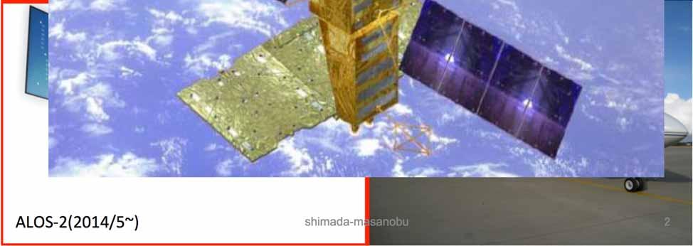
2 ALOS-2 followon-2020 shimada-masanobu
3


 2016 PALSAR-2")
4 25m resolution global mosaic using PALSAR-2 FBD data Old ver. of 2015 Mosaic (Africa) Stripes in the old version of mosaic 2015 PALSAR-2 25m Global Mosaic New ver. of 2015 Mosaic Image (Africa) 2016 PALSAR-2 25m global mosaic No stripe in the new version of mosaic.
 Accuracy: 2015 85.85% 2016:87.")
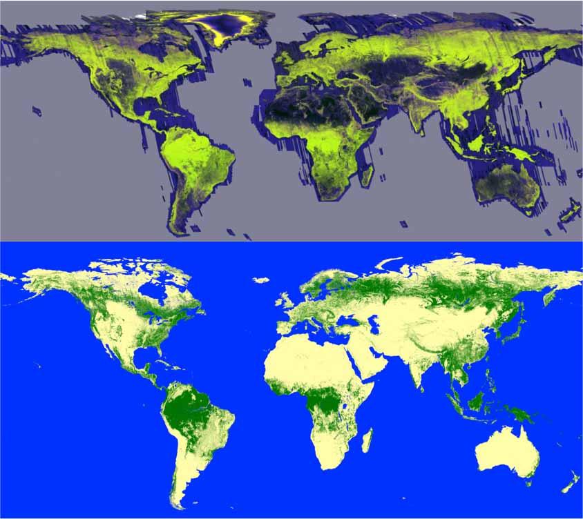
5 25m resolution Forest/Non-Forest Map 2015 Forest/Non-Forest Map Validation using Google Earth image (3912points for validating forest/non-forest) Accuracy: % 2016:87.24% 2016 Forest/Non-Forest Map
6 25m resolution global mosaic in Vietnam Reduced the stripes between path. New ver. Of 2015 Old ver. Of 2015


7 25m resolution global mosaic in Vietnam
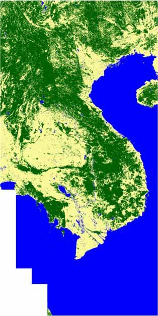
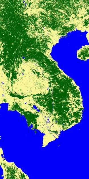
8 25m resolution Forest/Non-Forest map in Vietnam
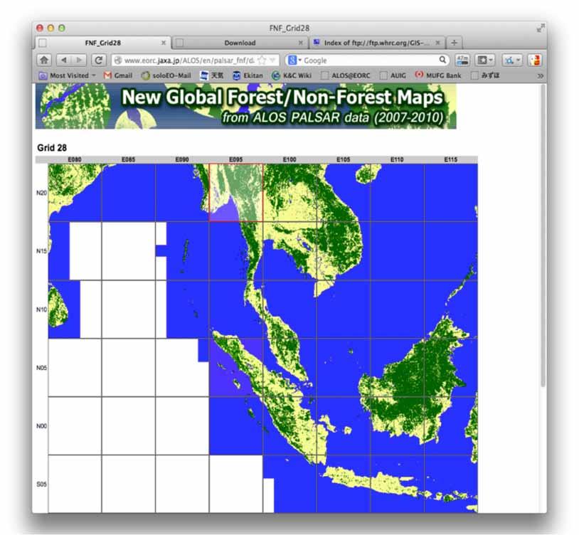
9 2015
10 2016

11 FNF and update
12

 Brazil")
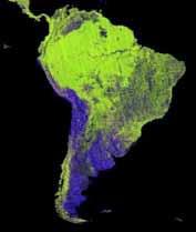
13 Deforestation process from L-band SAR time series 2009 (ALOS/PALSAR) 1996 (JERS-1/SAR) Brazil Rondonia
 One examples for generating a mosaic image Flow chart of producing")
14 Pre-processing (Multiple path processing) SLC generation, Ortho-rectification+ Slope correction Multiple raw data DEM preparation Multiple ortho generations Mosaic (processing) One examples for generating a mosaic image Flow chart of producing a mosaic
, ALOS/PALSAR (2007-2010), and ALOS-2/ PALSAR-2(2015-) Frequency: annual summer data (June-September) Data: gamma-zero and forest/non-forest (FNF), ancillary data")
15 PALSAR/PALSAR-2 25 m global mosaic and FNF Download: JAXA s SAR ARD (analysis ready Data), available from the site ( Contents Satellite: JERS-1/SAR(1995), ALOS/PALSAR ( ), and ALOS-2/ PALSAR-2(2015-) Frequency: annual summer data (June-September) Data: gamma-zero and forest/non-forest (FNF), ancillary data (local incidence, mask, etc.), spaced in 25m (and averaged in 100m), orthorectified, and slope corrected, Geometric accuracy: 10m Expression: 2byte data(unsigned short integer) Area: Global Land Down load unit: 1 degrees x 1 degrees Access Free of charge registered

16 ALOS PALSAR/PALSAR-2/JERS-1 25 m global mosaic data Open release registration htm

17 PALSAR 50 m global mosaic data
18

19 Bulk download of data over 5 x 5 region (25 tiles 1 x1 each) OR click on a tile on the grid to download the individual 1 tile
20 ALOS PALSAR/PALSAR-2/JERS-1 25 m global mosaic data Open release Backscatter (HH) Radar backscatter, normalised for incidence angle ( g o = s o /cosq i ) Radiometric and geometric corr for topography GEOTIF header information 16 bits (UINT)
21 ALOS PALSAR/PALSAR-2/JERS-1 25 m global mosaic data Open release Backscatter (HV) Radar backscatter normalised for incidence angle ( g o = s o /cosq i ) Radiometric and geometric corr for topography 16 bits (UINT)

22 ALOS PALSAR/PALSAR-2/JERS-1 25 m global mosaic data Open release Backscatter false-colour composite R: HH G: HV B: HH/HV

23 ALOS PALSAR/PALSAR-2/JERS-1 25 m global mosaic data Open release DN=917 29/07/2008 DN=854 27/05/2008 DN=975 25/09/2008 Observation date Data layer showing the acquisition date for each pixel in the image: Date = 24/1/ DN 16 bits (UINT)

24 ALOS PALSAR/PALSAR-2/JERS-1 25 m global mosaic data Open release Incidence angle Layer with local incidence angle for each pixel 16 bits (UINT)
25 ALOS PALSAR/PALSAR-2/JERS-1 25 m global mosaic data Open release Mask data Layer showing ocean and nodata areas: layover, shadow. 8 bits

26 ALOS PALSAR/PALSAR-2/JERS-1 25 m global mosaic data Open release
27


28 ALOS-2 PALSAR-2 Global Mosaic & Forest/Non-forest Map m resolution, first generated
")
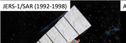
29 JERS-1 SAR Mosaic data (HH)

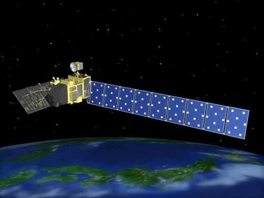
30 ALOS-2 Specifications. X Solar paddles Y Z SAR antenna

31 ALOS PALSAR/PALSAR-2/JERS-1 25 m global mosaic data Open release Product specifications and ancillary data
32 ALOS PALSAR/ALOS-2 PALSAR m global mosaic data Open release Product specifications and ancillary data
33


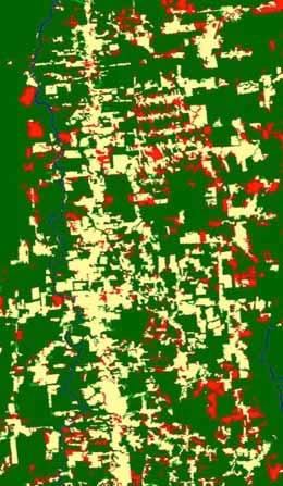
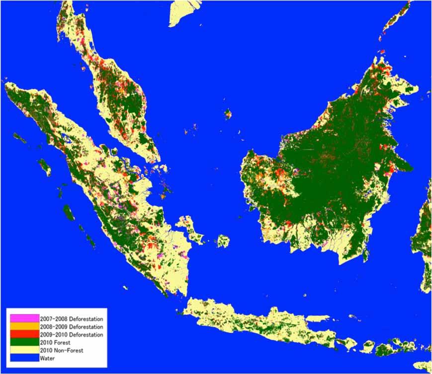
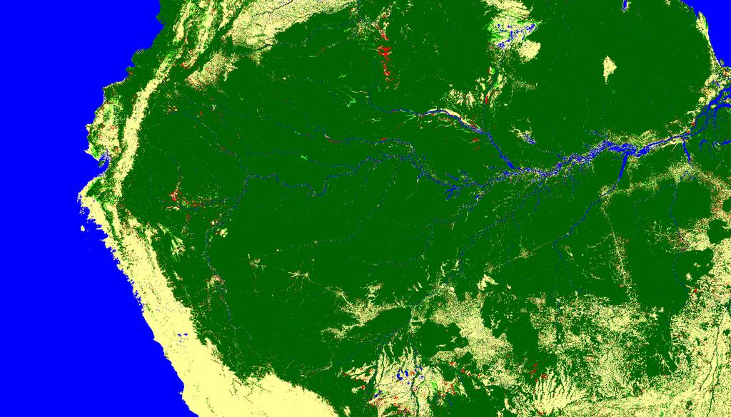
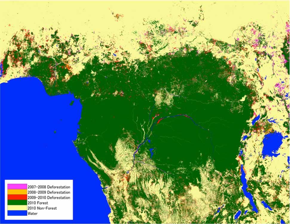
34 0 30km : Forest : Non-Forest : Deforestation : Reforestation


35 : Forest : Non-Forest : Deforestation : Reforestation

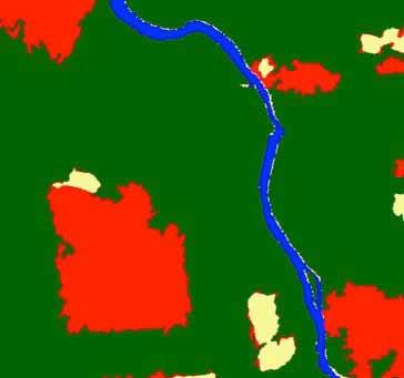

36 : Forest : Non-Forest : Deforestation : Reforestation
37
38
39
40 Conclusions ALOS-2/PALSAR-2 shows the excellent performance (high resolution, low noise level, polarimetry) as a high resolution L-band SAR to monitor the earth environment. ALOS-2/PALSAR-2 has started the forest observation already since Aug. 2014, and observed almost 90% of the forest region at least once. JAXA started to produce the 25/100m PALSAR-2 forest mosaic (HH-HV-HH/HV), browse mosaic, and open them to the public through JAXA/EORC Web. JAXA will continue to produce the high level products.
Global 25 m Resolution PALSAR-2/PALSAR Mosaic. and Forest/Non-Forest Map (FNF) Dataset Description
 Dataset Description") Global 25 m Resolution PALSAR-2/PALSAR Mosaic and Forest/Non-Forest Map (FNF) Dataset Description Japan Aerospace Exploration Agency (JAXA) Earth Observation Research Center (EORC) 1 Revision history Version
Global 25 m Resolution PALSAR-2/PALSAR Mosaic and Forest/Non-Forest Map (FNF) Dataset Description Japan Aerospace Exploration Agency (JAXA) Earth Observation Research Center (EORC) 1 Revision history Version
Geomatica OrthoEngine v10.2 Tutorial Orthorectifying ALOS PRISM Data Rigorous and RPC Modeling
 Geomatica OrthoEngine v10.2 Tutorial Orthorectifying ALOS PRISM Data Rigorous and RPC Modeling ALOS stands for Advanced Land Observing Satellite and was developed by the Japan Aerospace Exploration Agency
Forest Discrimination Analysis of Combined Landsat and ALOS-PALSAR Data
 Forest Discrimination Analysis of Combined Landsat and ALOS-PALSAR Data E. Lehmann, P. Caccetta, Z.-S. Zhou, A. Held CSIRO, Division of Mathematics, Informatics and Statistics, Australia A. Mitchell, I.
Introduction to Radar
 National Aeronautics and Space Administration ARSET Applied Remote Sensing Training http://arset.gsfc.nasa.gov @NASAARSET Introduction to Radar Jul. 16, 2016 www.nasa.gov Objective The objective of this
Forest Discrimination Analysis of Combined Landsat and ALOS-PALSAR Data
 Forest Discrimination Analysis of Combined Landsat and ALOS-PALSAR Data E. Lehmann 1, P. Caccetta 1, Z.-S. Zhou 1, A. Mitchell 2, I. Tapley 2, A. Milne 2, A. Held 3, K. Lowell 4, S. McNeill 5 1 CSIRO Mathematics,
The Current Status and Brief Results of Engineering Model for PALSAR-2 onboard ALOS-2 and Science Project
 The Current Status and Brief Results of Engineering Model for PALSAR-2 onboard ALOS-2 and Science Project + The 16 th KC meeting Japan Aerospace Exploration Agency Masanobu Shimada, Yukihiro KANKAKU The
ALOS and PALSAR. Masanobu Shimada
 ALOS and PALSAR Masanobu Shimada Earth Observation Research Center, National Space Development Agency of Japan, Harumi 1-8-10, Harumi island triton square office tower X 22, Chuo-Ku, Tokyo-To, Japan, 104-6023,
SAR Remote Sensing (Microwave Remote Sensing)
") iirs SAR Remote Sensing (Microwave Remote Sensing) Synthetic Aperture Radar Shashi Kumar shashi@iirs.gov.in Electromagnetic Radiation Electromagnetic radiation consists of an electrical field(e) which
iirs SAR Remote Sensing (Microwave Remote Sensing) Synthetic Aperture Radar Shashi Kumar shashi@iirs.gov.in Electromagnetic Radiation Electromagnetic radiation consists of an electrical field(e) which
ACTIVE SENSORS RADAR
 ACTIVE SENSORS RADAR RADAR LiDAR: Light Detection And Ranging RADAR: RAdio Detection And Ranging SONAR: SOund Navigation And Ranging Used to image the ocean floor (produce bathymetic maps) and detect objects
Remote sensing image correction
 Remote sensing image correction Introductory readings remote sensing http://www.microimages.com/documentation/tutorials/introrse.pdf 1 Preprocessing Digital Image Processing of satellite images can be
remote sensing? What are the remote sensing principles behind these Definition
 Introduction to remote sensing: Content (1/2) Definition: photogrammetry and remote sensing (PRS) Radiation sources: solar radiation (passive optical RS) earth emission (passive microwave or thermal infrared
SENTINEL-1 Toolbox. Polarimetric Tutorial Issued March 2015 Updated August Luis Veci
 SENTINEL-1 Toolbox Polarimetric Tutorial Issued March 2015 Updated August 2016 Luis Veci Copyright 2015 Array Systems Computing Inc. http://www.array.ca/ http://step.esa.int Polarimetric Tutorial The goal
ACTIVE MICROWAVE REMOTE SENSING OF LAND SURFACE HYDROLOGY
 Basics, methods & applications ACTIVE MICROWAVE REMOTE SENSING OF LAND SURFACE HYDROLOGY Annett.Bartsch@polarresearch.at Active microwave remote sensing of land surface hydrology Landsurface hydrology:
TerraSAR-X Image Product Guide
 [Texte] TerraSAR-X Image Product Guide Page 1 of 24 Ref.: OP00xxxxxxxxxx Commercial in Confidence 1 Introduction TerraSAR-X and TanDEM-X are commercial German Synthetic Aperture Radar (SAR) Earth observation
Specificities of Near Nadir Ka-band Interferometric SAR Imagery
 Specificities of Near Nadir Ka-band Interferometric SAR Imagery Roger Fjørtoft, Alain Mallet, Nadine Pourthie, Jean-Marc Gaudin, Christine Lion Centre National d Etudes Spatiales (CNES), France Fifamé
SAR Imagery: Airborne or Spaceborne? Presenter: M. Lorraine Tighe PhD
 SAR Imagery: Airborne or Spaceborne? Presenter: M. Lorraine Tighe PhD Introduction The geospatial community has seen a plethora of spaceborne SAR imagery systems where there are now extensive archives
PALSAR SCANSAR SCANSAR Interferometry
 PALSAR SCANSAR SCANSAR Interferometry Masanobu Shimada Japan Aerospace Exploration Agency Earth Observation Research Center ALOS PI symposium, Greece Nov. 6 2008 1 Introduction L-band PALSAR strip mode
COMBINED ANALYSIS OF OPTICAL AND SAR REMOTE SENSING DATA FOR FOREST MAPPING AND MONITORING
 7 th International Symposium on Digital Earth Perth, Australia 23-25 August 2011 COMBINED ANALYSIS OF OPTICAL AND SAR REMOTE SENSING DATA FOR FOREST MAPPING AND MONITORING E. LEHMANN 1, Z.-S. ZHOU 1, P.
SARscape Modules for ENVI
 Visual Information Solutions SARscape Modules for ENVI Read, process, analyze, and output products from SAR data. ENVI. Easy to Use Tools. Proven Functionality. Fast Results. DEM, based on TerraSAR-X-1
SAR Othorectification and Mosaicking
 White Paper SAR Othorectification and Mosaicking John Wessels: Senior Scientist PCI Geomatics SAR Othorectification and Mosaicking This study describes the high-speed orthorectification and mosaicking
Synthetic aperture RADAR (SAR) principles/instruments October 31, 2018
 principles/instruments October 31, 2018") GEOL 1460/2461 Ramsey Introduction to Remote Sensing Fall, 2018 Synthetic aperture RADAR (SAR) principles/instruments October 31, 2018 I. Reminder: Upcoming Dates lab #2 reports due by the start of next
GEOL 1460/2461 Ramsey Introduction to Remote Sensing Fall, 2018 Synthetic aperture RADAR (SAR) principles/instruments October 31, 2018 I. Reminder: Upcoming Dates lab #2 reports due by the start of next
European Space Agency and IPY
 European Space Agency and IPY ESA supports IPY 2007-2008 activities: First ESA step was a dedicated Announcement Opportunity (AO) for EO data provision in support IPY, released in 2006, with data provision
Detecting and Mapping Invasive Phragmites australis in the coastal Great Lakes with ALOS PALSAR imagery
 Detecting and Mapping Invasive Phragmites australis in the coastal Great Lakes with ALOS PALSAR imagery Laura L. Bourgeau-Chavez, Kirk Scarbrough, Liza Jenkins, Kevin Riordan, Richard Powell, Colin Brooks,
Introduction to image processing for remote sensing: Practical examples
 Università degli studi di Roma Tor Vergata Corso di Telerilevamento e Diagnostica Elettromagnetica Anno accademico 2010/2011 Introduction to image processing for remote sensing: Practical examples Dr.
Geomatica OrthoEngine V10.3 Tutorial. Orthorectifying AVNIR-2 Data Rigorous and RPC Modeling
 Geomatica OrthoEngine V10.3 Tutorial Orthorectifying AVNIR-2 Data Rigorous and RPC Modeling AVNIR-2 stands for Advanced Visible and Near Infrared Radiometer Type 2. It is a successor of AVNIR-1 and is
Time Trend Evaluations of Absolute Accuracies for PRISM and AVNIR-2
 The 3 rd ALOS Joint PI Symposium, Kona, Hawaii, US Nov. 9-13, 2009 Time Trend Evaluations of Absolute Accuracies for PRISM and AVNIR-2 Takeo Tadono*, Masanobu Shimada*, Hiroshi Murakami*, Junichi Takaku**,
Calibration Assessment of RADARSAT-2 Polarimetry Using High Precision Transponders
 Calibration Assessment of RADARSAT-2 Polarimetry Using High Precision Transponders R Touzi, S Côté, RK Hawkins CCRS/CSA Acknowledgments S Nedelcu (CCRS) S Muir (CSA) 1 Outline-Polarimetric RADARSAT-2 Independent
Radiometric and Geometric Correction Methods for Active Radar and SAR Imageries
 Radiometric and Geometric Correction Methods for Active Radar and SAR Imageries M. Mansourpour 1, M.A. Rajabi 1, Z. Rezaee 2 1 Dept. of Geomatics Eng., University of Tehran, Tehran, Iran mansourpour@gmail.com,
Microwave remote sensing. Rudi Gens Alaska Satellite Facility Remote Sensing Support Center
 Microwave remote sensing Alaska Satellite Facility Remote Sensing Support Center 1 Remote Sensing Fundamental The entire range of EM radiation constitute the EM Spectrum SAR sensors sense electromagnetic
ESTIMATION OF DAMAGED AREAS DUE TO THE 2010 CHILE EARTHQUAKE AND TSUNAMI USING SAR IMAGERY OF ALOS/PALSAR
 ESTIMATION OF DAMAGED AREAS DUE TO THE 2010 CHILE EARTHQUAKE AND TSUNAMI USING SAR IMAGERY OF ALOS/PALSAR Ni Made Pertiwi Jaya a, Miura Fusanori b, A. Besse Rimba c * a,b,c Yamaguchi University, Graduate
ENVISAT ASAR DATA PROCESSING
 ASAR data processing with GAMMA Software, Version of 20-Jun-2003 GAMMA SOFTWARE VALIDATION REPORT: ENVISAT ASAR DATA PROCESSING Urs Wegmüller, Tazio Strozzi, Charles Werner and Andreas Wiesmann Gamma Remote
KEY TECHNOLOGY DEVELOPMENT FOR THE ADVENACED LAND OBSERVING SATELLITE
 KEY TECHNOLOGY DEVELOPMENT FOR THE ADVENACED LAND OBSERVING SATELLITE Takashi HAMAZAKI, and Yuji OSAWA National Space Development Agency of Japan (NASDA) hamazaki.takashi@nasda.go.jp yuji.osawa@nasda.go.jp
Faraday rotation estimation from unfocussed ALOS PALSAR raw data
 Faraday rotation estimation from unfocussed ALOS PALSAR raw data arco Lavalle 1 3, E. Pottier 2, D. Solimini 1, N. iranda 3 1 DISP, Tor Vergata University, Rome, Italy 2 IETR UR CNRS 6164, University of
Planet Labs Inc 2017 Page 2
 SKYSAT IMAGERY PRODUCT SPECIFICATION: ORTHO SCENE LAST UPDATED JUNE 2017 SALES@PLANET.COM PLANET.COM Disclaimer This document is designed as a general guideline for customers interested in acquiring Planet
Contributions of the Remote Sensing by Earth Observation Satellites on Engineering Geology
 10th Asian Regional Conference of IAEG (2015) Contributions of the Remote Sensing by Earth Observation Satellites on Engineering Geology Takeo TADONO (1), Hiroto NAGAI (1), Atsuko NONOMURA (2) and Ryoichi
Review. Guoqing Sun Department of Geography, University of Maryland ABrief
 Review Guoqing Sun Department of Geography, University of Maryland gsun@glue.umd.edu ABrief Introduction Scattering Mechanisms and Radar Image Characteristics Data Availability Example of Applications
WorldDEM4Ortho. Technical Product Specification. Version 1.4. AIRBUS DEFENCE AND SPACE Intelligence
 Technical Product Specification Version 1.4 AIRBUS DEFENCE AND SPACE Intelligence Table of Contents Table of Contents... 2 List of Figures... 3 List of Tables... 3 Abbreviations... 4 References... 4 1
Soil moisture retrieval using ALOS PALSAR
 Soil moisture retrieval using ALOS PALSAR T. J. Jackson, R. Bindlish and M. Cosh USDA ARS Hydrology and Remote Sensing Lab, Beltsville, MD J. Shi University of California Santa Barbara, CA November 6,
RADAR (RAdio Detection And Ranging)
") RADAR (RAdio Detection And Ranging) CLASSIFICATION OF NONPHOTOGRAPHIC REMOTE SENSORS PASSIVE ACTIVE DIGITAL CAMERA THERMAL (e.g. TIMS) VIDEO CAMERA MULTI- SPECTRAL SCANNERS VISIBLE & NIR MICROWAVE Real
RADAR (RAdio Detection And Ranging) CLASSIFICATION OF NONPHOTOGRAPHIC REMOTE SENSORS PASSIVE ACTIVE DIGITAL CAMERA THERMAL (e.g. TIMS) VIDEO CAMERA MULTI- SPECTRAL SCANNERS VISIBLE & NIR MICROWAVE Real
Data Requirements Definition and Data Services Options for RAPP
 Data Requirements Definition and Data Services Options for RAPP Brian Killough CEOS Systems Engineering Office (SEO) 5 th GEOGLAM RAPP Workshop Frascati, Italy May 16-17, 2017 Requirements Update The observation
ALOS/PALSAR Level 1.1/1.5 product Format description <English Version>
 NEB-070062A ALOS/PALSAR Level 1.1/1.5 product Format description Revision History NEB Revision Revision Date Revision Contents NEB-01006 First edition 2002.2.5 Rev.A 2003.2.28 Chapter
Data Sharing Issues in SE Asia
 Data Sharing Issues in SE Asia Kandasri Limpakom User Service and Business Development Office About GISTDA THEOS & Its Applications GISTDA s Data Sharing Geo-Informatics and Space Technology Development
Ionospheric Structure Imaging with ALOS PALSAR
 The Second ALOS PI Symposium Rhodes, Greece November 3 7, 008 Ionospheric Structure Imaging with ALOS PALSAR PI Number: 37 JAXA-RA PI: Jong-Sen Lee, Thomas L. Ainsworth and Kun-Shan Chen CSRSR, National
Image processing manual using RapidEye and PALSAR around Milne Bay
 Image processing manual using RapidEye and PALSAR around Milne Bay 1. General procedure of using ERDAS Imagine 11. Menu Execute ERDAS Imagine click this icon (But this version is not latest). This menu
TerraSAR-X and TanDEM-X: Revolution in Spaceborne Radar
 TerraSAR-X and TanDEM-X: Revolution in Spaceborne Radar Ralf Düring, Fifamè N. Koudogbo, and Marco Weber, Infoterra GmbH, 88039 Friedrichshafen, Germany INTRODUCTION While Earth Observation from space
PLANET IMAGERY PRODUCT SPECIFICATIONS PLANET.COM
 PLANET IMAGERY PRODUCT SPECIFICATIONS SUPPORT@PLANET.COM PLANET.COM LAST UPDATED JANUARY 2018 TABLE OF CONTENTS LIST OF FIGURES 3 LIST OF TABLES 4 GLOSSARY 5 1. OVERVIEW OF DOCUMENT 7 1.1 Company Overview
SAR Remote Sensing. Introduction into SAR. Data characteristics, challenges, and applications.
 SAR Remote Sensing Introduction into SAR. Data characteristics, challenges, and applications. PD Dr. habil. Christian Thiel, Friedrich-Schiller-University Jena DLR-HR Jena & Friedrich-Schiller-University
The Biomass Mission, status of the satellite system
 The Biomass Mission, status of the satellite system M. Arcioni, P. Bensi, M. Fehringer, F. Fois, F. Heliere, K. Scipal PolInSAR/Biomass Meeting 2015, ESRIN 29/01/2015 1. Key facts (lifetime, duty cycle
Measurement Of Faraday Rotation In SAR Data Using MST Radar Data
 Measurement Of Faraday Rotation In SAR Data Using MST Radar Data Fatima Kani. K, Glory. J, Kanchanadevi. P, Saranya. P PG Scholars, Department of Electronics and Communication Engineering Kumaraguru College
CURRENT SCENARIO AND CHALLENGES IN THE ANALYSIS OF MULTITEMPORAL REMOTE SENSING IMAGES
 Remote Sensing Laboratory Dept. of Information Engineering and Computer Science University of Trento Via Sommarive, 14, I-38123 Povo, Trento, Italy CURRENT SCENARIO AND CHALLENGES IN THE ANALYSIS OF MULTITEMPORAL
Biomass, a polarimetric interferometric P-band SAR mission
 Biomass, a polarimetric interferometric P-band SAR mission M. Arcioni, P. Bensi, M. Fehringer, F. Fois, F. Heliere, N. Miranda, K. Scipal Fringe 2015, ESRIN 27/03/2015 The Biomass Mission 1. Biomass was
MODULE 9 LECTURE NOTES 2 ACTIVE MICROWAVE REMOTE SENSING
 MODULE 9 LECTURE NOTES 2 ACTIVE MICROWAVE REMOTE SENSING 1. Introduction Satellite sensors are capable of actively emitting microwaves towards the earth s surface. An active microwave system transmits
AVNIR-2 Ortho Rectified Image Product. Format Description
 AVNIR-2 Ortho Rectified Image Product Format Description First edition March 2018 Earth Observation Research Center (EORC), Japan Aerospace Exploration Agency (JAXA) Change Records Ver. Date Page Field
TerraSAR-X. Value Added Product Specification
 Doc. No.: 0009 Page: 1 / 26 TerraSAR-X Value Added Doc. No.: 0009 Page: 2 / 26 TABLE OF CONTENTS 1 INTRODUCTION... 4 1.1 Objective... 4 1.2 Reference Documents... 4 1.3 Definitions and Abbreviations...
Synthetic Aperture Radar for Rapid Flood Extent Mapping
 National Aeronautics and Space Administration ARSET Applied Remote Sensing Training http://arset.gsfc.nasa.gov @NASAARSET Synthetic Aperture Radar for Rapid Flood Extent Mapping Sang-Ho Yun ARIA Team Jet
Francesco Holecz. TUBE II meeting - 17 June Land Degradation. Land Degradation
 Land Degradation Francesco Holecz Objective To identify and monitor land degraded areas, in particular those related to agricultural and pastoral activities. Following products are generated: Land cover
Application and potentials of RADAR and LiDAR technologies for forest carbon assessment in Pacific Island Countries
 Application and potentials of RADAR and LiDAR technologies for forest carbon assessment in Pacific Island Countries June 19th, 2012 PNGFA-JICA Workshop Masamichi HARAGUCHI (Kokusai Kogyo Co., Ltd.) Consultant
The Radar Ortho Suite is an add-on to Geomatica. It requires Geomatica Core or Geomatica Prime as a pre-requisite.
 Technical Specifications Radar Ortho Suite The Radar Ortho Suite includes rigorous and rational function models developed to compensate for distortions and produce orthorectified radar images. Distortions
PLANET IMAGERY PRODUCT SPECIFICATION: PLANETSCOPE & RAPIDEYE
 PLANET IMAGERY PRODUCT SPECIFICATION: PLANETSCOPE & RAPIDEYE LAST UPDATED OCTOBER 2016 SALES@PLANET.COM PLANET.COM Table of Contents LIST OF FIGURES 3 LIST OF TABLES 3 GLOSSARY 5 1. OVERVIEW OF DOCUMENT
Detecting and Mapping Invasive Phragmites australis in the Coastal Great Lakes with ALOS PALSAR Imagery
 Detecting and Mapping Invasive Phragmites australis in the Coastal Great Lakes with ALOS PALSAR Imagery Brian Huberty U.S Fish & Wildlife Service Region 3 Ecological Services Laura L. Bourgeau-Chavez,
Developing land cover products in Monsoon Asia through integration of Landsat (GLS2005) and L-band PALSAR imagery: --- An Update
 and L-band PALSAR imagery: --- An Update") Developing land cover products in Monsoon Asia through integration of Landsat (GLS2005) and L-band PALSAR imagery: --- An Update Landsat 7 ETM+ PALSAR Xiangming Xiao Center for Spatial Analysis, University
Developing land cover products in Monsoon Asia through integration of Landsat (GLS2005) and L-band PALSAR imagery: --- An Update Landsat 7 ETM+ PALSAR Xiangming Xiao Center for Spatial Analysis, University
Synthetic Aperture Radar
 Synthetic Aperture Radar Picture 1: Radar silhouette of a ship, produced with the ISAR-Processor of the Ocean Master A Synthetic Aperture Radar (SAR), or SAR, is a coherent mostly airborne or spaceborne
CHAPTER II LITERATURE REVIEW. properties of an object without coming into physical contact with the object.
 CHAPTER II LITERATURE REVIEW 2.1 Remote Sensing The concept of remote sensing method is to obtain information about properties of an object without coming into physical contact with the object. Remote
Geo/SAT 2 INTRODUCTION TO REMOTE SENSING
 Geo/SAT 2 INTRODUCTION TO REMOTE SENSING Paul R. Baumann, Professor Emeritus State University of New York College at Oneonta Oneonta, New York 13820 USA COPYRIGHT 2008 Paul R. Baumann Introduction Remote
SMAP Calibration Requirements and Level 1 Processing
 SMAP Calibration Requirements and Level 1 Processing Richard West, Seungbum Kim, Eni Njoku Jet Propulsion Laboratory, California Institute of Technology Outline Science requirements Radar backscatter measurement
Research Article Simultaneous Observation Data of GB-SAR/PiSAR to Detect Flooding in an Urban Area
 Hindawi Publishing Corporation EURASIP Journal on Advances in Signal Processing Volume, Article ID, pages doi:.// Research Article Simultaneous Observation Data of GB-SAR/PiSAR to Detect Flooding in an
Damage detection in the 2015 Nepal earthquake using ALOS-2 satellite SAR imagery
 Proceedings of the Tenth Pacific Conference on Earthquake Engineering Building an Earthquake-Resilient Pacific 6-8 November 2015, Sydney, Australia Damage detection in the 2015 Nepal earthquake using ALOS-2
SAR Multi-Temporal Applications
 SAR Multi-Temporal Applications 83230359-DOC-TAS-EN-001 Contents 2 Advantages of SAR Remote Sensing Technology All weather any time Frequencies and polarisations Interferometry and 3D mapping Change Detection
GLOBAL AUTOMATIC ORTHORECTIFICATION OF ASAR PRODUCTS IN ESRIN G-POD
 GLOBAL AUTOMATIC ORTHORECTIFICATION OF ASAR PRODUCTS IN ESRIN G-POD R.Cossu (1), F.Brito (2), O.Colin (1), L.Fusco (1), P.Goncalves (2), M.Lavalle (3), and M.Paces (3) (1) ESA-ESRIN Directorate of Earth
Co-ReSyF RA lecture: Vessel detection and oil spill detection
 This project has received funding from the European Union s Horizon 2020 Research and Innovation Programme under grant agreement no 687289 Co-ReSyF RA lecture: Vessel detection and oil spill detection
PROGRESS IN ADDRESSING SCIENCE GOALS FOR GLACIER OBSERVATIONS BY MEANS OF SAR. Frank Paul & Thomas Nagler
 PROGRESS IN ADDRESSING SCIENCE GOALS FOR GLACIER OBSERVATIONS BY MEANS OF SAR Frank Paul & Thomas Nagler SAR Coordination Working Group Meeting, 13/11/2016 Observed glacier products and sensors Product
SARscape 4.1 Supported Sensors/Products (October 2008)
") SARscape 4.1 Supported Sensors/Products (October 2008) ALOS PALSAR (provided by JAXA) In case of RAW (level 1.0) data, import is carried out within the Focusing Module. PALSAR RAW data in CEOS standard
SARscape 4.1 Supported Sensors/Products (October 2008) ALOS PALSAR (provided by JAXA) In case of RAW (level 1.0) data, import is carried out within the Focusing Module. PALSAR RAW data in CEOS standard
Introduction to RADAR Remote Sensing for Vegetation Mapping and Monitoring. Wayne Walker, Ph.D.
 Introduction to RADAR Remote Sensing for Vegetation Mapping and Monitoring Wayne Walker, Ph.D. Outline What is RADAR (and what does it measure)? RADAR as an active sensor Applications of RADAR to vegetation
Session I: Status Reports on Ongoing and Future Missions Chairs: M.Shimada (JAXA) and P. Snoeij (ESA)
 and P. Snoeij (ESA)") Session I: Status Reports on Ongoing and Future Missions Chairs: M.Shimada (JAXA) and P. Snoeij (ESA) Canadian Radarsat Mission status-s. Cote Operating far beyond design lifetime (RSAT-1: 16 years, ASAR:
Session I: Status Reports on Ongoing and Future Missions Chairs: M.Shimada (JAXA) and P. Snoeij (ESA) Canadian Radarsat Mission status-s. Cote Operating far beyond design lifetime (RSAT-1: 16 years, ASAR:
Land-Cover Mapping in Stockholm Using Fusion of ALOS PALSAR and SPOT Data
 Land-Cover Mapping in Stockholm Using Fusion of ALOS PALSAR and SPOT Data Johan Wallin Master s of Science Thesis in Geoinformatics TRITA-GIT EX 08-012 School of Architecture and the Built Environment
SARscape s Coherent Changes Detection Tutorial
 SARscape s Coherent Changes Detection Tutorial Version 1.0 April 2018 1 Index Introduction... 3 Setting Preferences... 4 Data preparation... 5 Input data... 5 DEM Extraction... 5 Single Panels processing...
GFOI Expert Workshop. Sensor interoperability, complementarity, and the temporal component. Francesco Holecz
 GFOI Expert Workshop Sensor interoperability, complementarity, and the temporal component Francesco Holecz Woods Hole Research Centre, MA, USA 10-11 June, 2014 On sensor interoperability Single-date vs.
DEMS BASED ON SPACE IMAGES VERSUS SRTM HEIGHT MODELS. Karsten Jacobsen. University of Hannover, Germany
 DEMS BASED ON SPACE IMAGES VERSUS SRTM HEIGHT MODELS Karsten Jacobsen University of Hannover, Germany jacobsen@ipi.uni-hannover.de Key words: DEM, space images, SRTM InSAR, quality assessment ABSTRACT
Contribution of Sentinel-1 data for the monitoring of seasonal variations of the vegetation
 Contribution of Sentinel-1 data for the monitoring of seasonal variations of the vegetation P.-L. Frison, S. Kmiha, B. Fruneau, K. Soudani, E. Dufrêne, T. Koleck, L. Villard, M. Lepage, J.-F. Dejoux, J.-P.
GMES Sentinel-1 Transponder Development
 GMES Sentinel-1 Transponder Development Paul Snoeij Evert Attema Björn Rommen Nicolas Floury Malcolm Davidson ESA/ESTEC, European Space Agency, Noordwijk, The Netherlands Outline 1. GMES Sentinel-1 overview
Estimation of Damage Areas due to the 2010 Maule, Chile Earthquake Tsunami Using ASTER/DEM and ALOS/PALSAR Images
 Estimation of Damage Areas due to the 2010 Maule, Chile Earthquake Tsunami Using ASTER/DEM and ALOS/PALSAR Images Masashi Matsuoka Senior Research Scientist AIST Tsukuba, Japan m.matsuoka@aist.go.jp Masashi
Principles of Remote Sensing. Shuttle Radar Topography Mission S R T M. Michiel Damen. Dept. Earth Systems Analysis
 Principles of Remote Sensing Shuttle Radar Topography Mission S R T M Michiel Damen Dept. Earth Systems Analysis Contents Present problems with DEMs Advantage of SRTM Cell size Mission and system Radar
SARscape for ENVI. A Complete SAR Analysis Solution
 SARscape for ENVI A Complete SAR Analysis Solution IDL and ENVI A Foundation for SARscape IDL The Data Analysis & Visualization Platform Data Access: IDL supports virtually every data format, type and
ASAR, MERIS and AATSR products
 ASAR, MERIS and AATSR products Francesco Sarti and Steffen Dransfeld ESA/ESRIN 25 February 2008 ENVISAT http://envisat.esa.int/ Launched in 2002. Sun-synchronous polar orbit (SSO): Nominal reference orbit
Imaging radar Imaging radars provide map-like coverage to one or both sides of the aircraft.
 CEE 6100 / CSS 6600 Remote Sensing Fundamentals 1 Imaging radar Imaging radars provide map-like coverage to one or both sides of the aircraft. Acronyms: RAR real aperture radar ("brute force", "incoherent")
Alos PALSAR polarimetric data for land land cover classification in Amazon.
 Alos PALSAR polarimetric data for land land cover classification in Amazon. An emphasis on phase information. Investigators: Luciano Vieira Dutra (dutra@dpi.inpe.br) Corina C. Freitas Associate Res: Graziela
Introduction of GLI level-1 products
 Introduction of GLI level-1 products JAXA EORC December 24, 2003 http://www.eoc.jaxa.jp/homepage.html 1. JAXA Global Imager The JAXA Global Imager (GLI) orbit and observation method are outlined below.
Polarisation Capabilities and Status of TerraSAR-X
 Polarisation Capabilities and Status of TerraSAR-X Irena Hajnsek, Josef Mittermayer, Stefan Buckreuss, Kostas Papathanassiou German Aerospace Center Microwaves and Radar Institute irena.hajnsek@dlr.de
Correcting topography effects on terrestrial radar maps
 Correcting topography effects on terrestrial radar maps M. Jaud, R. Rouveure, P. Faure, M-O. Monod, L. Moiroux-Arvis UR TSCF Irstea, National Research Institute of Science and Technology for Environment
PALSAR calibration with passive antenna reflectors
 PALSAR calibration with passive antenna reflectors Alexander Zakharov, IRE RAS, Russia Peter Jerdev, SDB MPEI, Russia Alexey Sokolov, SDB MPEI, Russia E-mail: aizakhar@sunclass.ire.rssi.ru Bear Lakes calibration
Topographic mapping from space K. Jacobsen*, G. Büyüksalih**
 Topographic mapping from space K. Jacobsen*, G. Büyüksalih** * Institute of Photogrammetry and Geoinformation, Leibniz University Hannover ** BIMTAS, Altunizade-Istanbul, Turkey KEYWORDS: WorldView-1,
RADARSAT-2 Program Update Daniel De Lisle Canadian Space Agency
 RADARSAT-2 Program Update Daniel De Lisle Canadian Space Agency Presentation outline RADARSAT-1 Update RADARSAT-2 Mission description Mission Objectives System Characteristics Data Commercialization/Allocation
Sources of Geographic Information
 Sources of Geographic Information Data properties: Spatial data, i.e. data that are associated with geographic locations Data format: digital (analog data for traditional paper maps) Data Inputs: sampled
THE NASA/JPL AIRBORNE SYNTHETIC APERTURE RADAR SYSTEM. Yunling Lou, Yunjin Kim, and Jakob van Zyl
 THE NASA/JPL AIRBORNE SYNTHETIC APERTURE RADAR SYSTEM Yunling Lou, Yunjin Kim, and Jakob van Zyl Jet Propulsion Laboratory California Institute of Technology 4800 Oak Grove Drive, MS 300-243 Pasadena,
JAXA Mission Updates
 JAXA Mission Updates JECAM/GEOGLAM Science Meeting Ottawa, Canada 21 23 July 2014 Presenter: Kei OYOSHI Earth Observation Research Center, JAXA Shin-ichi Sobue, Yutaka Kaneko, Masanobu Shimada, Shinichi
TerraSAR-X Applications Guide
 TerraSAR-X Applications Guide Extract: Change Detection and Monitoring: Geospatial / Image Intelligence April 2015 Airbus Defence and Space Geo-Intelligence Programme Line Change Detection and Monitoring:
Description of the Instruments and Algorithm Approach
 Description of the Instruments and Algorithm Approach Passive and Active Remote Sensing SMAP uses active and passive sensors to measure soil moisture National Aeronautics and Space Administration Applied
Synthetic Aperture Radar Interferometry (InSAR) Technique (Lecture I- Tuesday 11 May 2010)
 Technique (Lecture I- Tuesday 11 May 2010)") Synthetic Aperture Radar Interferometry () Technique (Lecture I- Tuesday 11 May 2010) ISNET/CRTEAN Training Course on Synthetic Aperture Radar (SAR) Imagery: Processing, Interpretation and Applications
Synthetic Aperture Radar Interferometry () Technique (Lecture I- Tuesday 11 May 2010) ISNET/CRTEAN Training Course on Synthetic Aperture Radar (SAR) Imagery: Processing, Interpretation and Applications
OPTICAL AND SAR DATA INTEGRATION FOR AUTOMATIC CHANGE PATTERN DETECTION
 OPTICAL AND SAR DATA INTEGRATION FOR AUTOMATIC CHANGE PATTERN DETECTION B. Mishra, J. Susaki Department of Civil and Earth Resources Engineering, Kyoto University; Email address: mishra.bhogendra.46c@st.kyoto-u.ac.jp;