EO Sensors : ISRO Past, Current & Future
|
|
|
- Darlene Carr
- 5 years ago
- Views:
Transcription

1 EO Sensors : ISRO Past, Current & Future Vinay K Dadhwal Director National Remote Sensing Centre, ISRO, Hyderabad, INDIA International Regional Science Meeting on Land Cover and Land Use Change Dynamics and Impacts in South Asia Karunya University, Coimbatore, 10 Jan 2013
2 Historical Development Aryabhatta First Satellite (Not EO)built by ISRO & launched from Russia Bhaskara I (1979) & Bhaskara II (1981) First series of experimental Earth Observation satellites, Geostationary for Weather Studies Experimental & Technology Satellites SROSS, TES (High Resolution), IMS (Microsatellite) Operational IRS Series IRS 1A, IRS 1B, IRS 1C, IRS 1D Thematic Series


3 Bhaskara satellite Bhaskara I Launched : June 7, 1979 by Intercosmos (USSR) Optical : TV Camera, 1 km, 2 band (Red, NIR) Microwave Radiometer : SAMIR (19.24, , 31.4 GHz) Bhaskara II Launched : Nov 20, 1981 by Intercosmos (USSR) Optical : TV Camera, 1 km, 2 band (Red, NIR) Microwave Radiometer : SAMIR TVPayload Frame imager 341*341 Sq M 1Km GSD Intensifier coupled SUPER Vidicon Refractive optics SAMIR Dicke Radiometer 3 frequencies 19.35,22.35 and 31 GHz Km GSD 1500 Km swath
4 Operational IRS Satellites - Initiation Mission IRS-1A IRS-1B IRS-1C IRS-1D Weight 975 kg 975 kg 1250 kg 1250 kg Onboard power (Solar Panel, sq m) 600 Watts Communication S-band, X-band, VHF S-band, X-band 809 Watts/(9.6 sqm ) WiFS (189 m) Payloads, (Solid State LISS-1 (72.5 m) LISS-3 (23.6m) Push Broom Camera) LISS-2A, 2B (36.25 m) PAN (<6m) Onboard Tape Recorder 62 Gb 62 Gb Launch / Mission Completion Launch Vehicle/ Site Mar 17, 1988/ Jul 1996 Aug 29, 1991/ Dec 20, 2003 Vostok/ Baikanur, Kazakhstan Dec 28, 1995/ Sep 21, 2007 Molniya/ Baikanur, Kazakhstan 27 Sep 1997/ Jan 2010 PSLV C1, SHAR,Orbit # (ht km) 904 km 904 km 817 km 740 x 817 km Inclination o o 98.69o Repetivity/ (Orbits) 22 days / (307 orbits) 24 days Local time & a.m a.m a.m a.m. # Orbit : Polar Sun Synchronous ; & Local Time : Descending Node


5 Indian Earth Observation Satellites 2009 RISAT-2 X-SAR 2011 RESOURCESAT-2 LISS 3; LISS 4; AWiFS 2003 RESOURCESAT-1 LISS 3; LISS 4; AWiFS 2012 RISAT-1 C-SAR 2007/ 2008/ 2010 CARTOSAT-2/2A/2B PAN 2005 CARTOSAT-1 Stereo PAN, F/A 2008 IMS-1 MX HySI-T 2001 TES Step & Stare PAN 2009 OCEANSAT-2 OCM, SCAT ROSA 2011 Megha Tropiques MADRAS, SAPHIR SCaRaB 2003 INSAT- 3A VHRR, CCD 2002 KALPANA-1 VHRR
 5.8 m 23.5 m 56 m Swath (km) 23.")


6 Resourcesat-1 (IRS-P6) LISS-IV Stereo Viewing Specifications LISS-4 LISS-3 AWiFS Spatial Resolution (m) 5.8 m 23.5 m 56 m Swath (km) 23.9 (MX)/ 70 (Mono) x 2 Spectral Bands (mm) B to 0.59 B to 0.68 B to 0.86 B to 0.59 B to 0.68 B to 0.86 B to 1.70 B to 0.59 B to 0.68 B to 0.86 B to 1.70 Quantization (Bits) Best 7 of Revisit / Cycle (Days) 5 / / 24 5 / 24 Improved capability in radiometric, spatial and temporal resolutions Simultaneous data acquisition at different spatial resolutions for micro to macro level applications

7 Courtesy ASK,SAC
8 RSR : Across sensors & missions Chander et al., 2007, Trans IEEE Pandya Et al., 2007, J.Ind Soc. Rem Sens, 35, 333

9

10
 PLC(R) Scatterometer Specifications PARAMETER Altitude Frequency Resolution Polarisation Antenna Scanning Rate Data Rate Transmit Power Swath Wind Speed Range")
 100 W Peak 1400 km VALUE 4 to 24 m/s 2 m/sec or 10% ( Whichever is higher) 20 deg RMS Scatterometer Geometry OUTER BEAM V POL ORBIT TRACK INNER BEAM H POL 720 KMS 43.")
11 OCEANSAT-2 : SCATTEROMETER 2009 Launch Scatterometer STRUCTURE REFLECTOR FEE D FRONT END SWITCH ASS. SPAR RECIEVER DACS DCG PLC(M) PLC(R) Scatterometer Specifications PARAMETER Altitude Frequency Resolution Polarisation Antenna Scanning Rate Data Rate Transmit Power Swath Wind Speed Range Wind Speed Accuracy Wind Direction Accuracy 720 Km GHz 50 km X 50 km HH (Inner) and VV (Outer) Parabola of 1.0 m Dia 20.5 rpm Mbit/sec (Raw) 74.4 Kbit/Sec (Processed) 100 W Peak 1400 km VALUE 4 to 24 m/s 2 m/sec or 10% ( Whichever is higher) 20 deg RMS Scatterometer Geometry OUTER BEAM V POL ORBIT TRACK INNER BEAM H POL 720 KMS DEG DEG SCAN AXIS 725 KM 910 KM ACROSS TRACK NADIR TRACK GEOMETRY OF THE PENCIL-BEAM SCATTEROMETER FOR OCEANSAT-II 90


12 CARTOSAT-1 Launch : PSLV-C6: May 05, 2005

13 CARTOSAT 2 / 2A Altitude : 630 km / 638 km* Inclination : deg / deg* Period : 97.4 minutes Local time (D) : 9.30 am Orbits.day : 14 Revisit / Repetivity : 4 days / 310 days Lift-off mass : 680 kg Payload : Panchromatic Camera Operational Life : 5 Years CARTOSAT 2/2A PAN SENSOR Spectral Range : Spatial Res. : <1m (81cm nom.) Swath : 9.6 km SSR : 64 GB Data Rate : 336 MBPS On-board Comp. : 3.2:1 Transmission : 105 MBPS
 : 10 SNR : 180")
 : 10 UNO, Vieana Step")

14 CARTOSAT - 2 High Resolution PAN imaging SWATH (km) : 10 SNR : 180 IGFOV (m) : 0.8 SWR (%) : 10 UNO, Vieana Step and Stare imaging Cartosat 2-A PAN & P6 LISS-IV CARTOSAT 2A ; Launch PSLV C9 28 Apr 2008
 NO. BANDS : 64 fixed bands SPECTRAL Res.: 8 nanometer SPATIALRes. : 505.6 m SWATH : 129.")
15 Indian Mini Series-1/ IMS-1 ORBIT ALTITUDE MISSION LIFE DIMENSION MASS POWER DATA STORAGE : Polar sun synchronous : 635 km : 2 km : x x : 83 kg : 2 Sol panel/ 220W : 16 Gb SSR HySI Payload TYPE : Hypersp. Camera SPECTRAL : ( µm) NO. BANDS : 64 fixed bands SPECTRAL Res.: 8 nanometer SPATIALRes. : m SWATH : km MASS : 3.4 kg Mx Payload TYPE : 4 Band MX CCD Camera SPECTRAL : B1 ( µm) BANDS : B2 ( µm) : B3 ( µm) : B4 ( µm) RESOLUTION : 37 m - SWATH : 151 km - MASS : 5.9 kg

16 RISAT

17 Imaging SAR : RISAT
18 Geostationary Operational Met. Satellites INSAT 1 Series (1A/ 1B/ 1C/ 1D); INSAT 2 Series (2A/ 2B/ 2C/ 2D); VHRR Visible 2.75 km IR 11 km INSAT 2E ; INSAT 3A ; VHRR + CCD VHRR : Visbile 2 km, IR 8 km CCD : Multispectral 3band, 1 km KALPANA (Met only payload), 2002, VHRR


")


19 Launch: 12 Oct 2011 Megha-Tropiques - A Joint ISRO-CNES Mission For studying water cycle and energy exchanges in tropical regions SAPHIR SCARAB MADRAS ROSA Low inclination (20º) for frequent simultaneous observations of tropics Water vapour, Clouds Cloud condensed water, Precipitation, Evaporation Contributing to Global Precipitation Mission (GPM)


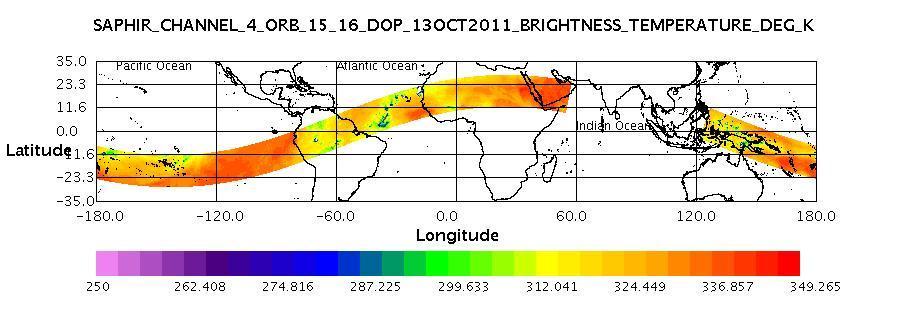


20 Initial Megha-Tropiques data products SAPHIR BT Data MADRAS BT Data SAPHIR Relative Humidity Two Layers MADRAS GP Data
21 FUTURE EO SATELLITES & SENSORS SARAL (2013) INSAT 3D (2013) Resourcesat 2A, GISAT, Oceansat 3, RISAT 1A, Cartosat 2C
: 50m Res.")

22 EO Near Future Satellites SARAL Satellite with ARgos and ALtika - Joint ISRO-CNES Mission Payloads Ka-band Altimeter (~35.5GHz) Dual freq Radiometer (23.8/36.8 GHz Status Launch by PSLV in early 2013 GISAT Multiple acquisition capability from a Geosynchronous Orbit Payloads High resolution multi-spectral VNIR (HRMX-VNIR): 50m Res. Hyper spectral VNIR & SWIR: 320m and 192m Res. High resolution Multi-spectral (HRMX-TIR): 1.5km Res. Status Launch by PSLV during INSAT - 3D For improved understanding of weather systems Payloads 19 channel Sounder 6 Channel Imager Status Launch by 2013 Resourcesat-2A Land and Water Resources Applications Continuity Mission Payloads LISS IV Mx, LISS III and AWiFS Status Launch by PSLV during Followed by satellites with high resolution cameras, hyperspectral sensors, Oceansat-3,
 Megha-Tropiques Ocean Surface Topography (OST) SARAL Sea Surface Temperature (SST-VC) - (under discussion) Atmospheric")
23 ISRO contribution: CEOS Virtual Constellations Land Surface Imaging (LSI) Resourcesat-2 Ocean Colour Radiometry (OCR) Oceansat-2 OCM Ocean Surface Vector Wind (OSVW) - Oceansat-2 Scatterometer Precipitation (PC) Megha-Tropiques Ocean Surface Topography (OST) SARAL Sea Surface Temperature (SST-VC) - (under discussion) Atmospheric Composition (ACC)
24 Thank You V K Dadhwal Director NRSC / ISRO Hyderabad, INDIA director@nrsc.gov.in

25 SARAL : Satellite for ARGOS & ALTIKA

26

27 INSAT 3D: IMAGER: 6 Band Band No. Spectrum (mm) IGFOV (km) S/N/ Or NEDT (K) Scene Condition :1 100% albedo :1 100% albedo K 300 K K 230 K K 300 K K 300 K
(updates from last Plenary) AS Kiran Kumar ISRO, INDIA
 AS Kiran Kumar ISRO, INDIA") ISRO s EARTH OBSERVATION SYSTEM (updates from last Plenary) AS Kiran Kumar ISRO, INDIA The 24 th CEOS Plenary Rio de Janeiro, Brazil 12 15 October, 2010 1 Four Decades of Indian Space Programme 30 LV Missions
ISRO s EARTH OBSERVATION SYSTEM (updates from last Plenary) AS Kiran Kumar ISRO, INDIA The 24 th CEOS Plenary Rio de Janeiro, Brazil 12 15 October, 2010 1 Four Decades of Indian Space Programme 30 LV Missions
ISRO s EARTH OBSERVATION SYSTEM (updates from last Plenary) AS Kiran Kumar ISRO, INDIA
 AS Kiran Kumar ISRO, INDIA") ISRO s EARTH OBSERVATION SYSTEM (updates from last Plenary) AS Kiran Kumar ISRO, INDIA The 24 th CEOS Plenary Rio de Janeiro, Brazil 12-15 October, 2010 1 Four Decades of Indian Space Programme 30LV Missions
ISRO s EARTH OBSERVATION SYSTEM (updates from last Plenary) AS Kiran Kumar ISRO, INDIA The 24 th CEOS Plenary Rio de Janeiro, Brazil 12-15 October, 2010 1 Four Decades of Indian Space Programme 30LV Missions
Indian Remote Sensing Satellites
 Resourcesat-1 Indian Remote Sensing Satellites -Current & Future Resourcesat Missions - Presented by: Timothy J. Puckorius Chairman & CEO EOTec 1 Presentation Topics India s Earth Observation Heritage
Indian Remote Sensing Satellites
 Resourcesat-1 Cartosat-1 Indian Remote Sensing Satellites -Current & Future Missions - Presented by: Timothy J. Puckorius Chairman & CEO EOTec 1 Presentation Topics Who is EOTec India s Earth Observation
Intersatellite Calibration of infrared sensors onboard Indian Geostationary Satellites using LEO Hyperspectral Observations
 Updates from GSICS members and Observers Indian Space Research Organisation (ISRO) Intersatellite Calibration of infrared sensors onboard Indian Geostationary Satellites using LEO Hyperspectral Observations
Geostationary satellites
 Polar satellites 800 km. 99 relative to the Equator S-N during ascending leg & N-S during descending leg Each orbit 100 minutes 14 orbits a day. Sun-Synchronous provides consistent lighting of Earth-scan
Report from ISRO. 19th GSICS Executive Panel, Bangalore, India, 1-2 June 2018
 Report from ISRO 19th GSICS Executive Panel, Bangalore, India, 1-2 June 2018 Raj Kumar, Pradeep K Thapliyal, Munn V Shukla (Space Applications Centre, ISRO, Ahmedabad) GSICS-EP-19, Bangalore, India, 1-2
Report from ISRO. 29-Feb to 5-Mar, Pradeep Thapliyal, Munn Shukla, Ipshita Dey, Shivani Shah. Space Applications Centre (ISRO) India
 India") Report from ISRO Annual Meeting of GRWG/GDWG, JAXA, Japan 29-Feb to 5-Mar, 2016 Pradeep Thapliyal, Munn Shukla, Ipshita Dey, Shivani Shah Space Applications Centre (ISRO) India ISRO Current satellites
Report from ISRO Annual Meeting of GRWG/GDWG, JAXA, Japan 29-Feb to 5-Mar, 2016 Pradeep Thapliyal, Munn Shukla, Ipshita Dey, Shivani Shah Space Applications Centre (ISRO) India ISRO Current satellites
ROLE OF SATELLITE DATA APPLICATION IN CADASTRAL MAP AND DIGITIZATION OF LAND RECORDS DR.T. RAVISANKAR GROUP HEAD (LRUMG) RSAA/NRSC/ISRO /DOS HYDERABAD
 RSAA/NRSC/ISRO /DOS HYDERABAD") ROLE OF SATELLITE DATA APPLICATION IN CADASTRAL MAP AND DIGITIZATION OF LAND RECORDS DR.T. RAVISANKAR GROUP HEAD (LRUMG) RSAA/NRSC/ISRO /DOS HYDERABAD WORKSHOP on Best Practices under National Land Records
ROLE OF SATELLITE DATA APPLICATION IN CADASTRAL MAP AND DIGITIZATION OF LAND RECORDS DR.T. RAVISANKAR GROUP HEAD (LRUMG) RSAA/NRSC/ISRO /DOS HYDERABAD WORKSHOP on Best Practices under National Land Records
Agency Report: Indian Earth Observation Programme
 Agency Report: Indian Earth Observation Programme Nitant Dube Space Applications Centre Indian Space Research Organisation Presentation to CEOS WGISS-41, Canberra Australia, March 2016 Indian EO Programme:
INDIAN PAYLOAD CAPABILITIES FOR SPACE MISSIONS
 5 th International ASTROD Symposium, July 11-13, Bangalore INDIAN PAYLOAD CAPABILITIES FOR SPACE MISSIONS A.S. Kiran Kumar Director Space Applications Centre Ahmedabad Application-specific EO payloads
BASICS OF REMOTE SENSING
 BASICS OF REMOTE SENSING 23: Basics of Remote Sensing Shibendu Shankar Ray Mahalanobis National Crop Forecast Centre, Department of Agriculture & Cooperation, Krishi Vistar Sadan, Pusa Campus, New Delhi
The Global Imager (GLI)
") The Global Imager (GLI) Launch : Dec.14, 2002 Initial check out : to Apr.14, 2003 (~L+4) First image: Jan.25, 2003 Second image: Feb.6 and 7, 2003 Calibration and validation : to Dec.14, 2003(~L+4) for
The Global Imager (GLI) Launch : Dec.14, 2002 Initial check out : to Apr.14, 2003 (~L+4) First image: Jan.25, 2003 Second image: Feb.6 and 7, 2003 Calibration and validation : to Dec.14, 2003(~L+4) for
9/12/2011. Training Course Remote Sensing Basic Theory & Image Processing Methods September 2011
 Training Course Remote Sensing Basic Theory & Image Processing Methods 19 23 September 2011 Popular Remote Sensing Sensors & their Selection Michiel Damen (September 2011) damen@itc.nl 1 Overview Low resolution
Microwave Sensors Subgroup (MSSG) Report
 Report") Microwave Sensors Subgroup (MSSG) Report CEOS WGCV-35 May 13-17, 2013, Shanghai, China DONG, Xiaolong, MSSG Chair CAS Key Laboratory of Microwave Remote Sensing National Space Science Center Chinese Academy
Microwave Sensors Subgroup (MSSG) Report CEOS WGCV-35 May 13-17, 2013, Shanghai, China DONG, Xiaolong, MSSG Chair CAS Key Laboratory of Microwave Remote Sensing National Space Science Center Chinese Academy
Microwave Sensors Subgroup (MSSG) Report
 Report") Microwave Sensors Subgroup (MSSG) Report Feb 17-20, 2014, ESA ESRIN, Frascati, Italy DONG, Xiaolong, MSSG Chair National Space Science Center Chinese Academy of Sciences (MiRS,NSSC,CAS) Email: dongxiaolong@mirslab.cn
Microwave Sensors Subgroup (MSSG) Report Feb 17-20, 2014, ESA ESRIN, Frascati, Italy DONG, Xiaolong, MSSG Chair National Space Science Center Chinese Academy of Sciences (MiRS,NSSC,CAS) Email: dongxiaolong@mirslab.cn
Indian Space Programme & Country Report to 9 th GEOSS-AP. Dr. PVN Rao ISRO, INDIA
 Indian Space Programme & Country Report to 9 th GEOSS-AP Dr. PVN Rao ISRO, INDIA January 2017 Vision: Harness Space Technology for National Development Space Transportation Polar Satellite Launch Vehicle
NON-PHOTOGRAPHIC SYSTEMS: Multispectral Scanners Medium and coarse resolution sensor comparisons: Landsat, SPOT, AVHRR and MODIS
 NON-PHOTOGRAPHIC SYSTEMS: Multispectral Scanners Medium and coarse resolution sensor comparisons: Landsat, SPOT, AVHRR and MODIS CLASSIFICATION OF NONPHOTOGRAPHIC REMOTE SENSORS PASSIVE ACTIVE DIGITAL
India recently successfully launched its PSLV-C16 rocked that carried into orbit the latest remote
 India recently successfully launched its PSLV-C16 rocked that carried into orbit the latest remote sensing satellite REsourcesat-2 that would study and help manage natural resources along with two Nano
Current and Future Meteorological Satellite Program of China
 Current and Future Meteorological Satellite Program of China ZHANG Wenjian, DONG Chaohua XU Jianmin, YANG Jun China Meteorological Administration May 30, 2005 Beijing, CHINA Outline of the Presentation
CHAPTER --'3 DATA DESCRIPTION
 CHAPTER --'3 DATA DESCRIPTION 37 3.1 INTRODUCTION In chapter 2 different techniques used for the study of polar cryosphere like passive and active remote sensing, altimetry and scatterometry are described.
Geospatial Vision and Policies Korean Industry View 26 November, 2014 SI Imaging Services
 Geospatial Vision and Policies Korean Industry View 26 November, 2014 SI Imaging Services Distribution Limitation, SI Imaging Services Proprietary Data : The data contained in this document, without the
Lecture 6: Multispectral Earth Resource Satellites. The University at Albany Fall 2018 Geography and Planning
 Lecture 6: Multispectral Earth Resource Satellites The University at Albany Fall 2018 Geography and Planning Outline SPOT program and other moderate resolution systems High resolution satellite systems
Platforms, Sensors & Data Products
 Platforms, Sensors & Data Products Introduction Remote sensing is defined as the science which deals with obtaining information about objects on earth surface by analysis of data, received from a remote
UPDATE ON COMS PROGRAM
 Prepared by KMA Agenda Item: C.2 Discussed in Plenary UPDATE ON COMS PROGRAM This document is to update the COMS program as a part of CGMS-34-WMO-WP-25. Currently, the integration of COMS system has been
Advanced Optical Satellite (ALOS-3) Overviews
 Overviews") K&C Science Team meeting #24 Tokyo, Japan, January 29-31, 2018 Advanced Optical Satellite (ALOS-3) Overviews January 30, 2018 Takeo Tadono 1, Hidenori Watarai 1, Ayano Oka 1, Yousei Mizukami 1, Junichi
K&C Science Team meeting #24 Tokyo, Japan, January 29-31, 2018 Advanced Optical Satellite (ALOS-3) Overviews January 30, 2018 Takeo Tadono 1, Hidenori Watarai 1, Ayano Oka 1, Yousei Mizukami 1, Junichi
CNES PRIORITIES IN POLAR AND CRYOSPHERE RESEARCH
 Polar Space Task Group 3rd Session CNES PRIORITIES IN POLAR AND CRYOSPHERE RESEARCH Juliette Lambin, Steven Hosford Wednesday, May 22th, 2013 Paris, France 1 OUTLINE CNES MISSIONS FOR POLAR/CRYOSPHERE
Remote Sensing in Daily Life. What Is Remote Sensing?
 Remote Sensing in Daily Life What Is Remote Sensing? First time term Remote Sensing was used by Ms Evelyn L Pruitt, a geographer of US in mid 1950s. Minimal definition (not very useful): remote sensing
The studies began when the Tiros satellites (1960) provided man s first synoptic view of the Earth s weather systems.
 provided man s first synoptic view of the Earth s weather systems.") Remote sensing of the Earth from orbital altitudes was recognized in the mid-1960 s as a potential technique for obtaining information important for the effective use and conservation of natural resources.
Remote sensing of the Earth from orbital altitudes was recognized in the mid-1960 s as a potential technique for obtaining information important for the effective use and conservation of natural resources.
Copernicus Introduction Lisbon, Portugal 13 th & 14 th February 2014
 Copernicus Introduction Lisbon, Portugal 13 th & 14 th February 2014 Contents Introduction GMES Copernicus Six thematic areas Infrastructure Space data An introduction to Remote Sensing In-situ data Applications
Light penetration within a clear water body. E z = E 0 e -kz
 THE BLUE PLANET 1 2 Light penetration within a clear water body E z = E 0 e -kz 3 4 5 Pure Seawater Phytoplankton b w 10-2 m -1 b w 10-2 m -1 b w, Morel (1974) a w, Pope and Fry (1997) b chl,loisel and
Introduction to KOMPSAT
 Introduction to KOMPSAT September, 2016 1 CONTENTS 01 Introduction of SIIS 02 KOMPSAT Constellation 03 New : KOMPSAT-3 50 cm 04 New : KOMPSAT-3A 2 KOMPSAT Constellation KOMPSAT series National space program
Geoinformatics. S S Jadhav Department of Geography M J College, Jalgaon Mail: Cell:
 Geoinformatics S S Jadhav Department of Geography M J College, Jalgaon Mail: sahadeoj@gmail.com Cell: 9763267396 1 Satellite Remote Sensing: What is Remote Sensing? "Remote sensing is the science (and
Saji A Kuriakose, SEDA Space Applications Centre, ISRO. Ahmedabad. First Day Image of Earth taken by MCC 4/22/2014
 First Day Image of Earth taken by MCC Image acquired on 19 th Nov, 2013 13:50 IST Altitude: ~ 68, 000 km Resolution: ~ 3.5 km Mode: 3 (0.4ms) Saji A Kuriakose, SEDA Space Applications Centre, ISRO 1 Ahmedabad
9/12/2011. Training Course Remote Sensing Basic Theory & Image Processing Methods September 2011
 Training Course Remote Sensing Basic Theory & Image Processing Methods 19 23 September 2011 Remote Sensing Platforms Michiel Damen (September 2011) damen@itc.nl 1 Overview Platforms & missions aerial surveys
Aral Sea profile Selection of area 24 February April May 1998
 250 km Aral Sea profile 1960 1960 1985 1986 1987 1988 1989 1990 1991 1992 1993 1994 1995 1996 1997 1998 2010? Selection of area Area of interest Kzyl-Orda Dried seabed 185 km Syrdarya river Aral Sea Salt
CNES programmes for Meteorology, Climate and Atmospheric composition
 CNES programmes for Meteorology, Climate and Atmospheric composition Thierry PHULPIN, D. RENAUT, A.LIFERMANN and C. LARIGAUDERIE 21 mars 2012 ITSC-18 Meteo France 1 IASI IASI on Metop-A IASI is still working
Kazuhiro TANAKA GCOM project team/jaxa April, 2016
 Kazuhiro TANAKA GCOM project team/jaxa April, 216 @ SPIE Asia-Pacific 216 at New Dehli, India 1 http://suzaku.eorc.jaxa.jp/gcom_c/index_j.html GCOM mission and satellites SGLI specification and IRS overview
WHAT IS NEXT IN EARTH OBSERVATION. SkyMed Mission
 WHAT IS NEXT IN EARTH OBSERVATION COSMO-SkyMed SkyMed Mission Paolo Ammendola Italian Space Agency Florence, Sept. 19, 2001 ammendola@asi asi.it THE NEEDS Market studies indicate that the value of the
The Sounding Instruments on Second Generation of Chinese Meteorological Satellite FY-3
 The Sounding Instruments on Second Generation of Chinese Meteorological Satellite FY-3 DONG Chaohua ZHANG Wenjian National Satellite Meteorological Center China Meteorological Administration Beijing 100081,
Earth s Gravitational Pull
 Satellite & Sensors Space Countries Earth s Gravitational Pull The Earth's gravity pulls everything toward the Earth. In order to orbit the Earth, the velocity of a body must be great enough to overcome
Futrajaya, Malaysia JULY 12, Jeong Heon SONG. Korea Aerospace Research Institution
 J P T M 2 0 1 1 Futrajaya, Malaysia JULY 12, 2011 Jeong Heon SONG Korea Aerospace Research Institution Outline Contribution of KARI Sentinel Asia / Data Provider Node International Charter KARI Space Activities
Final Examination Introduction to Remote Sensing. Time: 1.5 hrs Max. Marks: 50. Section-I (50 x 1 = 50 Marks)
") Final Examination Introduction to Remote Sensing Time: 1.5 hrs Max. Marks: 50 Note: Attempt all questions. Section-I (50 x 1 = 50 Marks) 1... is the technology of acquiring information about the Earth's
Final Examination Introduction to Remote Sensing Time: 1.5 hrs Max. Marks: 50 Note: Attempt all questions. Section-I (50 x 1 = 50 Marks) 1... is the technology of acquiring information about the Earth's
Brief introduction on Chinese ocean colour satellite missions
 卫星海洋环境动力学国家重点实验室 Brief introduction on Chinese ocean colour satellite missions Zhihua Mao, Delu Pan State Key Laboratory of Satellite Ocean Environment Dynamics, Second Institute of Oceanography, SOA 卫星海洋环境动力学国家重点实验室国家海洋局第二海洋研究所
Typical technical and operational characteristics of Earth exploration-satellite service (passive) systems using allocations between 1.
 systems using allocations between 1.") Recommendation ITU-R RS.1861 (01/2010) Typical technical and operational characteristics of Earth exploration-satellite service (passive) systems using allocations between 1.4 and 275 GHz RS Series Remote
Recommendation ITU-R RS.1861 (01/2010) Typical technical and operational characteristics of Earth exploration-satellite service (passive) systems using allocations between 1.4 and 275 GHz RS Series Remote
Integration and Test of the Microwave Radiometer Technology Acceleration (MiRaTA) CubeSat
 CubeSat") Integration and Test of the Microwave Radiometer Technology Acceleration (MiRaTA) CubeSat Kerri Cahoy, Gregory Allan, Ayesha Hein, Andrew Kennedy, Zachary Lee, Erin Main, Weston Marlow, Thomas Murphy MIT
Integration and Test of the Microwave Radiometer Technology Acceleration (MiRaTA) CubeSat Kerri Cahoy, Gregory Allan, Ayesha Hein, Andrew Kennedy, Zachary Lee, Erin Main, Weston Marlow, Thomas Murphy MIT
Sensor resolutions from space: the tension between temporal, spectral, spatial and swath. David Bruce UniSA and ISU
 Sensor resolutions from space: the tension between temporal, spectral, spatial and swath David Bruce UniSA and ISU 1 Presentation aims 1. Briefly summarize the different types of satellite image resolutions
Rochester Institute of Technology. Wildfire Airborne Sensor Program (WASP) Project Overview
 Project Overview") Rochester Institute of Technology Wildfire Airborne Sensor Program (WASP) Project Overview Introduction The following slides describe a program underway at RIT The sensor system described herein is being
Rochester Institute of Technology Wildfire Airborne Sensor Program (WASP) Project Overview Introduction The following slides describe a program underway at RIT The sensor system described herein is being
Passive Microwave Sensors LIDAR Remote Sensing Laser Altimetry. 28 April 2003
 Passive Microwave Sensors LIDAR Remote Sensing Laser Altimetry 28 April 2003 Outline Passive Microwave Radiometry Rayleigh-Jeans approximation Brightness temperature Emissivity and dielectric constant
Remote Sensing Platforms
 Types of Platforms Lighter-than-air Remote Sensing Platforms Free floating balloons Restricted by atmospheric conditions Used to acquire meteorological/atmospheric data Blimps/dirigibles Major role - news
SATELLITE OCEANOGRAPHY
 SATELLITE OCEANOGRAPHY An Introduction for Oceanographers and Remote-sensing Scientists I. S. Robinson Lecturer in Physical Oceanography Department of Oceanography University of Southampton JOHN WILEY
Introduction to Radar
 National Aeronautics and Space Administration ARSET Applied Remote Sensing Training http://arset.gsfc.nasa.gov @NASAARSET Introduction to Radar Jul. 16, 2016 www.nasa.gov Objective The objective of this
Microwave Remote Sensing (1)
") Microwave Remote Sensing (1) Microwave sensing encompasses both active and passive forms of remote sensing. The microwave portion of the spectrum covers the range from approximately 1cm to 1m in wavelength.
Microwave Remote Sensing (1) Microwave sensing encompasses both active and passive forms of remote sensing. The microwave portion of the spectrum covers the range from approximately 1cm to 1m in wavelength.
Int n r t o r d o u d c u ti t on o n to t o Remote Sensing
 Introduction to Remote Sensing Definition of Remote Sensing Remote sensing refers to the activities of recording/observing/perceiving(sensing)objects or events at far away (remote) places. In remote sensing,
3/31/03. ESM 266: Introduction 1. Observations from space. Remote Sensing: The Major Source for Large-Scale Environmental Information
 Remote Sensing: The Major Source for Large-Scale Environmental Information Jeff Dozier Observations from space Sun-synchronous polar orbits Global coverage, fixed crossing, repeat sampling Typical altitude
Remote Sensing: Essentials and Applications
 Remote Sensing: Essentials and Applications Brinda M. Chotaliya #1, Sarang Masani *2 # Graduate Student Member, IEEE Department of Masters of Electronics & Communication Gujarat Technological University,
Wind Imaging Spectrometer and Humidity-sounder (WISH): a Practical NPOESS P3I High-spatial Resolution Sensor
: a Practical NPOESS P3I High-spatial Resolution Sensor") Wind Imaging Spectrometer and Humidity-sounder (WISH): a Practical NPOESS P3I High-spatial Resolution Sensor Jeffery J. Puschell Raytheon Space and Airborne Systems, El Segundo, California Hung-Lung Huang
Wind Imaging Spectrometer and Humidity-sounder (WISH): a Practical NPOESS P3I High-spatial Resolution Sensor Jeffery J. Puschell Raytheon Space and Airborne Systems, El Segundo, California Hung-Lung Huang
(Refer Slide Time: 1:20)
") Introduction to Remote Sensing Dr. Arun K Saraf Department of Earth Sciences Indian Institute of Technology Roorkee Lecture 02 Development of Remote Sensing Technology & Advantages Hello! This is second
Introduction to Remote Sensing Dr. Arun K Saraf Department of Earth Sciences Indian Institute of Technology Roorkee Lecture 02 Development of Remote Sensing Technology & Advantages Hello! This is second
KOMPSAT Constellation. November 2012 Satrec Initiative
 KOMPSAT Constellation November 2012 Satrec Initiative KOMPSAT Constellation KOMPSAT National program Developed and operated by KARI (Korea Aerospace Research Institute) Dual use : Government & commercial
On-orbit spatial resolution estimation of IRS: CARTOSAT-1 Cameras with images of artificial and man-made targets Preliminary Results
 On-orbit spatial resolution estimation of IRS: CARTOSAT-1 Cameras with images of artificial and man-made targets Preliminary Results A. Senthil Kumar*, A.S. Manjunath, K.M.M. Rao, A.S. Kiran Kumar 1, R.R.
XSAT Ground Segment at CRISP
 XSAT Ground Segment at CRISP LIEW Soo Chin Head of Research, CRISP http://www.crisp.nus.edu.sg 5 th JPTM for Sentinel Asia Step-2, 14-16 Nov 2012, Daejeon, Korea Centre for Remote Imaging, Sensing and
Time Trend Evaluations of Absolute Accuracies for PRISM and AVNIR-2
 The 3 rd ALOS Joint PI Symposium, Kona, Hawaii, US Nov. 9-13, 2009 Time Trend Evaluations of Absolute Accuracies for PRISM and AVNIR-2 Takeo Tadono*, Masanobu Shimada*, Hiroshi Murakami*, Junichi Takaku**,
KEY TECHNOLOGY DEVELOPMENT FOR THE ADVENACED LAND OBSERVING SATELLITE
 KEY TECHNOLOGY DEVELOPMENT FOR THE ADVENACED LAND OBSERVING SATELLITE Takashi HAMAZAKI, and Yuji OSAWA National Space Development Agency of Japan (NASDA) hamazaki.takashi@nasda.go.jp yuji.osawa@nasda.go.jp
Sentinel-3 OLCI and SLSTR
 Sentinel-3 OLCI and SLSTR Craig Donlon ESA/ESTEC, Mission Science Division B. Berruti, J. Frerick, C. Mavrocordatos, J. Nieke, H. Rebhan, J. Stroede and the S3 Team, European Space Agency, ESTEC, Keplerlaan
EPS Bridge Low-Cost Satellite
 EPS Bridge Low-Cost Satellite Results of a Concept Study being performed for Dr. Hendrik Lübberstedt OHB-System AG OpSE Workshop Walberberg 8th November 2005 EPS Bridge Key System Requirements Minimum
Cross calibration of INSAT 3A CCD channel radiances with IRS P6 AWiFS sensor
 Cross calibration of INSAT 3A CCD channel radiances with IRS P6 AWiFS sensor SKSingh 1,, B K Bhattacharya 1 and A V Kulkarni 1,2 1 Space Applications Centre, Ahmedabad 380 015, India. 2 Current address:
Japan's Greenhouse Gases Observation from Space
 1 Workshop on EC CEOS Priority on GHG Monitoring Japan's Greenhouse Gases Observation from Space 18 June, 2018@Ispra, Italy Masakatsu NAKAJIMA Japan Aerospace Exploration Agency Development and Operation
REPORT ON THE STATUS OF CURRENT AND FUTURE RUSSIAN SATELLITE SYSTEMS
 Prepared by ROSH/ROSC Agenda Item: Session D Discussed in Plenary REPORT ON THE STATUS OF CURRENT AND FUTURE RUSSIAN SATELLITE SYSTEMS This document addresses the current status of the satellite systems:
AR M. Sc. (Rural Technology) II Semester Fundamental of Remote Sensing Model Paper
 II Semester Fundamental of Remote Sensing Model Paper") 1. Multiple choice question ; AR- 7251 M. Sc. (Rural Technology) II Semester Fundamental of Remote Sensing Model Paper 1. Chlorophyll strongly absorbs radition of : (b) Red and Blue wavelength (ii) Which
1. Multiple choice question ; AR- 7251 M. Sc. (Rural Technology) II Semester Fundamental of Remote Sensing Model Paper 1. Chlorophyll strongly absorbs radition of : (b) Red and Blue wavelength (ii) Which
FORMOSAT-5. - Launch Campaign-
 1 FORMOSAT-5 - Launch Campaign- FORMOSAT-5 Launch Campaign 2 FORMOSAT-5 Launch Campaign Launch Date: 2017.08.24 U.S. Pacific Time Activities 11:50-12:23 Launch Window 13:30-16:00 Reception 3 FORMOSAT-5
OVERVIEW OF KOMPSAT-3A CALIBRATION AND VALIDATION
 OVERVIEW OF KOMPSAT-3A CALIBRATION AND VALIDATION DooChun Seo 1, GiByeong Hong 1, ChungGil Jin 1, DaeSoon Park 1, SukWon Ji 1 and DongHan Lee 1 1 KARI(Korea Aerospace Space Institute), 45, Eoeun-dong,
Sources of Geographic Information
 Sources of Geographic Information Data properties: Spatial data, i.e. data that are associated with geographic locations Data format: digital (analog data for traditional paper maps) Data Inputs: sampled
AVHRR/3 Operational Calibration
 AVHRR/3 Operational Calibration Jörg Ackermann, Remote Sensing and Products Division 1 Workshop`Radiometric Calibration for European Missions, 30/31 Aug. 2017`,Frascati (EUM/RSP/VWG/17/936014) AVHRR/3
Microwave Radiometers for Small Satellites
 Microwave Radiometers for Small Satellites Gregory Allan, Ayesha Hein, Zachary Lee, Weston Marlow, Kerri Cahoy MIT STAR Laboratory Daniel Cousins, William J. Blackwell MIT Lincoln Laboratory This work
Radiometric performance of Second Generation Global Imager (SGLI) using integrating sphere
 using integrating sphere") Radiometric performance of Second Generation Global Imager (SGLI) using integrating sphere Taichiro Hashiguchi, Yoshihiko Okamura, Kazuhiro Tanaka, Yukinori Nakajima Japan Aerospace Exploration Agency
Radiometric performance of Second Generation Global Imager (SGLI) using integrating sphere Taichiro Hashiguchi, Yoshihiko Okamura, Kazuhiro Tanaka, Yukinori Nakajima Japan Aerospace Exploration Agency
Emerging Technology for Satellite Remote Sensing of Boundary Layer Clouds and their Environment
 Emerging Technology for Satellite Remote Sensing of Boundary Layer Clouds and their Environment Matt Lebsock (NASA-JPL) Contributors: Chi Ao (NASA-JPL) Tom Pagano (NASA-JPL) Amin Nehir (NASA-Langley) Where
An Introduction to Geomatics. Prepared by: Dr. Maher A. El-Hallaq خاص بطلبة مساق مقدمة في علم. Associate Professor of Surveying IUG
 An Introduction to Geomatics خاص بطلبة مساق مقدمة في علم الجيوماتكس Prepared by: Dr. Maher A. El-Hallaq Associate Professor of Surveying IUG 1 Airborne Imagery Dr. Maher A. El-Hallaq Associate Professor
Monitoring Natural Disasters with Small Satellites Smart Satellite Based Geospatial System for Environmental Protection
 Monitoring Natural Disasters with Small Satellites Smart Satellite Based Geospatial System for Environmental Protection Krištof Oštir, Space-SI, Slovenia Contents Natural and technological disasters Current
EXAMPLES OF TOPOGRAPHIC MAPS PRODUCED FROM SPACE AND ACHIEVED ACCURACY CARAVAN Workshop on Mapping from Space, Phnom Penh, June 2000
 EXAMPLES OF TOPOGRAPHIC MAPS PRODUCED FROM SPACE AND ACHIEVED ACCURACY CARAVAN Workshop on Mapping from Space, Phnom Penh, June 2000 Jacobsen, Karsten University of Hannover Email: karsten@ipi.uni-hannover.de
CHAPTER 7: Multispectral Remote Sensing
 CHAPTER 7: Multispectral Remote Sensing REFERENCE: Remote Sensing of the Environment John R. Jensen (2007) Second Edition Pearson Prentice Hall Overview of How Digital Remotely Sensed Data are Transformed
Introduction to Satellite Remote Sensing
 Introduction to Satellite Remote Sensing Remote sensing of the Earth from orbital altitudes was recognized in the mid-1960 s as a potential technique for obtaining information important for the effective
Chapter 3. Data Acquisition Systems. Ayman F. Habib. Remote Sensing
 Chapter 3 Data Acquisition Systems 1 Overview Utilized portions of the electro-magnetic radiation. Visible band. Infrared band. LIDAR systems. Microwave band (RADAR). Optical sensors (scanning operational
NEC s EO Sensors and Data Applications
 NEC s EO Sensors and Data Applications Second Singapore Space Symposium 30 September, 2015 Nanyang Technological University, Singapore Shimpei Kondo Space Technologies Department, Space System Division,
Drafting Committee for the Asia Pacific Plan of Action for Space Applications for Sustainable Development ( ) Republic of Korea
 Republic of Korea") Drafting Committee for the Asia Pacific Plan of Action for Space Applications for Sustainable Development (2018 2030) Republic of Korea Bangkok, Thailand 31 May 1 June 2018 김 1 KARI Introduction Government
Drafting Committee for the Asia Pacific Plan of Action for Space Applications for Sustainable Development (2018 2030) Republic of Korea Bangkok, Thailand 31 May 1 June 2018 김 1 KARI Introduction Government
Remote Sensing Platforms
 Remote Sensing Platforms Remote Sensing Platforms - Introduction Allow observer and/or sensor to be above the target/phenomena of interest Two primary categories Aircraft Spacecraft Each type offers different
Operational Space-Based Imaging Systems
 Operational Space-Based Imaging Systems R E M O T E S E N S I N G & G E O S PAT I A L A N A LY S I S L A B D O I : 2 0 A U G U S T, 2 0 1 6 Earth Observation Systems U.S. or foreign government systems
EnMAP Environmental Mapping and Analysis Program
 EnMAP Environmental Mapping and Analysis Program www.enmap.org Mathias Schneider Mission Objectives Regular provision of high-quality calibrated hyperspectral data Precise measurement of ecosystem parameters
The studies began when the Tiros satellites (1960) provided man s first synoptic view of the Earth s weather systems.
 provided man s first synoptic view of the Earth s weather systems.") Remote sensing of the Earth from orbital altitudes was recognized in the mid-1960 s as a potential technique for obtaining information important for the effective use and conservation of natural resources.
Remote sensing of the Earth from orbital altitudes was recognized in the mid-1960 s as a potential technique for obtaining information important for the effective use and conservation of natural resources.
Baumanets student micro-satellite
 Baumanets student micro-satellite Presentation at UNIVERSAT 2006 International Symposium June 28, 2006 Moscow, Russia Victoria Mayorova Director of Youth Space Center of Bauman Moscow State Technical University
High Resolution Sensor Test Comparison with SPOT, KFA1000, KVR1000, IRS-1C and DPA in Lower Saxony
 High Resolution Sensor Test Comparison with SPOT, KFA1000, KVR1000, IRS-1C and DPA in Lower Saxony K. Jacobsen, G. Konecny, H. Wegmann Abstract The Institute for Photogrammetry and Engineering Surveys
Study of Polarimetric Calibration for Circularly Polarized Synthetic Aperture Radar
 Study of Polarimetric Calibration for Circularly Polarized Synthetic Aperture Radar 2016.09.07 CEOS WORKSHOP 2016 Yuta Izumi, Sevket Demirci, Mohd Zafri Baharuddin, and Josaphat Tetuko Sri Sumantyo JOSAPHAT
ROSCOSMOS Agency Report. 36 th CEOS WGCV Plenary May 2013, Shanghai, China
 ROSCOSMOS Agency Report 36 th CEOS WGCV Plenary 13-17 May 2013, Shanghai, China Denisov Pavel «Research Center for Earth Operative Monitoring» Joint-Stock Company «Russian Space Systems» 1 PURPOSE AND
GNSS Reflectometry and Passive Radar at DLR
 ACES and FUTURE GNSS-Based EARTH OBSERVATION and NAVIGATION 26./27. May 2008, TU München Dr. Thomas Börner, Microwaves and Radar Institute, DLR Overview GNSS Reflectometry a joined proposal of DLR and
John P. Stevens HS: Remote Sensing Test
 Name(s): Date: Team name: John P. Stevens HS: Remote Sensing Test 1 Scoring: Part I - /18 Part II - /40 Part III - /16 Part IV - /14 Part V - /93 Total: /181 2 I. History (3 pts. each) 1. What is the name
Outline. Introduction. Introduction: Film Emulsions. Sensor Systems. Types of Remote Sensing. A/Prof Linlin Ge. Photographic systems (cf(
 GMAT x600 Remote Sensing / Earth Observation Types of Sensor Systems (1) Outline Image Sensor Systems (i) Line Scanning Sensor Systems (passive) (ii) Array Sensor Systems (passive) (iii) Antenna Radar
From Proba-V to Proba-MVA
 From Proba-V to Proba-MVA Fabrizio Niro ESA Sensor Performances Products and Algorithm (SPPA) ESA UNCLASSIFIED - For Official Use Proba-V extension in the Copernicus era Proba-V was designed with the main
RESOURCESAT - 1 (IRS - P6) DATA USER S HANDBOOK
 DATA USER S HANDBOOK") IRS-P6 DATA USER S HANDBOOK 1 IRS-P6/NRSA/NDC/HB-10/03 RESOURCESAT - 1 (IRS - P6) DATA USER S HANDBOOK NATIONAL REMOTE SENSING AGENCY DEPARTMENT Document No OF : SPACE, IRS-P6/NRSA/NDC/HB-10/03 GOVT. OF
IRS-P6 DATA USER S HANDBOOK 1 IRS-P6/NRSA/NDC/HB-10/03 RESOURCESAT - 1 (IRS - P6) DATA USER S HANDBOOK NATIONAL REMOTE SENSING AGENCY DEPARTMENT Document No OF : SPACE, IRS-P6/NRSA/NDC/HB-10/03 GOVT. OF
8th Int l Precip. Working Group & 5th Int l Workshop on Space-based Snow Measurement, Bologna, Italia
 8th Int l Precip. Working Group & 5th Int l Workshop on Space-based Snow Measurement, Bologna, Italia Time-Resolved Measurements of Precipitation from 6U-Class Satellite Constellations: Temporal Experiment
Satellite/Aircraft Imaging Systems Imaging Sensors Standard scanner designs Image data formats
 CEE 6150: Digital Image Processing 1 Satellite/Aircraft Imaging Systems Imaging Sensors Standard scanner designs Image data formats CEE 6150: Digital Image Processing 2 CEE 6150: Digital Image Processing
Compact High Resolution Imaging Spectrometer (CHRIS) siraelectro-optics
 siraelectro-optics") Compact High Resolution Imaging Spectrometer (CHRIS) Mike Cutter (Mike_Cutter@siraeo.co.uk) Summary CHRIS Instrument Design Instrument Specification & Performance Operating Modes Calibration Plan Data
Compact High Resolution Imaging Spectrometer (CHRIS) Mike Cutter (Mike_Cutter@siraeo.co.uk) Summary CHRIS Instrument Design Instrument Specification & Performance Operating Modes Calibration Plan Data