Indian Space Programme & Country Report to 9 th GEOSS-AP. Dr. PVN Rao ISRO, INDIA
|
|
|
- Amice Anderson
- 6 years ago
- Views:
Transcription

1 Indian Space Programme & Country Report to 9 th GEOSS-AP Dr. PVN Rao ISRO, INDIA January 2017
2 Vision: Harness Space Technology for National Development Space Transportation Polar Satellite Launch Vehicle (PSLV) Geosynchronous Satellite Launch Vehicle (GSLV) Advanced Launch Vehicle Modular LV Reusable LV Human spaceflight Space Infrastructure Earth Observation: Land, Water, Cartography, Oceanography, Atmosphere & Weather Communication Navigation Space Science: Exploration, Solar Physics, Astronomy, Astrophysics, Space Probes Ground Segment Space Applications Socio Economic Security: Food, water, Energy, Health, Shelter, Infrastructure & Information Sustainable Development: Agriculture, Urban, Coastal ecosystem, Climate change Disaster Risk Reduction Governance: Planning, Monitoring & Decision support Capacity Building Human Resources Technical Infrastructure Enhanced Output (Outsourcing & TT) New Technologies Academia, Industries Indigenization International cooperation Outreach


3 ISRO Missions in the Last One Year 1. Nov 12: GSAT Jan 20: PSLV C31/IRNSS 1E 3. Mar 11: PSLV C32/IRNSS 1F 4. Apr 28: PSLV C33/IRNSS 1G 5. Jun 22: PSLV C34/ Cartosat 2 Series Sep 08: GSLV F05/INSAT 3DR 7. Sep 26: PSLV C35/ SCATSat Oct 02: GSAT Dec 07: Resourcesat-2A Additionally 4 Student satellites 22 Satellites of 5 Nations

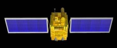


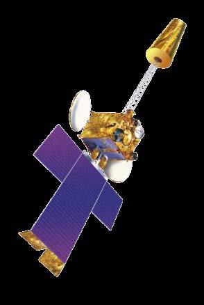


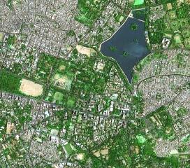
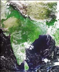

4 Earth Observation Satellites LAND & WATER HIGH RESOLUTION OCEAN WEATHER; CLIMATE RESOURCESAT-2, 2A CARTOSAT-2; 2A; 2B; 2S OCEANSAT-2 INSAT-3A RISAT-1 RISAT-2 CARTOSAT-1 SARAL SCATSAT-1 KALPANA MEGHA- TROPIQUES Cartosat-3, Oceansat-3, Resourcesat-3, RISAT, GISAT in for continuity of services and new capabilities. INSAT-3D, 3DR 1 KM IMAGING CAPABILITY 0.65 M


 GSD at Nadir: 56m (at Nadir)")
 Scene")
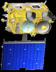
5 Resourcesat-2A Bands: Green, Red, NIR Quantization: 10 bits GSD at Nadir: 5.8m Swath: 70 km Scene Size: 70 km x 70 km LISS-4 Bands: Green, Red, NIR, SWIR Quantization: 10 bits GSD at Nadir: Across 23.5m/Along 22m Swath: 141 km Scene Size: 141 km x 141 km PSLV C36 Dec 07, 2016 LISS-3 AWiFS Two Instruments: AWiFS-A & AWiFS-B Bands: Green, Red, NIR, SWIR Quantization: 12 bits (G,R,NIR), 14 bits (SWIR) GSD at Nadir: 56m (at Nadir) Swath: 320 km (Individual), 740 km (Combined) Scene Size: 320 km x 320 km (SubScene) Scene Size: 740 km x 740 km (Combined, Full Scene)


")
 Cartosat-2")


6 20 Satellites 2 orbits One mission LAPAN-A3 Indonesia (Earth Observation) BIROS Germany (RS of High Temperature events) M3MSAT Canada (Study AIS signals from LEO) SKYSAT-Gen2-1 USA (Sub-meter resolution EO) GHGSAT-D Canada (Atm. GHG measurement) Cartosat-2 Series Sub-metre Pan & 2m MX June 22, 2016 DOVE (12 Sats.) USA (Earth Observation) SATYABAMASAT Satyabama Uni. (GHG data collection) SWAYAM College of Engineering,Pune (point to point messaging for HAM)

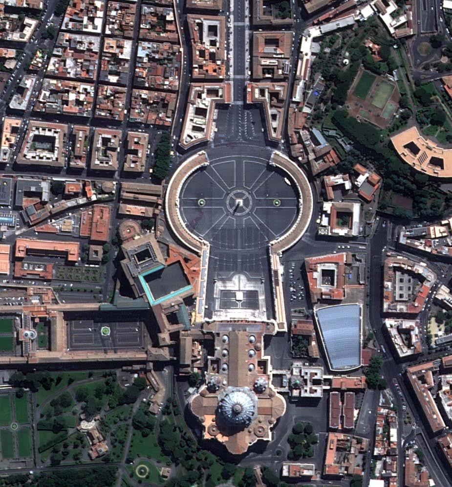
7 Vatican and Qatar in Cartosat-2 Series


8 Navigation Indian Constellation (NavIC) IRNSS-1F IRNSS-1A IRNSS-1C IRNSS-1D IRNSS-1G 55 E E 32.5 E 83 E E IRNSS-1B Vehicle Tracking and Fleet Management Maritime Services & Port Operations Railway operations Disaster Management Support Geo-tagging/Geo fencing Location based services Aid to hikers and travellers Survey Applications Infrastructure Planning Power Grid Synchronization Forest and Mining Precise Timing Mapping and Geodetic data capture Earth and Atmospheric Studies Search & Rescue Application Sectors Aviation Maritime IRNSS-1E Railways Navigation Roadways Survey
")


9 GAGAN (GPS Aided Geo Augmented Navigation) SYSTEM Jointly implemented by ISRO & Airports Authority of India Certified for en-route and landing aviation services 3 GEO Satellites 3 Uplink stations APPLICATIONS Aviation - Safety of Life, Increased efficiency Civilian - Precision Agriculture, Mining Monitoring, Transport fleet management, Maritime Navigation, Strategic Applications, Surveying,. GPS constellation 2 Control Centres 15 Reference Stations 2 Data communication networks


10 Data Reception, Processing & Archival 1980 s 2016 Data Reception 10 m Antenna L,S Bands Single Mission Antarctica Ground Station IMGEOS 7.5m antenna S, X Bands Multi-Mission Data Processing Rad. / Geo Corrected, Scene Product Terrain corrected, Value added, Global Geophysical Products No. of Products 30 products /day products /day Turn Around Time 10 days 1 hour Products Utilization 2000 products/year 1.5 lakhs products/year


11 INSAT 3DR Products Monitoring of extreme rain events Inter-satellite Calibration GSICS Tropical Cyclone monitoring & prediction


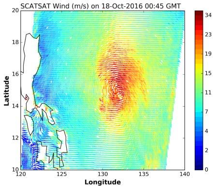
12 Scatsat-1 Products Hurricane Chaba, Near South Korea Coast (Scatsat-1: October 03, 2016 Tropical Cyclogenesis (Cyclone KYANT, BoB) TC Formation: 25 OCT 00 Z Cyclogenesis Prediction: 19 OCT 03 Z Lead Prediction time: 140 Hrs Antarctic HH Pol Arctic


13 Support to International Organisations for Disaster Management Sentinel Asia Satellite Data Support (16 supports) Capacity Building International Charter Space and Major Disasters Day-to-day Charter Activities Satellite Data Support for 22 activations in 2016 UN ESCAP Drought Monitoring Satellite Data Support SAARC STORM India, Bangladesh, Nepal and Bhutan CEOS WG Disasters Disaster Pilots MYANMAR FLOODS RISAT-1 CRS Data of 07-Aug-2016 TAIWAN OIL SPILL Workshop/Events Asia Pacific Space Leaders Forum on Nov 2, 2016 RISAT-1 CRS VV Polarisation Data of 05-Apr-2016
 Measurements Sensors for Radiation balance,")

 Continuous Recording of: Temperature, atm.")

14 Ground Observation Network Infrastructure Agro Metrological Stations (AMS) Vegetation Response to Climate and CO 2 Uptake Network of Micrometeorological (Canopy scale) Measurements Sensors for Radiation balance, Energy Balance, Water balance Carbon Flux Tower Size of current pool of carbon in vegetation & soils Quantitative estimates of C flux viz., GPP, NPP & respiration Fluxes controlled by environmental variables & vegetation types Automatic Weather Station (AWS) Continuous Recording of: Temperature, atm. pressure wind speed and direction rainfall relative humidity solar radiation Doppler Weather Radar (DWR) Continuous monitoring of extreme weather events Radar network for entire coastal areas, NE region, major cities. Atmospheric Boundary Level Network Mixed Layer Heights obtained from indigenously developed GPS Sondes Wind Profiler Doppler Lidars

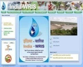

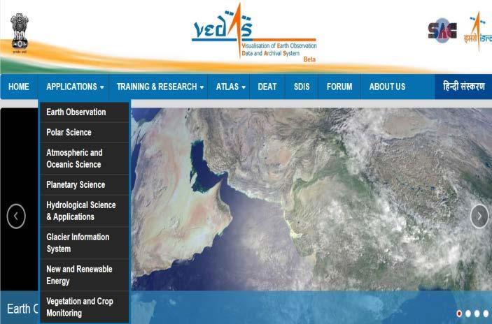
15 Bhuvan EO - Information Services MOSDAC India-Water Resources Info. System Vedas
 Mx (2m, 10 km swath, 4 Xs, 11 bit) Orbit : 500 km Local time: 0930 hrs GISAT - 1")

 Mx (1m, 16 km swath, 11 bit) Orbit : 450 km Local time: 1030 hrs Oceansat-3 & 3A Continuity")

 Orbit : 795 km Local time: 1030 hrs RS SAMPLER- 3S & 3SA High Res. Stereo imaging PAN Fore & AFT APAN: 1.")
16 EO Missions - Near Future CARTOSAT- 2D & 2E VHR Panchromatic and Multispectral Imaging PAN (0.60 m, 10 km swath, 11 bit) Mx (2m, 10 km swath, 4 Xs, 11 bit) Orbit : 500 km Local time: 0930 hrs GISAT - 1 Geosynchronous Orbit HR Mx VNIR : 50m; SWIR: 1.5 Km HYSI VNIR: 320m; WIR : 192m Orbit : km Every 30 min RISAT-1A Continuity for RISAT-1 C-Band SAR Orbit : 536 km Local time: 0600 hrs CARTOSAT-3 VHR Panchromatic, Multispectral Imaging PAN (0.25 m, 16 km swath, 11 bit) Mx (1m, 16 km swath, 11 bit) Orbit : 450 km Local time: 1030 hrs Oceansat-3 & 3A Continuity for OS-2 with Improvements 13 band OCM, IR-SST Ku-band Scatterometer, Orbit : 720 km Local time: 1200 hrs NISAR Joint Mission with JPL/NASA Payloads L & S Band SAR Orbit : 747 km Local time: 0600 hrs RESOURCESAT- 3 & 3A Continuity for Resourcesat-2A ALISS-3:10m & 12m, 925 km, 5 Bands, ATCOR: 240m, 0.4-1µm,, 10 bit) Orbit : 795 km Local time: 1030 hrs RS SAMPLER- 3S & 3SA High Res. Stereo imaging PAN Fore & AFT APAN: 1.25m, 60Km Mx: 2.5m, 60Km, 4 Bands Orbit : 630 km Local time: 1030 hrs INSAT 3DS Continuity for INSAT 3DR for improved understanding of weather systems 19 channel Sounder 6 Channel Imager Orbit : km Every 30 min
17 Expanding International Space Cooperation Nine cooperative documents with 7 nations Afghanistan, France, Japan, Russia, USA, UAE & Viet Nam Feasibility study for two joint missions (France & Japan) ARGOS in OCEANSAT-3 Satellite navigation ground stations in India and Russia RESOURCESAT-2 and Landsat 7/8 data sharing ISRO CNES Planetary Exploration JWG ISRO NASA Heliophysics Working Group ISRO-AEM Workshop on DMS Data sharing & Training in ASEAN SAARC-STORM: Ground station network


18 National Meet Promoting Space Technology Applications and Tools For Governance and Development
19 International Space Events in India
 Space Applications: Touching Human Lives Oct 23-27, 2017 New Delhi,")

20 International Space Events in India in th Asian Conference of Remote Sensing (38 th ACRS) Space Applications: Touching Human Lives Oct 23-27, 2017 New Delhi, India 24 th session of Asia-Pacific Regional Space Agency Forum (APRSAF-24) SPACE for Enhanced Governance and Development November 14-17, 2017 Bangalore, India SAVE THESE DATES
21 Other Institutional Support Activities Student Satellites RESPOND Space Science ANUSAT STUDSat 2010 SRMSat 2011 Jugnu (IITK) 2011 SathyabamaSat SWAYAM (CoEP) 2016 PRATHAM (IITM) PISAT (PES Univ.) Sponsored Research for R&D activities in Academia Demonstration of feasibility & Indigenisation STCs in IITs and IISc JRP in Univ. of Pune In : 84 projects; 62 institutes; 106 events; Rs. 24 Crores PLANEX: Planetary Science & Exploration: 18 Projects Space Science Promotion Scheme: 8 Universities Solar Terrestrial Atmospheric Research Programme Indian Astronomy Olympiad Programme by Homi Bhabha Centre for Science Education
 Affiliated to the United Nations (www.")
 1588 Professionals from 51 countries Indian Institute of Remote Sensing, Dept.")
 Professionals trained: 10,512 Foreign professionals: 983 from 95 Countries")
22 Space Educational Institutions in India Centre for Space Science and Technology Education in Asia and the Pacific (CSSTEAP) Affiliated to the United Nations ( Professionals from 51 countries Indian Institute of Remote Sensing, Dept. of Space, iirs Govt. of India Dehradun ( Professionals trained: 10,512 Foreign professionals: 983 from 95 Countries Indian Institute of Space Science and Technology, Thiruvananthapuram ( Enrolment (2016), Awarded (1003)


23 Forthcoming Missions in near future of 2017 Cartosat-2 Series GSAT-19 GSAT-9 12 Ku band Communication services SAARC Satellite GSLV-F09 GSAT-11 High Throughput Satellite - 12 Gbps capacity PSLV C37 PAN with 0.63m & MX with 2.0m GSLV MkIII-D1 Ku & Ka Band multibeam satellite GSAT-17 Communication satellite with 39 Transponders
24 Thank You
(updates from last Plenary) AS Kiran Kumar ISRO, INDIA
 AS Kiran Kumar ISRO, INDIA") ISRO s EARTH OBSERVATION SYSTEM (updates from last Plenary) AS Kiran Kumar ISRO, INDIA The 24 th CEOS Plenary Rio de Janeiro, Brazil 12 15 October, 2010 1 Four Decades of Indian Space Programme 30 LV Missions
ISRO s EARTH OBSERVATION SYSTEM (updates from last Plenary) AS Kiran Kumar ISRO, INDIA The 24 th CEOS Plenary Rio de Janeiro, Brazil 12 15 October, 2010 1 Four Decades of Indian Space Programme 30 LV Missions
ISRO s EARTH OBSERVATION SYSTEM (updates from last Plenary) AS Kiran Kumar ISRO, INDIA
 AS Kiran Kumar ISRO, INDIA") ISRO s EARTH OBSERVATION SYSTEM (updates from last Plenary) AS Kiran Kumar ISRO, INDIA The 24 th CEOS Plenary Rio de Janeiro, Brazil 12-15 October, 2010 1 Four Decades of Indian Space Programme 30LV Missions
ISRO s EARTH OBSERVATION SYSTEM (updates from last Plenary) AS Kiran Kumar ISRO, INDIA The 24 th CEOS Plenary Rio de Janeiro, Brazil 12-15 October, 2010 1 Four Decades of Indian Space Programme 30LV Missions
New Thrust in Indian Space Programme
 New Thrust in Indian Space Programme A Glance Dr. M Annadurai Director, ISRO Satellite Centre International Technical Meet on Quality Assurance Jan 2018 Vision: Harness space technology for national development
- Avenues and Requisites for Successful Collaboration - Indian Space Research Organisation Department of Space Government of India
 Strengthening Regional Resilience with Geo-Information Programme on Trans-boundary Cooperation in South and South East Asia for geospatial information - Avenues and Requisites for Successful Collaboration
Agency Report: Indian Earth Observation Programme
 Agency Report: Indian Earth Observation Programme Nitant Dube Space Applications Centre Indian Space Research Organisation Presentation to CEOS WGISS-41, Canberra Australia, March 2016 Indian EO Programme:
EO Sensors : ISRO Past, Current & Future
 EO Sensors : ISRO Past, Current & Future Vinay K Dadhwal Director National Remote Sensing Centre, ISRO, Hyderabad, INDIA International Regional Science Meeting on Land Cover and Land Use Change Dynamics
Indian Remote Sensing Satellites
 Resourcesat-1 Indian Remote Sensing Satellites -Current & Future Resourcesat Missions - Presented by: Timothy J. Puckorius Chairman & CEO EOTec 1 Presentation Topics India s Earth Observation Heritage
India recently successfully launched its PSLV-C16 rocked that carried into orbit the latest remote
 India recently successfully launched its PSLV-C16 rocked that carried into orbit the latest remote sensing satellite REsourcesat-2 that would study and help manage natural resources along with two Nano
Indian Remote Sensing Satellites
 Resourcesat-1 Cartosat-1 Indian Remote Sensing Satellites -Current & Future Missions - Presented by: Timothy J. Puckorius Chairman & CEO EOTec 1 Presentation Topics Who is EOTec India s Earth Observation
Report from ISRO. 29-Feb to 5-Mar, Pradeep Thapliyal, Munn Shukla, Ipshita Dey, Shivani Shah. Space Applications Centre (ISRO) India
 India") Report from ISRO Annual Meeting of GRWG/GDWG, JAXA, Japan 29-Feb to 5-Mar, 2016 Pradeep Thapliyal, Munn Shukla, Ipshita Dey, Shivani Shah Space Applications Centre (ISRO) India ISRO Current satellites
Report from ISRO Annual Meeting of GRWG/GDWG, JAXA, Japan 29-Feb to 5-Mar, 2016 Pradeep Thapliyal, Munn Shukla, Ipshita Dey, Shivani Shah Space Applications Centre (ISRO) India ISRO Current satellites
Report from ISRO. 19th GSICS Executive Panel, Bangalore, India, 1-2 June 2018
 Report from ISRO 19th GSICS Executive Panel, Bangalore, India, 1-2 June 2018 Raj Kumar, Pradeep K Thapliyal, Munn V Shukla (Space Applications Centre, ISRO, Ahmedabad) GSICS-EP-19, Bangalore, India, 1-2
Achievements January 2014 to January 2018
 Government of India Department of Space Indian Space Program - Highlights Achievements January 2014 to January 2018 16 February, 2018 Highlights of 4 year Achievements ISRO successfully accomplished 48
Geoinformatics. S S Jadhav Department of Geography M J College, Jalgaon Mail: Cell:
 Geoinformatics S S Jadhav Department of Geography M J College, Jalgaon Mail: sahadeoj@gmail.com Cell: 9763267396 1 Satellite Remote Sensing: What is Remote Sensing? "Remote sensing is the science (and
Geostationary satellites
 Polar satellites 800 km. 99 relative to the Equator S-N during ascending leg & N-S during descending leg Each orbit 100 minutes 14 orbits a day. Sun-Synchronous provides consistent lighting of Earth-scan
Space Technology and its Applications for National Development. V Bhanumurthy Outstanding Scientist Scientist, Associate Director, NRSC/ISRO
 Space Technology and its Applications for National Development V Bhanumurthy Outstanding Scientist Scientist, Associate Director, NRSC/ISRO GEO4SDGs THEME: GEO-KNOWLEDGE CONDUIT TO SDGs SUCCESS Geospatial
ROLE OF SATELLITE DATA APPLICATION IN CADASTRAL MAP AND DIGITIZATION OF LAND RECORDS DR.T. RAVISANKAR GROUP HEAD (LRUMG) RSAA/NRSC/ISRO /DOS HYDERABAD
 RSAA/NRSC/ISRO /DOS HYDERABAD") ROLE OF SATELLITE DATA APPLICATION IN CADASTRAL MAP AND DIGITIZATION OF LAND RECORDS DR.T. RAVISANKAR GROUP HEAD (LRUMG) RSAA/NRSC/ISRO /DOS HYDERABAD WORKSHOP on Best Practices under National Land Records
ROLE OF SATELLITE DATA APPLICATION IN CADASTRAL MAP AND DIGITIZATION OF LAND RECORDS DR.T. RAVISANKAR GROUP HEAD (LRUMG) RSAA/NRSC/ISRO /DOS HYDERABAD WORKSHOP on Best Practices under National Land Records
FUTURE TECHNOLOGICAL AND BUSINESS INNOVATIONS FOR INDIAN SPACE
 FUTURE TECHNOLOGICAL AND BUSINESS INNOVATIONS FOR INDIAN SPACE Mukund Kadursrinivas Rao (Mukund.k.rao@gmail.com) NIAS, Bengaluru INDIA 4th GSDM International Symposium Innovation, Space Technology, and
Geospatial Vision and Policies Korean Industry View 26 November, 2014 SI Imaging Services
 Geospatial Vision and Policies Korean Industry View 26 November, 2014 SI Imaging Services Distribution Limitation, SI Imaging Services Proprietary Data : The data contained in this document, without the
9/12/2011. Training Course Remote Sensing Basic Theory & Image Processing Methods September 2011
 Training Course Remote Sensing Basic Theory & Image Processing Methods 19 23 September 2011 Popular Remote Sensing Sensors & their Selection Michiel Damen (September 2011) damen@itc.nl 1 Overview Low resolution
Introduction to KOMPSAT
 Introduction to KOMPSAT September, 2016 1 CONTENTS 01 Introduction of SIIS 02 KOMPSAT Constellation 03 New : KOMPSAT-3 50 cm 04 New : KOMPSAT-3A 2 KOMPSAT Constellation KOMPSAT series National space program
Copernicus Introduction Lisbon, Portugal 13 th & 14 th February 2014
 Copernicus Introduction Lisbon, Portugal 13 th & 14 th February 2014 Contents Introduction GMES Copernicus Six thematic areas Infrastructure Space data An introduction to Remote Sensing In-situ data Applications
Intersatellite Calibration of infrared sensors onboard Indian Geostationary Satellites using LEO Hyperspectral Observations
 Updates from GSICS members and Observers Indian Space Research Organisation (ISRO) Intersatellite Calibration of infrared sensors onboard Indian Geostationary Satellites using LEO Hyperspectral Observations
Indian Regional Navigation Satellite System (IRNSS) / Navigation with Indian Constellation (NavIC) and GPS Aided Geo Augmented Navigation (GAGAN)
 / Navigation with Indian Constellation (NavIC) and GPS Aided Geo Augmented Navigation (GAGAN)") Indian Regional Navigation Satellite System (IRNSS) / Navigation with Indian Constellation (NavIC) and GPS Aided Geo Augmented Navigation (GAGAN) IRNSS-1A Gsat-8 IRNSS 7 November, 2016 Nilesh M. Desai
Indian Regional Navigation Satellite System (IRNSS) / Navigation with Indian Constellation (NavIC) and GPS Aided Geo Augmented Navigation (GAGAN) IRNSS-1A Gsat-8 IRNSS 7 November, 2016 Nilesh M. Desai
From the JUSTSAP to the PISA
 From the JUSTSAP to the PISA Osamu Odawara, Tokyo Institute of Technology Japan-US Science, Technology, and Space Application Program Pacific International Space Alliance JUSTSAP ( established in 1990
BASICS OF REMOTE SENSING
 BASICS OF REMOTE SENSING 23: Basics of Remote Sensing Shibendu Shankar Ray Mahalanobis National Crop Forecast Centre, Department of Agriculture & Cooperation, Krishi Vistar Sadan, Pusa Campus, New Delhi
Remote Sensing in Daily Life. What Is Remote Sensing?
 Remote Sensing in Daily Life What Is Remote Sensing? First time term Remote Sensing was used by Ms Evelyn L Pruitt, a geographer of US in mid 1950s. Minimal definition (not very useful): remote sensing
SPACE TECHNOLOGY INSTITUTE AND VNREDSat-1
 The First Steering Committee (FSC) of The Sentinel Asia Step 3 13-15 Oct 2015 SPACE TECHNOLOGY INSTITUTE AND VNREDSat-1 Ngo Duy Tan Deputy Director, Centre for Small Satellite Control and Exploitation,
XSAT Ground Segment at CRISP
 XSAT Ground Segment at CRISP LIEW Soo Chin Head of Research, CRISP http://www.crisp.nus.edu.sg 5 th JPTM for Sentinel Asia Step-2, 14-16 Nov 2012, Daejeon, Korea Centre for Remote Imaging, Sensing and
Drafting Committee for the Asia Pacific Plan of Action for Space Applications for Sustainable Development ( ) Republic of Korea
 Republic of Korea") Drafting Committee for the Asia Pacific Plan of Action for Space Applications for Sustainable Development (2018 2030) Republic of Korea Bangkok, Thailand 31 May 1 June 2018 김 1 KARI Introduction Government
Drafting Committee for the Asia Pacific Plan of Action for Space Applications for Sustainable Development (2018 2030) Republic of Korea Bangkok, Thailand 31 May 1 June 2018 김 1 KARI Introduction Government
NOAA Satellite and Information Service National Environmental Satellite, Data, and Information Service (NESDIS)
") NOAA Satellite and Information Service National Environmental Satellite, Data, and Information Service (NESDIS) Status of Current and Future Systems (NOAA-WP-33) Presentation to CGMS-40 November 2012;
NOAA Satellite and Information Service National Environmental Satellite, Data, and Information Service (NESDIS) Status of Current and Future Systems (NOAA-WP-33) Presentation to CGMS-40 November 2012;
Canadian Space Agency program update
 Canadian Space Agency program update Briefing to the meeting of the Expert Team on Satellite Systems (ET-SAT-11) Geneva, 4 April 2017 Guennadi Kroupnik Canadian Space Agency RADARSAT-2: CURRENT OPERATIONAL
WHAT IS NEXT IN EARTH OBSERVATION. SkyMed Mission
 WHAT IS NEXT IN EARTH OBSERVATION COSMO-SkyMed SkyMed Mission Paolo Ammendola Italian Space Agency Florence, Sept. 19, 2001 ammendola@asi asi.it THE NEEDS Market studies indicate that the value of the
EARTH OBSERVATION WITH SMALL SATELLITES
 EARTH OBSERVATION WITH SMALL SATELLITES AT THE FUCHS-GRUPPE B. Penné, C. Tobehn, M. Kassebom, H. Lübberstedt OHB-System GmbH, Universitätsallee 27-29, D-28359 Bremen, Germany www.fuchs-gruppe.com ABSTRACT
United nation, Vienna, 9-13 February 2015
 United nation, Vienna, 9-13 February 2015 RUSSIAN FEDERAL SPACE AGENCY In the Russian Federation, the federal agency in charge of space activities is the Russian Federal Space Agency (Roscosmos) Earth
Microwave Sensors Subgroup (MSSG) Report
 Report") Microwave Sensors Subgroup (MSSG) Report Feb 17-20, 2014, ESA ESRIN, Frascati, Italy DONG, Xiaolong, MSSG Chair National Space Science Center Chinese Academy of Sciences (MiRS,NSSC,CAS) Email: dongxiaolong@mirslab.cn
Microwave Sensors Subgroup (MSSG) Report Feb 17-20, 2014, ESA ESRIN, Frascati, Italy DONG, Xiaolong, MSSG Chair National Space Science Center Chinese Academy of Sciences (MiRS,NSSC,CAS) Email: dongxiaolong@mirslab.cn
(Refer Slide Time: 1:20)
") Introduction to Remote Sensing Dr. Arun K Saraf Department of Earth Sciences Indian Institute of Technology Roorkee Lecture 02 Development of Remote Sensing Technology & Advantages Hello! This is second
Introduction to Remote Sensing Dr. Arun K Saraf Department of Earth Sciences Indian Institute of Technology Roorkee Lecture 02 Development of Remote Sensing Technology & Advantages Hello! This is second
Microwave Sensors Subgroup (MSSG) Report
 Report") Microwave Sensors Subgroup (MSSG) Report CEOS WGCV-35 May 13-17, 2013, Shanghai, China DONG, Xiaolong, MSSG Chair CAS Key Laboratory of Microwave Remote Sensing National Space Science Center Chinese Academy
Microwave Sensors Subgroup (MSSG) Report CEOS WGCV-35 May 13-17, 2013, Shanghai, China DONG, Xiaolong, MSSG Chair CAS Key Laboratory of Microwave Remote Sensing National Space Science Center Chinese Academy
Lecture 6: Multispectral Earth Resource Satellites. The University at Albany Fall 2018 Geography and Planning
 Lecture 6: Multispectral Earth Resource Satellites The University at Albany Fall 2018 Geography and Planning Outline SPOT program and other moderate resolution systems High resolution satellite systems
Lecture-1 CHAPTER 2 INTRODUCTION TO GPS
 Lecture-1 CHAPTER 2 INTRODUCTION TO GPS 2.1 History of GPS GPS is a global navigation satellite system (GNSS). It is the commonly used acronym of NAVSTAR (NAVigation System with Time And Ranging) GPS (Global
44 th CGMS, Biot France. New Era, System Capacity, Global Contribution, the Vision and Future of China Space
 44 th CGMS, Biot France New Era, System Capacity, Global Contribution, the Vision and Future of China Space China National Space Administration Wang Cheng, Jun 9 2016 Three Milestones of China s Space
Hosted Payload Lessons
 Hosted Payload Lessons Carl Schueler Orbital Sciences Corporation Schueler.carl@orbital.com 805-895-8425 Poster 277a AMS 8 th Symposium on Space Weather Abstract Commercial satellites can host remote sensing
Final Examination Introduction to Remote Sensing. Time: 1.5 hrs Max. Marks: 50. Section-I (50 x 1 = 50 Marks)
") Final Examination Introduction to Remote Sensing Time: 1.5 hrs Max. Marks: 50 Note: Attempt all questions. Section-I (50 x 1 = 50 Marks) 1... is the technology of acquiring information about the Earth's
Final Examination Introduction to Remote Sensing Time: 1.5 hrs Max. Marks: 50 Note: Attempt all questions. Section-I (50 x 1 = 50 Marks) 1... is the technology of acquiring information about the Earth's
GAGAN-Extension to the Gulf Region. Joint ACAC/ICAO MID Workshop on GNSS 7 th & 8 th November 2017
 GAGAN-Extension to the Gulf Region Joint ACAC/ICAO MID Workshop on GNSS 7 th & 8 th November 2017 P.N.S. KUSHWAHA EXECUTIVE DIRECTOR (CNS P) Airports Authority of India New Delhi Topics covered : 1. GAGAN
Futrajaya, Malaysia JULY 12, Jeong Heon SONG. Korea Aerospace Research Institution
 J P T M 2 0 1 1 Futrajaya, Malaysia JULY 12, 2011 Jeong Heon SONG Korea Aerospace Research Institution Outline Contribution of KARI Sentinel Asia / Data Provider Node International Charter KARI Space Activities
Lessons, challenges & innovations: Indian Case studies EO data research to use
 Lessons, challenges & innovations: Indian Case studies EO data research to use Vinay K Dadhwal Director Indian Institute of Space Science & Technology Scaling-up Innovations for Solution Enablement (Commercialisation
Operational Space-Based Imaging Systems
 Operational Space-Based Imaging Systems R E M O T E S E N S I N G & G E O S PAT I A L A N A LY S I S L A B D O I : 2 0 A U G U S T, 2 0 1 6 Earth Observation Systems U.S. or foreign government systems
General Assembly. United Nations A/AC.105/C.1/L.335/Add.4. Draft report
 United Nations General Assembly Distr.: Limited 20 February 2014 Original: English Committee on the Peaceful Uses of Outer Space Scientific and Technical Subcommittee Fifty-first session Vienna, 10-21
Remote sensing radio applications/ systems for environmental monitoring
 Remote sensing radio applications/ systems for environmental monitoring Alexandre VASSILIEV ITU Radiocommunication Bureau phone: +41 22 7305924 e-mail: alexandre.vassiliev@itu.int 1 Source: European Space
New Technologies for Future EO Instrumentation Mick Johnson
 New Technologies for Future EO Instrumentation Mick Johnson Director of CEOI Monitoring the Earth from Space What data do EO satellites provide? Earth Observation science Operational services Weather,
GAGAN Initiatives Jan 18, 2018
 GAGAN Initiatives Jan 18, 2018 Topics covered 1. Brief profile of GAGAN 2. Features / Accuracy of GAGAN System 3. GAGAN Architecture 4. GAGAN services and Coverage 5. GAGAN utilization in aviation sector
The Global Imager (GLI)
") The Global Imager (GLI) Launch : Dec.14, 2002 Initial check out : to Apr.14, 2003 (~L+4) First image: Jan.25, 2003 Second image: Feb.6 and 7, 2003 Calibration and validation : to Dec.14, 2003(~L+4) for
The Global Imager (GLI) Launch : Dec.14, 2002 Initial check out : to Apr.14, 2003 (~L+4) First image: Jan.25, 2003 Second image: Feb.6 and 7, 2003 Calibration and validation : to Dec.14, 2003(~L+4) for
INDIAN PAYLOAD CAPABILITIES FOR SPACE MISSIONS
 5 th International ASTROD Symposium, July 11-13, Bangalore INDIAN PAYLOAD CAPABILITIES FOR SPACE MISSIONS A.S. Kiran Kumar Director Space Applications Centre Ahmedabad Application-specific EO payloads
EnMAP Environmental Mapping and Analysis Program
 EnMAP Environmental Mapping and Analysis Program www.enmap.org Mathias Schneider Mission Objectives Regular provision of high-quality calibrated hyperspectral data Precise measurement of ecosystem parameters
NON-PHOTOGRAPHIC SYSTEMS: Multispectral Scanners Medium and coarse resolution sensor comparisons: Landsat, SPOT, AVHRR and MODIS
 NON-PHOTOGRAPHIC SYSTEMS: Multispectral Scanners Medium and coarse resolution sensor comparisons: Landsat, SPOT, AVHRR and MODIS CLASSIFICATION OF NONPHOTOGRAPHIC REMOTE SENSORS PASSIVE ACTIVE DIGITAL
Sensor Technologies and Sensor Materials for Small Satellite Missions related to Disaster Management CANEUS Indo-US Cooperation
 Sensor Technologies and Sensor Materials for Small Satellite Missions related to Disaster Management CANEUS Indo-US Cooperation Suraj Rawal, Lockheed Martin Space Systems Co., USA G. Mohan Rao, Indian
Nigerian Communications Satellite Ltd. (NIGCOMSAT)
") OVERVIEW OF NIGERIAN SATELLITE AUGMENTATION SYSTEM COMMENCING WITH PILOT DEMONSTRATION TO VALIDATE NATIONAL WORK PLAN presented by Dr. Lawal Lasisi Salami, NIGERIAN COMMUNICATIONS SATELLITE LTD UNDER FEDERAL
OVERVIEW OF NIGERIAN SATELLITE AUGMENTATION SYSTEM COMMENCING WITH PILOT DEMONSTRATION TO VALIDATE NATIONAL WORK PLAN presented by Dr. Lawal Lasisi Salami, NIGERIAN COMMUNICATIONS SATELLITE LTD UNDER FEDERAL
SAR Interferometry Capabilities of Canada's planned SAR Satellite Constellation
 SAR Interferometry Capabilities of Canada's planned SAR Satellite Constellation Dirk Geudtner, Guy Séguin,, Ralph Girard Canadian Space Agency RADARSAT Follow-on Program CSA is in the middle of a Phase
Aral Sea profile Selection of area 24 February April May 1998
 250 km Aral Sea profile 1960 1960 1985 1986 1987 1988 1989 1990 1991 1992 1993 1994 1995 1996 1997 1998 2010? Selection of area Area of interest Kzyl-Orda Dried seabed 185 km Syrdarya river Aral Sea Salt
National SPace Organization
 National SPace Organization A center of innovation and excellence for space technology Bo Chen National Space Organization Presented at JPTM 2014, Sentinel Asia Yangon, Myanmar, 11/19-21 NARLabs-NSPO About
Indian GNSS Industry Overview Challenges and future prospects
 Indian GNSS Industry Overview Challenges and future prospects Expert Presentation By Dr. S.V. Kibe Consultant, SATCOM & GNSS, Bangalore, India (Former Programme Director, SATNAV,ISRO HQ) On February 20,2013
NASA Missions and Products: Update. Garik Gutman, LCLUC Program Manager NASA Headquarters Washington, DC
 NASA Missions and Products: Update Garik Gutman, LCLUC Program Manager NASA Headquarters Washington, DC 1 JPSS-2 (NOAA) SLI-TBD Formulation in 2015 RBI OMPS-Limb [[TSIS-2]] [[TCTE]] Land Monitoring at
FORMOSAT-2 FOR INTERNATIONAL SOCIETAL BENEFITS
 FORMOSAT-2 FOR INTERNATIONAL SOCIETAL BENEFITS Ming-Chih Cheng 1, Celine Zhang 2 1 Researcher, 2 Research Assistant National Space Organization ABSTRACT The Group on Earth Observations (GEO), established
Sub-Mesoscale Imaging of the Ionosphere with SMAP
 Sub-Mesoscale Imaging of the Ionosphere with SMAP Tony Freeman Xiaoqing Pi Xiaoyan Zhou CEOS Workshop, ASF, Fairbanks, Alaska, December 2009 1 Soil Moisture Active-Passive (SMAP) Overview Baseline Mission
CNES PRIORITIES IN POLAR AND CRYOSPHERE RESEARCH
 Polar Space Task Group 3rd Session CNES PRIORITIES IN POLAR AND CRYOSPHERE RESEARCH Juliette Lambin, Steven Hosford Wednesday, May 22th, 2013 Paris, France 1 OUTLINE CNES MISSIONS FOR POLAR/CRYOSPHERE
Indian Regional Navigation Satellite System (IRNSS)
") Indian Regional Navigation Satellite System (IRNSS) Presentation By Mr. K.N.Suryanarayana Rao Project Director, IRNSS ISRO Satellite Centre, Airport Road, Bangalore. IRNSS IRNSS Refers to Indian Regional
Indian Regional Navigation Satellite System (IRNSS) Presentation By Mr. K.N.Suryanarayana Rao Project Director, IRNSS ISRO Satellite Centre, Airport Road, Bangalore. IRNSS IRNSS Refers to Indian Regional
Results of Implementation of National Strategy for Research and Application of Space Technology up to 2020 ( )
") Results of Implementation of National Strategy for Research and Application of Space Technology up to 2020 (2016-2017) Dao Ngoc Chien, Ph.D Deputy Director-General Department of High Technologies, Ministry
Results of Implementation of National Strategy for Research and Application of Space Technology up to 2020 (2016-2017) Dao Ngoc Chien, Ph.D Deputy Director-General Department of High Technologies, Ministry
PLANET: IMAGING THE EARTH EVERY DAY
 PLANET: IMAGING THE EARTH EVERY DAY Benjamin Trigona-Harany Mailiao Refinery, Taiwan May 31, 2016 To image the whole world every day, making change visible, accessible and actionable. HONG KONG January
SAR missions for oceanography at the European Space Agency
 SAR missions for oceanography at the European Space Agency ERS-1, ERS-2, Envisat, Sentinel-1A, Sentinel-1B, ESA 3 rd Party Missions (ALOS) Prepared by ESA teams and ESA supporting companies ESA and SAR
Fundamentals of Remote Sensing
 Climate Variability, Hydrology, and Flooding Fundamentals of Remote Sensing May 19-22, 2015 GEO-Latin American & Caribbean Water Cycle Capacity Building Workshop Cartagena, Colombia 1 Objective To provide
RADARSAT-2 Program Update Daniel De Lisle Canadian Space Agency
 RADARSAT-2 Program Update Daniel De Lisle Canadian Space Agency Presentation outline RADARSAT-1 Update RADARSAT-2 Mission description Mission Objectives System Characteristics Data Commercialization/Allocation
Active and Passive Microwave Remote Sensing
 Active and Passive Microwave Remote Sensing Passive remote sensing system record EMR that was reflected (e.g., blue, green, red, and near IR) or emitted (e.g., thermal IR) from the surface of the Earth.
Big picture with KOMPSAT KOMPSAT-3A / KOMPSAT-3 / KOMPSAT-5 / KOMPSAT-2
 Big picture with KOMPSAT KOMPSAT-3A / KOMPSAT-3 / KOMPSAT-5 / KOMPSAT-2 Big picture with KOMPSAT Introduction SI Imaging Services (SIIS) is the exclusive worldwide marketing and sales representative of
Role of Landsat in Revolutionizing the Management of Natural Resources. Prof. UR Rao Former Chairman, ISRO, India
 Role of Landsat in Revolutionizing the Management of Natural Resources Prof. UR Rao Former Chairman, ISRO, India 40 Years of Landsat, June 6, 2012 Evolution of Remote Sensing Satellites TIROS Aerial Survey
The use of satellite images to forecast agricultural
 The use of satellite images to forecast agricultural Luxembourg, 12.03.2014 r. Tomasz Milewski NUTS for Poland: NUTS 1 macro-regions (grup of province, voivodships) (6), NUTS 2 - regions (province,
Status of Sentinel-1 and acquisition plans for GFOI
 Status of Sentinel-1 and acquisition plans for GFOI Frank Martin Seifert, Pierre Potin, Johannes Roeder, ESA Earth Observation Programme 5 th Space Data Coordination, ESRIN, Frascati, 24 February 2014
Introduction to Radar
 National Aeronautics and Space Administration ARSET Applied Remote Sensing Training http://arset.gsfc.nasa.gov @NASAARSET Introduction to Radar Jul. 16, 2016 www.nasa.gov Objective The objective of this
Pierre TABARY Programme Manager for Atmosphere, Meteorology and Climate CNES, Directorate for Innovation, Applications, Science
 CNES Earth Observation Activities Pierre TABARY Programme Manager for Atmosphere, Meteorology and Climate CNES, Directorate for Innovation, Applications, Science 28th of March, 2017 ADM-Aeolus CAL/VAL
Dr. P Shanmugam. Associate Professor Department of Ocean Engineering Indian Institute of Technology (IIT) Madras INDIA
 Madras INDIA") Dr. P Shanmugam Associate Professor Department of Ocean Engineering Indian Institute of Technology (IIT) Madras INDIA Biography Ph.D (Remote Sensing and Image Processing for Coastal Studies) - Anna University,
Dr. P Shanmugam Associate Professor Department of Ocean Engineering Indian Institute of Technology (IIT) Madras INDIA Biography Ph.D (Remote Sensing and Image Processing for Coastal Studies) - Anna University,
WOMEN POWER IN SPACE SCIENCE
 WOMEN POWER IN SPACE SCIENCE Dr. (Mrs. ) Geetha Ramkumar Space Physics Laboratory Vikram Sarabhai Space Centre ISRO, Trivandrum geetha_ramkumar@vssc.gov.in Organisation of presentation About DOS Women
The 21st Session of the Asia-Pacific Regional Space Agency Forum (APRSAF): Dawn of a New Decade
: Dawn of a New Decade") The 21st Session of the Asia-Pacific Regional Space Agency Forum (APRSAF): Dawn of a New Decade 52 nd Session of Scientific and Technical Subcommittee Kazuhiro MIYAZAKI Office for Space Utilization Promotion,
The 21st Session of the Asia-Pacific Regional Space Agency Forum (APRSAF): Dawn of a New Decade 52 nd Session of Scientific and Technical Subcommittee Kazuhiro MIYAZAKI Office for Space Utilization Promotion,
Vega Market Opportunities
 Vega Market Opportunities Workshop on VV02 Success ASI, Rome - Contents Space Applications Applications & Launcher Performance Vega Market Mostly Earth Observation Earth Observation Segment Launch Service
Advanced Optical Satellite (ALOS-3) Overviews
 Overviews") K&C Science Team meeting #24 Tokyo, Japan, January 29-31, 2018 Advanced Optical Satellite (ALOS-3) Overviews January 30, 2018 Takeo Tadono 1, Hidenori Watarai 1, Ayano Oka 1, Yousei Mizukami 1, Junichi
K&C Science Team meeting #24 Tokyo, Japan, January 29-31, 2018 Advanced Optical Satellite (ALOS-3) Overviews January 30, 2018 Takeo Tadono 1, Hidenori Watarai 1, Ayano Oka 1, Yousei Mizukami 1, Junichi
The studies began when the Tiros satellites (1960) provided man s first synoptic view of the Earth s weather systems.
 provided man s first synoptic view of the Earth s weather systems.") Remote sensing of the Earth from orbital altitudes was recognized in the mid-1960 s as a potential technique for obtaining information important for the effective use and conservation of natural resources.
Remote sensing of the Earth from orbital altitudes was recognized in the mid-1960 s as a potential technique for obtaining information important for the effective use and conservation of natural resources.
Update on Landsat Program and Landsat Data Continuity Mission
 Update on Landsat Program and Landsat Data Continuity Mission Dr. Jeffrey Masek LDCM Deputy Project Scientist NASA GSFC, Code 923 November 21, 2002 Draft LDCM Implementation Phase RFP Overview Page 1 Celebrate!
International Committee on Global Navigation Satellite Systems (ICG): Building a System of Systems
: Building a System of Systems") International Committee on Global Navigation Satellite Systems (ICG): Building a System of Systems Outline of Presentation Executive Secretariat of the ICG United Nations Office for Outer Space Affairs
International Committee on Global Navigation Satellite Systems (ICG): Building a System of Systems Outline of Presentation Executive Secretariat of the ICG United Nations Office for Outer Space Affairs
FREQUENCY DECLARATION FOR THE ARGOS-4 SYSTEM. NOAA-WP-40 presents a summary of frequency declarations for the Argos-4 system.
 Prepared by CNES Agenda Item: I/1 Discussed in WG1 FREQUENCY DECLARATION FOR THE ARGOS-4 SYSTEM NOAA-WP-40 presents a summary of frequency declarations for the Argos-4 system. FREQUENCY DECLARATION FOR
Presentation to the UN COPUOS STSC LTSSA Workshop. ISO Space Standards. 14 February 2013
 Presentation to the UN COPUOS STSC LTSSA Workshop ISO Space Standards 14 February 2013 by Frederick A. Slane Head, U.S. Delegation ISO TC20/SC14 Executive Director Space Infrastructure Foundation Purpose
2017 REMOTE SENSING EVENT TRAINING STRATEGIES 2016 SCIENCE OLYMPIAD COACHING ACADEMY CENTERVILLE, OH
 2017 REMOTE SENSING EVENT TRAINING STRATEGIES 2016 SCIENCE OLYMPIAD COACHING ACADEMY CENTERVILLE, OH This presentation was prepared using draft rules. There may be some changes in the final copy of the
KOMPSAT Constellation. November 2012 Satrec Initiative
 KOMPSAT Constellation November 2012 Satrec Initiative KOMPSAT Constellation KOMPSAT National program Developed and operated by KARI (Korea Aerospace Research Institute) Dual use : Government & commercial
Current and Future Meteorological Satellite Program of China
 Current and Future Meteorological Satellite Program of China ZHANG Wenjian, DONG Chaohua XU Jianmin, YANG Jun China Meteorological Administration May 30, 2005 Beijing, CHINA Outline of the Presentation
EVALUATION OF PLEIADES-1A TRIPLET ON TRENTO TESTFIELD
 EVALUATION OF PLEIADES-1A TRIPLET ON TRENTO TESTFIELD D. Poli a, F. Remondino b, E. Angiuli c, G. Agugiaro b a Terra Messflug GmbH, Austria b 3D Optical Metrology Unit, Fondazione Bruno Kessler, Trento,
INTERNATIONAL JOURNAL OF PURE AND APPLIED RESEARCH IN ENGINEERING AND TECHNOLOGY
 INTERNATIONAL JOURNAL OF PURE AND APPLIED RESEARCH IN ENGINEERING AND TECHNOLOGY A PATH FOR HORIZING YOUR INNOVATIVE WORK SATELLITE COMMUNICATION AND ITS APPLICATIONS SHEETAL RAJPUT Dept. of Computer Science
Application of Satellite Remote Sensing for Natural Disasters Observation
 Application of Satellite Remote Sensing for Natural Disasters Observation Prof. Krištof Oštir, Ph.D. University of Ljubljana Faculty of Civil and Geodetic Engineering Outline Earth observation current
Integration and Test of the Microwave Radiometer Technology Acceleration (MiRaTA) CubeSat
 CubeSat") Integration and Test of the Microwave Radiometer Technology Acceleration (MiRaTA) CubeSat Kerri Cahoy, Gregory Allan, Ayesha Hein, Andrew Kennedy, Zachary Lee, Erin Main, Weston Marlow, Thomas Murphy MIT
Integration and Test of the Microwave Radiometer Technology Acceleration (MiRaTA) CubeSat Kerri Cahoy, Gregory Allan, Ayesha Hein, Andrew Kennedy, Zachary Lee, Erin Main, Weston Marlow, Thomas Murphy MIT
Initial Results of IRNSS Standalone and Hybrid Operations
 Initial Results of IRNSS Standalone and Hybrid Operations Anindya Bose Sujoy Mandal, Kousik Samanta, (Ms) Debipriya Dutta, Suvro Kundu, Atanu Santra Department of Physics, The University of Burdwan, India
IKONOS High Resolution Multispectral Scanner Sensor Characteristics
 High Spatial Resolution and Hyperspectral Scanners IKONOS High Resolution Multispectral Scanner Sensor Characteristics Launch Date View Angle Orbit 24 September 1999 Vandenberg Air Force Base, California,
Overview on Data Collection systems: case of low orbiting satellites
 ITU Seminar for Americas Region Overview on Data Collection systems: case of low orbiting satellites Jean PLA, Frequency Management CNES, Toulouse, FRANCE jean.pla@cnes.fr Michel SARTHOU, ARGOS project
REPORT ON THE STATUS OF CURRENT AND FUTURE RUSSIAN SATELLITE SYSTEMS
 Prepared by ROSH/ROSC Agenda Item: Session D Discussed in Plenary REPORT ON THE STATUS OF CURRENT AND FUTURE RUSSIAN SATELLITE SYSTEMS This document addresses the current status of the satellite systems:
CSA Report on Earth Observation
 CSA Report on Earth Observation Dr. Satish K. Srivastava WGCV Chair & CSA Member of WGCV Canadian Space Agency Presented at College Park, MD, USA Sep 30 th to Oct 2 nd, 2014 RADARSAT-2 Spacecraft Health
Sensor resolutions from space: the tension between temporal, spectral, spatial and swath. David Bruce UniSA and ISU
 Sensor resolutions from space: the tension between temporal, spectral, spatial and swath David Bruce UniSA and ISU 1 Presentation aims 1. Briefly summarize the different types of satellite image resolutions