INDIAN PAYLOAD CAPABILITIES FOR SPACE MISSIONS
|
|
|
- Geraldine Flynn
- 5 years ago
- Views:
Transcription


1 5 th International ASTROD Symposium, July 11-13, Bangalore INDIAN PAYLOAD CAPABILITIES FOR SPACE MISSIONS A.S. Kiran Kumar Director Space Applications Centre Ahmedabad
 LISS 3/ LISS 4 AWiFS RESOURCESAT-2 (2011) LISS 3/")
 PAN TES(2001) Step& Stare PAN")
 LiV HySI/RaBIT KALPANA-1")
2 Application-specific EO payloads (Operational) IMS-1(2008) MX/ HySI-T RESOURCESAT-1 (2003) LISS 3/ LISS 4 AWiFS RESOURCESAT-2 (2011) LISS 3/ LISS 4/AWiFS RISAT-1 (2012) C-band SAR CARTOSAT-1 (2005) CARTOSAT-2/2A/2B (2007/2009/2010) PAN TES(2001) Step& Stare PAN OCEANSAT-2 (2009) OCM/ SCAT/ROSA STEREOPAN Megha-Tropiques (2011) MADRAS/SAPHIR/ScARaB/ ROSA YOUTHSAT(2011) LiV HySI/RaBIT KALPANA-1 (2002) VHRR INSAT-3A (2003) VHRR, CCD


3 Application-specific EO payloads (Planned) GISAT MXVNIR/SWIR/TIR/HySI RESOURCESAT-3A/3B/3C LISS 3/LISS 4/AWiFS RESOURCESAT-3 LISS 3/LISS 4/ AWiFS RESOURCESAT-2A LISS3/LISS4/AWiFS RISAT-1R C-band SAR RISAT-3 L-band SAR CARTOSAT-3 PAN CARTOSAT-2C/2D PAN SARAL Altimeter/ARGOS OCEANSAT-3 OCM, TIR GISAT MXVNIR/SWIR/ TIR/HySI INSAT- 3D Imager/Sounder

4 EARTH OBSERVATION (LAND AND WATER) RESOURCESAT-1 IMS-1 RESOURCESAT-2 RISAT-1 RESOURCESAT-2A RISAT-3 RISAT-1R RESOURCESAT-3A/3B/3C RESOURCESAT-3 GISAT


5 EARTH OBSERVATION (CARTOGRAPHY) TES CARTOSAT-1 CARTOSAT-2/2A/2B RISAT-1 CARTOSAT-2C/2D RISAT-3 RISAT-1R CARTOSAT-3

")


6 EARTH OBSERVATION (ATMOSPHERE & OCEAN) KALPANA-1 INSAT- 3A OCEANSAT-1 INSAT-3D OCEANSAT-2 YOUTHSAT GISAT OCEANSAT-3 SARAL MEGHA TROPIQUES


7
8 Current observation capabilities : Optical Payload Sensors in operation Spatial Res. Swath/ Coverage (km) Radiometry Spectral bands Repetivity/ revisit CCD 1 1 Km India & surround. VHRR 2 2 km VIS 8 km WV/IR 10 bits 3 (B3, B4, B5) 4 times/ day Earth Disc 10 bits 3 Every ½ hrs HySI/ IMS m bits days OCM m bits 8 2 days AWiFS 2 56 m /12 bits 4(B2,B3, B4, B5) 5 / 2.5 days MX/ IMS 1 37 m bits 4(B1, B2,B3, B4) 24 days LISS m 140 7/10 bits 4(B2,B3, B4, B5) 24/12 days LISS m 23/70 7/10 bits 3(B2,B3, B4) 40/ 5 days PAN (stereo) m bits days PAN (mono) 4 0.8/ 1 m 10 / bits 1 5 day revisit
9 Current observation capabilities : Microwave Payload Spatial Res. Swath km Radiometry Frequency Repetivity/revisit Scatterometer 50 Km bits Ku band 2 days SAR-X 1m to 8m 10 to bits X 2days SAR-C 1m to 50m 10 to bits C 25/7days Payload Spatial Res. Swath Frequency bands MADRAS 6km to 40 km (18.7 to 157GHz) SAPHIR 10 km 1700 GHz Repetivity/revisit Multiple observations per day ScARaB 40 km ROSA L1,L2 ~600 occultaions per day


10 Indian Imaging Capabilities - from Kilometer to sub-meter < 1m PAN CARTO-2 2.5m PAN CARTO-1 5.8m LISS-4 23m LISS-3 1 Km BHASKARA TV PAYLOAD 56m AWiFS 36m LISS-2 73m LISS-1 188m WiFS 360m 1 Km BHASKARA TV PAYLOAD 1km INSAT-CCD OCM < 1m CARTOSAT-2 PAN


11 Imaging Sensor for Earth Observation Cartographic applications IRS-PAN 5.8 m TES-PAN 1 m Cartosat 1 PAN 2.5 m Cartosat 2 PAN 0.8 m

")
12 CARTOSAT-2C/2D ORBIT PAYLOADS 500km POLAR SSO HIGH-RESOLUTION PANCHROMATIC (PAN) HIGH-RESOLUTION MULTI-SPECTRAL (MX) PAN PAYLOAD FEATURES Spectral bands PAN: µm Resolution 0.64m Swath 10Km Quantization 11 bits SWR >10% SNR >180 MX PAYLOAD FEATURES Spectral bands VIS1: µm VIS2: µm VIS3 : µm VIS4 : µm Resolution 1.6m Swath 10Km Quantization 11 bits SWR >20% SNR >500 TELESCOPE FOCAL PLANE Compact focal plane providing continuous imaging line (16000 pixels) Time-delay-and-integration (TDI) CCD based detection system CAMERA ELECTRONICS


13 CARTOSAT-3 series Cartosat-3 series (3, 3A, 3B) 0.25m GSD PAN, 1m Mx and~5m MWIR 16km swath TDI CCD based imager Can provide Square kilometer data per orbit 6400 sq km imaging per orbit m GSD PAN 0.5 m, 4 band MX 5 m MIR or 30m VNIR+ SWIR HySI CONTINUOUS IMAGING Mx PAN MIR 1690 Optical Butting Test bench HexaPod Mirror light-weighted 420 to 70 kg High speed FECE


14 Indian Mini-Satellite 4 Band, 36m GSD with a swath of ~ 140 Km Mx-Imager HySI Image Cube Jalgaon Area, 03-Jun bands; nm range; Spectral separation 8 nm; Spatial Res. 500 m; Swath km Crop Classification using HySI Data FCC with Classes HySI Payload


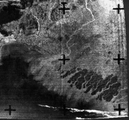
15 RISAT-1 C-band SAR Single/dual/quad polarisation Imaging with 1-50m resolution km SWATH

16

17 Radar Imaging Satellite (RISAT-1R) Swath: (in Km) Resolution: =50 ( m) C-band SAR with active-antenna Electronic beam steering Single/dual/quad polarization Multi Resolution Multi Swath Multi-Polarization Scan-SAR Strip-Map Spot-Light -Pitch Near-Swath Far-Swath ScanSAR 536kms +Pitch StripMap Spot Mode: = 1 m, σ o = -16dB Stripmap Mode: 3-6 m, σ o = -17dB 107 kms 659 kms Spotlight ScanSAR Mode1: 25 m, σ o = -17dB ScanSAR Mode2: 50 m, σ o = -17dB


18 INSAT-3D Met. Payloads 6 channel Imager 19 channel Sounder Visible to Thermal IR 1KM to 8KM IGFOV Half hourly earth coverage Flexible scanning modes Programmable number of lines and frame repeats Improved Blackbody calibration scheme Image motion & mirror motion compensation Visible to Lon. Wave IR Fully programmable East-West and North South Scan pattern Programmable dwell time for East-West scan step motion Automatic space view every 2 min and Blackbody view every 30min. 10KM IGFOV, 14bits digitization Image motion & Mirror motion compensation
 VIS (SNR>150) Spectral Band (µm)")
 1.55-1.70 1 km 19 MIR (1.4K) WV (1.")


19 6 Channel Imager Visible SWIR MIR WVP TIR-1 24 TIR-2 Channel (NE VIS (SNR>150) Spectral Band (µm) Spatial Resolution at Nadir (km) km SWIR (SNR>150) km 19 MIR (1.4K) WV (1.0K@230K) km km Scan Modes: Normal: Full Earth Disk, 18 x18 in 24 x19 FOR (<27min) Programme: No. of Scan lines and No. of Image repeats programmable. Can be placed anywhere in FOR TIR-1 (0.35K) TIR-2 (0.35K) km km


20 19 Channel Sounder VIS um SWIR 6Ch MWIR 5Ch LWIR 7Ch um um um Sounder Modes: Programmable Sounding Area: Programmable Space view Direction selection Selection of Dwell time on each scene: 0.1, 0.2 or 0.4s Minimum: 1 x 1 (640x640KM) in 1.7min, anywhere in FOR of 24 x19 Maximum: 15 x 15 (9600KMx9600KM) in ~400min, anywhere in FOR 24 19

 ScaRAB: Outgoing fluxes at TOA Four Channel Earth Radiation")


21 Megha-Tropiques (ISRO-CNES Collaboration) Studying water cycle and energy exchanges in Tropical-belt MADRAS: Precipitation and cloud properties Total-power radiometer with Conical scanning 5 frequencies (18.7GHz 157GHz) ScaRAB: Outgoing fluxes at TOA Four Channel Earth Radiation budget at μm, μm, μm & μm Resolution: 40 Km, Swath: 2242 Km SAPHIR: Water vapour profile mmw HSU at 183 GHz, 6-Ch Sounder Brightness-Temperature 4K-313K Resolution: 10 km & Swath: 1705 km ROSA: GPS based Two Frequency Receivers L1 ( MHz) & L2 ( MHz) SAPHIR SCARAB ROSA


 A dual frequency radiometer ( 24 / 37 GHz) A common antenna shared by Altimeter & Radiometer (1 meter")
22 SARAL: Satellite for Argos and Altika To provide altimetric measurements designed to study ocean circulation and sea surface elevation. Marine meteorology and sea state forecasting, operational oceanography, seasonal forecasting, climate monitoring and climate research. Argos Satellite based system collects environmental data from autonomous platforms Altika A Ka Band altimeter ( GHz) A dual frequency radiometer ( 24 / 37 GHz) A common antenna shared by Altimeter & Radiometer (1 meter dia) LRA (Laser Retro - Reflector Array) DORIS instrument (Doppler Orbitography & Radio positioning Integrated by Satellite) Envisat Alti. Range Data Altimeter σ 0 Data Envisat Altimeter SWH Data


 Sub continent")
23 GISAT High Resolution Imaging Sensors on GEO Platform High resolution Multi-spectral VNIR Ground Resolution : 50 meters Hyper-spectral VNIR Ground Resolution : 500 meters Hyper-spectral SWIR Ground Resolution : 500 meters Multi-channel IR Ground Resolution : 1500 meters Scanning Modes: Full globe (18x18 deg) Sub continent (10x12 deg) User defined area scanning

24 PLANETARY/SPACE EXPLORATION CHANDRAYAAN-1 CHANDRAYAAN-2 ADITYA ASTROSAT MARS MISSION


25 Chandrayaan-1 Guidance & Control System Payloads Lunar Insertion Manoeuvre Final Orbit 100 km Polar Laser Ranging ETO Lunar Transfer Trajectory Initial Orbit ~ 1000 km GTO Terrain Mapper Trans Lunar Injection Altimeter Star Trackers Mid Course Correction Moon at Launch Moon Impact Probe Sun Sensors Accelerometer Hyper Spectral Imager Gyroscope Pressure & Temp Sensors


26 TMC images of Chandrayaan-1 Lunar Impact Craters Dark Haloed crater Ray Crater


27 Lunar Mineralogy : HySI data 20 km Mare Orientale is one of the youngest basin on the Moon surface. Location of Mare Orientale is shown as red dot on extreme left Lunar composite image Nov The HySI image from Chandrayaan-1 data represent sixty four colour of Lunar surface. The reflectance curves generated from HySI data helps us to identify highland and basaltic rocks on Moon. Detection of Lunar rock types using HySI reflectance data Plagioclase 2. Iron bearing minerals on Basaltic terrain 3. Highland soils 4. Iron rich rocks on Highland terrain 5. Mare soils

28 Chandrayaan-2 Mission GSLV launch with a weight of ~2,650 kg Orbiter & Lander Indian Rover Orbiter Payloads - Soft X-ray spectrometer - L & S band mini SAR - Imaging IR spectrometer - Neutral mass spectrometer - Terrain Mapping Camera Rover Payloads - Laser Induced Breakdown spectroscopy - Alpha particle induced X-ray spectroscopy
 Camera Head (each) Processing Electronics (for 2 Camera head) Regulated Power (W) 500 mw 800 mw Size (mm x mm) 40 X 40 X 20 100")
 Fore Optics telescope Three mirror Slit Convex")

29 Terrain Mapping Camera-2 (TMC-2) Chandrayaan-2 Electro-Optical Payloads Micro Camera - Event Monitoring Camera - Rover Arm Camera (RAC) Camera Head (each) Processing Electronics (for 2 Camera head) Regulated Power (W) 500 mw 800 mw Size (mm x mm) 40 X 40 X X 100 X 30 Weight (g) <30 <300 Camera weight 4 Kg FOV 1 along track 6.5 across track Imaging views: +25, 0, -25 Size table Imaging IR Spectrometer (IIRS) Fore Optics telescope Three mirror Slit Convex grating Detector Spectrometer 200 mm Direction EOM Elect. Pkg. YAW 260 mm 192 mm PITCH 200 mm 35 mm ROLL 345 mm 172 mm GIFOV Swath 80m 40km Spectral Range µm Spectral Resolution <20 nm 250 mm Footprint: 10 m X 10 m Along-track sampling: 5 m Swath : 40km Max. spectral bands 256 Regulated Power Weight 7W + Detector cooler power 6.5kg


30 ADITYA A Space based Advanced Solar Coronagraph to study solar Corona in Visible and NIR wavelengths Observe Oscillations of coronal structures Polarization of light: Study of magnetic field Detect start of coronal mass ejection inputs for Space-Weather

 Soft X-Ray Telescope (SXT) Ultraviolet Imaging Telescope (UVIT) Scanning Sky Monitor (SSM) SXT UVIT LAXPC")
31 ASTROSAT versatile space based observatory India s first dedicated multi-wavelength astronomy satellite with a capability to observe target sources in wide spectral coverage extending over visible, ultraviolet, soft x-ray and hard x-ray regions with coaligned instruments simultaneously Large Area X-ray Proportional Counters (LAXPCs) Cadmium zinc Telluride Imager (CZTI) Soft X-Ray Telescope (SXT) Ultraviolet Imaging Telescope (UVIT) Scanning Sky Monitor (SSM) SXT UVIT LAXPC CZTI SSM


32 REFRACTIVE OPTICAL SYSTEMS Double Gauss FOV <40 EFL < 0.7m Telecentric FOV < 90 EFL:very small focal lengths~25mm ALL REFLECTIVE Cassegrain FOV < 3 EFL:Large focal length~15m Three-mirror Anastigmat UNOBSCURED) FOV ~ 10 EFL< 3 m CATADIOPTRIC MULTI-MIRROR mirror Primary mirror FCO Φ570 Interference Prism Ritchy Cassegrain with FCO FOV ~ 3 EFL: Large focal length~15m Korsch TMA FOV < 3 EFL: Very Large focal length~ 30m


33 Optical System - Technologies Gravity unloader concept Optical Fabrication Computer aided polishing Ion Beam figuring Stressed mirror polishing Light Weighting Scooping from rear Honey Comb structures Frit bonding Opto-Mechanical Engineering Optical performance simulation FE computation Gravity unloaders for large mirrors Optical Metrology Mirror testing using CGH Interferometric aided alignment Honey comb structure

34 Near ideal electro-optical system performance Telescope: Collects incoming EM energy Defines the spatial resolution Diffraction limited MTF Negligible Stray light Optics: Corrects for the aberrations Diffraction limited performance along the field Performs Optical filtering Polarization selection Registered bands Ideal Detector: 100% Photons Detected with 63% MTF Nyquist Measures Photon wavelength Time of Photon arrival Detects Polarization

 1.0-25.")


 Refractive")
 Aperture")

 ~0.")
35 Detector Wavelength (m) Si Ge InGaAs InSb InSb (77K) HgSdTe (77k) Imaging Sensors Evolution Focal plane array Sensor Chip Assembly QWIP Device Camera on chip MCT array on Si readout circuit MCT/CMOS linear array Single/ multi element detector ASIC for TR Control Imaging Technology Bhaskara IRS 1A/1 B IRS 1C/1D/P6 TES/CARTO Frame Pushbroom Step & Stare Resolution (m) / Focal Length (mm) Refractive (10-450) Reflective (~980) Catadioptic (~5600) Aperture (mm) Detector Vidicon / vacuum tube Linear array CCD / solid state Data rate (Mbps) ~ ~100 ~200 Platform Spin stabilised 3-axis stabilised Agile
 Mechanically/optically butted array for Large swath 3) Area array overlaid with")

36 Multi-spectral imager with high resolution (spatial, spectral and radiometric) Detector: 1) Multi-linear detector for high BBR 2) Mechanically/optically butted array for Large swath 3) Area array overlaid with filter operated as multi-linear array 4) Multi-band detector Filter: Discrete filter Strip filter Filter overlaid on detector die 3 Separate Silicon Layers at Each Pixel Different Colours Absorbed at Different Depths


37 Hyper-spectral Background can be reduced by Low emissive mirrors and grating Cold shield and cold stop at the exit pupil of the optics cooling the spectrometer optics and its structure Cooled Linear variable filter (LVF) Cooled Multiple Strip filter

38
39 TECHNOLOGY EVOLUTION OPTICAL MICROWAVE (BHASKARA) MULTI-SPECTRAL HIGH-RESOLUTION RADAR IMAGING IMAGING TECHNOLOGY FRAME IMAGER PUSH-BROOM STEP & STARE Synthetic Aperture Radar RESOLUTION 1000M 72/36M 5M 0.8M 1M-50M EM ENERGY COLLECTION REFRACTIVE (10-450mm) REFLECTIVE (~980mm) CATADIOPTRIC (~5600mm) ACTIVE ANTENNA DETECTOR VIDICON/ VACUUM TUBE LINEAR ARRAY CCD/SOLID-STATE LINEAR ARRAY CCD/SOLID-STATE RECEIVE MODULES ELECTRONICS CMOS LSTTL/STTL STTL/FTTL ASICS/ FTTL/ FPGA DATA RATE ~100 Kbps 5-20 Mbps 100 Mbps ~ 200 Mbps 640 Mbps PLATFORM SPIN- STABILISED 3-AXIS STABILISED/ SUN- SYNCHRONOUS AGILE 3-AXIS STABILISED/ SUN-SYNCHRONOUS YEAR

40 TRANSPONDERS: PRESENT COMMUNICATION SATELLITES 55 O 74 O 83 O 93.5 O INSAT-3E GSAT-8 INSAT-3C INSAT-4CR INSAT-3B INSAT-4A INSAT-3A INSAT-4B GSAT-12 XPDR 55 deg E 74 deg E 83 deg E 93.5 deg E INSAT-3E GSAT-8 INSAT-3C INSAT-4CR INSAT-3B INSAT-4A INSAT-3A INSAT-4B GSAT-12 MSS SxC 1 SxC - 1 CxS 1 CxS Ext. C Nor. C Ku Others BSS (C x S)


41 Communication Payload Systems


42 Frequency L5,S Rb Atomic Clock Atomic Clock Monitoring Unit NSG U L5- Upconverter S-Upconverter HPA-150 W HPA-250 W Helical Circular Array Antenna Rb- Clocks ACMU NSGU Mod-Upconverter Dual Band Helical Array Antenna


43 Onboard Reflector Antennas 2m Deployable Antenna on EV Top EV deployable & fixed Antennas INSAT3 EV Mounted Prime Focal Antenna GSAT3 ASA/SAC/ISRO


44 On Board C/Ku Band Shaped Antennas INSAT-3E Antenna System INSAT-3C Antenna System INSAT-4C Antenna System INSAT-4C Antenna System ASA/SAC/ISRO


45 ANTENNA MESUREMENT FACILITY Near-Field diagnosis Module COMPACT ANTENNA TEST RANGE ASA/SAC/ISRO
46 Remote sensing optical payloads Microwave payloads Communication and navigation payloads LEO- GEO-Lunar and planetary orbits Atomic clock developments ASA/SAC/ISRO


47 Thank You! A.S. Kiran Kumar Director Space Applications Centre
EO Sensors : ISRO Past, Current & Future
 EO Sensors : ISRO Past, Current & Future Vinay K Dadhwal Director National Remote Sensing Centre, ISRO, Hyderabad, INDIA International Regional Science Meeting on Land Cover and Land Use Change Dynamics
Indian Remote Sensing Satellites
 Resourcesat-1 Indian Remote Sensing Satellites -Current & Future Resourcesat Missions - Presented by: Timothy J. Puckorius Chairman & CEO EOTec 1 Presentation Topics India s Earth Observation Heritage
(updates from last Plenary) AS Kiran Kumar ISRO, INDIA
 AS Kiran Kumar ISRO, INDIA") ISRO s EARTH OBSERVATION SYSTEM (updates from last Plenary) AS Kiran Kumar ISRO, INDIA The 24 th CEOS Plenary Rio de Janeiro, Brazil 12 15 October, 2010 1 Four Decades of Indian Space Programme 30 LV Missions
ISRO s EARTH OBSERVATION SYSTEM (updates from last Plenary) AS Kiran Kumar ISRO, INDIA The 24 th CEOS Plenary Rio de Janeiro, Brazil 12 15 October, 2010 1 Four Decades of Indian Space Programme 30 LV Missions
ISRO s EARTH OBSERVATION SYSTEM (updates from last Plenary) AS Kiran Kumar ISRO, INDIA
 AS Kiran Kumar ISRO, INDIA") ISRO s EARTH OBSERVATION SYSTEM (updates from last Plenary) AS Kiran Kumar ISRO, INDIA The 24 th CEOS Plenary Rio de Janeiro, Brazil 12-15 October, 2010 1 Four Decades of Indian Space Programme 30LV Missions
ISRO s EARTH OBSERVATION SYSTEM (updates from last Plenary) AS Kiran Kumar ISRO, INDIA The 24 th CEOS Plenary Rio de Janeiro, Brazil 12-15 October, 2010 1 Four Decades of Indian Space Programme 30LV Missions
Indian Remote Sensing Satellites
 Resourcesat-1 Cartosat-1 Indian Remote Sensing Satellites -Current & Future Missions - Presented by: Timothy J. Puckorius Chairman & CEO EOTec 1 Presentation Topics Who is EOTec India s Earth Observation
Intersatellite Calibration of infrared sensors onboard Indian Geostationary Satellites using LEO Hyperspectral Observations
 Updates from GSICS members and Observers Indian Space Research Organisation (ISRO) Intersatellite Calibration of infrared sensors onboard Indian Geostationary Satellites using LEO Hyperspectral Observations
Report from ISRO. 19th GSICS Executive Panel, Bangalore, India, 1-2 June 2018
 Report from ISRO 19th GSICS Executive Panel, Bangalore, India, 1-2 June 2018 Raj Kumar, Pradeep K Thapliyal, Munn V Shukla (Space Applications Centre, ISRO, Ahmedabad) GSICS-EP-19, Bangalore, India, 1-2
ROLE OF SATELLITE DATA APPLICATION IN CADASTRAL MAP AND DIGITIZATION OF LAND RECORDS DR.T. RAVISANKAR GROUP HEAD (LRUMG) RSAA/NRSC/ISRO /DOS HYDERABAD
 RSAA/NRSC/ISRO /DOS HYDERABAD") ROLE OF SATELLITE DATA APPLICATION IN CADASTRAL MAP AND DIGITIZATION OF LAND RECORDS DR.T. RAVISANKAR GROUP HEAD (LRUMG) RSAA/NRSC/ISRO /DOS HYDERABAD WORKSHOP on Best Practices under National Land Records
ROLE OF SATELLITE DATA APPLICATION IN CADASTRAL MAP AND DIGITIZATION OF LAND RECORDS DR.T. RAVISANKAR GROUP HEAD (LRUMG) RSAA/NRSC/ISRO /DOS HYDERABAD WORKSHOP on Best Practices under National Land Records
9/12/2011. Training Course Remote Sensing Basic Theory & Image Processing Methods September 2011
 Training Course Remote Sensing Basic Theory & Image Processing Methods 19 23 September 2011 Popular Remote Sensing Sensors & their Selection Michiel Damen (September 2011) damen@itc.nl 1 Overview Low resolution
Report from ISRO. 29-Feb to 5-Mar, Pradeep Thapliyal, Munn Shukla, Ipshita Dey, Shivani Shah. Space Applications Centre (ISRO) India
 India") Report from ISRO Annual Meeting of GRWG/GDWG, JAXA, Japan 29-Feb to 5-Mar, 2016 Pradeep Thapliyal, Munn Shukla, Ipshita Dey, Shivani Shah Space Applications Centre (ISRO) India ISRO Current satellites
Report from ISRO Annual Meeting of GRWG/GDWG, JAXA, Japan 29-Feb to 5-Mar, 2016 Pradeep Thapliyal, Munn Shukla, Ipshita Dey, Shivani Shah Space Applications Centre (ISRO) India ISRO Current satellites
Geostationary satellites
 Polar satellites 800 km. 99 relative to the Equator S-N during ascending leg & N-S during descending leg Each orbit 100 minutes 14 orbits a day. Sun-Synchronous provides consistent lighting of Earth-scan
Saji A Kuriakose, SEDA Space Applications Centre, ISRO. Ahmedabad. First Day Image of Earth taken by MCC 4/22/2014
 First Day Image of Earth taken by MCC Image acquired on 19 th Nov, 2013 13:50 IST Altitude: ~ 68, 000 km Resolution: ~ 3.5 km Mode: 3 (0.4ms) Saji A Kuriakose, SEDA Space Applications Centre, ISRO 1 Ahmedabad
Agency Report: Indian Earth Observation Programme
 Agency Report: Indian Earth Observation Programme Nitant Dube Space Applications Centre Indian Space Research Organisation Presentation to CEOS WGISS-41, Canberra Australia, March 2016 Indian EO Programme:
BASICS OF REMOTE SENSING
 BASICS OF REMOTE SENSING 23: Basics of Remote Sensing Shibendu Shankar Ray Mahalanobis National Crop Forecast Centre, Department of Agriculture & Cooperation, Krishi Vistar Sadan, Pusa Campus, New Delhi
The Challenge. SPOT Vegetation. miniaturization. Proba Vegetation. Technology assessment:
 The Challenge Spot-5 lifetime expires in 2012. The next French satellite, Pleiades, is solely dedicated to HiRes. The Belgian Federal Science Policy Office (BELSPO) declared their interest to develop an
NON-PHOTOGRAPHIC SYSTEMS: Multispectral Scanners Medium and coarse resolution sensor comparisons: Landsat, SPOT, AVHRR and MODIS
 NON-PHOTOGRAPHIC SYSTEMS: Multispectral Scanners Medium and coarse resolution sensor comparisons: Landsat, SPOT, AVHRR and MODIS CLASSIFICATION OF NONPHOTOGRAPHIC REMOTE SENSORS PASSIVE ACTIVE DIGITAL
Geospatial Vision and Policies Korean Industry View 26 November, 2014 SI Imaging Services
 Geospatial Vision and Policies Korean Industry View 26 November, 2014 SI Imaging Services Distribution Limitation, SI Imaging Services Proprietary Data : The data contained in this document, without the
Hyperspectral goes to UAV and thermal
 Hyperspectral goes to UAV and thermal Timo Hyvärinen, Hannu Holma and Esko Herrala SPECIM, Spectral Imaging Ltd, Finland www.specim.fi Outline Roadmap to more compact, higher performance hyperspectral
Kazuhiro TANAKA GCOM project team/jaxa April, 2016
 Kazuhiro TANAKA GCOM project team/jaxa April, 216 @ SPIE Asia-Pacific 216 at New Dehli, India 1 http://suzaku.eorc.jaxa.jp/gcom_c/index_j.html GCOM mission and satellites SGLI specification and IRS overview
Detectors that cover a dynamic range of more than 1 million in several dimensions
 Detectors that cover a dynamic range of more than 1 million in several dimensions Detectors for Astronomy Workshop Garching, Germany 10 October 2009 James W. Beletic Teledyne Providing the best images
Copyrighted Material. Contents
 Preface xiii 1 Introduction 1 1.1 Concepts 1 1.2 Spacecraft Sensors Cost 5 1.2.1 Introduction to Cost Estimating 5 1.2.2 Cost Data 7 1.2.3 Cost Estimating Methodologies 8 1.2.4 The Cost Estimating Relationship
Satellite/Aircraft Imaging Systems Imaging Sensors Standard scanner designs Image data formats
 CEE 6150: Digital Image Processing 1 Satellite/Aircraft Imaging Systems Imaging Sensors Standard scanner designs Image data formats CEE 6150: Digital Image Processing 2 CEE 6150: Digital Image Processing
The Global Imager (GLI)
") The Global Imager (GLI) Launch : Dec.14, 2002 Initial check out : to Apr.14, 2003 (~L+4) First image: Jan.25, 2003 Second image: Feb.6 and 7, 2003 Calibration and validation : to Dec.14, 2003(~L+4) for
The Global Imager (GLI) Launch : Dec.14, 2002 Initial check out : to Apr.14, 2003 (~L+4) First image: Jan.25, 2003 Second image: Feb.6 and 7, 2003 Calibration and validation : to Dec.14, 2003(~L+4) for
RECONNAISSANCE PAYLOADS FOR RESPONSIVE SPACE
 3rd Responsive Space Conference RS3-2005-5004 RECONNAISSANCE PAYLOADS FOR RESPONSIVE SPACE Charles Cox Stanley Kishner Richard Whittlesey Goodrich Optical and Space Systems Division Danbury, CT Frederick
The Sounding Instruments on Second Generation of Chinese Meteorological Satellite FY-3
 The Sounding Instruments on Second Generation of Chinese Meteorological Satellite FY-3 DONG Chaohua ZHANG Wenjian National Satellite Meteorological Center China Meteorological Administration Beijing 100081,
KOMPSAT Constellation. November 2012 Satrec Initiative
 KOMPSAT Constellation November 2012 Satrec Initiative KOMPSAT Constellation KOMPSAT National program Developed and operated by KARI (Korea Aerospace Research Institute) Dual use : Government & commercial
OPAL Optical Profiling of the Atmospheric Limb
 OPAL Optical Profiling of the Atmospheric Limb Alan Marchant Chad Fish Erik Stromberg Charles Swenson Jim Peterson OPAL STEADE Mission Storm Time Energy & Dynamics Explorers NASA Mission of Opportunity
Current and Future Meteorological Satellite Program of China
 Current and Future Meteorological Satellite Program of China ZHANG Wenjian, DONG Chaohua XU Jianmin, YANG Jun China Meteorological Administration May 30, 2005 Beijing, CHINA Outline of the Presentation
Mission requirements and satellite overview
 Mission requirements and satellite overview E. BOUSSARIE 1 Dual concept Users need Defence needs Fulfil the Defence needs on confidentiality and security Civilian needs Fulfillment of the different needs
The studies began when the Tiros satellites (1960) provided man s first synoptic view of the Earth s weather systems.
 provided man s first synoptic view of the Earth s weather systems.") Remote sensing of the Earth from orbital altitudes was recognized in the mid-1960 s as a potential technique for obtaining information important for the effective use and conservation of natural resources.
Remote sensing of the Earth from orbital altitudes was recognized in the mid-1960 s as a potential technique for obtaining information important for the effective use and conservation of natural resources.
Lecture Notes Prepared by Prof. J. Francis Spring Remote Sensing Instruments
 Lecture Notes Prepared by Prof. J. Francis Spring 2005 Remote Sensing Instruments Material from Remote Sensing Instrumentation in Weather Satellites: Systems, Data, and Environmental Applications by Rao,
LE/ESSE Payload Design
 LE/ESSE4360 - Payload Design 3.2 Spacecraft Sensors Introduction to Sensors Earth, Moon, Mars, and Beyond Dr. Jinjun Shan, Professor of Space Engineering Department of Earth and Space Science and Engineering
Advanced Meteorological Imager (AMI) Development for GEO-KOMPSAT-2A
 Development for GEO-KOMPSAT-2A") 1 st KMA International Meteorological Satellite Conference Advanced Meteorological Imager (AMI) Development for GEO-KOMPSAT-2A 16 November 2015 Koon-Ho YANG Korea Aerospace Research Institute 1 Agenda
1 st KMA International Meteorological Satellite Conference Advanced Meteorological Imager (AMI) Development for GEO-KOMPSAT-2A 16 November 2015 Koon-Ho YANG Korea Aerospace Research Institute 1 Agenda
Passive Microwave Sensors LIDAR Remote Sensing Laser Altimetry. 28 April 2003
 Passive Microwave Sensors LIDAR Remote Sensing Laser Altimetry 28 April 2003 Outline Passive Microwave Radiometry Rayleigh-Jeans approximation Brightness temperature Emissivity and dielectric constant
Camera Case Study: HiSCI à now CaSSIS (Colour and Stereo Surface Imaging System)
") Camera Case Study: HiSCI à now CaSSIS (Colour and Stereo Surface Imaging System) A camera for ESA s 2016 ExoMars Trace Gas Orbiter: h
Camera Case Study: HiSCI à now CaSSIS (Colour and Stereo Surface Imaging System) A camera for ESA s 2016 ExoMars Trace Gas Orbiter: h
CIRiS: Compact Infrared Radiometer in Space August, 2017
 1 CIRiS: Compact Infrared Radiometer in Space August, 2017 David Osterman PI, CIRiS Mission Presented by Hansford Cutlip 10/8/201 7 Overview of the CIRiS instrument and mission The CIRiS instrument is
UPDATE ON COMS PROGRAM
 Prepared by KMA Agenda Item: C.2 Discussed in Plenary UPDATE ON COMS PROGRAM This document is to update the COMS program as a part of CGMS-34-WMO-WP-25. Currently, the integration of COMS system has been
India recently successfully launched its PSLV-C16 rocked that carried into orbit the latest remote
 India recently successfully launched its PSLV-C16 rocked that carried into orbit the latest remote sensing satellite REsourcesat-2 that would study and help manage natural resources along with two Nano
John P. Stevens HS: Remote Sensing Test
 Name(s): Date: Team name: John P. Stevens HS: Remote Sensing Test 1 Scoring: Part I - /18 Part II - /40 Part III - /16 Part IV - /14 Part V - /93 Total: /181 2 I. History (3 pts. each) 1. What is the name
Compact High Resolution Imaging Spectrometer (CHRIS) siraelectro-optics
 siraelectro-optics") Compact High Resolution Imaging Spectrometer (CHRIS) Mike Cutter (Mike_Cutter@siraeo.co.uk) Summary CHRIS Instrument Design Instrument Specification & Performance Operating Modes Calibration Plan Data
Compact High Resolution Imaging Spectrometer (CHRIS) Mike Cutter (Mike_Cutter@siraeo.co.uk) Summary CHRIS Instrument Design Instrument Specification & Performance Operating Modes Calibration Plan Data
Observational Astronomy
 Observational Astronomy Instruments The telescope- instruments combination forms a tightly coupled system: Telescope = collecting photons and forming an image Instruments = registering and analyzing the
Industry Day of the Copernicus Sentinel-5 and Jason-CS Projects
 Industry Day of the Copernicus Sentinel-5 and Jason-CS Projects With the present announcement, the European Space Agency and Astrium GmbH Satellites (Germany) inform the EMITS Users (European Companies
Final Examination Introduction to Remote Sensing. Time: 1.5 hrs Max. Marks: 50. Section-I (50 x 1 = 50 Marks)
") Final Examination Introduction to Remote Sensing Time: 1.5 hrs Max. Marks: 50 Note: Attempt all questions. Section-I (50 x 1 = 50 Marks) 1... is the technology of acquiring information about the Earth's
Final Examination Introduction to Remote Sensing Time: 1.5 hrs Max. Marks: 50 Note: Attempt all questions. Section-I (50 x 1 = 50 Marks) 1... is the technology of acquiring information about the Earth's
Millimetre Wave Technology for Earth Observation and Inter-Planetary Missions
 Millimetre Wave Technology for Earth Observation and Inter-Planetary Missions Dr Simon Rea, simon.rea@stfc.ac.uk Millimetre Technology Group STFC RAL Space, Didcot, UK, OX11 0QX Outline Introduction to
remote sensing? What are the remote sensing principles behind these Definition
 Introduction to remote sensing: Content (1/2) Definition: photogrammetry and remote sensing (PRS) Radiation sources: solar radiation (passive optical RS) earth emission (passive microwave or thermal infrared
CNES PRIORITIES IN POLAR AND CRYOSPHERE RESEARCH
 Polar Space Task Group 3rd Session CNES PRIORITIES IN POLAR AND CRYOSPHERE RESEARCH Juliette Lambin, Steven Hosford Wednesday, May 22th, 2013 Paris, France 1 OUTLINE CNES MISSIONS FOR POLAR/CRYOSPHERE
AN INTRODUCTION TO MICROCARB, FIRST EUROPEAN PROGRAM FOR CO2 MONITORING.
 AN INTRODUCTION TO MICROCARB, FIRST EUROPEAN PROGRAM FOR CO2 MONITORING. International Working Group on Green house Gazes Monitoring from Space IWGGMS-12 Francois BUISSON CNES With Didier PRADINES, Veronique
Int n r t o r d o u d c u ti t on o n to t o Remote Sensing
 Introduction to Remote Sensing Definition of Remote Sensing Remote sensing refers to the activities of recording/observing/perceiving(sensing)objects or events at far away (remote) places. In remote sensing,
Indian Space Programme & Country Report to 9 th GEOSS-AP. Dr. PVN Rao ISRO, INDIA
 Indian Space Programme & Country Report to 9 th GEOSS-AP Dr. PVN Rao ISRO, INDIA January 2017 Vision: Harness Space Technology for National Development Space Transportation Polar Satellite Launch Vehicle
Advanced Optical Satellite (ALOS-3) Overviews
 Overviews") K&C Science Team meeting #24 Tokyo, Japan, January 29-31, 2018 Advanced Optical Satellite (ALOS-3) Overviews January 30, 2018 Takeo Tadono 1, Hidenori Watarai 1, Ayano Oka 1, Yousei Mizukami 1, Junichi
K&C Science Team meeting #24 Tokyo, Japan, January 29-31, 2018 Advanced Optical Satellite (ALOS-3) Overviews January 30, 2018 Takeo Tadono 1, Hidenori Watarai 1, Ayano Oka 1, Yousei Mizukami 1, Junichi
Lecture 6: Multispectral Earth Resource Satellites. The University at Albany Fall 2018 Geography and Planning
 Lecture 6: Multispectral Earth Resource Satellites The University at Albany Fall 2018 Geography and Planning Outline SPOT program and other moderate resolution systems High resolution satellite systems
Platforms, Sensors & Data Products
 Platforms, Sensors & Data Products Introduction Remote sensing is defined as the science which deals with obtaining information about objects on earth surface by analysis of data, received from a remote
3/31/03. ESM 266: Introduction 1. Observations from space. Remote Sensing: The Major Source for Large-Scale Environmental Information
 Remote Sensing: The Major Source for Large-Scale Environmental Information Jeff Dozier Observations from space Sun-synchronous polar orbits Global coverage, fixed crossing, repeat sampling Typical altitude
Compact Multispectral and Hyperspectral Imagers based on a Wide Field of View TMA
 Compact Multispectral and Hyperspectral Imagers based on a Wide Field of View TMA M. Taccola (AOES),S. Grabarnik (AOES), L. Maresi (ESA/ESTEC), V. Moreau (AMOS), L. de Vos (OIP), Y. Versluys (OIP), G.
Sensor resolutions from space: the tension between temporal, spectral, spatial and swath. David Bruce UniSA and ISU
 Sensor resolutions from space: the tension between temporal, spectral, spatial and swath David Bruce UniSA and ISU 1 Presentation aims 1. Briefly summarize the different types of satellite image resolutions
METimage an innovative imaging radiometer for Post-EPS
 METimage an innovative imaging radiometer for Post-EPS Dr. Christian Brüns 1, Dr. Matthias Alpers 1, Dr. Alexander Pillukat 2 1 DLR German Space Agency, Königswinterer Straße 522-524, D-53227 Bonn, Germany
AMIPAS. Advanced Michelson Interferometer for Passive Atmosphere Sounding. Concepts and Technology for Future Atmospheric Chemistry Sensors
 Earth Observation, Navigation & Science Concepts and Technology for Future Atmospheric Chemistry Sensors AMIPAS Advanced Michelson Interferometer for Passive Atmosphere Sounding Markus Melf, Winfried Posselt,
9/12/2011. Training Course Remote Sensing Basic Theory & Image Processing Methods September 2011
 Training Course Remote Sensing Basic Theory & Image Processing Methods 19 23 September 2011 Remote Sensing Platforms Michiel Damen (September 2011) damen@itc.nl 1 Overview Platforms & missions aerial surveys
Sentinel-2 Products and Algorithms
 Sentinel-2 Products and Algorithms Ferran Gascon (Sentinel-2 Data Quality Manager) Workshop Preparations for Sentinel 2 in Europe, Oslo 26 November 2014 Sentinel-2 Mission Mission Overview Products and
KEY TECHNOLOGY DEVELOPMENT FOR THE ADVENACED LAND OBSERVING SATELLITE
 KEY TECHNOLOGY DEVELOPMENT FOR THE ADVENACED LAND OBSERVING SATELLITE Takashi HAMAZAKI, and Yuji OSAWA National Space Development Agency of Japan (NASDA) hamazaki.takashi@nasda.go.jp yuji.osawa@nasda.go.jp
Korea s First Satellite for Satellite Laser Ranging
 1 Korea s First Satellite for Satellite Laser Ranging 1 Jun Ho Lee 1, S. B. Kim 1, K.H. Kim 1, S. H. Lee 1, Y. J. Im 1, Y. Fumin 2, C. Wanzhen 2 1 Korea Advanced Institute of Science and Technology, South
NOAA EON-IR CubeSat Study for Operational Infrared Soundings
 NOAA EON-IR CubeSat Study for Operational Infrared Soundings Dan Mamula National Oceanic and Atmospheric Administration National Environmental Satellite, Data, and Information Service Office of Project,
Consumer digital CCD cameras
 CAMERAS Consumer digital CCD cameras Leica RC-30 Aerial Cameras Zeiss RMK Zeiss RMK in aircraft Vexcel UltraCam Digital (note multiple apertures Lenses for Leica RC-30. Many elements needed to minimize
Introduction to Remote Sensing. Electromagnetic Energy. Data From Wave Phenomena. Electromagnetic Radiation (EMR) Electromagnetic Energy
 Electromagnetic Energy") A Basic Introduction to Remote Sensing (RS) ~~~~~~~~~~ Rev. Ronald J. Wasowski, C.S.C. Associate Professor of Environmental Science University of Portland Portland, Oregon 1 September 2015 Introduction
A Basic Introduction to Remote Sensing (RS) ~~~~~~~~~~ Rev. Ronald J. Wasowski, C.S.C. Associate Professor of Environmental Science University of Portland Portland, Oregon 1 September 2015 Introduction
Outline. Introduction. Introduction: Film Emulsions. Sensor Systems. Types of Remote Sensing. A/Prof Linlin Ge. Photographic systems (cf(
 GMAT x600 Remote Sensing / Earth Observation Types of Sensor Systems (1) Outline Image Sensor Systems (i) Line Scanning Sensor Systems (passive) (ii) Array Sensor Systems (passive) (iii) Antenna Radar
WHAT IS NEXT IN EARTH OBSERVATION. SkyMed Mission
 WHAT IS NEXT IN EARTH OBSERVATION COSMO-SkyMed SkyMed Mission Paolo Ammendola Italian Space Agency Florence, Sept. 19, 2001 ammendola@asi asi.it THE NEEDS Market studies indicate that the value of the
PAPER NUMBER: PAPER TITLE: CMOS sensor for RSI applications. Section:
 PAPER NUMBER: 8528-3 PAPER TITLE: CMOS sensor for RSI applications On Section: "Earth Observing Missions and Sensors: Development, Implementation, and Characterization II" Page1 CMOS Sensor for RSI applications
HyperSTREEGO A Reactive Multispectral Optical Payload for Small Satellites
 Driving Innovation in Space Optics and Optical Systems HyperSTREEGO A Reactive Multispectral Optical Payload for Small Satellites Giovanni Bianucci 1 Introduction Demand for remote sensing data is increasing
Dr. P Shanmugam. Associate Professor Department of Ocean Engineering Indian Institute of Technology (IIT) Madras INDIA
 Madras INDIA") Dr. P Shanmugam Associate Professor Department of Ocean Engineering Indian Institute of Technology (IIT) Madras INDIA Biography Ph.D (Remote Sensing and Image Processing for Coastal Studies) - Anna University,
Dr. P Shanmugam Associate Professor Department of Ocean Engineering Indian Institute of Technology (IIT) Madras INDIA Biography Ph.D (Remote Sensing and Image Processing for Coastal Studies) - Anna University,
MERIS US Workshop. Instrument Overview. Steven Delwart
 MERIS US Workshop Instrument Overview Steven Delwart ENVISAT Acknowledgement To the ENVISAT Team & MERIS Instrument Engineers Jean-Loup Bezy George Gourmelon ENVISAT- MERIS 120M 200 Kg 1m 3 175 W MERIS
Remote Sensing Platforms
 Types of Platforms Lighter-than-air Remote Sensing Platforms Free floating balloons Restricted by atmospheric conditions Used to acquire meteorological/atmospheric data Blimps/dirigibles Major role - news
CaSSIS. Colour and Stereo Surface Imaging System. L. Gambicorti & CaSSIS team
 CaSSIS Colour and Stereo Surface Imaging System & CaSSIS team CaSSIS on Exomars TGO l l Introduction CaSSIS: stereo-colour camera Telescope and Optical configuration Best focus on ground CaSSIS integration
Gemini 8m Telescopes Instrument Science Requirements. R. McGonegal Controls Group. January 27, 1996
 GEMINI 8-M Telescopes Project Gemini 8m Telescopes Instrument Science Requirements R. McGonegal Controls Group January 27, 1996 GEMINI PROJECT OFFICE 950 N. Cherry Ave. Tucson, Arizona 85719 Phone: (520)
Radiometric performance of Second Generation Global Imager (SGLI) using integrating sphere
 using integrating sphere") Radiometric performance of Second Generation Global Imager (SGLI) using integrating sphere Taichiro Hashiguchi, Yoshihiko Okamura, Kazuhiro Tanaka, Yukinori Nakajima Japan Aerospace Exploration Agency
Radiometric performance of Second Generation Global Imager (SGLI) using integrating sphere Taichiro Hashiguchi, Yoshihiko Okamura, Kazuhiro Tanaka, Yukinori Nakajima Japan Aerospace Exploration Agency
OVERVIEW OF THE ALOS SATELLITE SYSTEM
 OVERVIEW OF THE ALOS SATELLITE SYSTEM Presented to The Symposium for ALOS Data Application Users @Kogakuin University, Tokyo, Japan Mar. 27, 2001 Takashi Hamazaki Senior Engineer ALOS Project National
CHAPTER --'3 DATA DESCRIPTION
 CHAPTER --'3 DATA DESCRIPTION 37 3.1 INTRODUCTION In chapter 2 different techniques used for the study of polar cryosphere like passive and active remote sensing, altimetry and scatterometry are described.
An Introduction to Remote Sensing & GIS. Introduction
 An Introduction to Remote Sensing & GIS Introduction Remote sensing is the measurement of object properties on Earth s surface using data acquired from aircraft and satellites. It attempts to measure something
746A27 Remote Sensing and GIS. Multi spectral, thermal and hyper spectral sensing and usage
 746A27 Remote Sensing and GIS Lecture 3 Multi spectral, thermal and hyper spectral sensing and usage Chandan Roy Guest Lecturer Department of Computer and Information Science Linköping University Multi
Comparison of off-axis TMA and FMA telescopes optimized over different fields of view: applications to Earth observation
 Comparison of off-axis TMA and FMA telescopes optimized over different fields of view: applications to Earth observation L. Clermont* a, Y. Stockman a, W. Dierckx b, J. Loicq a a Centre Spatial de Liège,
Introduction of Satellite Remote Sensing
 Introduction of Satellite Remote Sensing Spatial Resolution (Pixel size) Spectral Resolution (Bands) Resolutions of Remote Sensing 1. Spatial (what area and how detailed) 2. Spectral (what colors bands)
Remote Sensing in Daily Life. What Is Remote Sensing?
 Remote Sensing in Daily Life What Is Remote Sensing? First time term Remote Sensing was used by Ms Evelyn L Pruitt, a geographer of US in mid 1950s. Minimal definition (not very useful): remote sensing
Atmospheric interactions; Aerial Photography; Imaging systems; Intro to Spectroscopy Week #3: September 12, 2018
 GEOL 1460/2461 Ramsey Introduction/Advanced Remote Sensing Fall, 2018 Atmospheric interactions; Aerial Photography; Imaging systems; Intro to Spectroscopy Week #3: September 12, 2018 I. Quick Review from
Introduction to KOMPSAT
 Introduction to KOMPSAT September, 2016 1 CONTENTS 01 Introduction of SIIS 02 KOMPSAT Constellation 03 New : KOMPSAT-3 50 cm 04 New : KOMPSAT-3A 2 KOMPSAT Constellation KOMPSAT series National space program
Remote Sensing 1 Principles of visible and radar remote sensing & sensors
 Remote Sensing 1 Principles of visible and radar remote sensing & sensors Nick Barrand School of Geography, Earth & Environmental Sciences University of Birmingham, UK Field glaciologist collecting data
Solid Earth Timeline with a smattering of cryosphere technology
 Solid Earth Timeline with a smattering of cryosphere technology Muhammed Kabiru Hassan * Rebecca Boon Image from http://www.clipartheaven.com/show/clipart/technology_&_communication/satellites/satellite_23-gif.html
Time Trend Evaluations of Absolute Accuracies for PRISM and AVNIR-2
 The 3 rd ALOS Joint PI Symposium, Kona, Hawaii, US Nov. 9-13, 2009 Time Trend Evaluations of Absolute Accuracies for PRISM and AVNIR-2 Takeo Tadono*, Masanobu Shimada*, Hiroshi Murakami*, Junichi Takaku**,
Geoinformatics. S S Jadhav Department of Geography M J College, Jalgaon Mail: Cell:
 Geoinformatics S S Jadhav Department of Geography M J College, Jalgaon Mail: sahadeoj@gmail.com Cell: 9763267396 1 Satellite Remote Sensing: What is Remote Sensing? "Remote sensing is the science (and
Optical Design of an Off-axis Five-mirror-anastigmatic Telescope for Near Infrared Remote Sensing
 Journal of the Optical Society of Korea Vol. 16, No. 4, December 01, pp. 343-348 DOI: http://dx.doi.org/10.3807/josk.01.16.4.343 Optical Design of an Off-axis Five-mirror-anastigmatic Telescope for Near
THE SPACE TECHNOLOGY RESEARCH VEHICLE 2 MEDIUM WAVE INFRA RED IMAGER
 THE SPACE TECHNOLOGY RESEARCH VEHICLE 2 MEDIUM WAVE INFRA RED IMAGER S J Cawley, S Murphy, A Willig and P S Godfree Space Department The Defence Evaluation and Research Agency Farnborough United Kingdom
Active microwave systems (1) Satellite Altimetry
 Satellite Altimetry") Remote Sensing: John Wilkin Active microwave systems (1) Satellite Altimetry jwilkin@rutgers.edu IMCS Building Room 214C 732-932-6555 ext 251 Active microwave instruments Scatterometer (scattering from
Remote Sensing: John Wilkin Active microwave systems (1) Satellite Altimetry jwilkin@rutgers.edu IMCS Building Room 214C 732-932-6555 ext 251 Active microwave instruments Scatterometer (scattering from
Hyperspectral Systems: Recent Developments and Low Cost Sensors. 56th Photogrammetric Week in Stuttgart, September 11 to September 15, 2017
 Hyperspectral Systems: Recent Developments and Low Cost Sensors 56th Photogrammetric Week in Stuttgart, September 11 to September 15, 2017 Ralf Reulke Humboldt-Universität zu Berlin Institut für Informatik,
Philpot & Philipson: Remote Sensing Fundamentals Scanners 8.1 W.D. Philpot, Cornell University, Fall 2015
 Philpot & Philipson: Remote Sensing Fundamentals Scanners 8.1 8. SCANNERS 8.1 General Scanners are scanning radiometers which, when operated from an airborne or spaceborne platform, image the terrain in
Hyper-spectral, UHD imaging NANO-SAT formations or HAPS to detect, identify, geolocate and track; CBRN gases, fuel vapors and other substances
 Hyper-spectral, UHD imaging NANO-SAT formations or HAPS to detect, identify, geolocate and track; CBRN gases, fuel vapors and other substances Arnold Kravitz 8/3/2018 Patent Pending US/62544811 1 HSI and
Status of Meteosat Third Generation (MTG) Pre-Phase A System Architecture Studies
 Pre-Phase A System Architecture Studies") Status of Meteosat Third Generation (MTG) Pre-Phase A System Architecture Studies Paolo Bensi, Earth Observation Future Programme Department European Space Agency Planning: Meteosat Third Generation (MTG)
Status of Meteosat Third Generation (MTG) Pre-Phase A System Architecture Studies Paolo Bensi, Earth Observation Future Programme Department European Space Agency Planning: Meteosat Third Generation (MTG)
Mobile Wireless Communications - Overview
 S. R. Zinka srinivasa_zinka@daiict.ac.in October 16, 2014 First of all... Which frequencies we can use for wireless communications? Atmospheric Attenuation of EM Waves 100 % Gamma rays, X-rays and ultraviolet
OVERVIEW OF KOMPSAT-3A CALIBRATION AND VALIDATION
 OVERVIEW OF KOMPSAT-3A CALIBRATION AND VALIDATION DooChun Seo 1, GiByeong Hong 1, ChungGil Jin 1, DaeSoon Park 1, SukWon Ji 1 and DongHan Lee 1 1 KARI(Korea Aerospace Space Institute), 45, Eoeun-dong,
Hyperspectral Imager for Coastal Ocean (HICO)
") Hyperspectral Imager for Coastal Ocean (HICO) Detlev Even 733 Bishop Street, Suite 2800 phone: (808) 441-3610 fax: (808) 441-3601 email: detlev@nova-sol.com Arleen Velasco 15150 Avenue of Science phone:
Hyperspectral Imager for Coastal Ocean (HICO) Detlev Even 733 Bishop Street, Suite 2800 phone: (808) 441-3610 fax: (808) 441-3601 email: detlev@nova-sol.com Arleen Velasco 15150 Avenue of Science phone:
Miniaturized In-Situ Plasma Sensors Applications for NSF Small Satellite program. Dr. Geoff McHarg
 Miniaturized In-Situ Plasma Sensors Applications for NSF Small Satellite program Dr. Geoff McHarg National Science Foundation Small Satellite Workshop- CEDAR June 2007 FalconSat-3 Physics on a small satellite
JP Stevens High School: Remote Sensing
 1 Name(s): ANSWER KEY Date: Team name: JP Stevens High School: Remote Sensing Scoring: Part I - /18 Part II - /40 Part III - /16 Part IV - /14 Part V - /93 Total: /181 2 I. History (3 pts each) 1. What
Copernicus Introduction Lisbon, Portugal 13 th & 14 th February 2014
 Copernicus Introduction Lisbon, Portugal 13 th & 14 th February 2014 Contents Introduction GMES Copernicus Six thematic areas Infrastructure Space data An introduction to Remote Sensing In-situ data Applications