Mission requirements and satellite overview
|
|
|
- Lester Dennis
- 6 years ago
- Views:
Transcription
1 Mission requirements and satellite overview E. BOUSSARIE 1
2 Dual concept Users need Defence needs Fulfil the Defence needs on confidentiality and security Civilian needs Fulfillment of the different needs of institutional users (National and International, i.e. GMES) scientific users commercial users Large quantity of civilian images to be acquired Open access to the system via public networks (internet) Common needs Priority: Very urgent requests have highest priority High Reactivity: Acquisition and delivery delays should be very short 2
3 Operational Modes requirements Three operational modes are specified in the mission requirement document: Routine mode daily basis mission planning, 7 days a week Crisis mode 12 hours mission planning, absolute priority on crisis area Very urgent request Reduce the programming delay to allow late introduction of energency requests ( will be used in GMES frame) Great care is taken to design a global system with high reactivity, reducing data acquisition and data dissemination delays. 3
4 Joint definition phase X-SAR Dual System development planning Year Optical HR Ground Segment Definition C/ D phases Exploitation 4
5 Pleiades main characteristics 5
 phased sun-synchronous 14+13/16 altitude 620 km equator cross time around 6h00")
6 HR the orbits 2 satellites phased at 180 (revisit time 24 hours) phased sun-synchronous 14+15/26 altitude 695 km equator cross time around 10h30 Radar 4 satellites phased at 90 (revisit time 12 hours) phased sun-synchronous 14+13/16 altitude 620 km equator cross time around 6h00 6
7 PHR main requirements Main specifications revisit time less than 24 hours need of 2 HR satellites reference daily capacity: 250 images per satellite performance domain : 30 half-angle cone instrument : 20 km nadir swath panchromatic résolution < 1.00 m in the performances domain (0.70 m at nadir) 4 spectral bands : resolution : 4 times PAN resolution SPOT bands + blue band (=> natural color) 7

 24 m (circular error with 99,7% of probability) 8")
8 PHR main requirements Agility roll and pitch: 5 in less than 8 seconds 10 in less than 10 seconds 60 in less than 25 seconds stereo and tri-stereo imaging capabilities single pass multi-bands mosaiking Product localization on reference ellipsoid with a perfect DTM: 12 m (circular error with 90% of probability) 24 m (circular error with 99,7% of probability) 8


9 Mission performances "Instantaneous" capabilities: Crisis area: Over an area of interest of 100 x 200 km². 11 targets in one pass for 20 viewing angle authorised access 16 targets in one pass for 30 viewing angle authorised access Example of 20 viewing angle in roll and pitch combined (10 images) 9


10 Mission performances "Instantaneous" capabilities: Commercial mission over Europe: Over an area of interest of 1000 x 1000 km². 19 targets in one pass for 20 viewing angle authorised access 21 targets in one pass for 30 viewing angle authorised access Example of 30 viewing angle in roll and pitch combined (20 images) 10
11 Access Delay Performances 11
12 Mission performances 12
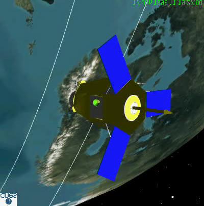
13 The Pléiades High Resolution optical satellite 13
14 Pleiades HR Satellite A new concept for European Earth Observation Pléiades HR satellite New generation of sub-metric Optical Earth Observation minisatellite ready for 2007 Including new generation technologies for the satellite allowing high system performances Industrial organization highlights Cnes is in charge of the system development Astrium is prime contractor for the satellite and the bus Alcatel is prime contractor for the optical instrument 14
 - For Image Quality")
15 Satellite architecture and design External configuration Under Rockot fairing configuration Low mass (<1000 kg) and high compacity allowing small launchers compatibility - Rockot, Soyouz, Vega, High performances optimized design - For agility Vertical instrument inside the bus for volume and inertia minimization High stiffness fixed small solar arrays (three panels) - For Image Quality Instrument mounted on the launcher interface cone with isostatic truss Fine sensor heads mounted on the instrument for maximum geometrical quality accuracy Satellite In-flight configuration 15
 Propulsion Star trackers")
16 Satellite architecture Instrument accomodation into the bus Instrument baffle DORIS antenna S band antenna (2) Image telemetry antenna Antennas supporting structure Instrument carbon/carbon cylinder structure Instrument detection unti and its radiator Bus structure Instrument optical bench Laucher/Instrument interface cone CMGs (4) Propulsion Star trackers (3) 16
 Optical design based on Korsch solution Focal length of 12.")
17 Instrument Design Overall architecture Tertiary mirror M3 Bus interface (with launcher interface cone) Carbon-Carbon cylinder Carbon-cyanat optical bench STR Plane mirror Highly Integrated Detection Unit with its radiator FOG Inertial Measurement Unit (optical core) Optical design based on Korsch solution Focal length of 12.9 m Primary mirror with 650 mm diameter Three zerodur mirrors plus one plane mirror Mechanical Design Central plane structure supporting all telescope elements M1, M3, plane mirror, fine sensors Carbon-Carbon cylinder for M1-M2 structure Thermal design Passive cooling plus heaters Cold tube M1-M2 Decoupled detection unit with heat pipes and dedicated radiator 17

18 Instrument Design Focal plane and Detection Unit Detection Unit Focal plane 5 TDI Panchromatic detectors of 6000 pixels each with lateral anti -blooming 20 to 50 lines of integration 5 4-color detectors of 1500 pixels each Detection Unit proximity electronics 5 PAN and 3 XS in dedicated PCB s housed behind the focal plane providing analogical video processing and A/D conversion Pan detector output : 58 Mpixel/s Total Pan output : 3.5 Gbit/s Total XS output : Gbits/s 18
19 Bus Design Payload Data Handling Compression Unit based on wavelet algorithm ASICs with mean ratio of 2 bits/pixel in panchromatic band and 2.5 bits/pixel in XS bands Input rate of 4.5 Gbit/s Mass Memory Unit of 600 Gbits (EOL) storage capacity 1.5 Gbit/s max input rate, auxiliary data (satellite attitude and position) through 1553, PAN 1 PAN 2 PAN 3 PAN 4 PAN 5 XS Ligne image (*2) DAI Ligne image (*2) DAI Ligne image (*2) DAI Ligne image (*2) DAI Ligne image (*2) DAI Ligne image (*3) DAI COMPRESSOR/MEMORY EQUIPEMENT compression card n 1 compression card n 2 compression card n 3 compression card n 4 compression card n 5 compression card n 6 compression card n 7 Output Interface CCSDS frame 155 Mbps moyen CCSDS frame 155 Mbps moyen CCSDS frame 155 Mbps moyen TELEMETRY CIPHERING EQUIPMENT (DCU) Ciphered TCCSDS frame 155 Mbps Ciphered TCCSDS frame 155 Mbps Ciphered TCCSDS frame 155 Mbps Trellis-coded 8PSK Modulator F1 Trellis-coded 8PSK Modulator F2 Trellis-coded 8PSK Modulator F3 TWTA 25 W RF TWTA 25 W RF TWTA 25 W RF OMUX X band antenna three 155 Mbit/s outputs INSTRUMENT Image Telemetry Three parallel trellis-coded 8- PSK modulators in X band coupled to travelling waves tubes power amplifiers (TWTA) nominal redundant (R) Comp-Mem Controler (N) MEMORY STACK One omni-directionnal 64 conical aperture antenna 1553 nominal 1553 redundant 19
Introduction : Pléiades System Pléiades Status The Pléiades Data distribution The FFG Cnes Cooperation Agreement
 Introduction : Pléiades System Pléiades Status The Pléiades Data distribution The FFG Cnes Cooperation Agreement 1 2 Introduction : overall context Pleiades is developed in the frame of the ORFEO program
EPS Bridge Low-Cost Satellite
 EPS Bridge Low-Cost Satellite Results of a Concept Study being performed for Dr. Hendrik Lübberstedt OHB-System AG OpSE Workshop Walberberg 8th November 2005 EPS Bridge Key System Requirements Minimum
OVERVIEW OF THE ALOS SATELLITE SYSTEM
 OVERVIEW OF THE ALOS SATELLITE SYSTEM Presented to The Symposium for ALOS Data Application Users @Kogakuin University, Tokyo, Japan Mar. 27, 2001 Takashi Hamazaki Senior Engineer ALOS Project National
First inflight results of Pleiades-1A innovative methods for optical calibration
 ICSO 2012 / Imagers and Radiometers First inflight results of Pleiades-1A innovative methods for optical calibration Philippe KUBIK Octobre 9 th, 2012 philippe.kubik@cnes.fr Titre du document + date Arial
FORMOSAT-5. - Launch Campaign-
 1 FORMOSAT-5 - Launch Campaign- FORMOSAT-5 Launch Campaign 2 FORMOSAT-5 Launch Campaign Launch Date: 2017.08.24 U.S. Pacific Time Activities 11:50-12:23 Launch Window 13:30-16:00 Reception 3 FORMOSAT-5
US Commercial Imaging Satellites
 US Commercial Imaging Satellites In the early 1990s, Russia began selling 2-meter resolution product from its archives of collected spy satellite imagery. Some of this product was down-sampled to provide
AN INTRODUCTION TO MICROCARB, FIRST EUROPEAN PROGRAM FOR CO2 MONITORING.
 AN INTRODUCTION TO MICROCARB, FIRST EUROPEAN PROGRAM FOR CO2 MONITORING. International Working Group on Green house Gazes Monitoring from Space IWGGMS-12 Francois BUISSON CNES With Didier PRADINES, Veronique
System outline of small standard bus and ASNARO spacecraft
 System outline of small standard bus and ASNARO spacecraft August 11 th, 2009 NEC Corporation, USEF, NEDO Toshiaki Ogawa, Kenichi Saito, Keita Miyazaki, and Osamu Ito Outline 1. Introduction 2. ASNARO
CXCI. Optical design of a compact telescope for the next generation Earth Observation system CXCI. Vincent COSTES. Octobre 2012
 CXCI Optical design of a compact telescope for the next generation Earth Observation system Vincent COSTES Octobre 2012 CXCI CXCI SUMMARY INTRODUCTION CXCI TECHNOLOGICAL PROGRAM COMPACTNESS REQUIREMENT
Miguel A. Aguirre. Introduction to Space. Systems. Design and Synthesis. ) Springer
 Springer") Miguel A. Aguirre Introduction to Space Systems Design and Synthesis ) Springer Contents Foreword Acknowledgments v vii 1 Introduction 1 1.1. Aim of the book 2 1.2. Roles in the architecture definition
Miguel A. Aguirre Introduction to Space Systems Design and Synthesis ) Springer Contents Foreword Acknowledgments v vii 1 Introduction 1 1.1. Aim of the book 2 1.2. Roles in the architecture definition
Monitoring Natural Disasters with Small Satellites Smart Satellite Based Geospatial System for Environmental Protection
 Monitoring Natural Disasters with Small Satellites Smart Satellite Based Geospatial System for Environmental Protection Krištof Oštir, Space-SI, Slovenia Contents Natural and technological disasters Current
A 1m Resolution Camera For Small Satellites
 A 1m Resolution Camera For Small Satellites Paper SSC06-X-5 Presenter: Jeremy Curtis 1 Introduction TopSat launched October 2005 carrying RAL s 2.5m GSD camera into a 686km orbit Built and operated by
KEY TECHNOLOGY DEVELOPMENT FOR THE ADVENACED LAND OBSERVING SATELLITE
 KEY TECHNOLOGY DEVELOPMENT FOR THE ADVENACED LAND OBSERVING SATELLITE Takashi HAMAZAKI, and Yuji OSAWA National Space Development Agency of Japan (NASDA) hamazaki.takashi@nasda.go.jp yuji.osawa@nasda.go.jp
DATA COMPRESSION & PROCESSING
 DATA COMPRESSION & PROCESSING Telemetry Encryption Unit (TMEU) Video Signal Processing Unit IR (BEV-IR) Video Electronic Unit (VEU) CCD Detection Electronics TELEMETRY ENCRYPTION UNIT (TMEU) Satellite
KOMPSAT Constellation. November 2012 Satrec Initiative
 KOMPSAT Constellation November 2012 Satrec Initiative KOMPSAT Constellation KOMPSAT National program Developed and operated by KARI (Korea Aerospace Research Institute) Dual use : Government & commercial
GMES Sentinel-2. The Optical High Resolution Mission for GMES Operational Services
 GMES Sentinel-2 The Optical High Resolution Mission for GMES Operational Services Philippe Martimort GMES Sentinel-2 Mission and Payload Manager, ESA/ESTEC 15 October 2007, AGRISAR Workshop, Noordwijk
Sentinel-2 Products and Algorithms
 Sentinel-2 Products and Algorithms Ferran Gascon (Sentinel-2 Data Quality Manager) Workshop Preparations for Sentinel 2 in Europe, Oslo 26 November 2014 Sentinel-2 Mission Mission Overview Products and
Compact High Resolution Imaging Spectrometer (CHRIS) siraelectro-optics
 siraelectro-optics") Compact High Resolution Imaging Spectrometer (CHRIS) Mike Cutter (Mike_Cutter@siraeo.co.uk) Summary CHRIS Instrument Design Instrument Specification & Performance Operating Modes Calibration Plan Data
Compact High Resolution Imaging Spectrometer (CHRIS) Mike Cutter (Mike_Cutter@siraeo.co.uk) Summary CHRIS Instrument Design Instrument Specification & Performance Operating Modes Calibration Plan Data
The Challenge. SPOT Vegetation. miniaturization. Proba Vegetation. Technology assessment:
 The Challenge Spot-5 lifetime expires in 2012. The next French satellite, Pleiades, is solely dedicated to HiRes. The Belgian Federal Science Policy Office (BELSPO) declared their interest to develop an
Advanced Optical Satellite (ALOS-3) Overviews
 Overviews") K&C Science Team meeting #24 Tokyo, Japan, January 29-31, 2018 Advanced Optical Satellite (ALOS-3) Overviews January 30, 2018 Takeo Tadono 1, Hidenori Watarai 1, Ayano Oka 1, Yousei Mizukami 1, Junichi
K&C Science Team meeting #24 Tokyo, Japan, January 29-31, 2018 Advanced Optical Satellite (ALOS-3) Overviews January 30, 2018 Takeo Tadono 1, Hidenori Watarai 1, Ayano Oka 1, Yousei Mizukami 1, Junichi
ROLE OF SATELLITE DATA APPLICATION IN CADASTRAL MAP AND DIGITIZATION OF LAND RECORDS DR.T. RAVISANKAR GROUP HEAD (LRUMG) RSAA/NRSC/ISRO /DOS HYDERABAD
 RSAA/NRSC/ISRO /DOS HYDERABAD") ROLE OF SATELLITE DATA APPLICATION IN CADASTRAL MAP AND DIGITIZATION OF LAND RECORDS DR.T. RAVISANKAR GROUP HEAD (LRUMG) RSAA/NRSC/ISRO /DOS HYDERABAD WORKSHOP on Best Practices under National Land Records
ROLE OF SATELLITE DATA APPLICATION IN CADASTRAL MAP AND DIGITIZATION OF LAND RECORDS DR.T. RAVISANKAR GROUP HEAD (LRUMG) RSAA/NRSC/ISRO /DOS HYDERABAD WORKSHOP on Best Practices under National Land Records
Microsatellite Constellation for Earth Observation in the Thermal Infrared Region
 Microsatellite Constellation for Earth Observation in the Thermal Infrared Region Federico Bacci di Capaci Nicola Melega, Alessandro Tambini, Valentino Fabbri, Davide Cinarelli Observation Index 1. Introduction
GMES DA COPERNICUS
 2014 Airbus Defence and Space All rights reserved. The reproduction, distribution and utilization of this document as well as the communication of its contents to others without express authorization is
Phone: , Fax: , Germany
 The TET-1 Satellite Bus A High Reliability Bus for Earth Observation, Scientific and Technology Verification Missions in LEO Pestana Conference Centre Funchal, Madeira - Portugal 31 May 4 June 2010 S.
AMIPAS. Advanced Michelson Interferometer for Passive Atmosphere Sounding. Concepts and Technology for Future Atmospheric Chemistry Sensors
 Earth Observation, Navigation & Science Concepts and Technology for Future Atmospheric Chemistry Sensors AMIPAS Advanced Michelson Interferometer for Passive Atmosphere Sounding Markus Melf, Winfried Posselt,
Geospatial Vision and Policies Korean Industry View 26 November, 2014 SI Imaging Services
 Geospatial Vision and Policies Korean Industry View 26 November, 2014 SI Imaging Services Distribution Limitation, SI Imaging Services Proprietary Data : The data contained in this document, without the
TELECOMMUNICATION SATELLITE TELEMETRY TRACKING AND COMMAND SUB-SYSTEM
 TELECOMMUNICATION SATELLITE TELEMETRY TRACKING AND COMMAND SUB-SYSTEM Rodolphe Nasta Engineering Division ALCATEL ESPACE Toulouse, France ABSTRACT This paper gives an overview on Telemetry, Tracking and
The Nemo Bus: A Third Generation Nanosatellite Bus for Earth Monitoring and Observation
 The Nemo Bus: A Third Generation Nanosatellite Bus for Earth Monitoring and Observation FREDDY M. PRANAJAYA Manager, Advanced Systems Group S P A C E F L I G H T L A B O R A T O R Y University of Toronto
Design of a Free Space Optical Communication Module for Small Satellites
 Design of a Free Space Optical Communication Module for Small Satellites Ryan W. Kingsbury, Kathleen Riesing Prof. Kerri Cahoy MIT Space Systems Lab AIAA/USU Small Satellite Conference August 6 2014 Problem
RECONNAISSANCE PAYLOADS FOR RESPONSIVE SPACE
 3rd Responsive Space Conference RS3-2005-5004 RECONNAISSANCE PAYLOADS FOR RESPONSIVE SPACE Charles Cox Stanley Kishner Richard Whittlesey Goodrich Optical and Space Systems Division Danbury, CT Frederick
AstroBus S, the high performance and competitive Small Satellites platform for Earth Observation
 AstroBus S, the high performance and competitive Small Satellites platform for Earth Observation Dr. Jean Cheganças 10th IAA Symposium on Small Satellites for Earth Observation April 20-24, 2015 Berlin,
9/12/2011. Training Course Remote Sensing Basic Theory & Image Processing Methods September 2011
 Training Course Remote Sensing Basic Theory & Image Processing Methods 19 23 September 2011 Remote Sensing Platforms Michiel Damen (September 2011) damen@itc.nl 1 Overview Platforms & missions aerial surveys
TopSat: Brief to Ground Segment Coordination. Presenter Ian Pilling. By : W.A. Levett. Co author: E.J. Baxter.
 TopSat: Brief to Ground Segment Coordination Board Presenter Ian Pilling By : W.A. Levett Co author: E.J. Baxter Contents Space Division overview The TopSat mission Overview Development Programme Launch
SEOSAT/INGENIO - A SPANISH HIGH-SPATIAL- RESOLUTION OPTICAL MISSION
 SEOSAT/INGENIO - A SPANISH HIGH-SPATIAL- RESOLUTION OPTICAL MISSION A.E.Marini, F.J. Reina Barragan, G.Crippa, B.Harnisch, I. Fuente ESA/ESTEC, Netherlands, M.Lopez - CDTI, Spain I.Cabeza - Airbus Space
CNES Position Regarding the Use of the X- X and Ka- Bands for EESS
 Orlando March 25-27, 2003 CNES Position Regarding the Use of the X- X and Ka- Bands for EESS Frédéric Cornet Centre National d'etudes Spatiales (Frederic.Cornet@cnes.fr) Data Rates Requirements Future
The studies began when the Tiros satellites (1960) provided man s first synoptic view of the Earth s weather systems.
 provided man s first synoptic view of the Earth s weather systems.") Remote sensing of the Earth from orbital altitudes was recognized in the mid-1960 s as a potential technique for obtaining information important for the effective use and conservation of natural resources.
Remote sensing of the Earth from orbital altitudes was recognized in the mid-1960 s as a potential technique for obtaining information important for the effective use and conservation of natural resources.
WHAT IS NEXT IN EARTH OBSERVATION. SkyMed Mission
 WHAT IS NEXT IN EARTH OBSERVATION COSMO-SkyMed SkyMed Mission Paolo Ammendola Italian Space Agency Florence, Sept. 19, 2001 ammendola@asi asi.it THE NEEDS Market studies indicate that the value of the
Satellite Technology for Future Applications
 Satellite Technology for Future Applications WSRF Panel n 4 Dubai, 3 March 2010 Guy Perez VP Telecom Satellites Programs 1 Commercial in confidence / All rights reserved, 2010, Thales Alenia Space Content
HEMERA Constellation of passive SAR-based micro-satellites for a Master/Slave configuration
 HEMERA Constellation of passive SAR-based micro-satellites for a Master/Slave HEMERA Team Members: Andrea Bellome, Giulia Broggi, Luca Collettini, Davide Di Ienno, Edoardo Fornari, Leandro Lucchese, Andrea
THE OFFICINE GALILEO DIGITAL SUN SENSOR
 THE OFFICINE GALILEO DIGITAL SUN SENSOR Franco BOLDRINI, Elisabetta MONNINI Officine Galileo B.U. Spazio- Firenze Plant - An Alenia Difesa/Finmeccanica S.p.A. Company Via A. Einstein 35, 50013 Campi Bisenzio
Introduction to KOMPSAT
 Introduction to KOMPSAT September, 2016 1 CONTENTS 01 Introduction of SIIS 02 KOMPSAT Constellation 03 New : KOMPSAT-3 50 cm 04 New : KOMPSAT-3A 2 KOMPSAT Constellation KOMPSAT series National space program
Annex B: HEO Satellite Mission
 Annex B: HEO Satellite Mission Table of Content TABLE OF CONTENT...I 1. INTRODUCTION...1 1.1. General... 1 1.2. Response Guidelines... 1 2. BRAODBAND CAPACITY...2 2.1. Mission Overview... 2 2.1.1. HEO
Interferometric Cartwheel 1
 The Interferometric CartWheel A wheel of passive radar microsatellites for upgrading existing SAR projects D. Massonnet, P. Ultré-Guérard (DPI/EOT) E. Thouvenot (DTS/AE/INS/IR) Interferometric Cartwheel
CubeSat Proximity Operations Demonstration (CPOD) Vehicle Avionics and Design
 Vehicle Avionics and Design") CubeSat Proximity Operations Demonstration (CPOD) Vehicle Avionics and Design August CubeSat Workshop 2015 Austin Williams VP, Space Vehicles CPOD: Big Capability in a Small Package Communications ADCS
CubeSat Proximity Operations Demonstration (CPOD) Vehicle Avionics and Design August CubeSat Workshop 2015 Austin Williams VP, Space Vehicles CPOD: Big Capability in a Small Package Communications ADCS
Chapter 6 Part 3. Attitude Sensors. AERO 423 Fall 2004
 Chapter 6 Part 3 Attitude Sensors AERO 423 Fall 2004 Sensors The types of sensors used for attitude determination are: 1. horizon sensors (or conical Earth scanners), 2. sun sensors, 3. star sensors, 4.
THE SPACE TECHNOLOGY RESEARCH VEHICLE 2 MEDIUM WAVE INFRA RED IMAGER
 THE SPACE TECHNOLOGY RESEARCH VEHICLE 2 MEDIUM WAVE INFRA RED IMAGER S J Cawley, S Murphy, A Willig and P S Godfree Space Department The Defence Evaluation and Research Agency Farnborough United Kingdom
Sentinel-1 System Overview
 Sentinel-1 System Overview Dirk Geudtner, Rámon Torres, Paul Snoeij, Malcolm Davidson European Space Agency, ESTEC Global Monitoring for Environment and Security (GMES) EU-led program aiming at providing
PAPER NUMBER: PAPER TITLE: Multi-band CMOS Sensor simplify FPA design. SPIE, Remote sensing 2015, Toulouse, France.
 PAPER NUMBER: 9639-28 PAPER TITLE: Multi-band CMOS Sensor simplify FPA design to SPIE, Remote sensing 2015, Toulouse, France On Section: Sensors, Systems, and Next-Generation Satellites Page1 Multi-band
; ; IR
 MS-2-2.5 SATELLITE The MS-2-2.5 satellite is designed for Earth Remote Sensing with the use of high resolution IR and multi-band imager. The satellite performs natural and man-caused disasters monitoring,
Introduction to Galileo PRS
 Introduction to Galileo PRS Fabio Covello 20/09/2017 ESA UNCLASSIFIED - For Official Use Galileo mission figures The Galileo Space Segment: 30 satellites (full constellation) Walker 24/3/1 constellation
National Aeronautics and Space Administration Jet Propulsion Laboratory California Institute of Technology
 QuikSCAT Mission Status QuikSCAT Follow-on Mission 2 QuikSCAT instrument and spacecraft are healthy, but aging June 19, 2009 will be the 10 year launch anniversary We ve had two significant anomalies during
Consumer digital CCD cameras
 CAMERAS Consumer digital CCD cameras Leica RC-30 Aerial Cameras Zeiss RMK Zeiss RMK in aircraft Vexcel UltraCam Digital (note multiple apertures Lenses for Leica RC-30. Many elements needed to minimize
Indian Remote Sensing Satellites
 Resourcesat-1 Indian Remote Sensing Satellites -Current & Future Resourcesat Missions - Presented by: Timothy J. Puckorius Chairman & CEO EOTec 1 Presentation Topics India s Earth Observation Heritage
HyperSTREEGO A Reactive Multispectral Optical Payload for Small Satellites
 Driving Innovation in Space Optics and Optical Systems HyperSTREEGO A Reactive Multispectral Optical Payload for Small Satellites Giovanni Bianucci 1 Introduction Demand for remote sensing data is increasing
EARTH OBSERVATION WITH SMALL SATELLITES
 EARTH OBSERVATION WITH SMALL SATELLITES AT THE FUCHS-GRUPPE B. Penné, C. Tobehn, M. Kassebom, H. Lübberstedt OHB-System GmbH, Universitätsallee 27-29, D-28359 Bremen, Germany www.fuchs-gruppe.com ABSTRACT
SPOT6. Impact of Spot 6 and 7 in the Constitution and Update of Spatial Data Infrastructures over Africa
 Astrium Services 2012 SPOT6 Impact of Spot 6 and 7 in the Constitution and Update of Spatial Data Infrastructures over Africa K. Guérin, M. Bernard, T. Rousselin, B. Navaro, J. Korona 26 th International
FRL's Demonstration and Science Experiments (DSX) rogram Quest for the Common Micro Satellite Bus
 rogram Quest for the Common Micro Satellite Bus") FRL's Demonstration and Science Experiments (DSX) rogram Quest for the Common Micro Satellite Bus 21st Annual Conference on Small Satellites August 13-16, 16, 2007 Logan, Utah N. Greg Heinsohn DSX HSB
FRL's Demonstration and Science Experiments (DSX) rogram Quest for the Common Micro Satellite Bus 21st Annual Conference on Small Satellites August 13-16, 16, 2007 Logan, Utah N. Greg Heinsohn DSX HSB
Industry Day of the Copernicus Sentinel-5 and Jason-CS Projects
 Industry Day of the Copernicus Sentinel-5 and Jason-CS Projects With the present announcement, the European Space Agency and Astrium GmbH Satellites (Germany) inform the EMITS Users (European Companies
Pléiades. Access to data. Charlotte Gabriel-Robez. January Pléiades product manager
 Pléiades Access to data Charlotte Gabriel-Robez Pléiades product manager January 2012 A variety of users 2008: Delegation of Public Service Granted by CNES to Spot Image Astrium Services (ex. Spot Image)
The Jason-l satellite design and development status.
 The Jason-l satellite design and development status. T. Lafon, F.Parisot CNES- Centre Spatial de Toulouse 18 avenue Edouard Belin- 31041 Toulouse Cedex 4, France. ABSTRACT: The Jason satellite is the first
9/12/2011. Training Course Remote Sensing Basic Theory & Image Processing Methods September 2011
 Training Course Remote Sensing Basic Theory & Image Processing Methods 19 23 September 2011 Popular Remote Sensing Sensors & their Selection Michiel Damen (September 2011) damen@itc.nl 1 Overview Low resolution
CubeSat Integration into the Space Situational Awareness Architecture
 CubeSat Integration into the Space Situational Awareness Architecture Keith Morris, Chris Rice, Mark Wolfson Lockheed Martin Space Systems Company 12257 S. Wadsworth Blvd. Mailstop S6040 Littleton, CO
Remote Sensing Platforms
 Types of Platforms Lighter-than-air Remote Sensing Platforms Free floating balloons Restricted by atmospheric conditions Used to acquire meteorological/atmospheric data Blimps/dirigibles Major role - news
EARTH OBSERVATION CONCEPT INVOLVING PORTABLE DATA RECEIVING AND PROCESSING EQUIPMENTS WOM-8 SYSTEM ABSTRACT
 EARTH OBSERVATION CONCEPT INVOLVING PORTABLE DATA RECEIVING AND PROCESSING EQUIPMENTS WOM-8 SYSTEM D~CIO CASTILHO CEBALLOS BRAZILIAN NATIONAL SPACE RESEARCH INSTITUTE P.O. BOX 515 - S.J. CAMPOS - SP BRAZIL
OVERVIEW OF KOMPSAT-3A CALIBRATION AND VALIDATION
 OVERVIEW OF KOMPSAT-3A CALIBRATION AND VALIDATION DooChun Seo 1, GiByeong Hong 1, ChungGil Jin 1, DaeSoon Park 1, SukWon Ji 1 and DongHan Lee 1 1 KARI(Korea Aerospace Space Institute), 45, Eoeun-dong,
Outline. Introduction. Introduction: Film Emulsions. Sensor Systems. Types of Remote Sensing. A/Prof Linlin Ge. Photographic systems (cf(
 GMAT x600 Remote Sensing / Earth Observation Types of Sensor Systems (1) Outline Image Sensor Systems (i) Line Scanning Sensor Systems (passive) (ii) Array Sensor Systems (passive) (iii) Antenna Radar
EUROPEAN SPACE AGENCY INDUSTRIAL POLICY COMMITTEE
 Att. : Annexes Paris, 20 th March 2008 (English only) EUROPEAN SPACE AGENCY INDUSTRIAL POLICY COMMITTEE GENERAL SUPPORT TECHNOLOGY PROGRAMME UPDATE OF THE GSTP-4 SPECIFIC AREA WORK PLAN AND PROCUREMENT
WorldView-2. WorldView-2 Overview
 WorldView-2 WorldView-2 Overview 6/4/09 DigitalGlobe Proprietary 1 Most Advanced Satellite Constellation Finest available resolution showing crisp detail Greatest collection capacity Highest geolocation
Mission Overview ELECTRON LOSSES AND FIELDS INVESTIGATION CubeSat Developers Workshop. University of California, Los Angeles April 25, 2013
 ELECTRON LOSSES AND FIELDS INVESTIGATION Mission Overview 2013 CubeSat Developers Workshop University of California, Los Angeles April 25, 2013 elfin@igpp.ucla.edu 1 Electron Losses and Fields Investigation
Small Satellites: The Execution and Launch of a GPS Radio Occultation Instrument in a 6U Nanosatellite
 Small Satellites: The Execution and Launch of a GPS Radio Occultation Instrument in a 6U Nanosatellite Dave Williamson Director, Strategic Programs Tyvak Tyvak: Satellite Solutions for Multiple Organizations
Chapter 2 Satellite Configuration Design
 Chapter 2 Satellite Configuration Design Abstract This chapter discusses the process of integration of the subsystem components and development of the satellite configuration to achieve a final layout
Satellite Testing. Prepared by. A.Kaviyarasu Assistant Professor Department of Aerospace Engineering Madras Institute Of Technology Chromepet, Chennai
 Satellite Testing Prepared by A.Kaviyarasu Assistant Professor Department of Aerospace Engineering Madras Institute Of Technology Chromepet, Chennai @copyright Solar Panel Deployment Test Spacecraft operating
Hyper-spectral, UHD imaging NANO-SAT formations or HAPS to detect, identify, geolocate and track; CBRN gases, fuel vapors and other substances
 Hyper-spectral, UHD imaging NANO-SAT formations or HAPS to detect, identify, geolocate and track; CBRN gases, fuel vapors and other substances Arnold Kravitz 8/3/2018 Patent Pending US/62544811 1 HSI and
Copernicus Introduction Lisbon, Portugal 13 th & 14 th February 2014
 Copernicus Introduction Lisbon, Portugal 13 th & 14 th February 2014 Contents Introduction GMES Copernicus Six thematic areas Infrastructure Space data An introduction to Remote Sensing In-situ data Applications
CubeSat Proximity Operations Demonstration (CPOD) Mission Update Cal Poly CubeSat Workshop San Luis Obispo, CA
 Mission Update Cal Poly CubeSat Workshop San Luis Obispo, CA") CubeSat Proximity Operations Demonstration (CPOD) Mission Update Cal Poly CubeSat Workshop San Luis Obispo, CA 04-22-2015 Austin Williams VP, Space Vehicles ConOps Overview - Designed to Maximize Mission
CubeSat Proximity Operations Demonstration (CPOD) Mission Update Cal Poly CubeSat Workshop San Luis Obispo, CA 04-22-2015 Austin Williams VP, Space Vehicles ConOps Overview - Designed to Maximize Mission
Cover. DLR-ESA Workshop on ARTES-11. SGEO: Implementation of of Artes-11. Dr. Andreas Winkler
 Cover DLR-ESA Workshop on ARTES-11 SGEO: Implementation of of Artes-11 Dr. Andreas Winkler June June29, 29, 2006 2006 Tegernsee, Tegernsee, Germany Germany Slide 1 Table Table of of Contents - Introduction
Status of Meteosat Third Generation (MTG) Pre-Phase A System Architecture Studies
 Pre-Phase A System Architecture Studies") Status of Meteosat Third Generation (MTG) Pre-Phase A System Architecture Studies Paolo Bensi, Earth Observation Future Programme Department European Space Agency Planning: Meteosat Third Generation (MTG)
Status of Meteosat Third Generation (MTG) Pre-Phase A System Architecture Studies Paolo Bensi, Earth Observation Future Programme Department European Space Agency Planning: Meteosat Third Generation (MTG)
B ==================================== C
 Satellite Space Segment Communication Frequencies Frequency Band (GHz) Band Uplink Crosslink Downlink Bandwidth ==================================== C 5.9-6.4 3.7 4.2 0.5 X 7.9-8.4 7.25-7.7575 0.5 Ku 14-14.5
OVERVIEW OF THE PRISMA SPACE AND GROUND SEGMENT AND ITS HYPERSPECTRAL PRODUCTS
 IEEE International Geoscience and Remote Sensing Symposium OVERVIEW OF THE PRISMA SPACE AND GROUND SEGMENT AND ITS HYPERSPECTRAL PRODUCTS Rocchina Guarini, Rosa Loizzo, Francesco Longo, Silvia Mari, Tiziana
SEOSAT/INGENIO - A SPANISH HIGH-SPATIAL-RESOLUTION OPTICAL MISSION
 SEOSAT/INGENIO - A SPANISH HIGH-SPATIAL-RESOLUTION OPTICAL MISSION A.Marini 1, F.J. Reina Barragan 1, G.Crippa 1, B.Harnisch 1, I. Fuente 1, M.Lopez 2, I. Cabeza 3 D.Zorita 4 1 ESA/ESTEC, the Netherlands.
OPAL Optical Profiling of the Atmospheric Limb
 OPAL Optical Profiling of the Atmospheric Limb Alan Marchant Chad Fish Erik Stromberg Charles Swenson Jim Peterson OPAL STEADE Mission Storm Time Energy & Dynamics Explorers NASA Mission of Opportunity
SPOT 5 / HRS: a key source for navigation database
 SPOT 5 / HRS: a key source for navigation database CONTENT DEM and satellites SPOT 5 and HRS : the May 3 rd 2002 revolution Reference3D : a tool for navigation and simulation Marc BERNARD Page 1 Report
A CubeSat-Based Optical Communication Network for Low Earth Orbit
 A CubeSat-Based Optical Communication Network for Low Earth Orbit Richard Welle, Alexander Utter, Todd Rose, Jerry Fuller, Kristin Gates, Benjamin Oakes, and Siegfried Janson The Aerospace Corporation
COSMO-SkyMed Mission Status Presented by Fabrizio BATTAZZA (ASI)
") COSMO-SkyMed Mission Status Presented by Fabrizio BATTAZZA (ASI) COSMO-1 & COSMO-2 LAUNCHES FIRST SATELLITE OF THE CONSTELLATION SUCCESSFULLY LAUNCHED 08 June 2007 03:35 (GMT) Vandenberg U.S.A. Air Force
COSMO-SkyMed Mission Status Presented by Fabrizio BATTAZZA (ASI) COSMO-1 & COSMO-2 LAUNCHES FIRST SATELLITE OF THE CONSTELLATION SUCCESSFULLY LAUNCHED 08 June 2007 03:35 (GMT) Vandenberg U.S.A. Air Force
Systematic Image Processing of the Small Satellite Mission BIRD
 Systematic Image Processing of the Small Satellite Mission BIRD Klaus Brieß 1, Eckehard Lorenz 2 1 Technische Universität Berlin, Institut für Luft und Raumfahrt, Marchstr.12, D-10587 Berlin 2 Deutsches
Status of MOLI development MOLI (Multi-footprint Observation Lidar and Imager)
") Status of MOLI development MOLI (Multi-footprint Observation Lidar and Imager) Tadashi IMAI, Daisuke SAKAIZAWA, Jumpei MUROOKA and Toshiyoshi KIMURA JAXA 1 Outline of This Presentation 1. Overview of MOLI
Status of MOLI development MOLI (Multi-footprint Observation Lidar and Imager) Tadashi IMAI, Daisuke SAKAIZAWA, Jumpei MUROOKA and Toshiyoshi KIMURA JAXA 1 Outline of This Presentation 1. Overview of MOLI
NON-PHOTOGRAPHIC SYSTEMS: Multispectral Scanners Medium and coarse resolution sensor comparisons: Landsat, SPOT, AVHRR and MODIS
 NON-PHOTOGRAPHIC SYSTEMS: Multispectral Scanners Medium and coarse resolution sensor comparisons: Landsat, SPOT, AVHRR and MODIS CLASSIFICATION OF NONPHOTOGRAPHIC REMOTE SENSORS PASSIVE ACTIVE DIGITAL
MICROSCOPE Mission operational concept
 MICROSCOPE Mission operational concept PY. GUIDOTTI (CNES, Microscope System Manager) January 30 th, 2013 1 Contents 1. Major points of the operational system 2. Operational loop 3. Orbit determination
COSMO-SkyMed Mission Status Presented by Giovanni VALENTINI (ASI)
") COSMO-SkyMed Mission Status Presented by Giovanni VALENTINI (ASI) FIRST SATELLITE FIRST SATELLITE OF THE CONSTELLATION SUCCESSFULLY LAUNCHED 08 June 2007 03:35 (GMT) Vandenberg U.S.A. Air Force Base SECOND
COSMO-SkyMed Mission Status Presented by Giovanni VALENTINI (ASI) FIRST SATELLITE FIRST SATELLITE OF THE CONSTELLATION SUCCESSFULLY LAUNCHED 08 June 2007 03:35 (GMT) Vandenberg U.S.A. Air Force Base SECOND
The world s most advanced constellation
 The DigitalGlobe Constellation The world s most advanced constellation of very high-resolution satellites The world s most advanced constellation The DigitalGlobe constellation of high-resolution satellites
Philpot & Philipson: Remote Sensing Fundamentals Scanners 8.1 W.D. Philpot, Cornell University, Fall 2015
 Philpot & Philipson: Remote Sensing Fundamentals Scanners 8.1 8. SCANNERS 8.1 General Scanners are scanning radiometers which, when operated from an airborne or spaceborne platform, image the terrain in
International Conference on Space Optics ICSO 2008 Toulouse, France October 2008
 International Conference on Space Optics ICSO 28 Toulouse, France 14 17 October 28 Edited by Josiane Costeraste, Errico Armandillo, and Nikos Karafolas The high resolution optical instruments for the Pleiades
Big picture with KOMPSAT KOMPSAT-3A / KOMPSAT-3 / KOMPSAT-5 / KOMPSAT-2
 Big picture with KOMPSAT KOMPSAT-3A / KOMPSAT-3 / KOMPSAT-5 / KOMPSAT-2 Big picture with KOMPSAT Introduction SI Imaging Services (SIIS) is the exclusive worldwide marketing and sales representative of
InnoSat and MATS An Ingenious Spacecraft Platform applied to Mesospheric Tomography and Spectroscopy
 Niclas Larsson N. Larsson, R. Lilja (OHB Sweden), M. Örth, S. Söderholm (ÅAC Microtec), J. Köhler, R. Lindberg (SNSB), J. Gumbel (MISU) SATELLITE SYSTEMS InnoSat and MATS An Ingenious Spacecraft Platform
Power modeling and budgeting design and validation with in-orbit data of two commercial LEO satellites
 SSC17-X-08 Power modeling and budgeting design and validation with in-orbit data of two commercial LEO satellites Alan Kharsansky Satellogic Av. Raul Scalabrini Ortiz 3333 piso 2, Argentina; +5401152190100
Sentinel-1 Calibration and Performance
 Sentinel-1 Calibration and Performance Paul Snoeij Evert Attema Björn Rommen Nicolas Floury Berthyl Duesmann Malcolm Davidson Ramon Torres European Space Agency Sentinel-1 Mission Objectives Component
AMSAT Fox Satellite Program
 AMSAT Space Symposium 2012 AMSAT Fox Satellite Program Tony Monteiro, AA2TX Topics Background Fox Launch Strategy Overview of Fox-1 Satellite 2 Background AO-51 was the most popular ham satellite Could
PLANET IMAGERY PRODUCT SPECIFICATIONS PLANET.COM
 PLANET IMAGERY PRODUCT SPECIFICATIONS SUPPORT@PLANET.COM PLANET.COM LAST UPDATED JANUARY 2018 TABLE OF CONTENTS LIST OF FIGURES 3 LIST OF TABLES 4 GLOSSARY 5 1. OVERVIEW OF DOCUMENT 7 1.1 Company Overview
PLEIADES-HR IMAGE QUALITY COMMISSIONING
 PLEIADES-HR IMAGE QUALITY COMMISSIONING Laurent Lebègue, Daniel Greslou, Françoise delussy, Sébastien Fourest, Gwendoline Blanchet, Christophe Latry, Sophie Lachérade, Jean-Marc Delvit, Philippe Kubik,
Prospects for Status and Development of GLONASS System Space Complex
 Prospects for Status and Development of GLONASS System Space Complex JSC M.F. Reshetnev Information Satellite Systems 9 14 of November2013, Dubai, UAE The Basis for Future Space Complex Development GLONASS