Introduction to Satellite Remote Sensing
|
|
|
- Peter Bryant
- 5 years ago
- Views:
Transcription
1 Introduction to Satellite Remote Sensing Remote sensing of the Earth from orbital altitudes was recognized in the mid-1960 s as a potential technique for obtaining information important for the effective use and conservation of natural resources. The studies began when the Tiros satellites (1960) provided first synoptic view of the Earth s weather systems. The manned Gemini and Apollo Programs ( ) led to further consideration of space-age remote sensing for study of the planet Earth. 1


2 Earth rising over the lunar surface, one of the most famous images of the 20th century. The photo was taken by astronaut William Anders from Apollo 8 in December 24, This is how Anders saw the image. Earth rising As Apollo 8 raced backward away from the Earth, Anders snapped a picture of a fist-sized fuzzy little ball of color against the immense backdrop of space. (Parker, RI News, Providence Journal, Oct. 24, 2010) (Anders lived in Barrington RI for about 5 years in 1980s as an executive at RI-based Textron. He was inducted Into Rhode Island Aviation Hall of Fame for his role on Apollo 8.) 2
.")

, later designated Landsat, provided repetitive multispectral observation of the Earth.")

3 Skylab, the largest manned space station placed at low Earth orbit at the time, was lunched in May 14, 1973 and carried into space the Earth Resources Experiment Package (EREP). EREP was designed to view the Earth with sensors that recorded data in visible, infrared, and microwave spectral regions. EREP became another step in space exploration by testing the high spatial resolution camera systems with film return capability. A significant feature of EREP was the use of man to operate the sensors in a laboratory fashion. The Earth Resources Technology Satellite (ERTS), later designated Landsat, provided repetitive multispectral observation of the Earth. Landsat represents the world's longest (since 1972) continuously acquired collection of space-based land remote sensing data. The instruments on the Landsat satellites have acquired millions of images. The images, archived in the United States and at Landsat receiving stations around the world, are a unique resource for global change research and applications in agriculture, geology, forestry, regional planning, education and national security. 3


4 Digital Data Acquisition Multispectral Digital Image Spatial Resolution (Pixel size) Spectral Resolution (Bands) 4
 Landsat 4 (07/16/1982 - ) - MSS, TM (30m, 120m TIR) Landsat 5 (03/01/1984 - ) - MSS, TM (30m, 120m TIR) Landsat 6 (10/05/1993): ETM?")
 Landsat-4, 5 Landsat-1, 2, 3 ETM+: Enhanced Thematic Mapper Plus MSS: Multispectral Scanner OLI: Operational Land Imager Pan: Panchromatic RBV: Return Beam")
 Provide increased penetration of water bodies, as well as supporting analysis of land use, soil, and vegetation characteristics. Band 2: 0.52-0.")

5 Landsat Missions Landsat 1 (07/12/ /06/1978) - RBV, MSS (80m) Landsat 2 (01/22/ /27/1983) - RBV, MSS (80m) Landsat 3 (03/05/ /07/1983) - RBV, MSS (80m) Landsat 4 (07/16/ ) - MSS, TM (30m, 120m TIR) Landsat 5 (03/01/ ) - MSS, TM (30m, 120m TIR) Landsat 6 (10/05/1993): ETM??? Landsat 7 (04/23/ ) - ETM+ (30m, 60m TIR, 15m Pan) Landsat 8 (February 11, 2013) OIL, TIRS (30m, 100m TIRS 15m Pan ) Landsat 9 (Scheduled lunch time: 2021) Landsat-4, 5 Landsat-1, 2, 3 ETM+: Enhanced Thematic Mapper Plus MSS: Multispectral Scanner OLI: Operational Land Imager Pan: Panchromatic RBV: Return Beam Vidicon Camera TIR: Thermal Infrared TIRS: Thermal Infrared Sensor TM: Thematic Mapper Landsat-8 Landsat-7 Spectral Cover of Landsat Sensors (TM, ETM+) Band 1: m (blue) Provide increased penetration of water bodies, as well as supporting analysis of land use, soil, and vegetation characteristics. Band 2: m (green) This band spans the region between the blue and red chlorophyll absorption bands and therefore corresponds to the green reflectance of healthy vegetation. Band 3: m (red) This is the red chlorophyll absorption band of healthy green vegetation and represents one of the most important bands for vegetation discrimination. 5
6 Spectral Cover of Landsat Sensors (TM, ETM+) Band 4: m (Near-infrared). This band is responsive to the amount of vegetation biomass present in the scene. It is useful for crop identification and emphasizes soil-crop and land-water contrasts. Band 5: m (Mid-infrared) This band is sensitive to the amount of moisture in plants and therefore useful in crop draught and in plant vigor studies. Band 6: m (Thermal infrared) This band measures the amount of infrared radiant flux emitted from surface. Band 7: m (Mid-infrared) This is an important band for the discrimination of geologic rock formation. It is effective in identifying zones of hydrothermal alteration in rocks. Comparison of Landsat 1-7 Sensors Multispectral Scanner (MSS) Landsat 1-5 Thematic Mapper (TM) Landsat 4 & 5 Enhanced Thematic Mapper Plus (ETM+) Landsat 7 Spectral Resolution ( m) (green) (red) (NIR) (NIR) (B) (G) (R) (NIR) (MIR) (TIR) (MIR) (Pan) Spatial Resolution (meter) 79 x x x 120 (TIR) 15 x 15 (Pan) 30 x x 60 (TIR) Temporal Resolution (revisit days) 18 (Landsat 1,2,3)


 Data (30")

, Bands 4, 5, 3")

7 Landsat-7 ETM+ Data of Providence Landsat-7 Panchromatic Data (15 m) Landsat-7 ETM+ Data (30 m), Bands 3, 2, 1 in RGB Landsat-7 ETM+ Data (30 m), Bands 4, 3, 2 in RGB Landsat-7 ETM+ Data (30 m), Bands 4, 5, 3 in RGB Landsat-8 and Sensors: 7
8 Landsat 8 Video Landsat-8 Sensors: Operational Land Imager (OLI) OLI spectral bands ETM + spectral bands # Band width GSD (m) # Band width GSD (m) (μm) (μm)
9 Landsat-8 Sensors: Operational Land Imager (OLI) Landsat-8 Sensors: Thermal Infrared Sensor (TIRS) TIRS Sensors measure land surface temperature in two thermal bands. Band # Center wavelength (μm) Spatial resolution (m)
 2. 0.52-0.60 (G) 3. 0.63-0.69 (R) 4. 0.76-0.90 (NIR) 5. 1.55-1.75 (MIR) 6. 10.4-12.5 (TIR) 7. 2.08-2.35 (MIR) Enhanced Thematic Mapper Plus (ETM+) Landsat 7 1. 0.45-0.52 2. 0.52-0.60 3. 0.63-0.69 4.")
 9. 1.36-1.38 10. 10.60-11.19 (TIRS) 11. 11.50-12.")
10 Spectral Resolution ( m) Multispectral Scanner (MSS) Landsat (green) (red) (NIR) (NIR) Comparison of Landsat Sensors Thematic Mapper (TM) Landsat 4 & (B) (G) (R) (NIR) (MIR) (TIR) (MIR) Enhanced Thematic Mapper Plus (ETM+) Landsat (Pan) Operational Land Imager (OLI) / Thermal Infrared Sensor (TIRS) Landsat (Pan) (TIRS) (TIRS) Spatial Resolution (meter) 79 x x x 120 (TIR) 15 x 15 (Pan) 30 x x 60 (TIR) 15 x 15 (Pan) 30 x x 100 (TIRS) Temporal Resolution (revisit days) 18 (Landsat 1,2,3) Example of Landsat 8 imagery (Fort Collins, Colorado, March 18, 2013) 10


11 11


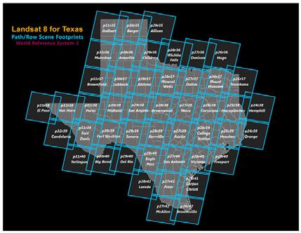
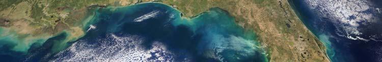
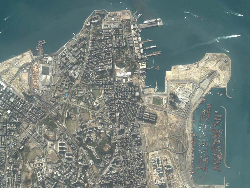
12 Rhode Island: Path 12/Row 31 12


13 Landsat Ground Stations Collections of Landsat Images of the World 13


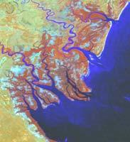
14 Mangroves in the Niger River Delta: 1990 Landsat Image 14


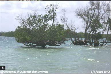
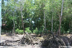

15 Mangrove Forests On Landsat Images Over 100 km crisscrossing streams and rivers of the Kibasira Swamp 15


16 Streams and rivers eroding the banks of the Rufiji river Stiegler s Gorge section of the Rufiji River 16
17 17


18 USGS EROS Data Center Monthly true color CONUS browse images, each pixel is shown generalized from m Landsat pixels to provide an approximate spatial resolution of 500 m. 18

: Annual")

 Monthly Landsat composites,")

19 QuickTime?and a decompressor are needed to see this picture. Web-enabled Landsat Data (WELD): Annual (December 2007 to November, 2008) Landsat ETM+ composited mosaics of the conterminous United States (Roy et al., 2010) Monthly Landsat composites, processed scenes Dec Jan Feb March 2010 April 2010 May 2010 June 2010 July 2010 August 2010 Sept Oct Nov

 (250m - 2 bands, 500m - 5 bands, 1000m - 29 bands) CERES: Clouds and the Earth's")

20 TERRA (EOS AM) - Launched December 18, 1999 The following instruments fly on TERRA: ASTER: MODIS: Advanced Spaceborne Thermal Emission and Reflection Radiometer (15m - 3 bands in VNIR; 30m - 6 bands in SWIR; 90m - 5 bands in TIR) Moderate Resolution Spectroradiometer ( m) (250m - 2 bands, 500m - 5 bands, 1000m - 29 bands) CERES: Clouds and the Earth's Radiant Energy System MISR: Multi-angle Imaging Spectroradiometer MOPITT: Measurements of Pollution in the Troposphere. Provisional Land Cover Product June 01 MODIS data from Jul 00 Jan

 and partially populated focal plane occupying 1/5th of the field-of-view, giving a ground swath width of 37 km.")
 contiguous bands of the solar reflected spectrum from")
21 The MODIS Global Vegetation Phenology product (MOD12Q2) provides estimates of the timing of vegetation phenology at global scales. As such, MOD12Q2 identifies the vegetation growth, maturity, and senescence marking seasonal cycles. EO-1: successfully launched on November 21, 2000 ALI - Advanced Land Imager consists of a 15 Wide Field Telescope (WFT) and partially populated focal plane occupying 1/5th of the field-of-view, giving a ground swath width of 37 km. Hyperion Hyper-spectral sensors a grating imaging spectrometer having a 30 meter ground sample distance over a 7.5 kilometer swath and providing 10nm (sampling interval) contiguous bands of the solar reflected spectrum from nm. 21


22 Hyperspectral data Hyperion sensor on board the EO-1 Satellite Spectral profile in a single pixel location from 0.4 to 2.5 m at 10 nm interval for a continuous coverage over 220 bands EO-1 launched November 21, 2000 NASA Operating Missions (as of 2011) 22
 Preparatory Project, or NPP, satellite was")


23 EOS AM Constellation / Ground Tracks National Polar-orbiting Operational Environmental Satellite System (NPOESS) Preparatory Project, or NPP, satellite was launched October 28, This marks the start of the next generation of space-based weather and climate observations. NPP becomes one of NASA s newest eye in the sky to keep tabs on the ozone, improve hurricane science, and maintain steady records of the changing climate - and will fill the void if any of the current polar satellites should fail. 23
 observations of Earth s precipitation to improve the forecasting of extreme events and studying global climate.")
 Microwave Imager (GMI) serves an essential role in the nearglobal-coverage and frequentrevisit-time requirements of GPM. GPM passed over the northeastern U.S.")
24 Global Precipitation Measurement (GPM) was launched February 27, GPM makes frequent (every 2 3 hours) observations of Earth s precipitation to improve the forecasting of extreme events and studying global climate. GPM builds on the notable successes of the Tropical Rainfall Measuring Mission (TRMM). Global Precipitation Measurement (GPM) Microwave Imager (GMI) serves an essential role in the nearglobal-coverage and frequentrevisit-time requirements of GPM. GPM passed over the northeastern U.S. on Oct. 29, 2017 at 8:36 p.m. EDT. The approximate location of the storm's center at the time of the GPM pass is shown with a large red "L". A large area of intense rain was located in the Atlantic east of the low's center. GMI estimated that rain in that area was falling at rates of greater than 2 inches (51 mm) per hour. The remnants of tropical storm Philippe on the five-year anniversary of Hurricane Sandy Credits: NASA/JAXA, Hal Pierce 24


25 NASA Planned and New Missions ( ) SPOT satellites SPOT 5 was successfully launched on May 3, 2002 SPOT 4 - March 24, 1998 SPOT-4 VEGETATION SPOT 3 - Sept. 25, 1993 SPOT 2 - Jan. 22, 1990 SPOT 1 - Feb. 21,
26 The SPOT Sensor The position of each HRV entrance mirror can be commanded by ground control to observe a region of interest not necessarily vertically beneath the satellite. Thus, each HRV offers an oblique viewing capability, the viewing angle being adjustable through +/- 27degrees relative to the vertical. Two spectral modes of acquisition are employed, panchromatic (P) and multispectral (XS). Both HRVs can operate in either mode, either simultaneously or individually. SPOT 4-VEGETATION: This program marks a significant advance to monitor crops and the continental biosphere. The VEGETATION instrument flying on Spot 4 provides global coverage on an almost daily basis at a resolution of 1 kilometer, thus making it an ideal tool for observing long-term environmental changes on a regional and worldwide scale. With a swath width of 2,250 kilometers, the VEGETATION instrument covers almost all of the globe's land masses while orbiting the Earth 14 times a day. Only a few zones near the equator are covered every day. Areas above 35 latitude are seen at least once daily. 26
 Multi-wavelength detectors to study principally land")

27 Sentinel Satellites (ESA) Initiate New Era n Earth Observation Sentinel Satellites (European Space Agency) Satellite Purpose Date Sentinel-1A Sentinel 1B Sentinel-2 Sentinel-3 Sentinel-5 Precursor Sentinel-4 Sentinel-5 Sentinel-6 Radar satellite that can see the Earth s surface in all weathers (two satellites to complete the RADAR pair) Multi-wavelength detectors to study principally land changes Similar to S2, but tuned to observe ocean properties and behavior The forerunner of Sentinel-5 to provide timely data on a multitude of trace gases and aerosols affecting air quality and climate. High-orbiting atmospheric sensor to give a global perspective on gases such as ozone Low-orbiting, high-resolution atmospheric sensor to help monitor air quality Future European name for the Jason sea-surface height mission with the US. It will carry a radar altimeter to provide high-precision and timely observations of the topography of the global ocean April 3, 2014 April 25, 2016 June, 2015 March 25, 2016 March 7, 2017 Scheduled 2021 Scheduled 2021 / 2022 Scheduled

, 4 meters")
")
 (Band 2: 0.")

28 Launched: September 24, 1999 Ground resolution: 1 meter panchromatic ( m), 4 meters multispectral (same as Landsat TM bands 1-4) (Band 1: m Blue) (Band 2: m Green) (Band 3: m Red) (Band 4: m Near IR) 28
29 29


30 On October 19, 2001 DigitalGlobe launched the QuickBird 2 satellite. September 3, 2003 QuickBird Satellite Panchromatic Images (0.6-m Spatial Resolution) 30

 Panchromatic only")
31 September 3, 2003 QuickBird Satellite True-color and Pseudo-color Images 2.5-m Spatial Resolution Concept of Multispectral Or spectral resolution GeoEye-1, a Google sponsored satellite, launched 9/6/2008. Camera Modes Simultaneous panchromatic and multispectral (pansharpened) Panchromatic only Multispectral only Resolution 0.41 m / 1.34 ft* panchromatic 1.65 m / 5.41 ft* multispectral 31


")
32 WorldView-3 satellite imagery 30-cm Natural Color June 8, 2015 Shuttle Radar Topography Mission (SRTM) February 11-22, 2000, obtained the high-resolution digital topographic database of the Earth Mt. Kilimanjaro (5,895 m) Digital Elevation Model (DEM) 32
 was a satellite-borne sensor")


.")
33 SeaWiFS (Sea-Viewing Wide Field-of-View Sensor) was a satellite-borne sensor designed to collect global ocean biological data. Active from Sept to Dec. 2010, its primary mission was to quantify chlorophyll produced by arine phytoplankton (microscopic plants). SeaWiFS October 2001 SeaWiFS October 1997 Examples Of SeaWiFS Images 33

34 Landsat-1, 2, 3 Sensors and Sensing Society Over 1,000 satellites in space Over 10,000 air crafts (including UAVs) Over millions of ground based survey vehicles Over tens of millions of video sensors Over hundreds of millions of smart phones Artificial Intellengence? Landsat-4, 5 Landsat-7 Landsat-8 Satellites in Space? 34
The studies began when the Tiros satellites (1960) provided man s first synoptic view of the Earth s weather systems.
 provided man s first synoptic view of the Earth s weather systems.") Remote sensing of the Earth from orbital altitudes was recognized in the mid-1960 s as a potential technique for obtaining information important for the effective use and conservation of natural resources.
Remote sensing of the Earth from orbital altitudes was recognized in the mid-1960 s as a potential technique for obtaining information important for the effective use and conservation of natural resources.
Introduction of Satellite Remote Sensing
 Introduction of Satellite Remote Sensing Spatial Resolution (Pixel size) Spectral Resolution (Bands) Resolutions of Remote Sensing 1. Spatial (what area and how detailed) 2. Spectral (what colors bands)
Satellite Remote Sensing: Earth System Observations
 Satellite Remote Sensing: Earth System Observations Land surface Water Atmosphere Climate Ecosystems 1 EOS (Earth Observing System) Develop an understanding of the total Earth system, and the effects of
NON-PHOTOGRAPHIC SYSTEMS: Multispectral Scanners Medium and coarse resolution sensor comparisons: Landsat, SPOT, AVHRR and MODIS
 NON-PHOTOGRAPHIC SYSTEMS: Multispectral Scanners Medium and coarse resolution sensor comparisons: Landsat, SPOT, AVHRR and MODIS CLASSIFICATION OF NONPHOTOGRAPHIC REMOTE SENSORS PASSIVE ACTIVE DIGITAL
Lecture 6: Multispectral Earth Resource Satellites. The University at Albany Fall 2018 Geography and Planning
 Lecture 6: Multispectral Earth Resource Satellites The University at Albany Fall 2018 Geography and Planning Outline SPOT program and other moderate resolution systems High resolution satellite systems
9/12/2011. Training Course Remote Sensing Basic Theory & Image Processing Methods September 2011
 Training Course Remote Sensing Basic Theory & Image Processing Methods 19 23 September 2011 Popular Remote Sensing Sensors & their Selection Michiel Damen (September 2011) damen@itc.nl 1 Overview Low resolution
An Introduction to Remote Sensing & GIS. Introduction
 An Introduction to Remote Sensing & GIS Introduction Remote sensing is the measurement of object properties on Earth s surface using data acquired from aircraft and satellites. It attempts to measure something
IKONOS High Resolution Multispectral Scanner Sensor Characteristics
 High Spatial Resolution and Hyperspectral Scanners IKONOS High Resolution Multispectral Scanner Sensor Characteristics Launch Date View Angle Orbit 24 September 1999 Vandenberg Air Force Base, California,
3/31/03. ESM 266: Introduction 1. Observations from space. Remote Sensing: The Major Source for Large-Scale Environmental Information
 Remote Sensing: The Major Source for Large-Scale Environmental Information Jeff Dozier Observations from space Sun-synchronous polar orbits Global coverage, fixed crossing, repeat sampling Typical altitude
On the use of water color missions for lakes in 2021
 Lakes and Climate: The Role of Remote Sensing June 01-02, 2017 On the use of water color missions for lakes in 2021 Cédric G. Fichot Department of Earth and Environment 1 Overview 1. Past and still-ongoing
Remote Sensing Platforms
 Types of Platforms Lighter-than-air Remote Sensing Platforms Free floating balloons Restricted by atmospheric conditions Used to acquire meteorological/atmospheric data Blimps/dirigibles Major role - news
Lecture 13: Remotely Sensed Geospatial Data
 Lecture 13: Remotely Sensed Geospatial Data A. The Electromagnetic Spectrum: The electromagnetic spectrum (Figure 1) indicates the different forms of radiation (or simply stated light) emitted by nature.
746A27 Remote Sensing and GIS. Multi spectral, thermal and hyper spectral sensing and usage
 746A27 Remote Sensing and GIS Lecture 3 Multi spectral, thermal and hyper spectral sensing and usage Chandan Roy Guest Lecturer Department of Computer and Information Science Linköping University Multi
Aral Sea profile Selection of area 24 February April May 1998
 250 km Aral Sea profile 1960 1960 1985 1986 1987 1988 1989 1990 1991 1992 1993 1994 1995 1996 1997 1998 2010? Selection of area Area of interest Kzyl-Orda Dried seabed 185 km Syrdarya river Aral Sea Salt
Remote Sensing Platforms
 Remote Sensing Platforms Remote Sensing Platforms - Introduction Allow observer and/or sensor to be above the target/phenomena of interest Two primary categories Aircraft Spacecraft Each type offers different
Lecture 7 Earth observation missions
 Remote sensing for agricultural applications: principles and methods (2013-2014) Instructor: Prof. Tao Cheng (tcheng@njau.edu.cn). Nanjing Agricultural University Lecture 7 Earth observation missions May
Introduction to Remote Sensing Fundamentals of Satellite Remote Sensing. Mads Olander Rasmussen
 Introduction to Remote Sensing Fundamentals of Satellite Remote Sensing Mads Olander Rasmussen (mora@dhi-gras.com) 01. Introduction to Remote Sensing DHI What is remote sensing? the art, science, and technology
Using Freely Available. Remote Sensing to Create a More Powerful GIS
 Using Freely Available Government Data and Remote Sensing to Create a More Powerful GIS All rights reserved. ENVI, E3De, IAS, and IDL are trademarks of Exelis, Inc. All other marks are the property of
Some Basic Concepts of Remote Sensing. Lecture 2 August 31, 2005
 Some Basic Concepts of Remote Sensing Lecture 2 August 31, 2005 What is remote sensing Remote Sensing: remote sensing is science of acquiring, processing, and interpreting images and related data that
NASA Missions and Products: Update. Garik Gutman, LCLUC Program Manager NASA Headquarters Washington, DC
 NASA Missions and Products: Update Garik Gutman, LCLUC Program Manager NASA Headquarters Washington, DC 1 JPSS-2 (NOAA) SLI-TBD Formulation in 2015 RBI OMPS-Limb [[TSIS-2]] [[TCTE]] Land Monitoring at
Sources of Geographic Information
 Sources of Geographic Information Data properties: Spatial data, i.e. data that are associated with geographic locations Data format: digital (analog data for traditional paper maps) Data Inputs: sampled
Geo/SAT 2 INTRODUCTION TO REMOTE SENSING
 Geo/SAT 2 INTRODUCTION TO REMOTE SENSING Paul R. Baumann, Professor Emeritus State University of New York College at Oneonta Oneonta, New York 13820 USA COPYRIGHT 2008 Paul R. Baumann Introduction Remote
CHAPTER 7: Multispectral Remote Sensing
 CHAPTER 7: Multispectral Remote Sensing REFERENCE: Remote Sensing of the Environment John R. Jensen (2007) Second Edition Pearson Prentice Hall Overview of How Digital Remotely Sensed Data are Transformed
Satellite Imagery and Remote Sensing. DeeDee Whitaker SW Guilford High EES & Chemistry
 Satellite Imagery and Remote Sensing DeeDee Whitaker SW Guilford High EES & Chemistry whitakd@gcsnc.com Outline What is remote sensing? How does remote sensing work? What role does the electromagnetic
QuikScat 6/19/ km AM, 6PM. 705 km :00 PM SeaWiFS. 705 km :01 AM. SeaWinds. Aqua (PM) 5/4/02
 5/4/02") 1997-2004 Revised: 7 January 2009 1997 1998 1999 2000 OrbView-2 1 8/1/97 12:00 PM SeaWiFS TRMM 11/27/97 402 km 35 CERES LIS VIRS TMI PR Landsat 7 4/15/99 10:05 AM ETM+ QuikScat 6/19/99 803 km 98.6 6 AM,
1997-2004 Revised: 7 January 2009 1997 1998 1999 2000 OrbView-2 1 8/1/97 12:00 PM SeaWiFS TRMM 11/27/97 402 km 35 CERES LIS VIRS TMI PR Landsat 7 4/15/99 10:05 AM ETM+ QuikScat 6/19/99 803 km 98.6 6 AM,
Introduction to Remote Sensing
 Introduction to Remote Sensing Spatial, spectral, temporal resolutions Image display alternatives Vegetation Indices Image classifications Image change detections Accuracy assessment Satellites & Air-Photos
Remote Sensing for Rangeland Applications
 Remote Sensing for Rangeland Applications Jay Angerer Ecological Training June 16, 2012 Remote Sensing The term "remote sensing," first used in the United States in the 1950s by Ms. Evelyn Pruitt of the
REMOTE SENSING. Topic 10 Fundamentals of Digital Multispectral Remote Sensing MULTISPECTRAL SCANNERS MULTISPECTRAL SCANNERS
 REMOTE SENSING Topic 10 Fundamentals of Digital Multispectral Remote Sensing Chapter 5: Lillesand and Keifer Chapter 6: Avery and Berlin MULTISPECTRAL SCANNERS Record EMR in a number of discrete portions
Remote Sensing and GIS
 Remote Sensing and GIS Atmosphere Reflected radiation, e.g. Visible Emitted radiation, e.g. Infrared Backscattered radiation, e.g. Radar (λ) Visible TIR Radar & Microwave 11/9/2017 Geo327G/386G, U Texas,
John P. Stevens HS: Remote Sensing Test
 Name(s): Date: Team name: John P. Stevens HS: Remote Sensing Test 1 Scoring: Part I - /18 Part II - /40 Part III - /16 Part IV - /14 Part V - /93 Total: /181 2 I. History (3 pts. each) 1. What is the name
Spectral Signatures. Vegetation. 40 Soil. Water WAVELENGTH (microns)
") Spectral Signatures % REFLECTANCE VISIBLE NEAR INFRARED Vegetation Soil Water.5. WAVELENGTH (microns). Spectral Reflectance of Urban Materials 5 Parking Lot 5 (5=5%) Reflectance 5 5 5 5 5 Wavelength (nm)
Spectral Signatures % REFLECTANCE VISIBLE NEAR INFRARED Vegetation Soil Water.5. WAVELENGTH (microns). Spectral Reflectance of Urban Materials 5 Parking Lot 5 (5=5%) Reflectance 5 5 5 5 5 Wavelength (nm)
29 th Annual Louisiana RS/GIS Workshop April 23, 2013 Cajundome Convention Center Lafayette, Louisiana
 Landsat Data Continuity Mission 29 th Annual Louisiana RS/GIS Workshop April 23, 2013 Cajundome Convention Center Lafayette, Louisiana http://landsat.usgs.gov/index.php# Landsat 5 Sets Guinness World Record
A map says to you, 'Read me carefully, follow me closely, doubt me not.' It says, 'I am the Earth in the palm of your hand. Without me, you are alone
 A map says to you, 'Read me carefully, follow me closely, doubt me not.' It says, 'I am the Earth in the palm of your hand. Without me, you are alone and lost. Beryl Markham (West With the Night, 1946
An Introduction to Geomatics. Prepared by: Dr. Maher A. El-Hallaq خاص بطلبة مساق مقدمة في علم. Associate Professor of Surveying IUG
 An Introduction to Geomatics خاص بطلبة مساق مقدمة في علم الجيوماتكس Prepared by: Dr. Maher A. El-Hallaq Associate Professor of Surveying IUG 1 Airborne Imagery Dr. Maher A. El-Hallaq Associate Professor
REMOTE SENSING INTERPRETATION
 REMOTE SENSING INTERPRETATION Jan Clevers Centre for Geo-Information - WU Remote Sensing --> RS Sensor at a distance EARTH OBSERVATION EM energy Earth RS is a tool; one of the sources of information! 1
Remote Sensing. Division C. Written Exam
 Remote Sensing Division C Written Exam Team Name: Team #: Team Members: _ Score: /132 A. Matching (10 points) 1. Nadir 2. Albedo 3. Diffraction 4. Refraction 5. Spatial Resolution 6. Temporal Resolution
REMOTE SENSING FOR FLOOD HAZARD STUDIES.
 REMOTE SENSING FOR FLOOD HAZARD STUDIES. OPTICAL SENSORS. 1 DRS. NANETTE C. KINGMA 1 Optical Remote Sensing for flood hazard studies. 2 2 Floods & use of remote sensing. Floods often leaves its imprint
Earth s Gravitational Pull
 Satellite & Sensors Space Countries Earth s Gravitational Pull The Earth's gravity pulls everything toward the Earth. In order to orbit the Earth, the velocity of a body must be great enough to overcome
Int n r t o r d o u d c u ti t on o n to t o Remote Sensing
 Introduction to Remote Sensing Definition of Remote Sensing Remote sensing refers to the activities of recording/observing/perceiving(sensing)objects or events at far away (remote) places. In remote sensing,
NORMALIZING ASTER DATA USING MODIS PRODUCTS FOR LAND COVER CLASSIFICATION
 NORMALIZING ASTER DATA USING MODIS PRODUCTS FOR LAND COVER CLASSIFICATION F. Gao a, b, *, J. G. Masek a a Biospheric Sciences Branch, NASA Goddard Space Flight Center, Greenbelt, MD 20771, USA b Earth
Sensor resolutions from space: the tension between temporal, spectral, spatial and swath. David Bruce UniSA and ISU
 Sensor resolutions from space: the tension between temporal, spectral, spatial and swath David Bruce UniSA and ISU 1 Presentation aims 1. Briefly summarize the different types of satellite image resolutions
Remote Sensing Exam 2 Study Guide
 Remote Sensing Exam 2 Study Guide Resolution Analog to digital Instantaneous field of view (IFOV) f ( cone angle of optical system ) Everything in that area contributes to spectral response mixels Sampling
Remote Sensing of the Environment An Earth Resource Perspective John R. Jensen Second Edition
 Remote Sensing of the Environment An Earth Resource Perspective John R. Jensen Second Edition Pearson Education Limited Edinburgh Gate Harlow Essex CM20 2JE England and Associated Companies throughout
Fundamentals of Remote Sensing
 Climate Variability, Hydrology, and Flooding Fundamentals of Remote Sensing May 19-22, 2015 GEO-Latin American & Caribbean Water Cycle Capacity Building Workshop Cartagena, Colombia 1 Objective To provide
Remote sensing in archaeology from optical to lidar. Krištof Oštir ModeLTER Scientific Research Centre of the Slovenian Academy of Sciences and Arts
 Remote sensing in archaeology from optical to lidar Krištof Oštir ModeLTER Scientific Research Centre of the Slovenian Academy of Sciences and Arts Introduction Optical remote sensing Systems Search for
Interpreting land surface features. SWAC module 3
 Interpreting land surface features SWAC module 3 Interpreting land surface features SWAC module 3 Different kinds of image Panchromatic image True-color image False-color image EMR : NASA Echo the bat
1. Theory of remote sensing and spectrum
 1. Theory of remote sensing and spectrum 7 August 2014 ONUMA Takumi Outline of Presentation Electromagnetic wave and wavelength Sensor type Spectrum Spatial resolution Spectral resolution Mineral mapping
Solid Earth Timeline with a smattering of cryosphere technology
 Solid Earth Timeline with a smattering of cryosphere technology Muhammed Kabiru Hassan * Rebecca Boon Image from http://www.clipartheaven.com/show/clipart/technology_&_communication/satellites/satellite_23-gif.html
GIS Data Collection. Remote Sensing
 GIS Data Collection Remote Sensing Data Collection Remote sensing Introduction Concepts Spectral signatures Resolutions: spectral, spatial, temporal Digital image processing (classification) Other systems
Module 3 Introduction to GIS. Lecture 8 GIS data acquisition
 Module 3 Introduction to GIS Lecture 8 GIS data acquisition GIS workflow Data acquisition (geospatial data input) GPS Remote sensing (satellites, UAV s) LiDAR Digitized maps Attribute Data Management Data
Remote Sensing. Measuring an object from a distance. For GIS, that means using photographic or satellite images to gather spatial data
 Remote Sensing Measuring an object from a distance For GIS, that means using photographic or satellite images to gather spatial data Remote Sensing measures electromagnetic energy reflected or emitted
JP Stevens High School: Remote Sensing
 1 Name(s): ANSWER KEY Date: Team name: JP Stevens High School: Remote Sensing Scoring: Part I - /18 Part II - /40 Part III - /16 Part IV - /14 Part V - /93 Total: /181 2 I. History (3 pts each) 1. What
Update on Landsat Program and Landsat Data Continuity Mission
 Update on Landsat Program and Landsat Data Continuity Mission Dr. Jeffrey Masek LDCM Deputy Project Scientist NASA GSFC, Code 923 November 21, 2002 Draft LDCM Implementation Phase RFP Overview Page 1 Celebrate!
remote sensing? What are the remote sensing principles behind these Definition
 Introduction to remote sensing: Content (1/2) Definition: photogrammetry and remote sensing (PRS) Radiation sources: solar radiation (passive optical RS) earth emission (passive microwave or thermal infrared
Outline. Introduction. Introduction: Film Emulsions. Sensor Systems. Types of Remote Sensing. A/Prof Linlin Ge. Photographic systems (cf(
 GMAT x600 Remote Sensing / Earth Observation Types of Sensor Systems (1) Outline Image Sensor Systems (i) Line Scanning Sensor Systems (passive) (ii) Array Sensor Systems (passive) (iii) Antenna Radar
Monitoring agricultural plantations with remote sensing imagery
 MPRA Munich Personal RePEc Archive Monitoring agricultural plantations with remote sensing imagery Camelia Slave and Anca Rotman University of Agronomic Sciences and Veterinary Medicine - Bucharest Romania,
Sustained Ocean Color Research and Operations
 Sustained Ocean Color Research and Operations What are the minimum requirements to continue the SeaWiFS/MODIS time-series? Based on a National Research Council report by the Ocean Studies Board May 2011
Active and Passive Microwave Remote Sensing
 Active and Passive Microwave Remote Sensing Passive remote sensing system record EMR that was reflected (e.g., blue, green, red, and near IR) or emitted (e.g., thermal IR) from the surface of the Earth.
USGS Welcome. 38 th CEOS Working Group on Calibration and Validation Plenary (WGCV-38)
") Landsat 5 USGS Welcome Prepared for 38 th CEOS Working Group on Calibration and Validation Plenary (WGCV-38) Presenter Tom Cecere International Liaison USGS Land Remote Sensing Program Elephant Butte Reservoir
Landsat 5 USGS Welcome Prepared for 38 th CEOS Working Group on Calibration and Validation Plenary (WGCV-38) Presenter Tom Cecere International Liaison USGS Land Remote Sensing Program Elephant Butte Reservoir
Sommersemester Prof. Dr. Christoph Kleinn Institut für Waldinventur und Waldwachstum Arbeitsbereich Fernerkundung und Waldinventur.
 Basics of Remote Sensing Some literature references Franklin, SE 2001 Remote Sensing for Sustainable Forest Management Lewis Publishers 407p Lillesand, Kiefer 2000 Remote Sensing and Image Interpretation
Remote Sensing Techniques
 1 of 8 7/9/2009 12:18 PM Remote Sensing Techniques Table of Contents Remote sensing basics Aerial photography Manned-space photography Landsat satellite imagery Remote Sensing Basics Remote sensing is
NEC s EO Sensors and Data Applications
 NEC s EO Sensors and Data Applications Second Singapore Space Symposium 30 September, 2015 Nanyang Technological University, Singapore Shimpei Kondo Space Technologies Department, Space System Division,
ADDITIONAL SATELLITE AND SENSORS
 ADDITIONAL SATELLITE AND SENSORS A list of additional satellites and sensors, along with links to appropriate websites, is presented below. ACRIMSAT (Active Cavity Radiometer Irradiance Monitor Satellite)
Passive Microwave Sensors LIDAR Remote Sensing Laser Altimetry. 28 April 2003
 Passive Microwave Sensors LIDAR Remote Sensing Laser Altimetry 28 April 2003 Outline Passive Microwave Radiometry Rayleigh-Jeans approximation Brightness temperature Emissivity and dielectric constant
Remote Sensing in Daily Life. What Is Remote Sensing?
 Remote Sensing in Daily Life What Is Remote Sensing? First time term Remote Sensing was used by Ms Evelyn L Pruitt, a geographer of US in mid 1950s. Minimal definition (not very useful): remote sensing
Chapter 8. Remote sensing
 1. Remote sensing 8.1 Introduction 8.2 Remote sensing 8.3 Resolution 8.4 Landsat 8.5 Geostationary satellites GOES 8.1 Introduction What is remote sensing? One can describe remote sensing in different
Copernicus Introduction Lisbon, Portugal 13 th & 14 th February 2014
 Copernicus Introduction Lisbon, Portugal 13 th & 14 th February 2014 Contents Introduction GMES Copernicus Six thematic areas Infrastructure Space data An introduction to Remote Sensing In-situ data Applications
Coral Reef Remote Sensing
 Coral Reef Remote Sensing Spectral, Spatial, Temporal Scaling Phillip Dustan Sensor Spatial Resolutio n Number of Bands Useful Bands coverage cycle Operation Landsat 80m 2 2 18 1972-97 Thematic 30m 7
Important Missions. weather forecasting and monitoring communication navigation military earth resource observation LANDSAT SEASAT SPOT IRS
 Fundamentals of Remote Sensing Pranjit Kr. Sarma, Ph.D. Assistant Professor Department of Geography Mangaldai College Email: prangis@gmail.com Ph. No +91 94357 04398 Remote Sensing Remote sensing is defined
Image interpretation. Aliens create Indian Head with an ipod? Badlands Guardian (CBC) This feature can be found 300 KMs SE of Calgary.
 This feature can be found 300 KMs SE of Calgary.") Image interpretation Aliens create Indian Head with an ipod? Badlands Guardian (CBC) This feature can be found 300 KMs SE of Calgary. 50 1 N 110 7 W Milestones in the History of Remote Sensing 19 th century
Image interpretation Aliens create Indian Head with an ipod? Badlands Guardian (CBC) This feature can be found 300 KMs SE of Calgary. 50 1 N 110 7 W Milestones in the History of Remote Sensing 19 th century
ASTER ADVANCED SPACEBORNE THERMAL EMISSION AND REFLECTION RADIOMETER
 ASTER ADVANCED SPACEBORNE THERMAL EMISSION AND REFLECTION RADIOMETER Front Cover image: Simulated ASTER images of Death Valley, California. The visible image (left) shows vegetation in red, salt deposits
PILOTING A DECISION SUPPORT TOOL (DST) FOR MAPPING CYANOBACTERIAL HARMFUL ALGAL BLOOMS (CHABS) TO SUPPORT PUBLIC HEALTH AND RESOURCE MANAGEMENT.
 FOR MAPPING CYANOBACTERIAL HARMFUL ALGAL BLOOMS (CHABS) TO SUPPORT PUBLIC HEALTH AND RESOURCE MANAGEMENT.") PILOTING A DECISION SUPPORT TOOL (DST) FOR MAPPING CYANOBACTERIAL HARMFUL ALGAL BLOOMS (CHABS) TO SUPPORT PUBLIC HEALTH AND RESOURCE MANAGEMENT. Nathan Torbick, Applied Geosolutions Scott Stoodley, Director,
PILOTING A DECISION SUPPORT TOOL (DST) FOR MAPPING CYANOBACTERIAL HARMFUL ALGAL BLOOMS (CHABS) TO SUPPORT PUBLIC HEALTH AND RESOURCE MANAGEMENT. Nathan Torbick, Applied Geosolutions Scott Stoodley, Director,
CHARACTERISTICS OF REMOTELY SENSED IMAGERY. Radiometric Resolution
 CHARACTERISTICS OF REMOTELY SENSED IMAGERY Radiometric Resolution There are a number of ways in which images can differ. One set of important differences relate to the various resolutions that images express.
Detection and Monitoring Through Remote Sensing....The Need For A New Remote Sensing Platform
 WILDFIRES Detection and Monitoring Through Remote Sensing...The Need For A New Remote Sensing Platform Peter Kimball ASEN 5235 Atmospheric Remote Sensing 5/1/03 1. Abstract This paper investigates the
Lecture 1 Introduction to Remote Sensing
 Lecture 1 Introduction to Remote Sensing Dr Ian Leiper School of Environmental and Life Sciences Bldg Purple 12.2.27 1 2 Lecture Outline Introductions Unit admin Learning outcomes Unit outline Practicals
EnMAP Environmental Mapping and Analysis Program
 EnMAP Environmental Mapping and Analysis Program www.enmap.org Mathias Schneider Mission Objectives Regular provision of high-quality calibrated hyperspectral data Precise measurement of ecosystem parameters
A broad survey of remote sensing applications for many environmental disciplines
 1 2 3 4 A broad survey of remote sensing applications for many environmental disciplines 5 6 7 8 9 10 1. First definition is very general and applies to many types of remote sensing. You use your eyes
Blacksburg, VA July 24 th 30 th, 2010 Remote Sensing Page 1. A condensed overview. For our purposes
 A condensed overview George McLeod Prepared by: With support from: NSF DUE-0903270 in partnership with: Geospatial Technician Education Through Virginia s Community Colleges (GTEVCC) The art and science
Data acquisition and integration 6.
 University of West Hungary, Faculty of Geoinformatics Malgorzata Verőné Wojtaszek Data acquisition and integration 6. module DAI6 Remote Sensing SZÉKESFEHÉRVÁR 2010 The right to this intellectual property
The Global Imager (GLI)
") The Global Imager (GLI) Launch : Dec.14, 2002 Initial check out : to Apr.14, 2003 (~L+4) First image: Jan.25, 2003 Second image: Feb.6 and 7, 2003 Calibration and validation : to Dec.14, 2003(~L+4) for
The Global Imager (GLI) Launch : Dec.14, 2002 Initial check out : to Apr.14, 2003 (~L+4) First image: Jan.25, 2003 Second image: Feb.6 and 7, 2003 Calibration and validation : to Dec.14, 2003(~L+4) for
Microwave Remote Sensing
 Provide copy on a CD of the UCAR multi-media tutorial to all in class. Assign Ch-7 and Ch-9 (for two weeks) as reading material for this class. HW#4 (Due in two weeks) Problems 1,2,3 and 4 (Chapter 7)
Atmospheric interactions; Aerial Photography; Imaging systems; Intro to Spectroscopy Week #3: September 12, 2018
 GEOL 1460/2461 Ramsey Introduction/Advanced Remote Sensing Fall, 2018 Atmospheric interactions; Aerial Photography; Imaging systems; Intro to Spectroscopy Week #3: September 12, 2018 I. Quick Review from
9/12/2011. Training Course Remote Sensing Basic Theory & Image Processing Methods September 2011
 Training Course Remote Sensing Basic Theory & Image Processing Methods 19 23 September 2011 Remote Sensing Platforms Michiel Damen (September 2011) damen@itc.nl 1 Overview Platforms & missions aerial surveys
Ghazanfar A. Khattak National Centre of Excellence in Geology University of Peshawar
 INTRODUCTION TO REMOTE SENSING Ghazanfar A. Khattak National Centre of Excellence in Geology University of Peshawar WHAT IS REMOTE SENSING? Remote sensing is the science of acquiring information about
Satellite Imagery Characteristics, Uses and Delivery to GIS Systems. Wayne Middleton April 2014
 Satellite Imagery Characteristics, Uses and Delivery to GIS Systems Wayne Middleton April 2014 About Geoimage Founded in Brisbane 1988 Leading Independent company Specialists in satellite imagery and geospatial
Introduction to Remote Sensing
 Introduction to Remote Sensing Daniel McInerney Urban Institute Ireland, University College Dublin, Richview Campus, Clonskeagh Drive, Dublin 14. 16th June 2009 Presentation Outline 1 2 Spaceborne Sensors
Earth Observations from Space U.S. Geological Survey
 Earth Observations from Space U.S. Geological Survey Geography Land Remote Sensing Program Dr. Bryant Cramer April 1, 2009 U.S. Department of the Interior U.S. Geological Survey USGS Landsat Historical
Remote Sensing of Environment (RSE)
") I N T R O Introduction to Introduction to Remote Sensing T O R S E Remote Sensing of Environment (RSE) with TNTmips page 1 TNTview Before Getting Started Imagery acquired by airborne or satellite sensors
I N T R O Introduction to Introduction to Remote Sensing T O R S E Remote Sensing of Environment (RSE) with TNTmips page 1 TNTview Before Getting Started Imagery acquired by airborne or satellite sensors
Abstract Quickbird Vs Aerial photos in identifying man-made objects
 Abstract Quickbird Vs Aerial s in identifying man-made objects Abdullah Mah abdullah.mah@aramco.com Remote Sensing Group, emap Division Integrated Solutions Services Department (ISSD) Saudi Aramco, Dhahran
Remote Sensing 1 Principles of visible and radar remote sensing & sensors
 Remote Sensing 1 Principles of visible and radar remote sensing & sensors Nick Barrand School of Geography, Earth & Environmental Sciences University of Birmingham, UK Field glaciologist collecting data
APCAS/10/21 April 2010 ASIA AND PACIFIC COMMISSION ON AGRICULTURAL STATISTICS TWENTY-THIRD SESSION. Siem Reap, Cambodia, April 2010
 APCAS/10/21 April 2010 Agenda Item 8 ASIA AND PACIFIC COMMISSION ON AGRICULTURAL STATISTICS TWENTY-THIRD SESSION Siem Reap, Cambodia, 26-30 April 2010 The Use of Remote Sensing for Area Estimation by Robert
366 Glossary. Popular method for scale drawings in a computer similar to GIS but without the necessity for spatial referencing CEP
 366 Glossary GISci Glossary ASCII ASTER American Standard Code for Information Interchange Advanced Spaceborne Thermal Emission and Reflection Radiometer Computer Aided Design Circular Error Probability
9/12/2011. Training Course Remote Sensing Basic Theory & Image Processing Methods September 2011
 Training Course Remote Sensing Basic Theory & Image Processing Methods 19 23 September 2011 Introduction to Remote Sensing Michiel Damen (September 2011) damen@itc.nl 1 Overview Some definitions Remote
Workshop on Practical Applications of MODIS Data in Australia
 Workshop on Practical Applications of MODIS Data in Australia Leeuwin Centre, Floreat WA November 26-29, 2002 Liam Gumley Space Science and Engineering Center University of Wisconsin-Madison Introduction
746A27 Remote Sensing and GIS
 746A27 Remote Sensing and GIS Lecture 1 Concepts of remote sensing and Basic principle of Photogrammetry Chandan Roy Guest Lecturer Department of Computer and Information Science Linköping University What
Introduction to Remote Sensing Part 1
 Introduction to Remote Sensing Part 1 A Primer on Electromagnetic Radiation Digital, Multi-Spectral Imagery The 4 Resolutions Displaying Images Corrections and Enhancements Passive vs. Active Sensors Radar
RADAR (RAdio Detection And Ranging)
") RADAR (RAdio Detection And Ranging) CLASSIFICATION OF NONPHOTOGRAPHIC REMOTE SENSORS PASSIVE ACTIVE DIGITAL CAMERA THERMAL (e.g. TIMS) VIDEO CAMERA MULTI- SPECTRAL SCANNERS VISIBLE & NIR MICROWAVE Real
RADAR (RAdio Detection And Ranging) CLASSIFICATION OF NONPHOTOGRAPHIC REMOTE SENSORS PASSIVE ACTIVE DIGITAL CAMERA THERMAL (e.g. TIMS) VIDEO CAMERA MULTI- SPECTRAL SCANNERS VISIBLE & NIR MICROWAVE Real
ASTER and USGS EROS Emergency Imaging for Hurricane Disasters
 ASTER and USGS EROS Emergency Imaging for Hurricane Disasters By Kenneth A. Duda and Michael Abrams Satellite images have been extremely useful in a variety of emergency response activities, including
ANALYSIS OF LAND COVER AND LAND USE CHANGES USING SENTINEL-2 IMAGES
 DOI 10.1515/pesd-2016-0034 PESD, VOL. 10, no. 2, 2016 ANALYSIS OF LAND COVER AND LAND USE CHANGES USING SENTINEL-2 IMAGES Nicoleta Iurist (Dumitrașcu) 1,, Florian Stătescu 2, Iustina Lateș 3 Key words,