FORMOSAT-5. - Launch Campaign-
|
|
|
- Ethelbert Stewart
- 5 years ago
- Views:
Transcription
1


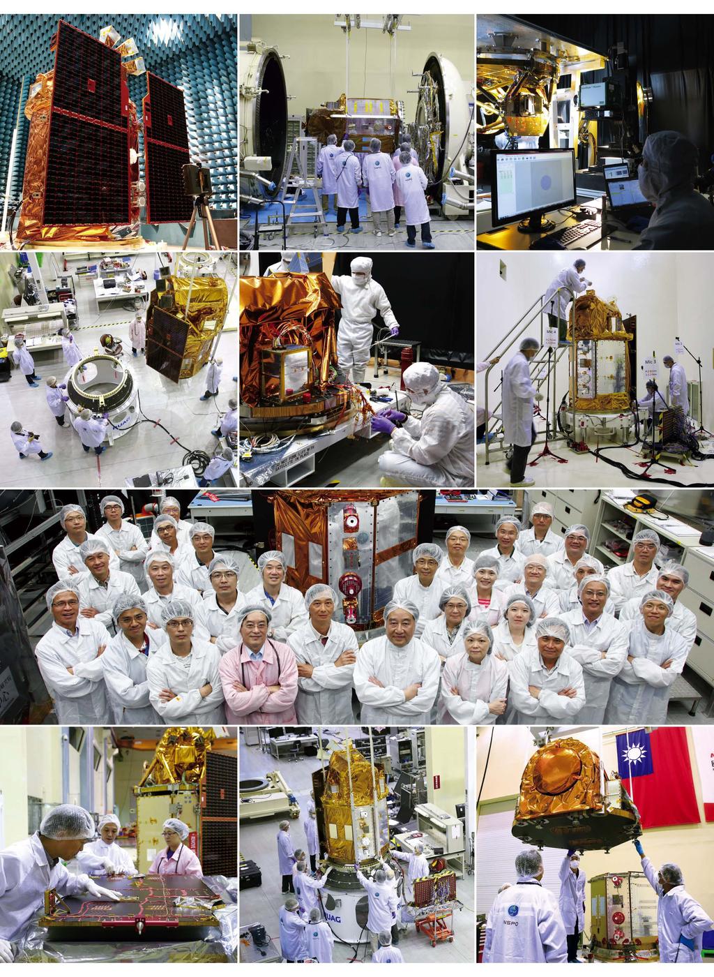
2 1 FORMOSAT-5 - Launch Campaign-
3 FORMOSAT-5 Launch Campaign 2 FORMOSAT-5 Launch Campaign Launch Date: U.S. Pacific Time Activities 11:50-12:23 Launch Window 13:30-16:00 Reception
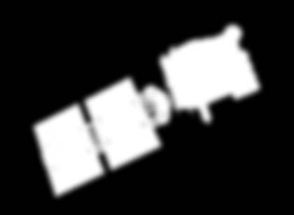
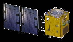
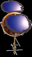
4 3 FORMOSAT-5 Mission Overview FORMOSAT-5 is the first space program that National Space Organization (NSPO) takes full responsibility for the complete satellite system development. Mission objectives of the program are as follows: To build up Taiwan's self-reliant space technology on the remote sensing payload and spacecraft bus, To develop the key components of the EO-type remote sensing instrument and spacecraft bus by integrating the domestic resources, To continue to serve the global imagery users' community of FORMOSAT-2, and To promote the space science experiment & research. FORMOSAT-5 will operate in a sun synchronous orbit at 720- km altitude with degree inclination angle. Similar to FORMOSAT-2, an optical Remote Sensing Instrument (RSI), which provides 2-m resolution panchromatic (PAN, black & white) and 4-m resolution multi-spectral (MS, color) images, will be the primary payload on FORMOSAT-5. The RSI is composed of Telescope and Electrical Unit. The Telescope consists of Optics, Structure Module and CMOS typed Focal Plane Assembly. RSI, has been jointly developed by NARL's centers including NSPO, ITRC and CIC, as well as domestic organizations of NCSIST, AIDC, CMOS Sensor Inc., and Camels Vision Technologies. In addition, Advanced Ionospheric Probe (AIP) is provided by Institute of Space Science, National Central University for the FORMOSAT-5 satellite as a science payload. The AIP is an all-in-one plasma sensor to measure ionospheric plasma concentrations, velocities, and temperatures over a wide range of spatial scales. The transient and long-term variations of ionospheric plasma can be monitored as seismic precursors associated with earthquakes.
5 FORMOSAT-5 Launch Campaign 4


6 5

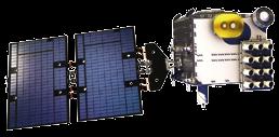
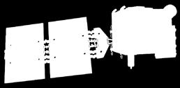
7 FORMOSAT-5 Launch Campaign 6 Satellite Specifications Parameter Specification Category Remote sensing satellite Weight Dimension Orbit About 450 kg (including fuel) Hexagonal, 2.8 m height, 1.6 m outer diameter Altitude 720 km, sun-synchronous Repeatability Every two days Image Down Link Rate 150 Mbits/sec Field of Regard 45 in pitch and roll axis Period About 99 minutes Mission Life Ground Sampling Distance (GSD) Swath Width 5 years nadir (PAN), nadir (Blue, Green, Red, Near Infrared) 24 nadir Image Data Storage 80 Gbits


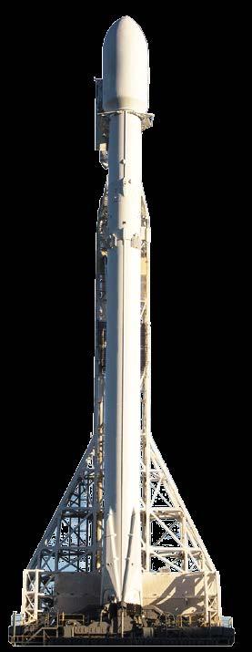
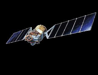
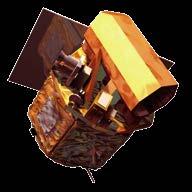
8 7 Launch Vehicle The FORMOSAT-5 launch service contract was awarded to a U.S. rocket company, Space Exploration Technologies Corporation (SpaceX), in April To fulfill the launch mission for the FORMOSAT-5, SpaceX proposed to use a Falcon 9 launch vehicle to deliver the satellite into the prescribed sun synchronous orbit at 720km altitude. Stage 2 Shutdown T=560 sec A=725 km Fairing Ejection 4 T=166 sec A=114 km Stage 2 Ignition 3 T=158 sec A=100 km 5 T : Time from liftoff A : Altitude 2 Stage 1 Separation T=150 sec A=88 km 1 Stage 1 Ignition and Liftoff T=0 sec A=0 km

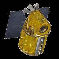
9 FORMOSAT-5 Launch Campaign 8 6 FORMOSAT-5 Deployment T=676 sec A=723 km Falcon 9 Logos on fairing

10 9 Early Orbits First Ground Station Contact (T+83 min) Launch (T+0 min) First Taiwan Ground Station Contact T+404 min FORMOSAT-5 Deployment (T+11 min) 83 minutes after launch, FORMOSAT-5 will contact with Svalbard ground station, 404 minutes after launch, FORMOSAT-5 will contact with Taiwan ground station.


 S-band TT&C")


 Image")
")
11 FORMOSAT-5 Launch Campaign 10 Satellite Operations S-band TT&C station/ X-band receiving station (National Cheng-Kung University, Tainan, Taiwan) S-band TT&C station (National Central University, Chungli, Taiwan) X-band receiving station (NSPO, Hsinchu, Taiwan) S-band TT&C station/ X-band receiving station (Svalbard, Norway) Satellite Operations Control Center (NSPO, Hsinchu, Taiwan) Image Processing System (NSPO, Hsinchu, Taiwan)


12 11 Image Processing Image Processing System includes five subsystems. The main functions of the five subsystems are described as follows. PSS: To generate a sequence of imaging parameters, such as attitude and timeline, as well as to send commands from ground stations. DIS: To receive X-band signals in real time and to de-compress, de-cipher and deformat into raw remote sensing image data for DPS. DMS: To manage all data storage and flow of IPS, and to provide the services of query, quick look, product order and product packing. DPS: To process raw satellite image data to generate three different levels of image products, Level 1A, Level 1C or Level 2, through radiometric correction or radiometric/geometric corrections. IQS: To monitor and track the qualities of satellite image, such as relative and absolute radiometric corrections, as well as geometric correction. Satellite Tasking Functions Multi-Tasking Stereo Imaging Along Coast Along Longitude


13 FORMOSAT-5 Launch Campaign 12 Image Coverage Day 1, 3, 5... Image Coverage Day 2, 4, 6... Image Coverage Two-day Revisit Cycle Global Coverage


14 13 FORMOSAT Scientific Satellite FORMOSAT Remote Sensing / Scientific Satellite FORMOSAT-3 Constellation 2006-Present Meteorological (GPS-RO) Satellites NSPO's Space Programs FORMOSAT Launch Remote Sensing / Scientific Satellite FORMOSAT-7 1 st Set Constellation 2018 Launch Meteorological (GNSS-RO) Satellites FORMOSAT-7R 2020 Launch Meteorological (GNSS-R) Satellite


15 FORMOSAT-5 Launch Campaign 14 Chronicle of FORMOSAT Program Approved 2013 Critical Design Review Passed 2014 End-to-end test succeeded 2015 Assembly, Integration, and Test Completed. Satellite ready for launch Satellite shipped to the United States for launch campaign.
16 15 MEMO
FORMOSAT-2 FOR INTERNATIONAL SOCIETAL BENEFITS
 FORMOSAT-2 FOR INTERNATIONAL SOCIETAL BENEFITS Ming-Chih Cheng 1, Celine Zhang 2 1 Researcher, 2 Research Assistant National Space Organization ABSTRACT The Group on Earth Observations (GEO), established
National SPace Organization
 National SPace Organization A center of innovation and excellence for space technology Bo Chen National Space Organization Presented at JPTM 2014, Sentinel Asia Yangon, Myanmar, 11/19-21 NARLabs-NSPO About
OVERVIEW OF KOMPSAT-3A CALIBRATION AND VALIDATION
 OVERVIEW OF KOMPSAT-3A CALIBRATION AND VALIDATION DooChun Seo 1, GiByeong Hong 1, ChungGil Jin 1, DaeSoon Park 1, SukWon Ji 1 and DongHan Lee 1 1 KARI(Korea Aerospace Space Institute), 45, Eoeun-dong,
Mission requirements and satellite overview
 Mission requirements and satellite overview E. BOUSSARIE 1 Dual concept Users need Defence needs Fulfil the Defence needs on confidentiality and security Civilian needs Fulfillment of the different needs
TAIWAN S SPACE PROGRAM DEVELOPMENT
 TAIWAN S SPACE PROGRAM DEVELOPMENT Shiann-Jeng Yu, Ming-Chih Cheng, Guey-Shin Chang. National Space Organization, 8F, 9 Prosperity 1st Road, Hsin-Chu Science Park, Hsin-Chu City, Taiwan Corresponding author:
KOMPSAT Constellation. November 2012 Satrec Initiative
 KOMPSAT Constellation November 2012 Satrec Initiative KOMPSAT Constellation KOMPSAT National program Developed and operated by KARI (Korea Aerospace Research Institute) Dual use : Government & commercial
Remote Sensing Platforms
 Remote Sensing Platforms Remote Sensing Platforms - Introduction Allow observer and/or sensor to be above the target/phenomena of interest Two primary categories Aircraft Spacecraft Each type offers different
Outline. GPS RO Overview. COSMIC Overview. COSMIC-2 Overview. Summary 9/29/16
 Bill Schreiner and UCAR/COSMIC Team UCAR COSMIC Program Observation and Analysis Opportunities Collaborating with the ICON and GOLD Missions Sept 27, 216 GPS RO Overview Outline COSMIC Overview COSMIC-2
9/12/2011. Training Course Remote Sensing Basic Theory & Image Processing Methods September 2011
 Training Course Remote Sensing Basic Theory & Image Processing Methods 19 23 September 2011 Remote Sensing Platforms Michiel Damen (September 2011) damen@itc.nl 1 Overview Platforms & missions aerial surveys
Remote Sensing Platforms
 Types of Platforms Lighter-than-air Remote Sensing Platforms Free floating balloons Restricted by atmospheric conditions Used to acquire meteorological/atmospheric data Blimps/dirigibles Major role - news
Introduction to KOMPSAT
 Introduction to KOMPSAT September, 2016 1 CONTENTS 01 Introduction of SIIS 02 KOMPSAT Constellation 03 New : KOMPSAT-3 50 cm 04 New : KOMPSAT-3A 2 KOMPSAT Constellation KOMPSAT series National space program
Microsatellite Constellation for Earth Observation in the Thermal Infrared Region
 Microsatellite Constellation for Earth Observation in the Thermal Infrared Region Federico Bacci di Capaci Nicola Melega, Alessandro Tambini, Valentino Fabbri, Davide Cinarelli Observation Index 1. Introduction
WorldView-2. WorldView-2 Overview
 WorldView-2 WorldView-2 Overview 6/4/09 DigitalGlobe Proprietary 1 Most Advanced Satellite Constellation Finest available resolution showing crisp detail Greatest collection capacity Highest geolocation
ROLE OF SATELLITE DATA APPLICATION IN CADASTRAL MAP AND DIGITIZATION OF LAND RECORDS DR.T. RAVISANKAR GROUP HEAD (LRUMG) RSAA/NRSC/ISRO /DOS HYDERABAD
 RSAA/NRSC/ISRO /DOS HYDERABAD") ROLE OF SATELLITE DATA APPLICATION IN CADASTRAL MAP AND DIGITIZATION OF LAND RECORDS DR.T. RAVISANKAR GROUP HEAD (LRUMG) RSAA/NRSC/ISRO /DOS HYDERABAD WORKSHOP on Best Practices under National Land Records
ROLE OF SATELLITE DATA APPLICATION IN CADASTRAL MAP AND DIGITIZATION OF LAND RECORDS DR.T. RAVISANKAR GROUP HEAD (LRUMG) RSAA/NRSC/ISRO /DOS HYDERABAD WORKSHOP on Best Practices under National Land Records
Advanced Optical Satellite (ALOS-3) Overviews
 Overviews") K&C Science Team meeting #24 Tokyo, Japan, January 29-31, 2018 Advanced Optical Satellite (ALOS-3) Overviews January 30, 2018 Takeo Tadono 1, Hidenori Watarai 1, Ayano Oka 1, Yousei Mizukami 1, Junichi
K&C Science Team meeting #24 Tokyo, Japan, January 29-31, 2018 Advanced Optical Satellite (ALOS-3) Overviews January 30, 2018 Takeo Tadono 1, Hidenori Watarai 1, Ayano Oka 1, Yousei Mizukami 1, Junichi
GLOBAL SATELLITE SYSTEM FOR MONITORING
 MEETING BETWEEN YUZHNOYE SDO AND HONEYWELL, International Astronautical Congress IAC-2012 DECEMBER 8, 2009 GLOBAL SATELLITE SYSTEM FOR MONITORING YUZHNOYE SDO PROPOSALS FOR COOPERATION WITH HONEYWELL EARTH
The RapidEye Mission. WGISS-24 Host Workshop Michael Oxfort / Oberpfaffenhofen / 17th October RapidEye proprietary information
 The RapidEye Mission WGISS-24 Host Workshop Michael Oxfort / Oberpfaffenhofen / 17th October 2007 1 Contents 1. Introduction 2. Business Concept 3. Markets and Segments 4. Products and Services (Selected
Geospatial Vision and Policies Korean Industry View 26 November, 2014 SI Imaging Services
 Geospatial Vision and Policies Korean Industry View 26 November, 2014 SI Imaging Services Distribution Limitation, SI Imaging Services Proprietary Data : The data contained in this document, without the
SAR Interferometry Capabilities of Canada's planned SAR Satellite Constellation
 SAR Interferometry Capabilities of Canada's planned SAR Satellite Constellation Dirk Geudtner, Guy Séguin,, Ralph Girard Canadian Space Agency RADARSAT Follow-on Program CSA is in the middle of a Phase
EPS Bridge Low-Cost Satellite
 EPS Bridge Low-Cost Satellite Results of a Concept Study being performed for Dr. Hendrik Lübberstedt OHB-System AG OpSE Workshop Walberberg 8th November 2005 EPS Bridge Key System Requirements Minimum
US Commercial Imaging Satellites
 US Commercial Imaging Satellites In the early 1990s, Russia began selling 2-meter resolution product from its archives of collected spy satellite imagery. Some of this product was down-sampled to provide
RECONNAISSANCE PAYLOADS FOR RESPONSIVE SPACE
 3rd Responsive Space Conference RS3-2005-5004 RECONNAISSANCE PAYLOADS FOR RESPONSIVE SPACE Charles Cox Stanley Kishner Richard Whittlesey Goodrich Optical and Space Systems Division Danbury, CT Frederick
The Future of GNSS-RO for Global Weather Monitoring and Prediction A COSMIC-2 / FORMOSAT-7 Program Status Update
 The Future of GNSS-RO for Global Weather Monitoring and Prediction A COSMIC-2 / FORMOSAT-7 Program Status Update Kendra Cook Lead NOAA Systems Engineer C 2 International, LLC 2 October 2014 Co-Authors:
OVERVIEW OF THE PRISMA SPACE AND GROUND SEGMENT AND ITS HYPERSPECTRAL PRODUCTS
 IEEE International Geoscience and Remote Sensing Symposium OVERVIEW OF THE PRISMA SPACE AND GROUND SEGMENT AND ITS HYPERSPECTRAL PRODUCTS Rocchina Guarini, Rosa Loizzo, Francesco Longo, Silvia Mari, Tiziana
GMES Sentinel-2. The Optical High Resolution Mission for GMES Operational Services
 GMES Sentinel-2 The Optical High Resolution Mission for GMES Operational Services Philippe Martimort GMES Sentinel-2 Mission and Payload Manager, ESA/ESTEC 15 October 2007, AGRISAR Workshop, Noordwijk
TopSat: Brief to Ground Segment Coordination. Presenter Ian Pilling. By : W.A. Levett. Co author: E.J. Baxter.
 TopSat: Brief to Ground Segment Coordination Board Presenter Ian Pilling By : W.A. Levett Co author: E.J. Baxter Contents Space Division overview The TopSat mission Overview Development Programme Launch
The Multi-Mission Satellite Operations at the NSPO Ground Segment
 P Road, Conference (Hosted and organized by ESA and EUMETSAT in association with AIAA) AIAA 2008-3228 The Multi-Mission Satellite Operations at the NSPO Ground Segment NSPO, 8F, 9 Prosperity 1P Shin-Fa
The world s most advanced constellation
 The DigitalGlobe Constellation The world s most advanced constellation of very high-resolution satellites The world s most advanced constellation The DigitalGlobe constellation of high-resolution satellites
PLANET IMAGERY PRODUCT SPECIFICATIONS PLANET.COM
 PLANET IMAGERY PRODUCT SPECIFICATIONS SUPPORT@PLANET.COM PLANET.COM LAST UPDATED JANUARY 2018 TABLE OF CONTENTS LIST OF FIGURES 3 LIST OF TABLES 4 GLOSSARY 5 1. OVERVIEW OF DOCUMENT 7 1.1 Company Overview
A 1m Resolution Camera For Small Satellites
 A 1m Resolution Camera For Small Satellites Paper SSC06-X-5 Presenter: Jeremy Curtis 1 Introduction TopSat launched October 2005 carrying RAL s 2.5m GSD camera into a 686km orbit Built and operated by
KEY TECHNOLOGY DEVELOPMENT FOR THE ADVENACED LAND OBSERVING SATELLITE
 KEY TECHNOLOGY DEVELOPMENT FOR THE ADVENACED LAND OBSERVING SATELLITE Takashi HAMAZAKI, and Yuji OSAWA National Space Development Agency of Japan (NASDA) hamazaki.takashi@nasda.go.jp yuji.osawa@nasda.go.jp
(CSES) Introduction for China Seismo- Electromagnetic Satellite
 Introduction for China Seismo- Electromagnetic Satellite") Introduction for China Seismo- Electromagnetic Satellite (CSES) Wang Lanwei Working Group of China Earthquake-related related Satellites Mission China Earthquake Administration Outline Project Objectives
Introduction for China Seismo- Electromagnetic Satellite (CSES) Wang Lanwei Working Group of China Earthquake-related related Satellites Mission China Earthquake Administration Outline Project Objectives
Introduction. Satellite Research Centre (SaRC)
") SATELLITE RESEARCH CENTRE - SaRC Introduction The of NTU strives to be a centre of excellence in satellite research and training of students in innovative space missions. Its first milestone satellite
SATELLITE RESEARCH CENTRE - SaRC Introduction The of NTU strives to be a centre of excellence in satellite research and training of students in innovative space missions. Its first milestone satellite
Research by Ukraine of the near Earth space
 MEETING BETWEEN YUZHNOYE SDO AND HONEYWELL, DECEMBER 8, 2009 Research by Ukraine of the near Earth space YUZHNOYE SDO PROPOSALS 50 th session FOR of COOPERATION STSC COPUOS WITH HONEYWELL Vienna 11-22
A Constellation of CubeSats for Amazon Rainforest Deforestation Monitoring
 4 th IAA Conference on University Satellites s & CubeSat Workshop - Rome, Italy - December 7, 2017 1 / 17 A Constellation of CubeSats for Monitoring Fernanda Cyrne Pedro Beghelli Iohana Siqueira Lucas
NCUBE: The first Norwegian Student Satellite. Presenters on the AAIA/USU SmallSat: Åge-Raymond Riise Eystein Sæther
 NCUBE: The first Norwegian Student Satellite Presenters on the AAIA/USU SmallSat: Åge-Raymond Riise Eystein Sæther Motivation Build space related competence within: mechanical engineering, electronics,
9/12/2011. Training Course Remote Sensing Basic Theory & Image Processing Methods September 2011
 Training Course Remote Sensing Basic Theory & Image Processing Methods 19 23 September 2011 Popular Remote Sensing Sensors & their Selection Michiel Damen (September 2011) damen@itc.nl 1 Overview Low resolution
EXAMPLES OF TOPOGRAPHIC MAPS PRODUCED FROM SPACE AND ACHIEVED ACCURACY CARAVAN Workshop on Mapping from Space, Phnom Penh, June 2000
 EXAMPLES OF TOPOGRAPHIC MAPS PRODUCED FROM SPACE AND ACHIEVED ACCURACY CARAVAN Workshop on Mapping from Space, Phnom Penh, June 2000 Jacobsen, Karsten University of Hannover Email: karsten@ipi.uni-hannover.de
High Resolution Sensor Test Comparison with SPOT, KFA1000, KVR1000, IRS-1C and DPA in Lower Saxony
 High Resolution Sensor Test Comparison with SPOT, KFA1000, KVR1000, IRS-1C and DPA in Lower Saxony K. Jacobsen, G. Konecny, H. Wegmann Abstract The Institute for Photogrammetry and Engineering Surveys
An Introduction to Geomatics. Prepared by: Dr. Maher A. El-Hallaq خاص بطلبة مساق مقدمة في علم. Associate Professor of Surveying IUG
 An Introduction to Geomatics خاص بطلبة مساق مقدمة في علم الجيوماتكس Prepared by: Dr. Maher A. El-Hallaq Associate Professor of Surveying IUG 1 Airborne Imagery Dr. Maher A. El-Hallaq Associate Professor
Indian Remote Sensing Satellites
 Resourcesat-1 Indian Remote Sensing Satellites -Current & Future Resourcesat Missions - Presented by: Timothy J. Puckorius Chairman & CEO EOTec 1 Presentation Topics India s Earth Observation Heritage
CubeSat Integration into the Space Situational Awareness Architecture
 CubeSat Integration into the Space Situational Awareness Architecture Keith Morris, Chris Rice, Mark Wolfson Lockheed Martin Space Systems Company 12257 S. Wadsworth Blvd. Mailstop S6040 Littleton, CO
Systematic Image Processing of the Small Satellite Mission BIRD
 Systematic Image Processing of the Small Satellite Mission BIRD Klaus Brieß 1, Eckehard Lorenz 2 1 Technische Universität Berlin, Institut für Luft und Raumfahrt, Marchstr.12, D-10587 Berlin 2 Deutsches
Development of Microsatellite to Detect Illegal Fishing MS-SAT
 Development of Microsatellite to Detect Illegal Fishing MS-SAT Ernest S. C. P. Bintang A.S.W.A.M. Department of Aerospace Engineering Faculty of Mechanical and Aerospace Engineering Institut Teknologi
Innovative Design Concepts for the Low-Cost Remote Sensing Satellites
 Innovative Design Concepts for the Low-Cost Remote Sensing Satellites SSC08-IV-11 Jer National Space Organization (NSPO), Taiwan 886-3-5784208, jl@nspo.org.tw Bo Chen, Cynthia Liu, and Eden Hsueh National
FEDERAL SPACE AGENCY SOVZOND JSC компания «Совзонд»
 FEDERAL SPACE AGENCY Resurs-DK.satellite SOVZOND JSC SPECIFICATIONS Launch date June 15, 2006 Carrier vehicle Soyuz Orbit Elliptical Altitude 360-604 km Revisit frequency (at nadir) 6 days Inclination
Satellite Testing. Prepared by. A.Kaviyarasu Assistant Professor Department of Aerospace Engineering Madras Institute Of Technology Chromepet, Chennai
 Satellite Testing Prepared by A.Kaviyarasu Assistant Professor Department of Aerospace Engineering Madras Institute Of Technology Chromepet, Chennai @copyright Solar Panel Deployment Test Spacecraft operating
Lecture 6: Multispectral Earth Resource Satellites. The University at Albany Fall 2018 Geography and Planning
 Lecture 6: Multispectral Earth Resource Satellites The University at Albany Fall 2018 Geography and Planning Outline SPOT program and other moderate resolution systems High resolution satellite systems
EARTH OBSERVATION WITH SMALL SATELLITES
 EARTH OBSERVATION WITH SMALL SATELLITES AT THE FUCHS-GRUPPE B. Penné, C. Tobehn, M. Kassebom, H. Lübberstedt OHB-System GmbH, Universitätsallee 27-29, D-28359 Bremen, Germany www.fuchs-gruppe.com ABSTRACT
Baumanets student micro-satellite
 Baumanets student micro-satellite Presentation at UNIVERSAT 2006 International Symposium June 28, 2006 Moscow, Russia Victoria Mayorova Director of Youth Space Center of Bauman Moscow State Technical University
OVERVIEW OF THE ALOS SATELLITE SYSTEM
 OVERVIEW OF THE ALOS SATELLITE SYSTEM Presented to The Symposium for ALOS Data Application Users @Kogakuin University, Tokyo, Japan Mar. 27, 2001 Takashi Hamazaki Senior Engineer ALOS Project National
PAPER NUMBER: PAPER TITLE: Multi-band CMOS Sensor simplify FPA design. SPIE, Remote sensing 2015, Toulouse, France.
 PAPER NUMBER: 9639-28 PAPER TITLE: Multi-band CMOS Sensor simplify FPA design to SPIE, Remote sensing 2015, Toulouse, France On Section: Sensors, Systems, and Next-Generation Satellites Page1 Multi-band
Abstract Quickbird Vs Aerial photos in identifying man-made objects
 Abstract Quickbird Vs Aerial s in identifying man-made objects Abdullah Mah abdullah.mah@aramco.com Remote Sensing Group, emap Division Integrated Solutions Services Department (ISSD) Saudi Aramco, Dhahran
SNIPE mission for Space Weather Research. CubeSat Developers Workshop 2017 Jaejin Lee (KASI)
") SNIPE mission for Space Weather Research CubeSat Developers Workshop 2017 Jaejin Lee (KASI) New Challenge with Nanosatellites In observing small-scale plasma structures, single satellite inherently suffers
SNIPE mission for Space Weather Research CubeSat Developers Workshop 2017 Jaejin Lee (KASI) New Challenge with Nanosatellites In observing small-scale plasma structures, single satellite inherently suffers
Sensor resolutions from space: the tension between temporal, spectral, spatial and swath. David Bruce UniSA and ISU
 Sensor resolutions from space: the tension between temporal, spectral, spatial and swath David Bruce UniSA and ISU 1 Presentation aims 1. Briefly summarize the different types of satellite image resolutions
Relative Cost and Performance Comparison of GEO Space Situational Awareness Architectures
 Relative Cost and Performance Comparison of GEO Space Situational Awareness Architectures Background Keith Morris Lockheed Martin Space Systems Company Chris Rice Lockheed Martin Space Systems Company
ERS/ENVISAT ASAR Data Products and Services
 ERS/ENVISAT ASAR Data Products and Services Andrea Celentano Business Manager celentan@eurimage.com What is Eurimage? Founded in 1989 Current shareholders: Since 1989 Commercial Partner of the European
HEMERA Constellation of passive SAR-based micro-satellites for a Master/Slave configuration
 HEMERA Constellation of passive SAR-based micro-satellites for a Master/Slave HEMERA Team Members: Andrea Bellome, Giulia Broggi, Luca Collettini, Davide Di Ienno, Edoardo Fornari, Leandro Lucchese, Andrea
IKONOS High Resolution Multispectral Scanner Sensor Characteristics
 High Spatial Resolution and Hyperspectral Scanners IKONOS High Resolution Multispectral Scanner Sensor Characteristics Launch Date View Angle Orbit 24 September 1999 Vandenberg Air Force Base, California,
Monitoring Natural Disasters with Small Satellites Smart Satellite Based Geospatial System for Environmental Protection
 Monitoring Natural Disasters with Small Satellites Smart Satellite Based Geospatial System for Environmental Protection Krištof Oštir, Space-SI, Slovenia Contents Natural and technological disasters Current
CHAPTER 7: Multispectral Remote Sensing
 CHAPTER 7: Multispectral Remote Sensing REFERENCE: Remote Sensing of the Environment John R. Jensen (2007) Second Edition Pearson Prentice Hall Overview of How Digital Remotely Sensed Data are Transformed
WG5: AGRICULTURE & FOOD SECURITY FORMOSAT SATELLITES IN AGRICULTURAL MONITORING
 WG5: AGRICULTURE & FOOD SECURITY FORMOSAT SATELLITES IN AGRICULTURAL MONITORING Franz M.C. Cheng & Satellite Image Division National Space Organization, NARLabs www.nspo.org.tw franz.cheng@nspo.narl.org.tw
IT-SPINS Ionospheric Imaging Mission
 IT-SPINS Ionospheric Imaging Mission Rick Doe, SRI Gary Bust, Romina Nikoukar, APL Dave Klumpar, Kevin Zack, Matt Handley, MSU 14 th Annual CubeSat Dveloper s Workshop 26 April 2017 IT-SPINS Ionosphere-Thermosphere
Big picture with KOMPSAT KOMPSAT-3A / KOMPSAT-3 / KOMPSAT-5 / KOMPSAT-2
 Big picture with KOMPSAT KOMPSAT-3A / KOMPSAT-3 / KOMPSAT-5 / KOMPSAT-2 Big picture with KOMPSAT Introduction SI Imaging Services (SIIS) is the exclusive worldwide marketing and sales representative of
Changing the economics of space. Redefining the word Responsive in Operationally Responsive Space
 Changing the economics of space Redefining the word Responsive in Operationally Responsive Space Dr. Stuart Eves s.eves@sstl.co.uk SSTL February 2009 Defining Responsive Responsive means flexible and agile,
Coral Reef Remote Sensing
 Coral Reef Remote Sensing Spectral, Spatial, Temporal Scaling Phillip Dustan Sensor Spatial Resolutio n Number of Bands Useful Bands coverage cycle Operation Landsat 80m 2 2 18 1972-97 Thematic 30m 7
TECHNICAL ASPECTS AND ATTITUDE CONTROL STRATEGY OF LAPAN-TUBSAT MICRO SATELLITE
 TECHNICAL ASPECTS AND ATTITUDE CONTROL STRATEGY OF LAPAN-TUBSAT MICRO SATELLITE S. Hardhienata (1), A. Nuryanto (1), R. H. Triharjanto (1), U. Renner (2) (1) Indonesian National Institute of Aeronautics
Consumer digital CCD cameras
 CAMERAS Consumer digital CCD cameras Leica RC-30 Aerial Cameras Zeiss RMK Zeiss RMK in aircraft Vexcel UltraCam Digital (note multiple apertures Lenses for Leica RC-30. Many elements needed to minimize
The Fourth FORMOSAT-3/COSMIC Data Users Workshop, Oct. 2009, Boulder, Colorado, USA NSPO
 The Fourth FORMOSAT-3/COSMIC Data Users Workshop, 27-29 Oct. 2009, Boulder, Colorado, USA FORMOSAT-3/COSMIC Follow-On Status at NSPO Nick Yen, Vicky Chu, Tie Yu, Joe Fong NSPO 10-29-2009 Summary from OSSE
The DigitalGlobe Constellation. World s Largest Sub-Meter High Resolution Satellite Constellation
 The DigitalGlobe Constellation World s Largest Sub-Meter High Resolution Satellite Constellation The DigitalGlobe Constellation The DigitalGlobe constellation of high resolution satellites offers incredible
Micro-STAR Potential Contribution to Human Safety and Security
 Micro-STAR Potential Contribution to Human Safety and Security Toto Marnanto Kadri Aeronautics Electronic Technology Center National Institute of Aeronautics and Space - LAPAN The 16 th Session of Asia
XVI. LOW EARTH ORBIT, MULTI-SPECTRAL IMAGING SATELLITE
 XVI. LOW EARTH ORBIT, MULTI-SPECTRAL IMAGING SATELLITE A. BACKGROUND According to the Systems Engineering and Integration (SEI) Integrated Concept of Operations discussed in Chapter VII, an essential aspect
Iridium NEXT SensorPODs: Global Access For Your Scientific Payloads
 Iridium NEXT SensorPODs: Global Access For Your Scientific Payloads 25 th Annual AIAA/USU Conference on Small Satellites August 9th 2011 Dr. Om P. Gupta Iridium Satellite LLC, McLean, VA, USA Iridium 1750
1. INTRODUCTION. GOCI : Geostationary Ocean Color Imager
 1. INTRODUCTION The Korea Ocean Research and Development Institute (KORDI) releases an announcement of opportunity (AO) to carry out scientific research for the utilization of GOCI data. GOCI is the world
detected by Himawari-8 then the location will be uplinked to approaching Cubesats as an urgent location for medium resolution imaging.
 Title: Cubesat constellation for monitoring and detection of bushfires in Australia Primary Point of Contact (POC) & email: siddharth.doshi2@gmail.com Co-authors: Siddharth Doshi, David Lam, Himmat Panag
Drafting Committee for the Asia Pacific Plan of Action for Space Applications for Sustainable Development ( ) Republic of Korea
 Republic of Korea") Drafting Committee for the Asia Pacific Plan of Action for Space Applications for Sustainable Development (2018 2030) Republic of Korea Bangkok, Thailand 31 May 1 June 2018 김 1 KARI Introduction Government
Drafting Committee for the Asia Pacific Plan of Action for Space Applications for Sustainable Development (2018 2030) Republic of Korea Bangkok, Thailand 31 May 1 June 2018 김 1 KARI Introduction Government
GNSS Reflectometry and Passive Radar at DLR
 ACES and FUTURE GNSS-Based EARTH OBSERVATION and NAVIGATION 26./27. May 2008, TU München Dr. Thomas Börner, Microwaves and Radar Institute, DLR Overview GNSS Reflectometry a joined proposal of DLR and
1. Detect and locate potentially illegal fishing ship using satellite image, AIS data, and external sources.
 Title: Development of Microsatellite to Detect Illegal Fishing MS-SAT Primary Point of Contact (POC) & email: Dr. Ridanto Eko Poetro; ridanto@ae.itb.ac.id Co-authors: Ernest Sebastian C., Bintang A.S.W.A.M.
Time Trend Evaluations of Absolute Accuracies for PRISM and AVNIR-2
 The 3 rd ALOS Joint PI Symposium, Kona, Hawaii, US Nov. 9-13, 2009 Time Trend Evaluations of Absolute Accuracies for PRISM and AVNIR-2 Takeo Tadono*, Masanobu Shimada*, Hiroshi Murakami*, Junichi Takaku**,
CHAPTER --'3 DATA DESCRIPTION
 CHAPTER --'3 DATA DESCRIPTION 37 3.1 INTRODUCTION In chapter 2 different techniques used for the study of polar cryosphere like passive and active remote sensing, altimetry and scatterometry are described.
The studies began when the Tiros satellites (1960) provided man s first synoptic view of the Earth s weather systems.
 provided man s first synoptic view of the Earth s weather systems.") Remote sensing of the Earth from orbital altitudes was recognized in the mid-1960 s as a potential technique for obtaining information important for the effective use and conservation of natural resources.
Remote sensing of the Earth from orbital altitudes was recognized in the mid-1960 s as a potential technique for obtaining information important for the effective use and conservation of natural resources.
FORMOSAT-2, KOMPSAT-2, ASTROTERRA
 FORMOSAT-2, KOMPSAT-2, ASTROTERRA Igor Lampin, Didier Giacobbo - SPOT IMAGE S.A. GSCB Workshop, ESA/ESRIN Frascati FORMOSAT-2 Mission status F-2 is owned by Taiwan National Space Organisation (NSPO), designed
COSMIC / FormoSat 3 Overview, Status, First results, Data distribution
 COSMIC / FormoSat 3 Overview, Status, First results, Data distribution COSMIC Introduction / Status Early results from COSMIC Neutral Atmosphere profiles Refractivity Temperature, Water vapor Planetary
PROPOSAL FOR A NEW HYPER SPECTRAL IMAGING MICRO SATELLITE: SVALBIRD
 PROPOSAL FOR A NEW HYPER SPECTRAL IMAGING MICRO SATELLITE: SVALBIRD Fred Sigernes 1, Udo Renner 2, Stephan Roemer 2, Jörn-Hendrik Bleif 2, Dag Arne Lorentzen 1, Stefan Claes 1, Reidar Nordheim 3, Frank
Satellite Engineering Research at US Prof Herman Steyn
 Satellite Engineering Research at US Prof Herman Steyn History (SUNSAT-1) Graduate student project Over 100 students 1992-2001 Microsatellite with 15m GSD 3-band multi-spectral pushbroom imager Launch
Futrajaya, Malaysia JULY 12, Jeong Heon SONG. Korea Aerospace Research Institution
 J P T M 2 0 1 1 Futrajaya, Malaysia JULY 12, 2011 Jeong Heon SONG Korea Aerospace Research Institution Outline Contribution of KARI Sentinel Asia / Data Provider Node International Charter KARI Space Activities
The Challenge. SPOT Vegetation. miniaturization. Proba Vegetation. Technology assessment:
 The Challenge Spot-5 lifetime expires in 2012. The next French satellite, Pleiades, is solely dedicated to HiRes. The Belgian Federal Science Policy Office (BELSPO) declared their interest to develop an
Reconnaissance Payloads for Responsive Space
 4th Responsive Space Conference RS4-2006-5003 Reconnaissance Payloads for Responsive Space Stanley Kishner, David Flynn, Charles Cox Goodrich Optical and Space Systems Division Danbury, CT 4th Responsive
Microsatellite Ionospheric Network in Orbit
 Changing the economics of space Microsatellite Ionospheric Network in Orbit Dr Stuart Eves Lead Mission Concepts Engineer SSTL s.eves@sstl.co.uk In tribute to Mino Freund 1962-2012 Introduction Objective
Hyper-spectral, UHD imaging NANO-SAT formations or HAPS to detect, identify, geolocate and track; CBRN gases, fuel vapors and other substances
 Hyper-spectral, UHD imaging NANO-SAT formations or HAPS to detect, identify, geolocate and track; CBRN gases, fuel vapors and other substances Arnold Kravitz 8/3/2018 Patent Pending US/62544811 1 HSI and
CanX-2 and NTS Canada's Smallest Operational Satellites
 CanX-2 and NTS Canada's Smallest Operational Satellites Daniel D. Kekez Space Flight Laboratory University of Toronto Institute for Aerospace Studies 9 August 2008 Overview Introduction to UTIAS/ SFL Mission
Geomatica OrthoEngine v10.2 Tutorial Orthorectifying ALOS PRISM Data Rigorous and RPC Modeling
 Geomatica OrthoEngine v10.2 Tutorial Orthorectifying ALOS PRISM Data Rigorous and RPC Modeling ALOS stands for Advanced Land Observing Satellite and was developed by the Japan Aerospace Exploration Agency
Reaching for the Stars
 Satellite Research Centre Reaching for the Stars Kay-Soon Low Centre Director School of Electrical & Electronic Engineering Nanyang Technological University 1 Satellite Programs @SaRC 2013 2014 2015 2016
International Conference on Space Optics ICSO 2014 La Caleta, Tenerife, Canary Islands 7 10 October /cso _2014 ono ' r
 International Conference on Space Optics La Caleta, Tenerife, Canary Islands 7 10 October 2014 Edited by Zoran Sodnik, Bruno Cugny, and Nikos Karafolas /cso _2014 ono ' r 6 October 2014: La Palma Excursion
1 Introduction. 2 Scientific Objectives and Mission Contents. SHEN Xuhui
 0254-6124/2014/34(5)-558 05 Chin. J. Space Sci. Ξ ΛΠΠ Shen Xuhui. The experimental satellite on electromagnetism monitoring. Chin. J. Space Sci., 2014, 34(5): 558-562, doi:10.11728/ cjss2014.05.558 The
; ; IR
 MS-2-2.5 SATELLITE The MS-2-2.5 satellite is designed for Earth Remote Sensing with the use of high resolution IR and multi-band imager. The satellite performs natural and man-caused disasters monitoring,
ROSCOSMOS Agency Report. 36 th CEOS WGCV Plenary May 2013, Shanghai, China
 ROSCOSMOS Agency Report 36 th CEOS WGCV Plenary 13-17 May 2013, Shanghai, China Denisov Pavel «Research Center for Earth Operative Monitoring» Joint-Stock Company «Russian Space Systems» 1 PURPOSE AND
Tropnet: The First Large Small-Satellite Mission
 Tropnet: The First Large Small-Satellite Mission SSC01-II4 J. Smith One Stop Satellite Solutions 1805 University Circle Ogden Utah, 84408-1805 (801) 626-7272 jay.smith@osss.com Abstract. Every small-satellite
KONGSBERG SATELLITE SERVICES Earth Observation for Maritime Operations Current Capabilities and Future Potential
 KONGSBERG SATELLITE SERVICES 2017 Earth Observation for Maritime Operations Current Capabilities and Future Potential Andreas Hay Kaljord Project Manager KSAT HQ IN TROMSØ - 69N WELCOME TO TROMSØ Established
RazakSAT A High Performance Satellite Waiting for Its Mission in Space
 SSC06-VI-6 RazakSAT A High Performance Satellite Waiting for Its Mission in Space H. J. Chun, B. J. Kim, H. S. Chang, E. E. Kim, W. K. Park and S. D. Park Satrec Initiative, 461-6 Jeonmin-dong, Yuseong-gu,