2010 Bentley Systems, Incorporated. Point Clouds in MicroStation V8i
|
|
|
- Johnathan Jennings
- 6 years ago
- Views:
Transcription


1 Point Clouds in MicroStation V8i
 Laser")


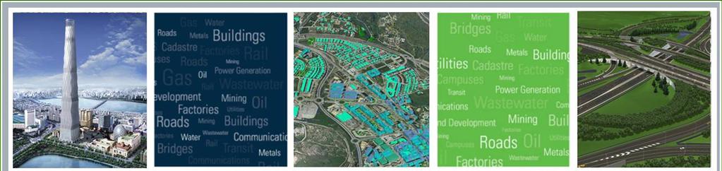
2 LiDAR Challenges Working with many forms of LiDAR (light detection and ranging) Laser Scanning Airborne LiDAR Mobile Mapping Systems All forms produce large data sets that require specialized software to view, extract and model for CADD use 2 Courtesy HNTB

3 Point cloud data is increasingly used as a basis for the 3D design work Today, this requires sophisticated software and specialized skill sets to extract and model what is needed for as-built conditions Only a select group have access to these tools and the point cloud data Courtesy HNTB LiDAR Challenges

4 MicroStation with point cloud capabilities will enable design teams to leverage the LiDAR data throughout the design workflow This will empower MicroStation user base with LiDAR viewing and measuring capabilities without need for add-on software Courtesy HNTB LiDAR Solutions


5 Value Creation Through Partnerships Agreement for continuous technology transfer Embedding VORTEX engine in V8i 5

6 Benefits of Partnership for MicroStation Users 1. Pointools is Dedicated to Software Development of High Performance Point Cloud Solutions 2. Embeddable Software Engine 3. Broad Interoperability Support 4. Large File Handling 5. High-speed Data Processing 6

7 Potential Impact of Pointools Agreement Mainstreaming use of laser scanned data Ability to manage billons of 3D data points Less need to create vector/cad models Leverage benefits of common CAD platform across all apps Better integration of design and construction VDC - Virtual Design and Construction Increased demand for laser scanned data and services Copyright 2010 Spar Point Research All Rights Reserved 7

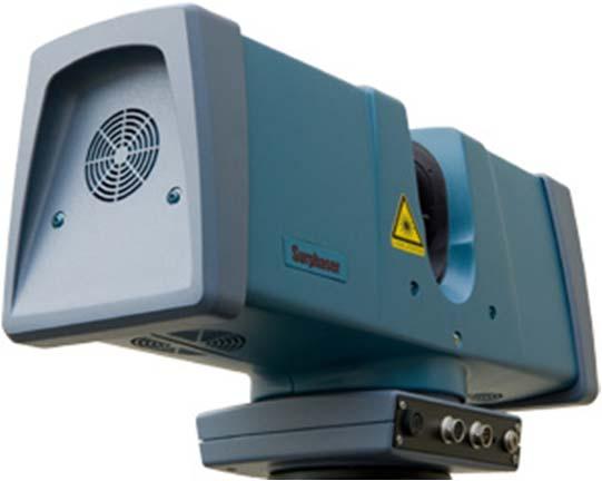
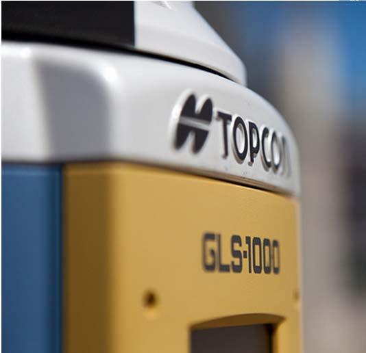
8 SUPPORTS ALL SCANNING TECHNOLOGIES 8


9 Large areas, relatively low density 9 Airborne Scanning


10 Mobile Scanning Relatively large areas, medium density 10
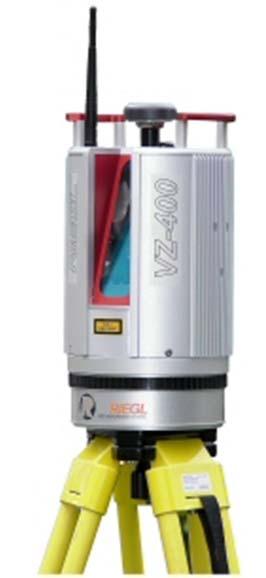
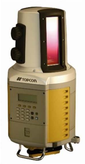
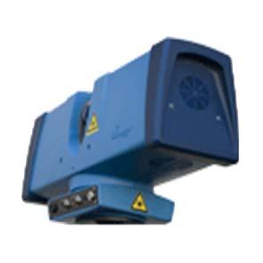
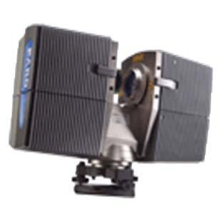
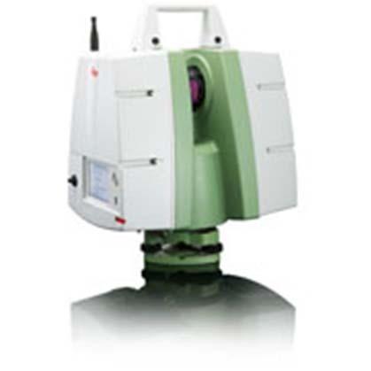
11 Terrestrial Scanning Small areas, medium high density 11
12 Laser Scanning Applications and Platforms GIS/mapping fixed wing Utility and corridor mapping helicopter Process, power and industrial plant tripod BIM tripod Transportation and infrastructure mobile Construction multiple City Modeling multiple Forensic and Security Planning multiple Entertainment and Gaming - multiple Copyright 2010 Spar Point Research All Rights Reserved 12
13 Bentley s Implementation Other Bentley Products DATA IMPORT VISUALISATION CLIPPING Point Cloud Functionality MicroStation ENABLES NATIVE POINT CLOUD VIEWING Bentley Platform Pointools vortex 13
14 Bentley s Implementation Other Bentley Products DATA IMPORT VISUALISATION CLIPPING Point Cloud Applications Point Cloud Functionality MicroStation SUPPORTS POINT CLOUD APPLICATIONS Bentley Platform Pointools vortex 14


15 Preparing Point Clouds in 15

16 MicroStation Implementation Native DGN Element Standard Viewing tools Similar to a reference file attachment Snap and Locate Measure, move, scale, etc. Level on/off Point Cloud Presentation RGB Classification Elevation Intensity 16

17 MicroStation User Experience 17


18 18

19 19
20 Demo 20
21 LIDAR Workflows LiDAR specialists prepare scans for mass consumption Capability will allow for: Evaluation of as-built models Design decision support Constructability analysis Clearance checking between design and survey data Many others 21


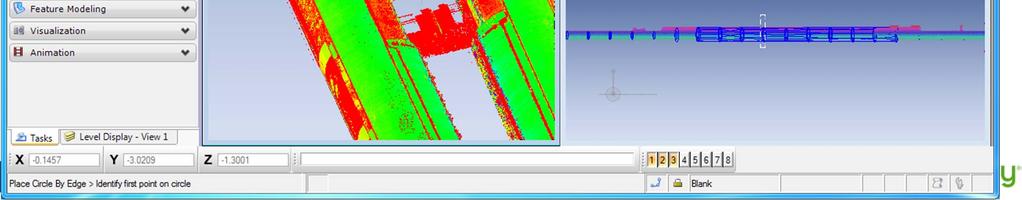
22 Rail Station Project 22

23 23

24 24

25 25
26 Availability Available in many V8i (SELECTseries 2) Products including: MicroStation V8i PowerDraft V8i Bentley View V8i Bentley Navigator V8i PowerCivil V8i PowerSurvey V8i 26
27 Point Clouds in MicroStation V8i
Civil Product Update. Derricke Gray, Product Manager Bentley Civil Americas
 Civil Product Update Derricke Gray, Product Manager Bentley Civil Americas 1 WWW.BENTLEY.COM 2016 Bentley Systems, Incorporated 2016 Bentley Systems, Incorporated Agenda Civil Update o Where we are at
What s New in Bentley Civil SELECTseries 3
 What s New in Bentley Civil SELECTseries 3 Introducing OpenRoads Technology Ian Rosam Product Manger, Bentley Civil 1 WWW.BENTLEY.COM 2013 2013 Bentley Bentley Systems, Incorporated Bentley Civil/Transportation
OpenRail SELECTseries 4 - Managing Geometry and Corridor Modeling
 2015 Bentley Systems, Incorporated OpenRail SELECTseries 4 - Managing Geometry and Corridor Modeling Robert Nice Senior Application Engineer Agenda: Why work in SELECTseries 4? Moving to SELECTseries 4
3D Modeling Demonstration
 2014 Bentley Systems, Incorporated 3D Modeling Demonstration Derricke Gray, Product Manager Bentley Civil Americas ESS Statewide Rollouts: 3D Modeling Engineering Content Management (ProjectWise) 2 WWW.BENTLEY.COM
Services Overview. Northeast Blueprint
 Services Overview 2D CAD Conversions Paper to CAD 2D CAD Conversions Construction Engineering / CAD Services Construction Markups Consultant Drawings Coordinated Drawings As -Builts Steel Structural Detailing
Programme TOC. CONNECT Platform CONNECTION Client MicroStation CONNECT Edition i-models what is comming
 Bentley CONNECT CONNECT Platform MicroStation CONNECT Edition 1 WWW.BENTLEY.COM 2016 Bentley Systems, Incorporated 2016 Bentley Systems, Incorporated Programme TOC CONNECT Platform CONNECTION Client MicroStation
Bentley Cloud Computing Strategy Present and Future
 Bentley Cloud Computing Strategy Present and Future Francois Valois MBA, Senior Product Manager Agenda Cloud Computing Bentley present Bentley future 2 WWW.BENTLEY.COM An analogy to the Cloud Computing
AutoPLANT Product Update
 AutoPLANT Product Update DK User Meeting 15 th November 2011 Chris Binns AutoPLANT Product Manager Agenda Introduction to me... Where we are today... AutoPLANT V8i (SELECTseries 3) Where we are going...
Bentley speedikon V8i
 Bentley speedikon V8i Overview Bentley speedikon V8i Products of the speedikon product line Bentley speedikon Industrial V8i Bentley speedikon Architectural V8i Bentley speedikon ProjectEditor V8i Bentley
Design, Drawing and Sheet Composition
 Design, Drawing and Sheet Composition Tools, Technologies and Concepts 1 WWW.BENTLEY.COM 2018 Bentley Systems, Incorporated 2018 Bentley Systems, Incorporated 2 WWW.BENTLEY.COM 2018 Bentley Systems, Incorporated
Bentley Civil Update and Direction
 www. bentley. com Bentley Civil Update and Direction Mike Wilson Director, Software Development, Bentley Civil The cast of characters this year Bentley Civil Mike Wilson that would be me Director, Software
Best Practice: Corridor Modeling
 2014 Bentley Systems, Incorporated Best Practice: Corridor Modeling Presented by: Joe Waxmonsky PE, Bentley Civil 2 WWW.BENTLEY.COM 2014 Bentley Systems, Incorporated Best Practice: Corridor Modeling Agenda
MicroStation CONNECT Edition - Information Modeling for Infrastructure Professionals
 MicroStation CONNECT Edition - Information Modeling for Infrastructure Professionals Urmas Jüriorg, CAD-süsteemide OÜ, Estonia 1 WWW.BENTLEY.COM 2016 Bentley Systems, Incorporated 2016 Bentley Systems,
Bentleyuser.dk ÅRSMØDE 2011 Vejle,
 2011 Bentley Systems, Incorporated Bentleyuser.dk ÅRSMØDE 2011 Vejle, 14.+15.11.2011 Bentley OpenPlant Update Carsten Gerke Senior Sales Director Bentley Plant EMEA Today s Agenda 2010 Bentley Systems,
Introducing Bentley Map VBA Development
 Introducing Bentley Map VBA Development Jeff Bielefeld Session Overview Introducing Bentley Map VBA Development - In this session attendees will be provided an introductory look at what is required to
OpenBridge Modeler: What is it and how can I use it today?
 2015 Bentley Systems, Incorporated OpenBridge Modeler: What is it and how can I use it today? Steve Willoughby, Senior Application Engineer Agenda: Introducing OpenBridge Modeler OpenBridge Modeler Features
ProConcrete. Gernot Jeromin Product Manager Bentley Systems, Incorporated
 ProConcrete Gernot Jeromin Product Manager ProConcrete 3D CAD Software for Concrete and Reinforcement 2 WWW.BENTLEY.COM What is ProConcrete AutoCAD Application MicroStation V8i version will be available
Plant & Process Electrical Design Introduction to I&W, promis e & BRCM
 2014 Bentley Systems, Incorporated Plant & Process Electrical Design Introduction to I&W, promis e & BRCM Rick Black- Industry Sales Director - Electrical Group EMEA 3 WWW.BENTLEY.COM 2014 Bentley Systems,
New Features in TerraScan. Version 013.xxx
 New Features in TerraScan Terrasolid Workshop ILMF 2013 Denver, CO 14 February 2013 Darrick Wagg GeoCue Corporation 9668 Madison Blvd., Suite 202 Madison, AL 35758 +1 (256) 461-8289 support@geocue.com
Design Tool Bag: Adding an ipad Pro to Your Toolset
 Design Tool Bag: Adding an ipad Pro to Your Toolset Jim LaPier IMPACT Designs, LLC Join the conversation #AU2016 Class summary With the introduction of the Apple ipad Pro and Apple Pencil, an incredibly
2010 Bentley Systems, Incorporated
 BentleyUser.dk 2010 AutoPLANT Product Update, 8 th November Chris Binns AutoPLANT Product Manager Agenda Introduction to me Who I am, my background etc. Latest AutoPLANT Release Current AutoPLANT Development
3D Scanning Services Information. With Hayles & Howe By K Lawrence CAD Technician
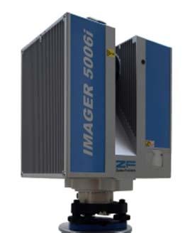
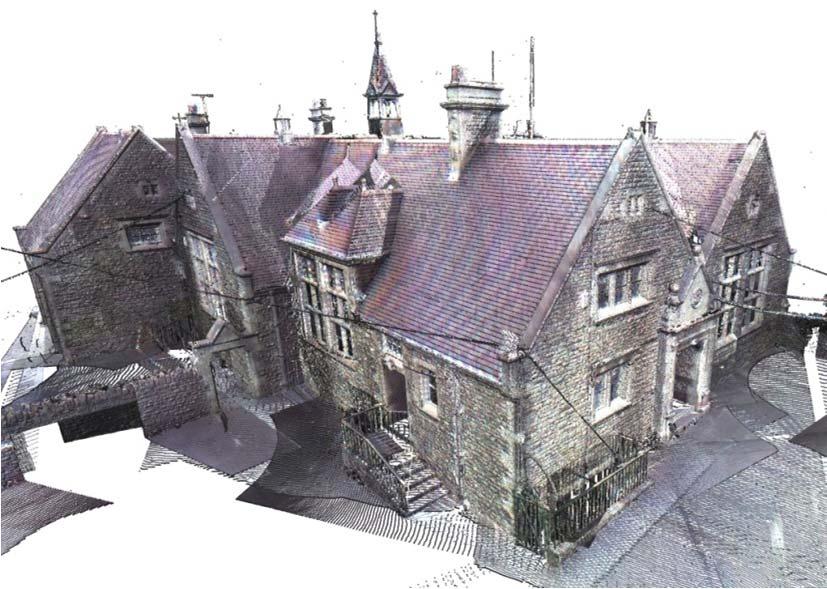
 3D Scanning Services Information 2017 With Hayles & Howe By K Lawrence CAD Technician 1 Summary Faro Laser Scanner Focus 3D X 130 HDR With the use of a 3D laser scanner you can capture any environment
Bentley's AECOsim Energy Simulator and What Next for Energy Simulation
 Bentley's AECOsim Energy Simulator and What Next for Energy Simulation Drury B. Crawley, Ph.D., FASHRAE, BEMP, FIBPSA 26 January 2013 1 WWW.BENTLEY.COM 2013 Bentley Systems, Incorporated AECOsim Energy
n 4ce Professional Module
 n 4ce Fact Sheet n 4ce Professional Module For the discerning user with specialist needs, n 4ce Professional provides extra facilities in Design and 3D presentations. Using the same platform as Lite, extra
Three Steps to Dynamic View for BIM Applications
 Three Steps to Dynamic View for BIM Applications The process of creating and using dynamic views can seem daunting to even the most experienced user. The Bentley BIM applications provide tools to somewhat
OpenBridge Designer Interoperability
 OpenBridge Designer Interoperability Steve Willoughby, Senior Application Engineer 1 WWW.BENTLEY.COM 2018 Bentley Systems, Incorporated 2018 Bentley Systems, Incorporated Agenda: OBM to LBC and Back OBM
Geospatial Keynote Nordic Civil konference I Vejle Bentley Systems, Incorporated 2016 Bentley Systems, Incorporated
 Geospatial Keynote Nordic Civil konference 07.11.2016 I Vejle 1 WWW.BENTLEY.COM 2016 Bentley Systems, Incorporated 2016 Bentley Systems, Incorporated Introduction Johannes Klick Senior Support Manager
3D Technologies Implementation - SE Freeways Design Wisconsin Department of Transportation
 3D Technologies Implementation - SE Freeways Design Wisconsin Department of Transportation Bob Gutierrez, P.E. Chief Southeast Freeways Design, WisDOT $1.7 b reconstruction of Zoo IC-Corridor WisDOT SE
3D Cadastre - Bentley Systems Perspective on Today's Motivations and Opportunities
 2015 Bentley Systems, Incorporated 3D Cadastre - Bentley Systems Perspective on Today's Motivations and Opportunities Benoit Fredericque, PhD. Senior Product Line Manager Infrastructure Serving People
AECOsim Building Designer. Quick Start Guide. Chapter 2 Making the Mass Model Intelligent Bentley Systems, Incorporated.
 AECOsim Building Designer Quick Start Guide Chapter 2 Making the Mass Model Intelligent 2012 Bentley Systems, Incorporated www.bentley.com/aecosim Table of Contents Making the Mass Model Intelligent...3
Building BIM in Australia: A Retrospective and Prospective Analysis
 Building BIM in Australia: A Retrospective and Prospective Analysis Professor Keith Hampson Sustainable Built Environment National Research Centre, Australia Co-author: Professor Robin Drogemuller Professor
OpenPlant. Hayley Brown Industry Consultant, Bentley Plant Bentley Systems, In
 OpenPlant Hayley Brown Industry Consultant, Bentley Plant tley Systems, In co Introduction What is OpenPlant? OpenPlant is the branding for the next generation of applications and tools based on ISO 15926
Leveraging PLM Components to Advance World s Infrastructure
 Leveraging PLM Components to Advance World s Infrastructure Sunand Sandurkar Director, Software Development 1 WWW.BENTLEY.COM 2018 Bentley Systems, Incorporated 2018 Bentley Systems, Incorporated Agenda
2014 Bentley Systems, Incorporated. Bentley Rail Track SELECTseries2 Maintenance Release
 2014 Bentley Systems, Incorporated Bentley Rail Track SELECTseries2 Maintenance Release Topics Look back What's in the latest release What's next 2 WWW.BENTLEY.COM 2014 Bentley Systems, Incorporated Previous
COMOS Walkinside 10.2
 COMOS Walkinside 10.2 Why Immersive Training? Knowledge retention through learning Leverage the power of: Human graphic memory from 3D contextual simulations Repetition of scenario-driven work tasks Time-scale
BIM FOR INFRASTRUCTURE THE IMPACT OF TODAY S TECHNOLOGY ON BIM
 BIM for Infrastructure The Impact of Today s Technology on BIM 1 BIM FOR INFRASTRUCTURE THE IMPACT OF TODAY S TECHNOLOGY ON BIM How Technology can Transform Business Processes and Deliver Innovation 8
Agenda 2 Bentley Overview. Solutions. Bridges. Buildings 4 Bentley Overview
 Agenda Attendees will learn about how to improve efficiencies by transferring AutoPLANT, PlantSpace, PDS and 3D CAD models to engineering analysis piping and structural models. A demonstration will be
Wholly Sheets, Batman - Plotting in AutoCAD Civil 3D Seth Cohen Advanced Technologies Solutions Inc.
 Seth Cohen Advanced Technologies Solutions Inc. CV637 Are you confused about how to plot all the different views (plan, profile, and cross sections) in AutoCAD Civil 3D software? Then this class is for
MicroStation V8i Intrinsically Geo-Coordinating Content for Project Design and Documentation
 MicroStation V8i Intrinsically Geo-Coorinating Content for Project Design an Documentation Chris Bober Bentley 2008 Bentley Intrinsic Geo-Coorination in V8i Priorities, Pressures an Solutions MicroStation
Modules for Graduate Certificate in Construction Productivity Enhancement Coming up soon Tentatively from January 2019 SkillsFuture funding may apply
 Modules for Graduate Certificate in Construction Productivity Enhancement Coming up soon Tentatively from January 2019 SkillsFuture funding may apply 1. CE5808A Digital Design Using BIM Technologies 2.
Share with Pride. SwP 013/15. Train Mounted Laser Survey of Birmingham New Street Area Resignalling Phase 7. Neil Archer Signalling Innovations Group
 Share with Pride SwP 013/15 Train Mounted Laser Survey of Birmingham New Street Area Resignalling Phase 7. Neil Archer Signalling Innovations Group Rob Dutton - Signalling Design Group Mick Brook - Infrastructure
2014 NCLUG Summer Conference. Workshops
 Workshops [CM Workshop] NCDOT Corridor Modeler (CM) Delta Training (3 Day) [SS2] Oak Thammavong, NCDOT Creating & Customizing templates presented by NCDOT, Oak Thammavong. The Advanced OpenRoads Technology
SHAPING SMART CITIES
 SHAPING CITIES STOP BY STAND C-327 LEARN HOW HEXAGON IS ENABLING CITIES OF ALL SIZES TO CURE GROWING PAINS, NOT JUST COPE WITH THEM. Also showcasing our solutions in conjunction with our partners: Huawei
Future of Bentley Plant applications: AutoPLant and OpenPlant
 1 WWW.BENTLEY.COM 2013 Bentley Systems, Incorporated Future of Bentley Plant applications: AutoPLant and Magnus Cullberg 2 WWW.BENTLEY.COM 2013 Bentley Systems, Incorporated AutoPLANT Modeler AutoPLANT
bentleyuser.se Användardagar Bentley Plant Directions
 bentleyuser.se Användardagar 8-9.11.2012 Bentley Plant Directions Inge-Magnar Olerud Agenda Plant Design recent history Current status OpenPlant (details in MP2 and MP3, today 14:00-16:10) AutoPLANT (details
OpenRoads Designer Best Practices Project Management
 OpenRoads Designer Best Practices Project Management Presented by: Ian Rosam, Director Civil Product Management, Bentley Systems, Inc. 1 WWW.BENTLEY.COM 2017 Bentley Systems, Incorporated 2017 Bentley
Implementing BIM for infrastructure: a guide to the essential steps
 Implementing BIM for infrastructure: a guide to the essential steps See how your processes and approach to projects change as you adopt BIM 1 Executive summary As an ever higher percentage of infrastructure
* SkillsFuture credit (available for Singapore Citizens, subject to approval)
") Modules for Graduate Certificate in Construction Productivity Enhancement * SkillsFuture credit (available for Singapore Citizens, subject to approval) ^ SkillsFuture Singapore (SSG) subsidy available
Modules for Graduate Certificate in Construction Productivity Enhancement * SkillsFuture credit (available for Singapore Citizens, subject to approval) ^ SkillsFuture Singapore (SSG) subsidy available
Practice Workbook. Cross Sections: Creating, Annotating, and Volumes. SELECTseries 4 ( ) or newer
 or newer") Practice Workbook This workbook is designed for use in Live instructor-led training and for OnDemand self study. The explanations and demonstrations are provided by the instructor in the classroom, or
Practice Workbook This workbook is designed for use in Live instructor-led training and for OnDemand self study. The explanations and demonstrations are provided by the instructor in the classroom, or
Please See NEXT PAGE for Class Selection
 SoCal Bentley Bash 2019 - January 11th - FRIDAY REGISTRATION FORM PLEASE PRINT - Use a separate form for each person registering For Admin Use Only *First Name *Last Name Company/School* *Address *City
UAV Technologies for 3D Mapping. Rolf Schaeppi Director Geospatial Solutions APAC / India
 UAV Technologies for 3D Mapping Rolf Schaeppi Director Geospatial Solutions APAC / India Some main application areas? Market situation Analyst statements billion dollars 7,3 defense market 2,5 civil market
Going Digital: Reality Modeling Advances Surveying, and Engineering
 Going Digital: Reality Modeling Advances Surveying, and Engineering Greg Bentley, CEO, Bentley Systems May 30, 2017 1 WWW.BENTLEY.COM 2017 Bentley Systems, Incorporated 2017 Bentley Systems, Incorporated
Bentley Rail Track Update
 Bentley Rail Track Update Robert Nice Bentley Systems UK Recent Past and Near Future Today, I will discuss recent enhancements to Bentley Rail Track. Some of these enhancements you may be very familiar
OVERVIEW. Ruggedised: ip 64 rated FOV: 360 X 275. Small footprint. High resolution 50 megapixel panoramic image. 4 x pre-calibrated sensors
 OVERVIEW Designed for rapid 360º precision imaging, istar is a 360º panoramic camera that captures full spherical images and high resolution panoramic video streams, providing efficient visual documentation
Intergeo 2017: Transition from Providing Solutions to Value Partnership
 ARTICLE Intergeo 2017: Transition from Providing Solutions to Value Partnership Intergeo 2017, the world s leading fair and conference on geodesy, geoinformation and land management, recently took place
BI TRENDS FOR Data De-silofication: The Secret to Success in the Analytics Economy
 11 BI TRENDS FOR 2018 Data De-silofication: The Secret to Success in the Analytics Economy De-silofication What is it? Many successful companies today have found their own ways of connecting data, people,
Looking into the Future Bentley Systems, Incorporated
 OPTRAM Looking into the Future Universal Truisms of Rail Too much of: Not Enough of: Infrastructure Problems Maintenance Budget 2 WWW.BENTLEY.COM Highest Priority Issues How Do You: 1) Know where to work
AGENDA: BIM Introduction. Large-Scale Value. Value for Architects. Conceptual BIM / Small BIM. All-Out BIM. BIM Introduction
 From Conceptual BIM to All-Out BIM Brent Mauti, Architect BARCH, OAA, MAA, SAA, AAA, MRAIC, NCARB, AIA, LEED-AP CH2M HILL CANADA ARCHITECTS INC. brent.mauti@ch2m.com Member of the Manitoba Association
Samuel Hudson BIM Support Specialist. Jeff Owens AIA, LEED AP
 BIM Preparation for the USACE Lessons Learned in Conversion from REVIT to BENTLEY BIM Presenters: Samuel Hudson BIM Support Specialist Jeff Owens AIA, LEED AP L E ll Lee Ezell Consulting BIM Specialist
Bentley Substation 2010 Bentley Systems, Incorporated Håkan Norling Bentley Professional Services
 www.bentley.com Bentley Substation Håkan Norling Bentley Professional Services Agenda, 12 th of November 2010 Bentley s Substation design solution Integration of primary- and secondary design based on
AVEVA PDMS. Business Benefits. Accurate and clash-free 3D plant design
 AVEVA PDMS Accurate and clash-free 3D plant design With ever increasing global demand for products from process and power plants, AVEVA PDMS enables companies to design, construct and maintain high quality
What is BIM and why should construction lawyers care about it? Dr. Carrie Sturts Dossick, P.E. Bita Astaneh Asl
 What is BIM and why should construction lawyers care about it? Dr. Carrie Sturts Dossick, P.E. Bita Astaneh Asl Learning Objectives What is BIM? > BIM definition > BIM history > Common current uses (3D
Full Waveform Digitizing, Dual Channel Airborne LiDAR Scanning System for Ultra Wide Area Mapping
 Full Waveform Digitizing, Dual Channel Airborne LiDAR Scanning System for Ultra Wide Area Mapping RIEGL LMS-Q56 high laser pulse repetition rate up to 8 khz digitization electronics for full waveform data
FARO Technical Seminar Spar 2006, Houston
 FARO Technical Seminar Spar 2006, Houston Martin Cooper O.I.L. Engineering Houston, Tx. Dr. Bernd Becker FARO Technologies Stuttgart Germany Content Application of the FARO Laser Scanner in Petrochemical
RIEGL VQ -780i NEW. Airborne Laser Scanning. Waveform Processing Airborne Laser Scanner for Ultra Wide Area Mapping and High Productivity.
 Waveform Processing Airborne Laser Scanner for Ultra Wide Area Mapping and High Productivity. NEW RIEGL VQ -78i online waveform processing as well as smart and full waveform recording excellent multiple
Helicopter Aerial Laser Ranging
 Helicopter Aerial Laser Ranging Håkan Sterner TopEye AB P.O.Box 1017, SE-551 11 Jönköping, Sweden 1 Introduction Measuring distances with light has been used for terrestrial surveys since the fifties.
GEOPAK V8i SELECTseries 1, Road 2
 GEOPAK V8i SELECTseries 1, Road 2 Ohio Department of Transportation October, 2012 Ohio Department of Transportation GEOPAK Road Training Guide for MicroStation V8i SELECTseries 1, October, 2012 The information
Practice Workbook. Cross Sections: Creating, Annotating, and Volumes
 Practice Workbook This workbook is designed for use in Live instructor-led training and for OnDemand selfstudy. The explanations and demonstrations are provided by the instructor in the classroom, or in
An Introduction to SITEOPS
 2015 Bentley Systems, Incorporated An Introduction to SITEOPS Bob Rolle, P.E Civil Application Engineer Today we ll cover how to: What our Clients want SITEOPS OPTIONEERING SITEOPS Workflow Blow your mind!
NEW. Airborne Laser Scanning. Waveform Processing Airborne Laser Scanner for Wide Area Mapping and High Productivity. visit our website
 Waveform Processing Airborne Laser Scanner for Wide Area Mapping and High Productivity. NEW RIEGL VQ -780i online waveform processing as well as smart and full waveform recording excellent multiple target
Drawing Compare for Autodesk Vault User Guide
 ENGINEERING SOFTWARE DEVELOPMENT MADE EASY Drawing Compare for Autodesk Vault User Guide 2017 www.amcbridge.com Contents: Welcome to Drawing Compare for Autodesk Vault... 3 Requirements and Installation...
DOWNLOAD OR READ : CONSTRUCTION CAD SOLUTIONS PDF EBOOK EPUB MOBI
 DOWNLOAD OR READ : CONSTRUCTION CAD SOLUTIONS PDF EBOOK EPUB MOBI Page 1 Page 2 construction cad solutions construction cad solutions pdf construction cad solutions CONSTRUCTION CAD SOLUTIONS LTD - Free
How to Design and Submit a DOT Project with Civil 3D
 11/30/2006-5:00 pm - 6:30 pm Room:San Polo - 3503 (ISD Campus) How to Design and Submit a DOT Project with Civil 3D Seth Cohen - ProSoft NET CV35-2 This lab will delve into the workflows and processes
1 Introduction. M.Rajabi a, T.Bigga b and M.A.Bartl c.
 Optimization of the quantity take-off (QTO) process for Mechanical, Electrical and plumbing (MEP) trades in tender estimation phase of the construction projects M.Rajabi a, T.Bigga b and M.A.Bartl c a
CHAPTER 15. Cross Section Sheets. None, except batch processing of an input file.
 CHAPTER 15 Cross Section Sheets 15.1 Introduction Objectives Project Manager Menu Bar Application Learn the procedures for laying out cross section sheets. Cross Section Sheets None, except batch processing
Any student may retake any class at any time and for any reason without additional charge.
 1 ENVISIONCAD ABOUT US Guaranteed Training 1 ENVISIONCAD ABOUT US EnvisionCAD is a provider of training solutions for MicroStation and select InRoads products. We also use our expertise to assist organizations
i-models Kansas City Revit Users Group September, 2013
 i-models Kansas City Revit Users Group September, 2013 Agenda i-model Definition Creation of i-models from Revit Reading an i-model Bentley Users collaborating with Revit Users Bentley View free Bentley
BIM: The UK Government Value Proposition
 BIM: The UK Government Value Proposition David Philp Head of BIM Implementation Cabinet Office, UK Government UK Government Strategy Task Group Arrival of BIM in the UK: An industry awoken We need To talk
Vehicle-to-X communication using millimeter waves
 Infrastructure Person Vehicle 5G Slides Robert W. Heath Jr. (2016) Vehicle-to-X communication using millimeter waves Professor Robert W. Heath Jr., PhD, PE mmwave Wireless Networking and Communications
Update on UltraCam and UltraMap technology
 Update on UltraCam and UltraMap technology Alexander Wiechert, Michael Gruber Anzengrubergasse 8/4, 8010 Graz, Austria {alexander.wiechert, michael.gruber}@vexcel-imaging.com Stuttgart, September 2017
10/18/2010. Focus. Information technology landscape
 Emerging Tools to Enable Construction Engineering Construction Engineering Conference: Opportunity and Vision for Education, Practice, and Research Blacksburg, VA October 1, 2010 A. B. Cleveland, Jr. Senior
Managing Imagery and Raster Data. Peter Becker
 Managing Imagery and Raster Data Peter Becker ArcGIS is a Comprehensive Imagery Platform Empowering you to make informed decisions System of Engagement System of Insight Extract Information from Imagery
Bentleyuser.dk Årsmøde 2010 Nordic Civil 2010
 Bentleyuser.dk Årsmøde 2010 Nordic Civil 2010 8.-10. November 2010, Munkebjerg Hotel, Vejle Workshop - X9 Resurfacing and Overlay Tools InRoads V8i Presenter: Joe Waxmonsky, P.E., Bentley Systems USA Bentley
FUGRO GROUP BUILDING AND INFRASTRUCTURE. TACKLING your complex challenges. UNDERSTANDING your operational objectives
 BUILDING AND INFRASTRUCTURE FUGRO GROUP UNDERSTANDING your operational objectives TACKLING your complex challenges DELIVERING your global success stories BUILDING AND INFRASTRUCTURE With a wide variety
LASER AIDED MODELLING (LAM ) CAPABILITY STATEMENT
 CAPABILITY STATEMENT") LASER AIDED MODELLING (LAM ) CAPABILITY STATEMENT CONTENTS WHO WE ARE BUILDING INFORMATION MODELLING (BIM) LASER SCANNING LASER AIDED MODELLING (LAM ) CASE STUDIES OFFICE LOCATIONS RAMBOLL MIDDLE EAST
LASER AIDED MODELLING (LAM ) CAPABILITY STATEMENT CONTENTS WHO WE ARE BUILDING INFORMATION MODELLING (BIM) LASER SCANNING LASER AIDED MODELLING (LAM ) CASE STUDIES OFFICE LOCATIONS RAMBOLL MIDDLE EAST
Discovering the source of smart:
 Discovering the source of smart: Intelligent decisions, intelligent infrastructure... How we need to integrate different ways of creating and managing information to support better decision making through
EUROPEAN GNSS ADOPTION OPPORTUNITIES IN TRANSPORT WITH FOCUS ON RAIL
 EUROPEAN GNSS ADOPTION OPPORTUNITIES IN TRANSPORT WITH FOCUS ON RAIL Gian Gherardo Calini European GNSS Agency III Workshop GNSS Technology Advances in a Multi-Constellation Framework 22 January 2016 This
D DAY 360 x330 Case Study 01. ScanLAB Projects. scanlabprojects.co.uk
 D DAY 360 x330 Case Study 01 DDay 360: In Early 2014 accompanied Windfalls Films, Military Historian Steven Zaloga and Colonel Len Fullenkamp, Professor of Military History and Strategy, to the D-Day landing
verticals products support services training community corporate Saving DGN to DWG (with AutoCAD paperspace and viewport compatibility)
") Page 1 of 6 Login Site Map Print Store Search Select Locale Quick Links verticals products support services training community corporate Support Support Tools KnowledgeBase TechNotes and FAQs Remote Support
Page 1 of 6 Login Site Map Print Store Search Select Locale Quick Links verticals products support services training community corporate Support Support Tools KnowledgeBase TechNotes and FAQs Remote Support
Sustaining Water Infrastructure using Bentley Water Solutions
 Sustaining Water Infrastructure using Bentley Water Solutions February 2010. Slavco Velickov, PhD Water Industry Director, EMEA Agenda 1.Bentley at a Glance 2.Bentley Water Solutions 3.Water Products Overview
Bridging the Gap. How to leverage BIM and VDC technology for marketing purposes
 Bridging the Gap How to leverage BIM and VDC technology for marketing purposes Before we get started please download kahoot! Kahoot.it Marketers aren t using BIM/VDC as a differentiator within the AEC
Ohio Department of Transportation, VBA Documentation
 Contents 1.1 Current Versions... 2 1.2 Overview... 3 1.3 Supporting Files and Standards... 4 1.3.1 ODOT_Drainage.cel... 4 1.3.2 ODOT2013.ddb... 5 1.4 ODOT_StormSewerPlan2013.mvba... 6 1.4.1 Mode: Place
Framework Programme 7
 Framework Programme 7 1 Joining the EU programmes as a Belarusian 1. Introduction to the Framework Programme 7 2. Focus on evaluation issues + exercise 3. Strategies for Belarusian organisations + exercise
Using Static and Mobile Laser Scanners to Measure and Manage Open Pit Mines
 Using Static and Mobile Laser Scanners to Measure and Manage Open Pit Mines by Dario Conforti, Teledyne Optech Email: dario.conforti@teledyne.com www.teledyneoptech.com 1 Case Studies Case Studies Static
Meetings and Proceedings; Book Chapter. Dawood, N. N. (Nashwan); Iqbal, N. (Nahim)
; Iqbal, N. (Nahim)") TeesRep - Teesside's Research Repository Building information modelling (BIM): A visual & whole life cycle approach Item type Authors Citation Publisher Additional Link Rights Meetings and Proceedings;
TeesRep - Teesside's Research Repository Building information modelling (BIM): A visual & whole life cycle approach Item type Authors Citation Publisher Additional Link Rights Meetings and Proceedings;
Active and Passive Microwave Remote Sensing
 Active and Passive Microwave Remote Sensing Passive remote sensing system record EMR that was reflected (e.g., blue, green, red, and near IR) or emitted (e.g., thermal IR) from the surface of the Earth.
SINCE 1916 SMPTE 2018 INNOVATION AND TECHNOLOGY IN MEDIA AND ENTERTAINMENT SURVEY RESULTS
 SINCE 1916 SMPTE 2018 INNOVATION AND TECHNOLOGY IN MEDIA AND ENTERTAINMENT SURVEY RESULTS MEDIA & ENTERTAINMENT COMPANIES ARE BETTING ON EMERGING TECHNOLOGIES M&E Companies are Betting on Emerging Technologies
X11-Using the New Civil Geometry Tools
 X11-Using the New Civil Geometry Tools Joe Waxmonsky, PE Bentley Civil 2010 Bentley Systems, Incorpo ora 2010 Bentley Systems, Incorpora 2010 Nordic Civil Geometry 2 WWW.BENTLEY.COM Roads and Bridges 2010
Airborne Laser Scanning. Lightweight Airborne Laser Scanner with Online Waveform Processing. visit our website
 Lightweight Airborne Laser Scanner with Online Waveform Processing RIEGL VUX-1LR 15 mm survey-grade accuracy scan speed up to 2 scans / second measurement rate up to 75, meas./sec operating flight altitude
Chapter 1 Overview of imaging GIS
 Chapter 1 Overview of imaging GIS Imaging GIS, a term used in the medical imaging community (Wang 2012), is adopted here to describe a geographic information system (GIS) that displays, enhances, and facilitates