DOST- ASTI Initiatives on the Development of Monitoring Stations and Application of Satellite Technology in Philippine Agriculture
|
|
|
- Elfreda Dennis
- 5 years ago
- Views:
Transcription
1 DOST- ASTI Initiatives on the Development of Monitoring Stations and Application of Satellite Technology in Philippine Agriculture Alvin E. Retamar Chief Science Research Specialist Advanced Science and Technology Institute Department of Science and Technology
 www.asti.dost.")
2 The Advanced Science and Technology Institute (DOST-ASTI)
 Focus on ICT and microelectronics research & development and technology")
3 About ASTI Created in 1987 as one of the seven (7) Research and Development Institutes (RDI) of the Department of Science and Technology (EO 128) Focus on ICT and microelectronics research & development and technology transfer
4 Source: rappler.com
5 Source: rappler.com Food Security Inclusive Growth Contribute to GDP

6 The Importance of Technology and Research Source: rappler.com

7 Challenges in Ph Agriculture Source: rappler.com Climate Change???

8 an average 20 typhoons per year visit the Philippines The Philippines source: wunderground.com

9 9

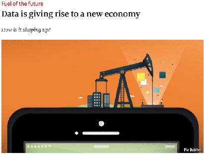
10 Data is the new Oil

11 ~2000 weather stations 400M records philsensors.asti.dost.gov.ph 11
12 BSWM AWS Project Establishment of Agro- Meteorological Stations in Highly Vulnerable Agriculture Areas: A Tool for Climate Change Adaptation and in the Development of Local Early Warning System (BSWM AWS) Project Produce 153 Agromets Develop database and visualization system
13 BSWM AWS Project

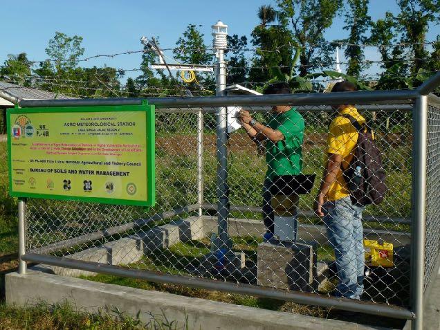
14 BSWM AWS Project
 Gathers data from the")


15 Advanced Remote Data-Acquisition unit (arq) Gathers data from the sensor Locally developed and produced Sends data through GSM and satellite Includes two LiPo Supports wide range of hardware communication protocol Customizable and flexible Approved industrial property model
16

17 Visualization (agromet.da.gov.ph)

18 Visualization (agromet.da.gov.ph)

19 Visualization (agromet.da.gov.ph)

20 Visualization (agromet.da.gov.ph)
21
22


23 Challenges Transportation and Logistics Maintenance Theft and vandalism Pests Social and political situation Communication facilities

24 Data, data, data from many other sources

25 ULAT - Lightning Detection Network 5 km 30 km
 ASTI as the de facto Ph")
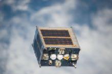
26 PHL-Microsatellite Program (DIWATA Constellation) ASTI as the de facto Ph space agency
27


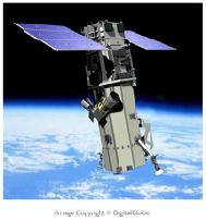
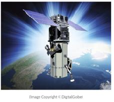
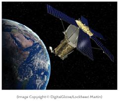
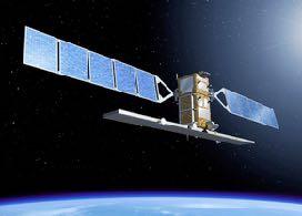
28 Diwata-1 Kompsat-3 Kompsat-5 Diwata-2 WorldView-1 WorldView-2 WorldView-3 WorldView-4 GeoEye-1 Cosmo-Skymed Dove Constellation

 in Nueva Ecija")
29 From Data to Information Flood extent extraction using Synthetic Aperture Radar (SAR) in Nueva Ecija (Kompsat-5)


30 Flood and Landslide Assessment of Biliran Island (Typhoon Urduja December 13-23, 2017) (Dove Constellation) December 18, 2017
31 Sugarcane Monitoring
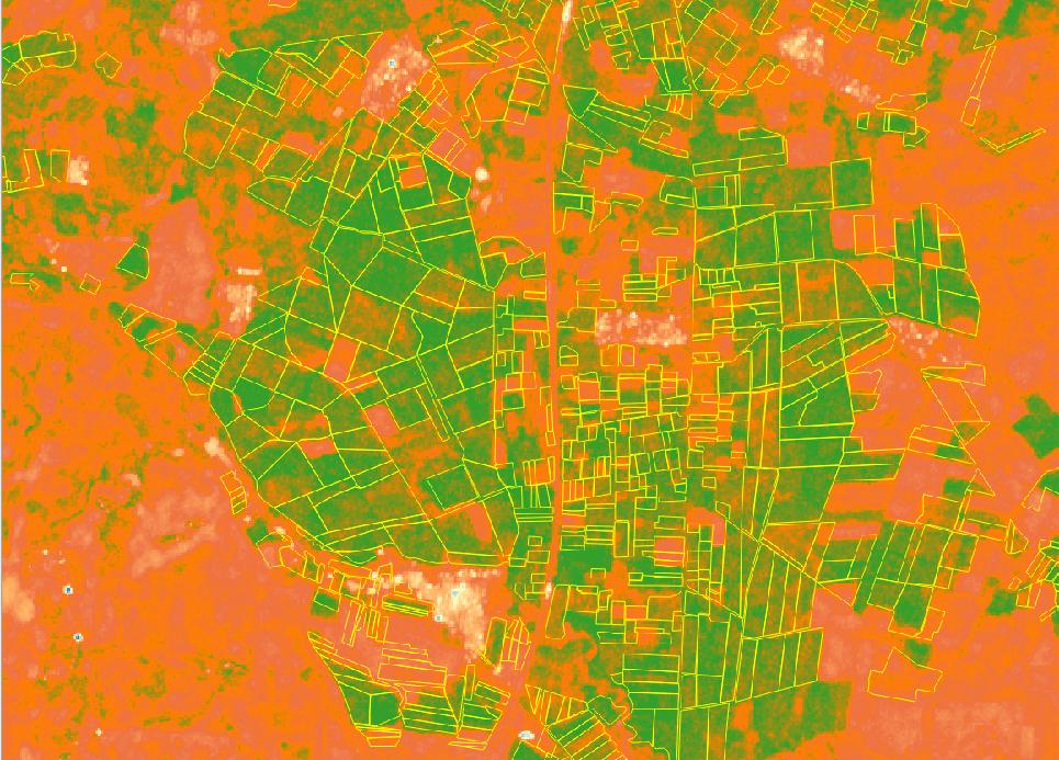
32 Sugarcane Monitoring
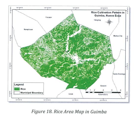
33 Rice Monitoring

 Example end-use* Methods for applications")
 Algorithms / Heuristics Ave")
34 ASTI Labeling Machine (ALaM) Unsupervised learning on satellite images ALaM data (labeled images, loc-obj files, etc.) Example end-use* Methods for applications Application (e.g., road management) Algorithms / Heuristics Ave traffic: Light to moderate Road condition: Good Potential hazard: Tree (Up-Left)
35 Advanced Science and Technology Institute Department of Science and Technology (DOST-ASTI) STORING, COMPUTING AND ACCESSING THE DATA

36
: 132 TB Dat a Data Upcoming (2 nd Qtr): PEDRO Data: 3 TB (annually) LiDAR Data: 104 TB NASA Data: 12 TB CERN")
37 ASTI Sensor Data No. of Records: ~115 M or 361 GB HPC Data 81 TB Project NOAH Data 1.2 GB (right now using Science Cloud) NOAH-WISE Data 194 GB PAGASA Data 9.5 TB Data Dat a Multiple Data Integration 3000 Rice Genomes Project (3kRG): 132 TB Dat a Data Upcoming (2 nd Qtr): PEDRO Data: 3 TB (annually) LiDAR Data: 104 TB NASA Data: 12 TB CERN Data: 3.12 GB Compute Storage Cloud

38 PREGINET The Philippines REN Operating for nearly 2 decades Connected to major international RENs (APAN, TEIN) What are RENs? Develop networking capacity to support Research and Education Build a community that is a forum for collaboration Roll out of next generation high-speed network services (e.g. IPv6) Testbeds for Innovations
39 PREGINET The Philippines only REN Operating for nearly 2 decades Connected to and an active member of major international RENs (APAN, TEIN) What are RENs? Develop networking capacity to support Research and Education Build a community that is a forum for collaboration Roll out of next generation services (e.g. IPv6) Testbeds for Innovations
40 Advanced Science and Technology Institute Department of Science and Technology (DOST-ASTI) SUMMARY
 ASTI Labeling Machine")
")
41 ASTI Science Infrastructure Sensor Network Disaster Management Climate & Numerical Modeling Weather Forecasting Agri Research Telemedicine Remote Sensing and Data Science (DATOS) ASTI Labeling Machine (ALaM) Societal Applications Computing and Archiving Research Environment (CoARE) High Performance Computing and Data Repository Philippine Research, Education and Government Information Network (PREGINET) High-speed Network
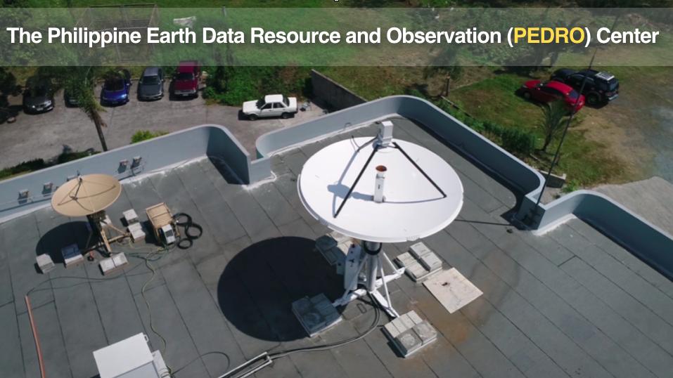
42 Responding to Operational Needs Satellite-related initiatives DOST-ASTI Philippine Earth Data Resource and Observation Center (PEDRO) Development of the Philippine Microsatellite Program (PHL- Microsat) HPC, Storage and Cloud Facility Computing and Archiving Research Environment (CoARE) Stakeholders Data Science, GIS and Remote Sensing Processing and R&D PHIVOLCS PAGASA NAMRIA NDRRMC DBM Others Remote Sensing and Data Science (DATOS) Helpdesk
43 Thank You Contact: Alvin E. Retamar Website:
Philippines Promotes Technological Self- Reliance: Achievements, Current Activities and Future Plans on Space Technology Applications
 Philippines Promotes Technological Self- Reliance: Achievements, Current Activities and Future Plans on Space Technology Applications Clarinda G. Reyes Department of Science and Technology Philippine Council
Automated Damage Analysis from Overhead Imagery
 Automated Damage Analysis from Overhead Imagery EVAN JONES ANDRE COLEMAN SHARI MATZNER Pacific Northwest National Laboratory 1 PNNL FY2015 at a Glance $955 million in R&D expenditures 4,400 scientists,
Synthetic Aperture Radar for Rapid Flood Extent Mapping
 National Aeronautics and Space Administration ARSET Applied Remote Sensing Training http://arset.gsfc.nasa.gov @NASAARSET Synthetic Aperture Radar for Rapid Flood Extent Mapping Sang-Ho Yun ARIA Team Jet
Remote sensing radio applications/ systems for environmental monitoring
 Remote sensing radio applications/ systems for environmental monitoring Alexandre VASSILIEV ITU Radiocommunication Bureau phone: +41 22 7305924 e-mail: alexandre.vassiliev@itu.int 1 Source: European Space
Sensor Technologies and Sensor Materials for Small Satellite Missions related to Disaster Management CANEUS Indo-US Cooperation
 Sensor Technologies and Sensor Materials for Small Satellite Missions related to Disaster Management CANEUS Indo-US Cooperation Suraj Rawal, Lockheed Martin Space Systems Co., USA G. Mohan Rao, Indian
Introduction to KOMPSAT
 Introduction to KOMPSAT September, 2016 1 CONTENTS 01 Introduction of SIIS 02 KOMPSAT Constellation 03 New : KOMPSAT-3 50 cm 04 New : KOMPSAT-3A 2 KOMPSAT Constellation KOMPSAT series National space program
457 APR The Fourth Medium to Long-term Plan has started. No.
 457 APR 2016 No. The Fourth Medium to Long-term Plan has started We are sorry to inform you that this April 2016 issue will be the final one to be distributed in printed materials. It would be appreciated
UNOSAT Satellite Imagery and GIS Solutions for DRR and Emergency Management
 UNOSAT Satellite Imagery and GIS Solutions for DRR and Emergency Management Francesco Pisano Director, Research, Technology Applications & Knowledge Systems January 2013 Introduction to UNOSAT 2 About
TOWARD AN INTEGRATED NATIONAL SURFACE OBSERVING NETWORK MALAYSIAN METEOROLOGICAL DEPARTMENT. Nik Mohd Riduan Nik Osman
 TOWARD AN INTEGRATED NATIONAL SURFACE OBSERVING NETWORK MALAYSIAN METEOROLOGICAL DEPARTMENT By Nik Mohd Riduan Nik Osman Malaysian Meteorological Department, Jalan Sultan, 46667 Petaling Jaya, Selangor,
Radiocommunications and climate changes
 Radiocommunications and climate changes Durban, South Africa 1 December 2011 COP-17 Vadim Nozdrin, Counselor, ITU-R Study Group 7 Study Group Department Radiocommunication Bureau
SECOND OPEN SKIES REVIEW CONFERENCE (OSRC) 2010
 2010") OSCC.RC/40/10 9 June 2010 Open Skies Consultative Commission ENGLISH only US Chair of the OSCC Review Conference SECOND OPEN SKIES REVIEW CONFERENCE (OSRC) 2010 7 to 9 June 2010 Working Session 2 Exploring
OSCC.RC/40/10 9 June 2010 Open Skies Consultative Commission ENGLISH only US Chair of the OSCC Review Conference SECOND OPEN SKIES REVIEW CONFERENCE (OSRC) 2010 7 to 9 June 2010 Working Session 2 Exploring
Remote Sensing Analysis Framework for Maritime Surveillance Application
 Remote Sensing Analysis Framework for Maritime Surveillance Application Olaf Frauenberger, Egbert Schwarz, Sergey Voinov Maritime Security Lab Neustrelitz (DFD) Maritime Big Data Workshop, 9-11 May, La
Radio Frequency Sensing from Space
 Radio Frequency Sensing from Space Edoardo Marelli ITU-R WP 7C Chairman ITU-R Seminar Manta (Ecuador) 20 September 2012 Why observing the Earth from space? Satellites orbiting around the Earth offer an
Verification Tool for Safeguards. Satellite Imagery IAEA. Technical Seminar for Diplomats. Karen Steinmaus, SGIM-ICA. Vienna, 3-5 February 2009
 Technical Seminar for Diplomats Vienna, 3-5 February 2009 Satellite Imagery as Verification Tool for Safeguards Karen Steinmaus, SGIM-ICA International Atomic Energy Agency The Satellite Imagery Analysis
Geospatial Vision and Policies Korean Industry View 26 November, 2014 SI Imaging Services
 Geospatial Vision and Policies Korean Industry View 26 November, 2014 SI Imaging Services Distribution Limitation, SI Imaging Services Proprietary Data : The data contained in this document, without the
Use of Synthetic Aperture Radar images for Crisis Response and Management
 2012 IEEE Global Humanitarian Technology Conference Use of Synthetic Aperture Radar images for Crisis Response and Management Gerardo Di Martino, Antonio Iodice, Daniele Riccio, Giuseppe Ruello Department
KOMPSAT Constellation. November 2012 Satrec Initiative
 KOMPSAT Constellation November 2012 Satrec Initiative KOMPSAT Constellation KOMPSAT National program Developed and operated by KARI (Korea Aerospace Research Institute) Dual use : Government & commercial
High Performance Computing i el sector agro-alimentari Fundació Catalana per la Recerca CAFÈ AMB LA RECERCA
 www.bsc.es High Performance Computing i el sector agro-alimentari Fundació Catalana per la Recerca CAFÈ AMB LA RECERCA 21 Octubre 2015 Technology Transfer Area about BSC High Performance Computing and
How to Access Imagery and Carry Out Remote Sensing Analysis Using Landsat Data in a Browser
 How to Access Imagery and Carry Out Remote Sensing Analysis Using Landsat Data in a Browser Including Introduction to Remote Sensing Concepts Based on: igett Remote Sensing Concept Modules and GeoTech
PEGASUS : a future tool for providing near real-time high resolution data for disaster management. Lewyckyj Nicolas
 PEGASUS : a future tool for providing near real-time high resolution data for disaster management Lewyckyj Nicolas nicolas.lewyckyj@vito.be http://www.pegasus4europe.com Overview Vito in a nutshell GI
GEOSPATIAL CLOUD COMPUTING SOLUTION APPLIED TO NEW CALEDONIA FOREST MONITORING
 GEOSPATIAL CLOUD COMPUTING SOLUTION APPLIED TO NEW CALEDONIA FOREST MONITORING Worldview-3 30 cm Forgotten Coast New Caledonia DigitalGLobe 2016, Distribution and processing BLUECHAM SAS BLUECHAM SAS 101
Monitoring Natural Disasters with Small Satellites Smart Satellite Based Geospatial System for Environmental Protection
 Monitoring Natural Disasters with Small Satellites Smart Satellite Based Geospatial System for Environmental Protection Krištof Oštir, Space-SI, Slovenia Contents Natural and technological disasters Current
SUGAR_GIS. From a user perspective. Provides spatial distribution of a wide range of sugarcane production data in an easy to use and sensitive way.
 SUGAR_GIS From a user perspective What is Sugar_GIS? A web-based, decision support tool. Provides spatial distribution of a wide range of sugarcane production data in an easy to use and sensitive way.
Futrajaya, Malaysia JULY 12, Jeong Heon SONG. Korea Aerospace Research Institution
 J P T M 2 0 1 1 Futrajaya, Malaysia JULY 12, 2011 Jeong Heon SONG Korea Aerospace Research Institution Outline Contribution of KARI Sentinel Asia / Data Provider Node International Charter KARI Space Activities
School of Rural and Surveying Engineering National Technical University of Athens
 Laboratory of Photogrammetry National Technical University of Athens Combined use of spaceborne optical and SAR data Incompatible data sources or a useful procedure? Charalabos Ioannidis, Dimitra Vassilaki
Detecting Flooded Locations Using SAR DATA, and Assessment of Post-Flooded Condition
 AASCIT Communications Volume 2, Issue 4 May 10, 2015 online ISSN: 2375-3803 Detecting Flooded Locations Using SAR DATA, and Assessment of Post-Flooded Condition Moung-Jin Lee Korea Environment Institute,
Table Satellites used for observations by members of the Disaster Charter and others (except Daichi)
") 2.1.4 Cooperation with from overseas institutions JAXA asked Sentinel Asia and, on behalf of the Cabinet Office, the Disaster Charter to carry out emergency observations immediately after the earthquake
2.1.4 Cooperation with from overseas institutions JAXA asked Sentinel Asia and, on behalf of the Cabinet Office, the Disaster Charter to carry out emergency observations immediately after the earthquake
Operational Space-Based Imaging Systems
 Operational Space-Based Imaging Systems R E M O T E S E N S I N G & G E O S PAT I A L A N A LY S I S L A B D O I : 2 0 A U G U S T, 2 0 1 6 Earth Observation Systems U.S. or foreign government systems
Application of Satellite Remote Sensing for Natural Disasters Observation
 Application of Satellite Remote Sensing for Natural Disasters Observation Prof. Krištof Oštir, Ph.D. University of Ljubljana Faculty of Civil and Geodetic Engineering Outline Earth observation current
XSAT Ground Segment at CRISP
 XSAT Ground Segment at CRISP LIEW Soo Chin Head of Research, CRISP http://www.crisp.nus.edu.sg 5 th JPTM for Sentinel Asia Step-2, 14-16 Nov 2012, Daejeon, Korea Centre for Remote Imaging, Sensing and
Active and Passive Microwave Remote Sensing
 Active and Passive Microwave Remote Sensing Passive remote sensing system record EMR that was reflected (e.g., blue, green, red, and near IR) or emitted (e.g., thermal IR) from the surface of the Earth.
Application and potentials of RADAR and LiDAR technologies for forest carbon assessment in Pacific Island Countries
 Application and potentials of RADAR and LiDAR technologies for forest carbon assessment in Pacific Island Countries June 19th, 2012 PNGFA-JICA Workshop Masamichi HARAGUCHI (Kokusai Kogyo Co., Ltd.) Consultant
EARTH OBSERVATION WITH SMALL SATELLITES
 EARTH OBSERVATION WITH SMALL SATELLITES AT THE FUCHS-GRUPPE B. Penné, C. Tobehn, M. Kassebom, H. Lübberstedt OHB-System GmbH, Universitätsallee 27-29, D-28359 Bremen, Germany www.fuchs-gruppe.com ABSTRACT
CALL359 JAPAN S EARTHQUAKE 2011, MARCH, 11
 CALL359 JAPAN S EARTHQUAKE 2011, MARCH, 11 PM for International Charter Dr. Masahiko Nagai JAXA - AIT 25th Meeting of the International Charter May 12 th 2011 on 2011, March, 11 at 14:46 (JST) Iwate Pref.
Active and Passive Microwave Remote Sensing
 Active and Passive Microwave Remote Sensing Passive remote sensing system record EMR that was reflected (e.g., blue, green, red, and near IR) or emitted (e.g., thermal IR) from the surface of the Earth.
KONGSBERG SATELLITE SERVICES 2017 Line Steinbakk, Director Programs. Himmel og hav - Ålesund 3. Oktober 2017
 KONGSBERG SATELLITE SERVICES 2017 Line Steinbakk, Director Programs Himmel og hav - Ålesund 3. Oktober 2017 KSAT HQ IN TROMSØ 69N Established in 1967 Kongsberg Satellite Services since 2002 World leading
Kongsberg Satellite Services, KSAT
 SvalSat, Earth Station at 78 North Kongsberg Satellite Services, KSAT Making Sense of Space Sigmund Dehli International Sales Manager WORLD CLASS through people, technology and dedication My plan KSAT
Drafting Committee for the Asia Pacific Plan of Action for Space Applications for Sustainable Development ( ) Republic of Korea
 Republic of Korea") Drafting Committee for the Asia Pacific Plan of Action for Space Applications for Sustainable Development (2018 2030) Republic of Korea Bangkok, Thailand 31 May 1 June 2018 김 1 KARI Introduction Government
Drafting Committee for the Asia Pacific Plan of Action for Space Applications for Sustainable Development (2018 2030) Republic of Korea Bangkok, Thailand 31 May 1 June 2018 김 1 KARI Introduction Government
ASEAN Meteorological Satellite Data Alliance (AMSDA)
") ASEAN Meteorological Satellite Data Alliance (AMSDA) Ken T. Murata 1, Praphan Pavarangkoon 1, Kanokvate Tungpimolrut 2, Chalermpol Charnsripinyo 2, Udom Lewlomphaisarl 2, Joel S. Marciano, Jr. 3, Andre
ASEAN Meteorological Satellite Data Alliance (AMSDA) Ken T. Murata 1, Praphan Pavarangkoon 1, Kanokvate Tungpimolrut 2, Chalermpol Charnsripinyo 2, Udom Lewlomphaisarl 2, Joel S. Marciano, Jr. 3, Andre
Satellite Contributions to Disaster Monitoring - Japanese Earthquake and Tsunami Case in
 1 Satellite Contributions to Disaster Monitoring - Japanese Earthquake and Tsunami Case in 2011 - Akira Iwasaki, Satoshi Miyatani and Shinichi Nakasuka The University of Tokyo ASTER METI/NASA 2 We express
Ubiquitous Sensing Network Research in NICT and Approach to Environment Measurements
 Ubiquitous Sensing Network Research in NICT and Approach to Environment Measurements Hiroshi Kumagai NICT: National Institute of Information and Communications Technology Japan 2005 Int l l Ubiquitous
Improvement of emergency response with technology-based solutions
 National Science & Technology Center for Disaster Reduction Improvement of emergency response with technology-based solutions - Pre-disaster relief for reducing impacts by typhoon Liang-Chun Chen Chinese
Introduction of CSRSR Image product processing systems in CSRSR Disaster monitoring and data processing
 3 rd Joint Project Team Meeting for Sentinel Asia STEP3 Data Analysis Node Report Li-Yu Chang Associate Research Engineer Center for Space and Remote Sensing Research National Central University, Taiwan
Service for Excellence and Equity through Science, Technology and Innovation (SEE thru STI) Briefer of DOST Programs, Projects, and Activities
 Briefer of DOST Programs, Projects, and Activities") Service for Excellence and Equity through Science, Technology and Innovation (SEE thru STI) Briefer of DOST Programs, Projects, and Activities Department of Science and Technology 2 Promote Science and
Service for Excellence and Equity through Science, Technology and Innovation (SEE thru STI) Briefer of DOST Programs, Projects, and Activities Department of Science and Technology 2 Promote Science and
TEIN2 and TEIN3 enabling emerging R&E networks
 TEIN2 and TEIN3 enabling emerging R&E networks George McLaughlin, APAN Vice-Chair & Coordinator, TEIN2 Applications & Collaboration Framework Emerging R&E Networks SIG 21 April 2008 1 Emerging R&E networks
ITU Radiocommunication Sector (ITU-R) and Climate Change. Alexandre VASSILIEV ITU Radiocommunication Bureau
 and Climate Change. Alexandre VASSILIEV ITU Radiocommunication Bureau") ITU Radiocommunication Sector (ITU-R) and Climate Change Alexandre VASSILIEV ITU Radiocommunication Bureau WSIS FORUM 2009, Geneva, 18-22 May 2009 Radio and Information Society Today radio technologies
ITU Radiocommunication Sector (ITU-R) and Climate Change Alexandre VASSILIEV ITU Radiocommunication Bureau WSIS FORUM 2009, Geneva, 18-22 May 2009 Radio and Information Society Today radio technologies
Outline. From AGEA-JRC I (2007) to AGEA-JRC II ( ) COSMO-SkyMed constellation for Earth observation and applications
 to AGEA-JRC II ( ) COSMO-SkyMed constellation for Earth observation and applications") Outline From AGEA-JRC I (2007) to AGEA-JRC II (2008-09) COSMO-SkyMed constellation for Earth observation and applications COSMO-SkyMed GeoAccuracy assessment o Geometric o Parcels measurements performances
Outline From AGEA-JRC I (2007) to AGEA-JRC II (2008-09) COSMO-SkyMed constellation for Earth observation and applications COSMO-SkyMed GeoAccuracy assessment o Geometric o Parcels measurements performances
Maximize Utilization of the performance of EOSs and strengthen. The First Steering Committee Secretariat JAXA
 Maximize Utilization of the performance of EOSs and strengthen cooperation among DPN/DAN The First Steering Committee Secretariat JAXA ALOS 2 observation is strong tool for disaster monitoring Wide area/range
GeoRadar Division. Geosystems BU A HISTORY OF PROVIDING HIGH TECHNOLOGY. IDS s Pisa Headquarters
 A HISTORY OF PROVIDING HIGH TECHNOLOGY IDS s Pisa Headquarters Geology and Environment IBIS-FL and IBIS-FMT, a dedicated configuration to enter into monitoring of landslides and mining market IBIS-FL:
United nation, Vienna, 9-13 February 2015
 United nation, Vienna, 9-13 February 2015 RUSSIAN FEDERAL SPACE AGENCY In the Russian Federation, the federal agency in charge of space activities is the Russian Federal Space Agency (Roscosmos) Earth
Satellite data for Maritime Operations. Andreas Hay Kaljord Project Manager Energy, Environment & Security
 Satellite data for Maritime Operations Andreas Hay Kaljord Project Manager Energy, Environment & Security Kongsberg Satellite Services (KSAT) World leading provider within our business area Supports 85
The Role of RADARSAT-2 for Flood and Agriculture Monitoring
 The Role of RADARSAT-2 for Flood and Agriculture Monitoring Gordon Staples MDA Richmond, BC, CANADA gstaples@mda.ca RESTRICTION ON USE, PUBLICATION OR DISCLOSURE OF PROPRETIARY INFORMATION This document
Smart Cities Solutions for Disaster Management Based on Satellites and Wireless Sensor Networks
 Smart Cities Solutions for Disaster Management Based on Satellites and Wireless Sensor Networks Presented by Dr. Krishna Dev Kumar Professor of Aerospace Engineering Director, Artificial Intelligence and
Continuity of Earth Observation Data for Australia: Research and Development Dependencies to 2020
 Continuity of Earth Observation Data for Australia: Research and Development Dependencies to 2020 January 2012 Enquiries Enquiries should be addressed to: Dr Kimberley Clayfield Executive Manager Space
Water Body Extraction Research Based on S Band SAR Satellite of HJ-1-C
 Cloud Publications International Journal of Advanced Remote Sensing and GIS 2016, Volume 5, Issue 2, pp. 1514-1523 ISSN 2320-0243, Crossref: 10.23953/cloud.ijarsg.43 Research Article Open Access Water
Metrological Telecommunication System Development Project
 Philippines Metrological Telecommunication System Development Project 1. Project Profile and Japan s ODA Loan Report Date: March 2001 Field Survey: September 2000 The Philippines Manila Cebu Site Map:
Can Satellite Image Analysis Replace Manual Digitization?
 Can Satellite Image Analysis Replace Manual Digitization? GeoDATA London 30 th Nov 2017 LUCY KENNEDY Spottitt CEO Lucy.Kennedy@spottitt.com +44 772 594 4643 Agenda Why develop processes and services based
Using Freely Available. Remote Sensing to Create a More Powerful GIS
 Using Freely Available Government Data and Remote Sensing to Create a More Powerful GIS All rights reserved. ENVI, E3De, IAS, and IDL are trademarks of Exelis, Inc. All other marks are the property of
Trend of Small EO Satellites and Their Applications
 UN Symposium to Strengthen the Partnership with Industry Nurturing the Development of Space Technology Trend of Small EO Satellites and Their Applications For further information, Phone: +82 42 365 7506
Co-ReSyF RA lecture: Vessel detection and oil spill detection
 This project has received funding from the European Union s Horizon 2020 Research and Innovation Programme under grant agreement no 687289 Co-ReSyF RA lecture: Vessel detection and oil spill detection
Lecture 6: Multispectral Earth Resource Satellites. The University at Albany Fall 2018 Geography and Planning
 Lecture 6: Multispectral Earth Resource Satellites The University at Albany Fall 2018 Geography and Planning Outline SPOT program and other moderate resolution systems High resolution satellite systems
2010 International Ocean Vector Winds Meeting Barcelona, Spain, May A NASA Perspective: Present Status and Moving Forward
 2010 International Ocean Vector Winds Meeting Barcelona, Spain, 18-20 May 2010 A NASA Perspective: Present Status and Moving Forward Peter Hacker and Eric Lindstrom NASA Science Mission Directorate Earth
Utilization of Radar data for Maritime Surveillance
 INDESO Project Utilization of Radar data for Maritime Surveillance DENDY MAHABROR MARINE RESEARCH CENTER INDESO RADAR GROUND STATION RADARSAT-2 AND COSMO-SKYMED BALI INDESO satelit VMS satelite radar vessel
COSMO-SkyMed Mission Status Presented by Giovanni VALENTINI (ASI)
") COSMO-SkyMed Mission Status Presented by Giovanni VALENTINI (ASI) FIRST SATELLITE FIRST SATELLITE OF THE CONSTELLATION SUCCESSFULLY LAUNCHED 08 June 2007 03:35 (GMT) Vandenberg U.S.A. Air Force Base SECOND
COSMO-SkyMed Mission Status Presented by Giovanni VALENTINI (ASI) FIRST SATELLITE FIRST SATELLITE OF THE CONSTELLATION SUCCESSFULLY LAUNCHED 08 June 2007 03:35 (GMT) Vandenberg U.S.A. Air Force Base SECOND
Project Overview Mapping Technology Assessment for Connected Vehicle Highway Network Applications
 Project Overview Mapping Technology Assessment for Connected Vehicle Highway Network Applications AASHTO GIS-T Symposium April 2012 Table Of Contents Connected Vehicle Program Goals Mapping Technology
A CONCEPT FOR NATURAL GAS TRANSMISSION PIPELINE MONITORING BASED ON NEW HIGH-RESOLUTION REMOTE SENSING TECHNOLOGIES
 A CONCEPT FOR NATURAL GAS TRANSMISSION PIPELINE MONITORING BASED ON NEW HIGH-RESOLUTION REMOTE SENSING TECHNOLOGIES Werner Zirnig - Ruhrgas Aktiengesellschaft Dieter Hausamann - DLR German Aerospace Center
EE 529 Remote Sensing Techniques. Introduction
 EE 529 Remote Sensing Techniques Introduction Course Contents Radar Imaging Sensors Imaging Sensors Imaging Algorithms Imaging Algorithms Course Contents (Cont( Cont d) Simulated Raw Data y r Processing
SARscape for ENVI. A Complete SAR Analysis Solution
 SARscape for ENVI A Complete SAR Analysis Solution IDL and ENVI A Foundation for SARscape IDL The Data Analysis & Visualization Platform Data Access: IDL supports virtually every data format, type and
Earth Observation and Sensing Technologies: a focus on Radar Imaging Developments. Riccardo Lanari
 Earth Observation and Sensing Technologies: a focus on Radar Imaging Developments Riccardo Lanari Institute for Electromagnetic Sensing of the Environment (IREA) National Research Council of Italy (CNR)
TVWS Area Connected. w Internet. w/out Internet. Based on DepEd Study
 3 TVWS Area Connected w Internet w/out Internet Based on DepEd Study CH3 CH6 CH8 CH10 CH12 TV White Space refers to the unused TV channels Guard Band channels are intentionally kept between active ones
Lecture 1 Introduction to Remote Sensing
 Lecture 1 Introduction to Remote Sensing Dr Ian Leiper School of Environmental and Life Sciences Bldg Purple 12.2.27 1 2 Lecture Outline Introductions Unit admin Learning outcomes Unit outline Practicals
Design and Development of a Remote Station for Real-time Monitoring of Urban Flooding
 Proceedings of the Asia-Pacific Advanced Network 2014 v. 38, p. 99-114. http://dx.doi.org/10.7125/apan.38.14 ISSN 2227-3026 Design and Development of a Remote Station for Real-time Monitoring of Urban
Space for Europe: A collection of case studies
 Space for Europe: A collection of case studies Introduction Klaus Becher Knowledge & Analysis LLP 1 26/10/2009 Space as a Problem Solver Practical benefits from investments in space technology Cost-saving
High resolution ground deformations monitoring by COSMO-SkyMed PSP SAR interferometry
 High resolution ground deformations monitoring by COSMO-SkyMed PSP SAR interferometry Mario Costantini e-geos - an ASI/Telespazio Company, Rome, Italy mario.costantini@e-geos.it Summary COSMO-SkyMed satellite
National SPace Organization
 National SPace Organization A center of innovation and excellence for space technology Bo Chen National Space Organization Presented at JPTM 2014, Sentinel Asia Yangon, Myanmar, 11/19-21 NARLabs-NSPO About
New and Emerging Issues Interface to Science Policy
 Ninth Session of the Committee on Sustainable Development and the Africa Regional Forum on Sustainable Development New and Emerging Issues Interface to Science Policy Addis Ababa, Ethiopia, 16-18 June
Development of the Technology of Utilization of Airborne Synthetic Aperture Radar (SAR)
") Development of the Technology of Utilization of Airborne Synthetic Aperture Radar (SAR) Mamoru Koarai, Kouichi Moteki, Nobuyuki Watanabe, Takaki Okatani,Youko Yamada and Kaoru Matsuo Geographical Survey
Development of the Technology of Utilization of Airborne Synthetic Aperture Radar (SAR) Mamoru Koarai, Kouichi Moteki, Nobuyuki Watanabe, Takaki Okatani,Youko Yamada and Kaoru Matsuo Geographical Survey
The studies began when the Tiros satellites (1960) provided man s first synoptic view of the Earth s weather systems.
 provided man s first synoptic view of the Earth s weather systems.") Remote sensing of the Earth from orbital altitudes was recognized in the mid-1960 s as a potential technique for obtaining information important for the effective use and conservation of natural resources.
Remote sensing of the Earth from orbital altitudes was recognized in the mid-1960 s as a potential technique for obtaining information important for the effective use and conservation of natural resources.
- Avenues and Requisites for Successful Collaboration - Indian Space Research Organisation Department of Space Government of India
 Strengthening Regional Resilience with Geo-Information Programme on Trans-boundary Cooperation in South and South East Asia for geospatial information - Avenues and Requisites for Successful Collaboration
Satellite Imagery Characteristics, Uses and Delivery to GIS Systems. Wayne Middleton April 2014
 Satellite Imagery Characteristics, Uses and Delivery to GIS Systems Wayne Middleton April 2014 About Geoimage Founded in Brisbane 1988 Leading Independent company Specialists in satellite imagery and geospatial
International Charter Space and Major Disasters
 International Charter Space and Major Disasters Sentinel Asia Joint Project Team Meeting July 7, 2010 Brenda Jones U.S. Geological Survey Charter Executive Secretariat Purpose An International agreement
RESERVOIR MONITORING USING RADAR SATELLITES
 RESERVOIR MONITORING USING RADAR SATELLITES Alain Arnaud, Johanna Granda, Geraint Cooksley ALTAMIRA INFORMATION S.L., Calle Córcega 381-387, E-08037 Barcelona, Spain. Key words: Reservoir monitoring, InSAR,
Q&A Earth-i Q&A Earth-i Observing the Earth Question: Can you provide an over view of Ear th-i s current capabilities and expertise?
 Q&A Earth-i Las Vegas. Photo courtesy of Earth-i Q&A Richard Blain: CEO, Earth-i Observing the Earth Earth-i is one of Europe s most prominent NewSpace companies supplying high resolution image data and
From Observational Data to Information IG (OD2I IG) The OD2I Team
 The OD2I Team") From Observational Data to Information IG (OD2I IG) The OD2I Team tinyurl.com/y74p56tb Tour de Table (time permitted) OD2I IG Primary data are interpreted for their meaning in determinate contexts Contexts
From Observational Data to Information IG (OD2I IG) The OD2I Team tinyurl.com/y74p56tb Tour de Table (time permitted) OD2I IG Primary data are interpreted for their meaning in determinate contexts Contexts
FORMOSAT-2 FOR INTERNATIONAL SOCIETAL BENEFITS
 FORMOSAT-2 FOR INTERNATIONAL SOCIETAL BENEFITS Ming-Chih Cheng 1, Celine Zhang 2 1 Researcher, 2 Research Assistant National Space Organization ABSTRACT The Group on Earth Observations (GEO), established
Soil moisture retrieval using ALOS PALSAR
 Soil moisture retrieval using ALOS PALSAR T. J. Jackson, R. Bindlish and M. Cosh USDA ARS Hydrology and Remote Sensing Lab, Beltsville, MD J. Shi University of California Santa Barbara, CA November 6,
NASA Missions and Products: Update. Garik Gutman, LCLUC Program Manager NASA Headquarters Washington, DC
 NASA Missions and Products: Update Garik Gutman, LCLUC Program Manager NASA Headquarters Washington, DC 1 JPSS-2 (NOAA) SLI-TBD Formulation in 2015 RBI OMPS-Limb [[TSIS-2]] [[TCTE]] Land Monitoring at
KONGSBERG SATELLITE SERVICES Earth Observation for Maritime Operations Current Capabilities and Future Potential
 KONGSBERG SATELLITE SERVICES 2017 Earth Observation for Maritime Operations Current Capabilities and Future Potential Andreas Hay Kaljord Project Manager KSAT HQ IN TROMSØ - 69N WELCOME TO TROMSØ Established
The Philippines SHARE Program in Aerial Imaging
 The Philippines SHARE Program in Aerial Imaging G. Tangonan, N. Libatique, C. Favila, J. Honrado, D. Solpico Ateneo Innovation Center This presentation is about our ongoing aerial imaging research in the
The Role of Urban Development Patterns in Mitigating the Effects of Tsunami Run-up: Final Report
 J-RAPID Final Symposium Sendai, Japan The Role of Urban Development Patterns in Mitigating the Effects of Tsunami Run-up: Final Report March 6, 2013 Fumio Yamazaki, Chiba University, Japan and Ronald T.
Application of Satellite Imagery for Rerouting Electric Power Transmission Lines
 Application of Satellite Imagery for Rerouting Electric Power Transmission Lines T. LUEMONGKOL 1, A. WANNAKOMOL 2 & T. KULWORAWANICHPONG 1 1 Power System Research Unit, School of Electrical Engineering
PYBOSSA Technology. What is PYBOSSA?
 PYBOSSA Technology What is PYBOSSA? PYBOSSA is our technology, used for the development of platforms and data collection within collaborative environments, analysis and data enrichment scifabric.com 1
The USGEO Satellite Needs process provides the firstever whole-of-government approach to identifying desired satellite products across the civilian
 Observations (USGEO) Satellite Needs Identifying Federal Satellite User Needs Glenn Bethel / USDA SNWG Co-Chair The USGEO Satellite Needs process provides the firstever whole-of-government approach to
NASA Spectrum Management Update: WRC-11 Issues and Objectives and Domestic Concerns
 NASA Spectrum Management Update: WRC-11 Issues and Objectives and Domestic Concerns CORF Spring Meeting May 27, 2009 John Zuzek NASA Remote Sensing Spectrum Manager Agenda Overview WRC-11 Issues of Primary
European Space Imaging
 European Space Imaging Use cases of Very High Resolution satellite imagery in support of crop management GEO-CRADLE Regional Workshop, 7/12/2017, Tunis Arnaud Durand adurand@euspaceimaging.com COMPANY
Module 3 Introduction to GIS. Lecture 8 GIS data acquisition
 Module 3 Introduction to GIS Lecture 8 GIS data acquisition GIS workflow Data acquisition (geospatial data input) GPS Remote sensing (satellites, UAV s) LiDAR Digitized maps Attribute Data Management Data
Satellite Imagery and Remote Sensing. DeeDee Whitaker SW Guilford High EES & Chemistry
 Satellite Imagery and Remote Sensing DeeDee Whitaker SW Guilford High EES & Chemistry whitakd@gcsnc.com Outline What is remote sensing? How does remote sensing work? What role does the electromagnetic
Smarter Philippines: Developing New Engines of Inclusive Economic Growth throughout the Philippines
 Smarter Philippines: Developing New Engines of Inclusive Economic Growth throughout the Philippines March 22, 2013 Alejandro P. Melchor III Program Director, Smarter Philippines Department of Science &
in Developing Countries in FY2008
 Study on Economic Partnership Projects in Developing Countries in FY2008 Study on Research and Development Center for Space Technology of Vietnam Academy of Science and Technology in Hoa Lac in Socialist
SURREY GSA CATALOG. Surrey Satellite Technology US LLC 8310 South Valley Highway, 3rd Floor, Englewood, CO
 SURREY CATALOG Space-Qualified flight hardware for small satellites, including GPS receivers, Attitude Determination and Control equipment, Communications equipment and Remote Sensing imagers Professional