TOWARD AN INTEGRATED NATIONAL SURFACE OBSERVING NETWORK MALAYSIAN METEOROLOGICAL DEPARTMENT. Nik Mohd Riduan Nik Osman
|
|
|
- Neal Tate
- 6 years ago
- Views:
Transcription
1 TOWARD AN INTEGRATED NATIONAL SURFACE OBSERVING NETWORK MALAYSIAN METEOROLOGICAL DEPARTMENT By Nik Mohd Riduan Nik Osman Malaysian Meteorological Department, Jalan Sultan, Petaling Jaya, Selangor, Malaysia Phone: , Fax: , ABSTRACT The Instrumentation Division of the Malaysian Meteorological Department was entrusted with the job of automating the observation network with the aim of consolidating and integrating all surface observation systems under the RM-9 Projects for the Malaysian Meteorological Department. The task was to develop a detailed roadmap that would examine current surface observing systems and look for overlaps and opportunities for consolidation/efficiency and propose modernization efforts, and also identify which Programs ultimately operate each component of the project. The plan was expected to integrate existing and proposed surface observing systems through coordinated program planning, budget considerations, and proper project execution by providing a template for integration of MMD s observing systems that support the MMD s mission goals, which would in the future, consolidate and integrate other federal, state, regional, public, and private observing systems. In order to maximize the potential value and benefit of observations and observing systems the plan identifies a specific Plan of Action and Milestones (POA&M) that demonstrates immediate progress toward integrating MMD surface observing systems, a first step toward the long term goal of a national integrated automated surface weather observing network. For the purpose of this plan the term surface observations refers to terrestrial based in-situ (direct measurements) surface observing systems that measure the common near surface atmospheric parameters. The plan envisions to integrate the diverse automated and manual observing systems in MMD, as early deliverables in this first step action plan. Non-MMD observing systems are excluded from this specific plan. Though the value of this data is recognized, integration and contributions of these systems to an all inclusive and comprehensive Integrated National Observing Network will be addressed at a later time. However, many of the issues described in this plan can be used as the basis for an integrated national network of systems and the national network into the Global Earth Observing System of Systems (GEOSS). 1 P a g e
 maintains a basic meteorological monitoring programme in compliance with the World Meteorological Organization and the International Civil Aviation")
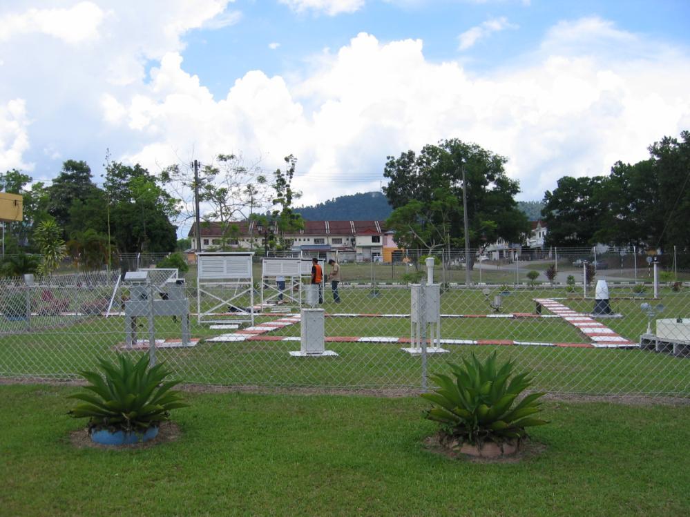
2 1.0 INTRODUCTION 1.1 The Malaysian Meteorological Department (MMD) maintains a basic meteorological monitoring programme in compliance with the World Meteorological Organization and the International Civil Aviation Organization standards, so as to fulfill international requirements for weather and climate monitoring, as well as to meet national obligations or extreme weather monitoring. This monitoring network contributes directly to the World Weather Watch (WWW) Programme and contributes directly to global efforts for the protection of people from natural disasters. 1.2 The core infrastructure of the surface observation network comprises of ;- a) 44 Principal Meteorological Stations b) 313 Auxiliary / Climatological Stations c) 15 Coastal and Port Monitoring Stations Malaysian Meteorological Stations 2 P a g e 1.3 The MMD started the process of upgrading its conventional/autographic instruments with Automatic Weather Stations (AWS) in These Automatic Weather Stations had inherent problems caused by proprietary design of both hardware and software. The ballooning costs of maintenance and spares for these systems caused MMD to decide in late 2002 to implement a solution, that would tackle the problems of automation across the board, in stages under the National 5-year Development Plans. Titled the Meteorological Stations Observation Network, the project envisioned the framework for a total integrated observing network, which would encompass both the aviation and climatological needs of the department. This plan was to be implemented in three stages over a span of 15 years. 1.4 The idea was to develop a pioneering and innovative system conceived and designed by MMD personnel and implemented with the collaboration of the private sector to provide a new paradigm in the design of acquisition systems. Utilizing TCP/IP from source the system was intended to move the technology one step
. Automation of Principal Stations 2.1.1 The first phase of the project was the implementation of a newly developed AWS system that had the following system characteristics")
3 closer towards the implementation of smart sensor technology (IEEE1451) standards in meteorological instrumentation. 2.0 MALAYSIA INTEGRATED AUTOMATIC WEATHER STATIONS (AWS) 2.1 First Phase ( ). Automation of Principal Stations The first phase of the project was the implementation of a newly developed AWS system that had the following system characteristics and was designed in-house design, using the latest cutting edge technologies available at the time. A brief description of the system is given below: a) IP based sensing b) Runs on TCP/IP network that supports Wired and Wireless (WIFI) LAN and even WAN c) Internet based solution up to the sensors level d) No client application needed just standard web browser e) Real-time operations f) Raw sensor data can be distributed anywhere, anytime, real-time over the Internet g) Open source (Java, Perl, PHP, Postgres RDBMS, Linux OS) h) Open standard data format (XML) i) Centralized Monitoring & Management of the entire AWS network j) Low set-up, operation & maintenance cost. k) Hardware independent i.e. the ASW system shall be able to cater for any brand of weather sensors l) Plug & play system Automatic Weather Station (First Phase) 3 P a g e
")
4 Automatic Weather Station (First Phase) Automatic Weather Station (First Phase) 4 P a g e

5 5 P a g e AWS System Data Flow
. Automation of Climatological Stations 2.2.1 The second phase of the plan was designed to build on the successful implementation of the Automated Weather Observing System")
6 AWS Data Display 6 P a g e 2.2 Second Phase ( ). Automation of Climatological Stations The second phase of the plan was designed to build on the successful implementation of the Automated Weather Observing System (AWOS) upgrading exercise at Principal stations implemented under the 8th Malaysia Plan. That Project was built on technologies that used integrated state-ofthe-art, commercial-off-the-shelf (COTS) technologies and open source software The objective of the project is to automate 108 manual climatological and agro-meteorological stations with real-time access and integrate these stations to the existing Principal stations observing network The main objectives of the project were to standardize, renew and extend the surface weather-stations network by designing, building and delivering 108 new automated unmanned auxiliary surface weather stations The system when completed would form a single comprehensive integrated automated system which would include the first phase to provide an end- toend solution or accurate real-time monitoring over the whole country. The new capabilities of the system were extended by:


7 a) Developing a Central 1-minute Data Repository with the ability for expansion to accommodate existing inputs and future stations with similar or new inputs. b) Designing a Network and Instruments Monitoring and Data Analyzing System, which contained the station metadata database for both existing and stations which were to be implemented in this exercise. c) Implementing a quality control system which enables both automatic and manual QC measures for Climatological purposes for both existing and future data inputs. AWS Equipment ( Second Phase) 7 P a g e


8 AWS Data Flow AWS Data Display 8 P a g e

9 2.3 Third Phase ( ). Automation of rainfall stations and integration of all systems The third phase of the project which is currently underway, extends the implementation of automation to unmanned remote rainfall stations. This stage also sees the relocation of existing stations to ensure a proper gridded surface network that enables a resolution of a 10km by 10km network This phase also sees the implementation of a new paradigm in the way data is transmitted from the stations. Implementing WMO standard codes revolutionizes the usual methods of transmitting hourly and daily extreme values using the rigid MMD Climate messages that were designed for manual methods of observation This phase also sees the standardization of all algorithms for the calculation of meteorological elements. The implementation of these algorithms ensures quality of data. List of AWS Stations (Third Phase) 9 P a g e

10 AWS Data Flow (Third Phase) 3.0 CHALLENGE OF INTEGRATED AWS IN MALAYSIA 3.1 Communication Throughout the implementation of the first phase, the country had been going through rapid development in the field of communications. MMD has been able to leverage on this for fast and reliable data transmission. The use of broadband technologies allows for real-time data transmission using data streaming. This allows forecasters to actually see the real situation at remote sites The main problems are the face that most of these technologies are implemented by Telcos mostly in urban areas and therefore MMD has to find alternative means of communications for remote sites. The use of satellite data transmission solves this issue but raises the issue of ballooning communications cost. MMD is now studying the use of longrange wireless technologies that would enable MMD to implement its own star-topology based transmission network. 10 P a g e
11 3.2 Surface area Despite its relatively small area, Malaysia terrain ranges from mountains with virgin jungle in the interior to flat plains and swamps in the coastal areas. This poses a problem, as some of these areas are inaccessible using conventional transport. Therefore the observation grid has areas where there is little or no data. MMD is currently studying ways to solve these problems with other Government agencies in the country. 4.0 CONCLUSION 4.1 The automated grid of surface observing stations in the country is now reaching its final target. Most of the objectives outlined in the Plan of Action and Milestones (POA&M) have been achieved. 4.2 The challenge for MMD is to enable the system to grow and to ensure the capacity building capabilities especially in the field of human resource for the maintenance of the system. 11 P a g e
Coexistence of fixed and space services at 2 GHz
 July 2012, issue 2.0.0 4RF Application Note Coexistence of fixed and space services at 2 GHz Contents 1. Introduction 2 2. Use of 2 GHz band by space services 3 3. Coexistence options for 2 GHz space services
Terms of Reference of Aircraft Noise at IGI Airport, New Delhi
 Terms of Reference of Aircraft Noise at IGI Airport, New Delhi In order to determine the noise impact from aircraft flights and identify potential measures to reduce the noise impact, an Aircraft Noise
al T TD ) ime D Faamily Products The RTD Family of products offers a full suite of highprecision GPS sensor positioning and navigation solutions for:
 ime D Faamily Products The RTD Family of products offers a full suite of highprecision GPS sensor positioning and navigation solutions for:") Reeal ynnamics al T amics (R TD ) ime D RTD) Time Dy Faamily mily ooff P roducts Products The RTD Family of products offers a full suite of highprecision GPS sensor positioning and navigation solutions
Reeal ynnamics al T amics (R TD ) ime D RTD) Time Dy Faamily mily ooff P roducts Products The RTD Family of products offers a full suite of highprecision GPS sensor positioning and navigation solutions
An IoT Based Real-Time Environmental Monitoring System Using Arduino and Cloud Service
 Engineering, Technology & Applied Science Research Vol. 8, No. 4, 2018, 3238-3242 3238 An IoT Based Real-Time Environmental Monitoring System Using Arduino and Cloud Service Saima Zafar Emerging Sciences,
AERODROME METEOROLOGICAL OBSERVATION AND FORECAST STUDY GROUP (AMOFSG)
") AMOFSG/9-IP/6 8/9/11 AERODROME METEOROLOGICAL OBSERVATION AND FORECAST STUDY GROUP (AMOFSG) NINTH MEETING Montréal, 26 to 30 September 2011 Agenda Item 5: Observing and forecasting at the aerodrome and
AMOFSG/9-IP/6 8/9/11 AERODROME METEOROLOGICAL OBSERVATION AND FORECAST STUDY GROUP (AMOFSG) NINTH MEETING Montréal, 26 to 30 September 2011 Agenda Item 5: Observing and forecasting at the aerodrome and
SATELLITE MONITORING OF REMOTE PV-SYSTEMS
 SATELLITE MONITORING OF REMOTE PV-SYSTEMS Stefan Krauter, Thomas Depping UFRJ-COPPE-EE, PV-Labs, C. P. 68504, Rio de Janeiro 21945-970 RJ, BRAZIL Tel: +55-21-2562-8032, Fax: +55-21-22906626, E-mail: krauter@coe.ufrj.br
The new German Space Strategy makes the space sector fit for the future Dr. Juergen Drescher DLR Washington Office
 The new German Space Strategy makes the space sector fit for the future Dr. Juergen Drescher DLR Washington Office 6th Eilene M. Galloway Symposium Washington D.C., December 1st, 2011 Space Policy of the
Progress in Open Access to European research data
 Progress in Open Access to European research data The case of Horizon 2020 Data Sharing Working Group Side Event during the GEO Summit Week ICCG, Geneva (CH), 13 January 2014 Michel SCHOUPPE EUROPEAN COMMISSION
ELDES / METEK Weather Radar Systems. General Description
 General Description Our weather radars are designed for precipitation monitoring at both regional and urban scales. They can be advantageously used as gap fillers of existing radar networks particularly
Independent Communications Authority of South Africa Pinmill Farm, 164 Katherine Street, Sandton Private Bag X10002, Sandton, 2146
 Independent Communications Authority of South Africa Pinmill Farm, 164 Katherine Street, Sandton Private Bag X10002, Sandton, 2146 ANNEXURE A TECHNICAL SPECIFICATIONS ICASA 09/2018 1. Purpose of the Request
ITU Radiocommunication Sector (ITU-R) and Climate Change. Alexandre VASSILIEV ITU Radiocommunication Bureau
 and Climate Change. Alexandre VASSILIEV ITU Radiocommunication Bureau") ITU Radiocommunication Sector (ITU-R) and Climate Change Alexandre VASSILIEV ITU Radiocommunication Bureau WSIS FORUM 2009, Geneva, 18-22 May 2009 Radio and Information Society Today radio technologies
ITU Radiocommunication Sector (ITU-R) and Climate Change Alexandre VASSILIEV ITU Radiocommunication Bureau WSIS FORUM 2009, Geneva, 18-22 May 2009 Radio and Information Society Today radio technologies
1 Research and Development of Global Environment Measurements
 1 Research and Development of Global Environment Measurements In the study of global environment measurements, two categories of research and development projects are going on: one is for satellite-borne
g~:~: P Holdren ~\k, rjj/1~
 July 9, 2015 M-15-16 OF EXECUTIVE DEPARTMENTS AND AGENCIES FROM: g~:~: P Holdren ~\k, rjj/1~ Office of Science a~fechno!o;} ~~~icy SUBJECT: Multi-Agency Science and Technology Priorities for the FY 2017
ASIAN INFO- COMMUNICATIONS COUNCIL
 ASIAN INFO- COMMUNICATIONS COUNCIL 26 TH CONFERENCE (HA NOI, VIETNAM) 5-9 NOVEMBER 2001 Presentation to General Assembly Document 105 Country Status Report: Malaysia Malaysian Communications & Multimedia
Weather Radar Systems. General Description
 General Description Our weather radars are designed for precipitation monitoring at both regional and urban scales. They can be advantageously used as gap filler of existing radar networks particularly
VEB Series. TCP/IP Network Matrix PA System. 32 simultaneous Audio Buses. Up to 60 Network Paging Consoles. Up to 128 Audio Output channels
 32 simultaneous Audio Buses Up to 60 Network Paging Consoles Up to 128 Audio Output channels Up to 1,500 Speaker Zones Up to 600 Control Inputs UP to 600 Control Outputs VEB Series TCP/IP Network Matrix
Connecting the automated field Building blocks for the modern field network
 WELL SITE AUTOMATION, JANUARY 2017 Connecting the automated field Building blocks for the modern field network Renner Vaughn, Global Program Lead Show me the data! Great crew change continues That mindset
Dimov Stojče Ilčev. CNS Systems
 Stratospheric Platform Systems (SPS) Presentation by: Dimov Stojče Ilčev Durban University of Technology (DUT) Space Science Centre (SSC) CNS Systems August 2011 SPS for Mobile CNS Applications Stratospheric
Recent Developments in NOAA s Real- Time Coastal Observing Systems for Safe and Efficient Maritime Transportation
 Recent Developments in NOAA s Real- Time Coastal Observing Systems for Safe and Efficient Maritime Transportation Rich Edwing, Director NOAA Center for Operational Oceanographic Products and Services CMTS
Optimizing wind farms
 Optimizing wind farms We are Uniper We are a leading international energy company with operations in more than 40 countries and around 13,000 employees. We combine a balanced portfolio of modern assets
IPSTAR Disaster Recovery and Emergency Communications
 IPSTAR Disaster Recovery and Emergency Communications March 2009 COPYRIGHT THAICOM PLC 2009 PROPRIETARY Content Introduction 3 Advantages 4 Applications 5 Equipment 6-7 IPSTAR Enterprise Series IPSTAR
DOST- ASTI Initiatives on the Development of Monitoring Stations and Application of Satellite Technology in Philippine Agriculture
 DOST- ASTI Initiatives on the Development of Monitoring Stations and Application of Satellite Technology in Philippine Agriculture Alvin E. Retamar Chief Science Research Specialist Advanced Science and
Introduction to Systems Approach and Backwards Planning
 Tuesday, 14 October, 14:15 15:00 PM Session 2 Introduction to Systems Approach and Backwards Planning John T. Snow, PhD, CCM CTA Meteorology, Climate Monitoring and Forecasting Caveat and Disclaimer Caveat:
10 th APEC TRANSPORTATION MINISTERIAL MEETING 7 th October 2017 Port Moresby, Papua New Guinea Ministerial Statement
 10 th APEC TRANSPORTATION MINISTERIAL MEETING 7 th October 2017 Port Moresby, Papua New Guinea Ministerial Statement 1. We, the Ministers responsible for transportation, met in Port Moresby, Papua New
STATE OF THE ART TIME OF USE METERING ISSUES
 STATE OF THE ART TIME OF USE ING ISSUES 15 Author & Presenter Dr R Billiet BSc (Elec Eng), Hons B Comm, DBA General Manager Sales and Marketing Strike Technologies (Pty) Ltd 1 Introduction This paper will
Mesh Networks. unprecedented coverage, throughput, flexibility and cost efficiency. Decentralized, self-forming, self-healing networks that achieve
 MOTOROLA TECHNOLOGY POSITION PAPER Mesh Networks Decentralized, self-forming, self-healing networks that achieve unprecedented coverage, throughput, flexibility and cost efficiency. Mesh networks technology
Moving to Model-Based Design
 Infrastructure Solutions White Paper Moving to Model-Based Design Choosing Between 2D and 3D Do you really have to choose between 2D and 3D? The answer is no, but it is important to know why. Over the
Development and Integration of Artificial Intelligence Technologies for Innovation Acceleration
 Development and Integration of Artificial Intelligence Technologies for Innovation Acceleration Research Supervisor: Minoru Etoh (Professor, Open and Transdisciplinary Research Initiatives, Osaka University)
Sensor Technologies and Sensor Materials for Small Satellite Missions related to Disaster Management CANEUS Indo-US Cooperation
 Sensor Technologies and Sensor Materials for Small Satellite Missions related to Disaster Management CANEUS Indo-US Cooperation Suraj Rawal, Lockheed Martin Space Systems Co., USA G. Mohan Rao, Indian
WAVE 5000 EVERY DEVICE. EVERY NETWORK. EVERY TEAM. CONNECTED LIKE NEVER BEFORE.
 DATA SHEET WAVE WORK GROUP COMMUNICATIONS EVERY DEVICE. EVERY NETWORK. EVERY TEAM. CONNECTED LIKE NEVER BEFORE. WAVE 5000 enables highly scalable, feature rich, enterprise grade push-to-talk (PTT) on broadband
IMPLEMENTING MULTIPLE ROBOT ARCHITECTURES USING MOBILE AGENTS
 IMPLEMENTING MULTIPLE ROBOT ARCHITECTURES USING MOBILE AGENTS L. M. Cragg and H. Hu Department of Computer Science, University of Essex, Wivenhoe Park, Colchester, CO4 3SQ E-mail: {lmcrag, hhu}@essex.ac.uk
Deriving meteorological observations from intercepted Mode-S EHS messages.
 Deriving meteorological observations from intercepted Mode-S EHS messages. Edmund Keith Stone and Malcolm Kitchen July 28, 2016 Abstract The Met Office has deployed a network of five receivers in the UK
Accessing NASA Earth Science Data / Open Data Policy
 Accessing NASA Earth Science Data / Open Data Policy Presentation by Martha Maiden Program Executive Earth Science Data Systems NASA Headquarters martha.e.maiden@nasa.gov July 15, 2013 U.S. data policy
ēko Pro Series System
 ēko Pro Series System FOR ENVIRONMENTAL MONITORING The ACEINNA ēko Pro Series Starter Kit is a wireless agricultural and environmental sensing system for crop monitoring, microclimate studies and environmental
Recent Trends of Using ICT in Modern College Libraries
 International Journal of Engineering and Mathematical Sciences Jan.- June 2012, Volume 1, Issue 1, pp.55-59 ISSN (Print) 2319-4537, (Online) 2319-4545. All rights reserved (www.ijems.org) IJEMS Recent
- Technical Brief Technical Specs (subject to change)
") - Technical Brief Technical Specs (subject to change) 1. Introduction Walabot is a programmable 3D sensor that looks into objects using radio frequency technology that breaks through known barriers, bringing
- Technical Brief Technical Specs (subject to change) 1. Introduction Walabot is a programmable 3D sensor that looks into objects using radio frequency technology that breaks through known barriers, bringing
Digitization of the built environment
 Digitization of the built environment 15.00-16.15 Chair: Kieran Parkinson, BSI David Mudd, BSI Gavin Summerson, BSI Matt Crunden, Legrand 1 11/10/2017 Standards in the Built Environment Energy Performance
DEVELOPMENT OF A HARDWARE AND SOFTWARE SYSTEM FOR METEOROLOGICAL OBSERVATIONS
 DEVELOPMENT OF A HARDWARE AND SOFTWARE SYSTEM FOR METEOROLOGICAL OBSERVATIONS Mikhail Shcherbakov *, Alexey Borisov Altai State Technical University, 656000, Barnaul, Russia Abstract. Article is devoted
RABAT LISBOA MADRID BARCELONA
 innovative data and technology intensive solutions for a safe and sustainable environment RABAT LISBOA MADRID BARCELONA www.qualitasremos.com COMPANY PROFILE QUALITAS is a group of engineering companies
ASSESSMENT BY ESA OF GCOS CLIMATE MONITORING PRINCIPLES FOR GMES
 Prepared by ESA Agenda Item: III.5 Discussed in WG3 ASSESSMENT BY ESA OF GCOS CLIMATE MONITORING PRINCIPLES FOR GMES The ESA Sentinel missions are being designed for the GMES services, with special emphasis
Establishment of a Multiplexed Thredds Installation and a Ramadda Collaboration Environment for Community Access to Climate Change Data
 Establishment of a Multiplexed Thredds Installation and a Ramadda Collaboration Environment for Community Access to Climate Change Data Prof. Giovanni Aloisio Professor of Information Processing Systems
MOBILIZE AND MAXIMIZE THE POTENTIAL OF P25 DIGITAL LMR
 WHITE PAPER MOBILIZE AND MAXIMIZE THE POTENTIAL OF P25 DIGITAL LMR PAGE 1 ARE YOU LEVERAGING THE POTENTIAL OF YOUR P25 LMR NETWORK? Your customers expect you to be ready, capable and equipped for power
Virginia s IFLOWS System and Future Approaches to Dam Safety
 Virginia s IFLOWS System and Future Approaches to Dam Safety Sam Utley Division Manager, Environmental Monitoring Services 3154 State Street, Blacksburg, VA 24060 PH: 540-961-7894 x427 March 10, 2008 MapTech
 Page 1 of 5 Buyers: Login Register Vendors: Login Register Accessibility Scenario-Based Assessment of High Frequency (HF), High Band Width Communications Solicitation Number: W911NF18R-DHS_HF Agency: Department
Capability Statement. Brisbane. Dalby. Mackay. Moranbah
 Capability Statement Brisbane Dalby Mackay Moranbah Who we are RCS Telecommunications was created in 2013 through the merger of Queensland Communications and Networking (QCN) and Radio Communications Solutions
FOREWORD. IHO S-100 Working Group
 IHO International Hydrographic Organization KHOA Korea Hydrographic and Oceanographic Agency MUCH MORE THAN JUST NAUTICAL CHARTS IHO UNIVERSAL HYDROGRAPHIC data MODEL This document was produced with the
GEONETCAST AMERICAS AN OPERATIONAL SERVICE DELIVERING ENVIRONMENTAL INFORMATION USING COMMUNICATION SATELLITES INTRODUCTION
 GEONETCAST AMERICAS AN OPERATIONAL SERVICE DELIVERING ENVIRONMENTAL INFORMATION USING COMMUNICATION SATELLITES Richard A. Fulton, Linda V. Moodie, and Paul Seymour National Oceanic and Atmospheric Administration
Addressable Radios for Emergency Alert (AREA): WorldSpace Satellite Radio
: WorldSpace Satellite Radio") Addressable Radios for Emergency Alert (AREA): A WorldSpace solution for effective delivery of alerts S.Rangarajan, Jerome Soumagne and Jean-Luc Vignaud WorldSpace Satellite Radio srangarajan@worldspace.com,
Addressable Radios for Emergency Alert (AREA): A WorldSpace solution for effective delivery of alerts S.Rangarajan, Jerome Soumagne and Jean-Luc Vignaud WorldSpace Satellite Radio srangarajan@worldspace.com,
Objectives, characteristics and functional requirements of wide-area sensor and/or actuator network (WASN) systems
 systems") Recommendation ITU-R M.2002 (03/2012) Objectives, characteristics and functional requirements of wide-area sensor and/or actuator network (WASN) systems M Series Mobile, radiodetermination, amateur and
Recommendation ITU-R M.2002 (03/2012) Objectives, characteristics and functional requirements of wide-area sensor and/or actuator network (WASN) systems M Series Mobile, radiodetermination, amateur and
Smart Cities Solutions for Disaster Management Based on Satellites and Wireless Sensor Networks
 Smart Cities Solutions for Disaster Management Based on Satellites and Wireless Sensor Networks Presented by Dr. Krishna Dev Kumar Professor of Aerospace Engineering Director, Artificial Intelligence and
APT RECOMMENDATION USE OF THE BAND MHZ FOR PUBLIC PROTECTION AND DISASTER RELIEF (PPDR) APPLICATIONS
 APPLICATIONS") APT RECOMMENDATION on USE OF THE BAND 4940-4990 MHZ FOR PUBLIC PROTECTION AND DISASTER RELIEF (PPDR) APPLICATIONS No. APT/AWF/REC-01(Rev.1) Edition: September 2006 Approved By The 31 st Session of the
APT RECOMMENDATION on USE OF THE BAND 4940-4990 MHZ FOR PUBLIC PROTECTION AND DISASTER RELIEF (PPDR) APPLICATIONS No. APT/AWF/REC-01(Rev.1) Edition: September 2006 Approved By The 31 st Session of the
Detection and Monitoring Through Remote Sensing....The Need For A New Remote Sensing Platform
 WILDFIRES Detection and Monitoring Through Remote Sensing...The Need For A New Remote Sensing Platform Peter Kimball ASEN 5235 Atmospheric Remote Sensing 5/1/03 1. Abstract This paper investigates the
16502/14 GT/nj 1 DG G 3 C
 Council of the European Union Brussels, 8 December 2014 (OR. en) 16502/14 OUTCOME OF PROCEEDINGS From: To: Council Delegations ESPACE 92 COMPET 661 RECH 470 IND 372 TRANS 576 CSDP/PSDC 714 PESC 1279 EMPL
POSITION OF THE NATIONAL RESEARCH COUNCIL OF ITALY (CNR) ON HORIZON 2020
 ON HORIZON 2020") POSITION OF THE NATIONAL RESEARCH COUNCIL OF ITALY (CNR) ON HORIZON 2020 General view CNR- the National Research Council of Italy welcomes the architecture designed by the European Commission for Horizon
POSITION OF THE NATIONAL RESEARCH COUNCIL OF ITALY (CNR) ON HORIZON 2020 General view CNR- the National Research Council of Italy welcomes the architecture designed by the European Commission for Horizon
Dynamic Dual Mode for ASTRO 25 Systems:
 SOLUTION PAPER Dynamic Dual Mode for ASTRO 25 Systems: Greater Capacity and Seamless Interoperability with Project 25 Phase 1 New technology promises to boost the capacity of your radio communications
END-TO-END WIRELESS NETWORKING SOLUTIONS. Peter Willington. Eaton
 END-TO-END WIRELESS NETWORKING SOLUTIONS Paper Presented by: Peter Willington Author: Peter Willington, Field Sales Engineer, Eaton 39th Annual WIOA Queensland Water Industry Operations Conference and
TNO division Defense, Security and Safety. Report numbers TNO
 Organisation Report name TNO division Defense, Security and Safety Final report WE@SEA project ROBIN Lite bird radar development aimed at maritime bird migration monitoring Report numbers WE@SEA 2005-022
Iridium NEXT SensorPODs: Global Access For Your Scientific Payloads
 Iridium NEXT SensorPODs: Global Access For Your Scientific Payloads 25 th Annual AIAA/USU Conference on Small Satellites August 9th 2011 Dr. Om P. Gupta Iridium Satellite LLC, McLean, VA, USA Iridium 1750
WFEO STANDING COMMITTEE ON ENGINEERING FOR INNOVATIVE TECHNOLOGY (WFEO-CEIT) STRATEGIC PLAN ( )
 STRATEGIC PLAN ( )") WFEO STANDING COMMITTEE ON ENGINEERING FOR INNOVATIVE TECHNOLOGY (WFEO-CEIT) STRATEGIC PLAN (2016-2019) Hosted by The China Association for Science and Technology March, 2016 WFEO-CEIT STRATEGIC PLAN (2016-2019)
WFEO STANDING COMMITTEE ON ENGINEERING FOR INNOVATIVE TECHNOLOGY (WFEO-CEIT) STRATEGIC PLAN (2016-2019) Hosted by The China Association for Science and Technology March, 2016 WFEO-CEIT STRATEGIC PLAN (2016-2019)
Italian Space Agency perspective on Small Satellites
 Italian Space Agency perspective on Small Satellites Agenzia Spaziale Italiana (ASI) CIRA 10 February 2016 Technology and Engineering Division G. Varacalli Outline National and global scenario Challenges
Big Data New non-traditional data sources for official statistics.
 National Statistical Service of the Republic of Armenia Ðì SA Big Data New non-traditional data sources for official statistics. Stepan Mnatsakanyan, President Anahit Safyan, Member of the State Council
Cooperation between the ESA Climate Change Initiative and the EC Copernicus Climate Change Service
 ecsat Fermi Avenue Harwell Campus Didcot, Oxfordshire OX11 0FD United Kingdom T +44 (0)1235 444200 www.esa.int REPORT Cooperation between the ESA Climate Change Initiative and the EC Copernicus Climate
THE EVOLUTION AND DEVELOPMENT OF THE UNITED STATES NATIONAL WEATHER SERVICE UNIVERSAL RADIOSONDE REPLACEMENT SYSTEM. Carl A. Bower, Jr.
 THE EVOLUTION AND DEVELOPMENT OF THE UNITED STATES NATIONAL WEATHER SERVICE UNIVERSAL RADIOSONDE REPLACEMENT SYSTEM Carl A. Bower, Jr. National Weather Service, 1325 East-West Highway #4312, Silver Spring,
Converging Information and Technologies. By George M Belich
 Converging Information and Technologies By George M Belich Introduction The twentieth century brought about a many changes in metering and information technologies. But most of the information, although
IEEE IoT Vertical and Topical Summit - Anchorage September 18th-20th, 2017 Anchorage, Alaska. Call for Participation and Proposals
 IEEE IoT Vertical and Topical Summit - Anchorage September 18th-20th, 2017 Anchorage, Alaska Call for Participation and Proposals With its dispersed population, cultural diversity, vast area, varied geography,
Evolving International Regulation on Satellite Services
 Evolving International Regulation on Satellite Services Inter-Agency Meeting on Outer Space Activities 2017 Mitsuhiro Sakamoto Radiocommunication Bureau International Telecommunication Union IMPORTANCE
SUMMARY. Adopt draft Decision 19.2/1 Roadmap to Enhanced WMO Technical Regulations Framework.
 World Meteorological Organization EXECUTIVE COUNCIL Sixty-Eighth Session Geneva, 15 to 24 June 2016 EC-68/Doc. 19.2 Submitted by: President 21.VI.2016 APPROVED AGENDA ITEM 19: AGENDA ITEM 19.2: GENERAL
2 ESF 2 Communications
 2 ESF 2 Communications THIS PAGE LEFT BLANK INTENTIONALLY ESF 2 Communications Table of Contents 1 Purpose and Scope... ESF 2-1 2 Policies and Agreements... ESF 2-1 3 Situation and Assumptions... ESF 2-1
CGMS-37, NOAA-WP-33 Prepared by NOAA Agenda Item: IV/1 Discussed in WG IV
 Prepared by NOAA Agenda Item: IV/1 Discussed in WG IV NOAA-WP-33 provides a status of its Geostationary Operational Environmental Satellite Series R (GOES-R). and polar-orbiting satellite constellations.
NASA Ground and Launch Systems Processing Technology Area Roadmap
 The Space Congress Proceedings 2012 (42nd) A New Beginning Dec 7th, 8:30 AM NASA Ground and Launch Systems Processing Technology Area Roadmap Nancy Zeitlin presenter Gregory Clements KSC Barbara Brown
Customer Showcase > Defense and Intelligence
 Customer Showcase Skyline TerraExplorer is a critical visualization technology broadly deployed in defense and intelligence, public safety and security, 3D geoportals, and urban planning markets. It fuses
The impact of rapid technological change on sustainable development
 15-17 January 2019, Vienna The impact of rapid technological change on sustainable development Shamika N. Sirimanne Director, Division on Technology and Logistics UNCTAD 2018-2019 CSTD Intersessional Panel
2006 CCRTS THE STATE OF THE ART AND THE STATE OF THE PRACTICE. Network on Target: Remotely Configured Adaptive Tactical Networks. C2 Experimentation
 2006 CCRTS THE STATE OF THE ART AND THE STATE OF THE PRACTICE Network on Target: Remotely Configured Adaptive Tactical Networks C2 Experimentation Alex Bordetsky Eugene Bourakov Center for Network Innovation
EverBlu. Wireless fixed data collection system
 Solution EverBlu Wireless fixed data collection system > Automatic daily meter reads > Graphical data analysis > Reliable self-healing wireless mesh network > Suitable for urban, suburban and rural environments
Facts Sheet. NEOM project
 Facts Sheet NEOM project NEOM is the world s first independent special zone stretching over three countries. It is set to become a new vibrant destination located in the Northwestern region of Saudi Arabia.
PI: Rhoads. ERRoS: Energetic and Reactive Robotic Swarms
 ERRoS: Energetic and Reactive Robotic Swarms 1 1 Introduction and Background As articulated in a recent presentation by the Deputy Assistant Secretary of the Army for Research and Technology, the future
Chapter 1 Introduction
 Chapter 1 Introduction 1.1Motivation The past five decades have seen surprising progress in computing and communication technologies that were stimulated by the presence of cheaper, faster, more reliable
FACT SHEET ... RICHNESS IN NATURAL RESOURCES:
 NEOM PROJECT NEOM is the world s first independent special zone stretching over three countries.it is set to become a new vibrant destination located in the north-western region of Saudi Arabia. Expected
FORMOSAT-2 FOR INTERNATIONAL SOCIETAL BENEFITS
 FORMOSAT-2 FOR INTERNATIONAL SOCIETAL BENEFITS Ming-Chih Cheng 1, Celine Zhang 2 1 Researcher, 2 Research Assistant National Space Organization ABSTRACT The Group on Earth Observations (GEO), established
CLICK HERE TO KNOW MORE
 CLICK HERE TO KNOW MORE Should GNSS Become a National Critical Infrastructure? Ooi Wei Han, Noordin Ahmad, Shahrizal IM National Space Agency (ANGKASA) Ministry of Science, Technology and Innovation (MOSTI)
SOME ASPECT AND PERSPECTIVES OF IMPLEMENTATION OF THE NATIONAL POLICY IN THE FIELD OF EXPLORATION AND PEACEFUL USES OF OUTER SPACE
 SOME ASPECT AND PERSPECTIVES OF IMPLEMENTATION OF THE NATIONAL POLICY IN THE FIELD OF EXPLORATION AND PEACEFUL USES OF OUTER SPACE 1 Folie 1 NKS Raumfahrt, Dr. Adrian klein Background National Academy
Innovation Report: The Manufacturing World Will Change Dramatically in the Next 5 Years: Here s How. mic-tec.com
 Innovation Report: The Manufacturing World Will Change Dramatically in the Next 5 Years: Here s How mic-tec.com Innovation Study 02 The Manufacturing World - The Next 5 Years Contents Part I Part II Part
In this issue: Current Market Dynamics and Future Growth Trends for Smart Water Metering in the United States
 Issue 52 September 12, 2012 In this issue: Current Market Dynamics and Future Growth Trends for Smart Water Metering in the United States By Eric Meliton Frost & Sullivan Current Market Dynamics and Future
Public Workshop on Optimising the Use of the Radio Spectrum by the Public Sector in the EU. Applications and Technologies
 Public Workshop on Optimising the Use of the Radio Spectrum by the Public Sector in the EU Applications and Technologies John Burns, Aegis Systems Ltd 1st April 2008 0 Scope of Presentation Overview of
Recommendations from the High-Resolution Marine Meteorology Workshop
 Recommendations from the High-Resolution Marine Meteorology Workshop 3-5 March 2003 Center for Ocean-Atmospheric Prediction Studies Florida State University Tallahassee, FL USA Foreword A new initiative
GPS Interference Detection & Mitigation
 GPS Interference Detection & Mitigation GAARDIAN GNSS AVAILABILITY ACCURACY RELIABILITY and INTEGRITY ASSESSMENT for TIMING and NAVIGATION A Technology Strategy Board funded collaboration Charles Curry,
SEA SURFACE TEMPERATURE RETRIEVAL USING TRMM MICROWAVE IMAGER DATA IN SOUTH CHINA SEA
 SEA SURFACE TEMPERATURE RETRIEVAL USING TRMM MICROWAVE IMAGER DATA IN SOUTH CHINA SEA Mohd Ibrahim Seeni Mohd and Mohd Nadzri Md. Reba Faculty of Geoinformation Science and Engineering Universiti Teknologi
Phone: Fax: Mentor Radio, LLC. Airport Wireless Integrated Connectivity System (AWICS)
") Mentor Radio, LLC Airport Wireless Integrated Connectivity System (AWICS) AIRPORT UPGRADE PROPOSAL Revised 2/12 Page 1 OVERVIEW Airport communications systems have grown from voice radios to encompass
Mentor Radio, LLC Airport Wireless Integrated Connectivity System (AWICS) AIRPORT UPGRADE PROPOSAL Revised 2/12 Page 1 OVERVIEW Airport communications systems have grown from voice radios to encompass
Developing a National Real-time CORS Network in New Zealand
 Dave COLLETT, New Zealand Key words: GNSS, Positioning, CORS, New Zealand, Infrastructure SUMMARY Land Information New Zealand administers PositioNZ - New Zealand's national CORS network. This network
SUPERFLEX. FlexRoute IP PRO AUDIO SUITE. for professional radio broadcast networks. we deliver full solutions
 SUPERFLEX FlexRoute IP PRO AUDIO SUITE for professional radio broadcast networks we deliver full solutions FLEXROUTE IP PRO AUDIO SUITE The FlexRoute IP Pro Audio Suite is the latest addition to IDC s
[APP NOTE TITLE] Application Profile. Challenges
![[APP NOTE TITLE] Application Profile. Challenges](/thumbs/96/126831407.jpg "[APP NOTE TITLE] Application Profile. Challenges") [APP NOTE TITLE] 03/23/2018 Application Profile Wireless infrastructure encompasses a broad range of radio technologies, antennas, towers, and frequencies. Radio networks are built from this infrastructure
[APP NOTE TITLE] 03/23/2018 Application Profile Wireless infrastructure encompasses a broad range of radio technologies, antennas, towers, and frequencies. Radio networks are built from this infrastructure
SMART CITY: A SURVEY
 SMART CITY: A SURVEY 1 Sonal Ade, 2 Dr.D.V. Rojatkar 1 Student, 2 Professor Dept Of Electronics And Telecommunication Government College Of Engineering, Chandrapur, Maharastra. Abstract-A smart city is
The LVCx Framework. The LVCx Framework An Advanced Framework for Live, Virtual and Constructive Experimentation
 An Advanced Framework for Live, Virtual and Constructive Experimentation An Advanced Framework for Live, Virtual and Constructive Experimentation The CSIR has a proud track record spanning more than ten
Manual on the Global Telecommunication System
 Manual on the Global Telecommunication System Annex III to the WMO Technical Regulations 2015 edition WEATHER CLIMATE WATER WMO-No. 386 Manual on the Global Telecommunication System Annex III to the WMO
Portugal Space 2030 A research, innovation and growth strategy for Portugal
 Portugal Space 2030 A research, innovation and growth strategy for Portugal A. STRATEGIC OBJECTIVES: Promote economic growth and the creation of skilled jobs in Portugal by promoting space-related markets,
SPACE-BASED SOLUTIONS & ANALYTICS
 SPACE-BASED SOLUTIONS & ANALYTICS Enable development and optimisation of airspace use, and no aircraft to be lost again wherever on Earth C N S S y m p o s i u m E u r o c o n t r o l 2 & 3 O c t o b e
A Wireless Smart Sensor Network for Flood Management Optimization
 A Wireless Smart Sensor Network for Flood Management Optimization 1 Hossam Adden Alfarra, 2 Mohammed Hayyan Alsibai Faculty of Engineering Technology, University Malaysia Pahang, 26300, Kuantan, Pahang,
October 20 th 2017, Webinar Beatrice Barresi, Rita Rinaldo ESA UNCLASSIFIED - For Official Use
 October 20 th 2017, Webinar Beatrice Barresi, Rita Rinaldo Beatrice.Barresi@esa.int Rita.Rinaldo@esa.int AGENDA 11:30-11:50 Welcome by ESA Introduction to the Kick-start Activity What ESA offers Kick-start
INDUSTRY ACADEMIA LINKAGE PROGRAMS (MALAYSIA)
") INDUSTRY ACADEMIA LINKAGE PROGRAMS (MALAYSIA) Mr. Mohd Izham Abdullah Senior Manager, SMIDEC APEC SME Innovation Center Lexington Hotel Seoul, Korea Table of Contents Overview - SMEs In Malaysia SME Innovation
INDUSTRY ACADEMIA LINKAGE PROGRAMS (MALAYSIA) Mr. Mohd Izham Abdullah Senior Manager, SMIDEC APEC SME Innovation Center Lexington Hotel Seoul, Korea Table of Contents Overview - SMEs In Malaysia SME Innovation
21 st Century Skills. Describe how satellite data is transmitted from space to Earth,
 Level of Difficulty: 4 Grade Range: 9-12 Activity Time: 45-60 min Business Category: IT Topic: Information and Communication OVERVIEW Information and Communication In this lesson, students will explore