GeoRadar Division. Geosystems BU A HISTORY OF PROVIDING HIGH TECHNOLOGY. IDS s Pisa Headquarters
|
|
|
- Jeffrey Cunningham
- 5 years ago
- Views:
Transcription

1 A HISTORY OF PROVIDING HIGH TECHNOLOGY IDS s Pisa Headquarters


2 Geology and Environment IBIS-FL and IBIS-FMT, a dedicated configuration to enter into monitoring of landslides and mining market IBIS-FL: Monitoring of landslides IBIS-FMT: Early Warning for mine slope instabilities Slope displacement map over imposed on a Google picture Prediction of mine slope collapses All rights reserved to IDS 2


3 Mining Business Unit Addresses the Mining business, with particular regard to the application of radar systems for critical safety monitoring Current main product: IBIS family for slope monitoring Other possible products: GPR for safety and exploration in mining All rights reserved to IDS 3


4 IBIS: Interferometric Radar Technology 0

5 Application fields Slope & Dam Monitoring


6 Terrain & Dam monitoring Terrain & Dam monitoring Measurement over Large Area Monitoring of millimetric movement on extensive area. Measure the cumulative displacement over a long period Compare displacement in different time Automatic system: 24H operative All rights reserved to IDS 6


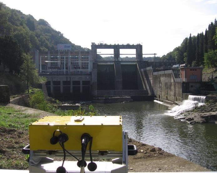
7 Slope & Dam monitoring Interferometric Radar Technology for Slope & Dam No access requested to the area: Technicians & Instrument in the safe zone All rights reserved to IDS 7

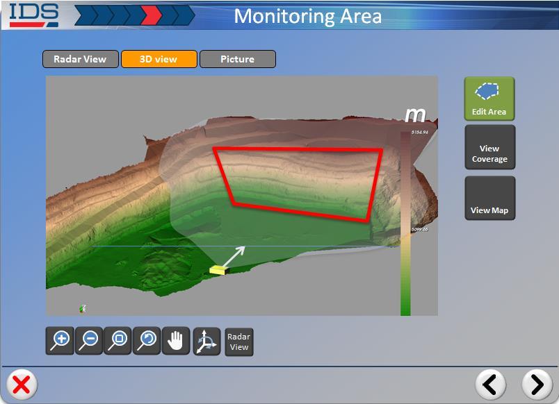
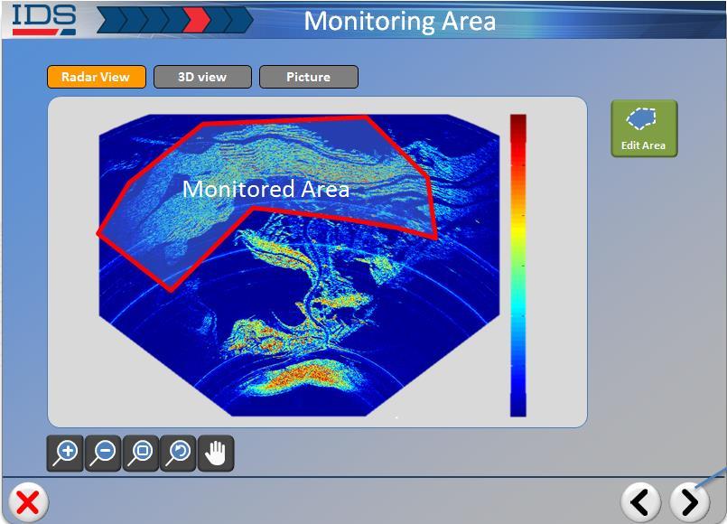
8 Slope & Dam monitoring Interferometric Radar Technology for Slope & Dam Extensive displacement map covering large area All rights reserved to IDS 8

9 Slope & Dam monitoring Interferometric Radar Technology for Slope & Dam Automatic early warning system All rights reserved to IDS 9


10 IBIS Slope & Dam configuration i IBIS-FL Automatic displacement map for slow movements Automatic early-warning alarm, day&night Accuracy: 0.1 mm Very long range: 4 km Operative in hard weather conditions All rights reserved to IDS 10


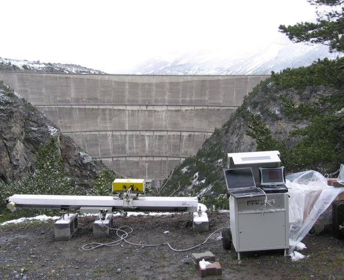
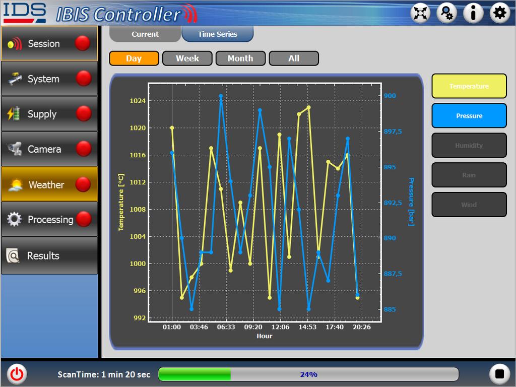
11 IBIS-FL Slope / Dam Weather station Weather station controlled by IBIS software Camera High-resolution digital camera controlled by IBIS software Wi-Fi link Wi-Fi radio link (point to point) to transfer radar data Solar panels Array of 4 solar panels for power supply controlled by IBIS software Power Supply unit Power supply Unit for longterm monitoring with 2 dedicated batteries Radar head High Range Resolution Interferometric Ku-band Radar Unit ( GHz) Diesel Generator Diesel generator for power supply controlled by IBIS software Linear Scanner 2 meters wide linear track for Synthetic Aperture Radar (SAR) operation All rights reserved to IDS 11


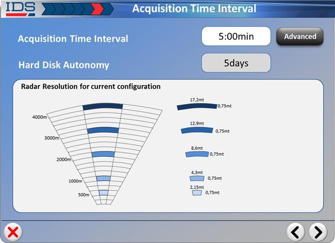
12 IBIS-FL High resolution map Pixel 500 m = 2.2 m x 0.5 1,000 m = 4.4 m x 0.5 2,000 m = 8.8 m x 0.5 m All rights reserved to IDS 12
13 IBIS-FL Area coverage & Accuracy Area coverage Radar Head km Linear Scanner Accuracy 0.1 mm 1 mm 0 km 1 km 2 km 3 km 4 km All rights reserved to IDS 13
14 IBIS-FL 1. Acquisition: IBIS Controller 02:00 min All rights reserved to IDS 14
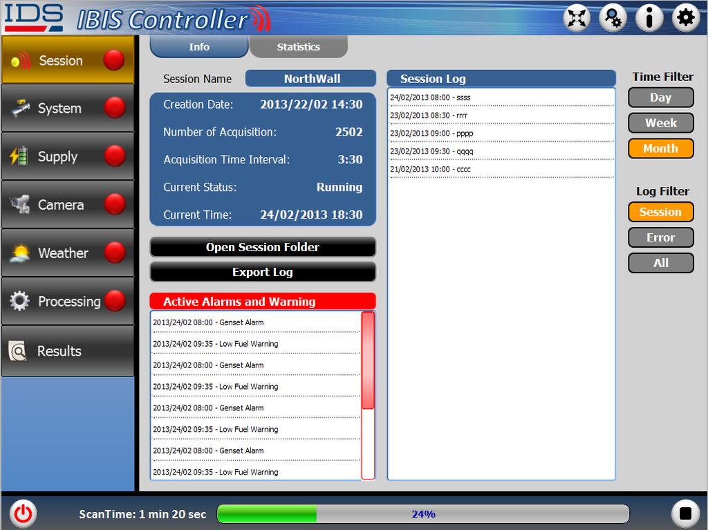

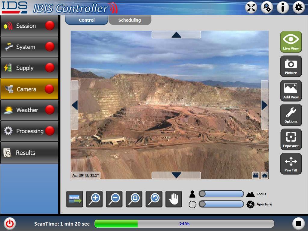
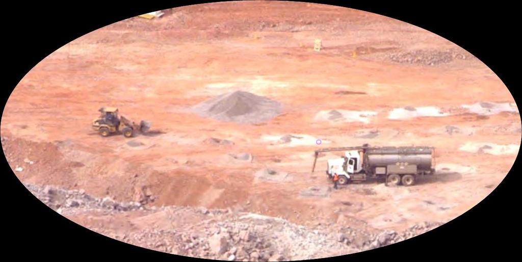

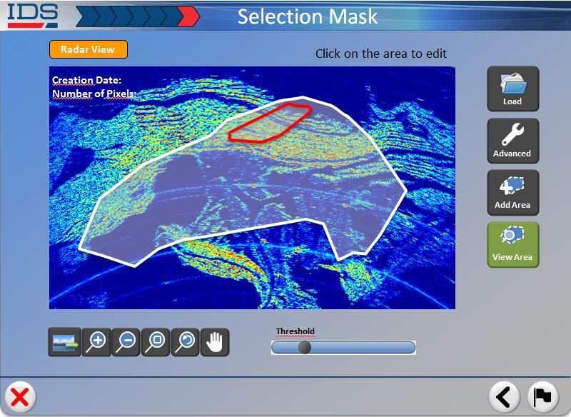
15 IBIS-FL 1. Acquisition: IBIS Controller Distance m Distance m All rights reserved to IDS 15


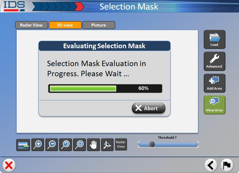
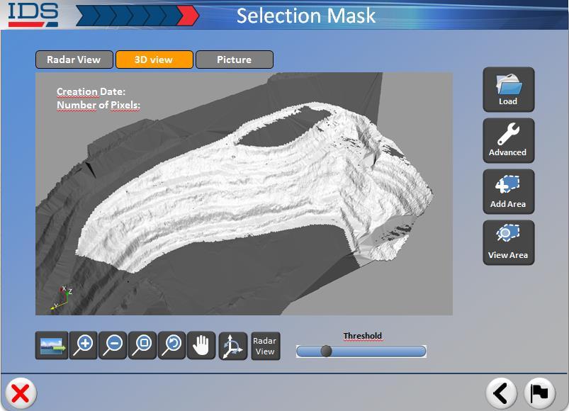
16 IBIS-FL 2. Processing: IBIS Guardian All rights reserved to IDS 16

17 IBIS-FL 3. Automatic alarms and Early warning All rights reserved to IDS 17


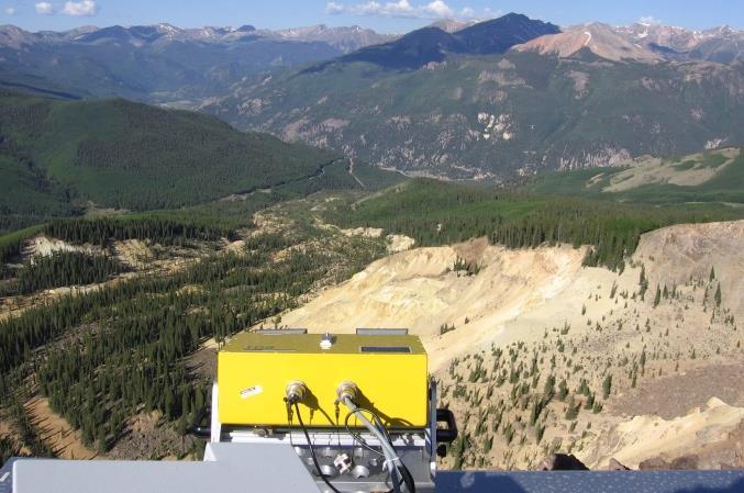
18 IBIS Portable configurations i IBIS-Rover / IBIS-FMT Rapid deployment in critical areas Transportable by light vehicle Quick and easy set up by one operator in different sites Long autonomous power Operative in hard weather conditions All rights reserved to IDS 18


19 IBIS Customer Service Helpdesk and technical assistance: 8H x 5 days Available remote support and daily system checks Geotechnical engineers and engineering geologists on staff

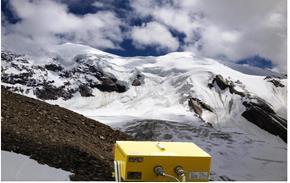
20 IBIS Case Study IBIS-FL Ice Avalanche: radar measurement Thanks to All rights reserved to IDS 20
 IBIS-FS IBIS-FL 3. Synthetic Aperture Radar (SAR) 4.")
21 IBIS Techniques behind IBIS 1. Interferometric technique 2. Frequency Modulated Continuous Wave (FM-CW) IBIS-FS IBIS-FL 3. Synthetic Aperture Radar (SAR) 4. Permanent Scatterers (PSInSAR) IBIS-FL All rights reserved to IDS 21

22 Techniques behind IBIS 1. Interferometric technique: computes the displacement of each pixels by comparing the phase information of the radar signal collected at different times. First acquisition Second acquisition TX RX TX RX 1 2 d T A R G E T T A R G E T d 4 2 Accuracy: up to 0.01 mm Sampling frequency: up to 200Hz 1 All rights reserved to IDS 22
: allows to obtain 2D high-resolution radar images by adding to the range resolution (from the FM-CW), the cross-range angular resolution.")
23 IBIS sensor Techniques behind IBIS-FL 3. Synthetic Aperture Radar (SAR): allows to obtain 2D high-resolution radar images by adding to the range resolution (from the FM-CW), the cross-range angular resolution. Pixel Spatial resolution Pixel R CR Observed area Measure Station Cross range direction Range direction Range resolution: 0.5 m Cross-range resolution: 4.4 m at m All rights reserved to IDS 23
 Area coverage dimension Observed area 4km Standard operating range: up to 4 km Accuracy: 0.")
24 2m Techniques behind IBIS-FL 3. Synthetic Aperture Radar (SAR) Area coverage dimension Observed area 4km Standard operating range: up to 4 km Accuracy: 0.1 mm (depending on range) 60 2km All rights reserved to IDS 24
Use of ground based radar to monitor the effect of increased axle loading on rail bridges. Evgeny Shilov. IDS GeoRadar
 Use of ground based radar to monitor the effect of increased axle loading on rail bridges aa Evgeny Shilov IDS GeoRadar Background of Techniques All rights reserved to IDS GeoRadar 2 Radar technology Radar
DISPLACEMENT AND DEFORMATION MEASUREMENT USING GROUND RADAR INTERFEROMETRY TECHNIQUE
 JOURNAL OF APPLIED ENGINEERING SCIENCES Article Number: 124_VOL. 1(16), issue 1_2013, pp.111-118 ISSN 2247-3769 ISSN-L 2247-3769 (Print) / e-issn:2284-7197 DISPLACEMENT AND DEFORMATION MEASUREMENT USING
Deformation Monitoring with Terrestrial SAR Interferometry
 Lisbon, 12 October 2009 Deformation Monitoring with Terrestrial SAR Interferometry Michele Crosetto Institute of Geomatics Castelldefels (Barcelona) michele.crosetto@ideg.es 1 Content Introduction: Satellite-based
IBIS range. GeoRadar Division. GeoRadar Division. Static and Dynamic Monitoring of Civil Engineering Structures by Microwave Interferometry
 Static and Dynamic Monitoring of Civil Engineering Structures by Microwave Interferometry Garry Spencer and Mark Bell 1 PRODUCTS IBIS range APPLICATIONS IBIS - FL LANDSLIDE & DAM MONITORING IBIS - FM SLOPE
remote sensing? What are the remote sensing principles behind these Definition
 Introduction to remote sensing: Content (1/2) Definition: photogrammetry and remote sensing (PRS) Radiation sources: solar radiation (passive optical RS) earth emission (passive microwave or thermal infrared
DEFORMATION CAMERA
 DEFORMATION CAMERA Automated optical deformation analysis for long-term monitoring of instabilities in rock and ice based on high-resolution images and sophisticated image processing methods. GEOPREVENT
PEGASUS : a future tool for providing near real-time high resolution data for disaster management. Lewyckyj Nicolas
 PEGASUS : a future tool for providing near real-time high resolution data for disaster management Lewyckyj Nicolas nicolas.lewyckyj@vito.be http://www.pegasus4europe.com Overview Vito in a nutshell GI
3-DEMON MONITORING PLATFORM: EXAMPLES OF APPLICATIONS IN STRUCTURAL AND GEOTECHNICAL MONITORING PROJECTS
 3-DEMON MONITORING PLATFORM: EXAMPLES OF APPLICATIONS IN STRUCTURAL AND GEOTECHNICAL MONITORING PROJECTS Luca MANETTI, Daniele INAUDI and Branko GLISIC Smartec SA, Switzerland Abstract: The 3DeMoN (3-Dimentional
Fundamental Concepts of Radar
 Fundamental Concepts of Radar Dr Clive Alabaster & Dr Evan Hughes White Horse Radar Limited Contents Basic concepts of radar Detection Performance Target parameters measurable by a radar Primary/secondary
Combining Ground Radars with Imaging Multisensors
 Combining Ground Radars with Imaging Multisensors FMV Sensors Symposium 2014 Anders GM Dahlberg Business Development Support & Key Account Manager anders.gm.dahlberg@flir.se Area surveillance day and night
TechTime New Mapping Tools for Transportation Engineering
 GeoEye-1 Stereo Satellite Imagery Presented by Karl Kliparchuk, M.Sc., GISP kkliparchuk@mcelhanney.com 604-683-8521 All satellite imagery are copyright GeoEye Corp GeoEye-1 About GeoEye Corp Headquarters:
THE CONNECTED INFRASTRUCTURE SOLUTION MONITORING HOW STRUCTURES EVOLVE
 THE CONNECTED INFRASTRUCTURE SOLUTION MONITORING HOW STRUCTURES EVOLVE Loadsensing is a data acquisition and monitoring system which combines state-of-the-art wireless monitoring and advanced software
Dynamic control of historical buildings through interferometric radar technique.
 . An useful approach for Structural Health Monitoring on earthquake damaged structures. Sergio Vincenzo Calcina, Luca Piroddi and Gaetano Ranieri Università di Cagliari Dipartimento di Ingegneria Civile,
DATACAR ADVANCED MULTILANE TRAFFIC MONITORING SYSTEM
 DATACAR Doc 9723 0030 ADVANCED MULTILANE TRAFFIC MONITORING SYSTEM Suitable both for permanent and temporary installations Non-Intrusive System Accurate detection, speed, counting and classifying traffic
Aerial Image Acquisition and Processing Services. Ron Coutts, M.Sc., P.Eng. RemTech, October 15, 2014
 Aerial Image Acquisition and Processing Services Ron Coutts, M.Sc., P.Eng. RemTech, October 15, 2014 Outline Applications & Benefits Image Sources Aircraft Platforms Image Products Sample Images & Comparisons
Basic Radar Definitions Introduction p. 1 Basic relations p. 1 The radar equation p. 4 Transmitter power p. 9 Other forms of radar equation p.
 Basic Radar Definitions Basic relations p. 1 The radar equation p. 4 Transmitter power p. 9 Other forms of radar equation p. 11 Decibel representation of the radar equation p. 13 Radar frequencies p. 15
ANECHOIC CHAMBER DIAGNOSTIC IMAGING
 ANECHOIC CHAMBER DIAGNOSTIC IMAGING Greg Hindman Dan Slater Nearfield Systems Incorporated 1330 E. 223rd St. #524 Carson, CA 90745 USA (310) 518-4277 Abstract Traditional techniques for evaluating the
Monitoring with low-cost GNSS receivers
 Monitoring with low-cost GNSS receivers GNSS monitoring with low-cost receivers 1 Why GNSS? Your advantages! free of charge and available worldwide No line of sight connection is necessary to the measuring
CASE STUDY BRIDGE DYNAMIC MONITORING
 Introduction BRIDGE DYNAMIC MONITORING Monitoring of structure movements and vibrations (bridges, buildings, monuments, towers etc.) is an increasingly important task for today s construction engineers.
Earth Observation from a Moon based SAR: Potentials and Limitations
 Earth Observation from a Moon based SAR: Potentials and Limitations F. Bovenga 1, M. Calamia 2,3, G. Fornaro 5, G. Franceschetti 4, L. Guerriero 1, F. Lombardini 5, A. Mori 2 1 Politecnico di Bari - Dipartimento
Advances in the use of Ground Based Radar for Disaster Recovery Risk Management
 Advances in the use of Ground Based Radar for Disaster Recovery Risk Management Mark BELL, Australia Key words: Radar, GPR, Interferometry, Synthetic Aperture Radar SUMMARY At the beginning of the 20th
Microwaves. Group 7, 11/22/2013
 Microwaves Group 7, 11/22/2013 Matthew Spickard History/Definition Andrew Miller Range of practical application Dustin Morris Detailed application and equation definition History First predicted by James
Active and passive radio frequency imaging using a swarm of SUAS
 Active and passive radio frequency imaging using a swarm of SUAS 7 th - 8 th June 2016 NATO SET 222 Dr Claire Stevenson Dstl cmstevenson@dstl.gov.uk 1 Contents 1.Motivation 2.Radio Frequency Imaging 3.Bistatic
URBAN MONITORING USING PERSISTENT SCATTERER INSAR AND PHOTOGRAMMETRY
 URBAN MONITORING USING PERSISTENT SCATTERER INSAR AND PHOTOGRAMMETRY Junghum Yu *, Alex Hay-Man Ng, Sungheuk Jung, Linlin Ge, and Chris Rizos. School of Surveying and Spatial Information Systems, University
Rainer Dielmann, Walter Bürkin Genitron Instruments GmbH, Frankfurt, Germany
 Adequate Technologies for Wireless real-time dose rate monitoring for off-site emergency management An experience report based on the Off-Site Emergency Preparedness (OSEP) activity, Tacis project Establishment
GeoRadar Division. GPR for Archeology and Cultural Heritage. GeoRadar Division. GPR Configuration for Archeology and Cultural Heritage Application
 GeoRadar Division GPR Configuration for Archeology and Cultural Heritage Application We believe that the Archaeological patrimony and the Cultural Heritage are one of the most important aspect of this
KONGSBERG SATELLITE SERVICES 2017 Line Steinbakk, Director Programs. Himmel og hav - Ålesund 3. Oktober 2017
 KONGSBERG SATELLITE SERVICES 2017 Line Steinbakk, Director Programs Himmel og hav - Ålesund 3. Oktober 2017 KSAT HQ IN TROMSØ 69N Established in 1967 Kongsberg Satellite Services since 2002 World leading
The studies began when the Tiros satellites (1960) provided man s first synoptic view of the Earth s weather systems.
 provided man s first synoptic view of the Earth s weather systems.") Remote sensing of the Earth from orbital altitudes was recognized in the mid-1960 s as a potential technique for obtaining information important for the effective use and conservation of natural resources.
Remote sensing of the Earth from orbital altitudes was recognized in the mid-1960 s as a potential technique for obtaining information important for the effective use and conservation of natural resources.
RESERVOIR MONITORING USING RADAR SATELLITES
 RESERVOIR MONITORING USING RADAR SATELLITES Alain Arnaud, Johanna Granda, Geraint Cooksley ALTAMIRA INFORMATION S.L., Calle Córcega 381-387, E-08037 Barcelona, Spain. Key words: Reservoir monitoring, InSAR,
GNSS-Reflectometry for Observation and Monitoring of Earth surface
 GNSS-Reflectometry for Observation and Monitoring of Earth surface Global Navigation meets Geoinformation ESA ESOC Darmstadt, 28-04-2017 Dr. Ing. Domenico Schiavulli INR engineer support at EUMETSAT Outline
Synthetic Aperture Radar for Rapid Flood Extent Mapping
 National Aeronautics and Space Administration ARSET Applied Remote Sensing Training http://arset.gsfc.nasa.gov @NASAARSET Synthetic Aperture Radar for Rapid Flood Extent Mapping Sang-Ho Yun ARIA Team Jet
Detection of a Point Target Movement with SAR Interferometry
 Journal of the Korean Society of Remote Sensing, Vol.16, No.4, 2000, pp.355~365 Detection of a Point Target Movement with SAR Interferometry Jung-Hee Jun* and Min-Ho Ka** Agency for Defence Development*,
High resolution ground deformations monitoring by COSMO-SkyMed PSP SAR interferometry
 High resolution ground deformations monitoring by COSMO-SkyMed PSP SAR interferometry Mario Costantini e-geos - an ASI/Telespazio Company, Rome, Italy mario.costantini@e-geos.it Summary COSMO-SkyMed satellite
L-BAND ICE-PENETRATING RADAR ON BOARD A SMALL SATELLITE
 L-BAND ICE-PENETRATING RADAR ON BOARD A SMALL SATELLITE Anoop Parthasarathy Mtech. Digital Signal Processing Centre for Emerging Technologies Jain University ACKNOWLEDGEMENTS My sincere thanks to Dr. G.
JANUARY 2017 GROUND BREAKING NEWS. groundprobe.com
 JANUARY 2017 GROUND BREAKING NEWS groundprobe.com Happy new year! In the last twelve months GroundProbe has grown by leaps and bounds in terms of new offerings, services, partnerships, office locations
BHE BONN HUNGARY ELECTRONICS LTD.
 WWW.BHE-MW.EU www.bhe-mw.eu 2 TACTICAL RADIO COMMUNICATION NETWORK SPECIAL SERVICES AEROSTAT OBSERVATION SYSTEM R&D CAPABILITIES DEVICES FOR COUNTERMEASURE DEVICES & COMPONENTS www.bhe-mw.eu 3 WELCOME
Acknowledgment. Process of Atmospheric Radiation. Atmospheric Transmittance. Microwaves used by Radar GMAT Principles of Remote Sensing
 GMAT 9600 Principles of Remote Sensing Week 4 Radar Background & Surface Interactions Acknowledgment Mike Chang Natural Resources Canada Process of Atmospheric Radiation Dr. Linlin Ge and Prof Bruce Forster
MULTI-CHANNEL SAR EXPERIMENTS FROM THE SPACE AND FROM GROUND: POTENTIAL EVOLUTION OF PRESENT GENERATION SPACEBORNE SAR
 3 nd International Workshop on Science and Applications of SAR Polarimetry and Polarimetric Interferometry POLinSAR 2007 January 25, 2007 ESA/ESRIN Frascati, Italy MULTI-CHANNEL SAR EXPERIMENTS FROM THE
RADAR (RAdio Detection And Ranging)
") RADAR (RAdio Detection And Ranging) CLASSIFICATION OF NONPHOTOGRAPHIC REMOTE SENSORS PASSIVE ACTIVE DIGITAL CAMERA THERMAL (e.g. TIMS) VIDEO CAMERA MULTI- SPECTRAL SCANNERS VISIBLE & NIR MICROWAVE Real
RADAR (RAdio Detection And Ranging) CLASSIFICATION OF NONPHOTOGRAPHIC REMOTE SENSORS PASSIVE ACTIVE DIGITAL CAMERA THERMAL (e.g. TIMS) VIDEO CAMERA MULTI- SPECTRAL SCANNERS VISIBLE & NIR MICROWAVE Real
DHS/U.S. Customs and Border Protection -
 DHS/U.S. Customs and Border Protection - Technology Solutions Program Office (TSPO) DHS/ Unmanned Aircraft System (UAS) October 31, 2006 1 Purpose Provide overall UAS program overview Program Description
9/12/2011. Training Course Remote Sensing Basic Theory & Image Processing Methods September 2011
 Training Course Remote Sensing Basic Theory & Image Processing Methods 19 23 September 2011 Popular Remote Sensing Sensors & their Selection Michiel Damen (September 2011) damen@itc.nl 1 Overview Low resolution
The ASTRI SST-2M Illuminator
 CTA Calibration Meeting Universidade de São Paulo Instituto de Astronomia, Geofisica e Ciencias Atmosferica The ASTRI SST-2M Illuminator A. Segreto, G. La Rosa INAF Palermo for the ASTRI Collaboration
Microwave Remote Sensing (1)
") Microwave Remote Sensing (1) Microwave sensing encompasses both active and passive forms of remote sensing. The microwave portion of the spectrum covers the range from approximately 1cm to 1m in wavelength.
Microwave Remote Sensing (1) Microwave sensing encompasses both active and passive forms of remote sensing. The microwave portion of the spectrum covers the range from approximately 1cm to 1m in wavelength.
Phantom Dome - Advanced Drone Detection and jamming system
 Phantom Dome - Advanced Drone Detection and jamming system *Picture for illustration only 1 1. The emanating threat of drones In recent years the threat of drones has become increasingly vivid to many
SUGAR_GIS. From a user perspective. Provides spatial distribution of a wide range of sugarcane production data in an easy to use and sensitive way.
 SUGAR_GIS From a user perspective What is Sugar_GIS? A web-based, decision support tool. Provides spatial distribution of a wide range of sugarcane production data in an easy to use and sensitive way.
Detection of traffic congestion in airborne SAR imagery
 Detection of traffic congestion in airborne SAR imagery Gintautas Palubinskas and Hartmut Runge German Aerospace Center DLR Remote Sensing Technology Institute Oberpfaffenhofen, 82234 Wessling, Germany
Introduction Active microwave Radar
 RADAR Imaging Introduction 2 Introduction Active microwave Radar Passive remote sensing systems record electromagnetic energy that was reflected or emitted from the surface of the Earth. There are also
SARscape Modules for ENVI
 Visual Information Solutions SARscape Modules for ENVI Read, process, analyze, and output products from SAR data. ENVI. Easy to Use Tools. Proven Functionality. Fast Results. DEM, based on TerraSAR-X-1
APPLICATION OF OCEAN RADAR ON THE BALTIC, FEATURES AND LIMITATIONS
 APPLICATION OF OCEAN RADAR ON THE BALTIC, FEATURES AND LIMITATIONS Thomas Helzel, Matthias Kniephoff, Leif Petersen, Markus Valentin Helzel Messtechnik GmbH e-mail: helzel@helzel.com Presentation at Hydro
A Unique Approach to Frequency-Modulated Continuous-Wave Radar Design
 Electromagnetics Research Group G.L. Charvat, L.C. Kempel, Michigan State University AMTA 2004 1 Overview of Presentation Principles of Frequency-Modulated Continuous-Wave (FMCW) Radar The unique approach
Development of the Technology of Utilization of Airborne Synthetic Aperture Radar (SAR)
") Development of the Technology of Utilization of Airborne Synthetic Aperture Radar (SAR) Mamoru Koarai, Kouichi Moteki, Nobuyuki Watanabe, Takaki Okatani,Youko Yamada and Kaoru Matsuo Geographical Survey
Development of the Technology of Utilization of Airborne Synthetic Aperture Radar (SAR) Mamoru Koarai, Kouichi Moteki, Nobuyuki Watanabe, Takaki Okatani,Youko Yamada and Kaoru Matsuo Geographical Survey
Change detection in cultural landscapes
 9-11 November 2015 ESA-ESRIN, Frascati (Rome), Italy 3 rd ESA-EARSeL Course on Remote Sensing for Archaeology Day 3 Change detection in cultural landscapes DeodatoTapete (1,2) & Francesca Cigna (1,2) (1)
RADAR DEVELOPMENT BASIC CONCEPT OF RADAR WAS DEMONSTRATED BY HEINRICH. HERTZ VERIFIED THE MAXWELL RADAR.
 1 RADAR WHAT IS RADAR? RADAR (RADIO DETECTION AND RANGING) IS A WAY TO DETECT AND STUDY FAR OFF TARGETS BY TRANSMITTING A RADIO PULSE IN THE DIRECTION OF THE TARGET AND OBSERVING THE REFLECTION OF THE
MFAM: Miniature Fabricated Atomic Magnetometer for Autonomous Magnetic Surveys
 MFAM: Miniature Fabricated Atomic Magnetometer for Autonomous Magnetic Surveys Bart Hoekstra Rahul Mhaskar Drones Applied to Geophysical Mapping Workshop Unmanned Vehicles The Future of Geophysics REMUS
Range Instrumentation Radar Roadmap. Tim Boolos Ira Ekhaus Mike Kurecki BAE Systems Instrumentation Products and Sustainment
 Range Instrumentation Radar Roadmap Tim Boolos Ira Ekhaus Mike Kurecki BAE Systems Instrumentation Products and Sustainment Introduction Ground Based Test Instrumentation is the foundation of Test and
9/13/2011. Training Course Remote Sensing Basic Theory & Image Processing Methods September 2011
 Training Course Remote Sensing Basic Theory & Image Processing Methods 19 23 September 2011 DIGITAL TERRAIN MODELS Introduction Michiel Damen (April 2011) damen@itc.nl 1 Digital Elevation and Terrain Models
Remote Sensing. Ch. 3 Microwaves (Part 1 of 2)
") Remote Sensing Ch. 3 Microwaves (Part 1 of 2) 3.1 Introduction 3.2 Radar Basics 3.3 Viewing Geometry and Spatial Resolution 3.4 Radar Image Distortions 3.1 Introduction Microwave (1cm to 1m in wavelength)
Remote Sensing Ch. 3 Microwaves (Part 1 of 2) 3.1 Introduction 3.2 Radar Basics 3.3 Viewing Geometry and Spatial Resolution 3.4 Radar Image Distortions 3.1 Introduction Microwave (1cm to 1m in wavelength)
Discoverer II Space Based Radar Concept
 Discoverer II Space Based Radar Concept DARPATech 2000 Sept 2000 Allan Steinhardt Outline The Discoverer II Concept New Capabilities Active Electronic Scanned Antenna Space Based Information Processing
Indian Remote Sensing Satellites
 Resourcesat-1 Indian Remote Sensing Satellites -Current & Future Resourcesat Missions - Presented by: Timothy J. Puckorius Chairman & CEO EOTec 1 Presentation Topics India s Earth Observation Heritage
Real-Time Through-Wall Imaging Using an Ultrawideband Multiple-Input Multiple-Output (MIMO) Phased-Array Radar System
 Phased-Array Radar System") Real-Time Through-Wall Imaging Using an Ultrawideband Multiple-Input Multiple-Output (MIMO) Phased-Array Radar System G. L. Charvat, T. S. Ralston, and J. E. Peabody Aerospace Sensor Technology Group This
Real-Time Through-Wall Imaging Using an Ultrawideband Multiple-Input Multiple-Output (MIMO) Phased-Array Radar System G. L. Charvat, T. S. Ralston, and J. E. Peabody Aerospace Sensor Technology Group This
Correcting topography effects on terrestrial radar maps
 Correcting topography effects on terrestrial radar maps M. Jaud, R. Rouveure, P. Faure, M-O. Monod, L. Moiroux-Arvis UR TSCF Irstea, National Research Institute of Science and Technology for Environment
39N6E KASTA-2E2 Low-Altitude 3D All-Round Surveillance Radar
 39N6E KASTA-2E2 Low-Altitude 3D All-Round Surveillance Radar The Kasta-2E2 low-altitude 3D all-round surveillance radar is designed to control airspace and to perform automatic detection, range/azimuth/altitude
Continuous, remote monitoring and logging of electromagnetic fields
 NARDA EMF MONITORS AMB-8059 Continuous, remote monitoring and logging of electromagnetic fields Interchangeable probes from 10 Hz to 40 GHz for low frequency & high frequency applications Multi-band probes
Automated Damage Analysis from Overhead Imagery
 Automated Damage Analysis from Overhead Imagery EVAN JONES ANDRE COLEMAN SHARI MATZNER Pacific Northwest National Laboratory 1 PNNL FY2015 at a Glance $955 million in R&D expenditures 4,400 scientists,
The BYU microsar System
 The BYU microsar System David G. Long BYU Center for Remote Sensing, Microwave Earth Remote Sensing Laboratory Electrical and Computer Engineering Dept., Brigham Young University 459 Clyde Building, Provo,
Sources of Geographic Information
 Sources of Geographic Information Data properties: Spatial data, i.e. data that are associated with geographic locations Data format: digital (analog data for traditional paper maps) Data Inputs: sampled
KOMPSAT Constellation. November 2012 Satrec Initiative
 KOMPSAT Constellation November 2012 Satrec Initiative KOMPSAT Constellation KOMPSAT National program Developed and operated by KARI (Korea Aerospace Research Institute) Dual use : Government & commercial
MODE TINSAR: AN ESA INCUBATION PROJECT DEDICATED TO THE TERRESTRIAL SAR INTERFEROMETRY
 MODE TINSAR: AN ESA INCUBATION PROJECT DEDICATED TO THE TERRESTRIAL SAR INTERFEROMETRY Mazzanti Paolo (1-2-3), Brunetti Alessandro (1-3), Scarascia Mugnozza Gabriele (1-2-3) (1) NHAZCA S.r.l., Spin-off
Principles of Pulse-Doppler Radar p. 1 Types of Doppler Radar p. 1 Definitions p. 5 Doppler Shift p. 5 Translation to Zero Intermediate Frequency p.
 Preface p. xv Principles of Pulse-Doppler Radar p. 1 Types of Doppler Radar p. 1 Definitions p. 5 Doppler Shift p. 5 Translation to Zero Intermediate Frequency p. 6 Doppler Ambiguities and Blind Speeds
Engineering Project Proposals
 Engineering Project Proposals (Wireless sensor networks) Group members Hamdi Roumani Douglas Stamp Patrick Tayao Tyson J Hamilton (cs233017) (cs233199) (cs232039) (cs231144) Contact Information Email:
Product Description 2-1
 2 Product Description 2.1 Chapter Overview This chapter provides an overall description of the STRATA TX System, its components, and its capabilities. Here are the topics covered: Topic System Description
UAV-based remote sensing of the slow-moving landslide Super-Sauze
 Universität Stuttgart UAV-based remote sensing of the slow-moving landslide Super-Sauze U. Niethammer, S. Rothmund, M. Joswig 06.02.2009 Motivation The four main objectives for our remote sensing campaign
CHC MINING DEFORMATION MONITORING SOLUTION
 CHC MINING DEFORMATION MONITORING SOLUTION Safety is first in mining. CHC offers solutions designed to improve safety for personnel on the ground and in the cab with 24/7 precision positioning for automatic
TerraSAR-X Applications Guide
 TerraSAR-X Applications Guide Extract: Change Detection and Monitoring: Geospatial / Image Intelligence April 2015 Airbus Defence and Space Geo-Intelligence Programme Line Change Detection and Monitoring:
C. R. Weisbin, R. Easter, G. Rodriguez January 2001
 on Solar System Bodies --Abstract of a Projected Comparative Performance Evaluation Study-- C. R. Weisbin, R. Easter, G. Rodriguez January 2001 Long Range Vision of Surface Scenarios Technology Now 5 Yrs
NAVIGATION AND REMOTE SENSING PAYLOADS AND METHODS OF THE SARVANT UNMANNED AERIAL SYSTEM
 NAVIGATION AND REMOTE SENSING PAYLOADS AND METHODS OF THE SARVANT UNMANNED AERIAL SYSTEM P. Molina, P. Fortuny, I. Colomina Institute of Geomatics -- Castelldefels (ES) M. Remy, K.A.C. Macedo, Y.R.C. Zúnigo,
ERS/ENVISAT ASAR Data Products and Services
 ERS/ENVISAT ASAR Data Products and Services Andrea Celentano Business Manager celentan@eurimage.com What is Eurimage? Founded in 1989 Current shareholders: Since 1989 Commercial Partner of the European
A Stepped Frequency CW SAR for Lightweight UAV Operation
 UNCLASSIFIED/UNLIMITED A Stepped Frequency CW SAR for Lightweight UAV Operation ABSTRACT Dr Keith Morrison Department of Aerospace, Power and Sensors University of Cranfield, Shrivenham Swindon, SN6 8LA
Concept of the future L-band SAR mission for wide swath SAR observation
 Concept of the future SAR mission for wide swath SAR observation A.Karasawa 1, Y.Okada 1, Y.Yokota 1, S.Nakamura 1 1) Mitsubishi Electric Corporation 1 Outline 1:Development of SAR systems in MELCO 2:Development
An interferometric radar for remote sensing of deflections on large structures
 Structural Studies, Repairs and Maintenance of Heritage Architecture XI 359 An interferometric radar for remote sensing of deflections on large structures C. Gentile, S. Bulgarelli, N. Gallino & A. Oldini
EE 529 Remote Sensing Techniques. Introduction
 EE 529 Remote Sensing Techniques Introduction Course Contents Radar Imaging Sensors Imaging Sensors Imaging Algorithms Imaging Algorithms Course Contents (Cont( Cont d) Simulated Raw Data y r Processing
Spatially Resolved Backscatter Ceilometer
 Spatially Resolved Backscatter Ceilometer Design Team Hiba Fareed, Nicholas Paradiso, Evan Perillo, Michael Tahan Design Advisor Prof. Gregory Kowalski Sponsor, Spectral Sciences Inc. Steve Richstmeier,
RMU3 Remote Monitoring Unit and GPS Interrupter
 About Mobiltex Mobiltex Data Ltd., formed in 1985 and headquartered in engages in the engineering, design and manufacture of high-quality industrial mobile data systems. RMU3 Remote Monitoring Unit and
Wireless Activity Sensors
 The Leader in Low-Cost, Remote Monitoring Solutions Wireless Activity Sensors General Description Monnit wireless activity sensors can be used in a host of applications where detecting vibration (sudden
Deliverable 5-A&B: A Review and Demonstration of the Geotechnical Asset Management Decisions Support System (GAMDSS)
") Deliverable 5-A&B: A Review and Demonstration of the Geotechnical Asset Management Decisions Support System (GAMDSS) Reid Sawtell, Rüdiger Escobar Wolf, El Hachemi Bouali, Thomas Oommen, Rick Dobson, and
Deliverable 5-A&B: A Review and Demonstration of the Geotechnical Asset Management Decisions Support System (GAMDSS) Reid Sawtell, Rüdiger Escobar Wolf, El Hachemi Bouali, Thomas Oommen, Rick Dobson, and
Some Notes on Using Balloon Photography For Modeling the Landslide Area
 Some Notes on Using Balloon Photography For Modeling the Landslide Area Catur Aries Rokhmana Department of Geodetic-Geomatics Engineering Gadjah Mada University Grafika No.2 Yogyakarta 55281 - Indonesia
RADAR SENSOR FOR INTRUSION AND OBSTACLES DETECTION
 SECURITY SYSTEMS RADAR SENSOR FOR INTRUSION AND OBSTACLES DETECTION In security you cannot choose the second best option indracompany.com DIO RADAR SENSOR FOR INTRUSION AND OBSTACLES DETECTION A medium-range
Active microwave systems (1) Satellite Altimetry
 Satellite Altimetry") Remote Sensing: John Wilkin Active microwave systems (1) Satellite Altimetry jwilkin@rutgers.edu IMCS Building Room 214C 732-932-6555 ext 251 Active microwave instruments Scatterometer (scattering from
Remote Sensing: John Wilkin Active microwave systems (1) Satellite Altimetry jwilkin@rutgers.edu IMCS Building Room 214C 732-932-6555 ext 251 Active microwave instruments Scatterometer (scattering from
CSRmesh Beacon management and Asset Tracking Muhammad Ulislam Field Applications Engineer, Staff, Qualcomm Atheros, Inc.
 CSRmesh Beacon management and Asset Tracking Muhammad Ulislam Field Applications Engineer, Staff, Qualcomm Atheros, Inc. CSRmesh Recap Bluetooth Mesh Introduction What is CSRmesh? A protocol that runs
Millimetre Wave Wireless Access:
 Millimetre Wave Wireless Access: The Path to 5G Enhanced Mobile Broadband Professor Mark Beach Communication and Networks Group, University of Bristol, Bristol. UK http://www.bristol.ac.uk/engineering/research/csn/
The Mobile CNC Measurement and 3D Scanning System. WENZEL ScanTec MobileScan3D
 The Mobile CNC Measurement and 3D Scanning System WENZEL ScanTec MobileScan3D MobileScan3D What is it and how does it work? MobileScan3D is a truly mobile CNC laser scanning solution allowing fully automatic
Hyper-spectral, UHD imaging NANO-SAT formations or HAPS to detect, identify, geolocate and track; CBRN gases, fuel vapors and other substances
 Hyper-spectral, UHD imaging NANO-SAT formations or HAPS to detect, identify, geolocate and track; CBRN gases, fuel vapors and other substances Arnold Kravitz 8/3/2018 Patent Pending US/62544811 1 HSI and
HIGH RESOLUTION DIFFERENTIAL INTERFEROMETRY USING TIME SERIES OF ERS AND ENVISAT SAR DATA
 HIGH RESOLUTION DIFFERENTIAL INTERFEROMETRY USING TIME SERIES OF ERS AND ENVISAT SAR DATA Javier Duro 1, Josep Closa 1, Erlinda Biescas 2, Michele Crosetto 2, Alain Arnaud 1 1 Altamira Information C/ Roger
Client: Statens vegvesen, Region midt County: Sør Trondelag
 Geological Survey of Norway N-7441 Trondheim, Norway REPORT Report no.: 2004.043 ISSN 0800-3416 Grading: Open Title: Preliminary analysis of InSAR data over Trondheim with respect to future road development
Monitoring the Earth Surface from space
 Monitoring the Earth Surface from space Picture of the surface from optical Imagery, i.e. obtained by telescopes or cameras operating in visual bandwith. Shape of the surface from radar imagery Surface
Radar Imaging Wavelengths
 A Basic Introduction to Radar Remote Sensing ~~~~~~~~~~ Rev. Ronald J. Wasowski, C.S.C. Associate Professor of Environmental Science University of Portland Portland, Oregon 3 November 2015 Radar Imaging
AIRBORNE IOT NETWORK (AIN) FOR SMART AGRICULTURE AND ENVIRONMENT PROTECTION
 FOR SMART AGRICULTURE AND ENVIRONMENT PROTECTION") AIRBORNE IOT NETWORK (AIN) FOR SMART AGRICULTURE AND ENVIRONMENT PROTECTION Nordin Ramli1, Kentaro Ishizu2, Rosdiadee Nordin3, Nestor Michael C. Tiglao4, Brian Yuliarto5, Fumihide Kojima2, and Hafizal
AIRBORNE IOT NETWORK (AIN) FOR SMART AGRICULTURE AND ENVIRONMENT PROTECTION Nordin Ramli1, Kentaro Ishizu2, Rosdiadee Nordin3, Nestor Michael C. Tiglao4, Brian Yuliarto5, Fumihide Kojima2, and Hafizal
TerraSAR-X Applications Guide
 TerraSAR-X Applications Guide Extract: Maritime Monitoring: Ship Detection April 2015 Airbus Defence and Space Geo-Intelligence Programme Line Maritime Monitoring: Ship Detection Issue Maritime security
Module 3 Introduction to GIS. Lecture 8 GIS data acquisition
 Module 3 Introduction to GIS Lecture 8 GIS data acquisition GIS workflow Data acquisition (geospatial data input) GPS Remote sensing (satellites, UAV s) LiDAR Digitized maps Attribute Data Management Data
Urban tunneling and the advantages of using InSAR SPN satellite technology to detect and monitor surface deformation effects
 Urban tunneling and the advantages of using InSAR SPN satellite technology to detect and monitor surface deformation effects María de Faragó 1, Geraint Cooksley 1 1 Altamira Information, Spain ABSTRACT