UAV applications for oil spill detection, suspended matter distribution and ice monitoring first tests and trials in Estonia 2015/2016
|
|
|
- Frederica Burke
- 6 years ago
- Views:
Transcription
1 UAV applications for oil spill detection, suspended matter distribution and ice monitoring first tests and trials in Estonia 2015/2016 Sander Rikka Marine Systems Institute at TUT
2 Outlook Introduction Oil spill detection Drone operations Sensors Suspended matter distribution Waves Ice monitoring Drones Summary 2

3 Introduction - drone DJI Inspire 1 Flight time min RGB camera (RAW+jpg) Wind resistance 10 m/s Temperature range -10 C to 40 C Relativly cost effective Different camera/gimbal systems and sensors available 3
4 Introduction - drone Total flight time over 100h since August 2015 Total flight distance over 400 km Great variability of weather conditions and locations Minimum temp approx. -24 C Maximum wind speed approx. 15 m/s Maximum altitude 500 m above sea level Operations carried out mostly from shore, but also include small rowboat and research vessels Operations both above open water and ice covered sea 4
5 Oil spill detection Visual camera sensor not perfect for oil spill detection - Difficult to distinguish oil from the background - Sun glint - Wind sheen - Sea weeds - Cannot operate at night - No methods to ensure the positive detection + Useful for documentation + Cheap and widely available + Easy to operate - The angle of the light - Seasonal differences - Reflections from waves and surface - Flight height - Wind, rain, snow etc 5


6 Oil spill detection Drone photo from above, viewing remaining of the main engine of MS VOLARE wreck, arrows point on detectable oil slicks originating from the wreck Near shore pollution as registered by UAV camera 6

7 MS Volare 7

8 MS Volare wreck after the salvage 8
9 Sensors Visual sensors airborne and satellite Infrared and thermal infrared sensors Probably the most applicable sensor to different types of UAVs Fluorosensors Good pontential SAR Many positive sides Lidar 9

10 Sensors Hyper-spectral + Large spectral coverage = lot of information - Not applicable to every type of UAVs Usage of filter to have different spectral bans Lightweight Saves image location Takes approx. 10 s to capture the image 10


11 Sensors airborne fluorosensor (LDI Innovation) Heavy Maximum detection height approx. 10m Information from single point = underwater buoy stations 11

12 Sesnors Lidar (LDI Innovation) Very heavy Single point measurements Gives specific parameters of oil 12
13 Other activities 13

14 Suspended matter distribution 14

15 Suspended matter distribution 15

16 Suspended matter distribution 16

17 River runoff 17
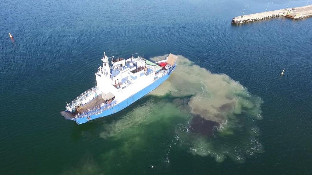
18 Ship maneuvering 18
 measurements Four diferent ground types were measured sand, peat, grass and soil (not presented here) RGB values from aircraft are in good agreement")
19 Pixel DN value Reflectance (RAMSES) Pixel DN value Reflectance (RAMSES) Pixel DN value Reflectance (RAMSES) Field tests RGB spectrum Inspire 1 pixel values are compared with RAMSES (Radiation Measurements with Enhanced Spectral resolution) measurements Four diferent ground types were measured sand, peat, grass and soil (not presented here) RGB values from aircraft are in good agreement with same values from RAMSES instrument in terms of shape Sand Wavelength (nm) Aircraft Ramses Ramses all Peat Wavelength (nm) Aircraft Ramses Ramses All Grass Wavelength (nm) Aircraft Ramses Ramses All 19


20 Waves As known, waves are important aspect of oil spill behavior Wavelength estimations quite straightforward Wave height estimation is extremly demanding, but possible 20
21 Wave height from camera image Extremly demanding task UAV attitude (roll, pitch, yaw) and altitude, camera orientation must be known UAV should able to fly around 1h over the wave buoy Gamma corrections made by camera not known Illumination of the scene A sky panorama is needed Complete cloud cover or completely clear sky needed Atmospheric conditions must be known Measured 2D spectra from a wave buoy 21
22 Ice monitoring Mostly used for determing whether there is ice or not validation against SAR imagery Lots and lots of images of ice and its formations in different locations and conditions Monitoring of ice breaking activities 22

23 SAR image over the GoR 23

24 Ice classification map 24

25 SAR image over Väinameri 25
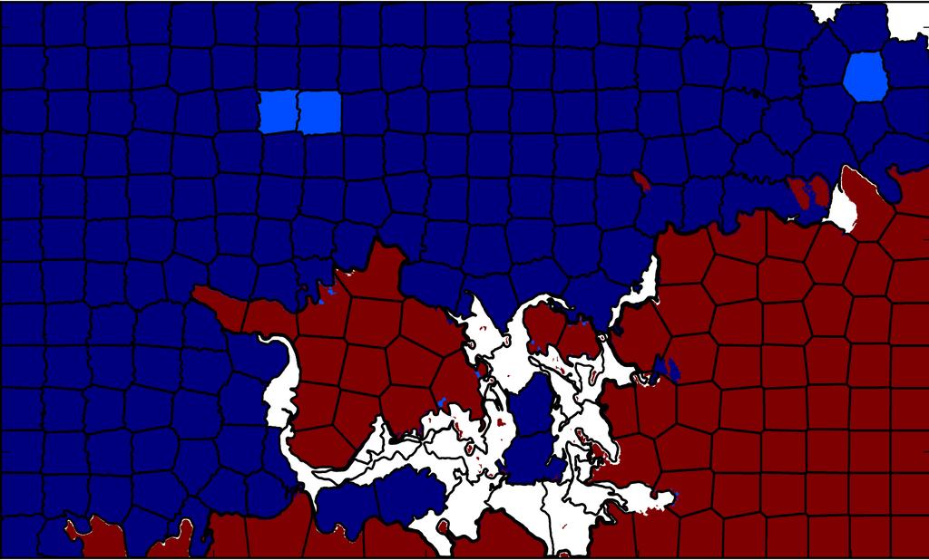
26 Ice classification map 26
27 Drones Fixed wings Great flight distances Great coverage Can carry many sensors Real time information might not be available Wave height analysis not available Takeoff and landing might be problematic Multirotor Able to measure at certain location Can carry many sensors Battery life Bad flight time Not that good area coverage 27
28 Summary Current technology has been very successful Lot of experiences in many situations Proves its usability Not at its full potential yet Ideal solution would include different types of drones Different sensors at the same time (fixed wings UAV) Specific sensor (multirotor) to measure specific parameters of oilspill and waves Great software-wise control over drones 28
29 Thanks for your attention 29
30 And of coarse, drones are good for photo- and videography 30
Monitoring water pollution in the river Ganga with innovations in airborne remote sensing and drone technology
 Monitoring water pollution in the river Ganga with innovations in airborne remote sensing and drone technology RAJIV SINHA, DIPRO SARKAR DEPARTMENT OF EARTH SCIENCES, INDIAN INSTITUTE OF TECHNOLOGY KANPUR,
How Farmer Can Utilize Drone Mapping?
 Presented at the FIG Working Week 2017, May 29 - June 2, 2017 in Helsinki, Finland How Farmer Can Utilize Drone Mapping? National Land Survey of Finland Finnish Geospatial Research Institute Roope Näsi,
UNERSITY OF NAIROBI UNIT: PRICIPLES AND APPLICATIONS OF REMOTE SENSING AND APLLIED CLIMATOLOGY
 UNERSITY OF NAIROBI DEPARTMENT OF METEOROLOGY UNIT: PRICIPLES AND APPLICATIONS OF REMOTE SENSING AND APLLIED CLIMATOLOGY COURSE CODE: SMR 308 GROUP TWO: SENSORS MEMBERS OF GROUP TWO 1. MUTISYA J.M I10/2784/2006
Introduction to Remote Sensing Fundamentals of Satellite Remote Sensing. Mads Olander Rasmussen
 Introduction to Remote Sensing Fundamentals of Satellite Remote Sensing Mads Olander Rasmussen (mora@dhi-gras.com) 01. Introduction to Remote Sensing DHI What is remote sensing? the art, science, and technology
Microwave Remote Sensing (1)
") Microwave Remote Sensing (1) Microwave sensing encompasses both active and passive forms of remote sensing. The microwave portion of the spectrum covers the range from approximately 1cm to 1m in wavelength.
Microwave Remote Sensing (1) Microwave sensing encompasses both active and passive forms of remote sensing. The microwave portion of the spectrum covers the range from approximately 1cm to 1m in wavelength.
TRACS A-B-C Acquisition and Processing and LandSat TM Processing
 TRACS A-B-C Acquisition and Processing and LandSat TM Processing Mark Hess, Ocean Imaging Corp. Kevin Hoskins, Marine Spill Response Corp. TRACS: Level A AIRCRAFT Ocean Imaging Corporation Multispectral/TIR
Module 3 Introduction to GIS. Lecture 8 GIS data acquisition
 Module 3 Introduction to GIS Lecture 8 GIS data acquisition GIS workflow Data acquisition (geospatial data input) GPS Remote sensing (satellites, UAV s) LiDAR Digitized maps Attribute Data Management Data
Microwave Remote Sensing
 Provide copy on a CD of the UCAR multi-media tutorial to all in class. Assign Ch-7 and Ch-9 (for two weeks) as reading material for this class. HW#4 (Due in two weeks) Problems 1,2,3 and 4 (Chapter 7)
Active and Passive Microwave Remote Sensing
 Active and Passive Microwave Remote Sensing Passive remote sensing system record EMR that was reflected (e.g., blue, green, red, and near IR) or emitted (e.g., thermal IR) from the surface of the Earth.
NON-PHOTOGRAPHIC SYSTEMS: Multispectral Scanners Medium and coarse resolution sensor comparisons: Landsat, SPOT, AVHRR and MODIS
 NON-PHOTOGRAPHIC SYSTEMS: Multispectral Scanners Medium and coarse resolution sensor comparisons: Landsat, SPOT, AVHRR and MODIS CLASSIFICATION OF NONPHOTOGRAPHIC REMOTE SENSORS PASSIVE ACTIVE DIGITAL
PEGASUS : a future tool for providing near real-time high resolution data for disaster management. Lewyckyj Nicolas
 PEGASUS : a future tool for providing near real-time high resolution data for disaster management Lewyckyj Nicolas nicolas.lewyckyj@vito.be http://www.pegasus4europe.com Overview Vito in a nutshell GI
Active and Passive Microwave Remote Sensing
 Active and Passive Microwave Remote Sensing Passive remote sensing system record EMR that was reflected (e.g., blue, green, red, and near IR) or emitted (e.g., thermal IR) from the surface of the Earth.
Aerial photography and Remote Sensing. Bikini Atoll, 2013 (60 years after nuclear bomb testing)
") Aerial photography and Remote Sensing Bikini Atoll, 2013 (60 years after nuclear bomb testing) Computers have linked mapping techniques under the umbrella term : Geomatics includes all the following spatial
Aerial photography and Remote Sensing Bikini Atoll, 2013 (60 years after nuclear bomb testing) Computers have linked mapping techniques under the umbrella term : Geomatics includes all the following spatial
MSRC Tactical Oil Spill Surveillance and Remote Sensing
 MSRC Tactical Oil Spill Surveillance and Remote Sensing Industry Technical Advisory Committee for Oil spill Response October 25, 2016 0 Historical Perspective -- Oil Spill Surveillance in U.S Exxon Valdez
746A27 Remote Sensing and GIS
 746A27 Remote Sensing and GIS Lecture 1 Concepts of remote sensing and Basic principle of Photogrammetry Chandan Roy Guest Lecturer Department of Computer and Information Science Linköping University What
Passive Microwave Sensors LIDAR Remote Sensing Laser Altimetry. 28 April 2003
 Passive Microwave Sensors LIDAR Remote Sensing Laser Altimetry 28 April 2003 Outline Passive Microwave Radiometry Rayleigh-Jeans approximation Brightness temperature Emissivity and dielectric constant
Review of Oil Spill Remote Sensing Technologies. Merv Fingas Spill Science, Edmonton, Alberta, Canada, T6W 1J6,
 Review of Oil Spill Remote Sensing Technologies Merv Fingas Spill Science, Edmonton, Alberta, Canada, T6W 1J6, fingasmerv@shaw.ca Abstract Remote-sensing for oil spills is reviewed. The technical aspects
Overview. Objectives. The ultimate goal is to compare the performance that different equipment offers us in a photogrammetric flight.
 Overview At present, one of the most commonly used technique for topographic surveys is aerial photogrammetry. This technique uses aerial images to determine the geometric properties of objects and spatial
Flood modelling and management. Glasgow University. 8 September Paul Shaw - GeoVision
 Flood modelling and management Glasgow University 8 September 2004 Paul Shaw - GeoVision How important are heights in flood modelling? Comparison of data collection technologies GPS - Global Positioning
An Introduction to Remote Sensing & GIS. Introduction
 An Introduction to Remote Sensing & GIS Introduction Remote sensing is the measurement of object properties on Earth s surface using data acquired from aircraft and satellites. It attempts to measure something
Valuable New Information for Precision Agriculture. Mike Ritter Founder & CEO - SLANTRANGE, Inc.
 Valuable New Information for Precision Agriculture Mike Ritter Founder & CEO - SLANTRANGE, Inc. SENSORS Accurate, Platform- Agnostic ANALYTICS On-Board, On-Location SLANTRANGE Delivering Valuable New Information
Introduction to KOMPSAT
 Introduction to KOMPSAT September, 2016 1 CONTENTS 01 Introduction of SIIS 02 KOMPSAT Constellation 03 New : KOMPSAT-3 50 cm 04 New : KOMPSAT-3A 2 KOMPSAT Constellation KOMPSAT series National space program
High Latitude Drone Ecology Network Multispectral Flight Protocol and Guidance Document
 High Latitude Drone Ecology Network Multispectral Flight Protocol and Guidance Document By Jakob Assmann (j.assmann@ed.ac.uk), Jeff Kerby (jtkerb@gmail.com) and Isla Myers-Smith The University of Edinburgh,
Remote Sensing for Resource Management
 Remote Sensing for Resource Management Ebenezer Nyadjro US Naval Research Lab/UNO RMU Summer Program (July 31-AUG 4, 2017) Motivation Polluted Pra River Motivation. 3 Motivation Polluted Pra River Motivation.
An Introduction to Geomatics. Prepared by: Dr. Maher A. El-Hallaq خاص بطلبة مساق مقدمة في علم. Associate Professor of Surveying IUG
 An Introduction to Geomatics خاص بطلبة مساق مقدمة في علم الجيوماتكس Prepared by: Dr. Maher A. El-Hallaq Associate Professor of Surveying IUG 1 Airborne Imagery Dr. Maher A. El-Hallaq Associate Professor
Remote Sensing. Ch. 3 Microwaves (Part 1 of 2)
") Remote Sensing Ch. 3 Microwaves (Part 1 of 2) 3.1 Introduction 3.2 Radar Basics 3.3 Viewing Geometry and Spatial Resolution 3.4 Radar Image Distortions 3.1 Introduction Microwave (1cm to 1m in wavelength)
Remote Sensing Ch. 3 Microwaves (Part 1 of 2) 3.1 Introduction 3.2 Radar Basics 3.3 Viewing Geometry and Spatial Resolution 3.4 Radar Image Distortions 3.1 Introduction Microwave (1cm to 1m in wavelength)
The studies began when the Tiros satellites (1960) provided man s first synoptic view of the Earth s weather systems.
 provided man s first synoptic view of the Earth s weather systems.") Remote sensing of the Earth from orbital altitudes was recognized in the mid-1960 s as a potential technique for obtaining information important for the effective use and conservation of natural resources.
Remote sensing of the Earth from orbital altitudes was recognized in the mid-1960 s as a potential technique for obtaining information important for the effective use and conservation of natural resources.
remote sensing? What are the remote sensing principles behind these Definition
 Introduction to remote sensing: Content (1/2) Definition: photogrammetry and remote sensing (PRS) Radiation sources: solar radiation (passive optical RS) earth emission (passive microwave or thermal infrared
Using Multi-spectral Imagery in MapInfo Pro Advanced
 Using Multi-spectral Imagery in MapInfo Pro Advanced MapInfo Pro Advanced Tom Probert, Global Product Manager MapInfo Pro Advanced: Intuitive interface for using multi-spectral / hyper-spectral imagery
ACTIVE SENSORS RADAR
 ACTIVE SENSORS RADAR RADAR LiDAR: Light Detection And Ranging RADAR: RAdio Detection And Ranging SONAR: SOund Navigation And Ranging Used to image the ocean floor (produce bathymetic maps) and detect objects
Interpreting land surface features. SWAC module 3
 Interpreting land surface features SWAC module 3 Interpreting land surface features SWAC module 3 Different kinds of image Panchromatic image True-color image False-color image EMR : NASA Echo the bat
Unmanned Aerial Vehicles: A New Approach for Coastal Habitat Assessment
 Unmanned Aerial Vehicles: A New Approach for Coastal Habitat Assessment David Ryan Principal Marine Scientist WorleyParsons Western Operations 2 OUTLINE Importance of benthic habitat assessment. Common
IKONOS High Resolution Multispectral Scanner Sensor Characteristics
 High Spatial Resolution and Hyperspectral Scanners IKONOS High Resolution Multispectral Scanner Sensor Characteristics Launch Date View Angle Orbit 24 September 1999 Vandenberg Air Force Base, California,
Advanced Optical Satellite (ALOS-3) Overviews
 Overviews") K&C Science Team meeting #24 Tokyo, Japan, January 29-31, 2018 Advanced Optical Satellite (ALOS-3) Overviews January 30, 2018 Takeo Tadono 1, Hidenori Watarai 1, Ayano Oka 1, Yousei Mizukami 1, Junichi
K&C Science Team meeting #24 Tokyo, Japan, January 29-31, 2018 Advanced Optical Satellite (ALOS-3) Overviews January 30, 2018 Takeo Tadono 1, Hidenori Watarai 1, Ayano Oka 1, Yousei Mizukami 1, Junichi
Geo/SAT 2 INTRODUCTION TO REMOTE SENSING
 Geo/SAT 2 INTRODUCTION TO REMOTE SENSING Paul R. Baumann, Professor Emeritus State University of New York College at Oneonta Oneonta, New York 13820 USA COPYRIGHT 2008 Paul R. Baumann Introduction Remote
The drone for precision agriculture
 The drone for precision agriculture Reap the benefits of scouting crops from above If precision technology has driven the farming revolution of recent years, monitoring crops from the sky will drive the
Ground Truth for Calibrating Optical Imagery to Reflectance
 Visual Information Solutions Ground Truth for Calibrating Optical Imagery to Reflectance The by: Thomas Harris Whitepaper Introduction: Atmospheric Effects on Optical Imagery Remote sensing of the Earth
LAST GENERATION UAV-BASED MULTI- SPECTRAL CAMERA FOR AGRICULTURAL DATA ACQUISITION
 LAST GENERATION UAV-BASED MULTI- SPECTRAL CAMERA FOR AGRICULTURAL DATA ACQUISITION FABIO REMONDINO, Erica Nocerino, Fabio Menna Fondazione Bruno Kessler Trento, Italy http://3dom.fbk.eu Marco Dubbini,
746A27 Remote Sensing and GIS. Multi spectral, thermal and hyper spectral sensing and usage
 746A27 Remote Sensing and GIS Lecture 3 Multi spectral, thermal and hyper spectral sensing and usage Chandan Roy Guest Lecturer Department of Computer and Information Science Linköping University Multi
3/31/03. ESM 266: Introduction 1. Observations from space. Remote Sensing: The Major Source for Large-Scale Environmental Information
 Remote Sensing: The Major Source for Large-Scale Environmental Information Jeff Dozier Observations from space Sun-synchronous polar orbits Global coverage, fixed crossing, repeat sampling Typical altitude
Capture the invisible
 Capture the invisible A Capture the invisible The Sequoia multispectral sensor captures both visible and invisible images, providing calibrated data to optimally monitor the health and vigor of your crops.
Futrajaya, Malaysia JULY 12, Jeong Heon SONG. Korea Aerospace Research Institution
 J P T M 2 0 1 1 Futrajaya, Malaysia JULY 12, 2011 Jeong Heon SONG Korea Aerospace Research Institution Outline Contribution of KARI Sentinel Asia / Data Provider Node International Charter KARI Space Activities
The Normal Baseline. Dick Gent Law of the Sea Division UK Hydrographic Office
 The Normal Baseline Dick Gent Law of the Sea Division UK Hydrographic Office 2 The normal baseline for measuring the breadth of the territorial sea is the low water line along the coast as marked on large
Spectral Signatures. Vegetation. 40 Soil. Water WAVELENGTH (microns)
") Spectral Signatures % REFLECTANCE VISIBLE NEAR INFRARED Vegetation Soil Water.5. WAVELENGTH (microns). Spectral Reflectance of Urban Materials 5 Parking Lot 5 (5=5%) Reflectance 5 5 5 5 5 Wavelength (nm)
Spectral Signatures % REFLECTANCE VISIBLE NEAR INFRARED Vegetation Soil Water.5. WAVELENGTH (microns). Spectral Reflectance of Urban Materials 5 Parking Lot 5 (5=5%) Reflectance 5 5 5 5 5 Wavelength (nm)
EE 529 Remote Sensing Techniques. Introduction
 EE 529 Remote Sensing Techniques Introduction Course Contents Radar Imaging Sensors Imaging Sensors Imaging Algorithms Imaging Algorithms Course Contents (Cont( Cont d) Simulated Raw Data y r Processing
Radar. Seminar report. Submitted in partial fulfillment of the requirement for the award of degree Of Mechanical
 A Seminar report on Radar Submitted in partial fulfillment of the requirement for the award of degree Of Mechanical SUBMITTED TO: SUBMITTED BY: www.studymafia.org www.studymafia.org Preface I have made
RADAR (RAdio Detection And Ranging)
") RADAR (RAdio Detection And Ranging) CLASSIFICATION OF NONPHOTOGRAPHIC REMOTE SENSORS PASSIVE ACTIVE DIGITAL CAMERA THERMAL (e.g. TIMS) VIDEO CAMERA MULTI- SPECTRAL SCANNERS VISIBLE & NIR MICROWAVE Real
RADAR (RAdio Detection And Ranging) CLASSIFICATION OF NONPHOTOGRAPHIC REMOTE SENSORS PASSIVE ACTIVE DIGITAL CAMERA THERMAL (e.g. TIMS) VIDEO CAMERA MULTI- SPECTRAL SCANNERS VISIBLE & NIR MICROWAVE Real
earthobservation.wordpress.com
 Dirty REMOTE SENSING earthobservation.wordpress.com Stuart Green Teagasc Stuart.Green@Teagasc.ie 1 Purpose Give you a very basic skill set and software training so you can: find free satellite image data.
An NDVI image provides critical crop information that is not visible in an RGB or NIR image of the same scene. For example, plants may appear green
 Normalized Difference Vegetation Index (NDVI) Spectral Band calculation that uses the visible (RGB) and near-infrared (NIR) bands of the electromagnetic spectrum NDVI= + An NDVI image provides critical
Chapter 8. Remote sensing
 1. Remote sensing 8.1 Introduction 8.2 Remote sensing 8.3 Resolution 8.4 Landsat 8.5 Geostationary satellites GOES 8.1 Introduction What is remote sensing? One can describe remote sensing in different
The Global Imager (GLI)
") The Global Imager (GLI) Launch : Dec.14, 2002 Initial check out : to Apr.14, 2003 (~L+4) First image: Jan.25, 2003 Second image: Feb.6 and 7, 2003 Calibration and validation : to Dec.14, 2003(~L+4) for
The Global Imager (GLI) Launch : Dec.14, 2002 Initial check out : to Apr.14, 2003 (~L+4) First image: Jan.25, 2003 Second image: Feb.6 and 7, 2003 Calibration and validation : to Dec.14, 2003(~L+4) for
REMOTE SENSING. Topic 10 Fundamentals of Digital Multispectral Remote Sensing MULTISPECTRAL SCANNERS MULTISPECTRAL SCANNERS
 REMOTE SENSING Topic 10 Fundamentals of Digital Multispectral Remote Sensing Chapter 5: Lillesand and Keifer Chapter 6: Avery and Berlin MULTISPECTRAL SCANNERS Record EMR in a number of discrete portions
The Hyperspectral UAV (HyUAV) a novel UAV-based spectroscopy tool for environmental monitoring
 a novel UAV-based spectroscopy tool for environmental monitoring") The Hyperspectral UAV (HyUAV) a novel UAV-based spectroscopy tool for environmental monitoring R. Garzonio 1, S. Cogliati 1, B. Di Mauro 1, A. Zanin 2, B. Tattarletti 2, F. Zacchello 2, P. Marras 2 and
The Hyperspectral UAV (HyUAV) a novel UAV-based spectroscopy tool for environmental monitoring R. Garzonio 1, S. Cogliati 1, B. Di Mauro 1, A. Zanin 2, B. Tattarletti 2, F. Zacchello 2, P. Marras 2 and
Aerial Image Acquisition and Processing Services. Ron Coutts, M.Sc., P.Eng. RemTech, October 15, 2014
 Aerial Image Acquisition and Processing Services Ron Coutts, M.Sc., P.Eng. RemTech, October 15, 2014 Outline Applications & Benefits Image Sources Aircraft Platforms Image Products Sample Images & Comparisons
KONGSBERG SATELLITE SERVICES 2017 Line Steinbakk, Director Programs. Himmel og hav - Ålesund 3. Oktober 2017
 KONGSBERG SATELLITE SERVICES 2017 Line Steinbakk, Director Programs Himmel og hav - Ålesund 3. Oktober 2017 KSAT HQ IN TROMSØ 69N Established in 1967 Kongsberg Satellite Services since 2002 World leading
AR M. Sc. (Rural Technology) II Semester Fundamental of Remote Sensing Model Paper
 II Semester Fundamental of Remote Sensing Model Paper") 1. Multiple choice question ; AR- 7251 M. Sc. (Rural Technology) II Semester Fundamental of Remote Sensing Model Paper 1. Chlorophyll strongly absorbs radition of : (b) Red and Blue wavelength (ii) Which
1. Multiple choice question ; AR- 7251 M. Sc. (Rural Technology) II Semester Fundamental of Remote Sensing Model Paper 1. Chlorophyll strongly absorbs radition of : (b) Red and Blue wavelength (ii) Which
The Philippines SHARE Program in Aerial Imaging
 The Philippines SHARE Program in Aerial Imaging G. Tangonan, N. Libatique, C. Favila, J. Honrado, D. Solpico Ateneo Innovation Center This presentation is about our ongoing aerial imaging research in the
OIL SPILLS IN ICE Remote Sensing
 OIL SPILLS IN ICE Remote Sensing Technology Overview and Upcoming JIP Research David Dickins Chevron IOSC2014 Savannah COLLABORATION AMONG TEN COMPANIES International arctic research programme Builds upon
Monitoring the vegetation success of a rehabilitated mine site using multispectral UAV imagery. Tim Whiteside & Renée Bartolo, eriss
 Monitoring the vegetation success of a rehabilitated mine site using multispectral UAV imagery Tim Whiteside & Renée Bartolo, eriss About the Supervising Scientist Main roles Working to protect the environment
Abstract. 1. Introduction
 Title: Satellite surveillance for maritime border monitoring Author: H. Greidanus Number: File: GMOSSBordMon1-2.doc Version: 1-2 Project: GMOSS Date: 25 Aug 2004 Distribution: Abstract Present day remote
Remote Sensing. in Agriculture. Dr. Baqer Ramadhan CRP 514 Geographic Information System. Adel M. Al-Rebh G Term Paper.
 Remote Sensing in Agriculture Term Paper to Dr. Baqer Ramadhan CRP 514 Geographic Information System By Adel M. Al-Rebh G199325390 May 2012 Table of Contents 1.0 Introduction... 4 2.0 Objective... 4 3.0
Lecture 13: Remotely Sensed Geospatial Data
 Lecture 13: Remotely Sensed Geospatial Data A. The Electromagnetic Spectrum: The electromagnetic spectrum (Figure 1) indicates the different forms of radiation (or simply stated light) emitted by nature.
Govt. Engineering College Jhalawar Model Question Paper Subject- Remote Sensing & GIS
 Govt. Engineering College Jhalawar Model Question Paper Subject- Remote Sensing & GIS Time: Max. Marks: Q1. What is remote Sensing? Explain the basic components of a Remote Sensing system. Q2. What is
Sources of Geographic Information
 Sources of Geographic Information Data properties: Spatial data, i.e. data that are associated with geographic locations Data format: digital (analog data for traditional paper maps) Data Inputs: sampled
Present and future of marine production in Boka Kotorska
 Present and future of marine production in Boka Kotorska First results from satellite remote sensing for the breeding areas of filter feeders in the Bay of Kotor INTRODUCTION Environmental monitoring is
Brian Arnall Precision Nutrient Management Oklahoma State University
 A Down to Earth Look at UAVs in Agriculture Brian Arnall Precision Nutrient Management Oklahoma State University Ok State has provided cease and desist. I have not flown one. I am very familiar with their
Satellite Imagery and Remote Sensing. DeeDee Whitaker SW Guilford High EES & Chemistry
 Satellite Imagery and Remote Sensing DeeDee Whitaker SW Guilford High EES & Chemistry whitakd@gcsnc.com Outline What is remote sensing? How does remote sensing work? What role does the electromagnetic
SMALL UNMANNED AERIAL VEHICLES AND OPTICAL GAS IMAGING
 SMALL UNMANNED AERIAL VEHICLES AND OPTICAL GAS IMAGING A look into the Application of Optical Gas imaging from a suas 4C Conference- 2017 Infrared Training Center, All rights reserved 1 NEEDS ANALYSIS
Polaris Sensor Technologies, Inc. Visible - Limited Detection Thermal - No Detection Polarization - Robust Detection etherm - Ultimate Detection
 Polaris Sensor Technologies, Inc. DETECTION OF OIL AND DIESEL ON WATER Visible - Limited Detection - No Detection - Robust Detection etherm - Ultimate Detection Pyxis Features: Day or night real-time sensing
Copernicus Introduction Lisbon, Portugal 13 th & 14 th February 2014
 Copernicus Introduction Lisbon, Portugal 13 th & 14 th February 2014 Contents Introduction GMES Copernicus Six thematic areas Infrastructure Space data An introduction to Remote Sensing In-situ data Applications
MSB Imagery Program FAQ v1
 MSB Imagery Program FAQ v1 (F)requently (A)sked (Q)uestions 9/22/2016 This document is intended to answer commonly asked questions related to the MSB Recurring Aerial Imagery Program. Table of Contents
MULTIPURPOSE QUADCOPTER SOLUTION FOR AGRICULTURE
 MULTIPURPOSE QUADCOPTER SOLUTION FOR AGRICULTURE Powered by COVERS UP TO 30HA AT 70M FLIGHT ALTITUDE PER BATTERY PHOTO & VIDEO FULL HD 1080P - 14MP 3-AXIS STABILIZATION INCLUDES NDVI & ZONING MAPS SERVICE
Crop Scouting with Drones Identifying Crop Variability with UAVs
 DroneDeploy Crop Scouting with Drones Identifying Crop Variability with UAVs A Guide to Evaluating Plant Health and Detecting Crop Stress with Drone Data Table of Contents 01 Introduction Crop Scouting
FLIGHT SUMMARY REPORT
 FLIGHT SUMMARY REPORT Flight Number: 97-011 Calendar/Julian Date: 23 October 1996 297 Sensor Package: Area(s) Covered: Wild-Heerbrugg RC-10 Airborne Visible and Infrared Imaging Spectrometer (AVIRIS) Southern
CHARLES MONDELLO PAST PRESIDENT PDC ASPRS FELLOW
 SMALL UNMANNED AERIAL SYSTEMS (SUAS) IN EMERGENCY MANAGEMENT RANDY FRANK MARION COUNTY DIRECTOR EMERGENCY MANAGEMENT CHARLES MONDELLO PAST PRESIDENT PDC ASPRS FELLOW SUAS OR DRONE OR UAV 1) Small Unmanned
Chapter 5. Preprocessing in remote sensing
 Chapter 5. Preprocessing in remote sensing 5.1 Introduction Remote sensing images from spaceborne sensors with resolutions from 1 km to < 1 m become more and more available at reasonable costs. For some
Aerial efficiency, photogrammetric accuracy
 Aerial efficiency, photogrammetric accuracy Why sensefly 3 reasons to choose the ebee Plus Large coverage for optimal efficiency The ebee Plus can map more square kilometres per flight, than any drone
Contents Remote Sensing for Studying Earth Surface and Changes
 Contents Remote Sensing for Studying Earth Surface and Changes Anupma Prakash Day : Tuesday Date : September 26, 2008 Audience : AMIDST Participants What is remote sensing? How does remote sensing work?
Satellite Imagery Characteristics, Uses and Delivery to GIS Systems. Wayne Middleton April 2014
 Satellite Imagery Characteristics, Uses and Delivery to GIS Systems Wayne Middleton April 2014 About Geoimage Founded in Brisbane 1988 Leading Independent company Specialists in satellite imagery and geospatial
SEA GRASS MAPPING FROM SATELLITE DATA
 JSPS National Coordinators Meeting, Coastal Marine Science 19 20 May 2008 Melaka SEA GRASS MAPPING FROM SATELLITE DATA Mohd Ibrahim Seeni Mohd, Nurul Hazrina Idris, Samsudin Ahmad 1. Introduction PRESENTATION
CHARACTERISTICS OF REMOTELY SENSED IMAGERY. Spatial Resolution
 CHARACTERISTICS OF REMOTELY SENSED IMAGERY Spatial Resolution There are a number of ways in which images can differ. One set of important differences relate to the various resolutions that images express.
High throughput phenotyping of field crop experiments using UAVs. Ph. Burger, R. Marandel, F. Baret, G. Colombeau, A. Comar
 High throughput phenotyping of field crop experiments using UAVs Ph. Burger, R. Marandel, F. Baret, G. Colombeau, A. Comar PHILIPPE BURGER Drone Garden Workshop - 10/07/2018 Phenotyping? Genotype= the
Outline for today. Geography 411/611 Remote sensing: Principles and Applications. Remote sensing: RS for biogeochemical cycles
 Geography 411/611 Remote sensing: Principles and Applications Thomas Albright, Associate Professor Laboratory for Conservation Biogeography, Department of Geography & Program in Ecology, Evolution, & Conservation
Leica - 3 rd Generation Airborne Digital Sensors Features / Benefits for Remote Sensing & Environmental Applications
 Leica - 3 rd Generation Airborne Digital Sensors Features / Benefits for Remote Sensing & Environmental Applications Arthur Rohrbach, Sensor Sales Dir Europe, Middle-East and Africa (EMEA) Luzern, Switzerland,
Int n r t o r d o u d c u ti t on o n to t o Remote Sensing
 Introduction to Remote Sensing Definition of Remote Sensing Remote sensing refers to the activities of recording/observing/perceiving(sensing)objects or events at far away (remote) places. In remote sensing,
RIEGL VQ -780i NEW. Airborne Laser Scanning. Waveform Processing Airborne Laser Scanner for Ultra Wide Area Mapping and High Productivity.
 Waveform Processing Airborne Laser Scanner for Ultra Wide Area Mapping and High Productivity. NEW RIEGL VQ -78i online waveform processing as well as smart and full waveform recording excellent multiple
DISCO-PRO AG ALL-IN-ONE DRONE SOLUTION FOR PRECISION AGRICULTURE. 80ha COVERAGE PARROT SEQUOIA INCLUDES MULTI-PURPOSE TOOL SAFE ANALYZE & DECIDE
 DISCO-PRO AG ALL-IN-ONE DRONE SOLUTION FOR PRECISION AGRICULTURE Powered by 80ha COVERAGE AT 120M * FLIGHT ALTITUDE (200AC @ 400FT) MULTI-PURPOSE TOOL PHOTO 14MPX VIDEO 1080P FULL HD PARROT SEQUOIA RGB
1. Theory of remote sensing and spectrum
 1. Theory of remote sensing and spectrum 7 August 2014 ONUMA Takumi Outline of Presentation Electromagnetic wave and wavelength Sensor type Spectrum Spatial resolution Spectral resolution Mineral mapping
NEW. Airborne Laser Scanning. Waveform Processing Airborne Laser Scanner for Wide Area Mapping and High Productivity. visit our website
 Waveform Processing Airborne Laser Scanner for Wide Area Mapping and High Productivity. NEW RIEGL VQ -780i online waveform processing as well as smart and full waveform recording excellent multiple target
Current and Future Meteorological Satellite Program of China
 Current and Future Meteorological Satellite Program of China ZHANG Wenjian, DONG Chaohua XU Jianmin, YANG Jun China Meteorological Administration May 30, 2005 Beijing, CHINA Outline of the Presentation
IR Laser Illuminators
 Eagle Vision PAN/TILT THERMAL & COLOR CAMERAS - All Weather Rugged Housing resist high humidity and salt water. - Image overlay combines thermal and video image - The EV3000 CCD colour night vision camera
How to Access Imagery and Carry Out Remote Sensing Analysis Using Landsat Data in a Browser
 How to Access Imagery and Carry Out Remote Sensing Analysis Using Landsat Data in a Browser Including Introduction to Remote Sensing Concepts Based on: igett Remote Sensing Concept Modules and GeoTech
Aquarius/SAC-D Mission Mission Simulators - Gary Lagerloef 6 th Science Meeting; Seattle, WA, USA July 2010
 Aquarius/SAC-D Mission Mission Simulators - Gary Lagerloef 6 th Science Meeting; Seattle, WA, USA Mission Design and Sampling Strategy Sun-synchronous exact repeat orbit 6pm ascending node Altitude 657
Fixed detection devices for oil slick
 Fixed detection devices for oil slick Mikaël Laurent http://www.cedre.fr 715, rue Alain Colas - CS 41836-29218 BREST CEDEX 2 - FRANCE Tél. : +33 2 98 33 10 10 - Fax : +33 2 98 44 91 38 contact@cedre.fr
Climate Change Observations Using Ground Based Optical Remote Sensing Instruments vs. Cameras
 NYCCT Spring 15 Research Methods for the Social and Behavioral Sciences Climate Change Observations Using Ground Based Optical Remote Sensing Instruments vs. Cameras Rudy Escobar 12/8/2015 Rudy Escobar
Five Sensors, One Day: Unmanned vs. Manned Logistics and Accuracy
 Five Sensors, One Day: Unmanned vs. Manned Logistics and Accuracy ASPRS UAS Mapping Technical Symposium Sept 13 th, 2016 Presenter: David Day, CP, GISP Keystone Aerial Surveys, Inc. Summary of activities
INF-GEO Introduction to remote sensing
 INF-GEO 4310 Introduction to remote sensing Anne Solberg (anne@ifi.uio.no) Satellites, orbits and repeat cycles Optical remote sensings Based on a tutorial adapted from Canadian Center for Remote Sensing,
Co-ReSyF RA lecture: Vessel detection and oil spill detection
 This project has received funding from the European Union s Horizon 2020 Research and Innovation Programme under grant agreement no 687289 Co-ReSyF RA lecture: Vessel detection and oil spill detection
Airborne Thermal Survey
 Airborne Thermal Survey Geotechnologies provides airborne thermal survey including producing of digital map layers for customer GIS system. We also provide full software support of a survey process. Geotechnologies
INTRODUCTION TO REMOTE SENSING AND ITS APPLICATIONS
 INTRODUCTION TO REMOTE SENSING AND ITS APPLICATIONS Prof. Dr. Abudeif A. Bakheit Geology Department. Faculty of Science Assiut University This representation was prepared from different power point representations