The drone for precision agriculture
|
|
|
- Anabel Simpson
- 5 years ago
- Views:
Transcription

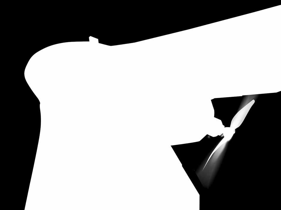
1 The drone for precision agriculture


2 Reap the benefits of scouting crops from above If precision technology has driven the farming revolution of recent years, monitoring crops from the sky will drive the next. With a drone or UAV you can capture highly accurate images of your fields, covering hundreds of hectares/acres in a single flight. Without the cost and hassle of manned services. And at a greater resolution than satellite imagery typically provides. By using image processing software you can then transform these shots into one large orthomosaic image. Apply algorithms like Normalized Difference Vegetation Index (NDVI) to this and you create a reflectance map of your crop. This map is the key to boosting yields, cutting costs, and driving your business forwards. It highlights exactly which areas of crop need closer examination for less time spent scouting, and more time treating the plants that need it.


3 4 reasons to choose the ebee Ag 01. Versatile 02. Reliable 03. Easy to use 04. Complete solution With its four different camera options the ebee Ag suits numerous agricultural applications. Use the NIR camera supplied or add one of our red-edge, RGB or multispectral sensors. The ebee Ag s artificial intelligence and robust lightweight construction ensure it will survive numerous flights (and landings), thus safeguarding your investment. The ebee Ag is a fully automonous drone. Just select the area you want to map using our emotion software, throw your drone into the air, and the ebee Ag will fly, acquire images and land itself. The ebee Ag is supplied with a sturdy carry case and two advanced software packages: emotion 2 for flight planning and monitoring; and Postflight Terra 3D for post-flight image processing and analysis.


4 Wide camera choice 4 sensor options: NIR, red-edge, RGB, multispectral Onboard ebee Ag Electric Brushless electric motor Low noise Environmentally friendly The ebee Ag is an artificially intelligent, fully autonomous drone. It is designed with safety in mind and contains numerous built-in failsafe systems. Thanks to its modular design, its wings can be easily disassembled and stored with its central body in a convenient carry-on sized case (supplied). Onboard artificial intelligence Analyses data from Inertial Measurement Unit & onboard GPS Optimises all aspects of every flight Ground sensor Highly accurate Allows ebee Ag to land softly & more precisely than GPS alone Reliable Onboard artificial intelligence Robust lightweight construction Able to survive numerous flights Super lightweight Durable EPP foam body & wings Take-off weight: 0.71 kg (1.56 lbs) Fully automated Create your flight plan Throw ebee Ag into the air Flies, acquires images & lands itself


5 Plan & control your flight Create maps to assess crop health sensefly s intuitive emotion software makes it easy to plan and simulate your scouting mission. Plan: Import your base map of choice and define the area you want to assess. Then specify your required ground resolution, with a GSD of down to 2 cm per pixel, and image overlap. emotion automatically generates a full flight plan, calculating the ebee Ag s required altitude and displaying its projected trajectory. Flying over uneven terrain? Use emotion s 3D mission planning feature to take into account elevation data when setting the altitude of mission waypoints and the resulting flight lines - improving ground resolution and increasing mission safety. Simulate: To ensure your mission s success, run a virtual flight that simulates wind strength and direction. Then make any flight plan updates required and prepare to launch. Process: Once the ebee Ag has landed, use its supplied Postflight Terra 3D software to process your flight s photos. In just a few clicks you can transform this imagery into geo-referenced 2D orthomosaics and 3D digital elevation models. Analyse: Postflight Terra 3D includes a handy index computation tab - just select a band from your near infrared or multispectral camera and calculate NDVI to assess plant health. You can also input custom formulas and customise colours to create exactly the map you require.
 band, the region where high plant reflectance occurs.")


6 Choose your accessory S110 NIR Supplied Like all ebee Ag cameras, this customised 12 MP model has been adapted so that it can be controlled by the drone s autopilot. It acquires image data in the near infrared (NIR) band, the region where high plant reflectance occurs. Its exposure parameters can be set manually and its RAW files are fully supported by the ebee Ag s software. Example applications: biomass indication, growth monitoring, crop discrimination, leaf area indexing. The multispec 4C is a cutting-edge sensor unit developed by Airinov s agronomy specialists and customised for the ebee Ag. It contains four separate 1.2 megapixel sensors that are controlled by the ebee Ag s autopilot. These acquire data across four highly precise bands, plus each sensor features a global shutter for sharp, undistorted images. Example applications: biomass indication, leaf area indexing, nitrogen recommendation, phenology and many more. S110 RE Unlike the NIR camera above, the 12 MB S110 RE acquires data in the red edge band, the region where a plant s reflectance changes from low to high. The S110 RE s exposure parameters can also be set manually and its RAW files are fully supported by the ebee Ag s software. Example applications: plant stress assessment, chlorophyll indication, senescence analysis, drought assessment. thermomap With thermomap you can literally take your crop s temperature, capturing thermal video and/or still images to create full thermal maps of your fields. Applications: water distribution management, irrigation checking, alternative method of plant stress analysis. S110 RGB The 12 MB S110 RGB acquires regular image data in the visible spectrum. Like the cameras above, its exposure parameters can be set manually and its RAW files are fully supported by the ebee Ag s software. Example applications: real colour 2D and 3D visual rendering, chlorophyll indication, drainage evaluation. Radio tracker If your region is prone to sudden gusty winds, or you plan to fly out of line of sight, this accessory can serve as a useful extra safeguard against unexpected aircraft loss. It comprises a small transmitter that fits snugly next to the ebee Ag s battery bay, plus a portable handheld receiver.


7 Biomass & yield estimation Plant counting Chlorophyll indication Plus Stress assessment Senescence analysis Leaf area indexing Phenology Growth monitoring Crop discrimination Weed detection Tree classification Drainage planning and much more.
 96 cm (38 in) EPP foam, carbon structure & composite parts Electric pusher propeller, 160 W brushless DC motor 11.")
 Wind resistance Ground Sampling Distance (GSD) Relative orthomosaic/3d model accuracy Absolute")
 Up to 3 km (1.86 miles) 1,000 ha / 2,470 ac (at 974 m / 3,195 ft altitude AGL) Up to 45 km/h (12m/s or 28 mph) Down to 2 cm (0.79 in) per pixel 1-3x GSD Down to 4 cm (1.")
8 Technical specifications Hardware Weight (inc. supplied camera) Wingspan Material Propulsion Battery Camera (supplied) Cameras (optional) Carry case dimensions Approx kg (1.56 lbs) 96 cm (38 in) EPP foam, carbon structure & composite parts Electric pusher propeller, 160 W brushless DC motor 11.1 V, 2150 mah 12 MP S110 NIR S110 RE, S110 RGB, multispec 4C, thermomap 55 x 45 x 25 cm (21.6 x 17.7 x 9.8 in) Maximum flight time Nominal cruise speed Radio link range Maximum coverage (single flight) Wind resistance Ground Sampling Distance (GSD) Relative orthomosaic/3d model accuracy Absolute horizontal/vertical accuracy (w/gcps) Absolute horizontal/vertical accuracy (no GCPs) Multi-drone operation Automatic 3D flight planning Linear landing accuracy Operation 45 minutes km/h (11-25 m/s or mph) Up to 3 km (1.86 miles) 1,000 ha / 2,470 ac (at 974 m / 3,195 ft altitude AGL) Up to 45 km/h (12m/s or 28 mph) Down to 2 cm (0.79 in) per pixel 1-3x GSD Down to 4 cm (1.5 in) / 7 cm (2.75 in) 1-5 m ( ft) Yes (inc. mid-air collision avoidance) Yes Approx. 5 m (16.4 ft) Package contents Where can you buy your ebee Ag? Visit to locate your nearest distributor. ebee Ag body (inc. all electronics & built-in autopilot) Pair of detachable wings 12 MP S110 NIR still camera (inc. 16 GB SD card, battery, USB cable & charger) 2.4 GHz USB radio modem for data link (inc. USB cable) Two Lithium-Polymer battery packs & charger Spare propeller Carry case with foam protection Remote control & accessories (for safety pilots) User manual Software included: emotion (flight planning & control) & Postflight Terra 3D (image processing & index calculation) +31 (0) info@geometius.nl (0) info@agrometius.nl About sensefly: sensefly designs, assembles and markets autonomous mini-drones and related software solutions for civil professional applications such as precision agriculture, land surveying, GIS, construction, environmental conservation and more. Content and images non contractual 2014 sensefly Ltd
9 EN For ebee Ag updates subscribe to our newsletter at
The survey-grade mapping drone
 The survey-grade mapping drone 3 reasons to choose the ebee RTK 01. Survey-grade accuracy Absolute orthomosaic / Digital Elevation Model accuracy of down to 3 cm (1.2 in) without the need for GCPs meaning
Aerial efficiency, photogrammetric accuracy
 Aerial efficiency, photogrammetric accuracy Why sensefly 3 reasons to choose the ebee Plus Large coverage for optimal efficiency The ebee Plus can map more square kilometres per flight, than any drone
The survey-grade mapping drone
 The survey-grade mapping drone +380,000 +110,000 +19,000,000 FLIGHTS TO DATE FLIGHT HOURS HA COVERAGE 3 reasons to choose the ebee RTK Survey-grade accuracy Fully integrated workflow Compatible with existing
The intelligent mapping & inspection drone
 The intelligent mapping & inspection drone 3 reasons to choose albris 1 flight, 3 types of imagery With the sensefly albris (previously called exom) you can switch between capturing high-res still, thermal
The intelligent mapping & inspection drone
 The intelligent mapping & inspection drone 3 reasons to choose albris 1 flight, 3 types of imagery With the sensefly albris you can switch between capturing highres still, thermal and video imagery during
Capture the invisible
 Capture the invisible A Capture the invisible The Sequoia multispectral sensor captures both visible and invisible images, providing calibrated data to optimally monitor the health and vigor of your crops.
MULTIPURPOSE QUADCOPTER SOLUTION FOR AGRICULTURE
 MULTIPURPOSE QUADCOPTER SOLUTION FOR AGRICULTURE Powered by COVERS UP TO 30HA AT 70M FLIGHT ALTITUDE PER BATTERY PHOTO & VIDEO FULL HD 1080P - 14MP 3-AXIS STABILIZATION INCLUDES NDVI & ZONING MAPS SERVICE
Geo-localization and Mosaicing System (GEMS): Enabling Precision Image Feature Location and Rapid Mosaicing General:
: Enabling Precision Image Feature Location and Rapid Mosaicing General:") Geo-localization and Mosaicing System (GEMS): Enabling Precision Image Feature Location and Rapid Mosaicing General: info@senteksystems.com www.senteksystems.com 12/6/2014 Precision Agriculture Multi-Spectral
Geo-localization and Mosaicing System (GEMS): Enabling Precision Image Feature Location and Rapid Mosaicing General: info@senteksystems.com www.senteksystems.com 12/6/2014 Precision Agriculture Multi-Spectral
MULTISPECTRAL AGRICULTURAL ASSESSMENT. Normalized Difference Vegetation Index. Federal Robotics INSPECTION & DOCUMENTATION
 MULTISPECTRAL AGRICULTURAL ASSESSMENT Normalized Difference Vegetation Index INSPECTION & DOCUMENTATION Federal Robotics Clearwater Dr. Amherst, New York 14228 716-221-4181 Sales@FedRobot.com www.fedrobot.com
DISCO-PRO AG ALL-IN-ONE DRONE SOLUTION FOR PRECISION AGRICULTURE. 80ha COVERAGE PARROT SEQUOIA INCLUDES MULTI-PURPOSE TOOL SAFE ANALYZE & DECIDE
 DISCO-PRO AG ALL-IN-ONE DRONE SOLUTION FOR PRECISION AGRICULTURE Powered by 80ha COVERAGE AT 120M * FLIGHT ALTITUDE (200AC @ 400FT) MULTI-PURPOSE TOOL PHOTO 14MPX VIDEO 1080P FULL HD PARROT SEQUOIA RGB
Crop Scouting with Drones Identifying Crop Variability with UAVs
 DroneDeploy Crop Scouting with Drones Identifying Crop Variability with UAVs A Guide to Evaluating Plant Health and Detecting Crop Stress with Drone Data Table of Contents 01 Introduction Crop Scouting
sensefly Camera Collection
 Camera Collection A professional sensor for every application Introducing S.O.D.A. 3D 3D mapping, redefined Image: S.O.D.A. 3D oblique image (left) merging into 3D mesh (right). Stunning digital 3D reconstructions
The Philippines SHARE Program in Aerial Imaging
 The Philippines SHARE Program in Aerial Imaging G. Tangonan, N. Libatique, C. Favila, J. Honrado, D. Solpico Ateneo Innovation Center This presentation is about our ongoing aerial imaging research in the
AG-VA Fully Autonomous UAV Sprayers
 AG-VA Fully Autonomous UAV Sprayers One of the most advance sprayer technology on the market! Best Price - Best Flight Time - Best Coverage Rate - 1 Yr Warranty* The AG-VA UAV Sprayer is available in 3
The brain for the plane is the Airelectronics' U-Pilot flight control system, which is embedded inside the plane's fuselage, leaving a lot of space on
 Airelectronics has developed a new complete solution meeting the needs of the farming science. The completely test Skywalkerplatform has been equipped with both thermal and multispectral cameras to measure
UAV Technologies for 3D Mapping. Rolf Schaeppi Director Geospatial Solutions APAC / India
 UAV Technologies for 3D Mapping Rolf Schaeppi Director Geospatial Solutions APAC / India Some main application areas? Market situation Analyst statements billion dollars 7,3 defense market 2,5 civil market
Aerial Image Acquisition and Processing Services. Ron Coutts, M.Sc., P.Eng. RemTech, October 15, 2014
 Aerial Image Acquisition and Processing Services Ron Coutts, M.Sc., P.Eng. RemTech, October 15, 2014 Outline Applications & Benefits Image Sources Aircraft Platforms Image Products Sample Images & Comparisons
RPAS Photogrammetric Mapping Workflow and Accuracy
 RPAS Photogrammetric Mapping Workflow and Accuracy Dr Yincai Zhou & Dr Craig Roberts Surveying and Geospatial Engineering School of Civil and Environmental Engineering, UNSW Background RPAS category and
Monitoring the vegetation success of a rehabilitated mine site using multispectral UAV imagery. Tim Whiteside & Renée Bartolo, eriss
 Monitoring the vegetation success of a rehabilitated mine site using multispectral UAV imagery Tim Whiteside & Renée Bartolo, eriss About the Supervising Scientist Main roles Working to protect the environment
U-Pilot can fly the aircraft using waypoint navigation, even when the GPS signal has been lost by using dead-reckoning navigation. Can also orbit arou
 We offer a complete solution for a user that need to put a payload in a advanced position at low cost completely designed by the Spanish company Airelectronics. Using a standard computer, the user can
Scaling Up Drone Science for Agriculture & Nature Resources through Cooperative Extension
 Scaling Up Drone Science for Agriculture & Nature Resources through Cooperative Extension Andy Lyons, Maggi Kelly, Sean Hogan, Shane Feirer, Robert Johnson CalGIS 2017, Oakland, CA. May 23, 2017 How and
Phase One 190MP Aerial System
 White Paper Phase One 190MP Aerial System Introduction Phase One Industrial s 100MP medium format aerial camera systems have earned a worldwide reputation for its high performance. They are commonly used
An NDVI image provides critical crop information that is not visible in an RGB or NIR image of the same scene. For example, plants may appear green
 Normalized Difference Vegetation Index (NDVI) Spectral Band calculation that uses the visible (RGB) and near-infrared (NIR) bands of the electromagnetic spectrum NDVI= + An NDVI image provides critical
LAST GENERATION UAV-BASED MULTI- SPECTRAL CAMERA FOR AGRICULTURAL DATA ACQUISITION
 LAST GENERATION UAV-BASED MULTI- SPECTRAL CAMERA FOR AGRICULTURAL DATA ACQUISITION FABIO REMONDINO, Erica Nocerino, Fabio Menna Fondazione Bruno Kessler Trento, Italy http://3dom.fbk.eu Marco Dubbini,
Overview. Objectives. The ultimate goal is to compare the performance that different equipment offers us in a photogrammetric flight.
 Overview At present, one of the most commonly used technique for topographic surveys is aerial photogrammetry. This technique uses aerial images to determine the geometric properties of objects and spatial
Deliverable 5-B: Review and Update on AURA System Requirements, Sensors, and Platforms Supplemental Report
 Deliverable 5-B: Review and Update on AURA System Requirements, Sensors, and Platforms Supplemental Report Focusing on education, research, and development of technology to sense and understand natural
How Farmer Can Utilize Drone Mapping?
 Presented at the FIG Working Week 2017, May 29 - June 2, 2017 in Helsinki, Finland How Farmer Can Utilize Drone Mapping? National Land Survey of Finland Finnish Geospatial Research Institute Roope Näsi,
Photomod Lite Contest 2013 Creating vegetation map using UAV at Seaside Palouki forest (Greece) by Apostolos Nteris
 by Apostolos Nteris") P r o j e c t I n f o r m a t i o n Title: Creating vegetation map using UAV at seaside Palouki forest (Greece) Author: Apostolos Nteris, Surveyor engineer OLYZON consulting - Trikala Greece Contact: Apostolos
P r o j e c t I n f o r m a t i o n Title: Creating vegetation map using UAV at seaside Palouki forest (Greece) Author: Apostolos Nteris, Surveyor engineer OLYZON consulting - Trikala Greece Contact: Apostolos
Validation of the QuestUAV PPK System
 Validation of the QuestUAV PPK System 3cm in xy, 400ft, no GCPs, 100Ha, 25 flights Nigel King 1, Kerstin Traut 2, Cameron Weeks 3 & Ruairi Hardman 4 1 Director QuestUAV, 2 Data Analyst QuestUAV, 3 Production
PARROT SKYCONTROLLER 2 PARROT COCKPITGLASSES 2 2 POWER BATTERIES
 F P V P A C K L I M I T L E S S F R E E D O M PARROT SKYCONTROLLER 2 PARROT COCKPITGLASSES 2 2 POWER BATTERIES PARROT BEBOP 2 POWER Parrot BEBOP 2 POWER is a compact drone equipped with cutting-edge technology,
Vegetation Indexing made easier!
 Remote Sensing Vegetation Indexing made easier! TETRACAM MCA & ADC Multispectral Camera Systems TETRACAM MCA and ADC are multispectral cameras for critical narrow band digital photography. Based on the
EnsoMOSAIC Aerial mapping tools
 EnsoMOSAIC Aerial mapping tools Jakarta and Kuala Lumpur, 2013 Contents MosaicMill MM Application examples Software introduction System introduction Rikola HS sensor UAV platform examples SW Syst HS UAV
PEGASUS : a future tool for providing near real-time high resolution data for disaster management. Lewyckyj Nicolas
 PEGASUS : a future tool for providing near real-time high resolution data for disaster management Lewyckyj Nicolas nicolas.lewyckyj@vito.be http://www.pegasus4europe.com Overview Vito in a nutshell GI
MSB Imagery Program FAQ v1
 MSB Imagery Program FAQ v1 (F)requently (A)sked (Q)uestions 9/22/2016 This document is intended to answer commonly asked questions related to the MSB Recurring Aerial Imagery Program. Table of Contents
Five Sensors, One Day: Unmanned vs. Manned Logistics and Accuracy
 Five Sensors, One Day: Unmanned vs. Manned Logistics and Accuracy ASPRS UAS Mapping Technical Symposium Sept 13 th, 2016 Presenter: David Day, CP, GISP Keystone Aerial Surveys, Inc. Summary of activities
High Latitude Drone Ecology Network Multispectral Flight Protocol and Guidance Document
 High Latitude Drone Ecology Network Multispectral Flight Protocol and Guidance Document By Jakob Assmann (j.assmann@ed.ac.uk), Jeff Kerby (jtkerb@gmail.com) and Isla Myers-Smith The University of Edinburgh,
High throughput phenotyping of field crop experiments using UAVs. Ph. Burger, R. Marandel, F. Baret, G. Colombeau, A. Comar
 High throughput phenotyping of field crop experiments using UAVs Ph. Burger, R. Marandel, F. Baret, G. Colombeau, A. Comar PHILIPPE BURGER Drone Garden Workshop - 10/07/2018 Phenotyping? Genotype= the
Heterogeneous Control of Small Size Unmanned Aerial Vehicles
 Magyar Kutatók 10. Nemzetközi Szimpóziuma 10 th International Symposium of Hungarian Researchers on Computational Intelligence and Informatics Heterogeneous Control of Small Size Unmanned Aerial Vehicles
Module 3 Introduction to GIS. Lecture 8 GIS data acquisition
 Module 3 Introduction to GIS Lecture 8 GIS data acquisition GIS workflow Data acquisition (geospatial data input) GPS Remote sensing (satellites, UAV s) LiDAR Digitized maps Attribute Data Management Data
White Paper Reaching 1 cm (0.4 in) drone survey accuracy
 drone survey accuracy") White Paper Reaching 1 cm (0.4 in) drone survey accuracy 3x higher absolute accuracy with WingtraOne Latest tests in USA and Switzerland prove that the VTOL WingtraOne drone repeatably reaches the best-in-class
White Paper Reaching 1 cm (0.4 in) drone survey accuracy 3x higher absolute accuracy with WingtraOne Latest tests in USA and Switzerland prove that the VTOL WingtraOne drone repeatably reaches the best-in-class
White Paper Reaching 1 cm (0.4 in) drone survey accuracy
 drone survey accuracy") White Paper Reaching 1 cm (0.4 in) drone survey accuracy 3x higher absolute accuracy with WingtraOne Latest tests in the USA and Switzerland prove that the VTOL WingtraOne drone repeatedly reaches the
White Paper Reaching 1 cm (0.4 in) drone survey accuracy 3x higher absolute accuracy with WingtraOne Latest tests in the USA and Switzerland prove that the VTOL WingtraOne drone repeatedly reaches the
SONOBOT AUTONOMOUS HYDROGRAPHIC SURVEY VEHICLE PRODUCT INFORMATION GUIDE
 SONOBOT AUTONOMOUS HYDROGRAPHIC SURVEY VEHICLE PRODUCT INFORMATION GUIDE EvoLogics Sonobot an autonomous unmanned surface vehicle for hydrographic surveys High Precision Differential GPS for high-accuracy
NON-PHOTOGRAPHIC SYSTEMS: Multispectral Scanners Medium and coarse resolution sensor comparisons: Landsat, SPOT, AVHRR and MODIS
 NON-PHOTOGRAPHIC SYSTEMS: Multispectral Scanners Medium and coarse resolution sensor comparisons: Landsat, SPOT, AVHRR and MODIS CLASSIFICATION OF NONPHOTOGRAPHIC REMOTE SENSORS PASSIVE ACTIVE DIGITAL
Ground Control Configuration Analysis for Small Area UAV Imagery Based Mapping
 Ground Control Configuration Analysis for Small Area UAV Imagery Based Mapping ASPRS IGTF 2017, Baltimore, MD March 15 th, 2017 Presenter: David Day, CP, GISP Wes Weaver Keystone Aerial Surveys, Inc. Summary
Valuable New Information for Precision Agriculture. Mike Ritter Founder & CEO - SLANTRANGE, Inc.
 Valuable New Information for Precision Agriculture Mike Ritter Founder & CEO - SLANTRANGE, Inc. SENSORS Accurate, Platform- Agnostic ANALYTICS On-Board, On-Location SLANTRANGE Delivering Valuable New Information
Delta-FW70 Fixed-Wing UAV & Intelligent Imaging Processing Designed to Impress
 Delta-FW70 Fixed-Wing UAV & Intelligent Imaging Processing Designed to Impress Ag Focused Farmer Approved Designed to provide professional aerial remote sensing and mapping capabilities in one platform.
EzOSD Manual. Overview & Operating Instructions Preliminary. April ImmersionRC EzOSD Manual 1
 EzOSD Manual Overview & Operating Instructions Preliminary. April 2009 ImmersionRC EzOSD Manual 1 Contents Overview... 3 Features... 3 Installation... 3 1. Installation using an ImmersionRC camera and
White Paper Reaching 1 cm (0.4 in) drone survey accuracy
 drone survey accuracy") White Paper Reaching 1 cm (0.4 in) drone survey accuracy 3x higher absolute accuracy with WingtraOne Latest tests in USA and Switzerland prove that the VTOL WingtraOne drone repeatably reaches the best-in-class
White Paper Reaching 1 cm (0.4 in) drone survey accuracy 3x higher absolute accuracy with WingtraOne Latest tests in USA and Switzerland prove that the VTOL WingtraOne drone repeatably reaches the best-in-class
An Introduction to Remote Sensing & GIS. Introduction
 An Introduction to Remote Sensing & GIS Introduction Remote sensing is the measurement of object properties on Earth s surface using data acquired from aircraft and satellites. It attempts to measure something
CORN BEST MANAGEMENT PRACTICES CHAPTER 22. Matching Remote Sensing to Problems
 CORN BEST MANAGEMENT PRACTICES CHAPTER 22 USDA photo by Regis Lefebure Matching Remote Sensing to Problems Jiyul Chang (Jiyul.Chang@sdstate.edu) and David Clay (David.Clay@sdstate.edu) Remote sensing can
Introduction to Photogrammetry
 Introduction to Photogrammetry Presented By: Sasanka Madawalagama Geoinformatics Center Asian Institute of Technology Thailand www.geoinfo.ait.asia Content Introduction to photogrammetry 2D to 3D Drones
High Resolution Multi-spectral Imagery
 High Resolution Multi-spectral Imagery Jim Baily, AirAgronomics AIRAGRONOMICS Having been involved in broadacre agriculture until 2000 I perceived a need for a high resolution remote sensing service to
Separation of crop and vegetation based on Digital Image Processing
 Separation of crop and vegetation based on Digital Image Processing Mayank Singh Sakla 1, Palak Jain 2 1 M.TECH GEOMATICS student, CEPT UNIVERSITY 2 M.TECH GEOMATICS student, CEPT UNIVERSITY Word Limit
The Hyperspectral UAV (HyUAV) a novel UAV-based spectroscopy tool for environmental monitoring
 a novel UAV-based spectroscopy tool for environmental monitoring") The Hyperspectral UAV (HyUAV) a novel UAV-based spectroscopy tool for environmental monitoring R. Garzonio 1, S. Cogliati 1, B. Di Mauro 1, A. Zanin 2, B. Tattarletti 2, F. Zacchello 2, P. Marras 2 and
The Hyperspectral UAV (HyUAV) a novel UAV-based spectroscopy tool for environmental monitoring R. Garzonio 1, S. Cogliati 1, B. Di Mauro 1, A. Zanin 2, B. Tattarletti 2, F. Zacchello 2, P. Marras 2 and
UAV PHOTOGRAMMETRY COMPARED TO TRADITIONAL RTK GPS SURVEYING
 UAV PHOTOGRAMMETRY COMPARED TO TRADITIONAL RTK GPS SURVEYING Brad C. Mathison and Amber Warlick March 20, 2016 Fearless Eye Inc. Kansas City, Missouri www.fearlesseye.com KEY WORDS: UAV, UAS, Accuracy
REMOTE SENSING WITH DRONES. YNCenter Video Conference Chang Cao
 REMOTE SENSING WITH DRONES YNCenter Video Conference Chang Cao 08-28-2015 28 August 2015 2 Drone remote sensing It was first utilized in military context and has been given great attention in civil use
Remote Sensing in Daily Life. What Is Remote Sensing?
 Remote Sensing in Daily Life What Is Remote Sensing? First time term Remote Sensing was used by Ms Evelyn L Pruitt, a geographer of US in mid 1950s. Minimal definition (not very useful): remote sensing
Mapping with the Phantom 4 Advanced & Pix4Dcapture Jerry Davis, Institute for Geographic Information Science, San Francisco State University
 Mapping with the Phantom 4 Advanced & Pix4Dcapture Jerry Davis, Institute for Geographic Information Science, San Francisco State University The DJI Phantom 4 is a popular, easy to fly UAS that integrates
A new perspective on Brampton Wood: Using drones to track our habitat improvement work
 A new perspective on Brampton Wood: Using drones to track our habitat improvement work Drones are an incredibly useful new tool in conservation. The Wildlife Trust BCN are investigating how we can use
GreenSeeker Handheld Crop Sensor Features
 GreenSeeker Handheld Crop Sensor Features Active light source optical sensor Used to measure plant biomass/plant health Displays NDVI (Normalized Difference Vegetation Index) reading. Pull the trigger
AIRPORT MAPPING JUNE 2016 EXPLORING UAS EFFECTIVENESS GEOSPATIAL SLAM TECHNOLOGY FEMA S ROMANCE WITH LIDAR VOLUME 6 ISSUE 4
 VOLUME 6 ISSUE 4 JUNE 2016 AIRPORT MAPPING 18 EXPLORING UAS EFFECTIVENESS 29 GEOSPATIAL SLAM TECHNOLOGY 36 FEMA S ROMANCE WITH LIDAR Nearly 2,000 U.S. landfill facilities stand to gain from cost-effective
UAV applications for oil spill detection, suspended matter distribution and ice monitoring first tests and trials in Estonia 2015/2016
 UAV applications for oil spill detection, suspended matter distribution and ice monitoring first tests and trials in Estonia 2015/2016 Sander Rikka Marine Systems Institute at TUT 1.11.2016 1 Outlook Introduction
IKONOS High Resolution Multispectral Scanner Sensor Characteristics
 High Spatial Resolution and Hyperspectral Scanners IKONOS High Resolution Multispectral Scanner Sensor Characteristics Launch Date View Angle Orbit 24 September 1999 Vandenberg Air Force Base, California,
Rochester Institute of Technology. Wildfire Airborne Sensor Program (WASP) Project Overview
 Project Overview") Rochester Institute of Technology Wildfire Airborne Sensor Program (WASP) Project Overview Introduction The following slides describe a program underway at RIT The sensor system described herein is being
Rochester Institute of Technology Wildfire Airborne Sensor Program (WASP) Project Overview Introduction The following slides describe a program underway at RIT The sensor system described herein is being
Assessment of Unmanned Aerial Vehicle for Management of Disaster Information
 Journal of the Korea Academia-Industrial cooperation Society Vol. 16, No. 1 pp. 697-702, 2015 http://dx.doi.org/10.5762/kais.2015.16.1.697 ISSN 1975-4701 / eissn 2288-4688 Assessment of Unmanned Aerial
Precision Agriculture Comparison and Evaluation of Innovative Very High Resolution (UAV) and LandSat Data
 and LandSat Data") Precision Agriculture Comparison and Evaluation of Innovative Very High Resolution (UAV) and LandSat Data Antonis Kavvadias 1, Emmanouil Psomiadis 2, Maroulio Chanioti 3, Eleni Gala 1, Spyros Michas 1
Precision Agriculture Comparison and Evaluation of Innovative Very High Resolution (UAV) and LandSat Data Antonis Kavvadias 1, Emmanouil Psomiadis 2, Maroulio Chanioti 3, Eleni Gala 1, Spyros Michas 1
Baldwin and Mobile Counties, AL Orthoimagery Project Report. Submitted: March 23, 2016
 2015 Orthoimagery Project Report Submitted: Prepared by: Quantum Spatial, Inc 523 Wellington Way, Suite 375 Lexington, KY 40503 859-277-8700 Page i of iii Contents Project Report 1. Summary / Scope...
Satellite Remote Sensing: Earth System Observations
 Satellite Remote Sensing: Earth System Observations Land surface Water Atmosphere Climate Ecosystems 1 EOS (Earth Observing System) Develop an understanding of the total Earth system, and the effects of
Leica - 3 rd Generation Airborne Digital Sensors Features / Benefits for Remote Sensing & Environmental Applications
 Leica - 3 rd Generation Airborne Digital Sensors Features / Benefits for Remote Sensing & Environmental Applications Arthur Rohrbach, Sensor Sales Dir Europe, Middle-East and Africa (EMEA) Luzern, Switzerland,
Getting Started with Drones in Agriculture
 NebGuide Nebraska Extension Research-Based Information That You Can Use G2296 Index: Crops, Crop Production/Field Crops Issued December 2017 Getting Started with Drones in Agriculture Laura J. Thompson,
Featherweight GPS Tracker User s Manual June 16, 2017
 Featherweight GPS Tracker User s Manual June 16, 2017 Hardware Configuration and Installation The dimensions for the board are provided below, in inches. Note that with the antenna installed, the total
Airborne Laser Scanning. Long-Range Airborne Laser Scanner for Full Waveform Analysis. visit our webpage LASER MEASUREMENT SYSTEMS
 Long-Range Airborne Laser Scanner for Full Waveform Analysis LMS-Q680 The long-range RIEGL LMS-Q680 airborne laser scanner makes use of a powerful laser source and of RIEGL s proprietary digital full waveform
Multispectral Scanners for Wildland Fire Assessment NASA Ames Research Center Earth Science Division. Bruce Coffland U.C.
 Multispectral Scanners for Wildland Fire Assessment NASA Earth Science Division Bruce Coffland U.C. Santa Cruz Slide Fire Burn Area (MASTER/B200) R 2.2um G 0.87um B 0.65um Airborne Science & Technology
NEW. Airborne Laser Scanning. Dual Wavelength Waveform Processing Airborne LiDAR Scanning System for High-Point Density Mapping Applications
 Dual Wavelength Waveform Processing Airborne LiDAR Scanning System for High-Point Density Mapping Applications NEW RIEGL VQ-156i-DW enhanced target characterization based upon simultaneous measurements
HALS-H1 Ground Surveillance & Targeting Helicopter
 ARATOS-SWISS Homeland Security AG & SMA PROGRESS, LLC HALS-H1 Ground Surveillance & Targeting Helicopter Defense, Emergency, Homeland Security (Border Patrol, Pipeline Monitoring)... Automatic detection
Processing Aster Data for Atmospheric Correction Geomatica 2014 Tutorial
 The Advanced Spaceborne Thermal Emission and Reflection Radiometer (ASTER) sensor is part of five sensor systems on board Terra. Terra is a satellite that was launched on December 18, 1999 at Vandenberg
Govt. Engineering College Jhalawar Model Question Paper Subject- Remote Sensing & GIS
 Govt. Engineering College Jhalawar Model Question Paper Subject- Remote Sensing & GIS Time: Max. Marks: Q1. What is remote Sensing? Explain the basic components of a Remote Sensing system. Q2. What is
UAV Imagery and Data Management for Precision Agriculture. John Nowatzki Extension Ag Machine Systems Specialist North Dakota State University
 UAV Imagery and Data Management for Precision Agriculture John Nowatzki Extension Ag Machine Systems Specialist North Dakota State University UAS in Precision Agriculture NDSU UAS & Sensing Activities
Water Leak Detection Report
 Water Leak Detection Report Proof of Concept Client: Anglian Water Site 1: Somersham, Ipswich Site 2: Bramford, Ipswich Site 3: Caister, Great Yarmouth Engineer(s): J. Arnott, D. Williams, S. Welland Date
Brian Arnall Precision Nutrient Management Oklahoma State University
 A Down to Earth Look at UAVs in Agriculture Brian Arnall Precision Nutrient Management Oklahoma State University Ok State has provided cease and desist. I have not flown one. I am very familiar with their
Aerial Survey & Classification of Bush Honeysuckle
 Aerial Survey & Classification of Bush Honeysuckle Project Report June 2017 Project Participants, Authors: Kurt Carraway, UAS Executive Director Andi Meyer, UAS Research Program Manager Travis Balthazor,
Camera Requirements For Precision Agriculture
 Camera Requirements For Precision Agriculture Radiometric analysis such as NDVI requires careful acquisition and handling of the imagery to provide reliable values. In this guide, we explain how Pix4Dmapper
GEO 428: DEMs from GPS, Imagery, & Lidar Tuesday, September 11
 GEO 428: DEMs from GPS, Imagery, & Lidar Tuesday, September 11 Global Positioning Systems GPS is a technology that provides Location coordinates Elevation For any location with a decent view of the sky
Outline for today. Geography 411/611 Remote sensing: Principles and Applications. Remote sensing: RS for biogeochemical cycles
 Geography 411/611 Remote sensing: Principles and Applications Thomas Albright, Associate Professor Laboratory for Conservation Biogeography, Department of Geography & Program in Ecology, Evolution, & Conservation
Objectives: 1. Assess the feasibility of using high spatial resolution image data for counting male Common Eiders.
 Sea Duck Joint Venture Annual Project Summary FY 2016 - (1 April 2016-31 March 2017) Cooperative Agreement F12AC01228 Project Title: Sea Duck Research and Monitoring in the Atlantic Flyway: Development
X8-M. Operation Manual
 X8-M Operation Manual Thank you for purchasing an X8-M! This manual contains important information about your aerial mapping platform. Please read these instructions before your first flight. 1 Plan 1
INSTRUCTIONS. 3DR Plane CONTENTS. Thank you for purchasing a 3DR Plane!
 DR Plane INSTRUCTIONS Thank you for purchasing a DR Plane! CONTENTS 1 1 Fuselage Right wing Left wing Horizontal stabilizer Vertical stabilizer Carbon fiber bar 1 1 1 7 8 10 11 1 Audio/video (AV) cable
Camera Requirements For Precision Agriculture
 Camera Requirements For Precision Agriculture Radiometric analysis such as NDVI requires careful acquisition and handling of the imagery to provide reliable values. In this guide, we explain how Pix4Dmapper
THE PENNSYLVANIA STATE UNIVERSITY SCHREYER HONORS COLLEGE DEPARTMENT OF MECHANICAL AND NUCLEAR ENGINEERING
 THE PENNSYLVANIA STATE UNIVERSITY SCHREYER HONORS COLLEGE DEPARTMENT OF MECHANICAL AND NUCLEAR ENGINEERING MEASURING NORMALIZED DIFFERENCE VEGETATION INDEX FOR AGRICULTURAL MANAGEMENT USING UNMANNED AERIAL
NAVIGATION AND REMOTE SENSING PAYLOADS AND METHODS OF THE SARVANT UNMANNED AERIAL SYSTEM
 NAVIGATION AND REMOTE SENSING PAYLOADS AND METHODS OF THE SARVANT UNMANNED AERIAL SYSTEM P. Molina, P. Fortuny, I. Colomina Institute of Geomatics -- Castelldefels (ES) M. Remy, K.A.C. Macedo, Y.R.C. Zúnigo,
Introduction to Photography - Lesson 1
 - Photography is an amazing subject with an ever broadening appeal. As the technology becomes more freely available what was once the exclusive territory of the wealthy professional is now accessible to
PRELIMINARY RESULTS FROM THE PORTABLE IMAGERY QUALITY ASSESSMENT TEST FIELD (PIQuAT) OF UAV IMAGERY FOR IMAGERY RECONNAISSANCE PURPOSES
 OF UAV IMAGERY FOR IMAGERY RECONNAISSANCE PURPOSES") PRELIMINARY RESULTS FROM THE PORTABLE IMAGERY QUALITY ASSESSMENT TEST FIELD (PIQuAT) OF UAV IMAGERY FOR IMAGERY RECONNAISSANCE PURPOSES R. Dabrowski a, A. Orych a, A. Jenerowicz a, P. Walczykowski a, a
PRELIMINARY RESULTS FROM THE PORTABLE IMAGERY QUALITY ASSESSMENT TEST FIELD (PIQuAT) OF UAV IMAGERY FOR IMAGERY RECONNAISSANCE PURPOSES R. Dabrowski a, A. Orych a, A. Jenerowicz a, P. Walczykowski a, a
366 Glossary. Popular method for scale drawings in a computer similar to GIS but without the necessity for spatial referencing CEP
 366 Glossary GISci Glossary ASCII ASTER American Standard Code for Information Interchange Advanced Spaceborne Thermal Emission and Reflection Radiometer Computer Aided Design Circular Error Probability
Augmented Reality and Unmanned Aerial Vehicle Assist in Construction Management
 1570 Augmented Reality and Unmanned Aerial Vehicle Assist in Construction Management Ming-Chang Wen 1 and Shih-Chung Kang 2 1 Department of Civil Engineering, National Taiwan University, email: r02521609@ntu.edu.tw
ABSTRACT. Detecting nitrogen status in crops within the growing season is important for making nutrient
 ABSTRACT TAYLOR, JOSEPH TOKESHI. Testing the Capabilities and Applications of Small Unmanned Aircraft Vehicles and Ground-based Sensors in Detecting Nitrogen Status in Corn and Winter Wheat. (Under the
GIS in Water Resources CEE 6440
 GIS in Water Resources CEE 6440 Optimal representation of plants & soils characteristics using high resolution imagery" Prepared by Manal ELarab Fall 202 Outline. Introduction: Precision Agriculture...
FLiFLi AirDrop Quick Guide
 FLiFLi AirDrop Quick Guide FLiFLi Airdrop is a portable drop equipment, attachable to DJI Phantom Series. AirDrop's hassle-free installation will upgrade your drone to another level of drone playing. Compare
HIGH RESOLUTION COLOR IMAGERY FOR ORTHOMAPS AND REMOTE SENSING. Author: Peter Fricker Director Product Management Image Sensors
 HIGH RESOLUTION COLOR IMAGERY FOR ORTHOMAPS AND REMOTE SENSING Author: Peter Fricker Director Product Management Image Sensors Co-Author: Tauno Saks Product Manager Airborne Data Acquisition Leica Geosystems
NEW. Airborne Laser Scanning. Waveform Processing Airborne Laser Scanner for Wide Area Mapping and High Productivity. visit our website
 Waveform Processing Airborne Laser Scanner for Wide Area Mapping and High Productivity. NEW RIEGL VQ -780i online waveform processing as well as smart and full waveform recording excellent multiple target
SUGAR_GIS. From a user perspective. Provides spatial distribution of a wide range of sugarcane production data in an easy to use and sensitive way.
 SUGAR_GIS From a user perspective What is Sugar_GIS? A web-based, decision support tool. Provides spatial distribution of a wide range of sugarcane production data in an easy to use and sensitive way.