The survey-grade mapping drone
|
|
|
- Christine Payne
- 6 years ago
- Views:
Transcription

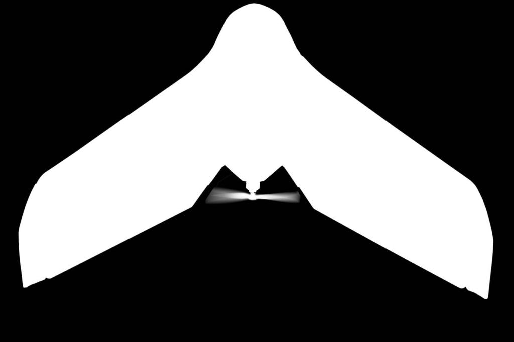
1 The survey-grade mapping drone


2 +380, , ,000,000 FLIGHTS TO DATE FLIGHT HOURS HA COVERAGE
 without the need for GCPs meaning less time in the field and high precision in even the most inaccessible areas.")
3 3 reasons to choose the ebee RTK Survey-grade accuracy Fully integrated workflow Compatible with existing base stations Absolute orthomosaic and digital surface model accuracy of down to 3 cm (1.2 in) without the need for GCPs meaning less time in the field and high precision in even the most inaccessible areas. The drone s supplied emotion ground control software connects to the base station and broadcasts correction data to the rover (the ebee RTK) no additional logger or third-party software required. The ebee RTK is compatible with most leading brands of base station and virtual reference station (VRS) networks, working seamlessly alongside your existing portfolio of instruments.
4 3 ways of working with the ebee RTK ebee RTK ebee RTK ebee RTK www Laptop/tablet with USB ground modem Laptop/tablet with USB ground modem Laptop/tablet with USB ground modem Operator GNSS/RTK base station on known position Operator GNSS/RTK base station on unknown position Operator 01. Local base, known position: 02. Local base, unknown position: 03. Virtual reference station: Place your base station on a known position Enter the base station s coordinates and characteristics into emotion emotion streams correction data to the drone via the ground modem Position your base station in a convenient location emotion calculates your base s approximate position emotion streams correction data to the drone via the ground modem Correct your base s position in post-processing to achieve a high level of absolute accuracy Configure your drone s emotion software to receive VRS/NTRIP correction data (internet connection and VRS/NTRIP subscription required) emotion streams correction data to the drone via the ground modem

5 We ve performed around 100 flights with our sensefly drones in total. The ebee RTK has proved particularly well suited to topographic surveying along the coast due to its linear landing, ideal for landing on beaches, its survey grade accuracy and its wind resistance of up to 45 kilometres per hour. Chris Drummond, Project Engineer/Drone Pilot, Water Research Laboratory, UNSW, Australia
6 Plan & control your flight sensefly s acclaimed emotion software makes it easy to plan, simulate and manage your mapping mission. Plan: Import your preferred background map and define the region you want to cover. Then specify your required ground resolution (with a GSD of down to 1.5 cm) and image overlap. emotion automatically generates a full flight plan, calculating the ebee RTK s required altitude and displaying its projected trajectory. To ensure your mission s success emotion includes a simulation mode. This virtual flight simulates wind strength and direction, allowing you to make any flight plan enhancements needed before launch. Configure: If you know your base station s coordinates, enter these into emotion. If not, emotion will calculate your base s approximate position. Or configure emotion to receive VRS/NTRIP corrections. emotion then streams correction data to the ebee via its USB ground modem. Launch: Shake the ebee RTK three times to start its motor, then throw it into the air. It flies, captures images and lands itself, while the artificial intelligence inside the ebee s autopilot continuously analyses IMU and GPS data to optimise every aspect of its flight. Monitor: Use emotion to view the drone s flight parameters, battery level and image acquisition progress in real time. Need to make an adjustment? Re-program the ebee s flight plan and landing point during its flight.


7 SAFETY FIRST The ebee RTK is built with safety firmly in mind, from its ultra-light, shock-absorbent construction to its numerous embedded safety features. emotion also includes a 3D flight planning feature. This uses real-world elevation data when setting the altitude of a flight s waypoints (shown above), for the most consistent ground resolution possible and the highest level of aircraft safety. We like that the ebee RTK is easy to transport, quick to set-up, the software is excellent and the RTK functionality works great. It s just a good option for our style of work. Ben Simpson, Managing Director, Survey Group, Australia

. Format(s): Example usage: GeoTIFF (.")

8 Create georeferenced maps & models Process Use emotion s Flight Data Manager to preprocess, geotag and organise your flight s images. Then import these into your professional image processing software of choice, such as Pix4Dmapper Pro, to create a range of valuable outputs. Orthomosaics In just a few clicks, you can transform the ebee s high-resolution aerial images into a georeferenced orthomosaic raster (also known as an orthophoto). Format(s): Example usage: GeoTIFF (.tif), KML tiles (png/kml) Background maps, 2D measurements, cadastre, urban/ infrastructure/transport planning, forestry, marketing We use an ebee for many different projects: mapping, road and railway projects, power lines, dam and construction projects, renewable energy and more. For us, it is the most effective drone on the market - the perfect blend of user-friendliness, quality, price, support, and software. Diner Yılmaz, General Director Artu Harita, Turkey
, shp 3D MESH WITH TEXTURE Wavefront (obj) Digital Surface Models (DSMs) The DSM is an essential component of the orthomosaicing process.")
. Format(s): GeoTIFF (.")

: las, laz, ply, ascii Typical usage: 3D line & surface area measurement, volumetric calculation (i.e. stockpiles) Drone vs LiDAR point clouds: http://goo.")
9 Other common outputs: INDEX MAP GeoTIFF (.tif ), shp 3D MESH WITH TEXTURE Wavefront (obj) Digital Surface Models (DSMs) The DSM is an essential component of the orthomosaicing process. It displays a continuous surface, featuring the tops of objects and structures such as trees and buildings (inc. bare earth when nothing is obscuring it). Ground-based objects can also be removed to produce a digital terrain model (DTM). Format(s): GeoTIFF (.tif ) Example usage: Flood plain analysis, sunlight/ signal coverage assessment, GIS applications, spatial analysis Point clouds These comprise millions of individual points, each featuring X, Y, Z coordinates and an RGB value. Can also be classified for more specific analysis using classes such as ground, buildings and vegetation. A LiDAR-like output, except in the presence of ground-obscuring vegetation, point clouds are most often used for geometric and CAD-based work. Format(s): las, laz, ply, ascii Typical usage: 3D line & surface area measurement, volumetric calculation (i.e. stockpiles) Drone vs LiDAR point clouds: Outputs compatible with: Esri ArcGIS QGIS Inpho Erdas Imagine RealWorks Maptek 3DReshaper Surpac Mapbox CONTOUR LINES dxf, shp GOOGLE MAPS KML tiles (png/kml) GlobalMapper Autodesk StereoCAD Google Maps MicroStation Quick Terrain Agisoft ccviewer & many more


10 Fully automated Create your flight plan Hand-launch (no catapult required) Flies, acquires images & lands itself Our ebee RTK projects, including a 30-mile corridor for California High Speed Rail, have yielded phenomenal quality, accuracy and ROI. Our costs were approximately 50% compared to using manned aircraft and we cut our delivery times by more than half. Marc A. Cañas, GISP, Vice President, J.L. Patterson & Associates, Inc., USA Optimal range Up to 40 min flight time Maximum flight coverage of 8 km 2 (3 mi 2 ) * The ebee has given me the best R.O.I. of any surveying tool I own. Prof. Tosa Ninkov PhD, Owner, GeoGIS Consultants, Serbia Green technology Low-noise brushless electric motor Rechargeable lithium-polymer battery Safe rear-facing propeller * Based on the following test conditions: target ground resolution of 30 cm (11.8 in) / pixel, no wind, moderate weather temp. (18 C/64.4 F), new fully charged battery, flight altitude of 1,000 m (3,280 ft) above ground level, take-off at approx. sea level, take-off point in centre of desired coverage area.

 Super lightweight Ultra-light EPP foam body & wings 0.73 kg (1.")
11 GNSS RTK antenna & receiver L1/L2, GPS & GLONASS Onboard RTK corrections at 20 Hz Receives corrections at 1 Hz from most leading brands of base station & VRS networks Absolute X,Y, Z accuracy down to 3 cm / 5 cm No ground control points required! 2.4 GHz radio link Communicates with emotion via USB ground modem Approx. 3 km (1.86 mile) range 18.2 MP still camera Fully controlled by ebee s autopilot Automatic image acquisition & geotagging GSD of down to 1.5 cm per pixel Multiple additional camera options available (inc. thermal) Super lightweight Ultra-light EPP foam body & wings 0.73 kg (1.61 lb) take-off weight Less kinetic energy than a kicked football


12 Supplied* Cameras WX RGB Like all ebee cameras, this 18.2 MP model has been adapted so that it can be controlled by the drone s autopilot. It acquires regular image data in the visible spectrum and its exposure parameters are set automatically. Technical features Resolution 18.2 MP Ground resolution at 2.75 cm (1 in) / pixe 100 m (328 ft) Sensor size 6.16 x 4.63 mm Pixel pitch 1.26 μm Image format JPEG sensefly S.O.D.A. The sensefly S.O.D.A. is the first camera to be designed for professional drone photogrammetry. It captures amazingly sharp aerial RGB images, across a range of light conditions, allowing you to produce detailed, vivid orthomosaics and highly precise digital surface models. Technical features Resolution 20 MP Ground resolution at 2.9 cm (1.1 in) / pixel 122 m (400 ft) Sensor size 1-inch (2.54 cm) Pixel pitch 2.33 μm Image format JPEG or JPEG + DNG *optional in Turkey.


 / pixel -40 C to 160 C (-40 F to 320 F) 0.1 C (0.")
13 thermomap thermomap is a thermal infrared camera, featuring an integrated shutter for in-flight radiometric calibration. It can capture thermal video and still images, allowing you to create thermal maps of a site (for example, to assess a mine s water distribution or to check the functionality of photovoltaic panels). Technical features S110 NIR Like all ebee Ag cameras, this customised 12 MP model has been adapted so that it can be controlled by the drone s autopilot. It acquires image data in the near infrared (NIR) band, the region where high plant reflectance occurs. Its exposure parameters can be set manually and its RAW files are fully supported by the ebee Ag s software. Technical features S110 RE Unlike the NIR camera above, the 12 MP S110 RE acquires data in the red edge band, the region where a plant s reflectance changes from low to high. The S110 RE s exposure parameters can also be set manually and its RAW files are fully supported by the ebee Ag s software. Technical features Resolution 640 x 512 pixels Resolution 12 MP Resolution 12 MP Ground resolution at 75 m (246 ft) Scene temperature Temperature resolution Temperature calibration Output formats 14 cm (5.5 in) / pixel -40 C to 160 C (-40 F to 320 F) 0.1 C (0.2 F) Automatic, in-flight TIFF images + MP4 video Ground resolution at 3.5 cm (1.4 in) / pixel 100 m (328 ft) Senseor size 7.44 x 5.58 mm Pixel pitch 1.86 µm Output formats JPEG and/or RAW Ground resolution at 3.5 cm (1.4 in) / pixel 100 m (328 ft) Senseor size 7.44 x 5.58 mm Pixel pitch 1.86 µm Output formats JPEG and/or RAW Weight Approx. 134 g (4.7 oz) Operating altitude m ( ft)

14 About sensefly At sensefly, we believe in using technology to make work safer and more efficient. Our proven drone solutions simplify the collection and analysis of geospatial data, allowing professionals in surveying, agriculture, engineering and humanitarian aid to make better decisions, faster. Where can you buy your ebee? Visit to locate your nearest distributor. sensefly was founded in 2009 and quickly became the leader in mapping drones. The company is a commercial drone subsidiary of Parrot Group. For more information, go to ebee Plus Aerial efficiency, photogrammetric accuracy ebee SQ The advanced agricultural drone albris The intelligent mapping & inspection drone sensefly SA Route de Genève Cheseaux-Lausanne Switzerland Content and images non contractual 2017 sensefly
 Detachable wings Yes Camera (supplied)* WX RGB (18.2 MP) Cameras (optional) sensefly S.O.D.A.")
15 HARDWARE Wingspan 96 cm (37.8 in) Weight (inc. supplied camera & battery) Approx kg (1.61 lb) Motor Low-noise, brushless, electric Radio link range Up to 3 km (1.86 miles) Detachable wings Yes Camera (supplied)* WX RGB (18.2 MP) Cameras (optional) sensefly S.O.D.A., thermomap, S110 NIR/RE Accessories (optional Radio tracker, backpack, camera protection kit SOFTWARE Flight planning & control software (supplied) emotion Image processing software (optional) Pix4Dmapper Pro OPERATION Automatic 3D flight planning Yes Cruise speed km/h (11-25 m/s or mph) Wind resistance Up to 45 km/h (12 m/s or 28 mph) Maximum flight time 40 minutes Maximum coverage (single flight) 8 km 2 (3 mi 2 )** Automatic landing Linear landing with ~ 5 m (16.4 ft) accuracy Multi-drone operation Yes Ground control points (GCPs) required No Oblique imagery 0 to -50 RESULTS Ground sampling distance (GSD) Down to 1.5 cm (0.6 in) / pixel*** Absolute horizontal/vertical accuracy (w/gcps) No GCPs required Absolute horizontal/vertical accuracy (no GCPs) Down to 3 cm (1.2 in) / 5 cm (2 in) *optional in Turkey. ** based on the following test conditions: target ground resolution of 30 cm (11.8 in) / pixel, no wind, moderate weather temp. (18 C/64.4 F), new fully charged battery, flight altitude of 1,000 m (3,280 ft) above ground level, take off at approx. sea level, take-off point in centre of desired coverage area. *** depends upon environmental conditions (light, wind, surface type). Package contents: ebee RTK body (inc. all electronics & built-in autopilot) Pair of detachable wings WX still camera (inc. SD card, battery, USB cable & charger) GNSS antenna 2.4 GHz USB radio modem for data link (inc. USB cable) Two lithium-polymer battery packs & charger Spare propeller Carry case with foam protection Remote control & accessories (for safety pilots) User manual emotion software download key (accessible via my.sensefly at no extra cost)


16 For ebee RTK updates subscribe to our newsletter at EN
The survey-grade mapping drone
 The survey-grade mapping drone 3 reasons to choose the ebee RTK 01. Survey-grade accuracy Absolute orthomosaic / Digital Elevation Model accuracy of down to 3 cm (1.2 in) without the need for GCPs meaning
The drone for precision agriculture
 The drone for precision agriculture Reap the benefits of scouting crops from above If precision technology has driven the farming revolution of recent years, monitoring crops from the sky will drive the
Aerial efficiency, photogrammetric accuracy
 Aerial efficiency, photogrammetric accuracy Why sensefly 3 reasons to choose the ebee Plus Large coverage for optimal efficiency The ebee Plus can map more square kilometres per flight, than any drone
sensefly Camera Collection
 Camera Collection A professional sensor for every application Introducing S.O.D.A. 3D 3D mapping, redefined Image: S.O.D.A. 3D oblique image (left) merging into 3D mesh (right). Stunning digital 3D reconstructions
The intelligent mapping & inspection drone
 The intelligent mapping & inspection drone 3 reasons to choose albris 1 flight, 3 types of imagery With the sensefly albris you can switch between capturing highres still, thermal and video imagery during
The intelligent mapping & inspection drone
 The intelligent mapping & inspection drone 3 reasons to choose albris 1 flight, 3 types of imagery With the sensefly albris (previously called exom) you can switch between capturing high-res still, thermal
Validation of the QuestUAV PPK System
 Validation of the QuestUAV PPK System 3cm in xy, 400ft, no GCPs, 100Ha, 25 flights Nigel King 1, Kerstin Traut 2, Cameron Weeks 3 & Ruairi Hardman 4 1 Director QuestUAV, 2 Data Analyst QuestUAV, 3 Production
RPAS Photogrammetric Mapping Workflow and Accuracy
 RPAS Photogrammetric Mapping Workflow and Accuracy Dr Yincai Zhou & Dr Craig Roberts Surveying and Geospatial Engineering School of Civil and Environmental Engineering, UNSW Background RPAS category and
White Paper Reaching 1 cm (0.4 in) drone survey accuracy
 drone survey accuracy") White Paper Reaching 1 cm (0.4 in) drone survey accuracy 3x higher absolute accuracy with WingtraOne Latest tests in USA and Switzerland prove that the VTOL WingtraOne drone repeatably reaches the best-in-class
White Paper Reaching 1 cm (0.4 in) drone survey accuracy 3x higher absolute accuracy with WingtraOne Latest tests in USA and Switzerland prove that the VTOL WingtraOne drone repeatably reaches the best-in-class
White Paper Reaching 1 cm (0.4 in) drone survey accuracy
 drone survey accuracy") White Paper Reaching 1 cm (0.4 in) drone survey accuracy 3x higher absolute accuracy with WingtraOne Latest tests in the USA and Switzerland prove that the VTOL WingtraOne drone repeatedly reaches the
White Paper Reaching 1 cm (0.4 in) drone survey accuracy 3x higher absolute accuracy with WingtraOne Latest tests in the USA and Switzerland prove that the VTOL WingtraOne drone repeatedly reaches the
MULTIPURPOSE QUADCOPTER SOLUTION FOR AGRICULTURE
 MULTIPURPOSE QUADCOPTER SOLUTION FOR AGRICULTURE Powered by COVERS UP TO 30HA AT 70M FLIGHT ALTITUDE PER BATTERY PHOTO & VIDEO FULL HD 1080P - 14MP 3-AXIS STABILIZATION INCLUDES NDVI & ZONING MAPS SERVICE
Capture the invisible
 Capture the invisible A Capture the invisible The Sequoia multispectral sensor captures both visible and invisible images, providing calibrated data to optimally monitor the health and vigor of your crops.
White Paper Reaching 1 cm (0.4 in) drone survey accuracy
 drone survey accuracy") White Paper Reaching 1 cm (0.4 in) drone survey accuracy 3x higher absolute accuracy with WingtraOne Latest tests in USA and Switzerland prove that the VTOL WingtraOne drone repeatably reaches the best-in-class
White Paper Reaching 1 cm (0.4 in) drone survey accuracy 3x higher absolute accuracy with WingtraOne Latest tests in USA and Switzerland prove that the VTOL WingtraOne drone repeatably reaches the best-in-class
DISCO-PRO AG ALL-IN-ONE DRONE SOLUTION FOR PRECISION AGRICULTURE. 80ha COVERAGE PARROT SEQUOIA INCLUDES MULTI-PURPOSE TOOL SAFE ANALYZE & DECIDE
 DISCO-PRO AG ALL-IN-ONE DRONE SOLUTION FOR PRECISION AGRICULTURE Powered by 80ha COVERAGE AT 120M * FLIGHT ALTITUDE (200AC @ 400FT) MULTI-PURPOSE TOOL PHOTO 14MPX VIDEO 1080P FULL HD PARROT SEQUOIA RGB
Deliverable 5-B: Review and Update on AURA System Requirements, Sensors, and Platforms Supplemental Report
 Deliverable 5-B: Review and Update on AURA System Requirements, Sensors, and Platforms Supplemental Report Focusing on education, research, and development of technology to sense and understand natural
Phase One 190MP Aerial System
 White Paper Phase One 190MP Aerial System Introduction Phase One Industrial s 100MP medium format aerial camera systems have earned a worldwide reputation for its high performance. They are commonly used
EnsoMOSAIC Aerial mapping tools
 EnsoMOSAIC Aerial mapping tools Jakarta and Kuala Lumpur, 2013 Contents MosaicMill MM Application examples Software introduction System introduction Rikola HS sensor UAV platform examples SW Syst HS UAV
Monitoring the vegetation success of a rehabilitated mine site using multispectral UAV imagery. Tim Whiteside & Renée Bartolo, eriss
 Monitoring the vegetation success of a rehabilitated mine site using multispectral UAV imagery Tim Whiteside & Renée Bartolo, eriss About the Supervising Scientist Main roles Working to protect the environment
Phase One ixu-rs1000 Accuracy Assessment Report Yu. Raizman, PhaseOne.Industrial, Israel
 17 th International Scientific and Technical Conference FROM IMAGERY TO DIGITAL REALITY: ERS & Photogrammetry Phase One ixu-rs1000 Accuracy Assessment Report Yu. Raizman, PhaseOne.Industrial, Israel 1.
UAV Technologies for 3D Mapping. Rolf Schaeppi Director Geospatial Solutions APAC / India
 UAV Technologies for 3D Mapping Rolf Schaeppi Director Geospatial Solutions APAC / India Some main application areas? Market situation Analyst statements billion dollars 7,3 defense market 2,5 civil market
Five Sensors, One Day: Unmanned vs. Manned Logistics and Accuracy
 Five Sensors, One Day: Unmanned vs. Manned Logistics and Accuracy ASPRS UAS Mapping Technical Symposium Sept 13 th, 2016 Presenter: David Day, CP, GISP Keystone Aerial Surveys, Inc. Summary of activities
Introduction to Photogrammetry
 Introduction to Photogrammetry Presented By: Sasanka Madawalagama Geoinformatics Center Asian Institute of Technology Thailand www.geoinfo.ait.asia Content Introduction to photogrammetry 2D to 3D Drones
Overview. Objectives. The ultimate goal is to compare the performance that different equipment offers us in a photogrammetric flight.
 Overview At present, one of the most commonly used technique for topographic surveys is aerial photogrammetry. This technique uses aerial images to determine the geometric properties of objects and spatial
Assessment of Unmanned Aerial Vehicle for Management of Disaster Information
 Journal of the Korea Academia-Industrial cooperation Society Vol. 16, No. 1 pp. 697-702, 2015 http://dx.doi.org/10.5762/kais.2015.16.1.697 ISSN 1975-4701 / eissn 2288-4688 Assessment of Unmanned Aerial
UAV PHOTOGRAMMETRY COMPARED TO TRADITIONAL RTK GPS SURVEYING
 UAV PHOTOGRAMMETRY COMPARED TO TRADITIONAL RTK GPS SURVEYING Brad C. Mathison and Amber Warlick March 20, 2016 Fearless Eye Inc. Kansas City, Missouri www.fearlesseye.com KEY WORDS: UAV, UAS, Accuracy
MSB Imagery Program FAQ v1
 MSB Imagery Program FAQ v1 (F)requently (A)sked (Q)uestions 9/22/2016 This document is intended to answer commonly asked questions related to the MSB Recurring Aerial Imagery Program. Table of Contents
Aerial Image Acquisition and Processing Services. Ron Coutts, M.Sc., P.Eng. RemTech, October 15, 2014
 Aerial Image Acquisition and Processing Services Ron Coutts, M.Sc., P.Eng. RemTech, October 15, 2014 Outline Applications & Benefits Image Sources Aircraft Platforms Image Products Sample Images & Comparisons
USE OF IMPROVISED REMOTELY SENSED DATA FROM UAV FOR GIS AND MAPPING, A CASE STUDY OF GOMA CITY, DR CONGO
 USE OF IMPROVISED REMOTELY SENSED DATA FROM UAV FOR GIS AND MAPPING, A CASE STUDY OF GOMA CITY, DR CONGO Cung Chin Thang United Nations Global Support Center, Brindisi, Italy, Email: thang@un.org KEY WORDS:
Baldwin and Mobile Counties, AL Orthoimagery Project Report. Submitted: March 23, 2016
 2015 Orthoimagery Project Report Submitted: Prepared by: Quantum Spatial, Inc 523 Wellington Way, Suite 375 Lexington, KY 40503 859-277-8700 Page i of iii Contents Project Report 1. Summary / Scope...
HIGH RESOLUTION COLOR IMAGERY FOR ORTHOMAPS AND REMOTE SENSING. Author: Peter Fricker Director Product Management Image Sensors
 HIGH RESOLUTION COLOR IMAGERY FOR ORTHOMAPS AND REMOTE SENSING Author: Peter Fricker Director Product Management Image Sensors Co-Author: Tauno Saks Product Manager Airborne Data Acquisition Leica Geosystems
Leica - 3 rd Generation Airborne Digital Sensors Features / Benefits for Remote Sensing & Environmental Applications
 Leica - 3 rd Generation Airborne Digital Sensors Features / Benefits for Remote Sensing & Environmental Applications Arthur Rohrbach, Sensor Sales Dir Europe, Middle-East and Africa (EMEA) Luzern, Switzerland,
2/9/2018. Fun with Drones Raymond J. Hintz, PLS, PhD University of Maine
 Fun with Drones Raymond J. Hintz, PLS, PhD University of Maine Raymond.hintz@umit.maine.edu 2 types (1)Fixed wing (airplane) -can be cheaper -can be faster and last longer on a battery -Need a take-off
Fun with Drones Raymond J. Hintz, PLS, PhD University of Maine
 Fun with Drones Raymond J. Hintz, PLS, PhD University of Maine Raymond.hintz@umit.maine.edu 2 types (1)Fixed wing (airplane) -can be cheaper -can be faster and last longer on a battery -Need a take-off
LAST GENERATION UAV-BASED MULTI- SPECTRAL CAMERA FOR AGRICULTURAL DATA ACQUISITION
 LAST GENERATION UAV-BASED MULTI- SPECTRAL CAMERA FOR AGRICULTURAL DATA ACQUISITION FABIO REMONDINO, Erica Nocerino, Fabio Menna Fondazione Bruno Kessler Trento, Italy http://3dom.fbk.eu Marco Dubbini,
How Farmer Can Utilize Drone Mapping?
 Presented at the FIG Working Week 2017, May 29 - June 2, 2017 in Helsinki, Finland How Farmer Can Utilize Drone Mapping? National Land Survey of Finland Finnish Geospatial Research Institute Roope Näsi,
MULTISPECTRAL AGRICULTURAL ASSESSMENT. Normalized Difference Vegetation Index. Federal Robotics INSPECTION & DOCUMENTATION
 MULTISPECTRAL AGRICULTURAL ASSESSMENT Normalized Difference Vegetation Index INSPECTION & DOCUMENTATION Federal Robotics Clearwater Dr. Amherst, New York 14228 716-221-4181 Sales@FedRobot.com www.fedrobot.com
Geo-localization and Mosaicing System (GEMS): Enabling Precision Image Feature Location and Rapid Mosaicing General:
: Enabling Precision Image Feature Location and Rapid Mosaicing General:") Geo-localization and Mosaicing System (GEMS): Enabling Precision Image Feature Location and Rapid Mosaicing General: info@senteksystems.com www.senteksystems.com 12/6/2014 Precision Agriculture Multi-Spectral
Geo-localization and Mosaicing System (GEMS): Enabling Precision Image Feature Location and Rapid Mosaicing General: info@senteksystems.com www.senteksystems.com 12/6/2014 Precision Agriculture Multi-Spectral
Photomod Lite Contest 2013 Creating vegetation map using UAV at Seaside Palouki forest (Greece) by Apostolos Nteris
 by Apostolos Nteris") P r o j e c t I n f o r m a t i o n Title: Creating vegetation map using UAV at seaside Palouki forest (Greece) Author: Apostolos Nteris, Surveyor engineer OLYZON consulting - Trikala Greece Contact: Apostolos
P r o j e c t I n f o r m a t i o n Title: Creating vegetation map using UAV at seaside Palouki forest (Greece) Author: Apostolos Nteris, Surveyor engineer OLYZON consulting - Trikala Greece Contact: Apostolos
Crop Scouting with Drones Identifying Crop Variability with UAVs
 DroneDeploy Crop Scouting with Drones Identifying Crop Variability with UAVs A Guide to Evaluating Plant Health and Detecting Crop Stress with Drone Data Table of Contents 01 Introduction Crop Scouting
Introduction to Remote Sensing Lab 6 Dr. Hurtado Wed., Nov. 28, 2018
 Lab 6: UAS Remote Sensing Due Wed., Dec. 5, 2018 Goals 1. To learn about the operation of a small UAS (unmanned aerial system), including flight characteristics, mission planning, and FAA regulations.
MEDIUM FORMAT CAMERA EVALUATION BASED ON THE LATEST PHASE ONE TECHNOLOGY
 MEDIUM FORMAT CAMERA EVALUATION BASED ON THE LATEST PHASE ONE TECHNOLOGY T.Tölg a, G. Kemper b, D. Kalinski c a Phase One / Germany tto@phaseone.com b GGS GmbH, Speyer / Germany kemper@ggs-speyer.de c
Scaling Up Drone Science for Agriculture & Nature Resources through Cooperative Extension
 Scaling Up Drone Science for Agriculture & Nature Resources through Cooperative Extension Andy Lyons, Maggi Kelly, Sean Hogan, Shane Feirer, Robert Johnson CalGIS 2017, Oakland, CA. May 23, 2017 How and
Vexcel Imaging GmbH Innovating in Photogrammetry: UltraCamXp, UltraCamLp and UltraMap
 Photogrammetric Week '09 Dieter Fritsch (Ed.) Wichmann Verlag, Heidelberg, 2009 Wiechert, Gruber 27 Vexcel Imaging GmbH Innovating in Photogrammetry: UltraCamXp, UltraCamLp and UltraMap ALEXANDER WIECHERT,
Leica ADS80 - Digital Airborne Imaging Solution NAIP, Salt Lake City 4 December 2008
 Luzern, Switzerland, acquired at 5 cm GSD, 2008. Leica ADS80 - Digital Airborne Imaging Solution NAIP, Salt Lake City 4 December 2008 Shawn Slade, Doug Flint and Ruedi Wagner Leica Geosystems AG, Airborne
Module 3 Introduction to GIS. Lecture 8 GIS data acquisition
 Module 3 Introduction to GIS Lecture 8 GIS data acquisition GIS workflow Data acquisition (geospatial data input) GPS Remote sensing (satellites, UAV s) LiDAR Digitized maps Attribute Data Management Data
Govt. Engineering College Jhalawar Model Question Paper Subject- Remote Sensing & GIS
 Govt. Engineering College Jhalawar Model Question Paper Subject- Remote Sensing & GIS Time: Max. Marks: Q1. What is remote Sensing? Explain the basic components of a Remote Sensing system. Q2. What is
REMOTE SENSING WITH DRONES. YNCenter Video Conference Chang Cao
 REMOTE SENSING WITH DRONES YNCenter Video Conference Chang Cao 08-28-2015 28 August 2015 2 Drone remote sensing It was first utilized in military context and has been given great attention in civil use
Flood modelling and management. Glasgow University. 8 September Paul Shaw - GeoVision
 Flood modelling and management Glasgow University 8 September 2004 Paul Shaw - GeoVision How important are heights in flood modelling? Comparison of data collection technologies GPS - Global Positioning
PARROT SKYCONTROLLER 2 PARROT COCKPITGLASSES 2 2 POWER BATTERIES
 F P V P A C K L I M I T L E S S F R E E D O M PARROT SKYCONTROLLER 2 PARROT COCKPITGLASSES 2 2 POWER BATTERIES PARROT BEBOP 2 POWER Parrot BEBOP 2 POWER is a compact drone equipped with cutting-edge technology,
Realtime Airborne Imagery for Emergency GIS Applications
 Realtime Airborne Imagery for Emergency GIS Applications Demonstration and Evaluation with Monroe County Office of Emergency Management August - September 2010 Information Products Laboratory for Emergency
An Introduction to Geomatics. Prepared by: Dr. Maher A. El-Hallaq خاص بطلبة مساق مقدمة في علم. Associate Professor of Surveying IUG
 An Introduction to Geomatics خاص بطلبة مساق مقدمة في علم الجيوماتكس Prepared by: Dr. Maher A. El-Hallaq Associate Professor of Surveying IUG 1 Airborne Imagery Dr. Maher A. El-Hallaq Associate Professor
The Philippines SHARE Program in Aerial Imaging
 The Philippines SHARE Program in Aerial Imaging G. Tangonan, N. Libatique, C. Favila, J. Honrado, D. Solpico Ateneo Innovation Center This presentation is about our ongoing aerial imaging research in the
The New Rig Camera Process in TNTmips Pro 2018
 The New Rig Camera Process in TNTmips Pro 2018 Jack Paris, Ph.D. Paris Geospatial, LLC, 3017 Park Ave., Clovis, CA 93611, 559-291-2796, jparis37@msn.com Kinds of Digital Cameras for Drones Two kinds of
AIRPORT MAPPING JUNE 2016 EXPLORING UAS EFFECTIVENESS GEOSPATIAL SLAM TECHNOLOGY FEMA S ROMANCE WITH LIDAR VOLUME 6 ISSUE 4
 VOLUME 6 ISSUE 4 JUNE 2016 AIRPORT MAPPING 18 EXPLORING UAS EFFECTIVENESS 29 GEOSPATIAL SLAM TECHNOLOGY 36 FEMA S ROMANCE WITH LIDAR Nearly 2,000 U.S. landfill facilities stand to gain from cost-effective
Sokkia GNSS Receiver. Product Portfolio. Price GRX2 GCX2. GHX2 MESA Field Tablet SA300 S-10. Features
 Only from Sokkia GNSS Receiver Price Product Portfolio GRX2 GCX2 S-10 GHX2 MESA Field Tablet SA300 Features Product Overview Smallest and lightest GNSS integrated receiver Innovative and ergonomic shape
VisionMap Sensors and Processing Roadmap
 Vilan, Gozes 51 VisionMap Sensors and Processing Roadmap YARON VILAN, ADI GOZES, Tel-Aviv ABSTRACT The A3 is a family of digital aerial mapping cameras and photogrammetric processing systems, which is
Ground Control Configuration Analysis for Small Area UAV Imagery Based Mapping
 Ground Control Configuration Analysis for Small Area UAV Imagery Based Mapping ASPRS IGTF 2017, Baltimore, MD March 15 th, 2017 Presenter: David Day, CP, GISP Wes Weaver Keystone Aerial Surveys, Inc. Summary
The Hyperspectral UAV (HyUAV) a novel UAV-based spectroscopy tool for environmental monitoring
 a novel UAV-based spectroscopy tool for environmental monitoring") The Hyperspectral UAV (HyUAV) a novel UAV-based spectroscopy tool for environmental monitoring R. Garzonio 1, S. Cogliati 1, B. Di Mauro 1, A. Zanin 2, B. Tattarletti 2, F. Zacchello 2, P. Marras 2 and
The Hyperspectral UAV (HyUAV) a novel UAV-based spectroscopy tool for environmental monitoring R. Garzonio 1, S. Cogliati 1, B. Di Mauro 1, A. Zanin 2, B. Tattarletti 2, F. Zacchello 2, P. Marras 2 and
ACCURACY ASSESSMENT OF DIRECT GEOREFERENCING FOR PHOTOGRAMMETRIC APPLICATIONS ON SMALL UNMANNED AERIAL PLATFORMS
 ACCURACY ASSESSMENT OF DIRECT GEOREFERENCING FOR PHOTOGRAMMETRIC APPLICATIONS ON SMALL UNMANNED AERIAL PLATFORMS O. Mian a, J. Lutes a, G. Lipa a, J. J. Hutton a, E. Gavelle b S. Borghini c * a Applanix
Lecture 7. Leica ADS 80 Camera System and Imagery. Ontario ADS 80 FRI Imagery. NRMT 2270, Photogrammetry/Remote Sensing
 NRMT 2270, Photogrammetry/Remote Sensing Lecture 7 Leica ADS 80 Camera System and Imagery. Ontario ADS 80 FRI Imagery. Tomislav Sapic GIS Technologist Faculty of Natural Resources Management Lakehead University
UltraCam and UltraMap Towards All in One Solution by Photogrammetry
 Photogrammetric Week '11 Dieter Fritsch (Ed.) Wichmann/VDE Verlag, Belin & Offenbach, 2011 Wiechert, Gruber 33 UltraCam and UltraMap Towards All in One Solution by Photogrammetry ALEXANDER WIECHERT, MICHAEL
ASPECTS OF DEM GENERATION FROM UAS IMAGERY
 ASPECTS OF DEM GENERATION FROM UAS IMAGERY A. Greiwea,, R. Gehrke a,, V. Spreckels b,, A. Schlienkamp b, Department Architecture, Civil Engineering and Geomatics, Fachhochschule Frankfurt am Main, Germany
Technical Notes LAND MAPPING APPLICATIONS. Leading the way with increased reliability.
 LAND MAPPING APPLICATIONS Technical Notes Leading the way with increased reliability. Industry-leading post-processing software designed to maximize the accuracy potential of your POS LV (Position and
How to Access Imagery and Carry Out Remote Sensing Analysis Using Landsat Data in a Browser
 How to Access Imagery and Carry Out Remote Sensing Analysis Using Landsat Data in a Browser Including Introduction to Remote Sensing Concepts Based on: igett Remote Sensing Concept Modules and GeoTech
Active and Passive Microwave Remote Sensing
 Active and Passive Microwave Remote Sensing Passive remote sensing system record EMR that was reflected (e.g., blue, green, red, and near IR) or emitted (e.g., thermal IR) from the surface of the Earth.
Experimental aerial photogrammetry with professional non metric camera Canon EOS 5D
 Experimental aerial photogrammetry with professional non metric camera Canon EOS 5D Ante Sladojević, Goran Mrvoš Galileo Geo Sustavi, Croatia 1. Introduction With this project we wanted to test professional
VisionMap A3 Edge A Single Camera for Multiple Solutions
 Photogrammetric Week '15 Dieter Fritsch (Ed.) Wichmann/VDE Verlag, Belin & Offenbach, 2015 Raizman, Gozes 57 VisionMap A3 Edge A Single Camera for Multiple Solutions Yuri Raizman, Adi Gozes, Tel-Aviv ABSTRACT
Managing Imagery and Raster Data. Peter Becker
 Managing Imagery and Raster Data Peter Becker ArcGIS is a Comprehensive Imagery Platform Empowering you to make informed decisions System of Engagement System of Insight Extract Information from Imagery
NAVIGATION AND REMOTE SENSING PAYLOADS AND METHODS OF THE SARVANT UNMANNED AERIAL SYSTEM
 NAVIGATION AND REMOTE SENSING PAYLOADS AND METHODS OF THE SARVANT UNMANNED AERIAL SYSTEM P. Molina, P. Fortuny, I. Colomina Institute of Geomatics -- Castelldefels (ES) M. Remy, K.A.C. Macedo, Y.R.C. Zúnigo,
Visualizing a Pixel. Simulate a Sensor s View from Space. In this activity, you will:
 Simulate a Sensor s View from Space In this activity, you will: Measure and mark pixel boundaries Learn about spatial resolution, pixels, and satellite imagery Classify land cover types Gain exposure to
Acquisition of Aerial Photographs and/or Satellite Imagery
 Acquisition of Aerial Photographs and/or Satellite Imagery Acquisition of Aerial Photographs and/or Imagery From time to time there is considerable interest in the purchase of special-purpose photography
2019 NYSAPLS Conf> Fundamentals of Photogrammetry for Land Surveyors
 2019 NYSAPLS Conf> Fundamentals of Photogrammetry for Land Surveyors George Southard GSKS Associates LLC Introduction George Southard: Master s Degree in Photogrammetry and Cartography 40 years working
NovAtel SPAN and Waypoint GNSS + INS Technology
 NovAtel SPAN and Waypoint GNSS + INS Technology SPAN Technology SPAN provides real-time positioning and attitude determination where traditional GNSS receivers have difficulties; in urban canyons or heavily
IGI Ltd. Serving the Aerial Survey Industry for more than 20 Years
 'Photogrammetric Week 05' Dieter Fritsch, Ed. Wichmann Verlag, Heidelberg 2005. Kremer 33 IGI Ltd. Serving the Aerial Survey Industry for more than 20 Years JENS KREMER, Kreuztal ABSTRACT Since 1982 IGI
Chapter 2 Definitions and Acronyms
 Advanced Materials and Technology Manual TABLE OF CONTENTS.0 Introduction... 1.1 Definitions... FIGURE.1 Schematic of Gridded All Passes Data and Gridded Final Coverage Data.... 4 FIGURE. Schematic of
Integrating 3D Optical Imagery with Thermal Remote Sensing for Evaluating Bridge Deck Conditions
 Integrating 3D Optical Imagery with Thermal Remote Sensing for Evaluating Bridge Deck Conditions Richard Dobson www.mtri.org Project History 3D Optical Bridge-evaluation System (3DOBS) Proof-of-Concept
Dual Channel Waveform Processing Airborne LiDAR Scanning System for High Point Density and Ultra Wide Area Mapping
 Dual Channel Waveform Processing Airborne LiDAR Scanning System for High Point Density and Ultra Wide Area Mapping RIEGL VQ-156i high laser pulse repetition rate: up to 2 MHz up to 1.33 million measurements
Active and Passive Microwave Remote Sensing
 Active and Passive Microwave Remote Sensing Passive remote sensing system record EMR that was reflected (e.g., blue, green, red, and near IR) or emitted (e.g., thermal IR) from the surface of the Earth.
ARCHAEOLOGICAL DOCUMENTATION OF A DEFUNCT IRAQI TOWN
 ARCHAEOLOGICAL DOCUMENTATION OF A DEFUNCT IRAQI TOWN J. Šedina a, K. Pavelka a, E. Housarová a a Czech Technical University in Prague, Faculty of Civil Engineering, Department of Geomatics, Thakurova 7,
CALIBRATING THE NEW ULTRACAM OSPREY OBLIQUE AERIAL SENSOR Michael Gruber, Wolfgang Walcher
 CALIBRATING THE NEW ULTRACAM OSPREY OBLIQUE AERIAL SENSOR Michael Gruber, Wolfgang Walcher Microsoft UltraCam Business Unit Anzengrubergasse 8/4, 8010 Graz / Austria {michgrub, wwalcher}@microsoft.com
Full Waveform Digitizing, Dual Channel Airborne LiDAR Scanning System for Ultra Wide Area Mapping
 Full Waveform Digitizing, Dual Channel Airborne LiDAR Scanning System for Ultra Wide Area Mapping RIEGL LMS-Q56 high laser pulse repetition rate up to 8 khz digitization electronics for full waveform data
World s fastest robot for stake out
 TinySurveyor World s fastest robot for stake out GNSS options The TinySurveyor can integrate with your existing GNSS equipment. The robot integrates with a total station for height measurements as well
TESTFIELD TRENTO: GEOMETRIC EVALUATION OF VERY HIGH RESOLUTION SATELLITE IMAGERY
 TESTFIELD TRENTO: GEOMETRIC EVALUATION OF VERY HIGH RESOLUTION SATELLITE IMAGERY G. AGUGIAROa, D. POLIb, F. REMONDINOa, 3DOM, 3D Optical Metrology Unit Bruno Kessler Foundation, Trento, Italy a b Vermessung
Some Notes on Using Balloon Photography For Modeling the Landslide Area
 Some Notes on Using Balloon Photography For Modeling the Landslide Area Catur Aries Rokhmana Department of Geodetic-Geomatics Engineering Gadjah Mada University Grafika No.2 Yogyakarta 55281 - Indonesia
EVALUATION OF PLEIADES-1A TRIPLET ON TRENTO TESTFIELD
 EVALUATION OF PLEIADES-1A TRIPLET ON TRENTO TESTFIELD D. Poli a, F. Remondino b, E. Angiuli c, G. Agugiaro b a Terra Messflug GmbH, Austria b 3D Optical Metrology Unit, Fondazione Bruno Kessler, Trento,
High Latitude Drone Ecology Network Multispectral Flight Protocol and Guidance Document
 High Latitude Drone Ecology Network Multispectral Flight Protocol and Guidance Document By Jakob Assmann (j.assmann@ed.ac.uk), Jeff Kerby (jtkerb@gmail.com) and Isla Myers-Smith The University of Edinburgh,
Aerial Triangulation Radiometry Essentials Dense Matching Ortho Generation
 Radiometry Aerial Triangulation Essentials Dense Matching Ortho Generation Highly advanced photogrammetric workflow system for UltraCam images. Microsoft UltraMap is a state-of-the-art, end-to-end, complete
Aerial Survey & Classification of Bush Honeysuckle
 Aerial Survey & Classification of Bush Honeysuckle Project Report June 2017 Project Participants, Authors: Kurt Carraway, UAS Executive Director Andi Meyer, UAS Research Program Manager Travis Balthazor,
Cassette DR Solution. FDR D-EVO G43i. Square shaped cassette enabling enhanced operability and multipurpose use ISS. Wireless
 Cassette DR Solution FDR D-EVO G43i Square shaped cassette enabling enhanced operability and multipurpose use 43 43 ISS Technology Wireless The world s first 43 43cm DR cassette achieved in pursuit of
746A27 Remote Sensing and GIS
 746A27 Remote Sensing and GIS Lecture 1 Concepts of remote sensing and Basic principle of Photogrammetry Chandan Roy Guest Lecturer Department of Computer and Information Science Linköping University What
While film cameras still
 aerial perspective by Mathias Lemmens, editor-in-chief, GIM International Digital Aerial Cameras System Configurations and Sensor Architectures Editor s note: This issue includes an extensive product survey
Structure from Motion (SfM) Photogrammetry Field Methods Manual for Students
 Photogrammetry Field Methods Manual for Students") Structure from Motion (SfM) Photogrammetry Field Methods Manual for Students Written by Katherine Shervais (UNAVCO) Introduction to SfM for Field Education The purpose of the Analyzing High Resolution
Structure from Motion (SfM) Photogrammetry Field Methods Manual for Students Written by Katherine Shervais (UNAVCO) Introduction to SfM for Field Education The purpose of the Analyzing High Resolution
Update on UltraCam and UltraMap technology
 Update on UltraCam and UltraMap technology Alexander Wiechert, Michael Gruber Anzengrubergasse 8/4, 8010 Graz, Austria {alexander.wiechert, michael.gruber}@vexcel-imaging.com Stuttgart, September 2017
Chapter 1 Overview of imaging GIS
 Chapter 1 Overview of imaging GIS Imaging GIS, a term used in the medical imaging community (Wang 2012), is adopted here to describe a geographic information system (GIS) that displays, enhances, and facilitates
UAV applications for oil spill detection, suspended matter distribution and ice monitoring first tests and trials in Estonia 2015/2016
 UAV applications for oil spill detection, suspended matter distribution and ice monitoring first tests and trials in Estonia 2015/2016 Sander Rikka Marine Systems Institute at TUT 1.11.2016 1 Outlook Introduction
AERIAL SURVEYS COMPANY PROFILE
 AERIAL SURVEYS COMPANY PROFILE Aerial Surveys, previously known as GeoSmart, is an innovative aerial photography and geospatial mapping service provider Our services enable customers to make better business
Recurring Aerial Imagery Acquisition Program
 Recurring Aerial Imagery Acquisition Program MSB Project No. 16-130 Report 4 of 5 Analysis of Aerial Imagery Acquisition Options Prepared By: Kinney Engineering, LLC 3909 Arctic Blvd, Ste 400 Anchorage,
ROLE OF SATELLITE DATA APPLICATION IN CADASTRAL MAP AND DIGITIZATION OF LAND RECORDS DR.T. RAVISANKAR GROUP HEAD (LRUMG) RSAA/NRSC/ISRO /DOS HYDERABAD
 RSAA/NRSC/ISRO /DOS HYDERABAD") ROLE OF SATELLITE DATA APPLICATION IN CADASTRAL MAP AND DIGITIZATION OF LAND RECORDS DR.T. RAVISANKAR GROUP HEAD (LRUMG) RSAA/NRSC/ISRO /DOS HYDERABAD WORKSHOP on Best Practices under National Land Records
ROLE OF SATELLITE DATA APPLICATION IN CADASTRAL MAP AND DIGITIZATION OF LAND RECORDS DR.T. RAVISANKAR GROUP HEAD (LRUMG) RSAA/NRSC/ISRO /DOS HYDERABAD WORKSHOP on Best Practices under National Land Records
Dual Channel Waveform Processing Airborne LiDAR Scanning System for High-Point Density and Ultra-Wide Area Mapping
 Dual Channel Waveform Processing Airborne LiDAR Scanning System for High-Point Density and Ultra-Wide Area Mapping RIEGL VQ-156i high laser pulse repetition rate up to 2 MHz up to 1.33 million measurements
Hardware Modeling and Machining for UAV- Based Wideband Radar
 Hardware Modeling and Machining for UAV- Based Wideband Radar By Ryan Tubbs Abstract The Center for Remote Sensing of Ice Sheets (CReSIS) at the University of Kansas is currently implementing wideband