The Hyperspectral UAV (HyUAV) a novel UAV-based spectroscopy tool for environmental monitoring
|
|
|
- Corey Ward
- 6 years ago
- Views:
Transcription

1 The Hyperspectral UAV (HyUAV) a novel UAV-based spectroscopy tool for environmental monitoring R. Garzonio 1, S. Cogliati 1, B. Di Mauro 1, A. Zanin 2, B. Tattarletti 2, F. Zacchello 2, P. Marras 2 and R. Colombo 1 1 Remote Sensing of Environmental Dynamics Laboratory, Earth and Environmental Sciences depart., University of Milan-Bicocca, Italy (r.garzonio1@campus.unimib.it) 2 Aermatica S.p.A. Gironico, Como, Italy UAVs in Environmental Research, July 2014, University of Exeter

2 Background & Objective Field spectroscopy is essential for remote sensing studies gaining valuable insights on Earth surface optical properties. Manual measurements represent the common way to collect near surface data. The UAV is a promising platform to support field surveys providing autonomous, multi-scale and low-cost measurements. Development and testing of HyUAV: a novel UAV based system for field spectroscopy
 + USB4000-VIS-NIR spectrometer On board controlled Simultaneous")
3 The Hyperspectral UAV - HyUAV PLATFORM: ANTEOS - Unmanned Aerial Vehicle Four-rotor platform with hovering capability, maximum payload of 2 Kg and flight time of 20 min GPS/IMU Radio connection to the ground control station Hyperspectral PAYLOAD: + RGB camera (Canon S100) + USB4000-VIS-NIR spectrometer On board controlled Simultaneous measurements


4 Payload - Spectrometer Ocean Optics USB4000-VIS-NIR Miniature Fiber Optic Spectrometer UAV support Physical Dimensions: 89.1 mm x 63.3 mm x 34.4 mm Weight: 190 grams Detector Specifications Detector: Toshiba TCD1304AP CCD Pixels: 3648 pixels Spectroscopic Wavelength range: nm Optical resolution: ~1.5 nm FWHM A/D resolution: 16 bit Optical fiber
 Optical fiber Holder for Neutral Density Filters to")


5 Flight height Payload - Entrance Optic Receptor Footprint (m) Optical fiber Holder for Neutral Density Filters to avoid saturation for high intensity light levels Shutter Variable length fore-optics with Iris Diaphragms to adapt the spectrometer field of view (FOV) Shutter with Integrated Controller to allow a regular in-flight dark-current measurements FOV 15 Sampled areas (footprint) as function of FOV and flight altitudes FOV degree Footprint UAVs in Environmental Research, July 2014, University Flight of height Exeter (m)


6 Payload Data Collection Basic spectrometer operations: Way-points scheme Integration Time Optimisation Dark Current Acquisition Target Spectrum Acquisition Data collection modes: Way-points: user defines a set of way-points and payload operations Transect scheme Transect: continuous collection of measurements along a defined path
 Define the accessible FLIGHT SPACE Create automatically a FLIGHT PATH in order to generate a series of waypoints")

7 A dedicated software developed for mission planning The user is able to: Load base maps (i.e. Google map, Bing aerial map) Define the accessible FLIGHT SPACE Create automatically a FLIGHT PATH in order to generate a series of waypoints defining the best path covering a horizontal/vertical surface Create a MISSION PATH to perform the following operations at each way point : Integration time optimization Dark current acquisition Software - Mission planning Target spectrum acquisition

8 DN Software Mission Control In-flight data collection: autonomous based on pre-defined mission planning manual UAV and USB are manually operated Spectrometer management RGB Camera Image Graphical User Interface Flight parameters
9 Software Data Processing Different software packages are under development for systematic processing of collected RGB and hyperspectral data: 1. Optical data and navigation data matching (GPS, roll, pitch, yaw): Geolocation of data Data quality evaluation based on navigation data 2. Hyperspectral data Dark Current (DC) subtraction Non linearity correction Calibration to spectral radiance Estimation of surface reflectance based on Meroni et al., RGB images Image mosaic Textured 3D model (sfm algorithm) Reconstruction of Digital Surface Model (DSM) Agisoft PhotoScan MicMac


 Radiometric")
10 Laboratory test A dedicated laboratory test-bed was used to simulate in-flight conditions: to evaluate the impact of UAV-rotors vibrations on spectral data to calibrate USB4000 Analyses were performed to consider the following features: Geometric (FOV dimension and position within RGB image) Radiometric Spectral
 projecting the spectrometer FOV on a levelled surface RGB")
 FOV diameter and centre position within RGB")
 resulted negligible FOV Chessboard Dark condition")
11 Laboratory test FOV Lamp Halogen lamp feeds the fore-optic (output to the spectrometer) projecting the spectrometer FOV on a levelled surface RGB images are collected in dark conditions and on a reference chessboard (to extract pixel dimension) FOV diameter and centre position within RGB image are estimated using image based algorithms Impact of vibrations (in-flight conditions) resulted negligible FOV Chessboard Dark condition Footprint


 monitoring changes of lamp intensity")


12 ASD reference spectrometer Laboratory test Radiometric USB4000 measurements over reference Spectralon panel before, during and after repeated flight simulations Simultaneous measurements collected with ASD FieldSpec (reference) monitoring changes of lamp intensity USB 4000 Radiometric signal shows limited variations that are not related to the switch-on/off of the rotors Data collected used for radiometric calibration of USB (by cross-comparison with ASD) Source lamp Spectralon

13 Laboratory test Spectral USB 4000 A spectral calibration lamp (Ocean Optics, Cal-2000) pointed through the entrance fore-optics Spectral peaks extracted from data collected In-flight wavelength position is not affected by platform vibrations (max deviation of 0.1 nm) Data used for the spectral calibration Spectral calibration lamp


14 Flight test Overview A flight test was done in order to verify the efficiency of the system and the accuracy of the collected data. The study area is a small pit with different surfaces (gravel, grassland, trees). Data from the different targets were collected from UAV during the flight. Each target reflectance from UAV was compared with that collected simultaneously by ASD FieldSpec spectrometer at ground.
15 Flight test Reflectance (1/2) The reflectance was calculated for the different targets using the formula: ρ(λ)= L(λ) Target L(λ) Solar L solar estimation flying over the calibrated tarp (6x6 m) before and after target measurements The graphs show good agreement between UAV and ASD reflectance for three different targets


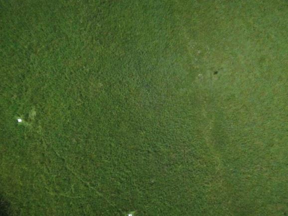
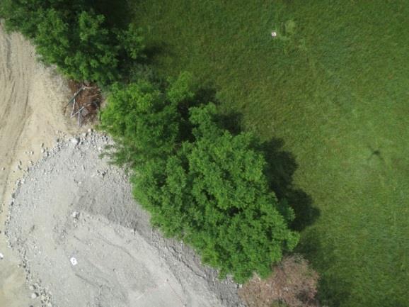
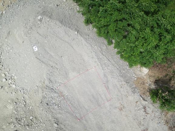
16 Light gravel Flight test Reflectance (2/2) Grassland Trees Gray gravel Dark gravel


17 Flight test RGB products Example of products derived from the RGB images: Orthomosaic image Digital Surface Model (DSM) Textured 3D model Orthomosaic image Textured 3D model
18 Conclusions & perspectives A HyUAV has been designed and developed providing systematic collection of RGB images and VNIR hyperspectral data for field spectroscopy surveys; The dedicated software packages have been developed for: i) mission planning; ii) data collection; iii) processing and geolocation of hyperspectral data and RGB images; The packages are planned to be available online soon in order to be helpful to similar UAV based system; The laboratory test on USB4000 showed that typical platform vibrations do not affect the spectral and radiometric quality in a significant way; The reliability of collected data has been tested in-flight conditions; the comparison between reflectance signatures estimated from UAV data and ground truth measured with ASD FieldSpec showed a good agreement; The UAV platform is demonstrating to be a helpful technology supporting common field surveys; further activities will regard the use of the system for different environmental applications (i.e. snow albedo monitoring, agricultural and forest applications and in-land fresh waters);


19 Acknowledgments SINOPIAE project: «System-prototype for multi-source integrative observation techniques of multispectral satellite, aircraft and ground data for multi-scale monitoring of the variations of environmental indicators related to atmospheric constituents and energy dispersion» The Project of Interest NextData: A national system for the retrieval, storage, access and diffusion of environmental and climate data from mountain and marine areas. LTDA Research group

20 Thanks for your kind attention UAVs in Environmental Research, July 2014, University of Exeter Roberto Garzonio
How Farmer Can Utilize Drone Mapping?
 Presented at the FIG Working Week 2017, May 29 - June 2, 2017 in Helsinki, Finland How Farmer Can Utilize Drone Mapping? National Land Survey of Finland Finnish Geospatial Research Institute Roope Näsi,
Ground Truth for Calibrating Optical Imagery to Reflectance
 Visual Information Solutions Ground Truth for Calibrating Optical Imagery to Reflectance The by: Thomas Harris Whitepaper Introduction: Atmospheric Effects on Optical Imagery Remote sensing of the Earth
Airborne hyperspectral data over Chikusei
 SPACE APPLICATION LABORATORY, THE UNIVERSITY OF TOKYO Airborne hyperspectral data over Chikusei Naoto Yokoya and Akira Iwasaki E-mail: {yokoya, aiwasaki}@sal.rcast.u-tokyo.ac.jp May 27, 2016 ABSTRACT Airborne
A dual-field-of-view spectrometer system for reflectance and fluorescence measurement
 A dual-field-of-view spectrometer system for reflectance and fluorescence measurement (1) Alasdair Mac Arthur, (2) Micol Rossini, (1) Iain Robinson, (3) Neville Davies and (3) Ken McDonald (1) Field Spectroscopy
A dual-field-of-view spectrometer system for reflectance and fluorescence measurement
 A dual-field-of-view spectrometer system for reflectance and fluorescence measurement (1) Alasdair Mac Arthur, (1) Iain Robinson, (2) Micol Rossini, (3) Neville Davies and (3) Ken McDonald (1) Field Spectroscopy
Geo-localization and Mosaicing System (GEMS): Enabling Precision Image Feature Location and Rapid Mosaicing General:
: Enabling Precision Image Feature Location and Rapid Mosaicing General:") Geo-localization and Mosaicing System (GEMS): Enabling Precision Image Feature Location and Rapid Mosaicing General: info@senteksystems.com www.senteksystems.com 12/6/2014 Precision Agriculture Multi-Spectral
Geo-localization and Mosaicing System (GEMS): Enabling Precision Image Feature Location and Rapid Mosaicing General: info@senteksystems.com www.senteksystems.com 12/6/2014 Precision Agriculture Multi-Spectral
Remote Sensing Calibration Solutions
 Remote Sensing Calibration Solutions Cameras, Sensors and Focal Plane Arrays Multispectral and Hyperspectral Imagers Small Satellite Imagers Earth Observation Systems SWIR Band Science and Imaging Reconnaissance
ENMAP RADIOMETRIC INFLIGHT CALIBRATION, POST-LAUNCH PRODUCT VALIDATION, AND INSTRUMENT CHARACTERIZATION ACTIVITIES
 ENMAP RADIOMETRIC INFLIGHT CALIBRATION, POST-LAUNCH PRODUCT VALIDATION, AND INSTRUMENT CHARACTERIZATION ACTIVITIES A. Hollstein1, C. Rogass1, K. Segl1, L. Guanter1, M. Bachmann2, T. Storch2, R. Müller2,
Compact High Resolution Imaging Spectrometer (CHRIS) siraelectro-optics
 siraelectro-optics") Compact High Resolution Imaging Spectrometer (CHRIS) Mike Cutter (Mike_Cutter@siraeo.co.uk) Summary CHRIS Instrument Design Instrument Specification & Performance Operating Modes Calibration Plan Data
Compact High Resolution Imaging Spectrometer (CHRIS) Mike Cutter (Mike_Cutter@siraeo.co.uk) Summary CHRIS Instrument Design Instrument Specification & Performance Operating Modes Calibration Plan Data
9/12/2011. Training Course Remote Sensing Basic Theory & Image Processing Methods September 2011
 Training Course Remote Sensing Basic Theory & Image Processing Methods 19 23 September 2011 Remote Sensing Platforms Michiel Damen (September 2011) damen@itc.nl 1 Overview Platforms & missions aerial surveys
LAST GENERATION UAV-BASED MULTI- SPECTRAL CAMERA FOR AGRICULTURAL DATA ACQUISITION
 LAST GENERATION UAV-BASED MULTI- SPECTRAL CAMERA FOR AGRICULTURAL DATA ACQUISITION FABIO REMONDINO, Erica Nocerino, Fabio Menna Fondazione Bruno Kessler Trento, Italy http://3dom.fbk.eu Marco Dubbini,
Monitoring the vegetation success of a rehabilitated mine site using multispectral UAV imagery. Tim Whiteside & Renée Bartolo, eriss
 Monitoring the vegetation success of a rehabilitated mine site using multispectral UAV imagery Tim Whiteside & Renée Bartolo, eriss About the Supervising Scientist Main roles Working to protect the environment
REMOTE SENSING WITH DRONES. YNCenter Video Conference Chang Cao
 REMOTE SENSING WITH DRONES YNCenter Video Conference Chang Cao 08-28-2015 28 August 2015 2 Drone remote sensing It was first utilized in military context and has been given great attention in civil use
Phase One 190MP Aerial System
 White Paper Phase One 190MP Aerial System Introduction Phase One Industrial s 100MP medium format aerial camera systems have earned a worldwide reputation for its high performance. They are commonly used
Leica - 3 rd Generation Airborne Digital Sensors Features / Benefits for Remote Sensing & Environmental Applications
 Leica - 3 rd Generation Airborne Digital Sensors Features / Benefits for Remote Sensing & Environmental Applications Arthur Rohrbach, Sensor Sales Dir Europe, Middle-East and Africa (EMEA) Luzern, Switzerland,
1. INTRODUCTION. GOCI : Geostationary Ocean Color Imager
 1. INTRODUCTION The Korea Ocean Research and Development Institute (KORDI) releases an announcement of opportunity (AO) to carry out scientific research for the utilization of GOCI data. GOCI is the world
Microscope-Spectrometer
 20 Micro-spectrometer ToupTek s spectrometer is applicable for spectral detection within the wavelength range between 200nm and 1100nm. Due to their high stability and performance, these portable instruments
Radiometric performance of Second Generation Global Imager (SGLI) using integrating sphere
 using integrating sphere") Radiometric performance of Second Generation Global Imager (SGLI) using integrating sphere Taichiro Hashiguchi, Yoshihiko Okamura, Kazuhiro Tanaka, Yukinori Nakajima Japan Aerospace Exploration Agency
Radiometric performance of Second Generation Global Imager (SGLI) using integrating sphere Taichiro Hashiguchi, Yoshihiko Okamura, Kazuhiro Tanaka, Yukinori Nakajima Japan Aerospace Exploration Agency
Spectral Analysis of the LUND/DMI Earthshine Telescope and Filters
 Spectral Analysis of the LUND/DMI Earthshine Telescope and Filters 12 August 2011-08-12 Ahmad Darudi & Rodrigo Badínez A1 1. Spectral Analysis of the telescope and Filters This section reports the characterization
PRELIMINARY RESULTS FROM THE PORTABLE IMAGERY QUALITY ASSESSMENT TEST FIELD (PIQuAT) OF UAV IMAGERY FOR IMAGERY RECONNAISSANCE PURPOSES
 OF UAV IMAGERY FOR IMAGERY RECONNAISSANCE PURPOSES") PRELIMINARY RESULTS FROM THE PORTABLE IMAGERY QUALITY ASSESSMENT TEST FIELD (PIQuAT) OF UAV IMAGERY FOR IMAGERY RECONNAISSANCE PURPOSES R. Dabrowski a, A. Orych a, A. Jenerowicz a, P. Walczykowski a, a
PRELIMINARY RESULTS FROM THE PORTABLE IMAGERY QUALITY ASSESSMENT TEST FIELD (PIQuAT) OF UAV IMAGERY FOR IMAGERY RECONNAISSANCE PURPOSES R. Dabrowski a, A. Orych a, A. Jenerowicz a, P. Walczykowski a, a
EnsoMOSAIC Aerial mapping tools
 EnsoMOSAIC Aerial mapping tools Jakarta and Kuala Lumpur, 2013 Contents MosaicMill MM Application examples Software introduction System introduction Rikola HS sensor UAV platform examples SW Syst HS UAV
FloX: A System for Automatic Long Term Measurements of Top of Canopy Sun Induced Chlorophyll Fluorescence
 FloX: A System for Automatic Long Term Measurements of Top of Canopy Sun Induced Chlorophyll Fluorescence Julitta, Tommaso; Burkart, Andreas; Rossini, Micol; Schickling, Anke; Colombo, Roberto; Rascher,
OPAL Optical Profiling of the Atmospheric Limb
 OPAL Optical Profiling of the Atmospheric Limb Alan Marchant Chad Fish Erik Stromberg Charles Swenson Jim Peterson OPAL STEADE Mission Storm Time Energy & Dynamics Explorers NASA Mission of Opportunity
PEGASUS : a future tool for providing near real-time high resolution data for disaster management. Lewyckyj Nicolas
 PEGASUS : a future tool for providing near real-time high resolution data for disaster management Lewyckyj Nicolas nicolas.lewyckyj@vito.be http://www.pegasus4europe.com Overview Vito in a nutshell GI
Hyperspectral goes to UAV and thermal
 Hyperspectral goes to UAV and thermal Timo Hyvärinen, Hannu Holma and Esko Herrala SPECIM, Spectral Imaging Ltd, Finland www.specim.fi Outline Roadmap to more compact, higher performance hyperspectral
MULTISPECTRAL AGRICULTURAL ASSESSMENT. Normalized Difference Vegetation Index. Federal Robotics INSPECTION & DOCUMENTATION
 MULTISPECTRAL AGRICULTURAL ASSESSMENT Normalized Difference Vegetation Index INSPECTION & DOCUMENTATION Federal Robotics Clearwater Dr. Amherst, New York 14228 716-221-4181 Sales@FedRobot.com www.fedrobot.com
MR-i. Hyperspectral Imaging FT-Spectroradiometers Radiometric Accuracy for Infrared Signature Measurements
 MR-i Hyperspectral Imaging FT-Spectroradiometers Radiometric Accuracy for Infrared Signature Measurements FT-IR Spectroradiometry Applications Spectroradiometry applications From scientific research to
Comprehensive Vicarious Calibration and Characterization of a Small Satellite Constellation Using the Specular Array Calibration (SPARC) Method
 Method") This document does not contain technology or Technical Data controlled under either the U.S. International Traffic in Arms Regulations or the U.S. Export Administration Regulations. Comprehensive Vicarious
This document does not contain technology or Technical Data controlled under either the U.S. International Traffic in Arms Regulations or the U.S. Export Administration Regulations. Comprehensive Vicarious
Characterization of the atmospheric aerosols and the surface radiometric properties in the AGRISAR Campaign
 Characterization of the atmospheric aerosols and the surface radiometric properties in the AGRISAR Campaign V. Estellés Solar Radiation Unit Universitat de València T. Ruhtz, P. Zieger, S. Stapelberg Institute
Signal-to-Noise Ratio (SNR) discussion
 discussion") Signal-to-Noise Ratio (SNR) discussion The signal-to-noise ratio (SNR) is a commonly requested parameter for hyperspectral imagers. This note is written to provide a description of the factors that affect
Signal-to-Noise Ratio (SNR) discussion The signal-to-noise ratio (SNR) is a commonly requested parameter for hyperspectral imagers. This note is written to provide a description of the factors that affect
THE HYMAP TM AIRBORNE HYPERSPECTRAL SENSOR: THE SYSTEM, CALIBRATION AND PERFORMANCE
 THE HYMAP TM AIRBORNE HYPERSPECTRAL SENSOR: THE SYSTEM, CALIBRATION AND PERFORMANCE T. Cocks, R. Jenssen, A. Stewart, I. Wilson* and T. Shields* Integrated Spectronics Pty Ltd, P.O. Box 437, Baulkham Hills,
Mod. 2 p. 1. Prof. Dr. Christoph Kleinn Institut für Waldinventur und Waldwachstum Arbeitsbereich Fernerkundung und Waldinventur
 Histograms of gray values for TM bands 1-7 for the example image - Band 4 and 5 show more differentiation than the others (contrast=the ratio of brightest to darkest areas of a landscape). - Judging from
WIDE SPECTRAL RANGE IMAGING INTERFEROMETER
 WIDE SPECTRAL RANGE IMAGING INTERFEROMETER Alessandro Barducci, Donatella Guzzi, Cinzia Lastri, Paolo Marcoionni, Vanni Nardino, Ivan Pippi CNR IFAC Sesto Fiorentino, ITALY ICSO 2012 Ajaccio 8-12/10/2012
Spatial-Spectral Target Detection. Table 1: Description of symmetric geometric targets
 Experiment Spatial-Spectral Target Detection Investigator: Jason Kaufman Support Crew: TBD Short Title: Objectives: Spatial-Spectral Target Detection The aim of this experiment is to detect and distinguish
On the use of water color missions for lakes in 2021
 Lakes and Climate: The Role of Remote Sensing June 01-02, 2017 On the use of water color missions for lakes in 2021 Cédric G. Fichot Department of Earth and Environment 1 Overview 1. Past and still-ongoing
Textbook, Chapter 15 Textbook, Chapter 10 (only 10.6)
") AGOG 484/584/ APLN 551 Fall 2018 Concept definition Applications Instruments and platforms Techniques to process hyperspectral data A problem of mixed pixels and spectral unmixing Reading Textbook, Chapter
AGOG 484/584/ APLN 551 Fall 2018 Concept definition Applications Instruments and platforms Techniques to process hyperspectral data A problem of mixed pixels and spectral unmixing Reading Textbook, Chapter
Introduction to Remote Sensing Lab 6 Dr. Hurtado Wed., Nov. 28, 2018
 Lab 6: UAS Remote Sensing Due Wed., Dec. 5, 2018 Goals 1. To learn about the operation of a small UAS (unmanned aerial system), including flight characteristics, mission planning, and FAA regulations.
APEX AIRBORNE PRISM EXPERIMENT A NEW CONCEPT FOR AN AIRBORNE IMAGING SPECTROMETER *
 APEX AIRBORNE PRISM EXPERIMENT A NEW CONCEPT FOR AN AIRBORNE IMAGING SPECTROMETER * K.I. Itten, M. Schaepman e mail: apex@geo.unizh.ch Remote Sensing Laboratories, Dept. of Geography, University of Zurich
University of Texas at San Antonio EES 5053 Term Project CORRELATION BETWEEN NDVI AND SURFACE TEMPERATURES USING LANDSAT ETM + IMAGERY NEWFEL MAZARI
 University of Texas at San Antonio EES 5053 Term Project CORRELATION BETWEEN NDVI AND SURFACE TEMPERATURES USING LANDSAT ETM + IMAGERY NEWFEL MAZARI Introduction and Objectives The present study is a correlation
Remote Sensing. The following figure is grey scale display of SPOT Panchromatic without stretching.
 Remote Sensing Objectives This unit will briefly explain display of remote sensing image, geometric correction, spatial enhancement, spectral enhancement and classification of remote sensing image. At
of the Small Satellite Mission Systematic Image Processing Eckehard Lorenz, DLR Berlin Ilmenau, Klaus Briess, TU Berlin 49th IWK
 Ilmenau, 27.-30.09. 2004 49th IWK Eckehard Lorenz, DLR Berlin Klaus Briess, TU Berlin Astro- und Feinwerktechnik Adlershof GmbH Systematic Image Processing of the Small Satellite Mission BIRD Optical Information
IDEAS+ WP3520 Calibration and data quality toolbox. July 2016 Steve Mackin James Warner
 IDEAS+ WP3520 Calibration and data quality toolbox July 2016 Steve Mackin James Warner Proposition : Every image contains the same information Railroad Valley, Nevada London, UK Rationale for the project
DEFENSE APPLICATIONS IN HYPERSPECTRAL REMOTE SENSING
 DEFENSE APPLICATIONS IN HYPERSPECTRAL REMOTE SENSING James M. Bishop School of Ocean and Earth Science and Technology University of Hawai i at Mānoa Honolulu, HI 96822 INTRODUCTION This summer I worked
SPECTRAL SCANNER. Recycling
 SPECTRAL SCANNER The Spectral Scanner, produced on an original project of DV s.r.l., is an instrument to acquire with extreme simplicity the spectral distribution of the different wavelengths (spectral
Oriel MS260i TM 1/4 m Imaging Spectrograph
 Oriel MS260i TM 1/4 m Imaging Spectrograph MS260i Spectrograph with 3 Track Fiber on input and InstaSpec CCD on output. The MS260i 1 4 m Imaging Spectrographs are economical, fully automated, multi-grating
specification display & lighting hera spectrometer
 specification display & lighting hera spectrometer Contents 1 Hera: cost effective spectrometer... 3 2 Highlights... 3 3 Speed & ease of use... 4 1 General specification Hera... 4 2 Hera series specifications...
Best practice for UAV Spectral sampling (BUS) - concept and overview of current status-
 - concept and overview of current status-") Best practice for UAV Spectral sampling (BUS) - concept and overview of current status- Helge Aasen 27.02.2017 0 Remote sensing in transition Lightweight and cheaper sensors available Smaller and more
Best practice for UAV Spectral sampling (BUS) - concept and overview of current status- Helge Aasen 27.02.2017 0 Remote sensing in transition Lightweight and cheaper sensors available Smaller and more
EDUCATION EXPERIMENT. Determining Color Difference (Delta E) Introduction
 Introduction") EDUCATION EXPERIMENT Determining Color Difference (Delta E) Introduction www.oceanoptics.com info@oceanoptics.com Color matching and color consistency have become important quality control parameters in
EDUCATION EXPERIMENT Determining Color Difference (Delta E) Introduction www.oceanoptics.com info@oceanoptics.com Color matching and color consistency have become important quality control parameters in
Instruction manual for Ocean Optics USB4000 and QE65 Pro spectroradiometers
 Aalto University School of Electrical Engineering Metrology Research Institute Hans Baumgartner Instruction manual for Version 1.0 24/11/2016 Page 2 (9) 1. Table of contents 1. Table of contents... 2 2.
Sentinel-2 Products and Algorithms
 Sentinel-2 Products and Algorithms Ferran Gascon (Sentinel-2 Data Quality Manager) Workshop Preparations for Sentinel 2 in Europe, Oslo 26 November 2014 Sentinel-2 Mission Mission Overview Products and
metcon meteorologieconsultgmbh, Instruments for Atmospheric Research W1aa_Feb_2017_1.doc 1 -
 metcon meteorologieconsultgmbh, Instruments for Atmospheric Research W1aa_Feb_2017_1.doc 1 - ACTINIC FLUX SPECTRAL RADIOMETERS Ultra-fast CCD-Detector Spectrometer, UVB enhanced Cooled CCD, 512 pixel *
Int n r t o r d o u d c u ti t on o n to t o Remote Sensing
 Introduction to Remote Sensing Definition of Remote Sensing Remote sensing refers to the activities of recording/observing/perceiving(sensing)objects or events at far away (remote) places. In remote sensing,
IKONOS High Resolution Multispectral Scanner Sensor Characteristics
 High Spatial Resolution and Hyperspectral Scanners IKONOS High Resolution Multispectral Scanner Sensor Characteristics Launch Date View Angle Orbit 24 September 1999 Vandenberg Air Force Base, California,
Status of MOLI development MOLI (Multi-footprint Observation Lidar and Imager)
") Status of MOLI development MOLI (Multi-footprint Observation Lidar and Imager) Tadashi IMAI, Daisuke SAKAIZAWA, Jumpei MUROOKA and Toshiyoshi KIMURA JAXA 1 Outline of This Presentation 1. Overview of MOLI
Status of MOLI development MOLI (Multi-footprint Observation Lidar and Imager) Tadashi IMAI, Daisuke SAKAIZAWA, Jumpei MUROOKA and Toshiyoshi KIMURA JAXA 1 Outline of This Presentation 1. Overview of MOLI
Zoltán Vekerdy Szent István Univ. János Tamás Debrecen University
 WATER PONDING IN HUNGARY: COLLECTION OF GROUND AND DRONE DATA GROUND REFLECTANCES Zoltán Vekerdy Szent István Univ. János Tamás Debrecen University 7th ADVANCED TRAINING COURSE ON LAND REMOTE SENSING 4
Camera Calibration Certificate No: DMC III 27542
 Calibration DMC III Camera Calibration Certificate No: DMC III 27542 For Peregrine Aerial Surveys, Inc. #201 1255 Townline Road Abbotsford, B.C. V2T 6E1 Canada Calib_DMCIII_27542.docx Document Version
EnMAP Environmental Mapping and Analysis Program
 EnMAP Environmental Mapping and Analysis Program www.enmap.org Mathias Schneider Mission Objectives Regular provision of high-quality calibrated hyperspectral data Precise measurement of ecosystem parameters
Multispectral. imaging device. ADVANCED LIGHT ANALYSIS by. Most accurate homogeneity MeasureMent of spectral radiance. UMasterMS1 & UMasterMS2
 Multispectral imaging device Most accurate homogeneity MeasureMent of spectral radiance UMasterMS1 & UMasterMS2 ADVANCED LIGHT ANALYSIS by UMaster Ms Multispectral Imaging Device UMaster MS Description
Hyperspectral imaging (HSI) goes embedded All rights reserved Max Larin, 1
 goes embedded All rights reserved Max Larin, 1") Hyperspectral imaging (HSI) goes embedded 2015 All rights reserved Max Larin, max.larin@ximea.com 1 Hyperspectral Imaging (HSI) goes embedded Seeing the invisible with Miniature intelligent HSI Cameras
Hyperspectral imaging (HSI) goes embedded 2015 All rights reserved Max Larin, max.larin@ximea.com 1 Hyperspectral Imaging (HSI) goes embedded Seeing the invisible with Miniature intelligent HSI Cameras
RADIOMETRIC CALIBRATION
 1 RADIOMETRIC CALIBRATION Lecture 10 Digital Image Data 2 Digital data are matrices of digital numbers (DNs) There is one layer (or matrix) for each satellite band Each DN corresponds to one pixel 3 Digital
Norsk Elektro Optikk AS (NEO) HySpex Airborne Sensors System Overview
 HySpex Airborne Sensors System Overview") Norsk Elektro Optikk AS (NEO) HySpex Airborne Sensors System Overview Trond Løke Research Scientist EUFAR meeting 14.04.2011 Outline Norsk Elektro Optikk AS (NEO) NEO company profile HySpex Optical Design
Norsk Elektro Optikk AS (NEO) HySpex Airborne Sensors System Overview Trond Løke Research Scientist EUFAR meeting 14.04.2011 Outline Norsk Elektro Optikk AS (NEO) NEO company profile HySpex Optical Design
ROLE OF SATELLITE DATA APPLICATION IN CADASTRAL MAP AND DIGITIZATION OF LAND RECORDS DR.T. RAVISANKAR GROUP HEAD (LRUMG) RSAA/NRSC/ISRO /DOS HYDERABAD
 RSAA/NRSC/ISRO /DOS HYDERABAD") ROLE OF SATELLITE DATA APPLICATION IN CADASTRAL MAP AND DIGITIZATION OF LAND RECORDS DR.T. RAVISANKAR GROUP HEAD (LRUMG) RSAA/NRSC/ISRO /DOS HYDERABAD WORKSHOP on Best Practices under National Land Records
ROLE OF SATELLITE DATA APPLICATION IN CADASTRAL MAP AND DIGITIZATION OF LAND RECORDS DR.T. RAVISANKAR GROUP HEAD (LRUMG) RSAA/NRSC/ISRO /DOS HYDERABAD WORKSHOP on Best Practices under National Land Records
Program for UV Intercomparison 2014 in Davos:
 Program for UV Intercomparison 2014 in Davos: June 2014 Date: 7 16 July 2014 Location: PMOD/WRC Davos Switzerland. Information Update: http://projects.pmodwrc.ch/env03/index.php/8-emrp-uv/project/24- intercomparison-2014
Preliminary Characterization Results: Fiber-Coupled, Multi-channel, Hyperspectral Spectrographs
 Preliminary Characterization Results: Fiber-Coupled, Multi-channel, Hyperspectral Spectrographs Carol Johnson, NIST MODIS-VIIRS Team Meeting January 26-28, 2010 Washington, DC Marine Optical System & Data
INNOVATIVE SPECTRAL IMAGING
 INNOVATIVE SPECTRAL IMAGING food inspection precision agriculture remote sensing defense & reconnaissance advanced machine vision product overview INNOVATIVE SPECTRAL IMAGING Innovative diffractive optics
AvaLight-DHc Full-range Compact Light Source
 AvaLight-DHc Full-range Compact Light Source AvaLight-DHc Get the best out of two worlds with the AvaLight-DHc. It has both a deuterium light source and a halogen light source, providing you with adequate
FLIGHT SUMMARY REPORT
 FLIGHT SUMMARY REPORT Flight Number: 97-011 Calendar/Julian Date: 23 October 1996 297 Sensor Package: Area(s) Covered: Wild-Heerbrugg RC-10 Airborne Visible and Infrared Imaging Spectrometer (AVIRIS) Southern
ALISEO: an Imaging Interferometer for Earth Observation
 ALISEO: an Imaging Interferometer for Earth Observation A. Barducci, F. Castagnoli, G. Castellini, D. Guzzi, C. Lastri, P. Marcoionni, I. Pippi CNR IFAC Sesto Fiorentino, ITALY ASSFTS14 Firenze - May 6-8,
Table 8 Overview light sources
 Avantes Deuterium light sources are known for their stable output and are used for UV absorption or reflection measurements. These can also be used as irradiance calibration sources due to their high-stability.
REMOTE SENSING INTERPRETATION
 REMOTE SENSING INTERPRETATION Jan Clevers Centre for Geo-Information - WU Remote Sensing --> RS Sensor at a distance EARTH OBSERVATION EM energy Earth RS is a tool; one of the sources of information! 1
Validation of the QuestUAV PPK System
 Validation of the QuestUAV PPK System 3cm in xy, 400ft, no GCPs, 100Ha, 25 flights Nigel King 1, Kerstin Traut 2, Cameron Weeks 3 & Ruairi Hardman 4 1 Director QuestUAV, 2 Data Analyst QuestUAV, 3 Production
VICARIOUS CALIBRATION SITE SELECTION FOR RAZAKSAT MEDIUM-SIZED APERTURE CAMERA (MAC)
") VICARIOUS CALIBRATION SITE SELECTION FOR RAZAKSAT MEDIUM-SIZED APERTURE CAMERA (MAC) Lee Yee Hwai a, Mazlan Hashim b, Ahmad Sabirin Arshad a a Astronautic Technology (M) Sdn Bhd (yee_hwai, sabirin)@atsb.com.my
VICARIOUS CALIBRATION SITE SELECTION FOR RAZAKSAT MEDIUM-SIZED APERTURE CAMERA (MAC) Lee Yee Hwai a, Mazlan Hashim b, Ahmad Sabirin Arshad a a Astronautic Technology (M) Sdn Bhd (yee_hwai, sabirin)@atsb.com.my
Kazuhiro TANAKA GCOM project team/jaxa April, 2016
 Kazuhiro TANAKA GCOM project team/jaxa April, 216 @ SPIE Asia-Pacific 216 at New Dehli, India 1 http://suzaku.eorc.jaxa.jp/gcom_c/index_j.html GCOM mission and satellites SGLI specification and IRS overview
Rochester Institute of Technology. Wildfire Airborne Sensor Program (WASP) Project Overview
 Project Overview") Rochester Institute of Technology Wildfire Airborne Sensor Program (WASP) Project Overview Introduction The following slides describe a program underway at RIT The sensor system described herein is being
Rochester Institute of Technology Wildfire Airborne Sensor Program (WASP) Project Overview Introduction The following slides describe a program underway at RIT The sensor system described herein is being
MicroCarb Mission: A new space instrumental concept based on dispersive components for the measurement of CO2 concentration in the atmosphere
 International Conference on Space Optics 2012 MicroCarb Mission: A new space instrumental concept based on dispersive components for the measurement of CO2 concentration in the atmosphere Véronique PASCAL
The Development of Imaging Spectrometry of the Coastal Ocean
 SU_8/2/2006_Davis.1 The Development of Imaging Spectrometry of the Coastal Ocean Curtiss O. Davis College of Oceanic and Atmospheric Sciences, Oregon State University, Corvallis, OR 97331 cdavis@coas.oregonstate.edu
An Introduction to Geomatics. Prepared by: Dr. Maher A. El-Hallaq خاص بطلبة مساق مقدمة في علم. Associate Professor of Surveying IUG
 An Introduction to Geomatics خاص بطلبة مساق مقدمة في علم الجيوماتكس Prepared by: Dr. Maher A. El-Hallaq Associate Professor of Surveying IUG 1 Airborne Imagery Dr. Maher A. El-Hallaq Associate Professor
Miniature Spectrometer Technical specifications
 Miniature Spectrometer Technical specifications Ref: MSP-ISI-TEC 001-02 Date: 2017-05-05 Contact Details Correspondence Address: Email: Phone: IS-Instruments Ltd. Pipers Business Centre 220 Vale Road Tonbridge
Chapter 5 Nadir looking UV measurement.
 Chapter 5 Nadir looking UV measurement. Part-II: UV polychromator instrumentation and measurements -A high SNR and robust polychromator using a 1D array detector- UV spectrometers onboard satellites have
Lecture 2. Electromagnetic radiation principles. Units, image resolutions.
 NRMT 2270, Photogrammetry/Remote Sensing Lecture 2 Electromagnetic radiation principles. Units, image resolutions. Tomislav Sapic GIS Technologist Faculty of Natural Resources Management Lakehead University
Module 3 Introduction to GIS. Lecture 8 GIS data acquisition
 Module 3 Introduction to GIS Lecture 8 GIS data acquisition GIS workflow Data acquisition (geospatial data input) GPS Remote sensing (satellites, UAV s) LiDAR Digitized maps Attribute Data Management Data
UM1380/ UM2380 UM1390/ UM2390 Datasheet
 UM1380/ UM2380 UM1390/ UM2390 Datasheet Description UM1380/ UM2380/ UM1390/ UM2390 spectro-module is a new OtO optical platform with 50% footprint down size compared to UM1280/UM2280 series. Besides the
MSPI: The Multiangle Spectro-Polarimetric Imager
 MSPI: The Multiangle Spectro-Polarimetric Imager I. Summary Russell A. Chipman Professor, College of Optical Sciences University of Arizona (520) 626-9435 rchipman@optics.arizona.edu The Multiangle SpectroPolarimetric
Chapter 8. Remote sensing
 1. Remote sensing 8.1 Introduction 8.2 Remote sensing 8.3 Resolution 8.4 Landsat 8.5 Geostationary satellites GOES 8.1 Introduction What is remote sensing? One can describe remote sensing in different
Vegetation Indexing made easier!
 Remote Sensing Vegetation Indexing made easier! TETRACAM MCA & ADC Multispectral Camera Systems TETRACAM MCA and ADC are multispectral cameras for critical narrow band digital photography. Based on the
UAS BASED TREE SPECIES IDENTIFICATION USING THE NOVEL FPI BASED HYPERSPECTRAL CAMERAS IN VISIBLE, NIR AND SWIR SPECTRAL RANGES
 UAS BASED TREE SPECIES IDENTIFICATION USING THE NOVEL FPI BASED HYPERSPECTRAL CAMERAS IN VISIBLE, NIR AND SWIR SPECTRAL RANGES R. Näsi a, *, E. Honkavaara a, S. Tuominen b, H. Saari c, I. Pölönen d, T.
Optimal Narrow Spectral Bands for Precision Weed Detection in Agricultural Fields using Hyperspectral Remote Sensing
 Optimal Narrow Spectral Bands for Precision Weed Detection in Agricultural Fields using Hyperspectral Remote Sensing Sam Tittle Seminar Presentation 11/17/2016 Committee Rick Lawrence Kevin Repasky Bruce
MULTIPURPOSE QUADCOPTER SOLUTION FOR AGRICULTURE
 MULTIPURPOSE QUADCOPTER SOLUTION FOR AGRICULTURE Powered by COVERS UP TO 30HA AT 70M FLIGHT ALTITUDE PER BATTERY PHOTO & VIDEO FULL HD 1080P - 14MP 3-AXIS STABILIZATION INCLUDES NDVI & ZONING MAPS SERVICE
Hyperspectral Systems: Recent Developments and Low Cost Sensors. 56th Photogrammetric Week in Stuttgart, September 11 to September 15, 2017
 Hyperspectral Systems: Recent Developments and Low Cost Sensors 56th Photogrammetric Week in Stuttgart, September 11 to September 15, 2017 Ralf Reulke Humboldt-Universität zu Berlin Institut für Informatik,
MERIS instrument. Muriel Simon, Serco c/o ESA
 MERIS instrument Muriel Simon, Serco c/o ESA Workshop on Sustainable Development in Mountain Areas of Andean Countries Mendoza, Argentina, 26-30 November 2007 ENVISAT MISSION 2 Mission Chlorophyll case
MultiCam A Multi-Spectral Imager for Airborne, Laboratory and Field Applications Instruction Manual
 MultiCam A Multi-Spectral Imager for Airborne, Laboratory and Field Applications Instruction Manual January 2008 Version 10 MULTICAM SPECIFICATION SHEET Features # of cameras up to 5 Imaging multi-spectral
22/11/2013. UAV: Overview of systems, applications and processing Kris Nackaerts, Peter Strigencz
 22/11/2013 UAV: Overview of systems, applications and processing Kris Nackaerts, Peter Strigencz Introduction» Systems» Applications» Non-imaging» Imaging» Processing, focus on photogrammetry» Use case
Συμβολή Αυτόνομων Συστημάτων Πλοήγησης (UAV) για τη χαρτογράφηση διαρροών νερού
 για τη χαρτογράφηση διαρροών νερού") Ημερίδα: ΟΛΟΚΛΗΡΩΜΕΝΗ ΧΡΗΣΗ ΔΟΡΥΦΟΡΙΚΩΝ, ΓΕΩΦYΣΙΚΩΝ ΚΑΙ ΥΠΕΡΦΑΣΜΑΤΙΚΩΝ ΤΕΧΝΟΛΟΓΙΩΝ ΓΙΑ ΠΑΡΑΚΟΛΟΥΘΗΣΗ ΔΙΑΡΡΟΩΝ ΝΕΡΟΥ ΣΕ ΔΙΚΤΥΑ ΥΔΡΕΥΣΗΣ ΣΤΗΝ ΚΥΠΡΟ. Συμβολή Αυτόνομων Συστημάτων Πλοήγησης (UAV) για τη χαρτογράφηση
Ημερίδα: ΟΛΟΚΛΗΡΩΜΕΝΗ ΧΡΗΣΗ ΔΟΡΥΦΟΡΙΚΩΝ, ΓΕΩΦYΣΙΚΩΝ ΚΑΙ ΥΠΕΡΦΑΣΜΑΤΙΚΩΝ ΤΕΧΝΟΛΟΓΙΩΝ ΓΙΑ ΠΑΡΑΚΟΛΟΥΘΗΣΗ ΔΙΑΡΡΟΩΝ ΝΕΡΟΥ ΣΕ ΔΙΚΤΥΑ ΥΔΡΕΥΣΗΣ ΣΤΗΝ ΚΥΠΡΟ. Συμβολή Αυτόνομων Συστημάτων Πλοήγησης (UAV) για τη χαρτογράφηση
An Introduction to Remote Sensing & GIS. Introduction
 An Introduction to Remote Sensing & GIS Introduction Remote sensing is the measurement of object properties on Earth s surface using data acquired from aircraft and satellites. It attempts to measure something
Towards a Management Plan for a Tropical Reef-Lagoon System Using Airborne Multispectral Imaging and GIS
 Towards a Management Plan for a Tropical Reef-Lagoon System Using Airborne Multispectral Imaging and GIS This paper was presented at the Fourth International Conference on Remote Sensing for Marine and
UAV applications for oil spill detection, suspended matter distribution and ice monitoring first tests and trials in Estonia 2015/2016
 UAV applications for oil spill detection, suspended matter distribution and ice monitoring first tests and trials in Estonia 2015/2016 Sander Rikka Marine Systems Institute at TUT 1.11.2016 1 Outlook Introduction
Hyper-spectral, UHD imaging NANO-SAT formations or HAPS to detect, identify, geolocate and track; CBRN gases, fuel vapors and other substances
 Hyper-spectral, UHD imaging NANO-SAT formations or HAPS to detect, identify, geolocate and track; CBRN gases, fuel vapors and other substances Arnold Kravitz 8/3/2018 Patent Pending US/62544811 1 HSI and
Wind Imaging Spectrometer and Humidity-sounder (WISH): a Practical NPOESS P3I High-spatial Resolution Sensor
: a Practical NPOESS P3I High-spatial Resolution Sensor") Wind Imaging Spectrometer and Humidity-sounder (WISH): a Practical NPOESS P3I High-spatial Resolution Sensor Jeffery J. Puschell Raytheon Space and Airborne Systems, El Segundo, California Hung-Lung Huang
Wind Imaging Spectrometer and Humidity-sounder (WISH): a Practical NPOESS P3I High-spatial Resolution Sensor Jeffery J. Puschell Raytheon Space and Airborne Systems, El Segundo, California Hung-Lung Huang
MS260i 1/4 M IMAGING SPECTROGRAPHS
 MS260i 1/4 M IMAGING SPECTROGRAPHS ENTRANCE EXIT MS260i Spectrograph with 3 Track Fiber on input and InstaSpec IV CCD on output. Fig. 1 OPTICAL CONFIGURATION High resolution Up to three gratings, with