UAV Imagery and Data Management for Precision Agriculture. John Nowatzki Extension Ag Machine Systems Specialist North Dakota State University
|
|
|
- Laurel Hunter
- 6 years ago
- Views:
Transcription


1 UAV Imagery and Data Management for Precision Agriculture John Nowatzki Extension Ag Machine Systems Specialist North Dakota State University
2 UAS in Precision Agriculture NDSU UAS & Sensing Activities Digital Data Management Issues Future of Digital Data in Agriculture


3 Precision Agriculture & Data Management Computer Software Commercial Services Telematics Big Data


4 Data in Precision Agriculture Fertilizer Application Map Yield Soil Elevation Imagery Soil Map Seeding Application Map Scouting Map Aerial Imagery Chemical Application Map Aerial, Satellite & UAS Imagery

5 GPS RTK GPS Section Control on Sprayers Row Control on Planters Section Control on Air Seeders Yield Monitors on Combines Variable Hybrid Seeding Variable Rate Seeding In-season Fertilization In-field Sensors Zone Management in Fields Drones in Ag Imagery for Crop Management 96% 46% 81% 55% 20% 83% 20% 49% 29% Precision Ag 4% Technologies 35% in 15% North Dakota 40%
6 NDSU UAS Activities Small and Large UAV S Phantom 3 Trimble UX5


7 UAS Platforms Hermes 450 3DR RTF X8 Altavian Phantom 3 & 4 DJI 100 Matrice Trimble UX5 DJI 1000A RF70 - Troybuilt


8 UAS Sensors Ximea Cameras GoPro Camera ICI 9640 S Thermal camera Hyperspectral Large area scanning EO/IR/NIR camera Sony NEX-5R camera with NIR Tetracam ADC Sentera dual sensor (4 band) Sentera Quad sensor (6 band) MicaSense Rededge Ximera Hyperspectral sensor Rikola Hyperspectral sensor Rikola Elbit EO/IR ICI 9640 Thermal Sentera SlantRange nm Sony NEX-5R

9 Roboflight RF-70


10 Phantom Quad Sensor 4 Cameras in One
11 Image Processing Software Pix4Dmapper Agisoft Photoscan Pro UnscramblerX SlantView Rikola Hyperspectral Imager ArcMap ERDAS Imagine ENVI Matlab QGIS SMS Spatial Management Systems


12 Large-scale UAS Project Imagery in May, June, July and August Color, Infrared Sensor 4,000, 6,000 and 8,000 ft Small UAS, Satellite, Ground and Yield Data All Imagery Securely Stored on NDSU Computers Objectives Uses for Crop Management Economic Value to Producers

13 Project Location Eastern ND
14 Project Location Eastern ND
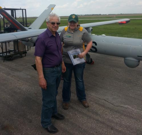
15 Hermes 450 UAS

16 Hermes 450 UAS Control Center

17 First Large UAS Civilian Flight in United States


18 Landing the Hermes 450

19 View from CAP Chase Plane
20 Data Management Large UAS Entire Corridor Each Date Date May June July August Altitude 4,000 6,000 8,000 6,000 8,000 6,000 8,000 4,000 8,000 Image Quantity Total Size 2.0 TB 1.5 TB 0.5 TB 4.0 TB 1.5 TB 0.5 TB 2.0 TB 1.5 TB 0.5 TB 2.0 TB 2.0 TB 0.5 TB 2.5 TB Total Quantity of Imagery Collected during the Project: 10.5 TB Plus Small UAS Imagery Plus Image Analyses
21 Data Transfer Issues One North Dakota Field 320 Acres, 2.45 GB Transfer Time from NDSU Secure File Site 2 minutes Grand Forks Courthouse Wired Connection 4 minutes Fargo Home CableOne & Wireless 7 minutes - Fargo Home CableOne & Wireless 9 minutes Carrington Home Cable & Wireless 10 minutes Cass County Courthouse Wireless 27 minutes Richland County Courthouse 53 minutes Griggs County Courthouse 1 hour and 10 minutes NDSU CREC


22 NDSU Extension Role Facilitate Collaborate Educate


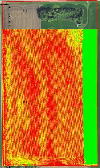
23 May Imagery: 4,000 6,000 8,000 4,000 8,000 6,000 Detailed Imagery - 50,000 Acres/Hour

24 Digital Elevation Model Using Large UAV

25 Sunflower Stand 2017 Skips and Doubles


26 Corn Imagery: May June July - August

27 Mapping IDC in Soybeans NDVI Trimble with MicaSense Camera

28 NDVI Trimble with MicaSense Camera


29 Hail Damage: Corn from 4, Acres out of 67 acres

30 Cattle in August Imagery: 4,000

31 ~ 40 Acres Imagery 4,000 RGB Image 4 cm Pixel Size

32 Imagery Issues: Time Between Images

33 Imagery Issues: Time Between Images Color Image

34 Imagery Issues: Time Between Images NDVI Image NDVI Mean= NDVI Mean=0.4975
35 Identifying Volunteer Soybeans in Dry Beans Fields


36 Identifying Noxious Weeds Slantrange Camera


37 Identifying Herbicide-resistant Weeds

38 Identifying Herbicide-resistant Weeds #1 Herbicide-resistant Cooler #2 Herbicide-susceptible 2-5 degrees warmer

39 Robotic Probe


40 Future of Data in Agriculture More In-field Sensors More Machine Sensors More Remote Sensing More UAVs More Robots One More Layer for Big Data Precision Agriculture
41 Questions - Comments Office Cell John.Nowatzki@ndsu.edu
42
43 Managing Large Amounts of Digital Data for Precision Agriculture John Nowatzki Agriculture and Biosystems Engineering Kim Owen Information Technology Division
44 Discovery and Innovation critical implications for R&E network infrastructure
45 Data transfer and storage ~ By nature, production ag occurs in rural / remote areas, likewise the data for initiatives like this will originate in those same locations. To use the data for analysis, discovery and innovation, the data must travel or at least be accessible to experts from a distance.
46 Data privacy and security ~ Grower privacy protect the grower s crop production and business related data while ensuring timely access to key research data sets by partners. Intellectual Property allow universities to patent research discoveries and transfer the patent to the private sector. Research transparency and replicability ensures attention to data privacy concerns is rigorous, but does not stifle progress of public/private research initiatives intended to benefit global society and economy.
47 Emphasizing the R&E role ~ [State & Regional networks] provide access to scalable operating cyberinfrastructure models for effective and dynamic delivery of computational resources and services to geographically distributed researchers. proximity to their campus members and familiarity with regional priorities and interests provide focus on challenges and opportunities characteristic of the region promote new capabilities and resources external to individual campuses. (Monaco et al., 2016)


48 Implications for the Midwest Big Data Hub Big Data Spoke Digital Agriculture ~ Unmanned Aircraft Systems, Plant Sciences and Education Project Vision Develop coordinated efforts by the academic, industrial and governmental sectors to automate Big Data lifecycles, improve access to data assets, and train a workforce with relevant skills and expertise, all contributors to solving sustaining global food security concerns.
49 References Monaco, G.E., McMullen, D.F., Huntoon, G., Leasure, J., Swanson, D., Neeman, H., Blake, J., Adams, K. (2016). The role of regional organizations in improving access to the national computational infrastructure. Retrieved online: _Regional_Organizations_in_Improving_Access_to_the_National_Co mputational_infrastructure_a_report_to_the_national_science_fo undation
Crop Scouting with Drones Identifying Crop Variability with UAVs
 DroneDeploy Crop Scouting with Drones Identifying Crop Variability with UAVs A Guide to Evaluating Plant Health and Detecting Crop Stress with Drone Data Table of Contents 01 Introduction Crop Scouting
Valuable New Information for Precision Agriculture. Mike Ritter Founder & CEO - SLANTRANGE, Inc.
 Valuable New Information for Precision Agriculture Mike Ritter Founder & CEO - SLANTRANGE, Inc. SENSORS Accurate, Platform- Agnostic ANALYTICS On-Board, On-Location SLANTRANGE Delivering Valuable New Information
Remote Scouting of Insect Damage in Potatoes
 Remote Scouting of Insect Damage in Potatoes Ian MacRae, Timothy Baker Dept. of: Entomology, Univ. of Minnesota Potato Remote Sensing Conference Madison, WI. Nov14, 2017. Use hyperspectral sensors to identify
Capture the invisible
 Capture the invisible A Capture the invisible The Sequoia multispectral sensor captures both visible and invisible images, providing calibrated data to optimally monitor the health and vigor of your crops.
Getting Started with Drones in Agriculture
 NebGuide Nebraska Extension Research-Based Information That You Can Use G2296 Index: Crops, Crop Production/Field Crops Issued December 2017 Getting Started with Drones in Agriculture Laura J. Thompson,
Scaling Up Drone Science for Agriculture & Nature Resources through Cooperative Extension
 Scaling Up Drone Science for Agriculture & Nature Resources through Cooperative Extension Andy Lyons, Maggi Kelly, Sean Hogan, Shane Feirer, Robert Johnson CalGIS 2017, Oakland, CA. May 23, 2017 How and
REMOTE SENSING WITH DRONES. YNCenter Video Conference Chang Cao
 REMOTE SENSING WITH DRONES YNCenter Video Conference Chang Cao 08-28-2015 28 August 2015 2 Drone remote sensing It was first utilized in military context and has been given great attention in civil use
MULTISPECTRAL AGRICULTURAL ASSESSMENT. Normalized Difference Vegetation Index. Federal Robotics INSPECTION & DOCUMENTATION
 MULTISPECTRAL AGRICULTURAL ASSESSMENT Normalized Difference Vegetation Index INSPECTION & DOCUMENTATION Federal Robotics Clearwater Dr. Amherst, New York 14228 716-221-4181 Sales@FedRobot.com www.fedrobot.com
An NDVI image provides critical crop information that is not visible in an RGB or NIR image of the same scene. For example, plants may appear green
 Normalized Difference Vegetation Index (NDVI) Spectral Band calculation that uses the visible (RGB) and near-infrared (NIR) bands of the electromagnetic spectrum NDVI= + An NDVI image provides critical
Overview. Objectives. The ultimate goal is to compare the performance that different equipment offers us in a photogrammetric flight.
 Overview At present, one of the most commonly used technique for topographic surveys is aerial photogrammetry. This technique uses aerial images to determine the geometric properties of objects and spatial
Validation of the QuestUAV PPK System
 Validation of the QuestUAV PPK System 3cm in xy, 400ft, no GCPs, 100Ha, 25 flights Nigel King 1, Kerstin Traut 2, Cameron Weeks 3 & Ruairi Hardman 4 1 Director QuestUAV, 2 Data Analyst QuestUAV, 3 Production
LAST GENERATION UAV-BASED MULTI- SPECTRAL CAMERA FOR AGRICULTURAL DATA ACQUISITION
 LAST GENERATION UAV-BASED MULTI- SPECTRAL CAMERA FOR AGRICULTURAL DATA ACQUISITION FABIO REMONDINO, Erica Nocerino, Fabio Menna Fondazione Bruno Kessler Trento, Italy http://3dom.fbk.eu Marco Dubbini,
How Farmer Can Utilize Drone Mapping?
 Presented at the FIG Working Week 2017, May 29 - June 2, 2017 in Helsinki, Finland How Farmer Can Utilize Drone Mapping? National Land Survey of Finland Finnish Geospatial Research Institute Roope Näsi,
The drone for precision agriculture
 The drone for precision agriculture Reap the benefits of scouting crops from above If precision technology has driven the farming revolution of recent years, monitoring crops from the sky will drive the
Geo-localization and Mosaicing System (GEMS): Enabling Precision Image Feature Location and Rapid Mosaicing General:
: Enabling Precision Image Feature Location and Rapid Mosaicing General:") Geo-localization and Mosaicing System (GEMS): Enabling Precision Image Feature Location and Rapid Mosaicing General: info@senteksystems.com www.senteksystems.com 12/6/2014 Precision Agriculture Multi-Spectral
Geo-localization and Mosaicing System (GEMS): Enabling Precision Image Feature Location and Rapid Mosaicing General: info@senteksystems.com www.senteksystems.com 12/6/2014 Precision Agriculture Multi-Spectral
How is GPS Used in Farming? Equipment Guidance Systems
 GPS Applications in Crop Production John Nowatzki, Extension Geospatial Specialist, Vern Hofman, Extension Ag Engineer Lowell Disrud, Assistant Professor, Kraig Nelson, Graduate Student Introduction The
DISCO-PRO AG ALL-IN-ONE DRONE SOLUTION FOR PRECISION AGRICULTURE. 80ha COVERAGE PARROT SEQUOIA INCLUDES MULTI-PURPOSE TOOL SAFE ANALYZE & DECIDE
 DISCO-PRO AG ALL-IN-ONE DRONE SOLUTION FOR PRECISION AGRICULTURE Powered by 80ha COVERAGE AT 120M * FLIGHT ALTITUDE (200AC @ 400FT) MULTI-PURPOSE TOOL PHOTO 14MPX VIDEO 1080P FULL HD PARROT SEQUOIA RGB
Digital Scouting Report
 REPORT #5799 Page 1 Digital Scouting Report Version 1.0 Flight name: SipeFarms 14Jul16 120m Location: 2731_TESTING (-105.020951791, 40.1924286792) Date: 2016-07-14 Acres: 72.49 Photos taken 91 Agribotix
The New Rig Camera Process in TNTmips Pro 2018
 The New Rig Camera Process in TNTmips Pro 2018 Jack Paris, Ph.D. Paris Geospatial, LLC, 3017 Park Ave., Clovis, CA 93611, 559-291-2796, jparis37@msn.com Kinds of Digital Cameras for Drones Two kinds of
Aerial photography and Remote Sensing. Bikini Atoll, 2013 (60 years after nuclear bomb testing)
") Aerial photography and Remote Sensing Bikini Atoll, 2013 (60 years after nuclear bomb testing) Computers have linked mapping techniques under the umbrella term : Geomatics includes all the following spatial
Aerial photography and Remote Sensing Bikini Atoll, 2013 (60 years after nuclear bomb testing) Computers have linked mapping techniques under the umbrella term : Geomatics includes all the following spatial
Remote Sensing. in Agriculture. Dr. Baqer Ramadhan CRP 514 Geographic Information System. Adel M. Al-Rebh G Term Paper.
 Remote Sensing in Agriculture Term Paper to Dr. Baqer Ramadhan CRP 514 Geographic Information System By Adel M. Al-Rebh G199325390 May 2012 Table of Contents 1.0 Introduction... 4 2.0 Objective... 4 3.0
CORN BEST MANAGEMENT PRACTICES CHAPTER 22. Matching Remote Sensing to Problems
 CORN BEST MANAGEMENT PRACTICES CHAPTER 22 USDA photo by Regis Lefebure Matching Remote Sensing to Problems Jiyul Chang (Jiyul.Chang@sdstate.edu) and David Clay (David.Clay@sdstate.edu) Remote sensing can
Vegetation Indexing made easier!
 Remote Sensing Vegetation Indexing made easier! TETRACAM MCA & ADC Multispectral Camera Systems TETRACAM MCA and ADC are multispectral cameras for critical narrow band digital photography. Based on the
Lecture 13: Remotely Sensed Geospatial Data
 Lecture 13: Remotely Sensed Geospatial Data A. The Electromagnetic Spectrum: The electromagnetic spectrum (Figure 1) indicates the different forms of radiation (or simply stated light) emitted by nature.
MULTIPURPOSE QUADCOPTER SOLUTION FOR AGRICULTURE
 MULTIPURPOSE QUADCOPTER SOLUTION FOR AGRICULTURE Powered by COVERS UP TO 30HA AT 70M FLIGHT ALTITUDE PER BATTERY PHOTO & VIDEO FULL HD 1080P - 14MP 3-AXIS STABILIZATION INCLUDES NDVI & ZONING MAPS SERVICE
Monitoring water pollution in the river Ganga with innovations in airborne remote sensing and drone technology
 Monitoring water pollution in the river Ganga with innovations in airborne remote sensing and drone technology RAJIV SINHA, DIPRO SARKAR DEPARTMENT OF EARTH SCIENCES, INDIAN INSTITUTE OF TECHNOLOGY KANPUR,
Journal of Unmanned Vehicle Systems. Development of a low-cost multispectral camera for aerial crop monitoring
 Development of a low-cost multispectral camera for aerial crop monitoring Journal: Journal of Unmanned Vehicle Systems Manuscript ID juvs-2017-0008.r1 Manuscript Type: Note Date Submitted by the Author:
An Analysis of Aerial Imagery and Yield Data Collection as Management Tools in Rice Production
 RICE CULTURE An Analysis of Aerial Imagery and Yield Data Collection as Management Tools in Rice Production C.W. Jayroe, W.H. Baker, and W.H. Robertson ABSTRACT Early estimates of yield and correcting
Brian Arnall Precision Nutrient Management Oklahoma State University
 A Down to Earth Look at UAVs in Agriculture Brian Arnall Precision Nutrient Management Oklahoma State University Ok State has provided cease and desist. I have not flown one. I am very familiar with their
Monitoring the vegetation success of a rehabilitated mine site using multispectral UAV imagery. Tim Whiteside & Renée Bartolo, eriss
 Monitoring the vegetation success of a rehabilitated mine site using multispectral UAV imagery Tim Whiteside & Renée Bartolo, eriss About the Supervising Scientist Main roles Working to protect the environment
Summary. Introduction. Remote Sensing Basics. Selecting a Remote Sensing Product
 K. Dalsted, J.F. Paris, D.E. Clay, S.A. Clay, C.L. Reese, and J. Chang SSMG-40 Selecting the Appropriate Satellite Remote Sensing Product for Precision Farming Summary Given the large number of satellite
GIS in Water Resources CEE 6440
 GIS in Water Resources CEE 6440 Optimal representation of plants & soils characteristics using high resolution imagery" Prepared by Manal ELarab Fall 202 Outline. Introduction: Precision Agriculture...
Five Sensors, One Day: Unmanned vs. Manned Logistics and Accuracy
 Five Sensors, One Day: Unmanned vs. Manned Logistics and Accuracy ASPRS UAS Mapping Technical Symposium Sept 13 th, 2016 Presenter: David Day, CP, GISP Keystone Aerial Surveys, Inc. Summary of activities
The Philippines SHARE Program in Aerial Imaging
 The Philippines SHARE Program in Aerial Imaging G. Tangonan, N. Libatique, C. Favila, J. Honrado, D. Solpico Ateneo Innovation Center This presentation is about our ongoing aerial imaging research in the
Croatian ideas on simplifying the CAP
 PAYING AGENCY IN AGRICULTURE, FISHERIES AND RURAL DEVELOPMENT Croatian ideas on simplifying the CAP Karlo Banović, Sector for OTS control 2017 IACS Workshop, Ghent 30.5.2017 Contents Current use new technologies
sensefly Camera Collection
 Camera Collection A professional sensor for every application Introducing S.O.D.A. 3D 3D mapping, redefined Image: S.O.D.A. 3D oblique image (left) merging into 3D mesh (right). Stunning digital 3D reconstructions
Introduction to Remote Sensing Fundamentals of Satellite Remote Sensing. Mads Olander Rasmussen
 Introduction to Remote Sensing Fundamentals of Satellite Remote Sensing Mads Olander Rasmussen (mora@dhi-gras.com) 01. Introduction to Remote Sensing DHI What is remote sensing? the art, science, and technology
Bringing Hyperspectral Imaging Into the Mainstream
 Bringing Hyperspectral Imaging Into the Mainstream Rich Zacaroli Product Line Manager, Commercial Hyperspectral Products Corning August 2018 Founded: 1851 Headquarters: Corning, New York Employees: ~46,000
Aerial Image Acquisition and Processing Services. Ron Coutts, M.Sc., P.Eng. RemTech, October 15, 2014
 Aerial Image Acquisition and Processing Services Ron Coutts, M.Sc., P.Eng. RemTech, October 15, 2014 Outline Applications & Benefits Image Sources Aircraft Platforms Image Products Sample Images & Comparisons
PSW News. Landsat Analysis Ready Data (ARD) February 15, 2018 Volume 4 Issue 1
 February 15, 2018 Volume 4 Issue 1") February 15, 2018 Volume 4 Issue 1 Landsat Analysis Ready Data (ARD) By: Pete Coulter, PSW Region Director Inside This Issue Landsat Analysis Ready Data (ARD) 1 CalGIS 2018 / GIS-Pro Call for Participation
February 15, 2018 Volume 4 Issue 1 Landsat Analysis Ready Data (ARD) By: Pete Coulter, PSW Region Director Inside This Issue Landsat Analysis Ready Data (ARD) 1 CalGIS 2018 / GIS-Pro Call for Participation
INNOVATIVE SPECTRAL IMAGING
 INNOVATIVE SPECTRAL IMAGING food inspection precision agriculture remote sensing defense & reconnaissance advanced machine vision product overview INNOVATIVE SPECTRAL IMAGING Innovative diffractive optics
EnsoMOSAIC Aerial mapping tools
 EnsoMOSAIC Aerial mapping tools Jakarta and Kuala Lumpur, 2013 Contents MosaicMill MM Application examples Software introduction System introduction Rikola HS sensor UAV platform examples SW Syst HS UAV
SUGAR_GIS. From a user perspective. Provides spatial distribution of a wide range of sugarcane production data in an easy to use and sensitive way.
 SUGAR_GIS From a user perspective What is Sugar_GIS? A web-based, decision support tool. Provides spatial distribution of a wide range of sugarcane production data in an easy to use and sensitive way.
Plant Health Monitoring System Using Raspberry Pi
 Volume 119 No. 15 2018, 955-959 ISSN: 1314-3395 (on-line version) url: http://www.acadpubl.eu/hub/ http://www.acadpubl.eu/hub/ 1 Plant Health Monitoring System Using Raspberry Pi Jyotirmayee Dashᵃ *, Shubhangi
Introduction to Remote Sensing Lab 6 Dr. Hurtado Wed., Nov. 28, 2018
 Lab 6: UAS Remote Sensing Due Wed., Dec. 5, 2018 Goals 1. To learn about the operation of a small UAS (unmanned aerial system), including flight characteristics, mission planning, and FAA regulations.
ABSTRACT. Detecting nitrogen status in crops within the growing season is important for making nutrient
 ABSTRACT TAYLOR, JOSEPH TOKESHI. Testing the Capabilities and Applications of Small Unmanned Aircraft Vehicles and Ground-based Sensors in Detecting Nitrogen Status in Corn and Winter Wheat. (Under the
Using Multi-spectral Imagery in MapInfo Pro Advanced
 Using Multi-spectral Imagery in MapInfo Pro Advanced MapInfo Pro Advanced Tom Probert, Global Product Manager MapInfo Pro Advanced: Intuitive interface for using multi-spectral / hyper-spectral imagery
Customer Showcase > Defense and Intelligence
 Customer Showcase Skyline TerraExplorer is a critical visualization technology broadly deployed in defense and intelligence, public safety and security, 3D geoportals, and urban planning markets. It fuses
PEGASUS : a future tool for providing near real-time high resolution data for disaster management. Lewyckyj Nicolas
 PEGASUS : a future tool for providing near real-time high resolution data for disaster management Lewyckyj Nicolas nicolas.lewyckyj@vito.be http://www.pegasus4europe.com Overview Vito in a nutshell GI
Ground Control Configuration Analysis for Small Area UAV Imagery Based Mapping
 Ground Control Configuration Analysis for Small Area UAV Imagery Based Mapping ASPRS IGTF 2017, Baltimore, MD March 15 th, 2017 Presenter: David Day, CP, GISP Wes Weaver Keystone Aerial Surveys, Inc. Summary
Module 3 Introduction to GIS. Lecture 8 GIS data acquisition
 Module 3 Introduction to GIS Lecture 8 GIS data acquisition GIS workflow Data acquisition (geospatial data input) GPS Remote sensing (satellites, UAV s) LiDAR Digitized maps Attribute Data Management Data
GreenSeeker Handheld Crop Sensor Features
 GreenSeeker Handheld Crop Sensor Features Active light source optical sensor Used to measure plant biomass/plant health Displays NDVI (Normalized Difference Vegetation Index) reading. Pull the trigger
First Exam. Geographers Tools: Gathering Information. Photographs and Imagery. SPIN 2 Image of Downtown Atlanta, GA 1995 REMOTE SENSING 9/19/2016
 First Exam Geographers Tools: Gathering Information Prof. Anthony Grande Hunter College Geography Lecture design, content and presentation AFG 0616. Individual images and illustrations may be subject to
Miniaturized hyperspectral imaging cameras
 Fraunhofer IOSB KCM SpectroNet Collaboration Forum 2015 Miniaturized hyperspectral imaging cameras 1 Hyper spectral imaging (HSI) 2 HSI sensor types from imec filter layouts Linescan Snapshot Mosaic Snapshot
CHARLES MONDELLO PAST PRESIDENT PDC ASPRS FELLOW
 SMALL UNMANNED AERIAL SYSTEMS (SUAS) IN EMERGENCY MANAGEMENT RANDY FRANK MARION COUNTY DIRECTOR EMERGENCY MANAGEMENT CHARLES MONDELLO PAST PRESIDENT PDC ASPRS FELLOW SUAS OR DRONE OR UAV 1) Small Unmanned
Chapter 1 Overview of imaging GIS
 Chapter 1 Overview of imaging GIS Imaging GIS, a term used in the medical imaging community (Wang 2012), is adopted here to describe a geographic information system (GIS) that displays, enhances, and facilitates
Precision Remote Sensing and Image Processing for Precision Agriculture (PA)
") Precision Remote Sensing and Image Processing for Precision Agriculture (PA) Dr. Jack F. Paris Presented to Colorado State University, Fort Collins, CO October 20, 2005 Speaker s Current Activities: Consultant
Precision Remote Sensing and Image Processing for Precision Agriculture (PA) Dr. Jack F. Paris Presented to Colorado State University, Fort Collins, CO October 20, 2005 Speaker s Current Activities: Consultant
First Exam: New Date. 7 Geographers Tools: Gathering Information. Photographs and Imagery REMOTE SENSING 2/23/2018. Friday, March 2, 2018.
 First Exam: New Date Friday, March 2, 2018. Combination of multiple choice questions and map interpretation. Bring a #2 pencil with eraser. Based on class lectures supplementing chapter 1. Review lecture
Best practice for UAV Spectral sampling (BUS) - concept and overview of current status-
 - concept and overview of current status-") Best practice for UAV Spectral sampling (BUS) - concept and overview of current status- Helge Aasen 27.02.2017 0 Remote sensing in transition Lightweight and cheaper sensors available Smaller and more
Best practice for UAV Spectral sampling (BUS) - concept and overview of current status- Helge Aasen 27.02.2017 0 Remote sensing in transition Lightweight and cheaper sensors available Smaller and more
Crop and Irrigation Water Management Using High-resolution Airborne Remote Sensing
 Crop and Irrigation Water Management Using High-resolution Airborne Remote Sensing Christopher M. U. Neale and Hari Jayanthi Dept. of Biological and Irrigation Eng. Utah State University & James L.Wright
GENERATING UAV ACCURATE ORTHO- MOSAICKED IMAGES USING A SIX-BAND MULTISPECTRAL CAMERA ARRANGEMENT
 GENERATING UAV ACCURATE ORTHO- MOSAICKED IMAGES USING A SIX-BAND MULTISPECTRAL CAMERA ARRANGEMENT F.J. MESAS-CARRASCOSA a1, J. TORRES-SÁNCHEZ 2, J.M. PEÑA 2, A. GARCÍA- FERRER 1, I. L. CASTILLEJO-GONZÁLEZ
First Exam: Thurs., Sept 28
 8 Geographers Tools: Gathering Information Prof. Anthony Grande Hunter College Geography Lecture design, content and presentation AFG 0917. Individual images and illustrations may be subject to prior copyright.
Visualizing a Pixel. Simulate a Sensor s View from Space. In this activity, you will:
 Simulate a Sensor s View from Space In this activity, you will: Measure and mark pixel boundaries Learn about spatial resolution, pixels, and satellite imagery Classify land cover types Gain exposure to
CHRISTOPHER F. SOLECKI
 EVALUATING UNMANNED AERIAL VEHICLE BASED CROP INDEXING TECHNIQUES: MODIFIED CONSUMER GRADE RGB VS. MULTISPECTRAL by CHRISTOPHER F. SOLECKI A THESIS SUBMITTED IN PARTIAL FULFILLMENT OF THE REQUIREMENTS
Photonic-based spectral reflectance sensor for ground-based plant detection and weed discrimination
 Research Online ECU Publications Pre. 211 28 Photonic-based spectral reflectance sensor for ground-based plant detection and weed discrimination Arie Paap Sreten Askraba Kamal Alameh John Rowe 1.1364/OE.16.151
UAV Technologies for 3D Mapping. Rolf Schaeppi Director Geospatial Solutions APAC / India
 UAV Technologies for 3D Mapping Rolf Schaeppi Director Geospatial Solutions APAC / India Some main application areas? Market situation Analyst statements billion dollars 7,3 defense market 2,5 civil market
Geo/SAT 2 INTRODUCTION TO REMOTE SENSING
 Geo/SAT 2 INTRODUCTION TO REMOTE SENSING Paul R. Baumann, Professor Emeritus State University of New York College at Oneonta Oneonta, New York 13820 USA COPYRIGHT 2008 Paul R. Baumann Introduction Remote
Differential adoption of digital technology in the Canadian agriculture and mining sectors
 Differential adoption of digital technology in the Canadian agriculture and mining sectors Peter W.B. Phillips, Ph.D. Distinguished Professor of Public Policy Brian Wixted, Ph.D. Adjunct Professor Centre
SMART PLACES WHAT. WHY. HOW.
 SMART PLACES WHAT. WHY. HOW. @adambeckurban @smartcitiesanz We envision a world where digital technology, data, and intelligent design have been harnessed to create smart, sustainable cities with highquality
2019 NYSAPLS Conf> Fundamentals of Photogrammetry for Land Surveyors
 2019 NYSAPLS Conf> Fundamentals of Photogrammetry for Land Surveyors George Southard GSKS Associates LLC Introduction George Southard: Master s Degree in Photogrammetry and Cartography 40 years working
THE PENNSYLVANIA STATE UNIVERSITY SCHREYER HONORS COLLEGE DEPARTMENT OF MECHANICAL AND NUCLEAR ENGINEERING
 THE PENNSYLVANIA STATE UNIVERSITY SCHREYER HONORS COLLEGE DEPARTMENT OF MECHANICAL AND NUCLEAR ENGINEERING MEASURING NORMALIZED DIFFERENCE VEGETATION INDEX FOR AGRICULTURAL MANAGEMENT USING UNMANNED AERIAL
Unmanned Aerial System for Monitoring Crop Status
 Unmanned Aerial System for Monitoring Crop Status Donald Ray Rogers III Thesis submitted to the Faculty of the Virginia Polytechnic Institute and State University in partial fulfillment of the requirements
Deliverable 5-B: Review and Update on AURA System Requirements, Sensors, and Platforms Supplemental Report
 Deliverable 5-B: Review and Update on AURA System Requirements, Sensors, and Platforms Supplemental Report Focusing on education, research, and development of technology to sense and understand natural
STRATEGIC FRAMEWORK Updated August 2017
 STRATEGIC FRAMEWORK Updated August 2017 STRATEGIC FRAMEWORK The UC Davis Library is the academic hub of the University of California, Davis, and is ranked among the top academic research libraries in North
UAV applications for oil spill detection, suspended matter distribution and ice monitoring first tests and trials in Estonia 2015/2016
 UAV applications for oil spill detection, suspended matter distribution and ice monitoring first tests and trials in Estonia 2015/2016 Sander Rikka Marine Systems Institute at TUT 1.11.2016 1 Outlook Introduction
UN-GGIM Future Trends in Geospatial Information Management 1
 UNITED NATIONS SECRETARIAT ESA/STAT/AC.279/P5 Department of Economic and Social Affairs October 2013 Statistics Division English only United Nations Expert Group on the Integration of Statistical and Geospatial
New Online/Web-based Services
 2012 Soil Fertility Seminars New Online/Web-based Services 1. Electronic Sample Submittal System Soil and SCN samples Plant tissue/manure (near future) 2. Sample Reports Soil Agvisor Lite Plant tissue
The Hyperspectral UAV (HyUAV) a novel UAV-based spectroscopy tool for environmental monitoring
 a novel UAV-based spectroscopy tool for environmental monitoring") The Hyperspectral UAV (HyUAV) a novel UAV-based spectroscopy tool for environmental monitoring R. Garzonio 1, S. Cogliati 1, B. Di Mauro 1, A. Zanin 2, B. Tattarletti 2, F. Zacchello 2, P. Marras 2 and
The Hyperspectral UAV (HyUAV) a novel UAV-based spectroscopy tool for environmental monitoring R. Garzonio 1, S. Cogliati 1, B. Di Mauro 1, A. Zanin 2, B. Tattarletti 2, F. Zacchello 2, P. Marras 2 and
Real Time Kinematic VALUE GUIDE (US, Canada, Australia & New Zealand) CLICK THE ARROW TO GET STARTED
 CLICK THE ARROW TO GET STARTED") Real Time Kinematic VALUE GUIDE (US, Canada, Australia & New Zealand) Copyright 2014 Deere & Company This material is the property of Deere & Company. All use, disclosure, and/or reproduction not specifically
Real Time Kinematic VALUE GUIDE (US, Canada, Australia & New Zealand) Copyright 2014 Deere & Company This material is the property of Deere & Company. All use, disclosure, and/or reproduction not specifically
UAV PHOTOGRAMMETRY COMPARED TO TRADITIONAL RTK GPS SURVEYING
 UAV PHOTOGRAMMETRY COMPARED TO TRADITIONAL RTK GPS SURVEYING Brad C. Mathison and Amber Warlick March 20, 2016 Fearless Eye Inc. Kansas City, Missouri www.fearlesseye.com KEY WORDS: UAV, UAS, Accuracy
UNCLASSIFIED. InnoVision Overview. Theron Anders 16 April 2008 Precision Strike Annual Programs Review UNCLASSIFIED
 InnoVision Overview Theron Anders 16 April 2008 Precision Strike Annual Programs Review 1 Functional Manager for NSG RDT&E InnoVision is the Functional Manager for the National System for Geospatial Intelligence
Lesson 3: Working with Landsat Data
 Lesson 3: Working with Landsat Data Lesson Description The Landsat Program is the longest-running and most extensive collection of satellite imagery for Earth. These datasets are global in scale, continuously
Generate Variable Rate Prescriptions Choosing a Computer to Run SlantView
 Table of Contents SlantView User Guide Definitions Install SlantView Compatibility Licensing Basic SlantView Workflow Download Data Process Data View Data Save Data Share Data Automated Statistics Reports
Camera Requirements For Precision Agriculture
 Camera Requirements For Precision Agriculture Radiometric analysis such as NDVI requires careful acquisition and handling of the imagery to provide reliable values. In this guide, we explain how Pix4Dmapper
AERIAL SURVEYS COMPANY PROFILE
 AERIAL SURVEYS COMPANY PROFILE Aerial Surveys, previously known as GeoSmart, is an innovative aerial photography and geospatial mapping service provider Our services enable customers to make better business
CLASSIFICATION OF VEGETATION AREA FROM SATELLITE IMAGES USING IMAGE PROCESSING TECHNIQUES ABSTRACT
 CLASSIFICATION OF VEGETATION AREA FROM SATELLITE IMAGES USING IMAGE PROCESSING TECHNIQUES Arpita Pandya Research Scholar, Computer Science, Rai University, Ahmedabad Dr. Priya R. Swaminarayan Professor
7 Geographers Tools: Gathering Information
 FIRST EXAM TODAY ExCr ATLAS EXERCISE for EXAM I is DUE. Bubble in your vtues., Feb. 26, 2019. Pass Scantrons forward. name on the back. Combination of multiple choice questions and map interpretation.
CORSnet-NSW. accurate reliable easy.
 CORSnet-NSW accurate reliable easy www.lpma.nsw.gov.au www.corsnet.com.au CORSnet-NSW supporting NSW farmers The NSW rural community is using precision agriculture techniques such as Variable Rate Applications,
sensors & systems Imagine future imaging... Leti, technology research institute Contact:
 Imaging sensors & systems Imagine future imaging... Leti, technology research institute Contact: leti.contact@cea.fr From consumer markets to high-end applications smart home IR array for human activity
Phase One 190MP Aerial System
 White Paper Phase One 190MP Aerial System Introduction Phase One Industrial s 100MP medium format aerial camera systems have earned a worldwide reputation for its high performance. They are commonly used
USE OF IMPROVISED REMOTELY SENSED DATA FROM UAV FOR GIS AND MAPPING, A CASE STUDY OF GOMA CITY, DR CONGO
 USE OF IMPROVISED REMOTELY SENSED DATA FROM UAV FOR GIS AND MAPPING, A CASE STUDY OF GOMA CITY, DR CONGO Cung Chin Thang United Nations Global Support Center, Brindisi, Italy, Email: thang@un.org KEY WORDS:
Phantom Dome - Advanced Drone Detection and jamming system
 Phantom Dome - Advanced Drone Detection and jamming system *Picture for illustration only 1 1. The emanating threat of drones In recent years the threat of drones has become increasingly vivid to many
Deliverable 8-C: Transportation Agency Field Demonstration Report Michigan Technological University Characterization of Unpaved Road
 Focusing on education, research, and development of technology to sense and understand natural and manmade environments." Deliverable 8-C: Transportation Agency Field Demonstration Report Michigan Technological
High throughput phenotyping of field crop experiments using UAVs. Ph. Burger, R. Marandel, F. Baret, G. Colombeau, A. Comar
 High throughput phenotyping of field crop experiments using UAVs Ph. Burger, R. Marandel, F. Baret, G. Colombeau, A. Comar PHILIPPE BURGER Drone Garden Workshop - 10/07/2018 Phenotyping? Genotype= the
Introduction of Satellite Remote Sensing
 Introduction of Satellite Remote Sensing Spatial Resolution (Pixel size) Spectral Resolution (Bands) Resolutions of Remote Sensing 1. Spatial (what area and how detailed) 2. Spectral (what colors bands)
Satellite Remote Sensing: Earth System Observations
 Satellite Remote Sensing: Earth System Observations Land surface Water Atmosphere Climate Ecosystems 1 EOS (Earth Observing System) Develop an understanding of the total Earth system, and the effects of
The brain for the plane is the Airelectronics' U-Pilot flight control system, which is embedded inside the plane's fuselage, leaving a lot of space on
 Airelectronics has developed a new complete solution meeting the needs of the farming science. The completely test Skywalkerplatform has been equipped with both thermal and multispectral cameras to measure
Smart Cities. Wednesday, May 16, :30 a.m. - 12:00 p.m. (EDT) What is a smart city? Are we ready for it? What are the challenges?
 What is a smart city? Are we ready for it? What are the challenges?") Smart Cities Wednesday, May 16, 2018 11:30 a.m. - 12:00 p.m. (EDT) What is a smart city? Are we ready for it? What are the challenges? Elements of a Smart(er) City The application of a wide range of electronic
Smart Cities Wednesday, May 16, 2018 11:30 a.m. - 12:00 p.m. (EDT) What is a smart city? Are we ready for it? What are the challenges? Elements of a Smart(er) City The application of a wide range of electronic
MSB Imagery Program FAQ v1
 MSB Imagery Program FAQ v1 (F)requently (A)sked (Q)uestions 9/22/2016 This document is intended to answer commonly asked questions related to the MSB Recurring Aerial Imagery Program. Table of Contents
Agenda Item No. C-29 AGENDA ITEM BRIEFING. Vice Chancellor and Dean of Engineering Director, Texas A&M Engineering Experiment Station
 Agenda Item No. C-29 AGENDA ITEM BRIEFING Submitted by: Subject: M. Katherine Banks Vice Chancellor and Dean of Engineering Director, Texas A&M Engineering Experiment Station Establishment of the Center