2019 NYSAPLS Conf> Fundamentals of Photogrammetry for Land Surveyors
|
|
|
- Stanley Craig
- 5 years ago
- Views:
Transcription
1 2019 NYSAPLS Conf> Fundamentals of Photogrammetry for Land Surveyors George Southard GSKS Associates LLC
2 Introduction George Southard: Master s Degree in Photogrammetry and Cartography 40 years working in the mapping industry Owner GSKS Associates LLC Consulting for the Geomatics Profession
3 data processing using the science of Photogrammetry
4 Definitions: Remote Photogrammetry The science or art of obtaining reliable measurements by means of photographs. Photogrammetry is the art, science, and technology of obtaining reliable information about physical objects and the environment through the processes of recording, measuring, and interpreting photographic images. (ASPRS, 1980)
5 Definitions: Analog Photogrammetry Using optical/mechanical/electrical instruments, to perform measurements from images printed on paper, film or glass, thus creating stereographic views of the image space for the purpose of 3D measurements. Analytical Photogrammetry Using equipment similar to those used in analog photogrammetry but which have computer/electronic components added for more efficient measurement of photographic images. Computer software programs are also a key element in these operations. Digital or Softcopy Photogrammetry The performance of photogrammetric operations using digital rather than hardcopy images. This work is accomplished primarily using computer, monitors, and a specially designed mouse along with sophisticated software.
6 Key Technologies and Terms Photogrammerty The Science of making maps from stereo imagery o Stereo (3D) Imaging o Ground Control (reference points, GPS, GNSS) o Aero-Triangulation (georeferencing) o Stereo Compilation o Topographic Mapping o Planimetric Mapping o 3D Point Clouds o Orthophotography
7 History


8 A brief history of Photogrammetry Origins of Remote Sensing Remote sensing began with aerial photography First photographs taken in 1839


9 A brief history of Photogrammetry Paris by Nadar, circa Gasper Felix Tournachon "Nadar" takes photograph of village of Petit Bicetre in France from a balloon.
, from hot air")
10 A brief history of Photogrammetry City of Boston by Black and King (1860), from hot air balloon

11 A brief history of Photogrammetry

12 A brief history of Photogrammetry Major developments in aerial photography WW1

13 A brief history of Photogrammetry After the war the technology was in place to begin large scale aerial surveys
14 Foundational Principles

15 Photogrammetric Fundamentals First Assumption: the photo image is a flat planar surface
 the camera platten for film or the CCD platten for digital images 2) the camera")
16 Photogrammetric Fundamentals Second Assumption: There are planar distortions in all photo images: - Distortions come from two sources 1) the camera platten for film or the CCD platten for digital images 2) the camera lens(s)
17 Known constants and variables..

18 Photo Orientation Six positions of orientation are needed to georeference each photo Ω Omega Yaw Φ Phi Pitch Κ Kappa - Roll x Longitude y Latitude Z - Elevation
19 Aerial Photography -Stereo pair Over lap about 60%
20 Precisely controlled image capture.. Over lap about 60%
21 Types of Photogrametry
22 Photogrammetric Types Photogrammetric Types from Applications Point of View (d is distance from camera to object) Close Range Photogrammetry Aerial Photogrammetry Space Photogrammetry d<50 m 50m>d<15km d = 300 km+

23 Close Range (terrestrial) Photogrammetry

24 Close Range (terrestrial) Photogrammetry
25 Aerial Photogrammetry


26 Space Photogrammetry Extraterrestrial pictures taken from spacebased cameras
27 Photogrametric Imagery
 Multispectral (RGB + Infrared)")
28 Introduction Types of Images Panchromatic, Black & White, Grayscale Color - Red Green Blue (RGB) Multispectral (RGB + Infrared) Hyperspectral

29 Panchromatic Image Sensitive to light in the nm range

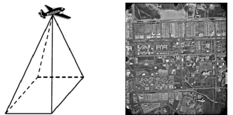
30 Black and white Image

31 Grayscale Image
32 False Color composite image

33 True Color composite image
34 Types of photographs (categorized by tilt) Vertical - camera axis as nearly vertical as Possible Oblique - camera axis intentionally tilted Low Oblique High Oblique

35 Types of photographs (categorized by tilt)


36 Vertical - Aerial Photo Mainly used for mapping


37 Low Oblique Aerial Photo Seldom used for mapping Low oblique (no horizon)


38 High Oblique Aerial Photo Horizon line in the photo Typically used for 3D city modeling
39 Aerial images are not maps! Characteristic of a Map vs a Photo Maps are based on parallel projection while photo has central projection Maps have a unique scale. Photo scale varies depending on terrain relief and degree of radial distortion
40 Image Acquisition for photogrammetric mapping
41 Image Acquisition
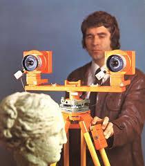
42 Precisely controlled image capture..
43 Precisely controlled image capture..

44 Image Acquisition Photos taken in parallel flight strips

45 Image Acquisition Each successive photograph overlap previous photo
46 Ground Control


47 Types of Ground Control Points

48 Types of Stereo Model control layout Full Stereo Model Control Stereo Model Control for Aero-triangulation
49 Types of Stereo Model control layout Full Stereo Model Control with Aero-triangulation
50 Ground Control Point Planning

51 Types of Stereo Model control layout Aero-Triangulation - (georeferencing all images for a unified block of ground control positions and tie points)
52 Photogrammetric Instruments


53 Direct Optical Projection Stereo plotters MULTIPLEX MODEL SKETCH

54 Direct Optical Projection Stereo plotters Kelsh Optical/ Mechanical Stereoplotter 1930s to 1970s

55 Direct Optical Projection Stereo plotters Wild Heerbrugg A8 Analogue Optical Mechanical Stereoplotter 1960s to 1980s

56 Direct Optical Projection Stereo plotters Wild BC2 analytical stereo-plotter. Analytical Optical/Electronic Stereoplotter 1980s 1990s

57 Softcopy (digital) Stereo plotters Digital Softcopy Stereoplotter 1990s - Present


58 3D Aerial Film Cameras Wild C Wild RC Wild RC30 & Zeiss TOP s


59 Imaging Cameras for Manned Aircraft Large Format RGB and IR 200 MP Medium Format RGB or IR MP Small Format RGB or IR MP


60 Imaging Cameras for Unmanned Aircraft High Quality Photogrammetric Mapping Calibrated Lens Distortion, Mid- Exposure Pulse, Fixed Focal Length Medium Quality Photogrammetric Mapping, Lens characterization, no MEP Imaging only, no photogrammetric mapping, no lens correction

61 Does camera choice effect accuracy? Canon S MP Horizontal RMSE = 6.4 cm Vertical RMSE = 14.0 cm Sony NEX-5 16 MP Horizontal RMSE = 1.3 cm Vertical RMSE = 1.9 cm
62 Sensor Size vs. image noise Camera Sensor Dimensions (mm) Rows x Columns (pixels) Pixel Area (μm 2 ) Canon S x x 3000 (12MP) 3.4 NEX-5R 23.4 x x 3264 (16MP) 28.8 The light collected is proportional to the sensor pixel area. Note that the NEX has 8 ½ times the area of the Canon this is a huge difference! Photon noise varies as the square root of the image signal, so collecting more light results in proportionally less noise, i.e. a higher signal-to-noise ratio is achieved. Higher signal-to-noise means more sensitivity to low-light situations, and broader dynamic range.

63 Image Noise Noise from Cannon S100 images Significant Noise Poor Conformance

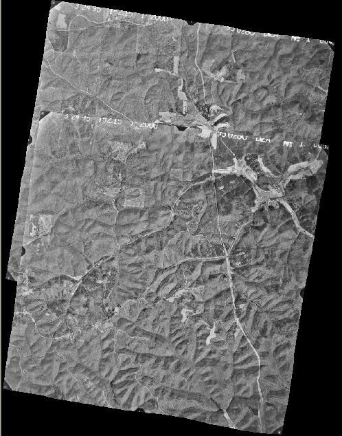
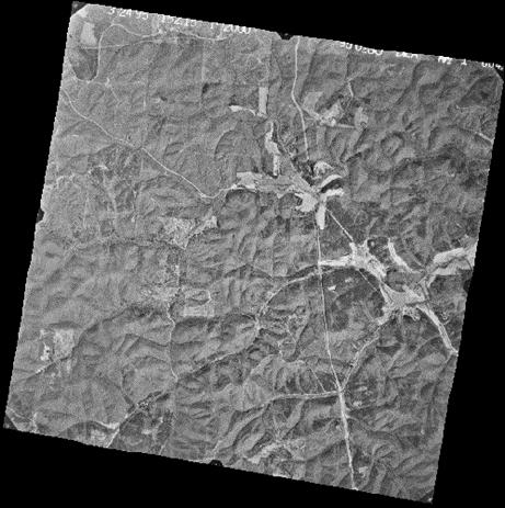
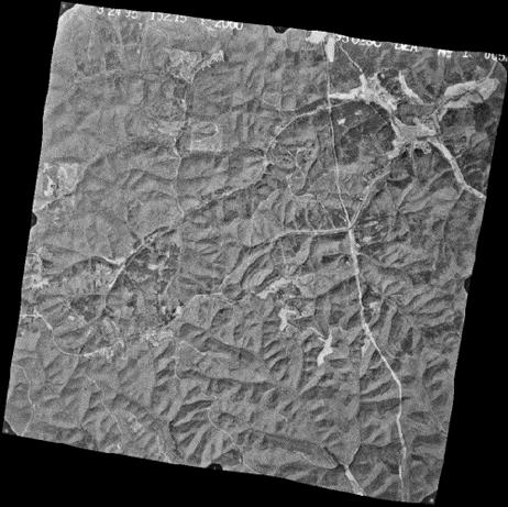
64 Image Noise Noise from NEX-5R Images Low Noise High Conformance

65 Focal length calibration Focal length is highly correlated with vertical scale and accuracy Precise focal length cannot be established for zoom lenses, even if the zoom feature is disabled.
66 Other Issues. Consumer cameras do not have a Mid-Exposure Pulse (MEP) o Real Time Kinematic GNSS o One must know the exact correlation of each photo center to the GNSS position at time of exposure o Common practice is to use the camera flash signal to create a MEP with modifications to the electronic circuitry Consumer cameras do not offer stock fixed focus lens options o Requires special lenses (which are expensive or not available for many consumer cameras.)


67 3D LIDAR Scanning Airborne LIDAR: Manned Aircraft Wide Area Mapping khz pulse rate OR Corridor Mapping khz pulse rate

68 Image Processing
69 Photogrammetric Image Processing o Ground Control (reference points, GPS, GNSS) o Aero-Triangulation - (georeferencing all images a unified block and tying the block to ground control positions) o Stereo Compilation (3D extraction of information from the georeferenced block of imagery) o Topographic Mapping o Orthophotography o Planimetric Mapping

70 Photogrammetric Image Processing Contour/topographic map

71 Photogrammetric Image Processing Topographic Map with Planimetric Features


72 Photogrammetric Image Processing o Orthophotography Vertical Photo Mosaic DTM/DSM (3D-view)

73 Photogrammetric Image Processing Orthophotography 3D Ortho Mosaic
74 Land Survey vs. UAS Survey Example UAS Survey GNSS Survey Comments Area 1.5 km km 2 Ground control setup & measurement 1 ¼ hr --- Ground control not required for all applications Setup time 15 min 15 min (per day) Survey time 45 min 30 ½ hr (4 days) Tear-down time 15 min 15 min (per day) Data processing time 4 hrs (2.80 GHz Intel Core i7, 16 GB RAM) --- Data can be processed overnight Total time 6 hr 30 min 32 hr 30 min 5x faster than GNSS Measurement sampling Distance 3.8 cm (at 120 m flight altitude) 15 m Minimum sampling size is 2.4 cm Horizontal accuracy 2 cm 1 cm Vertical accuracy 4 cm 2 cm

")

75 Topographic Survey Comparison Surface model generated from UAS survey (± 300,000 measurements) Surface model generated from GNSS survey (±1,000 measurements)
76 Questions
2017 TSPS Annual Conference & Tech Expo Unmanned Aircraft Systems (UAS) As a Tool for Land Surveyors
 As a Tool for Land Surveyors") 2017 TSPS Annual Conference & Tech Expo Unmanned Aircraft Systems (UAS) As a Tool for Land Surveyors George Southard GSKS Associates LLC Introduction George Southard: Master s Degree in Photogrammetry
2017 TSPS Annual Conference & Tech Expo Unmanned Aircraft Systems (UAS) As a Tool for Land Surveyors George Southard GSKS Associates LLC Introduction George Southard: Master s Degree in Photogrammetry
Aerial photography: Principles. Frame capture sensors: Analog film and digital cameras
 Aerial photography: Principles Frame capture sensors: Analog film and digital cameras Overview Introduction Frame vs scanning sensors Cameras (film and digital) Photogrammetry Orthophotos Air photos are
Photogrammetry. Lecture 4 September 7, 2005
 Photogrammetry Lecture 4 September 7, 2005 What is Photogrammetry Photogrammetry is the art and science of making accurate measurements by means of aerial photography: Analog photogrammetry (using films:
Sample Copy. Not For Distribution.
 Photogrammetry, GIS & Remote Sensing Quick Reference Book i EDUCREATION PUBLISHING Shubham Vihar, Mangla, Bilaspur, Chhattisgarh - 495001 Website: www.educreation.in Copyright, 2017, S.S. Manugula, V.
An Introduction to Geomatics. Prepared by: Dr. Maher A. El-Hallaq خاص بطلبة مساق مقدمة في علم. Associate Professor of Surveying IUG
 An Introduction to Geomatics خاص بطلبة مساق مقدمة في علم الجيوماتكس Prepared by: Dr. Maher A. El-Hallaq Associate Professor of Surveying IUG 1 Airborne Imagery Dr. Maher A. El-Hallaq Associate Professor
Leica ADS80 - Digital Airborne Imaging Solution NAIP, Salt Lake City 4 December 2008
 Luzern, Switzerland, acquired at 5 cm GSD, 2008. Leica ADS80 - Digital Airborne Imaging Solution NAIP, Salt Lake City 4 December 2008 Shawn Slade, Doug Flint and Ruedi Wagner Leica Geosystems AG, Airborne
PHOTOGRAMMETRY STEREOSCOPY FLIGHT PLANNING PHOTOGRAMMETRIC DEFINITIONS GROUND CONTROL INTRODUCTION
 PHOTOGRAMMETRY STEREOSCOPY FLIGHT PLANNING PHOTOGRAMMETRIC DEFINITIONS GROUND CONTROL INTRODUCTION Before aerial photography and photogrammetry became a reliable mapping tool, planimetric and topographic
Volume 1 - Module 6 Geometry of Aerial Photography. I. Classification of Photographs. Vertical
 RSCC Volume 1 Introduction to Photo Interpretation and Photogrammetry Table of Contents Module 1 Module 2 Module 3.1 Module 3.2 Module 4 Module 5 Module 6 Module 7 Module 8 Labs Volume 1 - Module 6 Geometry
Leica - 3 rd Generation Airborne Digital Sensors Features / Benefits for Remote Sensing & Environmental Applications
 Leica - 3 rd Generation Airborne Digital Sensors Features / Benefits for Remote Sensing & Environmental Applications Arthur Rohrbach, Sensor Sales Dir Europe, Middle-East and Africa (EMEA) Luzern, Switzerland,
Overview. Objectives. The ultimate goal is to compare the performance that different equipment offers us in a photogrammetric flight.
 Overview At present, one of the most commonly used technique for topographic surveys is aerial photogrammetry. This technique uses aerial images to determine the geometric properties of objects and spatial
MINNESOTA DEPARTMENT OF TRANSPORTATION OFFICE OF LAND MANAGEMENT SURVEYING AND MAPPING SECTION PHOTOGRAMMETRY UNIT
 SEP. 2011 MINNESOTA DEPARTMENT OF TRANSPORTATION OFFICE OF LAND MANAGEMENT SURVEYING AND MAPPING SECTION PHOTOGRAMMETRY UNIT SPECIAL PROVISIONS FOR: GROUP 1: AERIAL PHOTOGRAPHY/PHOTOGRAMMETRIC LAB SERVICES
HD aerial video for coastal zone ecological mapping
 HD aerial video for coastal zone ecological mapping Albert K. Chong University of Otago, Dunedin, New Zealand Phone: +64 3 479-7587 Fax: +64 3 479-7586 Email: albert.chong@surveying.otago.ac.nz Presented
Project Planning and Cost Estimating
 CHAPTER 17 Project Planning and Cost Estimating 17.1 INTRODUCTION Previous chapters have outlined and detailed technical aspects of photogrammetry. The basic tasks and equipment required to create various
Technical Evaluation of Khartoum State Mapping Project
 Technical Evaluation of Khartoum State Mapping Project Nagi Zomrawi 1 and Mohammed Fator 2 1 School of Surveying Engineering, Collage of Engineering, Sudan University of Science and Technology, Khartoum,
Aerial photography and Remote Sensing. Bikini Atoll, 2013 (60 years after nuclear bomb testing)
") Aerial photography and Remote Sensing Bikini Atoll, 2013 (60 years after nuclear bomb testing) Computers have linked mapping techniques under the umbrella term : Geomatics includes all the following spatial
Aerial photography and Remote Sensing Bikini Atoll, 2013 (60 years after nuclear bomb testing) Computers have linked mapping techniques under the umbrella term : Geomatics includes all the following spatial
HIGH RESOLUTION COLOR IMAGERY FOR ORTHOMAPS AND REMOTE SENSING. Author: Peter Fricker Director Product Management Image Sensors
 HIGH RESOLUTION COLOR IMAGERY FOR ORTHOMAPS AND REMOTE SENSING Author: Peter Fricker Director Product Management Image Sensors Co-Author: Tauno Saks Product Manager Airborne Data Acquisition Leica Geosystems
Lesson 4: Photogrammetry
 This work by the National Information Security and Geospatial Technologies Consortium (NISGTC), and except where otherwise Development was funded by the Department of Labor (DOL) Trade Adjustment Assistance
Phase One ixu-rs1000 Accuracy Assessment Report Yu. Raizman, PhaseOne.Industrial, Israel
 17 th International Scientific and Technical Conference FROM IMAGERY TO DIGITAL REALITY: ERS & Photogrammetry Phase One ixu-rs1000 Accuracy Assessment Report Yu. Raizman, PhaseOne.Industrial, Israel 1.
Processing of stereo scanner: from stereo plotter to pixel factory
 Photogrammetric Week '03 Dieter Fritsch (Ed.) Wichmann Verlag, Heidelberg, 2003 Bignone 141 Processing of stereo scanner: from stereo plotter to pixel factory FRANK BIGNONE, ISTAR, France ABSTRACT With
High Resolution Sensor Test Comparison with SPOT, KFA1000, KVR1000, IRS-1C and DPA in Lower Saxony
 High Resolution Sensor Test Comparison with SPOT, KFA1000, KVR1000, IRS-1C and DPA in Lower Saxony K. Jacobsen, G. Konecny, H. Wegmann Abstract The Institute for Photogrammetry and Engineering Surveys
EXAMPLES OF TOPOGRAPHIC MAPS PRODUCED FROM SPACE AND ACHIEVED ACCURACY CARAVAN Workshop on Mapping from Space, Phnom Penh, June 2000
 EXAMPLES OF TOPOGRAPHIC MAPS PRODUCED FROM SPACE AND ACHIEVED ACCURACY CARAVAN Workshop on Mapping from Space, Phnom Penh, June 2000 Jacobsen, Karsten University of Hannover Email: karsten@ipi.uni-hannover.de
Calibration Certificate
 Calibration Certificate Digital Mapping Camera (DMC) DMC Serial Number: DMC01-0053 CBU Serial Number: 0100053 For MPPG AERO Sp. z. o. o., ul. Kaczkowskiego 6 33-100 Tarnow Poland System Overview Flight
Five Sensors, One Day: Unmanned vs. Manned Logistics and Accuracy
 Five Sensors, One Day: Unmanned vs. Manned Logistics and Accuracy ASPRS UAS Mapping Technical Symposium Sept 13 th, 2016 Presenter: David Day, CP, GISP Keystone Aerial Surveys, Inc. Summary of activities
UAS Photogrammetry Best Practices
 UAS Photogrammetry Best Practices Pennsylvania Society of Land Surveyors January 15, 2019 Bryan Baker Certified Mapping Scientist (UAS) Bryan Baker UAS Sales Manager Leica Geosystems Reality Capture Team
Geometry of Aerial Photographs
 Geometry of Aerial Photographs Aerial Cameras Aerial cameras must be (details in lectures): Geometrically stable Have fast and efficient shutters Have high geometric and optical quality lenses They can
What is Photogrammetry
 Photogrammetry What is Photogrammetry Photogrammetry is the art and science of making accurate measurements by means of aerial photography: Analog photogrammetry (using films: hard-copy photos) Digital
Lecture 7. Leica ADS 80 Camera System and Imagery. Ontario ADS 80 FRI Imagery. NRMT 2270, Photogrammetry/Remote Sensing
 NRMT 2270, Photogrammetry/Remote Sensing Lecture 7 Leica ADS 80 Camera System and Imagery. Ontario ADS 80 FRI Imagery. Tomislav Sapic GIS Technologist Faculty of Natural Resources Management Lakehead University
Digital Aerial Photography UNBC March 22, Presented by: Dick Mynen TDB Consultants Inc.
 Digital Aerial Photography UNBC March 22, 2011 Presented by: Dick Mynen TDB Consultants Inc. Airborne Large Scale Digital Photography Who is using the technology in today s environment Options available
MEDIUM FORMAT CAMERA EVALUATION BASED ON THE LATEST PHASE ONE TECHNOLOGY
 MEDIUM FORMAT CAMERA EVALUATION BASED ON THE LATEST PHASE ONE TECHNOLOGY T.Tölg a, G. Kemper b, D. Kalinski c a Phase One / Germany tto@phaseone.com b GGS GmbH, Speyer / Germany kemper@ggs-speyer.de c
ACCURACY ASSESSMENT OF DIRECT GEOREFERENCING FOR PHOTOGRAMMETRIC APPLICATIONS ON SMALL UNMANNED AERIAL PLATFORMS
 ACCURACY ASSESSMENT OF DIRECT GEOREFERENCING FOR PHOTOGRAMMETRIC APPLICATIONS ON SMALL UNMANNED AERIAL PLATFORMS O. Mian a, J. Lutes a, G. Lipa a, J. J. Hutton a, E. Gavelle b S. Borghini c * a Applanix
Module 3 Introduction to GIS. Lecture 8 GIS data acquisition
 Module 3 Introduction to GIS Lecture 8 GIS data acquisition GIS workflow Data acquisition (geospatial data input) GPS Remote sensing (satellites, UAV s) LiDAR Digitized maps Attribute Data Management Data
Ground Control Configuration Analysis for Small Area UAV Imagery Based Mapping
 Ground Control Configuration Analysis for Small Area UAV Imagery Based Mapping ASPRS IGTF 2017, Baltimore, MD March 15 th, 2017 Presenter: David Day, CP, GISP Wes Weaver Keystone Aerial Surveys, Inc. Summary
CALIBRATING THE NEW ULTRACAM OSPREY OBLIQUE AERIAL SENSOR Michael Gruber, Wolfgang Walcher
 CALIBRATING THE NEW ULTRACAM OSPREY OBLIQUE AERIAL SENSOR Michael Gruber, Wolfgang Walcher Microsoft UltraCam Business Unit Anzengrubergasse 8/4, 8010 Graz / Austria {michgrub, wwalcher}@microsoft.com
Basics of Photogrammetry Note#6
 Basics of Photogrammetry Note#6 Photogrammetry Art and science of making accurate measurements by means of aerial photography Analog: visual and manual analysis of aerial photographs in hard-copy format
Govt. Engineering College Jhalawar Model Question Paper Subject- Remote Sensing & GIS
 Govt. Engineering College Jhalawar Model Question Paper Subject- Remote Sensing & GIS Time: Max. Marks: Q1. What is remote Sensing? Explain the basic components of a Remote Sensing system. Q2. What is
Using Low Cost DeskTop Publishing (DTP) Scanners for Aerial Photogrammetry
 Scanners for Aerial Photogrammetry") Journal of Geosciences and Geomatics, 21, Vol. 2, No., 17- Available online at http://pubs.sciepub.com/jgg/2//5 Science and Education Publishing DOI:1.12691/jgg-2--5 Using Low Cost DeskTop Publishing (DTP)
Journal of Geosciences and Geomatics, 21, Vol. 2, No., 17- Available online at http://pubs.sciepub.com/jgg/2//5 Science and Education Publishing DOI:1.12691/jgg-2--5 Using Low Cost DeskTop Publishing (DTP)
accuracy. You even hear the terms subcentimeter or even millimeter absolute accuracy during some of these
 Question: I would like to get your expert opinion on a dataset I just received. It is UAS-based imagery collected to produce a 50cm Digital Elevation Models (DEM) and 5cm resolution true color orthos.
Phase One 190MP Aerial System
 White Paper Phase One 190MP Aerial System Introduction Phase One Industrial s 100MP medium format aerial camera systems have earned a worldwide reputation for its high performance. They are commonly used
EnsoMOSAIC Aerial mapping tools
 EnsoMOSAIC Aerial mapping tools Jakarta and Kuala Lumpur, 2013 Contents MosaicMill MM Application examples Software introduction System introduction Rikola HS sensor UAV platform examples SW Syst HS UAV
Photomod Lite Contest 2013 Creating vegetation map using UAV at Seaside Palouki forest (Greece) by Apostolos Nteris
 by Apostolos Nteris") P r o j e c t I n f o r m a t i o n Title: Creating vegetation map using UAV at seaside Palouki forest (Greece) Author: Apostolos Nteris, Surveyor engineer OLYZON consulting - Trikala Greece Contact: Apostolos
P r o j e c t I n f o r m a t i o n Title: Creating vegetation map using UAV at seaside Palouki forest (Greece) Author: Apostolos Nteris, Surveyor engineer OLYZON consulting - Trikala Greece Contact: Apostolos
Acquisition of Aerial Photographs and/or Satellite Imagery
 Acquisition of Aerial Photographs and/or Satellite Imagery Acquisition of Aerial Photographs and/or Imagery From time to time there is considerable interest in the purchase of special-purpose photography
not to be republished NCERT Introduction To Aerial Photographs Chapter 6
 Chapter 6 Introduction To Aerial Photographs Figure 6.1 Terrestrial photograph of Mussorrie town of similar features, then we have to place ourselves somewhere in the air. When we do so and look down,
Chapter 1 Overview of imaging GIS
 Chapter 1 Overview of imaging GIS Imaging GIS, a term used in the medical imaging community (Wang 2012), is adopted here to describe a geographic information system (GIS) that displays, enhances, and facilitates
AIRPORT MAPPING JUNE 2016 EXPLORING UAS EFFECTIVENESS GEOSPATIAL SLAM TECHNOLOGY FEMA S ROMANCE WITH LIDAR VOLUME 6 ISSUE 4
 VOLUME 6 ISSUE 4 JUNE 2016 AIRPORT MAPPING 18 EXPLORING UAS EFFECTIVENESS 29 GEOSPATIAL SLAM TECHNOLOGY 36 FEMA S ROMANCE WITH LIDAR Nearly 2,000 U.S. landfill facilities stand to gain from cost-effective
Acquisition of Aerial Photographs and/or Imagery
 Acquisition of Aerial Photographs and/or Imagery Acquisition of Aerial Photographs and/or Imagery From time to time there is considerable interest in the purchase of special-purpose photography contracted
Camera Calibration Certificate No: DMC III 27542
 Calibration DMC III Camera Calibration Certificate No: DMC III 27542 For Peregrine Aerial Surveys, Inc. #201 1255 Townline Road Abbotsford, B.C. V2T 6E1 Canada Calib_DMCIII_27542.docx Document Version
PROPERTY OF THE LARGE FORMAT DIGITAL AERIAL CAMERA DMC II
 PROPERTY OF THE LARGE FORMAT DIGITAL AERIAL CAMERA II K. Jacobsen a, K. Neumann b a Institute of Photogrammetry and GeoInformation, Leibniz University Hannover, Germany jacobsen@ipi.uni-hannover.de b Z/I
Structure from Motion (SfM) Photogrammetry Field Methods Manual for Students
 Photogrammetry Field Methods Manual for Students") Structure from Motion (SfM) Photogrammetry Field Methods Manual for Students Written by Katherine Shervais (UNAVCO) Introduction to SfM for Field Education The purpose of the Analyzing High Resolution
Structure from Motion (SfM) Photogrammetry Field Methods Manual for Students Written by Katherine Shervais (UNAVCO) Introduction to SfM for Field Education The purpose of the Analyzing High Resolution
LECTURE NOTES 2016 CONTENTS. Sensors and Platforms for Acquisition of Aerial and Satellite Image Data
 LECTURE NOTES 2016 Prof. John TRINDER School of Civil and Environmental Engineering Telephone: (02) 9 385 5020 Fax: (02) 9 313 7493 j.trinder@unsw.edu.au CONTENTS Chapter 1 Chapter 2 Sensors and Platforms
Camera Calibration Certificate No: DMC II Aero Photo Europe Investigation
 Calibration DMC II 250 030 Camera Calibration Certificate No: DMC II 250 030 For Aero Photo Europe Investigation Aerodrome de Moulins Montbeugny Yzeure Cedex 03401 France Calib_DMCII250-030.docx Document
DMC PRACTICAL EXPERIENCE AND ACCURACY ASSESSMENT
 DMC PRACTICAL EXPERIENCE AND ACCURACY ASSESSMENT M. Madani 1, C. Dörstel 2, C. Heipke 3, K. Jacobsen 3 1 Z/I Imaging Corporation, Alabama, USA 2 Z/I Imaging GmbH, Aalen, Germany 3 Hanover University E-mail:
TELLS THE NUMBER OF PIXELS THE TRUTH? EFFECTIVE RESOLUTION OF LARGE SIZE DIGITAL FRAME CAMERAS
 TELLS THE NUMBER OF PIXELS THE TRUTH? EFFECTIVE RESOLUTION OF LARGE SIZE DIGITAL FRAME CAMERAS Karsten Jacobsen Leibniz University Hannover Nienburger Str. 1 D-30167 Hannover, Germany jacobsen@ipi.uni-hannover.de
FROM THE FIELD SHEET TO THE COMPLETE DIGITAL WORKFLOW
 FROM THE FIELD SHEET TO THE COMPLETE DIGITAL WORKFLOW Martin Gurtner Swisstopo, Federal Office of Topography, CH-3084 Wabern, Switzerland, martin.gurtner@swisstopo.ch Abstract The Swiss Federal Office
NRMT 2270, Photogrammetry/Remote Sensing. Lecture 4
 NRMT 2270, Photogrammetry/Remote Sensing Lecture 4 Cameras. Lenses. Photo Scale. Principles of Aerial Photography. Principle and Conjugate Principal Points. Vertical and Oblique Aerial photos. Stereo Viewing.
FLIGHT SUMMARY REPORT
 FLIGHT SUMMARY REPORT Flight Number: 97-011 Calendar/Julian Date: 23 October 1996 297 Sensor Package: Area(s) Covered: Wild-Heerbrugg RC-10 Airborne Visible and Infrared Imaging Spectrometer (AVIRIS) Southern
APPLICATIONS AND LESSONS LEARNED WITH AIRBORNE MULTISPECTRAL IMAGING
 APPLICATIONS AND LESSONS LEARNED WITH AIRBORNE MULTISPECTRAL IMAGING James M. Ellis and Hugh S. Dodd The MapFactory and HJW Walnut Creek and Oakland, California, U.S.A. ABSTRACT Airborne digital frame
THE NATIONAL AERIAL PHOTOGRAPHY PROGRAM: AN AERIAL SYSTEM IN SUPPORT OF THE UNITED STATES SPATIAL DATA INFRASTRUCTURE
 THE NATIONAL AERIAL PHOTOGRAPHY PROGRAM: AN AERIAL SYSTEM IN SUPPORT OF THE UNITED STATES SPATIAL DATA INFRASTRUCTURE Donald L. Light U.S. Geological Survey MS 511 National Center Reston, Virginia 22092
Application of GIS for earthquake hazard and risk assessment: Kathmandu, Nepal. Part 2: Data preparation GIS CASE STUDY
 GIS CASE STUDY Application of GIS for earthquake hazard and risk assessment: Kathmandu, Nepal Part 2: Data preparation Cees van Westen (E-mail : westen@itc.nl) Siefko Slob (E-mail: Slob@itc.nl) Lorena
CanImage. (Landsat 7 Orthoimages at the 1: Scale) Standards and Specifications Edition 1.0
 Standards and Specifications Edition 1.0") CanImage (Landsat 7 Orthoimages at the 1:50 000 Scale) Standards and Specifications Edition 1.0 Centre for Topographic Information Customer Support Group 2144 King Street West, Suite 010 Sherbrooke, QC
CanImage (Landsat 7 Orthoimages at the 1:50 000 Scale) Standards and Specifications Edition 1.0 Centre for Topographic Information Customer Support Group 2144 King Street West, Suite 010 Sherbrooke, QC
Camera Calibration Certificate No: DMC II
 Calibration DMC II 140-036 Camera Calibration Certificate No: DMC II 140-036 For Midwest Aerial Photography 7535 West Broad St, Galloway, OH 43119 USA Calib_DMCII140-036.docx Document Version 3.0 page
VERIFICATION OF POTENCY OF AERIAL DIGITAL OBLIQUE CAMERAS FOR AERIAL PHOTOGRAMMETRY IN JAPAN
 VERIFICATION OF POTENCY OF AERIAL DIGITAL OBLIQUE CAMERAS FOR AERIAL PHOTOGRAMMETRY IN JAPAN Ryuji. Nakada a, *, Masanori. Takigawa a, Tomowo. Ohga a, Noritsuna. Fujii a a Asia Air Survey Co. Ltd., Kawasaki
UAV PHOTOGRAMMETRY COMPARED TO TRADITIONAL RTK GPS SURVEYING
 UAV PHOTOGRAMMETRY COMPARED TO TRADITIONAL RTK GPS SURVEYING Brad C. Mathison and Amber Warlick March 20, 2016 Fearless Eye Inc. Kansas City, Missouri www.fearlesseye.com KEY WORDS: UAV, UAS, Accuracy
OLC Turnbull. wsidata.com
 OLC Turnbull wsidata.com August 26, 2013 Base station set up over control TURN_03 Data collected for: Department of Geology and Mineral Industries 800 NE Oregon Street Suite 965 Portland, OR 97232 Prepared
Camera Calibration Certificate No: DMC II
 Calibration DMC II 230 015 Camera Calibration Certificate No: DMC II 230 015 For Air Photographics, Inc. 2115 Kelly Island Road MARTINSBURG WV 25405 USA Calib_DMCII230-015_2014.docx Document Version 3.0
PHOTOGRAMMETRIC RESECTION DIFFERENCES BASED ON LABORATORY vs. OPERATIONAL CALIBRATIONS
 PHOTOGRAMMETRIC RESECTION DIFFERENCES BASED ON LABORATORY vs. OPERATIONAL CALIBRATIONS Dean C. MERCHANT Topo Photo Inc. Columbus, Ohio USA merchant.2@osu.edu KEY WORDS: Photogrammetry, Calibration, GPS,
Camera Calibration Certificate No: DMC II
 Calibration DMC II 140-005 Camera Calibration Certificate No: DMC II 140-005 For Midwest Aerial Photography 7535 West Broad St, Galloway, OH 43119 USA Calib_DMCII140-005.docx Document Version 3.0 page
MSB Imagery Program FAQ v1
 MSB Imagery Program FAQ v1 (F)requently (A)sked (Q)uestions 9/22/2016 This document is intended to answer commonly asked questions related to the MSB Recurring Aerial Imagery Program. Table of Contents
Camera Calibration Certificate No: DMC II
 Calibration DMC II 230 020 Camera Calibration Certificate No: DMC II 230 020 For MGGP Aero Sp. z o.o. ul. Słowackiego 33-37 33-100 Tarnów Poland Calib_DMCII230-020.docx Document Version 3.0 page 1 of 40
Camera Calibration Certificate No: DMC II
 Calibration DMC II 230 027 Camera Calibration Certificate No: DMC II 230 027 For Peregrine Aerial Surveys, Inc. 103-20200 56 th Ave Langley, BC V3A 8S1 Canada Calib_DMCII230-027.docx Document Version 3.0
Consumer digital CCD cameras
 CAMERAS Consumer digital CCD cameras Leica RC-30 Aerial Cameras Zeiss RMK Zeiss RMK in aircraft Vexcel UltraCam Digital (note multiple apertures Lenses for Leica RC-30. Many elements needed to minimize
Validation of the QuestUAV PPK System
 Validation of the QuestUAV PPK System 3cm in xy, 400ft, no GCPs, 100Ha, 25 flights Nigel King 1, Kerstin Traut 2, Cameron Weeks 3 & Ruairi Hardman 4 1 Director QuestUAV, 2 Data Analyst QuestUAV, 3 Production
How to. Go Smoothly. Make Your Next Project. Oblique color aerial photograph from a fl yover of the Island of Mayaguana in the Bahamas
 Color infrared aerial photograph (1:12,000) of a Cape Cod estuary for the U.S. Fish & Wildlife for use in aquatic vegetation studies Oblique color aerial photograph from a fl yover of the Island of Mayaguana
Content Reviewer (CR) Swati Katiyar Senior Research Fellow, Birla Institute of Scientific Research, Jaipur Language Editor (LE)
 Swati Katiyar Senior Research Fellow, Birla Institute of Scientific Research, Jaipur Language Editor (LE)") Component-I(A) - Personal Details Role Name Affiliation Principal Investigator Prof.MasoodAhsanSiddiqui Department of Geography, JamiaMilliaIslamia, New Delhi Paper Coordinator, if any Dr. M P Punia Head,
Component-I(A) - Personal Details Role Name Affiliation Principal Investigator Prof.MasoodAhsanSiddiqui Department of Geography, JamiaMilliaIslamia, New Delhi Paper Coordinator, if any Dr. M P Punia Head,
Figure 1 - The Main Screen of the e-foto Photogrammetric Project Creation and Management
 Introduction The Rio de Janeiro State University - UERJ After executing the integrated version of the e-foto, you will see the opening screen of the software, as shown in Figure 1 below. The main menu
UltraCam and UltraMap Towards All in One Solution by Photogrammetry
 Photogrammetric Week '11 Dieter Fritsch (Ed.) Wichmann/VDE Verlag, Belin & Offenbach, 2011 Wiechert, Gruber 33 UltraCam and UltraMap Towards All in One Solution by Photogrammetry ALEXANDER WIECHERT, MICHAEL
MONITORING RUBBLE-MOUND COASTAL STRUCTURES WITH PHOTOGRAMMETRY
 ,. CETN-III-21 2/84 MONITORING RUBBLE-MOUND COASTAL STRUCTURES WITH PHOTOGRAMMETRY INTRODUCTION: Monitoring coastal projects usually involves repeated surveys of coastal structures and/or beach profiles.
UltraCam and UltraMap An Update
 Photogrammetric Week '15 Dieter Fritsch (Ed.) Wichmann/VDE Verlag, Belin & Offenbach, 2015 Wiechert, Gruber 45 UltraCam and UltraMap An Update Alexander Wiechert, Michael Gruber, Graz ABSTRACT When UltraCam
DEM Generation Using a Digital Large Format Frame Camera
 DEM Generation Using a Digital Large Format Frame Camera Joachim Höhle Abstract Progress in automated photogrammetric DEM generation is presented. Starting from the procedures and the performance parameters
Remote Sensing is the observation of the Earth from satellites or aircrafts.
 Remote Sensing? Remote Sensing is the observation of the Earth from satellites or aircrafts. Sensors mounted on these platforms capture images of the Earth that reveal features may or may not apparent
GEOMETRIC RECTIFICATION OF EUROPEAN HISTORICAL ARCHIVES OF LANDSAT 1-3 MSS IMAGERY
 GEOMETRIC RECTIFICATION OF EUROPEAN HISTORICAL ARCHIVES OF LANDSAT -3 MSS IMAGERY Torbjörn Westin Satellus AB P.O.Box 427, SE-74 Solna, Sweden tw@ssc.se KEYWORDS: Landsat, MSS, rectification, orbital model
VisionMap Sensors and Processing Roadmap
 Vilan, Gozes 51 VisionMap Sensors and Processing Roadmap YARON VILAN, ADI GOZES, Tel-Aviv ABSTRACT The A3 is a family of digital aerial mapping cameras and photogrammetric processing systems, which is
Lab #10 Digital Orthophoto Creation (Using Leica Photogrammetry Suite)
") Lab #10 Digital Orthophoto Creation (Using Leica Photogrammetry Suite) References: Leica Photogrammetry Suite Project Manager: Users Guide, Leica Geosystems LLC. Leica Photogrammetry Suite 9.2 Introduction:
Lab #10 Digital Orthophoto Creation (Using Leica Photogrammetry Suite) References: Leica Photogrammetry Suite Project Manager: Users Guide, Leica Geosystems LLC. Leica Photogrammetry Suite 9.2 Introduction:
Flood modelling and management. Glasgow University. 8 September Paul Shaw - GeoVision
 Flood modelling and management Glasgow University 8 September 2004 Paul Shaw - GeoVision How important are heights in flood modelling? Comparison of data collection technologies GPS - Global Positioning
AERIAL SURVEY TEST PROJECT WITH DJI PHANTOM 3 QUADROCOPTER DRONE
 T. Jancso, P. Engler, P. Udvardy Aerial Survey Test Project with DJI Phantom 3 Quadrocopter Drone AERIAL SURVEY TEST PROJECT WITH DJI PHANTOM 3 QUADROCOPTER DRONE Tamas JANCSO, Associate Professor Phd
PRELIMINARY RESULTS FROM THE PORTABLE IMAGERY QUALITY ASSESSMENT TEST FIELD (PIQuAT) OF UAV IMAGERY FOR IMAGERY RECONNAISSANCE PURPOSES
 OF UAV IMAGERY FOR IMAGERY RECONNAISSANCE PURPOSES") PRELIMINARY RESULTS FROM THE PORTABLE IMAGERY QUALITY ASSESSMENT TEST FIELD (PIQuAT) OF UAV IMAGERY FOR IMAGERY RECONNAISSANCE PURPOSES R. Dabrowski a, A. Orych a, A. Jenerowicz a, P. Walczykowski a, a
PRELIMINARY RESULTS FROM THE PORTABLE IMAGERY QUALITY ASSESSMENT TEST FIELD (PIQuAT) OF UAV IMAGERY FOR IMAGERY RECONNAISSANCE PURPOSES R. Dabrowski a, A. Orych a, A. Jenerowicz a, P. Walczykowski a, a
POTENTIAL OF LARGE FORMAT DIGITAL AERIAL CAMERAS. Dr. Karsten Jacobsen Leibniz University Hannover, Germany
 POTENTIAL OF LARGE FORMAT DIGITAL AERIAL CAMERAS Dr. Karsten Jacobsen Leibniz University Hannover, Germany jacobsen@ipi.uni-hannover.de Introduction: Digital aerial cameras are replacing traditional analogue
CSI: Rombalds Moor Photogrammetry Photography
 Photogrammetry Photography Photogrammetry Training 26 th March 10:00 Welcome Presentation image capture Practice 12:30 13:15 Lunch More practice 16:00 (ish) Finish or earlier What is photogrammetry 'photo'
Camera Calibration Certificate No: DMC IIe
 Calibration DMC IIe 230 23522 Camera Calibration Certificate No: DMC IIe 230 23522 For Richard Crouse & Associates 467 Aviation Way Frederick, MD 21701 USA Calib_DMCIIe230-23522.docx Document Version 3.0
Introduction to Photogeology
 Geological Mapping 1 Academic Year 2016/2017 Introduction to Photogeology Igor Vlahović igor.vlahovic@rgn.hr Today we will say a little about basic photogeological analysis of terrain: about aerial photographs,
HISTORY OF REMOTE SENSING
 HISTORY OF REMOTE SENSING IMPORTANT PERIODS The beginning: photography and flight (1858-1918) Rapid developments in photogrammetry (1918-1939) Military imperatives (1939-1945) Cold wars and environmental
RPAS Photogrammetric Mapping Workflow and Accuracy
 RPAS Photogrammetric Mapping Workflow and Accuracy Dr Yincai Zhou & Dr Craig Roberts Surveying and Geospatial Engineering School of Civil and Environmental Engineering, UNSW Background RPAS category and
VisionMap A3 Edge A Single Camera for Multiple Solutions
 Photogrammetric Week '15 Dieter Fritsch (Ed.) Wichmann/VDE Verlag, Belin & Offenbach, 2015 Raizman, Gozes 57 VisionMap A3 Edge A Single Camera for Multiple Solutions Yuri Raizman, Adi Gozes, Tel-Aviv ABSTRACT
CEE 6100 / CSS 6600 Remote Sensing Fundamentals 1 Topic 4: Photogrammetry
 CEE 6100 / CSS 6600 Remote Sensing Fundamentals 1 PHOTOGRAMMETRY DEFINITION (adapted from Manual of Photographic Interpretation, 2 nd edition, Warren Philipson, 1997) Photogrammetry and Remote Sensing:
GEO 428: DEMs from GPS, Imagery, & Lidar Tuesday, September 11
 GEO 428: DEMs from GPS, Imagery, & Lidar Tuesday, September 11 Global Positioning Systems GPS is a technology that provides Location coordinates Elevation For any location with a decent view of the sky
ScienceDirect. The potential of UAV-based remote sensing for supporting precision agriculture in Indonesia
 Available online at www.sciencedirect.com ScienceDirect Procedia Environmental Sciences 24 (2015 ) 245 253 The 1st International Symposium on LAPAN-IPB Satellite for Food Security and Environmental Monitoring
Remote Sensing. The following figure is grey scale display of SPOT Panchromatic without stretching.
 Remote Sensing Objectives This unit will briefly explain display of remote sensing image, geometric correction, spatial enhancement, spectral enhancement and classification of remote sensing image. At
Principles of Photogrammetry
 Winter 2014 1 Instructor: Contact Information. Office: Room # ENE 229C. Tel: (403) 220-7105. E-mail: ahabib@ucalgary.ca Lectures (SB 148): Monday, Wednesday& Friday (10:00 a.m. 10:50 a.m.). Office Hours:
Airborne or Spaceborne Images for Topographic Mapping?
 Advances in Geosciences Konstantinos Perakis, Editor EARSeL, 2012 Airborne or Spaceborne Images for Topographic Mapping? Karsten Jacobsen Leibniz University Hannover, Institute of Photogrammetry and Geoinformation,
Remote Sensing. Measuring an object from a distance. For GIS, that means using photographic or satellite images to gather spatial data
 Remote Sensing Measuring an object from a distance For GIS, that means using photographic or satellite images to gather spatial data Remote Sensing measures electromagnetic energy reflected or emitted
Baldwin and Mobile Counties, AL Orthoimagery Project Report. Submitted: March 23, 2016
 2015 Orthoimagery Project Report Submitted: Prepared by: Quantum Spatial, Inc 523 Wellington Way, Suite 375 Lexington, KY 40503 859-277-8700 Page i of iii Contents Project Report 1. Summary / Scope...