How deep do you want to go?
|
|
|
- Edwina Phelps
- 5 years ago
- Views:
Transcription
1

2 KONGSBER G How deep do you want to go? Kongsberg Sim rad offers a complete range o f multibeam echo sounders All instruments are characterized by high mapping productivity in combination with exceptionally high sounding accuracy, and a dense pattern of soundings to cover the seafloor in order to reveal all details on the bottom. S h a llo w w ater EM 3002/EM /EM 2000 These high resolution m ultibeam echo sounders are com pact system s with robust sonar heads. Choose between portable or perm anent m ounting on any surve y vessel, including R O V/ AU Vs and tow ed vehicles. E o u O fu U) I O ) im u JQ (A cn c o 5 Medium w ater EM 1002 T his short to m edium range, high resolution m uitibeam echo sounder provides swath coverage up to 1500 m eters and m ay be supplied w ith an optional hull unit. Deep w ater EM 300/EM 120 These high perform ance m ultibeam echo sounders fo r deep w ate r m apping are the only system s w ith beam stabilization fo r both heave, roll, pitch and yaw m ovem ents. O u r SBP 120, sub-b ottom profiler m ay be integrated. Kongsberg Simrad offers free installation advice and world wide support. Kongsberg Simr3d AS A Telephone: horten.sales@kongsberg-simrad.com WORLD CLASS - through people, technology and dedication
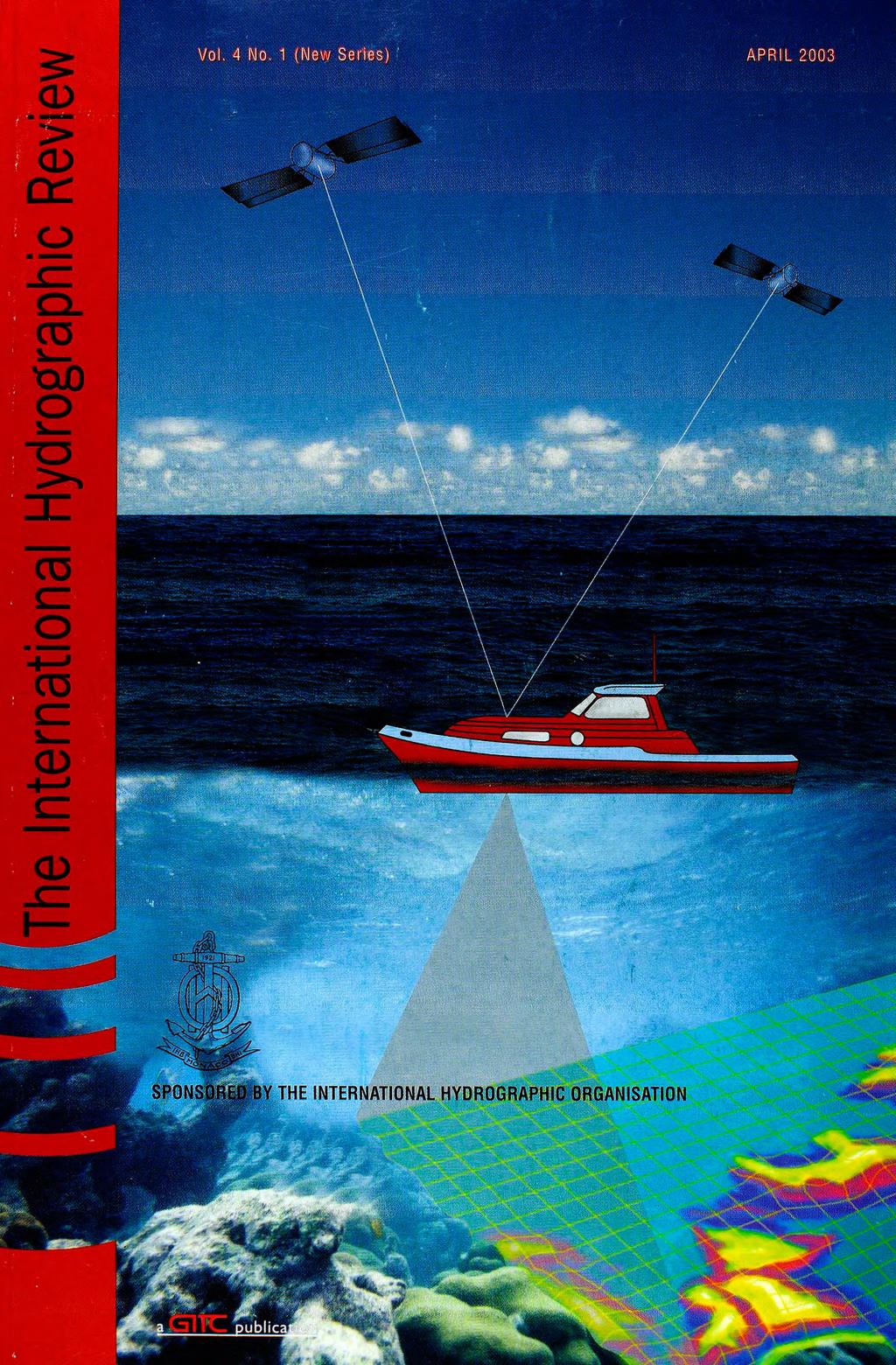
3 T he International Hyd rograph ic R eview SPONSORED BY THE INTERNATIONAL HYDROGRAPHIC ORGANISATION Published by: GITC bv, P.O Box 112, 8530 AC Lemmer, The Netherlands Tel.: +31 (514) , Fax: +31 (514) mailbox@gitc.nl, Web-site:
4 In t e r n a t io n a l h y d r o g r a p h ic r e v ie w

5 Contents B Editorial Adam J. Kerr Articles Dynamic Motion Residuals in Swatch Sonar Data: Ironing out the Creases By John E. Hughes Clarke, University of New Brunswick, Canada 6 The Geodetic Properties of the Equidistance Line By David H. Gray, Canadian Hydrographic Service, Ottawa, Canada 24 Analysis of Data Relevant to Establishing Outer Limits of a Continental Shelf under Law of the Sea Article 76 By Martin Jakobsson, Larry Mayer and Andrew Armstrong, University of New Hampshire, USA 36 Automatic Statistical Processing of Multibeam Echosounder Data By Brian Calder, University of New Hampshire, United Kingdom 53 Hydrography: Its Present State and Future Development By Z. Kopacz, W. Morgas and J. Urbanski, Naval University of Gdynia, Poland 69 Notes Loch Ness Survey 2002 By Peter Bennett, Kongsberg Simrad, United Kingdom 77 Co-tidal Reductions in Digital Hydrographic Survey By Lieutenant Commander AK Jolly, National Hydrographic Office, India 82 International Technical Assistance and Co-operation - Fifteen Years of Joint FIG/IHO Work in TACC - a Survey By Dr. Wilfried Schleider, Federal Republic of Germany 87 H Letter to the Editor Book Review Hi ObihiG rv " / , Instructions for Contributors
 : Horst Hecht : Robert Ward Editorial Manager :Nynke van den Berg Account Manager Johannes van")
6 The International Hydrographic Review Publishing Company :GITC bv President : I ng. Johan Boesjes Publication Director :Drs. Ing. Floris Siteur Editor-in-Chief :Adam J. Kerr Editorial Board :Michael Casey :Captain Hugo Gorziglia (International Hydrographic Organisation) : Horst Hecht : Robert Ward Editorial Manager :Nynke van den Berg Account Manager Johannes van der Schaar Circulation Manager :Jeroen Zaagemans Instructions for Contributors The International Hydrographic Review is an international journal published three times a year by GITC bv. It is sponsored by the International Hydrographic Organisation. It contains original papers concerning all aspects of hydrography and associated subjects. All articles are subjected to peer review and are expected to be 4,000 to 6,000 words long, although longer articles may be considered. It also provides a medium for discussions in the form of shorter Notes, that are typically 1,500 to 2,000 words in length. Information on the layout of articles and the form of illustrations and references may be obtained by requesting Instructions to Authors from the Editor. They are also published in the first issue of each year. Submissions should be send to: Mr. Adam Kerr or Flagstaff Cottage Lamorna Penzance Cornwall TR19 6XQ UNITED KINGDOM Tel.: +44 (0) Fax.: +44 (0) Adam.J.Kerr@btopenworld.com Nynke van den Berg GITC bv P.O. Box AC Lemmer THE NETHERLANDS Tel.: +31 (514) Fax: +31 (514) nynke.vandenberg@gitc.nl Information on the Layout of Articles and the form of illustrations and references may be obtained by requesting Instructions for Authors'. These are published in the first issue of each year and may be obtained by contacting the Editor. Reprints Reprints of all articles (including articles published in earlier issues) can be ordered. For more information, please contact Nynke van den Berg at GITC. Copyright Any permission needed to incorporate material published elsewhere is the responsibility of the authors and it will be assumed that such permission has been maintained. The publisher is not responsible for statements made in the articles or advertisements nor is responsible for typing or converting errors. No material may be reproduced in whole or in part without written permission of GITC bv. Subscription Information The Journal is published three times a year by GITC bv and can be obtained regularly by subscription. Please find below the subscription rates: Europe All other countries 1 year Individual US$ year Library US$ Should you wish to take out a subscription then please contact our Circulation Manager (jeroen.zaagemans@gitc.nl).
KONGSBERG seafloor-mapping echosounders
 KONGSBERG seafloor-mapping echosounders Berit Horvei WORLD CLASS through people, technology and dedication AGENDA Historical overview EM series Multibeam echosounder and Subbottom profiler Topside software.
The limits of spatial resolution achievable using a 30kHz multibeam sonar: model predictions and field results.
 The limits of spatial resolution achievable using a 30kHz multibeam sonar: model predictions and field results. John E. Hughes Clarke (1), James V. Gardner (2), Mike Torresan (2), and Larry Mayer (1) (1)
Kongsberg Maritime Product overview
 Kongsberg Maritime Product overview / 1 / 1-Nov-12 Frequency Range Coverage 125,250,500kHz 0.5-200m 12xD 200-400kHz 0.5-500m 5.5xD / 140-200 deg 300 khz 0.5-270m 4-10xD / 130-200 deg 70-100 khz 3-2000m
Acoustical images of the Gulf of Gdansk
 PROCEEDINGS of the 22 nd International Congress on Acoustics Underwater Acoustics: Paper ICA2016-427 Acoustical images of the Gulf of Gdansk Eugeniusz Kozaczka (a), Grazyna Grelowska (b) (a) Gdansk University
EK60. SCIENTIFIC SOUNDER SCIENTIFIC ECHO SOUNDER
 EK60 SCIENTIFIC ECHO SOUNDER HIGH DYNAMIC RANGE RAW DATA RECORDING LOW SELF NOISE HIGH PING RATE MULTI FREQUENCY APPLICATION FOR SPECIES ID SEVERAL FREQUENCIES COVERING SAME SAMPLE VOLUME REMOTE CONTROL
CONSIDERATIONS IN THE DESIGN, INSTALLATION AND OPERATION OF A COMPLETE SOUNDING SYSTEM
 International Hydrographic Review, Monaco, LXI (2), July 1984 CONSIDERATIONS IN THE DESIGN, INSTALLATION AND OPERATION OF A COMPLETE SOUNDING SYSTEM by Per Resen STEENSTRUP, M. Mech., Tech. Mang. This
Multibeam Echosounder Metadata and Quality Statistics
 Multibeam Echosounder Metadata and Quality Statistics Dave Mann, Survey Support Manager, Gardline Geosurvey Gardline MBES Systems Sea Explorer EM1002 RV Triton EM1002(S) Ocean Seeker EM1002(S) Ocean Endeavour
INTRODUCING AN OPERATIONAL MULTI-BEAM ARRAY SONAR
 INTRODUCING AN OPERATIONAL MULTI-BEAM ARRAY SONAR b y Morris F. G l e n n Oceanographer U.S. Naval Oceanographic Office PRECIS The Multi-Beam Array Sonar Survey System is a revolutionary new bathymetric
Proper Environmental Reduction for Attenuation in Multi-sector Sonars
 Rodrigo de Campos CARVALHO, Brazil and John E. HUGHES CLARKE, Canada SUMMARY Multibeam backscatter data represent a major seabed discrimination tool. For seafloor characterization, however, one of the
Company Profile. Facilities
 Company Profile R2Sonic was founded in February 2006 by three veteran underwater acoustical engineers; Jens R. Steenstrup, Mark Chun and Kirk Hobart; with the mission to utilize their experience to bring
08/10/2013. Marine Positioning Systems Surface and Underwater Positioning. egm502 seafloor mapping
 egm502 seafloor mapping lecture 8 navigation and positioning Marine Positioning Systems Surface and Underwater Positioning All observations at sea need to be related to a geographical position. To precisely
Simrad SX90 Long range high definition sonar system
 Simrad SX90 Long range high definition sonar system 360 omnidirectional sonar 90 vertical tip mode 20 to 30 KHz operational frequency Narrow beams Selectable beam width Hyperbolic FM Large dynamic range
Semi-buried seabed object detection: Sonar vs. Geophysical methods
 Semi-buried seabed object detection: Sonar vs. Geophysical methods Dino DRAGUN, Croatia, Lieselot NOPPE, Belgium, Pierre SERPE, Belgium, Emeline CARON, France, Astrid ROBERT, France Key words: Site Investigation,
Multibeam Water Column Imaging : Improved Wreck Least-Depth Determination
 Multibeam Water Column Imaging 1 Hughes Clarke, Lamplugh and Czotter Abstract Multibeam Water Column Imaging : Improved Wreck Least-Depth Determination John E. Hughes Clarke, Ocean Mapping Group, UNB,
Three-dimensional investigation of buried structures with multi-transducer parametric sub-bottom profiler as part of hydrographical applications
 Three-dimensional investigation of buried structures with multi-transducer parametric sub-bottom profiler as part Jens LOWAG, Germany, Dr. Jens WUNDERLICH, Germany, Peter HUEMBS, Germany Key words: parametric,
SONOBOT AUTONOMOUS HYDROGRAPHIC SURVEY VEHICLE PRODUCT INFORMATION GUIDE
 SONOBOT AUTONOMOUS HYDROGRAPHIC SURVEY VEHICLE PRODUCT INFORMATION GUIDE EvoLogics SONOBOT: Autonomous Surface Vehicle for Hydrographic Surveys High Precision Differential GPS for high-accuracy cartography
Multibeam data quality assurance at Genavir. Karine Abel Michaux
 Multibeam data quality assurance at Genavir Hervé Bisquay hbisquay@genavir.fr Karine Abel Michaux kabelmic@genavir.fr Pascal Viollette pviollette@genavir.fr GENAVIR Genavir is the operator of the civilian
Use of laser bathymetry at the German Baltic Sea coast. 9 November, 2016
 Use of laser bathymetry at the German Baltic Sea coast 9 November, 2016 Content Initial situation and aim of the project Organization and implementation Conclusions and next steps 16.02.2017 Ellmer: Laserbathymetry
Side-Scan Sonar Presentation STS
 Training Module Side-Scan Sonar Presentation STS SIDE-SCAN SONAR SAFETY Training Module Content: This module includes information on: Types of Side-Scan Benefits and Disadvantages System Configuration
CALTRANS BATHYMETRIC SURVEY VICINITY OF YERBA BUENA ISLAND AND OAKLAND MOLE ALONG SFOBB SAN FRANCISCO BAY
 FUGRO PELAGOS, INC. CALTRANS BATHYMETRIC SURVEY VICINITY OF YERBA BUENA ISLAND AND OAKLAND MOLE ALONG SFOBB SAN FRANCISCO BAY CALTRANS CONTRACT 59A0053 Survey Period: February 25 th March 1 st, 2013 Report
Synthesis of acoustic images of underwater targets
 FACULDADE DE ENGENHARIA DA UNIVERSIDADE DO PORTO Synthesis of acoustic images of underwater targets Duarte Nuno Reimão Borges Lopes Silva PREPARATION FOR THE MSC DISSERTATION Master in Electrical and Computers
Mid-Frequency Reverberation Measurements with Full Companion Environmental Support
 DISTRIBUTION STATEMENT A. Approved for public release; distribution is unlimited. Mid-Frequency Reverberation Measurements with Full Companion Environmental Support Dajun (DJ) Tang Applied Physics Laboratory,
GEBCO Centenary Conference
 GEBCO Centenary Conference Technical Developments in Depth Measurement Techniques and Position Determination from 1960 to 1980 Dave Wells and Steve Grant April 2003 Technical Developments in Depth / Positioning
NOTICE OF MARINE OPERATIONS
 Fugro EMU Limited Head Office Trafalgar Wharf (Unit 16) Hamilton Road Portchester Portsmouth PO6 4PX Tel: 02392 205 500 Fax: 02392 205 550 NOTICE OF MARINE OPERATIONS Notice is hereby given that Fugro
EM 710. Multibeam echo sounder
 EM 710 Multibeam echo sounder EM 710 Multibeam echo sounder Product description This document presents a brief technical description of the EM 710 multibeam echo sounder. About this document Rev Date
Research Vessel Technical Enhancement Committee (RVTEC) November 2009 Meeting ISS - Integrated Survey Systems
 November 2009 Meeting ISS - Integrated Survey Systems") Research Vessel Technical Enhancement Committee (RVTEC) November 2009 Meeting ISS - Integrated Survey Systems John Kiernan, P.E. SAIC - Marine Science and Technology Division ISS-2000 Integrated Survey
Research Vessel Technical Enhancement Committee (RVTEC) November 2009 Meeting ISS - Integrated Survey Systems John Kiernan, P.E. SAIC - Marine Science and Technology Division ISS-2000 Integrated Survey
SONOBOT AUTONOMOUS HYDROGRAPHIC SURVEY VEHICLE PRODUCT INFORMATION GUIDE
 SONOBOT AUTONOMOUS HYDROGRAPHIC SURVEY VEHICLE PRODUCT INFORMATION GUIDE EvoLogics Sonobot an autonomous unmanned surface vehicle for hydrographic surveys High Precision Differential GPS for high-accuracy
VDatum and SBET to Improve Accuracy of NOAA s High-Resolution Bathymetry
 VDatum and SBET to Improve Accuracy of NOAA s High-Resolution Bathymetry US HYDRO 2007 Extended Abstract Author: Crescent H. Moegling CoAuthor: Steve Brodet Moegling HYDRO 2007 1 Introduction NOAA s Hydrographic
Survey Sensors. 18/04/2018 Danny Wake Group Surveyor i-tech Services
 Survey Sensors 18/04/2018 Danny Wake Group Surveyor i-tech Services What do we need sensors for? For pure hydrographic surveying: Depth measurements Hazard identification Seabed composition Tides & currents
SonarWiz Datum Align Reference
 SonarWiz Datum Align Reference Rev 8.0, 12/22/2015 Chesapeake Technology, Inc. email: support@chesapeaketech.com Main Web site: http://www.chesapeaketech.com Support Web site: http://www.chestech-support.com
POSITION & ORIENTATION SYSTEMS FOR MARINE VESSELS
 POSITION & ORIENTATION SYSTEMS FOR MARINE VESSELS Applanix POS MV is the marine-survey industry s most accurate, robust, and reliable position and orientation solution available today. Representing the
Teledyne Marine Acoustic Imagining
 RESON SeaBat high performance sonars for long range object detection and MCM applications Navigation, object avoidance & up close inspection with BlueView Greg Probst Sales Manager, Defense Teledyne Marine
R/V Falkor Multibeam Echosounder System Calibration September 22 24, 2014
 R/V Falkor Multibeam Echosounder System Calibration September 22 24, 2014 Report prepared by: Paul D. Johnson Ocean Mapping/Joint Hydrographic Center 24 Colovos Road University of New Hampshire Durham,
global acoustic positioning system GAPS usbl acoustic with integrated INS positioning system Ixsea Oceano GAPS page 1
 global acoustic positioning system usbl acoustic positioning system with integrated INS positioning system page 1 THE MERGER OF INERTIAL AND UNDERWATER ACOUSTIC TECHNOLOGIES is a unique Global Acoustic
Evolution of Sonar Survey Systems for Sea Floor Studies.
 Everant.org/ETJ Research Article Engineering and Technology Journal ISSN: 2456-3358 Impact Factor: 3.449 Evolution of Sonar Survey Systems for Sea Floor Studies. Milind Naik 1, Govind Ranade 2, R. B. Lohani
EGYPTIAN HYDROGRAPHIC DEPARTMENT THE EGYPTIAN HYDROGRAPHIC FRAMEWORK
 gvt THE EGYPTIAN HYDROGRAPHIC FRAMEWORK The roles of a national Hydrographic Service can be summarized in collecting georeferenced data through systematic surveys at sea and along the coast related to:
Quick start guide M3 Sonar
 Quick start guide M3 Sonar Creating an image mosaic using Photoshop and Geographic Imager 2013, Kongsberg Mesotech Ltd. 922-20007005 M3 Sonar Quick start guide Creating an image mosaic using Photoshop
Defense and Maritime Solutions
 Defense and Maritime Solutions Automatic Contact Detection in Side-Scan Sonar Data Rebecca T. Quintal Data Processing Center Manager John Shannon Byrne Software Manager Deborah M. Smith Lead Hydrographer
AN AIDED NAVIGATION POST PROCESSING FILTER FOR DETAILED SEABED MAPPING UUVS
 MODELING, IDENTIFICATION AND CONTROL, 1999, VOL. 20, NO. 3, 165-175 doi: 10.4173/mic.1999.3.2 AN AIDED NAVIGATION POST PROCESSING FILTER FOR DETAILED SEABED MAPPING UUVS Kenneth Gade and Bjørn Jalving
R/V Falkor Multibeam Echosounder System Review
 University of New Hampshire University of New Hampshire Scholars' Repository Center for Coastal and Ocean Mapping Center for Coastal and Ocean Mapping 4-2-2013 R/V Falkor Multibeam Echosounder System Review
Marine Institute Job Description
 Marine Institute Job Description Position Contract Service Group Location Temporary Scientific & Technical Officer (STO), Hydrographic Data Processor (INFOMAR) Temporary specified purpose contract for
Automation at Depth: Ocean Infinity and seabed mapping using multiple AUVs
 Automation at Depth: Ocean Infinity and seabed mapping using multiple AUVs Ocean Infinity s seabed mapping campaign commenced in the summer of 2017. The Ocean Infinity team is made up of individuals from
Increased Safety and Efficiency using 3D Real-Time Sonar for Subsea Construction
 Increased Safety and Efficiency using 3D Real-Time Sonar for Subsea Construction Chief Technology Officer CodaOctopus Products, Ltd. Booth A33a 2D, 3D and Real-Time 3D (4D) Sonars? 2D Imaging 3D Multibeam
RVIB Nathaniel B. Palmer EM122 Multibeam Echosounder Sea Acceptance Trial for TX/RX Arrays NBP1505 June 10-15, 2015
 RVIB Nathaniel B. Palmer EM122 Multibeam Echosounder Sea Acceptance Trial for TX/RX Arrays NBP1505 June 10-15, 2015 Report prepared by: Paul Johnson and Kevin Jerram University of New Hampshire Center
Myanmar Naval Hydrographic Centre. National Report for 13 th North Indian Ocean Hydrographic Commission Meeting
 Myanmar Naval Hydrographic Centre National Report for 13 th North Indian Ocean Hydrographic Commission Meeting Yangon, Myanmar 19 th 22 nd February 2013 CONTENT 1. Myanmar Naval Hydrographic Centre 2.
Competitive Strategy. Supply Chain Strategy. Supply Chain Structure. Drivers for Supply Chain Performance
 Competitive Strategy Supply Chain Strategy Supply Chain Structure Efficiency Responsiveness Facility Transportation Inventory Information Drivers for Supply Chain Performance 9 772150 405004 03 Journal
SYSTEM 5900 SIDE SCAN SONAR
 SYSTEM 5900 SIDE SCAN SONAR HIGH-RESOLUTION, DYNAMICALLY FOCUSED, MULTI-BEAM SIDE SCAN SONAR Klein Marine System s 5900 sonar is the flagship in our exclusive family of multi-beam technology-based side
Helping Build Your Capacity in Nautical Charting & Hydrography
 Helping Build Your Capacity in Nautical Charting & Hydrography Helping Chart your World Rajesh Alla Riyadh, Kingdom of Saudi Arabia 04-06 March 2013 Company Background Marine Services Capacity Building
Inertial Systems. Ekinox 2 Series TACTICAL GRADE MEMS. Motion Sensing & Navigation IMU AHRS MRU INS VG
 Ekinox 2 Series TACTICAL GRADE MEMS Inertial Systems IMU AHRS MRU INS VG ITAR Free 0.02 RMS Motion Sensing & Navigation AEROSPACE GROUND MARINE EKINOX 2 SERIES R&D specialists usually compromise between
Inertial Navigation System
 Apogee Series ULTIMATE ACCURACY MEMS Inertial Navigation System INS MRU AHRS ITAR Free 0.005 RMS Motion Sensing & Georeferencing APOGEE SERIES makes high accuracy affordable for all surveying companies.
Applanix Products and Solutions for Hydrographic Survey & Marine Applications Maximize Your Productivity!
 Applanix Products and Solutions for Hydrographic Survey & Marine Applications Maximize Your Productivity! Applanix technology and support gives you the advantage: lower costs of deployment, faster times
SONARMITE v4.0 MTX sweep version - PORTABLE BLUETOOTH ECHO SOUNDER
 SONARMITE v4.0 MTX sweep version - PORTABLE BLUETOOTH ECHO SOUNDER Introduction The SonarMite Echo Sounder was the result of nearly two years research and development to further extend the boundaries of
BRINGING CLARITY TO THE WORLD BELOW THE COMPLETE UNDERWATER MAPPING PRODUCT RANGE
 BRINGING CLARITY TO THE WORLD BELOW THE COMPLETE UNDERWATER MAPPING PRODUCT RANGE BRINGING CLARITY TO THE WORLD BELOW OUR MISSION We shall earn the respect and recognition for our dedication to provide
Sonars TECHNOLOGY FOR SUSTAINABLE FISHERIES
 Sonars TECHNOLOGY FOR SUSTAINABLE FISHERIES SIMRAD SU90 SONAR The SU90 Sonar is made with no compromises. The number of channels has been increased by 50% compared to the SX90 Sonar giving the sonar an
Durham Research Online
 Durham Research Online Deposited in DRO: 24 August 2015 Version of attached le: Accepted Version Peer-review status of attached le: Peer-reviewed Citation for published item: Setchell, J.M. (2017) 'International
UNDERWATER SCIENCE. Single Beam Systems TECHNOLOGY FOR SUSTAINABLE FISHERIES
 UNDERWATER SCIENCE Single Beam Systems TECHNOLOGY FOR SUSTAINABLE FISHERIES SIMRAD EK SYSTEMS EK is our common name for all single beam echo sounders designed for research applications. The first EK sounder
Pipeline Inspection and Environmental Monitoring Using AUVs
 Pipeline Inspection and Environmental Monitoring Using AUVs Bjørn Jalving, Bjørn Gjelstad, Kongsberg Maritime AUV Workshop, IRIS Biomiljø, 7 8 September 2011 WORLD CLASS through people, technology and
LT Matthew Forney, NOAA Navigation Manager Alaska Region Bering Strait MaritimeSymposium. Office of Coast Survey
 NOAA LT Matthew Forney, NOAA Navigation Manager Alaska Region Bering Strait MaritimeSymposium Who is Coast Survey? First science agency of the U.S. Formed in 1807 Responsible for surveying 3.4 million
Development of Mid-Frequency Multibeam Sonar for Fisheries Applications
 Development of Mid-Frequency Multibeam Sonar for Fisheries Applications John K. Horne University of Washington, School of Aquatic and Fishery Sciences Box 355020 Seattle, WA 98195 phone: (206) 221-6890
Progress and Prospects of Hydrographic Surveying Technology in China
 Progress and Prospects of Hydrographic Surveying Technology in China By Huang Motao, Zhai Guojun, Ouyang Yongzhong, Liu Yanchun and Lu Xiuping, Tianjin Institute of Hydrographic Surveying and Charting,
Ian Church 1, Steven Brucker 1, Dr. John Hughes Clarke 1, Susan Haigh 1, Jason Bartlett 2 and Tim Janzen 2
 Developing Strategies to Facilitate using Post Processed GPS and Tidal Models Ian Church 1, Steven Brucker 1, Dr. John Hughes Clarke 1, Susan Haigh 1, Jason Bartlett 2 and Tim Janzen 2 1: Dept. Geodesy
Inertial Systems. Ekinox Series TACTICAL GRADE MEMS. Motion Sensing & Navigation IMU AHRS MRU INS VG
 Ekinox Series TACTICAL GRADE MEMS Inertial Systems IMU AHRS MRU INS VG ITAR Free 0.05 RMS Motion Sensing & Navigation AEROSPACE GROUND MARINE EKINOX SERIES R&D specialists usually compromise between high
Im proved M anual M ethods of Coordinated Signal Tim ing
 Im proved M anual M ethods of Coordinated Signal Tim ing R o b e r t M. Sh a n t e a u Research Associate Joint Highway R esearch Project IN T R O D U C T IO N T his p ap er addresses the problem of finding
Gyrocompass and motion sensor. octans. navigation and positioning
 Gyrocompass and motion sensor octans navigation and positioning the best in fog technology The technological heart of is the Fibre-Optic Gyroscope (FOG), the only truly-solid-state answer to rotation sensing.
Better Business Regulation in a Risk Society
 Better Business Regulation in a Risk Society Alberto Alemanno Frank den Butter André Nijsen Jacopo Torriti Editors Better Business Regulation in a Risk Society Editors Alberto Alemanno Department of Law
Acoustic Resonance Classification of Swimbladder-Bearing Fish
 Acoustic Resonance Classification of Swimbladder-Bearing Fish Timothy K. Stanton and Dezhang Chu Applied Ocean Physics and Engineering Department Woods Hole Oceanographic Institution Bigelow 201, MS #11
Satellite-derived bathymetry: A reconnaissance tool for hydrography
 University of New Hampshire University of New Hampshire Scholars' Repository Center for Coastal and Ocean Mapping Center for Coastal and Ocean Mapping 8-2013 Satellite-derived bathymetry: A reconnaissance
Applications of iusbl Technology overview
 Applications of iusbl Technology overview Tom Bennetts Project Manager Summary 1. What is iusbl and its target applications 2. Advantages of iusbl and sample data 3. Technical hurdles and Calibration methods
THE EVOLUTION OF THE INTERNATIONAL SPATIAL ARCHITECTURE OF CLUSTERING AND VALUE NETWORKS
 THE EVOLUTION OF THE INTERNATIONAL SPATIAL ARCHITECTURE OF CLUSTERING AND VALUE NETWORKS OECD Directorate for Science, Technology and Industry Indicators and Analysis for Science, Technology and Innovation
REPORT. Technical Visit THE ISLAMIC REPUBLIC OF IRAN February 2007
 REPORT Technical Visit to THE ISLAMIC REPUBLIC OF IRAN 20-22 February 2007 2 Technical Visit to the Islamic Republic of Iran (IHO Work Program 2007, Tasks 2.1.7 and 2.1.10) 20-22 February 2007 I.- General
GNSS Based Hydrographic Surveying: clear advantages and hidden obstacles
 GNSS Based Hydrographic Surveying: clear advantages and hidden obstacles Thijs Ligteringen MSc., John Loog MSc, Dr. Leendert Dorst Hydrographic Service of the Royal Netherlands Navy P.O.Box 10.000; 1780CA
Africa Research Journal
 SAIEE AFRICA RESEARCH JOURNAL Vol 100 No.1 pp 1-22 ISSN 1991-1696 Africa Research Journal Research Journal of the South African Institute of Electrical Engineers Incorporating the SAIEE Transactions www.saiee.org.za
2011 Capital Markets Day
 2011 Capital Markets Day Geir Håøy President Kongsberg Maritime WORLD CLASS through people, technology and dedication Kongsberg Maritime Introduction Significant market position within the drilling segment
Using synthetic aperture sonar as an effective hydrographic survey tool
 Using synthetic aperture sonar as an effective hydrographic survey tool Andy Hoggarth 1 (presenter), Karl Kenny 2 1. CARIS 1, 115 Waggoners Lane, Fredericton, NB CANADA E3B 2L4, 506-458-8533 2. Kraken
The Research Vessel Maurice Ewing
 Research Vessel Maurice Ewing in the Gulf of Corinth August 2001 The Research Vessel Maurice Ewing Length: Disp. Tonnage: 237 feet 2598 long tons Year Built: 1983 (converted 1989-1990) Endurance: 50 days
R E P O R T. of the BSHC Working Group for the Harmonization of the Chart Datum of the Baltic Sea (CDWG)
") 12-14 June 2007 Explanatory Note Klaipeda, Lithuania R E P O R T of the BSHC Working Group for the Harmonization of the Chart Datum of the Baltic Sea (CDWG) Activities of the CDWG The CDWG was established
12-14 June 2007 Explanatory Note Klaipeda, Lithuania R E P O R T of the BSHC Working Group for the Harmonization of the Chart Datum of the Baltic Sea (CDWG) Activities of the CDWG The CDWG was established
A Survey of Mariners' Opinions on Using Electronic Charts
 s i l s Note A Survey of Mariners' Opinions on Using Electronic Charts Igor Karnicnik, M.Sc., Geodetic Institute of Slovenia, Slovenia. A new component of modern shipborne navigation equipment is the Electronic
Annex I Content, format and structure of annual reports for exploration under contract for polymetallic nodules
 Annex I Content, format and structure of annual reports for exploration under contract for polymetallic nodules I, Executive summary 1. The Contractor is requested to provide a summary of major achievements
Lake Borgne, Louisiana Debris Mapping
 Lake Borgne, Louisiana Debris Mapping Abstract Gary R. Davis, Paul L. Donaldson, Walter Simmons, Rebecca Quintal Science Applications International Corporation 221 Third Street Newport, RI 02840 USA Under
The Application of Autonomous Underwater Vehicle (AUV) Technology in the Oil Industry Vision and Experiences
 Technology in the Oil Industry Vision and Experiences") The Application of Autonomous Underwater Vehicle (AUV) Technology in the Oil Industry Vision and David BINGHAM and Tony DRAKE, United Kingdom, Andrew HILL, USA and Roger LOTT, United Kingdom Key words:
The Application of Autonomous Underwater Vehicle (AUV) Technology in the Oil Industry Vision and David BINGHAM and Tony DRAKE, United Kingdom, Andrew HILL, USA and Roger LOTT, United Kingdom Key words:
NOAA s National Ocean Service / Office of Coast Survey
 Coast Survey OCS 1807 2007 Maintains over 1000 nautical charts & 9 Coast Pilots Surveys over 3.4M SNM of oceans and lakes Conducts research and development in hydrography Thomas Jefferson Founder of The
Inertial Navigation System
 Apogee Marine Series ULTIMATE ACCURACY MEMS Inertial Navigation System INS MRU AHRS ITAR Free 0.005 RMS Navigation, Motion & Heave Sensing APOGEE SERIES makes high accuracy affordable for all surveying
SANDHAYAK CLASS A NEW CLASS OF INDIAN SURVEYING SHIP
 Intern a tio n a l H ydrographic Review, Monaco, LXI (I), January 1984 SANDHAYAK CLASS A NEW CLASS OF INDIAN SURVEYING SHIP by the Indian Naval Hydrographic Office'* In 1973, the Government of India approved
PUBLISHABLE FINAL ACTIVITY REPORT
 SCRATCH PHASE IV Support for SMEs Collaborative Aeronautical Technical Research Contract N : ASA3-CT-2004-510981 Specific Support Action Specific Programme: Integrating and strengthening the ERA Thematic
bendis writer jake thomas & john denning assistant editors
 Previously in Age of ultron years Ago, founding Avenger Henry Pym invented the ArtificiAl intelligence known As ultron. once ultron became sentient, He dedicated His existence to destroying HumAnity. the
GEO-MARINE TECHNOLOGY, INC. A Geological, Geophysical, and Hydrographic Survey Consultancy
 COMPANY PROFILE OUR MISSION AND TRADE OUR MISSION: OUR TRADE: We few, professional scientists strive to support the objectives of our marine energy and telecommunications clients with cooperation, innovation
Example: COUNTY: Engine 225, County, are you requesting to 2nd alarm? UNIT: Engine 225, Affirmative.
 CAD UNIT AND RUN CARD CHANGES Department Chiefs must notify Brunswick County 9-1-1 in writing in advance of new apparatus being delivered, units that are being retired and services that may no longer be
HYDROGRAPHISCHE NACHRICHTEN
 HYDROGRAPHISCHE NACHRICHTEN Fachzeitschrift für Hydrographie und Geoinformation 02/2015 First International Issue Hydrography made in Germany Bathymetry of Lake Constance Extensive sheet pile wall inspection
Harpoon 4.2 Evolution and Improvements
 Harpoon 4.2 Evolution and Improvements Larry Bond and Christopher Carlson Historicon 2018 Admiralty Trilogy Seminar Introduction u Harpoon 4.1 published in 2001! u Legacy upgrade started in 2015 It was
Estimating Fish Densities from Single Fish Echo Traces
 The Open Ocean Engineering Journal, 2009, 2, 17-32 17 Estimating Fish Densities from Single Fish Echo Traces Open Access Magnar Aksland * University of Bergen, Department of Biology, P.O. Box 7800, N-5020
ELAN Microelectronics 33221B-3B00 Touchpad Controller
 ELAN Microelectronics 33221B-3B00 Basic Functional Analysis 1891 Robertson Road, Suite 500, Ottawa, ON K2H 5B7 Canada Tel: 613-829-0414 chipworks.com Basic Functional Analysis 2 Some of the information
Handling Interferometric Data: Streamlining the Processing Flow
 Handling Interferometric Data: Streamlining the Processing Flow Paper 5 at Hydro8, 4 th November 2008 Tom Hiller, Advanced Products Manager, GeoAcoustics Ltd. WORLD CLASS through people, technology and
R/V Falkor Multibeam Echosounder System Review
 R/V Falkor Multibeam Echosounder System Review February 12, 2014 Report prepared by: Jonathan D. Beaudoin, Paul D. Johnson and Ashton F. Flinders Center for Coastal and Ocean Mapping/Joint Hydrographic
Old House Channel Bathymetric and Side Scan Survey
 FIELD RESEARCH FACILITY DUCK, NC Old House Channel Bathymetric and Side Scan Survey COASTAL AND HYDRAULICS LABORATORY FIELD DATA COLLECTION AND ANALYSIS BRANCH Michael Forte December 2009 View looking
WASSP S3 MULTIBEAM FOR SURVEY & MAPPING EXPLORE IT ALL
 WASSP S3 EXPLORE IT ALL DISCOVER A NEW WORLD WITH THE LATEST INNOVATION FROM WASSP Outstanding performance, versatility and value. That s what you expect and exactly what you get with the new S3 sounder
Durham Research Online
 Durham Research Online Deposited in DRO: 29 August 2017 Version of attached le: Accepted Version Peer-review status of attached le: Not peer-reviewed Citation for published item: Chiu, Wei-Yu and Sun,
USING THE ZELLO VOICE TRAFFIC AND OPERATIONS NETS
 USING THE ZELLO VOICE TRAFFIC AND OPERATIONS NETS A training course for REACT Teams and members This is the third course of a three course sequence the use of REACT s training and operations nets in major
Optimizing Resolution and Uncertainty in Bathymetric Sonar Systems
 University of New Hampshire University of New Hampshire Scholars' Repository Center for Coastal and Ocean Mapping Center for Coastal and Ocean Mapping 6-2013 Optimizing Resolution and Uncertainty in Bathymetric
CODEVINTEC. Miniature and accurate IMU, AHRS, INS/GNSS Attitude and Heading Reference Systems
 45 27 39.384 N 9 07 30.145 E Miniature and accurate IMU, AHRS, INS/GNSS Attitude and Heading Reference Systems Aerospace Land/Automotive Marine Subsea Miniature inertial sensors 0.1 Ellipse Series New