Satellite-derived bathymetry: A reconnaissance tool for hydrography
|
|
|
- Arron Baker
- 5 years ago
- Views:
Transcription

1 University of New Hampshire University of New Hampshire Scholars' Repository Center for Coastal and Ocean Mapping Center for Coastal and Ocean Mapping Satellite-derived bathymetry: A reconnaissance tool for hydrography Shachak Pe'eri University of New Hampshire, Durham, shachak.peeri@unh.edu Christopher Parrish University of New Hampshire, Durham Lee Alexander University of New Hampshire, Durham, lee.alexander@unh.edu Andy Armstrong University of New Hampshire, Durham Follow this and additional works at: Part of the Oceanography and Atmospheric Sciences and Meteorology Commons Recommended Citation Pe'eri, Shachak; Parrish, Christopher; Alexander, Lee; and Armstrong, Andy, "Satellite-derived bathymetry: A reconnaissance tool for hydrography" (2013). JALBTCX Annual workshop This Conference Proceeding is brought to you for free and open access by the Center for Coastal and Ocean Mapping at University of New Hampshire Scholars' Repository. It has been accepted for inclusion in Center for Coastal and Ocean Mapping by an authorized administrator of University of New Hampshire Scholars' Repository. For more information, please contact nicole.hentz@unh.edu.
2 Satellite-derived bathymetry: A reconnaissance tool for hydrography This conference proceeding is available at University of New Hampshire Scholars' Repository:


3 Shachak Pe eri 1, Christopher Parrish 2,3, Lee Alexander 1, and Andrew Armstrong 1,3 1 Center for Coastal and Ocean Mapping, University of New Hampshire, Durham, NH, USA 2 NGS Remote Sensing Division, NOAA/NOS, National Geodetic Survey, Silver Spring, MD, USA 3 Joint Hydrographic Center, National Oceanic and Atmospheric Administration, Durham, NH, USA 1
4 The image cannot be displayed. Your computer may not have enough memory to open the image, or the image may have been corrupted. Restart your computer, and then open the file again. If the red x still appears, you may have to delete the image and then insert it again. SDB: Technical overview Approaches: Inversion methods (e.g., Lyzenga 1978, 2006; Philpot 1989) Ratio approaches (e.g., Dierssen et al. 2003; Stumpf et al. 2003) Look-up tables (LUT) (e.g., Louchard et al. 2001) Z = Stumpf et al m 0 ln ln ( L ( λ )) obs i m1 ( L ( λ )) obs j L obs (λ i ), L obs (λ j )-radiance values m o - gain m 1 - offset 2
5 SDB: Study activities Developed a satellite-derived procedure using ArcMap. Demonstrated proof of concept in US (MA), Nigeria and Belize. Estimate the product accuracy. Broadened our collaboration within NOAA (e.g., IOCM and OSC/CSDL). Evaluated imagery from different satellites over (Barrow, AK and Buck Island, USVI). Participated in an external evaluation study by NOAA over (Simeonof Island, AK; Saipan; St. Thomas, USVI). Published the procedure and our results.
6 The image cannot be displayed. Your computer may not have enough memory to open the image, or the image may have been corrupted. Restart your computer, and then open the file again. If the red x still appears, you may have to delete the image and then insert it again. 4
7 The image cannot be displayed. Your computer may not have enough memory to open the image, or the image may have been corrupted. Restart your computer, and then open the file again. If the red x still appears, you may have to delete the image and then insert it again. 5


8 6
9 Directions over the past year Is the procedure limited spatially or can bathymetry be derived in other geographical locations, namely the Arctic? The water clarity is the main error source. Is it possible to reduce this error or at least identify the locations most affected by water clarity? Would this procedure work with imagery from other satellites? 7


10 Available resources Landsat 7 Landsat 8 (LDCM) WorldView2 Launch Date: 4/1999 Launch Date: 2/2011 Launch Date: 10/2009 Organization: NASA/USGS program Swath: 185km Ground resolution: 28.5m Company: DigitalGlobe Swath: 18 km Ground resolution: 2m (Images from landsat.gsfc.nasa.gov and 8

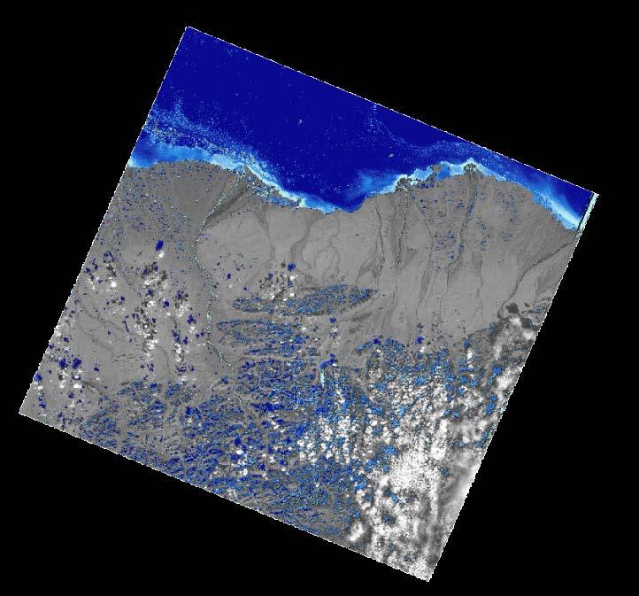
11 Barrow, AK Study sites St. Croix, USVI Site: Buck Island Water: very clear Bottom: Coral and sand St. Croix, USVI Barrow, AK Site: Elson Lagoon Water: Turbid Bottom: mud, sand and gravel 9

 St.")

12 Buck Island, USVI NOAA Chart (scale: 1:100,000) St. Croix, USVI ALB reference dataset (LADS-MKII) 10

/ln(green)")
13 Landsat 7 results (Acquisition date: January 8, 2003) Ln(blue)/ln(green) Satellite-derived bathymetry
14 Landsat 7 results (comparison to reference bathymetry) Absolute depth difference ±6 m 0 m 3000 Frequency Grid resolution: 28.5 m Difference in Depth (meters)
 9 8 Depth (Fathoms) 7 6 5 4 3 2 1 0 R² = 0.80 1 1.02 1.04 1.06 1.08 1.")
15 WorldView2 results (Acquisition date: January 14, 2012) Extinction depth: 14.5 m (8 Fathoms) 9 8 Depth (Fathoms) R² = Ln(blue)/ln(green) Satellite-derived bathymetry

 1706-1/14/2012 (15:17:06 GMT; off-nadir angle: 10.")
16 WorldView2 results (comparison to reference bathymetry) /8/2009 (15:11:26 GMT; off-nadir angle: 22.9 ) /14/2012 (15:17:16 GMT; off-nadir angle: 15.3 ) /14/2012 (15:17:06 GMT; off-nadir angle: 10.5 ) Landsat 7 Absolute depth difference ±6 m 0 m /14/2012 (15:17:30 GMT; off-nadir angle: 20.5 )
17 Reference sources Elevation difference over Buck Island study site between satellite-derived bathymetry (Landsat 7) and the lidar reference bathymetry (LADS MK-II) Depth difference (m) Depth difference (m) Depth (m) Referencing to chart datum using lidar Depth (m) Referencing to chart datum using chart soundings Extinction Depth (14.5 m) 15


18 Elson Lagoon, Ak NOAA Chart (scale 1:48,149) Chart (Scale 1:47,943)


19 Reference depth measurements Digitized soundings 17

20 Landsat 7 results (Acquisition date : July 18, 2002) 4.5 m 0 m km Extinction depth: 4.5 m (15 ft)
 Extinction depth: 4.3 m (14 ft) Extinction depth: 3.")
21 WorldView2 results (Acquisition date: July 21, 2010 through August 10, 2010) Extinction depth: 4.3 m (14 ft) Extinction depth: 3.9 m (13 ft)
 Absolute depth difference ±6 m 0 m Chart 16082 (Scale")
22 Comparison to the chart soundings (WV2) NOAA Chart (scale 1:48,149) Absolute depth difference ±6 m 0 m Chart (Scale 1:47,943)

 1706_1730")

")


 NIR band 6")
23 Time series over Buck Island 1718_1730 (Δt=12 min) 1706_1730 (Δt=24 min) 1706_1718 (Δt=12 min) 1126_1718 (Δt=2y1m6d) 1126_ _1730 Absolute depth difference ±6 m 0 m (Δt = 2 years 1 month 6 days) NIR band 6 Up to 14 m misalignment between the images 21

24 Time series over Elson Lagoon Absolute depth difference ±6 m 0 m 22
25 Results (WorldView2) Extinction Depth (4.3 m) Statistics ( 4.3 m ): Mean = m Standard deviation = 0.64 m Statistics ( 4.3 m ): Mean = m Standard deviation = 0.81 m 23

26 SDB: Issues with product results Image quality WV2 (also with Landsat8) Landsat7 Depth Site WV2_eff L7 _eff WV2 _rec L7_rec Barrow, AK 4.5 m 4.3 m 6 m 6 m Simeonof Island, AK 4.5 m 4.2 m 12.5 m 12.5 m Saipan 12 m 6 m 23 m 10 m St. Thomas, USVI m 17 m
 Difference map in meters between the satellite-derived")
.")
27 SDB: Discussion (Right image) Algorithm result image. (Left image) Difference map in meters between the satellite-derived bathymetry and the ALB reference dataset in depths greater than the extinction depth (11.5 m). The difference map is overlaid on NOAA Chart (soundings are in fathoms).
28 The image cannot be displayed. Your computer may not have enough memory to open the image, or the image may have been corrupted. Restart your computer, and then open the file again. If the red x still The appears, image you cannot may be have displayed. to delete Your the image computer and may then not insert have it again. enough memory to open the image, or the image may have been corrupted. Restart your computer, and then open the file again. If the red x still appears, you may have to delete the image and then insert it again.


29 Discussion Images from: Arctic Nautical Charting Plan a plan to sustainable marine charting transportation in Alaska (Feb. 15, 2013) ( Arctic_Nautical_Charting_Plan.pdf) 27


30 U.S.A Canada Landsat 7 imagery ( )

 BA")
31 Current work GEBCO project (Eunice Tetteh, Marine Research Div., Fisheries Ministry, Ghana) Landsat 8 imagery (April-June, 2013) BA Charts over coverage
32 Summary Landsat 7 and WorldView2 images were investigated over St. Croix, USVI and Barrow, AK. WorldView2 imagery proved high resolution imagery (2 m) that can be used as a reconnaissance tool for large-scale charts (i.e. 1:4,000 to 1:50,000). However, the WorldView2 swath is relatively small (18 km), which will require more images and may delay the production. Landsat 7 is useful as a reconnaissance tool for charts of 1:60,000 or smaller scales. 30
33 Thanks Acknowledgements: UNH/NOAA Joint Hydrographic Center grant NA05NOS Brian Madore (CCOM/JHC) Capt. Robert Ward (International Hydrographic Bureau) Jeff Ferguson and Dave Scharff (NOAA/OCS/) Karen Marks (NOAA and IHO-IOC GEBCO program) Mike Aslaksen and Maryellen Sault (NOAA/NGS) Ashley Chappell (NOAA IOCM program) Fugro LADS and Fugro Palegos 31
INGESTION OF JALBTCX ALB DATASET INTO NOAA'S CHART PRODUCTION
 INGESTION OF JALBTCX ALB DATASET INTO NOAA'S CHART PRODUCTION Shachak Pe eri (JHC/CCOM) and Gretchen Imahori (NOAA) OCS/MCD (NOAA): John Barber, Anthony Klemm, Julia Powell, Mike Brown and John Nyberg
Enhanced coastal mapping using lidar waveform features
 University of New Hampshire University of New Hampshire Scholars' Repository Center for Coastal and Ocean Mapping Center for Coastal and Ocean Mapping 6-2014 Enhanced coastal mapping using lidar waveform
United States - Canada Hydrographic Commission Halifax, Canada May 16, 2016
 United States - Canada Hydrographic Commission Halifax, Canada May 16, 2016 USCHC39 INF-E NOAA Pilot Study Applying Satellite-Derived Bathymetry to Longboat Pass, Florida Submitted by: The United States
United States-Canada Hydrographic Commission (USCHC) Meeting
 Meeting") International Hydrographic Organization United States - Canada Hydrographic Commission International Hydrographic Organization (IHO) United States-Canada Hydrographic Commission (USCHC) Meeting 16 May
International Hydrographic Organization United States - Canada Hydrographic Commission International Hydrographic Organization (IHO) United States-Canada Hydrographic Commission (USCHC) Meeting 16 May
Shallow Water Remote Sensing
 Shallow Water Remote Sensing John Hedley, IOCCG Summer Class 2018 Overview - different methods and applications Physics-based model inversion methods High spatial resolution imagery and Sentinel-2 Bottom
SEA GRASS MAPPING FROM SATELLITE DATA
 JSPS National Coordinators Meeting, Coastal Marine Science 19 20 May 2008 Melaka SEA GRASS MAPPING FROM SATELLITE DATA Mohd Ibrahim Seeni Mohd, Nurul Hazrina Idris, Samsudin Ahmad 1. Introduction PRESENTATION
Fugro commence new Airborne Lidar Bathymetry trials
 Fugro commence new Airborne Lidar Bathymetry trials Laurent Pronier 20 May 2011 Marrakech, Morocco, 18-22 May 2011 Contents Menu LADS Technology - History LADS Mk I (RAN LADS I) LADS Mk II RAN LADS II
MULTI-TEMPORAL SATELLITE IMAGES WITH BATHYMETRY CORRECTION FOR MAPPING AND ASSESSING SEAGRASS BED CHANGES IN DONGSHA ATOLL
 MULTI-TEMPORAL SATELLITE IMAGES WITH BATHYMETRY CORRECTION FOR MAPPING AND ASSESSING SEAGRASS BED CHANGES IN DONGSHA ATOLL Chih -Yuan Lin and Hsuan Ren Center for Space and Remote Sensing Research, National
The Normal Baseline. Dick Gent Law of the Sea Division UK Hydrographic Office
 The Normal Baseline Dick Gent Law of the Sea Division UK Hydrographic Office 2 The normal baseline for measuring the breadth of the territorial sea is the low water line along the coast as marked on large
Determining Accurate Elevations: Datums & Tools, Today & Tomorrow
 Determining Accurate Elevations: Datums & Tools, Today & Tomorrow Association of State Floodplain Managers Annual Meeting Grand Rapids, MI Christine Gallagher June 21, 2016 Overview NGS Mission Important
Using multi-angle WorldView-2 imagery to determine ocean depth near the island of Oahu, Hawaii
 Using multi-angle WorldView-2 imagery to determine ocean depth near the island of Oahu, Hawaii Krista R. Lee*, Richard C. Olsen, Fred A. Kruse Department of Physics and Remote Sensing Center Naval Postgraduate
NATIONAL VDATUM -- THE IMPLEMENTATION OF A NATIONAL VERTICAL DATUM TRANSFORMATION DATABASE
 NATIONAL VDATUM -- THE IMPLEMENTATION OF A NATIONAL VERTICAL DATUM TRANSFORMATION DATABASE Bruce Parker, Dennis Milbert, Kurt Hess, and Stephen Gill National Ocean Service, NOAA The National Ocean Service
Optimizing Resolution and Uncertainty in Bathymetric Sonar Systems
 University of New Hampshire University of New Hampshire Scholars' Repository Center for Coastal and Ocean Mapping Center for Coastal and Ocean Mapping 6-2013 Optimizing Resolution and Uncertainty in Bathymetric
VDatum and SBET to Improve Accuracy of NOAA s High-Resolution Bathymetry
 VDatum and SBET to Improve Accuracy of NOAA s High-Resolution Bathymetry US HYDRO 2007 Extended Abstract Author: Crescent H. Moegling CoAuthor: Steve Brodet Moegling HYDRO 2007 1 Introduction NOAA s Hydrographic
Lecture 6: Multispectral Earth Resource Satellites. The University at Albany Fall 2018 Geography and Planning
 Lecture 6: Multispectral Earth Resource Satellites The University at Albany Fall 2018 Geography and Planning Outline SPOT program and other moderate resolution systems High resolution satellite systems
Defense and Maritime Solutions
 Defense and Maritime Solutions Automatic Contact Detection in Side-Scan Sonar Data Rebecca T. Quintal Data Processing Center Manager John Shannon Byrne Software Manager Deborah M. Smith Lead Hydrographer
Joining New Zealand Land and Sea Vertical Datums (JLAS) Graeme Blick Group Manager Positioning and Resilience
 Graeme Blick Group Manager Positioning and Resilience") Presented at the FIG Congress 2018, May 6-11, 2018 in Istanbul, Turkey Joining New Zealand Land and Sea Vertical Datums (JLAS) Graeme Blick Group Manager Positioning and Resilience Mapping NZ 2025 What
Presented at the FIG Congress 2018, May 6-11, 2018 in Istanbul, Turkey Joining New Zealand Land and Sea Vertical Datums (JLAS) Graeme Blick Group Manager Positioning and Resilience Mapping NZ 2025 What
Jeffrey H. Bowles, Wesley J. Moses, Gia M. Lamela, Richard Mied, Karen W. Patterson, and Ellen J. Wagner
 1 Jeffrey H. Bowles, Wesley J. Moses, Gia M. Lamela, Richard Mied, Karen W. Patterson, and Ellen J. Wagner and, Washington, D.C. from Center for Advanced Land Management Information Technologies (CALMIT),
Tidal Datums & Coastal Profiles. DGGS Coastal Hazards Program - Fairbanks, AK Program Manager: Nicole Kinsman
 Tidal Datums & Coastal Profiles DGGS Coastal Hazards Program - Fairbanks, AK Program Manager: Nicole Kinsman nicole.kinsman@alaska.gov 907-451-5026 Overview AOOS-funded DGGS Projects: 1) Port Heiden Short-Term
Overview of Tides and Water Levels
 Overview of Tides and Water Levels www.tidesandcurrents.noaa.gov New Orleans, Baton Rouge, Lafayette, LA March 2009 Gerald Hovis, NOAA - National Ocean Service William Sweet, NOAA - National Ocean Service
Old House Channel Bathymetric and Side Scan Survey
 FIELD RESEARCH FACILITY DUCK, NC Old House Channel Bathymetric and Side Scan Survey COASTAL AND HYDRAULICS LABORATORY FIELD DATA COLLECTION AND ANALYSIS BRANCH Michael Forte December 2009 View looking
17 th CHRIS Meeting Rostock, Germany, 5-9 September Report of IHO-IEC Harmonization Group on Marine Information Objects (HGMIO
 17 th CHRIS Meeting Rostock, Germany, 5-9 September 2004 CHRIS17-7A rev.1 Report of IHO-IEC Harmonization Group on Marine Information Objects (HGMIO Lee Alexander, University of New Hampshire (Chair, HGMIO)
MAPPING BATHYMETRY FROM MULTI-SOURCE REMOTE SENSING IMAGES: A CASE STUDY IN THE BEILUN ESTUARY, GUANGXI, CHINA
 MAPPING BATHYMETRY FROM MULTI-SOURCE REMOTE SENSING IMAGES: A CASE STUDY IN THE BEILUN ESTUARY, GUANGXI, CHINA Zhongwei Deng b, Minhe Ji a, b, *, Zhihua Zhang b a Guangxi ASEAN Marine Research Center,
Determining Accurate Elevations: Datums & Tools, Today & Tomorrow
 Determining Accurate Elevations: Datums & Tools, Today & Tomorrow Maryland Association Floodplain and Stormwater Managers Linthicum Heights, MD Christine Gallagher Oct. 20, 2016 Overview NGS Mission Important
Development of Mosaic Datasets and Image Services for Bathymetric Data
 Development of Mosaic Datasets and Image Services for Bathymetric Data Jesse Varner Cooperative Institute for Research in Environmental Sciences (CIRES), University of Colorado John Cartwright NOAA National
Update on Landsat Program and Landsat Data Continuity Mission
 Update on Landsat Program and Landsat Data Continuity Mission Dr. Jeffrey Masek LDCM Deputy Project Scientist NASA GSFC, Code 923 November 21, 2002 Draft LDCM Implementation Phase RFP Overview Page 1 Celebrate!
Recent Developments in NOAA s Real- Time Coastal Observing Systems for Safe and Efficient Maritime Transportation
 Recent Developments in NOAA s Real- Time Coastal Observing Systems for Safe and Efficient Maritime Transportation Rich Edwing, Director NOAA Center for Operational Oceanographic Products and Services CMTS
Debris Detection: Background, Efforts, & Lessons Learned. Peter Murphy Alaska Coordinator / Detection Lead NOAA Marine Debris Program
 Debris Detection: Background, Efforts, & Lessons Learned Peter Murphy Alaska Coordinator / Detection Lead NOAA Marine Debris Program Outline Marine Debris Issue Types Distribution Impacts NOAA Marine Debris
NON-PHOTOGRAPHIC SYSTEMS: Multispectral Scanners Medium and coarse resolution sensor comparisons: Landsat, SPOT, AVHRR and MODIS
 NON-PHOTOGRAPHIC SYSTEMS: Multispectral Scanners Medium and coarse resolution sensor comparisons: Landsat, SPOT, AVHRR and MODIS CLASSIFICATION OF NONPHOTOGRAPHIC REMOTE SENSORS PASSIVE ACTIVE DIGITAL
Overview of Recent Tidal Projects in the United States
 1 st Tides and Water Levels Working Group Meeting Overview of Recent Tidal Projects in the United States Stephen Gill National Oceanic and Atmospheric Administration, National Ocean Service Center for
Helping Build Your Capacity in Nautical Charting & Hydrography
 Helping Build Your Capacity in Nautical Charting & Hydrography Helping Chart your World Rajesh Alla Riyadh, Kingdom of Saudi Arabia 04-06 March 2013 Company Background Marine Services Capacity Building
... Salient Ocean Issues that have arisen during 2002
 ... As reported in paragraph 62 of the resolution Oceans and the law of the seas, we are especially pleased with the focus for this meeting, given that protecting vulnerable marine ecosystems and safety
The Study of Sea Bottom Morphology and Bathymetric Mapping Using Worldview-2 Imagery
 The Study of Sea Bottom Morphology and Bathymetric Mapping Using Worldview-2 Imagery Iwan E. Setiawan Badan Informasi Geospasial, Cibinong, Indonesia Doddy M. Yuwono Badan Informasi Geospasial, Cibinong,
21st International Conference of The Coastal Society
 21st International Conference of The Coastal Society DEVELOPMENT OF A VERTICAL DATUM TRANSFORMATION TOOL AND A BATHYMETRIC/TOPOGRAPHIC DIGITAL ELEVATION MODEL FOR SOUTHERN CALIFORNIA Edward P. Myers, NOAA/NOS
University of Texas at San Antonio EES 5053 Term Project CORRELATION BETWEEN NDVI AND SURFACE TEMPERATURES USING LANDSAT ETM + IMAGERY NEWFEL MAZARI
 University of Texas at San Antonio EES 5053 Term Project CORRELATION BETWEEN NDVI AND SURFACE TEMPERATURES USING LANDSAT ETM + IMAGERY NEWFEL MAZARI Introduction and Objectives The present study is a correlation
The studies began when the Tiros satellites (1960) provided man s first synoptic view of the Earth s weather systems.
 provided man s first synoptic view of the Earth s weather systems.") Remote sensing of the Earth from orbital altitudes was recognized in the mid-1960 s as a potential technique for obtaining information important for the effective use and conservation of natural resources.
Remote sensing of the Earth from orbital altitudes was recognized in the mid-1960 s as a potential technique for obtaining information important for the effective use and conservation of natural resources.
Multiplatform Remote Sensing for Coral Reef Community Assessment
 Multiplatform Remote Sensing for Coral Reef Community Assessment Quinta Reunión Nacional de Percepción Remota y Sistemas de Información Geográfica en Puerto Rico September 27, 2007 Roy A. Armstrong, Ph.
EVALUATION OF PLEIADES-1A TRIPLET ON TRENTO TESTFIELD
 EVALUATION OF PLEIADES-1A TRIPLET ON TRENTO TESTFIELD D. Poli a, F. Remondino b, E. Angiuli c, G. Agugiaro b a Terra Messflug GmbH, Austria b 3D Optical Metrology Unit, Fondazione Bruno Kessler, Trento,
Our Quality Promise WHITE PAPER
 Our Quality Promise www.digitalglobe.com Corporate (U.S.) +1.303.684.4561 or +1.800.496.1225 London +44.20.8899.6801 Singapore +65.6389.4851 To ensure your success, we put quality at our core At DigitalGlobe,
Appendix A Lower Columbia River Chart Datum Modeling
 Appendix A Lower Columbia River Chart Datum Modeling David Evans and Associates, Inc. David Evans and Associates, Inc. 2801 SE Columbia Way, Ste. 130 Vancouver, WA 98661 (360) 314-3200 1.0 Vertical Datum
EUSIPCO Worldview-2 High Resolution Remote Sensing Image Processing for the Monitoring of Coastal Areas
 EUSIPCO 2013 1569741167 Worldview-2 High Resolution Remote Sensing Image Processing for the Monitoring of Coastal Areas Francisco Eugenio 1, Javier Martin 1, Javier Marcello 1 and Juan A. Bermejo 2 1 Instituto
EnMAP Environmental Mapping and Analysis Program
 EnMAP Environmental Mapping and Analysis Program www.enmap.org Mathias Schneider Mission Objectives Regular provision of high-quality calibrated hyperspectral data Precise measurement of ecosystem parameters
INTEGRATING BATHYMETRY, TOPOGRAPHY, AND SHORELINE, AND THE IMPORTANCE OF VERTICAL DATUMS
 INTEGRATING BATHYMETRY, TOPOGRAPHY, AND SHORELINE, AND THE IMPORTANCE OF VERTICAL DATUMS Bruce Parker, Dennis Milbert, Kurt Hess, and Stephen Gill National Ocean Service, NOAA 1315 East-West Highway Silver
Instruction with Hands-on Practice: Creating a Bathymetric Database & Datum Conversion
 Instruction with Hands-on Practice: Creating a Bathymetric Database & Datum Conversion Tanya Beck Coastal and Hydraulics Laboratory Engineer Research and Development Center May 17, 2010 US Army Corps of
S-100 Overlays: A Brave New World?
 University of New Hampshire University of New Hampshire Scholars' Repository Center for Coastal and Ocean Mapping Center for Coastal and Ocean Mapping 3-2015 S-100 Overlays: A Brave New World? Lee Alexander
NOAA Navigation Services Update
 NOAA Navigation Services Update Captain Jim Crocker Chief, Navigation Services Division NOAA s More than Two Centuries of Service First U.S. gov t science agency President Thomas Jefferson created the
Kongsberg Maritime Product overview
 Kongsberg Maritime Product overview / 1 / 1-Nov-12 Frequency Range Coverage 125,250,500kHz 0.5-200m 12xD 200-400kHz 0.5-500m 5.5xD / 140-200 deg 300 khz 0.5-270m 4-10xD / 130-200 deg 70-100 khz 3-2000m
Morphology Change Procedure using Satellite Derived Bathymetry
 Morphology Change Procedure using Satellite Derived Bathymetry Brian Madore December 23, 2014 To monitor the morphology of a region it is important to have imagery which is taken consistently and can cover
GEOPHYSICAL RESEARCH LETTERS, VOL. 36, L04605, doi: /2008gl036873, 2009
 Click Here for Full Article GEOPHYSICAL RESEARCH LETTERS, VOL. 36, L04605, doi:10.1029/2008gl036873, 2009 Combining remote sensing data and an inundation model to map tidal mudflat regions and improve
Sun glint correction of very high spatial resolution images
 Sun glint correction of very high spatial resolution images G. Doxani, M. Papadopoulou, P. Lafazani, M. Tsakiri - Strati, E. Mavridou Department of Cadastre, Photogrammetry and Cartography, Aristotle University
GeoCoastPilot: Linking the Coast Pilot with Georeferenced Imagery & Chart Information
 University of New Hampshire University of New Hampshire Scholars' Repository Center for Coastal and Ocean Mapping Center for Coastal and Ocean Mapping 10-2008 GeoCoastPilot: Linking the Coast Pilot with
3/31/03. ESM 266: Introduction 1. Observations from space. Remote Sensing: The Major Source for Large-Scale Environmental Information
 Remote Sensing: The Major Source for Large-Scale Environmental Information Jeff Dozier Observations from space Sun-synchronous polar orbits Global coverage, fixed crossing, repeat sampling Typical altitude
HYDROGRAPHIC SURVEY STANDARDS AND DELIVERABLES
 TABLE OF CONTENTS 1. HYDROGRAPHIC SURVEY METHODOLOGY... 3 2. HYDROGRAPHIC SURVEY REFERENCE STANDARDS... 3 3. HYDROGRAPHIC SURVEY CRITERIA... 3 3.1 HYDROGRAPHIC SURVEYS OVER NON GAZETTED NAVIGABLE WATERS*:...
VERTICAL DATUM TRANSFORMATIONS FOR KINEMATIC GPS HYDROGRAPHIC SURVEYS. Kurt W. Hess, Dennis G. Milbert, Stephen K. Gill, and Daniel R.
 VERTICAL DATUM TRANSFORMATIONS FOR KINEMATIC GPS HYDROGRAPHIC SURVEYS Kurt W. Hess, Dennis G. Milbert, Stephen K. Gill, and Daniel R. Roman National Ocean Service, NOAA ABSTRACT Kinematic Global Positioning
GLMTF November 18, 2014 Presentation
 GLMTF November 18, 2014 Presentation Michigan Security Network Founded by major corporations, industry leaders and leading universities in 2008 as a non-profit organization (501c6). MiSN mission is to
Satellite Monitoring of a Large Tailings Storage Facility
 Satellite Monitoring of a Large Tailings Storage Facility Benjamin Schmidt and Matt Malgesini, Golder Associates Inc., USA Jim Turner, PhotoSat Ltd, Canada Jeff Reinson, Goldcorp Inc., Canada Presentation
FOREWORD. IHO S-100 Working Group
 IHO International Hydrographic Organization KHOA Korea Hydrographic and Oceanographic Agency MUCH MORE THAN JUST NAUTICAL CHARTS IHO UNIVERSAL HYDROGRAPHIC data MODEL This document was produced with the
BATHYMETRIC DATA AND NAUTICAL CHART DATUMS
 Distr. LIMITED ECA/NRD/CART.9/USA.2 October 1996 Original: ENGLISH Ninth United Nations Regional Cartographic Conference for Africa Addis Ababa, Ethiopia 11-15 November 1996 A GLOBAL APPROACH TO UPDATE
Present and future of marine production in Boka Kotorska
 Present and future of marine production in Boka Kotorska First results from satellite remote sensing for the breeding areas of filter feeders in the Bay of Kotor INTRODUCTION Environmental monitoring is
LT Matthew Forney, NOAA Navigation Manager Alaska Region Bering Strait MaritimeSymposium. Office of Coast Survey
 NOAA LT Matthew Forney, NOAA Navigation Manager Alaska Region Bering Strait MaritimeSymposium Who is Coast Survey? First science agency of the U.S. Formed in 1807 Responsible for surveying 3.4 million
On the use of water color missions for lakes in 2021
 Lakes and Climate: The Role of Remote Sensing June 01-02, 2017 On the use of water color missions for lakes in 2021 Cédric G. Fichot Department of Earth and Environment 1 Overview 1. Past and still-ongoing
Sources of Geographic Information
 Sources of Geographic Information Data properties: Spatial data, i.e. data that are associated with geographic locations Data format: digital (analog data for traditional paper maps) Data Inputs: sampled
Spectral Signatures. Vegetation. 40 Soil. Water WAVELENGTH (microns)
") Spectral Signatures % REFLECTANCE VISIBLE NEAR INFRARED Vegetation Soil Water.5. WAVELENGTH (microns). Spectral Reflectance of Urban Materials 5 Parking Lot 5 (5=5%) Reflectance 5 5 5 5 5 Wavelength (nm)
Spectral Signatures % REFLECTANCE VISIBLE NEAR INFRARED Vegetation Soil Water.5. WAVELENGTH (microns). Spectral Reflectance of Urban Materials 5 Parking Lot 5 (5=5%) Reflectance 5 5 5 5 5 Wavelength (nm)
Historical radiometric calibration of Landsat 5
 Rochester Institute of Technology RIT Scholar Works Theses Thesis/Dissertation Collections 2001 Historical radiometric calibration of Landsat 5 Erin O'Donnell Follow this and additional works at: http://scholarworks.rit.edu/theses
The DigitalGlobe Constellation. World s Largest Sub-Meter High Resolution Satellite Constellation
 The DigitalGlobe Constellation World s Largest Sub-Meter High Resolution Satellite Constellation The DigitalGlobe Constellation The DigitalGlobe constellation of high resolution satellites offers incredible
The Benefits of the 8 Spectral Bands of WorldView-2
 W H I T E P A P E R The Benefits of the 8 Spectral Bands of WorldView-2 A U G U S T 2 0 0 9 Corporate (U.S.) 303.684.4561 or 800.496.1225 London +44.20.8899.6801 Singapore +65.6389.4851 www.digitalglobe.com
Lesson 9: Multitemporal Analysis
 Lesson 9: Multitemporal Analysis Lesson Description Multitemporal change analyses require the identification of features and measurement of their change through time. In this lesson, we will examine vegetation
DigitalGlobe High Resolution Satellite Imagery
 DigitalGlobe High Resolution Satellite Imagery KIAN KANG, SALES MANAGER, SOUTH EAST ASIA & TAIWAN See a better world. DigitalGlobe Overview Over 1,300 employees spanning the globe H E A D Q UA R T E R
Polar Communications & Weather (PCW) Mission. Guennadi Kroupnik, Canadian Space Agency
 Mission. Guennadi Kroupnik, Canadian Space Agency") Polar Communications & Weather (PCW) Mission Guennadi Kroupnik, Canadian Space Agency Mission Objectives Reliable communications and navigations services in the high latitudes (North of 70º) to ensure:
Polar Communications & Weather (PCW) Mission Guennadi Kroupnik, Canadian Space Agency Mission Objectives Reliable communications and navigations services in the high latitudes (North of 70º) to ensure:
The world s most advanced constellation
 The DigitalGlobe Constellation The world s most advanced constellation of very high-resolution satellites The world s most advanced constellation The DigitalGlobe constellation of high-resolution satellites
Progress Towards the Seamless Combination of Bathymetric and Topographic Data in New Zealand
 Progress Towards the Seamless Combination of Bathymetric and Topographic Data in New Zealand Matt Amos Senior Technical Advisor National Geodetic Office Introduction Datasets usually defined in terms of
Introduction of Satellite Remote Sensing
 Introduction of Satellite Remote Sensing Spatial Resolution (Pixel size) Spectral Resolution (Bands) Resolutions of Remote Sensing 1. Spatial (what area and how detailed) 2. Spectral (what colors bands)
Cedar Bayou: Houston Ship Channel to U.S. Steel Dock
 Cedar Bayou: + + -.ft.ft + B A R B O U R S BC A + 2+ + 2+ + + 2 + 2 A + 2+ + + + + + + 'W 2 'N 'W 2 'N 2 2 2 2 2 2 2 2 2 2 2 + Cedar Bayou Channel Buoy 2 Light 2 + Cedar Bayou Channel Daybeacon 2+ Cedar
ESTIMATING REEF HABITAT COVERAGE SUITABLE FOR THE HUMPHEAD WRASSE, CHEILINUS UNDULATUS, USING REMOTE SENSING
 FAO Fisheries and Aquaculture Circular No. 1057 FIRF/C1057 (En) ISSN 2070-6065 ESTIMATING REEF HABITAT COVERAGE SUITABLE FOR THE HUMPHEAD WRASSE, CHEILINUS UNDULATUS, USING REMOTE SENSING Copies of FAO
Ground Truth for Calibrating Optical Imagery to Reflectance
 Visual Information Solutions Ground Truth for Calibrating Optical Imagery to Reflectance The by: Thomas Harris Whitepaper Introduction: Atmospheric Effects on Optical Imagery Remote sensing of the Earth
Global Land Survey 2005
 Global Land Survey 2005 Jeff Masek, Shannon Franks, Terry Arvidson NASA GSFC Rachel Headley, Steve Covington USGS EROS April, 2008 1 Global Land Survey (GLS 2005) Follow-on to the GeoCover orthorectified
35017 Las Palmas de Gran Canaria, Spain Santa Cruz de Tenerife, Spain ABSTRACT
 Atmospheric correction models for high resolution WorldView-2 multispectral imagery: A case study in Canary Islands, Spain. J. Martin* a F. Eugenio a, J. Marcello a, A. Medina a, Juan A. Bermejo b a Institute
USGS Welcome. 38 th CEOS Working Group on Calibration and Validation Plenary (WGCV-38)
") Landsat 5 USGS Welcome Prepared for 38 th CEOS Working Group on Calibration and Validation Plenary (WGCV-38) Presenter Tom Cecere International Liaison USGS Land Remote Sensing Program Elephant Butte Reservoir
Landsat 5 USGS Welcome Prepared for 38 th CEOS Working Group on Calibration and Validation Plenary (WGCV-38) Presenter Tom Cecere International Liaison USGS Land Remote Sensing Program Elephant Butte Reservoir
Online Resources: KEY FEATURES
 Explore key features of online Earth science data tools that can be useful for K 12 student investigations. Sources are color coded for relative level/ease-of-use: BLUE (introductory); ORANGE (intermediate)
IDENTIFICATION AND MAPPING OF HAWAIIAN CORAL REEFS USING HYPERSPECTRAL REMOTE SENSING
 IDENTIFICATION AND MAPPING OF HAWAIIAN CORAL REEFS USING HYPERSPECTRAL REMOTE SENSING Jessica Frances N. Ayau College of Education University of Hawai i at Mānoa Honolulu, HI 96822 ABSTRACT Coral reefs
Working with Elevation Services. Cody Benkelman
 Working with Elevation Services Cody Benkelman Outline ArcGIS Online World Elevation & 3D Elevation Cache for Pro What is included? - Data and Tools How can I use it? - Modes of use - Client Applications
Satellite Imagery and Remote Sensing. DeeDee Whitaker SW Guilford High EES & Chemistry
 Satellite Imagery and Remote Sensing DeeDee Whitaker SW Guilford High EES & Chemistry whitakd@gcsnc.com Outline What is remote sensing? How does remote sensing work? What role does the electromagnetic
Radiometric Use of WorldView-3 Imagery. Technical Note. 1 WorldView-3 Instrument. 1.1 WorldView-3 Relative Radiance Response
 Radiometric Use of WorldView-3 Imagery Technical Note Date: 2016-02-22 Prepared by: Michele Kuester This technical note discusses the radiometric use of WorldView-3 imagery. The first two sections briefly
Myanmar Naval Hydrographic Centre. National Report for 13 th North Indian Ocean Hydrographic Commission Meeting
 Myanmar Naval Hydrographic Centre National Report for 13 th North Indian Ocean Hydrographic Commission Meeting Yangon, Myanmar 19 th 22 nd February 2013 CONTENT 1. Myanmar Naval Hydrographic Centre 2.
VIIRS Cloud-Free Compositing For Nighttime Lights
 VIIRS Cloud-Free Compositing For Nighttime Lights Kimberly Baugh, CIRES University of Colorado Feng Chi Hsu, CIRES University of Colorado Mikhail Zhizhin, CIRES University of Colorado Tilottama Ghosh,
SATELLITE OCEANOGRAPHY
 SATELLITE OCEANOGRAPHY An Introduction for Oceanographers and Remote-sensing Scientists I. S. Robinson Lecturer in Physical Oceanography Department of Oceanography University of Southampton JOHN WILEY
APCAS/10/21 April 2010 ASIA AND PACIFIC COMMISSION ON AGRICULTURAL STATISTICS TWENTY-THIRD SESSION. Siem Reap, Cambodia, April 2010
 APCAS/10/21 April 2010 Agenda Item 8 ASIA AND PACIFIC COMMISSION ON AGRICULTURAL STATISTICS TWENTY-THIRD SESSION Siem Reap, Cambodia, 26-30 April 2010 The Use of Remote Sensing for Area Estimation by Robert
Empirical Analysis of Aerial Camera Filters for Shoreline Mapping
 University of New Hampshire University of New Hampshire Scholars' Repository Center for Coastal and Ocean Mapping Center for Coastal and Ocean Mapping 3-2005 Empirical Analysis of Aerial Camera Filters
MESOAMERICAN AND CARIBBEAN HYDROGRAPHIC COMMISSION 11 th Meeting, Paramaribo, Suriname, Novembro NATIONAL REPORT BRAZIL
 Page 1 of 5 MESOAMERICAN AND CARIBBEAN HYDROGRAPHIC COMMISSION 11 th Meeting, Paramaribo, Suriname, Novembro 8-12 2010 NATIONAL REPORT BRAZIL 1. Hydrographic Office / Service: Directorate of Hydrography
Atmospheric Correction for Coastal and Inland Waters Current Capabilities and Challenges
 Atmospheric Correction for Coastal and Inland Waters Current Capabilities and Challenges Nima Pahlevan Research Scientist NASA Goddard Space Flight Center Science Systems and Applications Inc. Outline
International Collaborative Engagement Program for Polar Research ICE-PPR. Ministry of Defence Denmark Charlotte Havsteen
 International Collaborative Engagement Program for Polar Research ICE-PPR Ministry of Defence Denmark Charlotte Havsteen Situational Awareness Status Situational awareness Underwater Subsurface Acoustic/Long
Project Title: Validation and Correction for the MODIS Spatial Response. NASA Grant #: NAG Period: October 1, May 31, 1999
 Project Title: Validation and Correction for the MODIS Spatial Response NASA Grant #: NAG5 6339 Period: October 1, 1997 - May 31, 1999 Robert A. Schowengerdt, Principal Investigator Stuart E. Biggar, Co
UNH/NOAA Joint Hydrographic Center
 UNH/NOAA Joint Hydrographic Center Performance and Progress Report Executive Summary Project Title: Joint Hydrographic Center Report Period: 01/01/2015 12/31/2015 NOAA Ref No: NA10NOS4000073 Principal
Passive Localization of Multiple Sources Using Widely-Spaced Arrays with Application to Marine Mammals
 Passive Localization of Multiple Sources Using Widely-Spaced Arrays with Application to Marine Mammals L. Neil Frazer School of Ocean and Earth Science and Technology University of Hawaii at Manoa 1680
Towards a Management Plan for a Tropical Reef-Lagoon System Using Airborne Multispectral Imaging and GIS
 Towards a Management Plan for a Tropical Reef-Lagoon System Using Airborne Multispectral Imaging and GIS This paper was presented at the Fourth International Conference on Remote Sensing for Marine and
ENMAP RADIOMETRIC INFLIGHT CALIBRATION, POST-LAUNCH PRODUCT VALIDATION, AND INSTRUMENT CHARACTERIZATION ACTIVITIES
 ENMAP RADIOMETRIC INFLIGHT CALIBRATION, POST-LAUNCH PRODUCT VALIDATION, AND INSTRUMENT CHARACTERIZATION ACTIVITIES A. Hollstein1, C. Rogass1, K. Segl1, L. Guanter1, M. Bachmann2, T. Storch2, R. Müller2,
UNH/NOAA Joint Hydrographic Center
 UNH/NOAA Joint Hydrographic Center Performance and Progress Report Project Title: Joint Hydrographic Center Report Period: 01/01/2014 12/31/2014 Principal Investigator: Larry A. Mayer NOAA Ref No: NA10NOS4000073
Sources of Geographic Information
 Sources of Geographic Information Data properties: Spatial data, i.e. data that are associated with geographic locations Data format: digital (analog data for traditional paper maps) Data Inputs: sampled
National Aeronautics and Space Administration. Landsat Update. Jeff Masek, NASA GSFC Jim Irons, NASA GSFC. April 3, 2012 LCLUC Meeting.
 National Aeronautics and Space Administration Landsat Update Jeff Masek, NASA GSFC Jim Irons, NASA GSFC April 3, 2012 LCLUC Meeting www.nasa.gov Agenda Landsat-5/7 Update LDCM / Landsat-8 Mission Status
MSB Imagery Program FAQ v1
 MSB Imagery Program FAQ v1 (F)requently (A)sked (Q)uestions 9/22/2016 This document is intended to answer commonly asked questions related to the MSB Recurring Aerial Imagery Program. Table of Contents