DigitalGlobe High Resolution Satellite Imagery
|
|
|
- Jewel Doyle
- 6 years ago
- Views:
Transcription
1 DigitalGlobe High Resolution Satellite Imagery KIAN KANG, SALES MANAGER, SOUTH EAST ASIA & TAIWAN See a better world.

2 DigitalGlobe Overview Over 1,300 employees spanning the globe H E A D Q UA R T E R S C O L O R A D O U SA DigitalGlobe Overview: Seeing a better world


3 Markets served C I V I L G O V E R N M E N T E N E R G Y MINING D E F E N S E & I N T E L L I G E N C E US G O V E R N M E N T T E C H N O L O G Y G LO BA L D E V E LO P M E N T


4 DigitalGlobe is The market leader in remote sensing IKONOS.82 meter resolution 9 m CE90 QuickBird.65 meter resolution 23 m CE90 WorldView-1.50 meter resolution <4 m CE90 GeoEye-1.41 meter resolution <3.5 m CE90 WorldView-2.46 meter resolution <3.5 m CE90 WorldView-3.31 meter resolution <3.0 m CE90 WorldView-4.31 meter resolution <3.0 m CE90 CURRENTLY IMAGING IN ORBIT AVAILABLE VIA DIGITALGLOBE ARCHIVE
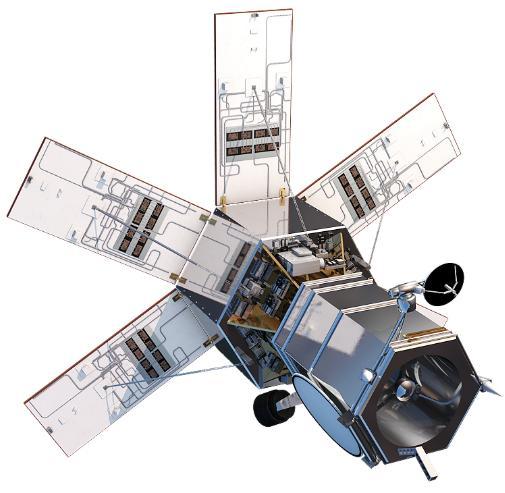

5 WorldView-4
6 Worldview 4 Technical Info

7 Worldview 4: First Image WV04 FirstImage Date 26 Nov 2016


8 30cm Imagery: ChiangMai Airport WV3 28 Dec 2016, Chiang Mai Airport, Thailand


9 30cm Imagery : SKP Thailand WV3, 11 Nov 2016SKP, Thailand 30 cm
10 WV3 Short Wave Infrared See a better world.

 satellite in the industry WORLDVIEW-3")
 Pan: 0.")
11 Desert Clouds Blue Aerosol Green Red Aerosol Water Water Water Aerosol NDVI Cirrus Snow/Cloud Aerosol-3 WorldView-3 will be the first high-resolution super spectral (>10 bands) satellite in the industry WORLDVIEW-3 CAVIS BANDS 30m GSD Atmospheric Compensation 3.72m GSD (7.5m releasable) 1.24m GSD WAVELENGTH (NANOMETERS) Pan: 0.31m GSD Global Space & Technology Convention 2015
 on the Earth s surface.")
12 Identify Man-Made or Geologic Material Locate and classify man-made materials (metals, plastics, paints, fiberglass, asphalt, oil and various chemicals) and geologic minerals (clays, alteration, iron oxides, carbonates, and others) on the Earth s surface. Material identification at this resolution enables highconfidence decision-making with information not available from any other satellite imaging company.
, elevation data and our clever engineers!")
13 Main Information of the Roof Roof materials Roof tilt angle Roof height The analysis is based on shortwave infrared data (SWIR), elevation data and our clever engineers!


14 See Through Smoke and Haze Get a clear view of the ground with SWIR wavelengths that penetrate smoke and haze, so you can make decisions with confidence in heat-of-the-moment situations.


15 Mining - Mapping Mineral Resources (1/2) WV-1 Panchromatic WV2 Multispectral WV3 Classification of minerals Clay Location: Nevada Cuprite, 7.5m resolution WV3 shortwave infrared image Mica Carbonate
16 Vricon Derivative Products Build Once DSM/DTM View shed analysis 36x greater detail than HRTe 4 DSM True Ortho True Ortho image base layer Nadir view of all pixels Point Cloud Standard LAS format Compatible with LIDAR exploitation tools 17 2/14/2017

17 Vricon 3D Surface Model Accurate, Consistent Geospatial Foundation Every rendered pixel is accurate RGB Textured TIN Mesh Triangulated Irregular Network Very Small File Size Optimized for Streaming Hosted as Web Service Similar Technology to Modern Videogames Allows for extremely fast, efficient 3D rendering 0.5m Resolution --- 3m SE90 Absolute Accuracy 18 2/14/2017

18 TO REPLACE IMAGE: Right-click on the image Select Change Picture Locate an appropriate image: (Image should be 1600px wide by 1153px tall, Lower resolution images make the file easier to . Higher resolution images look better) Select the image and click OK DELETE THESE NOTES IF NOT NEEDED 19 2/14/2017

19
20 DigitalGlobe Basemap
European Space Imaging. Your Partner for Very High-Resolution Satellite Imagery GEOGRAPHIC
 European Space Imaging Your Partner for Very High-Resolution Satellite Imagery XVII International User Conference of GeoInformation Systems & Remote Sensing European Space Imaging Your Partner for Very
European Space Imaging
 European Space Imaging Use cases of Very High Resolution satellite imagery in support of crop management GEO-CRADLE Regional Workshop, 7/12/2017, Tunis Arnaud Durand adurand@euspaceimaging.com COMPANY
Geology, Exploration, and WorldView-3 SWIR Kumar Navulur, PhD
 Geology, Exploration, and WorldView-3 SWIR Kumar Navulur, PhD Mt Everest Digital Elevation Model 0.5 m WorldView 2 2m False Color IR Drape DigitalGlobe Proprietary. DigitalGlobe. All rights reserved. Agenda
DIGITALGLOBE SATELLITE IMAGERY AND CLOUD SERVICES FOR SUGARCANE MAPPING
 DIGITALGLOBE SATELLITE IMAGERY AND CLOUD SERVICES FOR SUGARCANE MAPPING PRESENTER: DILLON PANIZZOLO (TECHNICAL MANAGER) COMPANY: GEO DATA DESIGN DATE: 18 TH AUGUST 2015 SASTA Congress Sugar Cane Mapping
Summary of the VHR image acquisition Campaign 2014 and new sensors for 2015
 Summary of the VHR image acquisition Campaign 2014 and new sensors for 2015 Michaela Neumann, George Ellis, Samuel Bärisch, Blanka Vajsova 19 November 2014, Dresden 20th MARS Conference Presentation Outline
Lecture 6: Multispectral Earth Resource Satellites. The University at Albany Fall 2018 Geography and Planning
 Lecture 6: Multispectral Earth Resource Satellites The University at Albany Fall 2018 Geography and Planning Outline SPOT program and other moderate resolution systems High resolution satellite systems
CHARACTERISTICS OF REMOTELY SENSED IMAGERY. Spatial Resolution
 CHARACTERISTICS OF REMOTELY SENSED IMAGERY Spatial Resolution There are a number of ways in which images can differ. One set of important differences relate to the various resolutions that images express.
MOVING FROM PIXELS TO PRODUCTS
 TRUE COLOR RGB MOSAIC, OSAKA, JAPAN MOVING FROM PIXELS TO PRODUCTS and data to insight AUTOMATED STRUCTURE IDENTIFICATION, OSAKA, JAPAN Table of Contents Moving from Pixels to Products 3 Doubling the Spectral
IKONOS High Resolution Multispectral Scanner Sensor Characteristics
 High Spatial Resolution and Hyperspectral Scanners IKONOS High Resolution Multispectral Scanner Sensor Characteristics Launch Date View Angle Orbit 24 September 1999 Vandenberg Air Force Base, California,
Satellite Imagery Characteristics, Uses and Delivery to GIS Systems. Wayne Middleton April 2014
 Satellite Imagery Characteristics, Uses and Delivery to GIS Systems Wayne Middleton April 2014 About Geoimage Founded in Brisbane 1988 Leading Independent company Specialists in satellite imagery and geospatial
Designing a Remote Sensing Project. Many factors to consider: here lumped into 12 sections hold on!! first some basic concepts
 Designing a Remote Sensing Project Many factors to consider: here lumped into 12 sections hold on!! first some basic concepts DVC Geography 160 Introduction to Remote Sensing J. Ellis DigitalGlobe (2006)
Introduction to Remote Sensing Fundamentals of Satellite Remote Sensing. Mads Olander Rasmussen
 Introduction to Remote Sensing Fundamentals of Satellite Remote Sensing Mads Olander Rasmussen (mora@dhi-gras.com) 01. Introduction to Remote Sensing DHI What is remote sensing? the art, science, and technology
The world s most advanced constellation
 The DigitalGlobe Constellation The world s most advanced constellation of very high-resolution satellites The world s most advanced constellation The DigitalGlobe constellation of high-resolution satellites
Data Sharing Issues in SE Asia
 Data Sharing Issues in SE Asia Kandasri Limpakom User Service and Business Development Office About GISTDA THEOS & Its Applications GISTDA s Data Sharing Geo-Informatics and Space Technology Development
Aral Sea profile Selection of area 24 February April May 1998
 250 km Aral Sea profile 1960 1960 1985 1986 1987 1988 1989 1990 1991 1992 1993 1994 1995 1996 1997 1998 2010? Selection of area Area of interest Kzyl-Orda Dried seabed 185 km Syrdarya river Aral Sea Salt
US Commercial Imaging Satellites
 US Commercial Imaging Satellites In the early 1990s, Russia began selling 2-meter resolution product from its archives of collected spy satellite imagery. Some of this product was down-sampled to provide
HARRIS GEOSPATIAL MARKETPLACE. HarrisGeospatial.com
 HARRIS GEOSPATIAL MARKETPLACE HarrisGeospatial.com Satellite image of Washington, D.C. Image courtesy of DigitalGlobe GET IT ALL IN ONE PLACE Data for Any Project Map Products Vis/Sim Products Geospatial
WorldView-2. WorldView-2 Overview
 WorldView-2 WorldView-2 Overview 6/4/09 DigitalGlobe Proprietary 1 Most Advanced Satellite Constellation Finest available resolution showing crisp detail Greatest collection capacity Highest geolocation
Topographic mapping from space K. Jacobsen*, G. Büyüksalih**
 Topographic mapping from space K. Jacobsen*, G. Büyüksalih** * Institute of Photogrammetry and Geoinformation, Leibniz University Hannover ** BIMTAS, Altunizade-Istanbul, Turkey KEYWORDS: WorldView-1,
DIGITALGLOBE ATMOSPHERIC COMPENSATION
 See a better world. DIGITALGLOBE BEFORE ACOMP PROCESSING AFTER ACOMP PROCESSING Summary KOBE, JAPAN High-quality imagery gives you answers and confidence when you face critical problems. Guided by our
The studies began when the Tiros satellites (1960) provided man s first synoptic view of the Earth s weather systems.
 provided man s first synoptic view of the Earth s weather systems.") Remote sensing of the Earth from orbital altitudes was recognized in the mid-1960 s as a potential technique for obtaining information important for the effective use and conservation of natural resources.
Remote sensing of the Earth from orbital altitudes was recognized in the mid-1960 s as a potential technique for obtaining information important for the effective use and conservation of natural resources.
9/12/2011. Training Course Remote Sensing Basic Theory & Image Processing Methods September 2011
 Training Course Remote Sensing Basic Theory & Image Processing Methods 19 23 September 2011 Popular Remote Sensing Sensors & their Selection Michiel Damen (September 2011) damen@itc.nl 1 Overview Low resolution
Image interpretation I and II
 Image interpretation I and II Looking at satellite image, identifying different objects, according to scale and associated information and to communicate this information to others is what we call as IMAGE
Remote Sensing. Odyssey 7 Jun 2012 Benjamin Post
 Remote Sensing Odyssey 7 Jun 2012 Benjamin Post Definitions Applications Physics Image Processing Classifiers Ancillary Data Data Sources Related Concepts Outline Big Picture Definitions Remote Sensing
Our Quality Promise WHITE PAPER
 Our Quality Promise www.digitalglobe.com Corporate (U.S.) +1.303.684.4561 or +1.800.496.1225 London +44.20.8899.6801 Singapore +65.6389.4851 To ensure your success, we put quality at our core At DigitalGlobe,
NON-PHOTOGRAPHIC SYSTEMS: Multispectral Scanners Medium and coarse resolution sensor comparisons: Landsat, SPOT, AVHRR and MODIS
 NON-PHOTOGRAPHIC SYSTEMS: Multispectral Scanners Medium and coarse resolution sensor comparisons: Landsat, SPOT, AVHRR and MODIS CLASSIFICATION OF NONPHOTOGRAPHIC REMOTE SENSORS PASSIVE ACTIVE DIGITAL
The DigitalGlobe Constellation. World s Largest Sub-Meter High Resolution Satellite Constellation
 The DigitalGlobe Constellation World s Largest Sub-Meter High Resolution Satellite Constellation The DigitalGlobe Constellation The DigitalGlobe constellation of high resolution satellites offers incredible
Satellite Remote Sensing: Earth System Observations
 Satellite Remote Sensing: Earth System Observations Land surface Water Atmosphere Climate Ecosystems 1 EOS (Earth Observing System) Develop an understanding of the total Earth system, and the effects of
Blacksburg, VA July 24 th 30 th, 2010 Remote Sensing Page 1. A condensed overview. For our purposes
 A condensed overview George McLeod Prepared by: With support from: NSF DUE-0903270 in partnership with: Geospatial Technician Education Through Virginia s Community Colleges (GTEVCC) The art and science
CHARACTERISTICS OF VERY HIGH RESOLUTION OPTICAL SATELLITES FOR TOPOGRAPHIC MAPPING
 CHARACTERISTICS OF VERY HIGH RESOLUTION OPTICAL SATELLITES FOR TOPOGRAPHIC MAPPING K. Jacobsen Leibniz University Hannover, Institute of Photogrammetry and Geoinformation jacobsen@ipi.uni-hannover.de Commission
FEDERAL SPACE AGENCY SOVZOND JSC компания «Совзонд»
 FEDERAL SPACE AGENCY Resurs-DK.satellite SOVZOND JSC SPECIFICATIONS Launch date June 15, 2006 Carrier vehicle Soyuz Orbit Elliptical Altitude 360-604 km Revisit frequency (at nadir) 6 days Inclination
Consumer digital CCD cameras
 CAMERAS Consumer digital CCD cameras Leica RC-30 Aerial Cameras Zeiss RMK Zeiss RMK in aircraft Vexcel UltraCam Digital (note multiple apertures Lenses for Leica RC-30. Many elements needed to minimize
Module 3 Introduction to GIS. Lecture 8 GIS data acquisition
 Module 3 Introduction to GIS Lecture 8 GIS data acquisition GIS workflow Data acquisition (geospatial data input) GPS Remote sensing (satellites, UAV s) LiDAR Digitized maps Attribute Data Management Data
Introduction of Satellite Remote Sensing
 Introduction of Satellite Remote Sensing Spatial Resolution (Pixel size) Spectral Resolution (Bands) Resolutions of Remote Sensing 1. Spatial (what area and how detailed) 2. Spectral (what colors bands)
Files Used in This Tutorial. Background. Calibrating Images Tutorial
 In this tutorial, you will calibrate a QuickBird Level-1 image to spectral radiance and reflectance while learning about the various metadata fields that ENVI uses to perform calibration. This tutorial
Satellite Monitoring of a Large Tailings Storage Facility
 Satellite Monitoring of a Large Tailings Storage Facility Benjamin Schmidt and Matt Malgesini, Golder Associates Inc., USA Jim Turner, PhotoSat Ltd, Canada Jeff Reinson, Goldcorp Inc., Canada Presentation
Specialists in Satellite Imagery and Geospatial Solutions. Satellite Imagery a valuable tool for the Mining Industry
 Specialists in Satellite Imagery and Geospatial Solutions Satellite Imagery a valuable tool for the Mining Industry Satellites Deciding which is the best satellite imagery for your application? Geoimage
EVALUATION OF PLEIADES-1A TRIPLET ON TRENTO TESTFIELD
 EVALUATION OF PLEIADES-1A TRIPLET ON TRENTO TESTFIELD D. Poli a, F. Remondino b, E. Angiuli c, G. Agugiaro b a Terra Messflug GmbH, Austria b 3D Optical Metrology Unit, Fondazione Bruno Kessler, Trento,
MSB Imagery Program FAQ v1
 MSB Imagery Program FAQ v1 (F)requently (A)sked (Q)uestions 9/22/2016 This document is intended to answer commonly asked questions related to the MSB Recurring Aerial Imagery Program. Table of Contents
The studies began when the Tiros satellites (1960) provided man s first synoptic view of the Earth s weather systems.
 provided man s first synoptic view of the Earth s weather systems.") Remote sensing of the Earth from orbital altitudes was recognized in the mid-1960 s as a potential technique for obtaining information important for the effective use and conservation of natural resources.
Remote sensing of the Earth from orbital altitudes was recognized in the mid-1960 s as a potential technique for obtaining information important for the effective use and conservation of natural resources.
DEM GENERATION WITH WORLDVIEW-2 IMAGES
 DEM GENERATION WITH WORLDVIEW-2 IMAGES G. Büyüksalih a, I. Baz a, M. Alkan b, K. Jacobsen c a BIMTAS, Istanbul, Turkey - (gbuyuksalih, ibaz-imp)@yahoo.com b Zonguldak Karaelmas University, Zonguldak, Turkey
Overview of how remote sensing is used by the wildland fire community.
 Overview of how remote sensing is used by the wildland fire community. Presented to the ASEN 6210 Remote Sensing Seminar on 2/18/04 by: Jeff Baranyi ESRI Denver Reported by Gary Fager. Images are from
Use of Remote Sensing to Characterize Impervious Cover in Stormwater Impaired Watersheds
 University of Massachusetts Amherst ScholarWorks@UMass Amherst Water Resources Research Center Conferences Water Resources Research Center 4-9-2007 Use of Remote Sensing to Characterize Impervious Cover
Introduction to KOMPSAT
 Introduction to KOMPSAT September, 2016 1 CONTENTS 01 Introduction of SIIS 02 KOMPSAT Constellation 03 New : KOMPSAT-3 50 cm 04 New : KOMPSAT-3A 2 KOMPSAT Constellation KOMPSAT series National space program
Abstract Quickbird Vs Aerial photos in identifying man-made objects
 Abstract Quickbird Vs Aerial s in identifying man-made objects Abdullah Mah abdullah.mah@aramco.com Remote Sensing Group, emap Division Integrated Solutions Services Department (ISSD) Saudi Aramco, Dhahran
News on Image Acquisition for Campaign 2008
 Ispra, 3-4/04/2008 CwRS KO meeting 1 News on Image Acquisition for Campaign 2008 Pär Johan Åstrand, Maria Erlandsson, annian Zhu CID Action Ispra, 3-4/04/2008 CwRS KO meeting 2 Outline of presentation
REMOTE SENSING INTERPRETATION
 REMOTE SENSING INTERPRETATION Jan Clevers Centre for Geo-Information - WU Remote Sensing --> RS Sensor at a distance EARTH OBSERVATION EM energy Earth RS is a tool; one of the sources of information! 1
HYPERSPECTRAL IMAGERY FOR SAFEGUARDS APPLICATIONS. International Atomic Energy Agency, Vienna, Austria
 HYPERSPECTRAL IMAGERY FOR SAFEGUARDS APPLICATIONS G. A. Borstad 1, Leslie N. Brown 1, Q.S. Bob Truong 2, R. Kelley, 3 G. Healey, 3 J.-P. Paquette, 3 K. Staenz 4, and R. Neville 4 1 Borstad Associates Ltd.,
UAV Technologies for 3D Mapping. Rolf Schaeppi Director Geospatial Solutions APAC / India
 UAV Technologies for 3D Mapping Rolf Schaeppi Director Geospatial Solutions APAC / India Some main application areas? Market situation Analyst statements billion dollars 7,3 defense market 2,5 civil market
High-Resolution Satellite Imagery and Possible Mass Graves in Sheberghan, Afghanistan. June 26, 2009
 High-Resolution Satellite Imagery and Possible Mass Graves in Sheberghan, Afghanistan June 26, 2009 This report was produced by the Geospatial Technologies and Human Rights Project as part of the Science
1. Theory of remote sensing and spectrum
 1. Theory of remote sensing and spectrum 7 August 2014 ONUMA Takumi Outline of Presentation Electromagnetic wave and wavelength Sensor type Spectrum Spatial resolution Spectral resolution Mineral mapping
New Constellations, New Capabilities, and Future Opportunities
 New Constellations, New Capabilities, and Future Opportunities PETER KINNE REGIONAL DIRECTOR DIGITALGLOBE See a better world. The Past HOW FAR HAVE WE COME? See a better world. 1783 - Take couple of French
Remote Sensing and GIS
 Remote Sensing and GIS Atmosphere Reflected radiation, e.g. Visible Emitted radiation, e.g. Infrared Backscattered radiation, e.g. Radar (λ) Visible TIR Radar & Microwave 11/9/2017 Geo327G/386G, U Texas,
Remote Sensing Platforms
 Types of Platforms Lighter-than-air Remote Sensing Platforms Free floating balloons Restricted by atmospheric conditions Used to acquire meteorological/atmospheric data Blimps/dirigibles Major role - news
Multilook scene classification with spectral imagery
 Multilook scene classification with spectral imagery Richard C. Olsen a*, Brandt Tso b a Physics Department, Naval Postgraduate School, Monterey, CA, 93943, USA b Department of Resource Management, National
INFORMATION CONTENT ANALYSIS FROM VERY HIGH RESOLUTION OPTICAL SPACE IMAGERY FOR UPDATING SPATIAL DATABASE
 INFORMATION CONTENT ANALYSIS FROM VERY HIGH RESOLUTION OPTICAL SPACE IMAGERY FOR UPDATING SPATIAL DATABASE M. Alkan a, * a Department of Geomatics, Faculty of Civil Engineering, Yıldız Technical University,
The Most Suitable Sizes Of Ground Control Points (Gcps) For World View2
 For World View2") The Most Suitable Sizes Of Ground Control Points (Gcps) For World View2 Dr. O. Mutluoglu Dr.M. Yakar Dr. H.M. Yilmaz 1 INTRODUCTION High resolution satellite images, (less than 1 m. Resolution) are used
The Most Suitable Sizes Of Ground Control Points (Gcps) For World View2 Dr. O. Mutluoglu Dr.M. Yakar Dr. H.M. Yilmaz 1 INTRODUCTION High resolution satellite images, (less than 1 m. Resolution) are used
Remote Sensing Part 3 Examples & Applications
 Remote Sensing Part 3 Examples & Applications Review: Spectral Signatures Review: Spectral Resolution Review: Computer Display of Remote Sensing Images Individual bands of satellite data are mapped to
Ground Truth for Calibrating Optical Imagery to Reflectance
 Visual Information Solutions Ground Truth for Calibrating Optical Imagery to Reflectance The by: Thomas Harris Whitepaper Introduction: Atmospheric Effects on Optical Imagery Remote sensing of the Earth
Lecture 13: Remotely Sensed Geospatial Data
 Lecture 13: Remotely Sensed Geospatial Data A. The Electromagnetic Spectrum: The electromagnetic spectrum (Figure 1) indicates the different forms of radiation (or simply stated light) emitted by nature.
What can we check with VHR Pan and HR multispectral imagery?
 2008 CwRS Campaign Kick-off meeting, Ispra, 03-04 April 2008 1 What can we check with VHR Pan and HR multispectral imagery? Pavel MILENOV GeoCAP, Agriculture Unit, JRC 2008 CwRS Campaign Kick-off meeting,
TESTFIELD TRENTO: GEOMETRIC EVALUATION OF VERY HIGH RESOLUTION SATELLITE IMAGERY
 TESTFIELD TRENTO: GEOMETRIC EVALUATION OF VERY HIGH RESOLUTION SATELLITE IMAGERY G. AGUGIAROa, D. POLIb, F. REMONDINOa, 3DOM, 3D Optical Metrology Unit Bruno Kessler Foundation, Trento, Italy a b Vermessung
Debris Detection: Background, Efforts, & Lessons Learned. Peter Murphy Alaska Coordinator / Detection Lead NOAA Marine Debris Program
 Debris Detection: Background, Efforts, & Lessons Learned Peter Murphy Alaska Coordinator / Detection Lead NOAA Marine Debris Program Outline Marine Debris Issue Types Distribution Impacts NOAA Marine Debris
Remote Sensing (Test) Topic: Climate Change Processes*
 Topic: Climate Change Processes*") Scioly Summer Study Session 2017 Remote Sensing (Test) Topic: Climate Change Processes* By user whythelongface (merge) Name(s): Test format: This test is worth 150 points. There are four sections: 1. Remote
Scioly Summer Study Session 2017 Remote Sensing (Test) Topic: Climate Change Processes* By user whythelongface (merge) Name(s): Test format: This test is worth 150 points. There are four sections: 1. Remote
COMPARISON OF INFORMATION CONTENTS OF HIGH RESOLUTION SPACE IMAGES
 COMPARISON OF INFORMATION CONTENTS OF HIGH RESOLUTION SPACE IMAGES H. Topan*, G. Büyüksalih*, K. Jacobsen ** * Karaelmas University Zonguldak, Turkey ** University of Hannover, Germany htopan@karaelmas.edu.tr,
Using QuickBird Imagery in ESRI Software Products
 Using QuickBird Imagery in ESRI Software Products TABLE OF CONTENTS 1. Introduction...2 Purpose Scope Image Stretching Color Guns 2. Imagery Usage Instructions...4 ArcView 3.x...4 ArcGIS...7 i Using QuickBird
Section 2 Image quality, radiometric analysis, preprocessing
 Section 2 Image quality, radiometric analysis, preprocessing Emmanuel Baltsavias Radiometric Quality (refers mostly to Ikonos) Preprocessing by Space Imaging (similar by other firms too): Modulation Transfer
DigitalGlobe Corporate Overview. DigitalGlobe Inc 03/09/2008 DigitalGlobe Proprietary
 DigitalGlobe Corporate Overview DigitalGlobe Inc 03/09/2008 DigitalGlobe Proprietary 1 Our Company - Today DigitalGlobe is a Global Leader providing Imagery Platforms and Services for Civil Government
How to Access Imagery and Carry Out Remote Sensing Analysis Using Landsat Data in a Browser
 How to Access Imagery and Carry Out Remote Sensing Analysis Using Landsat Data in a Browser Including Introduction to Remote Sensing Concepts Based on: igett Remote Sensing Concept Modules and GeoTech
Update on Landsat Program and Landsat Data Continuity Mission
 Update on Landsat Program and Landsat Data Continuity Mission Dr. Jeffrey Masek LDCM Deputy Project Scientist NASA GSFC, Code 923 November 21, 2002 Draft LDCM Implementation Phase RFP Overview Page 1 Celebrate!
A broad survey of remote sensing applications for many environmental disciplines
 1 2 3 4 A broad survey of remote sensing applications for many environmental disciplines 5 6 7 8 9 10 1. First definition is very general and applies to many types of remote sensing. You use your eyes
IMPROVEMENT IN THE DETECTION OF LAND COVER CLASSES USING THE WORLDVIEW-2 IMAGERY
 IMPROVEMENT IN THE DETECTION OF LAND COVER CLASSES USING THE WORLDVIEW-2 IMAGERY Ahmed Elsharkawy 1,2, Mohamed Elhabiby 1,3 & Naser El-Sheimy 1,4 1 Dept. of Geomatics Engineering, University of Calgary
Comprehensive Application on Extraction of Mineral Alteration and Mapping from ETM+ Sensors and ASTER Sensors Data in Ethiopia
 Sensors & Transducers 2013 by IFSA http://www.sensorsportal.com Comprehensive Application on Extraction of Mineral Alteration and Mapping from ETM+ Sensors and ASTER Sensors Data in Ethiopia 1 Ming Tao,
An Introduction to Geomatics. Prepared by: Dr. Maher A. El-Hallaq خاص بطلبة مساق مقدمة في علم. Associate Professor of Surveying IUG
 An Introduction to Geomatics خاص بطلبة مساق مقدمة في علم الجيوماتكس Prepared by: Dr. Maher A. El-Hallaq Associate Professor of Surveying IUG 1 Airborne Imagery Dr. Maher A. El-Hallaq Associate Professor
Remote sensing in archaeology from optical to lidar. Krištof Oštir ModeLTER Scientific Research Centre of the Slovenian Academy of Sciences and Arts
 Remote sensing in archaeology from optical to lidar Krištof Oštir ModeLTER Scientific Research Centre of the Slovenian Academy of Sciences and Arts Introduction Optical remote sensing Systems Search for
Monitoring the vegetation success of a rehabilitated mine site using multispectral UAV imagery. Tim Whiteside & Renée Bartolo, eriss
 Monitoring the vegetation success of a rehabilitated mine site using multispectral UAV imagery Tim Whiteside & Renée Bartolo, eriss About the Supervising Scientist Main roles Working to protect the environment
The Benefits of the 8 Spectral Bands of WorldView-2
 W H I T E P A P E R The Benefits of the 8 Spectral Bands of WorldView-2 A U G U S T 2 0 0 9 Corporate (U.S.) 303.684.4561 or 800.496.1225 London +44.20.8899.6801 Singapore +65.6389.4851 www.digitalglobe.com
Verification Tool for Safeguards. Satellite Imagery IAEA. Technical Seminar for Diplomats. Karen Steinmaus, SGIM-ICA. Vienna, 3-5 February 2009
 Technical Seminar for Diplomats Vienna, 3-5 February 2009 Satellite Imagery as Verification Tool for Safeguards Karen Steinmaus, SGIM-ICA International Atomic Energy Agency The Satellite Imagery Analysis
Coral Reef Remote Sensing
 Coral Reef Remote Sensing Spectral, Spatial, Temporal Scaling Phillip Dustan Sensor Spatial Resolutio n Number of Bands Useful Bands coverage cycle Operation Landsat 80m 2 2 18 1972-97 Thematic 30m 7
GIS Data Collection. Remote Sensing
 GIS Data Collection Remote Sensing Data Collection Remote sensing Introduction Concepts Spectral signatures Resolutions: spectral, spatial, temporal Digital image processing (classification) Other systems
A CONCEPT FOR NATURAL GAS TRANSMISSION PIPELINE MONITORING BASED ON NEW HIGH-RESOLUTION REMOTE SENSING TECHNOLOGIES
 A CONCEPT FOR NATURAL GAS TRANSMISSION PIPELINE MONITORING BASED ON NEW HIGH-RESOLUTION REMOTE SENSING TECHNOLOGIES Werner Zirnig - Ruhrgas Aktiengesellschaft Dieter Hausamann - DLR German Aerospace Center
NEC s EO Sensors and Data Applications
 NEC s EO Sensors and Data Applications Second Singapore Space Symposium 30 September, 2015 Nanyang Technological University, Singapore Shimpei Kondo Space Technologies Department, Space System Division,
Satellite monitoring of a large tailings storage facility
 ABSTRACT Satellite monitoring of a large tailings storage facility Benjamin Schmidt, Matt Malgesini Golder Associates Inc., USA Jim Turner PhotoSat Ltd, Canada Jeff Reinson Goldcorp Inc., Canada Minera
ROLE OF SATELLITE DATA APPLICATION IN CADASTRAL MAP AND DIGITIZATION OF LAND RECORDS DR.T. RAVISANKAR GROUP HEAD (LRUMG) RSAA/NRSC/ISRO /DOS HYDERABAD
 RSAA/NRSC/ISRO /DOS HYDERABAD") ROLE OF SATELLITE DATA APPLICATION IN CADASTRAL MAP AND DIGITIZATION OF LAND RECORDS DR.T. RAVISANKAR GROUP HEAD (LRUMG) RSAA/NRSC/ISRO /DOS HYDERABAD WORKSHOP on Best Practices under National Land Records
ROLE OF SATELLITE DATA APPLICATION IN CADASTRAL MAP AND DIGITIZATION OF LAND RECORDS DR.T. RAVISANKAR GROUP HEAD (LRUMG) RSAA/NRSC/ISRO /DOS HYDERABAD WORKSHOP on Best Practices under National Land Records
XSAT Ground Segment at CRISP
 XSAT Ground Segment at CRISP LIEW Soo Chin Head of Research, CRISP http://www.crisp.nus.edu.sg 5 th JPTM for Sentinel Asia Step-2, 14-16 Nov 2012, Daejeon, Korea Centre for Remote Imaging, Sensing and
FOR 353: Air Photo Interpretation and Photogrammetry. Lecture 2. Electromagnetic Energy/Camera and Film characteristics
 FOR 353: Air Photo Interpretation and Photogrammetry Lecture 2 Electromagnetic Energy/Camera and Film characteristics Lecture Outline Electromagnetic Radiation Theory Digital vs. Analog (i.e. film ) Systems
to Geospatial Technologies
 What s in a Pixel? A Primer for Remote Sensing What s in a Pixel Development UNH Cooperative Extension Geospatial Technologies Training Center Shane Bradt UConn Cooperative Extension Geospatial Technology
Porta Farm Image Analysis. Summary. May 14, Lars Bromley, Summary... 1 Location... 4 Imagery... 4 Processing and Analysis...
 Porta Farm Image Analysis May 14, 2006 Lars Bromley, lbromley@aaas.org Summary... 1 Location... 4 Imagery... 4 Processing and Analysis...5 Summary According to Amnesty International the legal settlement
TechTime New Mapping Tools for Transportation Engineering
 GeoEye-1 Stereo Satellite Imagery Presented by Karl Kliparchuk, M.Sc., GISP kkliparchuk@mcelhanney.com 604-683-8521 All satellite imagery are copyright GeoEye Corp GeoEye-1 About GeoEye Corp Headquarters:
Development of normalized vegetation, soil and water indices derived from satellite remote sensing data
 Development of normalized vegetation, soil and water indices derived from satellite remote sensing data Takeuchi, W. & Yasuoka, Y. IIS/UT, Japan E-mail: wataru@iis.u-tokyo.ac.jp Nov. 25th, 2004 ACRS2004
Satellite Imagery and Remote Sensing. DeeDee Whitaker SW Guilford High EES & Chemistry
 Satellite Imagery and Remote Sensing DeeDee Whitaker SW Guilford High EES & Chemistry whitakd@gcsnc.com Outline What is remote sensing? How does remote sensing work? What role does the electromagnetic
Introduction to Remote Sensing
 Introduction to Remote Sensing Spatial, spectral, temporal resolutions Image display alternatives Vegetation Indices Image classifications Image change detections Accuracy assessment Satellites & Air-Photos
Sources of Geographic Information
 Sources of Geographic Information Data properties: Spatial data, i.e. data that are associated with geographic locations Data format: digital (analog data for traditional paper maps) Data Inputs: sampled
Monitoring of mine tailings using satellite and lidar data
 Surveying Monitoring of mine tailings using satellite and lidar data by Prevlan Chetty, Southern Mapping Geospatial This study looks into the use of high resolution satellite imagery from RapidEye and
Tutorial 10 Information extraction from high resolution optical satellite sensors
 Tutorial 10 Information extraction from high resolution optical satellite sensors Karsten Jacobsen 1, Emmanuel Baltsavias 2, David Holland 3 1 University of, Nienburger Strasse 1, D-30167, Germany, jacobsen@ipi.uni-hannover.de
Advanced Techniques in Urban Remote Sensing
 Advanced Techniques in Urban Remote Sensing Manfred Ehlers Institute for Geoinformatics and Remote Sensing (IGF) University of Osnabrueck, Germany mehlers@igf.uni-osnabrueck.de Contents Urban Remote Sensing:
Optimizing Multiresolution Segmentation for Extracting Plastic Greenhouses from WorldView 3 Imagery
 Optimizing Multiresolution Segmentation for Extracting Plastic Greenhouses from WorldView 3 Imagery Manuel A. Aguilar, Antonio Novelli, Abderrahim Nemmaoui, Fernando J. Aguilar, Andrés García Lorca, Óscar
Today s Agenda. GPS Imagery (optical and radar)
") Today s Agenda GPS Imagery (optical and radar) Topography For more info on Remote Sensing, there is a class: Introduction to the Physics of Remote Sensing (EE/Ge 157 abc) GPS Our use of GPS: Location of
Today s Agenda GPS Imagery (optical and radar) Topography For more info on Remote Sensing, there is a class: Introduction to the Physics of Remote Sensing (EE/Ge 157 abc) GPS Our use of GPS: Location of
LPIS Orthoimagery An assessment of the Bing imagery for LPIS purpose
 LPIS Orthoimagery An assessment of the Bing imagery for LPIS purpose Slavko Lemajić Wim Devos, Pavel Milenov GeoCAP Action - MARS Unit - JRC Ispra Tallinn, 24 th November 2011 Outline JRC`s Ortho specifications
Managing Imagery and Raster Data. Peter Becker
 Managing Imagery and Raster Data Peter Becker ArcGIS is a Comprehensive Imagery Platform Empowering you to make informed decisions System of Engagement System of Insight Extract Information from Imagery