Multibeam Echosounder Metadata and Quality Statistics
|
|
|
- Cody Curtis
- 6 years ago
- Views:
Transcription


1 Multibeam Echosounder Metadata and Quality Statistics Dave Mann, Survey Support Manager, Gardline Geosurvey

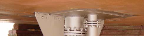
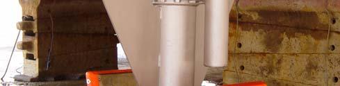
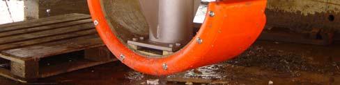
2 Gardline MBES Systems Sea Explorer EM1002 RV Triton EM1002(S) Ocean Seeker EM1002(S) Ocean Endeavour EM1002 / EM120 Sea Profiler EM1000 Sea Surveyor EM1000 / EM12 Portable EM3000 Sea Trident ELAC 1050
3 Metadata What is it? A complex topic in itself IGGI Guidelines Principles of Good Metadata Management The Dublin Core Metadata Initiative (DCMI) is an organization dedicated to promoting the widespread adoption of interoperable metadata standards A technical word for Data about Data Structured information that describes, explains, locates or otherwise makes it easier to retrieve, use, or manage an information resource.


4 Metadata Why do we want it? To catalogue data To provide an abstract of the data To search for data To learn more about data
5 Metadata Why do we want it? Geophysical Site Survey 9 Kms 2 Hydrographic Survey 9,000 Kms 2
6 Metadata Why do we want it? CONTRACTOR shall fill out the following swath coverage tables as an integral component of their bid. The swath coverage tables shall detail the seafloor coverage of the multibeam bathymetry and backscatter system(s) as a function of water depth and survey speed, with a minimum accuracy of 0.5% of the water depth. Swath coverage tables should be based upon experience, preferably with the vessel proposed, and not manufacturer s specifications.

7 Metadata - Survey Data Client Details Survey Vessel Crew List Project Information Geodetic Parameters Survey Plan Equipment List
8 Metadata - Multibeam Data Equipment Specifications Interface Details Installation Parameters Calibration Details Operating Parameters Quality Statistics
9 Equipment Specifications Equipment Specifications MBES Frequency 95 KHz Number of Beams 111 Beam Width 2 x 2 Swathe width 150 Pulse Length 0.2, 0.7, 2.0 msec Sample Rate 9 KHz Survey Sensors Motion/Heading Sensor SVP Probes DGPS
10 Survey Sensors Seapath 200 Attitude/Heading System Pitch/Roll 0.03 RMS Heave 5cm or 5% Heading RMS Transducer Velocity Probe (AML) Velocity 0.05 m/sec Temperature C Depth 0.05 % Velocity Probe (Valeport) Velocity 0.03 m/sec Temperature 0.01 C Depth 0.04 % DGPS
11 Interface Details Format Data rates Baud rates Demodulator RTCM Seapath 200 CoG Velocity Heading DGPS Attitude Heading PPS MRU5 Transducer EM1002 Processor Unit Attitude Heading Transducer CTD Velocity Temperature EM1002 Workstation MBES Datagrams Voyager5 PC
12 Integrated Survey System
13 Installation Details Installation Survey Hardware versions Software versions

14 Operating Parameters Operating Parameters MBES Mode Draught / Waterline Sound Velocity Profile Filter Settings Motion Sensor Filter Settings Positioning System Reference Station
 Tests Acquisition Statistics Processing")
15 MBES Quality Plan Installation Survey Report Harbour Tests Instrument Tests Calibrations Heading/Motion Sensor Positioning System Velocity Probes Offshore Calibration (Patch) Tests Acquisition Statistics Processing Statistics

16 MBES Quality Statistics What is Quality? Fitness for Purpose Verification Is it working correctly? Manufacturers Specification Validation Is it providing the required data? Clients Specification

17 Clients Specifications Different Clients Different Specifications Oil / Gas Exploration Site Surveys Pipeline Route Surveys Inspection Cable Companies Cable Route Surveys Government Agencies Hydrographic Surveys EEZ Surveys
18 Quality Control Statistics Depth data Acquisition Statistics Noise data Motion Sensor data Velocity data Timing data Percentage of Valid Soundings Mean Swathe Width Ping Rate IHO statistics a/b are : User# Total # fail % fail # pass % pass ===== ===== ====== ======

19 Mean Depth per Beam MBES Quality Statistics
20 MBES Quality Statistics Fortunately, the Earth is flat(ish)..

21 But not always MBES Quality Statistics

22 MBES Quality Statistics Beam Errors may be derived from Best Fit Curve Beam Errors -> Corrections, if desired.

23 MBES Quality Statistics If the Earth is not Flat, the Surveyor may Frown

24 MBES Quality Statistics Persistent Frown, or Smile, indicates Velocity Problems

25 MBES Quality Statistics Quantify Error wrt Depth and compare with Specification

26 MBES Quality Statistics Differencing depths enables a Noise figure to be calculated

27 MBES Quality Statistics Peaks in Noise coincide with change in Amplitude/Phase detection
28 MBES Quality Statistics Consistent figures are expected at same depth (50m)

29 MBES Quality Statistics But will vary with water depth (220m)

30 MBES Quality Statistics And with type of system 220m)

31 MBES Quality Statistics Change in Noise values may indicate change in sea conditions

32 MBES Quality Statistics Motion data may be analysed to indicate sea conditions

33 MBES Quality Statistics Scatter plot will show Magnitude and Period

34 MBES Quality Statistics Histogram will show Frequency Distribution

35 MBES Quality Statistics Comparison of Lines indicated change in sea conditions

36 Transducer velocity is critical MBES Problems

37 MBES Problems Long term trends can highlight problems

38 MBES Problems Mean Depths show general problem, plus exaggerated effect

39 MBES Problems Problems within a line have instantaneous effect

40 MBES Problems Time synchronization with GPS can be problematic

41 MBES Problems Loss of GPS Pulse can introduce large offset errors
42 MBES Problems Two options for synchronization System Use Processor Unit (PU) Time to time-tag position data. 4No need for PPS 6Must have consistent latency Datagram Synchronize PU to GPS using Pulse per Second (PPS). Then use the Time reported in the (GGA) datagram to time-tag position data. 4Most accurate (in theory) 6Requires PPS

43 MBES Problems An apparent shift in seabed features, could be caused by a number of problems

44 MBES Problems Monitor difference between System time and GPS time

45 MBES Problems If the GPS-System time difference is greater than 1 second, a potential problem exists

46 MBES Problems Care taken when calibrations show unexpected results
47 MBES Problems A Rule of Thumb : System Use Processor Unit (PU) Time to time-tag position data. Most Reliable, IF LATENCY IS CONSISTENT Datagram Synchronize PU to GPS using Pulse per Second (PPS). Then use the Time reported in the (GGA) datagram to time-tag position data. Most Accurate, IF PPS IS RELIABLE
48 Conclusions The concept of Metadata appears to suited to the problem of multibeam data management. Quality statistics should form an important part of such Metadata. Analysis of relatively simple statistics can help to verify the quality of acquired data. Useful implementation requires agreed standards
49 THANK-YOU Dave Mann, Survey Support Manager, Gardline Geosurvey
KONGSBERG seafloor-mapping echosounders
 KONGSBERG seafloor-mapping echosounders Berit Horvei WORLD CLASS through people, technology and dedication AGENDA Historical overview EM series Multibeam echosounder and Subbottom profiler Topside software.
Multibeam data quality assurance at Genavir. Karine Abel Michaux
 Multibeam data quality assurance at Genavir Hervé Bisquay hbisquay@genavir.fr Karine Abel Michaux kabelmic@genavir.fr Pascal Viollette pviollette@genavir.fr GENAVIR Genavir is the operator of the civilian
Survey Sensors. 18/04/2018 Danny Wake Group Surveyor i-tech Services
 Survey Sensors 18/04/2018 Danny Wake Group Surveyor i-tech Services What do we need sensors for? For pure hydrographic surveying: Depth measurements Hazard identification Seabed composition Tides & currents
CALTRANS BATHYMETRIC SURVEY VICINITY OF YERBA BUENA ISLAND AND OAKLAND MOLE ALONG SFOBB SAN FRANCISCO BAY
 FUGRO PELAGOS, INC. CALTRANS BATHYMETRIC SURVEY VICINITY OF YERBA BUENA ISLAND AND OAKLAND MOLE ALONG SFOBB SAN FRANCISCO BAY CALTRANS CONTRACT 59A0053 Survey Period: February 25 th March 1 st, 2013 Report
AN ACOUSTIC PIPELINE TRACKING AND SURVEY SYSTEM FOR THE OFFSHORE
 AN ACOUSTIC PIPELINE TRACKING AND SURVEY SYSTEM FOR THE OFFSHORE Nico Roosnek Roosnek Research & Development Vlaskamp 92 2592 AC The Hague The Netherlands e-mail: nico@roosnek.nl Abstract: Acoustic pipeline
SYSTEM 5900 SIDE SCAN SONAR
 SYSTEM 5900 SIDE SCAN SONAR HIGH-RESOLUTION, DYNAMICALLY FOCUSED, MULTI-BEAM SIDE SCAN SONAR Klein Marine System s 5900 sonar is the flagship in our exclusive family of multi-beam technology-based side
Research Vessel Technical Enhancement Committee (RVTEC) November 2009 Meeting ISS - Integrated Survey Systems
 November 2009 Meeting ISS - Integrated Survey Systems") Research Vessel Technical Enhancement Committee (RVTEC) November 2009 Meeting ISS - Integrated Survey Systems John Kiernan, P.E. SAIC - Marine Science and Technology Division ISS-2000 Integrated Survey
Research Vessel Technical Enhancement Committee (RVTEC) November 2009 Meeting ISS - Integrated Survey Systems John Kiernan, P.E. SAIC - Marine Science and Technology Division ISS-2000 Integrated Survey
Semi-buried seabed object detection: Sonar vs. Geophysical methods
 Semi-buried seabed object detection: Sonar vs. Geophysical methods Dino DRAGUN, Croatia, Lieselot NOPPE, Belgium, Pierre SERPE, Belgium, Emeline CARON, France, Astrid ROBERT, France Key words: Site Investigation,
R/V Falkor Multibeam Echosounder System Calibration September 22 24, 2014
 R/V Falkor Multibeam Echosounder System Calibration September 22 24, 2014 Report prepared by: Paul D. Johnson Ocean Mapping/Joint Hydrographic Center 24 Colovos Road University of New Hampshire Durham,
R/V Falkor Multibeam Echosounder System Review
 R/V Falkor Multibeam Echosounder System Review February 12, 2014 Report prepared by: Jonathan D. Beaudoin, Paul D. Johnson and Ashton F. Flinders Center for Coastal and Ocean Mapping/Joint Hydrographic
EK60. SCIENTIFIC SOUNDER SCIENTIFIC ECHO SOUNDER
 EK60 SCIENTIFIC ECHO SOUNDER HIGH DYNAMIC RANGE RAW DATA RECORDING LOW SELF NOISE HIGH PING RATE MULTI FREQUENCY APPLICATION FOR SPECIES ID SEVERAL FREQUENCIES COVERING SAME SAMPLE VOLUME REMOTE CONTROL
Kongsberg Maritime Product overview
 Kongsberg Maritime Product overview / 1 / 1-Nov-12 Frequency Range Coverage 125,250,500kHz 0.5-200m 12xD 200-400kHz 0.5-500m 5.5xD / 140-200 deg 300 khz 0.5-270m 4-10xD / 130-200 deg 70-100 khz 3-2000m
OFFSHORE ANALYSIS & RESEARCH SOLUTIONS HOUSTON PETROLEUM SURVEYORS GROUP PERSONNEL DATA PROCESSING PARTNERSHIPS
 OFFSHORE ANALYSIS & RESEARCH SOLUTIONS HOUSTON PETROLEUM SURVEYORS GROUP KEEPING YOUR PROJECTS IN MOTION OARS-HPSG combines the experience of two highly complementary organizations providing expanded capabilities,
Company Profile. Facilities
 Company Profile R2Sonic was founded in February 2006 by three veteran underwater acoustical engineers; Jens R. Steenstrup, Mark Chun and Kirk Hobart; with the mission to utilize their experience to bring
GeoSwath Plus Wide swath bathymetry and georeferenced side scan
 GeoSwath Plus Wide swath bathymetry and georeferenced side scan www.geoacoustics.com GeoSwath Plus Wide Swath Bathymetry and co-registered georeferenced side scan system We maximise marine performance
R/V Falkor Multibeam Echosounder System Review
 University of New Hampshire University of New Hampshire Scholars' Repository Center for Coastal and Ocean Mapping Center for Coastal and Ocean Mapping 4-2-2013 R/V Falkor Multibeam Echosounder System Review
RVIB Nathaniel B. Palmer EM122 Multibeam Echosounder Sea Acceptance Trial for TX/RX Arrays NBP1505 June 10-15, 2015
 RVIB Nathaniel B. Palmer EM122 Multibeam Echosounder Sea Acceptance Trial for TX/RX Arrays NBP1505 June 10-15, 2015 Report prepared by: Paul Johnson and Kevin Jerram University of New Hampshire Center
GEO-MARINE TECHNOLOGY, INC. A Geological, Geophysical, and Hydrographic Survey Consultancy
 COMPANY PROFILE OUR MISSION AND TRADE OUR MISSION: OUR TRADE: We few, professional scientists strive to support the objectives of our marine energy and telecommunications clients with cooperation, innovation
Seafloor Mapping Using Interferometric Sonars: Advances in Technology and Techniques
 Seafloor Mapping Using Interferometric Sonars: Advances in Technology and Techniques Tom Hiller, Advanced Products Manager, GeoAcoustics Ltd. WORLD CLASS through people, technology and dedication Brest,
Experiences with Hydrographic Data Budgets Using a Low-logistics AUV Platform. Thomas Hiller Teledyne Marine Systems
 Experiences with Hydrographic Data Budgets Using a Low-logistics AUV Platform Thomas Hiller Teledyne Marine Systems 1 Teledyne Marine Systems Strategic Business Units 2 What is the Gavia? The Gavia is
Increased Safety and Efficiency using 3D Real-Time Sonar for Subsea Construction
 Increased Safety and Efficiency using 3D Real-Time Sonar for Subsea Construction Chief Technology Officer CodaOctopus Products, Ltd. Booth A33a 2D, 3D and Real-Time 3D (4D) Sonars? 2D Imaging 3D Multibeam
global acoustic positioning system GAPS usbl acoustic with integrated INS positioning system Ixsea Oceano GAPS page 1
 global acoustic positioning system usbl acoustic positioning system with integrated INS positioning system page 1 THE MERGER OF INERTIAL AND UNDERWATER ACOUSTIC TECHNOLOGIES is a unique Global Acoustic
Teledyne Marine Acoustic Imagining
 RESON SeaBat high performance sonars for long range object detection and MCM applications Navigation, object avoidance & up close inspection with BlueView Greg Probst Sales Manager, Defense Teledyne Marine
Automation at Depth: Ocean Infinity and seabed mapping using multiple AUVs
 Automation at Depth: Ocean Infinity and seabed mapping using multiple AUVs Ocean Infinity s seabed mapping campaign commenced in the summer of 2017. The Ocean Infinity team is made up of individuals from
Pioneers of Wideband High Resolution Multibeam Systems
 Pioneers of Wideband High Resolution Multibeam Systems W W W. R 2 S O N I C. C O M Systems Overview The R2Sonic Sonic Series are the world s first true wideband high resolution Motion Heading SV GPS shallow
Lake Borgne, Louisiana Debris Mapping
 Lake Borgne, Louisiana Debris Mapping Abstract Gary R. Davis, Paul L. Donaldson, Walter Simmons, Rebecca Quintal Science Applications International Corporation 221 Third Street Newport, RI 02840 USA Under
Survey Operations Pipeline Inspection
 Survey Operations Pipeline Inspection HydroFest 16 th April 20 Kevin Donald Agenda Why Inspect? Definition of a Pipeline Types of Survey Positioning Data Processing The Future Conclusions Page 2 Why Inspect?
08/10/2013. Marine Positioning Systems Surface and Underwater Positioning. egm502 seafloor mapping
 egm502 seafloor mapping lecture 8 navigation and positioning Marine Positioning Systems Surface and Underwater Positioning All observations at sea need to be related to a geographical position. To precisely
Motion Sensor Performance
 ARTICLE DIRECT COMPARISON USING 2005 COMMON DATASET Motion Sensor Performance Integral components of a swathe bathymetry system are the motion and heading sensors. The current trend is to offer a system
Helping Build Your Capacity in Nautical Charting & Hydrography
 Helping Build Your Capacity in Nautical Charting & Hydrography Helping Chart your World Rajesh Alla Riyadh, Kingdom of Saudi Arabia 04-06 March 2013 Company Background Marine Services Capacity Building
Using synthetic aperture sonar as an effective hydrographic survey tool
 Using synthetic aperture sonar as an effective hydrographic survey tool Andy Hoggarth 1 (presenter), Karl Kenny 2 1. CARIS 1, 115 Waggoners Lane, Fredericton, NB CANADA E3B 2L4, 506-458-8533 2. Kraken
SONARMITE v4.0 MTX sweep version - PORTABLE BLUETOOTH ECHO SOUNDER
 SONARMITE v4.0 MTX sweep version - PORTABLE BLUETOOTH ECHO SOUNDER Introduction The SonarMite Echo Sounder was the result of nearly two years research and development to further extend the boundaries of
VDatum and SBET to Improve Accuracy of NOAA s High-Resolution Bathymetry
 VDatum and SBET to Improve Accuracy of NOAA s High-Resolution Bathymetry US HYDRO 2007 Extended Abstract Author: Crescent H. Moegling CoAuthor: Steve Brodet Moegling HYDRO 2007 1 Introduction NOAA s Hydrographic
Applanix Products and Solutions for Hydrographic Survey & Marine Applications Maximize Your Productivity!
 Applanix Products and Solutions for Hydrographic Survey & Marine Applications Maximize Your Productivity! Applanix technology and support gives you the advantage: lower costs of deployment, faster times
PRINCIPLE OF SEISMIC SURVEY
 PRINCIPLE OF SEISMIC SURVEY MARINE INSTITUTE Galway, Ireland 29th April 2016 Laurent MATTIO Contents 2 Principle of seismic survey Objective of seismic survey Acquisition chain Wave propagation Different
Inertial Navigation System
 Apogee Series ULTIMATE ACCURACY MEMS Inertial Navigation System INS MRU AHRS ITAR Free 0.005 RMS Motion Sensing & Georeferencing APOGEE SERIES makes high accuracy affordable for all surveying companies.
TORSTEIN PEDERSEN. Improving the Common DVL: A New Standard in Doppler Velocity Logs
 TORSTEIN PEDERSEN Improving the Common DVL: A New Standard in Doppler Velocity Logs VOLVO OCEAN RACE 2011 Precursor to Nortek s DVL story Nortek Background for DVLs Technology Company with expertise in
Evaluation of GPS-Based Attitude Parameters Applied to Bathymetric Measurements
 Article ID: Evaluation of GPS-Based Attitude Parameters Applied to Bathymetric Measurements Chang Chia-chyang, Lee Hsing-wei Department of Surveying and Mapping Engineering, Chung Cheng Institute of Technology
Solutions for a blue planet
 Solutions for a blue planet Optimising the businesses of offshore and shallow water professionals with sustainability as our beacon The world is seeing a steady increase in operations at sea in the energy,
Three-dimensional investigation of buried structures with multi-transducer parametric sub-bottom profiler as part of hydrographical applications
 Three-dimensional investigation of buried structures with multi-transducer parametric sub-bottom profiler as part Jens LOWAG, Germany, Dr. Jens WUNDERLICH, Germany, Peter HUEMBS, Germany Key words: parametric,
Inertial Systems. Ekinox Series TACTICAL GRADE MEMS. Motion Sensing & Navigation IMU AHRS MRU INS VG
 Ekinox Series TACTICAL GRADE MEMS Inertial Systems IMU AHRS MRU INS VG ITAR Free 0.05 RMS Motion Sensing & Navigation AEROSPACE GROUND MARINE EKINOX SERIES R&D specialists usually compromise between high
Kongsberg Seatex AS Pirsenteret N-7462 Trondheim Norway POSITION 303 VELOCITY 900 HEADING 910 ATTITUDE 413 HEAVE 888
 WinFrog Device Group: Device Name/Model: Device Manufacturer: Device Data String(s) Output to WinFrog: WinFrog Data String(s) Output to Device: WinFrog Data Item(s) and their RAW record: GPS SEAPATH Kongsberg
Hydrographic processing considerations in the Big Data age: An overview of technology trends in ocean and coastal surveys
 IOP Conference Series: Earth and Environmental Science PAPER OPEN ACCESS Hydrographic processing considerations in the Big Data age: An overview of technology trends in ocean and coastal surveys To cite
WASSP S3 MULTIBEAM FOR SURVEY & MAPPING EXPLORE IT ALL
 WASSP S3 EXPLORE IT ALL DISCOVER A NEW WORLD WITH THE LATEST INNOVATION FROM WASSP Outstanding performance, versatility and value. That s what you expect and exactly what you get with the new S3 sounder
Inertial Sensors. Ellipse 2 Series MINIATURE HIGH PERFORMANCE. Navigation, Motion & Heave Sensing IMU AHRS MRU INS VG
 Ellipse 2 Series MINIATURE HIGH PERFORMANCE Inertial Sensors IMU AHRS MRU INS VG ITAR Free 0.1 RMS Navigation, Motion & Heave Sensing ELLIPSE SERIES sets up new standard for miniature and cost-effective
Positioning Small AUVs for Deeper Water Surveys Using Inverted USBL
 Positioning Small AUVs for Deeper Water Surveys Using Inverted USBL Presented at Hydro12, Rotterdam, November 2012 Dr. T.M. Hiller, thiller@teledyne.com Overview Introduction to Gavia AUV Gavia Acoustic
Handling Interferometric Data: Streamlining the Processing Flow
 Handling Interferometric Data: Streamlining the Processing Flow Paper 5 at Hydro8, 4 th November 2008 Tom Hiller, Advanced Products Manager, GeoAcoustics Ltd. WORLD CLASS through people, technology and
Old House Channel Bathymetric and Side Scan Survey
 FIELD RESEARCH FACILITY DUCK, NC Old House Channel Bathymetric and Side Scan Survey COASTAL AND HYDRAULICS LABORATORY FIELD DATA COLLECTION AND ANALYSIS BRANCH Michael Forte December 2009 View looking
Inertial Sensors. Ellipse Series MINIATURE HIGH PERFORMANCE. Navigation, Motion & Heave Sensing IMU AHRS MRU INS VG
 Ellipse Series MINIATURE HIGH PERFORMANCE Inertial Sensors IMU AHRS MRU INS VG ITAR Free 0.1 RMS Navigation, Motion & Heave Sensing ELLIPSE SERIES sets up new standard for miniature and cost-effective
Pipeline Inspection and Environmental Monitoring Using AUVs
 Pipeline Inspection and Environmental Monitoring Using AUVs Bjørn Jalving, Bjørn Gjelstad, Kongsberg Maritime AUV Workshop, IRIS Biomiljø, 7 8 September 2011 WORLD CLASS through people, technology and
A complete range of marine survey services worldwide
 A complete range of marine survey services worldwide www.alpineocean.com Welcome to Alpine Below: Alpine s headquarters in Norwood, New Jersey Combining regional knowledge Our staff of professionals includes
Evolution of Sonar Survey Systems for Sea Floor Studies.
 Everant.org/ETJ Research Article Engineering and Technology Journal ISSN: 2456-3358 Impact Factor: 3.449 Evolution of Sonar Survey Systems for Sea Floor Studies. Milind Naik 1, Govind Ranade 2, R. B. Lohani
Side-Scan Sonar Presentation STS
 Training Module Side-Scan Sonar Presentation STS SIDE-SCAN SONAR SAFETY Training Module Content: This module includes information on: Types of Side-Scan Benefits and Disadvantages System Configuration
Object Detection for Underwater Port Security
 Object Detection for Underwater Port Security Dr. Lloyd Huff LCHUFF CONSULTANCY,LLC Mr. John Thomas TRITON IMAGING,INC Shallow Survey 2012 February 22, 2012 INTRODUCTION I am glad to be here today to make
EM 710. Multibeam echo sounder
 EM 710 Multibeam echo sounder EM 710 Multibeam echo sounder Product description This document presents a brief technical description of the EM 710 multibeam echo sounder. About this document Rev Date
Sonar advancements for coastal and maritime surveys
 ConférenceMéditerranéenneCôtièreetMaritime EDITION1,HAMMAMET,TUNISIE(2009) CoastalandMaritimeMediterraneanConference Disponibleenligne http://www.paralia.fr Availableonline Sonar advancements for coastal
Teledyne Oil & Gas Innovation and Subsea Reliability
 A Member of Innovation and Subsea Reliability www.teledyneoilandgas.com Technologies A Member of Seismic Instruments Imaging Vehicles Photo Courtesy BMT has been proudly serving the oil and gas industry
Gyrocompass and motion sensor. octans. navigation and positioning
 Gyrocompass and motion sensor octans navigation and positioning the best in fog technology The technological heart of is the Fibre-Optic Gyroscope (FOG), the only truly-solid-state answer to rotation sensing.
Inertial Sensors. Ellipse Series MINIATURE HIGH PERFORMANCE. Navigation, Motion & Heave Sensing IMU AHRS MRU INS VG
 Ellipse Series MINIATURE HIGH PERFORMANCE Inertial Sensors IMU AHRS MRU INS VG ITAR Free 0.2 RMS Navigation, Motion & Heave Sensing ELLIPSE SERIES sets up new standard for miniature and cost-effective
POS MV Position and Attitude sensors. Applications. > > High reliability in all dynamic conditions. > > Immunity to GNSS outages
 45 27 39.384 N 9 07 30.145 E POS MV Position and Attitude sensors Applanix technology and support gives you the advantage: lower costs of deployment, faster times to completion, and improved quality of
Marine Institute Job Description
 Marine Institute Job Description Position Contract Service Group Location Temporary Scientific & Technical Officer (STO), Hydrographic Data Processor (INFOMAR) Temporary specified purpose contract for
1 Introduction integrated 3D sonar system for underwater inspection applications
 1 Introduction The Underwater Inspection System (UIS TM ) is an integrated 3D sonar system for underwater inspection applications, specifically port and harbor construction, maintenance, port expansion,
Ongoing Developments in Side Scan Sonar The pursuit of better Range, Resolution and Speed
 Ongoing Developments in Side Scan Sonar The pursuit of better Range, Resolution and Speed Nick Lawrence EdgeTech Advances in Seafloor-mapping Sonar Conference 30 th November 2009 Company Profile EdgeTech
Surveyors in The Oil & Gas Industry. Walter Jardine Lead Surveyor, BP North Sea Region Hydrofest 13 April 2011
 Surveyors in The Oil & Gas Industry what on earth do those guys do? Walter Jardine Lead Surveyor, BP North Sea Region Hydrofest 13 April 2011 Why Geography Matters in the O&G Industry Around 80% of the
POS MV Position and Attitude sensors. Applications. > > High reliability in all dynamic conditions. > > Immunity to GNSS outages
 45 27 39.384 N 9 07 30.145 E POS MV Position and Attitude sensors Applanix technology and support gives you the advantage: lower costs of deployment, faster times to completion, and improved quality of
Shared Use of DGPS for DP and Survey Operations
 Gabriel Delgado-Saldivar The Use of DP-Assisted FPSOs for Offshore Well Testing Services DYNAMIC POSITIONING CONFERENCE October 17-18, 2006 Sensors Shared Use of DGPS for Dr. David Russell Subsea 7, Scotland
APPLICATIONS OF KINEMATIC GPS AT SHOM
 International Hydrographic Review, Monaco, LXXVI(1), March 1999 APPLICATIONS OF KINEMATIC GPS AT SHOM by Michel EVEN 1 Abstract The GPS in kinematic mode has now been in use at SHOM for several years in
Maritime Administration of Latvia Hydrographic Service National Report to Baltic Sea Hydrographic Commission
 Maritime Administration of Latvia Hydrographic Service National Report to Baltic Sea Hydrographic Commission Executive summary 2017 The Report gives an overview of the main activities of Hydrographic Service
Marine Institute Job Description
 Marine Institute Job Description 02-02-2015 Position Contract Service Group Location Scientific & Technical Officer, Hydrographic Data Processor (INFOMAR) Temporary Specified Purpose, up to end 2018 (INFOMAR
Mid-Frequency Reverberation Measurements with Full Companion Environmental Support
 DISTRIBUTION STATEMENT A. Approved for public release; distribution is unlimited. Mid-Frequency Reverberation Measurements with Full Companion Environmental Support Dajun (DJ) Tang Applied Physics Laboratory,
Synthesis of acoustic images of underwater targets
 FACULDADE DE ENGENHARIA DA UNIVERSIDADE DO PORTO Synthesis of acoustic images of underwater targets Duarte Nuno Reimão Borges Lopes Silva PREPARATION FOR THE MSC DISSERTATION Master in Electrical and Computers
Proper Environmental Reduction for Attenuation in Multi-sector Sonars
 Rodrigo de Campos CARVALHO, Brazil and John E. HUGHES CLARKE, Canada SUMMARY Multibeam backscatter data represent a major seabed discrimination tool. For seafloor characterization, however, one of the
Teledyne Marine Oil and Gas.
 Oil and Gas www.teledynemarine.com/energy Applications in Oil and Gas Teledyne Marine encompasses over 20 brands that offer innovative, highly reliable technology spanning the life cycle of an oil field,
Falkor 2017 UHDAS installation and ADCP evaluation
 Falkor 2017 UHDAS installation and ADCP evaluation Dr. Julia M Hummon University of Hawaii hummon@hawaii.edu Revision History 06/06/17 draft 07/03/17 final Table of Contents 1 Introduction...1 1.1 ADCPs...1
NOAA Newport 2012 ADCP
 NOAA Newport 2012 ADCP Part I: ADCP Getting Ocean Velocity ADCP Acquisition Systems: UHDAS, VmDAS What can go wrong Part II: UHDAS 1: Outline NOAA Newport 2012 ADCP Part II: UHDAS 2: Outline ADCP Processing
The Evolution of Fisheries Acoustics. LO: Identify and sequence hardware and analytic contributions made to Fisheries Acoustics.
 The Evolution of Fisheries Acoustics LO: Identify and sequence hardware and analytic contributions made to Fisheries Acoustics. The First Sonars Sperm whale (Physeter macrocephalus) Killer whale (Orcinus
Subsea Positioning In deep water
 Subsea Positioning In deep water PETRONAS - PETRAD - INTSOK CCOP DEEPWATER SUBSEA TIE-BACK Damai Puri Resort & Spa, Kuching, Sarawak, MALAYSIA 24TH - 26TH January, 2011 Supplier to the oil & gas industry
IMCA Competence Assessment Portfolio May 2012
 S/S20/000/01 Safety (S20 refers to Grade I core competences which are applicable to roles S21, S22, S23, S24 and S25, as described in IMCA C 004) of company health, safety, environment and quality procedures
Emerging Subsea Networks
 FIBRE-TO-PLATFORM CONNECTIVITY, WORKING IN THE 500m ZONE Andrew Lloyd (Global Marine Systems Limited) Email: andrew.lloyd@globalmarinesystems.com Global Marine Systems Ltd, New Saxon House, 1 Winsford
Inertial Navigation System
 Apogee Marine Series ULTIMATE ACCURACY MEMS Inertial Navigation System INS MRU AHRS ITAR Free 0.005 RMS Navigation, Motion & Heave Sensing APOGEE SERIES makes high accuracy affordable for all surveying
AN AIDED NAVIGATION POST PROCESSING FILTER FOR DETAILED SEABED MAPPING UUVS
 MODELING, IDENTIFICATION AND CONTROL, 1999, VOL. 20, NO. 3, 165-175 doi: 10.4173/mic.1999.3.2 AN AIDED NAVIGATION POST PROCESSING FILTER FOR DETAILED SEABED MAPPING UUVS Kenneth Gade and Bjørn Jalving
A Turnkey Weld Inspection Solution Combining PAUT & TOFD
 A Turnkey Weld Inspection Solution Combining PAUT & TOFD INTRODUCTION With the recent evolutions of the codes & standards, the replacement of conventional film radiography with advanced ultrasonic testing
Optimizing Resolution and Uncertainty in Bathymetric Sonar Systems
 University of New Hampshire University of New Hampshire Scholars' Repository Center for Coastal and Ocean Mapping Center for Coastal and Ocean Mapping 6-2013 Optimizing Resolution and Uncertainty in Bathymetric
Kordil Surveying & Engineering Services
 Kordil Surveying & Engineering Services About Kordil Kordil Surveying & Engineering Ltd. Co. in short Kordil is an all in one surveying company providing service from Turkey. Hydrography, Oceanography
Inertial Systems. Ekinox 2 Series TACTICAL GRADE MEMS. Motion Sensing & Navigation IMU AHRS MRU INS VG
 Ekinox 2 Series TACTICAL GRADE MEMS Inertial Systems IMU AHRS MRU INS VG ITAR Free 0.02 RMS Motion Sensing & Navigation AEROSPACE GROUND MARINE EKINOX 2 SERIES R&D specialists usually compromise between
UNIT-4 POWER QUALITY MONITORING
 UNIT-4 POWER QUALITY MONITORING Terms and Definitions Spectrum analyzer Swept heterodyne technique FFT (or) digital technique tracking generator harmonic analyzer An instrument used for the analysis and
G003 Data Preprocessing and Starting Model Preparation for 3D Inversion of Marine CSEM Surveys
 G003 Data Preprocessing and Starting Model Preparation for 3D Inversion of Marine CSEM Surveys J.J. Zach* (EMGS ASA), F. Roth (EMGS ASA) & H. Yuan (EMGS Americas) SUMMARY The marine controlled-source electromagnetic
VESSEL IDENTIFICATION. Ready to work:
 The Nautical Geo is a research vessel available for worldwide operations. Fitted with cutting-edge survey equipment, she can undertake complex survey operations as well as light construction support, ensuring
CODEVINTEC. Miniature and accurate IMU, AHRS, INS/GNSS Attitude and Heading Reference Systems
 45 27 39.384 N 9 07 30.145 E Miniature and accurate IMU, AHRS, INS/GNSS Attitude and Heading Reference Systems Aerospace Land/Automotive Marine Subsea Miniature inertial sensors 0.1 Ellipse Series New
EGYPTIAN HYDROGRAPHIC DEPARTMENT THE EGYPTIAN HYDROGRAPHIC FRAMEWORK
 gvt THE EGYPTIAN HYDROGRAPHIC FRAMEWORK The roles of a national Hydrographic Service can be summarized in collecting georeferenced data through systematic surveys at sea and along the coast related to:
Deep. Navigating the. High Accuracy Positioning Support for Deep Water Construction. Copyright Journal of Ocean Technology 2017
 Navigating the Deep High Accuracy Positioning Support for Deep Water Construction by Will Primavesi, Tamir Frydenrych, and Drew Nicholson ISTOCKPHOTO.COM/CHERT61 The Journal of Ocean Technology, Vol. 12,
Acoustic Resonance Classification of Swimbladder-Bearing Fish
 Acoustic Resonance Classification of Swimbladder-Bearing Fish Timothy K. Stanton and Dezhang Chu Applied Ocean Physics and Engineering Department Woods Hole Oceanographic Institution Bigelow 201, MS #11
Tritech International Vehicle Sonar Developments
 Tritech International Vehicle Sonar Developments Mike Broadbent Business Development Manager Oceanology 2012 - UUVS Overview About Tritech Mechanical Scanning Sonar - Improving the performance High Speed
Paper for a communication at the U.S. Hydro 2003
 Paper for a communication at the U.S. Hydro 2003 A Student Initiated Hydrographic Survey in a Riverine Environment, The Pearl River 2002 Field Project Experience David Dodd, Stephan Howden, David Wells,
HYDROGRAPHIC SURVEY STANDARDS AND DELIVERABLES
 TABLE OF CONTENTS 1. HYDROGRAPHIC SURVEY METHODOLOGY... 3 2. HYDROGRAPHIC SURVEY REFERENCE STANDARDS... 3 3. HYDROGRAPHIC SURVEY CRITERIA... 3 3.1 HYDROGRAPHIC SURVEYS OVER NON GAZETTED NAVIGABLE WATERS*:...
MARINE SURVEY MARINE SURVEY 1
 MARINE SURVEY MARINE SURVEY 1 MARINE SURVEY 2 MARINE SURVEY MARINE SURVEY 3 SOLUTIONS 4 MARINE SURVEY MARINE SURVEY 5 MARINE SURVEY 5 ixblue stands as a global leader in the design and manufacturing of
Motion Reference Units
 Motion Reference Units MRU Datasheet Rev. 1.3 IP-67 sealed 5% / 5 cm Heave accuracy 0.03 m/sec Velocity accuracy 0.05 deg Pitch and Roll accuracy 0.005 m/sec2 Acceleration accuracy 0.0002 deg/sec Angular
POSITION & ORIENTATION SYSTEMS FOR MARINE VESSELS
 POSITION & ORIENTATION SYSTEMS FOR MARINE VESSELS Applanix POS MV is the marine-survey industry s most accurate, robust, and reliable position and orientation solution available today. Representing the