Seafloor Mapping Using Interferometric Sonars: Advances in Technology and Techniques
|
|
|
- Tamsin Simmons
- 6 years ago
- Views:
Transcription

1 Seafloor Mapping Using Interferometric Sonars: Advances in Technology and Techniques Tom Hiller, Advanced Products Manager, GeoAcoustics Ltd. WORLD CLASS through people, technology and dedication Brest, France. 30 November 2009
2 Presentation Outline Summary of the key attributes of interferometric technology Requirements for high accuracy surveys Examples of interferometric technology capabilities Use of interferometric technology in ROVs and AUVs / 2 / 30-Nov-09
3 Introduction to Interferometric Sonar Concepts and Technology / 3 / 30-Nov-09
4 How does an interferometer work? Transmitted pulse geometry similar to side scan Multiple receive staves (typically 4) Phase of returned sonar signal is measured on each stave Differential Phase is used to determine return angle Data is a time series (of angles, amplitudes, and other attributes) / 4 / 30-Nov-09


 / 5 /")
5 The data products: Side scan transmit geometry Simultaneous bathymetry and amplitude data (range series of angles and amplitudes) / 5 / 30-Nov-09
6 Principles of operation Transmit is short in time (a few cycles), wide across track and narrow along track (like a side scan) Multiple receiver staves within each transducer Phase measurement based on differential time Phase difference (Ф) / 6 / 30-Nov-09
7 Limitation: Interferometric Noise Sources Phasor diagrams illustrating sliding footprint and sea noise effects Result: interferometric raw data has angle noise / 7 / 30-Nov-09
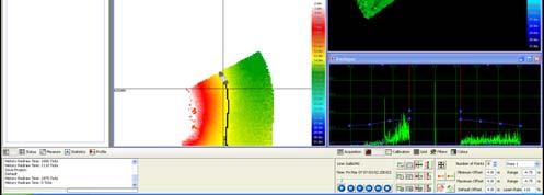
8 / 8 / 30-Nov-09 Looking at the Raw Data in Detail: key feature: 1000s of data points/ping Accurate range, noisy angle


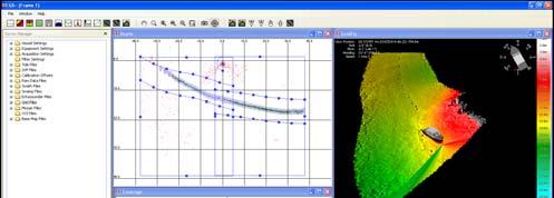
9 Basics of Interferometric Data Processing Key steps: Amplitude filtering Statistical filtering Binning / 9 / 30-Nov-09
10 Summary of interferometer attributes: Wide field of view (>240degrees) Data density similar to digital side scan Simultaneous bathymetry and side scan Swath width is insensitive to roll Higher data density away from nadir Limited range due to signal to noise requirement for phase measurements High data density but phase noise means processing is needed to get accurate seafloor depths Able to be implemented in compact, robust, low power form - Particularly suitable for shallow water surveys from small vessels / 10 / 30-Nov-09


11 / 11 / 30-Nov-09 The GeoAcoustics GeoSwath Plus
12 GeoSwath Technology Timeline GeoSwath 32 was introduced in 1998 by GeoAcoustics Ltd of Great Yarmouth, UK GeoSwath Plus was launched Q Continuous improvements in hardware and software have been improving data quality and swath width Data has been accepted as meeting IHO standards, and been included in UKHO Nautical Charts since 2005 Military Other By mid-2009 over 120 systems in use worldwide Environment Ports & harbours Oil&Gas Scientific/ geological General Hydrographic Dredging / 12 / 30-Nov-09


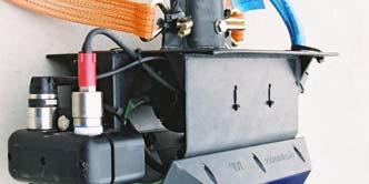
13 GeoSwath Transducer Specifications: Frequency: 125kHz 250kHz 500kHz Txd dims: 60x25x8cm 30x15x6cm 25x11x6cm Max depth: 200m 100m 50m Usual use: 0m 200m capability 10m-200m 0m 100m capability 2m-50m 0m 50m capability 1m-40m Typically found on: Larger Survey Ship Smaller Vessel and larger AUV/ROV Small vessel & small AUV/ROV / 13 / 30-Nov-09

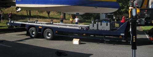
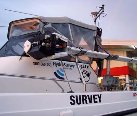
14 GeoSwath Deployment Examples Large and small vessels. Fixed, semi-permanent and temporary. Pole mount, hull mount. AUV and ROV mount. / 14 / 30-Nov-09


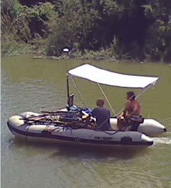

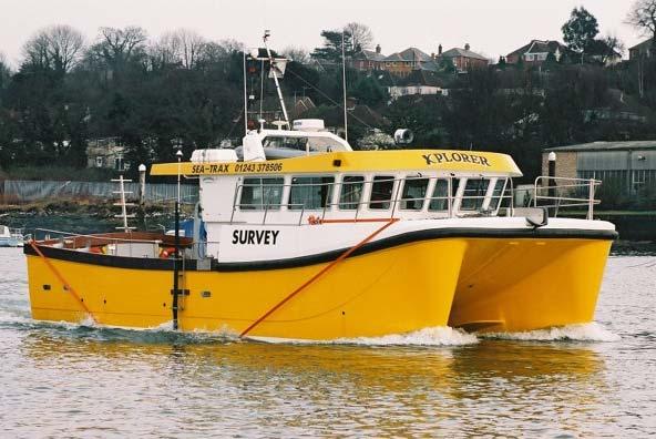
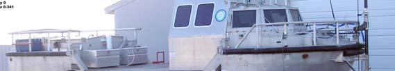
15 Suitable for very small survey vessels: / 15 / 30-Nov-09
16 Achieving High Accuracy with Interferometric Data / 16 / 30-Nov-09
17 GeoSwath Data Processing summary / 17 / 30-Nov-09
18 Alternative Third Party Processing Routes Real-time control GeoSwath Plus On-line processing Transfer of flagged raw data via Ethernet (real-time) Hypack QINSY GeoSwath Plus Acquisition Hardware Data storage and transfer GeoSwath Plus Off-line processing Data Flagging and conversion to GSF Data filtering and conversion to reduced raw file Fledermaus SABRE Other GSF reader CARIS Further GS+ processing and export as xyz Other vendors / 18 / 30-Nov-09
19 Unfiltered and filtered raw data / 19 / 30-Nov-09 19

20 All data view of single swath, 50m per side range setting, 5 Knots vessel speed / 20 / 30-Nov-09 20

21 Single swath binned at 50cm without interpolation or smoothing, and sun illuminated / 21 / 30-Nov-09 21


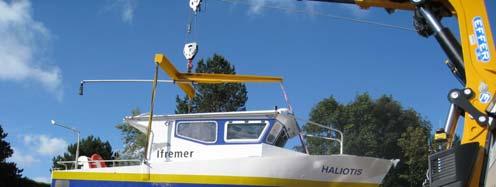
 10")
22 High Data Density Ensures Survey Quality Raw Data 1m Grid Bin size sonar footprint min. feature size. Data density > (or >>) 10 per bin. / 22 / 30-Nov-09 22


23 500kHz GeoSwath: bathymetry and side scan coverage plots Water depth ~10m under the transducers 80m swath width Bathymetry: 20cm grid / 23 / 30-Nov-09 Resolves 5cm high sand waves Side-scan mosaic: 10cm grid
24 / 24 / 30-Nov-09 Standard deviation of filtered data
25 / 25 / 30-Nov-09 Data density at different resolutions
26 Interferometric data processing for high accuracy: Key Characteristic: lots of data with accurate range and noisy angle In each depth bin may be 100s of measurements with approximately independent noise and random distribution Mean of this many depths gives a very repeatable and reliable number Standard Error of the Mean = Standard Deviation of data divided by the square root of the number of data points Accurate depths requires high data density, good data filtering, and prudent binning / 26 / 30-Nov-09
27 Running a Survey: the side scan search pattern / 27 / 30-Nov-09 27

28 The side scan search pattern gives full coverage high resolution interferometric surveys: / 28 / 30-Nov m x 780m, 8m to 25m deep, 2h survey time 28
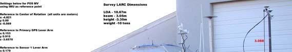
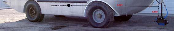
29 High accuracy surveying also requires: Data Timing and Time Synchronisation: Sub-ms PPS timing and use of time stamped ancillary data. Navigation accuracy: RTK GPS, or postprocessed position and attitude Accurate sound velocity profiles Minimise possible offset error sources: Minimise lever arms Align reference frame axes Accurately measured offsets Accurate ancillary data Good calibration: multiple patch tests, cross-checks Using above have demonstrated <4cm repeatability re. geoid. / 29 / 30-Nov-09
30 Example of high accuracy river mapping: Example is from Rijkswaterstaat; part of the Dutch Ministry of Transportation and Water Management. Responsibilities including the construction and maintennance of waterways and flood prevention. Chose the GeoSwath because it is particularly suitable for the shallow rivers, canals and seas in Holland. All the GeoSwath installations on RWS vessels are 250kHz GeoSwath Plus configured with the QINSy real time interface / 30 / 30-Nov-09

31 / 31 / 30-Nov-09 Vessel and retractable mounts


32 GeoSwath and QINSY -real time interface -into native QPS structure / 32 / 30-Nov-09
33 Data Comparison Tests by Rijkswaterstaat Same boat, same ancillaries, 2 fixed sonar mounts: GeoSwath 250kHz and Reson Seabat 8101 RTK GPS positioning and height control, Octans motion sensor Surveys run alternately, same 4-line pattern; GeoSwath-8101-GeoSwath-8101 Processing separately: GeoSwath via GS+ software 8101 via QPS QINSY GeoSwath via QINSY Data compared in final grid / 33 / 30-Nov-09
.")
34 Detailed comparisons of 300m profiles GeoSwath1 vs GeoSwath2 Beamformer1 vs Beamformer2 GeoSwath1 vs Beamformer1 GeoSwath2 vs Beamformer2 Conclusion: GeoSwath and Beamformer results are as repeatable as each other via either processing route (within ~3cm). / 34 / 30-Nov-09
 / 35 / 30-Nov-09")
35 Interferometer vs Beamformer Comparison on the River Meuse (1m bins) / 35 / 30-Nov-09


36 Data suitable for engineering surveys of rivers, canals and ports / 36 / 30-Nov-09

 3589 3598 / 37 /")
37 Bathymetry and Sediment Classification Maps: Example of monitoring slow changes in sediment dump area Aivo Lepland, Reidulv Bøe, Aave Lepland, Oddbjørn Totland, "Monitoring the volume and lateral spread of disposed sediments by acoustic methods, Oslo Harbor, Norway", Journal of Environmental Management 90 (2009) / 37 / 30-Nov-09
38 Another approach to height control: GPS height using postprocessed navigation solution Combine with inertial data to obtain full 3D GPS solution - remove effects of: Squat Vessel loading Tide errors Long period swell Errors in the concept of vessel centre of rotation / 38 / 30-Nov-09


39 POS-MV SBET processing vs tide and heave 2km line off NW Australia; ±10cm swell artefacts with ~12s period / 39 / 30-Nov-09


40 Precise positioning allows multi-senor surveys of structures. Breakwater with bathymetry and LIDAR data combined Images from U.S. Army Corp of Engineers, Field Data Collection and Analysis Branch, Coastal Hydraulics Lab. / 40 / 30-Nov-09
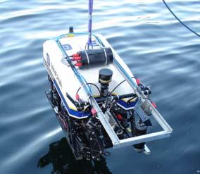
41 GeoSwath Plus for ROVs and AUVs / 41 / 30-Nov-09
42 Why GeoSwath works well on AUVs and ROVs: Intrinsic advantages of interferometric technology Wide coverage even at low fly heights Swath width insensitive to vehicle motion Simultaneous bathymetry and Side Scan Dimensions Small, light and rugged transducers Compact low power electronics Communications PC based - Windows XP Ethernet and serial interfaces Proprietary acquisition and processing software package / 42 / 30-Nov-09

43 / 43 / 30-Nov KHz Transducers and Electronics
44 GeoSwath ROV Sonar Receivers and controller Sonar Transmitters Compact PC Ethernet Interface Timing, start, stop Timing etc Sensor inputs Attitude etc Optionally also to dry-end PC Transducer Transducer / 44 / 30-Nov-09

45 / 45 / 30-Nov-09 GeoSwath Plus on Minerva ROV

46 / 46 / 30-Nov-09 GeoSwath Plus on ROV


47 Sidescan and bathymetry / 47 / 30-Nov-09 47

48 / 48 / 30-Nov-09 ROV Survey Data Bathymetry: Subsea ridge
49 GeoSwath AUV Generic AUV application using Standard GeoSwath Electronics Modules Sonar Receivers and controller Sonar Transmitters Compact PC Memory Ethernet Interface Timing, start, stop Timing etc Sensor inputs Attitude etc Transducer Transducer Local controller or self contained / 49 / 30-Nov-09


50 AUV module electronics and transducers 40cm / 50 / 30-Nov-09


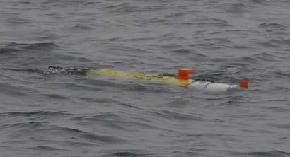
51 / 51 / 30-Nov-09 GeoSwath on the Hydroid Remus 100 AUV
52 AUV swath width capability: >100m at 5m fly height / 52 / 30-Nov-09


53 GeoSwath on the Gavia AUV 2.6m Propulsion Control & Comms INS DVL GeoSwath Batt. Nose / 53 / 30-Nov-09

54 Resolution of objects using 500kHz GeoSwath on small AUV at 5m fly height. / 54 / 30-Nov-09


55 Pre-lay pipe trench survey using AUV-mounted GeoSwath 1km / 55 / 30-Nov-09

56 Harbour post-dredge survey using AUV-mounted GeoSwath 100m / 56 / 30-Nov-09

57 Portable AUVs for difficult deployments: under-ice mapping Location of APLIS ice camp: 73 N, 146 W in Beaufort Sea / 57 / 30-Nov-09

58 / 58 / 30-Nov-09 GeoSwath Plus on Gavia AUV Under the Artic Ice

59 / 59 / 30-Nov-09 Mission data
 Doble M. J. and Wadhams P.")

60 Maps of the underside of the Arctic ice (from M. Doble and P. Wadhams, University of Cambridge, UK) Doble M. J. and Wadhams P. (2009) First Through- Ice Use Of A Small Auv For Mapping The Arctic Sea Ice Underside. GeoPhysics Research Letters Doble M. J and Wadhams P. (2009) Digital terrain mapping of the underside of sea ice from a small AUV Journal of Atmospheric and Oceanic Technology / 60 / 30-Nov-09

61 / 61 / 30-Nov-09 GeoSwath Plus on Gavia AUV, Bonaire 2008

62 Small AUV operations Operations Centre Survey area Vessel transit to site / 62 / 30-Nov-09

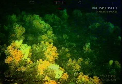
63 / 63 / 30-Nov-09 The edge of the coral reef

64 GeoSwath 500kHz SS from 2 lines at 15m fly height / 64 / 30-Nov-09

65 / 65 / 30-Nov-09 The AUV track lines down to 210m vehicle depth

66 / 66 / 30-Nov-09 Wide swath width from a small AUV.

67 / 67 / 30-Nov-09 with simultaneous co-registered side scan
68 Summary: Interferometric technology has been shown to be suitable for high accuracy surveys, given proper survey planning, ancillary equipment and data processing. This technology is particularly suitable for small boat shallow water applications and AUV/ROV deployment / 68 / 30-Nov-09

69 Kongsberg Maritime / 69 / 30-Nov-09
Handling Interferometric Data: Streamlining the Processing Flow
 Handling Interferometric Data: Streamlining the Processing Flow Paper 5 at Hydro8, 4 th November 2008 Tom Hiller, Advanced Products Manager, GeoAcoustics Ltd. WORLD CLASS through people, technology and
GeoSwath Plus Wide swath bathymetry and georeferenced side scan
 GeoSwath Plus Wide swath bathymetry and georeferenced side scan www.geoacoustics.com GeoSwath Plus Wide Swath Bathymetry and co-registered georeferenced side scan system We maximise marine performance
Experiences with Hydrographic Data Budgets Using a Low-logistics AUV Platform. Thomas Hiller Teledyne Marine Systems
 Experiences with Hydrographic Data Budgets Using a Low-logistics AUV Platform Thomas Hiller Teledyne Marine Systems 1 Teledyne Marine Systems Strategic Business Units 2 What is the Gavia? The Gavia is
KONGSBERG seafloor-mapping echosounders
 KONGSBERG seafloor-mapping echosounders Berit Horvei WORLD CLASS through people, technology and dedication AGENDA Historical overview EM series Multibeam echosounder and Subbottom profiler Topside software.
Positioning Small AUVs for Deeper Water Surveys Using Inverted USBL
 Positioning Small AUVs for Deeper Water Surveys Using Inverted USBL Presented at Hydro12, Rotterdam, November 2012 Dr. T.M. Hiller, thiller@teledyne.com Overview Introduction to Gavia AUV Gavia Acoustic
Old House Channel Bathymetric and Side Scan Survey
 FIELD RESEARCH FACILITY DUCK, NC Old House Channel Bathymetric and Side Scan Survey COASTAL AND HYDRAULICS LABORATORY FIELD DATA COLLECTION AND ANALYSIS BRANCH Michael Forte December 2009 View looking
global acoustic positioning system GAPS usbl acoustic with integrated INS positioning system Ixsea Oceano GAPS page 1
 global acoustic positioning system usbl acoustic positioning system with integrated INS positioning system page 1 THE MERGER OF INERTIAL AND UNDERWATER ACOUSTIC TECHNOLOGIES is a unique Global Acoustic
Company Profile. Facilities
 Company Profile R2Sonic was founded in February 2006 by three veteran underwater acoustical engineers; Jens R. Steenstrup, Mark Chun and Kirk Hobart; with the mission to utilize their experience to bring
Teledyne Marine Acoustic Imagining
 RESON SeaBat high performance sonars for long range object detection and MCM applications Navigation, object avoidance & up close inspection with BlueView Greg Probst Sales Manager, Defense Teledyne Marine
Increased Safety and Efficiency using 3D Real-Time Sonar for Subsea Construction
 Increased Safety and Efficiency using 3D Real-Time Sonar for Subsea Construction Chief Technology Officer CodaOctopus Products, Ltd. Booth A33a 2D, 3D and Real-Time 3D (4D) Sonars? 2D Imaging 3D Multibeam
SYSTEM 5900 SIDE SCAN SONAR
 SYSTEM 5900 SIDE SCAN SONAR HIGH-RESOLUTION, DYNAMICALLY FOCUSED, MULTI-BEAM SIDE SCAN SONAR Klein Marine System s 5900 sonar is the flagship in our exclusive family of multi-beam technology-based side
Three-dimensional investigation of buried structures with multi-transducer parametric sub-bottom profiler as part of hydrographical applications
 Three-dimensional investigation of buried structures with multi-transducer parametric sub-bottom profiler as part Jens LOWAG, Germany, Dr. Jens WUNDERLICH, Germany, Peter HUEMBS, Germany Key words: parametric,
Lake Borgne, Louisiana Debris Mapping
 Lake Borgne, Louisiana Debris Mapping Abstract Gary R. Davis, Paul L. Donaldson, Walter Simmons, Rebecca Quintal Science Applications International Corporation 221 Third Street Newport, RI 02840 USA Under
Research Vessel Technical Enhancement Committee (RVTEC) November 2009 Meeting ISS - Integrated Survey Systems
 November 2009 Meeting ISS - Integrated Survey Systems") Research Vessel Technical Enhancement Committee (RVTEC) November 2009 Meeting ISS - Integrated Survey Systems John Kiernan, P.E. SAIC - Marine Science and Technology Division ISS-2000 Integrated Survey
Research Vessel Technical Enhancement Committee (RVTEC) November 2009 Meeting ISS - Integrated Survey Systems John Kiernan, P.E. SAIC - Marine Science and Technology Division ISS-2000 Integrated Survey
Kongsberg Maritime Product overview
 Kongsberg Maritime Product overview / 1 / 1-Nov-12 Frequency Range Coverage 125,250,500kHz 0.5-200m 12xD 200-400kHz 0.5-500m 5.5xD / 140-200 deg 300 khz 0.5-270m 4-10xD / 130-200 deg 70-100 khz 3-2000m
PRINCIPLE OF SEISMIC SURVEY
 PRINCIPLE OF SEISMIC SURVEY MARINE INSTITUTE Galway, Ireland 29th April 2016 Laurent MATTIO Contents 2 Principle of seismic survey Objective of seismic survey Acquisition chain Wave propagation Different
1 Introduction integrated 3D sonar system for underwater inspection applications
 1 Introduction The Underwater Inspection System (UIS TM ) is an integrated 3D sonar system for underwater inspection applications, specifically port and harbor construction, maintenance, port expansion,
Using synthetic aperture sonar as an effective hydrographic survey tool
 Using synthetic aperture sonar as an effective hydrographic survey tool Andy Hoggarth 1 (presenter), Karl Kenny 2 1. CARIS 1, 115 Waggoners Lane, Fredericton, NB CANADA E3B 2L4, 506-458-8533 2. Kraken
Object Detection for Underwater Port Security
 Object Detection for Underwater Port Security Dr. Lloyd Huff LCHUFF CONSULTANCY,LLC Mr. John Thomas TRITON IMAGING,INC Shallow Survey 2012 February 22, 2012 INTRODUCTION I am glad to be here today to make
Multibeam Echosounder Metadata and Quality Statistics
 Multibeam Echosounder Metadata and Quality Statistics Dave Mann, Survey Support Manager, Gardline Geosurvey Gardline MBES Systems Sea Explorer EM1002 RV Triton EM1002(S) Ocean Seeker EM1002(S) Ocean Endeavour
Robots at Work The growing role of robotic systems in the Oceans and Subsea Engineering. David Brookes Senior Advisor, Upstream Engineering, BP
 Robots at Work The growing role of robotic systems in the Oceans and Subsea Engineering David Brookes Senior Advisor, Upstream Engineering, BP Synopsis ROV s History Current Capabilities and Examples AUV
Integrity Monitoring using AUVs
 Integrity Monitoring using AUVs Andrew McMurtrie Business Development Manager NCS Survey Limited Subsea Europe, 27-28 October, in Paris Content Introduction to NCS Survey Low logistics, man-portable AUVs
Motion Sensor Performance
 ARTICLE DIRECT COMPARISON USING 2005 COMMON DATASET Motion Sensor Performance Integral components of a swathe bathymetry system are the motion and heading sensors. The current trend is to offer a system
CODEVINTEC. Miniature and accurate IMU, AHRS, INS/GNSS Attitude and Heading Reference Systems
 45 27 39.384 N 9 07 30.145 E Miniature and accurate IMU, AHRS, INS/GNSS Attitude and Heading Reference Systems Aerospace Land/Automotive Marine Subsea Miniature inertial sensors 0.1 Ellipse Series New
POSITION & ORIENTATION SYSTEMS FOR MARINE VESSELS
 POSITION & ORIENTATION SYSTEMS FOR MARINE VESSELS Applanix POS MV is the marine-survey industry s most accurate, robust, and reliable position and orientation solution available today. Representing the
MINE SEARCH MISSION PLANNING FOR HIGH DEFINITION SONAR SYSTEM - SELECTION OF SPACE IMAGING EQUIPMENT FOR A SMALL AUV DOROTA ŁUKASZEWICZ, LECH ROWIŃSKI
 MINE SEARCH MISSION PLANNING FOR HIGH DEFINITION SONAR SYSTEM - SELECTION OF SPACE IMAGING EQUIPMENT FOR A SMALL AUV DOROTA ŁUKASZEWICZ, LECH ROWIŃSKI Gdansk University of Technology Faculty of Ocean Engineering
Applications of iusbl Technology overview
 Applications of iusbl Technology overview Tom Bennetts Project Manager Summary 1. What is iusbl and its target applications 2. Advantages of iusbl and sample data 3. Technical hurdles and Calibration methods
Pipeline Inspection and Environmental Monitoring Using AUVs
 Pipeline Inspection and Environmental Monitoring Using AUVs Bjørn Jalving, Bjørn Gjelstad, Kongsberg Maritime AUV Workshop, IRIS Biomiljø, 7 8 September 2011 WORLD CLASS through people, technology and
Survey Sensors. 18/04/2018 Danny Wake Group Surveyor i-tech Services
 Survey Sensors 18/04/2018 Danny Wake Group Surveyor i-tech Services What do we need sensors for? For pure hydrographic surveying: Depth measurements Hazard identification Seabed composition Tides & currents
EGYPTIAN HYDROGRAPHIC DEPARTMENT THE EGYPTIAN HYDROGRAPHIC FRAMEWORK
 gvt THE EGYPTIAN HYDROGRAPHIC FRAMEWORK The roles of a national Hydrographic Service can be summarized in collecting georeferenced data through systematic surveys at sea and along the coast related to:
Multibeam data quality assurance at Genavir. Karine Abel Michaux
 Multibeam data quality assurance at Genavir Hervé Bisquay hbisquay@genavir.fr Karine Abel Michaux kabelmic@genavir.fr Pascal Viollette pviollette@genavir.fr GENAVIR Genavir is the operator of the civilian
Inertial Navigation System
 Apogee Marine Series ULTIMATE ACCURACY MEMS Inertial Navigation System INS MRU AHRS ITAR Free 0.005 RMS Navigation, Motion & Heave Sensing APOGEE SERIES makes high accuracy affordable for all surveying
Autonomous Underwater Vehicles
 Autonomous Underwater Vehicles New Autonomous Underwater Vehicle technology development at WHOI to support the growing needs of scientific, commercial and military undersea search and survey operations
Side-Scan Sonar Presentation STS
 Training Module Side-Scan Sonar Presentation STS SIDE-SCAN SONAR SAFETY Training Module Content: This module includes information on: Types of Side-Scan Benefits and Disadvantages System Configuration
PHINS, An All-In-One Sensor for DP Applications
 DYNAMIC POSITIONING CONFERENCE September 28-30, 2004 Sensors PHINS, An All-In-One Sensor for DP Applications Yves PATUREL IXSea (Marly le Roi, France) ABSTRACT DP positioning sensors are mainly GPS receivers
New Underwater Positioning Solution using Underwater Acoustic and Inertial technologies
 New Underwater Positioning Solution using Underwater Acoustic and Inertial technologies Hubert Pelletier Wedneday October 30th, 2013 2 ixblue SAS in a few words A 100% French independent worldwide established
SONARMITE v4.0 MTX sweep version - PORTABLE BLUETOOTH ECHO SOUNDER
 SONARMITE v4.0 MTX sweep version - PORTABLE BLUETOOTH ECHO SOUNDER Introduction The SonarMite Echo Sounder was the result of nearly two years research and development to further extend the boundaries of
Inertial Systems. Ekinox Series TACTICAL GRADE MEMS. Motion Sensing & Navigation IMU AHRS MRU INS VG
 Ekinox Series TACTICAL GRADE MEMS Inertial Systems IMU AHRS MRU INS VG ITAR Free 0.05 RMS Motion Sensing & Navigation AEROSPACE GROUND MARINE EKINOX SERIES R&D specialists usually compromise between high
Inertial Navigation System
 Apogee Series ULTIMATE ACCURACY MEMS Inertial Navigation System INS MRU AHRS ITAR Free 0.005 RMS Motion Sensing & Georeferencing APOGEE SERIES makes high accuracy affordable for all surveying companies.
APPLICATIONS OF KINEMATIC GPS AT SHOM
 International Hydrographic Review, Monaco, LXXVI(1), March 1999 APPLICATIONS OF KINEMATIC GPS AT SHOM by Michel EVEN 1 Abstract The GPS in kinematic mode has now been in use at SHOM for several years in
Tritech International Vehicle Sonar Developments
 Tritech International Vehicle Sonar Developments Mike Broadbent Business Development Manager Oceanology 2012 - UUVS Overview About Tritech Mechanical Scanning Sonar - Improving the performance High Speed
Gyrocompass and motion sensor. octans. navigation and positioning
 Gyrocompass and motion sensor octans navigation and positioning the best in fog technology The technological heart of is the Fibre-Optic Gyroscope (FOG), the only truly-solid-state answer to rotation sensing.
Now add true dual channel side scan and Sub Bottom profile to your hydrographic surveys.
 New ROSS 4900 Series Side Scan Sonar and Sub Bottom profiler. Now add true dual channel side scan and Sub Bottom profile to your hydrographic surveys. Laboratories, well known for its line of multi channel
Semi-buried seabed object detection: Sonar vs. Geophysical methods
 Semi-buried seabed object detection: Sonar vs. Geophysical methods Dino DRAGUN, Croatia, Lieselot NOPPE, Belgium, Pierre SERPE, Belgium, Emeline CARON, France, Astrid ROBERT, France Key words: Site Investigation,
Fugro commence new Airborne Lidar Bathymetry trials
 Fugro commence new Airborne Lidar Bathymetry trials Laurent Pronier 20 May 2011 Marrakech, Morocco, 18-22 May 2011 Contents Menu LADS Technology - History LADS Mk I (RAN LADS I) LADS Mk II RAN LADS II
Object Detection with Phase-Measuring Bathymetric Sidescan Sonar Depth Data
 Object Detection with Phase-Measuring Bathymetric Sidescan Sonar Depth Data Kevin Jerram and Val Schmidt Center for Coastal and Ocean Mapping Durham, New Hampshire A shipwreck and bedforms are visible
Sonar advancements for coastal and maritime surveys
 ConférenceMéditerranéenneCôtièreetMaritime EDITION1,HAMMAMET,TUNISIE(2009) CoastalandMaritimeMediterraneanConference Disponibleenligne http://www.paralia.fr Availableonline Sonar advancements for coastal
Teledyne Oil & Gas Innovation and Subsea Reliability
 A Member of Innovation and Subsea Reliability www.teledyneoilandgas.com Technologies A Member of Seismic Instruments Imaging Vehicles Photo Courtesy BMT has been proudly serving the oil and gas industry
CALTRANS BATHYMETRIC SURVEY VICINITY OF YERBA BUENA ISLAND AND OAKLAND MOLE ALONG SFOBB SAN FRANCISCO BAY
 FUGRO PELAGOS, INC. CALTRANS BATHYMETRIC SURVEY VICINITY OF YERBA BUENA ISLAND AND OAKLAND MOLE ALONG SFOBB SAN FRANCISCO BAY CALTRANS CONTRACT 59A0053 Survey Period: February 25 th March 1 st, 2013 Report
Teledyne Marine Oil and Gas.
 Oil and Gas www.teledynemarine.com/energy Applications in Oil and Gas Teledyne Marine encompasses over 20 brands that offer innovative, highly reliable technology spanning the life cycle of an oil field,
Survey Operations Pipeline Inspection
 Survey Operations Pipeline Inspection HydroFest 16 th April 20 Kevin Donald Agenda Why Inspect? Definition of a Pipeline Types of Survey Positioning Data Processing The Future Conclusions Page 2 Why Inspect?
OFFSHORE ANALYSIS & RESEARCH SOLUTIONS HOUSTON PETROLEUM SURVEYORS GROUP PERSONNEL DATA PROCESSING PARTNERSHIPS
 OFFSHORE ANALYSIS & RESEARCH SOLUTIONS HOUSTON PETROLEUM SURVEYORS GROUP KEEPING YOUR PROJECTS IN MOTION OARS-HPSG combines the experience of two highly complementary organizations providing expanded capabilities,
HYDROGRAPHIC SURVEY STANDARDS AND DELIVERABLES
 TABLE OF CONTENTS 1. HYDROGRAPHIC SURVEY METHODOLOGY... 3 2. HYDROGRAPHIC SURVEY REFERENCE STANDARDS... 3 3. HYDROGRAPHIC SURVEY CRITERIA... 3 3.1 HYDROGRAPHIC SURVEYS OVER NON GAZETTED NAVIGABLE WATERS*:...
Applanix Products and Solutions for Hydrographic Survey & Marine Applications Maximize Your Productivity!
 Applanix Products and Solutions for Hydrographic Survey & Marine Applications Maximize Your Productivity! Applanix technology and support gives you the advantage: lower costs of deployment, faster times
Pioneers of Wideband High Resolution Multibeam Systems
 Pioneers of Wideband High Resolution Multibeam Systems W W W. R 2 S O N I C. C O M Systems Overview The R2Sonic Sonic Series are the world s first true wideband high resolution Motion Heading SV GPS shallow
Ranger USBL Acoustic Positioning System for DP Reference and Survey
 Acoustic Positioning System for DP Reference and Survey cc 545000m N 544990m 544980m 544970m 6027910m 6027900m W 6027890m 6027880m S Contents Introduction 01 Ranger USBL System Overview 02 Ranger USBL
Flood modelling and management. Glasgow University. 8 September Paul Shaw - GeoVision
 Flood modelling and management Glasgow University 8 September 2004 Paul Shaw - GeoVision How important are heights in flood modelling? Comparison of data collection technologies GPS - Global Positioning
Inertial Systems. Ekinox 2 Series TACTICAL GRADE MEMS. Motion Sensing & Navigation IMU AHRS MRU INS VG
 Ekinox 2 Series TACTICAL GRADE MEMS Inertial Systems IMU AHRS MRU INS VG ITAR Free 0.02 RMS Motion Sensing & Navigation AEROSPACE GROUND MARINE EKINOX 2 SERIES R&D specialists usually compromise between
USBL positioning and communication SyStEmS. product information GUidE
 USBL positioning and communication SyStEmS product information GUidE evologics s2c R usbl - series underwater positioning and communication systems EvoLogics S2CR USBL is a series of combined positioning
Subsea Positioning In deep water
 Subsea Positioning In deep water PETRONAS - PETRAD - INTSOK CCOP DEEPWATER SUBSEA TIE-BACK Damai Puri Resort & Spa, Kuching, Sarawak, MALAYSIA 24TH - 26TH January, 2011 Supplier to the oil & gas industry
Kordil Surveying & Engineering Services
 Kordil Surveying & Engineering Services About Kordil Kordil Surveying & Engineering Ltd. Co. in short Kordil is an all in one surveying company providing service from Turkey. Hydrography, Oceanography
DP MAINTENANCE INTRODUC INTR TION T TION O SENS T OR O SENS S OR
 DP MAINTENANCE INTRODUCTION TO SENSORS Sensors Wind Sensors PMEs Workstations Gyrocompasses Network Switchbox Network Switchbox Controller Cabinets Dual Ethernet Motion Sensors (VRU) Field Stations Thrusters
SeaWATCH ADCP. Self-Contained 300 khz / 600 khz / 1200 khz
 SeaWATCH ADCP Self-Contained 300 khz / 600 khz / 1200 khz The Rowe Technologies SeaWATCH product family is the most versatile self-contained Acoustic Doppler Current Profilers (ADCPs) and represent the
A Subsea Structural Deflection Monitoring System designed by RTS AS, Norway. 51st Marine Measurement Forum Adil Ali Seatronics Limited
 A Subsea Structural Deflection Monitoring System designed by RTS AS, Norway. 51st Marine Measurement Forum Adil Ali Seatronics Limited Seatronics and RTS Seatronics Limited : Established: 1978, Aberdeen-based
SIS-1624 Dual Frequency Side Scan
 The Teledyne Benthos SIS-1624 Series Side Scan Sonar is a fully integrated system that uses advanced Chirp and Continuous Wave (CW) technologies, dual frequency and an advanced highspeed communication
WORLD CLASS through people, technology and dedication
 WORLD CLASS through people, technology and dedication WORLD CLASS through people, technology and dedication 1 2 Acoustic Positioning Systems Hydrofest Robert Gordon University Scott Sutherland Building
Figure 1. Overview of Critical and Emerging Critical Areas along Columbia River
 GPS Derived Water Levels for Large Scale Hydrographic Surveys: Implementation of a Separation Model of the Columbia River Datum, A Case Study Crescent H. Moegling 1, Jon L. Dasler 2, Jason C. Creech 3,
POS MV Position and Attitude sensors. Applications. > > High reliability in all dynamic conditions. > > Immunity to GNSS outages
 45 27 39.384 N 9 07 30.145 E POS MV Position and Attitude sensors Applanix technology and support gives you the advantage: lower costs of deployment, faster times to completion, and improved quality of
Optimizing Resolution and Uncertainty in Bathymetric Sonar Systems
 University of New Hampshire University of New Hampshire Scholars' Repository Center for Coastal and Ocean Mapping Center for Coastal and Ocean Mapping 6-2013 Optimizing Resolution and Uncertainty in Bathymetric
TORSTEIN PEDERSEN. Improving the Common DVL: A New Standard in Doppler Velocity Logs
 TORSTEIN PEDERSEN Improving the Common DVL: A New Standard in Doppler Velocity Logs VOLVO OCEAN RACE 2011 Precursor to Nortek s DVL story Nortek Background for DVLs Technology Company with expertise in
Remote Sensing: John Wilkin IMCS Building Room 211C ext 251. Active microwave systems (1) Satellite Altimetry
 Satellite Altimetry") Remote Sensing: John Wilkin wilkin@marine.rutgers.edu IMCS Building Room 211C 732-932-6555 ext 251 Active microwave systems (1) Satellite Altimetry Active microwave instruments Scatterometer (scattering
Remote Sensing: John Wilkin wilkin@marine.rutgers.edu IMCS Building Room 211C 732-932-6555 ext 251 Active microwave systems (1) Satellite Altimetry Active microwave instruments Scatterometer (scattering
Generic Bathymetry Data - Interface Control Document
 Generic Bathymetry Data - Interface Control Document For WASSP Prepared by: Keith Fletcher Electronic Navigation Ltd October 15, 2013 Version 2.2 2013 by WASSP Ltd No part of this document should be reproduced
SONOBOT AUTONOMOUS HYDROGRAPHIC SURVEY VEHICLE PRODUCT INFORMATION GUIDE
 SONOBOT AUTONOMOUS HYDROGRAPHIC SURVEY VEHICLE PRODUCT INFORMATION GUIDE EvoLogics Sonobot an autonomous unmanned surface vehicle for hydrographic surveys High Precision Differential GPS for high-accuracy
08/10/2013. Marine Positioning Systems Surface and Underwater Positioning. egm502 seafloor mapping
 egm502 seafloor mapping lecture 8 navigation and positioning Marine Positioning Systems Surface and Underwater Positioning All observations at sea need to be related to a geographical position. To precisely
VDatum and SBET to Improve Accuracy of NOAA s High-Resolution Bathymetry
 VDatum and SBET to Improve Accuracy of NOAA s High-Resolution Bathymetry US HYDRO 2007 Extended Abstract Author: Crescent H. Moegling CoAuthor: Steve Brodet Moegling HYDRO 2007 1 Introduction NOAA s Hydrographic
EK60. SCIENTIFIC SOUNDER SCIENTIFIC ECHO SOUNDER
 EK60 SCIENTIFIC ECHO SOUNDER HIGH DYNAMIC RANGE RAW DATA RECORDING LOW SELF NOISE HIGH PING RATE MULTI FREQUENCY APPLICATION FOR SPECIES ID SEVERAL FREQUENCIES COVERING SAME SAMPLE VOLUME REMOTE CONTROL
EM 710. Multibeam echo sounder
 EM 710 Multibeam echo sounder EM 710 Multibeam echo sounder Product description This document presents a brief technical description of the EM 710 multibeam echo sounder. About this document Rev Date
Active microwave systems (1) Satellite Altimetry
 Satellite Altimetry") Remote Sensing: John Wilkin Active microwave systems (1) Satellite Altimetry jwilkin@rutgers.edu IMCS Building Room 214C 732-932-6555 ext 251 Active microwave instruments Scatterometer (scattering from
Remote Sensing: John Wilkin Active microwave systems (1) Satellite Altimetry jwilkin@rutgers.edu IMCS Building Room 214C 732-932-6555 ext 251 Active microwave instruments Scatterometer (scattering from
Simrad SX90 Long range high definition sonar system
 Simrad SX90 Long range high definition sonar system 360 omnidirectional sonar 90 vertical tip mode 20 to 30 KHz operational frequency Narrow beams Selectable beam width Hyperbolic FM Large dynamic range
Hydrographic processing considerations in the Big Data age: An overview of technology trends in ocean and coastal surveys
 IOP Conference Series: Earth and Environmental Science PAPER OPEN ACCESS Hydrographic processing considerations in the Big Data age: An overview of technology trends in ocean and coastal surveys To cite
INS for life of field
 INS for life of field Mark Carter Business Development Manager : Inertial Oceanology 2012 Positioning Requirements Drilling Construction Pipe Lay IRM Decommissioning Rig DP (Dual Redundant) Site Survey
LBL POSITIONING AND COMMUNICATION SYSTEMS PRODUCT INFORMATION GUIDE
 LBL POSITIONING AND COMMUNICATION SYSTEMS PRODUCT INFORMATION GUIDE EvoLogics S2C LBL Underwater Positioning and Communication Systems EvoLogics LBL systems bring the benefi ts of long baseline (LBL) acoustic
Helping Build Your Capacity in Nautical Charting & Hydrography
 Helping Build Your Capacity in Nautical Charting & Hydrography Helping Chart your World Rajesh Alla Riyadh, Kingdom of Saudi Arabia 04-06 March 2013 Company Background Marine Services Capacity Building
POS MV Position and Attitude sensors. Applications. > > High reliability in all dynamic conditions. > > Immunity to GNSS outages
 45 27 39.384 N 9 07 30.145 E POS MV Position and Attitude sensors Applanix technology and support gives you the advantage: lower costs of deployment, faster times to completion, and improved quality of
SWIMMER: Hybrid AUV/ROV concept. Alain FIDANI Innovative Projects and R&D Manager Oil&Gas Division CYBERNETIX SA, France
 SWIMMER: Hybrid AUV/ROV concept Alain FIDANI Innovative Projects and R&D Manager Oil&Gas Division CYBERNETIX SA, France CONTENT OF PRESENTATION 1. SWIMMER context and concept 2. SWIMMER background information
Kongsberg Seatex AS Pirsenteret N-7462 Trondheim Norway POSITION 303 VELOCITY 900 HEADING 910 ATTITUDE 413 HEAVE 888
 WinFrog Device Group: Device Name/Model: Device Manufacturer: Device Data String(s) Output to WinFrog: WinFrog Data String(s) Output to Device: WinFrog Data Item(s) and their RAW record: GPS SEAPATH Kongsberg
Phased Array Velocity Sensor Operational Advantages and Data Analysis
 Phased Array Velocity Sensor Operational Advantages and Data Analysis Matt Burdyny, Omer Poroy and Dr. Peter Spain Abstract - In recent years the underwater navigation industry has expanded into more diverse
AN ACOUSTIC PIPELINE TRACKING AND SURVEY SYSTEM FOR THE OFFSHORE
 AN ACOUSTIC PIPELINE TRACKING AND SURVEY SYSTEM FOR THE OFFSHORE Nico Roosnek Roosnek Research & Development Vlaskamp 92 2592 AC The Hague The Netherlands e-mail: nico@roosnek.nl Abstract: Acoustic pipeline
A 3D, FORWARD-LOOKING, PHASED ARRAY, OBSTACLE AVOIDANCE SONAR FOR AUTONOMOUS UNDERWATER VEHICLES
 A 3D, FORWARD-LOOKING, PHASED ARRAY, OBSTACLE AVOIDANCE SONAR FOR AUTONOMOUS UNDERWATER VEHICLES Matthew J. Zimmerman Vice President of Engineering FarSounder, Inc. 95 Hathaway Center, Providence, RI 02907
Experiences with Fugro's Real Time GPS/GLONASS Orbit/Clock Decimeter Level Precise Positioning System
 Return to Session Directory DYNAMIC POSITIONING CONFERENCE October 13-14, 2009 Sensors Experiences with Fugro's Real Time GPS/GLONASS Orbit/Clock Decimeter Level Precise Positioning System Ole Ørpen and
Airborne Laser Scanning. Long-Range Airborne Laser Scanner for Full Waveform Analysis. visit our webpage LASER MEASUREMENT SYSTEMS
 Long-Range Airborne Laser Scanner for Full Waveform Analysis LMS-Q680 The long-range RIEGL LMS-Q680 airborne laser scanner makes use of a powerful laser source and of RIEGL s proprietary digital full waveform
Maritime Administration of Latvia Hydrographic Service National Report to Baltic Sea Hydrographic Commission
 Maritime Administration of Latvia Hydrographic Service National Report to Baltic Sea Hydrographic Commission Executive summary 2017 The Report gives an overview of the main activities of Hydrographic Service
SAAB SEA POWER CAPABILITIES FOR MALAYSIA AND APAC LIMA Robert Hewson Vice President Head of Communications, Saab Asia Pacific
 1 SAAB SEA POWER CAPABILITIES FOR MALAYSIA AND APAC LIMA 2017 Robert Hewson Vice President Head of Communications, Saab Asia Pacific This document and the information contained herein is the property of
Adapting the advances in survey technology and visualization to provide new and better products
 Adapting the advances in survey technology and visualization to provide new and better products Duncan Mallace 1, John Dillon-Leetch 2, Lindsay Gee, Maurice Doucet 3, Rob Spillard, Alison Kentuck 4 and
Motion Reference Units
 Motion Reference Units MRU Datasheet Rev. 1.3 IP-67 sealed 5% / 5 cm Heave accuracy 0.03 m/sec Velocity accuracy 0.05 deg Pitch and Roll accuracy 0.005 m/sec2 Acceleration accuracy 0.0002 deg/sec Angular
USBL positioning and communication systems. Applications
 USBL positioning and communication systems Offering a powerful USBL transceiver functionality with full benefits of an S2C technology communication link Applications Positioning of offshore equipment >
RIEGL VQ -780i NEW. Airborne Laser Scanning. Waveform Processing Airborne Laser Scanner for Ultra Wide Area Mapping and High Productivity.
 Waveform Processing Airborne Laser Scanner for Ultra Wide Area Mapping and High Productivity. NEW RIEGL VQ -78i online waveform processing as well as smart and full waveform recording excellent multiple
Remote Sensing: John Wilkin IMCS Building Room 211C ext 251. Active microwave systems (1) Satellite Altimetry
 Satellite Altimetry") Remote Sensing: John Wilkin wilkin@marine.rutgers.edu IMCS Building Room 211C 732-932-6555 ext 251 Active microwave systems (1) Satellite Altimetry Active microwave instruments Scatterometer (scattering
Remote Sensing: John Wilkin wilkin@marine.rutgers.edu IMCS Building Room 211C 732-932-6555 ext 251 Active microwave systems (1) Satellite Altimetry Active microwave instruments Scatterometer (scattering
Hydroacoustic Aided Inertial Navigation System - HAIN A New Reference for DP
 Return to Session Directory Return to Session Directory Doug Phillips Failure is an Option DYNAMIC POSITIONING CONFERENCE October 9-10, 2007 Sensors Hydroacoustic Aided Inertial Navigation System - HAIN