The Alaska Air Carriers Association. Supports and Advocates for the Commercial Aviation Community
|
|
|
- Jocelyn Chambers
- 5 years ago
- Views:
Transcription

1 The Alaska Air Carriers Association Supports and Advocates for the Commercial Aviation Community

2 The Alaska Air Carriers Association membership includes Part 121, 135, 125 and commercial Part 91 air operators.

3 AACA offers member benefits.

4 Emergency Locating Technology Has evolved over the Last years.


5 Emergency Locator Equipment Background Information The first MHz beacons were ELTs designed for military aircraft in the 1950 s. In 1970 following the Boggs- Begich tragedy in SE Alaska Congress mandated ELTs on all U.S. aircraft MHz ELT s were designed to inform ATC and other pilots monitoring the ratio frequency of an emergency.

6 Limitations of / 243 MHz Beacons MHz ELT use an analog signal only. These low power output caused satellites to have difficulty detecting the signal. Only 1 in 8 alerts come from beacons. Many false alerts came from sources like ATM machines, pizza ovens, and even stadium scoreboards! Search area is roughly 500 Sq. NM.

7 MHz ELT Limitations : No Global Coverage
 on board")


8 Modern Emergency Locator Equipment (ELT) on board aircraft is The 406 MHz ELT which solved many issues that With the 121.5MHz ELT and has become the industry standard.

9 406 MHz has Global Coverage and Instantaneous Detection! GEO Footprint LEO Footprint


10 Limitations of / 243 MHz Beacons Poorer Accuracy 406 MHz with GPS 406 MHz MHz Search Time = Minimal Search Time = 2-3 hours Search Time = 12+ hours

11 Newer ELTs transmit on 406 MHz and some are equipped with a low power beacon on MHz to assist with local homing. Satellites hear the signals and notify local emergency response personnel. Beacons operating at 406 MHz are encoded and can provide name and contact information. Thus reducing false alarms.


12 EPIRB Emergency Position Indicating Radio Beacons (EPIRBs) used to alert search and rescue services. EPIRBs transmit a coded message on 406 MHz distress frequency via satellite and earth stations. Some EPIRBS have built in GPS which enable rescue services to accurately locate you to +/- 50 meters. SPOT A SPOT will send emergency responders an SOS - GPS location with a push of a Button. In addition, the pocket size device can forward a motion-activated track. A SPOT can also sends preprogrammed text messages with GPS Coordinates. inreach Also pocket size, this satellite technology offers 2-way satellite text messaging, can share a tracks, and send a satellite request for help 24/7 thru the monitoring center.


13 NAVIGATION


14 LORAN -C Loran-C combined two different techniques to provide a signal that was both long-range and highly accurate. The downside was the expense of the equipment needed to interpret the signals. Loran-C was used exclusively by militaries after it was first introduced in 1957 until 1974 when use was opened to the public. From the late 1970s, especially in the early 1980s, LORAN-C was very popular. By the 1990s when civilian satellite navigation arrived, Loran-C use faded.


15 Dispatch Tracking - New Software Provides: Company dispatch centers with estimated flight time arrivals for any point. Can view the entire fleet at one time, on one screen or one aircraft at a time. Sends SOS alerts via automatically when an accident occurs. Offers on-call personnel 24/7 to assist with emergency situations.

16 Legacy is A partnership with organizations who offer grants and cash scholarships. Automatic Dependent Surveillance Broadcast (ADS-B)

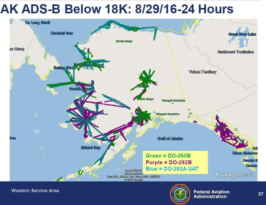
17 The Y-K Delta was the focal point for the Capstone Phase I project. Capstone included airports, weather products, communications, and GPS-driven systems in the bundle of avionics that were installed on 200 Aircraft. Those aircraft offered cargo, mail, passenger travel, or other in southwest Alaska. In addition, FAA created 19 GPS non-precision instrument approach Procedures and installed automated weather observation system (AWOS) at the same airports to enable air-carrier use of the new non-precision GPS instrument approach procedures. The aircraft were fitted with instrument flight rules (IFR) capable WAAS GPS receivers, a (UAT) data-link system that enabled ADS B, and flight information services (FIS) including real-time weather, and a multifunction display (MFD) depicting terrain, other ADS B aircraft, weather graphics and text data. It was the first time weather information was available in the cockpit.
 of the airways were above the altitudes that the general aviation fleet of aircraft could safely fly without encountering icing conditions, even in the summer.")
18 Southeast Alaska was the focal point for the Capstone Phase II Project. Flying in SE Alaska was very different from the Y-K Delta due to the terrain. The Minimum En Route Altitude (MEA) of the airways were above the altitudes that the general aviation fleet of aircraft could safely fly without encountering icing conditions, even in the summer. Legacy en route navigation aids require land-based sites where power and Access but neither were attainable. Wide Area Augmentation System or WAAS GPS offers a Global Positioning System (GPS), with higher accuracy, integrity, and availability even at lower altitudes. Routes were created in southeast based on WAAS GPS and remain in use today.
19

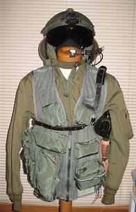


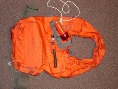
20 Safety Gear


21 Questions?
The transponder and emergency locator transmitter
 nuts & bolts building basics The ELT Past and Future ELT changes aim to improve safety GEORGE R. WILHELMSEN The transponder and emergency locator transmitter (ELT) are two pieces of avionics in the average
Status of the COSPAS-SARSAT system and future development integrated in GALILEO. Patrice Brault MARTEC SERPE-IESM
 Status of the COSPAS-SARSAT system and future development integrated in GALILEO Patrice Brault MARTEC SERPE-IESM MARTEC SERPE IESM plant Guidel ARGOS drifter PTR ERIKA Safety of human life actual components
Automatic Dependent Surveillance -ADS-B
 ASECNA Workshop on ADS-B (Dakar, Senegal, 22 to 23 July 2014) Automatic Dependent Surveillance -ADS-B Presented by FX SALAMBANGA Regional Officer, CNS WACAF OUTLINE I Definition II Principles III Architecture
ADS-B Primer. FlyQ EFB from Seattle Avionics. A pilot s guide to practical ADS-B information without the acronyms
 FlyQ EFB from Seattle Avionics ADS-B Primer A pilot s guide to practical ADS-B information without the acronyms Updated October 15, 2014 Steve Podradchik Summary FlyQ EFB includes support for in-flight
An Introduction to Airline Communication Types
 AN INTEL COMPANY An Introduction to Airline Communication Types By Chip Downing, Senior Director, Aerospace & Defense WHEN IT MATTERS, IT RUNS ON WIND RIVER EXECUTIVE SUMMARY Today s global airliners use
SARSAT Overview. SAR Controllers Training March2013. Jesse Reich NOAA Ground Systems Engineer
 SARSAT Overview SAR Controllers Training 2013 19 21 March2013 Jesse Reich NOAA Ground Systems Engineer Agenda Cospas-Sarsat Overview U.S. SARSAT Organization System Description User Segment (Beacons) /
ADS-B Ruling and FreeFlight Systems new ADS-B solutions
 ADS-B Ruling and FreeFlight Systems new ADS-B solutions EAA-Oshkosh July 2010 FreeFlight Systems Proprietary Data What is ADS-B? Current Radar System Interrogation from radar Receives response from aircraft
GA and NextGen How technologies like WAAS and ADS-B will change your flying! Presented By Claire Kultgen
 GA and NextGen How technologies like WAAS and ADS-B will change your flying! Presented By Claire Kultgen Overview 1. TIS 2. ADS-B FIS-B TIS-B ADS-R 3. WAAS 4. T-Routes and GPS MEAs Questions Chat Pilot
Use of Satellite-based Technologies to Enhance safety and efficiency in ATC and Airport Operation
 Use of Satellite-based Technologies to Enhance safety and efficiency in ATC and Airport Operation Presented by Felix Tsao Senior Electronics Engineer Civil Aviation Department 26 May 2017 1 Briefing on
COMPARISON OF SURVEILLANCE TECHNOLOGIES ICAO
 COMPARISON OF SURVEILLANCE TECHNOLOGIES By: M. Paydar ICAO ICAO Seminar on the Implementation of Aeronautical Surveillance and Automation Systems in the SAM Region (San Carlos de Bariloche, Argentina,
PROSECUTING 406/121.5 MHZ DISTRESS BEACONS. Table of Contents
 PROSECUTING 406/121.5 MHZ DISTRESS BEACONS Table of Contents 1. Purpose and intended recipients of this document 2. Synopsis 3. 406 MHz Distress Beacon Channels and Radio Frequency Spectrum 4. Limitations
Copyrighted Material - Taylor & Francis
 22 Traffic Alert and Collision Avoidance System II (TCAS II) Steve Henely Rockwell Collins 22. Introduction...22-22.2 Components...22-2 22.3 Surveillance...22-3 22. Protected Airspace...22-3 22. Collision
Regional and Inter-Regional Seminar and Workshop on Search and Rescue
 Regional and Inter-Regional Seminar and Workshop on Search and Rescue Mahe, Seychelles 19-22 July 2016 1 Agenda Aireon Introduction Space-Based ADS-B Overview Aireon System Deployment Status Aireon ALERT
There s a Lynx NGT-series solution to fit any need. MODEL COMPARISON. ADS B Out MHz Mode S ES. p p p p. ADS B In. 978 MHz UAT p p p p
 There s a Lynx NGT-series solution to fit any need. MODEL COMPARISON ADS B Out LYNX NGT-9000 NGT-9000+ NGT-9000D NGT-9000D+ 1090 MHz Mode S ES ADS B In 978 MHz UAT 1090 MHz Internal WAAS/GPS Wi-Fi Capable
Emergency Locator Signal Detection and Geolocation Small Satellite Constellation Feasibility Study
 Emergency Locator Signal Detection and Geolocation Small Satellite Constellation Feasibility Study Authors: Adam Gunderson, Celena Byers, David Klumpar Background Aircraft Emergency Locator Transmitters
NAVIGATION INSTRUMENTS - BASICS
 NAVIGATION INSTRUMENTS - BASICS 1. Introduction Several radio-navigation instruments equip the different airplanes available in our flight simulators software. The type of instrument that can be found
SARSAT Overview. SAR Controllers Training March 2015 Christopher O Connors NOAA SARSAT Program Manager
 SARSAT Overview SAR Controllers Training 2015 3 5 March 2015 Christopher O Connors NOAA SARSAT Program Manager Agenda Cospas-Sarsat System Description User Segment (Beacons) Space Segment Ground Segment
MEOSAR Performance Overview. SAR Controllers Training March 2016 Mickey Fitzmaurice NOAA Senior Systems Engineer
 MEOSAR Performance Overview SAR Controllers Training 2016 1 3 March 2016 Mickey Fitzmaurice NOAA Senior Systems Engineer MEOSAR: AN IMPROVED SYSTEM CONCEPT MEO sat at 20,000 km LEO sat at 800-900 km MEO
Seychelles Civil Aviation Authority SAFETY NOTICE. Coding and registration of Seychelles 406 Mhz Emergency Locator Transmitters (ELTs)
") Seychelles Civil Aviation Authority Safety Notice SAFETY NOTICE Number: Issued: 25 April 2018 Coding and registration of Seychelles 406 Mhz Emergency Locator Transmitters (ELTs) This Safety Notice contains
Seychelles Civil Aviation Authority Safety Notice SAFETY NOTICE Number: Issued: 25 April 2018 Coding and registration of Seychelles 406 Mhz Emergency Locator Transmitters (ELTs) This Safety Notice contains
What s up with WAAS?
 I N D U S T RY What s up with WAAS? There s a bright new star in the GPS constellation and pretty soon every bright pilot is going to want to use it. B Y D A L E S M I T H You probably didn t notice it
Cooperation Agreements for SAR Service and COSPAS-SARSAT
 SAR/NAM/CAR/SAM IP/15 International Civil Aviation Organization 07/05/09 Search and Rescue (SAR) Meeting for the North American, Caribbean and South American Regions (SAR/NAM/CAR/SAM) (Puntarenas, Costa
SUPPLEMENT REVISION CESSNA MODEL 182T
 SUPPLEMENT REVISION CESSNA MODEL 182T NAV III AVIONICS OPTION - Serials 18281228 and 18281318 thru 18281868 and 18281870 thru 18281875 PILOTS OPERATING HANDBOOK AND AIRPLANE FLIGHT MANUAL REVISION 1 1
The Future in Marine Radio Communication GMDSS. Department of Transportation United States Coast Guard
 The Future in Marine Radio Communication GMDSS Department of Transportation United States Coast Guard Do you use a Maritime Radio System? If so, the new Global Maritime Distress and Safety System (GMDSS)
ETSO.DevP.05 1/5. 1 Cf. EASA Web:
 Deviations requests for an ETSO approval for CS-ETSO applicable to various aircraft instruments (ETSO-C10b, -C45a, -C46a) and ETSO-2C126 ELT Consultation Paper 1. Introductory note The hereby presented
ADS-B Introduction Greg Dunstone
 ADS-B Introduction Greg Dunstone Surveillance Program Lead, Airservices Australia SURVEILLANCE Basics Primary and Secondary radar Why do we need Surveillance? Why surveillance? Improved safety Reduced
AE4-393: Avionics Exam Solutions
 AE4-393: Avionics Exam Solutions 2008-01-30 1. AVIONICS GENERAL a) WAAS: Wide Area Augmentation System: an air navigation aid developed by the Federal Aviation Administration to augment the Global Positioning
APPENDIX C VISUAL AND NAVIGATIONAL AIDS
 VISUAL AND NAVIGATIONAL AIDS APPENDIX C VISUAL AND NAVIGATIONAL AIDS An integral part of the airport system is the visual and navigational aids provided to assist pilots in navigating both on the airfield
GPS/WAAS Program Update
 GPS/WAAS Program Update UN/Argentina Workshop on the Applications of GNSS 19-23 March 2018 Cordoba, Argentina GNSS: A Global Navigation Satellite System of Systems Global Constellations GPS (24+3) GLONASS
Understanding ADS-B (Dec 2015) Alan Hepburn ICS #16828
 Alan Hepburn ICS #16828") Understanding ADS-B (Dec 2015) Alan Hepburn ICS #16828 Introduction Anybody who pays any attention to the aviation press cannot fail to be aware that a major change is heading for operators in the United
Understanding ADS-B (Dec 2015) Alan Hepburn ICS #16828 Introduction Anybody who pays any attention to the aviation press cannot fail to be aware that a major change is heading for operators in the United
The Future of Search & Rescue. We Save Lives. Steve Waters SAFE Symposium 2016
 The Future of Search & Rescue We Save Lives Steve Waters SAFE Symposium 2016 Covering today.. Understanding the Search and Rescue Ecosystem Helios and GADSS Global Aeronautical Distress and Safety System
GMDSS for Recreational Boaters
 GMDSS for Recreational Boaters OVERVIEW The Global Maritime Distress and Safety System (GMDSS) is an international system using advanced communications technology. Development of GMDSS was initiated by
SELFRIDGE AIR TRAFFIC CONTROL Mark Winsor, Air Traffic Manager, Steven Oliver, RAPCON Chief Controller,
 SELFRIDGE AIR TRAFFIC CONTROL Mark Winsor, Air Traffic Manager, 239-5190 Steven Oliver, RAPCON Chief Controller, 239-4517 APPROACH CONTROL AIRSPACE Click Click Click MTC NOT TO SCALE MTC
EE Chapter 14 Communication and Navigation Systems
 EE 2145230 Chapter 14 Communication and Navigation Systems Two way radio communication with air traffic controllers and tower operators is necessary. Aviation electronics or avionics: Avionic systems cover
How to Intercept a Radial Outbound
 How to Intercept a Radial Outbound by Greg Whiley Another practical publication from Aussie Star Flight Simulation How to intercepting a radial outbound 1 Greg Whiley Aussie Star Flight Simulation How
ELT Homing. Air and Ground Search. 22/06/2010 CASARA Ottawa. Prepared By Terry Cooper
 ELT Homing Air and Ground Search Prepared By Terry Cooper Visual Search 1 500 AGL: Where s the crash? Visual Search 2 How about now? (200 AGL) What is an ELT? Low power radio transmitter (~50-75mw, 5W
GBAS FOR ATCO. June 2017
 GBAS FOR ATCO June 2017 Disclaimer This presentation is for information purposes only. It should not be relied on as the sole source of information, and should always be used in the context of other authoritative
SPECIAL EFFECTS OF THE REGIONAL SATELLITE AUGMENTATION SYSTEM (RSAS)
") St. D. Ilcev (Mangosuthu University of Technology (MUT) South Africa) SPECIAL EFFECTS OF THE REGIONAL SATELLITE AUGMENTATION SYSTEM (RSAS) This paper introduces the special effects of the new developed
St. D. Ilcev (Mangosuthu University of Technology (MUT) South Africa) SPECIAL EFFECTS OF THE REGIONAL SATELLITE AUGMENTATION SYSTEM (RSAS) This paper introduces the special effects of the new developed
Understanding ADS-B traffic
 Understanding ADS-B traffic 24 August 2012 Advanced Tips 26 comments The Garmin Pilot app, when paired with a GDL 39, can display ADS-B traffic. ADS-B has suddenly become a household word among pilots,
Chapter 10 Navigation
 Chapter 10 Navigation Table of Contents VHF Omnidirectional Range (VOR) VOR Orientation Course Determination VOR Airways VOR Receiver Check Points Automatic Direction Finder (ADF) Global Positioning System
AIREON SPACE-BASED ADS-B
 AIREON SPACE-BASED ADS-B 2018 Transport Canada Delegates Conference Steve Bellingham Manager, Navigation Systems Engineering Steve.Bellingham@navcanada.ca CNS/ATM Systems Communication Navigation Surveillance
ADS-B and WFP Operators. Safety Advantages Security Concerns. Thomas Anthony Director U.S.C. Aviation Safety and Security Program ADS-B
 ADS-B and WFP Operators Safety Advantages Security Concerns Thomas Anthony Director U.S.C. Aviation Safety and Security Program ADS-B How can ADS-B be useful for Humanitarian Air Operation? Are there security
Study on Airworthiness Requirement for the Position Quality of ADS-B System
 Available online at www.sciencedirect.com Procedia Engineering 17 (2011 ) 415 421 The 2nd International Symposium on Aircraft Airworthiness (ISAA 2011) Study on Airworthiness Requirement for the Position
Modern Navigation. Thomas Herring
 12.215 Modern Navigation Thomas Herring Summary of Last class Satellite Orbits Treat the basic description and dynamics of satellite orbits Major perturbations on GPS satellite orbits Sources of orbit
The Global Aeronautical Distress and Safety System (GADSS)
") The Global Aeronautical Distress and Safety System (GADSS) for NAM/CAR/SAM SAR Implementation Meeting (based on ICAO/IMO JWG-SAR/23 Berlin, 12-16 September 2016) Need, Overview, Status David Edwards modified
The Global Aeronautical Distress and Safety System (GADSS) for NAM/CAR/SAM SAR Implementation Meeting (based on ICAO/IMO JWG-SAR/23 Berlin, 12-16 September 2016) Need, Overview, Status David Edwards modified
Alternate Position, Navigation & Time APNT for Civil Aviation
 Alternate Position, Navigation & Time APNT for Civil Aviation For Working Group B of the International GNSS Committee Shanghai, May 2011 by Per Enge & Leo Eldredge Work supported by the Federal Aviation
NAVIGATION INTRUMENTATION ADF
 1. Introduction NAVIGATION INTRUMENTATION ADF The Automatic Direction Finding (ADF) equipment on-board of aircraft is used together with the Non Directional Beacon (NDB) transmitters installed on the ground.
Regulations. Aeronautical Radio Service
 Regulations Aeronautical Radio Service Version 1.0 Issue Date: 30 December 2009 Copyright 2009 Telecommunications Regulatory Authority (TRA). All rights reserved. P O Box 26662, Abu Dhabi, United Arab
ACR Electronics, Inc Ravenswood Road Fort Lauderdale, FL New Product Briefing SARLink 406 MHz / Iridium Beacon
 ACR Electronics, Inc. 5757 Ravenswood Road Fort Lauderdale, FL 33312 www.acrartex.com New Product Briefing SARLink 406 MHz / Iridium Beacon Two Powerful Brands One Great Company Our Brands Marine, Aviation,
Surveillance and Broadcast Services
 Surveillance and Broadcast Services Surveillance and Broadcast Services Casa Grande EAA Jimmy Wright Date: April 18, 2015 Today s Air Transportation System Ground-based Human-centric and un-automated Single
ICAO Inter-regional SAR Workshop 2016
 ICAO Inter-regional SAR Workshop 2016 Global Aeronautical Distress and Safety System (GADSS) - Implications for Search And Rescue Services Dave Edwards U.S. Coast Guard Chairman, International Civil Aviation
Global Navigation Satellite System (GNSS) GPS Serves Over 400 Million Users Today. GPS is used throughout our society
 GPS Serves Over 400 Million Users Today. GPS is used throughout our society") Global avigation Satellite System (GSS) For freshmen at CKU AA December 10th, 2009 by Shau-Shiun Jan ICA & IAA, CKU Global avigation Satellite System (GSS) GSS (Global Positioning System, GPS) Basics Today
Global avigation Satellite System (GSS) For freshmen at CKU AA December 10th, 2009 by Shau-Shiun Jan ICA & IAA, CKU Global avigation Satellite System (GSS) GSS (Global Positioning System, GPS) Basics Today
Next Generation Air. Surveillance Sector. Federal Aviation Administration Transportation. By: Rick Castaldo Date: June 19, 2007
 Next Generation Air Transportation System (NextGen) Surveillance Sector By: Rick Castaldo Date: 0 Surveillance? Determining the location of something. In our case, for the use of ATC Staff, We want to
AT01 AIRPLANE FLIGHT MANUAL
 Table of Contents Supplement AVE12 1. Section 1 General AVE12 3 2. Section 2 Operating Limitations AVE12 3 3. Section 3 Emergency Procedures AVE12 3 4. Section 4 Normal Procedures AVE12 4 5. Section 5
KGX 150/130 ADS -B Certified Transceivers & Receivers
 BendixKing By Honeywell 9201 -B San Mateo Blvd. NE Albuquerque, NM 87113 U.S.A. CAGE: 6PC31 Telephone: 1-505 -903-6148 Telephone: 1-855 -250-7027 (Toll Free in U.S.A.) Web site: http://www.bendixking.com
Lecture-1 CHAPTER 2 INTRODUCTION TO GPS
 Lecture-1 CHAPTER 2 INTRODUCTION TO GPS 2.1 History of GPS GPS is a global navigation satellite system (GNSS). It is the commonly used acronym of NAVSTAR (NAVigation System with Time And Ranging) GPS (Global
2000 by UPS Aviation Technologies, Inc. All rights reserved. Printed in the U.S.A.
 No part of this document may be reproduced in any form or by any means without the express written consent of UPS Aviation Technologies, Inc. UPS Aviation Technologies, Inc., II Morrow, and Apollo are
IMPLEMENTATION OF GNSS BASED SERVICES
 International Civil Aviation Organization IMPLEMENTATION OF GNSS BASED SERVICES Julio Siu Communications, Navigation and Surveillance Regional Officer ICAO NACC Regional Office ICAO Workshop on PBN Airspace
Experiences in. Flight Inspecting GBAS
 Experiences in Flight Inspecting GBAS Thorsten Heinke Aerodata AG 1 Flight Inspection of GBAS Overview Basics Requirements Equipment Flight Inspection 2 Ground Based Augmentation System VDB Tx-Frequency
TITLE 14 OF THE CODE OF FEDERAL REGULATIONS (14 CFR) GUIDANCE MATERIAL
 GUIDANCE MATERIAL") TITLE 14 OF THE CODE OF FEDERAL REGULATIONS (14 CFR) GUIDANCE MATERIAL Subject: INDEX OF AVIATION TECHNICAL STANDARD ORDERS Date: 10/10/00 Initiated by: AIR-120 AC No: AC 20-110L Change: 1. PURPOSE. This
TITLE 14 OF THE CODE OF FEDERAL REGULATIONS (14 CFR) GUIDANCE MATERIAL Subject: INDEX OF AVIATION TECHNICAL STANDARD ORDERS Date: 10/10/00 Initiated by: AIR-120 AC No: AC 20-110L Change: 1. PURPOSE. This
AIRCRAFT AVIONIC SYSTEMS
 AIRCRAFT AVIONIC SYSTEMS B-777 cockpit Package C:\Documents and ettings\administrato Course Outline Radio wave propagation Aircraft Navigation Systems - Very High Omni-range (VOR) system - Instrument Landing
Emergency Locator Transmitters. Presentation of the changes in the range of ELTs
 Emergency Locator Transmitters Presentation of the changes in the range of ELTs Changes in the 406 MHz industry Smaller beacons on the market in 1987 Easy programming Better distribution and Service etwork
SURVEILLANCE and BROADCAST SERVICES OVERVIEW
 Place image here (10 x 3.5 ) SURVEILLANCE and BROADCAST SERVICES OVERVIEW 11/13/2018 HARRIS.COM #HARRISCORP SBS Program Overview The SBS Program: FAA contract awarded to Harris on 8/30/07, extending over
Exelis FIS-B: Status & Future Presentation for Friends & Partners in Aviation Weather 2014
 Exelis FIS-B: Status & Future Presentation for Friends & Partners in Aviation Weather 2014 Paul Freeman July 22, 2014 Surveillance and Broadcast Services (SBS) Program Copyright 2014 Exelis Inc. Exelis
Challenges and Solutions for GPS Receiver Test
 Challenges and Solutions for GPS Receiver Test Presenter: Mirin Lew January 28, 2010 Agenda GPS technology concepts GPS and GNSS overview Assisted GPS (A-GPS) Basic tests required for GPS receiver verification
A Review of Vulnerabilities of ADS-B
 A Review of Vulnerabilities of ADS-B S. Sudha Rani 1, R. Hemalatha 2 Post Graduate Student, Dept. of ECE, Osmania University, 1 Asst. Professor, Dept. of ECE, Osmania University 2 Email: ssrani.me.ou@gmail.com
Navigation Systems - Enroute. Nolan, Chap 2
 Navigation Systems - Enroute Nolan, Chap 2 1 En-route Navigation Visual Flight Rules Instrument Flight Rules Pilotage/Dead-Reckoning Land-based Space-based Aircraft-based Aeronautic Charts Forecast Wind
Copyright Information
 PILOT S GUIDE Copyright Information Stratus 3 Pilot s Guide, 2018 Appareo Systems, LLC. All Rights Reserved. All content within is copyrighted by Appareo Systems, LLC and may not be reprinted without permission.
An advisory circular may also include technical information that is relevant to the standards or requirements.
 Advisory Circular AC91-24 Automatic Dependent Surveillance Broadcast (ADS-B) Systems Revision 0 24 July 2018 General Civil Aviation Authority advisory circulars contain guidance and information about standards,
2 Flight Plans 1 Fill in the appropriate boxes 2 Find acceptable routes 3 Useful Newbie Comments
 VATSIM Requirement 1 Download and install essential software 1 Your Sim MSFS, XPlane 2 Pilot Clients SB, FSInn 3 To find ATC Wazzaup, Servinfo, VATSpy, VATSIM Stats, Pilot Client 4 Interpreting This Requirement
An Introduction to INDUSTRY PARTNERS 25/05/2017. Military Army & Air Force. Government Defense & Rescue. Aviation Maritime Military. Other.
 An Introduction to 1 INDUSTRY PARTNERS Aviation Maritime Military Coast Guard & Navy Military Army & Air Force Government Defense & Rescue Other Commercial Commercial/Workboat Navy Air Force SAR Agencies
GNSS Spectrum Issues and New GPS L5
 Federal Aviation Administration Washington, D.C. GNSS Spectrum Issues and New GPS L5 International Civil Aviation Organization Regional Coordination Meeting Lima, Peru March 27 28, 2001 Basic GPS System!Space
Circle the correct answer on the question sheets and fill in the corresponding circle on the separate answer sheet.
 Gleim FAA Test Prep: Instrument Pilot (20 questions) IPGS Study Unit 3: Navigation Systems (IFH Ch 7, PHAK Ch 15) Name: Date: Circle the correct answer on the question sheets and fill in the corresponding
10 Secondary Surveillance Radar
 10 Secondary Surveillance Radar As we have just noted, the primary radar element of the ATC Surveillance Radar System provides detection of suitable targets with good accuracy in bearing and range measurement
ATM INDRA ADS-B SYSTEM AUTOMATIC DEPENDANT SURVEILLANCE BROADCAST JULY -2014
 ATM INDRA ADS-B SYSTEM AUTOMATIC DEPENDANT SURVEILLANCE BROADCAST JULY -2014 INDEX 01 ADS-B in Air Traffic Management 02 ADS-B Regulations and Mandates 03 Indra ADS-B: Highlights 04 Indra ADS-B: System
Agenda. Importance of SARSAT Cospas-Sarsat System Description. U.S. SARSAT SARSAT Challenges
 SARSAT Overview SAR Controllers Training 2016 February 29 - March 3, 2016 Christopher O Connors NOAA Direct Services Branch Chief/SARSAT Program Manager Agenda Importance of SARSAT Cospas-Sarsat System
Sikorsky S-70i BLACK HAWK Training
 Sikorsky S-70i BLACK HAWK Training Serving Government and Military Crewmembers Worldwide U.S. #15-S-0564 Updated 11/17 FlightSafety offers pilot and maintenance technician training for the complete line
The Global Flight Tracking (GFT) for Civil Aviation WRC-15 Report
 for Civil Aviation WRC-15 Report") The Global Flight Tracking (GFT) for Civil Aviation WRC-15 Report Dr. KY-Leng Deputy Director General General Department of Posts and Telecommunication Ministry of Posts and Telecommunication Email: leng-ky@mptc.gov.kh
The Global Flight Tracking (GFT) for Civil Aviation WRC-15 Report Dr. KY-Leng Deputy Director General General Department of Posts and Telecommunication Ministry of Posts and Telecommunication Email: leng-ky@mptc.gov.kh
ICAO/IMO JOINT WORKING GROUP ON HARMONIZATION OF AERONAUTICAL AND MARITIME SEARCH AND RESCUE (ICAO/IMO JWG-SAR)
") International Civil Aviation Organization ICAO/IMO JWG-SAR/13-WP/3 30/6/06 WORKING PAPER ICAO/IMO JOINT WORKING GROUP ON HARMONIZATION OF AERONAUTICAL AND MARITIME SEARCH AND RESCUE (ICAO/IMO JWG-SAR)
International Civil Aviation Organization ICAO/IMO JWG-SAR/13-WP/3 30/6/06 WORKING PAPER ICAO/IMO JOINT WORKING GROUP ON HARMONIZATION OF AERONAUTICAL AND MARITIME SEARCH AND RESCUE (ICAO/IMO JWG-SAR)
Chapter 2. Search and Rescue Systems
 Chapter 2 Search and Rescue Systems Objectives (1 of 4) As they relate to SAR in the United States, describe the general roles of: National SAR Committee (NSARC) National SAR Plan National SAR Supplement
Arctic Navigation Issues. e-nav conference Nordic Institute of Navigation Bergen, March 5 th 2009
 Arctic Navigation Issues e-nav conference Nordic Institute of Navigation Bergen, March 5 th 2009 by Anna B.O. Jensen - AJ Geomatics Jean-Paul Sicard - Rovsing A/S March 2009 1 Outline Reduction of ice
Cockpit Voice Recorder Intelligibility Analysis Flight Test Procedures
 Registration: Serial #: Model: Date: Important Note To Flight Crew The procedures detailed in this report are intended to demonstrate that the CVR records the required information. Failure to follow each
WRC-12 Implications for Terrestrial Services other than Mobile Broadband. John Mettrop BDT Expert. Scope
 WRC-12 Implications for Terrestrial Services other than Mobile Broadband John Mettrop BDT Expert Scope Areas addressed Aeronautical Amateur Maritime Radiodetermination Public protection & disaster relief
P/N 135A FAA Approved: 7/26/2005 Section 9 Initial Release Page 1 of 10
 FAA APPROVED AIRPLANE FLIGHT MANUAL SUPPLEMENT FOR GARMIN GNS 430 - VHF COMM/NAV/GPS Serial No: Registration No: When installing the Garmin GNS 430 - VHF COMM/NAV/GPS in the Liberty Aerospace XL2, this
Rockwell Collins ADS-B Perspective Bangkok March 2005
 Rockwell Collins ADS-B Perspective Bangkok March 2005 Arnold Oldach aoldach@rockwellcollins.com NOTICE: The contents of this document are proprietary to Rockwell Collins, Inc. and shall not be disclosed,
Navigation Equipment. Pilotage and Dead Reckoning. Navigational Aids. Radio Waves
 1 Navigation Equipment Successful air navigation not only involves piloting an aircraft from place to place, but also not getting lost, not breaking any FAA regulations, and not endangering the safety
Exam questions: AE3-295-II
 Exam questions: AE3-295-II 1. NAVIGATION SYSTEMS (30 points) In this question we consider the DME radio beacon. [a] What does the acronym DME stand for? (3 points) DME stand for Distance Measuring Equipment
ICAO SARPS AND GUIDANCE DOCUMENTS ON SURVEILLANCE SYSTEMS
 ICAO SARPS AND GUIDANCE DOCUMENTS ON SURVEILLANCE SYSTEMS MEETING/WORKSHOP ON AUTOMATIC DEPENDENT SURVEILLANCE BROADCAST (ADS B) IMPLEMENTATION (ADS B/IMP) (Lima, Peru, 13 to 16 November 2017) ONOFRIO
CONSIDERATIONS FOR GNSS MEASUREMENTS
 CONSIDERATIONS FOR GNSS MEASUREMENTS Cornel PĂUNESCU 1, Cristian VASILE 2, Cosmin CIUCULESCU 3 1 PhD University of Bucharest, e-mail: cornelpaun@gmail.com 2 Lecturer PhD University of Craiova, cristi_vasile_4you@yahoo.com
Ground Based Augmentation Systems (GBAS) Introduction
 Introduction") Ground Based Augmentation Systems (GBAS) Introduction Technical and Operational Overview Andreas Lipp GBAS Implementation Workshop, ICAO EUR/NAT Paris, 18 March 2010 The European Organisation for the Safety
Ground Based Augmentation Systems (GBAS) Introduction Technical and Operational Overview Andreas Lipp GBAS Implementation Workshop, ICAO EUR/NAT Paris, 18 March 2010 The European Organisation for the Safety
Distress beacons save lives. Photo: Life Flight Trust
 Photo: Life Flight Trust Distress beacons save lives HOW DOES THE GLOBAL DISTRESS BEACON SYSTEM WORK? The global distress beacon system is used by search and rescue authorities around the world. It is
Evolution from 3D to 4D radar
 Evolution from 3D to 4D radar MARIA GUTIERREZ (1), GERARDO ARANGUREN (1), MIGUEL RODRIGUEZ (2), JAVIER BILBAO (2), JAVIER GÓMEZ (1) (1) Department of Electronics and Telecommunications (2) Department of
Airspace User Forum 2012
 Airspace User Forum 2012 The must know on ICAO FPL 2012 Kim BREIVIK Expert FPL Operational Specifications & Requirements Section Purpose The nature and scope of the amendment is to update the ICAO model
Nigerian Communications Satellite Ltd. (NIGCOMSAT)
") OVERVIEW OF NIGERIAN SATELLITE AUGMENTATION SYSTEM COMMENCING WITH PILOT DEMONSTRATION TO VALIDATE NATIONAL WORK PLAN presented by Dr. Lawal Lasisi Salami, NIGERIAN COMMUNICATIONS SATELLITE LTD UNDER FEDERAL
OVERVIEW OF NIGERIAN SATELLITE AUGMENTATION SYSTEM COMMENCING WITH PILOT DEMONSTRATION TO VALIDATE NATIONAL WORK PLAN presented by Dr. Lawal Lasisi Salami, NIGERIAN COMMUNICATIONS SATELLITE LTD UNDER FEDERAL
If yes, details, including whether internal or external, the size & if tethered. Internal, tehered
 3 Safety equipment Epiry (mm/yy) number Yes No 3.1 Recognition lights Strobe lights 3.2 Fire etinguisher, with pressure gauge 25.11.2014 2 3.3 First aid kit 06.03.2015 2 3.4 Life jackets, one per occupant
Cockpit GPS Quick Start Guide
 Cockpit GPS Quick Start Guide Introduction My online book, Cockpit GPS, has grown to over 250 pages. I have that much information because at one time or another I thought that each piece would be useful
Modular Test Approaches for SSR Signal Analysis in IFF Applications
 Modular Test Approaches for SSR Signal Analysis in IFF Applications Military radar applications call for highly specialized test equipment Radar signal analysis applications require highly specialized
S-Band: a new space for mobile communication in Europe Orazio Pulvirenti MSS Project Manager Eutelsat Innovation Team
 S-Band: a new space for mobile communication in Europe Orazio Pulvirenti MSS Project Manager Eutelsat Innovation Team Evolutions in Satellite Telecommunication Ground Segments Noordwijk, June 5 th 2008
UNITED NATIONS UNIVERSITY Institute for Environment & Human Security (UNU-EHS) Bonn, Germany
 Bonn, Germany") UNITED NATIONS UNIVERSITY Institute for Environment & Human Security (UNU-EHS) Bonn, Germany Introduction to GPS technology Prof. Dr. Jörg Szarzynski Education Programme Director Head of Section EduSphere
UNITED NATIONS UNIVERSITY Institute for Environment & Human Security (UNU-EHS) Bonn, Germany Introduction to GPS technology Prof. Dr. Jörg Szarzynski Education Programme Director Head of Section EduSphere
Approved by the Tactical Operations Committee February 2014 VOR MON Criteria Prioritization
 Approved by the Tactical Operations Committee February 2014 VOR MON Criteria Prioritization Report of the Tactical Operations Committee in Response to Tasking from The Federal Aviation Administration January
12.S56 GPS: Where Are You? Fall 2008
 MIT OpenCourseWare http://ocw.mit.edu 12.S56 GPS: Where Are You? Fall 2008 For information about citing these materials or our Terms of Use, visit: http://ocw.mit.edu/terms. 12S56 GPS Basics of Handheld