ELT Homing. Air and Ground Search. 22/06/2010 CASARA Ottawa. Prepared By Terry Cooper
|
|
|
- Buck Reynolds
- 6 years ago
- Views:
Transcription
1 ELT Homing Air and Ground Search Prepared By Terry Cooper

2 Visual Search AGL: Where s the crash?

3 Visual Search 2 How about now? (200 AGL)
 or 406Mhz Triggered by impact/shock 48 Hour battery life External and Built-in antennas")
4 What is an ELT? Low power radio transmitter (~50-75mw, 5W on 406) 121.5Mhz, 243Mhz (military) or 406Mhz Triggered by impact/shock 48 Hour battery life External and Built-in antennas Typically installed in the tail of an aircraft (fixed wing).
5 Typical ELT Location ELT
 Doppler shift used to find possible location")
6 SARSAT/COSPAS Satellites on Polar orbits (LEOS) Satellite orbits take 100 minutes Monitoring 121.5*, 243*, and 406 MHz Primarily designed for 406MHz Relay ELT signals to local user terminals (ground stations) Doppler shift used to find possible location of the beacon and 243 monitoring will cease by Feb. 2009
7 Signal Confidence SARSAT hits are given a confidence value. Confidence Accuracy Miles Miles Miles Miles
8 Comparing ELT Types TYPE Location Accuracy 12nm 2nm Coverage Local Global Signal Power.1W 5W Alert time Hours Instantaneous Doppler Location 2 Passes 1 Pass
9 Radio Basics
10 Radio Direction Finding Two methods of RDF Triangulation (signal strength, bearing) Homing (signal strength and direction)


11 Tools of the Trade Little L-Per Handheld H Antenna

12 Vehicle Mount Quad Right Left Fore Aft Magnetic Vehicle mount antennas Left/Right Fore/Aft
13 A/C External Antennas Temporary Strut mount installation Permanent Belly mount installation
14 Little L-Per How it works REC Mode only used for Handheld Antenna forms directional beam (YAGI) Left side points to target at highest signal Needle indicates signal strength Useful for confirming multiple DF centres DF Mode Antennas switched a high rate Needle points to side with strongest signal Needle centres with target in front or behind Functional with very weak signal (you may not hear it) Works well with moving vehicle or aircraft
15 ELT search basics Look for obvious target areas near SARSAT hit airports, heliports, Purolator depots Look for high ground Take numerous bearings Box the target or triangulate
16 Handheld RDF Use L-Per on DF mode Find centres (there should be two) More than two centres use REC mode Take multiple bearings to the target Triangulate with bearings Watch for sources of error
17 CENTRE
18 CENTRE
19 CENTRE
20 CENTRE! CENTRE
21 CENTRE
22 CENTRE
23 CENTRE
24 CENTRE
25 CENTRE! CENTRE
26 CENTRE
27 CENTRE
28 CENTRE
29 CENTRE
30 CENTRE! CENTRE
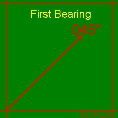
31 Triangulation

32 Using the Quad Little L-Per is always in DF mode While vehicle is moving, average the indication (it will be swinging) Watch for centre or flip Keep needle at about half scale by adjusting sensitivity control Box the target Always look for sources of error
33 Using the Quad Right Left Fore Aft Right Left Fore Aft Right Left Fore Aft Target in Front Target Beside Target in Back
34 Using the Quad Right Left Fore Aft Right Left Fore Aft Right Left Fore Aft Target Left Target Front or back Target Right
35 Boxing the target (Quad) Switch in Fore/Aft: needle right Switch in Right/Left: Needle Left Leave switch in Fore/Aft
36 Boxing the target (Quad) Switch in Fore/Aft: needle centres Switch in Right/Left: Needle Left Mark map
37 Boxing the target (Quad) Switch in Fore/Aft: needle centres Switch in Right/Left: Needle Left Find a road to left
38 Boxing the target (Quad) Switch in Fore/Aft: needle centres Switch in Right/Left: Needle Left Mark map
39 Boxing the target (Quad) Switch in Fore/Aft: needle centres Switch in Right/Left: Needle Left Entire track should be done Without stopping vehicle for Heading checks, errors are Reduced by vehicle motion. Get as close as possible with Vehicle, then proceed on foot with Handheld antenna Additional sides reduces error
40 Closing in Reduce L-Per sensitivity Fold H antenna Use Handheld Radio Tune off frequency Remove antenna Use signal strength meter Use these methods for airports or Purolator depots where multiple choices of target exist
41 Air Search RDF Homing Use Little L-Per and Strut or belly mount or Spotter held antennae Similar to ground vehicle RDF with Quads Turn to centre, hold to track to target Fly perpendicular tracks to narrow target area.
42 Boxing the target (air) Fly tracks with needle centred at all times Signal strength increasing, Needle moderately sensitive
43 Boxing the target (air) Brief turns can be used to confirm station passage. Signal strength very high, Needle very sensitive
44 Boxing the target (air) Signal strength decreasing, Needle less sensitive
45 Boxing the target (air) Probable target area
46 Boxing the target (air) Fly second track perpendicular to first starting roughly in the centre of probable target area. Keep the needle centred
47 Boxing the target (air) Intersection of tracks is target location Keep the needle centred Call in the ground team.
48 Boxing the target (air) Additional tracks will refine target location, reducing search altitude will also narrow the area. Some error will still exist due to search altitude, local terrain, and ELT position.
49 Aural Null Using aircraft communications radio Procedure A Procedure B
50 Aural Null Procedure B is quicker, less flying Accurate navigation is required for either procedure Signal propagation errors will affect results Aircraft radio/antennas have a directional bias.
51 Wing Blanking Using aircraft comms radio Once a signal is picked up: Turn 360 degrees Note audible drop in signal The signal drop indicates that the belly of the a/c points at the target. Repeat the process to triangulate the target. Doesn t work with all antenna installations.
52 RDF in the real world (stuff that will fool you) RDF in open areas RDF in Hills/Mountains/Wooded areas RDF in urban areas Effects of wreckage Effects of hangars
53 Reflection Errors
54 Hangar/Crash Effects
55 Hawksbury East (Actual Search) Runway, Grass Metal open front hangars Large Mtce hangar Trees Paved apron
56 Canyon Effect

57 Forest Effects
58 Hills/Mountains
59 Signal Polarization
60 Airborne False Targets
61 Airborne Reflections
62 Information Sources (Maker of Little L-Per) (Scott E Lanis) Practice and Experience

63
Hidden Transmitter Hunting. Dale Hunt WB6BYU
 Hidden Transmitter Hunting Dale Hunt WB6BYU Introduction What is Transmitter Hunting? Why would we want to do it? ELT searches Locating sources of interference Locating balloon / rocket payloads Fun /
Cooperation Agreements for SAR Service and COSPAS-SARSAT
 SAR/NAM/CAR/SAM IP/15 International Civil Aviation Organization 07/05/09 Search and Rescue (SAR) Meeting for the North American, Caribbean and South American Regions (SAR/NAM/CAR/SAM) (Puntarenas, Costa
The transponder and emergency locator transmitter
 nuts & bolts building basics The ELT Past and Future ELT changes aim to improve safety GEORGE R. WILHELMSEN The transponder and emergency locator transmitter (ELT) are two pieces of avionics in the average
The Alaska Air Carriers Association. Supports and Advocates for the Commercial Aviation Community
 The Alaska Air Carriers Association Supports and Advocates for the Commercial Aviation Community The Alaska Air Carriers Association membership includes Part 121, 135, 125 and commercial Part 91 air operators.
PROSECUTING 406/121.5 MHZ DISTRESS BEACONS. Table of Contents
 PROSECUTING 406/121.5 MHZ DISTRESS BEACONS Table of Contents 1. Purpose and intended recipients of this document 2. Synopsis 3. 406 MHz Distress Beacon Channels and Radio Frequency Spectrum 4. Limitations
Status of the COSPAS-SARSAT system and future development integrated in GALILEO. Patrice Brault MARTEC SERPE-IESM
 Status of the COSPAS-SARSAT system and future development integrated in GALILEO Patrice Brault MARTEC SERPE-IESM MARTEC SERPE IESM plant Guidel ARGOS drifter PTR ERIKA Safety of human life actual components
Technician Licensing Class
 Technician Licensing Class Talk to Outer Presented Space by Amateur Radio Technician Class Element 2 Course Presentation ELEMENT 2 SUB-ELEMENTS (Groupings) About Ham Radio Call Signs Control Mind the Rules
S a t e l l i t e T i m e a n d L o c a t i o n. N o v e m b e r John Fischer VP Advanced R&D
 STL - S a t e l l i t e T i m e a n d L o c a t i o n N o v e m b e r 2 0 1 7 John Fischer VP Advanced R&D jfischer@orolia.com 11/28/201 1 7 WHY AUGMENT GNSS? Recent UK Study Economic Input to UK of a
AIRCRAFT AVIONIC SYSTEMS
 AIRCRAFT AVIONIC SYSTEMS B-777 cockpit Package C:\Documents and ettings\administrato Course Outline Radio wave propagation Aircraft Navigation Systems - Very High Omni-range (VOR) system - Instrument Landing
NAVIGATION INTRUMENTATION ADF
 1. Introduction NAVIGATION INTRUMENTATION ADF The Automatic Direction Finding (ADF) equipment on-board of aircraft is used together with the Non Directional Beacon (NDB) transmitters installed on the ground.
Introduction to: Radio Navigational Aids
 Introduction to: Radio Navigational Aids 1 Lecture Topics Basic Principles Radio Directional Finding (RDF) Radio Beacons Distance Measuring Equipment (DME) Instrument Landing System (ILS) Microwave Landing
EE Chapter 14 Communication and Navigation Systems
 EE 2145230 Chapter 14 Communication and Navigation Systems Two way radio communication with air traffic controllers and tower operators is necessary. Aviation electronics or avionics: Avionic systems cover
NASA Search and Rescue Cospas-Sarsat MEOSAR, Second Generation Beacons, and DF Receiver with UAS March 23, 2017
 NASA Search and Rescue Cospas-Sarsat MEOSAR, Second Generation Beacons, and DF Receiver with UAS March 23, 2017 Dr. Lisa Mazzuca Mission Manager NASA Search and Rescue Office Goddard Space Flight Center
SARSAT Overview. SAR Controllers Training March2013. Jesse Reich NOAA Ground Systems Engineer
 SARSAT Overview SAR Controllers Training 2013 19 21 March2013 Jesse Reich NOAA Ground Systems Engineer Agenda Cospas-Sarsat Overview U.S. SARSAT Organization System Description User Segment (Beacons) /
Navigation Systems - Enroute. Nolan, Chap 2
 Navigation Systems - Enroute Nolan, Chap 2 1 En-route Navigation Visual Flight Rules Instrument Flight Rules Pilotage/Dead-Reckoning Land-based Space-based Aircraft-based Aeronautic Charts Forecast Wind
MEOSAR Performance Overview. SAR Controllers Training March 2016 Mickey Fitzmaurice NOAA Senior Systems Engineer
 MEOSAR Performance Overview SAR Controllers Training 2016 1 3 March 2016 Mickey Fitzmaurice NOAA Senior Systems Engineer MEOSAR: AN IMPROVED SYSTEM CONCEPT MEO sat at 20,000 km LEO sat at 800-900 km MEO
C I R R U S EMERGENCY DESCRIPTION A. Emergency Locator Transmitter (ELT)
") EMERGENCY 1. DESCRIPTION A. Emergency Locator Transmitter (ELT) This airplane is equipped with a self-contained ELT. The ELT transmitter is installed immediately behind the aft cabin bulkhead. The ELT
EMERGENCY 1. DESCRIPTION A. Emergency Locator Transmitter (ELT) This airplane is equipped with a self-contained ELT. The ELT transmitter is installed immediately behind the aft cabin bulkhead. The ELT
Urban DF Team. Home Study Course
 Urban DF Team Home Study Course 1. General. Urban Direction Finding (UDF) Teams are teams of at least two qualified CAP members equipped and trained to locate and secure emergency transmitters (ELT or
Page K1. The Big Picture. Pilotage
 Page K1 Pilotage 1. [K1/3/2] Pilotage is navigation by A. reference to flight instruments. B. reference to landmarks. C. reference to airborne satellites. Electronic Elucidation The Big Picture 3. [K4/2/1]
NDB Approach Background
 NDB Approaches 1 NDB Approach Background One of the oldest and most disliked approaches Can use NDBs both on and off of the destination airport NDB approaches can be on the TO or FROM side of an NDB; some
Chapter 2. Search and Rescue Systems
 Chapter 2 Search and Rescue Systems Objectives (1 of 4) As they relate to SAR in the United States, describe the general roles of: National SAR Committee (NSARC) National SAR Plan National SAR Supplement
SURVEILLANCE MONITORING OF PARALLEL PRECISION APPROACHES IN A FREE FLIGHT ENVIRONMENT. Carl Evers Dan Hicok Rannoch Corporation
 SURVEILLANCE MONITORING OF PARALLEL PRECISION APPROACHES IN A FREE FLIGHT ENVIRONMENT Carl Evers (cevers@rannoch.com), Dan Hicok Rannoch Corporation Gene Wong Federal Aviation Administration (FAA) ABSTRACT
FOX Hunting Basics Dave W8RZA
 FOX Hunting Basics Dave W8RZA FOX Hunting Basics Steps in a transmiter hunt Signal acquisiton Triangulaton Plot bearings on map to get an estmated directon of the transmiter Homing follow your nose Snifng
RCC Messages. SAR Controllers Training February Tom Griffin SSAI USMCC Systems Analyst
 RCC Messages SAR Controllers Training 2012 14 16 February 2012 Tom Griffin SSAI USMCC Systems Analyst Overview Summary of Alert Message Types Overview of Alert Message Structure Revised RCC Message Manual
TWO-WAY TIME TRANSFER TO AIRBORNE PLATFORMS USING COMMERCIAL SATELLITE MODEMS
 TWO-WAY TIME TRANSFER TO AIRBORNE PLATFORMS USING COMMERCIAL SATELLITE MODEMS Tom Celano and Jeremy Warriner, Timing Solutions Corporation 5335 Sterling Drive, Suite B Boulder, CO 80301, USA Tel: 303-939-8481;
AIR ROUTE SURVEILLANCE 3D RADAR
 AIR TRAFFIC MANAGEMENT AIR ROUTE SURVEILLANCE 3D RADAR Supplying ATM systems around the world for more than 30 years indracompany.com ARSR-10D3 AIR ROUTE SURVEILLANCE 3D RADAR ARSR 3D & MSSR Antenna Medium
Navigation Equipment. Pilotage and Dead Reckoning. Navigational Aids. Radio Waves
 1 Navigation Equipment Successful air navigation not only involves piloting an aircraft from place to place, but also not getting lost, not breaking any FAA regulations, and not endangering the safety
RECOMMENDATION ITU-R SA.1624 *
 Rec. ITU-R SA.1624 1 RECOMMENDATION ITU-R SA.1624 * Sharing between the Earth exploration-satellite (passive) and airborne altimeters in the aeronautical radionavigation service in the band 4 200-4 400
SARSAT Overview. SAR Controllers Training March 2015 Christopher O Connors NOAA SARSAT Program Manager
 SARSAT Overview SAR Controllers Training 2015 3 5 March 2015 Christopher O Connors NOAA SARSAT Program Manager Agenda Cospas-Sarsat System Description User Segment (Beacons) Space Segment Ground Segment
10 Secondary Surveillance Radar
 10 Secondary Surveillance Radar As we have just noted, the primary radar element of the ATC Surveillance Radar System provides detection of suitable targets with good accuracy in bearing and range measurement
Automatic Dependent Surveillance -ADS-B
 ASECNA Workshop on ADS-B (Dakar, Senegal, 22 to 23 July 2014) Automatic Dependent Surveillance -ADS-B Presented by FX SALAMBANGA Regional Officer, CNS WACAF OUTLINE I Definition II Principles III Architecture
Satellite Sub-systems
 Satellite Sub-systems Although the main purpose of communication satellites is to provide communication services, meaning that the communication sub-system is the most important sub-system of a communication
Technician Licensing Class T9
 Technician Licensing Class T9 Amateur Radio Course Monroe EMS Building Monroe, Utah January 11/18, 2014 January 22, 2014 Testing Session Valid dates: July 1, 2010 June 30, 2014 Amateur Radio Technician
not authorized for IFR use. authorized for IFR use under VMC. authorized for IFR use under IMC until the runway is in sight.
 Gleim FAA Test Prep: Instrument Pilot (20 questions) Name: Date: Circle the correct answer on the question sheets AND fill in the corresponding circle on the separate answer sheet. [1] Gleim #: 3.4.32
Using CROSSBAND Repeaters (CBRs) - By Neil Robin, WA7NBF - March 14, 2009
 - By Neil Robin, WA7NBF - March 14, 2009") Using CROSSBAND Repeaters (CBRs) - By Neil Robin, WA7NBF - March 14, 2009 Background Information: Most of us have not used specialized repeaters that provide fill-in communications when normal duplex repeaters
Using CROSSBAND Repeaters (CBRs) - By Neil Robin, WA7NBF - March 14, 2009 Background Information: Most of us have not used specialized repeaters that provide fill-in communications when normal duplex repeaters
Communication & Safety at Sea
 Ocean Signal Ltd. Unit 4, Ocivan Way Margate CT9 4NN United Kingdom info@oceansignal.com +44 1843 282930 Communication & Safety at Sea Introducing Ocean Signal The Range Ocean Signal specialises in the
Technician Licensing Class. Antennas
 Technician Licensing Class Antennas Antennas A simple dipole mounted so the conductor is parallel to the Earth's surface is a horizontally polarized antenna. T9A3 Polarization is referenced to the Earth
Emergency Locator Signal Detection and Geolocation Small Satellite Constellation Feasibility Study
 Emergency Locator Signal Detection and Geolocation Small Satellite Constellation Feasibility Study Authors: Adam Gunderson, Celena Byers, David Klumpar Background Aircraft Emergency Locator Transmitters
Agenda. Importance of SARSAT Cospas-Sarsat System Description. U.S. SARSAT SARSAT Challenges
 SARSAT Overview SAR Controllers Training 2016 February 29 - March 3, 2016 Christopher O Connors NOAA Direct Services Branch Chief/SARSAT Program Manager Agenda Importance of SARSAT Cospas-Sarsat System
Entity Tracking and Surveillance using the Modified Biometric System, GPS-3
 Advance in Electronic and Electric Engineering. ISSN 2231-1297, Volume 3, Number 9 (2013), pp. 1115-1120 Research India Publications http://www.ripublication.com/aeee.htm Entity Tracking and Surveillance
Satellite Communications. Chapter 9
 Satellite Communications Chapter 9 Satellite-Related Terms Earth Stations antenna systems on or near earth Uplink transmission from an earth station to a satellite Downlink transmission from a satellite
Satellite Communications. Chapter 9
 Satellite Communications Chapter 9 Satellite-Related Terms Earth Stations antenna systems on or near earth Uplink transmission from an earth station to a satellite Downlink transmission from a satellite
Communication & Safety at Sea
 Communication & Safety at Sea English Introducing Ocean Signal Ocean Signal specialises in the development and manufacture of advanced communication and safety products for the marine market. With one
The Future of Search & Rescue. We Save Lives. Steve Waters SAFE Symposium 2016
 The Future of Search & Rescue We Save Lives Steve Waters SAFE Symposium 2016 Covering today.. Understanding the Search and Rescue Ecosystem Helios and GADSS Global Aeronautical Distress and Safety System
ACR Electronics, Inc Ravenswood Road Fort Lauderdale, FL New Product Briefing SARLink 406 MHz / Iridium Beacon
 ACR Electronics, Inc. 5757 Ravenswood Road Fort Lauderdale, FL 33312 www.acrartex.com New Product Briefing SARLink 406 MHz / Iridium Beacon Two Powerful Brands One Great Company Our Brands Marine, Aviation,
Satellite Navigation (and positioning)
") Satellite Navigation (and positioning) Picture: ESA AE4E08 Instructors: Sandra Verhagen, Hans van der Marel, Christian Tiberius Course 2010 2011, lecture 1 Today s topics Course organisation Course contents
Satellite Navigation (and positioning) Picture: ESA AE4E08 Instructors: Sandra Verhagen, Hans van der Marel, Christian Tiberius Course 2010 2011, lecture 1 Today s topics Course organisation Course contents
Capt. MOHAMED ASHOUR
 1 What is signaling techniques? Signaling techniques is the art to use signaling devices for saving lives 2 Communication One of your first concerns when you find yourself in a survival situation is to
4/25/2012. Supplement T9. 2 Exam Questions, 2 Groups. Amateur Radio Technician Class T9A: T9A: T9A: T9A:
 Amateur Radio Technician Class Element 2 Course Presentation ti ELEMENT 2 SUB-ELEMENTS Technician Licensing Class Supplement T9 Antennas, Feedlines 2 Exam Questions, 2 Groups T1 - FCC Rules, descriptions
DISTANCE-RC BEACON V3.1 MANUAL REVISION 4.0
 DISTANCE-RC BEACON V3.1 MANUAL REVISION 4.0 INTRODUCTION The Distance-RC beacon is a small device that can aid you in locating lost/downed RC crafts. The beacon works by sending out tones in UHF band.
Use of Satellite-based Technologies to Enhance safety and efficiency in ATC and Airport Operation
 Use of Satellite-based Technologies to Enhance safety and efficiency in ATC and Airport Operation Presented by Felix Tsao Senior Electronics Engineer Civil Aviation Department 26 May 2017 1 Briefing on
36. Global Positioning System
 36. Introduction to the Global Positioning System (GPS) Why do we need GPS? Position: a basic need safe sea travel, crowed skies, resource management, legal questions Positioning: a challenging job local
GE 113 REMOTE SENSING
 GE 113 REMOTE SENSING Topic 9. Introduction to Global Positioning Systems (GPS) and Other GNSS Technologies Lecturer: Engr. Jojene R. Santillan jrsantillan@carsu.edu.ph Division of Geodetic Engineering
There s a Lynx NGT-series solution to fit any need. MODEL COMPARISON. ADS B Out MHz Mode S ES. p p p p. ADS B In. 978 MHz UAT p p p p
 There s a Lynx NGT-series solution to fit any need. MODEL COMPARISON ADS B Out LYNX NGT-9000 NGT-9000+ NGT-9000D NGT-9000D+ 1090 MHz Mode S ES ADS B In 978 MHz UAT 1090 MHz Internal WAAS/GPS Wi-Fi Capable
Basic Radar Definitions Introduction p. 1 Basic relations p. 1 The radar equation p. 4 Transmitter power p. 9 Other forms of radar equation p.
 Basic Radar Definitions Basic relations p. 1 The radar equation p. 4 Transmitter power p. 9 Other forms of radar equation p. 11 Decibel representation of the radar equation p. 13 Radar frequencies p. 15
503 Series Emergency Locator Transmitter
 503 Series Emergency Locator Transmitter 503 Series Emergency Locator Transmitter Fully Approved TSO C91a & C-126 COSPAS / SARSAT Approval 97 Extended frequency coverage Full remote operation Fixed and
Radio Determination on Mini-UAV Platforms: Tracking and Locating Radio Transmitters
 Brigham Young University BYU ScholarsArchive All Theses and Dissertations 2009-06-30 Radio Determination on Mini-UAV Platforms: Tracking and Locating Radio Transmitters Braden Russell Huber Brigham Young
Trusted for Life TM. USCG AIS Mandate. 3 rd December 10:30 am - 11:15 am
 Trusted for Life TM USCG AIS Mandate 3 rd December 10:30 am - 11:15 am The AIS Mandate McMurdo Stand 2335 CEO McMurdo UK McMurdo By the Numbers 25% Percentage of world s 406MHz beacons manufactured by
The Impact of Choice of Roofing Material on Navaids Wave Polarization
 The Impact of Choice of Roofing Material on Navaids Wave Polarization Robert J. Omusonga Directorate of Air Navigation Services, East African School of Aviation, P.O Box 93939-80100, Mombasa, Kenya Email:
Introduction Getting Started Receiver Controls In the Field: A Quick Tutorial Frequently Asked Questions...
 OWNER S MANUAL Field Marshall Tracking Receiver OWNERS MANUAL Contents: Introduction... 3 Getting Started... 4 Receiver Controls... 6 In the Field: A Quick Tutorial... 9 Frequently Asked Questions... 14
Digital Surveillance Devices?
 Technology Framework Tracking Technologies Don Mason Associate Director Digital Surveillance Devices? Digital Surveillance Devices? Secure Continuous Remote Alcohol Monitor SCRAM Page 1 Location Tracking
Digital surveillance devices?
 Technology Framework Tracking Technologies Don Mason Associate Director Copyright 2011 National Center for Justice and the Rule of Law All Rights Reserved Digital surveillance devices? Digital surveillance
1 V NAME. Clock Pulse. Unipolar NRZ NRZ AMI NRZ HDB3
 NAME ES 442 Homework #9 (Spring 208 Due May 7, 208 ) Print out homework and do work on the printed pages.. Problem High Density Bipolar 3 (HDB3) (20 points) HDB3 is a line code developed to avoid long
The Future in Marine Radio Communication GMDSS. Department of Transportation United States Coast Guard
 The Future in Marine Radio Communication GMDSS Department of Transportation United States Coast Guard Do you use a Maritime Radio System? If so, the new Global Maritime Distress and Safety System (GMDSS)
RT-600/SAR-DF 517. Wideband Airborne Radio Direction Finder for SAR & Law Enforcement, MHz. To locate and decode COSPAS-SARSAT
 Wideband Airborne Radio Direction Finder for SAR & Law Enforcement, 118-470 MHz RT-600/SAR-DF 517 To locate and decode COSPAS-SARSAT signals on 406 MHz The RT-600/SAR-DF 517 is an advanced wideband radio
RECOMMENDATION ITU-R SA (Question ITU-R 210/7)
") Rec. ITU-R SA.1016 1 RECOMMENDATION ITU-R SA.1016 SHARING CONSIDERATIONS RELATING TO DEEP-SPACE RESEARCH (Question ITU-R 210/7) Rec. ITU-R SA.1016 (1994) The ITU Radiocommunication Assembly, considering
Rec. ITU-R SA.1016 1 RECOMMENDATION ITU-R SA.1016 SHARING CONSIDERATIONS RELATING TO DEEP-SPACE RESEARCH (Question ITU-R 210/7) Rec. ITU-R SA.1016 (1994) The ITU Radiocommunication Assembly, considering
Lesson 11: Antennas. Copyright Winters Version 1.0. Preparation for Amateur Radio Technician Class Exam
 Lesson 11: Antennas Preparation for Amateur Radio Technician Class Exam Topics Antenna ½ wave Dipole antenna ¼ wave Vertical antenna Antenna polarization Antenna location Beam antennas Test Equipment Exam
International Cospas-Sarsat Programme : From operations to MEOSAR prospects
 International Cospas-Sarsat Programme : From operations to MEOSAR prospects Presented by Jean-Charles CORNILLOU MRCC Corsen director with the help of Michel MARGERY (CNES) & Alex GENICOT (FMCC) UN/USA
Sources of Geographic Information
 Sources of Geographic Information Data properties: Spatial data, i.e. data that are associated with geographic locations Data format: digital (analog data for traditional paper maps) Data Inputs: sampled
# Made In USA. Simple GPS Tracker Parts List. Needed Tools and Materials
 Needed Tools and Materials #09245 Made In USA Compatible Ebay (to mount electronics to) Drill and Screwdriver (for mounting Transmitter to ebay) Compatible Battery (for powering Airborne Transmitter) Optional
Regulations. Aeronautical Radio Service
 Regulations Aeronautical Radio Service Version 1.0 Issue Date: 30 December 2009 Copyright 2009 Telecommunications Regulatory Authority (TRA). All rights reserved. P O Box 26662, Abu Dhabi, United Arab
Location, Location, Location
 Location, Location, Location Larry Rudolph 1 Outline Positioning Technology GPS and others Location Specifiers Privacy Issues Universal Location On earth, we need three piece of information: latitude,
Radar observables: Target range Target angles (azimuth & elevation) Target size (radar cross section) Target speed (Doppler) Target features (imaging)
 Target size (radar cross section) Target speed (Doppler) Target features (imaging)") Fundamentals of Radar Prof. N.V.S.N. Sarma Outline 1. Definition and Principles of radar 2. Radar Frequencies 3. Radar Types and Applications 4. Radar Operation 5. Radar modes What What is is Radar? Radar?
Fundamentals of Radar Prof. N.V.S.N. Sarma Outline 1. Definition and Principles of radar 2. Radar Frequencies 3. Radar Types and Applications 4. Radar Operation 5. Radar modes What What is is Radar? Radar?
Radar. Seminar report. Submitted in partial fulfillment of the requirement for the award of degree Of Mechanical
 A Seminar report on Radar Submitted in partial fulfillment of the requirement for the award of degree Of Mechanical SUBMITTED TO: SUBMITTED BY: www.studymafia.org www.studymafia.org Preface I have made
UNIT-4 Part A 1. What is kickback noise? [ N/D-16]
![UNIT-4 Part A 1. What is kickback noise? [ N/D-16]](/thumbs/89/99433785.jpg "UNIT-4 Part A 1. What is kickback noise? [ N/D-16]") UNIT-4 Part A 1. What is kickback noise? [ N/D-16] It is basically the noise from the switching first stage on the input of the comparator. If the output of the first stage swings quickly in large range,
UNIT-4 Part A 1. What is kickback noise? [ N/D-16] It is basically the noise from the switching first stage on the input of the comparator. If the output of the first stage swings quickly in large range,
New Communications Repeater Connector ON/OFF
 New Communications Repeater Connector ON/OFF Power Antenna and inreach SE The primary difference between the Rhotheta RT-600 and the older Becker DF-517 is that the new unit will simultaneously scan all
Amateur Radio License. Propagation and Antennas
 Amateur Radio License Propagation and Antennas Todays Topics Propagation Antennas Propagation Modes Ground wave Low HF and below, ground acts as waveguide Line-of-Sight (LOS) VHF and above, radio waves
Amateur Radio Satellites
 Amateur Radio Satellites An Introduction and Demo of AO-85 Eddie Pettis, N5JGK and Russ Tillman, K5NRK Presentation Outline History of Amateur Radio Satellites: Project OSCAR and AMSAT Amateur Radio Satellites
What s up with WAAS?
 I N D U S T RY What s up with WAAS? There s a bright new star in the GPS constellation and pretty soon every bright pilot is going to want to use it. B Y D A L E S M I T H You probably didn t notice it
723 Specialized 80 to 500 MHz Radio Direction Finding System For Airport Interference Detection
 723 Specialized 80 to 500 MHz Radio Direction Finding System For Airport Interference Detection The TCI Model 723 is a compact, high-performance radio direction finder that can be easily integrated into
Technician License. Course
 Technician License Course Technician License Course Chapter 4 Lesson Plan Module - 10 Practical Antennas The Dipole Most basic antenna The Dipole Most basic antenna The Dipole Total length is ½ wavelength
Characteristics and protection criteria for radars operating in the aeronautical radionavigation service in the frequency band
 Recommendation ITU-R M.2008 (03/2012) Characteristics and protection criteria for radars operating in the aeronautical radionavigation service in the frequency band 13.25-13.40 GHz M Series Mobile, radiodetermination,
R-300 RECEIVER. Operating Manual PREMIUM AMATEUR RADIO VERSION - COVERS THE ENTIRE MHZ BAND IN 10 KHZ STEPS
 R-300 RECEIVER PREMIUM AMATEUR RADIO VERSION - COVERS THE ENTIRE 222-224.990 MHZ BAND IN 10 KHZ STEPS - SUPER SELECTIVE 8 POLE SSB CRYSTAL FILTER FOR USE IN HIGHLY CONGESTED RF ENVIRONMENTS -.5 PPM TCXO
Dynamic Two-Way Time Transfer to Moving Platforms W H I T E PA P E R
 Dynamic Two-Way Time Transfer to Moving Platforms WHITE PAPER Dynamic Two-Way Time Transfer to Moving Platforms Tom Celano, Symmetricom 1Lt. Richard Beckman, USAF-AFRL Jeremy Warriner, Symmetricom Scott
Primer on GPS Operations
 MP Rugged Wireless Modem Primer on GPS Operations 2130313 Rev 1.0 Cover illustration by Emma Jantz-Lee (age 11). An Introduction to GPS This primer is intended to provide the foundation for understanding
Location, Location, Location
 Location, Location, Location Larry Rudolph 1 Outline Administrative remarks and requests Positioning Technology GPS and others Location Specifiers Privacy Issues Asking for help For 3rd edition phones,
# Made In USA. Simple GPS Tracker Parts List
 Needed Tools and Materials Compatible Ebay (to mount electronics to) Drill and Screwdriver (for mounting Transmitter to ebay) Compatible Battery (for powering Airborne Transmitter) Optional Tools / Finishing
EMERGENCY BEACON CORPORATION 15 RIVER ST NEW ROCHELLE, NEW YORK PHONE: (914) FAX (914)
 FAX (914)") EMERGENCY BEACON CORPORATION 15 RIVER ST NEW ROCHELLE, NEW YORK 10801 PHONE: (914) 235-9400 FAX (914)576-7075 emergencybeacon@verizon.net IMPORTANT: TESTING SHOULD NOT BE DONE WITH NIGHT VISION GOGGLES
EMERGENCY BEACON CORPORATION 15 RIVER ST NEW ROCHELLE, NEW YORK 10801 PHONE: (914) 235-9400 FAX (914)576-7075 emergencybeacon@verizon.net IMPORTANT: TESTING SHOULD NOT BE DONE WITH NIGHT VISION GOGGLES
Notice of coordination procedure required under spectrum access licences for the 2.6 GHz band
 Notice of coordination procedure required under spectrum access licences for the 2.6 GHz band Coordination with aeronautical radionavigation radar in the 2.7 GHz band Notice Publication date: 1 March 2013
ICG-12 Kyoto Japan WG-B December Dr. Lisa Mazzuca
 ICG-12 Kyoto Japan WG-B December 5 2017 Dr. Lisa Mazzuca MEOSAR: SPACE SEGMENT BDS & Cospas-Sarsat: C-S JC-31 (Oct 2017) China Working Papers BDS 406 MHz MEOSAR REPEATER TECHNOLOGY STATUS (JC31-9/2) Executive
AIC AERONAUTICAL INFORMATION SERVICE OFFICE OF CIVIL AVIATION P. O. BOX 684, BOROKO
 PAPUA NEW GUINEA AIC TELEPHONE 3244672 TELEGRAPHIC ADDRESS AFTN AYPYYOYX Fax 3250749 File: 33.16.3 AERONAUTICAL INFORMATION SERVICE OFFICE OF CIVIL AVIATION P. O. BOX 684, BOROKO 01/2004 06 SEP 406 MHz
July 1995 QST Volume 79, Number 7
 Lab Notes Prepared by the ARRL Laboratory Staff (e-mail: tis@arrl.org) By Mike Tracy, KC1SX Technical Information Service Coordinator Q: I m just getting started on VHF and UHF FM and I want to set up
FCC Technician License Course
 FCC Technician License Course 2014-2018 FCC Element 2 Technician Class Question Pool Presented by: Tamiami Amateur Radio Club (TARC) WELCOME To the third of 4, 3-hour classes presented by TARC to prepare
In an unmagnetized piece of iron, the atoms are arranged in domains. In each domain the atoms are aligned, but the domains themselves are random.
 4/7 Properties of the Magnetic Force 1. Perpendicular to the field and velocity. 2. If the velocity and field are parallel, the force is zero. 3. Roughly (field and vel perp), the force is the product
RECOMMENDATION ITU-R M.1314* REDUCTION OF SPURIOUS EMISSIONS OF RADAR SYSTEMS OPERATING IN THE 3 GHz AND 5 GHz BANDS (Question ITU-R 202/8)
") Rec. ITU-R M.1314 1 RECOMMENDATION ITU-R M.1314* REDUCTION OF SPURIOUS EMISSIONS OF RADAR SYSTEMS OPERATING IN THE 3 GHz AND 5 GHz BANDS (Question ITU-R 202/8) (1997) Rec. ITU-R M.1314 Summary This Recommendation
Rec. ITU-R M.1314 1 RECOMMENDATION ITU-R M.1314* REDUCTION OF SPURIOUS EMISSIONS OF RADAR SYSTEMS OPERATING IN THE 3 GHz AND 5 GHz BANDS (Question ITU-R 202/8) (1997) Rec. ITU-R M.1314 Summary This Recommendation
This presentation will cover T- Hunting and ARDF. In this talk we will discuss : The equipment The competition The strategy Other uses for DF
 This presentation will cover T- Hunting and ARDF In this talk we will discuss : The equipment The competition The strategy Other uses for DF Types of Transmitter Hunting: Car Hunts or "T-Hunting" One Transmitter
RESOLUTION A.659(16) adopted on 19 October 1989 PROVISION OF RADIO SERVICES FOR THE GLOBAL MARITIME DISTRESS AND SAFETY SYSTEM
 adopted on 19 October 1989 PROVISION OF RADIO SERVICES FOR THE GLOBAL MARITIME DISTRESS AND SAFETY SYSTEM") INTERNATIONAL MARITIME ORGANIZATION RESOLUTION A.659(16) adopted on 19 October 1989 A 16/Res.659 30 November 1989 Original: ENGLISH ASSEMBLY - 16th session Agenda item 10 IMO RESOLUTION A.659(16) adopted
INTERNATIONAL MARITIME ORGANIZATION RESOLUTION A.659(16) adopted on 19 October 1989 A 16/Res.659 30 November 1989 Original: ENGLISH ASSEMBLY - 16th session Agenda item 10 IMO RESOLUTION A.659(16) adopted
GPS (GLOBAL POSITIONING SYSTEM)
") GPS (GLOBAL POSITIONING SYSTEM) What is GPS? GPS, standing for Global Positioning System, is becoming common nowadays. Following is a brief introduction. The American Defense Department developed GPS originally
GPS (GLOBAL POSITIONING SYSTEM) What is GPS? GPS, standing for Global Positioning System, is becoming common nowadays. Following is a brief introduction. The American Defense Department developed GPS originally
EBC 302-VHMJ OR VRHMJ EMERGENCY LOCATOR TRANSMITTERS EACH UNIT CONSISTS OF: 1 ELT AND 1 MOUNTING BRACKET
 EMERGENCY BEACON CORPORATION 15 RIVER ST NEW ROCHELLE, NEW YORK 10801 PHONE: (914) 235-9400 FAX (914)576-7075 emergencybeacon@verizon.net IMPORTANT; TESTING SHOULD NOT BE DONE WITH NIGHT VISION GOGGLES
Copyrighted Material - Taylor & Francis
 22 Traffic Alert and Collision Avoidance System II (TCAS II) Steve Henely Rockwell Collins 22. Introduction...22-22.2 Components...22-2 22.3 Surveillance...22-3 22. Protected Airspace...22-3 22. Collision
VIP-300U TRANSPORTABLE RF JAMMER
 VIP-300U TRANSPORTABLE RF JAMMER The Transportable RF Jammer model VIP300U uses a proprietary barrage jamming method to defeat remote controlled improvised explosive devices. It works by sending out RF