SARSAT Overview. SAR Controllers Training March2013. Jesse Reich NOAA Ground Systems Engineer
|
|
|
- Louisa Townsend
- 5 years ago
- Views:
Transcription


1 SARSAT Overview SAR Controllers Training March2013 Jesse Reich NOAA Ground Systems Engineer
2 Agenda Cospas-Sarsat Overview U.S. SARSAT Organization System Description User Segment (Beacons) / Registrations Ground Segment Space Segment SAR Segment Future of Cospas-Sarsat 4/2/2013 2

3 SARSAT Search And Rescue Satellite-Aided Tracking System 4/2/2013 3
4 History 1950s First satellites launched & Doppler technology developed 1960s Emergency 121/243 MHz beacons first used by military 1970 Congress mandates carriage of ELT on general aviation aircraft 1972 Congressmen Boggs and Begich lost in Alaska plane crash 1975 Apollo-Soyuz Test Project 1976 Canada, France and USA begin development of SARSAT program 1979 MOU signed between Canada, France, USA and former USSR 1982 Launch of Cospas-1 and First Save 1983 Launch of SARSAT COSPAS-SARSAT declared operational 1988 International Cospas-Sarsat Program Agreement signed 1992 Russia assumes responsibilities for the former USSR 1998 Geostationary space segment becomes operational 1998 Termination of 121/243 MHz service starting in 2009 announced 2005 U.S. passes 5000 rescues 2009 Termination of and 243 MHz processing by space segment 4/2/2013 4
5 Cospas-Sarsat Overview COSPAS: Cosmicheskaya Systyema Poiska Aariynyich Sudov (Russian) which translates loosely into Space System for the Search of Vessels in Distress SARSAT: Search And Rescue Satellite-Aided Tracking Cospas-Sarsat provides, free-of-charge, distress alert and location information to search and rescue authorities anywhere in the world for maritime, aviation and land users in distress. In short: C-S takes the search out of Search and Rescue 4/2/2013 5

6 Cospas-Sarsat Rescues Number rescued world-wide since 1982: over 33,000 Number rescued in United States since 1982: over 7,019 Rescues so far this year in the U.S. for CY 2013 (as of 2/21/13): 20 Rescues at sea: Terrestrial rescues: 13 people rescued in 7 incidents 7 person rescued in 5 incidents CY Rescues in 111 Incidents Rescues at sea: Aviation rescues: Terrestrial rescues: 182 people rescued in 54 incidents 22 people rescued in 13 incidents 59 people rescued in 44 incidents 4/2/2013 6
 UN specialized agency responsible for aviation matters and improving civil aviation safety (Mandates use of 406 MHz beacons) International Telecommunication Union UN specialized")
7 Cospas-Sarsat Overview International Maritime Organization (IMO) UN specialized agency responsible for improving maritime safety (Mandates use of emergency beacons) International Civil Aviation Organization (ICAO) UN specialized agency responsible for aviation matters and improving civil aviation safety (Mandates use of 406 MHz beacons) International Telecommunication Union UN specialized agency responsible for coordinating global telecommunications (406 MHz beacon specifications) 4/2/2013 7

8 Cospas-Sarsat Participants 4/2/2013 8
9 Cospas-Sarsat Program Management International Organization Implementation of Agreement, Administration of Secretariat, Joint relations with States and Organizations, Financial Management Cospas-Sarsat Council Program Management Cospas-Sarsat Secretariat Technical and operational specifications, Coordination, Enhancements, Monitoring, Plans and procedures, System Configuration Joint Committee System Operation Administrative Organization Operational Working Group Technical Working Group 4/2/2013 9


10 U.S. SARSAT The four multi-department agencies involved in the U.S. portion of SARSAT: Inland SAR Maritime SAR Research & Development System Operation Representative to Cospas-Sarsat Program 4/2/
11 U.S. SARSAT Program Management National Organization NOAA USCG USAF NASA Operational Coordination, Development of Specifications and Requirements, Outreach, Development of International Positions Program Steering Group Joint Working Group Policy, Management, Budgeting, Strategic Planning NOAA USCG USAF NASA FAA FCC Operations Working Group Technical Working Group 4/2/
12 Cospas-Sarsat System Overview 4/2/

13 Cospas-Sarsat System Overview User Segment 4/2/
 Homing Applications: Maritime - Emergency Position-Indicating Radio Beacon (EPIRB) Aviation - Emergency Locator Transmitter (ELT) Personal/Land - Personal Locator Beacon (PLB) Security")
14 User Segment Beacons Activation: Manual Automatic (Hydrostatic/G-Switch) Signal: 406 MHz (Digital) MHz (Analog) Homing Applications: Maritime - Emergency Position-Indicating Radio Beacon (EPIRB) Aviation - Emergency Locator Transmitter (ELT) Personal/Land - Personal Locator Beacon (PLB) Security Ship Security Alerting System (SSAS) * Most U.S. general aviation ELTs are still MHz which are no longer monitored by Cospas-Sarsat 4/2/


15 User Segment 66,451* aviation users in U.S. All types and uses of aircraft 188,035* maritime users in U.S. Divided between commercial and recreational vessels 116,987* land-based users in U.S. Recreational use plus some aviation and maritime use Estimate of approximately 1,319,000 users worldwide in 2011 and 1,717,000 worldwide in 2015 * Registered U.S. beacons as of March 4, /2/
16 User Segment Attributes of 406 MHz Every beacon has unique 15 hex identification Unique ID allows registration with contact information Non-Distress activations can be terminated with a phone call Reduces stress on SAR assets Powerful 5 watt transmitter and digital signal increases accuracy of location by Doppler processing The system can discriminate between real beacon transmissions and non-beacon transmissions which reduces the resources spent on tracking interfering sources Global coverage provided by store and forward capability of Cospas-Sarsat satellites Increased system capacity due to short duration transmission, and spreading of frequency allocation 4/2/

17 User Segment Beacon Registration 4/2/
18 Importance of Registration Detection Near real-time detection of the 406 MHz transmission from an emergency beacon. Even if there is no LEO satellite in view to achieve Doppler for location, GEO satellites work to save lives in 4 ways: Use of Registration Database to contact owner or emergency POC; this allows rescue forces to get more detailed information such as nature of emergency, severity of injuries, number of people involved, etc. and can help determine if alert is actual distress If beacon is equipped with GPS, the position (accurate within 100 meters) is embedded with the alert and given to rescue forces. Has continuous monitoring of nearly 1/3 the Earth s surface. Has a 46-minute mean time advantage for first detection. 4/2/
19 Importance of Registration Identification Digital data transmitted by beacon provides nationality and type of beacon Tail number or other identifying information can be encoded into the beacon Registration Database provides additional information such as owner/operator, and can include specifics on aircraft or vessel In most cases, false alerts are resolved prior to launch of resources, saving taxpayer $$ 4/2/

20 Cospas-Sarsat System Overview Ground Segment 4/2/
 Combine LEO data with GEO data to improve Doppler processing Maintains accuracy by producing a correction of the satellite ephemeris each time a satellite signal is received")
21 Ground Segment Local User Terminals (LUTs) LEOSAR Local User Terminals (LEOLUTs): Receive and process data from Low Earth Orbit (LEO) satellite search and rescue processors (SARP) and search and rescue repeaters (SARR) Combine LEO data with GEO data to improve Doppler processing Maintains accuracy by producing a correction of the satellite ephemeris each time a satellite signal is received Transmit collected data to the Mission Control Center 4/2/
 58 LEOLUTs in 46 Locations")
22 Ground Segment Local User Terminals (LUTs) 58 LEOLUTs in 46 Locations 4/2/

23 Ground Segment Local User Terminals (LUTs) GEOSAR Local User Terminals (GEOLUTs): Receive and process data from Geostationary Earth Orbit (GEO) satellite search and rescue repeaters (SARR) Provides beacon location information to MCC when it is included in the digital message of a 406 MHz beacon if the beacon has external or internal navigation device Transmit collected data to the Mission Control Center 4/2/
 19 GEOLUT Locations 4/2/2013")
24 Ground Segment Local User Terminals (LUTs) 19 GEOLUT Locations 4/2/


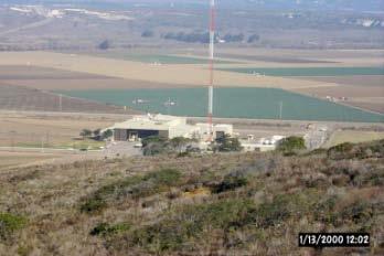

25 Ground Segment United States Dual System LUTs Guam Maryland California Miami Alaska Hawaii 4/2/
 and SAR Points of Contact (SPOC).")
26 Ground Segment Mission Control Centers (MCCs) Receive alerts from national LUTs and foreign MCCs Validate, match, and merge alerts to improve location accuracy and determine the correct destination Correlate with registration database and append info to alert Geographically sort and then transmit alerts to appropriate Rescue Coordination Centers (RCCs) and SAR Points of Contact (SPOC). Filter redundant data Perform System support and monitoring functions 4/2/

27 Cospas-Sarsat System Overview Search and Rescue Segment 4/2/
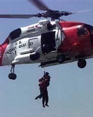

28 Rescue Coordination Centers Receive SARSAT Distress Alerts from MCCs Coordinate the Rescue Response 4/2/

29 Rescue Coordination Centers U.S. Rescue Coordination Center Coverage Areas AKRCC CGD17 CGD9 CGD13 AFRCC CGD1 PACAREA LANTAREA CGD7 CGD14 CGD8 4/2/
30 MCC to MCC Data Distribution ARMCC BRMCC CHMCC CMCC PEMCC CNMCC HKMCC KOMCC USMCC GRMCC ITMCC NMCC TAMCC JAMCC FMCC UKMCC VNMCC TRMCC ASMCC ALMCC IDMCC SIMCC AUMCC CMC SPMCC SAMCC NIMCC THMCC Nodal MCC AEMCC INMCC PAMCC 4/2/
31 Cospas-Sarsat System Overview Space Segment 4/2/
32 Currently 2 Types of Satellites: Space Segment Low Earth Orbiting Search And Rescue (LEOSAR)- 5 on Orbit Altitude: 500 miles in Pole-Pole orbit Performs Doppler locating function (primary means of locating not GPS) Stores & Forwards alerts continuously for 48 hours (provides worldwide coverage and total system redundancy) Geostationary Orbiting Search And Rescue (GEOSAR)- 4 on Orbit Altitude: 23,000 miles in fixed orbit Performs instantaneous alerting function. No locating capability unless beacon is equipped with GPS. Coverage from 70N 70S 4/2/

33 Space Segment Typical Satellite Footprints 4/2/

34 Space Segment GEOSAR Coverage - Typical Satellite Footprint 4/2/

35 Space Segment Field of View Path of LEO satellite. Beacon RF Coverage GEO Satellite 4/2/
36 Future Enhancements Current Limitations GEOSAR: Coverage limited to 70N to 70S Fixed geometry to emergency beacon No Doppler or independent location capability LEOSAR: Waiting time Payload configuration fixed System: Performance variations between SAR payloads System reliability 4/2/

37 Future Enhancements Future Capability Medium Earth Orbit SAR System (MEOSAR) Improved Position Accuracy Average accuracy decrease from 3.1 km to 500 meters Decrease in waiting time Improvement ranges from three minutes to eight hours depending on latitude and terrain. Robust Space Segment which operates even if some of the satellites fail 4/2/
38 Future Enhancements International Cooperation Similar systems being proposed for the European Galileo and Russian Glonass Global Navigation Satellite System (GNSS) systems. U.S. European Union agreement on GPS/Galileo calls for cooperation on search and rescue within Cospas-Sarsat Cospas-Sarsat concluded a Declaration of Intent to Cooperate with the Galileo Joint Undertaking in December U.S. Russia in middle of negotiating an agreement which will include search and rescue Cospas-Sarsat has developed MEOSAR Implementation Plan to help ensure interoperability Countries developing plans to deploy test and operational ground segment equipment to support the new space segment. 4/2/
39 Cospas-Sarsat Results 4/2/


40 Cospas-Sarsat Results Rescues in the United States Calendar year 2011 Overall 207 Rescues in 116 Events EPIRB 123 rescues in 41 events PLB ELT 71 rescues in 42 events 14 rescues 6 events 4/2/
 7,019")
41 Cospas-Sarsat Results Persons rescued world-wide since ,000+ Persons rescued in United States since 1982 (as of Feb 21, 2013) 7,019 4/2/
42 Questions? 4/2/
SARSAT Overview. SAR Controllers Training March 2015 Christopher O Connors NOAA SARSAT Program Manager
 SARSAT Overview SAR Controllers Training 2015 3 5 March 2015 Christopher O Connors NOAA SARSAT Program Manager Agenda Cospas-Sarsat System Description User Segment (Beacons) Space Segment Ground Segment
Agenda. Importance of SARSAT Cospas-Sarsat System Description. U.S. SARSAT SARSAT Challenges
 SARSAT Overview SAR Controllers Training 2016 February 29 - March 3, 2016 Christopher O Connors NOAA Direct Services Branch Chief/SARSAT Program Manager Agenda Importance of SARSAT Cospas-Sarsat System
International Data Distribution
 International Data Distribution SAR Controllers Training 2012 14 16 February 2012 Sam Baker Science Systems and Applications, Inc. Chief USMCC Cospas-Sarsat was designed to: Save lives through Early detection
International Data Distribution. SAR Controllers Training March 2016 Dawn D. Anderson ERT, Inc. Chief USMCC
 International Data Distribution SAR Controllers Training 2016 1 3 March 2016 Dawn D. Anderson ERT, Inc. Chief USMCC Cospas-SARSAT is designed to: Save lives through Early detection of distress sometimes
Status of the COSPAS-SARSAT system and future development integrated in GALILEO. Patrice Brault MARTEC SERPE-IESM
 Status of the COSPAS-SARSAT system and future development integrated in GALILEO Patrice Brault MARTEC SERPE-IESM MARTEC SERPE IESM plant Guidel ARGOS drifter PTR ERIKA Safety of human life actual components
COSPAS-SARSAT System Evolution and Enhancement. MEOSAR System. Emilia Melián Martínez Head of SPMCC Cospas-Sarsat Spain
 COSPAS-SARSAT System Evolution and Enhancement Gijón, Spain MEOSAR System Emilia Melián Martínez Head of SPMCC Cospas-Sarsat Spain Source: CNES D. Ducros COSPAS-SARSAT PROGRAMME IT S ABOUT SAVING LIVES
International Cospas-Sarsat Programme : From operations to MEOSAR prospects
 International Cospas-Sarsat Programme : From operations to MEOSAR prospects Presented by Jean-Charles CORNILLOU MRCC Corsen director with the help of Michel MARGERY (CNES) & Alex GENICOT (FMCC) UN/USA
Search and Rescue Satellite Aided Tracking (SARSAT) Program Plan. Version 2.1 March 6, 2007
 Program Plan. Version 2.1 March 6, 2007") . Search and Rescue Satellite Aided Tracking (SARSAT) Program Plan Version 2.1 March 6, 2007 . - Page Intentionally Left Blank . Document History Version Revision Date Revised Pages Comments 1 0 October
. Search and Rescue Satellite Aided Tracking (SARSAT) Program Plan Version 2.1 March 6, 2007 . - Page Intentionally Left Blank . Document History Version Revision Date Revised Pages Comments 1 0 October
The Future of Search & Rescue. We Save Lives. Steve Waters SAFE Symposium 2016
 The Future of Search & Rescue We Save Lives Steve Waters SAFE Symposium 2016 Covering today.. Understanding the Search and Rescue Ecosystem Helios and GADSS Global Aeronautical Distress and Safety System
MEOSAR Performance Overview. SAR Controllers Training March 2016 Mickey Fitzmaurice NOAA Senior Systems Engineer
 MEOSAR Performance Overview SAR Controllers Training 2016 1 3 March 2016 Mickey Fitzmaurice NOAA Senior Systems Engineer MEOSAR: AN IMPROVED SYSTEM CONCEPT MEO sat at 20,000 km LEO sat at 800-900 km MEO
RCC Messages. SAR Controllers Training March Tom Griffin SSAI USMCC Systems Analyst
 RCC Messages SAR Controllers Training 2013 19 21 March 2013 Tom Griffin SSAI USMCC Systems Analyst Overview Summary of Alert Message Types Overview of Alert Message Structure Revised RCC Message Manual
National Data Distribution. SAR Controllers Training March 2016 Dawn D. Anderson ERT, Inc. Chief USMCC
 National Data Distribution SAR Controllers Training 2016 1 3 March 2016 Dawn D. Anderson ERT, Inc. Chief USMCC Overview Data Distribution for the C/S System MEOSAR Data Principles of National Data Distribution
RCC Messages. SAR Controllers Training February 2014 Tom Griffin ERT, Inc. USMCC Systems Analyst
 RCC Messages SAR Controllers Training 2014 25-28 February 2014 Tom Griffin ERT, Inc. USMCC Systems Analyst Overview Alert message enhancements Summary of alert message types Overview of alert message structure
RCC Messages. SAR Controllers Training February Tom Griffin SSAI USMCC Systems Analyst
 RCC Messages SAR Controllers Training 2012 14 16 February 2012 Tom Griffin SSAI USMCC Systems Analyst Overview Summary of Alert Message Types Overview of Alert Message Structure Revised RCC Message Manual
Chapter 2. Search and Rescue Systems
 Chapter 2 Search and Rescue Systems Objectives (1 of 4) As they relate to SAR in the United States, describe the general roles of: National SAR Committee (NSARC) National SAR Plan National SAR Supplement
MEOSAR System. (And Second Gen Beacons) COMNAP SAR Workshop 1-2 June Cheryl Bertoia. Cospas-Sarsat Secretariat Montreal, Canada
 COMNAP SAR Workshop 1-2 June Cheryl Bertoia. Cospas-Sarsat Secretariat Montreal, Canada") MEOSAR System (And Second Gen Beacons) COMNAP SAR Workshop 1-2 June 2016 Cheryl Bertoia Cospas-Sarsat Secretariat Montreal, Canada 2 Participating Countries (May 2016) 4 Parties 26 Ground Segment Providers
MEOSAR System (And Second Gen Beacons) COMNAP SAR Workshop 1-2 June 2016 Cheryl Bertoia Cospas-Sarsat Secretariat Montreal, Canada 2 Participating Countries (May 2016) 4 Parties 26 Ground Segment Providers
ISU Symposium The Public Face of Space Strasbourg, France February A quiet and sustainable success story.
 ISU Symposium The Public Face of Space Strasbourg, France 16 18 February 2010 The International Cospas-Sarsat Programme: A quiet and sustainable success story Dany St-Pierre Cospas-Sarsat Secretariat ISU
Otmar E. Oduber Minister of Tourism, Transport & Labour. Mr. Jozef A. Maduro Director of Department Civil Aviation
 Department of Civil Aviation Aruba AIRWORTHINESS Division Offshore Aircraft Registration and Search & Rescue. Presented by Aviation Safety Inspectors: ing. Glenn Kelly & ing. Jeramiah Schwengle Content
MEOSAR & GPS ICG WG-B Vienna Austria, June 2016
 MEOSAR & GPS ICG WG-B Vienna Austria, June 2016 Dr. Lisa Mazzuca, Mission Manager NASA Search and Rescue Office Goddard Space Flight Center 1 Overview Cospas-Sarsat System GNSS-enabled Medium Earth Orbit
Global and Regional Overview of SAR Services 1.2 ICAO Guidelines for SAR Service including COSPAS-SARSAT System
 SAR/NAM/CAR/SAM IP/06 International Civil Aviation Organization 04/05/09 Search and Rescue (SAR) Meeting for the North American, Caribbean and South American Regions (SAR/NAM/CAR/SAM) (Puntarenas, Costa
Protection criteria for Cospas-Sarsat local user terminals in the band MHz
 Recommendation ITU-R M.1731-2 (01/2012) Protection criteria for Cospas-Sarsat local user terminals in the band 1 544-1 545 MHz M Series Mobile, radiodetermination, amateur and related satellite services
SAFELINK EPIRB (WITH GPS) 406 Beacon Specification. Meets the requirements of international standards:
 406 Beacon Specification. Meets the requirements of international standards:") SAFELINK EPIRB (WITH GPS) 406 Beacon Specification Meets the requirements of international standards: IEC 61097 2 2008, IEC/EN 60945 Fourth edition (2002 08), ETSI 300 066 v1.3.1 (2001 01), RTCM SC110
SAFELINK EPIRB (WITH GPS) 406 Beacon Specification Meets the requirements of international standards: IEC 61097 2 2008, IEC/EN 60945 Fourth edition (2002 08), ETSI 300 066 v1.3.1 (2001 01), RTCM SC110
Search and Rescue Operations requirements in GNSS
 Search and Rescue Operations requirements in GNSS Abstract: Unquestionably, the achievement of search and rescue operations essentially depends on the time factor therefore, Search and Rescue SAR operations
AIC AERONAUTICAL INFORMATION SERVICE OFFICE OF CIVIL AVIATION P. O. BOX 684, BOROKO
 PAPUA NEW GUINEA AIC TELEPHONE 3244672 TELEGRAPHIC ADDRESS AFTN AYPYYOYX Fax 3250749 File: 33.16.3 AERONAUTICAL INFORMATION SERVICE OFFICE OF CIVIL AVIATION P. O. BOX 684, BOROKO 01/2004 06 SEP 406 MHz
Future Concepts for Galileo SAR & Ground Segment. Executive summary
 Future Concepts for Galileo SAR & Ground Segment TABLE OF CONTENT GALILEO CONTRIBUTION TO THE COSPAS/SARSAT MEOSAR SYSTEM... 3 OBJECTIVES OF THE STUDY... 3 ADDED VALUE OF SAR PROCESSING ON-BOARD G2G SATELLITES...
Implementation and introduction of the COSPAS SARSAT system in South Africa
 Implementation and introduction of the COSPAS SARSAT system in South Africa Dirk Cornelissen Network Centre Operations - Maritime Telkom SA Limited November 2006 What is the COSPAS SARSAT programme? International
Scilab and the CelestLab Toolbox for Testing of the MEOSAR Satellite System
 Scilab and the CelestLab Toolbox for Testing of the MEOSAR Satellite System ScilabTEC 2014 Benoît HELIN Cospas-Sarsat Secretariat www.cospas-sarsat.int Summary The Cospas-Sarsat Programme Demonstration
The transponder and emergency locator transmitter
 nuts & bolts building basics The ELT Past and Future ELT changes aim to improve safety GEORGE R. WILHELMSEN The transponder and emergency locator transmitter (ELT) are two pieces of avionics in the average
Ref: CS05/320/F December 2005
 Ref: CS05/320/F510-511-530-480 20 December 2005 To: 406 MHz Beacon Manufacturers, Agents & Developers, C-S Beacon Type Approval Test Facilities, Beacon Component Manufacturers, Cc: International Civil
PROSECUTING 406/121.5 MHZ DISTRESS BEACONS. Table of Contents
 PROSECUTING 406/121.5 MHZ DISTRESS BEACONS Table of Contents 1. Purpose and intended recipients of this document 2. Synopsis 3. 406 MHz Distress Beacon Channels and Radio Frequency Spectrum 4. Limitations
GUIDANCE ON THE COSPAS-SARSAT INTERNATIONAL 406 MHz BEACON REGISTRATION DATABASE
 E ALBERT EMBANKMENT LONDON SE1 7SR Telephone: +44 (0)20 7735 7611 Fax: +44 (0)20 7587 3210 GUIDANCE ON THE COSPAS-SARSAT INTERNATIONAL 406 MHz BEACON REGISTRATION DATABASE MSC.1/Circ.1210/Rev.1 21 November
MARITIME RADIO SYSTEMS FOR DISTRESS ALERTING
 Journal of KONES Powertrain and Transport, Vol. 25, No. 1 2018 MARITIME RADIO SYSTEMS FOR DISTRESS ALERTING Karol Korcz Gdynia Maritime University Department of Marine Telecommunication Morska Street 81-87,
International Civil Aviation Organization
 International Civil Aviation Organization INFORMATION PAPER 05 August 2016 ENGLISH ONLY Agenda item 7 ICAO/IMO JOINT WORKING GROUP ON HARMONIZATION OF AERONAUTICAL AND MARITIME SEARCH AND RESCUE (ICAO/IMO
Press Kit - Sept. 2 nd McMurdo Group s Techno-Sciences, Inc. Chosen for Australia/ New Zealand MEOSAR Infrastructure Deployment
 Press Kit - Sept. 2 nd 2014 McMurdo Group s Techno-Sciences, Inc. Chosen for Australia/ New Zealand MEOSAR Infrastructure Deployment 13 Million+ Deal is Asia Pacific s First Installation of Next-Generation
CHAPTER 30 MARITIME SAFETY SYSTEMS
 CHAPTER 30 MARITIME SAFETY SYSTEMS MARITIME SAFETY AND THE NAVIGATOR 3000. Introduction The navigator s chief responsibility is the safety of the vessel and its crew. Fulfilling this duty consists mostly
Seychelles Civil Aviation Authority SAFETY NOTICE. Coding and registration of Seychelles 406 Mhz Emergency Locator Transmitters (ELTs)
") Seychelles Civil Aviation Authority Safety Notice SAFETY NOTICE Number: Issued: 25 April 2018 Coding and registration of Seychelles 406 Mhz Emergency Locator Transmitters (ELTs) This Safety Notice contains
Seychelles Civil Aviation Authority Safety Notice SAFETY NOTICE Number: Issued: 25 April 2018 Coding and registration of Seychelles 406 Mhz Emergency Locator Transmitters (ELTs) This Safety Notice contains
ASSEMBLY 37TH SESSION
 International Civil Aviation Organization WORKING PAPER A37-WP/195 1 22/9/10 (Information paper) ASSEMBLY 37TH SESSION TECHNICAL COMMISSION Agenda Item 35: The Global Air Traffic Management (ATM) System
Corrupt Beacon IDs. SAR Controllers Training February Sam Baker Science Systems and Applications, Inc.
 Corrupt Beacon IDs SAR Controllers Training 2012 14 16 February 2012 Sam Baker Science Systems and Applications, Inc. Chief, USMCC Alerts with Unknown Beacon Type Unknown Beacon Type identifies alerts
The Alaska Air Carriers Association. Supports and Advocates for the Commercial Aviation Community
 The Alaska Air Carriers Association Supports and Advocates for the Commercial Aviation Community The Alaska Air Carriers Association membership includes Part 121, 135, 125 and commercial Part 91 air operators.
Agenda Item 3: Performance framework for Regional Air Navigation Planning and Implementation BRAZILIAN AERONAUTICAL SEARCH AND RESCUE SYSTEM
 GREPECAS/16-IP/13 International Civil Aviation Organization 03/03/11 CAR/SAM Regional Planning and Implementation Group (GREPECAS) Sixteenth Meeting of the CAR/SAM Regional Planning and Implementation
New Aspects of Hybrid Satellite Orbits (HSO) Constellations for Global Coverage of Mobile Satellite Communications (MSC)
 Constellations for Global Coverage of Mobile Satellite Communications (MSC)") New Aspects of Hybrid Satellite Orbits (HSO) Constellations for Global Coverage of Mobile Satellite Communications (MSC) Stojce Dimov Ilcev Durban University of Technology (DUT), 133 Bencorrum, 183 Prince
New Aspects of Hybrid Satellite Orbits (HSO) Constellations for Global Coverage of Mobile Satellite Communications (MSC) Stojce Dimov Ilcev Durban University of Technology (DUT), 133 Bencorrum, 183 Prince
Proud supporter of the IRMF and the G4 - International Maritime Mass Rescue Conference
 Proud supporter of the IRMF and the G4 - International Maritime Mass Rescue Conference - 2017 Corporate Presentation 6/27/2017 1 OROLIA PROFILE $100m Founded in October 2006 in France, Head Office in Washington
CHAPTER 29 POSITION REPORTING SYSTEMS
 CHAPTER 29 POSITION REPORTING SYSTEMS INTRODUCTION 2900. Purpose The purpose of position reporting systems is to monitor vessel positions and inform authorities and other vessels of an emergency or distress
ICG-12 Kyoto Japan WG-B December Dr. Lisa Mazzuca
 ICG-12 Kyoto Japan WG-B December 5 2017 Dr. Lisa Mazzuca MEOSAR: SPACE SEGMENT BDS & Cospas-Sarsat: C-S JC-31 (Oct 2017) China Working Papers BDS 406 MHz MEOSAR REPEATER TECHNOLOGY STATUS (JC31-9/2) Executive
Cooperation Agreements for SAR Service and COSPAS-SARSAT
 SAR/NAM/CAR/SAM IP/15 International Civil Aviation Organization 07/05/09 Search and Rescue (SAR) Meeting for the North American, Caribbean and South American Regions (SAR/NAM/CAR/SAM) (Puntarenas, Costa
COMMUNICATION SYSTEMS FOR SAFETY AND SECURITY OF SHIPS
 Journal of KONES Powertrain and Transport, Vol. 23, No. 1 2016 COMMUNICATION SYSTEMS FOR SAFETY AND SECURITY OF SHIPS Karol Korcz Gdynia Maritime University, Department of Marine Telecommunication Morska
COSPAS-SARSAT RCC MESSAGE FORMATS. Chris Payne Manager Australian Mission Control Centre
 COSPAS-SARSAT RCC MESSAGE FORMATS Chris Payne Manager Australian Mission Control Centre COSPAS-SARSAT RCC MESSAGE FORMATS References: IAMSAR Manual Vol 2, Appendix B C-S System Interface Description (SID),
NASA Search and Rescue Cospas-Sarsat MEOSAR, Second Generation Beacons, and DF Receiver with UAS March 23, 2017
 NASA Search and Rescue Cospas-Sarsat MEOSAR, Second Generation Beacons, and DF Receiver with UAS March 23, 2017 Dr. Lisa Mazzuca Mission Manager NASA Search and Rescue Office Goddard Space Flight Center
An Introduction to INDUSTRY PARTNERS 25/05/2017. Military Army & Air Force. Government Defense & Rescue. Aviation Maritime Military. Other.
 An Introduction to 1 INDUSTRY PARTNERS Aviation Maritime Military Coast Guard & Navy Military Army & Air Force Government Defense & Rescue Other Commercial Commercial/Workboat Navy Air Force SAR Agencies
SECOND GENERATION BEACON HEX ID OPTIONS
 Cospas-Sarsat Task Group Meeting TG-1/2014/6/7 Second Generation Beacon Specifications Origin: RTCM 10-14 February 2014 Date: 13 January 2014 Agenda Item 6.1 SECOND GENERATION BEACON HEX ID OPTIONS 1.
FALCON SERVICE ADVISORY
 406 MHz Emergency Locator Transmitters (ELTs) Registration Sep 28, 10 Origin: Field Status: Closed Classification: Maint & Ops REASON The international search and rescue agency COSPAS-SARSAT has informed
THE INTERNATIONAL COSPAS-SARSAT PROGRAMME AGREEMENT
 THE INTERNATIONAL COSPAS-SARSAT PROGRAMME AGREEMENT THE INTERNATIONAL COSPAS-SARSAT PROGRAMME AGREEMENT TABLE OF CONTENTS Page PREAMBLE 1 ARTICLE 1 DEFINITIONS 2 ARTICLE 2 PURPOSE OF THE AGREEMENT 2 ARTICLE
GMDSS modernisation and e-navigation: spectrum needs
 ETSI Workshop "Future Evolution of Marine Communication", 7-8 November 2017, Sophia Antipolis, France GMDSS modernisation and e-navigation: spectrum needs Karlis Bogens BR Terrestrial Services Department
Challenges and Solutions for GPS Receiver Test
 Challenges and Solutions for GPS Receiver Test Presenter: Mirin Lew January 28, 2010 Agenda GPS technology concepts GPS and GNSS overview Assisted GPS (A-GPS) Basic tests required for GPS receiver verification
For more than 30 years, since its
 WORKING PAPERS MEOSAR New GNSS Role in Search & Rescue The ESA-built Svalbard Medium-Earth Orbit Local User Terminal (MEOLUT) on Spitsbergen Island, part of an extension of the international Cospas Sarsat
General Assembly Committee on the Peaceful Uses of Outer Space
 United Nations General Assembly Distr.: General 30 January 2007 Original: English Committee on the Peaceful Uses of Outer Space Contents Report on the United Nations/South Africa Training Course on Satellite-Aided
Sub-regional SAR Systems. Brian Day General Civil Aviation Authority United Arab Emirates ICAO Global SAR Forum Abu Dhabi 2010
 Sub-regional SAR Systems Brian Day General Civil Aviation Authority United Arab Emirates ICAO Global SAR Forum Abu Dhabi 2010 LEGAL OBLIGATION Article 25 of Chicago Convention Each Contracting State undertakes
Trusted for Life TM. USCG AIS Mandate. 3 rd December 10:30 am - 11:15 am
 Trusted for Life TM USCG AIS Mandate 3 rd December 10:30 am - 11:15 am The AIS Mandate McMurdo Stand 2335 CEO McMurdo UK McMurdo By the Numbers 25% Percentage of world s 406MHz beacons manufactured by
GNSS Programme. Overview and Status in Europe
 GNSS Programme Overview and Status in Europe Inaugural Forum Satellite Positioning Research and Application Center 23 April 2007 Tokyo Presented by Thomas Naecke (European Commission) Prepared by Daniel
ICAO/IMO JOINT WORKING GROUP ON HARMONIZATION OF AERONAUTICAL AND MARITIME SEARCH AND RESCUE (ICAO/IMO JWG-SAR)
") International Civil Aviation Organization ICAO/IMO JWG-SAR/13-WP/3 30/6/06 WORKING PAPER ICAO/IMO JOINT WORKING GROUP ON HARMONIZATION OF AERONAUTICAL AND MARITIME SEARCH AND RESCUE (ICAO/IMO JWG-SAR)
International Civil Aviation Organization ICAO/IMO JWG-SAR/13-WP/3 30/6/06 WORKING PAPER ICAO/IMO JOINT WORKING GROUP ON HARMONIZATION OF AERONAUTICAL AND MARITIME SEARCH AND RESCUE (ICAO/IMO JWG-SAR)
ICAO Inter-regional SAR Workshop 2016
 ICAO Inter-regional SAR Workshop 2016 Global Aeronautical Distress and Safety System (GADSS) - Implications for Search And Rescue Services Dave Edwards U.S. Coast Guard Chairman, International Civil Aviation
Systems. Contents 1 Rescue. 3 Operation. 2 Transmission. Objectives In this section students will...
 1 Systems Contents 1 Rescue Objectives In this section students will listen to a news report about an air-sea rescue read an incident report and complete an incident report form study and practise using
REVISED QUESTIONNAIRE ON SHORE-BASED FACILITIES FOR THE GLOBAL MARITIME DISTRESS AND SAFETY SYSTEM (GMDSS)
") E 4 ALBERT EMBANKMENT LONDON SE1 7SR Telephone: +44 (0)20 7735 7611 Fax: +44 (0)20 7587 3210 MSC.1/Circ.1382/Rev.2 24 June 2013 REVISED QUESTIONNAIRE ON SHORE-BASED FACILITIES FOR THE GLOBAL MARITIME DISTRESS
E 4 ALBERT EMBANKMENT LONDON SE1 7SR Telephone: +44 (0)20 7735 7611 Fax: +44 (0)20 7587 3210 MSC.1/Circ.1382/Rev.2 24 June 2013 REVISED QUESTIONNAIRE ON SHORE-BASED FACILITIES FOR THE GLOBAL MARITIME DISTRESS
Information Bulletin
 INTERNATIONAL COSPAS-SARSAT PROGRAMME Information Bulletin ARE YOU READY? Cospas-Sarsat prepares to end satellite processing at 121.5/243 MHz Three-year old Kate Williams was saved after the automatic
CONSIDERATION OF THE OUTCOME OF WRC-12 AND PREPARATION OF INITIAL ADVICE ON A DRAFT IMO POSITION ON WRC-2015 AGENDA ITEMS
 E JOINT IMO/ITU EXPERTS GROUP ON MARITIME RADIOCOMMUNICATION MATTERS 8th session Agenda item 5 IMO/ITU EG 8/5/8 5 September 2012 ENGLISH ONLY CONSIDERATION OF THE OUTCOME OF WRC-12 AND PREPARATION OF INITIAL
RCC Satisfaction Index Survey Results
 RCC Satisfaction Index Survey Results SAR Controllers Training 2012 14 16 February 2012 Chris O Connors NOAA SARSAT Program Manager Overview RCC satisfaction survey conducted annually to determine the
Satellite technology to prevent and respond in cases of maritime accidents
 United Nations International Conference on Space-based Technologies for Disaster Management "Disaster risk identification, assessment and monitoring" 23-25 October 2013, Beijing, China. Satellite technology
MINIMIZING DELAYS IN SEARCH AND RESCUE RESPONSE TO DISTRESS ALERTS
 INTERNATIONAL MARITIME ORGANIZATION 4 ALBERT EMBANKMENT LONDON SE1 7SR Telephone: 020 7735 7611 Fax: 020 7587 3210 IMO E Ref. T2-OSS/1.4 MSC.1/Circ.1248 16 October 2007 MINIMIZING DELAYS IN SEARCH AND
GNSS Training for ITS Developers. Characterisation of EGNSS performances in relationship with the application requirements
 GNSS Training for ITS Developers Characterisation of EGNSS performances in relationship with the application requirements Table of Content egnss for Application: Main Challenges EGNOS and GALILEO Performances
Communication & Safety at Sea
 Ocean Signal Ltd. Unit 4, Ocivan Way Margate CT9 4NN United Kingdom info@oceansignal.com +44 1843 282930 Communication & Safety at Sea Introducing Ocean Signal The Range Ocean Signal specialises in the
Distress beacons save lives. Photo: Life Flight Trust
 Photo: Life Flight Trust Distress beacons save lives HOW DOES THE GLOBAL DISTRESS BEACON SYSTEM WORK? The global distress beacon system is used by search and rescue authorities around the world. It is
Communication & Safety at Sea
 Communication & Safety at Sea English Introducing Ocean Signal Ocean Signal specialises in the development and manufacture of advanced communication and safety products for the marine market. With one
GLOBAL NAVIGATION SATELLITE SYSTEMS (GNSS) ECE 2526E Tuesday, 24 April 2018
 ECE 2526E Tuesday, 24 April 2018") GLOBAL NAVIGATION SATELLITE SYSTEMS (GNSS) ECE 2526E Tuesday, 24 April 2018 MAJOR GLOBAL NAVIGATION SATELLITE SYSTEMS (GNSS) Global Navigation Satellite System (GNSS) includes: 1. Global Position System
GLOBAL NAVIGATION SATELLITE SYSTEMS (GNSS) ECE 2526E Tuesday, 24 April 2018 MAJOR GLOBAL NAVIGATION SATELLITE SYSTEMS (GNSS) Global Navigation Satellite System (GNSS) includes: 1. Global Position System
AC No. : AC/AW/005R02 Date : 05 Feb 10
 AERONAUTICAL CIRCULAR CIVIL AVIATION AUTHORITY MACAO, CHINA SUBJECT: Coding and Registration of Macao 406 MHz Emergency Locator Transmitter (ELT) for Search and Rescue EFFECTIVE DATE: 01 March 2010 CANCELLATION:
Nigerian Communications Satellite Ltd. (NIGCOMSAT)
") OVERVIEW OF NIGERIAN SATELLITE AUGMENTATION SYSTEM COMMENCING WITH PILOT DEMONSTRATION TO VALIDATE NATIONAL WORK PLAN presented by Dr. Lawal Lasisi Salami, NIGERIAN COMMUNICATIONS SATELLITE LTD UNDER FEDERAL
OVERVIEW OF NIGERIAN SATELLITE AUGMENTATION SYSTEM COMMENCING WITH PILOT DEMONSTRATION TO VALIDATE NATIONAL WORK PLAN presented by Dr. Lawal Lasisi Salami, NIGERIAN COMMUNICATIONS SATELLITE LTD UNDER FEDERAL
Lecture-1 CHAPTER 2 INTRODUCTION TO GPS
 Lecture-1 CHAPTER 2 INTRODUCTION TO GPS 2.1 History of GPS GPS is a global navigation satellite system (GNSS). It is the commonly used acronym of NAVSTAR (NAVigation System with Time And Ranging) GPS (Global
King AbdulAziz University. Faculty of Environmental Design. Geomatics Department. Mobile GIS GEOM 427. Lecture 3
 King AbdulAziz University Faculty of Environmental Design Geomatics Department Mobile GIS GEOM 427 Lecture 3 Ahmed Baik, Ph.D. Email: abaik@kau.edu.sa Eng. Fisal Basheeh Email: fbasaheeh@kau.edu.sa GNSS
GLObal Navigation Satellite System (GLONASS)
") FEDERAL SPACE AGENCY GLObal Navigation Satellite System (GLONASS) Sergey Revnivykh Deputy Director General Central Research Institute of Machine Building Head of PNT Center 4-th meeting of International
FEDERAL SPACE AGENCY GLObal Navigation Satellite System (GLONASS) Sergey Revnivykh Deputy Director General Central Research Institute of Machine Building Head of PNT Center 4-th meeting of International
Galileo Programme Update
 Galileo Programme Update Pieter De Smet, European Commission ICTP Conference, Prague, 10 November, 2014 1 December 2014 The European GNSS Programmes 2 Secure Foundations ü A stable 7 years perspective
GNSS Spectrum Issues and New GPS L5
 Federal Aviation Administration Washington, D.C. GNSS Spectrum Issues and New GPS L5 International Civil Aviation Organization Regional Coordination Meeting Lima, Peru March 27 28, 2001 Basic GPS System!Space
Emergency Locator Signal Detection and Geolocation Small Satellite Constellation Feasibility Study
 Emergency Locator Signal Detection and Geolocation Small Satellite Constellation Feasibility Study Authors: Adam Gunderson, Celena Byers, David Klumpar Background Aircraft Emergency Locator Transmitters
McMurdo the Brand. Service and Spares. Contents
 McMurdo the Brand McMurdo is a brand of marine safety and emergency location beacon products, manufactured by Orolia Ltd. The brand originated in the 1940 s, and since that date has been involved in designing
IDENTIFICATION AND RECOVERY SYSTEM FOR SUBMARINE FLEETS S-10 SUBMARINE BEACON. ORCA S10 User Manual
 IDENTIFICATION AND RECOVERY SYSTEM FOR SUBMARINE FLEETS SUBMARINE BEACON S-10 ORCA S10 User Manual BriarTek, Inc. Technical Support: 703.548.7892 Email: support@briartek.com Web: www.briartek.com 2018
ION BEACONS EMERGENCY LOCATI. Tel: +33 (0) or Tel: +44 (0)
 or Tel: +44 (0)") Dealer: Tel: +33 (0)2 97 02 49 49 or Tel: +44 (0)23 9262 3900 E-mail: sales.kannad-av@orolia.com www.kannadaviation.com Find us on Facebook Follow us @kannadaviation DISTRIBUTORS AND AGENTS THROUGHOUT
Dealer: Tel: +33 (0)2 97 02 49 49 or Tel: +44 (0)23 9262 3900 E-mail: sales.kannad-av@orolia.com www.kannadaviation.com Find us on Facebook Follow us @kannadaviation DISTRIBUTORS AND AGENTS THROUGHOUT
THE HISTORY AND EXPERIENCE OF THE INTERNATIONAL COSPAS-SARSAT PROGRAMME FOR SEARCH AND RESCUE
 THE HISTORY AND EXPERIENCE OF THE INTERNATIONAL COSPAS-SARSAT PROGRAMME FOR SEARCH AND RESCUE Editor: Daniel Levesque, Study Manager International Astronautical Federation (IAF), Paris 30 July 2016 Table
REGIONAL & INTER- REGIONAL SEMINAR & WORKSHOP ON SEARCH AND RESCUE (SAR) KCAA PRESENTATION EDEN BLUE, MAHE, SEYCHELLES 20 th July 2016
 KCAA PRESENTATION EDEN BLUE, MAHE, SEYCHELLES 20 th July 2016") REGIONAL & INTER- REGIONAL SEMINAR & WORKSHOP ON SEARCH AND RESCUE (SAR) KCAA PRESENTATION EDEN BLUE, MAHE, SEYCHELLES 20 th July 2016 KENYA S SAR ORGANIZATION What is on ground; Challenges; and What needs
REGIONAL & INTER- REGIONAL SEMINAR & WORKSHOP ON SEARCH AND RESCUE (SAR) KCAA PRESENTATION EDEN BLUE, MAHE, SEYCHELLES 20 th July 2016 KENYA S SAR ORGANIZATION What is on ground; Challenges; and What needs
Principal Investigator Co-Principal Investigator Co-Principal Investigator Prof. Talat Ahmad Vice-Chancellor Jamia Millia Islamia Delhi
 Subject Paper No and Title Module No and Title Module Tag Geology Remote Sensing and GIS Concepts of Global Navigation Satellite RS & GIS XXXIII Principal Investigator Co-Principal Investigator Co-Principal
Regional and Inter-Regional Seminar and Workshop on Search and Rescue
 Regional and Inter-Regional Seminar and Workshop on Search and Rescue Mahe, Seychelles 19-22 July 2016 1 Agenda Aireon Introduction Space-Based ADS-B Overview Aireon System Deployment Status Aireon ALERT
Overview of the global GNSS market and status of Galileo
 2012 GNSS.asia workshop Overview of the global GNSS market and status of Galileo 6 November, 2012 Taipei Justyna Redelkiewicz, European GNSS Agency European GNNS Agency supports European Commission in
GMDSS for Recreational Boaters
 GMDSS for Recreational Boaters OVERVIEW The Global Maritime Distress and Safety System (GMDSS) is an international system using advanced communications technology. Development of GMDSS was initiated by
FOR MORE INFORMATION ON GMDSS CONTACT:
 FOR MORE INFORMATION ON GMDSS CONTACT: Commanding Officer USCG Navigation Center, MS 7310, 7323 Telegraph Road, Alexandria, VA 20598-7310 Tel:1-703-313-5900 www.navcen.uscg.gov Commandant (CG-652) Spectrum
IMO GUIDELINES TO ADMINISTRATIONS ON REPORTING FALSE ALERTS
 INTERNATIONAL MARITIME ORGANIZATION 4 ALBERT EMBANKMENT LONDON SE1 7SR Telephone: 020 7735 7611 Fax: 020 7587 3210 Telex: 23588 IMOLDN G IMO E Ref. T2/6.04 MSC/Circ.1078 6 June 2003 GUIDELINES TO ADMINISTRATIONS
Global Navigation Satellite Systems (GNSS)
") Global Navigation Satellite Systems (GNSS) Pat Norris MRAeS, FRIN LogicaCMG Business Development Manager Chairman, RAeS Space Group LogicaCMG 2006. All rights reserved 2 Global Navigation Satellite Systems
Global Navigation Satellite Systems (GNSS) Pat Norris MRAeS, FRIN LogicaCMG Business Development Manager Chairman, RAeS Space Group LogicaCMG 2006. All rights reserved 2 Global Navigation Satellite Systems
European GNSS Applications in H2020
 European GNSS Applications in H2020 Countdown to H2020 12.12.2013, Brussels Carmen Aguilera European GNSS Agency Agenda European GNSS Agency EU-GNSS market potential FP7- experience and results H2020 opportunities
LRIT spectrum, cybersecurity and other ITU related activities
 IMSO Seminar Effective Implementation and Management of the LRIT System 15 16 February 2018, London, UK LRIT spectrum, cybersecurity and other ITU related activities Nikolai Vassiliev Chief, Terrestrial
GPS Status and Modernization
 GPS Status and Modernization Nov 2011 Colonel Harold Martin PNT Command Lead AFSPC A3P "This briefing is for information only. No US Government commitment to sell, loan, lease, co-develop or co-produce
IMO WORLD-WIDE RADIONAVIGATION SYSTEM (WWRNS) GALILEO receiver performance standards. Submitted by the European Commission
 GALILEO receiver performance standards. Submitted by the European Commission") INTERNATIONAL MARITIME ORGANIZATION E IMO SUB-COMMITTEE ON SAFETY OF NAVIGATION 50th session Agenda item 13 2 April 2004 Original: ENGLISH WORLD-WIDE RADIONAVIGATION SYSTEM (WWRNS) GALILEO receiver performance
INTERNATIONAL MARITIME ORGANIZATION E IMO SUB-COMMITTEE ON SAFETY OF NAVIGATION 50th session Agenda item 13 2 April 2004 Original: ENGLISH WORLD-WIDE RADIONAVIGATION SYSTEM (WWRNS) GALILEO receiver performance
Extent of Consultation
 Objective Parts 40A, 40C and 40D prescribe design, construction and equipment requirements for passenger ships that are not SOLAS ships, non-passenger ships that are not SOLAS ships and fishing ships.
The Future in Marine Radio Communication GMDSS. Department of Transportation United States Coast Guard
 The Future in Marine Radio Communication GMDSS Department of Transportation United States Coast Guard Do you use a Maritime Radio System? If so, the new Global Maritime Distress and Safety System (GMDSS)
In 2010, Cospas-Sarsat alert data assisted in 641 distress incidents in which 2,338 persons were rescued.
 Information Bulletin ISSUE 24 - FEBRUARY 2012 Search-and-Rescue Payload Launch Inaugurates MEOSAR Satellite Constellation With the successful launch 26 February 2011 of Russia s Glonass-K No. 1 satellite,