Experiences in. Flight Inspecting GBAS
|
|
|
- Jared Crawford
- 5 years ago
- Views:
Transcription
1 Experiences in Flight Inspecting GBAS Thorsten Heinke Aerodata AG 1
2 Flight Inspection of GBAS Overview Basics Requirements Equipment Flight Inspection 2
3 Ground Based Augmentation System VDB Tx-Frequency Range : MHz in 25 khz increments VDB: VHF Data Broadcast - Error correction data - Integrity data - Approach data for one or more Runways/Approaches GBAS Reference Receivers GBAS Ground Station Status Information 3


4 Ground Based Augmentation System One GBAS Ground station may support several runways and approaches ILS Lookalike Deviations are provided to the pilot: FIS GLS Distance GLS Lateral Deviation GLS Vertical Deviation 4
5 VHF Data Broadcast (VDB) Messages - Type 1: Differential Error Correction Data - Type 2: Differential Reference Point Data - (Integrity Data) - Type 3: Reserved for GBRS Ground Based Ranging Source (Airport Pseudolites) - Type 4: FAS Final Approach Segment Construction Data for one or more Runways/Approaches - Type 5: Ranging Source Availability (optional) - Type 6: Reserved for Carrier Corrections - Type 7: Reserved for Military - Type 8: Reserved for Test 5

6 Final Approach Segment Diagram LTP Landing Threshold Point FTP Fictitious Threshold Point GPIP Glide-Path Intercept Point FPAP Flight Path Alignment Point TCH Threshold Crossing Height 6
 A Line through GERP normal to the Centerline can be compared with ILS Glide Path Intercept Line Centerline Vertical")
7 GLS (GNSS Landing System) Vertical Deviation α v Angular Vertical Deviation FPAP Desired Flight Path α v GPA Glide Path Angle Threshold Crossing Height Threshold Crossing Point GERP GLS-Elevation Reference Point LTP/FTP Vertical Direction (Normal to WGS-84 Ellipsoid at LTP/FTP) A Line through GERP normal to the Centerline can be compared with ILS Glide Path Intercept Line Centerline Vertical Deviation [DDM] = GPA α v
8 GLS (GNSS Landing System) Lateral Deviation GARP GLS-Azimuth Reference Point GARP-Offset 305m α Lat D g LTP/FTP GARP can be compared with the ILS-LLZ Antenna Centerline Vertical Direction (Normal to WGS-84 Ellipsoid at LTP/FTP) Lateral Deviation [DDM] = α CourseWidth arctan D G Lat 8


9 Comparison GLS ILS GNSS Landing System Instrument Landing System GLS Azimuth Reference Point GLS Elevation Reference Point Deviation calculated in DDM Localizer Antenna Position Glide path intercept Line Deviation measured in DDM GLS is similar to ILS 9
10 What influences the Performance / Precision of GBAS? - Signal of GBAS Ground Station Coverage Interference Incorrect FAS-Data - Availability of Satellites at the Ground Station Satellite Masking Multipath Interference - Availability of Satellites at the Aircraft Satellite Masking Multipath Interference - Satellite Constellation DOP 10
11 When is Flight Inspection required? - Prior to commissioning on each runway served and for each approach - Whenever interference is reported or suspected and ground testing cannot confirm elimination of the source of interference - As a result of a procedure modification or the introduction of a new procedure - Whenever changes occur to the GBAS configuration such as the location of the GBAS ground subsystem antenna phase-centre, the location of the data link transmit antenna, or the system database - Whenever site changes such as new obstructions or major construction occur that have the potential to impact GNSS signal reception and data broadcast transmission - After certain maintenance activities 11
12 What should be inspected on ground - Data Contents - FAS Horizontal Tolerance: 0,4m horizontal, uncertainty 0,05m Vertical Tolerance: 0,2m vertical, uncertainty 0,05m - Integrity Data - Differential Correction Data - Runway surface coverage (> -99 dbw/m² < -35 3,7m / 12ft above runway) - Availability of Satellites at Ground Station - Multipath at Ground Station - Interference at Ground Station 12
13 What should be flight inspected - Coverage of VDB Ground Station - Frequency Spectrum of VDB Frequency ± khz either side in case of suspected interference - Frequency Spectrum of GPS Frequency ( MHz) when GPS Parameters indicate possible RF interference - Satellite Availability at aircraft (PRN#) - Satellite Constellation (VDOP,HDOP, EPE) 13


14 Coverage Area The minimum operational VDB coverage area has to be: No Data Continuity Alerts shall be allowed in this area -35 dbw/m²> Field Strength > -99 dbw/m² 14
15 Procedures 20 NM Arc around Theta (~ 0ft HAT) ±10 15 NM Arc around Theta (~ 0ft HAT) ±35 Level Run from 20 NM to 13 NM or less at ~ 00ft HAT Level Run from 21 NM to 2.5 NM or less at ~ 0ft HAT Field Strength > -99 dbw/m² Main Purpose: Coverage of VDB Ground Station, Satellite availability, DOP 15
 Deviations via the AFIS Flight Guidance Interface on EFIS AFIS Provides: GLS Lateral Deviation GLS Vertical Deviation GLS Distance Use of Autopilot")
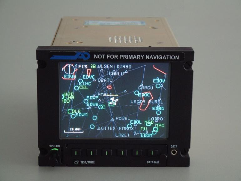
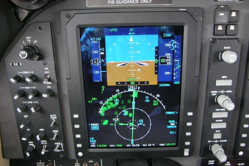
16 GBAS Guidance in for Pilots Problem: The Primary Aircraft Avionic (in Flight Inspection Aircraft) does NOT support GBAS (GNLU) installation! How to provide Guidance to the pilots? Solution: The AFIS provides GBAS(GLS) Deviations via the AFIS Flight Guidance Interface on EFIS AFIS Provides: GLS Lateral Deviation GLS Vertical Deviation GLS Distance Use of Autopilot for GLS! 16
17 GBAS Software Measurement Programs for Coverage Arcs, Level Runs and Approaches Evaluation of GLS Deviations GLS Flight Guidance in cockpit provided through AFIS to provide GBAS Guidance to pilots (GBAS receiver can not be integrated to current avionic of flight inspection aircraft) Graphical and numerical analysis of VDB Signal in Space Power Density GPS L1 and L2 Spectrum Analyzer Measurement Program VDB Spectrum Analyzer Measurement Program 17

18 Software - Database 18

19 Software Procedure Definition 19

20 Software Graphic Selection 20

21 Software FAS Data 21

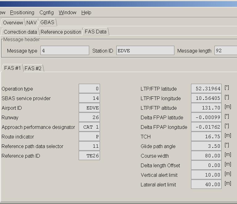
22 Software FAS Data 22

23 Software Antenna Pattern Correction 23
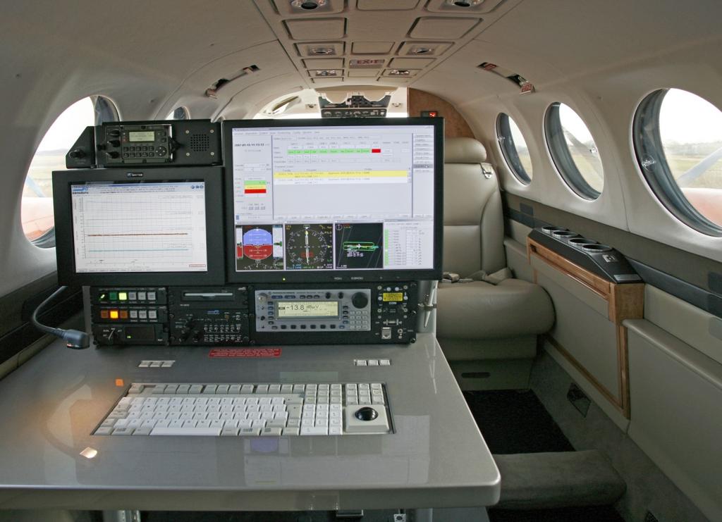
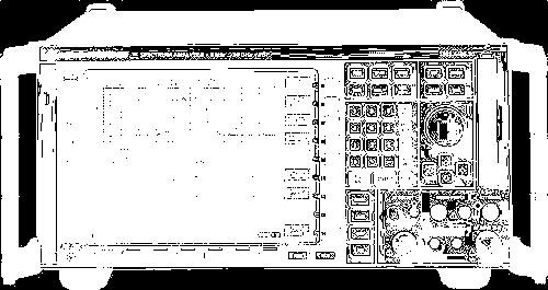
24 Flight Inspection Equipment 24

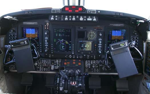
25 Hardware AFIS CRS in A/C 25
26 GBAS Coverage Arc Ideal Clearance (Full Deflection everywhere outside Course Sector) Ideal Linearity in Course Sector No Deviation Error Constant and sufficient VDB Signal In Space Power Density 26
27 GBAS Approach (lateral) No Rougness on Course Beam No Deviation Error Increasing and sufficient VDB Signal In Space Power Density 27
28 GBAS Approach (vertical) No Rougness on Course Beam Almost no Deviation Error Slight increase of Deviation Error (caused by GBAS vertical accuracy) Increasing and sufficient VDB Signal In Space Power Density 28
29 GBAS Level Run Ideal Behavior of Glidepath Beam No Deviation Error 29
30 GBAS GPS Signal Analysis Individual Satellite Data 30
31 In order to measure field strength accurate (+/- 3dB): - VDB AGC Characteristics of receiver (GNLU) needs to be proper calibrated (polynomial correction curve) - Aerodata therefore has developed GNLU calibration procedure. - Cable Losses need to be compensated - Antenna Characteristics of VDB Antenna needs to be compensated: - Azimuth compensation - Frequency Compensation Ground tests have demonstrated AFIS measures VDB Signal Strength with an absolute accuracy better than +/- 3dB!!! 31
32 In order to measure position Errors and Deviation Errors: - GNLU shows different Time behavior for: - Position Output - GLS LLZ Deviation Output - GLS GP Deviation Output These Time Delays need to be compensated for accurate measurements 32
33 - Typical Flight Inspection Aircraft are not primary GNLU equipped; - Retrofit solution for a GNLU installation in e.g. Beech King Air cockpit is not available How to fly the GLS Approach, especially if it is no overlay to ILS? Solution: AFIS Flight Guidance Interface to aircraft EFIS allows the pilots to fly GLS Approaches using the AFIS GNLU. Only this feature allows to : - Evaluate the fly ability of GLS approaches with regular Flight Inspection Aircraft - Fly GLS approaches with autopilot 33
34 GBAS Requirements Aircraft: Capability to fly GBAS Approach (e.g. provided by AFIS flight guidance) Capability to use autopilot for flying GBAS approach VDB and GPS antenna for GBAS (GNLU) Flight Inspection System: GBAS receiver (GNLU) with AGC output (non standard version) Provide Cockpit Flight Guidance to fly GBAS procedures (Arcs, Level runs, Approaches) High accurate Reference Position with proven integrity (e.g. PDGPS) Compensation of Antenna Lever arms on flight inspection aircraft Compensation of Antenna Pattern characteristic for accurate field strength measurements Proper Time Synchronization of data (synchronization by timestamp!) Spectrum Analyzer interface 34
35 GBAS Benefits For Airlines: Nearly ideal Guidance Signal provided to pilots Fuel savings, noise abatement and reduced emissions (flexible flight paths) Higher precision guidance Minimal pilot training (similar to ILS) For Airports: Improved airport capacity (simultaneous operations to parallel runways, simultaneous ) No Protection Areas (as required for ILS) Improved airport access, even where ILS cannot be installed for terrain or economic reasons. For Air Navigation Service Providers: Reduced cost and lower ongoing maintenance (one GBAS covers all runways at an airport) Flexibility to add or change final approach procedures without changing system configuration Continued operations during routine flight inspection or airport works. 35
 Example: A simple 1 Watt handheld GPS Jammer can blast GPS Signals in a kilometer radius Intentional Jamming: GPS Jammer like this can simply be bought via Internet Unintentional Interference: A")
36 GBAS Disadvantages Fully dependant on GPS: GPS Interference or jamming could disable entire system (Complete airport / all runways simultaneously!) Example: A simple 1 Watt handheld GPS Jammer can blast GPS Signals in a kilometer radius Intentional Jamming: GPS Jammer like this can simply be bought via Internet Unintentional Interference: A defective microwave oven on board of a sailboat jammed GPS on an entire airport in the US. A wireless network router from University jammed GPS at an airport in Spain Costly Precision Approach Lighting system is required for every runway 36


37 Thank you for your attention! 37
GBAS FOR ATCO. June 2017
 GBAS FOR ATCO June 2017 Disclaimer This presentation is for information purposes only. It should not be relied on as the sole source of information, and should always be used in the context of other authoritative
Ground Based Augmentation Systems (GBAS) Introduction
 Introduction") Ground Based Augmentation Systems (GBAS) Introduction Technical and Operational Overview Andreas Lipp GBAS Implementation Workshop, ICAO EUR/NAT Paris, 18 March 2010 The European Organisation for the Safety
Ground Based Augmentation Systems (GBAS) Introduction Technical and Operational Overview Andreas Lipp GBAS Implementation Workshop, ICAO EUR/NAT Paris, 18 March 2010 The European Organisation for the Safety
Cockpit Visualization of Curved Approaches based on GBAS
 www.dlr.de Chart 1 Cockpit Visualization of Curved Approaches based on GBAS R. Geister, T. Dautermann, V. Mollwitz, C. Hanses, H. Becker German Aerospace Center e.v., Institute of Flight Guidance www.dlr.de
RFI Impact on Ground Based Augmentation Systems (GBAS)
") RFI Impact on Ground Based Augmentation Systems (GBAS) Nadia Sokolova SINTEF ICT, Dept. Communication Systems SINTEF ICT 1 GBAS: General Concept - improves the accuracy, provides integrity and approach
RFI Impact on Ground Based Augmentation Systems (GBAS) Nadia Sokolova SINTEF ICT, Dept. Communication Systems SINTEF ICT 1 GBAS: General Concept - improves the accuracy, provides integrity and approach
Operational Benefits of Ground Based Augmentation Systems
 Operational Benefits of Ground Based Augmentation Systems Airline Perspective Ron Renk Manager, Flight Technologies/ 737 Pilot Flight Operations June 15, 2011 Today s Program What is GBAS? Why Continental
> ATM Seminar 2015 > Dauterrmann/Geister 376 >
 DLR.de Chart 1 Combining Advanced-RNP with SBAS Guided Precision Terminal Area Paths and Final Approach Guidance Exploiting All Benefits from Performance Based Navigation Thomas Dautermann and Robert Geister
APPENDIX C VISUAL AND NAVIGATIONAL AIDS
 VISUAL AND NAVIGATIONAL AIDS APPENDIX C VISUAL AND NAVIGATIONAL AIDS An integral part of the airport system is the visual and navigational aids provided to assist pilots in navigating both on the airfield
Navy Landing System Overview
 Navy Landing System Overview OPNAV N8853 CDR Brett Bucket Easler 1 Interoperable Solution USN Automatic Carrier Landing System (SPN-46) LHA/D Landing System (SPN-35) Shore Precision Approach Radar (PAR)
Modern ARINC 743B DO-229D and DO-253C GLSSU Solutions For Retrofit
 Commercial Aviation Modern ARINC 743B DO-229D and DO-253C GLSSU Solutions For Retrofit Presented to AEEC March 2010 The Classic Retrofit Challenge Financial: Operating budget year financing ROI payback:
SECTION 2 BROADBAND RF CHARACTERISTICS. 2.1 Frequency bands
 SECTION 2 BROADBAND RF CHARACTERISTICS 2.1 Frequency bands 2.1.1 Use of AMS(R)S bands Note.- Categories of messages, and their relative priorities within the aeronautical mobile (R) service, are given
PBN Airspace & Procedures
 PBN Airspace & Procedures Design/Database/Charting Aspects Presented by Sorin Onitiu Manager Business Affairs - Jeppesen ICAO Regional GO-TEAM Visit Belarus Minsk, 7 9 April 2015 Topics Evolution of Procedure
International Civil Aviation Organization. Performance Based Navigation/Global Navigation Satellite System Task Force (PBN/GNSS TF)
") PBN/GNSS TF/5-IP/4 2/04/2013 International Civil Aviation Organization Performance Based Navigation/Global Navigation Satellite System Task Force (PBN/GNSS TF) Fifth Meeting (Cairo, Egypt, 15-17 April
PBN/GNSS TF/5-IP/4 2/04/2013 International Civil Aviation Organization Performance Based Navigation/Global Navigation Satellite System Task Force (PBN/GNSS TF) Fifth Meeting (Cairo, Egypt, 15-17 April
NAVIGATION INSTRUMENTS - BASICS
 NAVIGATION INSTRUMENTS - BASICS 1. Introduction Several radio-navigation instruments equip the different airplanes available in our flight simulators software. The type of instrument that can be found
GNSS for Landing Systems and Carrier Smoothing Techniques Christoph Günther, Patrick Henkel
 GNSS for Landing Systems and Carrier Smoothing Techniques Christoph Günther, Patrick Henkel Institute of Communications and Navigation Page 1 Instrument Landing System workhorse for all CAT-I III approach
VOR/DME APPROACH WITH A320
 1. Introduction VOR/DME APPROACH WITH A320 This documentation presents an example of a VOR/DME approach performed with an Airbus 320 at LFRS runway 21. This type of approach is a non-precision approach
Glide Slope Considerations to Provide Support for Aircraft Certification for Steep Angle Approaches.
 Aaron A. Wilson Associate Program Engineer Avionics Engineering Center 224 Stocker Center, Ohio University Athens, Ohio 45701, USA Email:wilsona@ohio.edu David A. Quinet Senior Program Engineer Avionics
GBAS Roadmap. Summary. GNSSP.4.IP.yy.2. Global Navigation Satellite System (GNSS) Panel Meeting 4. Montreal, 23 rd April 2 nd May, 2003
 Panel Meeting 4. Montreal, 23 rd April 2 nd May, 2003") GNSSP.4.IP.yy.2 Global Navigation Satellite System (GNSS) Panel Meeting 4 Montreal, 23 rd April 2 nd May, 2003 (Prepared by EUROCONTROL) Summary This Information Paper is a roadmap for the Ground-Based
GNSSP.4.IP.yy.2 Global Navigation Satellite System (GNSS) Panel Meeting 4 Montreal, 23 rd April 2 nd May, 2003 (Prepared by EUROCONTROL) Summary This Information Paper is a roadmap for the Ground-Based
The prior specification for navaid data was XP NAV810, which was compatible with X-Plane Changes in the spec for XP NAV1100 were:
 X-PLANE NAVIGATION DATA FOR NAVAIDS (USER_NAV.DAT & EARTH_NAV.DAT) FILE SPECIFICATION VERSION 1100 REVISION HISTORY 7 May 2009 Spec converted to this new format to support new web site (http://data.x-plane.com).
AIRCRAFT AVIONIC SYSTEMS
 AIRCRAFT AVIONIC SYSTEMS B-777 cockpit Package C:\Documents and ettings\administrato Course Outline Radio wave propagation Aircraft Navigation Systems - Very High Omni-range (VOR) system - Instrument Landing
Mode 4A Unsafe terrain clearance with landing gear not down and flaps not in landing position
 1.6.18 Ground Proximity Warning System Allied Signal Aerospace (Honeywell) manufactures the GPWS, part number 965-0648- 008. The GPWS provides the following alerts if thresholds are exceeded: Mode 1 Excessive
CIVIL AVIATION REQUIREMENTS SECTION 4 - AERODROME STANDARDS & AIR TRAFFIC SERVICES SERIES 'D', PART II 12 TH JULY 2006 EFFECTIVE: FORTHWITH
 GOVERNMENT OF INDIA OFFICE OF DIRECTOR GENERAL OF CIVIL AVIATION TECHNICAL CENTRE, OPP SAFDARJANG AIRPORT, NEW DELHI CIVIL AVIATION REQUIREMENTS SECTION 4 AERODROME STANDARDS & AIR TRAFFIC SERVICES SERIES
VERY PRECISE SYNCHRONIZATION OF A GROUP OF PSEUDOLITES
 VERY PRECISE SYNCHRONIZATION OF A GROUP OF PSEUDOLITES Werner R. Lange Lange-Electronic GmbH Gernlinden, Germany T.: +49-8142-2845820 WLange@lange-electronic.de Abstract Pseudolites are GNSS transmitters
Ron Turner Technical Lead for Surface Systems. Syracuse, NY. Sensis Air Traffic Systems - 1
 Multilateration Technology Overview Ron Turner Technical Lead for Surface Systems Sensis Corporation Syracuse, NY Sensis Air Traffic Systems - 1 Presentation Agenda Multilateration Overview Transponder
GNSS Spectrum Issues and New GPS L5
 Federal Aviation Administration Washington, D.C. GNSS Spectrum Issues and New GPS L5 International Civil Aviation Organization Regional Coordination Meeting Lima, Peru March 27 28, 2001 Basic GPS System!Space
WAAS/LPV Flight Inspection and the Importance of Database Integrity and Standardization
 WAAS/LPV Flight Inspection and the Importance of Database Integrity and Standardization Gary A. Flynn Engineering Manager Aviation System Standards Federal Aviation Administration Oklahoma City, Oklahoma,
ext Subject: Adoption of Amendment 91 to Annex 10, Volume I
 International Civil Aviation Organization Organisation de l aviation civile internationale Tel.: +1 514-954-8219 ext. 8178 Ref.: AN 7/62.2.2-18/18 Organización de Aviación Civil Internacional Международная
10 Secondary Surveillance Radar
 10 Secondary Surveillance Radar As we have just noted, the primary radar element of the ATC Surveillance Radar System provides detection of suitable targets with good accuracy in bearing and range measurement
PORTABLE GNSS MONITORING STATION (PGMS)
") SPACE PORTABLE GNSS MONITORING STATION (PGMS) Satellite communications, earth observation, navigation and positioning and control stations indracompany.com PORTABLE GNSS MONITORING STATION (PGMS) PORTABLE
SPACE PORTABLE GNSS MONITORING STATION (PGMS) Satellite communications, earth observation, navigation and positioning and control stations indracompany.com PORTABLE GNSS MONITORING STATION (PGMS) PORTABLE
Navigation für herausfordernde Anwendungen Robuste Satellitennavigation für sicherheitskritische Anwendungen
 www.dlr.de Chart 1 Navigation für herausfordernde Anwendungen Robuste Satellitennavigation für sicherheitskritische Anwendungen PD Dr.-Ing. habil. Michael Meurer German Aerospace Centre (DLR), Oberpfaffenhofen
Future Dual Systems for Landing. The DGNSS PALS opportunity Marco Donfrancesco Intelligence & Cyber EW Sales & Mktg
 Future Dual Systems for Landing. The DGNSS PALS opportunity Marco Donfrancesco Intelligence & Cyber EW Sales & Mktg SG-175 DGNSS PALS study The study shall provide technical advice on the data link capabilities
GNSS: CNS Dependencies
 GNSS: CNS Dependencies Lendina Smaja DATM/RDS/NAV 10 March 2015 Agenda The Future Technical Environment GNSS GNSS Supporting CNS Loss of Signal Impact GNSS: CNS Dependencies 2 Original FANS CNS/ATM Concept
Scientific Journal of Silesian University of Technology. Series Transport Zeszyty Naukowe Politechniki Śląskiej. Seria Transport
 Scientific Journal of Silesian University of Technology. Series Transport Zeszyty Naukowe Politechniki Śląskiej. Seria Transport Volume 93 2016 p-issn: 0209-3324 e-issn: 2450-1549 DOI: https://doi.org/10.20858/sjsutst.2016.93.13
Advisory Circular. Precision Approach Path Indicator Harmonization with Instrument Landing System
 Advisory Circular Subject: Precision Approach Path Indicator Harmonization with Instrument Landing System Issuing Office: PAA Sub Activity Area: File Classification No.: Standards Aviation Safety Regulatory
Radio Navigation Aids Flight Test Seminar
 Radio Navigation Aids Flight Test Seminar FLIGHT INSPECTION IN THE NEW MILLENNIUM Curt Keedy FAA Flight Inspection Policy and Standards Change, Challenge, and Opportunity CHANGES Global Positioning system
Using Frequency Diversity to Improve Measurement Speed Roger Dygert MI Technologies, 1125 Satellite Blvd., Suite 100 Suwanee, GA 30024
 Using Frequency Diversity to Improve Measurement Speed Roger Dygert MI Technologies, 1125 Satellite Blvd., Suite 1 Suwanee, GA 324 ABSTRACT Conventional antenna measurement systems use a multiplexer or
EE Chapter 14 Communication and Navigation Systems
 EE 2145230 Chapter 14 Communication and Navigation Systems Two way radio communication with air traffic controllers and tower operators is necessary. Aviation electronics or avionics: Avionic systems cover
IMPLEMENTATION OF GNSS BASED SERVICES
 International Civil Aviation Organization IMPLEMENTATION OF GNSS BASED SERVICES Julio Siu Communications, Navigation and Surveillance Regional Officer ICAO NACC Regional Office ICAO Workshop on PBN Airspace
Subject: Aeronautical Telecommunications Aeronautical Radio Frequency Spectrum Utilization
 GOVERNMENT OF INDIA OFFICE OF DIRECTOR GENERAL OF CIVIL AVIATION TECHNICAL CENTRE, OPP SAFDARJANG AIRPORT, NEW DELHI CIVIL AVIATION REQUIREMENTS SECTION 4 - AERODROME STANDARDS & AIR TRAFFIC SERVICES SERIES
Agilent 8644A-2 Air Navigation Receiver Testing with the Agilent 8644A
 Agilent 8644A-2 Air Navigation Receiver Testing with the Agilent 8644A Application Note This application note describes the synthesized internal audio source used in the Agilent Technologies 8645A, 8665A,
CEPT/ERC Recommendation ERC E (Funchal 1998)
") Page 1 Distribution: B CEPT/ERC Recommendation ERC 54-01 E (Funchal 1998) METHOD OF MEASURING THE MAXIMUM FREQUENCY DEVIATION OF FM BROADCAST EMISSIONS IN THE BAND 87.5 MHz TO 108 MHz AT MONITORING STATIONS
Page 1 Distribution: B CEPT/ERC Recommendation ERC 54-01 E (Funchal 1998) METHOD OF MEASURING THE MAXIMUM FREQUENCY DEVIATION OF FM BROADCAST EMISSIONS IN THE BAND 87.5 MHz TO 108 MHz AT MONITORING STATIONS
DF Antennas - Datasheet. Datasheet
 DF Antennas - Datasheet Datasheet To cover a wide frequency range with high sensitivity, Narda offers several directional antennas. Each antenna is optimized for their particular frequency range with regard
ECC Recommendation (16)04
04") ECC Recommendation (16)04 Determination of the radiated power from FM sound broadcasting stations through field strength measurements in the frequency band 87.5 to 108 MHz Approved 17 October 2016 Edition
ECC Recommendation (16)04 Determination of the radiated power from FM sound broadcasting stations through field strength measurements in the frequency band 87.5 to 108 MHz Approved 17 October 2016 Edition
Monitoring Pulse Based Navigation Signals in Flight
 Monitoring Pulse Based Navigation Signals in Flight Rolf Seide Senior Manager Competence Center Flight Inspection Systems Aerodata AG Herrmann-Blenk-Strasse 36 D-38108 Braunschweig Fax: +49 531 2359 222
Radio Navigation Aids Flight Test Seminar
 Radio Navigation Aids Flight Test Seminar L. Nelson Spohnheimer, US TRNSG Delegate Curt Keedy, Advisor Testing of Radio Navigation Aids Study Group TRNSG Overview & Status 11/01 1 Membership Usually 15-20
GPS (Introduction) References. Terms
 References. Terms") GPS (Introduction) MSE, Rumc, GPS, 1 Terms NAVSTAR GPS ( Navigational Satellite Timing and Ranging - Global Positioning System) is a GNSS (Global Navigation Satellite System), developed by the US-DoD in
GPS (Introduction) MSE, Rumc, GPS, 1 Terms NAVSTAR GPS ( Navigational Satellite Timing and Ranging - Global Positioning System) is a GNSS (Global Navigation Satellite System), developed by the US-DoD in
Fokker 50 - Automatic Flight Control System
 GENERAL The Automatic Flight Control System (AFCS) controls the aircraft around the pitch, roll, and yaw axes. The system consists of: Two Flight Directors (FD). Autopilot (AP). Flight Augmentation System
GPS (Introduction) References. Terms
 References. Terms") GPS (Introduction) WCOM2, GPS, 1 Terms NAVSTAR GPS ( Navigational Satellite Timing and Ranging - Global Positioning System) is a GNSS (Global Navigation Satellite System), developed by the US-DoD in 197x
GPS (Introduction) WCOM2, GPS, 1 Terms NAVSTAR GPS ( Navigational Satellite Timing and Ranging - Global Positioning System) is a GNSS (Global Navigation Satellite System), developed by the US-DoD in 197x
RECOMMENDATION ITU-R SM.1268*
 Rec. ITU-R SM.1268 1 RECOMMENDATION ITU-R SM.1268* METHOD OF MEASURING THE MAXIMUM FREQUENCY DEVIATION OF FM BROADCAST EMISSIONS AT MONITORING STATIONS (Question ITU-R 67/1) Rec. ITU-R SM.1268 (1997) The
ICG GNSS Interoperability Workshop A Civil Aviation Perspective
 Approved for Public Release; Distribution Unlimited. 13-1907. ICG GNSS Interoperability Workshop A Civil Aviation Perspective C h r i s t o p h e r J. H e g a r t y A p r i l 2 0 1 3 Disclaimer: The contents
Annex 10 Aeronautical Communications
 Attachment D 3.2.8.1 For Basic GNSS receivers, the receiver qualification standards require demonstration of user positioning accuracy in the presence of interference and a model of selective availability
The Alaska Air Carriers Association. Supports and Advocates for the Commercial Aviation Community
 The Alaska Air Carriers Association Supports and Advocates for the Commercial Aviation Community The Alaska Air Carriers Association membership includes Part 121, 135, 125 and commercial Part 91 air operators.
The Use of Raw GPS for Vertical Navigation
 The Use of Raw GPS for Vertical Navigation J.D. Andrew Graham, P.Eng NAV CANADA Biography Andrew Graham is a project engineer with NAV CANADA s Satellite Navigation Program Office in Ottawa, Canada, where
A Review of Vulnerabilities of ADS-B
 A Review of Vulnerabilities of ADS-B S. Sudha Rani 1, R. Hemalatha 2 Post Graduate Student, Dept. of ECE, Osmania University, 1 Asst. Professor, Dept. of ECE, Osmania University 2 Email: ssrani.me.ou@gmail.com
HD Radio FM Transmission System Specifications
 HD Radio FM Transmission System Specifications Rev. D February 18, 2005 Doc. No. SY_SSS_1026s TRADEMARKS The ibiquity Digital logo and ibiquity Digital are registered trademarks of ibiquity Digital Corporation.
Distributed integrity monitoring of differential GPS corrections
 Distributed integrity monitoring of differential GPS corrections by Martin Pettersson Supervised by Fredrik Gustafsson Niclas Bergman Department of Automatic Control University of Linköpings Made for Luftfartsverket
Regulatory requirements for white space devices. Regulatory requirements for white space devices in the UHF TV band
 Regulatory requirements for white space devices in the UHF TV band 4 July 2012 Contents Section Page 1 Introduction 2 2 Terminology 3 3 Requirements for master WSDs 5 4 Requirements for slave WSDs 12 5
AREA NAVIGATION SYSTEMS
 AREA NAVIGATION SYSTEMS 1. Introduction RNAV is defined as a method of navigation which permits aircraft operation on any desired flight path within the coverage of station-referenced navigation aids or
Evaluation, Design, Commissioning and Certification of a ±15 Reduced Coverage Localizer
 Evaluation, Design, Commissioning and Certification of a ±15 Reduced Coverage Localizer Hervé Demule Navigation Engineer / Project Manager Skyguide, Swiss Air Navigation Services Route de Pré-Bois 15-17,
0.6 kbits/s, the modulation shall be aviation binary phase shift keying (A-BPSK).
.") SECTION 3 RF CHANNEL CHARACTERISTICS 3.1 Modulation 3.1.1 Modulation for channel rates 2.4 kbits/s and below. For channel rates of 2.4, 1.2 and 0.6 kbits/s, the modulation shall be aviation binary phase
SECTION 3 RF CHANNEL CHARACTERISTICS 3.1 Modulation 3.1.1 Modulation for channel rates 2.4 kbits/s and below. For channel rates of 2.4, 1.2 and 0.6 kbits/s, the modulation shall be aviation binary phase
Near Term Improvements to WAAS Availability
 Near Term Improvements to WAAS Availability Juan Blanch, Todd Walter, R. Eric Phelts, Per Enge Stanford University ABSTRACT Since 2003, when it was first declared operational, the Wide Area Augmentation
ORBITAL NAVIGATION SYSTEMS PRESENT AND FUTURE TENDS
 ORBITAL NAVIGATION SYSTEMS PRESENT AND FUTURE TENDS CONTENT WHAT IS COVERED A BRIEF HISTORY OF SYSTEMS PRESENT SYSTEMS IN USE PROBLEMS WITH SATELLITE SYSTEMS PLANNED IMPROVEMENTS CONCLUSION CONTENT WHAT
ERC Recommendation 54-01
 ERC Recommendation 54-01 Method of measuring the maximum frequency deviation of FM broadcast emissions in the band 87.5 to 108 MHz at monitoring stations Approved May 1998 Amended 13 February 2015 Amended
AE4-393: Avionics Exam Solutions
 AE4-393: Avionics Exam Solutions 2008-01-30 1. AVIONICS GENERAL a) WAAS: Wide Area Augmentation System: an air navigation aid developed by the Federal Aviation Administration to augment the Global Positioning
Learning Objectives 062 Radio Navigation
 Learning Objectives 062 Radio Navigation Syllabus 060 00 00 00 NAVIGATION 062 00 00 00 RADIO NAVIGATION 062 01 00 00 BASIC RADIO PROPAGATION THEORY 062 01 01 00 Basic principles 062 01 01 01 Electromagnetic
An Introduction to Airline Communication Types
 AN INTEL COMPANY An Introduction to Airline Communication Types By Chip Downing, Senior Director, Aerospace & Defense WHEN IT MATTERS, IT RUNS ON WIND RIVER EXECUTIVE SUMMARY Today s global airliners use
AEEC 2013 Presentation to the Airlines and the Aviation Industry
 AEEC 2013 Presentation to the Airlines and the Aviation Industry Multi-Frequency/Multi-Constellation (MFMC) GNSS Receivers Value for Aviation and Airlines John Studenny CMC GPS Product Manager Alain Beaulieu
Technical Requirements for Land Mobile and Fixed Radio Services Operating in the Bands MHz and MHz
 Provisional - Issue 1 March 2004 Spectrum Management and Telecommunications Policy Standard Radio System Plans Technical Requirements for Land Mobile and Fixed Radio Services Operating in the Bands 138-144
FieldGenius Technical Notes GPS Differential Corrections
 FieldGenius Technical tes GPS Differential Corrections Introduction The accuracy requirement of survey grade or mapping grade GPS applications for real time positioning requires the use of differential
TEST YOUR SATELLITE NAVIGATION PERFORMANCE ON YOUR ANDROID DEVICE GLOSSARY
 TEST YOUR SATELLITE NAVIGATION PERFORMANCE ON YOUR ANDROID DEVICE GLOSSARY THE GLOSSARY This glossary aims to clarify and explain the acronyms used in GNSS and satellite navigation performance testing
Absolute Antenna Calibration
 Absolute Antenna Calibration (Characteristics of Antenna Type) Method Geo++ GNPCV Real Time Calibration Antenna Data Manufacturer : CHC Shanghai HuaCe Navigation Technology Ltd. Antenna Type : i80 GNSS
Airborne Satellite Communications on the Move Solutions Overview
 Airborne Satellite Communications on the Move Solutions Overview High-Speed Broadband in the Sky The connected aircraft is taking the business of commercial airline to new heights. In-flight systems are
Antenna pattern. Figure 1: Antenna Gain as a function of Angle. Modulated Transmitter Antenna Modulated Transmission Target
 ANGLE TRACKING Amplitude Measurement Amplitude threshold is used to determine that a target is within the beam This gives a very rough measure of the target direction (within one beamwidth) if the target
AN/APN-242 Color Weather & Navigation Radar
 AN/APN-242 Color Weather & Navigation Radar Form, Fit and Function Replacement for the APN-59 Radar Previous Configuration: APN-59 Antenna Stabilization Data Generator Antenna Subsystem Radar Receiver
Keysight Technologies VOR and ILS Radio Navigation Receiver Test Using Option 302 for Keysight Signal Sources. Application Note
 Keysight Technologies VOR and ILS Radio Navigation Receiver Test Using Option 302 for Keysight Signal Sources Application Note Introduction The Keysight X-series (EXG and MXG) analog and vector signal
RECOMMENDATION ITU-R M
 参考資料 - 作 -2-1 Rec. ITU-R M.1842-1 1 RECOMMENDATION ITU-R M.1842-1 Characteristics of VHF radio systems and equipment for the exchange of data and electronic mail in the maritime mobile service RR Appendix
FieldGenius Technical Notes GPS Terminology
 FieldGenius Technical Notes GPS Terminology Almanac A set of Keplerian orbital parameters which allow the satellite positions to be predicted into the future. Ambiguity An integer value of the number of
Proceedings of Al-Azhar Engineering 7 th International Conference Cairo, April 7-10, 2003.
 Proceedings of Al-Azhar Engineering 7 th International Conference Cairo, April 7-10, 2003. MODERNIZATION PLAN OF GPS IN 21 st CENTURY AND ITS IMPACTS ON SURVEYING APPLICATIONS G. M. Dawod Survey Research
INTEGRITY AND CONTINUITY ANALYSIS FROM GPS JANUARY TO MARCH 2017 QUARTERLY REPORT
 INTEGRITY AND CONTINUITY ANALYSIS FROM GPS JANUARY TO MARCH 2017 QUARTERLY REPORT Name Responsibility Date Signature Prepared by M Pattinson (NSL) 11/04/17 Checked by L Banfield (NSL) 11/04/17 Authorised
Monitoring Station for GNSS and SBAS
 Monitoring Station for GNSS and SBAS Pavel Kovář, Czech Technical University in Prague Josef Špaček, Czech Technical University in Prague Libor Seidl, Czech Technical University in Prague Pavel Puričer,
MYANMAR CIVIL AVIATION REQUIREMENTS
 Civil Aviation Requirements THE REPULBIC OF THE UNION OF MYANMAR MINISTRY OF TRANSPORT DEPARTMENT OF CIVIL AVIATION MYANMAR CIVIL AVIATION REQUIREMENTS MCAR Part-5 ANS Section 9 Volume-V Aeronautical Telecommunications
FOUND FBA-2C1/2C2 BUSH HAWK EQUIPPED WITH SINGLE GARMIN GNS-430 # 1 VHF-AM COMM / VOR-ILS / GPS RECEIVER
 FOUND SUPPLEMENT M400-S11 Transport Canada Approved Flight Manual Supplement For FOUND BUSH HAWK EQUIPPED WITH SINGLE # 1 VHF-AM COMM / VOR-ILS / GPS RECEIVER Section 1 General is Unapproved and provided
Mobile Security Fall 2015
 Mobile Security Fall 2015 Patrick Tague #8: Location Services 1 Class #8 Location services for mobile phones Cellular localization WiFi localization GPS / GNSS 2 Mobile Location Mobile location has become
INTEGRITY AND CONTINUITY ANALYSIS FROM GPS JULY TO SEPTEMBER 2016 QUARTERLY REPORT
 INTEGRITY AND CONTINUITY ANALYSIS FROM GPS JULY TO SEPTEMBER 2016 QUARTERLY REPORT Name Responsibility Date Signature Prepared by M Pattinson (NSL) 07/10/16 Checked by L Banfield (NSL) 07/10/16 Authorised
International Civil Aviation Organization THE SIXTH MEETING OF IONOSPHERIC STUDIES TASK FORCE (ISTF/6) OUTCOME OF THE NSP/2 MEETING
 OUTCOME OF THE NSP/2 MEETING") ISTF/6 WP/06 Agenda Item 2 15/01/16 International Civil Aviation Organization THE SIXTH MEETING OF IONOSPHERIC STUDIES TASK FORCE (ISTF/6) Bangkok, Thailand, 19 21 January 2016 Agenda Item 2: Review of
ISTF/6 WP/06 Agenda Item 2 15/01/16 International Civil Aviation Organization THE SIXTH MEETING OF IONOSPHERIC STUDIES TASK FORCE (ISTF/6) Bangkok, Thailand, 19 21 January 2016 Agenda Item 2: Review of
ELECTRONIC BULLETIN For information only
 International Civil Aviation Organization ELECTRONIC BULLETIN For information only EB 2011/56 AN 7/5 21 November 2011 INTERFERENCE TO GLOBAL NAVIGATION SATELLITE SYSTEM (GNSS) SIGNALS 1. Aviation operations
SATELLITE BASED AUGMENTATION SYSTEM (SBAS) FOR AUSTRALIA
 FOR AUSTRALIA") SATELLITE BASED AUGMENTATION SYSTEM (SBAS) FOR AUSTRALIA AN AIN POSITION PAPER SUBMITTED TO VARIOUS GOVERNMENT DEPARTMENTS BY MR KYM OSLEY AM, CSC, EXEC SECRETARY AIN What are GNSS Augmentation Systems?
SATELLITE BASED AUGMENTATION SYSTEM (SBAS) FOR AUSTRALIA AN AIN POSITION PAPER SUBMITTED TO VARIOUS GOVERNMENT DEPARTMENTS BY MR KYM OSLEY AM, CSC, EXEC SECRETARY AIN What are GNSS Augmentation Systems?
INTERFERENCE FROM PASSENGER-CARRIED
 E L E C T R O M A G N E T I C INTERFERENCE FROM PASSENGER-CARRIED PORTABLE ELECTRONIC DEVICES Operators of commercial airplanes have reported numerous cases of portable electronic devices affecting airplane
SURVEILLANCE MONITORING OF PARALLEL PRECISION APPROACHES IN A FREE FLIGHT ENVIRONMENT. Carl Evers Dan Hicok Rannoch Corporation
 SURVEILLANCE MONITORING OF PARALLEL PRECISION APPROACHES IN A FREE FLIGHT ENVIRONMENT Carl Evers (cevers@rannoch.com), Dan Hicok Rannoch Corporation Gene Wong Federal Aviation Administration (FAA) ABSTRACT
ICAO policy on GNSS, GNSS SARPs and global GNSS developments. Jim Nagle Chief, Communication, Navigation and Surveillance Section ICAO
 ICAO policy on GNSS, GNSS SARPs and global GNSS developments Jim Nagle Chief, Communication, Navigation and Surveillance Section ICAO Presentation overview Introduction GNSS developments in ICAO ICAO policy
Radio Frequency Interference
 Radio Frequency Interference Regional Preparatory Workshop for WRC-19 Mexico City, Mexico 6 7 February, 2018 Mike Biggs Senior Engineer US FAA Spectrum Engineering Services What is Radio Frequency Interference
Real World Results from a Signal Measurement Drone
 Real World Results from a Signal Measurement Drone Presented by Ian Gair SixArms IEEE BTS October 2017 1 Outline of this Presentation What we are measuring Quick recap of Drone Based measurements Case
Technical presentation of VDL Mode 4 for General Aviation
 Technical presentation of VDL Mode 4 for General Aviation EGOA Enhanced General Aviation Operation by ADS-B Disposition Applications ADS-B FIS-B Data link VDL Mode 4 Equipment VDL Mode 4 Transceiver/Com
RFeye Arrays. Direction finding and geolocation systems
 RFeye Arrays Direction finding and geolocation systems Key features AOA, augmented TDOA and POA Fast, sensitive, very high POI of all signal types Capture independent of signal polarization Antenna modules
What s up with WAAS?
 I N D U S T RY What s up with WAAS? There s a bright new star in the GPS constellation and pretty soon every bright pilot is going to want to use it. B Y D A L E S M I T H You probably didn t notice it
Method of measuring the maximum frequency deviation of FM broadcast emissions at monitoring stations. Recommendation ITU-R SM.
 Recommendation ITU-R SM.1268-4 (11/217) Method of measuring the maximum frequency deviation of FM broadcast emissions at monitoring stations SM Series Spectrum management ii Rec. ITU-R SM.1268-4 Foreword
Impact of Personal Privacy Devices for WAAS Aviation Users
 Impact of Personal Privacy Devices for WAAS Aviation Users Grace Xingxin Gao, Kazuma Gunning, Todd Walter and Per Enge Stanford University, USA ABSTRACT Personal privacy devices (PPDs) are low-cost jammers
GBAS CAT II/III concepts for flexible approach procedures
 GBAS CAT II/III concepts for flexible approach procedures Thomas Feuerle, Mark Bitter, Peter Hecker (TU Braunschweig) Robert Geister (DLR) 2 nd ENRI Workshop on ATM/CNS, Tokyo Content Motivation & preparationary
Assessing & Mitigation of risks on railways operational scenarios
 R H I N O S Railway High Integrity Navigation Overlay System Assessing & Mitigation of risks on railways operational scenarios Rome, June 22 nd 2017 Anja Grosch, Ilaria Martini, Omar Garcia Crespillo (DLR)
Method of measuring the maximum frequency deviation of FM broadcast emissions at monitoring stations
 Recommendation ITU-R SM.1268-2 (02/2011) Method of measuring the maximum frequency deviation of FM broadcast emissions at monitoring stations SM Series Spectrum management ii Rec. ITU-R SM.1268-2 Foreword
GNSS MONITORING NETWORKS
 SPACE GNSS MONITORING NETWORKS Satellite communications, earth observation, navigation and positioning and control stations indracompany.com GNSS MONITORING NETWORKS GNSS MONITORING NETWORKS Indra s solutions