GNSS for Landing Systems and Carrier Smoothing Techniques Christoph Günther, Patrick Henkel
|
|
|
- Dwight Robertson
- 6 years ago
- Views:
Transcription


1 GNSS for Landing Systems and Carrier Smoothing Techniques Christoph Günther, Patrick Henkel Institute of Communications and Navigation Page 1
2 Instrument Landing System workhorse for all CAT-I III approach and landing today Localizer, Oberpfaffenhofen MHz [Source: Wikipedia] MHz Institute of Communications and Navigation Page 2

3 Weaknesses of ILS Localizer and glideslope transmitter at the end of the runway. In order to avoid multipath interference all airplanes must have cleared the runway and taxis limits the arrival frequency under bad weather conditions strong restrictions on the location of buildings Long straight flight segment before landing (straight in approach) curved approach often desirable Fixed glide path intercept point (small / large aircrafts) One equipment per runway and direction not all runways are equipped due to costs Does not provide ground guidance runway incursion, 2 per day in Europe City Airports [Ian Billinghurst] Institute of Communications and Navigation Page 3

4 Feared Clock Events Phase jump 1 single satellite had no feared event in 168 days of processing Frequency jump Frequency drift Bakharev, Frolova, Moudrak, 2008 Institute of Communications and Navigation Page 4
5 Unobserved Clock Run-Off PRN 23, January 1 st, 2004 [Source: Boeing] Institute of Communications and Navigation Page 5
6 Satellite Maneuver without Warning PRN 18, April 10 th, 2007 [Source: FAA] Institute of Communications and Navigation Page 6


7 Ground Based Augmentation System GPS / Galileo Ionospheric Gradient Navigation Signals Interference Jammer / Spoofing GBAS Reference Receivers Corrections and Integrity VHF Data Broadcast Institute of Communications and Navigation Page 7

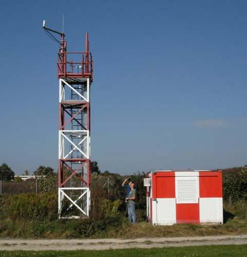
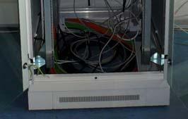
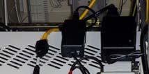
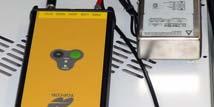
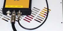
8 Experimental GBAS Systems Research Airport Braunschweig DLR receiver station optional sites for Thales CAT I GBAS DLR EVNet Node GLS Institute of Communications and Navigation Page 8
9 The Concept of Integrity Horizontal Alert Limit (HAL) accuracy (H) Event: Alert: within time to alert Vertical Alert Limit (VAL) accuracy (V) accuracy: integrity: the average error is small detect when the measured position leaves the box (worst case situation) continuity: it does not happen during a specified maneuver of duration true position measured position availability: accuracy, integrity and continuity are provided Institute of Communications and Navigation Page 9
![Accident Statistics - The Basis for Requirements per 1 million flights 10-3 for Navigation Sensor [Source IATA] pilot can](/docs-images/77/74967754/images/10-1.jpg "handle 99 out of 100 error conditions, provided they have alternative means (CAT I) Institute of Communications and Navigation")
10 Accident Statistics - The Basis for Requirements per 1 million flights 10-3 for Navigation Sensor [Source IATA] pilot can handle 99 out of 100 error conditions, provided they have alternative means (CAT I) Institute of Communications and Navigation Page 10
11 GNSS Landing Systems ILS like performance [Source: FAA] Difficult part! Institute of Communications and Navigation Page 11
12 Three Elements for Achieving Integrity Monitoring eliminate events which are likely and have a large impact, e.g., satellite clock jumps. Note that this adjusts the tails of the probability distribution of errors. Protection levels in the position domain bound the impact of small errors, which are likely to occur and cannot be easily detected in a short time, e.g. noise, diffuse multipath. Bound the probability of events that are not covered by protection levels and are hard to detect in a short time, e.g. simultaneous failure of two reference receivers. Institute of Communications and Navigation Page 12
13 Protection Levels in Position Domain The user s position and clock offset are determined from the equation which is linear with a very good level of accuracy, otherwise iterate. Solve by least square Thus bounds on the pseudorange must be preserved under linear transformations to be applicable to position domain. Institute of Communications and Navigation Page 13
14 Symmetric Overbounding DeCleene, 2000 Institute of Communications and Navigation Page 14
15 Paired Overbounds Rife, Pullen, Pervan, Enge, 2004 Institute of Communications and Navigation Page 15
16 Gaussian Overbounds Inflation Factor Nominal ionosphere, gaussian core, heavy tail Lee, Pulle, Datta-Barua, Enge, 2006 Institute of Communications and Navigation Page 16
17 K-factors The gaussian overbound of the noise contributions are projected into position domain, resulting in an aggregate variance: The gaussian cdf must be evaluated at in order to ensure that the allocation for the -error of not fulfilling the bound is not exceeded: The individual variances are thus inflated twice! (CAT-III, 4 receivers) is not very compatible with standards code measurements and a vertical alert limit of 5.3 m Institute of Communications and Navigation Page 17
18 Hatch Filter Variant Smoothing - + range, clocks, troposphere [Hwang, Mc. Graw, Bader, J. Nav. 1999] Institute of Communications and Navigation Page 18
19 Known Smoothing Algorithms I Single carrier smoothing Dual frequency ionosphere free smoothing [Hwang, Mc. Graw, Bader, J. Nav. 1999, Mc. Graw, Young, NTM 2005] Institute of Communications and Navigation Page 19
20 Known Smoothing Algorithms II Dual frequency divergence free smoothing [Hwang, Mc. Graw, Bader, J. Nav. 1999, Mc. Graw, Young, NTM 2005] Hiro Konno [NTM 2006, ION 2007] compute IF and DF as well as associated VAL, then use method with lower VAL areas with insufficient availability are considerably reduced but not eliminated VAL 10 m, desirable 5.3 m, EUROCAE 2.6 m, ASMCS may require much smaller xal Institute of Communications and Navigation Page 20
![Galileo Frequencies aeronautical aeronautical [Courtesy: CNES] L1: SoL service, BOC(1,1) modulation 154 10.](/docs-images/77/74967754/images/21-1.jpg "23 MHz E5b: SoL service, upper part of ALTBOC(15,10) BPSK(10) 118 E5a: OS service, lower part co-located with L5 115 Institute of")
21 Galileo Frequencies aeronautical aeronautical [Courtesy: CNES] L1: SoL service, BOC(1,1) modulation MHz E5b: SoL service, upper part of ALTBOC(15,10) BPSK(10) 118 E5a: OS service, lower part co-located with L5 115 Institute of Communications and Navigation Page 21
22 Three Carrier Smoothing Three carrier ionosphere free Hatch smoothing minimize the noise term (marginal improvement in the factor) but: Multipath: factor 3 for code, factor 2 for carrier Institute of Communications and Navigation Page 22
23 Biases Explicit Solution Bias of the solution Institute of Communications and Navigation Page 23
24 Generalized Carrier Smoothing Smoothing Ambiguity estimation Institute of Communications and Navigation Page 24
25 Smoothed Code and Conditions geometry restitution (output) geometry removal (input) ionosphere free (output) ionosphere free (input) ambiguity sufficient condition Institute of Communications and Navigation Page 25
26 Search for Linear Combinations Search for the solution fraction of all integers with a small noise and a small probability of wrong fixing: Institute of Communications and Navigation Page 26
27 Good Linear Combinations Search and least square Multipath: factor 3 for code, factor 2 for carrier measure for the probability of wrong fixing Institute of Communications and Navigation Page 27
28 Position Determination and Ambiguity Resolution These are k equations with k+4 unknowns, expand the system using a Hatch smoothed code (less noisy) -> 4 more equations smoothed auxiliary solution round the float least square solution for N to the next integer, compute fixed position Institute of Communications and Navigation Page 28
29 Probability of Wrong Fixing Equation Least square solution Distribution of is gaussian with covariance Probability of wrong fixing Institute of Communications and Navigation Page 29
30 Bound on the Probability of Wrong Fixing with only dependent on Institute of Communications and Navigation Page 30
31 Biases in Differential Mode u 1 u 2 u 3 u 4 u 5 Differential processing, e.g. Institute of Communications and Navigation Page 31
32 Biases in Precise Point Positioning w 1 1 w 2 1 w 1 2 w 2 1 w 2 2 w 3 2 u 1 u 2 u 3 u 4 u 5 receiver type 1 receiver type 2 Bias on the link between satellite k and receiver i from class n: Assumption: the satellite bias is stable and is provided by an augmentation system SBAS, GBAS, Institute of Communications and Navigation Page 32
33 Behavior of the Biases [Laurichesse, Mercier, ION GNSS 07] lines mainly horizontal ~ bias constant duration of each line ~ 1 pass Institute of Communications and Navigation Page 33
34 Positioning with Biases Invariant under the transformation Institute of Communications and Navigation Page 34
35 Comments on Biases Run a bias filter, which is update at each step Use filtered biases and fixed ambiguities N to determine the fixed solution Using the solution for i=1, j=-1, k=0 and the minimum noise ionosphere free code combination: control code bias in E5a, E5b (absolute) control phase bias in E5a and E5b (differential) RAIM type verification of the fixed ambiguities. Large ambiguity discrimination Institute of Communications and Navigation Page 35
36 Combination with Controlled Biases and a Low Noise (i,j,k)=(6,-7,1) lambda= , sigma= , discr= Coefficients Carrier biases Code biases Probability of wrong fixing <1E-100 Institute of Communications and Navigation Page 36
37 Ionosphere 2 nd Order Correction S. Bassiri, G.A. Hajj (1993) Similar invariance as in the case of biases, impacted by the difference in the case (i=1,j=-1,k=0) Institute of Communications and Navigation Page 37
38 Conclusions Aim at accuracy and integrity for demanding applications promising method wrto. performance and simplicity Ambiguity fixed during tracking In the case of a loss of lock or cycle slip, the ambiguity must be reacquired, trading ionospheric disturbances against equipment biases ionospheric disturbances are driven by solar activity, which is out of human control equipment biases can be influenced by careful engineering of the transmitter and receiver Biases are important in undifferenced methods Tropospheric corrections must be performed more precisely as accuracy increases. The corrections provided by SBAS converge in an aeronautical scenario The impact of the ionospheric delay of second order can be suppressed. Institute of Communications and Navigation Page 38
Integer Ambiguity Resolution for Precise Point Positioning Patrick Henkel
 Integer Ambiguity Resolution for Precise Point Positioning Patrick Henkel Overview Introduction Sequential Best-Integer Equivariant Estimation Multi-frequency code carrier linear combinations Galileo:
Performance Assessment of Dual Frequency GBAS Protection Level Algorithms using a Dual Constellation and Non-Gaussian Error Distributions
 Performance Assessment of Dual Frequency GBAS Protection Level Algorithms using a Dual Constellation and Non-Gaussian Error Distributions Patrick Rémi, German Aerospace Center (DLR) Boubeker Belabbas,
Several ground-based augmentation system (GBAS) Galileo E1 and E5a Performance
 Galileo E1 and E5a Performance") » COVER STORY Galileo E1 and E5a Performance For Multi-Frequency, Multi-Constellation GBAS Analysis of new Galileo signals at an experimental ground-based augmentation system (GBAS) compares noise and
» COVER STORY Galileo E1 and E5a Performance For Multi-Frequency, Multi-Constellation GBAS Analysis of new Galileo signals at an experimental ground-based augmentation system (GBAS) compares noise and
Reduction of Ionosphere Divergence Error in GPS Code Measurement Smoothing by Use of a Non-Linear Process
 Reduction of Ionosphere Divergence Error in GPS Code Measurement Smoothing by Use of a Non-Linear Process Shiladitya Sen, Tufts University Jason Rife, Tufts University Abstract This paper develops a singlefrequency
ARAIM: Utilization of Modernized GNSS for Aircraft-Based Navigation Integrity
 ARAIM: Utilization of Modernized GNSS for Aircraft-Based Navigation Integrity Alexandru (Ene) Spletter Deutsches Zentrum für Luft- und Raumfahrt (DLR), e.v. The author gratefully acknowledges the support
The Wide Area Augmentation System
 The Wide Area Augmentation System Stanford University http://waas.stanford.edu What is Augmentation? 2 Add to GNSS to Enhance Service Improve integrity via real time monitoring Improve availability and
Prototyping Advanced RAIM for Vertical Guidance
 Prototyping Advanced RAIM for Vertical Guidance Juan Blanch, Myung Jun Choi, Todd Walter, Per Enge. Stanford University Kazushi Suzuki. NEC Corporation Abstract In the next decade, the GNSS environment
Measurement Error and Fault Models for Multi-Constellation Navigation Systems. Mathieu Joerger Illinois Institute of Technology
 Measurement Error and Fault Models for Multi-Constellation Navigation Systems Mathieu Joerger Illinois Institute of Technology Colloquium on Satellite Navigation at TU München May 16, 2011 1 Multi-Constellation
Demonstrations of Multi-Constellation Advanced RAIM for Vertical Guidance using GPS and GLONASS Signals
 Demonstrations of Multi-Constellation Advanced RAIM for Vertical Guidance using GPS and GLONASS Signals Myungjun Choi, Juan Blanch, Stanford University Dennis Akos, University of Colorado Boulder Liang
Guochang Xu GPS. Theory, Algorithms and Applications. Second Edition. With 59 Figures. Sprin ger
 Guochang Xu GPS Theory, Algorithms and Applications Second Edition With 59 Figures Sprin ger Contents 1 Introduction 1 1.1 AKeyNoteofGPS 2 1.2 A Brief Message About GLONASS 3 1.3 Basic Information of Galileo
Near Term Improvements to WAAS Availability
 Near Term Improvements to WAAS Availability Juan Blanch, Todd Walter, R. Eric Phelts, Per Enge Stanford University ABSTRACT Since 2003, when it was first declared operational, the Wide Area Augmentation
Ionospheric Corrections for GNSS
 Ionospheric Corrections for GNSS The Atmosphere and its Effect on GNSS Systems 14 to 16 April 2008 Santiago, Chile Ing. Roland Lejeune Overview Ionospheric delay corrections Core constellations GPS GALILEO
Validation of Multiple Hypothesis RAIM Algorithm Using Dual-frequency GNSS Signals
 Validation of Multiple Hypothesis RAIM Algorithm Using Dual-frequency GNSS Signals Alexandru Ene, Juan Blanch, Todd Walter, J. David Powell Stanford University, Stanford CA, USA BIOGRAPHY Alexandru Ene
Fault Detection and Elimination for Galileo-GPS Vertical Guidance
 Fault Detection and Elimination for Galileo-GPS Vertical Guidance Alexandru Ene, Juan Blanch, J. David Powell, Stanford University BIOGRAPHY Alex Ene is a Ph.D. candidate in Aeronautical and Astronautical
Navigation für herausfordernde Anwendungen Robuste Satellitennavigation für sicherheitskritische Anwendungen
 www.dlr.de Chart 1 Navigation für herausfordernde Anwendungen Robuste Satellitennavigation für sicherheitskritische Anwendungen PD Dr.-Ing. habil. Michael Meurer German Aerospace Centre (DLR), Oberpfaffenhofen
RFI Impact on Ground Based Augmentation Systems (GBAS)
") RFI Impact on Ground Based Augmentation Systems (GBAS) Nadia Sokolova SINTEF ICT, Dept. Communication Systems SINTEF ICT 1 GBAS: General Concept - improves the accuracy, provides integrity and approach
RFI Impact on Ground Based Augmentation Systems (GBAS) Nadia Sokolova SINTEF ICT, Dept. Communication Systems SINTEF ICT 1 GBAS: General Concept - improves the accuracy, provides integrity and approach
Satellite Navigation Science and Technology for Africa. 23 March - 9 April, Air Navigation Applications (SBAS, GBAS, RAIM)
") 2025-25 Satellite Navigation Science and Technology for Africa 23 March - 9 April, 2009 Air Navigation Applications (SBAS, GBAS, RAIM) Walter Todd Stanford University Department of Applied Physics CA 94305-4090
2025-25 Satellite Navigation Science and Technology for Africa 23 March - 9 April, 2009 Air Navigation Applications (SBAS, GBAS, RAIM) Walter Todd Stanford University Department of Applied Physics CA 94305-4090
SENSORS SESSION. Operational GNSS Integrity. By Arne Rinnan, Nina Gundersen, Marit E. Sigmond, Jan K. Nilsen
 Author s Name Name of the Paper Session DYNAMIC POSITIONING CONFERENCE 11-12 October, 2011 SENSORS SESSION By Arne Rinnan, Nina Gundersen, Marit E. Sigmond, Jan K. Nilsen Kongsberg Seatex AS Trondheim,
Evaluation of Dual Frequency GBAS Performance using Flight Data
 Evaluation of Dual Frequency GBAS Performance using Flight Data Mihaela-Simona Circiu, Michael Felux, Patrick Remi, Lai Yi, Boubeker Belabbas, German Aerospace Center (DLR) Sam Pullen, Stanford University
GNSS Solutions: Do GNSS augmentation systems certified for aviation use,
 GNSS Solutions: WAAS Functions and Differential Biases GNSS Solutions is a regular column featuring questions and answers about technical aspects of GNSS. Readers are invited to send their questions to
Lessons Learned During the Development of GNSS Integrity Monitoring and Verification Techniques for Aviation Users
 Lessons Learned During the Development of GNSS Integrity Monitoring and Verification Techniques for Aviation Users Sam Pullen Stanford University spullen@stanford.edu ITSNT Symposium 16 November 2016 Toulouse,
An Investigation of Local-Scale Spatial Gradient of Ionospheric Delay Using the Nation-Wide GPS Network Data in Japan
 An Investigation of Local-Scale Spatial Gradient of Ionospheric Delay Using the Nation-Wide GPS Network Data in Japan Takayuki Yoshihara, Takeyasu Sakai and Naoki Fujii, Electronic Navigation Research
GBAS safety assessment guidance. related to anomalous ionospheric conditions
 INTERNATIONAL CIVIL AVIATION ORGANIZATION ASIA AND PACIFIC OFFICE GBAS safety assessment guidance Edition 1.0 September 2016 Adopted by APANPIRG/27 Intentionally left blank Edition 1.0 September 2016 2
GBAS FOR ATCO. June 2017
 GBAS FOR ATCO June 2017 Disclaimer This presentation is for information purposes only. It should not be relied on as the sole source of information, and should always be used in the context of other authoritative
A study of the ionospheric effect on GBAS (Ground-Based Augmentation System) using the nation-wide GPS network data in Japan
 using the nation-wide GPS network data in Japan") A study of the ionospheric effect on GBAS (Ground-Based Augmentation System) using the nation-wide GPS network data in Japan Takayuki Yoshihara, Electronic Navigation Research Institute (ENRI) Naoki Fujii,
A study of the ionospheric effect on GBAS (Ground-Based Augmentation System) using the nation-wide GPS network data in Japan Takayuki Yoshihara, Electronic Navigation Research Institute (ENRI) Naoki Fujii,
Distributed integrity monitoring of differential GPS corrections
 Distributed integrity monitoring of differential GPS corrections by Martin Pettersson Supervised by Fredrik Gustafsson Niclas Bergman Department of Automatic Control University of Linköpings Made for Luftfartsverket
THE Ground-Based Augmentation System (GBAS) (known as
 (known as") JOURNAL OF AIRCRAFT Vol. 48, No. 4, July August 2011 Ionospheric Threat Mitigation by Geometry Screening in Ground-Based Augmentation Systems Jiyun Lee Korea Advanced Institute of Science and Technology,
JOURNAL OF AIRCRAFT Vol. 48, No. 4, July August 2011 Ionospheric Threat Mitigation by Geometry Screening in Ground-Based Augmentation Systems Jiyun Lee Korea Advanced Institute of Science and Technology,
VERY PRECISE SYNCHRONIZATION OF A GROUP OF PSEUDOLITES
 VERY PRECISE SYNCHRONIZATION OF A GROUP OF PSEUDOLITES Werner R. Lange Lange-Electronic GmbH Gernlinden, Germany T.: +49-8142-2845820 WLange@lange-electronic.de Abstract Pseudolites are GNSS transmitters
Horizontal Advanced RAIM: Operational Benefits and Future Challenges
 Horizontal Advanced RAIM: Operational Benefits and Future Challenges International Technical Symposium on Navigation and Timing 2015 Session Air Navigation November 2015 Toulouse/France 1 ICAO ABAS augmentation
Experiences in. Flight Inspecting GBAS
 Experiences in Flight Inspecting GBAS Thorsten Heinke Aerodata AG 1 Flight Inspection of GBAS Overview Basics Requirements Equipment Flight Inspection 2 Ground Based Augmentation System VDB Tx-Frequency
Figure 2: Maximum Ionosphere-Induced Vertical Errors at Memphis
 277 Figure 2: Maximum Ionosphere-Induced Vertical Errors at Memphis 278 Figure 3: VPL Inflation Required to Remove Unsafe Geometries 279 280 Figure 4: Nominal IPP Scenario All Surrounding IGPs are Good
SBAS DFMC performance analysis with the SBAS DFMC Service Volume software Prototype (DSVP)
") SBAS DFMC performance analysis with the SBAS DFMC Service Volume software Prototype (DSVP) D. Salos, M. Mabilleau, Egis Avia C. Rodriguez, H. Secretan, N. Suard, CNES (French Space Agency) Email: Daniel.salos@egis.fr
SBAS DFMC performance analysis with the SBAS DFMC Service Volume software Prototype (DSVP) D. Salos, M. Mabilleau, Egis Avia C. Rodriguez, H. Secretan, N. Suard, CNES (French Space Agency) Email: Daniel.salos@egis.fr
Optimization of a Vertical Protection Level Equation for Dual Frequency SBAS
 Optimization of a Vertical Protection Level Equation for Dual Frequency SBAS Juan Blanch odd Walter Per Enge. Stanford University ABSRAC he advent of dual frequency Satellite Based Augmentation Systems
Introduction to Advanced RAIM. Juan Blanch, Stanford University July 26, 2016
 Introduction to Advanced RAIM Juan Blanch, Stanford University July 26, 2016 Satellite-based Augmentation Systems Credit: Todd Walter Receiver Autonomous Integrity Monitoring (556 m Horizontal Error Bound)
The Wide Area Augmentation System (WAAS)
") The Wide Area Augmentation System (WAAS) Stanford University http://waas.stanford.edu !Aviation Metrics Outline!GPS/Aviation Timelines!The Wide-Area Augmentation System!Integrity Analyses!Comparison with
The Wide Area Augmentation System (WAAS) Stanford University http://waas.stanford.edu !Aviation Metrics Outline!GPS/Aviation Timelines!The Wide-Area Augmentation System!Integrity Analyses!Comparison with
VERTICAL POSITION ERROR BOUNDING FOR INTEGRATED GPS/BAROMETER SENSORS TO SUPPORT UNMANNED AERIAL VEHICLE (UAV)
") VERTICAL POSITION ERROR BOUNDING FOR INTEGRATED GPS/BAROMETER SENSORS TO SUPPORT UNMANNED AERIAL VEHICLE (UAV) Jinsil Lee, Eunjeong Hyeon, Minchan Kim, Jiyun Lee Korea Advanced Institute of Science and
VERTICAL POSITION ERROR BOUNDING FOR INTEGRATED GPS/BAROMETER SENSORS TO SUPPORT UNMANNED AERIAL VEHICLE (UAV) Jinsil Lee, Eunjeong Hyeon, Minchan Kim, Jiyun Lee Korea Advanced Institute of Science and
The experimental evaluation of the EGNOS safety-of-life services for railway signalling
 Computers in Railways XII 735 The experimental evaluation of the EGNOS safety-of-life services for railway signalling A. Filip, L. Bažant & H. Mocek Railway Infrastructure Administration, LIS, Pardubice,
EVALUATION OF GPS BLOCK IIR TIME KEEPING SYSTEM FOR INTEGRITY MONITORING
 EVALUATION OF GPS BLOCK IIR TIME KEEPING SYSTEM FOR INTEGRITY MONITORING Dr. Andy Wu The Aerospace Corporation 2350 E El Segundo Blvd. M5/689 El Segundo, CA 90245-4691 E-mail: c.wu@aero.org Abstract Onboard
Integrity of Satellite Navigation in the Arctic
 Integrity of Satellite Navigation in the Arctic TODD WALTER & TYLER REID STANFORD UNIVERSITY APRIL 2018 Satellite Based Augmentation Systems (SBAS) in 2018 2 SBAS Networks in 2021? 3 What is Meant by Integrity?
Analysis of a Three-Frequency GPS/WAAS Receiver to Land an Airplane
 Analysis of a Three-Frequency GPS/WAAS Receiver to Land an Airplane Shau-Shiun Jan Department of Aeronautics and Astronautics Stanford University, California 94305 BIOGRAPHY Shau-Shiun Jan is a Ph.D. candidate
Assessment of Nominal Ionosphere Spatial Decorrelation for LAAS
 Assessment of Nominal Ionosphere Spatial Decorrelation for LAAS Jiyun Lee, Sam Pullen, Seebany Datta-Barua, and Per Enge Stanford University, Stanford, California 9-8 Abstract The Local Area Augmentation
Satellite-Based Augmentation System (SBAS) Integrity Services
 Integrity Services") Satellite-Based Augmentation System (SBAS) Integrity Services Presented To: Munich, Germany Date: March 8, 2010 By: Leo Eldredge, Manager GNSS Group, FAA FAA Satellite Navigation Program 2 Wide Area Augmentation
Satellite-Based Augmentation System (SBAS) Integrity Services Presented To: Munich, Germany Date: March 8, 2010 By: Leo Eldredge, Manager GNSS Group, FAA FAA Satellite Navigation Program 2 Wide Area Augmentation
UNIT 1 - introduction to GPS
 UNIT 1 - introduction to GPS 1. GPS SIGNAL Each GPS satellite transmit two signal for positioning purposes: L1 signal (carrier frequency of 1,575.42 MHz). Modulated onto the L1 carrier are two pseudorandom
Special Committee SC-159 Navigation Equipment Using the Global Navigation Satellite System (GNSS) (Version 13)
 (Version 13)") RTCA Paper No. 307-18/PMC-1839 December 13, 2018 TERMS OF REFERENCE Special Committee SC-159 Navigation Equipment Using the Global Navigation Satellite System (GNSS) (Version 13) REQUESTOR: Organization
RTCA Paper No. 307-18/PMC-1839 December 13, 2018 TERMS OF REFERENCE Special Committee SC-159 Navigation Equipment Using the Global Navigation Satellite System (GNSS) (Version 13) REQUESTOR: Organization
Modernizing WAAS. Todd Walter and Per Enge, Stanford University, Patrick Reddan Zeta Associates Inc.
 Modernizing WAAS Todd Walter and Per Enge, Stanford University, Patrick Reddan Zeta Associates Inc. ABSTRACT The Wide Area Augmentation System (WAAS) became operational on July 10, 003. Currently this
Satellite Navigation Integrity and integer ambiguity resolution
 Satellite Navigation Integrity and integer ambiguity resolution Picture: ESA AE4E08 Sandra Verhagen Course 2010 2011, lecture 12 1 Today s topics Integrity and RAIM Integer Ambiguity Resolution Study Section
Development of a GAST-D ground subsystem prototype and its performance evaluation with a long term-data set
 Development of a GAST-D ground subsystem prototype and its performance evaluation with a long term-data set T. Yoshihara, S. Saito, A. Kezuka, K. Hoshinoo, S. Fukushima, and S. Saitoh Electronic Navigation
Special Committee SC-159 Navigation Equipment Using the Global Navigation Satellite System (GNSS) (Version 11)
 (Version 11)") RTCA Paper No. 094-18/PMC-1737 March 22, 2018 TERMS OF REFERENCE Special Committee SC-159 Navigation Equipment Using the Global Navigation Satellite System (GNSS) (Version 11) REQUESTOR: Organization Person
RTCA Paper No. 094-18/PMC-1737 March 22, 2018 TERMS OF REFERENCE Special Committee SC-159 Navigation Equipment Using the Global Navigation Satellite System (GNSS) (Version 11) REQUESTOR: Organization Person
Worst Impact of Pseudorange nominal Bias on the Position in a Civil Aviation Context
 Worst Impact of Pseudorange nominal Bias on the Position in a Civil Aviation Context J.B. Pagot, O. Julien, ENAC, France Yoan Gregoire, CNES, France BIOGRAPHIES Dr. Jean-Baptiste Pagot is currently working
Recent Progress on Aviation Integrity
 Recent Progress on Aviation Integrity for the Institute of Navigation on September 17, 2008 by Per Enge, Stanford University Acknowledgement: This work was sponsored by the FAA Satellite Navigation Office
GNSS-based Flight Inspection Systems
 GNSS-based Flight Inspection Systems Euiho Kim, Todd Walter, and J. David Powell Department of Aeronautics and Astronautics Stanford University Stanford, CA 94305, USA Abstract This paper presents novel
Further Development of Galileo-GPS RAIM for Vertical Guidance
 Further Development of Galileo-GPS RAIM for Vertical Guidance Alexandru Ene, Stanford University BIOGRAPHY Alex Ene is a Ph.D. candidate in Aeronautics and Astronautics working in the Global Positioning
GNSS Spectrum Issues and New GPS L5
 Federal Aviation Administration Washington, D.C. GNSS Spectrum Issues and New GPS L5 International Civil Aviation Organization Regional Coordination Meeting Lima, Peru March 27 28, 2001 Basic GPS System!Space
ARAIM Integrity Support Message Parameter Validation by Online Ground Monitoring
 ARAIM Integrity Support Message Parameter Validation by Online Ground Monitoring Samer Khanafseh, Mathieu Joerger, Fang Cheng-Chan and Boris Pervan Illinois Institute of Technology, Chicago, IL ABSTRACT
HORIZONTAL ARAIM AVAILABILITY FOR CIVIL AVIATION OPERATIONS. ARAIM Outreach event
 HORIZONTAL ARAIM AVAILABILITY FOR CIVIL AVIATION OPERATIONS ARAIM Outreach event Moses1978 copyright April 7, 2017 H-ARAIM availability for civil aviation operations 07/04/2017 1 INTRODUCTION Space Segment
GBAS CAT II/III concepts for flexible approach procedures
 GBAS CAT II/III concepts for flexible approach procedures Thomas Feuerle, Mark Bitter, Peter Hecker (TU Braunschweig) Robert Geister (DLR) 2 nd ENRI Workshop on ATM/CNS, Tokyo Content Motivation & preparationary
GNSS: CNS Dependencies
 GNSS: CNS Dependencies Lendina Smaja DATM/RDS/NAV 10 March 2015 Agenda The Future Technical Environment GNSS GNSS Supporting CNS Loss of Signal Impact GNSS: CNS Dependencies 2 Original FANS CNS/ATM Concept
Code-Carrier Divergence Monitoring for GAST-F GBAS
 Code-Carrier Divergence Monitoring for GAST-F GBAS Yiping Jiang, Carl Milner, Christophe Macabiau To cite this version: Yiping Jiang, Carl Milner, Christophe Macabiau. Code-Carrier Divergence Monitoring
Alternative Positioning, Navigation and Timing (APNT) for Performance Based Navigation (PBN)
 for Performance Based Navigation (PBN)") DLR.de Chart 1 Alternative Positioning, Navigation and Timing (APNT) for Performance Based Navigation (PBN) Presented by Boubeker Belabbas Prepared by : Nicolas Schneckenburger, Elisabeth Nossek, Dmitriy
DLR.de Chart 1 Alternative Positioning, Navigation and Timing (APNT) for Performance Based Navigation (PBN) Presented by Boubeker Belabbas Prepared by : Nicolas Schneckenburger, Elisabeth Nossek, Dmitriy
GNSS Signal Observations - Stanford and DLR
 GNSS Signal Observations - Stanford and DLR Christoph Günther, Sherman Lo Contributors: Dennis Akos, Alan Chen, Johann Furthner, Grace Gao, Sebastian Graf, David de Lorenzo, Oliver Montenbruck, Alexander
Annex 10 Aeronautical Communications
 Attachment D 3.2.8.1 For Basic GNSS receivers, the receiver qualification standards require demonstration of user positioning accuracy in the presence of interference and a model of selective availability
High Integrity GNSS Receiver for Ground Based Mobile Applications
 High Integrity GNSS Receiver for Ground Based Mobile Applications M. Raimondi, G. Carrié, C. Berland, D. Serant, Thales Alenia Space, Toulouse, France T. Junique, F. Barbiero, CNES, Toulouse, France N.
Radio Navigation Aids Flight Test Seminar
 Radio Navigation Aids Flight Test Seminar FLIGHT INSPECTION IN THE NEW MILLENNIUM Curt Keedy FAA Flight Inspection Policy and Standards Change, Challenge, and Opportunity CHANGES Global Positioning system
Global Navigation Satellite Systems II
 Global Navigation Satellite Systems II AERO4701 Space Engineering 3 Week 4 Last Week Examined the problem of satellite coverage and constellation design Looked at the GPS satellite constellation Overview
Future GNSS: Improved Signals and Constellations
 Future GNSS: Improved Signals and Constellations Guillermo Martínez Morán 1 1 Airbus Defense & Space. Paseo John Lennon s/n 28096 Getafe (Madrid Spain) Guillermo.M.Martinez@military.airbus.com Abstract:
Modelling GPS Observables for Time Transfer
 Modelling GPS Observables for Time Transfer Marek Ziebart Department of Geomatic Engineering University College London Presentation structure Overview of GPS Time frames in GPS Introduction to GPS observables
ARAIM Fault Detection and Exclusion
 ARAIM Fault Detection and Exclusion Boris Pervan Illinois Institute of Technology Chicago, IL November 16, 2017 1 RAIM ARAIM Receiver Autonomous Integrity Monitoring (RAIM) uses redundant GNSS measurements
On Location at Stanford University
 Thank you for inviting me (back) to Deutsches Zentrum für Luft- und Raumfahrt On Location at Stanford University by Per Enge (with the help of many) July 27, 2009 My thanks to the Federal Aviation Administration
Integrated Navigation System
 Integrated Navigation System Adhika Lie adhika@aem.umn.edu AEM 5333: Design, Build, Model, Simulate, Test and Fly Small Uninhabited Aerial Vehicles Feb 14, 2013 1 Navigation System Where am I? Position,
LAAS Sigma-Mean Monitor Analysis and Failure-Test Verification
 LAAS Sigma-Mean Monitor Analysis and Failure-Test Verification Jiyun Lee, Sam Pullen, Gang Xie, and Per Enge Stanford University ABSTRACT The Local Area Augmentation System (LAAS) is a ground-based differential
THOMAS PANY SOFTWARE RECEIVERS
 TECHNOLOGY AND APPLICATIONS SERIES THOMAS PANY SOFTWARE RECEIVERS Contents Preface Acknowledgments xiii xvii Chapter 1 Radio Navigation Signals 1 1.1 Signal Generation 1 1.2 Signal Propagation 2 1.3 Signal
Generation of Consistent GNSS SSR Corrections
 Generation of Consistent GNSS SSR Corrections for Distributed CORS Networks Jannes Wübbena, Martin Schmitz, Gerhard Wübbena Geo++ GmbH 30827 Garbsen, Germany www.geopp.de Abstract Generation of Consistent
Aircraft Landing Systems Based on GPS & Galileo
 Aircraft Landing Systems Based on GPS & Galileo for the Czech Technical University by Per Enge Thursday 4 August, 2005 Future Aircraft Landing Systems: Outline 1. Today: Global Positioning System (GPS)
Ionospheric Estimation using Extended Kriging for a low latitude SBAS
 Ionospheric Estimation using Extended Kriging for a low latitude SBAS Juan Blanch, odd Walter, Per Enge, Stanford University ABSRAC he ionosphere causes the most difficult error to mitigate in Satellite
GNSS Signal Structures
 GNSS Signal Structures Tom Stansell Stansell Consulting Tom@Stansell.com Bangkok, Thailand 23 January 2018 S t a n s e l l C o n s u l t i n g RL Introduction It s a pleasure to speak with you this morning.
Galileo Integrity Concept user level
 Galileo Integrity Concept user level Presented at The Technical Universtiy of Munich Andrew Simsky, Frank Boon GPS integrity provided by SBAS (1/2) WAAS/EGNOS define Safety-Of-Life on top of GPS RTCA DO229
Status of ARAIM. S. Wallner ICG 6, Tokyo, Japan 05/09/2011. ESA UNCLASSIFIED For Official Use
 Status of ARAIM S. Wallner ICG 6, Tokyo, Japan 05/09/2011 ARAIM Concept Objectives Classical GPS RAIM for NPA used since years Evolving GNSS environment Multi-GNSS GPS/Galileo/Glonass/Compass/QZSS Dual-frequency
Relative positioning with Galileo E5 AltBOC code measurements
 Relative positioning with Galileo E5 AltBOC code measurements Dissertation submitted to the University of Liège in requirements for a Master s degree in Geomatics and Geometrology Cécile Deprez PhD Candidate
GNSS Technologies. PPP and RTK
 PPP and RTK 29.02.2016 Content Carrier phase based positioning PPP RTK VRS Slides based on: GNSS Applications and Methods, by S. Gleason and D. Gebre-Egziabher (Eds.), Artech House Inc., 2009 http://www.gnssapplications.org/
GNSS OBSERVABLES. João F. Galera Monico - UNESP Tuesday 12 Sep
 GNSS OBSERVABLES João F. Galera Monico - UNESP Tuesday Sep Basic references Basic GNSS Observation Equations Pseudorange Carrier Phase Doppler SNR Signal to Noise Ratio Pseudorange Observation Equation
Assessing & Mitigation of risks on railways operational scenarios
 R H I N O S Railway High Integrity Navigation Overlay System Assessing & Mitigation of risks on railways operational scenarios Rome, June 22 nd 2017 Anja Grosch, Ilaria Martini, Omar Garcia Crespillo (DLR)
Ground Based Augmentation Systems (GBAS) Introduction
 Introduction") Ground Based Augmentation Systems (GBAS) Introduction Technical and Operational Overview Andreas Lipp GBAS Implementation Workshop, ICAO EUR/NAT Paris, 18 March 2010 The European Organisation for the Safety
Ground Based Augmentation Systems (GBAS) Introduction Technical and Operational Overview Andreas Lipp GBAS Implementation Workshop, ICAO EUR/NAT Paris, 18 March 2010 The European Organisation for the Safety
Evaluation of GPS L5, Galileo E1 and Galileo E5a Performance in Flight Trials for Multi Frequency Multi Constellation GBAS
 Evaluation of GPS L5, Galileo E1 and Galileo E5a Performance in Flight Trials for Multi Frequency Multi Constellation GBAS M.-S. Circiu *, M. Felux*, B. Belabbas*, M. Meurer* +, Jiyun Lee ǂ, Minchan Kim
The Benefit of Triple Frequency on Cycle Slip Detection
 Presented at the FIG Congress 2018, The Benefit of Triple Frequency on Cycle Slip Detection May 6-11, 2018 in Istanbul, Turkey Dong Sheng Zhao 1, Craig Hancock 1, Gethin Roberts 2, Lawrence Lau 1 1 The
Aviation Benefits of GNSS Augmentation
 Aviation Benefits of GNSS Augmentation Workshop on the Applications of GNSS Chisinau, Moldova 17-21 May 2010 Jeffrey Auerbach Advisor on GNSS Affairs Office of Space and Advanced Technology U.S. Department
Wide Area Augmentation System (WAAS)
") Wide Area Augmentation System (WAAS) Ionospheric Effects Symposium By: Jason Burns Technology Evolution Lead Date: Agenda WAAS Overview Ionospheric Effects on WAAS Future Plans User Segment Update 2 WAAS
Wide Area Augmentation System (WAAS) Ionospheric Effects Symposium By: Jason Burns Technology Evolution Lead Date: Agenda WAAS Overview Ionospheric Effects on WAAS Future Plans User Segment Update 2 WAAS
BeiDou Next Generation Signal Design and Expected Performance
 International Technical Symposium on Navigation and Timing ENAC, 17 Nov 2015 BeiDou Next Generation Signal Design and Expected Performance Challenges and Proposed Solutions Zheng Yao Tsinghua University
INTEGRITY AND CONTINUITY ANALYSIS FROM GPS JANUARY TO MARCH 2017 QUARTERLY REPORT
 INTEGRITY AND CONTINUITY ANALYSIS FROM GPS JANUARY TO MARCH 2017 QUARTERLY REPORT Name Responsibility Date Signature Prepared by M Pattinson (NSL) 11/04/17 Checked by L Banfield (NSL) 11/04/17 Authorised
Performances of Modernized GPS and Galileo in Relative Positioning with weighted ionosphere Delays
 Agence Spatiale Algérienne Centre des Techniques Spatiales Agence Spatiale Algérienne Centre des Techniques Spatiales الوكالة الفضائية الجزائرية مركز للتقنيات الفضائية Performances of Modernized GPS and
On Location at Stanford University
 Thank you for inviting me to Calgary On Location at Stanford University by Per Enge (with the help of many) May 29, 2009 With Gratitude to the Federal Aviation Administration from Misra and Enge, 2006
IMO WORLD-WIDE RADIONAVIGATION SYSTEM (WWRNS) GALILEO receiver performance standards. Submitted by the European Commission
 GALILEO receiver performance standards. Submitted by the European Commission") INTERNATIONAL MARITIME ORGANIZATION E IMO SUB-COMMITTEE ON SAFETY OF NAVIGATION 50th session Agenda item 13 2 April 2004 Original: ENGLISH WORLD-WIDE RADIONAVIGATION SYSTEM (WWRNS) GALILEO receiver performance
INTERNATIONAL MARITIME ORGANIZATION E IMO SUB-COMMITTEE ON SAFETY OF NAVIGATION 50th session Agenda item 13 2 April 2004 Original: ENGLISH WORLD-WIDE RADIONAVIGATION SYSTEM (WWRNS) GALILEO receiver performance
We are IntechOpen, the world s leading publisher of Open Access books Built by scientists, for scientists. International authors and editors
 We are IntechOpen, the world s leading publisher of Open Access books Built by scientists, for scientists 4,100 116,000 10M Open access books available International authors and editors Downloads Our authors
REAL-TIME ESTIMATION OF IONOSPHERIC DELAY USING DUAL FREQUENCY GPS OBSERVATIONS
 European Scientific Journal May 03 edition vol.9, o.5 ISS: 857 788 (Print e - ISS 857-743 REAL-TIME ESTIMATIO OF IOOSPHERIC DELAY USIG DUAL FREQUECY GPS OBSERVATIOS Dhiraj Sunehra, M.Tech., PhD Jawaharlal
Autonomous Fault Detection with Carrier-Phase DGPS for Shipboard Landing Navigation
 Autonomous Fault Detection with Carrier-Phase DGPS for Shipboard Landing Navigation MOON-BEOM HEO and BORIS PERVAN Illinois Institute of Technology, Chicago, Illinois SAM PULLEN, JENNIFER GAUTIER, and
INTEGRITY AND CONTINUITY ANALYSIS FROM GPS JULY TO SEPTEMBER 2016 QUARTERLY REPORT
 INTEGRITY AND CONTINUITY ANALYSIS FROM GPS JULY TO SEPTEMBER 2016 QUARTERLY REPORT Name Responsibility Date Signature Prepared by M Pattinson (NSL) 07/10/16 Checked by L Banfield (NSL) 07/10/16 Authorised
Incorporating GLONASS into Aviation RAIM Receivers
 Incorporating GLONASS into Aviation RAIM Receivers Todd Walter, Juan Blanch, Myung Jun Choi, Tyler Reid, and Per Enge Stanford University ABSTRACT Recently the Russian government issued a mandate on the
DESIGN OF AIRPORT SURFACE MOVEMENT USING SINGLE-FREQUENCY GPS A DISSERTATION SUBMITTED TO THE DEPARTMENT OF AERONAUTICS AND ASTRONAUTICS
 DESIGN OF AIRPORT SURFACE MOVEMENT USING SINGLE-FREQUENCY GPS A DISSERTATION SUBMITTED TO THE DEPARTMENT OF AERONAUTICS AND ASTRONAUTICS AND THE COMMITTEE ON GRADUATE STUDIES OF STANFORD UNIVERSITY IN
Evaluation of Two Types of Dual-Frequency Differential GPS Techniques under Anomalous Ionosphere Conditions
 Evaluation of Two Types of Dual-Frequency Differential GPS Techniques under Anomalous Ionosphere Conditions Hiroyuki Konno, Sam Pullen, Jason Rife, and Per Enge Stanford University ABSTRACT Strong ionosphere
Enabling the LAAS Differentially Corrected Positioning Service (DCPS): Design and Requirements Alternatives
: Design and Requirements Alternatives") Enabling the LAAS Differentially Corrected Positioning Service (DCPS): Design and Requirements Alternatives Young Shin Park, Sam Pullen, and Per Enge, Stanford University BIOGRAPHIES Young Shin Park is
Enabling the LAAS Differentially Corrected Positioning Service (DCPS): Design and Requirements Alternatives Young Shin Park, Sam Pullen, and Per Enge, Stanford University BIOGRAPHIES Young Shin Park is
AIRCRAFT LANDING USING A MODERNIZED GLOBAL POSITIONING SYSTEM AND THE WIDE AREA AUGMENTATION SYSTEM
 AIRCRAFT LANDING USING A MODERNIZED GLOBAL POSITIONING SYSTEM AND THE WIDE AREA AUGMENTATION SYSTEM A DISSERTATION SUBMITTED TO THE DEPARTMENT OF AERONAUTICS AND ASTRONAUTICS AND THE COMMITTEE ON GRADUATE