Capacity Building Activities on GNSS in Japan
|
|
|
- Lucas Park
- 5 years ago
- Views:
Transcription
1 Capacity Building Activities on GNSS in Japan Hiroaki Tateshita Japan Aerospace Exploration Agency Akio Yasuda Tokyo University of Marine Science & Technology 1
2 Contents Back ground of Geospatial Information System (GIS) University Consortium on GIS/GNSS Education GESTISS(Geospatial and Space Technology consortium for Innovative Social Services) Summer Seminar on GNSS organized by IPNTJ Conclusion 2
;")


3 Social Benefit Services with Space Satellite Infrastructure (Observation, Communication, Positioning); communication Flood Warning Service for Bangladesh Satellite observation Data relay Satellite observation 3D topodata Land cover data Precipitation measurement from space Data sharing with cellular phone network Real-time global precipitation data Satellite positioning Satellite Positioning Estimating people distribution for better evacuation guidance 流量 (m3/s) Water runoff simulation /28 0:00 Geospatial River discharge analysis with 6/28 6/28 6/28 6/29 6/29 6:00 12:00 18:00 0:00 6:00 GIS 6/29 12:00 6/29 18:00 6/30 0:00 6/30 6:00 計算流量実績流量 6/30 6/30 7/1 12:00 18:00 0:00 Information dissemination to people Water level forecast through cellular phone Flood forecast 3


4 Human Resource Development for individual technology Designing/managing innovative social services with space infrastructure Space infrastructure collaborative relations observation positioning communication Service designer/manager to integrate space infrastructure and social benefit services transportation disaster Environment Social benefit services 4
5 Three Universities Involved in GESTISS GESTISS(Geospatial and Space Technology Consortium for Innovative Social Services) University of Tokyo : GIS Tokyo University of Marine Science and Technology : GNSS Keio University: SDM (System Design and Management) Visiting Lecture in Asian Institute of Technology (Bangkok) : 6-class hours for each subject in each semester. Three-year project sponsored by MEXT (Japanese Ministry of Education) 08 December
6 IPNTJ The First Summer School on GNSS in Tokyo Organized by The Institute of Positioning, Navigation and Timing of Japan Co-organized by Faculty of Marine Technology, Tokyo University of Marine Science and Technology Supported by Multi-GNSS Asia and GESTISS 2013/08/19-24
7 Outline of International Summer School Period : 2013/08/19-08/24 Place : Tokyo University of Maine Science and Technology(TUMSAT), Japan Organized by : Dr. Yasuda, Prof. Emeritus of TUMSAT The Institute of Positioning, Navigation and Timing of Japan Instructors: Dr. Yasuda : Professor Emeritus at TUMSAT Dr. Kubo : Associate Prof. at TUMSAT Mr. Takasu: Inventor of RTK-LIB, GNSS Specialist at TUMSAT Dr. Petrovski: Guest Prof. at TUMSAT, Director of ip-solutions, Japan, co-author of Digital Satellite Navigation and Geophysics' CUP book Expected Attendees : Japanese and foreign students with post graduate level & young instructors who are in charge of teaching GNSS in their own countries Number of participants : 40 (Foreigner : 20, Japanese : 20) Supported by : MGA(Multi-GNSS Asia), GESTISS(Geospatial and Space Technology Consortium for Innovative Social Service) Language : English
8 Call for Participants 2013/4 Potential Candidates --Beginners with master level (Preferablewho Specialized in Electronics or Information & Communication Technologies) --Young instructors who are in charge of teaching GNSS in their own countries. Call for Scholarship* Application until 30 th April. * (Round Trip Ticket + Accommodations + fee) up to 10 participants. Acceptance Notification by 15 th May. Call for Application until 40 Applicants. Application form will be prepared shortly at Contact: Prof. Akio Yasuda at Tokyo University of Marine Science and Technology, yasuda@kaiyodai.ac.jp

9 IPNTJ 2013/08/20
10 Participants Country No. Age FRN No. JPN No. Taiwan 6* Thailand 4** Philippine Russia Indonesia Sri Lanka Nepal Vietnam Italy Total Total * One from Philippines ** One from Sri Lanka, another from Nepal 14 of them were invited including partial support Jobs from Abroad Student 9 Academics 5 Institute 3 Officer 1 Private Co. 2 No. Total 20 Jobs of JPN Participants No. Private Co. 15 Officer 1 Student 4 Total 20
11 Introduction of GNSS Technology (1st day) O. Introduction by Dr. A. Yasuda 1. History of radio navigation 2. What is GNSS? 3. Global evolution of GNSSs A. Overview of GNSS Positioning by Dr. N. Kubo 1. Description of satellite orbits, coordinates transformation, and time systems. 2. GNSS observables 3. Pseudorange and carrier phase observables. 4. GNSS errors (Atmosphere, ionosphere, multipath, satellite clock and orbit) 5. Point positioning using pseudorange Evaluation (1 5) Deg. of Difficulty 3.1 (Std. 3) Satisfaction 4.0 Evaluation (1 5) Deg. of Difficulty 3.3 (Std. 3) Satisfaction
 square estimation, error sources and their mitigation Satisfactionand 4.3integer ambiguity resolution.")
12 Positioning Algorithm and RTKLIB Class B (2nd & 3rd Days) by Mr. T. Takasu 1. Basic theory for GNSS data analysis Evaluation (1 5) It includes signal structure, models of observables, Deg. of Difficulty algorithms 3.6 for (Std. least 3) square estimation, error sources and their mitigation Satisfactionand 4.3integer ambiguity resolution. It focuses on carrier-phase based precise positioning techniques like RTK and PPP. 2. Introduction of RTKLIB RTKLIB is an open-source software package for GNSS data analysis. It includes program structure, AP functionality, usages of API, supported standard data formats and models involved in RTKLIB. 3. Practice of GNSS data analysis with RTKLIB It includes the usage of APs: RTKPOST, RTKNAVI, RTKPLOT and RTKCONV, options setting and detailed instructions to deal with real GNSS data for both of post-processing and real-time. 4. Advanced Topics It provides some advanced topics in GNSS precise positioning technology.


13 Positioning Algorithm and RTKLIB Class B (2nd & 3rd Days) by Mr. T. Takasu 1. Basic theory for GNSS data analysis It includes signal structure, models of observables, algorithms for least square estimation, error sources and their mitigation and integer ambiguity resolution. It focuses on carrier-phase based precise positioning techniques like RTK and PPP. 2. Introduction of RTKLIB RTKLIB is an open-source software package for GNSS data analysis. It includes program structure, AP functionality, usages of API, supported Field standard Practice data of formats RTKLIB and models involved in RTKLIB. 3. Practice of GNSS data analysis with RTKLIB It includes the usage of APs: RTKPOST, RTKNAVI, RTKPLOT and RTKCONV, options setting and detailed instructions to deal with real GNSS data for both of post-processing and real-time. 4. Advanced Topics Evaluation (1 5) It provides some advanced topics in GNSS precise Deg. of positioning Difficulty 3.6 technology. (Std. 3) Antenna Satisfaction 4.2
 navigation message. / 5.")
14 GNSS Signal and Receiver Class C (4th & 5th Days)by Dr. I. Petrovski Day 1. Introduction into GNSS signals. 1. Spread-spectrum concept and benefits for GNSS. 2. GNSS frequencies and there specifics with regard to radio signal propagation. / 3. Code and carrier generation in GNSS transmitters and simulators. Evaluation /(14. GNSS 5) navigation message. / 5. GPS, GLONASS, Galileo, QZSS, Compass, particulars and comparison. / 6. Signal generation Satisfaction using GNSS 4.2 simulator. Practise to operate GNSS simulator in order to generate various GNSS signals. Deg. of Difficulty 4.0 (Std. 3) Day 2. Receiver design and operation. Evaluation (1 5) 1. Main components and their functions. Deg. of Difficulty 3.5 (Std. 3) Antenna / RF front end / Baseband processor Satisfaction / Navigation 3.7 processor. 2. Baseband processor in detail. Operation of baseband processor: acquisition / Operation of baseband processor: code and carrier tracking loops / Reading navigation message. Total Average Evaluation (1 5) 3. Specific of various receiver designs. Conventional receivers / Mobile receivers Deg. of Difficulty / High-end 3.5 (Std. receivers 3) / Software receivers. Satisfaction Practise to operate real-time software receiver with simulated and live GNSS signals.
 Quasi-Zenith")

15 Demonstrations GNSS Simulator (Spirent Communications) Indoor Message System (Hitachi Industrial Equipment Systems) Quasi-Zenith Satellite Reception Demo (Japan Aerospace Exploration Agency) Unmanned Aerial Vehicle Application & Demo (Information & Science Techno-System) 15
 Quasi-Zenith")

16 Demonstrations GNSS Simulator (Spirent Communications) Indoor Message System (Hitachi Industrial Equipment Systems) Quasi-Zenith Satellite Reception Demo (Japan Aerospace Exploration Agency) Unmanned Aerial Vehicle Application & Demo (Information & Science Techno-System) 16
 Indoor Message System (Hitachi")


17 Demonstrations GNSS Simulator (Spirent Communications) Indoor Message System (Hitachi Industrial Equipment Systems) Quasi-Zenith Satellite Reception Demo (Japan Aerospace Exploration Agency) Unmanned Aerial Vehicle Application & Demo (Information & Science Techno-System) UAV : Falcon-PARS 17
18 Workshop for the school participants (6th day) 1) "Custom GNSS solutions for applied and infrastructural tasks, Russian experience", Anton Belokrylov (Industrial Geodetic Systems, Russia) 2)"My experience on GNSS in QZSS project", Ryo Iwama(NEC, Japan) 3) The precise localization system for rail vehicle, (Italy) 4) Ionosphericeffect on GNSS Performance in Indonesia, Slamet Supriadi (LAPAN, Indonesia) 5)"Application of GPS radio occultation data to single-frequency GPS positioning", Ernest Macalalad (National Central University, Taiwan) 6) Seismic wave investigations for far-field and near-field earthquake using Taiwan dense CGPS network, Huang-Kai Hung (Department of Earth Sciences, National Cheng Kung University, Taiwan) 7)"Identification of Characteristic of Kinematic GPS For Monitoring Earth Crust Deformation", Anjar Dimara Sakti (Bandung Institute of Technology, Indonesia) 18


19 Group Discussion (6 th day) conducted by Mr. Tateshita (JAXA)
20 Supporters Sponsors: FurunoElectric PASCO Cooperation Spirent Communications Cooperated by: JAXA ip-solution SensorComm Information & Science Techno-System Hitachi Industrial Equipment Systems
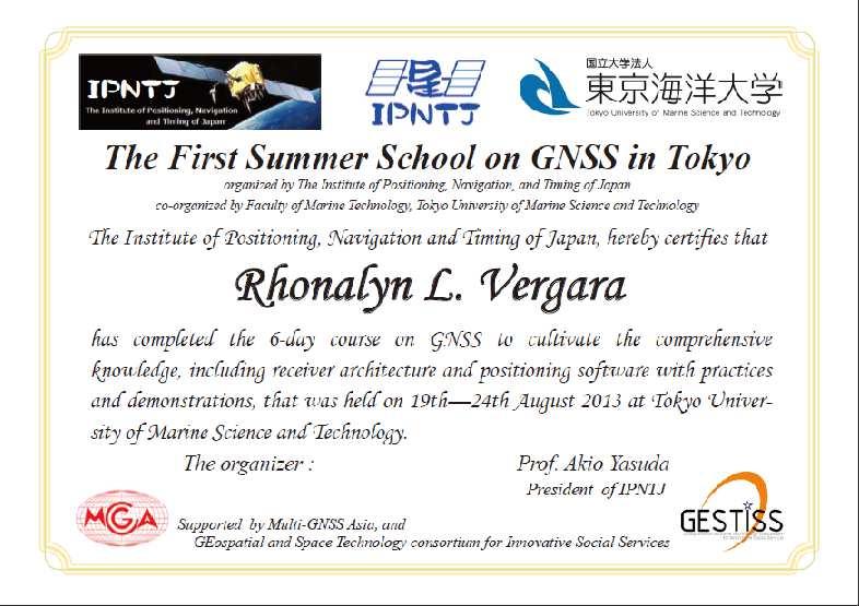
21 Certificate
22 Conclude Remarks Introduce the framework of GESTISS. Introduce the first Summer School in Tokyo. The 6-day course of the lecture were successfully held with high satisfactions. Next Summer School will be held in August Please check the IPNTJ home page time to time. Thank you very much for your attention.
23 Time Table of the Summer School Time Table for GNSS Summer School 8/19-24 Aug. 19 Aug. 20 Aug. 21 Aug. 22 Aug. 23 Aug. 24 Monday Teusday Wednesday Thurday Friday Saturday Opening/Guidance Introduction Class B-1 Class B-6 Class C-1 Class C Break Break Break Break Break Class A-1 Class B-2 Class B-7 Class C-2 Class C-7 UAV Demo Lunch Lunch Lunch Lunch Lunch Class A-2 Class B-3 Class B-8 IMES-Demo Class C-8 workshop Break Break Break Break Break Groupe Class A-3 Class B-4 Class B-9 Class C-4 Class C-9 Discussion Spirent Seminar (1H) Break Break Break Break Self introduction (1H) Class B-5 QZSS-Demo Class C-5 UAV-Appli Closing Welcome Party Farewell party 1 class=80 minutes Instructors Introduction Class-A Class-B Class-C Dr. Akio Yasuda Dr. Nobuaki Kubo Mr. Tomoji Takasu Dr. Ivan Petrovski 23
24 RTKLIB Open source program package for RTK-GPS Hasbeendevelopedby Mr. Takasu since2006 Latest version: More than 20,000 downloads Version 2.4.2will be released at the end of March Portable C library + several positioning APs GUIAPsonWindows ConsoleAPsonLinuxetc
 : Plot GNSS data and visibility analysis : RINEX converter for raw")
25 ApplicationPrograms(APs) RTKNAVI RTKPOST RTKPLOT RTKCONV : Real-time positioning (Raw data from Receiver) :Post-processinganalysis (RINEX ) : Plot GNSS data and visibility analysis : RINEX converter for raw receiver data 25
Summer School on GNSS 2015
 Summer School on GNSS 2015 Organized by The Institute of Positioning, Navigation and Timing of Japan Co organized by Faculty of Marine Technology, Tokyo University of Marine Science and Technology Supported
Research Activities and Education in TUMSAT
 Research Activities and Education in TUMSAT 2011/09/07 @ ICG-6 Akio Yasuda Tokyo University of Marine Science & Technology 1 Content Tokyo University of Marine Science and Technology Etchujima Campus of
Effect of Quasi Zenith Satellite (QZS) on GPS Positioning
 on GPS Positioning") Effect of Quasi Zenith Satellite (QZS) on GPS ing Tomoji Takasu 1, Takuji Ebinuma 2, and Akio Yasuda 3 Laboratory of Satellite Navigation, Tokyo University of Marine Science and Technology 1 (Tel: +81-5245-7365,
Effect of Quasi Zenith Satellite (QZS) on GPS ing Tomoji Takasu 1, Takuji Ebinuma 2, and Akio Yasuda 3 Laboratory of Satellite Navigation, Tokyo University of Marine Science and Technology 1 (Tel: +81-5245-7365,
Report on GNSS Training
 Report on GNSS Training Course ID: T141-30 Afghanistan, Australia, Austria, Bangladesh, Bhutan, Cambodia, India, Indonesia, Japan, Maldives, Mongolia, Nepal, The Philippines, Sri Lanka, Tajikistan, Thailand,
Kalman Filter Based Integer Ambiguity. Ionosphere and Troposphere Estimation
 ION GNSS 2010 Kalman Filter Based Integer Ambiguity Resolution Strategy t for Long Baseline RTK with Ionosphere and Troposphere Estimation Tokyo University of Marine Science and Technology Tomoji jitakasu
Performance Evaluation of the Effect of QZS (Quasi-zenith Satellite) on Precise Positioning
 on Precise Positioning") Performance Evaluation of the Effect of QZS (Quasi-zenith Satellite) on Precise Positioning Nobuaki Kubo, Tomoko Shirai, Tomoji Takasu, Akio Yasuda (TUMST) Satoshi Kogure (JAXA) Abstract The quasi-zenith
Performance Evaluation of the Effect of QZS (Quasi-zenith Satellite) on Precise Positioning Nobuaki Kubo, Tomoko Shirai, Tomoji Takasu, Akio Yasuda (TUMST) Satoshi Kogure (JAXA) Abstract The quasi-zenith
Development of an Open Source Multi GNSS Data Processing Software
 2nd Asia Oceania Regional Workshop on GNSS 2010 Development of an Open Source Multi GNSS Data Processing Software Tomoji TAKASU Tokyo University of Marine Science and Technology Contents Introduction Issues
Skytraq Manual (Single frequency receiver) Procedure to logging skytraq data with RTKNAVI
 Procedure to logging skytraq data with RTKNAVI") Tokyo University of Marine Science and Technology Skytraq Manual (Single frequency receiver) Procedure to logging skytraq data with RTKNAVI TUMSAT 1 Skytraq Receiver http://www.skytraq.com.tw/products/products.html
Tokyo University of Marine Science and Technology Skytraq Manual (Single frequency receiver) Procedure to logging skytraq data with RTKNAVI TUMSAT 1 Skytraq Receiver http://www.skytraq.com.tw/products/products.html
The Benefits of Three Frequencies for the High Accuracy Positioning
 The Benefits of Three Frequencies for the High Accuracy Positioning Nobuaki Kubo (Tokyo University of Marine and Science Technology) Akio Yasuda (Tokyo University of Marine and Science Technology) Isao
An introduction to RTKLIB open source GNSS processing software. Ryan Ruddick and Suelynn Choy
 An introduction to RTKLIB open source GNSS processing software Ryan Ruddick and Suelynn Choy 1 Resources RTKLIB homepage http://www.rtklib.com GIT repository https://github.com/tomojitakasu/rtklib/ Windows
THE CURRENT STATUS OF ASIA OCEANIA MULTI-GNSS DEMONSTRATION CAMPAIGN. Multi-GNSS Asia Secretariat June 4 th, th ICG Providers Forum
 THE CURRENT STATUS OF ASIA OCEANIA MULTI-GNSS DEMONSTRATION CAMPAIGN 1 Multi-GNSS Asia Secretariat June 4 th, 2012 8 th ICG Providers Forum ASIA OCEANIA MULTI-GNSS DEMONSTRATION CAMPAIGN Multi-GNSS Monitoring
PRELIMINARY PROGRAMME
 ICG EXPERTS MEETING: GLOBAL NAVIGATION SATELLITE SYSTEMS SERVICES 14-18 December 2015 Vienna International Centre, Vienna, Austria Organized by International Committee on Global Navigation Satellite Systems
Development of Ultimate Seamless Positioning System for Global Cellular Phone Platform based on QZSS IMES
 Development of Ultimate Seamless Positioning System for Global Cellular Phone Platform based on QZSS IMES Dinesh Manandhar, Kazuki Okano, Makoto Ishii, Masahiro Asako, Hideyuki Torimoto GNSS Technologies
THE CURRENT STATUS OF ASIA OCEANIA MULTI-GNSS DEMONSTRATION CAMPAIGN
 THE CURRENT STATUS OF ASIA OCEANIA MULTI-GNSS DEMONSTRATION CAMPAIGN 1 Multi-GNSS Asia Secretariat July 25, 2012 UN ICG WG-A intersession Mtg. Session4 @UWM Olstzyn, Poland ASIA OCEANIA MULTI-GNSS DEMONSTRATION
Invited Guests All Resource Persons Shafa Manzul Dinesh 0 10:30-11:00 Group Photo, Break GIC Staffs :30-12:30 GPS Introduction
 14-JAN-2019 (Day 1), Monday Minutes. Time Course Description Resource 0 08:30-09:00 Registration GIC Staffs 30 09:00-09:30 Opening Ceremony 60 09:30-10:30 Presentation on ICG GIC Presentation Course Introduction
THE CURRENT STATUS OF ASIA OCEANIA MULTI-GNSS DEMONSTRATION CAMPAIGN
 THE CURRENT STATUS OF ASIA OCEANIA MULTI-GNSS DEMONSTRATION CAMPAIGN 1 7th Meeting of the International Committee on Global Navigation Satellite Systems (ICG) November 5-9, 2012 @Beijing, China ASIA OCEANIA
Status of Multi-GNSS Monitoring Network Establishment
 Status of Multi-GNSS Monitoring Network Establishment Japan Aerospace Exploration Agency Satoshi Kogure ICG-6 6 WG-A/D cross-session session @Tokyo, JAPAN 7 September, 2011 Contents Introduction Overview
Report on a Multi-GNSS Demonstration project in the Asia/Oceania region
 Report on a Multi-GNSS Demonstration project in the Asia/Oceania region - Asia Oceania is the Showcase of New GNSS Era - Japan Aerospace Exploration Agency ICG 5@Turin, Italy October 19, 2010 1 Back Ground
The technical contribution of QZSS and GNSS to Tsunami early warning system
 0/17 Tsunami Workshop by Sentinel Asia @Sendai International Center Meeting Room 5 The technical contribution of QZSS and GNSS to Tsunami early warning system July 3, 2012 K. Mutoh, J. Yamashita, and S.
Understanding GPS/GNSS
 Understanding GPS/GNSS Principles and Applications Third Edition Contents Preface to the Third Edition Third Edition Acknowledgments xix xxi CHAPTER 1 Introduction 1 1.1 Introduction 1 1.2 GNSS Overview
Current Status of the Japanese Quasi-Zenith Satellite System (QZSS)
") Current Status of the Japanese Quasi-Zenith Satellite System (QZSS) 12 November 2008 Koji TERADA QZSS Project Manager Japan Aerospace Exploration Agency Contents Introduction Concept of the QZSS System
Current Status of the Japanese Quasi-Zenith Satellite System (QZSS) 12 November 2008 Koji TERADA QZSS Project Manager Japan Aerospace Exploration Agency Contents Introduction Concept of the QZSS System
Foreword by Glen Gibbons About this book Acknowledgments List of abbreviations and acronyms List of definitions
 Table of Foreword by Glen Gibbons About this book Acknowledgments List of abbreviations and acronyms List of definitions page xiii xix xx xxi xxv Part I GNSS: orbits, signals, and methods 1 GNSS ground
Approach to the era of Multi-GNSS (GEONET by GSI : part2)
") Approach to the era of Multi-GNSS (GEONET by GSI : part2) Tetsuro IMAKIIRE (Geospatial Information Authority of Japan) Contents 1. Multi GNSS environment 1.1 Expansion of GNSS 1.2 QZSS 2. Utility of Multi
Approach to the era of Multi-GNSS (GEONET by GSI : part2) Tetsuro IMAKIIRE (Geospatial Information Authority of Japan) Contents 1. Multi GNSS environment 1.1 Expansion of GNSS 1.2 QZSS 2. Utility of Multi
The Possibility of Precise Automobile Navigation using GPS/QZS L5 and (Galileo E5) Pseudo ranges
 Pseudo ranges") The Possibility of Precise Automobile Navigation using GPS/QZS L5 and (Galileo E5 Pseudo ranges ION ITM ITM 013 Hiroko Tokura, Taro Suzuki, Tomoji Takasu, Nobuaki Kubo (Tokyo University of Marine Scienceand
The Possibility of Precise Automobile Navigation using GPS/QZS L5 and (Galileo E5 Pseudo ranges ION ITM ITM 013 Hiroko Tokura, Taro Suzuki, Tomoji Takasu, Nobuaki Kubo (Tokyo University of Marine Scienceand
GNSS Education Activities The University of Tokyo
 GNSS Education Activities The University of Tokyo Dinesh MANANDHAR, Associate Professor Center for Spatial Information Science, The University of Tokyo 6 th NOV 2018 dinesh@iis.u-tokyo.ac.jp Slide : 1
Framework and Performance Evaluation of a Ray Tracing-Software Defined Radio Method for GNSS Positioning in an Urban Canyon Environment
 Framework and Performance Evaluation of a Ray Tracing-Software Defined Radio Method for GNSS Positioning in an Urban Canyon Environment Rei Furukawa, Kozo Keikaku Engineering Inc., Tokyo University of
Global Navigation Satellite System (GNSS) for Disaster Mitigation
 for Disaster Mitigation") Global Navigation Satellite System (GNSS) for Disaster Mitigation By Chathura H. Wickramasinghe Geoinformatics Center Asian Institute of Technology Establish in 1959 as a Post Graduate School Catering
Global Navigation Satellite System (GNSS) for Disaster Mitigation By Chathura H. Wickramasinghe Geoinformatics Center Asian Institute of Technology Establish in 1959 as a Post Graduate School Catering
The Promise and Challenges of Accurate Low Latency GNSS for Environmental Monitoring and Response
 Technical Seminar Reference Frame in Practice, The Promise and Challenges of Accurate Low Latency GNSS for Environmental Monitoring and Response John LaBrecque Geohazards Focus Area Global Geodetic Observing
THE XXV FIG International Congress 2014
 THE XXV FIG International Congress 2014 1 ASIA OCEANIA MULTI-GNSS DEMONSTRATION CAMPAIGN Kazutoshi Sato, Hiroaki Tatashita, Wakabayashi Yaka, Hideshi Kakimoto, and Satoshi Kogure Multi-GNSS Asia Secretariat
Current status of Quasi-Zenith Satellite System. Japan Aerospace Exploration Agency QZSS Project Team
 Current status of Quasi-Zenith Satellite System Japan Aerospace Exploration Agency QZSS Project Team 1 Quasi-Zenith Satellite System The QZSS is a regional space-based PNT (Positioning, Navigation and
Understanding GPS: Principles and Applications Second Edition
 Understanding GPS: Principles and Applications Second Edition Elliott Kaplan and Christopher Hegarty ISBN 1-58053-894-0 Approx. 680 pages Navtech Part #1024 This thoroughly updated second edition of an
Asia Oceania Multi-GNSS Demonstration Campaign
 Asia Oceania Multi-GNSS Demonstration Campaign Kazutoshi SATO, Hiroaki TATESHITA, Yaka WAKABAYASHI, Hideshi KAKIMOTO, and Satoshi KOGURE, Key words: Multi-GNSS, Asia, Oceania, MGA, workshop SUMMARY Over
GEONET -CORS Network of japan-
 GEONET -CORS Network of japan- Basara Miyahara Geospatial Information Authority of Japan Geospatial and GNSS CORS Infrastructure Forum Kuala Lumpur - Malaysia Geospatial Information Authority of Japan
GNSS buoy array in the ocean for natural hazard mitigation. Teruyuki KATO Earthquake Research Institute the University of Tokyo, Japan
 GNSS buoy array in the ocean for natural hazard mitigation Teruyuki KATO Earthquake Research Institute the University of Tokyo, Japan 1 GNSS applications in Earth science From static to high-rate observations
Asia Oceania Regional Workshop on GNSS Precise Point Positioning Experiment by using QZSS LEX
 Asia Oceania Regional Workshop on GNSS 2010 Precise Point Positioning Experiment by using QZSS LEX Tomoji TAKASU Tokyo University of Marine Science and Technology Contents Introduction of QZSS LEX Evaluation
The International Scene: How Precise Positioning Will Underpin Critical GNSS Applications
 The International Scene: How Precise Positioning Will Underpin Critical GNSS Applications School of Civil & Environmental Engineering, UNSW, Sydney, Australia Chris Rizos Member of the IGS Governing Board
Assessment of GNSS Ionospheric Scintillation and TEC Monitoring Using the Multi-constellation GPStation-6 Receiver
 Assessment of GNSS Ionospheric Scintillation and TEC Monitoring Using the Multi-constellation GPStation-6 Receiver Rod MacLeod Regional Manager Asia/Pacific NovAtel Australia Pty Ltd Outline Ionospheric
GNSS analysis software GSILIB for utilizing Multi- GNSS data
 Technical Seminar Reference Frame in Practice, GNSS analysis software GSILIB for utilizing Multi- GNSS data *Satoshi Kawamoto, Naofumi Takamatsu Geospatial Information Authority of Japan Sponsors: Geospatial
Quasi-Zenith Satellite System (QZSS)
") Transmission of Augmentation Corrections using the Japanese QZSS for Real-Time Precise Point Positioning in Australia Ken Harima 1, Suelynn Choy 1, Mazher Choudhury 2, Chris Rizos 2, Satoshi Kogure 3 1
Transmission of Augmentation Corrections using the Japanese QZSS for Real-Time Precise Point Positioning in Australia Ken Harima 1, Suelynn Choy 1, Mazher Choudhury 2, Chris Rizos 2, Satoshi Kogure 3 1
QZSS and LEX Signal. Performance of Real-Time Precise Point Positioning Using MADOCA-LEX Augmentation Messages. Outline
 Performance of Real-Time Precise Point Positioning Using MADOCA-LEX Augmentation Messages Suelynn Choy 1, Ken Harima 1, Mohammad Choudhury 2, Yong Li 2, Yaka Wakabayashi 3, Thomas Grinter 4, Satoshi Kogure
EXPERIMENTAL RESULTS OF LEX CORRECTIONS USING FARMING MACHINE
 Sixth Meeting of the International Committee on Global Navigation Satellite Systems (ICG) EXPERIMENTAL RESULTS OF LEX CORRECTIONS USING FARMING MACHINE Masayuki Kanzaki Hitachi Zosen Corporation Prof.
MGA Webinar Series : 1 Very Cheap RTK Receivers: Changing the Landscape of Positioning Services
 MGA Webinar Series : 1 Very Cheap RTK Receivers: Changing the Landscape of Positioning Services Dinesh Manandhar Center for Spatial Information Science The University of Tokyo Contact Information: dinesh@iis.u-tokyo.ac.jp
Prospect for Global Positioning Augmentation Service by QZSS
 Prospect for Global Positioning Augmentation Service by QZSS Global Positioning Augmentation Service Corporation Director, Yoshikatsu Iotake Feb. 6, 2018 Copyright 2018 Global Positioning Augmentation
General Assembly. United Nations A/AC.105/946
 United Nations A/AC.105/946 General Assembly Distr.: General 16 November 2009 Original: English Committee on the Peaceful Uses of Outer Space Report on the United Nations/Azerbaijan/United States of America/European
Introduction to GNSS Base-Station
 Introduction to GNSS Base-Station Dinesh Manandhar Center for Spatial Information Science The University of Tokyo Contact Information: dinesh@iis.u-tokyo.ac.jp Slide : 1 Introduction GPS or GNSS observation
Challenges and Solutions for GPS Receiver Test
 Challenges and Solutions for GPS Receiver Test Presenter: Mirin Lew January 28, 2010 Agenda GPS technology concepts GPS and GNSS overview Assisted GPS (A-GPS) Basic tests required for GPS receiver verification
Expert Site Visit Report
 Expert Site Visit Report Time and Frequency Metrology Sub Division Research Center for Metrology Indonesian Institute of Sciences RCM LIPI Metrology Enabling Developing Economies in Asia, MEDEA Project
5G positioning and hybridization with GNSS observations
 5G positioning and hybridization with GNSS observations 1. Introduction Abstract The paradigm of ubiquitous location information has risen a requirement for hybrid positioning methods, as a continuous
An IGS-based simulator of ionospheric conditions for GNSS positioning quality assessment
 The United Nations/United States of America Workshop on the International Space Weather Initiative An IGS-based simulator of ionospheric conditions for GNSS positioning quality assessment Renato Filjar
Trainings and capacity buildings of space
 Trainings and capacity buildings of space technology, GIS and SAR products development for disaster management for DAN Dr. Masahiko NAGAI, Prof. Ryosuke Shibasaki Center for Spatial Information Science,
Report of Working Group B: Enhancement of Global Navigation Satellite Systems Services Performance
 Report of : Enhancement of Global Navigation Satellite Systems Services Performance 1. The Working Group on Enhancement of Global Navigation Satellite Systems (GNSS) Service Performance (WG-B) of the International
One Source for Positioning Success
 novatel.com One Source for Positioning Success RTK, PPP, SBAS OR DGNSS. NOVATEL CORRECT OPTIMIZES ALL CORRECTION SOURCES, PUTTING MORE POWER, FLEXIBILITY AND CONTROL IN YOUR HANDS. NovAtel CORRECT is the
3D-Map Aided Multipath Mitigation for Urban GNSS Positioning
 Summer School on GNSS 2014 Student Scholarship Award Workshop August 2, 2014 3D-Map Aided Multipath Mitigation for Urban GNSS Positioning I-Wen Chu National Cheng Kung University, Taiwan. Page 1 Outline
King AbdulAziz University. Faculty of Environmental Design. Geomatics Department. Mobile GIS GEOM 427. Lecture 3
 King AbdulAziz University Faculty of Environmental Design Geomatics Department Mobile GIS GEOM 427 Lecture 3 Ahmed Baik, Ph.D. Email: abaik@kau.edu.sa Eng. Fisal Basheeh Email: fbasaheeh@kau.edu.sa GNSS
The 21st Session of the Asia-Pacific Regional Space Agency Forum (APRSAF): Dawn of a New Decade
: Dawn of a New Decade") The 21st Session of the Asia-Pacific Regional Space Agency Forum (APRSAF): Dawn of a New Decade 52 nd Session of Scientific and Technical Subcommittee Kazuhiro MIYAZAKI Office for Space Utilization Promotion,
The 21st Session of the Asia-Pacific Regional Space Agency Forum (APRSAF): Dawn of a New Decade 52 nd Session of Scientific and Technical Subcommittee Kazuhiro MIYAZAKI Office for Space Utilization Promotion,
International GNSS Monitoring & Assessment Service for OS (igmas) ICG September 2011, Tokyo, Japan
 ICG September 2011, Tokyo, Japan") Presentation on igmas FOR WORKING GROUP A International GNSS Monitoring & Assessment Service for OS (igmas) by Xurong Dong International Cooperation Research Centre, CSNO ICG 6 5 9 September 2011, Tokyo,
Presentation on igmas FOR WORKING GROUP A International GNSS Monitoring & Assessment Service for OS (igmas) by Xurong Dong International Cooperation Research Centre, CSNO ICG 6 5 9 September 2011, Tokyo,
FieldGenius Technical Notes GPS Terminology
 FieldGenius Technical Notes GPS Terminology Almanac A set of Keplerian orbital parameters which allow the satellite positions to be predicted into the future. Ambiguity An integer value of the number of
Development of a Pseudo Quasi Zenith Satellite and Multipath Analysis Using an Airborne platform
 Journal of Global Positioning Systems (7) Vol.6, No.: 16-13 Development of a Pseudo Quasi Zenith Satellite and Multipath Analysis Using an Airborne platform Toshiaki Tsujii, Hiroshi Tomita, Yoshinori Okuno
Development of Multi-GNSS Orbit and Clock Determination Software "MADOCA"
 The 5th Asia Oceania Regional Workshop on GNSS Development of Multi-GNSS Orbit and Clock Determination Software "MADOCA" Tokyo Univ. of Marine Science and Technology Tomoji TAKASU December 1-3, 2013 @Hanoi
International Committee on Global Navigation Satellite Systems
 International Committee on Global Navigation Satellite Systems Training Course on Global Navigation Satellite Systems 14 18 January 2019, Asian Institute of Technology, Bangkok, Thailand Sharafat Gadimova
Dynamic Global Navigation Satellite System antenna position verification using raw pseudorange information
 Scientific Journals of the Maritime University of Szczecin Zeszyty Naukowe Akademii Morskiej w Szczecinie 016, 46 (118), 76 81 ISSN 1733-8670 (Printed) Received: 31.08.015 ISSN 39-0378 (Online) Accepted:.03.016
Bernhard Hofnlann-Wellenhof Herbert Lichtenegger Elmar Wasle. GNSS - Global Navigation Satellite Systenls. GPS, GLONASS, Galileo, and nl0re
 Bernhard Hofnlann-Wellenhof Herbert Lichtenegger Elmar Wasle GNSS - Global Navigation Satellite Systenls GPS, GLONASS, Galileo, and nl0re SpringerWienNewYork Contents Abbreviations xxi 1 Introduction 1
How multipath error influences on ambiguity resolution
 How multipath error influences on ambiguity resolution Nobuaki Kubo, Akio Yasuda Tokyo University of Mercantile Marine BIOGRAPHY Nobuaki Kubo received his Master of Engineering (Electrical) in 99 from
GNSS Accuracy Improvements through Multipath Mitigation with New Signals and services
 GNSS Accuracy Improvements through Multipath Mitigation with New Signals and services Andrey Veytsel, Ph.D Moscow Technical University 10 Meeting of the International Committee on Global Navigation Satellite
NTRIP Background History, Development & BKG. Networked Transport of RTCM via Internet Protocol
 Networked Transport of RTCM via Internet Protocol Networked Transport of RTCM via Internet Protocol Bundesamt für Kartographie und Geodäsie Motivation: Use Internet to transport GNSS corrections Communication
Improvement of Reachability and Promptness of an Augmentation-Signal-Based Early Warning System Using Multiple Satellites of the QZSS Constellation
 ISBN 978-93-84468-20-0 Proceedings of 2015 International Conference on Future Computational Technologies (ICFCT'2015) Singapore, March 29-30, 2015, pp. 15-26 Improvement of Reachability and Promptness
International Committee on Global Navigation Satellite Systems (ICG)
") International Committee on Global Navigation Satellite Systems (ICG) A forum to discuss global navigation satellite systems to benefit people around the world Sharafat Gadimova United Nations Office for
International Committee on Global Navigation Satellite Systems (ICG) A forum to discuss global navigation satellite systems to benefit people around the world Sharafat Gadimova United Nations Office for
Global Correction Services for GNSS
 Global Correction Services for GNSS Hemisphere GNSS Whitepaper September 5, 2015 Overview Since the early days of GPS, new industries emerged while existing industries evolved to use position data in real-time.
Analysis on GNSS Receiver with the Principles of Signal and Information
 Analysis on GNSS Receiver with the Principles of Signal and Information Lishu Guo 1,2, Xuyou Li 1, Xiaoying Kong 2 1. College of Automation, Harbin Engineering University, Harbin, China 2. School of Computing
Signals, and Receivers
 ENGINEERING SATELLITE-BASED NAVIGATION AND TIMING Global Navigation Satellite Systems, Signals, and Receivers John W. Betz IEEE IEEE PRESS Wiley CONTENTS Preface Acknowledgments Useful Constants List of
Precise GNSS Positioning for Mass-market Applications
 Precise GNSS Positioning for Mass-market Applications Yang GAO, Canada Key words: GNSS, Precise GNSS Positioning, Precise Point Positioning (PPP), Correction Service, Low-Cost GNSS, Mass-Market Application
Time and frequency transfer methods based on GNSS. LIANG Kun, National Institute of Metrology(NIM), China
, China") Time and frequency transfer methods based on GNSS LIANG Kun, National Institute of Metrology(NIM), China Outline Remote time and frequency transfer GNSS time and frequency transfer methods Data and results
Time and frequency transfer methods based on GNSS LIANG Kun, National Institute of Metrology(NIM), China Outline Remote time and frequency transfer GNSS time and frequency transfer methods Data and results
RESEARCH AND TRAINING UNIT FOR NAVIGATIONAL ELECTRONICS OSMANIA UNIVERSITY, HYDERABAD
 4-Day Short Course on Scientists, Engineers and academicians working in the area of GNSS for more than a decade in the Industry, R&D Labs and Academic Institutes, will deliver the lectures. Technologies
Potential use of QZSS monitoring station for future research. Kavinda Gunasekara Geoinformatics Center Asian Institute of Technology
 Potential use of QZSS monitoring station for future research Kavinda Gunasekara Geoinformatics Center Asian Institute of Technology Geoinformatics Center Established in 1999 Over 1,600 Graduate students
Multisystem Real Time Precise-Point-Positioning, today with GPS+GLONASS in the near future also with QZSS, Galileo, Compass, IRNSS
 2 International Symposium on /GNSS October 26-28, 2. Multisystem Real Time Precise-Point-Positioning, today with +GLONASS in the near future also with QZSS, Galileo, Compass, IRNSS Álvaro Mozo García,
Guide to GNSS Base stations
 Guide to GNSS Base stations Outline Introduction Example of a base station (TUMSAT) Preparation for setting up a base station Procedure for setting up a base station Examples at two other universities
PageNET: In Support of the Surveying Community
 Philippine Active Geodetic Network : In Support of the Surveying Community ICG Experts Meeting: Global Navigation Satellite Systems Services Vienna International Center, Vienna, Austria December 14-18,
Precise Positioning with NovAtel CORRECT Including Performance Analysis
 Precise Positioning with NovAtel CORRECT Including Performance Analysis NovAtel White Paper April 2015 Overview This article provides an overview of the challenges and techniques of precise GNSS positioning.
1. INTRODUCTION. Longitude, deg In contrast to the global systems such as GPS, GLONASS and
 SPECIAL REPORT Highly-Accurate Positioning Experiment Using QZSS at ENRI Ken Ito Electronic Navigation Research Institute (ENRI) 1. INTRODUCTION P ositioning with GPS is widely used in Japan in the area
Future GNSS Precision Applications. Stuart Riley
 Future GNSS Precision Applications Stuart Riley Major Trimble Precision Markets Survey Mostly person portable equipment Construction Machine control and person carried equipment Includes Marine applications
Report on the United Nations/Croatia Workshop on the Applications of Global Navigation Satellite Systems
 United Nations General Assembly Distr.: General 3 September 2013 Original: English Committee on the Peaceful Uses of Outer Space Report on the United Nations/Croatia Workshop on the Applications of Global
GNSS (GPS) buoy array in the Pacific for natural disaster mitigation. Teruyuki KATO Earthquake Research Institute the University of Tokyo, Japan
 buoy array in the Pacific for natural disaster mitigation. Teruyuki KATO Earthquake Research Institute the University of Tokyo, Japan") GNSS (GPS) buoy array in the Pacific for natural disaster mitigation Teruyuki KATO Earthquake Research Institute the University of Tokyo, Japan 1 (Modified from Oki & Koketsu, 2011) Historical megaquakes
GNSS (GPS) buoy array in the Pacific for natural disaster mitigation Teruyuki KATO Earthquake Research Institute the University of Tokyo, Japan 1 (Modified from Oki & Koketsu, 2011) Historical megaquakes
Precise Positioning with Smartphones running Android 7 or later
 Precise Positioning with Smartphones running Android 7 or later * René Warnant, * Cécile Deprez, + Quentin Warnant * University of Liege Geodesy and GNSS + Augmenteo, Plaine Image, Lille (France) Belgian
POWERGPS : A New Family of High Precision GPS Products
 POWERGPS : A New Family of High Precision GPS Products Hiroshi Okamoto and Kazunori Miyahara, Sokkia Corp. Ron Hatch and Tenny Sharpe, NAVCOM Technology Inc. BIOGRAPHY Mr. Okamoto is the Manager of Research
Software-defined GNSS receiver as a framework for GNSS-related research and education
 United Nations/Nepal Workshop on Applications of Global Navigation Satellite Systems Kathmandu, Nepal 12-16 December, 2016 Software-defined GNSS receiver as a framework for GNSS-related research and education
Performance Evaluation of Differential Global Navigation Satellite System with RTK Corrections
 IOSR Journal of Electronics and Communication Engineering (IOSR-JECE) e-issn: 2278-2834,p- ISSN: 2278-8735.Volume 9, Issue 2, Ver. VI (Mar - Apr. 2014), PP 43-47 Performance Evaluation of Differential
GE 113 REMOTE SENSING
 GE 113 REMOTE SENSING Topic 9. Introduction to Global Positioning Systems (GPS) and Other GNSS Technologies Lecturer: Engr. Jojene R. Santillan jrsantillan@carsu.edu.ph Division of Geodetic Engineering
Intelligent Transport Systems and GNSS. ITSNT 2017 ENAC, Toulouse, France 11/ Nobuaki Kubo (TUMSAT)
") Intelligent Transport Systems and GNSS ITSNT 2017 ENAC, Toulouse, France 11/14-17 2017 Nobuaki Kubo (TUMSAT) Contents ITS applications in Japan How can GNSS contribute to ITS? Current performance of GNSS
Intelligent Transport Systems and GNSS ITSNT 2017 ENAC, Toulouse, France 11/14-17 2017 Nobuaki Kubo (TUMSAT) Contents ITS applications in Japan How can GNSS contribute to ITS? Current performance of GNSS
New Approach for Tsunami Detection Based on RTK-GNSS Using Network of Ships
 New Approach for Tsunami Detection Based on RTK-GNSS Using Network of Ships Tokyo University of Marine Science and Technology Ryuta Nakaosone Nobuaki Kubo Background After the Indian Ocean Tsunami on 2004,
International Cooperation Research Center, China Satellite Navigation Office
 International Cooperation Research Center, ICG-8, Nov 10, 2013 Dubai Overview BeiDou Navigation Satellite System (hereinafter referred to as BDS") has provide regional service by the end of 2012, which
An Industry View on Realistic Benefits for High Precision GNSS Applications due to GNSS Modernisation The Future of High Precision GNSS
 An Industry View on Realistic Benefits for High Precision GNSS Applications due to GNSS Modernisation The Future of High Precision GNSS Bernhard Richter GNSS Business Director at Leica Geosystems 1 Content
GNSS R&D in Japan and QZSS 2015 NGRC Symposium 7/2/2015
 GNSS R&D in Japan and QZSS 215 NGRC Symposium 7/2/215 Nobuai Kubo Toyo University of Marine Science and Technology TUMSAT Contents GNSS R&D in JAPAN QZSS - several topics - university, research institute
Low-Cost GNSS for Geodetic Applications
 Institut für Ingenieurgeodäsie Presented at the FIG Congress 2018, May 6-11, 2018 in Istanbul, Turkey Low-Cost GNSS for Geodetic Applications Dr.-Ing. Li Zhang Institute of Engineering Geodesy (IIGS),
ABSTRACT: Three types of portable units with GNSS raw data recording capability are assessed to determine static and kinematic position accuracy
 ABSTRACT: Three types of portable units with GNSS raw data recording capability are assessed to determine static and kinematic position accuracy under various environments using alternatively their internal
StatusUpdate on the Quasi-Zenith Satellite System
 StatusUpdate on the Quasi-Zenith Satellite System Presented by : Dinesh Manandhar, The University of Tokyo On behalf of Satoshi KOGURE National Space Policy Secretariat UN-Nepal GNSS Workshop on the Applications
Positioning Performance Study of the RESSOX System With Hardware-in-the-loop Clock
 International Global Navigation Satellite Systems Society IGNSS Symposium 27 The University of New South Wales, Sydney, Australia 4 6 December, 27 Positioning Performance Study of the RESSOX System With
Enhancing global PPP with Local Ionospheric Corrections
 Enhancing global PPP with Local Ionospheric Corrections Suelynn Choy 1, Ken Harima 1, Satoshi Kogure 2 1 School of Mathematical and Geospatial Sciences, RMIT University, Australia 2 Satellite Navigation
Geoscience & Positioning, Navigation and Timing Services for Canadians
 Geoscience & Positioning, Navigation and Timing Services for Canadians Calvin Klatt, Ph.D. Director and Chief Geodesist Natural Resources Canada / Directeur et géodésien principal Ressources naturelles
Brazil and Russia space cooperation: recent projects and future perspectives in the field of GNSS monitoring and SLR stations
 Brazil and Russia space cooperation: recent projects and future perspectives in the field of GNSS monitoring and SLR stations Renato A. Borges (UnB) and Geovany A. Borges (UnB) Emails: raborges@ene.unb.br
GNSS Buoy Array in the Ocean for a Synthetic Geohazards Monitoring System
 GNSS Buoy Array in the Ocean for a Synthetic Geohazards Monitoring System Teruyuki Kato, Earthq. Res. Inst., Univ. Tokyo, Japan Yukihiro Terada, Nat. Inst. Tech., Kochi Col., Japan Keiichi Tadokoro, Grad.