The Possibility of Precise Automobile Navigation using GPS/QZS L5 and (Galileo E5) Pseudo ranges
|
|
|
- Juliana Avice Montgomery
- 5 years ago
- Views:
Transcription
1 The Possibility of Precise Automobile Navigation using GPS/QZS L5 and (Galileo E5 Pseudo ranges ION ITM ITM 013 Hiroko Tokura, Taro Suzuki, Tomoji Takasu, Nobuaki Kubo (Tokyo University of Marine Scienceand Technology
2 Outline Background Objective Multipath error estimation methods Static ti and kinematic experiment Test results Conclusion 1


3 Background GPS L5 up to 4 by 01 L5 is broadcast from 3 satellites (PRN1/4/5 QZS L5 up to 4 by 017 Galileo E5AltBOC :cmlevel accuracyunderopensky under
4 L5 Signal Tracking by SDR (PRN Correlation Value L5 signal Standard L1 C/A GPS PRN1 01/8/16 Open Sky Elevation:45 deg. 10ms Integration FE: Fraunhofer SF: 40.96MHz Delay (m 3
5 Multipath Envelope (hardware simulator check: MP is set 6dB lower than Direct Consumer receiver Pseudo ra ange error rs [m] Geodetic receiver Multipath Delay [m] Consumer receiver is vulnerable to multipath delay even over 100m 4
6 Multipath Envelope (close up Pseudo range err rors [m] Geodetic receiver Multipath Delay [m] small difference between L1 and L5 Multipath in L1 has been imped 5


7 Performance in Urban Areas Vehicles in dense urban areas with geodetic receiver DGPS in Tokyo RTK in Tokyo Several applications require high accuracy (RTK far from perfect at present 6
8 Objective Pseudo range observations from L5 in both GPS and QZS are basically robust against multipath. It can be used for high h reliable and accurate application without Ambiguity Resolution. L5 performance has not been investigated because satellites with L5 are few. The Question: Dose pseudo ranges of new signals really work well in urban areas? 7
9 Estimation of Multipath Error Code Carrier Carrier difference(cc differnce differnce Effective for static data Cycle slip happens a lot for kinematic data impossible to extract multipath for kinematic data Proposed method Separating Multipath Errors for Vehicle 8
10 CC difference CC difference L1 = P x Φ x Φ CC difference L5 =P x Φ x Φ1 P : Pseudo range measurement Φ : Carrier phasemeasurement Dual frequency receivers can effectively remove the ionospheric delay Offset average Use both Pseudo range and Carrier phase Effective for only static data 9
11 Proposed Method Separating Multipath Errors for Vehicle Higher Elevation SV Reference SV Precise Rover Position + Double Difference 4 Different Combinations of Multipath and Noise Code minus Carrier Difference Extraction of Target Multipath and Noise Target Multipath and Noise Precise Rover Position Rover Reference Receiver 10
12 Separating Multipath Errors for Vehicle P ( mp ( mp ( P c ( dt c( dt c ( dt c( dt noise noise P dt dt dt dt ( P ion ion ion ion ( mp ( mp P tropo tropo noise tropo tropo noise sv sv sv sv 1 mp mp mp mp noise noise noise noise Target = + + Raw Data Measurements Computed by each CC Difference : Target SV : QZS (Elevation angle >
13 Proposed Method Separating Multipath Errors for Vehicle Higher Elevation SV Reference SV Precise Rover Position + Double Difference 4 Different Combinations of Multipath and Noise Code minus Carrier Difference Cc difference 1 Rover Reference Receiver 1
14 Separating Multipath Errors for Vehicle P ( mp ( mp ( P c ( dt c( dt c ( dt c( dt noise noise P dt dt dt dt ( P ion ion ion ion ( mp ( mp P tropo tropo noise tropo tropo noise sv sv sv sv 1 mp mp mp mp noise noise noise noise Target = + + Raw Data Measurements Computed by each CC Difference : Target SV : QZS (Elevation angle >
15 Proposed Method Separating Multipath Errors for Vehicle Higher Elevation SV Reference SV Precise Rover Position + Double Difference 4 Different Combinations of Multipath and Noise Code minus Carrier Difference Cc difference Rover Reference Receiver 14
16 Separating Multipath Errors for Vehicle P ( mp ( mp ( P c ( dt c( dt c ( dt c( dt noise noise P dt dt dt dt ( P ion ion ion ion ( mp ( mp P tropo tropo noise tropo tropo noise sv sv sv sv 1 mp mp mp mp noise noise noise noise Target = + + Raw Data Measurements Computed by each CC Difference : Target SV : QZS (Elevation angle >
17 Proposed Method Separating Multipath Errors for Vehicle Higher Elevation SV Reference SV Precise Rover Position + Double Difference 4 Different Combinations of Multipath and Noise Code minus Carrier Difference Cc difference 3 Rover Reference Receiver 16
18 Separating Multipath Errors for Vehicle P ( mp ( mp ( P c ( dt c( dt c ( dt c( dt noise noise P dt dt dt dt ( P ion ion ion ion ( mp ( mp P tropo tropo noise tropo tropo noise sv sv sv sv 1 mp mp mp mp noise noise noise noise Target = + + Raw Data Measurements Computed by each CC Difference : Target SV : QZS (Elevation angle >
19 Proposed Method Separating Multipath Errors for Vehicle Higher Elevation SV Reference SV (QZS is very useful Precise Rover Position + Double Difference 4 Different Combinations of Multipath and Noise Code minus Carrier Difference Extraction of Target Multipath and Noise Target Multipath and Noise Precise Rover Position Rover Reference Receiver 18
20 Test and Results 1. Static Test 1 (Toyosu,Tokyo Tokyo long distance (approx. 30m from building. Static Test (campas,tokyo short distance (<10m from building 3. Kinematic Test 1 (tukishima, Tokyo 4. Kinematic Test (edagawa, Tokyo Validation for proposed method Estimate multipath error using proposed method Target : GPS PRN1 PRN1 (transmitting both L1 and L5 19


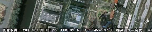
21 Static Test 1 (Toyosu,Tokyo 1/13/ 01 (GPSTIME 0:30~ Geodetic Receiver 60 min Hz 5 8 satellites in view over 15 degrees elevation Target SV : GPS PRN 1 (L1,L5 Reference SV : QZS 1 (L1,L5 L5 Precise position was computed by post processing Building Rover Receiver 30m W N S Long delay multipath using proposed method to extraction the PRN 1 multipath 0 E
22 Static Test 1 Multipath Errors (no smoothing [m] GPSTIME [s] [] σ [m] L L
23 Static Test 1 Multipath Errors (100s smoothing [m] We just set receiver parameter as 100s for smoothing GPSTIME [s] [] σ [m] L L1 0.1


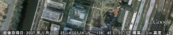
24 Static Test (campas,tokyo 1/14/ 01 (GPSTIME 0:30~ N Geodetic Receiver 60 min Hz 5 9 satellites in view over 15 degrees elevation Target SV : GPS PRN 1 (L1,L5 Reference SV : QZS 1 (L1,L5 L5 Precise position was computed by post processing Rover Receiver 9m Building W S Short delay multipath using proposed method to extraction the PRN 1 multipath 3 E
25 Static Test Multipath Errors (no smoothing [m] σ [m] L L GPSTIME [s] 4
26 Static Test Multipath Errors (100s smoothing [m] 3 We just set receiver parameter as 100s for smoothing GPSTIME [s] σ [m] L L
27 [m] Validation adao of Our Proposed Method MP errors derived from cc difference MP errors derived from proposed method GPSTIME [s] Multipath for PRN 1 derived from cc difference match 1 Multipath for PRN 1 derived from Proposed Method 6
28 [db] Temporal Carrier to Noise oseratio GPSTIME [s] Another type of geodetic receiver shows almost same difference level (4 5dB between L1 and L5 although h the maximum level lwas different. 7


29 Kinematic Test 1 (tukishima, Tokyo 11/3/ 01 Geodetic Receiver 0 min 5 Hz satellites in view over 15 degrees elevation Target SV : GPS PRN 1 PRN (L1,L5 L5 Reference SV : QZS 1 (L1,L5 Precise position was computed by post processing s smoothing 8 7 Fix rate[%] RTK m (Post Processed RTK Plots 8
30 Kinematic Test 1 Multipath Errors [m] GPSTIME[s] Enabled percentage[%] L L
31 Kinematic Test 1 Multipath Errors [m] abs(mp < 5m GPSTIME[s] σ [m] L L
32 Kinematic Test (edagawa, Tokyo 1/7/01 Geodetic Receiverei er 35min 5 Hz 4 9 satellites in view over 15 degrees elevation Target SV : GPS PRN 1 PRN (L1,L5 L5 Reference SV : QZS 1 (L1,L5 Precise position was computed by post processing s smoothing Fix rate[%] RTK m 31 31
33 Kinematic Test Multipath Errors [m] Enabled 0 percentage[%] L L GPSTIME [s] 3
34 Kinematic Test Multipath Errors [m] abs(mp < 5m σ [m] L L GPSTIME [s] 33
35 Conclusion Pseudo range observables from L5 are basically robust against multipath. We were able to estimate t multipath th errors for moving targets by using the proposed method. The multipath mitigation performance bt between L1 and L5 was not so different at present. Using L5 instead of L1 will be practical in the future without special correlator. 34
36 Future work Further investigation for L5 signal is required because manufactures are still developing the tracking technique for new L5 signal. Software defined GNSS receiver can be used to evaluate it. 35
37 Thank you very much for your kind attention!
Performance Evaluation of the Effect of QZS (Quasi-zenith Satellite) on Precise Positioning
 on Precise Positioning") Performance Evaluation of the Effect of QZS (Quasi-zenith Satellite) on Precise Positioning Nobuaki Kubo, Tomoko Shirai, Tomoji Takasu, Akio Yasuda (TUMST) Satoshi Kogure (JAXA) Abstract The quasi-zenith
Performance Evaluation of the Effect of QZS (Quasi-zenith Satellite) on Precise Positioning Nobuaki Kubo, Tomoko Shirai, Tomoji Takasu, Akio Yasuda (TUMST) Satoshi Kogure (JAXA) Abstract The quasi-zenith
Reduction of Pseudorange Multipath Error in Static Positioning. Tokyo University of Mercantile Marine Nobuaki Kubo Akio Yasuda
 Reduction of Pseudorange Multipath Error in Static Positioning Tokyo University of Mercantile Marine Nobuaki Kubo Akio Yasuda Brief Many researchers have tried to reduce the multipath effect from both
and Vehicle Sensors in Urban Environment
 AvailabilityImprovement ofrtk GPS GPSwithIMU and Vehicle Sensors in Urban Environment ION GPS/GNSS 2012 Tk Tokyo University it of Marine Si Science and Technology Nobuaki Kubo, Chen Dihan 1 Contents Background
ION ITM Tokyo University of Marine Science and Technology H. Sridhara, N. Kubo, R.Kikuchi
 Single-Frequency Multi-GNSS RTK Positioning for Moving Platform ION ITM 215 215.1.27-29 Tokyo University of Marine Science and Technology H. Sridhara, N. Kubo, R.Kikuchi 1 Agenda Motivation and Background
The Benefits of Three Frequencies for the High Accuracy Positioning
 The Benefits of Three Frequencies for the High Accuracy Positioning Nobuaki Kubo (Tokyo University of Marine and Science Technology) Akio Yasuda (Tokyo University of Marine and Science Technology) Isao
Performance Evaluation of Multi-GNSS RTK for Automobiles in Urban Areas
 Performance Evaluation of Multi-GNSS RTK for Automobiles in Urban Areas ISGNSS2014 21-24 October, 2014, ICC Jeju, Korea Nobuaki Kubo, Hiroko Tokura, Taro Suzuki (TUMSAT) 1 Contents Current Status of Multi-GNSS
POWERGPS : A New Family of High Precision GPS Products
 POWERGPS : A New Family of High Precision GPS Products Hiroshi Okamoto and Kazunori Miyahara, Sokkia Corp. Ron Hatch and Tenny Sharpe, NAVCOM Technology Inc. BIOGRAPHY Mr. Okamoto is the Manager of Research
Positioning with Single and Dual Frequency Smartphones Running Android 7 or Later
 Positioning with Single and Dual Frequency Smartphones Running Android 7 or Later * René Warnant, *Laura Van De Vyvere, + Quentin Warnant * University of Liege Geodesy and GNSS + Augmenteo, Plaine Image,
TEST RESULTS OF A HIGH GAIN ADVANCED GPS RECEIVER
 TEST RESULTS OF A HIGH GAIN ADVANCED GPS RECEIVER ABSTRACT Dr. Alison Brown, Randy Silva, Gengsheng Zhang,; NAVSYS Corporation. NAVSYS High Gain Advanced GPS Receiver () uses a digital beam-steering antenna
How multipath error influences on ambiguity resolution
 How multipath error influences on ambiguity resolution Nobuaki Kubo, Akio Yasuda Tokyo University of Mercantile Marine BIOGRAPHY Nobuaki Kubo received his Master of Engineering (Electrical) in 99 from
HIGH GAIN ADVANCED GPS RECEIVER
 ABSTRACT HIGH GAIN ADVANCED GPS RECEIVER NAVSYS High Gain Advanced () uses a digital beam-steering antenna array to enable up to eight GPS satellites to be tracked, each with up to dbi of additional antenna
GNSS analysis software GSILIB for utilizing Multi- GNSS data
 Technical Seminar Reference Frame in Practice, GNSS analysis software GSILIB for utilizing Multi- GNSS data *Satoshi Kawamoto, Naofumi Takamatsu Geospatial Information Authority of Japan Sponsors: Geospatial
GPS PERFORMANCE EVALUATION OF THE HUAWEI MATE 9 WITH DIFFERENT ANTENNA CONFIGURATIONS
 GPS PERFORMANCE EVALUATION OF THE HUAWEI MATE 9 WITH DIFFERENT ANTENNA CONFIGURATIONS AND P10 IN THE FIELD Gérard Lachapelle & Research Team PLAN Group, University of Calgary (http://plan.geomatics.ucalgary.ca)
Reliability Estimation for RTK-GNSS/IMU/Vehicle Speed Sensors in Urban Environment
 Laboratory of Satellite Navigation Engineering Reliability Estimation for RTK-GNSS/IMU/Vehicle Speed Sensors in Urban Environment Ren Kikuchi, Nobuaki Kubo (TUMSAT) Shigeki Kawai, Ichiro Kato, Nobuyuki
Multipath and Atmospheric Propagation Errors in Offshore Aviation DGPS Positioning
 Multipath and Atmospheric Propagation Errors in Offshore Aviation DGPS Positioning J. Paul Collins, Peter J. Stewart and Richard B. Langley 2nd Workshop on Offshore Aviation Research Centre for Cold Ocean
Intelligent Transport Systems and GNSS. ITSNT 2017 ENAC, Toulouse, France 11/ Nobuaki Kubo (TUMSAT)
") Intelligent Transport Systems and GNSS ITSNT 2017 ENAC, Toulouse, France 11/14-17 2017 Nobuaki Kubo (TUMSAT) Contents ITS applications in Japan How can GNSS contribute to ITS? Current performance of GNSS
Intelligent Transport Systems and GNSS ITSNT 2017 ENAC, Toulouse, France 11/14-17 2017 Nobuaki Kubo (TUMSAT) Contents ITS applications in Japan How can GNSS contribute to ITS? Current performance of GNSS
Framework and Performance Evaluation of a Ray Tracing-Software Defined Radio Method for GNSS Positioning in an Urban Canyon Environment
 Framework and Performance Evaluation of a Ray Tracing-Software Defined Radio Method for GNSS Positioning in an Urban Canyon Environment Rei Furukawa, Kozo Keikaku Engineering Inc., Tokyo University of
Effect of Quasi Zenith Satellite (QZS) on GPS Positioning
 on GPS Positioning") Effect of Quasi Zenith Satellite (QZS) on GPS ing Tomoji Takasu 1, Takuji Ebinuma 2, and Akio Yasuda 3 Laboratory of Satellite Navigation, Tokyo University of Marine Science and Technology 1 (Tel: +81-5245-7365,
Effect of Quasi Zenith Satellite (QZS) on GPS ing Tomoji Takasu 1, Takuji Ebinuma 2, and Akio Yasuda 3 Laboratory of Satellite Navigation, Tokyo University of Marine Science and Technology 1 (Tel: +81-5245-7365,
GNSS Accuracy Improvements through Multipath Mitigation with New Signals and services
 GNSS Accuracy Improvements through Multipath Mitigation with New Signals and services Andrey Veytsel, Ph.D Moscow Technical University 10 Meeting of the International Committee on Global Navigation Satellite
Evaluation of L2C Observations and Limitations
 Evaluation of L2C Observations and Limitations O. al-fanek, S. Skone, G.Lachapelle Department of Geomatics Engineering, Schulich School of Engineering, University of Calgary, Canada; P. Fenton NovAtel
GNSS & Coordinate Systems
 GNSS & Coordinate Systems Matthew McAdam, Marcelo Santos University of New Brunswick, Department of Geodesy and Geomatics Engineering, Fredericton, NB May 29, 2012 Santos, 2004 msantos@unb.ca 1 GNSS GNSS
RTCM State Space Representation (SSR) Overall Concepts Towards PPP-RTK
 Overall Concepts Towards PPP-RTK") RTCM State Space Representation (SSR) Overall Concepts Towards PPP-RTK Gerhard Wübbena Geo++ GmbH 30827 Garbsen Germany www.geopp.de Contents Terms and Abbreviations RTCM-SSR Working Group GNSS Error Sources
RTCM State Space Representation (SSR) Overall Concepts Towards PPP-RTK Gerhard Wübbena Geo++ GmbH 30827 Garbsen Germany www.geopp.de Contents Terms and Abbreviations RTCM-SSR Working Group GNSS Error Sources
PROPART PROJECT PRESENTATION
 1 PROPART PROJECT PRESENTATION Stefan Nord RISE Measurement Science and Technology RISE/Safety and Transport Presentation Outline Project Data Consortium Objectives Partner contributions 3 Project data
Introduction to GNSS Base-Station
 Introduction to GNSS Base-Station Dinesh Manandhar Center for Spatial Information Science The University of Tokyo Contact Information: dinesh@iis.u-tokyo.ac.jp Slide : 1 Introduction GPS or GNSS observation
Phase Center Calibration and Multipath Test Results of a Digital Beam-Steered Antenna Array
 Phase Center Calibration and Multipath Test Results of a Digital Beam-Steered Antenna Array Kees Stolk and Alison Brown, NAVSYS Corporation BIOGRAPHY Kees Stolk is an engineer at NAVSYS Corporation working
Geodetic Reference via Precise Point Positioning - RTK
 2012 Geo++ GmbH Geodetic Reference via Precise Point Positioning - RTK Gerhard Wübbena Geo++ GmbH 30827 Garbsen Germany www.geopp.de 2012 Geo++ GmbH Contents Terms and Abbreviations GNSS Principles GNSS
Research Activities and Education in TUMSAT
 Research Activities and Education in TUMSAT 2011/09/07 @ ICG-6 Akio Yasuda Tokyo University of Marine Science & Technology 1 Content Tokyo University of Marine Science and Technology Etchujima Campus of
Methodology and Case Studies of Signal-in-Space Error Calculation
 Methodology and Case Studies of Signal-in-Space Error Calculation Top-down Meets Bottom-up Grace Xingxin Gao *, Haochen Tang *, Juan Blanch *, Jiyun Lee +, Todd Walter * and Per Enge * * Stanford University,
Introduction to Global Navigation Satellite System (GNSS) Signal Structure
 Signal Structure") Introduction to Global Navigation Satellite System (GNSS) Signal Structure Dinesh Manandhar Center for Spatial Information Science The University of Tokyo Contact Information: dinesh@iis.u-tokyo.ac.jp
Introduction to Global Navigation Satellite System (GNSS) Signal Structure Dinesh Manandhar Center for Spatial Information Science The University of Tokyo Contact Information: dinesh@iis.u-tokyo.ac.jp
Study and analysis of Differential GNSS and Precise Point Positioning
 IOSR Journal of Electrical and Electronics Engineering (IOSR-JEEE) e-issn: 2278-1676,p-ISSN: 2320-3331, Volume 9, Issue 2 Ver. I (Mar Apr. 2014), PP 53-59 Study and analysis of Differential GNSS and Precise
Assessment of GNSS Ionospheric Scintillation and TEC Monitoring Using the Multi-constellation GPStation-6 Receiver
 Assessment of GNSS Ionospheric Scintillation and TEC Monitoring Using the Multi-constellation GPStation-6 Receiver Rod MacLeod Regional Manager Asia/Pacific NovAtel Australia Pty Ltd Outline Ionospheric
MGA Webinar Series : 1 Very Cheap RTK Receivers: Changing the Landscape of Positioning Services
 MGA Webinar Series : 1 Very Cheap RTK Receivers: Changing the Landscape of Positioning Services Dinesh Manandhar Center for Spatial Information Science The University of Tokyo Contact Information: dinesh@iis.u-tokyo.ac.jp
Field experience with future GNSS ranging signals (a review). A.Simsky, J.-M. Sleewaegen, W. De Wilde Septentrio, Belgium
. A.Simsky, J.-M. Sleewaegen, W. De Wilde Septentrio, Belgium") Field experience with future GNSS ranging signals (a review). A.Simsky, J.-M. Sleewaegen, W. De Wilde Septentrio, Belgium Technical University of Munich June 07 2010 Contents Septentrio: company profile
Field experience with future GNSS ranging signals (a review). A.Simsky, J.-M. Sleewaegen, W. De Wilde Septentrio, Belgium Technical University of Munich June 07 2010 Contents Septentrio: company profile
Evaluation of RTKLIB's Positioning Accuracy Using low-cost GNSS Receiver and ASG-EUPOS
 http://www.transnav.eu the International Journal on Marine Navigation and Safety of Sea Transportation Volume 7 Number 1 March 2013 DOI: 10.12716/1001.07.01.10 Evaluation of RTKLIB's Positioning Accuracy
Modelling GPS Observables for Time Transfer
 Modelling GPS Observables for Time Transfer Marek Ziebart Department of Geomatic Engineering University College London Presentation structure Overview of GPS Time frames in GPS Introduction to GPS observables
The Case for Recording IF Data for GNSS Signal Forensic Analysis Using a SDR
 The Case for Recording IF Data for GNSS Signal Forensic Analysis Using a SDR Professor Gérard Lachapelle & Dr. Ali Broumandan PLAN Group, University of Calgary PLAN.geomatics.ucalgary.ca IGAW 2016-GNSS
Guide to GNSS Base stations
 Guide to GNSS Base stations Outline Introduction Example of a base station (TUMSAT) Preparation for setting up a base station Procedure for setting up a base station Examples at two other universities
Kalman Filter Based Integer Ambiguity. Ionosphere and Troposphere Estimation
 ION GNSS 2010 Kalman Filter Based Integer Ambiguity Resolution Strategy t for Long Baseline RTK with Ionosphere and Troposphere Estimation Tokyo University of Marine Science and Technology Tomoji jitakasu
UNIT 1 - introduction to GPS
 UNIT 1 - introduction to GPS 1. GPS SIGNAL Each GPS satellite transmit two signal for positioning purposes: L1 signal (carrier frequency of 1,575.42 MHz). Modulated onto the L1 carrier are two pseudorandom
Improved GPS Carrier Phase Tracking in Difficult Environments Using Vector Tracking Approach
 Improved GPS Carrier Phase Tracking in Difficult Environments Using Vector Tracking Approach Scott M. Martin David M. Bevly Auburn University GPS and Vehicle Dynamics Laboratory Presentation Overview Introduction
PRINCIPLES AND FUNCTIONING OF GPS/ DGPS /ETS ER A. K. ATABUDHI, ORSAC
 PRINCIPLES AND FUNCTIONING OF GPS/ DGPS /ETS ER A. K. ATABUDHI, ORSAC GPS GPS, which stands for Global Positioning System, is the only system today able to show you your exact position on the Earth anytime,
Integer Ambiguity Resolution for Precise Point Positioning Patrick Henkel
 Integer Ambiguity Resolution for Precise Point Positioning Patrick Henkel Overview Introduction Sequential Best-Integer Equivariant Estimation Multi-frequency code carrier linear combinations Galileo:
5G positioning and hybridization with GNSS observations
 5G positioning and hybridization with GNSS observations 1. Introduction Abstract The paradigm of ubiquitous location information has risen a requirement for hybrid positioning methods, as a continuous
A GPS RECEIVER DESIGNED FOR CARRIER-PHASE TIME TRANSFER
 A GPS RECEIVER DESIGNED FOR CARRIER-PHASE TIME TRANSFER Alison Brown, Randy Silva, NAVSYS Corporation and Ed Powers, US Naval Observatory BIOGRAPHY Alison Brown is the President and CEO of NAVSYS Corp.
ABSTRACT: Three types of portable units with GNSS raw data recording capability are assessed to determine static and kinematic position accuracy
 ABSTRACT: Three types of portable units with GNSS raw data recording capability are assessed to determine static and kinematic position accuracy under various environments using alternatively their internal
Positioning Techniques. João F. Galera Monico - UNESP Tuesday 12 Sep
 Positioning Techniques João F. Galera Monico - UNESP Tuesday 12 Sep Positioning methods Absolute Positioning Static and kinematic SPP and PPP Relative Positioning Static Static rapid Semi kinematic Kinematic
Precise Positioning with NovAtel CORRECT Including Performance Analysis
 Precise Positioning with NovAtel CORRECT Including Performance Analysis NovAtel White Paper April 2015 Overview This article provides an overview of the challenges and techniques of precise GNSS positioning.
How Effective Are Signal. Quality Monitoring Techniques
 How Effective Are Signal Quality Monitoring Techniques for GNSS Multipath Detection? istockphoto.com/ppampicture An analytical discussion on the sensitivity and effectiveness of signal quality monitoring
FieldGenius Technical Notes GPS Terminology
 FieldGenius Technical Notes GPS Terminology Almanac A set of Keplerian orbital parameters which allow the satellite positions to be predicted into the future. Ambiguity An integer value of the number of
GNSS Reflectometry: Innovative Remote Sensing
 GNSS Reflectometry: Innovative Remote Sensing J. Beckheinrich 1, G. Beyerle 1, S. Schön 2, H. Apel 1, M. Semmling 1, J. Wickert 1 1.GFZ, German Research Center for Geosciences, Potsdam, Germany 2.Leibniz
TEST RESULTS OF A DIGITAL BEAMFORMING GPS RECEIVER FOR MOBILE APPLICATIONS
 TEST RESULTS OF A DIGITAL BEAMFORMING GPS RECEIVER FOR MOBILE APPLICATIONS Alison Brown, Huan-Wan Tseng, and Randy Kurtz, NAVSYS Corporation BIOGRAPHY Alison Brown is the President and CEO of NAVSYS Corp.
Jun CHEN. Differential GNSS positioning with low-cost receivers. Background. Objective: Methods:
 Jun CHEN Differential GNSS positioning with low-cost receivers Duration of the Thesis: 6 months Completion: May 2013 Tutor: Prof. Dr. sc.-techn. Wolfgang Keller Dr. Maorong Ge (Potsdam-GFZ) Examiner: Prof.
ProMark 3 RTK. White Paper
 ProMark 3 RTK White Paper Table of Contents 1. Introduction... 1 2. ProMark3 RTK Operational Environment... 2 3. BLADE TM : A Unique Magellan Technology for Quicker Convergence... 3 4. ProMark3 RTK Fixed
GPS (Introduction) References. Terms
 References. Terms") GPS (Introduction) MSE, Rumc, GPS, 1 Terms NAVSTAR GPS ( Navigational Satellite Timing and Ranging - Global Positioning System) is a GNSS (Global Navigation Satellite System), developed by the US-DoD in
GPS (Introduction) MSE, Rumc, GPS, 1 Terms NAVSTAR GPS ( Navigational Satellite Timing and Ranging - Global Positioning System) is a GNSS (Global Navigation Satellite System), developed by the US-DoD in
ARAIM Fault Detection and Exclusion
 ARAIM Fault Detection and Exclusion Boris Pervan Illinois Institute of Technology Chicago, IL November 16, 2017 1 RAIM ARAIM Receiver Autonomous Integrity Monitoring (RAIM) uses redundant GNSS measurements
Development of an Open Source Multi GNSS Data Processing Software
 2nd Asia Oceania Regional Workshop on GNSS 2010 Development of an Open Source Multi GNSS Data Processing Software Tomoji TAKASU Tokyo University of Marine Science and Technology Contents Introduction Issues
Trimble GNSS Infrastructure
 Trimble GNSS Infrastructure A History of Innovation Trimble, the first company to offer commercial GPS products company to integrate GPS with communications technology RTK system in the market in 1994
Assessment of the Contribution of QZSS Combined GPS/BeiDou Positioning in Asia-Pacific Areas
 Assessment of the Contribution of QZSS Combined GPS/BeiDou Positioning in Asia-Pacific Areas Yize Zhang, Nobuaki Kubo, Junping Chen, Hu Wang and Jiexian Wang Abstract Three QZSS satellites are launched
An introduction to RTKLIB open source GNSS processing software. Ryan Ruddick and Suelynn Choy
 An introduction to RTKLIB open source GNSS processing software Ryan Ruddick and Suelynn Choy 1 Resources RTKLIB homepage http://www.rtklib.com GIT repository https://github.com/tomojitakasu/rtklib/ Windows
Fast convergence of Trimble CenterPoint RTX by regional augmentation
 Fast convergence of Trimble CenterPoint RTX by regional augmentation Dr. Ralf Drescher Trimble Terrasat GmbH, Munich EGU General Assembly 2015, Vienna Thursday, 16 April 2015 Outline Introduction CenterPoint
DECIMETER LEVEL MAPPING USING DIFFERENTIAL PHASE MEASUREMENTS OF GPS HANDHELD RECEIVERS
 DECIMETER LEVEL MAPPING USING DIFFERENTIAL PHASE MEASUREMENTS OF GPS HANDHELD RECEIVERS Dr. Ahmed El-Mowafy Civil and Environmental Engineering Department College of Engineering The United Arab Emirates
The Possibility of Precise Positioning in the Urban Area
 Presented at GNSS 004 The 004 International Symposium on GNSS/GPS Sydney, Australia 6 8 December 004 The Possibility of Precise Positioning in the Urban Area Nobuai Kubo Toyo University of Marine Science
GPS and Recent Alternatives for Localisation. Dr. Thierry Peynot Australian Centre for Field Robotics The University of Sydney
 GPS and Recent Alternatives for Localisation Dr. Thierry Peynot Australian Centre for Field Robotics The University of Sydney Global Positioning System (GPS) All-weather and continuous signal system designed
What to Expect with the Current Constellation
 FIGURE 1 Galileo constellation and occupation status of orbital slots (RAAN: right ascension of the ascending node, May 9, 2017). Source: ESA HOW GALILEO BENEFITS HIGH-PRECISION RTK What to Expect with
Procedures for Quality Control of GNSS Surveying Results Based on Network RTK Corrections.
 Procedures for Quality Control of GNSS Surveying Results Based on Network RTK Corrections. Limin WU, China Feng xia LI, China Joël VAN CRANENBROECK, Switzerland Key words : GNSS Rover RTK operations, GNSS
Cycle slip detection using multi-frequency GPS carrier phase observations: A simulation study
 Available online at www.sciencedirect.com Advances in Space Research 46 () 44 49 www.elsevier.com/locate/asr Cycle slip detection using multi-frequency GPS carrier phase observations: A simulation study
VARIATION OF STATIC-PPP POSITIONING ACCURACY USING GPS-SINGLE FREQUENCY OBSERVATIONS (ASWAN, EGYPT)
") ARTIFICIAL SATELLITES, Vol. 52, No. 2 2017 DOI: 10.1515/arsa-2017-0003 VARIATION OF STATIC-PPP POSITIONING ACCURACY USING GPS-SINGLE FREQUENCY OBSERVATIONS (ASWAN, EGYPT) Ashraf Farah Associate professor,
ARTIFICIAL SATELLITES, Vol. 52, No. 2 2017 DOI: 10.1515/arsa-2017-0003 VARIATION OF STATIC-PPP POSITIONING ACCURACY USING GPS-SINGLE FREQUENCY OBSERVATIONS (ASWAN, EGYPT) Ashraf Farah Associate professor,
Broadcast Ionospheric Model Accuracy and the Effect of Neglecting Ionospheric Effects on C/A Code Measurements on a 500 km Baseline
 Broadcast Ionospheric Model Accuracy and the Effect of Neglecting Ionospheric Effects on C/A Code Measurements on a 500 km Baseline Intro By David MacDonald Waypoint Consulting May 2002 The ionosphere
Capacity Building Activities on GNSS in Japan
 Capacity Building Activities on GNSS in Japan Hiroaki Tateshita Japan Aerospace Exploration Agency Akio Yasuda Tokyo University of Marine Science & Technology 1 Contents Back ground of Geospatial Information
PPP with Ambiguity Resolution (AR) using RTCM-SSR
 using RTCM-SSR") PPP with Ambiguity Resolution (AR) using RTCM-SSR Gerhard Wübbena, Martin Schmitz, Andreas Bagge Geo++ GmbH 30827 Garbsen Germany www.geopp.de PPP with Ambiguity Resolution (AR) using RTCM-SSR Abstract
PPP with Ambiguity Resolution (AR) using RTCM-SSR Gerhard Wübbena, Martin Schmitz, Andreas Bagge Geo++ GmbH 30827 Garbsen Germany www.geopp.de PPP with Ambiguity Resolution (AR) using RTCM-SSR Abstract
Asian Journal of Science and Technology Vol. 08, Issue, 11, pp , November, 2017 RESEARCH ARTICLE
 Available Online at http://www.journalajst.com ASIAN JOURNAL OF SCIENCE AND TECHNOLOGY ISSN: 0976-3376 Asian Journal of Science and Technology Vol. 08, Issue, 11, pp.6697-6703, November, 2017 ARTICLE INFO
Asia Oceania Regional Workshop on GNSS Precise Point Positioning Experiment by using QZSS LEX
 Asia Oceania Regional Workshop on GNSS 2010 Precise Point Positioning Experiment by using QZSS LEX Tomoji TAKASU Tokyo University of Marine Science and Technology Contents Introduction of QZSS LEX Evaluation
Introduction to GNSS
 Introduction to GNSS Dimitrios Bolkas, Ph.D. Department of Surveying Engineering, Pennsylvania State University, Wilkes Barre Campus PSLS Surveyor s Conference January 21-24, 2018 Hershey, PA Global Navigation
Broadcasting System Time Scales Offsets in Navigation Messages. Assessment of Feasibility
 Broadcasting System Time Scales Offsets in Navigation Messages. Assessment of Feasibility A. Druzhin, A. Tyulyakov. A. Pokhaznikov Working Group A ICG-8, Dubai, United Arab Emirates 2 Rastrelli Square,
DEFINING THE FUTURE OF SATELLITE SURVEYING WITH TRIMBLE R-TRACK TECHNOLOGY
 DEFINING THE FUTURE OF SATELLITE SURVEYING WITH TRIMBLE R-TRACK TECHNOLOGY EDMOND NORSE, GNSS PORTFOLIO MANAGER, TRIMBLE SURVEY DIVISION WESTMINSTER, CO USA ABSTRACT In September 2003 Trimble introduced
GPS: The Basics. Darrell R. Dean, Jr. Civil and Environmental Engineering West Virginia University. Expected Learning Outcomes for GPS
 GPS: The Basics Darrell R. Dean, Jr. Civil and Environmental Engineering West Virginia University Expected Learning Outcomes for GPS Explain the acronym GPS Name 3 important tdt dates in history of GPS
Global Navigation Satellite Systems (GNSS)Part I EE 570: Location and Navigation
Part I EE 570: Location and Navigation") Lecture Global Navigation Satellite Systems (GNSS)Part I EE 570: Location and Navigation Lecture Notes Update on April 25, 2016 Aly El-Osery and Kevin Wedeward, Electrical Engineering Dept., New Mexico
Lecture Global Navigation Satellite Systems (GNSS)Part I EE 570: Location and Navigation Lecture Notes Update on April 25, 2016 Aly El-Osery and Kevin Wedeward, Electrical Engineering Dept., New Mexico
Trustworthy Positioning for Next Generation Intelligent Transport Systems Ahmed El-Mowafy
 Trustworthy Positioning for Next Generation Intelligent Transport Systems Ahmed El-Mowafy Contents Background on ITS and C-ITS Requirements Challenges RAIM Test and Results Utilisation Workshop, Sydney,
GPS STATIC-PPP POSITIONING ACCURACY VARIATION WITH OBSERVATION RECORDING INTERVAL FOR HYDROGRAPHIC APPLICATIONS (ASWAN, EGYPT)
") GPS STATIC-PPP POSITIONING ACCURACY VARIATION WITH OBSERVATION RECORDING INTERVAL FOR HYDROGRAPHIC APPLICATIONS (ASWAN, EGYPT) Ashraf Farah Associate Professor,College of Engineering, Aswan University,
GPS STATIC-PPP POSITIONING ACCURACY VARIATION WITH OBSERVATION RECORDING INTERVAL FOR HYDROGRAPHIC APPLICATIONS (ASWAN, EGYPT) Ashraf Farah Associate Professor,College of Engineering, Aswan University,
Tracking New Signals from Space GPS Modernization and Trimble R-Track Technology
 Tracking New Signals from Space GPS Modernization and Trimble R-Track Technology Edmond T. Norse Trimble Integrated Surveying Group, Westminster, Colorado U.S. TRIMBLE 2 Tracking New Signals from Space
AIRPORT MULTIPATH SIMULATION AND MEASUREMENT TOOL FOR SITING DGPS REFERENCE STATIONS
 AIRPORT MULTIPATH SIMULATION AND MEASUREMENT TOOL FOR SITING DGPS REFERENCE STATIONS ABSTRACT Christophe MACABIAU, Benoît ROTURIER CNS Research Laboratory of the ENAC, ENAC, 7 avenue Edouard Belin, BP
ORBITAL NAVIGATION SYSTEMS PRESENT AND FUTURE TENDS
 ORBITAL NAVIGATION SYSTEMS PRESENT AND FUTURE TENDS CONTENT WHAT IS COVERED A BRIEF HISTORY OF SYSTEMS PRESENT SYSTEMS IN USE PROBLEMS WITH SATELLITE SYSTEMS PLANNED IMPROVEMENTS CONCLUSION CONTENT WHAT
Introduction to GNSS
 Introduction to GNSS Dimitrios Bolkas, Ph.D. Department of Surveying Engineering, Pennsylvania State University, Wilkes Barre Campus PSLS Surveyor s Conference Hershey, PA Global Navigation Satellite System
GNSS Modernisation and Its Effect on Surveying. Short range GNSS phase-based positioning is limited by multipath
 3..212 GNSS Modernisation and Its Effect on Surveying Dr. Lawrence Lau Professor Gethin Wyn Roberts FIG Working Week 212 The Motivation Short range GNSS phase-based positioning is limited by multipath
DYNAMIC RT TECHNOLOGY
 DYNAMIC RT TECHNOLOGY GLOBAL NAVIGATION SATELLITE SYSTEMS (GNSS) POTENTIAL FUTURE DEVELOPMENTS(2005 2017?) GPS MODERNIZATION BLOCK IIF & III GLONASS ENHANCEMENTS (K & M) EUROPEAN UNION - GALILEO CHINA
DESIGN AND IMPLEMENTATION OF INTEGRATED GLOBAL NAVIGATION SATELLITE SYSTEM (GNSS) RECEIVER. B.Tech Thesis Report
 RECEIVER. B.Tech Thesis Report") Indian Institute of Technology Jodhpur DESIGN AND IMPLEMENTATION OF INTEGRATED GLOBAL NAVIGATION SATELLITE SYSTEM (GNSS) RECEIVER B.Tech Thesis Report Submitted by Arun Balajee V, Aswin Suresh and Mahesh
Indian Institute of Technology Jodhpur DESIGN AND IMPLEMENTATION OF INTEGRATED GLOBAL NAVIGATION SATELLITE SYSTEM (GNSS) RECEIVER B.Tech Thesis Report Submitted by Arun Balajee V, Aswin Suresh and Mahesh
Low-Cost GNSS for Geodetic Applications
 Institut für Ingenieurgeodäsie Presented at the FIG Congress 2018, May 6-11, 2018 in Istanbul, Turkey Low-Cost GNSS for Geodetic Applications Dr.-Ing. Li Zhang Institute of Engineering Geodesy (IIGS),
Carrier Phase GPS Augmentation Using Laser Scanners and Using Low Earth Orbiting Satellites
 Carrier Phase GPS Augmentation Using Laser Scanners and Using Low Earth Orbiting Satellites Colloquium on Satellite Navigation at TU München Mathieu Joerger December 15 th 2009 1 Navigation using Carrier
Global Positioning System: what it is and how we use it for measuring the earth s movement. May 5, 2009
 Global Positioning System: what it is and how we use it for measuring the earth s movement. May 5, 2009 References Lectures from K. Larson s Introduction to GNSS http://www.colorado.edu/engineering/asen/
Analysis of GNSS Receiver Biases and Noise using Zero Baseline Techniques
 1 Analysis of GNSS Receiver Biases and Noise using Zero Baseline Techniques Ken MacLeod, Simon Banville, Reza Ghoddousi-Fard and Paul Collins Canadian Geodetic Survey, Natural Resources Canada Plenary
REAL-TIME GPS ATTITUDE DETERMINATION SYSTEM BASED ON EPOCH-BY-EPOCH TECHNOLOGY
 REAL-TIME GPS ATTITUDE DETERMINATION SYSTEM BASED ON EPOCH-BY-EPOCH TECHNOLOGY Dr. Yehuda Bock 1, Thomas J. Macdonald 2, John H. Merts 3, William H. Spires III 3, Dr. Lydia Bock 1, Dr. Jeffrey A. Fayman
High Gain Advanced GPS Receiver
 High Gain Advanced GPS Receiver NAVSYS Corporation 14960 Woodcarver Road, Colorado Springs, CO 80921 Introduction The NAVSYS High Gain Advanced GPS Receiver (HAGR) is a digital beam steering receiver designed
Precise Point Positioning (PPP) using
 using") Precise Point Positioning (PPP) using Product Technical Notes // May 2009 OnPOZ is a product line of Effigis. EZSurv is a registered trademark of Effigis. All other trademarks are registered or recognized
Precise Point Positioning (PPP) using Product Technical Notes // May 2009 OnPOZ is a product line of Effigis. EZSurv is a registered trademark of Effigis. All other trademarks are registered or recognized
New Tools for Network RTK Integrity Monitoring
 New Tools for Network RTK Integrity Monitoring Xiaoming Chen, Herbert Landau, Ulrich Vollath Trimble Terrasat GmbH BIOGRAPHY Dr. Xiaoming Chen is a software engineer at Trimble Terrasat. He holds a PhD
Cycle Slip Detection in Single Frequency GPS Carrier Phase Observations Using Expected Doppler Shift
 Nordic Journal of Surveying and Real Estate Research Volume, Number, 4 Nordic Journal of Surveying and Real Estate Research : (4) 63 79 submitted on April, 3 revised on 4 September, 3 accepted on October,
TREATMENT OF DIFFRACTION EFFECTS CAUSED BY MOUNTAIN RIDGES
 TREATMENT OF DIFFRACTION EFFECTS CAUSED BY MOUNTAIN RIDGES Rainer Klostius, Andreas Wieser, Fritz K. Brunner Institute of Engineering Geodesy and Measurement Systems, Graz University of Technology, Steyrergasse
RHINOS Railway High Integrity Navigation Overlay System. RHINOS Workshop. 21 st June 2017 Performance Analysis Activity R.
 RHINOS Railway High Integrity Navigation Overlay System RHINOS Workshop 21 st June 2017 Performance Analysis Activity R. Capua (Sogei) Objectives Simulation and Analysis of High Precision and High Integrity
Automated Quality Control of Global Navigation Satellite System (GNSS) Data
 Data") P-315 Automated Quality Control of Global Navigation Satellite System (GNSS) Data S.Senthil Kumar* & Arun Kumar Chauhan, ONGC Summary Global Navigation Satellite System (GNSS), includes GPS, GLONASS and
P-315 Automated Quality Control of Global Navigation Satellite System (GNSS) Data S.Senthil Kumar* & Arun Kumar Chauhan, ONGC Summary Global Navigation Satellite System (GNSS), includes GPS, GLONASS and
Receiver Technology CRESCENT OEM WHITE PAPER AMY DEWIS JENNIFER COLPITTS
 CRESCENT OEM WHITE PAPER AMY DEWIS JENNIFER COLPITTS With offices in Kansas City, Hiawatha, Calgary and Scottsdale, Hemisphere GPS is a global leader in designing and manufacturing innovative, costeffective,
Demonstrations of Multi-Constellation Advanced RAIM for Vertical Guidance using GPS and GLONASS Signals
 Demonstrations of Multi-Constellation Advanced RAIM for Vertical Guidance using GPS and GLONASS Signals Myungjun Choi, Juan Blanch, Stanford University Dennis Akos, University of Colorado Boulder Liang