and Vehicle Sensors in Urban Environment
|
|
|
- Maximilian Porter
- 6 years ago
- Views:
Transcription
1 AvailabilityImprovement ofrtk GPS GPSwithIMU and Vehicle Sensors in Urban Environment ION GPS/GNSS 2012 Tk Tokyo University it of Marine Si Science and Technology Nobuaki Kubo, Chen Dihan 1
2 Contents Background Objective and Commercial Product Loosely coupled Integration of RTK with other sensors Proposed Technique Test Results Summary 2
3 Background The number of traffic accident deaths is decreasing in Japan for two decades. d Future ITS still requires more efficient transport system. Safety Energy saving Standardization What is a roll of GNSS? Transition of the number of deaths for 20 years in Japan (within 24 hours) 3
4 ITS and GNSS Automaticcollisionavoidance collision avoidance system have been installed recently. They are not related to GNSS. However, mostofpresent of andfuture services for ITSwillstill rely on GNSS to some extent. VICS (FM, Beacon) ETC Warning system (tight curve, fallen object) Prove system (avoid traffic jam, significant database) ITS spot Auto pilot (expressway) Auto pilot (general road) Where is your position? (10m or 1m or 10cm) 4
5 Two Commercial Products #1 Survey grade GNSS + DMI + military grade IMU Expensive but fully integrated turnkey position 10 cm accuracy even with one minute outage it is often used as a reference system for automobile #2 Car navigation grade grade GNSS + Speed sensor + IMU A few hundred dollars but several meters accuracy 100% coverage, g, continuous positioning 5


6 Performance of #2 Product Open sky: Horizontal Errors were within 3m Urban: Horizontal Errors were within 5m Dense urban: following figures Underground: 10m / minute West Shinjuku in Tokyo Maximum deviation: i about 10m (many skyscrapers) Provided by HONDA R&D 6
7 Our Objective Survey grade GNSS + Speed sensor + IMU Reliable RTK still requires dual frequency Low cost Prospective accuracy in safety use for ITS like lane recognition is said under 1m with continuous positions 10m 5m 1m 10cm 1cm Target Accuracy #2 Product #1 Product 1m horizontal error and 100% availability 7
8 Algorithm of Loosely Coupled Integration Accelerometer Vehicle Sensor Gyroscope GNSS Raw Data (+SQT) Speed Yaw Rate Velocity Movement Detection Heading Heading Filter Velocity Filter #3 Float Position #2 RTK Wrong Fix Position #1 Detection Position Filter *SQT: Signal Quality Test # : Order of Priority Navigation 8
9 RTK Double differenced observations LAMBDA method Ratio Test (>3) + ADOP Good Quality Observation Bad Quality Observation is included LAMBDA + Ratio Test (ADOP) LAMBDA + Ratio Test (ADOP) Reliability OK Reliability decreases 9
10 Signal Quality Test (Detecting dominant multipath signal) Detection method is very simple (Kubo et al, 2005) (L1+L2, 2011) C/N 0 (db Hz) PRN 15 (elevation ) 50 estimated 40 actual data threshold 7 10dB Only reflection 30 minimum i level l Temporal variation of C/N 0 time Diffraction and reflection (dominant multipath) 10
11 Ambiguity Resolution with Velocity Information (Kubo et al, 2008) RTK requires initial positions (=float solutions). Instead of normal float solution, expected position ii is used. Search space can be reduced dramatically. t+1 t t 1 t 2 Expected Position(t) = Previous Fix Position(t 1) + (Velocity(t)+Velocity(t 1))/2 11
12 Algorithm of Loosely Coupled Integration Accelerometer Vehicle Sensor Gyroscope GNSS Raw Data (+SQT) Speed Yaw Rate Velocity Movement Detection Heading Heading Filter Velocity Filter #3 Float Position #2 RTK Wrong Fix Position #1 Detection Position Filter *SQT: Signal Quality Test # : Order of Priority Navigation 12
 x ˆ kk kk 1 k k k kk 1 F x ˆ k 1 k k k k K P H ( H P H R ) T T k k k 1 k k k k 1 k k 1 The heading error will increase when the vehicle is moving in a high yaw rate GPS")
13 Heading from GPS Velocity We can not get the right heading when x k ( G, ) k gk the vehicle is stationary or in a low speed x GPS velocity measurement has a few cm/s noise 1 F x Gw y Hx v 1 t F 0 1 k k k k k k k xˆ xˆ K ( y H xˆ ) x ˆ kk kk 1 k k k kk 1 F x ˆ k 1 k k k k K P H ( H P H R ) T T k k k 1 k k k k 1 k k 1 The heading error will increase when the vehicle is moving in a high yaw rate GPS sampling is in a low rate Heading from GPS True heading P P K H P kk kk 1 k k kk 1 P FP F GQG T T k 1 k k k k k k k k R 0 2 G 0 2 g track 13
14 A new heading estimation algorithm Moving situations Low speed (from vehicle speed sensor) Normal speed with low yaw rate and HDOP<5 with low yaw rate and HDOP>5 with high h yaw rate and HDOP<5 with high yaw rate and HDOP>5 Speed threshold : 1 m/s Yaw rate threshold : 4 deg/s The measurement covariance will be updated in each state. Error (deg g) No smoothed / std=0.64 Error (deg g) Smoothed by IMU / std=0.29 Not include stop and low speed 14
15 Algorithm of Loosely Coupled Integration Accelerometer Vehicle Sensor Gyroscope GNSS Raw Data (+SQT) Speed Yaw Rate Velocity Movement Detection Heading Heading Filter Velocity Filter #3 Float Position #2 RTK Wrong Fix Position #1 Detection Position Filter *SQT: Signal Quality Test # : Order of Priority Navigation 15
16 Wrong fix Detection Calculate the change of the altitude t 2 h vsin( ) dt t1 is the pitch angle change deduced from a pitch rate gyro Velocity in vertical direction from GPS is also used Epochs of t1 and t2 are used when the RTK GPS is available. lbl Bad quality carrier phase can be often received in t2 (re tracking). Maximum threshold Outage of RTK GPS Minimum i thresholdh An example of the threshold of height 16
17 Automobile Experimental Tests Test1 (only RTK): Tokyo(2011) Test2 (RTK+IMU+Speed): Nagoya(2010) GPS Receiver NovAtel OEM5 or JAVAD Delta (CS=100s) Antenna NovAtel GPS702or JAVAD RegAnt IMU Crossbow IMU 440 (MEMS) Speed sensor True position Baseline Mask angle HDOP threshold h 10 Standardvehicle loaded wheelspeedsensors sensors POS/LV (Applanix) (positional accuracy within 10cm/1min outage ) within 10 km 15 degrees 17
")

 Ttl")


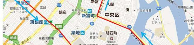


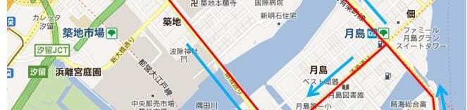


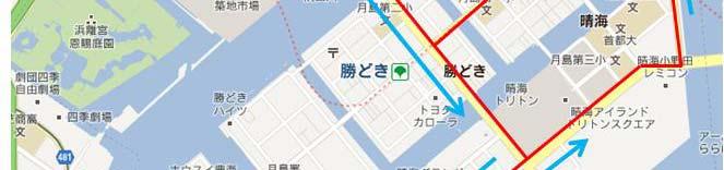
18 Tokyo (Test1) (Open 10% Ub Urban 50% Dense 40%) Ttl Total period: 1hour Data rate: 5Hz JAVADDelta+RegAnt Delta Relatively wide road Around Tokyo Station 18
19 RTK Performance (Test1) Availability and percentage within 50 cm in horizontal error GPS GPS+QZS DGPS 69.6% 84.7% Normal RTK 17.6% (99.2%) 31.7% (99.7%) +signal quality test 15.7% (99.8%) 36.0% (100%) +velocity information 21.2% (99.8%) 43.5% (100%) Total: epochs (5Hz) (): percentage within 50 cm 4.5 GPS QZS Satellite Constellation 19
20 Temporal Horizontal Errors (Test1) (GPS+QZS, Best case in RTK) 2 Ab bsolute Horiz zontal Error (m) GPSTIME (s) 7737 / epochs 20


21 Nagoya (Test2) (Open 0% Urban 40% Dense 50% No Sky 10%) QZS was not evaluated Ttl Total period: 27min NovAtel OEM5+ GPS702 Data rate: 10Hz POS/LV was used to evaluate the precise temporal errors. Relatively wide road Good GPS Constellation Average speed was 3.5m/s Test Route No Sky 21


22 Number of Used Satellites (Test2) Average NUS in reference > > Average NUS in rover > 3.2 L1 + L2 carrier phase are valid Percentage with 4 or more satellites: 42% Over 50 are not displayed 22
23 RTK Performance (Test2) Availability and percentage within 1 m in horizontal error GPS DGPS 51.0% (55.3%) Normal RTK 12.4% (88.9%) +signal qualitytest 13.0% (98.4%) +velocity information 32.0% (94.8%) +ADOP < % 0% (99.8%) Total: epochs (10Hz) (): percentage within 1 m for integration The rest of 68 % positions have to be generated from filtered DGPS or INS using our proposed integration method. 23
24 Wrong Fix Detection Summary (Test2) Abso olute Horizont tal Errors (m) Temporal Horizontal Errors in RTK (32% of all) GPSTIME (s) Horizontal Statistics Errors (m) Wrong fix Detection 1m-2m m-3m 3 3 >3m Most of wrong fixes were dt detected td! Altitude in RTK (m) Actual Wrong Fix Detection Example GPSTIME (s) 24
25 Total Performance (Test2) Statistics Horizontal Errors (m) N Percentage <=1m <1m >1m
")


26 Total Horizontal Positions (Test2) RTK-GPS fixed positions 32% of all (5219 of 16270epochs) Positions given by our proposed p integration system 68% of all (11051 of 16270epochs) = 100 % 26
27 Summary Our proposed signal quality test and velocity use for the reliability and availability in RTK were quite effective in urban environment. However, there are still wrong fixes. Loosely coupled ldintegration i (GPS+IMU+Speed) S method was proposed and availability was improved from 32% to 100%. Accuracy deterioration was small using IMU and Speed. Multi GNSS and Multi Frequency is clear in future. As QZS was effective in RTK, the performance of RTK in urban environment must be improved. What is an appropriate application in the level of 1m accuracy? 27
28 Thank you for your attention! Acknowledgements I would like to thank the Toyota central R&D for their valuable experimental data. Financial support was partly provided by Space Use Promotion Grant from Ministry of Education, Culture, Sports, Science and Technology. 28
Performance Evaluation of the Effect of QZS (Quasi-zenith Satellite) on Precise Positioning
 on Precise Positioning") Performance Evaluation of the Effect of QZS (Quasi-zenith Satellite) on Precise Positioning Nobuaki Kubo, Tomoko Shirai, Tomoji Takasu, Akio Yasuda (TUMST) Satoshi Kogure (JAXA) Abstract The quasi-zenith
Performance Evaluation of the Effect of QZS (Quasi-zenith Satellite) on Precise Positioning Nobuaki Kubo, Tomoko Shirai, Tomoji Takasu, Akio Yasuda (TUMST) Satoshi Kogure (JAXA) Abstract The quasi-zenith
Reliability Estimation for RTK-GNSS/IMU/Vehicle Speed Sensors in Urban Environment
 Laboratory of Satellite Navigation Engineering Reliability Estimation for RTK-GNSS/IMU/Vehicle Speed Sensors in Urban Environment Ren Kikuchi, Nobuaki Kubo (TUMSAT) Shigeki Kawai, Ichiro Kato, Nobuyuki
ION ITM Tokyo University of Marine Science and Technology H. Sridhara, N. Kubo, R.Kikuchi
 Single-Frequency Multi-GNSS RTK Positioning for Moving Platform ION ITM 215 215.1.27-29 Tokyo University of Marine Science and Technology H. Sridhara, N. Kubo, R.Kikuchi 1 Agenda Motivation and Background
Intelligent Transport Systems and GNSS. ITSNT 2017 ENAC, Toulouse, France 11/ Nobuaki Kubo (TUMSAT)
") Intelligent Transport Systems and GNSS ITSNT 2017 ENAC, Toulouse, France 11/14-17 2017 Nobuaki Kubo (TUMSAT) Contents ITS applications in Japan How can GNSS contribute to ITS? Current performance of GNSS
Intelligent Transport Systems and GNSS ITSNT 2017 ENAC, Toulouse, France 11/14-17 2017 Nobuaki Kubo (TUMSAT) Contents ITS applications in Japan How can GNSS contribute to ITS? Current performance of GNSS
The Possibility of Precise Automobile Navigation using GPS/QZS L5 and (Galileo E5) Pseudo ranges
 Pseudo ranges") The Possibility of Precise Automobile Navigation using GPS/QZS L5 and (Galileo E5 Pseudo ranges ION ITM ITM 013 Hiroko Tokura, Taro Suzuki, Tomoji Takasu, Nobuaki Kubo (Tokyo University of Marine Scienceand
The Possibility of Precise Automobile Navigation using GPS/QZS L5 and (Galileo E5 Pseudo ranges ION ITM ITM 013 Hiroko Tokura, Taro Suzuki, Tomoji Takasu, Nobuaki Kubo (Tokyo University of Marine Scienceand
Performance Evaluation of Multi-GNSS RTK for Automobiles in Urban Areas
 Performance Evaluation of Multi-GNSS RTK for Automobiles in Urban Areas ISGNSS2014 21-24 October, 2014, ICC Jeju, Korea Nobuaki Kubo, Hiroko Tokura, Taro Suzuki (TUMSAT) 1 Contents Current Status of Multi-GNSS
The Benefits of Three Frequencies for the High Accuracy Positioning
 The Benefits of Three Frequencies for the High Accuracy Positioning Nobuaki Kubo (Tokyo University of Marine and Science Technology) Akio Yasuda (Tokyo University of Marine and Science Technology) Isao
NovAtel s. Performance Analysis October Abstract. SPAN on OEM6. SPAN on OEM6. Enhancements
 NovAtel s SPAN on OEM6 Performance Analysis October 2012 Abstract SPAN, NovAtel s GNSS/INS solution, is now available on the OEM6 receiver platform. In addition to rapid GNSS signal reacquisition performance,
SPAN Technology System Characteristics and Performance
 SPAN Technology System Characteristics and Performance NovAtel Inc. ABSTRACT The addition of inertial technology to a GPS system provides multiple benefits, including the availability of attitude output
New Approach for Tsunami Detection Based on RTK-GNSS Using Network of Ships
 New Approach for Tsunami Detection Based on RTK-GNSS Using Network of Ships Tokyo University of Marine Science and Technology Ryuta Nakaosone Nobuaki Kubo Background After the Indian Ocean Tsunami on 2004,
Reduction of Pseudorange Multipath Error in Static Positioning. Tokyo University of Mercantile Marine Nobuaki Kubo Akio Yasuda
 Reduction of Pseudorange Multipath Error in Static Positioning Tokyo University of Mercantile Marine Nobuaki Kubo Akio Yasuda Brief Many researchers have tried to reduce the multipath effect from both
A Positon and Orientation Post-Processing Software Package for Land Applications - New Technology
 A Positon and Orientation Post-Processing Software Package for Land Applications - New Technology Tatyana Bourke, Applanix Corporation Abstract This paper describes a post-processing software package that
How multipath error influences on ambiguity resolution
 How multipath error influences on ambiguity resolution Nobuaki Kubo, Akio Yasuda Tokyo University of Mercantile Marine BIOGRAPHY Nobuaki Kubo received his Master of Engineering (Electrical) in 99 from
ATLANS-C. mobile mapping position and orientation solution
 mobile mapping position and orientation solution mobile mapping position and orientation solution THE SMALLEST ATLANS-C is a high performance all-in-one position and orientation solution for both land
CODEVINTEC. Miniature and accurate IMU, AHRS, INS/GNSS Attitude and Heading Reference Systems
 45 27 39.384 N 9 07 30.145 E Miniature and accurate IMU, AHRS, INS/GNSS Attitude and Heading Reference Systems Aerospace Land/Automotive Marine Subsea Miniature inertial sensors 0.1 Ellipse Series New
Inertial Navigation System
 Apogee Series ULTIMATE ACCURACY MEMS Inertial Navigation System INS MRU AHRS ITAR Free 0.005 RMS Motion Sensing & Georeferencing APOGEE SERIES makes high accuracy affordable for all surveying companies.
Inertial Sensors. Ellipse 2 Series MINIATURE HIGH PERFORMANCE. Navigation, Motion & Heave Sensing IMU AHRS MRU INS VG
 Ellipse 2 Series MINIATURE HIGH PERFORMANCE Inertial Sensors IMU AHRS MRU INS VG ITAR Free 0.1 RMS Navigation, Motion & Heave Sensing ELLIPSE SERIES sets up new standard for miniature and cost-effective
GPS-Aided INS Datasheet Rev. 2.7
 1 The Inertial Labs Single and Dual Antenna GPS-Aided Inertial Navigation System INS is new generation of fully-integrated, combined GPS, GLONASS, GALILEO, QZSS and BEIDOU navigation and highperformance
Inertial Sensors. Ellipse 2 Series MINIATURE HIGH PERFORMANCE. Navigation, Motion & Heave Sensing IMU AHRS MRU INS VG
 Ellipse 2 Series MINIATURE HIGH PERFORMANCE Inertial Sensors IMU AHRS MRU INS VG ITAR Free 0.1 RMS Navigation, Motion & Heave Sensing ELLIPSE SERIES sets up new standard for miniature and cost-effective
GPS-Aided INS Datasheet Rev. 3.0
 1 GPS-Aided INS The Inertial Labs Single and Dual Antenna GPS-Aided Inertial Navigation System INS is new generation of fully-integrated, combined GPS, GLONASS, GALILEO, QZSS, BEIDOU and L-Band navigation
Inertial Systems. Ekinox Series TACTICAL GRADE MEMS. Motion Sensing & Navigation IMU AHRS MRU INS VG
 Ekinox Series TACTICAL GRADE MEMS Inertial Systems IMU AHRS MRU INS VG ITAR Free 0.05 RMS Motion Sensing & Navigation AEROSPACE GROUND MARINE EKINOX SERIES R&D specialists usually compromise between high
Inertially Aided RTK Performance Evaluation
 Inertially Aided RTK Performance Evaluation Bruno M. Scherzinger, Applanix Corporation, Richmond Hill, Ontario, Canada BIOGRAPHY Dr. Bruno M. Scherzinger obtained the B.Eng. degree from McGill University
WHITE PAPER ABSTARCT. The new Quantum TM Algorithm by ComNav Technology July 2016
 WHITE PAPER The new Quantum TM Algorithm by ComNav Technology July 206 ABSTARCT The latest Quantum TM algorithm, as an upgrade of ComNav Technology Quan tm Algorithm, is a brand new technology that improves
NovAtel SPAN and Waypoint GNSS + INS Technology
 NovAtel SPAN and Waypoint GNSS + INS Technology SPAN Technology SPAN provides real-time positioning and attitude determination where traditional GNSS receivers have difficulties; in urban canyons or heavily
Integration of Inertial Measurements with GNSS -NovAtel SPAN Architecture-
 Integration of Inertial Measurements with GNSS -NovAtel SPAN Architecture- Sandy Kennedy, Jason Hamilton NovAtel Inc., Canada Edgar v. Hinueber imar GmbH, Germany ABSTRACT As a GNSS system manufacturer,
Motion & Navigation Solution
 Navsight Land & Air Solution Motion & Navigation Solution FOR SURVEYING APPLICATIONS Motion, Navigation, and Geo-referencing NAVSIGHT LAND/AIR SOLUTION is a full high performance inertial navigation solution
Inertial Sensors. Ellipse Series MINIATURE HIGH PERFORMANCE. Navigation, Motion & Heave Sensing IMU AHRS MRU INS VG
 Ellipse Series MINIATURE HIGH PERFORMANCE Inertial Sensors IMU AHRS MRU INS VG ITAR Free 0.1 RMS Navigation, Motion & Heave Sensing ELLIPSE SERIES sets up new standard for miniature and cost-effective
ProMark 3 RTK. White Paper
 ProMark 3 RTK White Paper Table of Contents 1. Introduction... 1 2. ProMark3 RTK Operational Environment... 2 3. BLADE TM : A Unique Magellan Technology for Quicker Convergence... 3 4. ProMark3 RTK Fixed
Effect of Quasi Zenith Satellite (QZS) on GPS Positioning
 on GPS Positioning") Effect of Quasi Zenith Satellite (QZS) on GPS ing Tomoji Takasu 1, Takuji Ebinuma 2, and Akio Yasuda 3 Laboratory of Satellite Navigation, Tokyo University of Marine Science and Technology 1 (Tel: +81-5245-7365,
Effect of Quasi Zenith Satellite (QZS) on GPS ing Tomoji Takasu 1, Takuji Ebinuma 2, and Akio Yasuda 3 Laboratory of Satellite Navigation, Tokyo University of Marine Science and Technology 1 (Tel: +81-5245-7365,
Inertial Navigation System
 Apogee Marine Series ULTIMATE ACCURACY MEMS Inertial Navigation System INS MRU AHRS ITAR Free 0.005 RMS Navigation, Motion & Heave Sensing APOGEE SERIES makes high accuracy affordable for all surveying
On the Road to Driverless. Personal cars and commercial trucks are. Differential GNSS+INS for Land Vehicle Autonomous Navigation Qualification
 » COVER STORY MERCEDES vision of future mobility, autonomous driving. On the Road to Driverless Differential GNSS+INS for Land Vehicle Autonomous Navigation Qualification Land-vehicle autonomous navigation
GPS-Aided INS Datasheet Rev. 2.6
 GPS-Aided INS 1 GPS-Aided INS The Inertial Labs Single and Dual Antenna GPS-Aided Inertial Navigation System INS is new generation of fully-integrated, combined GPS, GLONASS, GALILEO and BEIDOU navigation
Precise Positioning with NovAtel CORRECT Including Performance Analysis
 Precise Positioning with NovAtel CORRECT Including Performance Analysis NovAtel White Paper April 2015 Overview This article provides an overview of the challenges and techniques of precise GNSS positioning.
Webinar. 9 things you should know about centimeter-level GNSS accuracy
 Webinar 9 things you should know about centimeter-level GNSS accuracy Webinar agenda 9 things you should know about centimeter-level GNSS accuracy 1. High precision GNSS challenges 2. u-blox F9 technology
GNSS analysis software GSILIB for utilizing Multi- GNSS data
 Technical Seminar Reference Frame in Practice, GNSS analysis software GSILIB for utilizing Multi- GNSS data *Satoshi Kawamoto, Naofumi Takamatsu Geospatial Information Authority of Japan Sponsors: Geospatial
ADVANCED GNSS ALGORITHMS FOR SAFE AUTONOMOUS VEHICLES
 ION GNSS+ 2017 ADVANCED GNSS ALGORITHMS FOR SAFE AUTONOMOUS VEHICLES SEPTEMBER 29 TH, 2017 ION GNSS+ 2017, PORTLAND, OREGON, USA SESSION A5: Autonomous and Assisted Vehicle Applications Property of GMV
FieldGenius Technical Notes GPS Terminology
 FieldGenius Technical Notes GPS Terminology Almanac A set of Keplerian orbital parameters which allow the satellite positions to be predicted into the future. Ambiguity An integer value of the number of
REAL-TIME GPS ATTITUDE DETERMINATION SYSTEM BASED ON EPOCH-BY-EPOCH TECHNOLOGY
 REAL-TIME GPS ATTITUDE DETERMINATION SYSTEM BASED ON EPOCH-BY-EPOCH TECHNOLOGY Dr. Yehuda Bock 1, Thomas J. Macdonald 2, John H. Merts 3, William H. Spires III 3, Dr. Lydia Bock 1, Dr. Jeffrey A. Fayman
High Precision GNSS in Automotive
 High Precision GNSS in Automotive Jonathan Auld, VP Engineering and Safety 6, March, 2018 2 Global OEM Positioning Solutions and Services for Land, Sea, and Air. GNSS in Automotive Today Today the primary
GPS-Aided INS Datasheet Rev. 2.3
 GPS-Aided INS 1 The Inertial Labs Single and Dual Antenna GPS-Aided Inertial Navigation System INS is new generation of fully-integrated, combined L1 & L2 GPS, GLONASS, GALILEO and BEIDOU navigation and
Inertial Sensors. Ellipse Series MINIATURE HIGH PERFORMANCE. Navigation, Motion & Heave Sensing IMU AHRS MRU INS VG
 Ellipse Series MINIATURE HIGH PERFORMANCE Inertial Sensors IMU AHRS MRU INS VG ITAR Free 0.2 RMS Navigation, Motion & Heave Sensing ELLIPSE SERIES sets up new standard for miniature and cost-effective
Sensor Fusion for Navigation in Degraded Environements
 Sensor Fusion for Navigation in Degraded Environements David M. Bevly Professor Director of the GPS and Vehicle Dynamics Lab dmbevly@eng.auburn.edu (334) 844-3446 GPS and Vehicle Dynamics Lab Auburn University
ENHANCEMENTS IN UAV FLIGHT CONTROL AND SENSOR ORIENTATION
 Heinz Jürgen Przybilla Manfred Bäumker, Alexander Zurhorst ENHANCEMENTS IN UAV FLIGHT CONTROL AND SENSOR ORIENTATION Content Introduction Precise Positioning GNSS sensors and software Inertial and augmentation
Utilizing Batch Processing for GNSS Signal Tracking
 Utilizing Batch Processing for GNSS Signal Tracking Andrey Soloviev Avionics Engineering Center, Ohio University Presented to: ION Alberta Section, Calgary, Canada February 27, 2007 Motivation: Outline
al T TD ) ime D Faamily Products The RTD Family of products offers a full suite of highprecision GPS sensor positioning and navigation solutions for:
 ime D Faamily Products The RTD Family of products offers a full suite of highprecision GPS sensor positioning and navigation solutions for:") Reeal ynnamics al T amics (R TD ) ime D RTD) Time Dy Faamily mily ooff P roducts Products The RTD Family of products offers a full suite of highprecision GPS sensor positioning and navigation solutions
Reeal ynnamics al T amics (R TD ) ime D RTD) Time Dy Faamily mily ooff P roducts Products The RTD Family of products offers a full suite of highprecision GPS sensor positioning and navigation solutions
Precise Robust Positioning with Inertial/GPS RTK
 Precise Robust Positioning with Inertial/GPS RTK Bruno M. Scherzinger, Applanix Corporation, Richmond Hill, Ontario, Canada BIOGRAPHY Dr. Bruno M. Scherzinger obtained the B.Eng. degree from McGill University
NovAtel SPAN and Waypoint. GNSS + INS Technology
 NovAtel SPAN and Waypoint GNSS + INS Technology SPAN Technology SPAN provides continual 3D positioning, velocity and attitude determination anywhere satellite reception may be compromised. SPAN uses NovAtel
GPS PERFORMANCE EVALUATION OF THE HUAWEI MATE 9 WITH DIFFERENT ANTENNA CONFIGURATIONS
 GPS PERFORMANCE EVALUATION OF THE HUAWEI MATE 9 WITH DIFFERENT ANTENNA CONFIGURATIONS AND P10 IN THE FIELD Gérard Lachapelle & Research Team PLAN Group, University of Calgary (http://plan.geomatics.ucalgary.ca)
Inertial Systems. Ekinox 2 Series TACTICAL GRADE MEMS. Motion Sensing & Navigation IMU AHRS MRU INS VG
 Ekinox 2 Series TACTICAL GRADE MEMS Inertial Systems IMU AHRS MRU INS VG ITAR Free 0.02 RMS Motion Sensing & Navigation AEROSPACE GROUND MARINE EKINOX 2 SERIES R&D specialists usually compromise between
Integration of GPS with a Rubidium Clock and a Barometer for Land Vehicle Navigation
 Integration of GPS with a Rubidium Clock and a Barometer for Land Vehicle Navigation Zhaonian Zhang, Department of Geomatics Engineering, The University of Calgary BIOGRAPHY Zhaonian Zhang is a MSc student
TECHNICAL PAPER: Performance Analysis of Next-Generation GNSS/INS System from KVH and NovAtel
 TECHNICAL PAPER: Performance Analysis of Next-Generation GNSS/INS System from KVH and NovAtel KVH Industries, Inc. 50 Enterprise Center Middletown, RI 02842 USA KVH Contact Information Phone: +1 401-847-3327
Inertial Systems. Ekinox 2 Series TACTICAL GRADE MEMS. Motion Sensing & Navigation IMU AHRS MRU INS VG
 Ekinox 2 Series TACTICAL GRADE MEMS Inertial Systems IMU AHRS MRU INS VG ITAR Free 0.02 RMS Motion Sensing & Navigation AEROSPACE GROUND MARINE EKINOX 2 SERIES R&D specialists usually compromise between
Trustworthy Positioning for Next Generation Intelligent Transport Systems Ahmed El-Mowafy
 Trustworthy Positioning for Next Generation Intelligent Transport Systems Ahmed El-Mowafy Contents Background on ITS and C-ITS Requirements Challenges RAIM Test and Results Utilisation Workshop, Sydney,
Asian Journal of Science and Technology Vol. 08, Issue, 11, pp , November, 2017 RESEARCH ARTICLE
 Available Online at http://www.journalajst.com ASIAN JOURNAL OF SCIENCE AND TECHNOLOGY ISSN: 0976-3376 Asian Journal of Science and Technology Vol. 08, Issue, 11, pp.6697-6703, November, 2017 ARTICLE INFO
POWERGPS : A New Family of High Precision GPS Products
 POWERGPS : A New Family of High Precision GPS Products Hiroshi Okamoto and Kazunori Miyahara, Sokkia Corp. Ron Hatch and Tenny Sharpe, NAVCOM Technology Inc. BIOGRAPHY Mr. Okamoto is the Manager of Research
Introduction to GNSS Base-Station
 Introduction to GNSS Base-Station Dinesh Manandhar Center for Spatial Information Science The University of Tokyo Contact Information: dinesh@iis.u-tokyo.ac.jp Slide : 1 Introduction GPS or GNSS observation
Resilient PNT: From PNT-Unit concept to first realization
 www.dlr.de Chart 1 >Resilient PNT: From PNT Unit concept to first realization> R. Ziebold > e-navigation Underway 1/3/213 Resilient PNT: From PNT-Unit concept to first realization Ralf Ziebold, Z. Dai,
GPS and Recent Alternatives for Localisation. Dr. Thierry Peynot Australian Centre for Field Robotics The University of Sydney
 GPS and Recent Alternatives for Localisation Dr. Thierry Peynot Australian Centre for Field Robotics The University of Sydney Global Positioning System (GPS) All-weather and continuous signal system designed
Framework and Performance Evaluation of a Ray Tracing-Software Defined Radio Method for GNSS Positioning in an Urban Canyon Environment
 Framework and Performance Evaluation of a Ray Tracing-Software Defined Radio Method for GNSS Positioning in an Urban Canyon Environment Rei Furukawa, Kozo Keikaku Engineering Inc., Tokyo University of
TEST RESULTS OF A HIGH GAIN ADVANCED GPS RECEIVER
 TEST RESULTS OF A HIGH GAIN ADVANCED GPS RECEIVER ABSTRACT Dr. Alison Brown, Randy Silva, Gengsheng Zhang,; NAVSYS Corporation. NAVSYS High Gain Advanced GPS Receiver () uses a digital beam-steering antenna
One Source for Positioning Success
 novatel.com One Source for Positioning Success RTK, PPP, SBAS OR DGNSS. NOVATEL CORRECT OPTIMIZES ALL CORRECTION SOURCES, PUTTING MORE POWER, FLEXIBILITY AND CONTROL IN YOUR HANDS. NovAtel CORRECT is the
New Developments of Inertial Navigation Systems at Applanix
 Hutton et al 1 New Developments of Inertial Navigation Systems at Applanix JOE HUTTON, TATYANA BOURKE, BRUNO SCHERZINGER, APPLANIX ABSTRACT GNSS-Aided Inertial Navigation for Direct Georeferencing of aerial
Evaluation of GNSS for the realization of the autonomous car
 Evaluation of GNSS for the realization of the autonomous car 2015 Cross-ministerial Strategic Innovation Promotion Program Autonomous Driving WG AISAN TECHNOLOGY CO., LTD. Corporate Name Representative
Positioning with Single and Dual Frequency Smartphones Running Android 7 or Later
 Positioning with Single and Dual Frequency Smartphones Running Android 7 or Later * René Warnant, *Laura Van De Vyvere, + Quentin Warnant * University of Liege Geodesy and GNSS + Augmenteo, Plaine Image,
Tersus RTK Competitive Analysis
 Test Report Jun 2018 Tersus RTK Competitive Analysis 2018 Tersus GNSS Inc. All rights reserved. Sales & Technical Support: sales@tersus-gnss.com & support@tersus-gnss.com More details, please visit www.tersus-gnss.com
TEST RESULTS OF A DIGITAL BEAMFORMING GPS RECEIVER FOR MOBILE APPLICATIONS
 TEST RESULTS OF A DIGITAL BEAMFORMING GPS RECEIVER FOR MOBILE APPLICATIONS Alison Brown, Huan-Wan Tseng, and Randy Kurtz, NAVSYS Corporation BIOGRAPHY Alison Brown is the President and CEO of NAVSYS Corp.
The Usefulness of Internet-based (NTrip) RTK for Navigation and Intelligent Transportation Systems
 RTK for Navigation and Intelligent Transportation Systems") The Usefulness of Internet-based (NTrip) RTK for Navigation and Intelligent Transportation Systems Marcin Uradzinski, University of Warmia and Mazury, Poland Don Kim and Richard B. Langley, University
The Usefulness of Internet-based (NTrip) RTK for Navigation and Intelligent Transportation Systems Marcin Uradzinski, University of Warmia and Mazury, Poland Don Kim and Richard B. Langley, University
EXPERIMENTAL RESULTS OF LEX CORRECTIONS USING FARMING MACHINE
 Sixth Meeting of the International Committee on Global Navigation Satellite Systems (ICG) EXPERIMENTAL RESULTS OF LEX CORRECTIONS USING FARMING MACHINE Masayuki Kanzaki Hitachi Zosen Corporation Prof.
GNSS & Coordinate Systems
 GNSS & Coordinate Systems Matthew McAdam, Marcelo Santos University of New Brunswick, Department of Geodesy and Geomatics Engineering, Fredericton, NB May 29, 2012 Santos, 2004 msantos@unb.ca 1 GNSS GNSS
The Possibility of Precise Positioning in the Urban Area
 Presented at GNSS 004 The 004 International Symposium on GNSS/GPS Sydney, Australia 6 8 December 004 The Possibility of Precise Positioning in the Urban Area Nobuai Kubo Toyo University of Marine Science
Precise Point Positioning (PPP) using
 using") Precise Point Positioning (PPP) using Product Technical Notes // May 2009 OnPOZ is a product line of Effigis. EZSurv is a registered trademark of Effigis. All other trademarks are registered or recognized
Precise Point Positioning (PPP) using Product Technical Notes // May 2009 OnPOZ is a product line of Effigis. EZSurv is a registered trademark of Effigis. All other trademarks are registered or recognized
SPEEDBOX Technical Datasheet
 SPEEDBOX Technical Datasheet Race Technology Limited, 2008 Version 1.1 1. Introduction... 3 1.1. Product Overview... 3 1.2. Applications... 3 1.3. Standard Features... 3 2. Port / Connector details...
DYNAMIC RT TECHNOLOGY
 DYNAMIC RT TECHNOLOGY GLOBAL NAVIGATION SATELLITE SYSTEMS (GNSS) POTENTIAL FUTURE DEVELOPMENTS(2005 2017?) GPS MODERNIZATION BLOCK IIF & III GLONASS ENHANCEMENTS (K & M) EUROPEAN UNION - GALILEO CHINA
PHINS, An All-In-One Sensor for DP Applications
 DYNAMIC POSITIONING CONFERENCE September 28-30, 2004 Sensors PHINS, An All-In-One Sensor for DP Applications Yves PATUREL IXSea (Marly le Roi, France) ABSTRACT DP positioning sensors are mainly GPS receivers
DEVICE CONFIGURATION INSTRUCTIONS
 WinFrog Device Group: Device Name/Model: Device Manufacturer: Device Data String(s) Output to WinFrog: WinFrog Data String(s) Output to Device: WinFrog Data Item(s) and their RAW record: GPS POS/MV (NMEA)
Visione per il veicolo Paolo Medici 2017/ Visual Perception
 Visione per il veicolo Paolo Medici 2017/2018 02 Visual Perception Today Sensor Suite for Autonomous Vehicle ADAS Hardware for ADAS Sensor Suite Which sensor do you know? Which sensor suite for Which algorithms
POSITION & ORIENTATION SYSTEMS FOR MARINE VESSELS
 POSITION & ORIENTATION SYSTEMS FOR MARINE VESSELS Applanix POS MV is the marine-survey industry s most accurate, robust, and reliable position and orientation solution available today. Representing the
Robust Positioning for Urban Traffic
 Robust Positioning for Urban Traffic Motivations and Activity plan for the WG 4.1.4 Dr. Laura Ruotsalainen Research Manager, Department of Navigation and positioning Finnish Geospatial Research Institute
Using a Sky Projection to Evaluate Pseudorange Multipath and to Improve the Differential Pseudorange Position
 Using a Sky Projection to Evaluate Pseudorange Multipath and to Improve the Differential Pseudorange Position Dana G. Hynes System Test Group, NovAtel Inc. BIOGRAPHY Dana Hynes has been creating software
AIRPORT MULTIPATH SIMULATION AND MEASUREMENT TOOL FOR SITING DGPS REFERENCE STATIONS
 AIRPORT MULTIPATH SIMULATION AND MEASUREMENT TOOL FOR SITING DGPS REFERENCE STATIONS ABSTRACT Christophe MACABIAU, Benoît ROTURIER CNS Research Laboratory of the ENAC, ENAC, 7 avenue Edouard Belin, BP
GL1DE. Introducing NovAtel s. Technology. Precise thinking.
 Introducing NovAtel s GLDE Technology Precise thinking 28 NovAtel Inc. All rights reserved. Printed in Canada. D239 www.novatel.com -8-NOVATEL (U.S. & Canada) or 43-295-49 Europe +44 () 993 852-436 SE
Impact of Personal Privacy Devices for WAAS Aviation Users
 Impact of Personal Privacy Devices for WAAS Aviation Users Grace Xingxin Gao, Kazuma Gunning, Todd Walter and Per Enge Stanford University, USA ABSTRACT Personal privacy devices (PPDs) are low-cost jammers
SPAN Tightly Coupled GNSS+INS Technology Performance for Exceptional 3D, Continuous Position, Velocity & Attitude
 SPAN Tightly Coupled GNSSINS Technology Performance for Exceptional 3D, Continuous Position, Velocity & Attitude SPAN Technology NOVATEL S SPAN TECHNOLOGY PROVIDES CONTINUOUS 3D POSITIONING, VELOCITY AND
HIGH GAIN ADVANCED GPS RECEIVER
 ABSTRACT HIGH GAIN ADVANCED GPS RECEIVER NAVSYS High Gain Advanced () uses a digital beam-steering antenna array to enable up to eight GPS satellites to be tracked, each with up to dbi of additional antenna
Steering Angle Sensor; MEMS IMU; GPS; Sensor Integration
 Journal of Intelligent Transportation Systems, 12(4):159 167, 2008 Copyright C Taylor and Francis Group, LLC ISSN: 1547-2450 print / 1547-2442 online DOI: 10.1080/15472450802448138 Integration of Steering
Satellite Navigation Integrity and integer ambiguity resolution
 Satellite Navigation Integrity and integer ambiguity resolution Picture: ESA AE4E08 Sandra Verhagen Course 2010 2011, lecture 12 1 Today s topics Integrity and RAIM Integer Ambiguity Resolution Study Section
Assessment of high-rate GPS using a single-axis shake table
 Assessment of high-rate GPS using a single-axis shake table S. Häberling, M. Rothacher, A. Geiger Institute of Geodesy and Photogrammetry, ETH Zurich Introduction Project: Study the applicability of high-rate
PERFORMANCE EVALUATION OF SMARTPHONE GNSS MEASUREMENTS WITH DIFFERENT ANTENNA CONFIGURATIONS
 PERFORMANCE EVALUATION OF SMARTPHONE GNSS MEASUREMENTS WITH DIFFERENT ANTENNA CONFIGURATIONS Ranjeeth Siddakatte, Ali Broumandan and Gérard Lachapelle PLAN Group, Department of Geomatics Engineering, Schulich
Kongsberg Seatex AS Pirsenteret N-7462 Trondheim Norway POSITION 303 VELOCITY 900 HEADING 910 ATTITUDE 413 HEAVE 888
 WinFrog Device Group: Device Name/Model: Device Manufacturer: Device Data String(s) Output to WinFrog: WinFrog Data String(s) Output to Device: WinFrog Data Item(s) and their RAW record: GPS SEAPATH Kongsberg
GE 113 REMOTE SENSING
 GE 113 REMOTE SENSING Topic 9. Introduction to Global Positioning Systems (GPS) and Other GNSS Technologies Lecturer: Engr. Jojene R. Santillan jrsantillan@carsu.edu.ph Division of Geodetic Engineering
Advanced Navigation Solutions - ANAVS Company presentation
 Advanced Navigation Solutions - ANAVS Company presentation April 2014 Table of contents 1. Advanced Navigation Solutions - ANAVS 2. PAD System hardware 3. PAD System software 4. Applications 5. Patents
Revisions Revision Date By Changes A 11 Feb 2013 MHA Initial release , Xsens Technologies B.V. All rights reserved. Information in this docum
 MTi 10-series and MTi 100-series Document MT0503P, Revision 0 (DRAFT), 11 Feb 2013 Xsens Technologies B.V. Pantheon 6a P.O. Box 559 7500 AN Enschede The Netherlands phone +31 (0)88 973 67 00 fax +31 (0)88
SERIES VECTORNAV TACTICAL SERIES VN-110 IMU/AHRS VN-210 GNSS/INS VN-310 DUAL GNSS/INS
 TACTICAL VECTORNAV SERIES TACTICAL SERIES VN110 IMU/AHRS VN210 GNSS/INS VN310 DUAL GNSS/INS VectorNav introduces the Tactical Series, a nextgeneration, MEMS inertial navigation platform that features highperformance
Carrier Phase DGPS for Autonomous Airborne Refueling
 Carrier Phase DGPS for Autonomous Airborne Refueling Samer Khanafseh and Boris Pervan, Illinois Institute of Technology, Chicago, IL Glenn Colby, Naval Air Warfare Center, Patuxent River, MD ABSTRACT For
Advances in GNSS Technology and it s Application to Tidal Derivation
 Advances in GNSS Technology and it s Application to Tidal Derivation Tim Painter Chief Surveyor Fugro Survey Africa Pty Ltd John Vint Survey and Starfix Product Manager Fugro Survey AS, Norway Scope of
Positioning Challenges in Cooperative Vehicular Safety Systems
 Positioning Challenges in Cooperative Vehicular Safety Systems Dr. Luca Delgrossi Mercedes-Benz Research & Development North America, Inc. October 15, 2009 Positioning for Automotive Navigation Personal
Detection and Tracking of the Vanishing Point on a Horizon for Automotive Applications
 Detection and Tracking of the Vanishing Point on a Horizon for Automotive Applications Young-Woo Seo and Ragunathan (Raj) Rajkumar GM-CMU Autonomous Driving Collaborative Research Lab Carnegie Mellon University
Receiver Technology CRESCENT OEM WHITE PAPER AMY DEWIS JENNIFER COLPITTS
 CRESCENT OEM WHITE PAPER AMY DEWIS JENNIFER COLPITTS With offices in Kansas City, Hiawatha, Calgary and Scottsdale, Hemisphere GPS is a global leader in designing and manufacturing innovative, costeffective,
08/10/2013. Marine Positioning Systems Surface and Underwater Positioning. egm502 seafloor mapping
 egm502 seafloor mapping lecture 8 navigation and positioning Marine Positioning Systems Surface and Underwater Positioning All observations at sea need to be related to a geographical position. To precisely
Hydrofest The Hydrographic Society in Scotland
 Hydrofest 2017 The Hydrographic Society in Scotland POSITIONING SYSTEMS Eddie Milne 1. GNSS Positioning 2. Additional Sensors 3. Alternative Positioning 4. Bringing it altogether GNSS = GPS + Glonass +