Brazil and Russia space cooperation: recent projects and future perspectives in the field of GNSS monitoring and SLR stations
|
|
|
- Adelia Tate
- 5 years ago
- Views:
Transcription

 Emails: raborges@ene.unb.")
 Workshop SLR")
1 Brazil and Russia space cooperation: recent projects and future perspectives in the field of GNSS monitoring and SLR stations Renato A. Borges (UnB) and Geovany A. Borges (UnB) s: and Presented by: Sonia Costa (CGED/IBGE) Workshop SLR en América Latina Mendoza Argentina November 2017
2 Outline Presentation outline: GLONASS measuring ground stations; GLONASS at UnB 1 st referential station in Latin America: Introduction; Measuring ground station capability; Current work at ground station; R&D GLONASS data network; Cooperative activities; Current research and future perspectives. Final remarks. 2

3 GLONASS Measuring Ground Stations GLONASS stations in Brazil GLONASS Differential Correction Station starts operation in 2013 at the University of Brasília. 3

4 GLONASS Measuring Ground Stations GLONASS stations in Brazil GLONASS Quantum Optical Station with OWS starts operation in


5 GLONASS at UnB - Introduction Timeline Overview: Brazilian and Russian governments signed an agreement to install GLONASS reference and monitoring stations in Brazilian territory; Brazilian Space Agency elected University of Brasília to receive the first station; GLONASS Differential Correction Station starts operation; GLONASS Quantum Optical Station with OWS starts operation. 5
; IRLS Site Code BRAL, Station #7407, DOMES #48081S001, 15.7731 S, 132.")
6 GLONASS at UnB Ground Station Capability OWS and LRS: L1 and L2 GNSS receiver MS-GLONASS IBPA (BRAJ station); IRLS Site Code BRAL, Station #7407, DOMES #48081S001, S, W; 6

7 GLONASS at UnB Ground Station Capability Laser operation and data transfer server technical room 7

8 GLONASS at UnB Ground Station Capability Laser operation and data transfer server technical room 8

9 GLONASS at UnB Ground Station Capability Compact Laser-Optical System for SLR, Angular Measurements and Photometry Mount type Az-El, with two flanges for equipment mounting Digitally controlled torque motor drive Equipment weight on each mount flange less than 20 kg Angular elevation rotation range from 0 to 90 degrees Angular azimuth rotation range from -270 to 270 degrees Maximum angular speed and acceleration are 30 deg/s and 5 deg/s 2 9
10 GLONASS at UnB Ground Station Capability Compact Laser-Optical System Parameters: SLR of SC with retroreflectors Parameter Description Feature SC orbit height range 400 to km Orbit height for SC daytime measurements 400 to 6000 km NP RMS error (averaging interval 60s) 0.5 to 2 cm Elevation range 20 to 85 degrees Compact Laser-Optical System Parameters: Angular measurements Parameter Description Feature Visual star magnitude less than 14 m RMS error for SC angular velocity up to 40 arcsec 2 Compact Laser-Optical System Parameters: Photometry Parameter Description Feature Visual star magnitude less than 12 m Brightness determination error 0.2 m 10

11 GLONASS at UnB Ground Station Capability Laser Ranging System Parameters Parameter Description Operation wavelength Pulse repetition rate Laser pulse duration Minimum laser pulse energy Output beam divergence Receive telescope diameter Laser fire epochs accuracy Feature 532 nm 300 Hz 150 ps 2 mj 5 arcsec 25 cm 200 ns 11


12 One Way GNSS Measurement Station Double frequency GNSS precise receiver model MS-GLONASS IBPA RingAnt-G3T Javad antenna GLONASS at UnB Ground Station Capability Signal tracking of GLONASS and GPS satélites in the visibility zone of the station Measurements of GLONASS and GPS code pseudoranges and Doppler increments of distance and carrier frequency Record of observation and navigation messages in RINEX format 12

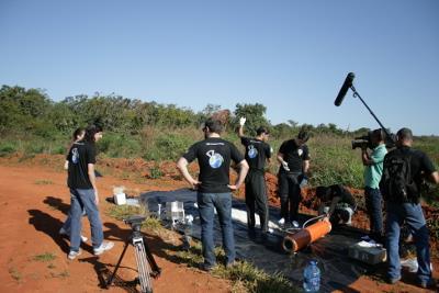
13 GLONASS at UnB Current Work at Ground Station Current work at the GLONASS measuring ground station: Technical team training; Software and hardware update; Seminars about the GLONASS system and the UnB QOS; Authorities visits and technical tours at the station; Support to Russian teams visiting the station for maintenance and upgrade in the system; Carrying out regular sessions of measurements following the program of the Russian company (24/7 work); Sample of the work done on April 4 th success out of 74 tries. 13
 passage on April 10 th")
14 GLONASS at UnB Current Work at Ground Station Pointing/tracking control virtual panel Beacon-c satellite (909) passage on April 10 th

15 GLONASS at UnB Current Work at Ground Station Laser ranging control virtual panel (Beacon-c satellite 909 on April 10 th 2016). 15

16 GLONASS at UnB Current Work at Ground Station Night camera virtual panel (GLONASS satellite 747). 16

17 GLONASS at UnB Current Work at Ground Station BRAJ RINEX Observation Mixed File of April 8 th
18 GLONASS at UnB R&D GLONASS Data Network Summarized timeline overview: Sep. 22 nd 2015 CPD/UnB FTP server for data transfer set up; Sep. 25 th 2015 Measurement data transfer protocol signed; Oct. 01 st 2015 UnB regular data transfer started; Feb. 16 th 2016 ITEP regular data transfer started; Apr. 20 th 2016 UFSM regular data transfer started; Current data transfer protocol: Data format: RINEX observation file version 2.11, interval of 30 seconds, including approximation position header field; RINEX navigation file for GLONASS and GPS version 2.11; Data period: Daily starting on Oct. 01 st 2015 from UnB station; Daily starting on Feb. 16 th 2016 from ITEP station; Daily starting on Apr. 20 th 2016 from UFSM station; RINEX navigation file for GLONASS and GPS version 2.11; Other periods: March, April, June and July of 2015 (UnB station only). 18


19 GLONASS at UnB Cooperative Activities Cooperation between UnB and The Abdus Salam International Centre for Theoretical Physics - ICTP (Trieste/Italy): May 18 th 2015 ICTP and UnB representatives first talk during the Workshop on Applications of GNSS at Krasnoyarsk, Russia; Sept. 15 th 2015 Official Letter in support of the cooperation enters into force; Jan. 26 th 2016 MoU formalizes the scientific research cooperation between the UnB and the ICTP in the field of PPP in the region of Brasilia. 19
; - Advanced filtering")

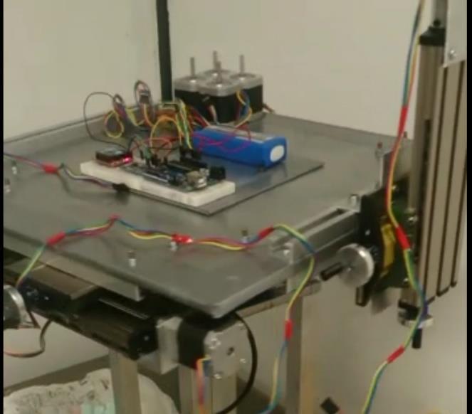
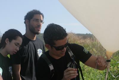
20 GLONASS at UnB Current Research and Perspectives Current team at LAICA in the field of GNSS : 5 professors; 6 undergraduate students; 1 master student; 7 technical operators and support staff. GNSS related topics under investigation : GNSS single frequency module: - Impact point prediction; - Attitude determination; - High altitude ballons experiments (LAICAnSat); - Advanced filtering solutions for GNSS/INS integration MS-GLONASS IBPA dual frequency receiver: - Precise Point Positioning (PPP). Brazilian national defense strategy and space activities : Project aligned with the interests of the Defense and Science and Technology ministries; Improve and develop national capability in the field geo location and positioning within the field of aerospace systems. 20


21 GLONASS at UnB Current Research and Perspectives Possible applications and test facilities at LAICA/UnB 21


22 GLONASS at UnB Current Research and Perspectives Possible applications and test facilities at LAICA/UnB 22
23 Final Remarks In conclusion: The GLONASS station in Brazil represents an excellent opportunity for the advancement of research on GNSS in Brazil and also to improve the accuracy of PNT in South America; These first years operating the station was important for technical team training, adjustment of the station equipment, providing a better understanding of the weather condition, collecting data for post processing and establish new research partners in the field of GNSS; Investigation within the PPP Project is going to continue in the region of Brasilia, Brazil using the data from the R&D GLONASS data network. Future perspectives include: Practical applications on HASP (LAICAnSat); Onboard attitude determination; Impact point prediction; High precision applications with UAVs and mobile robots. 23


24 Thank You For Your Attention! Acknowledgements: JC RPC PSI
About compliance of GLONASS S/C retroreflectors system with the requirements of International Laser Ranging Service standard
 FEDERAL SPACE AGENCY FGUP «Science-Research Institute for Precise Instrument Engineering» About compliance of GLONASS S/C retroreflectors system with the requirements of International Laser Ranging Service
Results of the PZ reference frame implementation to GLONASS
 Joint-stock company «RESEARCH-AND-PRODUCTION CORPORATION «PRECISION SYSTEMS AND INSTRUMENTS» Results of the PZ-90.11 reference frame implementation to GLONASS Speaker: Deputy General Director, Deputy Chief
Developing An Optical Ground Station For The CHOMPTT CubeSat Mission. Tyler Ritz
 Developing An Optical Ground Station For The CHOMPTT CubeSat Mission Tyler Ritz tritz@ufl.edu Background and Motivation Application of precision time transfer to space Satellite navigation systems ( x
Performance Evaluation of Differential Global Navigation Satellite System with RTK Corrections
 IOSR Journal of Electronics and Communication Engineering (IOSR-JECE) e-issn: 2278-2834,p- ISSN: 2278-8735.Volume 9, Issue 2, Ver. VI (Mar - Apr. 2014), PP 43-47 Performance Evaluation of Differential
GLObal Navigation Satellite System (GLONASS)
") FEDERAL SPACE AGENCY GLObal Navigation Satellite System (GLONASS) Sergey Revnivykh Deputy Director General Central Research Institute of Machine Building Head of PNT Center 4-th meeting of International
FEDERAL SPACE AGENCY GLObal Navigation Satellite System (GLONASS) Sergey Revnivykh Deputy Director General Central Research Institute of Machine Building Head of PNT Center 4-th meeting of International
NGSLR's measurement of the retro-reflector array response of various LEO to GNSS satellites
 NGSLR's measurement of the retro-reflector array response of various LEO to GNSS satellites Jan McGarry Christopher Clarke, John Degnan, Howard Donovan, Benjamin Han, Julie Horvath, Thomas Zagwodzki NASA/GSFC
Sub-system and System Level Testing and Calibration of Space Altimeters and LIDARS.
 Sub-system and System Level Testing and Calibration of Space Altimeters and LIDARS. Haris Riris, Pete Liiva, Xiaoli Sun, James Abshire Laser Remote Sensing Branch Goddard Space Flight Center, Greenbelt,
HALS-H1 Ground Surveillance & Targeting Helicopter
 ARATOS-SWISS Homeland Security AG & SMA PROGRESS, LLC HALS-H1 Ground Surveillance & Targeting Helicopter Defense, Emergency, Homeland Security (Border Patrol, Pipeline Monitoring)... Automatic detection
A CubeSat-Based Optical Communication Network for Low Earth Orbit
 A CubeSat-Based Optical Communication Network for Low Earth Orbit Richard Welle, Alexander Utter, Todd Rose, Jerry Fuller, Kristin Gates, Benjamin Oakes, and Siegfried Janson The Aerospace Corporation
Implementation of New Positioning System in Riga
 Implementation of New Positioning System in Riga M.Abele (1), J.Balodis (1), K.Balodis (1), M.Caunite (1), I.Janpaule (1), A.Rubans (1), G.Silabriedis (1,2), I.Mitrofanovs(2), A.arinsjh (1) (1) University
GPS and Recent Alternatives for Localisation. Dr. Thierry Peynot Australian Centre for Field Robotics The University of Sydney
 GPS and Recent Alternatives for Localisation Dr. Thierry Peynot Australian Centre for Field Robotics The University of Sydney Global Positioning System (GPS) All-weather and continuous signal system designed
Technology of Precise Orbit Determination
 Technology of Precise Orbit Determination V Seiji Katagiri V Yousuke Yamamoto (Manuscript received March 19, 2008) Since 1971, most domestic orbit determination systems have been developed by Fujitsu and
Precise Point Positioning (PPP) using
 using") Precise Point Positioning (PPP) using Product Technical Notes // May 2009 OnPOZ is a product line of Effigis. EZSurv is a registered trademark of Effigis. All other trademarks are registered or recognized
Precise Point Positioning (PPP) using Product Technical Notes // May 2009 OnPOZ is a product line of Effigis. EZSurv is a registered trademark of Effigis. All other trademarks are registered or recognized
Modern Navigation. Thomas Herring
 12.215 Modern Navigation Thomas Herring Summary of Last class Finish up some aspects of estimation Propagation of variances for derived quantities Sequential estimation Error ellipses Discuss correlations:
Other Space Geodetic Techniques. E. Calais Purdue University - EAS Department Civil 3273
 Other Space Geodetic Techniques E. Calais Purdue University - EAS Department Civil 3273 ecalais@purdue.edu Satellite Laser Ranging = SLR Measurement of distance (=range) between a ground station and a
Signal Quality Monitoring. Authors: Yury Yaskin, General Director, Chief designer. Valeriy Tyubalin, Deputy Chief designer
 Signal Quality Monitoring Authors: Yury Yaskin, General Director, Chief designer. Valeriy Tyubalin, Deputy Chief designer ICG-7 Meeting, Beijing, China, 4-9 November 2012 Avnues of development: 1. Controlling
magicgnss: QUALITY DATA, ALGORITHMS AND PRODUCTS FOR THE GNSS USER COMMUNITY
 SEMANA GEOMATICA 2009 magicgnss: QUALITY DATA, ALGORITHMS AND PRODUCTS FOR THE GNSS USER COMMUNITY MARCH 3, 2009 BARCELONA, SPAIN SESSION: GNSS PRODUCTS A. Mozo P. Navarro R. Píriz D. Rodríguez March 3,
Global Navigation Satellite System (GLONASS): Status and Development
: Status and Development") Global Navigation Satellite System (GLONASS): Status and Development Tatiana Mirgorodskaya Information and Analysis Center for Positioning, Navigation and Timing Roscosmos State Corporation UN-Nepal Workshop
Global Navigation Satellite System (GLONASS): Status and Development Tatiana Mirgorodskaya Information and Analysis Center for Positioning, Navigation and Timing Roscosmos State Corporation UN-Nepal Workshop
Experiences with Fugro's Real Time GPS/GLONASS Orbit/Clock Decimeter Level Precise Positioning System
 Return to Session Directory DYNAMIC POSITIONING CONFERENCE October 13-14, 2009 Sensors Experiences with Fugro's Real Time GPS/GLONASS Orbit/Clock Decimeter Level Precise Positioning System Ole Ørpen and
Space Situational Awareness 2015: GPS Applications in Space
 Space Situational Awareness 2015: GPS Applications in Space James J. Miller, Deputy Director Policy & Strategic Communications Division May 13, 2015 GPS Extends the Reach of NASA Networks to Enable New
Bernhard Hofnlann-Wellenhof Herbert Lichtenegger Elmar Wasle. GNSS - Global Navigation Satellite Systenls. GPS, GLONASS, Galileo, and nl0re
 Bernhard Hofnlann-Wellenhof Herbert Lichtenegger Elmar Wasle GNSS - Global Navigation Satellite Systenls GPS, GLONASS, Galileo, and nl0re SpringerWienNewYork Contents Abbreviations xxi 1 Introduction 1
Other Space Geodetic Techniques. E. Calais Purdue University - EAS Department Civil 3273
 Other Space Geodetic Techniques E. Calais Purdue University - EAS Department Civil 3273 ecalais@purdue.edu Satellite Laser Ranging Measurement of distance (=range) between a ground station and a satellite
SERIES VECTORNAV TACTICAL SERIES VN-110 IMU/AHRS VN-210 GNSS/INS VN-310 DUAL GNSS/INS
 TACTICAL VECTORNAV SERIES TACTICAL SERIES VN110 IMU/AHRS VN210 GNSS/INS VN310 DUAL GNSS/INS VectorNav introduces the Tactical Series, a nextgeneration, MEMS inertial navigation platform that features highperformance
Real-Time and Multi-GNSS Key Projects of the International GNSS Service
 Real-Time and Multi-GNSS Key Projects of the International GNSS Service Urs Hugentobler, Chris Rizos, Mark Caissy, Georg Weber, Oliver Montenbruck, Ruth Neilan EUREF 2013 Symposium Budapest, Hungary, May
GLONASS PROGRAMME UPDATE
 GLONASS PROGRAMME UPDATE Ivan Revnivykh Roscosmos State Space Corporation 11 th Meeting of the International Committee on Global Navigation Satellite System November 7, 2016 Sochi, Russian Federation CONTENTS
Absolute Antenna Calibration
 Absolute Antenna Calibration (Characteristics of Antenna Type) Method Geo++ GNPCV Real Time Calibration Antenna Data Manufacturer : CHC Shanghai HuaCe Navigation Technology Ltd. Antenna Type : i80 GNSS
Evaluation of Potential Systematic Bias in GNSS Orbital Solutions
 Evaluation of Potential Systematic Bias in GNSS Orbital Solutions Graham M. Appleby Space Geodesy Facility, Natural Environment Research Council Monks Wood, Abbots Ripton, Huntingdon PE28 2LE, UK Toshimichi
Terrestrial Free-Space Optical Communications Network Testbed: INNOVA
 Terrestrial Free-Space Optical Communications Network Testbed: INNOVA Morio Toyoshima, Yasushi Munemasa, Hideki Takenaka, Yoshihisa Takayama, Yoshisada Koyama, Hiroo Kunimori, Toshihiro Kubooka, Kenji
Lecture-1 CHAPTER 2 INTRODUCTION TO GPS
 Lecture-1 CHAPTER 2 INTRODUCTION TO GPS 2.1 History of GPS GPS is a global navigation satellite system (GNSS). It is the commonly used acronym of NAVSTAR (NAVigation System with Time And Ranging) GPS (Global
GPS Geodetic Reference System WGS 84
 GPS Geodetic Reference System WGS 84 International Committee on GNSS Working Group D Saint Petersburg, Russia 16 September 2009 Barbara Wiley National Geospatial-Intelligence Agency United States of America
Precise Positioning with Smartphones running Android 7 or later
 Precise Positioning with Smartphones running Android 7 or later * René Warnant, * Cécile Deprez, + Quentin Warnant * University of Liege Geodesy and GNSS + Augmenteo, Plaine Image, Lille (France) Belgian
GNSS analysis software GSILIB for utilizing Multi- GNSS data
 Technical Seminar Reference Frame in Practice, GNSS analysis software GSILIB for utilizing Multi- GNSS data *Satoshi Kawamoto, Naofumi Takamatsu Geospatial Information Authority of Japan Sponsors: Geospatial
GPS Status and Modernization
 GPS Status and Modernization Nov 2011 Colonel Harold Martin PNT Command Lead AFSPC A3P "This briefing is for information only. No US Government commitment to sell, loan, lease, co-develop or co-produce
FieldGenius Technical Notes GPS Terminology
 FieldGenius Technical Notes GPS Terminology Almanac A set of Keplerian orbital parameters which allow the satellite positions to be predicted into the future. Ambiguity An integer value of the number of
INTRODUCTION The validity of dissertation Object of investigation Subject of investigation The purpose: of the tasks The novelty:
 INTRODUCTION The validity of dissertation. According to the federal target program "Maintenance, development and use of the GLONASS system for 2012-2020 years the following challenges were determined:
Current status of Quasi-Zenith Satellite System. Japan Aerospace Exploration Agency QZSS Project Team
 Current status of Quasi-Zenith Satellite System Japan Aerospace Exploration Agency QZSS Project Team 1 Quasi-Zenith Satellite System The QZSS is a regional space-based PNT (Positioning, Navigation and
NASDA S PRECISE ORBIT DETERMINATION SYSTEM
 NASDA S PRECISE ORBIT DETERMINATION SYSTEM Maki Maeda Takashi Uchimura, Akinobu Suzuki, Mikio Sawabe National Space Development Agency of Japan (NASDA) Sengen 2-1-1, Tsukuba, Ibaraki, 305-8505, JAPAN E-mail:
Orbit Determination for CE5T Based upon GPS Data
 Orbit Determination for CE5T Based upon GPS Data Cao Jianfeng (1), Tang Geshi (2), Hu Songjie (3), ZhangYu (4), and Liu Lei (5) (1) Beijing Aerospace Control Center, 26 Beiqing Road, Haidian Disrtrict,
NovAtel SPAN and Waypoint. GNSS + INS Technology
 NovAtel SPAN and Waypoint GNSS + INS Technology SPAN Technology SPAN provides continual 3D positioning, velocity and attitude determination anywhere satellite reception may be compromised. SPAN uses NovAtel
NeQuick model performance analysis for GNSS mass market receivers positioning
 UN/ICTP Workshop on GNSS NeQuick model performance analysis for GNSS mass market receivers positioning Parthenope University of Naples salvatore.gaglione@uniparthenope.it 1 PANG Research Group composed
AOS STUDIES ON USE OF PPP TECHNIQUE FOR TIME TRANSFER
 AOS STUDIES ON USE OF PPP TECHNIQUE FOR TIME TRANSFER P. Lejba, J. Nawrocki, D. Lemański, and P. Nogaś Space Research Centre, Astrogeodynamical Observatory (AOS), Borowiec, ul. Drapałka 4, 62-035 Kórnik,
MAGICGNSS RTCM-BASED SERVICE, A LEAP FORWARD TOWARDS MULTI- GNSS HIGH ACCURACY REAL-TIME PROCESSING
 ION GNSS 2015 MAGICGNSS RTCM-BASED SERVICE, A LEAP FORWARD TOWARDS MULTI- GNSS HIGH ACCURACY REAL-TIME PROCESSING SEPTEMBER 16 TH, 2015 - ION GNSS 2015, TAMPA, FLORIDA, USA SESSION E2A: NEXT GENERATION
German Aerospace Center, Institute of Technical Physics, Pfaffenwaldring 38-40, Stuttgart, Germany
 Satellite Laser Ranging with a fibre-based transmitter Daniel Hampf *, Fabian Sproll, Paul Wagner, Leif Humbert, Thomas Hasenohr, Wolfgang Riede, Jens Rodmann German Aerospace Center, Institute of Technical
IGS workshop 2018 Multi-GNSS through Global Collaboration Datum: 29 October - 2 November 2018 Plats: Wuhan, China Deltagare: Tong Ning (I0101)
") 2018-11-19 RESERAPPORT IGS workshop 2018 Multi-GNSS through Global Collaboration Datum: 29 October - 2 November 2018 Plats: Wuhan, China Deltagare: Tong Ning (I0101) Syfte med mötet The workshop programme
2018-11-19 RESERAPPORT IGS workshop 2018 Multi-GNSS through Global Collaboration Datum: 29 October - 2 November 2018 Plats: Wuhan, China Deltagare: Tong Ning (I0101) Syfte med mötet The workshop programme
Status of MOLI development MOLI (Multi-footprint Observation Lidar and Imager)
") Status of MOLI development MOLI (Multi-footprint Observation Lidar and Imager) Tadashi IMAI, Daisuke SAKAIZAWA, Jumpei MUROOKA and Toshiyoshi KIMURA JAXA 1 Outline of This Presentation 1. Overview of MOLI
Status of MOLI development MOLI (Multi-footprint Observation Lidar and Imager) Tadashi IMAI, Daisuke SAKAIZAWA, Jumpei MUROOKA and Toshiyoshi KIMURA JAXA 1 Outline of This Presentation 1. Overview of MOLI
Trimble Business Center:
 Trimble Business Center: Modernized Approaches for GNSS Baseline Processing Trimble s industry-leading software includes a new dedicated processor for static baselines. The software features dynamic selection
Monitoring the Earth Surface from space
 Monitoring the Earth Surface from space Picture of the surface from optical Imagery, i.e. obtained by telescopes or cameras operating in visual bandwith. Shape of the surface from radar imagery Surface
GLONASS Status and Modernization
 GLONASS Status and Modernization Ekaterina Oleynik Central Research Institute of Roscosmos Federal Space Agency United Nations/Latvia Workshop on the Applications of Global Navigation Satellite Systems
Multipath and Atmospheric Propagation Errors in Offshore Aviation DGPS Positioning
 Multipath and Atmospheric Propagation Errors in Offshore Aviation DGPS Positioning J. Paul Collins, Peter J. Stewart and Richard B. Langley 2nd Workshop on Offshore Aviation Research Centre for Cold Ocean
Motion & Navigation Solution
 Navsight Land & Air Solution Motion & Navigation Solution FOR SURVEYING APPLICATIONS Motion, Navigation, and Geo-referencing NAVSIGHT LAND/AIR SOLUTION is a full high performance inertial navigation solution
Including GNSS Based Heading in Inertial Aided GNSS DP Reference System
 Author s Name Name of the Paper Session DYNAMIC POSITIONING CONFERENCE October 9-10, 2012 Sensors II SESSION Including GNSS Based Heading in Inertial Aided GNSS DP Reference System By Arne Rinnan, Nina
NovAtel SPAN and Waypoint GNSS + INS Technology
 NovAtel SPAN and Waypoint GNSS + INS Technology SPAN Technology SPAN provides real-time positioning and attitude determination where traditional GNSS receivers have difficulties; in urban canyons or heavily
CH GPS/GLONASS/GALILEO/SBAS Signal Simulator. General specification Version 0.2 Eng. Preliminary
 CH-380 GPS/GLONASS/GALILEO/SBAS Signal Simulator General specification Version 0.2 Eng Preliminary Phone: +7 495 665 648 Fax: +7 495 665 649 navis@navis.ru NAVIS-UKRAINE Mazura str. 4 Smela, Cherkassy
GALILEO COMMON VIEW: FORMAT, PROCESSING, AND TESTS WITH GIOVE
 GALILEO COMMON VIEW: FORMAT, PROCESSING, AND TESTS WITH GIOVE Pascale Defraigne Royal Observatory of Belgium (ROB) Avenue Circulaire, 3, B-1180 Brussels, Belgium e-mail: p.defraigne@oma.be M. C. Martínez-Belda
ABSTRACT: Three types of portable units with GNSS raw data recording capability are assessed to determine static and kinematic position accuracy
 ABSTRACT: Three types of portable units with GNSS raw data recording capability are assessed to determine static and kinematic position accuracy under various environments using alternatively their internal
Overview of the Small Optical TrAnsponder (SOTA) Project
 Project") Overview of the Small Optical TrAnsponder (SOTA) Project Space Communications Laboratory Wireless Networks Research Center National Institute of Information and Communications Technology (NICT) Satellite
Overview of the Small Optical TrAnsponder (SOTA) Project Space Communications Laboratory Wireless Networks Research Center National Institute of Information and Communications Technology (NICT) Satellite
Time and frequency transfer methods based on GNSS. LIANG Kun, National Institute of Metrology(NIM), China
, China") Time and frequency transfer methods based on GNSS LIANG Kun, National Institute of Metrology(NIM), China Outline Remote time and frequency transfer GNSS time and frequency transfer methods Data and results
Time and frequency transfer methods based on GNSS LIANG Kun, National Institute of Metrology(NIM), China Outline Remote time and frequency transfer GNSS time and frequency transfer methods Data and results
Assessment of high-rate GPS using a single-axis shake table
 Assessment of high-rate GPS using a single-axis shake table S. Häberling, M. Rothacher, A. Geiger Institute of Geodesy and Photogrammetry, ETH Zurich Introduction Project: Study the applicability of high-rate
Global Positioning Systems Directorate
 Space and Missile Systems Center Global Positioning Systems Directorate GPS Program Update to 8 th Stanford PNT Symposium 30 Oct 2014 Col Matt Smitham Deputy Director, GPS Directorate Global Positioning
Satellite Laser Retroreflectors for GNSS Satellites: ILRS Standard
 Satellite Laser Retroreflectors for GNSS Satellites: ILRS Standard Michael Pearlman Director Central Bureau International Laser Ranging Service Harvard-Smithsonian Center for Astrophysics Cambridge MA
Asian Journal of Science and Technology Vol. 08, Issue, 11, pp , November, 2017 RESEARCH ARTICLE
 Available Online at http://www.journalajst.com ASIAN JOURNAL OF SCIENCE AND TECHNOLOGY ISSN: 0976-3376 Asian Journal of Science and Technology Vol. 08, Issue, 11, pp.6697-6703, November, 2017 ARTICLE INFO
Precise Point Positioning Developments at GSD: Products, Services
 Precise Point Positioning Developments at GSD: Products, Services F. Lahaye, P. Collins, Y. Mireault, P. Tétreault, M. Caissy Geodetic Survey Division, Natural Resources Canada (NRCan) GEOIDE - PPP Workshop
Presented at the FIG Congress 2018, May 6-11, 2018 in Istanbul, Turkey
 Presented at the FIG Congress 2018, May 6-11, 2018 in Istanbul, Turkey 2 Improving Hydrographic PPP by Height Constraining Ashraf Abdallah (Egypt) Volker Schwieger, (Germany) ashraf.abdallah@aswu.edu.eg
GPS-Aided INS Datasheet Rev. 2.6
 GPS-Aided INS 1 GPS-Aided INS The Inertial Labs Single and Dual Antenna GPS-Aided Inertial Navigation System INS is new generation of fully-integrated, combined GPS, GLONASS, GALILEO and BEIDOU navigation
GNSS: orbits, signals, and methods
 Part I GNSS: orbits, signals, and methods 1 GNSS ground and space segments Global Navigation Satellite Systems (GNSS) at the time of writing comprise four systems, two of which are fully operational and
PRECISE POINT POSITIONING USING COMBDINE GPS/GLONASS MEASUREMENTS
 PRECISE POINT POSITIONING USING COMBDINE GPS/GLONASS MEASUREMENTS Mohamed AZAB, Ahmed EL-RABBANY Ryerson University, Canada M. Nabil SHOUKRY, Ramadan KHALIL Alexandria University, Egypt Outline Introduction.
The Promise and Challenges of Accurate Low Latency GNSS for Environmental Monitoring and Response
 Technical Seminar Reference Frame in Practice, The Promise and Challenges of Accurate Low Latency GNSS for Environmental Monitoring and Response John LaBrecque Geohazards Focus Area Global Geodetic Observing
SERIES VECTORNAV INDUSTRIAL SERIES VN-100 IMU/AHRS VN-200 GPS/INS VN-300 DUAL GNSS/INS
 TACTICAL VECTORNAV SERIES INDUSTRIAL SERIES VN100 IMU/AHRS VN200 GPS/INS VN300 DUAL GNSS/INS VectorNav presents the Industrial Series, a complete line of MEMSbased, industrialgrade inertial navigation
ORBITS AND CLOCKS FOR GLONASS PPP
 ION GNSS 2009 ORBITS AND CLOCKS FOR GLONASS PPP SEPTEMBER 22-25, 2009 - SAVANNAH, GEORGIA SESSION E3: PPP AND NETWORK-BASED RTK 1 D. Calle A. Mozo P. Navarro R. Píriz D. Rodríguez G. Tobías September 24,
Performance Evaluation of the Effect of QZS (Quasi-zenith Satellite) on Precise Positioning
 on Precise Positioning") Performance Evaluation of the Effect of QZS (Quasi-zenith Satellite) on Precise Positioning Nobuaki Kubo, Tomoko Shirai, Tomoji Takasu, Akio Yasuda (TUMST) Satoshi Kogure (JAXA) Abstract The quasi-zenith
Performance Evaluation of the Effect of QZS (Quasi-zenith Satellite) on Precise Positioning Nobuaki Kubo, Tomoko Shirai, Tomoji Takasu, Akio Yasuda (TUMST) Satoshi Kogure (JAXA) Abstract The quasi-zenith
SONG Stellar Observations Network Group. The prototype
 SONG Stellar Observations Network Group The prototype F. Grundahl1, J. Christensen Dalsgaard1, U. G. Jørgensen2, H. Kjeldsen1,S. Frandsen1 and P. Kjærgaard2 1) Danish AsteroSeismology Centre, University
Brainstorm. In addition to cameras / Kinect, what other kinds of sensors would be useful?
 Brainstorm In addition to cameras / Kinect, what other kinds of sensors would be useful? How do you evaluate different sensors? Classification of Sensors Proprioceptive sensors measure values internally
Sounding the Atmosphere Ground Support for GNSS Radio-Occultation Processing
 Sounding the Atmosphere Ground Support for GNSS Radio-Occultation Processing Atmospheric Sounding René Zandbergen & John M. Dow Navigation Support Office, Ground Systems Engineering Department, Directorate
Foreword by Glen Gibbons About this book Acknowledgments List of abbreviations and acronyms List of definitions
 Table of Foreword by Glen Gibbons About this book Acknowledgments List of abbreviations and acronyms List of definitions page xiii xix xx xxi xxv Part I GNSS: orbits, signals, and methods 1 GNSS ground
NTRIP Background History, Development & BKG. Networked Transport of RTCM via Internet Protocol
 Networked Transport of RTCM via Internet Protocol Networked Transport of RTCM via Internet Protocol Bundesamt für Kartographie und Geodäsie Motivation: Use Internet to transport GNSS corrections Communication
GPS for crustal deformation studies. May 7, 2009
 GPS for crustal deformation studies May 7, 2009 High precision GPS for Geodesy Use precise orbit products (e.g., IGS or JPL) Use specialized modeling software GAMIT/GLOBK GIPSY OASIS BERNESE These software
Terrestrial Laser Scanning. 3D Laser Scanner with Real-Time Registration & Processing. Preliminary Data Sheet
 VZ 4 3D Laser Scanner with Real-Time Registration & Processing RIEGL VZ-4i new, innovative processing architecture for data acquisition and simultaneous geo-referencing, filtering and analysis in real-time
Status of Active Debris Removal (ADR) developments at the Swiss Space Center
 developments at the Swiss Space Center") Status of Active Debris Removal (ADR) developments at the Swiss Space Center Muriel Richard, Benoit Chamot, Volker Gass, Claude Nicollier muriel.richard@epfl.ch IAF SYMPOSIUM 2013 11 February 2013 Vienna
Status of Active Debris Removal (ADR) developments at the Swiss Space Center Muriel Richard, Benoit Chamot, Volker Gass, Claude Nicollier muriel.richard@epfl.ch IAF SYMPOSIUM 2013 11 February 2013 Vienna
One Source for Positioning Success
 novatel.com One Source for Positioning Success RTK, PPP, SBAS OR DGNSS. NOVATEL CORRECT OPTIMIZES ALL CORRECTION SOURCES, PUTTING MORE POWER, FLEXIBILITY AND CONTROL IN YOUR HANDS. NovAtel CORRECT is the
Overview of the inter-orbit and orbit-to-ground laser communication demonstration by OICETS
 Overview of the inter-orbit and orbit-to-ground laser communication demonstration by OICETS Takashi Jono *a, Yoshihisa Takayama a, Koichi Shiratama b, Ichiro Mase b, Benoit Demelenne c, Zoran Sodnik d,
GPS Signal Degradation Analysis Using a Simulator
 GPS Signal Degradation Analysis Using a Simulator G. MacGougan, G. Lachapelle, M.E. Cannon, G. Jee Department of Geomatics Engineering, University of Calgary M. Vinnins, Defence Research Establishment
A GLONASS Observation Message Compatible With The Compact Measurement Record Format
 A GLONASS Observation Message Compatible With The Compact Measurement Record Format Leica Geosystems AG 1 Introduction Real-time kinematic (RTK) Global Navigation Satellite System (GNSS) positioning has
LASER GLONASS. Dr. Shargorodskiy Victor, dr. Kosenko Victor, dr. Chubykin Alexey, dr. Pasynkov Vladimir, dr. Sadovnikov Mikhail
 Dr. Shargorodskiy Victor, dr. Kosenko Victor, dr. Chubykin Alexey, dr. Pasynkov Vladimir, dr. Sadovnikov Mikhail Open Joint-stock Company «Research-and-Production Corporation «Precision Systems and Instruments»
Author s Name Name of the Paper Session. DYNAMIC POSITIONING CONFERENCE October 10-11, 2017 SENSORS SESSION. Sensing Autonomy.
 Author s Name Name of the Paper Session DYNAMIC POSITIONING CONFERENCE October 10-11, 2017 SENSORS SESSION Sensing Autonomy By Arne Rinnan Kongsberg Seatex AS Abstract A certain level of autonomy is already
Atlantic. Industrial High Power Picosecond Lasers. features
 Industrial High Picosecond Lasers lasers have been designed as a versatile tool for a variety of industrial material processing applications. They are compact, OEM rugged, with up to 6 W output power at
PERSPECTIVES OF FREE GNSS POST-PROCESSING SOFTWARE USING
 XIII International forum «INTEREXPO GEO-Siberia 2017» PERSPECTIVES OF FREE GNSS POST-PROCESSING SOFTWARE USING S. Shevchuk, L. Lipatnikov, K. Malyutina (Siberian State University of Geosystems and Technologies)
X-ray generation by femtosecond laser pulses and its application to soft X-ray imaging microscope
 X-ray generation by femtosecond laser pulses and its application to soft X-ray imaging microscope Kenichi Ikeda 1, Hideyuki Kotaki 1 ' 2 and Kazuhisa Nakajima 1 ' 2 ' 3 1 Graduate University for Advanced
Simulation Analysis for Performance Improvements of GNSS-based Positioning in a Road Environment
 Simulation Analysis for Performance Improvements of GNSS-based Positioning in a Road Environment Nam-Hyeok Kim, Chi-Ho Park IT Convergence Division DGIST Daegu, S. Korea {nhkim, chpark}@dgist.ac.kr Soon
Initial Results of IRNSS Standalone and Hybrid Operations
 Initial Results of IRNSS Standalone and Hybrid Operations Anindya Bose Sujoy Mandal, Kousik Samanta, (Ms) Debipriya Dutta, Suvro Kundu, Atanu Santra Department of Physics, The University of Burdwan, India
AIM payload OPTEL-D. Multi-purpose laser communication system. Presentation to: AIM Industry Days ESTEC, 22nd February 2016
 AIM payload OPTEL-D Multi-purpose laser communication system Presentation to: AIM Industry Days ESTEC, 22nd February 2016 Outline 1. Objectives OPTEL-D 2. Technology Development Activities 3. OPTEL-D payload
Teqc QC Results. MP1 and MP2
 T rimble T RM59900 T i-choke Ring GNSS Ant enna T est Report Article Number: 788 Rating: Unrated Last Updated: Mon, Nov 23, 2015 at 11:11 PM Location: UNAVCO facility roof NE corner Author: Henry Berglund
NL300 series. Compact Flash-Lamp Pumped Q-switched Nd:YAG Lasers FEATURES APPLICATIONS NANOSECOND LASERS
 NL200 NL210 NL230 NL300 NL740 electro-optically Q-switched nanosecond Nd:YAG lasers produce high energy pulses with 3 6 ns duration. Pulse repetition rate can be selected in range of 5 20 Hz. NL30 HT models
Introduction to Geographic Information Science. Last Lecture. Today s Outline. Geography 4103 / GNSS/GPS Technology
 Geography 4103 / 5103 Introduction to Geographic Information Science GNSS/GPS Technology Last Lecture Geoids Ellipsoid Datum Projection Basics Today s Outline GNSS technology How satellite based navigation
OPTEL-µ : Flight Design and Status of EQM Development
 OPTEL-µ : Flight Design and Status of EQM Development Elisabetta Rugi Grond General Manager OEI Opto AG ICSO-2016, 20 th Oct. 2016 Presentation Outline System Overview OPTEL-µ Space Terminal: Block Diagram
TrigNet: The South African Network of Continuously Operating GNSS Base Stations
 TrigNet: The South African Network of Continuously Operating GNSS Base Stations R Wonnacott ESESA User Need Workshop Thread 2: Status of Current GNSS Applications in South Africa Somerset West 2 March
WHU's Developments for the GPS Ultra-Rapid Products and the COMPASS Precise Products
 WHU's Developments for the GPS Ultra-Rapid Products and the COMPASS Precise Products C. Shi; Q. Zhao; M. Li; Y. Lou; H. Zhang; W. Tang; Z. Hu; X. Dai; J. Guo; M.Ge; J. Liu 2012 International GNSS Workshop
MINOS Timing and GPS Precise Point Positioning
 MINOS Timing and GPS Precise Point Positioning Stephen Mitchell US Naval Observatory stephen.mitchell@usno.navy.mil for the International Workshop on Accelerator Alignment 2012 in Batavia, IL A Joint
Baumanets student micro-satellite
 Baumanets student micro-satellite Presentation at UNIVERSAT 2006 International Symposium June 28, 2006 Moscow, Russia Victoria Mayorova Director of Youth Space Center of Bauman Moscow State Technical University
GPS: The Basics. Darrell R. Dean, Jr. Civil and Environmental Engineering West Virginia University. Expected Learning Outcomes for GPS
 GPS: The Basics Darrell R. Dean, Jr. Civil and Environmental Engineering West Virginia University Expected Learning Outcomes for GPS Explain the acronym GPS Name 3 important tdt dates in history of GPS
GOCE SSTI L2 TRACKING LOSSES AND THEIR IMPACT ON POD PERFORMANCE
 GOCE SSTI L2 TRACKING LOSSES AND THEIR IMPACT ON POD PERFORMANCE Jose van den IJssel 1, Pieter Visser 1, Eelco Doornbos 1, Ulrich Meyer 2, Heike Bock 2, and Adrian Jäggi 2 1 Department of Earth Observation