LASER GLONASS. Dr. Shargorodskiy Victor, dr. Kosenko Victor, dr. Chubykin Alexey, dr. Pasynkov Vladimir, dr. Sadovnikov Mikhail
|
|
|
- Benedict Craig
- 6 years ago
- Views:
Transcription
1 Dr. Shargorodskiy Victor, dr. Kosenko Victor, dr. Chubykin Alexey, dr. Pasynkov Vladimir, dr. Sadovnikov Mikhail Open Joint-stock Company «Research-and-Production Corporation «Precision Systems and Instruments» Reshetnev company 4 TCNII
2 The biggest contribution in the balance of errors of GNSS user position determination is the error of the space segment consisting of navigation S/C constellation and S/C ground control system. Laser GLONASS is a combination of methods and technology that will radically reduce that error. Development of laser systems utilizing break-through information and measurement technologies is foreseen in to achieve high accuracy characteristics of the GLONASS. 2
3 Purpose of creation of laser technologies and systems Achievement of GLONASS target characteristics Component of error of position and time determination due to the space segment real time up to 0.6 m and 0.1* m (base values 2.8 m and 1.0* m) in posterior mode up to 0.03 m (base value 0.1 m) up to 1 ns (base value 5 ns) calibration - up to 0,1 ns * using additional systems Obtaining measurement data to reduce: error of reference of Federal Geocentric Coordinate System (FGCS) to the center of gravity of the Earth down to 0.01 m (base value 0.5 m) FGCS error in GLONASS down to 0.02м (base value 0.2 m) 3
4 L a s e r G L O N A S S s y s t e m s Onboard systems Ground systems ISLNCS OOSLR Array of CCR GOSLR Network of SLR SVOEVP ISLNCS - Inter Satellite Laser Navigation and Communication System OOSLR On-board One-way SLR GOSLR Ground One-way SLR CCR Corner Cube Reflector SVOEVP - System for high-accuracy determination of ephemeris and time corrections GMS GNSS Monitoring System (radio) VLBI Very Long Baseline Interferometry S L R G M S c o l l o c a t i o n S L R GMS, VLBI DORIS S L R GMS, VLBI 4

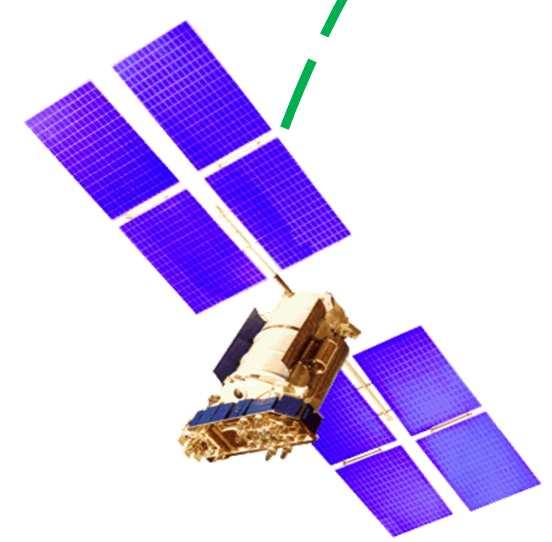
5 ISLNCS is designed for high-accuracy inter-satellite one-way measurements of pseudo-range for: - repeated determination of deviation of a S/C time scale drift with subnanosecond accuracy at every orbit, - integrity check of navigation field; - provision for global coverage with placement of S/C time synching systems on Russian territory only. Retroreflector array (AC 10 8 м 2 ) ISLNCS ISLNCS and retroreflector array onboard satellite GLONASS-M 5

6 ISLNCS measurement tasks are solved using high-accuracy counter-measurements of pseudo range between GLONASS navigation satellites Measurement data exchange is done using laser signals with time-pulse modulation Pseudo range differs from the range by difference between time scales multiplied by the speed of light. In case of counter-measurements, this value will be included in pseudo-range measurements with different signs. ISLNCS flight model Half-sum of counter pseudo-ranges is true range, and their half-distance unambiguously determines the shift of time scales between two S/C. 6

7 Problems solved by on-way SLR: - calibration of on-board and ground GMS equipment during in-flight operations; - synching remote ground clocks at accuracy levels not achievable by radio systems and mobile frequency standards Central time scale Retroreflector array GLONASS-M S/C On-board one-way SLR Remote clock time scale One-way range channel Two-way range measurement channel Schematics of synching of onboard time scale and ground time scale and transmission of time to a remote ground station using one-way SLR 7
8 Operating principle of the laser system for determination of difference between onboard and ground time scales The method of determination of difference between onboard and ground time scales is based on comparison of one-way and two-way distances measured at sub-centimeter levels. Half of a two-way range differs from the one-way pseudo range by shift between time scales multiplied by the speed of light. Determination of this shift is at the level of s. 8
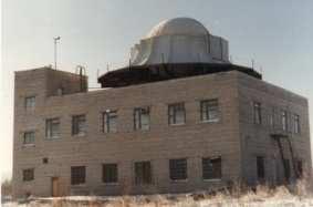
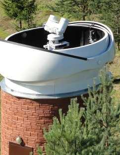
9 SLR Network 9
10 Problems solved by SLR network - calibration of active radio systems during their flight operations with sub-centimeter accuracy; - obtaining SLR, VLBI and GMS collocation data to provide GLONASS system with high-accuracy coordinate reference frame to ensure required accuracy of transfer of Federal Geocentric Coordinate System (FGCS) by GLONASS system; - evaluation of errors of representation of FGCS by GLONASS navigation field by comparison of SLR coordinates obtained from laser measurements of LAGEOS satellites with SLR coordinates obtained from laser measurements of GLONASS satellites; - check accuracy of calculation of high-accuracy ephemeris and time correction information SVOEVP. 10


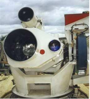
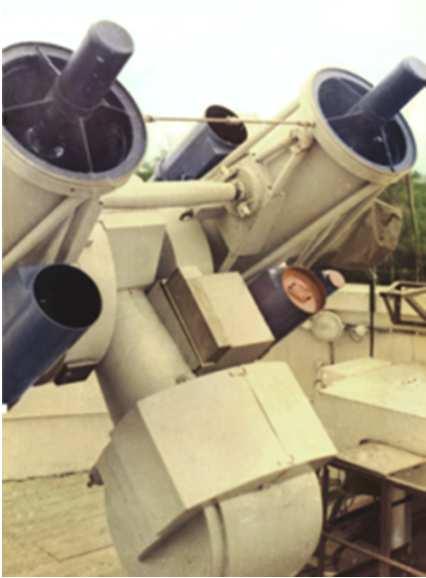
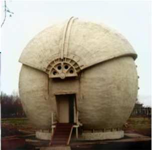
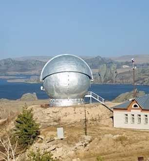
11 Shelkovo (Moscow Region) Svetloe SLR Komsomolsk-On-Amur Altai Baikonur 11
12 System for high-accuracy determination of ephemeris and time corrections (SVOEVP) Provision of real-time GLONASS ETS calculation of SD for NFAF models support support of GCS GSD Calculation of highaccuracy posterior data for provision of global positioning Solution of fundamental problems FGCS support geodynamic data calculation ETS Ephemeris and Time Support FGCS Federal Geocentric Coordinate System GCS Ground Control System GSD geodetic source data NF navigation field NFAF navigation frame accuracy factor PETI posterior ephemeris and time Information RT Real Time SD source data UNE user navigation equipment Information generalized evaluations of NF accuracy information bulletins Navigation provision in posterior mode PETI GLONASS (GPS) parameters of local models of stratosphere, ionosphere, etc. positioning in relative mode RT navigation support assisting technology remote calibration of UNE in the course of operation Support for navigation of dynamic users in FGCS 12
13 SLR measurements are used in SVOEVP GLONASS for solution of the following problems: check of transmission of the parameters of the Federal Geocentric Coordinate System (FGCS) to end users by GLONASS navigation signals; calculation of reference parameters and check of correspondence of parameters of the Federal Geocentric Coordinate System (FGCS) to the international reference frame (ITRF); check of posterior ephemeris information (PEI) of the SVOEVP using comparison of two-way laser measurement of slant ranges with ranges obtained from PEI; check of posterior time and frequency information using comparison of two-way SLR range with one way range obtained by on-board one-way SLR (or GMS); use of SLR measurements for calculation of velocities of ground stations motion for refinement and support of initial geodetic data of GLONASS ground control system; refinement of location determination of phase centers of satellite antennae systems and analysis of spacecraft attitude system work quality using comparison of one-way SLR and GMS data; calculation of calibration corrections of GLONASS navigation equipment, evaluation of accuracy of user navigation equipment; calculation of calibration corrections and check of accuracy of two-way and one-way radio measurement systems; support of malfunctioning GLONASS satellites in the case of partial and complete failure of onboard radio systems, including daytime observations. 13
14 Conclusion: Development of experimental and serial units of onboard and ground equipment is foreseen in the Federal Target Program Support, development and operation of GLONASS system in Creation of Laser GLONASS and, therefore, achievement of parity and, perhaps, superiority to the world level of potential accuracy of ephemeris and time support is a real deal in the near future. 14

15 Thank you for your attention!
Results of the PZ reference frame implementation to GLONASS
 Joint-stock company «RESEARCH-AND-PRODUCTION CORPORATION «PRECISION SYSTEMS AND INSTRUMENTS» Results of the PZ-90.11 reference frame implementation to GLONASS Speaker: Deputy General Director, Deputy Chief
About compliance of GLONASS S/C retroreflectors system with the requirements of International Laser Ranging Service standard
 FEDERAL SPACE AGENCY FGUP «Science-Research Institute for Precise Instrument Engineering» About compliance of GLONASS S/C retroreflectors system with the requirements of International Laser Ranging Service
Other Space Geodetic Techniques. E. Calais Purdue University - EAS Department Civil 3273
 Other Space Geodetic Techniques E. Calais Purdue University - EAS Department Civil 3273 ecalais@purdue.edu Satellite Laser Ranging = SLR Measurement of distance (=range) between a ground station and a
Other Space Geodetic Techniques. E. Calais Purdue University - EAS Department Civil 3273
 Other Space Geodetic Techniques E. Calais Purdue University - EAS Department Civil 3273 ecalais@purdue.edu Satellite Laser Ranging Measurement of distance (=range) between a ground station and a satellite
System Status and Performance Improvement Prospects
 Communication Геодезия Navigation GLOBAL NAVIGATION SATELLITE SYSTEM (GLONASS): System Status and Performance Improvement Prospects Viktor KOSENKO, First Deputy General Designer First Deputy General Director
Satellite Laser Retroreflectors for GNSS Satellites: ILRS Standard
 Satellite Laser Retroreflectors for GNSS Satellites: ILRS Standard Michael Pearlman Director Central Bureau International Laser Ranging Service Harvard-Smithsonian Center for Astrophysics Cambridge MA
National Reference Systems of the RUSSIAN FEDERATION, used in GLONASS. including the user and fundamental segments
 National Reference Systems of the RUSSIAN FEDERATION, used in GLONASS. including the user and fundamental segments 8-th Meeting of the International Committee on Global Navigation Satellite Systems Dubai,
Orbit Determination for CE5T Based upon GPS Data
 Orbit Determination for CE5T Based upon GPS Data Cao Jianfeng (1), Tang Geshi (2), Hu Songjie (3), ZhangYu (4), and Liu Lei (5) (1) Beijing Aerospace Control Center, 26 Beiqing Road, Haidian Disrtrict,
GLONASS: Current status and perspectives
 Federal Space Agency GLONASS: Current status and perspectives 3rd ALLSAT Open conference Hannover, June 22, 2006 Vyacheslav DVORKIN, Sergey KARUTIN Russian Institute of Space Device Engineering 53, Aviamotornaya
Evaluation of Potential Systematic Bias in GNSS Orbital Solutions
 Evaluation of Potential Systematic Bias in GNSS Orbital Solutions Graham M. Appleby Space Geodesy Facility, Natural Environment Research Council Monks Wood, Abbots Ripton, Huntingdon PE28 2LE, UK Toshimichi
GNSS: orbits, signals, and methods
 Part I GNSS: orbits, signals, and methods 1 GNSS ground and space segments Global Navigation Satellite Systems (GNSS) at the time of writing comprise four systems, two of which are fully operational and
Satellite Navigation Using GPS
 Satellite Navigation Using GPS T.J. Martín Mur & J.M. Dow Orbit Attitude Division, European Space Operations Centre (ESOC), Darmstadt, Germany Introduction The launch of the first Sputnik triggered the
GPS Geodetic Reference System WGS 84
 GPS Geodetic Reference System WGS 84 International Committee on GNSS Working Group D Saint Petersburg, Russia 16 September 2009 Barbara Wiley National Geospatial-Intelligence Agency United States of America
Space Situational Awareness 2015: GPS Applications in Space
 Space Situational Awareness 2015: GPS Applications in Space James J. Miller, Deputy Director Policy & Strategic Communications Division May 13, 2015 GPS Extends the Reach of NASA Networks to Enable New
Co-location on Ground and in Space; GGOS Core Site
 Co-location on Ground and in Space; GGOS Core Site Michael Pearlman/CfA Harald Schuh/TUW Erricos Pavlis/UMBC Unified Analysis Workshop Zurich, Switzerland September 16 17, 2011 NRC Report Precise Geodetic
GPS and GNSS from the International Geosciences Perspective
 GPS and GNSS from the International Geosciences Perspective G. Beutler Astronomical Institute, University of Bern Member of IAG Executive Committee and of IGS Governing Board National Space-Based Positioning,
INTRODUCTION The validity of dissertation Object of investigation Subject of investigation The purpose: of the tasks The novelty:
 INTRODUCTION The validity of dissertation. According to the federal target program "Maintenance, development and use of the GLONASS system for 2012-2020 years the following challenges were determined:
Challenges and Solutions for GPS Receiver Test
 Challenges and Solutions for GPS Receiver Test Presenter: Mirin Lew January 28, 2010 Agenda GPS technology concepts GPS and GNSS overview Assisted GPS (A-GPS) Basic tests required for GPS receiver verification
Global Navigation Satellite System (GLONASS): Status and Development
: Status and Development") Global Navigation Satellite System (GLONASS): Status and Development Tatiana Mirgorodskaya Information and Analysis Center for Positioning, Navigation and Timing Roscosmos State Corporation UN-Nepal Workshop
Global Navigation Satellite System (GLONASS): Status and Development Tatiana Mirgorodskaya Information and Analysis Center for Positioning, Navigation and Timing Roscosmos State Corporation UN-Nepal Workshop
Technology of Precise Orbit Determination
 Technology of Precise Orbit Determination V Seiji Katagiri V Yousuke Yamamoto (Manuscript received March 19, 2008) Since 1971, most domestic orbit determination systems have been developed by Fujitsu and
GNSS Reflectometry and Passive Radar at DLR
 ACES and FUTURE GNSS-Based EARTH OBSERVATION and NAVIGATION 26./27. May 2008, TU München Dr. Thomas Börner, Microwaves and Radar Institute, DLR Overview GNSS Reflectometry a joined proposal of DLR and
FieldGenius Technical Notes GPS Terminology
 FieldGenius Technical Notes GPS Terminology Almanac A set of Keplerian orbital parameters which allow the satellite positions to be predicted into the future. Ambiguity An integer value of the number of
VLBI and DDOR activities at ESOC
 VLBI and DDOR activities at ESOC Claudia Flohrer 1, Mattia Mercolino 2, Erik Schönemann 1, Tim Springer 1, Joachim Feltens 1, René Zandbergen 1, Werner Enderle 1, Trevor Morley 3 1) Navigation Support
Geodetic Reference Frame Theory
 Technical Seminar Reference Frame in Practice, Geodetic Reference Frame Theory and the practical benefits of data sharing Geoffrey Blewitt University of Nevada, Reno, USA http://geodesy.unr.edu Sponsors:
Understanding GPS/GNSS
 Understanding GPS/GNSS Principles and Applications Third Edition Contents Preface to the Third Edition Third Edition Acknowledgments xix xxi CHAPTER 1 Introduction 1 1.1 Introduction 1 1.2 GNSS Overview
The Geodetic Reference Antenna in Space (GRASP): A Mission to Enhance the Terrestrial Reference Frame
: A Mission to Enhance the Terrestrial Reference Frame") The Geodetic Reference Antenna in Space (GRASP): A Mission to Enhance the Terrestrial Reference Frame Yoaz Bar-Sever, R. Steven Nerem, and the GRASP Team The Most Complete Geodesy Mission Collocate all
The Geodetic Reference Antenna in Space (GRASP): A Mission to Enhance the Terrestrial Reference Frame Yoaz Bar-Sever, R. Steven Nerem, and the GRASP Team The Most Complete Geodesy Mission Collocate all
NASDA S PRECISE ORBIT DETERMINATION SYSTEM
 NASDA S PRECISE ORBIT DETERMINATION SYSTEM Maki Maeda Takashi Uchimura, Akinobu Suzuki, Mikio Sawabe National Space Development Agency of Japan (NASDA) Sengen 2-1-1, Tsukuba, Ibaraki, 305-8505, JAPAN E-mail:
GLONASS PROGRAMME UPDATE
 GLONASS PROGRAMME UPDATE Ivan Revnivykh Roscosmos State Space Corporation 11 th Meeting of the International Committee on Global Navigation Satellite System November 7, 2016 Sochi, Russian Federation CONTENTS
Update on the International Terrestrial Reference Frame (ITRF)
") Update on the International Terrestrial Reference Frame (ITRF) Zuheir Altamimi Head of the IERS ITRF Product Center Institut National de l Information Géographique et Forestière IGN, France E-mail: zuheir.altamimi@ign.fr
Update on the International Terrestrial Reference Frame (ITRF) Zuheir Altamimi Head of the IERS ITRF Product Center Institut National de l Information Géographique et Forestière IGN, France E-mail: zuheir.altamimi@ign.fr
Basics of Satellite Navigation an Elementary Introduction Prof. Dr. Bernhard Hofmann-Wellenhof Graz, University of Technology, Austria
 Basics of Satellite Navigation an Elementary Introduction Prof. Dr. Bernhard Hofmann-Wellenhof Graz, University of Technology, Austria Basic principles 1.1 Definitions Satellite geodesy (SG) comprises
Modern Navigation. Thomas Herring
 12.215 Modern Navigation Thomas Herring Summary of Last class Finish up some aspects of estimation Propagation of variances for derived quantities Sequential estimation Error ellipses Discuss correlations:
A GLONASS Observation Message Compatible With The Compact Measurement Record Format
 A GLONASS Observation Message Compatible With The Compact Measurement Record Format Leica Geosystems AG 1 Introduction Real-time kinematic (RTK) Global Navigation Satellite System (GNSS) positioning has
Multi-technique combination at observation level with NAPEOS
 Multi-technique combination at observation level with NAPEOS Michiel Otten, Claudia Flohrer, Tim Springer, Werner Enderle EGU General Assembly 2012 Vienna Austria 27/04/2012 Introduction Combination of
GLOBAL POSITIONING SYSTEMS. Knowing where and when
 GLOBAL POSITIONING SYSTEMS Knowing where and when Overview Continuous position fixes Worldwide coverage Latitude/Longitude/Height Centimeter accuracy Accurate time Feasibility studies begun in 1960 s.
Fundamentals of GPS Navigation
 Fundamentals of GPS Navigation Kiril Alexiev 1 /76 2 /76 At the traditional January media briefing in Paris (January 18, 2017), European Space Agency (ESA) General Director Jan Woerner explained the knowns
Clock Synchronization of Pseudolite Using Time Transfer Technique Based on GPS Code Measurement
 , pp.35-40 http://dx.doi.org/10.14257/ijseia.2014.8.4.04 Clock Synchronization of Pseudolite Using Time Transfer Technique Based on GPS Code Measurement Soyoung Hwang and Donghui Yu* Department of Multimedia
GPS and Recent Alternatives for Localisation. Dr. Thierry Peynot Australian Centre for Field Robotics The University of Sydney
 GPS and Recent Alternatives for Localisation Dr. Thierry Peynot Australian Centre for Field Robotics The University of Sydney Global Positioning System (GPS) All-weather and continuous signal system designed
Applications, Products and Services of GPS Technology
 Applications, Products and Services of GPS Technology Enrico C. Paringit. Dr. Eng. University of the Philippines Training Center for Applied Geodesy and Photogrammetry 1 Outline of this Presentation GPS
THE GLOBAL NAVIGATION SATELLITE SYSTEM GLONASS: DEVELOPMENT AND USAGE IN THE 21ST CENTURY
 THE GLOBAL NAVIGATION SATELLITE SYSTEM GLONASS: DEVELOPMENT AND USAGE IN THE 21ST CENTURY Mr. G. M. Polischuk, Mr. V. I. Kozlov Russian Aerospace Agency Schepkina 42, Moscow 129090, Russia Tel: (+7-095)
The International GNSS Service (IGS): Product and Services
: Product and Services") The International GNSS Service (IGS): Product and Services Ruth E. Neilan 1, Chris Rizos 2 1 Director, IGS Central Bureau, NASA/JPL, Pasadena, USA 2 VP IAG, IGS Governing Board, UNSW, Sydney, Australia
The International GNSS Service (IGS): Product and Services Ruth E. Neilan 1, Chris Rizos 2 1 Director, IGS Central Bureau, NASA/JPL, Pasadena, USA 2 VP IAG, IGS Governing Board, UNSW, Sydney, Australia
GLObal Navigation Satellite System (GLONASS)
") FEDERAL SPACE AGENCY GLObal Navigation Satellite System (GLONASS) Sergey Revnivykh Deputy Director General Central Research Institute of Machine Building Head of PNT Center 4-th meeting of International
FEDERAL SPACE AGENCY GLObal Navigation Satellite System (GLONASS) Sergey Revnivykh Deputy Director General Central Research Institute of Machine Building Head of PNT Center 4-th meeting of International
Aaron J. Dando Principle Supervisor: Werner Enderle
 Aaron J. Dando Principle Supervisor: Werner Enderle Australian Cooperative Research Centre for Satellite Systems (CRCSS) at the Queensland University of Technology (QUT) Aaron Dando, CRCSS/QUT, 19 th AIAA/USU
The realization of a 3D Reference System
 The realization of a 3D Reference System Standard techniques: topographic surveying and GNSS Observe angles and distances either between points on the Earth surface or to satellites and stars. Do not observe
Prospects for Status and Development of GLONASS System Space Complex
 Prospects for Status and Development of GLONASS System Space Complex JSC M.F. Reshetnev Information Satellite Systems 9 14 of November2013, Dubai, UAE The Basis for Future Space Complex Development GLONASS
Application of GNSS for the high orbit spacecraft navigation
 Application of GNSS for the high orbit spacecraft navigation JSC Academician M.F.Reshetnev Information Satellite Systems V. Kosenko, A. Grechkoseev, M. Sanzharov ICG-8 WG-B, Dubai, UAE November 2013 Objectives
SLR residuals to GPS / GLONASS and combined GNSS-SLR analysis
 SLR residuals to GPS / GLONASS and combined GNSS-SLR analysis D. Thaller, K. Sośnica, R. Dach, A. Jäggi, C. Baumann Astronomical Institute, University of Bern, Switzerland International Technical Laser
IAG School on Reference Systems June 7 June 12, 2010 Aegean University, Department of Geography Mytilene, Lesvos Island, Greece SCHOOL PROGRAM
 IAG School on Reference Systems June 7 June 12, 2010 Aegean University, Department of Geography Mytilene, Lesvos Island, Greece SCHOOL PROGRAM Monday June 7 8:00-9:00 Registration 9:00-10:00 Opening Session
2. GPS and GLONASS Basic Facts
 2. GPS and GLONASS Basic Facts In 1973 the U.S. Department of Defense decided to establish, develop, test, acquire, and deploy a spaceborne Global Positioning System (GPS). The result of this decision
Resection. We can measure direction in the real world! Lecture 10: Position Determination. Resection Example: Isola, Slovenia. Professor Keith Clarke
 Geography 12: Maps and Spatial Reasoning Lecture 10: Position Determination We can measure direction in the real world! Professor Keith Clarke Resection Resection Example: Isola, Slovenia Back azimuth
ASSEMBLY 37TH SESSION
 International Civil Aviation Organization WORKING PAPER A37-WP/195 1 22/9/10 (Information paper) ASSEMBLY 37TH SESSION TECHNICAL COMMISSION Agenda Item 35: The Global Air Traffic Management (ATM) System
Principles of the Global Positioning System Lecture 19
 12.540 Principles of the Global Positioning System Lecture 19 Prof. Thomas Herring http://geoweb.mit.edu/~tah/12.540 GPS Models and processing Summary: Finish up modeling aspects Rank deficiencies Processing
Real-Time and Multi-GNSS Key Projects of the International GNSS Service
 Real-Time and Multi-GNSS Key Projects of the International GNSS Service Urs Hugentobler, Chris Rizos, Mark Caissy, Georg Weber, Oliver Montenbruck, Ruth Neilan EUREF 2013 Symposium Budapest, Hungary, May
Developing An Optical Ground Station For The CHOMPTT CubeSat Mission. Tyler Ritz
 Developing An Optical Ground Station For The CHOMPTT CubeSat Mission Tyler Ritz tritz@ufl.edu Background and Motivation Application of precision time transfer to space Satellite navigation systems ( x
THE CREATION OF DIFFERENTIAL CORRECTION SYSTEMS AND THE SYSTEMS OF GLOBAL NAVIGATION SATELLITE SYSTEM MONITORING
 THE CREATION OF DIFFERENTIAL CORRECTION SYSTEMS AND THE SYSTEMS OF GLOBAL NAVIGATION SATELLITE SYSTEM MONITORING G. M. Polishchuk, V. I. Kozlov, Y. M. Urlichich, V. V. Dvorkin, and V. V. Gvozdev Russian
ICG WG-B Achievements on Interoperable GNSS Space Service Volume (SSV) November, 2016 Sochi, Russian Federation
 November, 2016 Sochi, Russian Federation") ICG WG-B Achievements on Interoperable GNSS Space Service Volume (SSV) November, 2016 Sochi, Russian Federation ICG WG-B Action Group on SSV Action group on SSV was formed within WG-B in order to Establish
ICG WG-B Achievements on Interoperable GNSS Space Service Volume (SSV) November, 2016 Sochi, Russian Federation ICG WG-B Action Group on SSV Action group on SSV was formed within WG-B in order to Establish
GNSS & Coordinate Systems
 GNSS & Coordinate Systems Matthew McAdam, Marcelo Santos University of New Brunswick, Department of Geodesy and Geomatics Engineering, Fredericton, NB May 29, 2012 Santos, 2004 msantos@unb.ca 1 GNSS GNSS
CONSIDERATIONS FOR GNSS MEASUREMENTS
 CONSIDERATIONS FOR GNSS MEASUREMENTS Cornel PĂUNESCU 1, Cristian VASILE 2, Cosmin CIUCULESCU 3 1 PhD University of Bucharest, e-mail: cornelpaun@gmail.com 2 Lecturer PhD University of Craiova, cristi_vasile_4you@yahoo.com
3-9 High Accuracy Clock (HAC)
") 3-9 High Accuracy Clock (HAC) NODA Hiroyuki, SANO Kazuhiko, and HAMA Shin ichi To obtain the basic technology of satellite positioning system, NASDA will conduct the experiments of ETS-VIII high accurate
3-9 High Accuracy Clock (HAC) NODA Hiroyuki, SANO Kazuhiko, and HAMA Shin ichi To obtain the basic technology of satellite positioning system, NASDA will conduct the experiments of ETS-VIII high accurate
Global Navigation Satellite Systems (GNSS)Part I EE 570: Location and Navigation
Part I EE 570: Location and Navigation") Lecture Global Navigation Satellite Systems (GNSS)Part I EE 570: Location and Navigation Lecture Notes Update on April 25, 2016 Aly El-Osery and Kevin Wedeward, Electrical Engineering Dept., New Mexico
Lecture Global Navigation Satellite Systems (GNSS)Part I EE 570: Location and Navigation Lecture Notes Update on April 25, 2016 Aly El-Osery and Kevin Wedeward, Electrical Engineering Dept., New Mexico
Volume 8, ISSN (Online), Published at:
, Published at:") DEVELOPMENT OF INFORMATION AND TELECOMMUNICATION AND SPACE TECHNOLOGIES USING NEW MECHANISMS OF TECHNOLOGICAL PLATFORMS Igor V. Kovalev, Yuri Y. Loginov, Pavel V. Zelenkov Siberian State Aerospace University
DEVELOPMENT OF INFORMATION AND TELECOMMUNICATION AND SPACE TECHNOLOGIES USING NEW MECHANISMS OF TECHNOLOGICAL PLATFORMS Igor V. Kovalev, Yuri Y. Loginov, Pavel V. Zelenkov Siberian State Aerospace University
PRECISE RECEIVER CLOCK OFFSET ESTIMATIONS ACCORDING TO EACH GLOBAL NAVIGATION SATELLITE SYSTEMS (GNSS) TIMESCALES
 TIMESCALES") ARTIFICIAL SATELLITES, Vol. 52, No. 4 DOI: 10.1515/arsa-2017-0009 PRECISE RECEIVER CLOCK OFFSET ESTIMATIONS ACCORDING TO EACH GLOBAL NAVIGATION SATELLITE SYSTEMS (GNSS) TIMESCALES Thayathip Thongtan National
ARTIFICIAL SATELLITES, Vol. 52, No. 4 DOI: 10.1515/arsa-2017-0009 PRECISE RECEIVER CLOCK OFFSET ESTIMATIONS ACCORDING TO EACH GLOBAL NAVIGATION SATELLITE SYSTEMS (GNSS) TIMESCALES Thayathip Thongtan National
Current status of Quasi-Zenith Satellite System. Japan Aerospace Exploration Agency QZSS Project Team
 Current status of Quasi-Zenith Satellite System Japan Aerospace Exploration Agency QZSS Project Team 1 Quasi-Zenith Satellite System The QZSS is a regional space-based PNT (Positioning, Navigation and
ESTIMATION OF IONOSPHERIC DELAY FOR SINGLE AND DUAL FREQUENCY GPS RECEIVERS: A COMPARISON
 ESTMATON OF ONOSPHERC DELAY FOR SNGLE AND DUAL FREQUENCY GPS RECEVERS: A COMPARSON K. Durga Rao, Dr. V B S Srilatha ndira Dutt Dept. of ECE, GTAM UNVERSTY Abstract: Global Positioning System is the emerging
A CubeSat-Based Optical Communication Network for Low Earth Orbit
 A CubeSat-Based Optical Communication Network for Low Earth Orbit Richard Welle, Alexander Utter, Todd Rose, Jerry Fuller, Kristin Gates, Benjamin Oakes, and Siegfried Janson The Aerospace Corporation
Brazil and Russia space cooperation: recent projects and future perspectives in the field of GNSS monitoring and SLR stations
 Brazil and Russia space cooperation: recent projects and future perspectives in the field of GNSS monitoring and SLR stations Renato A. Borges (UnB) and Geovany A. Borges (UnB) Emails: raborges@ene.unb.br
SOME ASPECT AND PERSPECTIVES OF IMPLEMENTATION OF THE NATIONAL POLICY IN THE FIELD OF EXPLORATION AND PEACEFUL USES OF OUTER SPACE
 SOME ASPECT AND PERSPECTIVES OF IMPLEMENTATION OF THE NATIONAL POLICY IN THE FIELD OF EXPLORATION AND PEACEFUL USES OF OUTER SPACE 1 Folie 1 NKS Raumfahrt, Dr. Adrian klein Background National Academy
Optical Time Transfer for Future Disaggregated Small Satellite Navigation Systems
 Optical Time Transfer for Future Disaggregated Small Satellite Navigation Systems John W. Conklin*, Nathan Barnwell, Leopoldo Caro, Maria Carrascilla, Olivia Formoso, Seth Nydam, Paul Serra, Norman Fitz-Coy
Current State and Future Developments of the IVS and Geodetic VLBI. H. Schuh, D. Behrend, A. Niell, B. Petrachenko, and R.
 Current State and Future Developments of the IVS and Geodetic VLBI H. Schuh, D. Behrend, A. Niell, B. Petrachenko, and R. Heinkelmann Bologna, 26-Sept-2008 Geodetic VLBI Unique technique for CRF Precession/Nutation
GPS the Interdisciplinary Chameleon: How Does it do That?
 GPS the Interdisciplinary Chameleon: How Does it do That? Geoff Blewitt Nevada Bureau of Mines and Geology & Seismological Laboratory University of Nevada, Reno, USA Cool Science using GPS Application
Relative Navigation, Timing & Data. Communications for CubeSat Clusters. Nestor Voronka, Tyrel Newton
 Relative Navigation, Timing & Data Communications for CubeSat Clusters Nestor Voronka, Tyrel Newton Tethers Unlimited, Inc. 11711 N. Creek Pkwy S., Suite D113 Bothell, WA 98011 425-486-0100x678 voronka@tethers.com
Introduction to Geographic Information Science. Last Lecture. Today s Outline. Geography 4103 / GNSS/GPS Technology
 Geography 4103 / 5103 Introduction to Geographic Information Science GNSS/GPS Technology Last Lecture Geoids Ellipsoid Datum Projection Basics Today s Outline GNSS technology How satellite based navigation
GPS for. Land Surveyors. Jan Van Sickle. Fourth Edition. CRC Press. Taylor & Francis Group. Taylor & Francis Croup, an Informa business
 GPS for Land Surveyors Fourth Edition Jan Van Sickle CRC Press Taylor & Francis Group Boca Raton London New York CRC Press is an imprint of the Taylor & Francis Croup, an Informa business Contents Preface
TrigNet: The South African Network of Continuously Operating GNSS Base Stations
 TrigNet: The South African Network of Continuously Operating GNSS Base Stations R Wonnacott ESESA User Need Workshop Thread 2: Status of Current GNSS Applications in South Africa Somerset West 2 March
Time and frequency transfer methods based on GNSS. LIANG Kun, National Institute of Metrology(NIM), China
, China") Time and frequency transfer methods based on GNSS LIANG Kun, National Institute of Metrology(NIM), China Outline Remote time and frequency transfer GNSS time and frequency transfer methods Data and results
Time and frequency transfer methods based on GNSS LIANG Kun, National Institute of Metrology(NIM), China Outline Remote time and frequency transfer GNSS time and frequency transfer methods Data and results
Monitoring the Earth Surface from space
 Monitoring the Earth Surface from space Picture of the surface from optical Imagery, i.e. obtained by telescopes or cameras operating in visual bandwith. Shape of the surface from radar imagery Surface
IGS workshop 2018 Multi-GNSS through Global Collaboration Datum: 29 October - 2 November 2018 Plats: Wuhan, China Deltagare: Tong Ning (I0101)
") 2018-11-19 RESERAPPORT IGS workshop 2018 Multi-GNSS through Global Collaboration Datum: 29 October - 2 November 2018 Plats: Wuhan, China Deltagare: Tong Ning (I0101) Syfte med mötet The workshop programme
2018-11-19 RESERAPPORT IGS workshop 2018 Multi-GNSS through Global Collaboration Datum: 29 October - 2 November 2018 Plats: Wuhan, China Deltagare: Tong Ning (I0101) Syfte med mötet The workshop programme
Global Navigation Satellite Systems II
 Global Navigation Satellite Systems II AERO4701 Space Engineering 3 Week 4 Last Week Examined the problem of satellite coverage and constellation design Looked at the GPS satellite constellation Overview
VLBI processing at ESOC
 VLBI processing at ESOC Claudia Flohrer, Erik Schönemann, Tim Springer, René Zandbergen, Werner Enderle ESOC - Navigation Support Office (OPS-GN), Darmstadt, Germany 9th IVS General Meeting Johannesburg
Global GPS-VLBI Hybrid Observation. Younghee Kwak
 Global GPS-VLBI Hybrid Observation Younghee Kwak Classical VLBI vs. Space Craft Tracking plane wave front stable sources curved wave front fast moving sources Plank(2013) 2/20 Space craft tracking by VieVS2tie
GalileoSat System Simulation Facility (GSSF)
") GalileoSat System Simulation Facility (GSSF) VEGA Informations-Technologien GmbH Slide 1 Introduction GSSF Project Overview GSSF Requirements The GSSF System ❽ Components ❽ User Interface ❽ Technology
GalileoSat System Simulation Facility (GSSF) VEGA Informations-Technologien GmbH Slide 1 Introduction GSSF Project Overview GSSF Requirements The GSSF System ❽ Components ❽ User Interface ❽ Technology
USING GLONASS SIGNAL FOR CLOCK SYNCHRONIZATION
 USING GLONASS SIGNAL FOR CLOCK SYNCHRONIZATION Prof. Yuri G.Gouzhva, Prof. Anid G.Gevorkyan, Dr. Pyotr P.Eogdanov, Dr. Vitaly V. Ovchinnikov Russian Institute of Radionavigation and Time 2, Rastrelli square,
Views on Interoperability
 Views on Interoperability International Committee on Global Navigation Satellite Systems Prague, November 10 th 14 th 2014 Navigation solutions powered by Europe INTRODUCTION The original purpose of the
Where Next for GNSS?
 Where Next for GNSS? Professor Terry Moore Professor of Satellite Navigation Nottingham The University of Nottingham Where Next for GNSS Back to the Future? Professor Terry Moore Professor of Satellite
DYNAMIC POSITIONING CONFERENCE October 7-8, Sensors II. Redundancy in Dynamic Positioning Systems Based on Satellite Navigation
 Return to Session Directory DYNAMIC POSITIONING CONFERENCE October 7-8, 2008 Sensors II Redundancy in Dynamic Positioning Systems Based on Satellite Navigation Ole Ørpen, Tor Egil Melgård, Arne Norum Fugro
EE 570: Location and Navigation
 EE 570: Location and Navigation Global Navigation Satellite Systems (GNSS) Part I Aly El-Osery Kevin Wedeward Electrical Engineering Department, New Mexico Tech Socorro, New Mexico, USA In Collaboration
Overview of New Datums
 Overview of New Datums Scott Lokken NC Advisor NOAA s National Geodetic Survey 9/4/2015 1 New Datums are Coming in 2022! Both a new geometric and a new geopotential (vertical) datum will be released in
Guochang Xu GPS. Theory, Algorithms and Applications. Second Edition. With 59 Figures. Sprin ger
 Guochang Xu GPS Theory, Algorithms and Applications Second Edition With 59 Figures Sprin ger Contents 1 Introduction 1 1.1 AKeyNoteofGPS 2 1.2 A Brief Message About GLONASS 3 1.3 Basic Information of Galileo
The Promise and Challenges of Accurate Low Latency GNSS for Environmental Monitoring and Response
 Technical Seminar Reference Frame in Practice, The Promise and Challenges of Accurate Low Latency GNSS for Environmental Monitoring and Response John LaBrecque Geohazards Focus Area Global Geodetic Observing
GLONASS Status and Modernization
 GLONASS Status and Modernization Ekaterina Oleynik Central Research Institute of Roscosmos Federal Space Agency United Nations/Latvia Workshop on the Applications of Global Navigation Satellite Systems
National time scale UTC(SU) and GLONASS system time scale: current status and perspectives
 and GLONASS system time scale: current status and perspectives") State Scientific Center of the Russian Federation National Research Institute for Physical-Technical and Radio Engineering Measurements National time scale UTC(SU) and GLONASS system time scale: current
State Scientific Center of the Russian Federation National Research Institute for Physical-Technical and Radio Engineering Measurements National time scale UTC(SU) and GLONASS system time scale: current
Processing 20 years of SLR observations to GNSS satellites
 Processing 20 years of SLR observations to GNSS satellites K. Sośnica (1, 2), R. Dach (1), D. Thaller (3), A. Jäggi (1), G. Beutler (1), D. Arnold (1) (1) Astronomical Institute, University of Bern, Sidlerstrasse
Traceability measurement results of accurate time and frequency in Bosnia and Herzegovina
 INFOTEH-JAHORINA Vol. 11, March 2012. Traceability measurement results of accurate time and frequency in Bosnia and Herzegovina Osman Šibonjić, Vladimir Milojević, Fatima Spahić Institute of Metrology
Understanding GPS: Principles and Applications Second Edition
 Understanding GPS: Principles and Applications Second Edition Elliott Kaplan and Christopher Hegarty ISBN 1-58053-894-0 Approx. 680 pages Navtech Part #1024 This thoroughly updated second edition of an
COMPARISON BETWEEN BROADCAST AND PRECISE ORBITS: GPS GLONASS GALILEO AND BEIDOU. A. Caporali and L. Nicolini University of Padova, Italy
 COMPARISON BETWEEN BROADCAST AND PRECISE ORBITS: GPS GLONASS GALILEO AND BEIDOU A. Caporali and L. Nicolini University of Padova, Italy Summary Previous works Input data and method used Comparison between
Russian Federation in GNSS Open Service Performance Parameters Template Creation
 Russian Federation in GNSS Open Service Performance Parameters Template Creation Bolkunov Alexey Russian Federal Space Agency Central Scientific-Research Institute for Machine building Information and
T2L2 ON JASON-2: FIRST EVALUATION OF THE FLYING MODEL
 T2L2 ON JASON-2: FIRST EVALUATION OF THE FLYING MODEL Ph. Guillemot, I. Petitbon Microwave & Time-Frequency Department CNES French Space Agency Toulouse, France E. Samain, P. Vrancken, J. Weick, D. Albanese,
Korea Astronomy and Space Science Institute 2. National Institute of Information and Communications Technology 3. Ajou University 4.
 Kwak, Younghee 1 Tetsuro Kondo 2, Tadahiro Gotoh 2, Jun Amagai 2, Hiroshi Takiguchi 2, Mamoru Sekido 2, Ryuichi Ichikawa 2, Tetsuo Sasao 4, Junghe Cho 1, Tuhwan Kim 3 1 Korea Astronomy and Space Science
SDCM present status and future. GLONASS signals development.
 The Eighth Meeting of the International Committee on Global Navigation Satellite Systems, November 9 14, 2013, Dubai SDCM present status and future. GLONASS signals development. Prof. Grigory Stupak, Dr.
Including GNSS Based Heading in Inertial Aided GNSS DP Reference System
 Author s Name Name of the Paper Session DYNAMIC POSITIONING CONFERENCE October 9-10, 2012 Sensors II SESSION Including GNSS Based Heading in Inertial Aided GNSS DP Reference System By Arne Rinnan, Nina
Space geodetic techniques for remote sensing the ionosphere
 Space geodetic techniques for remote sensing the ionosphere Harald Schuh 1,2, Mahdi Alizadeh 1, Jens Wickert 2, Christina Arras 2 1. Institute of Geodesy and Geoinformation Science, Technische Universität