Architecture, implementation and application of soil moisture in-situ sensor
|
|
|
- Aldous Benson
- 5 years ago
- Views:
Transcription
1 Architecture, implementation and application of soil moisture in-situ sensor network across Canadian agricultural landscapes Xiaoyuan Geng 1, Heather McNairn 1, Patrick Rollin 1, Jessika L Heureux 1, Catherine Champagne 1, Jiali Shang 1, Steve Liang 2 1. Science and Technology Branch, Agriculture & Agri-Food Canada, Ottawa, Ontario, Canada 2. University Calgary, Alberta, Canada World Geospatial Forum, Geneva, May, 2014
2 Agenda Business requirements In-situ sensor network design and implementation Sensor calibration and QA/QC Data management and access Application and use cases 2
3 Business requirements Departmental needs Cost-effectively validate SAR derived soil moisture map Provide representative soil moisture data to modellers Added business case for NASA field campaign for SMAP cal/val Producers would like to access the data collected from their farms via Internet or smart phone. To meet departmental priorities in the area of Science and Innovation 3
4 In-situ sensor network design and implementation 4


5 Sensor Web architecture AAFC Ontario Web based PC access AAFC Manitoba University Calgary WAP based mobile access to most current data SMS/ warnings Others sensor net In-situ sensor net/web servers with OGC sensor web protocol suit Server-to-server data replication Nipissing Sensor net A2A ASCII export server EC Saskatchewan addupi XML based thirdparty application connectivity 5
6 Architecture of our use case Public users AAFC sensor web server Other sensor web servers Nipissing University sensor web server U. Of Calgary GeoSENS server 6
7 Star-network based insitu-senor web 7
8 Descriptive view of the system 8


9 In-situ station design 9


10 In-situ sensor station installation 10


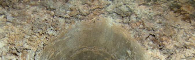
11 Installing Soil Probes 11


12 Notes on installation and site configuration 12
13 Sensor calibration and QA/QC 13
14 Notes on calibration Four calibration methods have been studied in Casselman site Hydroa probe default loam setting uses a calibration equation and the coefficients for the equation are averages of the coefficients from 20 soils. Site specific calibration a regression for each soil (Kennedy et al. 2003), to transform the real dielectric constant values to more closely match the gravimetrically determined volumetric moisture content value. Soil texture and pedology based empirical method uses calibration curve for each soil class on the soil texture triangle (Bellingham, 2007), was used to obtain the volumetric soil moisture from real dielectric constant Using model developed by Peplinski et al., 1995 A semi-empirical dielectric mixture model 14

15 Notes on calibration Based on our calibration test, the performance of Bellingham method is comparatively better than other methods and the Bellingham method can be used to convert soil moisture station real dielectric readings to Table 3: Texture based volumetric calibration equations moisture content. Location Sand % Clay % Silt % Stevens s texture class Calibration equations S1-5cm Clay S1-20cm Clay VMC = ( RDC RDC RDC ) / 100 VMC = ( RDC RDC RDC ) / 100 S1-50cm Clay/Clay loam = SQRT(RDC) S2-5cm Loam =0.109 SQRT(RDC) S2-20cm Loam =0.117 SQRT(RDC) S2-50cm Sandy loam = SQRT(RDC) S3-5cm Clay S3-20cm Clay VMC = ( RDC RDC RDC ) / 100 VMC = ( RDC RDC RDC ) / 100 S3-50cm Silty clay = SQRT(RDC)
16 Notes on calibration 16
17 Data management and access 17
18 Data access via Sensor Web World Wide Web provides enormous distributed computing resources. Sensor Web leveraging Internet protocols connects distributed and networked heterogeneous in-situ and remote sensors. An effective Sensor Web should be constructed using interoperable protocols and application interfaces. A Sensor Web is achieved by connecting the to information centers/servers/nodes that store, disseminate, exchange, display, and manage the sensed information. 18
19 Data access with interoperable API The Sensor Observation Service (SOS) is a web service to query real-time sensor data and sensor data time series and is part of the Sensor Web. The offered sensor data comprises descriptions of sensors themselves, which are encoded in the Sensor Model Language (SensorML), and the measured values in the Observations and Measurements (O & M) encoding format. The web service as well as both file formats are open standards and specifications of the same name defined by the Open Geospatial Consortium (OGC). Source: Wikipedia 19
20 Data access: SOS xml stream 20
21 GeoCENS Portal a SOS use case Created and maintained by ServerUp Current contract with ServerUp includes improving data downloading capability and generating a data summary window when viewing latest data from a station 21
22 Data summary and visualization The data summary table will be achievable and downloadable and will contain something like the following data: Date/time of last reading: June 14, :00 CST or EST Current Conditions (past hour): Air Temp: 25.3 C Relative Humidity: 50 % Wind Direction: WSW / 241 Wind Speed: 19 km/h Max Wind Speed: 30 km/h Min Wind Speed: 12 km/h Precip, past hour (or 15 min): 0 mm Precip, since midnight: 2.1 mm Conditions Previous 24 Hours or previous day (June 13, 2013 ) Total Precip: 1.4 mm Min Air Temp: 13.1 C Max Air Temp: 27.3 C Ave Air Temp: 20.2 C Ave RH: 60.3 % Ave Wind Direction: SW / 240 Ave Wind Speed: 20.1 km/h 22
23 Data access: download The archived summary data can be downloaded by the general public The complete data set can currently be downloaded by the public as long as they register and log in. 23
24 Application and use cases 24


.")
25 In-situ data for SMAP sensor cal/val Objectives: SMAP will provide global measurements of soil moisture and its freeze/thaw state. These measurements will be used to enhance understanding of processes that link the water, energy and carbon cycles, and to extend the capabilities of weather and climate prediction models. SMAP data will also be used to quantify net carbon flux in boreal landscapes and to develop improved flood prediction and drought monitoring capabilities. Observatory: The SMAP observatory employs a dedicated spacecraft with an instrument suite that will be launched on an expendable launch vehicle into a 680-km near-polar, sun-synchronous orbit, with equator crossings at 6 am and 6 pm local time. Instrument: The SMAP instrument includes a radiometer and a synthetic aperture radar operating at L-band ( GHz). The instrument is designed to make coincident measurements of surface emission and backscatter, with the ability to sense the soil conditions through moderate vegetation cover. The instrument measurements will be analyzed to yield estimates of soil moisture and freeze/thaw state. The measurement swath width is 1000 km, providing global coverage within 3 days at the equator and 2 days at boreal latitudes (>45 degrees N). Operations: SMAP science measurements will be acquired for a period of three years. A comprehensive validation program will be carried out after launch to assess the accuracies of the soil moisture and freeze/thaw estimates. Data products from the SMAP mission will be made available through a NASAdesignated data center. 25


26 SAR derived soil moisture validation Soil moisture maps retrieved from RADARSAT-2 image pairs using the hybrid inversion method. A. Merzouki, H. McNairn, X. Geng, P. Rollin, R. Han, 9th Advanced SAR Workshop, October 2013, Montreal 26
27 SAR derived soil moisture validation Station 1 Station 2 Station 3 Station 4 Temporal evolution of soil moisture data sets for each in situ station. A. Merzouki, H. McNairn, X. Geng, P. Rollin, R. Han, 9th Advanced SAR Workshop, October 2013, Montreal 27
28 Extended in-situ sensor for pivot monitoring 28
29 Thank you! Contact: Tel
Soil moisture retrieval using ALOS PALSAR
 Soil moisture retrieval using ALOS PALSAR T. J. Jackson, R. Bindlish and M. Cosh USDA ARS Hydrology and Remote Sensing Lab, Beltsville, MD J. Shi University of California Santa Barbara, CA November 6,
SMAP Overview. Ron Weaver Slides li0ed from Barry Weiss and Jennifer Cruz at JPL Barry Weiss. Jet Propulsion Laboratory
 http://smap.jpl.nasa.gov/ SMAP Overview Ron Weaver Slides li0ed from Barry Weiss and Jennifer Cruz at JPL Barry Weiss Jet Propulsion Laboratory California Ins7tute of Technology Pasadena, CA Copyright
Microwave Sensors Subgroup (MSSG) Report
 Report") Microwave Sensors Subgroup (MSSG) Report Feb 17-20, 2014, ESA ESRIN, Frascati, Italy DONG, Xiaolong, MSSG Chair National Space Science Center Chinese Academy of Sciences (MiRS,NSSC,CAS) Email: dongxiaolong@mirslab.cn
Microwave Sensors Subgroup (MSSG) Report Feb 17-20, 2014, ESA ESRIN, Frascati, Italy DONG, Xiaolong, MSSG Chair National Space Science Center Chinese Academy of Sciences (MiRS,NSSC,CAS) Email: dongxiaolong@mirslab.cn
Aquarius/SAC-D and Soil Moisture
 Aquarius/SAC-D and Soil Moisture T. J. Jackson P. O Neill February 24, 2011 Aquarius/SAC-D and Soil Moisture + L-band dual polarization + Combined active and passive Coarse spatial resolution (~100 km)
Microwave Sensors Subgroup (MSSG) Report
 Report") Microwave Sensors Subgroup (MSSG) Report CEOS WGCV-35 May 13-17, 2013, Shanghai, China DONG, Xiaolong, MSSG Chair CAS Key Laboratory of Microwave Remote Sensing National Space Science Center Chinese Academy
Microwave Sensors Subgroup (MSSG) Report CEOS WGCV-35 May 13-17, 2013, Shanghai, China DONG, Xiaolong, MSSG Chair CAS Key Laboratory of Microwave Remote Sensing National Space Science Center Chinese Academy
Sub-Mesoscale Imaging of the Ionosphere with SMAP
 Sub-Mesoscale Imaging of the Ionosphere with SMAP Tony Freeman Xiaoqing Pi Xiaoyan Zhou CEOS Workshop, ASF, Fairbanks, Alaska, December 2009 1 Soil Moisture Active-Passive (SMAP) Overview Baseline Mission
SMAP Hands-On. ARSET Applied Remote Sensing Training. Jul. 20,
 National Aeronautics and Space Administration ARSET Applied Remote Sensing Training http://arset.gsfc.nasa.gov @NASAARSET SMAP Hands-On Jul. 20, 2016 www.nasa.gov Outline 1. Data products overview 2. Discovering
High-Resolution Enhanced Product Based on SMAP Active-Passive Approach using Sentinel 1A and 1B SAR Data
 High-Resolution Enhanced Product Based on SMAP Active-Passive Approach using Sentinel 1A and 1B SAR Data Narendra N. Das 1, Dara Entekhabi 2, Seungbum Kim 1, Scott Dunbar 1, Andreas Colliander 1 Simon
AGRICULTURE LAND USE MAPPING USING MULTI-SENSOR AND MULTI- TEMPORAL EARTH OBSERVATION DATA INTRODUCTION
 AGRICULTURE LAND USE MAPPING USING MULTI-SENSOR AND MULTI- TEMPORAL EARTH OBSERVATION DATA Jiali Shang Catherine Champagne Heather McNairn Agriculture and Agri-Food Canada 960 Carling Avenue, Ottawa, ON,
Monitoring Natural Disasters with Small Satellites Smart Satellite Based Geospatial System for Environmental Protection
 Monitoring Natural Disasters with Small Satellites Smart Satellite Based Geospatial System for Environmental Protection Krištof Oštir, Space-SI, Slovenia Contents Natural and technological disasters Current
Description of the Instruments and Algorithm Approach
 Description of the Instruments and Algorithm Approach Passive and Active Remote Sensing SMAP uses active and passive sensors to measure soil moisture National Aeronautics and Space Administration Applied
Passive Microwave Sensors LIDAR Remote Sensing Laser Altimetry. 28 April 2003
 Passive Microwave Sensors LIDAR Remote Sensing Laser Altimetry 28 April 2003 Outline Passive Microwave Radiometry Rayleigh-Jeans approximation Brightness temperature Emissivity and dielectric constant
Soil Moisture Observation Utilizing Reflected GNSS Signals
 Soil Moisture Observation Utilizing Reflected GNSS Signals GNSS-R Tech in Soil Moisture New Data Processing Method Prof. Dongkai YANG Joint African/Asia-Pacific UN-Regional Centers and International Training
Remote sensing radio applications/ systems for environmental monitoring
 Remote sensing radio applications/ systems for environmental monitoring Alexandre VASSILIEV ITU Radiocommunication Bureau phone: +41 22 7305924 e-mail: alexandre.vassiliev@itu.int 1 Source: European Space
Microwave remote sensing. Rudi Gens Alaska Satellite Facility Remote Sensing Support Center
 Microwave remote sensing Alaska Satellite Facility Remote Sensing Support Center 1 Remote Sensing Fundamental The entire range of EM radiation constitute the EM Spectrum SAR sensors sense electromagnetic
Copernicus Introduction Lisbon, Portugal 13 th & 14 th February 2014
 Copernicus Introduction Lisbon, Portugal 13 th & 14 th February 2014 Contents Introduction GMES Copernicus Six thematic areas Infrastructure Space data An introduction to Remote Sensing In-situ data Applications
Towards Global Monitoring of Soil Moisture at 1 km Spatial Resolution using Sentinel-1: Initial Results
 Towards Global Monitoring of Soil Moisture at 1 km Spatial Resolution using Sentinel-1: Initial Results W. Wagner, V. Naeimi, B. Bauer-Marschallinger, S. Cao, A. Dostalova, C. Notarnicola, F. Greifeneder,
Introduction to Radar
 National Aeronautics and Space Administration ARSET Applied Remote Sensing Training http://arset.gsfc.nasa.gov @NASAARSET Introduction to Radar Jul. 16, 2016 www.nasa.gov Objective The objective of this
SMAP. The SMAP Combined Instrument Surface Soil Moisture Product. Soil Moisture Active Passive Mission
 Soil Moisture Active Passive Mission SMAP The SMAP Combined Instrument Surface Soil Moisture Product N. Das (JPL) D. Entekhabi (MIT) A. Colliander (JPL) S. Yueh (JPL) July 10-11, 2014 Satellite Soil Moisture
Soil Moisture Active Passive (SMAP) Mission Applications Plan
 Mission Applications Plan") National Aeronautics and Space Administration Goddard Space Flight Center, Greenbelt, MD Soil Moisture Active Passive (SMAP) Mission Applications Plan Edited by: Molly Brown 1, Susan Moran 2, Vanessa Escobar
National Aeronautics and Space Administration Goddard Space Flight Center, Greenbelt, MD Soil Moisture Active Passive (SMAP) Mission Applications Plan Edited by: Molly Brown 1, Susan Moran 2, Vanessa Escobar
How to Access Imagery and Carry Out Remote Sensing Analysis Using Landsat Data in a Browser
 How to Access Imagery and Carry Out Remote Sensing Analysis Using Landsat Data in a Browser Including Introduction to Remote Sensing Concepts Based on: igett Remote Sensing Concept Modules and GeoTech
ISO SMAPVEX16-MB ECCC Radiometer Angular Dataset Data Product Specifications. Revision: A
 ISO 19131 SMAPVEX16-MB ECCC Radiometer Angular Dataset Data Product Specifications Revision: A Data product specifications: SMAPVEX16-MB ECCC Radiometer Angular Dataset - Table of Contents- 1. Overview...
KONGSBERG SATELLITE SERVICES 2017 Line Steinbakk, Director Programs. Himmel og hav - Ålesund 3. Oktober 2017
 KONGSBERG SATELLITE SERVICES 2017 Line Steinbakk, Director Programs Himmel og hav - Ålesund 3. Oktober 2017 KSAT HQ IN TROMSØ 69N Established in 1967 Kongsberg Satellite Services since 2002 World leading
Introduction to RADAR Remote Sensing for Vegetation Mapping and Monitoring. Wayne Walker, Ph.D.
 Introduction to RADAR Remote Sensing for Vegetation Mapping and Monitoring Wayne Walker, Ph.D. Outline What is RADAR (and what does it measure)? RADAR as an active sensor Applications of RADAR to vegetation
9/12/2011. Training Course Remote Sensing Basic Theory & Image Processing Methods September 2011
 Training Course Remote Sensing Basic Theory & Image Processing Methods 19 23 September 2011 Popular Remote Sensing Sensors & their Selection Michiel Damen (September 2011) damen@itc.nl 1 Overview Low resolution
CIRiS: Compact Infrared Radiometer in Space August, 2017
 1 CIRiS: Compact Infrared Radiometer in Space August, 2017 David Osterman PI, CIRiS Mission Presented by Hansford Cutlip 10/8/201 7 Overview of the CIRiS instrument and mission The CIRiS instrument is
Introduction Active microwave Radar
 RADAR Imaging Introduction 2 Introduction Active microwave Radar Passive remote sensing systems record electromagnetic energy that was reflected or emitted from the surface of the Earth. There are also
ACTIVE MICROWAVE REMOTE SENSING OF LAND SURFACE HYDROLOGY
 Basics, methods & applications ACTIVE MICROWAVE REMOTE SENSING OF LAND SURFACE HYDROLOGY Annett.Bartsch@polarresearch.at Active microwave remote sensing of land surface hydrology Landsurface hydrology:
Satellite Remote Sensing: Earth System Observations
 Satellite Remote Sensing: Earth System Observations Land surface Water Atmosphere Climate Ecosystems 1 EOS (Earth Observing System) Develop an understanding of the total Earth system, and the effects of
The Role of RADARSAT-2 for Flood and Agriculture Monitoring
 The Role of RADARSAT-2 for Flood and Agriculture Monitoring Gordon Staples MDA Richmond, BC, CANADA gstaples@mda.ca RESTRICTION ON USE, PUBLICATION OR DISCLOSURE OF PROPRETIARY INFORMATION This document
The Sentinel-1 Constellation
 The Sentinel-1 Constellation Evert Attema, Sentinel-1 Mission & System Manager AGRISAR and EAGLE Campaigns Final Workshop 15-16 October 2007 ESA/ESTECNoordwijk, The Netherlands Sentinel-1 Programme Sentinel-1
Canadian Space Agency program update
 Canadian Space Agency program update Briefing to the meeting of the Expert Team on Satellite Systems (ET-SAT-11) Geneva, 4 April 2017 Guennadi Kroupnik Canadian Space Agency RADARSAT-2: CURRENT OPERATIONAL
Aquarius/SAC-D Mission Mission Simulators - Gary Lagerloef 6 th Science Meeting; Seattle, WA, USA July 2010
 Aquarius/SAC-D Mission Mission Simulators - Gary Lagerloef 6 th Science Meeting; Seattle, WA, USA Mission Design and Sampling Strategy Sun-synchronous exact repeat orbit 6pm ascending node Altitude 657
Estimation of soil moisture using radar and optical images over Grassland areas
 Estimation of soil moisture using radar and optical images over Grassland areas Mohamad El Hajj*, Nicolas Baghdadi*, Gilles Belaud, Mehrez Zribi, Bruno Cheviron, Dominique Courault, Olivier Hagolle, François
ISRO s EARTH OBSERVATION SYSTEM (updates from last Plenary) AS Kiran Kumar ISRO, INDIA
 AS Kiran Kumar ISRO, INDIA") ISRO s EARTH OBSERVATION SYSTEM (updates from last Plenary) AS Kiran Kumar ISRO, INDIA The 24 th CEOS Plenary Rio de Janeiro, Brazil 12-15 October, 2010 1 Four Decades of Indian Space Programme 30LV Missions
ISRO s EARTH OBSERVATION SYSTEM (updates from last Plenary) AS Kiran Kumar ISRO, INDIA The 24 th CEOS Plenary Rio de Janeiro, Brazil 12-15 October, 2010 1 Four Decades of Indian Space Programme 30LV Missions
Open Standard-based Internet of Things Platform
 RH: 85 % Temp: 18 Celsius 2.1 m/sec, heading east 1.8 m/sec, heading east Open Standard-based Internet of Things Platform Dr. Steve Liang Founder and CEO, SensorUp Inc. Associate Professor, Geomatics Engineering
Lecture 6: Multispectral Earth Resource Satellites. The University at Albany Fall 2018 Geography and Planning
 Lecture 6: Multispectral Earth Resource Satellites The University at Albany Fall 2018 Geography and Planning Outline SPOT program and other moderate resolution systems High resolution satellite systems
NASA Spectrum Management Update: WRC-11 Issues and Objectives and Domestic Concerns
 NASA Spectrum Management Update: WRC-11 Issues and Objectives and Domestic Concerns CORF Spring Meeting May 27, 2009 John Zuzek NASA Remote Sensing Spectrum Manager Agenda Overview WRC-11 Issues of Primary
Fundamentals of Remote Sensing
 Climate Variability, Hydrology, and Flooding Fundamentals of Remote Sensing May 19-22, 2015 GEO-Latin American & Caribbean Water Cycle Capacity Building Workshop Cartagena, Colombia 1 Objective To provide
CEGEG046 / GEOG3051 Principles & Practice of Remote Sensing (PPRS) 8: RADAR 1
 8: RADAR 1") CEGEG046 / GEOG3051 Principles & Practice of Remote Sensing (PPRS) 8: RADAR 1 Dr. Mathias (Mat) Disney UCL Geography Office: 113, Pearson Building Tel: 7670 05921 Email: mdisney@ucl.geog.ac.uk www.geog.ucl.ac.uk/~mdisney
CEGEG046 / GEOG3051 Principles & Practice of Remote Sensing (PPRS) 8: RADAR 1 Dr. Mathias (Mat) Disney UCL Geography Office: 113, Pearson Building Tel: 7670 05921 Email: mdisney@ucl.geog.ac.uk www.geog.ucl.ac.uk/~mdisney
Active and Passive Microwave Remote Sensing
 Active and Passive Microwave Remote Sensing Passive remote sensing system record EMR that was reflected (e.g., blue, green, red, and near IR) or emitted (e.g., thermal IR) from the surface of the Earth.
Review. Guoqing Sun Department of Geography, University of Maryland ABrief
 Review Guoqing Sun Department of Geography, University of Maryland gsun@glue.umd.edu ABrief Introduction Scattering Mechanisms and Radar Image Characteristics Data Availability Example of Applications
Landsat 8 and Sentinel 2 higher order products: input to S2DUP. Chris Justice (UMD) Curtis Woodcock (BU), Martin Claverie (UMD/GSFC)
 Curtis Woodcock (BU), Martin Claverie (UMD/GSFC)") Landsat 8 and Sentinel 2 higher order products: input to S2DUP Chris Justice (UMD) Curtis Woodcock (BU), Martin Claverie (UMD/GSFC) MODIS Land Products Energy Balance Product Suite Surface Reflectance
Landsat 8 and Sentinel 2 higher order products: input to S2DUP Chris Justice (UMD) Curtis Woodcock (BU), Martin Claverie (UMD/GSFC) MODIS Land Products Energy Balance Product Suite Surface Reflectance
Observing Dry-Fallen Intertidal Flats in the German Bight Using ALOS PALSAR Together With Other Remote Sensing Sensors
 Observing Dry-Fallen Intertidal Flats in the German Bight Using ALOS PALSAR Together With Other Remote Sensing Sensors Martin Gade, Institut für Meereskunde & Kerstin Stelzer Brockmann Consult Outline
National Aeronautics and Space Administration Jet Propulsion Laboratory California Institute of Technology
 QuikSCAT Mission Status QuikSCAT Follow-on Mission 2 QuikSCAT instrument and spacecraft are healthy, but aging June 19, 2009 will be the 10 year launch anniversary We ve had two significant anomalies during
Canada's Stewardship Agenda: The Role of Satellite Imagery in Watershed Management
 NOTE TO THE READER Canada's Stewardship Agenda: The Role of Satellite Imagery in Watershed Management Gary Borstad 1,Roger Stacey 2,and David Brooks 3 1) G. A. Borstad Associates Ltd 9865 West Saanich
SMOS mission: a new way for monitoring Sea Surface Salinity?
 SMOS mission: a new way for monitoring Sea Surface Salinity? J. Boutin (1) (1) Laboratoire d Oceanographie et du Climat- Expérimentation et Applications Numériques (LOCEAN), PARIS, FRANCE Thanks to T.
Application Potential of Planned SAR Satellites a Preview
 PREPRINT/PRÉTIRAGE Application Potential of Planned SAR Satellites a Preview J.J. van der Sanden 1, P. Budkewitsch 1, R. Landry 1, M.J. Manore 2, H. McNairn 1, T.J. Pultz 1, and P.W. Vachon 1 1 Canada
Microwave Remote Sensing
 Provide copy on a CD of the UCAR multi-media tutorial to all in class. Assign Ch-7 and Ch-9 (for two weeks) as reading material for this class. HW#4 (Due in two weeks) Problems 1,2,3 and 4 (Chapter 7)
2010 International Ocean Vector Winds Meeting Barcelona, Spain, May A NASA Perspective: Present Status and Moving Forward
 2010 International Ocean Vector Winds Meeting Barcelona, Spain, 18-20 May 2010 A NASA Perspective: Present Status and Moving Forward Peter Hacker and Eric Lindstrom NASA Science Mission Directorate Earth
SPATIAL MAPPING OF SOIL MOISTURE USING RADARSAT-1 DATA INTRODUCTION
 SPATIAL MAPPING OF SOIL MOISTURE USING RADARSAT-1 DATA Tarendra Lakhankar, PhD Student Hosni Ghedira, Asst. Professor Reza Khanbilvardi, Professor NOAA-CREST, City University of New York New York 10031
9 Moisture Monitoring
 9 Moisture Monitoring Microwave techniques have been considered for moisture sensing in many food processing and agriculture-related industries (Trabelsi, et al. 1998b). Chapter 7 highlighted the strong
Synthetic Aperture Radar for Rapid Flood Extent Mapping
 National Aeronautics and Space Administration ARSET Applied Remote Sensing Training http://arset.gsfc.nasa.gov @NASAARSET Synthetic Aperture Radar for Rapid Flood Extent Mapping Sang-Ho Yun ARIA Team Jet
Active and Passive Microwave Remote Sensing
 Active and Passive Microwave Remote Sensing Passive remote sensing system record EMR that was reflected (e.g., blue, green, red, and near IR) or emitted (e.g., thermal IR) from the surface of the Earth.
WGISS-42 USGS Agency Report
 WGISS-42 USGS Agency Report U.S. Department of the Interior U.S. Geological Survey Kristi Kline USGS EROS Center Major Activities Landsat Archive/Distribution Changes Land Change Monitoring, Assessment,
PEGASUS : a future tool for providing near real-time high resolution data for disaster management. Lewyckyj Nicolas
 PEGASUS : a future tool for providing near real-time high resolution data for disaster management Lewyckyj Nicolas nicolas.lewyckyj@vito.be http://www.pegasus4europe.com Overview Vito in a nutshell GI
University of Texas at San Antonio EES 5053 Term Project CORRELATION BETWEEN NDVI AND SURFACE TEMPERATURES USING LANDSAT ETM + IMAGERY NEWFEL MAZARI
 University of Texas at San Antonio EES 5053 Term Project CORRELATION BETWEEN NDVI AND SURFACE TEMPERATURES USING LANDSAT ETM + IMAGERY NEWFEL MAZARI Introduction and Objectives The present study is a correlation
XSAT Ground Segment at CRISP
 XSAT Ground Segment at CRISP LIEW Soo Chin Head of Research, CRISP http://www.crisp.nus.edu.sg 5 th JPTM for Sentinel Asia Step-2, 14-16 Nov 2012, Daejeon, Korea Centre for Remote Imaging, Sensing and
REPORT ON THE STATUS OF CURRENT AND FUTURE RUSSIAN SATELLITE SYSTEMS
 Prepared by ROSH/ROSC Agenda Item: Session D Discussed in Plenary REPORT ON THE STATUS OF CURRENT AND FUTURE RUSSIAN SATELLITE SYSTEMS This document addresses the current status of the satellite systems:
Using the Radio Spectrum to Understand Space Weather
 Using the Radio Spectrum to Understand Space Weather Ray Greenwald Virginia Tech Topics to be Covered What is Space Weather? Origins and impacts Analogies with terrestrial weather Monitoring Space Weather
NON-PHOTOGRAPHIC SYSTEMS: Multispectral Scanners Medium and coarse resolution sensor comparisons: Landsat, SPOT, AVHRR and MODIS
 NON-PHOTOGRAPHIC SYSTEMS: Multispectral Scanners Medium and coarse resolution sensor comparisons: Landsat, SPOT, AVHRR and MODIS CLASSIFICATION OF NONPHOTOGRAPHIC REMOTE SENSORS PASSIVE ACTIVE DIGITAL
2017 REMOTE SENSING EVENT TRAINING STRATEGIES 2016 SCIENCE OLYMPIAD COACHING ACADEMY CENTERVILLE, OH
 2017 REMOTE SENSING EVENT TRAINING STRATEGIES 2016 SCIENCE OLYMPIAD COACHING ACADEMY CENTERVILLE, OH This presentation was prepared using draft rules. There may be some changes in the final copy of the
REMOTE SENSING FOR FLOOD HAZARD STUDIES.
 REMOTE SENSING FOR FLOOD HAZARD STUDIES. OPTICAL SENSORS. 1 DRS. NANETTE C. KINGMA 1 Optical Remote Sensing for flood hazard studies. 2 2 Floods & use of remote sensing. Floods often leaves its imprint
SAR Imagery: Airborne or Spaceborne? Presenter: M. Lorraine Tighe PhD
 SAR Imagery: Airborne or Spaceborne? Presenter: M. Lorraine Tighe PhD Introduction The geospatial community has seen a plethora of spaceborne SAR imagery systems where there are now extensive archives
Status of Sentinel-1 and acquisition plans for GFOI
 Status of Sentinel-1 and acquisition plans for GFOI Frank Martin Seifert, Pierre Potin, Johannes Roeder, ESA Earth Observation Programme 5 th Space Data Coordination, ESRIN, Frascati, 24 February 2014
L-BAND ICE-PENETRATING RADAR ON BOARD A SMALL SATELLITE
 L-BAND ICE-PENETRATING RADAR ON BOARD A SMALL SATELLITE Anoop Parthasarathy Mtech. Digital Signal Processing Centre for Emerging Technologies Jain University ACKNOWLEDGEMENTS My sincere thanks to Dr. G.
Iridium NEXT SensorPODs: Global Access For Your Scientific Payloads
 Iridium NEXT SensorPODs: Global Access For Your Scientific Payloads 25 th Annual AIAA/USU Conference on Small Satellites August 9th 2011 Dr. Om P. Gupta Iridium Satellite LLC, McLean, VA, USA Iridium 1750
SMEX05 Multispectral Radiometer Data: Iowa
 Notice to Data Users: The documentation for this data set was provided solely by the Principal Investigator(s) and was not further developed, thoroughly reviewed, or edited by NSIDC. Thus, support for
The use of satellite images to forecast agricultural
 The use of satellite images to forecast agricultural Luxembourg, 12.03.2014 r. Tomasz Milewski NUTS for Poland: NUTS 1 macro-regions (grup of province, voivodships) (6), NUTS 2 - regions (province,
AGRON / E E / MTEOR 518: Microwave Remote Sensing
 AGRON / E E / MTEOR 518: Microwave Remote Sensing Dr. Brian K. Hornbuckle, Associate Professor Departments of Agronomy, ECpE, and GeAT bkh@iastate.edu What is remote sensing? Remote sensing: the acquisition
Oil spill detection in the Chinese Seas by spaceborne synthetic aperture radars: challenges and pitfalls (Project: OPAC )
") Oil spill detection in the Chinese Seas by spaceborne synthetic aperture radars: challenges and pitfalls (Project: 10705 OPAC ) Werner Alpers Institute of Oceanography, University of Hamburg, Hamburg,
Oil spill detection in the Chinese Seas by spaceborne synthetic aperture radars: challenges and pitfalls (Project: 10705 OPAC ) Werner Alpers Institute of Oceanography, University of Hamburg, Hamburg,
Introduction to KOMPSAT
 Introduction to KOMPSAT September, 2016 1 CONTENTS 01 Introduction of SIIS 02 KOMPSAT Constellation 03 New : KOMPSAT-3 50 cm 04 New : KOMPSAT-3A 2 KOMPSAT Constellation KOMPSAT series National space program
Framework for Satellite-Based EO Monitoring in the Government 2nd Arctic and High-Latitude Products Evolution and Validation Workshop
 Framework for Satellite-Based EO Monitoring in the Government 2nd Arctic and High-Latitude Products Evolution and Validation Workshop Norrkoping, October 27-28, 2015 Yves Crevier, Guy Aube yves.crevier@asc-csa.gc.ca
Towards Sentinel-1 Soil Moisture Data Services: The Approach taken by the Earth Observation Data Centre for Water Resources Monitoring
 Towards Sentinel-1 Soil Moisture Data Services: The Approach taken by the Earth Observation Data Centre for Water Resources Monitoring Wolfgang Wagner wolfgang.wagner@geo.tuwien.ac.at Department of Geodesy
New standards for on-board software development. Eurofleets2 & SeaDataNet2. Jordi Sorribas (UTM - CSIC)
") 16 th ERVO Annual Meeting June 11-12, 2014 CSIC (UTM-CMIMA), Barcelona (Spain) New standards for on-board software development. Jordi Sorribas (UTM - CSIC) Eurofleets2 & SeaDataNet2 Data Services: General
16 th ERVO Annual Meeting June 11-12, 2014 CSIC (UTM-CMIMA), Barcelona (Spain) New standards for on-board software development. Jordi Sorribas (UTM - CSIC) Eurofleets2 & SeaDataNet2 Data Services: General
Definition of Calibration Terms
 Microwaves and Radar Institute Tandem-L, Technical Note Doc. No.: TDL-SE-TN-0010 prepared: J. Reimann, M. Schwerdt Date Calibration Engineer reviewed: M. Schwerdt Date Head of Calibration Group released:
Synthetic aperture RADAR (SAR) principles/instruments October 31, 2018
 principles/instruments October 31, 2018") GEOL 1460/2461 Ramsey Introduction to Remote Sensing Fall, 2018 Synthetic aperture RADAR (SAR) principles/instruments October 31, 2018 I. Reminder: Upcoming Dates lab #2 reports due by the start of next
GEOL 1460/2461 Ramsey Introduction to Remote Sensing Fall, 2018 Synthetic aperture RADAR (SAR) principles/instruments October 31, 2018 I. Reminder: Upcoming Dates lab #2 reports due by the start of next
Warren Cartwright, Product Manager MDA Geospatial Services, Canada
 Advanced InSAR Techniques for Urban Infrastructure Monitoring Warren Cartwright, Product Manager MDA Geospatial Services, Canada www.mdacorporation.com RESTRICTION ON USE, PUBLICATION OR DISCLOSURE OF
Radio Frequency Sensing from Space
 Radio Frequency Sensing from Space Edoardo Marelli ITU-R WP 7C Chairman ITU-R Seminar Manta (Ecuador) 20 September 2012 Why observing the Earth from space? Satellites orbiting around the Earth offer an
The studies began when the Tiros satellites (1960) provided man s first synoptic view of the Earth s weather systems.
 provided man s first synoptic view of the Earth s weather systems.") Remote sensing of the Earth from orbital altitudes was recognized in the mid-1960 s as a potential technique for obtaining information important for the effective use and conservation of natural resources.
Remote sensing of the Earth from orbital altitudes was recognized in the mid-1960 s as a potential technique for obtaining information important for the effective use and conservation of natural resources.
Aquaflex Soil Moisture Sensor (SI.60) -User Manual-
 -User Manual-") Aquaflex Soil Moisture Sensor (SI.60) -User Manual- These Aquaflex sensors can be connected to: An Aquaflex Datalogger (sensor part number SI.60-D) and both Soil Moisture and Temperature may be logged,
Aquaflex Soil Moisture Sensor (SI.60) -User Manual- These Aquaflex sensors can be connected to: An Aquaflex Datalogger (sensor part number SI.60-D) and both Soil Moisture and Temperature may be logged,
Remote Sensing for Resource Management
 Remote Sensing for Resource Management Ebenezer Nyadjro US Naval Research Lab/UNO RMU Summer Program (July 31-AUG 4, 2017) Motivation Polluted Pra River Motivation. 3 Motivation Polluted Pra River Motivation.
(updates from last Plenary) AS Kiran Kumar ISRO, INDIA
 AS Kiran Kumar ISRO, INDIA") ISRO s EARTH OBSERVATION SYSTEM (updates from last Plenary) AS Kiran Kumar ISRO, INDIA The 24 th CEOS Plenary Rio de Janeiro, Brazil 12 15 October, 2010 1 Four Decades of Indian Space Programme 30 LV Missions
ISRO s EARTH OBSERVATION SYSTEM (updates from last Plenary) AS Kiran Kumar ISRO, INDIA The 24 th CEOS Plenary Rio de Janeiro, Brazil 12 15 October, 2010 1 Four Decades of Indian Space Programme 30 LV Missions
New Small Satellite Capabilities for Microwave Atmospheric Remote Sensing: The Earth Observing Nanosatellite- Microwave (EON-MW)
") New Small Satellite Capabilities for Microwave Atmospheric Remote Sensing: The Earth Observing Nanosatellite- Microwave (EON-MW) W. Blackwell, D. Cousins, and L. Fuhrman MIT Lincoln Laboratory August 6,
New Small Satellite Capabilities for Microwave Atmospheric Remote Sensing: The Earth Observing Nanosatellite- Microwave (EON-MW) W. Blackwell, D. Cousins, and L. Fuhrman MIT Lincoln Laboratory August 6,
European Space Agency and IPY
 European Space Agency and IPY ESA supports IPY 2007-2008 activities: First ESA step was a dedicated Announcement Opportunity (AO) for EO data provision in support IPY, released in 2006, with data provision
RADARSAT-1 Satellite
 RADARSAT-1 Satellite Summary: RADARSAT-1 is an advanced Earth observation satellite project developed by the Canadian Space Agency (CSA) to monitor environmental change and to support resource sustainability.
Specificities of Near Nadir Ka-band Interferometric SAR Imagery
 Specificities of Near Nadir Ka-band Interferometric SAR Imagery Roger Fjørtoft, Alain Mallet, Nadine Pourthie, Jean-Marc Gaudin, Christine Lion Centre National d Etudes Spatiales (CNES), France Fifamé
Radar Observations in the German Wadden Sea
 Radar Observations in the German Wadden Sea Martin Gade (1), Sabrina Melchionna (1,2) and Linnea Kemme (1,3) (1)Universität Hamburg, 20146 Hamburg, Germany, Tel: +49 40 42838-5450, Fax: -7471, E-mail:
VALIDATION OF CANADA-WIDE LAI/FPAR MAPS FROM SATELLITE IMAGERY*
 VALIDATION OF CANADA-WIDE LAI/FPAR MAPS FROM SATELLITE IMAGERY* J. M. Chen, L. Brown, J. Cihlar, S.G. Leblanc Environmental Monitoring Section Canada Centre for Remote Sensing, 588 Booth Street, 4th floor,
Day One 12/07/ Introduction to Co-ReSyF Miguel Terra-Homem. Building on the SenSyF project.
 Day One 12/07/2017 1.1. Introduction to Co-ReSyF Miguel Terra-Homem Building on the SenSyF project. Satellite data access is normally accessible through each mission. Each mission then has heterogeneous
SAR Interferometry Capabilities of Canada's planned SAR Satellite Constellation
 SAR Interferometry Capabilities of Canada's planned SAR Satellite Constellation Dirk Geudtner, Guy Séguin,, Ralph Girard Canadian Space Agency RADARSAT Follow-on Program CSA is in the middle of a Phase
SAR missions for oceanography at the European Space Agency
 SAR missions for oceanography at the European Space Agency ERS-1, ERS-2, Envisat, Sentinel-1A, Sentinel-1B, ESA 3 rd Party Missions (ALOS) Prepared by ESA teams and ESA supporting companies ESA and SAR
Playa del Rey, California InSAR Ground Deformation Monitoring Interim Report H
 Playa del Rey, California InSAR Ground Deformation Monitoring Interim Report H Ref.: RV-14524 Doc.: CM-168-01 January 31, 2013 SUBMITTED TO: Southern California Gas Company 555 W. Fifth Street (Mail Location
HIGH RESOLUTION X-BAND SAR IMAGERY FOR PRECISE AGRICULTURE AND CROP MONITORING
 HIGH RESOLUTION X-BAND SAR IMAGERY FOR PRECISE AGRICULTURE AND CROP MONITORING Dan G. Blumberg Department of Geography and Environmental Development, Ben-Gurion University of the Negev, Beer- Sheva Israel
IMPACT OF BAQ LEVEL ON INSAR PERFORMANCE OF RADARSAT-2 EXTENDED SWATH BEAM MODES
 IMPACT OF BAQ LEVEL ON INSAR PERFORMANCE OF RADARSAT-2 EXTENDED SWATH BEAM MODES Jayson Eppler (1), Mike Kubanski (1) (1) MDA Systems Ltd., 13800 Commerce Parkway, Richmond, British Columbia, Canada, V6V
Sources of Geographic Information
 Sources of Geographic Information Data properties: Spatial data, i.e. data that are associated with geographic locations Data format: digital (analog data for traditional paper maps) Data Inputs: sampled
GeoRadar Division. Geosystems BU A HISTORY OF PROVIDING HIGH TECHNOLOGY. IDS s Pisa Headquarters
 A HISTORY OF PROVIDING HIGH TECHNOLOGY IDS s Pisa Headquarters Geology and Environment IBIS-FL and IBIS-FMT, a dedicated configuration to enter into monitoring of landslides and mining market IBIS-FL:
ELECTROMAGNETIC PROPAGATION (ALT, TEC)
") ELECTROMAGNETIC PROPAGATION (ALT, TEC) N. Picot CNES, 18 Av Ed Belin, 31401 Toulouse, France Email : Nicolas.Picot@cnes.fr ABSTRACT For electromagnetic propagation, the ionosphere plays a key role. This
ELECTROMAGNETIC PROPAGATION (ALT, TEC) N. Picot CNES, 18 Av Ed Belin, 31401 Toulouse, France Email : Nicolas.Picot@cnes.fr ABSTRACT For electromagnetic propagation, the ionosphere plays a key role. This
ERS/ENVISAT ASAR Data Products and Services
 ERS/ENVISAT ASAR Data Products and Services Andrea Celentano Business Manager celentan@eurimage.com What is Eurimage? Founded in 1989 Current shareholders: Since 1989 Commercial Partner of the European
ACTIVE SENSORS RADAR
 ACTIVE SENSORS RADAR RADAR LiDAR: Light Detection And Ranging RADAR: RAdio Detection And Ranging SONAR: SOund Navigation And Ranging Used to image the ocean floor (produce bathymetic maps) and detect objects