The Shoppes at Forney Crossings
|
|
|
- Gertrude Fletcher
- 6 years ago
- Views:
Transcription


1 F M 548 U.S. HWY 80 U.S. HWY 80 F M 688 F M 548 COOL SPRINGS F M 1641 F M 548 TROPHY BUGLE CALL PHESANT WHITE PORCH SPINAKER The Shoppes at Forney Crossings
2 18' 14'-8" 18' 15' " 14' 7'


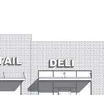
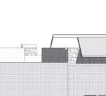
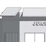
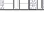
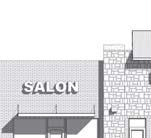
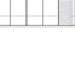
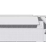
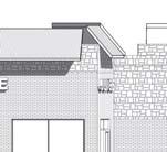
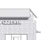

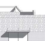
3 23'-0" 21'-0" 24'-9 1/2" 6'-3 3/8" 24'-10 7/8" 9'-6 1/8" 3'-4 3/8" 14'-9 1/4" A-2.3 A '-0" 19'-0" 23'-0" 23'-0" 10'-0" 23'-0" 21'-0" Project number Date A-3.1 Drawn by Author Checked by Checker Scale 1/8" = 1'-0" 1/29/ :26:42 AM 33'-4 3/4" L:\ARCHITECTURE\Jobs\Architecture Second Copy\Architecture\2015 Forney\Drop Ins\Forney Village\ Forney Crossings\SFC.rvt EXTERIOR ELEVATIONS - ELEVATION A THE SHOPPES AT FORNEY CROSSINGS EAST ELEVATION 1/8" = 1'-0" NORTH ELEVATION 1/8" = 1'-0" WEST ELEVATION 1/8" = 1'-0" SOUTH ELEVATION 1/8" = 1'-0" MASONRY CALCULATIONS BRICK: SQ. FT. STONE: 598- SQ. FT. TOTAL: SQ. FT. % OF MASONRY: 100% No. Date


4
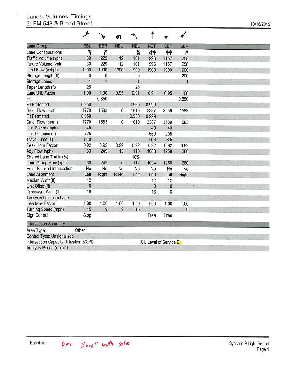
5 David J. Boski Engineering, PLLC F Castle Road Burleson, TX Tel.: (817) Traffic Technical Memorandum (Engineering Study) for Shoppes at Forney Crossings on FM 548 in Forney David J. Boski Engineering has been contracted to analyze the traffic impact that a proposed retail development (Shoppes at Forney Crossings) will have on FM 548 in Forney TX. The purpose of this technical memorandum is to provide the City of Forney and the Texas Department of Transportation with an engineering study concerning the existing AM and PM traffic at the FM 548/FM 548 (FM 1641) and FM 548/E. Broad (FM 688) intersections, level-ofservice analysis at both intersections for build-out and horizon year, trip generation and distribution for the new development, deceleration lane analysis and a sight distance analysis at the proposed access point. Below are the results of this analysis. Project Location, Roadway Characteristics and Speed Limit This development is located on FM 548 (south of U.S Hwy 80) in Forney and is bordered by railroad tracks to the north, FM 548 to the east and south and the old FM 1641 right-of-way to the west. FM 1641 continues south of this site. The land use to the east and west of this site is undeveloped land (east zoned Commercial, west zoned Planned Development), to the south is single family residential and to the north across the railroad track is retail/commercial. FM 548 on the east side of the development is a 4 lane concrete curb and gutter divided roadway (10 foot wide center median) with 2 twelve foot travel lanes and 1 foot inside and outside shoulders in each direction. The pavement and markings are in good condition. The speed limit on this section of FM 548 is posted at 50 MPH. The southbound right lane is a right turn only lane at FM 548. FM 548 on the south side of the development is 2 lane undivided asphalt roadway with numerous left turn lanes. The main pavement section contains 2 twelve foot lanes (one each direction) and 8 foot shoulders on both sides. At its intersection with northbound FM 548, the intersection contains one westbound lane, two eastbound left turn lanes and an eastbound right turn lane. The pavement and markings are in good condition. The speed limit on this section of roadway is 55 MPH. The FM 548/548 intersection is signalized. The roadways in the vicinity of this development are relatively flat with slight horizontal curves. An aerial view along with a close up of this project location and roadway is presented in Exhibits #1and #2. TxDOT Technical Memo 548.doc FM 548, Forney Page 1 of 16


6 David J. Boski Engineering, PLLC F Castle Road Burleson, TX Tel.: (817) Traffic Signal Railroad Tracks Project location Exhibit #1 Location Map TxDOT Technical Memo 548.doc FM 548, Forney Page 2 of 16
7 David J. Boski Engineering, PLLC F Castle Road Burleson, TX Tel.: (817) Old FM 1641 ROW RR Crossing Proposed Shoppes at Forney Crossing Development Traffic Signal Exhibit #2 Close up location Site Layout and Driveway Spacing This development will contain approximately 14,800 square feet of retail use (unknown users) on 1.6 acres of land. The land area of the property forms a triangle and is bounded by the RR tracks to the north, the old FM 1641 ROW on the west and FM 548 on the east. Due to the unique layout of the property the only available access point will be on the east side of the property to access the 4 lane divided section of FM 548. The proposed access point on FM 548 will function as a right-in/right out due to the raised median on FM 548. The proposed access point will be located approximately 275 feet north of the FM 548/FM 548 intersection (330 feet south of the railroad crossing and 390 feet south of E. Broad Street). The driveway will be 30 feet wide with 20 foot radii. The driveway access spacing does not meet TxDOT s Spacing Criteria (425 feet required) as presented in the TxDOT Access Manual for a 50 MPH speed limit. Due to the unique geometry of the property, location of the railroad crossing to the north, the need to provide a fire lane around the building which would align with driveway and the driveway being located on the approach side of signal controlled intersection a variance is requested to approve the TxDOT Technical Memo 548.doc FM 548, Forney Page 3 of 16
8 David J. Boski Engineering, PLLC F Castle Road Burleson, TX Tel.: (817) proposed driveway location. This will be the only driveway on southbound FM 548 between E. Broad Street and FM 548. The proposed driveway spacing does meet the spacing requirements outlined in the City of Forney Engineering Design Manual. A layout of this development is presented in Exhibit #3 and in the back of this report. Exhibit #4 shows the proposed driveway spacing. FM 688 Exhibit #3 Site Plan TxDOT Technical Memo 548.doc FM 548, Forney Page 4 of 16
9 David J. Boski Engineering, PLLC F Castle Road Burleson, TX Tel.: (817) Proposed Driveway Location 390 feet to E. Broad Street (FM 688) 330 feet to RR crossing 275 feet to intersection Sight Distance Analysis Exhibit #4 Proposed Driveway Location A sight distance analysis was conducted at the proposed access point on FM 548. Google Map Street View pictures from the proposed access location are shown in Exhibits #5 and #6. Since a raised median exists in FM 548, traffic can only travel in one direction thus the proposed access point was evaluated for stopping sight distance and right turn from stop criteria for a 50 MPH speed limit. The required sight distance for each scenario is shown in Table #1. Sight Distance Summary Scenario Required Stopping Sight Distance Required Intersection Sight Distance Sight distance met Right turn from stop 425 feet 480 feet Yes 480+ feet Table #1 TxDOT Technical Memo 548.doc FM 548, Forney Page 5 of 16

10 David J. Boski Engineering, PLLC F Castle Road Burleson, TX Tel.: (817) The visibility available from the proposed access point was over 480 feet looking to the north. This distance meets AASHTO s required stopping sight distance of 425 feet and the right turn movement sight distance of 480 feet for the 50 MPH posted speed limit sight distance Exhibit #5 View from proposed driveway looking north TxDOT Technical Memo 548.doc FM 548, Forney Page 6 of 16

11 David J. Boski Engineering, PLLC F Castle Road Burleson, TX Tel.: (817) feet to intersection Exhibit #6 - View from proposed driveway looking south Traffic Counts AM and PM peak hour turning movement counts were collected at the intersections of E. Broad Street/FM 548 and FM 548/FM 548 on Wednesday October 14, 2015 by Accurate Counts. The collected turning movement counts can be seen in Tables #2 and #3. East Broad Street/FM 548 Traffic Counts EB EB SB Right SB Thru NB Left NB Thru Right Left AM Peak PM Peak , Table #2 TxDOT Technical Memo 548.doc FM 548, Forney Page 7 of 16
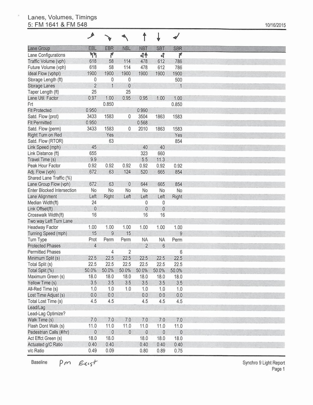
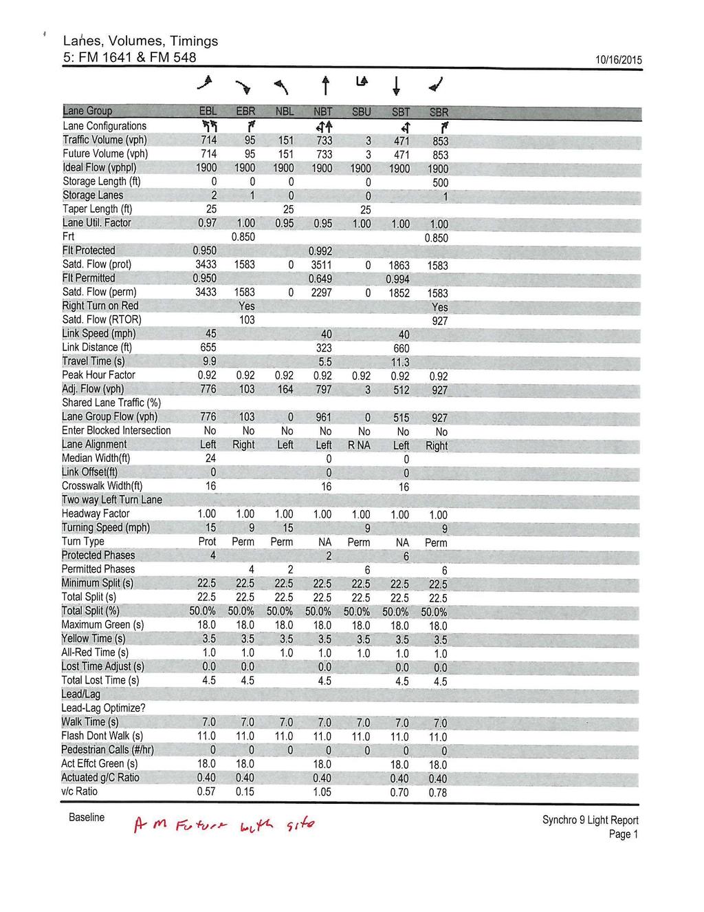
12 David J. Boski Engineering, PLLC F-8922 FM 548/FM 548 Traffic Counts 2624 Castle Road Burleson, TX Tel.: (817) EB Right EB Left SB Right SB Thru NB Left NB Thru AM Peak PM Peak Table #3 The traffic counts indicate an AM peak on the north/south portion of FM 548 near the FM 548 intersection of 2,126 vehicles (1,110 NB and 1,016 SB 52%/48% distribution) and a PM peak of 2,424 vehicles (1,096 NB and 1,398 SB 44%/56% distribution). The AM peak on the east/west portion of FM 548 near the FM 548 intersection had 1,390 vehicles (620 EB and 770 WB 45%/55% distributions) and a PM peak of 1,576 vehicles (676 EB and 900 WB 43%/57% distribution). The AM peak hour on FM 548 is 7:00 to 8:00 am and the PM peak hour is 5:00 to 6:00 pm. Trip Generation Trip generation for this proposed development was performed for the anticipated land uses (retail) using the Institute of Transportation Engineers (ITE) Trip Generation Manual 9 th Edition for Shopping Center ITE Land Use #820. The trip generation is based upon the proposed site plan that contains 14,832 square feet of retail space. The average trip generation rate was used. The average rate was chose over the regression equations based upon the ITE recommended practice that if the standard deviation for the weighted average rate is less than 110% of the weighted average rate than the rate is to be used. In this case, Shopping Center use meets the criteria. Table #4 below depicts the Daily, AM and PM peak hour trip generation equations and distributions for this development as provided by the ITE Trip Generation Manual. Category/ITE Use Trip Generation Rates/Equations and Distributions Daily Trip Rate/ Distribution % In/Out AM Trip Rate*/ Distribution % In/Out PM Trip Rate*/ Distribution % In/Out Shopping Center # per 1,000 sq ft 50/ per 1,000 sq ft 62/ per 1,000 sq ft 48/52 Table #4 *peak hour of adjacent traffic Table #5 indicates the total trips generated by this development based upon the assumptions listed above. TxDOT Technical Memo 548.doc FM 548, Forney Page 8 of 16
13 David J. Boski Engineering, PLLC F-8922 Shoppes at Forney Crossings Trip Generation 2624 Castle Road Burleson, TX Tel.: (817) Category/ITE Use Shopping Center #820 Total Trips Total Traffic In/Out Sq. Footage 14,832 sq. ft. Daily Trips /316 AM Peak Trips /5 PM Peak Trips /29 Trip Distribution/Traffic Growth Table #5 Trip distribution to and from the site were based upon the layout of the development and the collected traffic counts. Since this development only has one access point onto southbound FM 548 all site traffic will use this driveway. Based upon collected traffic counts, 45% of the traffic will come from the north, 25% will come from the south and 30% will come from the west. For the west traffic it was assumed, based on the counts that 15% during the AM peak and 25% during the PM peak would use E. Broad Street (FM 688) and 85% during the AM peak and 75% during the PM peak would use FM 548. All traffic from the south and west on FM 548 that will be entering the site will need to make a U-turn at the FM 548/E. Broad Street intersection. All traffic exiting the site and heading north will make a U-turn at FM 548/FM 548 intersection. Exhibit #7 illustrates these traffic distributions. The entire development will be constructed and open for business by To predict background traffic 5 years in the future on the adjacent roadways the TxDOT Statewide Planning Map was used to determine a growth rate. Traffic volumes in the vicinity on FM 548 were not available however counts on FM 688 (E. Broad Street) just north of this development were available from year 2007 (4,600 vehicles a day) to year 2012 (6,000 vehicles a day). Based upon the available data a 4.5% growth rate was used to predict future background traffic volumes FM 548. TxDOT Technical Memo 548.doc FM 548, Forney Page 9 of 16

.")

14 David J. Boski Engineering, PLLC F Castle Road Burleson, TX Tel.: (817) North = access location 45% total traffic volume from north 15% AM 25% PM of west traffic 30% total traffic volume from west Development location 85% AM 75% PM of west traffic 25% total traffic volume from south Exhibit #7 - Traffic Distribution Site Turning Movements and Auxiliary Lane Analysis Based upon the traffic distribution and assumptions listed previously, Exhibit #8 shows the anticipated site generated peak hour turning movement traffic volumes at the build out of the development (year 2016). Exhibit #9 shows the background traffic at build-out (2016), background with site traffic (2016) and future traffic (5 years year 2021) with site. With the right-in/right-out driveway for the development a few U-turns will be produced at the median openings north and south of this development (4 AM and 12 PM at E. Broad and 3 AM and 16 PM at FM 548). TxDOT Technical Memo 548.doc FM 548, Forney Page 10 of 16
15 David J. Boski Engineering, PLLC F Castle Road Burleson, TX Tel.: (817) AM 12 PM 4 AM 12 PM 1 AM 3 PM Proposed access 9 AM 26 PM 317 Daily 5 AM 29 PM 316 Daily 3 AM 16 PM 1AM 6 PM 2 AM 6 PM Exhibit #8 Site Generated Turning Movements TxDOT Technical Memo 548.doc FM 548, Forney Page 11 of 16
16 David J. Boski Engineering, PLLC F Castle Road Burleson, TX Tel.: (817) LEGEND Background volume Background + Site 2021 Background +Site 0 AM/0 PM 4AM/12 PM 4 AM/12 PM 77 AM/227 PM 78 AM/229 PM 101 AM/297 PM 149AM/98 PM 150 AM/101 PM 195 AM/131 PM Proposed access 0 AM/0 PM 9 AM/26 PM 9 AM/26 PM 0AM/0 PM 5 AM/29 PM 5 AM/29 PM 0 AM/0 PM 3 AM/16 PM 3 AM/16 PM 654 AM/786 PM 655 AM/792 PM 853 AM/1030 PM 547 AM/618 PM 549 AM/624 PM 714 AM/811 PM Exhibit #9 Background and Background/Site generated peak hour turning movements A deceleration lane analysis was performed for this development s proposed access point on FM 548. Table 2-3 of the TxDOT Access Management Manual was used as a basis for the analysis of the auxiliary lanes. The analysis was based upon the posted 50 MPH speed limit. Table #6 reflects the results of the auxiliary lane analysis. Deceleration Lane Analysis Entrance AM peak hour right turns into the development PM peak hour right turns into the development TxDOT Threshold for deceleration lane (vph) TxDOT Threshold met FM vph No Table #6 TxDOT Technical Memo 548.doc FM 548, Forney Page 12 of 16
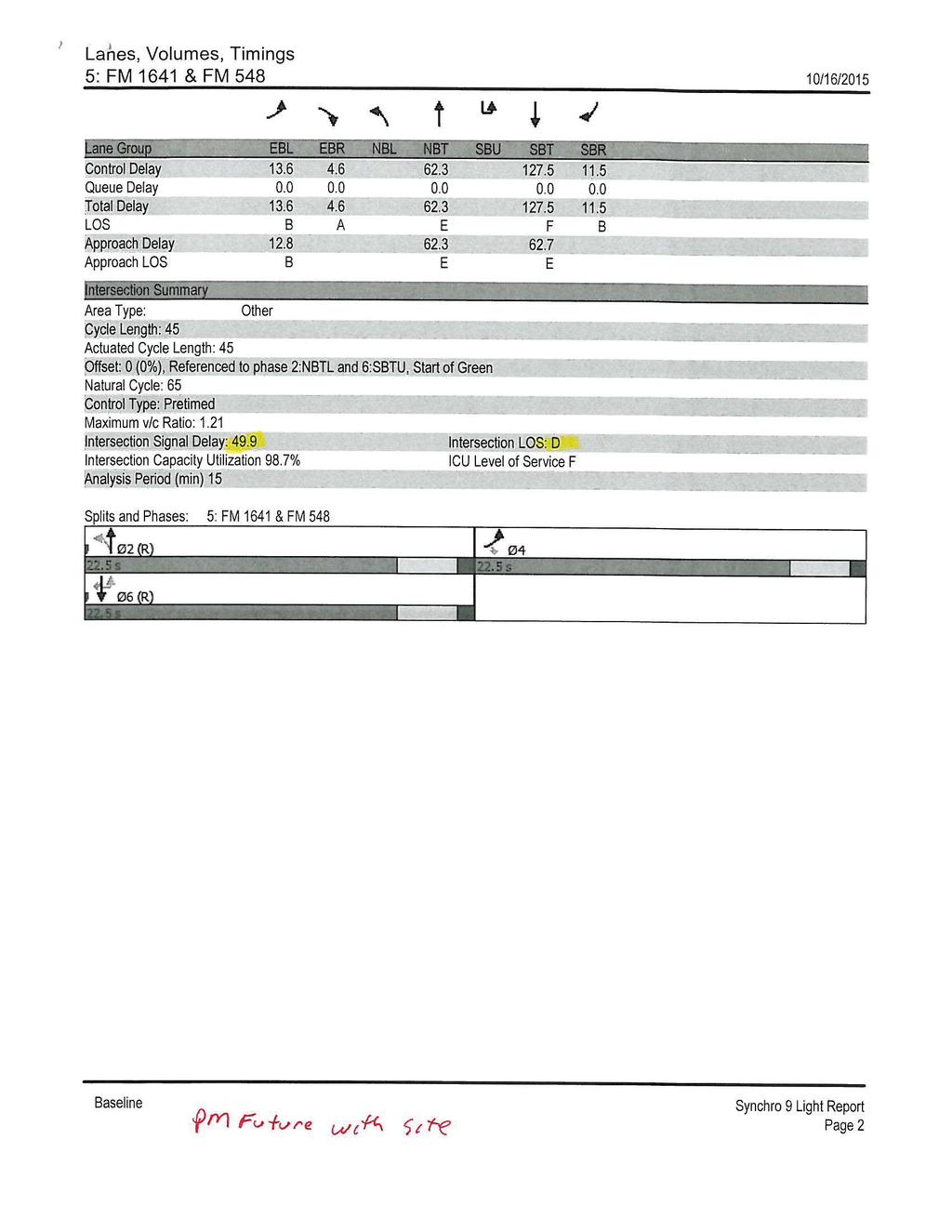
17 David J. Boski Engineering, PLLC F Castle Road Burleson, TX Tel.: (817) The right-turn ingress movements generated by this development at the FM 548 access point do not exceed the TxDOT threshold of 50 vph for a deceleration lane. Street Intersection Level-of-Service Analysis AM peak hour and PM peak hour intersection levels-of-service analysis were performed for the FM 548/E. Broad Street and FM 548/FM 548 intersections using Synchro 9 traffic signal simulation software which is based upon Highway Capacity methodology for the level-of-service. The intersection level-of-service analysis along with intersection capacity utilization for the oneway stop controlled intersection of FM 548/E. Broad Street was investigated along with the levelof-service and intersection delay for the signalized intersection of FM 548/FM 548. The analysis includes build out year (2016) with and without site traffic and 5 years in the future with and without the site traffic (year 2021). As stated previously a 4.5% growth rate was used to predict future background traffic volumes. Previous Exhibit #8 showed the site traffic that will be added to the intersections and Tables #6 and #7 show the level-of-service at the intersections in build out year (2016) and at horizon year (2021) Intersectio n E. Broad/FM 548 E. Broad/FM 548 E. Broad/FM 548 Intersection (Approach) Level-of-Service Build Out Build Out Year 2021 Year 2016 Year 2016 Without Site Existing With Site Traffic Traffic Traffic Time Analyzed AM Peak PM Peak Intersection LOS/(Capacity Utilization) C (67.1%) D (75.7%) Intersection LOS/(Capacity Utilization) Table #6 C (67.2%) E (83.7%) Intersection LOS/(Capacity Utilization) E (84.3%) F (105.8%) Build Out Year 2021 With Site Traffic Intersection LOS/(Capacity Utilization) E (84.4%) F (105.9%) TxDOT Technical Memo 548.doc FM 548, Forney Page 13 of 16
18 David J. Boski Engineering, PLLC F Castle Road Burleson, TX Tel.: (817) Intersection Time Analyzed FM 548/FM 548 Level-of-Service Build Out Build Out Year 2016 Year 2016 Existing With Site Traffic Traffic Intersection LOS/(delay - seconds) Intersection LOS/(delay - seconds) Year 2021 Without Site Traffic Approach LOS/(delay seconds)) Build Out Year 2021 With Site Traffic Approach LOS/(delay seconds) FM 548/FM 548 AM Peak B (10.6) B (10.6) C (25.8) C (25.8) FM 548/FM 548 PM Peak B (16.8) B (18.8) D (49.9) D (49.9) Table #7 The intersection of E. Broad/FM 548 currently operates at a level-of-service (LOS) of C and D during the AM and PM peak hours. Due to the potential U-turns from this development the LOS drops to E in the PM peak with this development. At 5 years in the future (year 2021) the AM peak will function at an LOS of E and PM peak function at F with or without site traffic due to the intersection being over capacity in the PM peak hour. It is recommended that a more in depth investigation be conducted in the next few years to determine if an installation of the traffic signal at that location will help improve operations. The intersection of FM 548/FM 548 currently operates at a level-of-service of B during the AM and PM peak hours and will continue to do so with build-out of this development. At 5 years in the future (year 2021) the AM peak will function at an LOS of C and PM peak function at D with or without the site traffic. This development will not have any significant impact on the FM 548/FM 548 intersection. Summary/Recommendations This development is located on FM 548 (south of U.S Hwy 80) in Forney and is bordered by railroad tracks to the north, FM 548 to the east and south and the old FM 1641 right-of-way to the west. FM 1641 continues south of this site. This development will contain approximately 14,800 square feet of retail use (unknown users) on 1.6 acres of land and is anticipated to be built out by the year The land area of the property forms a triangle and is bounded by the RR tracks to the north, the old FM 1641 ROW on the west and FM 548 on the east. Due to the unique layout of the property the only available access point will be on the east side of the property to access the 4 lane divided section of FM 548. The proposed access point on FM 548 will function as a right-in/right out due to the raised median on FM 548. The proposed access point will be located approximately 275 feet north of the FM 548/FM 548 intersection (330 feet south of the railroad crossing and 390 feet south of E. Broad Street). The driveway will be 30 feet wide with 20 foot radii. The driveway access spacing does not meet TxDOT s Spacing Criteria (425 feet required) as presented in the TxDOT Access Manual for a 50 MPH speed limit. Due to the unique geometry of the property, location of the TxDOT Technical Memo 548.doc FM 548, Forney Page 14 of 16
19 David J. Boski Engineering, PLLC F-8922 TxDOT Technical Memo 548.doc FM 548, Forney Page 15 of Castle Road Burleson, TX Tel.: (817) railroad crossing to the north, the need to provide a fire lane around the building which would align with driveway and the driveway being located on the approach side of signal controlled intersection a variance is requested to approve the proposed driveway location. This will be the only driveway on southbound FM 548 between E. Broad Street and FM 548. The proposed driveway spacing does meet the spacing requirements outlined in the City of Forney Engineering Design Manual. The location of the driveway places it approximately 50 within the white solid lane markings for the right turn only lane, it is recommended to remove the solid white lane markings in the vicinity of the driveway and place skip white pavement markings in this location. This striping modification will not impact the southbound right turn only traffic. The visibility available from the proposed access point was over 480 feet looking to the north. This distance meets AASHTO s required stopping sight distance of 425 feet and the right turn movement sight distance of 480 feet for the 50 MPH posted speed limit. The traffic counts indicate an AM peak on north/south portion of FM 548 near the FM 548 intersection of 2,126 vehicles (1,110 NB and 1,016 SB 52%/48% distribution) and a PM peak of 2,424 vehicles (1,096 NB and 1,398 SB 44%/56% distribution). The AM peak on the east/west portion of FM 548 near the FM 548 intersection had 1,390 vehicles (620 EB and 770 WB 45%/55% distributions) and a PM peak of 1,576 vehicles (676 EB and 900 WB 43%/57% distribution). The AM peak hour on FM 548 is 7:00 to 8:00 am and the PM peak hour is 5:00 to 6:00 pm. At build out (year 2016) the retail development will generate an additional 633 daily trips, 14 AM and 55 PM peak hour trips. Based upon the layout of the development, land uses and access locations it is projected the right-turn ingress movements generated at the proposed access point on southbound FM 548 (9 AM and 26 PM) do not exceed the TxDOT deceleration threshold of 50 vph for a 50 MPH speed limit. Thus a right-turn deceleration lane at the proposed FM 548 access point is not recommended. The intersection of E. Broad/FM 548 currently operates at a level-of-service (LOS) of C and D during the AM and PM peak hours. Due to the potential U-turns from this development the LOS drops to E in the PM peak with this development. At 5 years in the future (year 2021) the AM peak will function at an LOS of E and PM peak function at F with or without site traffic due to the intersection being over capacity in the PM peak hour. It is recommended that a more in depth investigation be conducted in the next few years to determine if an installation of the traffic signal at that location will help improve operations. The intersection of FM 548/FM 548 currently operates at a level-of-service of B during the AM and PM peak hours and will continue to do so with build-out of this development. At 5 years in the future (year 2021) the AM peak will function at an LOS of C and PM peak function at D with or without the site traffic. This development will not have any significant impact on the FM 548/FM 548 intersection. In addition with the unique nature of the roadway cross section (10 wide center median and no turn lanes) consideration should be giving to expanding the roadway cross section in the future to provide for left turn lanes at the Broad Street and FM 548 intersections. The property on east side
20 David J. Boski Engineering, PLLC F Castle Road Burleson, TX Tel.: (817) contains 20+ acres zoned commercial which is currently undeveloped but once the property is developed it will generate a significate number of left and U-turns at these 2 intersections. Calculations and data stated in this document are provided in back of the report If you have any questions regarding this analysis please do not hesitate to call me at Sincerely, David J. Boski, P.E. TxDOT Technical Memo 548.doc FM 548, Forney Page 16 of 16

21
22
23
24
25
26
27
28
29
30
31
32
33
34
35
36
37
38
39
40
41
42
43
44
45
46
47
48
State Road A1A North Bridge over ICWW Bridge
 Final Report State Road A1A North Bridge over ICWW Bridge Draft Design Traffic Technical Memorandum Contract Number: C-9H13 TWO 5 - Financial Project ID 249911-2-22-01 March 2016 Prepared for: Florida
King Mill Lambert DRI# 2035 Henry County, Georgia
 Transportation Analysis King Mill Lambert DRI# 2035 Henry County, Georgia Prepared for: The Alter Group, Ltd. Prepared by: Kimley-Horn and Associates, Inc. Norcross, GA Kimley-Horn and Associates, Inc.
TRAFFIC IMPACT STUDY. PROPOSED AMENDED MASTER PLAN AMENDED - H - ZONE Village of Ridgewood Bergen County, New Jersey
 TRAFFIC IMPACT STUDY PROPOSED AMENDED MASTER PLAN AMENDED - H - ZONE Village of Ridgewood Bergen County, New Jersey Prepared For: The Valley Hospital 223 North Van Dien Avenue Ridgewood, New Jersey 07450
Noise Mitigation Study Pilot Program Summary Report Contract No
 Ohio Turnpike Commission Noise Mitigation Study Pilot Program Summary Report Contract No. 71-08-02 Prepared For: Ohio Turnpike Commission 682 Prospect Street Berea, Ohio 44017 Prepared By: November 2009
Updated: April 7, 2016
 Updated: April 7, 2016 Hwy 36 to Lexington Ave. Add a lane in each direction Recommend a MNPASS Lane Several spot improvements to roadway included Concrete pavement Noise walls will be evaluated Replace
Single Point Urban Interchange (SPUI) with Signals
 with Signals") 1 Single Point Urban Interchange (SPUI) with Signals Allows for concurrent left turns on Wurzbach Parkway and on NW Military Traffic Signal added on NW Military Hwy at Fairfield Bend/ Turnberry Way Large
1 Single Point Urban Interchange (SPUI) with Signals Allows for concurrent left turns on Wurzbach Parkway and on NW Military Traffic Signal added on NW Military Hwy at Fairfield Bend/ Turnberry Way Large
FM 691 CORRIDOR STUDY
 FM 691 CORRIDOR STUDY Transportation Policy Board Meeting August 13, 2008 Agenda Project Overview US 75/FM 691 Interchange US 75 Ramping Alternatives FM 691 Corridor Typical Sections Extension to SH 289
Exit 61 I-90 Interchange Modification Justification Study
 Exit 61 I-90 Interchange Modification Justification Study Introduction Exit 61 is a diamond interchange providing the connection between Elk Vale Road and I-90. Figure 1 shows the location of Exit 61.
DELINEATOR REFERENCE POINT 200' TYPICAL SPACING (YELLOW DELINEATORS) END OF MERGE LANE TAPER DELINEATOR REFERENCE POINT
 END OF MERGE LANE TAPER DELINEATOR REFERENCE POINT") 200' TYP. 600' < EACH SIDE BOTH ROADWAYS END OF MERGE LANE TAPER TYPICAL FOR ALL 2-LANE MERGES EXCEPT WHERE THERE IS A MERGE FROM THE RIGHT AND NO OFFSET IN THE THROUGH LANES END OF MERGE LANE TAPER 200'
200' TYP. 600' < EACH SIDE BOTH ROADWAYS END OF MERGE LANE TAPER TYPICAL FOR ALL 2-LANE MERGES EXCEPT WHERE THERE IS A MERGE FROM THE RIGHT AND NO OFFSET IN THE THROUGH LANES END OF MERGE LANE TAPER 200'
Demolition of Ramp C (SN ): Westbound Ontario Street to Eastbound I-90/94) over I-90/94 (JF Kennedy Expressway)
: Westbound Ontario Street to Eastbound I-90/94) over I-90/94 (JF Kennedy Expressway)") I-90/94 (Kennedy Expressway) at Ohio Street Structure Replacement and Rehabilitation Section Number 0303-474HB-R D-91-177-09 Contract 60F63 Cook County, Region One, District One City of Chicago Project
I-90/94 (Kennedy Expressway) at Ohio Street Structure Replacement and Rehabilitation Section Number 0303-474HB-R D-91-177-09 Contract 60F63 Cook County, Region One, District One City of Chicago Project
TCAG Annual Intersection Monitoring Program
 TCAG Annual Intersection Monitoring Program 2015 Intersection Monitoring Report Prepared by: Transportation Modeling Department August, 2015 Work Element 605.01 TABLE OF CONTENTS INTRODUCTION...1 PROJECT
Hwy 36 to Lexington Ave. Add a lane in each direction Recommend a MNPASS Lane Several spot improvements to roadway included Concrete pavement Noise
 Hwy 36 to Lexington Ave. Add a lane in each direction Recommend a MNPASS Lane Several spot improvements to roadway included Concrete pavement Noise walls will be evaluated 2 Approximate $200 million construction
Georgia Department of Transportation. Automated Traffic Signal Performance Measures Reporting Details
 Georgia Department of Transportation Automated Traffic Signal Performance Measures Prepared for: Georgia Department of Transportation 600 West Peachtree Street, NW Atlanta, Georgia 30308 Prepared by: Atkins
TCAG Annual Intersection Monitoring Program
 TCAG Annual Intersection Monitoring Program 2015 Intersection Monitoring Report Prepared by: Transportation Modeling Department August, 2015 Work Element 605.01 TABLE OF CONTENTS INTRODUCTION...1 PROJECT
Construction Plan Reading Basics & Applications
 Construction Plan Reading Basics & Applications July 12 th, 2016 / 4 p.m. Richland County Transportation Penny Office Instructor Ben W. Lewis, PE Welcome & Introductions Instructor Ben W. Lewis, PE Project
Texas Transportation Institute The Texas A&M University System College Station, Texas
 1. Report No. FHWA/TX-08/0-4986-1 4. Title and Subtitle AN ASSESSMENT OF YIELD TREATMENTS AT FRONTAGE ROAD EXIT RAMP AND FRONTAGE ROAD U-TURN MERGE AREAS 2. Government Accession No. 3. Recipient's Catalog
Memorandum 1.0 Highway Traffic Noise
 Memorandum Date: September 18, 2009 To: Chris Hiniker, SEH From: Stephen B. Platisha, P.E. Re: Updated CSAH 14 Noise Analysis The purpose of this memorandum is to provide the results of the revised traffic
A STOP BASED APPROACH FOR DETERMINING WHEN TO RUN SIGNAL COORDINATION PLANS
 0 0 A STOP BASED APPROACH FOR DETERMINING WHEN TO RUN SIGNAL COORDINATION PLANS Rasool Andalibian (Corresponding Author) PhD Candidate Department of Civil and Environmental Engineering University of Nevada,
Interchange Feasibility Study
 Interchange Feasibility Study I-88/Illinois Route 47 Full Interchange Kane County, IL Prepared for Village of Sugar Grove, Illinois August 5, 2010 Prepared by GRAEF 8501 West Higgins Road, Suite 280 Chicago,
DESIGN PUBLIC HEARING
 DESIGN PUBLIC HEARING JUNE 22, 2016 AT TOWN HALL AUDITORIUM 11 TOWN HOUSE ROAD WESTON, MASSACHUSETTS 7:00 PM FOR THE PROPOSED DEMOLITION OF LEGACY TOLL PLAZAS ALONG I-90 DISTRICT 6 PLAZAS 14, 15 AND 55
Appendix D. Traffic Noise Analysis Report. I-94 St. Michael to Albertville Minnesota Department of Transportation
 Appendix D Traffic Noise Analysis Report I-94 St. Michael to Albertville Minnesota Department of Transportation Traffic Noise Analysis Report I-94 St. Michael to Albertville Project SP 8680-172 Report
Appendix B: Transportation B-10 Toll Plaza Analysis
 Appendix B: Transportation B-10 Toll Plaza Analysis TRAFFIC-DESIGN STUDIES TZB TOLL PLAZA ANALYSES STUDY ASSUMPTIONS Study Goal: Provide assessment of current design concept for toll plaza operations under
DEVELOPMENT SERVICES SITE PLAN SUBMITTAL 2.2.3
 DEVELOPMENT SERVICES SITE PLAN SUBMITTAL 2.2.3 Unified Development Code (UDC) Article 2, Applications, Procedures and Criteria provides the steps for applying the Unified Development Code standards to
Date Requested, 200_ Work Order No. Funding source Name of project Project limits: Purpose of the project
 Bureau of Engineering SURVEY DIVISION REQUEST FOR TOPOGRAPHIC SURVEY Date Requested, 200_ Work Order No. Funding source Name of project Project limits: Purpose of the project Caltrans involvement (must
I-20 East Texas Corridor Implementation Plan DALLAS DISTRICT Updated May Install cable barrier system in median
 I-20 East Texas Corridor Implementation Plan DALLAS DISTRICT Updated May 2016 AE-1 Median Barrier I-635 to Kaufman County Line AF-1 Lawson Road to Kaufman County Line Install cable barrier system in median
SECTION SITE SURVEYS
 SECTION 02 21 13 SITE SURVEYS SPEC WRITER NOTE: 1. Delete text between // // not applicable to project. Edit remaining text to suit project. 2. Use this section to specify survey required before design
PUBLIC HEARING LOOP 375 FRONTAGE ROADS RECONFIGURATION FROM FM 76 (NORTH LOOP DRIVE) TO ZARAGOZA PORT OF ENTRY CSJ: EL PASO COUNTY, TEXAS
 TO ZARAGOZA PORT OF ENTRY CSJ: EL PASO COUNTY, TEXAS") PUBLIC HEARING LOOP 375 FRONTAGE ROADS RECONFIGURATION FROM FM 76 (NORTH LOOP DRIVE) TO ZARAGOZA PORT OF ENTRY CSJ: 2552-03-058 EL PASO COUNTY, TEXAS Del Valle High School July 25, 2018 Hearing Information
PUBLIC HEARING LOOP 375 FRONTAGE ROADS RECONFIGURATION FROM FM 76 (NORTH LOOP DRIVE) TO ZARAGOZA PORT OF ENTRY CSJ: 2552-03-058 EL PASO COUNTY, TEXAS Del Valle High School July 25, 2018 Hearing Information
CONCEPT REVIEW GUIDELINES
 Department of Planning & Community Development @ Jefferson Station 1526 E. Forrest Avenue Suite 100 East Point, GA 30344 404.270.7212 (Phone) 404.765.2784 (Fax) www.eastpointcity.org CONCEPT REVIEW GUIDELINES
CITY OF LA MARQUE CHAPTER GRAPHIC REQUIREMENTS CONSTRUCTION PLAN AND MISCELLANEOUS REQUIREMENTS
 CITY OF LA MARQUE CHAPTER 2 -------------------------------------------- GRAPHIC REQUIREMENTS CONSTRUCTION PLAN AND MISCELLANEOUS REQUIREMENTS CHAPTER 2 ------------------------------------------------
Sign Legibility Rules Of Thumb
 Sign Legibility Rules Of Thumb UNITED STATES SIGN COUNCIL 2006 United States Sign Council SIGN LEGIBILITY By Andrew Bertucci, United States Sign Council Since 1996, the United States Sign Council (USSC)
LOWNDES COUNTY ENGINEERING PLAN REVIEW CHECKLIST. Design Professional: Phone: Developer: Phone: 2 nd Submittal (No Fee)
") MEMORANDUM MICHAEL B. FLETCHER, P.E. COUNTY ENGINEER 327 N. Ashley Street Valdosta, GA 31601 Telephone: (229) 671-2424 Fax: (229) 245-5299 mfletcher@lowndescounty.com LOWNDES COUNTY ENGINEERING PLAN REVIEW
MEMORANDUM MICHAEL B. FLETCHER, P.E. COUNTY ENGINEER 327 N. Ashley Street Valdosta, GA 31601 Telephone: (229) 671-2424 Fax: (229) 245-5299 mfletcher@lowndescounty.com LOWNDES COUNTY ENGINEERING PLAN REVIEW
DEVELOPMENT PLAN CHECKLIST
 Project Identification Information: DEVELOPMENT PLAN CHECKLIST 1.0 GENERAL 1.1 Additional information as required by specific Land Use 1.2 All sheets to include sheet number ( of ) 1.3 Seal and signature
Memorandum. Dear Ms. Allen,
 RhoadesPlanningGroup Memorandum To: Shannon Allen, AICP, Principal Planner From: Rhoades Planning Group Date: June 10, 2015 Re: Response to Incomplete Letter, 1900 Fourth Street Dear Ms. Allen, This letter
Charlton/Oxford Route 20 Reconstruction Project
 Public Informational Meeting February 1, 2017 Oxford High School Charlton/Oxford Route 20 Reconstruction Project Project File No. 602659 2014 HDR, Inc., all rights reserved. Public Informational Meeting
Appendix C HCS 7 ANALYTICAL REPORTS: MITIGATED SIGNALIZED AND NON-SIGNALIZED INTERSECTIONS. Draft
 Appendix C HCS 7 ANALYTICAL REPORTS: MITIGATED SIGNALIZED AND NON-SIGNALIZED INTERSECTIONS HCS7 All-Way Stop Control Report Site Information Analyst M Hays Intersection Mulberry Ave @ Newcomb St Agency/Co.
Update on Traffic Results and Findings
 Los Angeles County Metropolitan Transportation Authority Update on Traffic Results and Findings presented to the Corridor Advisory Committee February 16, 2017 Traffic Presentation Topics 2 Traffic Volumes
Diversion Analysis. Appendix K
 Appendix K Appendix K Appendix K Project Description The Project includes the potential closure of the eastbound direction ramp for vehicular traffic at Washington Street and University Avenue. In addition,
FARM TO MARKET 1103 OPEN HOUSE PUBLIC MEETING. FM 1103 I-35 to Rodeo Dr
 FARM TO MARKET 1103 OPEN HOUSE PUBLIC MEETING March 29, 2016 FM 1103 FROM: I-35 TO: RODEO DR COMAL & GUADALUPE COUNTY OPEN HOUSE PUBLIC MEETING March 29, 2016 5:00 p.m. 7:00 p.m. Barbara C Jordan Intermediate
User s Guide: Traffic Noise Model
 User s Guide: Traffic Noise Model TxDOT Environmental Affairs Division Effective Date: 005 730.03.GUI Version.5 TxDOT User s Guide: Traffic Noise Model (TNM) Produced by the Environmental Affairs Division
LARAMIE COUNTY PLANNING & DEVELOPMENT OFFICE 3966 Archer Pkwy Cheyenne, WY Phone (307) Fax (307)
 Fax (307)") 3966 Archer Pkwy Cheyenne, WY 82009 planning@laramiecounty.com Phone (307) 633-4303 Fax (307) 633-4616 SITE PLAN REVIEW PROCESS 1. Pre-Application Meeting: The applicant shall meet with a Laramie County
3966 Archer Pkwy Cheyenne, WY 82009 planning@laramiecounty.com Phone (307) 633-4303 Fax (307) 633-4616 SITE PLAN REVIEW PROCESS 1. Pre-Application Meeting: The applicant shall meet with a Laramie County
SITE PLAN APPLICATION
 SITE PLAN APPLICATION SECTION 1. APPLICANT/OWNER INFORMATION Please Print or Type Applicant/Developer: City: State: Zip: Telephone: Fax: E-mail: Applicant s Status: (Check One) Owner Tenant Prospective
Site Plan Review Application. Interest in the Property (e.g. fee simple, land option, etc.)
") 1. Identification CITY OF FENTON 301 South Leroy Street Fenton, Michigan 48430-2196 (810) 629-2261 FAX (810) 629-2004 Site Plan Review Application Project Name Applicant Name Address City/State/Zip Phone
1. Identification CITY OF FENTON 301 South Leroy Street Fenton, Michigan 48430-2196 (810) 629-2261 FAX (810) 629-2004 Site Plan Review Application Project Name Applicant Name Address City/State/Zip Phone
EVALUATING AN ADAPTIVE SIGNAL CONTROL SYSTEM IN GRESHAM. James M. Peters, P.E., P.T.O.E., Jay McCoy, P.E., Robert Bertini, Ph.D., P.E.
 EVALUATING AN ADAPTIVE SIGNAL CONTROL SYSTEM IN GRESHAM James M. Peters, P.E., P.T.O.E., Jay McCoy, P.E., Robert Bertini, Ph.D., P.E. ABSTRACT Cities and Counties are faced with increasing traffic congestion
0-6920: PROACTIVE TRAFFIC SIGNAL TIMING AND COORDINATION FOR CONGESTION MITIGATION ON ARTERIAL ROADS. TxDOT Houston District
 0-6920: PROACTIVE TRAFFIC SIGNAL TIMING AND COORDINATION FOR CONGESTION MITIGATION ON ARTERIAL ROADS TxDOT Houston District October 10, 2017 PI: XING WU, PHD, PE CO-PI: HAO YANG, PHD DEPT. OF CIVIL & ENVIRONMENTAL
Appendix B: Noise Study
 Appendix B: Noise Study creating remarkable solutions for a higher quality of life NOISE STUDY Interstate 55 Route PP to County Road 311 Prepared for: MoDOT PROJECT NO. J010956 November 2014 Prepared
A. INTRODUCTION PRINCIPAL CONCLUSIONS
 Chapter 16: Traffic and Parking A. INTRODUCTION This chapter examines the potential traffic and parking impacts of the proposed development of the Fresh Kills Park project. The analysis of the proposed
We will study all three methods, but first let's review a few basic points about units of measurement.
 WELCOME Many pay items are computed on the basis of area measurements, items such as base, surfacing, sidewalks, ditch pavement, slope pavement, and Performance turf. This chapter will describe methods
Noise Abatement Design Study Report Dulles Loop Project (Route 606 and Loudoun County Parkway) UPC 97529
 UPC 97529") CNE A Description: CNE A Proposed Barriers A1, A2, A3 Common Noise Environment (CNE) A is located along in the northern portion of the study area and is comprised of single-family homes in the Loudoun
CNE A Description: CNE A Proposed Barriers A1, A2, A3 Common Noise Environment (CNE) A is located along in the northern portion of the study area and is comprised of single-family homes in the Loudoun
Abilene District Traffic Signal Timing and Capacity Analysis
 Abilene District Traffic Signal Timing and Capacity Analysis 2017 IAC Report Task-45 TransTech Lab, TechMRT Hongchao Liu, Ph.D., P.E. Jason (Bo) Pang, Ph.D. Ariel Castillo-Rodriguez, E.I.T. I Table of
1050 Page Mill Road Office Development
 1050 Page Mill Road Office Development Transportation Impact Analysis Prepared for: 1050 Page Mill Road Property, LLC April 15, 2015 Hexagon Office: 2 N. Second Street, Suite 400 San Jose, CA 95113 Hexagon
2017 San Juan College Luminarias 6:00pm - 11:30pm
 Parking For Walking available north side of college campus 2017 San Juan College Luminarias 6:00pm - 11:30pm Drive-Thru Entrance (2 Lanes) Drive-Thru Entrance starts at 30th Street & Butler Avenue * sign
Plan Preparation Checklist
 Appendix D Plan Preparation Checklist It is the responsibility of the Designer to complete and submit this checklist along with all required drawings for OUC (EFP) Review. All drawings submitted for OUC
PLANNED SIGN PROGRAM SUBMITTAL REQUIREMENTS
 PLANNED SIGN PROGRAM SUBMITTAL REQUIREMENTS City of Greenwood Village Community Development Department 6060 S. Quebec Street Greenwood Village, CO 80111-4591 (303) 486-5783; FAX (303) 773-1238 SUBMITTAL
SECTION 3 IMPROVEMENT PLAN REQUIREMENTS
 SECTION 3 IMPROVEMENT PLAN REQUIREMENTS CONTENTS Page 3-1 Digital Submittals 3-2 3-2 Paper Size and Scale 3-2 3-3 Drafting Standard 3-2 3-4 Title Sheet 3-2 3-5 Title Block 3-3 3-6 Drainage, Sewer, Water,
Jointing Rural Intersections
 Design Manual Chapter 5 - Roadway Design 5G - PCC Pavement Joints 5G-4 Jointing Rural Intersections This section describes how to joint rural intersections by following the guidelines outlined in Iowa
CHAPTER 3 INFORMATION REQUIRED FOR PUBLIC IMPROVEMENT CONSTRUCTION PLANS TABLE OF CONTENTS
 CHAPTER 3 INFORMATION REQUIRED FOR PUBLIC IMPROVEMENT CONSTRUCTION PLANS TABLE OF CONTENTS Section Title Page 3.1 General... 3-1 3.1.1 Plan Set...3-1 A. Loveland (City Limits Only)...3-1 3.1.2 Final Mylars...3-1
Guide Sign Policy for Secondary State Highways Edition
 Massachusetts Highway Department, Ten Park Plaza, Boston, MA 02116-3973 ` Guide Sign Policy for Secondary State Highways 2005 Edition Revised September 2005 1. PURPOSE The Massachusetts Highway Department
Residential Plot Plans
 Residential Plot Plans Planning & Development Services/Building Safety Division 1 Riverfront Plaza Ste. 110 Lawrence, KS 66044 (785)832-7700 Fax (785)832-3110 Email: buildinginspections@lawrenceks.org
CHAPTER 1: TITLE SHEET and GENERAL LAYOUT
 CHAPTER 1: TITLE SHEET and GENERAL LAYOUT AREA OF ENVIRONMENTAL SENSITIVITY It is important to show the areas of environmental sensitivity in the plan to make sure these areas are not impacted. These locations
Clear Creek County Site Development
 Clear Creek County Annex Community Development Clear Creek County Site Development The Clear Creek Board of County Commissioners has adopted design standards for the construction of driveways. These design
Porter County Plan Commission
 Plan Type: Development Plan Administrative DRC PC Primary Plan Administrative DRC PC Secondary Plat/Replat Administrative DRC PC PUD Conceptual Detailed Final Project Information Project Name: Developer
DESIGN GUIDELINES (SD) COUNTY OF ALAMEDA PUBLIC WORKS AGENCY 399 ELMHURST STREET HAYWARD, CA
 COUNTY OF ALAMEDA PUBLIC WORKS AGENCY 399 ELMHURST STREET HAYWARD, CA") DESIGN GUIDELINES (SD) COUNTY OF ALAMEDA PUBLIC WORKS AGENCY 399 ELMHURST STREET HAYWARD, CA 94544-1395 PUBLIC WORKS DESIGN GUIDELINES TABLE OF CONTENTS SD-100 SERIES SPECIAL DRAWINGS SD-100 8/1991 SILT
DESIGN GUIDELINES (SD) COUNTY OF ALAMEDA PUBLIC WORKS AGENCY 399 ELMHURST STREET HAYWARD, CA 94544-1395 PUBLIC WORKS DESIGN GUIDELINES TABLE OF CONTENTS SD-100 SERIES SPECIAL DRAWINGS SD-100 8/1991 SILT
ENTERPRISE Transportation Pooled Fund Study TPF-5 (231)
") ENTERPRISE Transportation Pooled Fund Study TPF-5 (231) Impacts of Traveler Information on the Overall Network FINAL REPORT Prepared by September 2012 i 1. Report No. ENT-2012-2 2. Government Accession
ENTERPRISE Transportation Pooled Fund Study TPF-5 (231) Impacts of Traveler Information on the Overall Network FINAL REPORT Prepared by September 2012 i 1. Report No. ENT-2012-2 2. Government Accession
PLANNING Development Services Department
 PLANNING Development Services Department Date Stamp APPLICATION SUBMITTAL CHECKLIST for Design Review Case Number: I acknowledge that the City of Glendale requires the following items be submitted before
INSTRUCTIONS: 1. Record the transmittal letter number, date, and subject on the transmittal record sheet located in the front of the manual.
 MINNESOTA DEPARTMENT OF TRANSPORTATION DEVELOPED BY: Design Standards ISSUED BY: Office of Technical Support Design Services Section TRANSMITTAL LETTER NO. (0-03) MANUAL: Standard Plates DATED: September
CHECKLIST PRELIMINARY SUBDIVISION AND PRELIMINARY SITE PLAN
 N/A Waiver (1) Four (4) copies of application form. (2) Fifteen (15) copies of plan (3) Subdivision/site plan application fee & professional review escrow deposit (4) Variance application fee & professional
CITY OF APACHE JUNCTION DEVELOPMENT SERVICES CIVIL ENGINEERING PLAN REVIEW CHECKLIST PROJECT: LOCATION:
 CITY OF APACHE JUNCTION DEVELOPMENT SERVICES CIVIL ENGINEERING PLAN REVIEW CHECKLIST PROJECT: LOCATION: LOG NO.: LEGEND REVIEW REVIEWED BY DATE / - Requirement satisfied 1 O Requirement not satisfied 2?
Q. Will prevailing winds and wind speeds be taken into account in the noise study?
 Anthony Henday Noise Study Questions asked at Open House (October 24, 2016) March 2, 2017 Q. Will prevailing winds and wind speeds be taken into account in the noise study? Yes, engineers will review weather
OVER-HEIGHT FENCE/RETAINING WALL CERTIFICATION APPLICATION
 OVER-HEIGHT FENCE/RETAINING WALL CERTIFICATION APPLICATION Application information below to be completed by Applicant/Agent//Owner APN PROPERTY ADDRESS PROPERTY LOCATION (if no address) APPLICANT S NAME
Operating Standards Attachment to Development Application
 Planning & Development Services 2255 W Berry Ave. Littleton, CO 80120 Phone: 303-795-3748 Mon-Fri: 8am-5pm www.littletongov.org Operating Standards Attachment to Development Application 1 SKETCH PLANS
Please remove and replace the entire Table of Contents, Section A to Section J and all Appendices.
 Please remove and replace the entire Table of Contents, Section A to Section J and all Appendices. The following is a list of changes to the Design Criteria: 1. A2.01 General Note 4 Utility Coordination
SUMMIT COUNTY PLANNING AND ENGINEERING DEPARTMENT
 SUMMIT COUNTY PLANNING AND ENGINEERING DEPARTMENT SINGLE-FAMILY SITE PLAN INFORMATION PACKET GENERAL INFORMATION This information packet explains how your application for a single-family site plan will
Cotton Belt Corridor. Area Focus Group (AFG) Carrollton/Addison August 29, John Hoppie, Capital Planning
 Carrollton/Addison August 29, John Hoppie, Capital Planning") Cotton Belt Corridor Area Focus Group (AFG) Carrollton/Addison August 29, 2017 John Hoppie, Capital Planning 0 Agenda Design Update Alignment/Cross-section/Stations/Facilities Environmental Update Documentation
Cotton Belt Corridor Area Focus Group (AFG) Carrollton/Addison August 29, 2017 John Hoppie, Capital Planning 0 Agenda Design Update Alignment/Cross-section/Stations/Facilities Environmental Update Documentation
Town of Westlake Construction Plans Review Checklist
 CONSTRUCTION PLANS CONTENTS All Drawings 24 x 36 Cover Sheet Final Plat Site Plan Demolition Plan Utility Plan Drainage Area Map and Calculations Paving Plan & Profile Sheets Storm Drain Plan & Profile
DIVISION PAVEMENT MARKINGS AND MARKERS
 DIVISION 61 66 PAVEMENT MARKINGS AND MARKERS 66.01 SCOPE: The purpose of these specifications is to describe the minimum requirements of the City of Chesapeake for pavement markings and shall be in addition
Construction Documents (CDs) Checklist
 Checklist") Development Services Department 100 N. Wilcox Street, Castle Rock CO 80104 Project Manager 720-733-3582 Construction Documents (CDs) Checklist A complete Construction Document (CD) submittal will contain
Development Services Department 100 N. Wilcox Street, Castle Rock CO 80104 Project Manager 720-733-3582 Construction Documents (CDs) Checklist A complete Construction Document (CD) submittal will contain
SECTION 100 PRELIMINARY CONSIDERATIONS & INSTRUCTIONS
 SECTION 100 PRELIMINARY CONSIDERATIONS & INSTRUCTIONS 101 General 102 Submittal Requirements A. Initial Submittal B. Second Submittal 103 Plan Requirements A. Subdivisions B. Site Plans 104 Approval of
APPENDIX M NOISE ANALYSIS
 APPENDIX M NOISE ANALYSIS McCORMICK RANKIN CORPORATION 2655 North Sheridan Way, Suite 300 Mississauga, Ontario, L5K 2P8 Tel: (905)823-8500 Fax: (905) 823-8503 E-mail: mrc@mrc.ca Website: www.mrc.ca MEMO
SDSU NEW STUDENT HOUSING PROJECT ENVIRONMENTAL IMPACT REPORT Final EIR Comments and Responses
 FINAL SDSU NEW STUDENT HOUSING PROJECT ENVIRONMENTAL IMPACT REPORT Final EIR Comments and Responses SCH# 2016121025 Prepared for: 5500 Campanile Drive San Diego, California 92182-1624 Contact: Laura Shinn
REVIEW TOPICS CEEN 2320 FINAL EXAM
 REVIEW TOPICS CEEN 2320 FINAL EXAM Be familiar with all materials covered in class, your class handouts and the notes you took in class, your homework assignments, test questions, formulas, tables, figures.
CHAPTER TWO Fire Lanes & Fire Access
 Contents: CHAPTER TWO Fire Lanes & Fire Access Access Requirements for New Construction Sites Fire Lane Signs and Installations Alternative Fire Lane Signs Fire Lane Identification (Red Painted Curbs)
BOSTON EVERETT HORIZON WAY BROADWAY ALFORD ST BOW ST BOSTON CITY LINE EVERETT CITY LINE DEXTER ST MYSTIC ST COURTLAND ST LYNDE ST THORNDIKE ST
 BOSTON HORIZON WAY ALFORD ST BROADWAY BOSTON CITY LINE CITY LINE MANHOLE #101 (STA 5+00) BOW ST DEXTER ST ST LYNDE ST THORNDIKE ST COURTLAND ST RIVER PROP (TYP) ROBIN ST BETTY ST 50 500 1. BASELINE STATIONING
Currently 2 vacant engineer positions (1 Engineer level, 1 Managing Engineer level)
") INDOT Agency Factoids (System/Comm.) Number of signalized intersections- 2570 200 connected by fiber 300 connected by radio 0 connected by twisted pair 225 connected by cellular 1500 not connected to communication
INDOT Agency Factoids (System/Comm.) Number of signalized intersections- 2570 200 connected by fiber 300 connected by radio 0 connected by twisted pair 225 connected by cellular 1500 not connected to communication
CITY OF PINE CITY SMALL WIRELESS FACILITY DESIGN GUIDELINES
 CITY OF PINE CITY SMALL WIRELESS FACILITY DESIGN GUIDELINES I. PURPOSE AND COMPLIANCE In implementing City Code, Chapter 8, Section 815, the City Council of the City of Pine City (the City ) finds that
CONCURRENT OPTIMIZATION OF SIGNAL PROGRESSION AND CROSSOVER SPACING FOR DIVERGING DIAMOND INTERCHANGES
 CONCURRENT OPTIMIZATION OF SIGNAL PROGRESSION AND CROSSOVER SPACING FOR DIVERGING DIAMOND INTERCHANGES Yao Cheng*, Saed Rahwanji, Gang-Len Chang MDOT State Highway Administration University of Maryland,
Precast Concrete Pavement Background Concepts. Project 1517 FHWA, CTR & TxDOT Gary Graham November 15, 2001
 Precast Concrete Pavement Background Concepts Project 1517 FHWA, CTR & TxDOT Gary Graham November 15, 2001 Project Background CTR contracted by FHWA/TxDOT to investigate the feasibility of using precast
To apply proposed roadway data (vertical alignments, cross section template data, cut/fill slopes, etc.)
") That CAD Girl J ennifer dib ona Website: www.thatcadgirl.com Email: thatcadgirl@aol.com Phone: (919) 417-8351 Fax: (919) 573-0351 Roadway Design Extracting Existing Ground Cross Sections This document
That CAD Girl J ennifer dib ona Website: www.thatcadgirl.com Email: thatcadgirl@aol.com Phone: (919) 417-8351 Fax: (919) 573-0351 Roadway Design Extracting Existing Ground Cross Sections This document
Section 101. Street Design
 Section 101 Street Design This section establishes the uniform policies and procedures for the preparation of street design plans and construction requirements in the City of Irvine. It is not intended
Manhole or Catch Basin Type A & B Cone Sections Precast - Design F Manhole or Catch Basin Cover (Reducer Cone Section Precast) Design D
 Design D") MINNESOTA DEPARTMENT OF TRANSPORTATION DEVELOPED BY: Design Standards ISSUED BY: Office of Program Management and Technical Support, Design Support Section TRANSMITTAL LETTER NO. (14-02) MANUAL: Standard
MINNESOTA DEPARTMENT OF TRANSPORTATION DEVELOPED BY: Design Standards ISSUED BY: Office of Program Management and Technical Support, Design Support Section TRANSMITTAL LETTER NO. (14-02) MANUAL: Standard
SUBMITTAL REQUIREMENTS FOR COMMERCIAL SIGNAGE PROJECTS
 SUBMITTAL REQUIREMENTS FOR COMMERCIAL SIGNAGE PROJECTS When submitting your application for Commercial projects please include the following: 1. Completed Building Permit Application with page 2 stamped
Section 7 Specification 7.2 Painted Roadway Lines TABLE OF CONTENTS
 TABLE OF CONTENTS 7.2 PAINTED ROADWAY LINES... 1 7.2.1 GENERAL... 1 7.2.1.1 Description... 1 7.2.1.2 Contractor Quality Control Inspection Plan... 1 7.2.2 MATERIALS... 1 7.2.3 EQUIPMENT... 1 7.2.3.1 General...
Chapter 23. Signing and Pavement Marking Plans
 Chapter 23 Signing and Pavement Marking Plans 23.1 General... 23-3 23.2 Key Sheet... 23-4 23.3 Signature Sheet... 23-4 23.4 Tabulation of Quantities and Pay Item Notes... 23-4 23.4.1 Standard Notes...
DRAFTING & DESIGN STANDARDS
 DRAFTING & DESIGN STANDARDS CITY OF MARBLE FALLS, TX ENGINEERING DEPARTMENT FIRST EDITION - AUGUST, 2013 EFFECTIVE DATE - TBD 801 Fourth Street Marble Falls, Texas 78654 ENGINEERING DEPARTMENT DRAFTING
WELCOME. Open House. meeting is downstairs in the Foot Room RED WING BRIDGE PROJECT. US 63 River Bridge and Approach Roadways.
 WELCOME RED WING BRIDGE PROJECT US 63 River Bridge and Approach Roadways Open House meeting is downstairs in the Foot Room November 2016 Plum/3rd Street Traffic Control Change Signal to All-Way Stop Plum
TRAFFIC ENGINEERING SAB3843. CHE ROS BIN ISMAIL and OTHMAN BIN CHE PUAN
 TRAFFIC ENGINEERING SAB3843 GEOMETRIC DESIGN OF ROADS CHE ROS BIN ISMAIL and OTHMAN BIN CHE PUAN SOME MAJOR ELEMENTS OF ROAD GEOMETRY: Horizontal alignment, Vertical alignment, Sight distances, Crosssection,
Texas Transportation Institute The Texas A&M University System College Station, Texas
 1. Report No. FHWA/TX-05/0-4422-2 4. Title and Subtitle DEVELOPMENT OF A TRAFFIC SIGNAL PERFORMANCE MEASUREMENT SYSTEM (TSPMS) 2. Government Accession No. 3. Recipient's Catalog No. Technical Report Documentation
CHAPTER 7: ALIGNMENT
 QUALITY MANAGEMENT 7.1 Description CHAPTER 7: ALIGNMENT Creation of an additional alignment file and a summary of the total lane miles per lift (rounded to the nearest hundredth) for the given material
TOWN OF OAKVILLE FIRE ROUTE APPLICATION PACKAGE
 TOWN OF OAKVILLE FIRE ROUTE APPLICATION PACKAGE This application package contains: Page1. 2. 3. 4. 5. 6. 7. Application Process Description Minimum Fire Route Design Requirements Drawing Requirements Sample
Appendix L Noise Technical Report. Rehabilitation and Restoration of the Longfellow Bridge
 Appendix L Noise Technical Report Rehabilitation and Restoration of the Longfellow Bridge Noise Technical Report Rehabilitation and Restoration of the Longfellow Bridge Boston, MA May, 2011* Prepared by
APPLICATION FOR SITE PREPARATION PERMIT
 Engineering Division 550 Landa Street New Braunfels, Texas 78130 (830) 221-4020 1. Subdivision/Plat Name: Location Description/ Nearest Intersection: Acreage: APPLICATION FOR SITE PREPARATION PERMIT No.