GNSS-R for Ocean and Cryosphere Applications
|
|
|
- Brian Kennedy
- 5 years ago
- Views:
Transcription
1 GNSS-R for Ocean and Cryosphere Applications E.Cardellach and A. Rius Institut de Ciències de l'espai (ICE/IEEC-CSIC), Spain
2 Contents Altimetry with Global Navigation Satellite Systems: Model correlation vs. PARIS Interferometric Technique Sea Ice Monitoring Experiment Dome-C Dry Snow Experiment
3 PARIS: GNSS-R PARIS: PAssive Reflectometry and Interferometry System, also called GNSS-Reflectometry Bi-/multi-static geometry
4 PARIS: GNSS-R PARIS: PAssive Reflectometry and Interferometry System, also called GNSS-Reflectometry Bi-/multi-static geometry Ocean Altimetry
5 PARIS: GNSS-R PARIS: PAssive Reflectometry and Interferometry System, also called GNSS-Reflectometry Bi-/multi-static geometry Sea-Ice Monitoring Ocean Altimetry
6 PARIS: GNSS-R PARIS: PAssive Reflectometry and Interferometry System, also called GNSS-Reflectometry Bi-/multi-static geometry Sea-Ice Monitoring Ocean Altimetry Dry Snow
, code division multiple access (CDMA) by deterministic sequences called pseudorandom noise (PRN) using the binary phase-shift keying (BPSK) technique (180 deg phase-shifts) These sequences")
7 GPS L1 signal L-band (~1.6 GHz), code division multiple access (CDMA) by deterministic sequences called pseudorandom noise (PRN) using the binary phase-shift keying (BPSK) technique (180 deg phase-shifts) These sequences only match up, or strongly correlate, when they are exactly aligned (delay/doppler), otherwise noise level (i.e. PRN codes are highly orthogonal to one another). A way to recognize and separate different simultaneously visible GPS satellites. GPS L1 Codes' Characteristics & Spectrum:
8 Contents Altimetry with Global Navigation Satellite Systems: Model correlation vs. PARIS Interferometric Technique Sea Ice Monitoring Experiment Dome-C Dry Snow Experiment
9 How to receive the reflected signals? Traditional GNSS-R approach: (1) a replica of the signal is generated, using the well-known PRN codes and delay/doppler information (2) the signals are cross-correlated against the modelled orthogonal replicas (3) in the time-domain, this brings information about the group-delay between each visible and reflected transmitter and the receiver position.
10 How to receive the reflected signals? Traditional GNSS-R approach: PARIS Interferometric Technique: (1) a replica of the signal is generated, (1) no replica or model is used to using the well-known PRN codes cross-correlate with; and delay/doppler information (2) the signals are cross-correlated against the modelled orthogonal replicas (3) in the time-domain, this brings information about the group-delay between each visible and reflected transmitter and the receiver position. (2) a selected reflected signal, obtained with a high-gain narrowbeam and correctly pointed antenna is cross-correlated with the signals obtained by a similar antenna pointing toward the transmitter (without reflection)
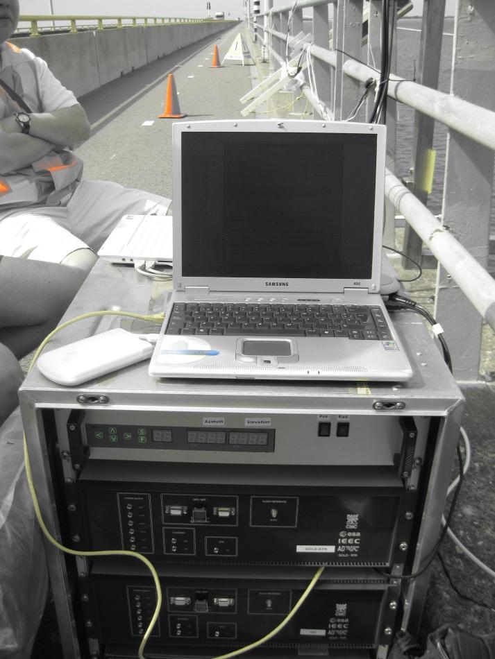
11 (2) the signals are cross-correlated against the modelled orthogonal replicas (3) in the time-domain, this brings information about the group-delay between each visible and reflected transmitter and the receiver position. Full Custom GNSS-R H/W Receiver: GOLD-RTR obtained with a high-gain narrowbeam and correctly pointed antenna is cross-correlated with the signals obtained by a similar antenna pointing toward the transmitter (without reflection)
12 Full Custom GNSS-R H/W Receiver: GOLD-RTR - IEEC design/manufacture H/W signal processor, FPGA: 640 complex correlators (10 channels) 15 meter inter-lag space flights, 8+ months ground campaigns: data available for research
13 public+encrypted signals contribute to the correlation, Full Custom GNSS-R H/W Receiver: GOLD-RTR - IEEC design/manufacture H/W signal processor, FPGA: 640 complex correlators (10 channels) 15 meter inter-lag space flights, 8+ months ground campaigns: data available for research Increased power and bandwidth: better precision?

14 public+encrypted signals contribute to the correlation, Full Custom GNSS-R H/W Receiver: GOLD-RTR Increased power and bandwidth: better precision? New PARIS Interferometric Receiver: PIR - designed and manufactured at IEEC during , based on modifications of the GOLD-RTR - IEEC design/manufacture H/W signal processor, FPGA: 640 complex correlators (10 channels) 15 meter inter-lag space flights, 8+ months ground campaigns: data available for research - cross-correlate reflected vs. direct signals using 320 complex correlators (built on FPGA), ns (3.75 m) inter-lag delay, - 1 msec coherent integration, - sampling rate: 80 MHz, - RF bandwidth programmable (8 to 80 MHz, 580 khz steps)
 waveform, obtained in urban environment (roof/building reflections): Lag delay 0 = 299.79 m")
15 Theoretical shape of a PIR (interferometric) waveform, using nominal transmitted powers especified at ISGPS-200: Examples C/A code chip: 1 C/A unit P code chip: 0.1 C/A unit Interferometric: 0.06 C/A unit A real PIR (interferometric) waveform, obtained in urban environment (roof/building reflections): Lag delay 0 = m
16 Test of PIR at laboratory - Experiments conducted on June 22, The SPIRENT synthesized signals included five visible GPS signals for a given simulation time, instrument location and dynamics, and one delayed signal, for only one PRN, with a well controlled synthesized delay. We present: - results from two SPIRENT experiments solely. - with data taken with standard mode (i.e. no calibration measurements, no swapping of the channels).
17 Preliminary group-delay results T (sod) SPIRENT delay step (cm) ref PIR measured 1-sec delay step sigma (cm) (cm) ref Difference (cm) 1.8 ref
18 Experiment #17 The configured SNR should relate to the Bridge Experiment, but it is likely that some effects will degrade the performance in other scenarios: higher altitudes of the receiver, rougher sea surface conditions, instrumental, multipath, etc. In order to inspect the effect of the signal-to-noise degradation into the altimetric performance, Experiment #17 gradually swept a range of 32 db in the signal-tonoise ratio, around the nominal Bridge Experiment value 40.4 db ( 15dB antennas' gain considered; final antennas were 9dB gain 28.4 db SNR ). The resulting measured delay dispersion depends on the signal-to-noise ratio at the correlation peak (for Ti=1s and BWRF=24 MHz) as:
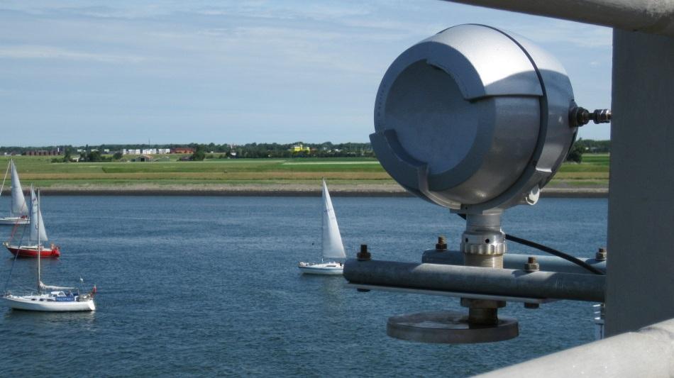
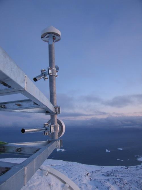
19 Bridge Experiment Zeeland Brug, The Netherlands, July Bridge altitude over water: ~18 meter Estuary waters with tide signal (2.5 m total oscillation) Equipment: PIR + traditional GNSS-R receiver (for comparison) 2 high-gain narrow-beam antennas, pointing up/down at fixed directions (20 deg incidence) Geodetic antenna, pointing zenith Complemented with a radar altimeter (RADAC wave guide working at 10 GHz) and L-band radiometer.
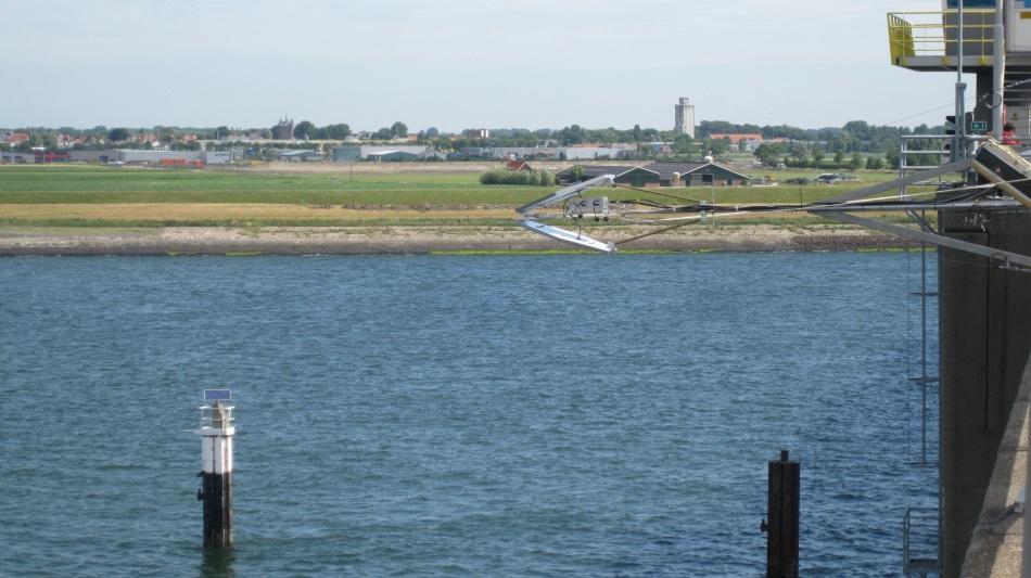

20
 32 deg Back-front ratio < -35 db S11 (within")
21 Antennas Gain 9.1 db Directivity 15 db Beam width (-3 db) 32 deg Back-front ratio < -35 db S11 (within L1) < -20 db Size (diam. hexagonal plane). 80 cm Weight (approx.) 1.8 kg
22 Group-Delay Results We are interested in GROUP DELAY altimetry (THIS IS NOT CARRIER PHASE ALTIMETRY). Group delay presents 1second ~7cm. Group delays present contamination by other GPS satellites. This combined -delay has been modelled by weighting each satellite contribution according to its location within the antenna gain pattern (simple model). July 7 July 8:
23 Altimetric Results The PIR measured altitude is presented on top, integrating the data up to one minute (34 1-sec samples + 10 swapped 1sec samples). 1-sec ~ 7cm/(2 sin(e)) --> 3.5 to 4.3 cm. On the bottom, the RADAC Wave Guide measurement of the altitude, 10 minutes averaged solution. July 7 July 8:
24 Altimetric Results Double differences (DD): (PIR Radar)day2 - (PIR Radar)day1 For good interval, peak-to-peak of ~20 cm ~3.3 cm (DD dispersion), which represents ~6.4 cm 1-second altitude dispersion.
25 Summary altimetry: ESA PARIS-IoD aims to use interferometric GNSS-R altimetry rather than code-modulation based altimetry IEEC developed a PARIS Interferometric Receiver (PIR) A SPIRENT/lab and Bridge/real experiments have been conducted SPRIENT test conclusions: group delay obtained with a-few cm precision (1 second dispersion); 1-cm delay jumps detected. Bridge experiment conclusions: In spite of non optimal conditions w.r.t. space-based measurements (strong multipath environment; antenna at fixed pointing direction; all satellites have the same differential delay & Doppler signatures) GROUP DELAY ALTIMETRY PERFORM AT 4 TO 6 CM LEVEL IN 1-SEC OBSERVATION.
26 Contents Altimetry with Global Navigation Satellite Systems: Model correlation vs. PARIS Interferometric Technique Sea Ice Monitoring Experiment Dome-C Dry Snow Experiment
 Long term campaign: Nov 2008 May 2009:")

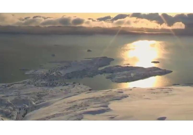
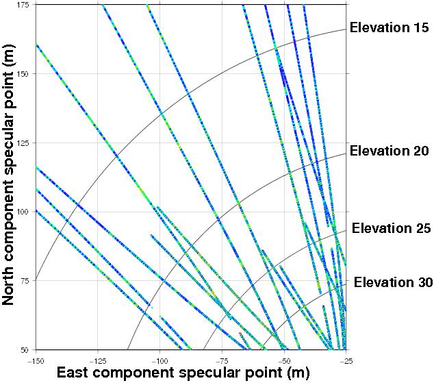
27 Sea Ice experiment Location: Godhavn (west coast in Greenland) Long term campaign: Nov 2008 May 2009: formation, evolution, melting of sea ice. Altitude = 700 meter Low elevation range due to coastline profile: 5 to 15 deg
28 Sea Ice experiment Strong multipath
29 Phase-altimetry Phase altimetry with cm precision Potential determination of sea ice free-board level, linked to thickness (stage of development) Agreement with AOTIM-5 and between polarizations
30 Sea-ice characterization Polarimetric ratio between co- and cross-polar components relates to permittivity: - The Fresnel coefficients of sea-ice depend on its dielectric properties (brine, temperature). - At the observation geometry, 5-20 deg elevation, both co- and crosspolar components are of the same order of magnitude. Its ratio is therefore sensitive to variations in dielectric properties.


31 Sea-ice characterization ice parameters (sea-ice concentration, form, and thickness) from DMI's egg-charts interpolated to PRN02 specular point location: GPS parameters for same PRN02: polarimetric ratio; slope of the trailing edge (roughness); and 1-sec RMS dispersion of the phase observables:
32 Contents Altimetry with Global Navigation Satellite Systems: Model correlation vs. PARIS Interferometric Technique Sea Ice Monitoring Experiment Dome-C Dry Snow Experiment
 of the dry snow: 10th to 21st January 2010 Clean visibility, large range of elevations (5 to 65 deg) and absence of near-multipath Validation area for remote sensing: availability of ancillary")
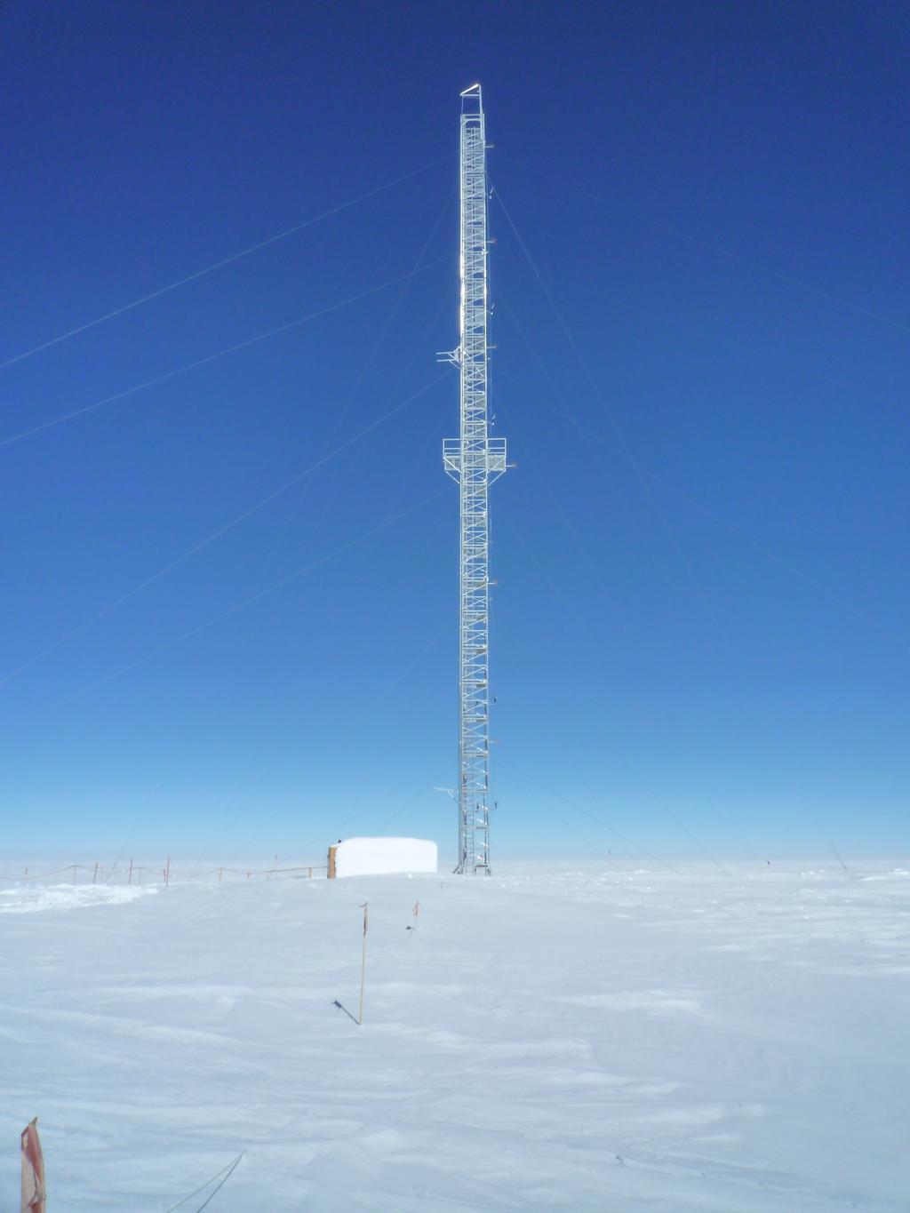
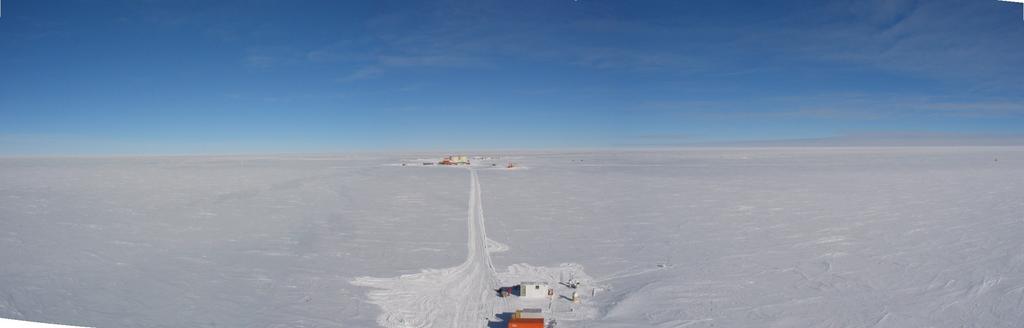
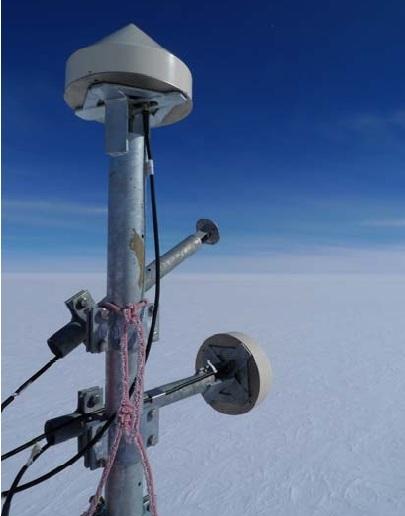
33 Dry snow experiment Dome-C, Antarctica Shorter campaign due to stability (Macelloni et al. 2005) of the dry snow: 10th to 21st January 2010 Clean visibility, large range of elevations (5 to 65 deg) and absence of near-multipath Validation area for remote sensing: availability of ancillary data 45 m vertical distance: overlap of direct and reflected signal for several lags Not a single surface : reflected signal as a contribution from different layers
34 Dry snow experiment

35 Need for a model Only GNSS-R snow model available in the literature was Wiehl et al. [2003]: volumetric scattering, which does not explain the beating of the waveform. New simple model, multilayer single reflection:

36 Need for a model Amplitude modelling: - only cross-polar component of the reflection considered -only co-polar component for transmission
37 Need for a model Complex waveform generated: - Incident signal at surface with A=1 - Direct signal set to lag 22 (RHCP to LHCP leakage with A=0.1) - Frequency of direct signal as a reference
38 Methodology Spectral components depend on the waveform lag: to conduct FFTs of the time series of each lag within the waveform


39 Results REAL DATA: MODEL:
40 Summary cryosphere: SEA ICE - Phase altimetry with cm precision at two polarizations Potential determination of the ice thickness (related to freeboard level) - Polarimetric and RMS measurements matches with ice percentage Permittivity and roughness can be used for sea ice classification DRY SNOW - A model with multiple layers has been tested - Lag by lag FFT series separates interferometric information from other effects - Preliminar results show good agreement - Proper inversion could determine dominant layers of the dry snow profile at L-band
GNSS-R for studies of the cryosphere
 GNSS-R for studies of the cryosphere F. Fabra 1, E. Cardellach 1, O. Nogués-Correig 1, S. Oliveras 1, S. Ribó 1, J.C. Arco 1, A. Rius 1, M. Belmonte-Rivas 2, M. Semmling 3, G. Macelloni 4, S. Pettinato
PARIS Interferometric Technique - Proof of Concept PIT-PoC
 PARIS Interferometric Technique - Proof of Concept PIT-PoC O. Nogués-Correig 1, S. Ribó 1, J.C. Arco 1, E. Cardellach 1, A. Rius 1 E. València 2, J.M. Tarongí 2, A. Camps 2, H. van der Marel 3, M. Martín-Neira
The Typhoon Investigation using GNSS-R Interferometric Signals (TIGRIS)
") The Typhoon Investigation using GNSS-R Interferometric Signals (TIGRIS) F. Fabra 1, W. Li 2, M. Martín-Neira 3, S. Oliveras 1, A. Rius 1, W. Yang 2, D. Yang 2 and Estel Cardellach 1 1 Institute of Space
The Typhoon Investigation using GNSS-R Interferometric Signals (TIGRIS) F. Fabra 1, W. Li 2, M. Martín-Neira 3, S. Oliveras 1, A. Rius 1, W. Yang 2, D. Yang 2 and Estel Cardellach 1 1 Institute of Space
Prototype Software-based Receiver for Remote Sensing using Reflected GPS Signals. Dinesh Manandhar The University of Tokyo
 Prototype Software-based Receiver for Remote Sensing using Reflected GPS Signals Dinesh Manandhar The University of Tokyo dinesh@qzss.org 1 Contents Background Remote Sensing Capability System Architecture
OBSERVATION PERFORMANCE OF A PARIS ALTIMETER IN-ORBIT DEMONSTRATOR
 OBSERVATION PERFORMANCE OF A PARIS ALTIMETER IN-ORBIT DEMONSTRATOR Salvatore D Addio, Manuel Martin-Neira Acknowledgment to: Nicolas Floury, Roberto Pietro Cerdeira TEC-ETP, ETP, Electrical Engineering
Rec. ITU-R P RECOMMENDATION ITU-R P *
 Rec. ITU-R P.682-1 1 RECOMMENDATION ITU-R P.682-1 * PROPAGATION DATA REQUIRED FOR THE DESIGN OF EARTH-SPACE AERONAUTICAL MOBILE TELECOMMUNICATION SYSTEMS (Question ITU-R 207/3) Rec. 682-1 (1990-1992) The
PARIS Ocean Altimeter
 PARIS Ocean Altimeter M. Martín-Neira, S. D Addio (TEC-ETP) European Space Agency Acknowledgment: C. Buck (TEC-ETP) N. Floury, R. Prieto (TEC-EEP) GNSS-R10 Workshop, UPC, Barcelona, 21-22 October 2010
Theoretical Simulations of GNSS Reflections from Bare and Vegetated Soils
 Theoretical Simulations of GNSS Reflections from Bare and Vegetated Soils R. Giusto 1, L. Guerriero, S. Paloscia 3, N. Pierdicca 1, A. Egido 4, N. Floury 5 1 DIET - Sapienza Univ. of Rome, Rome DISP -
CYGNSS Wind Retrieval Performance
 International Ocean Vector Wind Science Team Meeting Kailua-Kona, Hawaii USA 6-8 May 2013 CYGNSS Wind Retrieval Performance Chris Ruf (1), Maria-Paola Clarizia (1,2), Andrew O Brien (3), Joel Johnson (3),
GNSS Reflections over Ocean Surfaces
 GNSS Reflections over Ocean Surfaces State of the Art F. Soulat CCT Space Reflectometry December 1st 2010 Page n 1 Outline Concept GNSS-R Signal On-going Activities ( Applications) CLS GNSS-R Studies CCT
2 INTRODUCTION TO GNSS REFLECTOMERY
 2 INTRODUCTION TO GNSS REFLECTOMERY 2.1 Introduction The use of Global Navigation Satellite Systems (GNSS) signals reflected by the sea surface for altimetry applications was first suggested by Martín-Neira
GNSS Reflectometry: Innovative Remote Sensing
 GNSS Reflectometry: Innovative Remote Sensing J. Beckheinrich 1, G. Beyerle 1, S. Schön 2, H. Apel 1, M. Semmling 1, J. Wickert 1 1.GFZ, German Research Center for Geosciences, Potsdam, Germany 2.Leibniz
Fully focused SAR processing. Walter H. F. Smith and Alejandro E. Egido
 Fully focused SAR processing Walter H. F. Smith and Alejandro E. Egido Acknowledgements We thank ESA for making FBR SAR products available from CryoSat and Sentinel-3A. We thank the Svalbard and Crete
Technical Note on POlarimetric Phase Interferometry (POPI)
") arxiv:physics/0606099 v2 16 Jun 2006 Technical Note on POlarimetric Phase Interferometry (POPI) Estel Cardellach, Serni Ribó, and Antonio Rius Institut de Ciències de l Espai (IEEC-CSIC) 1 Chapter 1 POlarimetric
arxiv:physics/0606099 v2 16 Jun 2006 Technical Note on POlarimetric Phase Interferometry (POPI) Estel Cardellach, Serni Ribó, and Antonio Rius Institut de Ciències de l Espai (IEEC-CSIC) 1 Chapter 1 POlarimetric
Measuring Galileo s Channel the Pedestrian Satellite Channel
 Satellite Navigation Systems: Policy, Commercial and Technical Interaction 1 Measuring Galileo s Channel the Pedestrian Satellite Channel A. Lehner, A. Steingass, German Aerospace Center, Münchnerstrasse
Scientific Applications of Fully-Focused SAR Altimetry
 Scientific Applications of Fully-Focused SAR Altimetry Alejandro Egido (1,2), Walter Smith (2) (1) UMD/CICS-MD, United States (2) NOAA, United States CICS Science Conference Nov 29, 30 & Dec 1, 2016 College
Soil Moisture Observation Utilizing Reflected GNSS Signals
 Soil Moisture Observation Utilizing Reflected GNSS Signals GNSS-R Tech in Soil Moisture New Data Processing Method Prof. Dongkai YANG Joint African/Asia-Pacific UN-Regional Centers and International Training
Assessment of instrument STability and Retrieval Algorithms for SMOS data (ASTRA)
") Assessment of instrument STability and Retrieval Algorithms for SMOS data (ASTRA) S.Paloscia IFAC-CNR MRSG - Microwave Remote Sensing Group Florence (Italy) Microwave Remote Sensing Group I - DOMEX-2 :
Assessment of instrument STability and Retrieval Algorithms for SMOS data (ASTRA) S.Paloscia IFAC-CNR MRSG - Microwave Remote Sensing Group Florence (Italy) Microwave Remote Sensing Group I - DOMEX-2 :
Airborne Experiments to study GNSS-R Phase Observations as part of the GEOHALO Mission
 Airborne Experiments to study GNSS-R Phase Observations as part of the GEOHALO Mission M. Semmling1, G. Beyerle1, J. Beckheinrich1, J. Wickert1, F. Fabra2, S. Ribó2, M. Scheinert3 GFZ 2 IEEC 3 TUD 1 Deutsches
OCEAN SURFACE ROUGHNESS REFLECTOMETRY WITH GPS MULTISTATIC RADAR FROM HIGH-ALTITUDE AIRCRAFT
 OCEAN SURFACE ROUGHNESS REFLECTOMETRY WITH GPS MULTISTATIC RADAR FROM HIGH-ALTITUDE AIRCRAFT VALERY U. ZAVOROTNY 1, DENNIS M. AKOS 2, HANNA MUNTZING 3 1 NOAA/Earth System Research Laboratory/ Physical
Remote Sensing with Reflected Signals
 Remote Sensing with Reflected Signals GNSS-R Data Processing Software and Test Analysis Dongkai Yang, Yanan Zhou, and Yan Wang (airplane) istockphoto.com/mark Evans; gpsiff background Authors from a leading
A Global System for Detecting Dangerous Seas Using GNSS Bi-static Radar Technology
 A Global System for Detecting Dangerous Seas Using GNSS Bi-static Radar Technology Scott Gleason, Ka Bian, Alex da Silva Curiel Stephen Mackin and Martin Sweeting 20 th AIAA/USU Smallsat Conference, Logan,
SPREAD SPECTRUM CHANNEL MEASUREMENT INSTRUMENT
 SPACE SPREAD SPECTRUM CHANNEL MEASUREMENT INSTRUMENT Satellite communications, earth observation, navigation and positioning and control stations indracompany.com SSCMI SPREAD SPECTRUM CHANNEL MEASUREMENT
GNSS Technologies. GNSS Acquisition Dr. Zahidul Bhuiyan Finnish Geospatial Research Institute, National Land Survey
 GNSS Acquisition 25.1.2016 Dr. Zahidul Bhuiyan Finnish Geospatial Research Institute, National Land Survey Content GNSS signal background Binary phase shift keying (BPSK) modulation Binary offset carrier
Automotive Radar Sensors and Congested Radio Spectrum: An Urban Electronic Battlefield?
 Automotive Radar Sensors and Congested Radio Spectrum: An Urban Electronic Battlefield? By Sefa Tanis Share on As automotive radars become more widespread, the heavily occupied RF spectrum will resemble
A Coherent Bistatic Vegetation Model for SoOp Land Applications: Preliminary Simulation Results
 A Coherent Bistatic Vegetation Model for SoOp Land Applications: Preliminary Simulation Results Mehmet Kurum (1), Manohar Deshpande (2), Alicia T. Joseph (2), Peggy E. O Neill (2), Roger H. Lang (3), Orhan
Characteristics of the Land Mobile Navigation Channel for Pedestrian Applications
 Characteristics of the Land Mobile Navigation Channel for Pedestrian Applications Andreas Lehner German Aerospace Center Münchnerstraße 20 D-82230 Weßling, Germany andreas.lehner@dlr.de Co-Authors: Alexander
Detection of Multipath Propagation Effects in SAR-Tomography with MIMO Modes
 Detection of Multipath Propagation Effects in SAR-Tomography with MIMO Modes Tobias Rommel, German Aerospace Centre (DLR), tobias.rommel@dlr.de, Germany Gerhard Krieger, German Aerospace Centre (DLR),
Developments in GNSS Reflectometry from the SGR-ReSI on TDS-1
 Changing the economics of space Developments in GNSS Reflectometry from the SGR-ReSI on TDS-1 Martin Unwin Philip Jales, Jason Tye (SSTL), Brent Abbott SST-US Christine Gommenginger, Giuseppe Foti (NOC)
PARIS-MB User Manual
 PARIS-MB User Manual Serni Ribó Institut de Ciències de l Espai (CSIC/IEEC) January 7th, 2014 Version 1.0 1 Instrument Description The PARIS Multi-Band receiver is a GNSS reflection receiver capable of
The Influence of Multipath on the Positioning Error
 The Influence of Multipath on the Positioning Error Andreas Lehner German Aerospace Center Münchnerstraße 20 D-82230 Weßling, Germany andreas.lehner@dlr.de Co-Authors: Alexander Steingaß, German Aerospace
A Zeppelin-based Study on GNSS Reflectometry for Altimetric Application
 A Zeppelin-based Study on GNSS Reflectometry for Altimetric Application M. Semmling 1 G. Beyerle 1 J. Beckheinrich 1 J. Wickert 1 M. Ge 1 S. Schön 2 1 GFZ Deutsches GeoForschungsZentrum, Potsdam 2 IfE
Using Frequency Diversity to Improve Measurement Speed Roger Dygert MI Technologies, 1125 Satellite Blvd., Suite 100 Suwanee, GA 30024
 Using Frequency Diversity to Improve Measurement Speed Roger Dygert MI Technologies, 1125 Satellite Blvd., Suite 1 Suwanee, GA 324 ABSTRACT Conventional antenna measurement systems use a multiplexer or
Performance of Wideband Mobile Channel with Perfect Synchronism BPSK vs QPSK DS-CDMA
 Performance of Wideband Mobile Channel with Perfect Synchronism BPSK vs QPSK DS-CDMA By Hamed D. AlSharari College of Engineering, Aljouf University, Sakaka, Aljouf 2014, Kingdom of Saudi Arabia, hamed_100@hotmail.com
Global Positioning System: what it is and how we use it for measuring the earth s movement. May 5, 2009
 Global Positioning System: what it is and how we use it for measuring the earth s movement. May 5, 2009 References Lectures from K. Larson s Introduction to GNSS http://www.colorado.edu/engineering/asen/
THE NASA/JPL AIRBORNE SYNTHETIC APERTURE RADAR SYSTEM. Yunling Lou, Yunjin Kim, and Jakob van Zyl
 THE NASA/JPL AIRBORNE SYNTHETIC APERTURE RADAR SYSTEM Yunling Lou, Yunjin Kim, and Jakob van Zyl Jet Propulsion Laboratory California Institute of Technology 4800 Oak Grove Drive, MS 300-243 Pasadena,
CHAPTER 2 WIRELESS CHANNEL
 CHAPTER 2 WIRELESS CHANNEL 2.1 INTRODUCTION In mobile radio channel there is certain fundamental limitation on the performance of wireless communication system. There are many obstructions between transmitter
MAKING TRANSIENT ANTENNA MEASUREMENTS
 MAKING TRANSIENT ANTENNA MEASUREMENTS Roger Dygert, Steven R. Nichols MI Technologies, 1125 Satellite Boulevard, Suite 100 Suwanee, GA 30024-4629 ABSTRACT In addition to steady state performance, antennas
PARIS In-Orbit Demonstrator
 1/52 PARIS In-Orbit Demonstrator Manuel Martín-Neira Neira,, Salvatore D Addio,, Christopher Buck (TEC-ETP) ETP) Acknowledgments: F. Coromina (TEC-ETP) ETP) N. Floury (TEC-EEP) EEP) J. Santiago Prowald
CNES PRIORITIES IN POLAR AND CRYOSPHERE RESEARCH
 Polar Space Task Group 3rd Session CNES PRIORITIES IN POLAR AND CRYOSPHERE RESEARCH Juliette Lambin, Steven Hosford Wednesday, May 22th, 2013 Paris, France 1 OUTLINE CNES MISSIONS FOR POLAR/CRYOSPHERE
Earth Remote Sensing using Surface-Reflected GNSS Signals (Part II)
") Jet Propulsion Laboratory California Institute of Technology National Aeronautics and Space Administration Jet Propulsion Laboratory California Institute of Technology Pasadena, California Earth Remote
Jet Propulsion Laboratory California Institute of Technology National Aeronautics and Space Administration Jet Propulsion Laboratory California Institute of Technology Pasadena, California Earth Remote
GNSS-R for Land Bio-Geophysical Parameters Monitoring: the LEiMON Project
 GNSS-R for Land Bio-Geophysical Parameters Monitoring: the LEiMON Project Alejandro Egido(1), Marco Caparrini(1), Leila Guerriero(2), Nazzareno Pierdicca(2), Simonetta Paloscia(3), Marco Brogioni(3), Nicolas
The Delay-Doppler Altimeter
 Briefing for the Coastal Altimetry Workshop The Delay-Doppler Altimeter R. K. Raney Johns Hopkins University Applied Physics Laboratory 05-07 February 2008 1 What is a Delay-Doppler altimeter? Precision
4GHz / 6GHz Radiation Measurement System
 4GHz / 6GHz Radiation Measurement System The MegiQ Radiation Measurement System (RMS) is a compact test system that performs 3-axis radiation pattern measurement in non-anechoic spaces. With a frequency
STM Product Evolution for Processing Baseline 2.24
 PREPARATION AND OPERATIONS OF THE MISSION PERFORMANCE CENTRE (MPC) FOR THE COPERNICUS SENTINEL-3 MISSION Contract: 4000111836/14/I-LG Customer: ESA Document Contract No.: 4000111836/14/I-LG Project: PREPARATION
A Bistatic HF Radar for Current Mapping and Robust Ship Tracking
 A Bistatic HF Radar for Current Mapping and Robust Ship Tracking D. B. Trizna Imaging Science Research, Inc. 6103B Virgo Court Burke, VA, 22015 USA Abstract- A bistatic HF radar has been developed for
Channel Modelling ETIN10. Directional channel models and Channel sounding
 Channel Modelling ETIN10 Lecture no: 7 Directional channel models and Channel sounding Ghassan Dahman / Fredrik Tufvesson Department of Electrical and Information Technology Lund University, Sweden 2014-02-17
Microwave Remote Sensing
 Provide copy on a CD of the UCAR multi-media tutorial to all in class. Assign Ch-7 and Ch-9 (for two weeks) as reading material for this class. HW#4 (Due in two weeks) Problems 1,2,3 and 4 (Chapter 7)
A LOW-COST GNSS-R SYSTEM BASED ON SOFTWARE-DEFINED-RADIO
 A LOW-COST GNSS-R SYSTEM BASED ON SOFTWARE-DEFINED-RADIO Thomas Hobiger, Jun Amagai, Masanori Aida, Hideki Narita, and Tadahiro Gotoh (National Institute of Information and Communications Technology, Koganei,
Passive Microwave Sensors LIDAR Remote Sensing Laser Altimetry. 28 April 2003
 Passive Microwave Sensors LIDAR Remote Sensing Laser Altimetry 28 April 2003 Outline Passive Microwave Radiometry Rayleigh-Jeans approximation Brightness temperature Emissivity and dielectric constant
ECE 476/ECE 501C/CS Wireless Communication Systems Winter Lecture 6: Fading
 ECE 476/ECE 501C/CS 513 - Wireless Communication Systems Winter 2005 Lecture 6: Fading Last lecture: Large scale propagation properties of wireless systems - slowly varying properties that depend primarily
Incoherent Scatter Experiment Parameters
 Incoherent Scatter Experiment Parameters At a fundamental level, we must select Waveform type Inter-pulse period (IPP) or pulse repetition frequency (PRF) Our choices will be dictated by the desired measurement
ECE 476/ECE 501C/CS Wireless Communication Systems Winter Lecture 6: Fading
 ECE 476/ECE 501C/CS 513 - Wireless Communication Systems Winter 2004 Lecture 6: Fading Last lecture: Large scale propagation properties of wireless systems - slowly varying properties that depend primarily
The Discussion of this exercise covers the following points:
 Exercise 3-2 Frequency-Modulated CW Radar EXERCISE OBJECTIVE When you have completed this exercise, you will be familiar with FM ranging using frequency-modulated continuous-wave (FM-CW) radar. DISCUSSION
Enhancing space situational awareness using passive radar from space based emitters of opportunity
 Tracking Space Debris Craig Benson School of Engineering and IT Enhancing space situational awareness using passive radar from space based emitters of opportunity Space Debris as a Problem Debris is fast
GNSS Reflectometry and Passive Radar at DLR
 ACES and FUTURE GNSS-Based EARTH OBSERVATION and NAVIGATION 26./27. May 2008, TU München Dr. Thomas Börner, Microwaves and Radar Institute, DLR Overview GNSS Reflectometry a joined proposal of DLR and
Multi-Path Fading Channel
 Instructor: Prof. Dr. Noor M. Khan Department of Electronic Engineering, Muhammad Ali Jinnah University, Islamabad Campus, Islamabad, PAKISTAN Ph: +9 (51) 111-878787, Ext. 19 (Office), 186 (Lab) Fax: +9
Alternative Positioning, Navigation and Timing (APNT) for Performance Based Navigation (PBN)
 for Performance Based Navigation (PBN)") DLR.de Chart 1 Alternative Positioning, Navigation and Timing (APNT) for Performance Based Navigation (PBN) Presented by Boubeker Belabbas Prepared by : Nicolas Schneckenburger, Elisabeth Nossek, Dmitriy
DLR.de Chart 1 Alternative Positioning, Navigation and Timing (APNT) for Performance Based Navigation (PBN) Presented by Boubeker Belabbas Prepared by : Nicolas Schneckenburger, Elisabeth Nossek, Dmitriy
ESA Radar Remote Sensing Course ESA Radar Remote Sensing Course Radar, SAR, InSAR; a first introduction
 Radar, SAR, InSAR; a first introduction Ramon Hanssen Delft University of Technology The Netherlands r.f.hanssen@tudelft.nl Charles University in Prague Contents Radar background and fundamentals Imaging
GNSS-Reflectometry for Observation and Monitoring of Earth surface
 GNSS-Reflectometry for Observation and Monitoring of Earth surface Global Navigation meets Geoinformation ESA ESOC Darmstadt, 28-04-2017 Dr. Ing. Domenico Schiavulli INR engineer support at EUMETSAT Outline
Ocean SAR altimetry. from SIRAL2 on CryoSat2 to Poseidon-4 on Jason-CS
 Ocean SAR altimetry from SIRAL2 on CryoSat2 to Poseidon-4 on Jason-CS Template reference : 100181670S-EN L. Phalippou, F. Demeestere SAR Altimetry EGM NOC, Southampton, 26 June 2013 History of SAR altimetry
Scalable Front-End Digital Signal Processing for a Phased Array Radar Demonstrator. International Radar Symposium 2012 Warsaw, 24 May 2012
 Scalable Front-End Digital Signal Processing for a Phased Array Radar Demonstrator F. Winterstein, G. Sessler, M. Montagna, M. Mendijur, G. Dauron, PM. Besso International Radar Symposium 2012 Warsaw,
TEST RESULTS OF A HIGH GAIN ADVANCED GPS RECEIVER
 TEST RESULTS OF A HIGH GAIN ADVANCED GPS RECEIVER ABSTRACT Dr. Alison Brown, Randy Silva, Gengsheng Zhang,; NAVSYS Corporation. NAVSYS High Gain Advanced GPS Receiver () uses a digital beam-steering antenna
GNSS Ocean Reflected Signals
 GNSS Ocean Reflected Signals Per Høeg DTU Space Technical University of Denmark Content Experimental setup Instrument Measurements and observations Spectral characteristics, analysis and retrieval method
Modern radio techniques
 Modern radio techniques for probing the ionosphere Receiver, radar, advanced ionospheric sounder, and related techniques Cesidio Bianchi INGV - Roma Italy Ionospheric properties related to radio waves
EENG473 Mobile Communications Module 3 : Week # (12) Mobile Radio Propagation: Small-Scale Path Loss
 Mobile Radio Propagation: Small-Scale Path Loss") EENG473 Mobile Communications Module 3 : Week # (12) Mobile Radio Propagation: Small-Scale Path Loss Introduction Small-scale fading is used to describe the rapid fluctuation of the amplitude of a radio
EENG473 Mobile Communications Module 3 : Week # (12) Mobile Radio Propagation: Small-Scale Path Loss Introduction Small-scale fading is used to describe the rapid fluctuation of the amplitude of a radio
Satellite Navigation Principle and performance of GPS receivers
 Satellite Navigation Principle and performance of GPS receivers AE4E08 GPS Block IIF satellite Boeing North America Christian Tiberius Course 2010 2011, lecture 3 Today s topics Introduction basic idea
Coherent Marine Radar. Measurements of Ocean Wave Spectra and Surface Currents
 Measurements of Ocean Wave Spectra and Surface Currents Dennis Trizna Imaging Science Research, Inc. dennis @ isr-sensing.com Presentation Outline: Introduction: Standard Marine Radar vs. Single Image
HIGH GAIN ADVANCED GPS RECEIVER
 ABSTRACT HIGH GAIN ADVANCED GPS RECEIVER NAVSYS High Gain Advanced () uses a digital beam-steering antenna array to enable up to eight GPS satellites to be tracked, each with up to dbi of additional antenna
Remote Sensing using Bistatic GPS and a Digital Beam Steering Receiver
 Remote Sensing using Bistatic GPS and a Digital Beam Steering Receiver Alison Brown and Ben Mathews, NAVSYS Corporation BIOGRAPHY Alison Brown is the President and Chief Executive Officer of NAVSYS Corporation.
Channel. Muhammad Ali Jinnah University, Islamabad Campus, Pakistan. Multi-Path Fading. Dr. Noor M Khan EE, MAJU
 Instructor: Prof. Dr. Noor M. Khan Department of Electronic Engineering, Muhammad Ali Jinnah University, Islamabad Campus, Islamabad, PAKISTAN Ph: +9 (51) 111-878787, Ext. 19 (Office), 186 (Lab) Fax: +9
Wireless Channel Propagation Model Small-scale Fading
 Wireless Channel Propagation Model Small-scale Fading Basic Questions T x What will happen if the transmitter - changes transmit power? - changes frequency? - operates at higher speed? Transmit power,
Channel Modelling ETI 085
 Channel Modelling ETI 085 Lecture no: 7 Directional channel models Channel sounding Why directional channel models? The spatial domain can be used to increase the spectral efficiency i of the system Smart
GNSS Reflectometry at GFZ
 GNSS Reflectometry at GFZ Achim Helm, Georg Beyerle, Ralf Stosius, Markus Rothacher (GFZ) External Partners and Contributors: Oliver Montenbruck (DLR), Estel Cardellach, Antonio Rius (IEEC), Sergei Yudanov,
Chapter 7. Multiple Division Techniques
 Chapter 7 Multiple Division Techniques 1 Outline Frequency Division Multiple Access (FDMA) Division Multiple Access (TDMA) Code Division Multiple Access (CDMA) Comparison of FDMA, TDMA, and CDMA Walsh
EVLA System Commissioning Results
 EVLA System Commissioning Results EVLA Advisory Committee Meeting, March 19-20, 2009 Rick Perley EVLA Project Scientist t 1 Project Requirements EVLA Project Book, Chapter 2, contains the EVLA Project
Practical issue: Group definition. TSTE17 System Design, CDIO. Quadrature Amplitude Modulation (QAM) Components of a digital communication system
 Components of a digital communication system") 1 2 TSTE17 System Design, CDIO Introduction telecommunication OFDM principle How to combat ISI How to reduce out of band signaling Practical issue: Group definition Project group sign up list will be put
1 2 TSTE17 System Design, CDIO Introduction telecommunication OFDM principle How to combat ISI How to reduce out of band signaling Practical issue: Group definition Project group sign up list will be put
Tracking of Moving Targets with MIMO Radar
 Tracking of Moving Targets with MIMO Radar Peter W. Moo, Zhen Ding Radar Sensing & Exploitation Section DRDC Ottawa Research Centre Presentation to 2017 NATO Military Sensing Symposium 31 May 2017 waveform
It is well known that GNSS signals
 GNSS Solutions: Multipath vs. NLOS signals GNSS Solutions is a regular column featuring questions and answers about technical aspects of GNSS. Readers are invited to send their questions to the columnist,
Altimeter Range Corrections
 Altimeter Range Corrections Schematic Summary Corrections Altimeters Range Corrections Altimeter range corrections can be grouped as follows: Atmospheric Refraction Corrections Sea-State Bias Corrections
A Multicarrier CDMA Based Low Probability of Intercept Network
 A Multicarrier CDMA Based Low Probability of Intercept Network Sayan Ghosal Email: sayanghosal@yahoo.co.uk Devendra Jalihal Email: dj@ee.iitm.ac.in Giridhar K. Email: giri@ee.iitm.ac.in Abstract The need
Multi Band Passive Forward Scatter Radar
 Multi Band Passive Forward Scatter Radar S. Hristov, A. De Luca, M. Gashinova, A. Stove, M. Cherniakov EESE, University of Birmingham Birmingham, B15 2TT, UK m.cherniakov@bham.ac.uk Outline Multi-Band
Introduction to Global Navigation Satellite System (GNSS) Signal Structure
 Signal Structure") Introduction to Global Navigation Satellite System (GNSS) Signal Structure Dinesh Manandhar Center for Spatial Information Science The University of Tokyo Contact Information: dinesh@iis.u-tokyo.ac.jp
Introduction to Global Navigation Satellite System (GNSS) Signal Structure Dinesh Manandhar Center for Spatial Information Science The University of Tokyo Contact Information: dinesh@iis.u-tokyo.ac.jp
Frequency-Modulated Continuous-Wave Radar (FM-CW Radar)
") Frequency-Modulated Continuous-Wave Radar (FM-CW Radar) FM-CW radar (Frequency-Modulated Continuous Wave radar = FMCW radar) is a special type of radar sensor which radiates continuous transmission power
Frequency-Modulated Continuous-Wave Radar (FM-CW Radar) FM-CW radar (Frequency-Modulated Continuous Wave radar = FMCW radar) is a special type of radar sensor which radiates continuous transmission power
HAMEG Programmable Measuring Instruments Series 8100
 HAMEG Programmable Measuring Instruments Series 8100 HAMEG Programmable Measuring Instruments Series 8100 are ideally suited for test installations in production and automated tests in laboratories. They
OFDM system: Discrete model Spectral efficiency Characteristics. OFDM based multiple access schemes. OFDM sensitivity to synchronization errors
 Introduction - Motivation OFDM system: Discrete model Spectral efficiency Characteristics OFDM based multiple access schemes OFDM sensitivity to synchronization errors 4 OFDM system Main idea: to divide
Chapter 2. Modified Rectangular Patch Antenna with Truncated Corners. 2.1 Introduction of rectangular microstrip antenna
 Chapter 2 Modified Rectangular Patch Antenna with Truncated Corners 2.1 Introduction of rectangular microstrip antenna 2.2 Design and analysis of rectangular microstrip patch antenna 2.3 Design of modified
Active Radio Frequency Sensing for Soil Moisture Retrieval
 Active Radio Frequency Sensing for Soil Moisture Retrieval T. Pratt and Z. Lin University of Notre Dame Other Contributors L. Leo, S. Di Sabatino, E. Pardyjak Summary of DUGWAY Experimental Set-Up Deployed
SAR Formation Flying
 3 th June 13 SAR Formation Flying Annex 4. Bistatic Sensor Experiment Document Version: v1_1 Dr. Kegen Yu, Prof. Chris Rizos & Prof. Andrew Dempster Australian Centre for Space Engineering Research (ACSER)
L-band brightness temperature at Dome-C Antarctica: intercomparison between DOMEX-3, SMOS and Aquarius data
 SMOS & AQUARIUS SCIENCE WORKSHOP Brest 15 17 April 2013 L-band brightness temperature at Dome-C Antarctica: intercomparison between DOMEX-3, SMOS and Aquarius data Marco Brogioni, Giovanni Macelloni, Simone
Corresponding author address: Valery Melnikov, 1313 Haley Circle, Norman, OK,
 2.7 EVALUATION OF POLARIMETRIC CAPABILITY ON THE RESEARCH WSR-88D Valery M. Melnikov *, Dusan S. Zrnic **, John K. Carter **, Alexander V. Ryzhkov *, Richard J. Doviak ** * - Cooperative Institute for
Range Considerations for RF Networks
 TI Technology Days 2010 Range Considerations for RF Networks Richard Wallace Abstract The antenna can be one of the most daunting components of wireless designs. Most information available relates to large
TEST RESULTS OF A DIGITAL BEAMFORMING GPS RECEIVER FOR MOBILE APPLICATIONS
 TEST RESULTS OF A DIGITAL BEAMFORMING GPS RECEIVER FOR MOBILE APPLICATIONS Alison Brown, Huan-Wan Tseng, and Randy Kurtz, NAVSYS Corporation BIOGRAPHY Alison Brown is the President and CEO of NAVSYS Corp.
Development of Broadband Radar and Initial Observation
 Development of Broadband Radar and Initial Observation Tomoo Ushio, Kazushi Monden, Tomoaki Mega, Ken ichi Okamoto and Zen-Ichiro Kawasaki Dept. of Aerospace Engineering Osaka Prefecture University Osaka,
Spread Spectrum Techniques
 0 Spread Spectrum Techniques Contents 1 1. Overview 2. Pseudonoise Sequences 3. Direct Sequence Spread Spectrum Systems 4. Frequency Hopping Systems 5. Synchronization 6. Applications 2 1. Overview Basic
Utilizing Batch Processing for GNSS Signal Tracking
 Utilizing Batch Processing for GNSS Signal Tracking Andrey Soloviev Avionics Engineering Center, Ohio University Presented to: ION Alberta Section, Calgary, Canada February 27, 2007 Motivation: Outline
ASR-2300 Multichannel SDR Module for PNT and Mobile communications. Dr. Michael B. Mathews Loctronix, Corporation
 ASR-2300 Multichannel SDR Module for PNT and Mobile communications GNU Radio Conference 2013 October 1, 2013 Boston, Massachusetts Dr. Michael B. Mathews Loctronix, Corporation Loctronix Corporation 2008,
D1.17B VDES Channel Model - Review of VDES terrestrial test results Recent Updates and Work In Progress
 D1.17B VDES Channel Model - Review of VDES terrestrial test results Recent Updates and Work In Progress Arunas Macikunas 1, Jan Šafář 2, Ronald Raulefs 3, Wei Wang 3 1 Waves in Space Corp., Canada 2 General
Ultra-Wideband Radars for Measurements Over Land and Sea Ice
 Ultra-Wideband Radars for Measurements Over Land and Sea Ice R. Hale, H. Miller, S. Gogineni, J.-B. Yan, F. Rodriguez-Morales, C. Leuschen, Z. Wang, J. Paden, D. Gomez-Garcia, T. Binder, D. Steinhage,
Cooperative navigation (part II)
") Cooperative navigation (part II) An example using foot-mounted INS and UWB-transceivers Jouni Rantakokko Aim Increased accuracy during long-term operations in GNSS-challenged environments for - First responders
Cooperative navigation (part II) An example using foot-mounted INS and UWB-transceivers Jouni Rantakokko Aim Increased accuracy during long-term operations in GNSS-challenged environments for - First responders