22/11/2013. UAV: Overview of systems, applications and processing Kris Nackaerts, Peter Strigencz
|
|
|
- Jocelyn Norton
- 6 years ago
- Views:
Transcription
1 22/11/2013 UAV: Overview of systems, applications and processing Kris Nackaerts, Peter Strigencz
2 Introduction» Systems» Applications» Non-imaging» Imaging» Processing, focus on photogrammetry» Use case 22/11/2013 2
3 Systems» Limited to ready to fly COTS solutions» Characteristics» Fixed wing <-> multi rotor» Endurance / study area» Robustness» Flightplanning software» Autopilot capabilities» Automatic takeoff / landing?» Safety measures» Sensitivity to weather conditions» Payload capabilities» Logistics? 22/11/2013 3

4 22/11/2013 4

5 22/11/2013 5


6 22/11/2013 6

7 22/11/2013 7


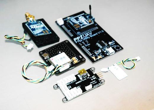
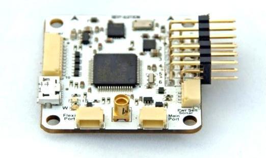

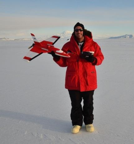
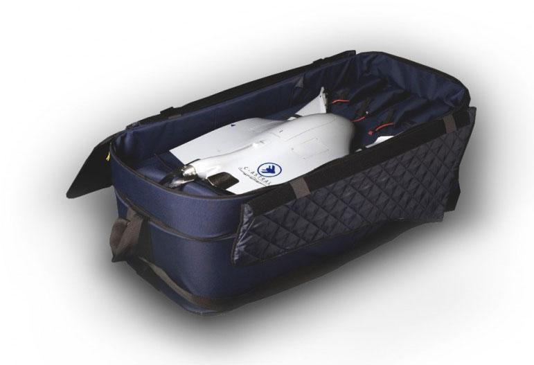
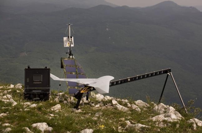
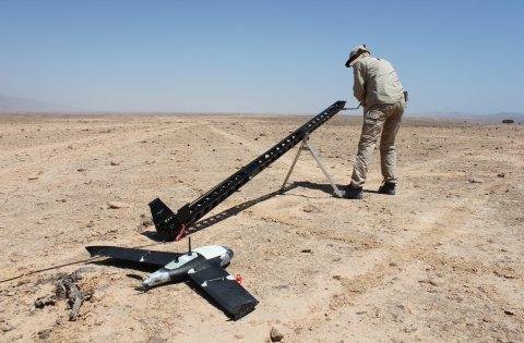
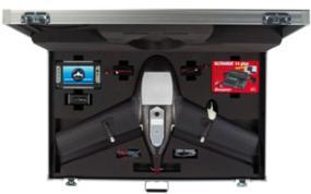
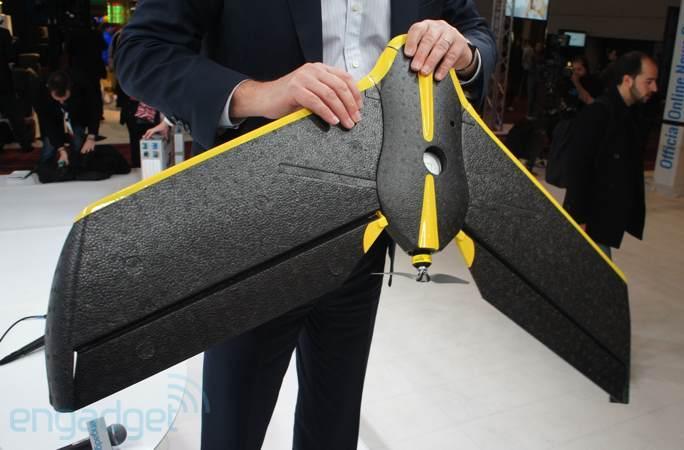
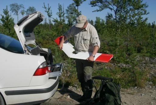
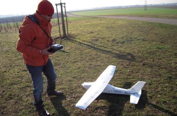
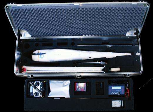
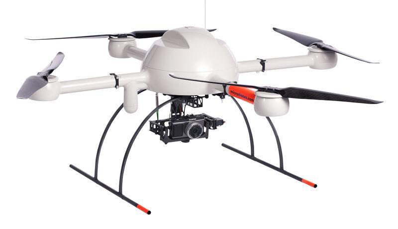
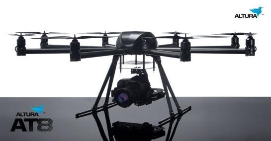
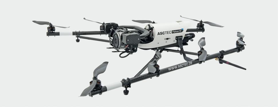
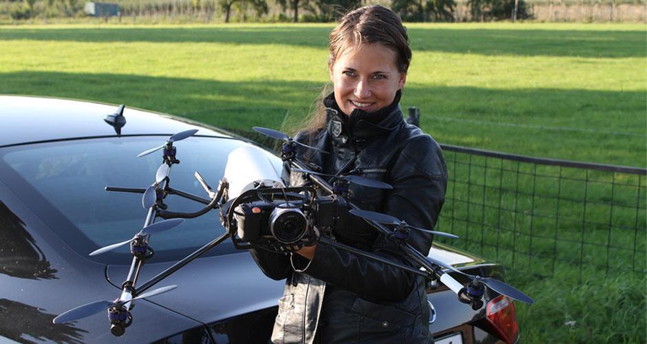
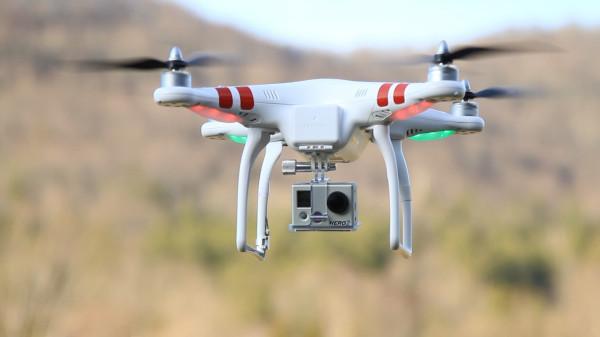
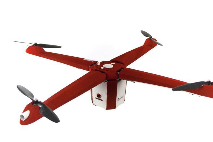
8 Systems for the more adventurous 22/11/2013 8

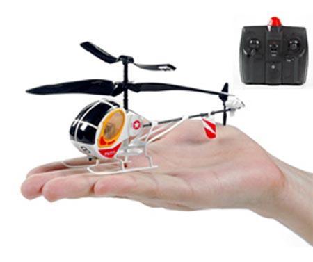
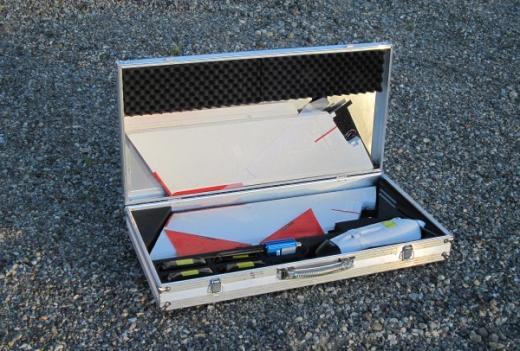
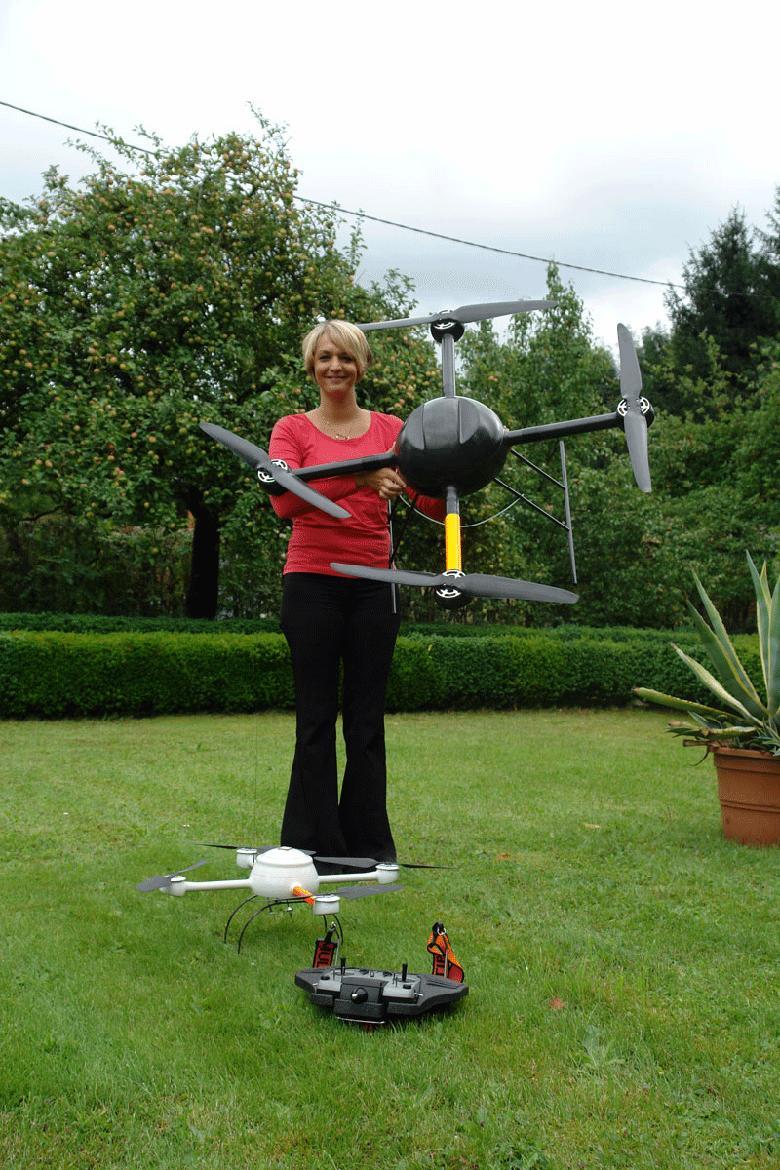
9 Systems don t forget 22/11/2013 9
10 Motion blur [%] Platform selection process: one example 1400 Motion blur versus shutter speed/integration time 120 Typical cruise speed Shutter speed / integration time [ ms ] 22/11/
11 Platforms: summary» Platforms are available» Ready to use with/without experience» Challenges:» Technology is young, still needs to prove itself» Safety» Legislation: everyone wants to fly & communicate safely» TTM of ew technology is (extremely) short» Data is abundant but not always of best quality» Sensors & platform stability» Many possibilities, focus is needed 22/11/

12 Applications non imaging» Applications» Precision farming» Radio signal based search & rescue» Atmospheric research & meteo» Pressure, temperature & relative humidity profiling» Wind profiling» Air quality parameters» COST action ES 0802» ISARRA: International Society for Atmospheric Research using Remotely piloted Aircraft» Laserscanning» FARO, Riegl, Velodyne, Yellowscan 22/11/


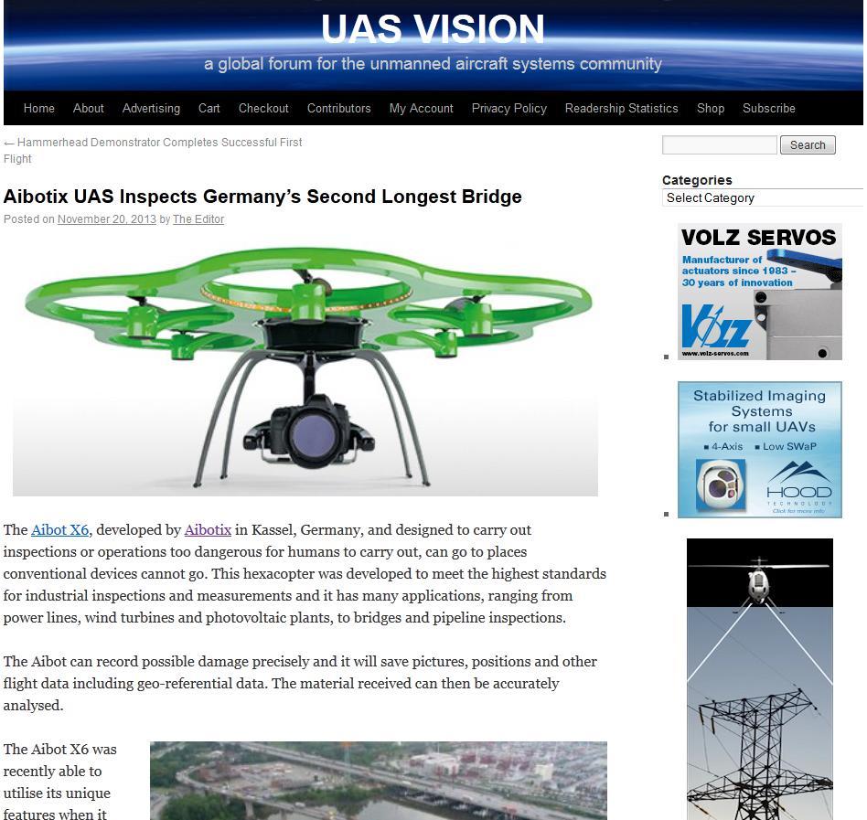
13 Applications non imaging Source: Dyson Awards Source: Source: Aibotix 22/11/


14 Applications non imaging» Example 1: SUMO UAV» Source: Reuder et al., 2009» Example 2: Vito BlackCarbon Sensor 22/11/
15 Applications - imaging» Video» Object tracking, realtime imagery, realtime mosaicing,» Photogrammetry» 2.5 & 3D extraction, orthophotographs» Multi- / Hyperspectral imaging» Vegetation, air, water, soil quality monitoring» Endless?» Thermal imaging» Irrigation, energy budgets of houses/industrial areas, search & rescue, wildlife detection 22/11/
16 22/11/
17 Photogrammetry: some parameters» Camera» Optics, mechanics, electronics» Platform» Stability, speed» GPS / IMU» Accuracy, synchronisation» GCP» Accuracy (real world & image plane)» Tiepoints» Detection & identification accuracy» Bundle adjustment algorithm» Precision, robustness, performance, flexibility 22/11/
18 Photogrammetric software a short overview» In situ check» Arrive at the office with usefull data» Self calibration» During bundle adjustment camera parameters are optimized» Focus on airborn or ground based photogrammetry» Free net adjustment» Garbage in, beauty out?» Tiepoint extraction & coded GCP support» Dense DSM» Ortho generation» GPU support ( x 10 / 20 performance gain)» Cloud services 22/11/
19 In situ check Self calibration Ground Air Free net BA with support for GCP en EO Gecoded GCPs (True) Ortho Dense DEM Volume calculations GPU support Cloud processing Photogrammetric software a short overview Pix4D Photoscan Erdas LPS Menci Ensomosaic ? - Pieneering Photomodeler scanner / Autodesk ImageModeler / /11/
20 Photogrammetry - summary» Software available in many varieties with varying complexity for novice and advanced users and price ranges» Black box approach, focused on production» Performance can vary widely in terms of robustness, accuracy and processing time» Challenges:» Robustness: how sure are you as user that the images you took in the field will be processed correctly?» Flexibility towards researchers 22/11/
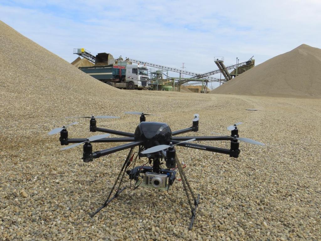
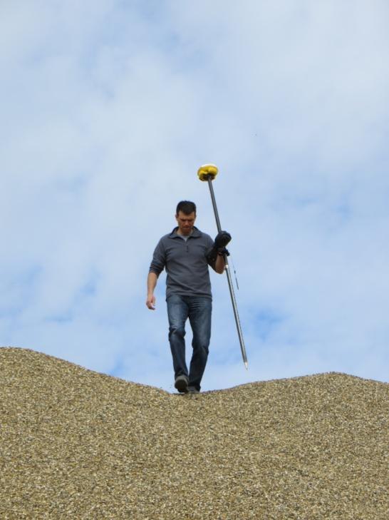
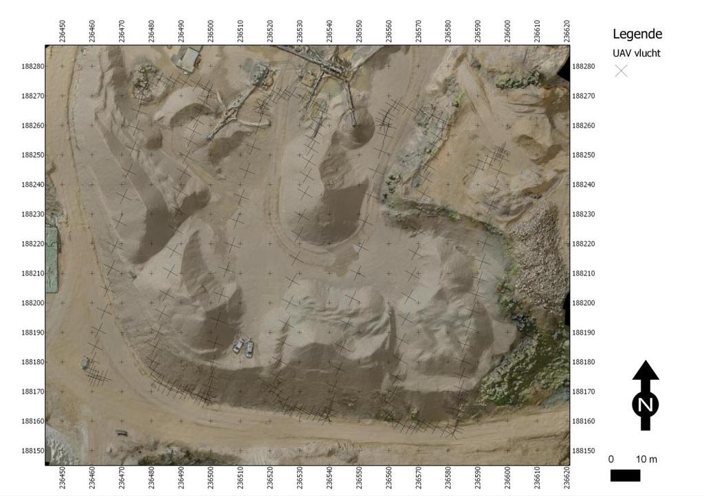
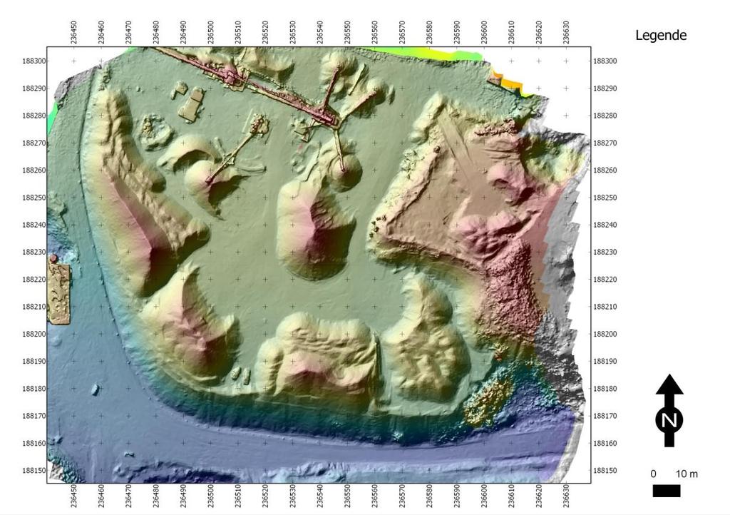
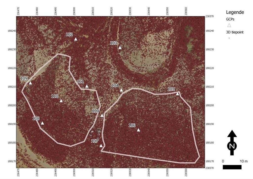
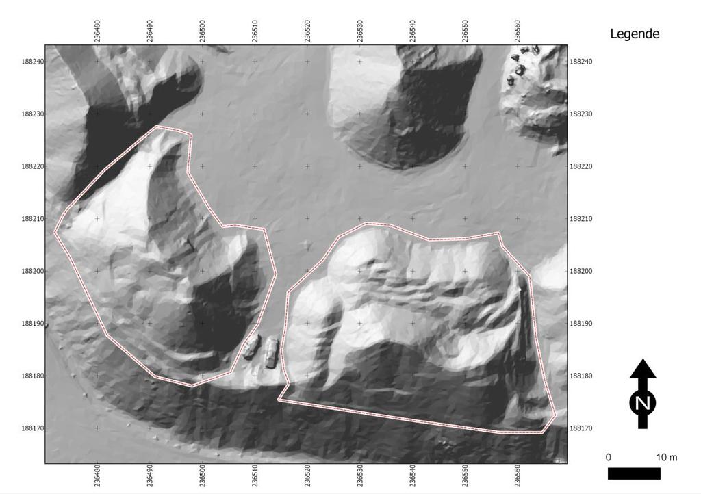
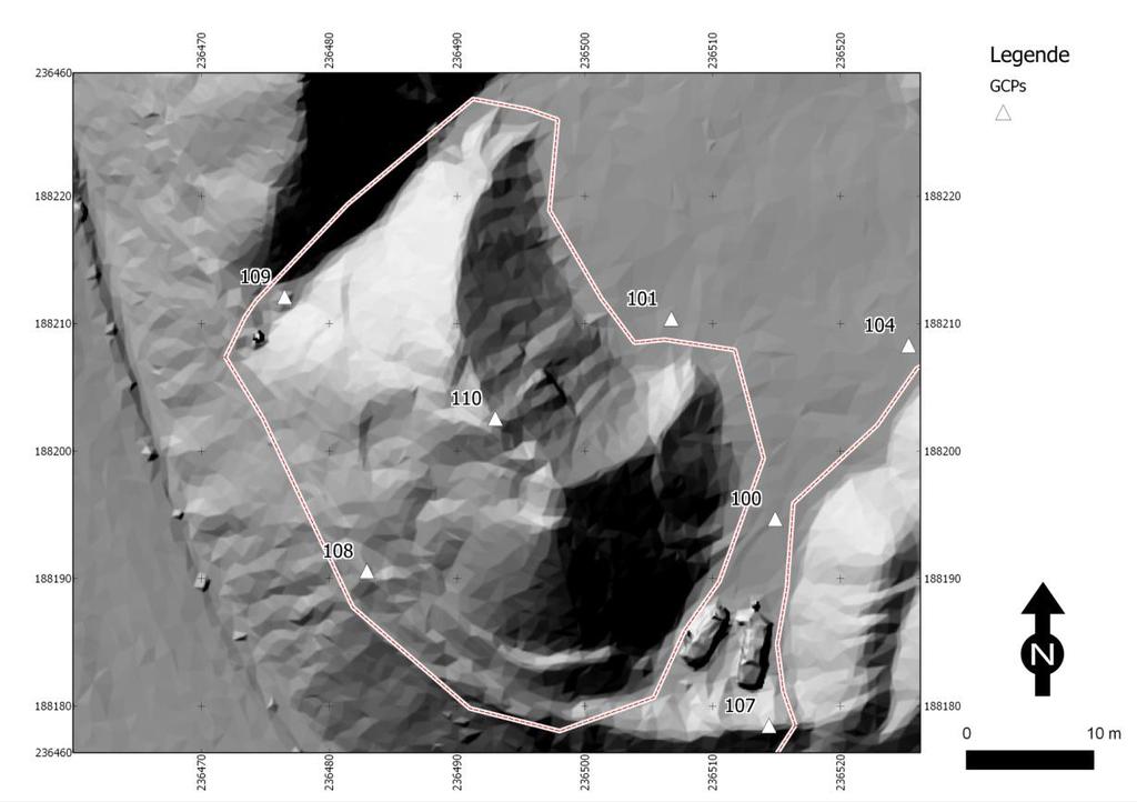
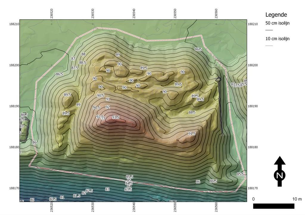
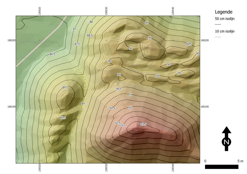
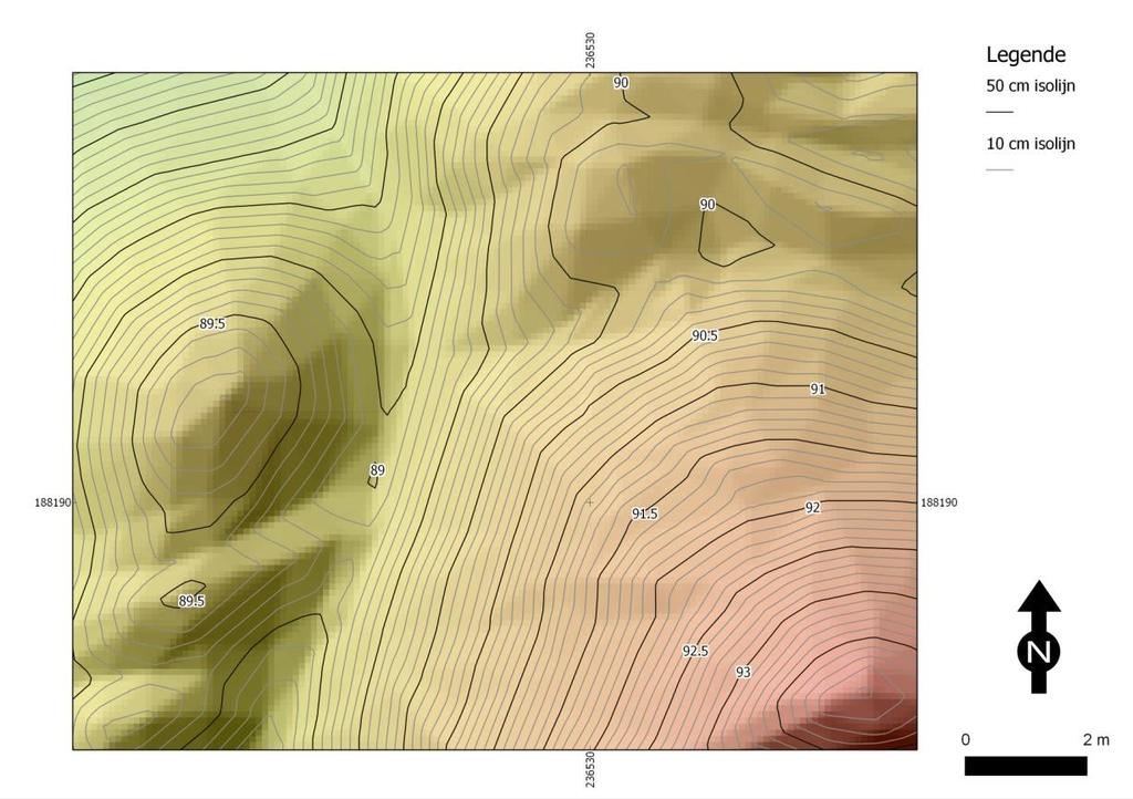
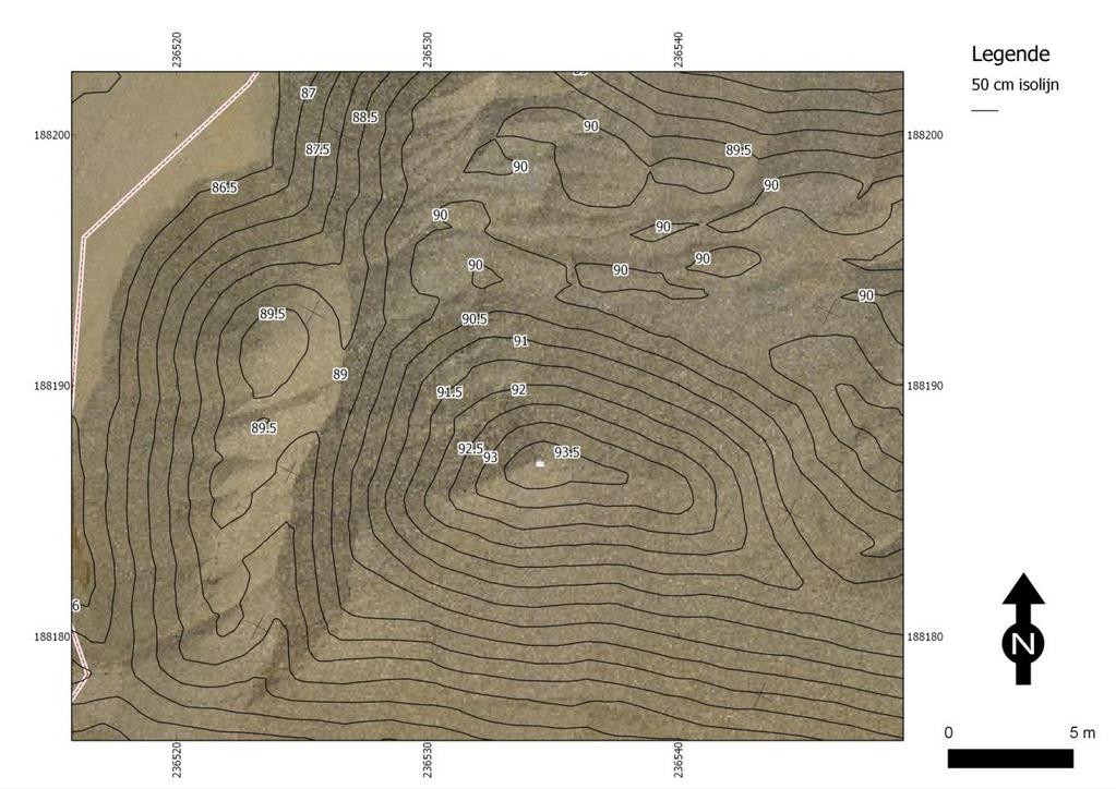
21 Use case» Mechelse heide / PS-Survey bvba» Can volumes be measured from gravel heaps with a UAV?» How accurate is the end product, is it comparable to present measurement technique?» What is the work effort? 22/11/

22 22/11/
23 22/11/
24 22/11/
25 22/11/
26 22/11/
27 22/11/
28 22/11/
29 22/11/
30 22/11/
31 22/11/
32 22/11/
33 22/11/
34 22/11/
![Z [m] Hoogteprofiel transect 11 13 95 94 91 94 93 90 93 92 92](/docs-images/73/68935635/images/35-2.jpg "91 89 91 90 90 88 89 89 88 87 88 87 87 86 86 85 0 5 5 10 510 15")

35 Z [m] Hoogteprofiel transect Relatieve afstand [m] Photoscan t0 Photoscan t1 Pix4D t0 Pix4D t1 RTK GPS 22/11/
36 Results (10 cm resolution) Photoscan Pix4D Zone Time Mean error on 7,6 7,5 3,1-1,6 3,3 3,9-1,1 1,8 cm CP elevation StDev error on ,8 17,7 19,1 16,2 17,4 21,3 cm CP elevation Volume estimate m3 RTK GPS volume m3 Relative error 2,7 2,3 2,3 1,2 1,2 0,7 1,6 1,9 % 22/11/

37 22/11/

38 22/11/
39 Conclusions» Platforms are ready» Improvements possible, especially multispectral sensors» Software is ready» Improvements possible, especially in information extraction» Legislation is not ready, yet» Real world applications are possible/feasible» Great opportunity for the remote sensing community» Please focus on real world applications to make this technology a success 22/11/
40 Conclusions» It s not about the platform, it s about the solution(s)» UAV technology is mainly complementary to other existing technologies 22/11/
41 22/11/
EnsoMOSAIC Aerial mapping tools
 EnsoMOSAIC Aerial mapping tools Jakarta and Kuala Lumpur, 2013 Contents MosaicMill MM Application examples Software introduction System introduction Rikola HS sensor UAV platform examples SW Syst HS UAV
UAV Technologies for 3D Mapping. Rolf Schaeppi Director Geospatial Solutions APAC / India
 UAV Technologies for 3D Mapping Rolf Schaeppi Director Geospatial Solutions APAC / India Some main application areas? Market situation Analyst statements billion dollars 7,3 defense market 2,5 civil market
Geo-localization and Mosaicing System (GEMS): Enabling Precision Image Feature Location and Rapid Mosaicing General:
: Enabling Precision Image Feature Location and Rapid Mosaicing General:") Geo-localization and Mosaicing System (GEMS): Enabling Precision Image Feature Location and Rapid Mosaicing General: info@senteksystems.com www.senteksystems.com 12/6/2014 Precision Agriculture Multi-Spectral
Geo-localization and Mosaicing System (GEMS): Enabling Precision Image Feature Location and Rapid Mosaicing General: info@senteksystems.com www.senteksystems.com 12/6/2014 Precision Agriculture Multi-Spectral
PEGASUS : a future tool for providing near real-time high resolution data for disaster management. Lewyckyj Nicolas
 PEGASUS : a future tool for providing near real-time high resolution data for disaster management Lewyckyj Nicolas nicolas.lewyckyj@vito.be http://www.pegasus4europe.com Overview Vito in a nutshell GI
Deliverable 5-B: Review and Update on AURA System Requirements, Sensors, and Platforms Supplemental Report
 Deliverable 5-B: Review and Update on AURA System Requirements, Sensors, and Platforms Supplemental Report Focusing on education, research, and development of technology to sense and understand natural
ASPECTS OF DEM GENERATION FROM UAS IMAGERY
 ASPECTS OF DEM GENERATION FROM UAS IMAGERY A. Greiwea,, R. Gehrke a,, V. Spreckels b,, A. Schlienkamp b, Department Architecture, Civil Engineering and Geomatics, Fachhochschule Frankfurt am Main, Germany
Unmanned Aerial Vehicles: A New Approach for Coastal Habitat Assessment
 Unmanned Aerial Vehicles: A New Approach for Coastal Habitat Assessment David Ryan Principal Marine Scientist WorleyParsons Western Operations 2 OUTLINE Importance of benthic habitat assessment. Common
SENSITIVITY ANALYSIS OF UAV-PHOTOGRAMMETRY FOR CREATING DIGITAL ELEVATION MODELS (DEM)
") SENSITIVITY ANALYSIS OF UAV-PHOTOGRAMMETRY FOR CREATING DIGITAL ELEVATION MODELS (DEM) G. Rock a, *, J.B. Ries b, T. Udelhoven a a Dept. of Remote Sensing and Geomatics. University of Trier, Behringstraße,
SENSITIVITY ANALYSIS OF UAV-PHOTOGRAMMETRY FOR CREATING DIGITAL ELEVATION MODELS (DEM) G. Rock a, *, J.B. Ries b, T. Udelhoven a a Dept. of Remote Sensing and Geomatics. University of Trier, Behringstraße,
RPAS Photogrammetric Mapping Workflow and Accuracy
 RPAS Photogrammetric Mapping Workflow and Accuracy Dr Yincai Zhou & Dr Craig Roberts Surveying and Geospatial Engineering School of Civil and Environmental Engineering, UNSW Background RPAS category and
UAV PHOTOGRAMMETRY COMPARED TO TRADITIONAL RTK GPS SURVEYING
 UAV PHOTOGRAMMETRY COMPARED TO TRADITIONAL RTK GPS SURVEYING Brad C. Mathison and Amber Warlick March 20, 2016 Fearless Eye Inc. Kansas City, Missouri www.fearlesseye.com KEY WORDS: UAV, UAS, Accuracy
Assessing the Accuracy of Ortho-image using Photogrammetric Unmanned Aerial System
 Assessing the Accuracy of Ortho-image using Photogrammetric Unmanned Aerial System H. H. Jeong a, J. W. Park a, J. S. Kim a, C. U. Choi a, * a Dept. of Spatial Information Engineering, Pukyong National
UAS data processing retrospective
 16 th International Scientific and Technical Conference From Imagery to Map: Digital Photogrammetric Technologies UAS data processing retrospective Smirnov Alexey Technical Support Department, Racurs November
Aerial efficiency, photogrammetric accuracy
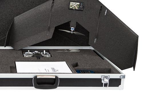
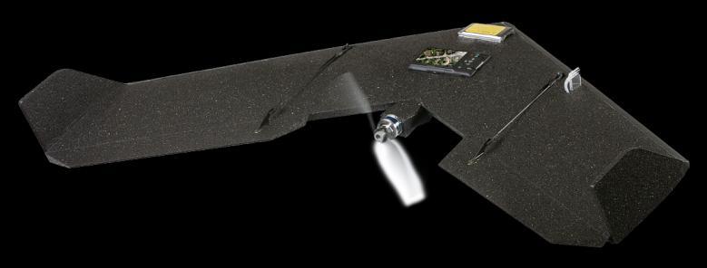
 Aerial efficiency, photogrammetric accuracy Why sensefly 3 reasons to choose the ebee Plus Large coverage for optimal efficiency The ebee Plus can map more square kilometres per flight, than any drone
The Hyperspectral UAV (HyUAV) a novel UAV-based spectroscopy tool for environmental monitoring
 a novel UAV-based spectroscopy tool for environmental monitoring") The Hyperspectral UAV (HyUAV) a novel UAV-based spectroscopy tool for environmental monitoring R. Garzonio 1, S. Cogliati 1, B. Di Mauro 1, A. Zanin 2, B. Tattarletti 2, F. Zacchello 2, P. Marras 2 and
The Hyperspectral UAV (HyUAV) a novel UAV-based spectroscopy tool for environmental monitoring R. Garzonio 1, S. Cogliati 1, B. Di Mauro 1, A. Zanin 2, B. Tattarletti 2, F. Zacchello 2, P. Marras 2 and
ACCURACY ASSESSMENT OF DIRECT GEOREFERENCING FOR PHOTOGRAMMETRIC APPLICATIONS ON SMALL UNMANNED AERIAL PLATFORMS
 ACCURACY ASSESSMENT OF DIRECT GEOREFERENCING FOR PHOTOGRAMMETRIC APPLICATIONS ON SMALL UNMANNED AERIAL PLATFORMS O. Mian a, J. Lutes a, G. Lipa a, J. J. Hutton a, E. Gavelle b S. Borghini c * a Applanix
Five Sensors, One Day: Unmanned vs. Manned Logistics and Accuracy
 Five Sensors, One Day: Unmanned vs. Manned Logistics and Accuracy ASPRS UAS Mapping Technical Symposium Sept 13 th, 2016 Presenter: David Day, CP, GISP Keystone Aerial Surveys, Inc. Summary of activities
AERIAL SURVEYS COMPANY PROFILE
 AERIAL SURVEYS COMPANY PROFILE Aerial Surveys, previously known as GeoSmart, is an innovative aerial photography and geospatial mapping service provider Our services enable customers to make better business
Introduction to Photogrammetry
 Introduction to Photogrammetry Presented By: Sasanka Madawalagama Geoinformatics Center Asian Institute of Technology Thailand www.geoinfo.ait.asia Content Introduction to photogrammetry 2D to 3D Drones
Leica - 3 rd Generation Airborne Digital Sensors Features / Benefits for Remote Sensing & Environmental Applications
 Leica - 3 rd Generation Airborne Digital Sensors Features / Benefits for Remote Sensing & Environmental Applications Arthur Rohrbach, Sensor Sales Dir Europe, Middle-East and Africa (EMEA) Luzern, Switzerland,
AIRPORT MAPPING JUNE 2016 EXPLORING UAS EFFECTIVENESS GEOSPATIAL SLAM TECHNOLOGY FEMA S ROMANCE WITH LIDAR VOLUME 6 ISSUE 4
 VOLUME 6 ISSUE 4 JUNE 2016 AIRPORT MAPPING 18 EXPLORING UAS EFFECTIVENESS 29 GEOSPATIAL SLAM TECHNOLOGY 36 FEMA S ROMANCE WITH LIDAR Nearly 2,000 U.S. landfill facilities stand to gain from cost-effective
Overview. Objectives. The ultimate goal is to compare the performance that different equipment offers us in a photogrammetric flight.
 Overview At present, one of the most commonly used technique for topographic surveys is aerial photogrammetry. This technique uses aerial images to determine the geometric properties of objects and spatial
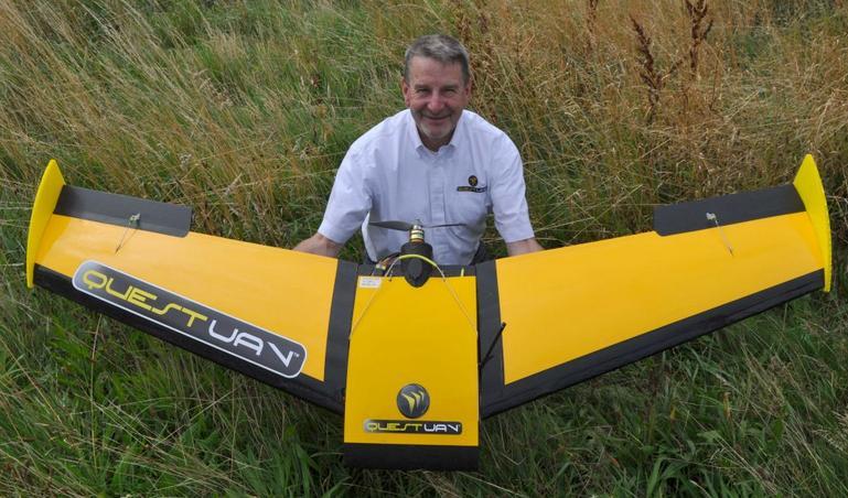
Validation of the QuestUAV PPK System
 Validation of the QuestUAV PPK System 3cm in xy, 400ft, no GCPs, 100Ha, 25 flights Nigel King 1, Kerstin Traut 2, Cameron Weeks 3 & Ruairi Hardman 4 1 Director QuestUAV, 2 Data Analyst QuestUAV, 3 Production
Aerial Image Acquisition and Processing Services. Ron Coutts, M.Sc., P.Eng. RemTech, October 15, 2014
 Aerial Image Acquisition and Processing Services Ron Coutts, M.Sc., P.Eng. RemTech, October 15, 2014 Outline Applications & Benefits Image Sources Aircraft Platforms Image Products Sample Images & Comparisons
High Resolution Sensor Test Comparison with SPOT, KFA1000, KVR1000, IRS-1C and DPA in Lower Saxony
 High Resolution Sensor Test Comparison with SPOT, KFA1000, KVR1000, IRS-1C and DPA in Lower Saxony K. Jacobsen, G. Konecny, H. Wegmann Abstract The Institute for Photogrammetry and Engineering Surveys
Baldwin and Mobile Counties, AL Orthoimagery Project Report. Submitted: March 23, 2016
 2015 Orthoimagery Project Report Submitted: Prepared by: Quantum Spatial, Inc 523 Wellington Way, Suite 375 Lexington, KY 40503 859-277-8700 Page i of iii Contents Project Report 1. Summary / Scope...
EXAMPLES OF TOPOGRAPHIC MAPS PRODUCED FROM SPACE AND ACHIEVED ACCURACY CARAVAN Workshop on Mapping from Space, Phnom Penh, June 2000
 EXAMPLES OF TOPOGRAPHIC MAPS PRODUCED FROM SPACE AND ACHIEVED ACCURACY CARAVAN Workshop on Mapping from Space, Phnom Penh, June 2000 Jacobsen, Karsten University of Hannover Email: karsten@ipi.uni-hannover.de
Up, Up, and Away!! Marine Robotics and Remote Duke University Marine Laboratory. David W. Johnston
 Up, Up, and Away!! Marine Robotics and Remote Sensing @ Duke University Marine Laboratory David W. Johnston Assistant Professor of the Practice of Marine Conservation & Ecology! Division of Marine Science
White Paper Reaching 1 cm (0.4 in) drone survey accuracy
 drone survey accuracy") White Paper Reaching 1 cm (0.4 in) drone survey accuracy 3x higher absolute accuracy with WingtraOne Latest tests in USA and Switzerland prove that the VTOL WingtraOne drone repeatably reaches the best-in-class
White Paper Reaching 1 cm (0.4 in) drone survey accuracy 3x higher absolute accuracy with WingtraOne Latest tests in USA and Switzerland prove that the VTOL WingtraOne drone repeatably reaches the best-in-class
accuracy. You even hear the terms subcentimeter or even millimeter absolute accuracy during some of these
 Question: I would like to get your expert opinion on a dataset I just received. It is UAS-based imagery collected to produce a 50cm Digital Elevation Models (DEM) and 5cm resolution true color orthos.
LAST GENERATION UAV-BASED MULTI- SPECTRAL CAMERA FOR AGRICULTURAL DATA ACQUISITION
 LAST GENERATION UAV-BASED MULTI- SPECTRAL CAMERA FOR AGRICULTURAL DATA ACQUISITION FABIO REMONDINO, Erica Nocerino, Fabio Menna Fondazione Bruno Kessler Trento, Italy http://3dom.fbk.eu Marco Dubbini,
White Paper Reaching 1 cm (0.4 in) drone survey accuracy
 drone survey accuracy") White Paper Reaching 1 cm (0.4 in) drone survey accuracy 3x higher absolute accuracy with WingtraOne Latest tests in the USA and Switzerland prove that the VTOL WingtraOne drone repeatedly reaches the
White Paper Reaching 1 cm (0.4 in) drone survey accuracy 3x higher absolute accuracy with WingtraOne Latest tests in the USA and Switzerland prove that the VTOL WingtraOne drone repeatedly reaches the
NAVIGATION AND REMOTE SENSING PAYLOADS AND METHODS OF THE SARVANT UNMANNED AERIAL SYSTEM
 NAVIGATION AND REMOTE SENSING PAYLOADS AND METHODS OF THE SARVANT UNMANNED AERIAL SYSTEM P. Molina, P. Fortuny, I. Colomina Institute of Geomatics -- Castelldefels (ES) M. Remy, K.A.C. Macedo, Y.R.C. Zúnigo,
Vexcel Imaging GmbH Innovating in Photogrammetry: UltraCamXp, UltraCamLp and UltraMap
 Photogrammetric Week '09 Dieter Fritsch (Ed.) Wichmann Verlag, Heidelberg, 2009 Wiechert, Gruber 27 Vexcel Imaging GmbH Innovating in Photogrammetry: UltraCamXp, UltraCamLp and UltraMap ALEXANDER WIECHERT,
The drone for precision agriculture
 The drone for precision agriculture Reap the benefits of scouting crops from above If precision technology has driven the farming revolution of recent years, monitoring crops from the sky will drive the
MULTIPURPOSE QUADCOPTER SOLUTION FOR AGRICULTURE
 MULTIPURPOSE QUADCOPTER SOLUTION FOR AGRICULTURE Powered by COVERS UP TO 30HA AT 70M FLIGHT ALTITUDE PER BATTERY PHOTO & VIDEO FULL HD 1080P - 14MP 3-AXIS STABILIZATION INCLUDES NDVI & ZONING MAPS SERVICE
Profiling Radiometer for Atmospheric and Cloud Observations PRACO
 Profiling Radiometer for Atmospheric and Cloud Observations PRACO Boulder Environmental Sciences and Technology BEST Small startup company, established in 2006 Focused on radiometry ground based and airborne
Monitoring the vegetation success of a rehabilitated mine site using multispectral UAV imagery. Tim Whiteside & Renée Bartolo, eriss
 Monitoring the vegetation success of a rehabilitated mine site using multispectral UAV imagery Tim Whiteside & Renée Bartolo, eriss About the Supervising Scientist Main roles Working to protect the environment
The brain for the plane is the Airelectronics' U-Pilot flight control system, which is embedded inside the plane's fuselage, leaving a lot of space on
 Airelectronics has developed a new complete solution meeting the needs of the farming science. The completely test Skywalkerplatform has been equipped with both thermal and multispectral cameras to measure
DISCO-PRO AG ALL-IN-ONE DRONE SOLUTION FOR PRECISION AGRICULTURE. 80ha COVERAGE PARROT SEQUOIA INCLUDES MULTI-PURPOSE TOOL SAFE ANALYZE & DECIDE
 DISCO-PRO AG ALL-IN-ONE DRONE SOLUTION FOR PRECISION AGRICULTURE Powered by 80ha COVERAGE AT 120M * FLIGHT ALTITUDE (200AC @ 400FT) MULTI-PURPOSE TOOL PHOTO 14MPX VIDEO 1080P FULL HD PARROT SEQUOIA RGB
White Paper Reaching 1 cm (0.4 in) drone survey accuracy
 drone survey accuracy") White Paper Reaching 1 cm (0.4 in) drone survey accuracy 3x higher absolute accuracy with WingtraOne Latest tests in USA and Switzerland prove that the VTOL WingtraOne drone repeatably reaches the best-in-class
White Paper Reaching 1 cm (0.4 in) drone survey accuracy 3x higher absolute accuracy with WingtraOne Latest tests in USA and Switzerland prove that the VTOL WingtraOne drone repeatably reaches the best-in-class
PHOTOGRAMMETRIC RESECTION DIFFERENCES BASED ON LABORATORY vs. OPERATIONAL CALIBRATIONS
 PHOTOGRAMMETRIC RESECTION DIFFERENCES BASED ON LABORATORY vs. OPERATIONAL CALIBRATIONS Dean C. MERCHANT Topo Photo Inc. Columbus, Ohio USA merchant.2@osu.edu KEY WORDS: Photogrammetry, Calibration, GPS,
HIGH RESOLUTION COLOR IMAGERY FOR ORTHOMAPS AND REMOTE SENSING. Author: Peter Fricker Director Product Management Image Sensors
 HIGH RESOLUTION COLOR IMAGERY FOR ORTHOMAPS AND REMOTE SENSING Author: Peter Fricker Director Product Management Image Sensors Co-Author: Tauno Saks Product Manager Airborne Data Acquisition Leica Geosystems
Ground Control Configuration Analysis for Small Area UAV Imagery Based Mapping
 Ground Control Configuration Analysis for Small Area UAV Imagery Based Mapping ASPRS IGTF 2017, Baltimore, MD March 15 th, 2017 Presenter: David Day, CP, GISP Wes Weaver Keystone Aerial Surveys, Inc. Summary
Lecture 7. Leica ADS 80 Camera System and Imagery. Ontario ADS 80 FRI Imagery. NRMT 2270, Photogrammetry/Remote Sensing
 NRMT 2270, Photogrammetry/Remote Sensing Lecture 7 Leica ADS 80 Camera System and Imagery. Ontario ADS 80 FRI Imagery. Tomislav Sapic GIS Technologist Faculty of Natural Resources Management Lakehead University
REMOTE SENSING WITH DRONES. YNCenter Video Conference Chang Cao
 REMOTE SENSING WITH DRONES YNCenter Video Conference Chang Cao 08-28-2015 28 August 2015 2 Drone remote sensing It was first utilized in military context and has been given great attention in civil use
sensefly Camera Collection
 Camera Collection A professional sensor for every application Introducing S.O.D.A. 3D 3D mapping, redefined Image: S.O.D.A. 3D oblique image (left) merging into 3D mesh (right). Stunning digital 3D reconstructions
High throughput phenotyping of field crop experiments using UAVs. Ph. Burger, R. Marandel, F. Baret, G. Colombeau, A. Comar
 High throughput phenotyping of field crop experiments using UAVs Ph. Burger, R. Marandel, F. Baret, G. Colombeau, A. Comar PHILIPPE BURGER Drone Garden Workshop - 10/07/2018 Phenotyping? Genotype= the
Realtime Airborne Imagery for Emergency GIS Applications
 Realtime Airborne Imagery for Emergency GIS Applications Demonstration and Evaluation with Monroe County Office of Emergency Management August - September 2010 Information Products Laboratory for Emergency
Helicopter Aerial Laser Ranging
 Helicopter Aerial Laser Ranging Håkan Sterner TopEye AB P.O.Box 1017, SE-551 11 Jönköping, Sweden 1 Introduction Measuring distances with light has been used for terrestrial surveys since the fifties.
VisionMap Sensors and Processing Roadmap
 Vilan, Gozes 51 VisionMap Sensors and Processing Roadmap YARON VILAN, ADI GOZES, Tel-Aviv ABSTRACT The A3 is a family of digital aerial mapping cameras and photogrammetric processing systems, which is
Adaptation and Application of Aerospace and Defense Industry Technologies to the Oil and Gas Industry
 ELTA Systems Group & Subsidiary of ISRAEL AEROSPACE INDUSTRIES Adaptation and Application of Aerospace and Defense Industry Technologies to the Oil and Gas Industry Dr. Nathan Weiss Israel Aerospace Industries
MEDIUM FORMAT CAMERA EVALUATION BASED ON THE LATEST PHASE ONE TECHNOLOGY
 MEDIUM FORMAT CAMERA EVALUATION BASED ON THE LATEST PHASE ONE TECHNOLOGY T.Tölg a, G. Kemper b, D. Kalinski c a Phase One / Germany tto@phaseone.com b GGS GmbH, Speyer / Germany kemper@ggs-speyer.de c
Active and Passive Microwave Remote Sensing
 Active and Passive Microwave Remote Sensing Passive remote sensing system record EMR that was reflected (e.g., blue, green, red, and near IR) or emitted (e.g., thermal IR) from the surface of the Earth.
ScienceDirect. The potential of UAV-based remote sensing for supporting precision agriculture in Indonesia
 Available online at www.sciencedirect.com ScienceDirect Procedia Environmental Sciences 24 (2015 ) 245 253 The 1st International Symposium on LAPAN-IPB Satellite for Food Security and Environmental Monitoring
Capture the invisible
 Capture the invisible A Capture the invisible The Sequoia multispectral sensor captures both visible and invisible images, providing calibrated data to optimally monitor the health and vigor of your crops.
GEO 428: DEMs from GPS, Imagery, & Lidar Tuesday, September 11
 GEO 428: DEMs from GPS, Imagery, & Lidar Tuesday, September 11 Global Positioning Systems GPS is a technology that provides Location coordinates Elevation For any location with a decent view of the sky
Flood modelling and management. Glasgow University. 8 September Paul Shaw - GeoVision
 Flood modelling and management Glasgow University 8 September 2004 Paul Shaw - GeoVision How important are heights in flood modelling? Comparison of data collection technologies GPS - Global Positioning
Module 3 Introduction to GIS. Lecture 8 GIS data acquisition
 Module 3 Introduction to GIS Lecture 8 GIS data acquisition GIS workflow Data acquisition (geospatial data input) GPS Remote sensing (satellites, UAV s) LiDAR Digitized maps Attribute Data Management Data
Photomod Lite Contest 2013 Creating vegetation map using UAV at Seaside Palouki forest (Greece) by Apostolos Nteris
 by Apostolos Nteris") P r o j e c t I n f o r m a t i o n Title: Creating vegetation map using UAV at seaside Palouki forest (Greece) Author: Apostolos Nteris, Surveyor engineer OLYZON consulting - Trikala Greece Contact: Apostolos
P r o j e c t I n f o r m a t i o n Title: Creating vegetation map using UAV at seaside Palouki forest (Greece) Author: Apostolos Nteris, Surveyor engineer OLYZON consulting - Trikala Greece Contact: Apostolos
An Introduction to Geomatics. Prepared by: Dr. Maher A. El-Hallaq خاص بطلبة مساق مقدمة في علم. Associate Professor of Surveying IUG
 An Introduction to Geomatics خاص بطلبة مساق مقدمة في علم الجيوماتكس Prepared by: Dr. Maher A. El-Hallaq Associate Professor of Surveying IUG 1 Airborne Imagery Dr. Maher A. El-Hallaq Associate Professor
Aerial photography: Principles. Frame capture sensors: Analog film and digital cameras
 Aerial photography: Principles Frame capture sensors: Analog film and digital cameras Overview Introduction Frame vs scanning sensors Cameras (film and digital) Photogrammetry Orthophotos Air photos are
Unmanned Aerial Vehicle Data Acquisition for Damage Assessment in. Hurricane Events
 Unmanned Aerial Vehicle Data Acquisition for Damage Assessment in Hurricane Events Stuart M. Adams a Carol J. Friedland b and Marc L. Levitan c ABSTRACT This paper examines techniques for data collection
Visual inspection strategies for large bridges using Unmanned Aerial Vehicles (UAV)
") Visual inspection strategies for large bridges using Unmanned Aerial Vehicles (UAV) Norman Hallermann & Guido Morgenthal Bauhaus-Universität Weimar, Chair of Modeling and Simulation of Structures, Weimar,
Visual inspection strategies for large bridges using Unmanned Aerial Vehicles (UAV) Norman Hallermann & Guido Morgenthal Bauhaus-Universität Weimar, Chair of Modeling and Simulation of Structures, Weimar,
Best practice for UAV Spectral sampling (BUS) - concept and overview of current status-
 - concept and overview of current status-") Best practice for UAV Spectral sampling (BUS) - concept and overview of current status- Helge Aasen 27.02.2017 0 Remote sensing in transition Lightweight and cheaper sensors available Smaller and more
Best practice for UAV Spectral sampling (BUS) - concept and overview of current status- Helge Aasen 27.02.2017 0 Remote sensing in transition Lightweight and cheaper sensors available Smaller and more
The survey-grade mapping drone
 The survey-grade mapping drone 3 reasons to choose the ebee RTK 01. Survey-grade accuracy Absolute orthomosaic / Digital Elevation Model accuracy of down to 3 cm (1.2 in) without the need for GCPs meaning
Phase One ixu-rs1000 Accuracy Assessment Report Yu. Raizman, PhaseOne.Industrial, Israel
 17 th International Scientific and Technical Conference FROM IMAGERY TO DIGITAL REALITY: ERS & Photogrammetry Phase One ixu-rs1000 Accuracy Assessment Report Yu. Raizman, PhaseOne.Industrial, Israel 1.
AERIAL SURVEY TEST PROJECT WITH DJI PHANTOM 3 QUADROCOPTER DRONE
 T. Jancso, P. Engler, P. Udvardy Aerial Survey Test Project with DJI Phantom 3 Quadrocopter Drone AERIAL SURVEY TEST PROJECT WITH DJI PHANTOM 3 QUADROCOPTER DRONE Tamas JANCSO, Associate Professor Phd
Drones and Ham Radio. Bob Schatzman KD9AAD
 Drones and Ham Radio Bob Schatzman KD9AAD Not Your Childhood RC Toy! Highly Accurate GPS receiver! Magnetic Compass! R/C Transmitter/Receiver! Accelerometers/Gyros! HDTV & HQ Still Camera on a Smart Gimbal!
APPLICATIONS AND LESSONS LEARNED WITH AIRBORNE MULTISPECTRAL IMAGING
 APPLICATIONS AND LESSONS LEARNED WITH AIRBORNE MULTISPECTRAL IMAGING James M. Ellis and Hugh S. Dodd The MapFactory and HJW Walnut Creek and Oakland, California, U.S.A. ABSTRACT Airborne digital frame
REMOTE SENSING. Topic 10 Fundamentals of Digital Multispectral Remote Sensing MULTISPECTRAL SCANNERS MULTISPECTRAL SCANNERS
 REMOTE SENSING Topic 10 Fundamentals of Digital Multispectral Remote Sensing Chapter 5: Lillesand and Keifer Chapter 6: Avery and Berlin MULTISPECTRAL SCANNERS Record EMR in a number of discrete portions
Active and Passive Microwave Remote Sensing
 Active and Passive Microwave Remote Sensing Passive remote sensing system record EMR that was reflected (e.g., blue, green, red, and near IR) or emitted (e.g., thermal IR) from the surface of the Earth.
UltraCam and UltraMap Towards All in One Solution by Photogrammetry
 Photogrammetric Week '11 Dieter Fritsch (Ed.) Wichmann/VDE Verlag, Belin & Offenbach, 2011 Wiechert, Gruber 33 UltraCam and UltraMap Towards All in One Solution by Photogrammetry ALEXANDER WIECHERT, MICHAEL
2019 NYSAPLS Conf> Fundamentals of Photogrammetry for Land Surveyors
 2019 NYSAPLS Conf> Fundamentals of Photogrammetry for Land Surveyors George Southard GSKS Associates LLC Introduction George Southard: Master s Degree in Photogrammetry and Cartography 40 years working
Configuration, Capabilities, Limitations, and Examples
 FUGRO EARTHDATA, Inc. Introduction to the New GeoSAR Interferometric Radar Sensor Bill Sharp GeoSAR Regional Director - Americas Becky Morton Regional Manager Configuration, Capabilities, Limitations,
Experimental aerial photogrammetry with professional non metric camera Canon EOS 5D
 Experimental aerial photogrammetry with professional non metric camera Canon EOS 5D Ante Sladojević, Goran Mrvoš Galileo Geo Sustavi, Croatia 1. Introduction With this project we wanted to test professional
2017 TSPS Annual Conference & Tech Expo Unmanned Aircraft Systems (UAS) As a Tool for Land Surveyors
 As a Tool for Land Surveyors") 2017 TSPS Annual Conference & Tech Expo Unmanned Aircraft Systems (UAS) As a Tool for Land Surveyors George Southard GSKS Associates LLC Introduction George Southard: Master s Degree in Photogrammetry
2017 TSPS Annual Conference & Tech Expo Unmanned Aircraft Systems (UAS) As a Tool for Land Surveyors George Southard GSKS Associates LLC Introduction George Southard: Master s Degree in Photogrammetry
IMAGE ACQUISITION GUIDELINES FOR SFM
 IMAGE ACQUISITION GUIDELINES FOR SFM a.k.a. Close-range photogrammetry (as opposed to aerial/satellite photogrammetry) Basic SfM requirements (The Golden Rule): minimum of 60% overlap between the adjacent
High Fidelity 3D Reconstruction
 High Fidelity 3D Reconstruction Adnan Ansar, California Institute of Technology KISS Workshop: Gazing at the Solar System June 17, 2014 Copyright 2014 California Institute of Technology. U.S. Government
Aerial Triangulation Radiometry Essentials Dense Matching Ortho Generation
 Radiometry Aerial Triangulation Essentials Dense Matching Ortho Generation Highly advanced photogrammetric workflow system for UltraCam images. Microsoft UltraMap is a state-of-the-art, end-to-end, complete
Introduction to Remote Sensing Lab 6 Dr. Hurtado Wed., Nov. 28, 2018
 Lab 6: UAS Remote Sensing Due Wed., Dec. 5, 2018 Goals 1. To learn about the operation of a small UAS (unmanned aerial system), including flight characteristics, mission planning, and FAA regulations.
Heterogeneous Control of Small Size Unmanned Aerial Vehicles
 Magyar Kutatók 10. Nemzetközi Szimpóziuma 10 th International Symposium of Hungarian Researchers on Computational Intelligence and Informatics Heterogeneous Control of Small Size Unmanned Aerial Vehicles
USE OF IMPROVISED REMOTELY SENSED DATA FROM UAV FOR GIS AND MAPPING, A CASE STUDY OF GOMA CITY, DR CONGO
 USE OF IMPROVISED REMOTELY SENSED DATA FROM UAV FOR GIS AND MAPPING, A CASE STUDY OF GOMA CITY, DR CONGO Cung Chin Thang United Nations Global Support Center, Brindisi, Italy, Email: thang@un.org KEY WORDS:
Spatial mapping of évapotranspiration and energy balance components over riparian vegetation using airborne remote sensing
 Remole Sensing and Hydrology 2000 (Proceedings of a symposium held at Santa Fe, New Mexico, USA, April 2000). IAHS Publ. no. 267, 2001. 311 Spatial mapping of évapotranspiration and energy balance components
Visione per il veicolo Paolo Medici 2017/ Visual Perception
 Visione per il veicolo Paolo Medici 2017/2018 02 Visual Perception Today Sensor Suite for Autonomous Vehicle ADAS Hardware for ADAS Sensor Suite Which sensor do you know? Which sensor suite for Which algorithms
From Photos to Models
 From Photos to Models Strategies for using digital photogrammetry in your project Adam Barnes Katie Simon Adam Wiewel What is Photogrammetry? The art, science and technology of obtaining reliable information
Crop Scouting with Drones Identifying Crop Variability with UAVs
 DroneDeploy Crop Scouting with Drones Identifying Crop Variability with UAVs A Guide to Evaluating Plant Health and Detecting Crop Stress with Drone Data Table of Contents 01 Introduction Crop Scouting
Remote Sensing of the Environment with Small Unmanned Aircraft Systems
 Remote Sensing of the Environment with Small Unmanned Aircraft Systems (UASs), Part 1: A review of progress and challenges Ken Whitehead 1 * and Chris H. Hugenholtz 1 1 Department of Geography, University
Scaling Up Drone Science for Agriculture & Nature Resources through Cooperative Extension
 Scaling Up Drone Science for Agriculture & Nature Resources through Cooperative Extension Andy Lyons, Maggi Kelly, Sean Hogan, Shane Feirer, Robert Johnson CalGIS 2017, Oakland, CA. May 23, 2017 How and
remote sensing? What are the remote sensing principles behind these Definition
 Introduction to remote sensing: Content (1/2) Definition: photogrammetry and remote sensing (PRS) Radiation sources: solar radiation (passive optical RS) earth emission (passive microwave or thermal infrared
SATELLITE OCEANOGRAPHY
 SATELLITE OCEANOGRAPHY An Introduction for Oceanographers and Remote-sensing Scientists I. S. Robinson Lecturer in Physical Oceanography Department of Oceanography University of Southampton JOHN WILEY
Combining Technologies: LiDaR, High Resolution Digital Images, Infrared Thermography and Geographic Information Systems
 : LiDaR, High Resolution Digital Images, Infrared Thermography and Geographic Information Systems Presented by: Eldris Ferrer, Ms E, GIS Analyst and Remote Sensing Specialist, CSA Group Alexis Ocasio,
VERIFICATION OF POTENCY OF AERIAL DIGITAL OBLIQUE CAMERAS FOR AERIAL PHOTOGRAMMETRY IN JAPAN
 VERIFICATION OF POTENCY OF AERIAL DIGITAL OBLIQUE CAMERAS FOR AERIAL PHOTOGRAMMETRY IN JAPAN Ryuji. Nakada a, *, Masanori. Takigawa a, Tomowo. Ohga a, Noritsuna. Fujii a a Asia Air Survey Co. Ltd., Kawasaki
IGI Ltd. Serving the Aerial Survey Industry for more than 20 Years
 'Photogrammetric Week 05' Dieter Fritsch, Ed. Wichmann Verlag, Heidelberg 2005. Kremer 33 IGI Ltd. Serving the Aerial Survey Industry for more than 20 Years JENS KREMER, Kreuztal ABSTRACT Since 1982 IGI
UAV-based remote sensing of the slow-moving landslide Super-Sauze
 Universität Stuttgart UAV-based remote sensing of the slow-moving landslide Super-Sauze U. Niethammer, S. Rothmund, M. Joswig 06.02.2009 Motivation The four main objectives for our remote sensing campaign
GPS-Aided INS Datasheet Rev. 3.0
 1 GPS-Aided INS The Inertial Labs Single and Dual Antenna GPS-Aided Inertial Navigation System INS is new generation of fully-integrated, combined GPS, GLONASS, GALILEO, QZSS, BEIDOU and L-Band navigation
Basic Digital Image Processing. The Structure of Digital Images. An Overview of Image Processing. Image Restoration: Line Drop-outs
 Basic Digital Image Processing A Basic Introduction to Digital Image Processing ~~~~~~~~~~ Rev. Ronald J. Wasowski, C.S.C. Associate Professor of Environmental Science University of Portland Portland,
ASSEMBLY OF A REMOTELY PILOTED AIRCRAFT OF LOW COST APPLIED TO AGRICULTURE
 Journal of the Brazilian Association of Agricultural Engineering ISSN: 1809-4430 (on-line) TECHNICAL PAPER ASSEMBLY OF A REMOTELY PILOTED AIRCRAFT OF LOW COST APPLIED TO AGRICULTURE Doi:http://dx.doi.org/10.1590/1809-4430-Eng.Agric.v37n6p1268-1274/2017
MULTISPECTRAL AGRICULTURAL ASSESSMENT. Normalized Difference Vegetation Index. Federal Robotics INSPECTION & DOCUMENTATION
 MULTISPECTRAL AGRICULTURAL ASSESSMENT Normalized Difference Vegetation Index INSPECTION & DOCUMENTATION Federal Robotics Clearwater Dr. Amherst, New York 14228 716-221-4181 Sales@FedRobot.com www.fedrobot.com
Processing of stereo scanner: from stereo plotter to pixel factory
 Photogrammetric Week '03 Dieter Fritsch (Ed.) Wichmann Verlag, Heidelberg, 2003 Bignone 141 Processing of stereo scanner: from stereo plotter to pixel factory FRANK BIGNONE, ISTAR, France ABSTRACT With
VisionMap A3 Edge A Single Camera for Multiple Solutions
 Photogrammetric Week '15 Dieter Fritsch (Ed.) Wichmann/VDE Verlag, Belin & Offenbach, 2015 Raizman, Gozes 57 VisionMap A3 Edge A Single Camera for Multiple Solutions Yuri Raizman, Adi Gozes, Tel-Aviv ABSTRACT