Education Programs Synergies
|
|
|
- Delphia Ward
- 6 years ago
- Views:
Transcription
1 Chart 1 > Vortrag > Autor Dokumentname > Datum
2 Education Programs Synergies Dieter Hausamann, DLR Antonios Mouratidis, ESA WGCapD-2 Meeting March 4 6, 2013 Frascati, Italy
3 Our Goals Attract (young) people to EO Technology Missions Software Data Applications Create awareness for the usefulness of EO especially in developing countries Demonstrate advantage of combined expertise

4
5 Chart 5 > Vortrag > Autor Dokumentname > Datum

6 DLR German Aerospace Center Research Institution Space Agency Project Management Agency


7 Promoting the Next-Generation Scientists Stade Hamburg Neustrelitz Bremen Trauen Berlin- Dortmund Braunschweig Köln Bonn Göttingen Lampoldshausen Stuttgart Augsburg Oberpfaffenhofen Weilheim

8 DLR Site Oberpfaffenhofen Employees: Approx. 1,700 Size of site: m² Research institutes and facilities: - Microwaves and Radar Institute - Institute of Communications and Navigation - Institute of Atmospheric Physics - Remote Sensing Technology Institute - Institute of Robotics and Mechatronics - German Remote Sensing Data Center - Space Operations and Astronaut Training - Galileo Control Center - Flight Experiments


9 DLR_School_Lab Oberpfaffenhofen
10 Experiments DLR_School_Lab Oberpfaffenhofen Experiment Institute 1. Infrared Technology Remote Sensing Technology 2. Laser Technology Physics of the Atmosphere 3. Radar Technology Microwave and Radar Technology 4. Optical Remote Sensing Remote Sensing Data Center 5. Weather and Climate Physics of the Atmosphere 6. Satellite Data Analysis Remote Sensing Data Center 7. Satellite Navigation Communication and Navigation 8. Robotics Robotics and Mechatronics 9. Virtual Mechanics Robotics and Mechatronics 10. Flight Team Simulator Flighte Operations 11. Mobile Rocket Basis Space Operations 12. ASUROnaut Robotics and Mechatronics 13. Tunnel Boring Machine Technical University Munich


11

12

13
14 CW-ISAR: The New Imaging Radar Experiment

15 Folie 15 > DLR_School_Lab Oberpfaffenhofen > D. Hausamann
16 Experiment Keywords Instruments Infrared Technology Laser Technology Radar Measuring Technology Optical Remote Sensing Remote Sensing Experiments Major Components thermometry, emissivity, black body, prism, BIRD, Herschel, Boltzmann 2 FLIR-Cameras, Pyrometer, special coated examination objects polarisation, emission, Infrared Class IV Laser, Class II Laser monochromatic light, quantum optics, for signal transmission, simulating 3Dsignal transmission, LIDAR, HALO Laserscanner microwaves, echo, Doppler effect, frequency, SAR, Tandem-X sun spectrum, ozone, reflectance, hyperspectral RS, VNIR, NDVI Imaging Radar (SAR), One Dimensional Radar, Radar Speed Sensor ASD-Spectroradiometer, Sun Photometer, Pyrometer Earth Observation with Satellite Data resolution, multispectral sensor, image processing, change detection, Landsat LEOWorks image processing software, Landsat Data
17 Experimental Concept Experiments represent the institutes competence close relation to state-of-the-art research development by DLR scientific & technical experts combination of specialists know-how and high-tech equipment continuous update and further development Didactical transfer small team experiments (4-6 students 1 supervisor) autonomous and haptical work emphasized results depending on students age and capabilities time frame: 2 hours per experiment level of complexity adjusted to each individual group


18
19 Chart 19 > Vortrag > Autor Dokumentname > Datum


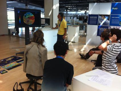
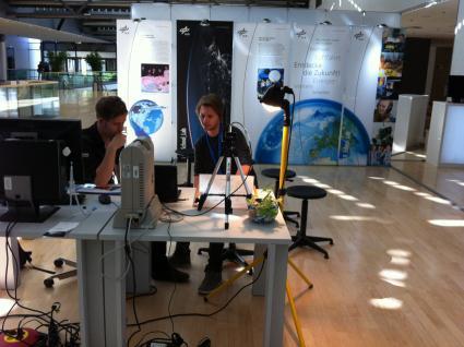
20 ESA EDUSPACE EO Education resources for secondary schools In 8 languages

21 Theory

22 Case studies (introductions, background, data and exercises)

23 Software and Tutorials
 http://www.asrc.")
24 Interactive Meteosat online application A web-based interactive application for exploiting satellite meteorology in secondary schools (also connected to Eduspace case studies)


25 ESA School Atlas/Geography from Space (Incl. teacher s handbook and DVDs) bridging the gap between the classroom, space technology and Earth observation


26 Teacher s Pack (hard copy and DVD) 11 worksheets on Watching over the Earth topics Available in 6 languages (Deutsch, English, Español, Français, Italiano, Nederlands)
27 Joint DLR/ESA EO Education stand at IGARSS 2012 in Munich Combined lab experiments, training sessions and 3D Demonstrations


28


 The School Lab was combined")

29 Radar experiment Spectroscopy Infrared techniques The DLR School Lab experiments presented at IGARSS. (More info at: The School Lab was combined with ESA lectures and computer practicals based on Eduspace ( in a joint ESA/DLR EO Education stand for school visits


30 EO training sessions for high schools delivered by ESA. (More info at:


31 3D demonstrations on EO, were also made for the general public throughout IGARSS, at the ESA/DLR Education area. The material used belongs to the ESA virtual reality theatre. (More info at:


32

33

34
35 Our Vision Establish Practical EO Education and Training Centers in many places Special Focus: Developing Countries Africa Asia Use Existing Expertise of Space Agencies DLR ESA UK Space

36 Next Step: Living Planet Symposium 2013 Edinburgh, United Kingdom, September a DLR/ESA/UK Space Agency EO education stand based on the IGARSS 2012 one


37 Thank You for Your Attention!
European Satellite Navigation Competition The DLR Special Topic Prize NEXT GENERATION NAVIGATION. Folie 1
 European Satellite Navigation Competition 2010 The DLR Special Topic Prize NEXT GENERATION NAVIGATION Folie 1 Robert Klarner, DLR Technology Marketing, 01/05/2009 DLR German Aerospace Center Research Institution
Risk assessment of high voltage Silicon and. Silicon Carbide diodes for Space applications
 MEWS 27 Risk assessment of high voltage Silicon and Silicon Carbide diodes for Space applications DLR, Hans-Dieter Herrmann www.dlr.de Chart 2 MEWS27 > DLR Presentation > Version 1.52 > H.-D. Herrmann
The DLR_School_Labs. DLR at a glance. Out of the classroom into the lab! Drucksachenkategorie.
 www.dlr.de/dlrschoollab DLR at a glance DLR is Germany s national research centre for aeronautics and space. Its extensive research and development work in Aeronautics, Space, Energy, Transport and Security
Drucksachenkategorie The DLR_School_Labs Out of the classroom into the lab!
 www.dlr.de/dlrschoollab Drucksachenkategorie The DLR_School_Labs Out of the classroom into the lab! ESA Airbus Out of the classroom into the lab! The German Aerospace Center (DLR) invites students and
DATA SCIENCE INTELLIGENT MOBILITY INDUSTRY 4.0
 DATA SCIENCE INTELLIGENT MOBILITY INDUSTRY 4.0 DLR in facts and figures 2016 DLR at a glance Research and technology The German Aerospace Center (DLR) provides ground-breaking services through the combination
Spaceborne GNSS at DLR/GSOC
 Spaceborne GNSS at DLR/GSOC O.Montenbruck German Space Operations Center, DLR Slide 1 Organization DLR (German Aerospace Center) Aeronautics, astronautics, energy, and transport research National Space
Generic Experimental Cockpit (GECO)
") Generic Experimental Cockpit (GECO) Generic Experimental Cockpit (GECO) The Generic Experimental Cockpit is a modular fixed-base cockpit simulator with interchangeable flight-mechanical models. These are
Generic Experimental Cockpit (GECO) Generic Experimental Cockpit (GECO) The Generic Experimental Cockpit is a modular fixed-base cockpit simulator with interchangeable flight-mechanical models. These are
13/11/2013. German Aerospace Center. Virtual Reality for Planning and Controlling of Robot-based Servicing in Space. German Aerospace Center
 DLR.de Chart 1 DLR.de Chart 4 German Aerospace Center Virtual Reality for Planning and Controlling of Robot-based Servicing in Space Andreas Gerndt German Aerospace Center (DLR) Simulation and Software
The symposium will include an exhibition with the following exhibitors:
 9 12 September 2013 Living Planet Symposium School Lab Living Planet Symposium (LPS) Overview: 9 13 September The Living Planet Symposium (LPS) is a conference to present the results of the ESA Earth Observation
The DLR_School_Labs. DLR at a Glance. Out of the classroom into the lab! Drucksachenkategorie. DLR.de/dlrschoollab
 DLR.de/dlrschoollab DLR at a Glance DLR is the national aeronautics and space research centre of the Federal Republic of Germany. Its extensive research and development work in aeronautics, space, energy,
DLR site Lampoldshausen An overview
 Deutsches Zentrum für Luftund Raumfahrt e.v. German Aerospace Center DLR Lampoldshausen 74239 Hardthausen Phone: +49 6298 28-0 Communications Lampoldshausen Phone: +49 6298 28-201 E-mail: anja.kaboth@dlr.de
Current Challenges (and Solutions) in Satellite Navigation. Omar García Crespillo Institute of Communication and Navigation
 in Satellite Navigation. Omar García Crespillo Institute of Communication and Navigation") Current Challenges (and Solutions) in Satellite Navigation Omar García Crespillo Institute of Communication and Navigation Satellite Navigation Application Fields Navigation: automotive, aircrafts, shipping,
Current Challenges (and Solutions) in Satellite Navigation Omar García Crespillo Institute of Communication and Navigation Satellite Navigation Application Fields Navigation: automotive, aircrafts, shipping,
REVIEW OF ENMAP SCIENTIFIC POTENTIAL AND PREPARATION PHASE
 REVIEW OF ENMAP SCIENTIFIC POTENTIAL AND PREPARATION PHASE H. Kaufmann 1, K. Segl 1, L. Guanter 1, S. Chabrillat 1, S. Hofer 2, H. Bach 3, P. Hostert 4, A. Mueller 5, and C. Chlebek 6 1 Helmholtz Centre
Executive Board. Innovations for tomorrow. Meet your needs with DLR s potential
 Executive Board Innovations for tomorrow Meet your needs with DLR s potential Publication data Published by Deutsches Zentrum für Luft- und Raumfahrt e.v. A member of the Helmholtz Society Technology Marketing
Remote Sensing Analysis Framework for Maritime Surveillance Application
 Remote Sensing Analysis Framework for Maritime Surveillance Application Olaf Frauenberger, Egbert Schwarz, Sergey Voinov Maritime Security Lab Neustrelitz (DFD) Maritime Big Data Workshop, 9-11 May, La
Applications for Maritime Situational Awareness
 Applications for Maritime Situational Awareness Egbert Schwarz German Aerospace Center (DLR) Earth Observation Center (EOC) Maritime Security Lab Bremen Neustrelitz ASIAN SPACE TECNOLOGY SUMMIT 11TH &
The new German Space Strategy makes the space sector fit for the future Dr. Juergen Drescher DLR Washington Office
 The new German Space Strategy makes the space sector fit for the future Dr. Juergen Drescher DLR Washington Office 6th Eilene M. Galloway Symposium Washington D.C., December 1st, 2011 Space Policy of the
A CONCEPT FOR NATURAL GAS TRANSMISSION PIPELINE MONITORING BASED ON NEW HIGH-RESOLUTION REMOTE SENSING TECHNOLOGIES
 A CONCEPT FOR NATURAL GAS TRANSMISSION PIPELINE MONITORING BASED ON NEW HIGH-RESOLUTION REMOTE SENSING TECHNOLOGIES Werner Zirnig - Ruhrgas Aktiengesellschaft Dieter Hausamann - DLR German Aerospace Center
Thin-Disc-Based Driver
 Thin-Disc-Based Driver Jochen Speiser German Aerospace Center (DLR) Institute of Technical Physics Solid State Lasers and Nonlinear Optics Folie 1 German Aerospace Center! Research Institution! Space Agency!
Position Paper. On the mid-term review of the 2011 White Paper on Transport
 Position Paper On the mid-term review of the 2011 White Paper on Transport Midway towards a Sustainable Transport Introduction DLR welcomes the European Commission s Communication on a sustainable future
9/12/2011. Training Course Remote Sensing Basic Theory & Image Processing Methods September 2011
 Training Course Remote Sensing Basic Theory & Image Processing Methods 19 23 September 2011 Popular Remote Sensing Sensors & their Selection Michiel Damen (September 2011) damen@itc.nl 1 Overview Low resolution
Active and Passive Microwave Remote Sensing
 Active and Passive Microwave Remote Sensing Passive remote sensing system record EMR that was reflected (e.g., blue, green, red, and near IR) or emitted (e.g., thermal IR) from the surface of the Earth.
Lecture 6: Multispectral Earth Resource Satellites. The University at Albany Fall 2018 Geography and Planning
 Lecture 6: Multispectral Earth Resource Satellites The University at Albany Fall 2018 Geography and Planning Outline SPOT program and other moderate resolution systems High resolution satellite systems
Copernicus Introduction Lisbon, Portugal 13 th & 14 th February 2014
 Copernicus Introduction Lisbon, Portugal 13 th & 14 th February 2014 Contents Introduction GMES Copernicus Six thematic areas Infrastructure Space data An introduction to Remote Sensing In-situ data Applications
Lecture 02. Introduction of Remote Sensing
 Lecture 02. Introduction of Remote Sensing Concept of Remote Sensing Picture of Remote Sensing Content of Remote Sensing Classification of Remote Sensing Passive Remote Sensing Active Remote Sensing Comparison
remote sensing? What are the remote sensing principles behind these Definition
 Introduction to remote sensing: Content (1/2) Definition: photogrammetry and remote sensing (PRS) Radiation sources: solar radiation (passive optical RS) earth emission (passive microwave or thermal infrared
EARTH OBSERVATION WITH SMALL SATELLITES
 EARTH OBSERVATION WITH SMALL SATELLITES AT THE FUCHS-GRUPPE B. Penné, C. Tobehn, M. Kassebom, H. Lübberstedt OHB-System GmbH, Universitätsallee 27-29, D-28359 Bremen, Germany www.fuchs-gruppe.com ABSTRACT
Introduction to Remote Sensing Fundamentals of Satellite Remote Sensing. Mads Olander Rasmussen
 Introduction to Remote Sensing Fundamentals of Satellite Remote Sensing Mads Olander Rasmussen (mora@dhi-gras.com) 01. Introduction to Remote Sensing DHI What is remote sensing? the art, science, and technology
How to Access EO Data
 How to Access EO Data Andrea Minchella 29 June 2009, D1L1 ESA CAT-1 EO Principal Investigator ESA PIs and Projects 1-10 projects 11-20 projects 21-40 projects 41-60 projects 61-100 projects 101-200 projects
Remote Sensing for Epidemiological Studies
 Remote Sensing for Epidemiological Studies Joint ICTP-IAEA Conference on Predicting Disease Patterns According to Climate Changes The Abdus Salam International Centre for Theoretical Physics 12-14 May
Linking Earth Observation Systems and Applications: Systems and Projects of the German Remote Sensing Data Center Environment and Security
 Linking Earth Observation Systems and Applications: Systems and Projects of the German Remote Sensing Data Center Environment and Security Gunter Schreier, Erhard Diedrich German Aerospace Center DLR German
Vertical profiles of aerosols in the lowest 300m - What we can see in CALIPSO observations and COSMO-MUSCAT model -
 www.dlr.de Chart 1 Vertical profiles of aerosols in the lowest 300m - What we can see in CALIPSO observations and COSMO-MUSCAT model - Diana Mancera Supervisors DLR: Dr. Marion Schroedter-Homscheidt Dr.
Space Challenges Preparing the next generation of explorers. The Program
 Space Challenges Preparing the next generation of explorers Space Challenges is the biggest free educational program in the field of space science and high technologies in the Balkans - http://spaceedu.net
Remote Sensing 1 Principles of visible and radar remote sensing & sensors
 Remote Sensing 1 Principles of visible and radar remote sensing & sensors Nick Barrand School of Geography, Earth & Environmental Sciences University of Birmingham, UK Field glaciologist collecting data
Dr. Rolf Densing, DLR German Aerospace Center European Interparliamentary Space Conference, 23 March 2015
 Space Governance in Europe German Perspective Dr. Rolf Densing, DLR German Aerospace Center European Interparliamentary Space Conference, 23 March 2015 DLR.de Chart 2 I. The Main Actors in European Space
Detection of traffic congestion in airborne SAR imagery
 Detection of traffic congestion in airborne SAR imagery Gintautas Palubinskas and Hartmut Runge German Aerospace Center DLR Remote Sensing Technology Institute Oberpfaffenhofen, 82234 Wessling, Germany
Report on CEOS WGCV SAR Subgroup Activities
 Report on CEOS WGCV SAR Subgroup Activities CEOS WGCV 37 th Plenary ESRIN, Frascati/Italy February 17-20, 2014 M. Zink Chair CEOS WGCV SAR Subgroup German Aerospace Center (DLR) manfred.zink@dlr.de http://sarcv.ceos.org
Application of an optical data link on DLR s BIROS satellite
 www.dlr.de Chart 1 > OSIRIS @ SpaceOps > C. Fuchs > DLR Institute of Communications and Navigation Application of an optical data link on DLR s BIROS satellite Martin Brechtelsbauer, Christopher Schmidt,
UAV CRAFT CRAFT CUSTOMIZABLE SIMULATOR
 CRAFT UAV CRAFT CUSTOMIZABLE SIMULATOR Customizable, modular UAV simulator designed to adapt, evolve, and deliver. The UAV CRAFT customizable Unmanned Aircraft Vehicle (UAV) simulator s design is based
Robot: Robonaut 2 The first humanoid robot to go to outer space
 ProfileArticle Robot: Robonaut 2 The first humanoid robot to go to outer space For the complete profile with media resources, visit: http://education.nationalgeographic.org/news/robot-robonaut-2/ Program
9/12/2011. Training Course Remote Sensing Basic Theory & Image Processing Methods September 2011
 Training Course Remote Sensing Basic Theory & Image Processing Methods 19 23 September 2011 Remote Sensing Platforms Michiel Damen (September 2011) damen@itc.nl 1 Overview Platforms & missions aerial surveys
A Modular Architecture for an Interactive Real-Time Simulation and Training Environment for Satellite On-Orbit Servicing
 A Modular Architecture for an Interactive Real-Time Simulation and Training Environment for Satellite On-Orbit Servicing Robin Wolff German Aerospace Center (DLR), Germany Slide 1 Outline! Motivation!
Information furnished in conformity with the Convention on Registration of Objects Launched into Outer Space
 United Nations Secretariat Distr.: General 9 September 2003 Original: English Committee on the Peaceful Uses of Outer Space Information furnished in conformity with the Convention on Registration of Objects
746A27 Remote Sensing and GIS
 746A27 Remote Sensing and GIS Lecture 1 Concepts of remote sensing and Basic principle of Photogrammetry Chandan Roy Guest Lecturer Department of Computer and Information Science Linköping University What
Active and Passive Microwave Remote Sensing
 Active and Passive Microwave Remote Sensing Passive remote sensing system record EMR that was reflected (e.g., blue, green, red, and near IR) or emitted (e.g., thermal IR) from the surface of the Earth.
Microwave Remote Sensing
 Provide copy on a CD of the UCAR multi-media tutorial to all in class. Assign Ch-7 and Ch-9 (for two weeks) as reading material for this class. HW#4 (Due in two weeks) Problems 1,2,3 and 4 (Chapter 7)
Monitoring of the Geo-Plasma Environment
 Monitoring of the Geo-Plasma Environment MOPLE N. Jakowski and S. S. M. Stankov MOPLE MOPLE submitted as as EoI EoIfor for FP6 FP6 by: by: Deutsches Zentrum für für Luft- Luft-und und Raumfahrt e.v. e.v.
Unmanned on-orbit servicing (OOS), ROKVISS and the TECSAS mission
, ROKVISS and the TECSAS mission") In Proceedings of the 8th ESA Workshop on Advanced Space Technologies for Robotics and Automation 'ASTRA 2004' ESTEC, Noordwijk, The Netherlands, November 2-4, 2004 On-Orbit Servicing (OOS), ROKVISS and
In Proceedings of the 8th ESA Workshop on Advanced Space Technologies for Robotics and Automation 'ASTRA 2004' ESTEC, Noordwijk, The Netherlands, November 2-4, 2004 On-Orbit Servicing (OOS), ROKVISS and
GIS Data Collection. Remote Sensing
 GIS Data Collection Remote Sensing Data Collection Remote sensing Introduction Concepts Spectral signatures Resolutions: spectral, spatial, temporal Digital image processing (classification) Other systems
Lecture Notes Prepared by Prof. J. Francis Spring Remote Sensing Instruments
 Lecture Notes Prepared by Prof. J. Francis Spring 2005 Remote Sensing Instruments Material from Remote Sensing Instrumentation in Weather Satellites: Systems, Data, and Environmental Applications by Rao,
Space Challenges Preparing the next generation of explorers. The Program
 Space Challenges Preparing the next generation of explorers Space Challenges is one of the biggest educational programs in the field of space science and high technologies in Europe - http://spaceedu.net
Sikorsky S-70i BLACK HAWK Training
 Sikorsky S-70i BLACK HAWK Training Serving Government and Military Crewmembers Worldwide U.S. #15-S-0564 Updated 11/17 FlightSafety offers pilot and maintenance technician training for the complete line
Press Release 19 December 2017
 3 rd Symposium on Driving Simulation Experts discuss the technical progress of driving simulation en route to autonomous driving Fellbach/Stuttgart, - Around 75 participants gathered in Braunschweig on
The studies began when the Tiros satellites (1960) provided man s first synoptic view of the Earth s weather systems.
 provided man s first synoptic view of the Earth s weather systems.") Remote sensing of the Earth from orbital altitudes was recognized in the mid-1960 s as a potential technique for obtaining information important for the effective use and conservation of natural resources.
Remote sensing of the Earth from orbital altitudes was recognized in the mid-1960 s as a potential technique for obtaining information important for the effective use and conservation of natural resources.
Oil & Gas / EO Service Industry Workshop September 2010
 Oil & Gas / EO Service Industry Workshop 14-15 September 2010 Stephen Coulson, Philppe Bally, Gordon Campbell, Ben Koetz, Pierre-Philippe Mathieu, Ola Grabak, (ESA) Ana Belen Ruescas (Serco) Introduction
Hyperspectral Systems: Recent Developments and Low Cost Sensors. 56th Photogrammetric Week in Stuttgart, September 11 to September 15, 2017
 Hyperspectral Systems: Recent Developments and Low Cost Sensors 56th Photogrammetric Week in Stuttgart, September 11 to September 15, 2017 Ralf Reulke Humboldt-Universität zu Berlin Institut für Informatik,
United nation, Vienna, 9-13 February 2015
 United nation, Vienna, 9-13 February 2015 RUSSIAN FEDERAL SPACE AGENCY In the Russian Federation, the federal agency in charge of space activities is the Russian Federal Space Agency (Roscosmos) Earth
Remote Sensing for Fire Management. FOR 435: Remote Sensing for Fire Management
 Remote Sensing for Fire Management FOR 435: Remote Sensing for Fire Management 2. Remote Sensing Primer Primer A very Brief History Modern Applications As a young man, my fondest dream was to become a
Introduction to Remote Sensing
 Introduction to Remote Sensing Dr. Mathias (Mat) Disney UCL Geography Office: 301, 3rd Floor, Chandler House Tel: 7670 4290 Email: mdisney@ucl.geog.ac.uk www.geog.ucl.ac.uk/~mdisney 1 Course outline Format
Sounding Rocket Development with Liquid Propellants within the DLR STERN Programme
 Fakultät Maschinenwesen Institut für Luft- und Raumfahrttechnik Professur für Raumfahrtsysteme, Prof. Martin Tajmar Sounding Rocket Development with Liquid Propellants within the DLR STERN Programme, Jan
COSMOS 2020 Infoday Bratislava Space Call 2015
 DLR.de Chart 1 COSMOS 2020 Infoday Bratislava Space Call 2015 Marc Jochemich DLR - German Aerospace Center Space Administration DLR.de Chart 2 https://ec.europa.eu/research/participants/portal/ DLR.de
GNSS Reflectometry and Passive Radar at DLR
 ACES and FUTURE GNSS-Based EARTH OBSERVATION and NAVIGATION 26./27. May 2008, TU München Dr. Thomas Börner, Microwaves and Radar Institute, DLR Overview GNSS Reflectometry a joined proposal of DLR and
GEOS 107: The Planet Earth Session 7. Geographic Information Science: Remote Sensing, GIS and GPS/1. Dr. Mark J Chopping
 GEOS 107: The Planet Earth Session 7 Geographic Information Science: Remote Sensing, GIS and GPS/1 Dr. Mark J Chopping Geographic Information Science We have 3 sessions on Geographic Information Science:
Automation & Robotics (A&R) for Space Applications in the German Space Program
 for Space Applications in the German Space Program") B. Sommer, RD-RR 1 Automation & Robotics (A&R) for Space Applications in the German Space Program ASTRA 2002 ESTEC, November 2002 1 2 Current and future application areas Unmanned exploration of the cold
B. Sommer, RD-RR 1 Automation & Robotics (A&R) for Space Applications in the German Space Program ASTRA 2002 ESTEC, November 2002 1 2 Current and future application areas Unmanned exploration of the cold
Photo: HERO/Nordlicht
 Research Port Rostock - Network for Maritime Applications Photo: HERO/Nordlicht Structure t Who we are What we do What we want Video nereus Brussels 2 Structure t Who we are What we do What we want Video
How to access EO data
 How to access EO data PAC USF USF PDHS LRAC USCF PDCC Europe s expanding EO Capability Continuity & Evolution Wind Scatterometer (Low rate) all weather; day and night SAR Antenna (C-Band, 5.3 GHz) image
Int n r t o r d o u d c u ti t on o n to t o Remote Sensing
 Introduction to Remote Sensing Definition of Remote Sensing Remote sensing refers to the activities of recording/observing/perceiving(sensing)objects or events at far away (remote) places. In remote sensing,
ROKVISS Verification of Advanced Tele-Presence Concepts for Future Space Missions
 ROKVISS Verification of Advanced Tele-Presence Concepts for Future Space Missions ASTRA 2002 Klaus Landzettel, Bernhard Brunner, Alexander Beyer, Erich Krämer, Carsten Preusche, Bernhard-Michael Steinmetz,
Remote Sensing for Rangeland Applications
 Remote Sensing for Rangeland Applications Jay Angerer Ecological Training June 16, 2012 Remote Sensing The term "remote sensing," first used in the United States in the 1950s by Ms. Evelyn Pruitt of the
9/13/2011. Training Course Remote Sensing Basic Theory & Image Processing Methods September 2011
 Training Course Remote Sensing Basic Theory & Image Processing Methods 19 23 September 2011 DIGITAL TERRAIN MODELS Introduction Michiel Damen (April 2011) damen@itc.nl 1 Digital Elevation and Terrain Models
IABG Space Centre We give you space on earth SPACE
 IABG Space Centre We give you space on earth SPACE IABG Space Centre We give you space on earth. IABG Space Centre International technical and scientific services to ensure the success of your space projects
Space for Europe: A collection of case studies
 Space for Europe: A collection of case studies Introduction Klaus Becher Knowledge & Analysis LLP 1 26/10/2009 Space as a Problem Solver Practical benefits from investments in space technology Cost-saving
Galileo signal reflections used for monitoring waves and weather at sea
 Press Release Monday 26 th November 2007 Galileo signal reflections used for monitoring waves and weather at sea Surrey Satellite Technology Ltd (SSTL) and the University of Surrey have succeeded for the
RSEN - Remote Sensing for Earth Observation
 Coordinating unit: Teaching unit: Academic year: Degree: ECTS credits: 2017 230 - ETSETB - Barcelona School of Telecommunications Engineering 739 - TSC - Department of Signal Theory and Communications
CRAFT UAV CRAFT CUSTOMIZABLE SIMULATOR
 CRAFT UAV CRAFT CUSTOMIZABLE SIMULATOR Customizable, modular UAV simulator designed to adapt, evolve, and deliver. The UAV CRAFT customizable Unmanned Aircraft Vehicle (UAV) simulator s design is based
NON-PHOTOGRAPHIC SYSTEMS: Multispectral Scanners Medium and coarse resolution sensor comparisons: Landsat, SPOT, AVHRR and MODIS
 NON-PHOTOGRAPHIC SYSTEMS: Multispectral Scanners Medium and coarse resolution sensor comparisons: Landsat, SPOT, AVHRR and MODIS CLASSIFICATION OF NONPHOTOGRAPHIC REMOTE SENSORS PASSIVE ACTIVE DIGITAL
End-to-End Simulation and Verification of Rendezvous and Docking/Berthing Systems using Robotics
 Session 9 Special Test End-to-End Simulation and Verification of Rendezvous and Docking/Berthing Systems using Robotics Author(s): H. Benninghoff, F. Rems, M. Gnat, R. Faller, R. Krenn, M. Stelzer, B.
VR-OOS System Architecture Workshop zu interaktiven VR-Technologien für On-Orbit Servicing
 www.dlr.de Chart 1 > VR-OOS System Architecture > Robin Wolff VR-OOS Workshop 09/10.10.2012 VR-OOS System Architecture Workshop zu interaktiven VR-Technologien für On-Orbit Servicing Robin Wolff DLR, and
of the Small Satellite Mission Systematic Image Processing Eckehard Lorenz, DLR Berlin Ilmenau, Klaus Briess, TU Berlin 49th IWK
 Ilmenau, 27.-30.09. 2004 49th IWK Eckehard Lorenz, DLR Berlin Klaus Briess, TU Berlin Astro- und Feinwerktechnik Adlershof GmbH Systematic Image Processing of the Small Satellite Mission BIRD Optical Information
Co-ReSyF RA lecture: Vessel detection and oil spill detection
 This project has received funding from the European Union s Horizon 2020 Research and Innovation Programme under grant agreement no 687289 Co-ReSyF RA lecture: Vessel detection and oil spill detection
SECOND OPEN SKIES REVIEW CONFERENCE (OSRC) 2010
 2010") OSCC.RC/40/10 9 June 2010 Open Skies Consultative Commission ENGLISH only US Chair of the OSCC Review Conference SECOND OPEN SKIES REVIEW CONFERENCE (OSRC) 2010 7 to 9 June 2010 Working Session 2 Exploring
OSCC.RC/40/10 9 June 2010 Open Skies Consultative Commission ENGLISH only US Chair of the OSCC Review Conference SECOND OPEN SKIES REVIEW CONFERENCE (OSRC) 2010 7 to 9 June 2010 Working Session 2 Exploring
7.7 TerraSAR-X & TanDEM-X
 7.7 TerraSAR-X & TanDEM-X Two Innovative Remote Sensing Stars for space-borne Earth Observation Vorlesung Wolfgang Keydel Microwaves and Radar Institute, German Aerospace Research Center (DLR), D-82230
An Introduction to Remote Sensing & GIS. Introduction
 An Introduction to Remote Sensing & GIS Introduction Remote sensing is the measurement of object properties on Earth s surface using data acquired from aircraft and satellites. It attempts to measure something
1 Research and Development of Global Environment Measurements
 1 Research and Development of Global Environment Measurements In the study of global environment measurements, two categories of research and development projects are going on: one is for satellite-borne
John P. Stevens HS: Remote Sensing Test
 Name(s): Date: Team name: John P. Stevens HS: Remote Sensing Test 1 Scoring: Part I - /18 Part II - /40 Part III - /16 Part IV - /14 Part V - /93 Total: /181 2 I. History (3 pts. each) 1. What is the name
Detection and Monitoring Through Remote Sensing....The Need For A New Remote Sensing Platform
 WILDFIRES Detection and Monitoring Through Remote Sensing...The Need For A New Remote Sensing Platform Peter Kimball ASEN 5235 Atmospheric Remote Sensing 5/1/03 1. Abstract This paper investigates the
Legacy of NOAA, NASA and NIST Cooperation in Developing Radiometric Calibration Standards Equipment and Methodologies. Raju Datla, Michael Weinreb
 Legacy of NOAA, NASA and NIST Cooperation in Developing Radiometric Calibration Standards Equipment and Methodologies CALCON 2012 Conference August 28, 2012 Raju Datla, Michael Weinreb Riverside Technology,
MEthane Remote sensing LIdar mission COPUOS, Vienna June 2013
 CNES CNES/Photon/ill.Michel Regy, 2013 MEthane Remote sensing LIdar mission COPUOS, Vienna 12.-21. June 2013 1 MERLIN COPUOS, Vienna 12.-21. June 2013 CNES Climate Change Temperature Increase over the
Final Examination Introduction to Remote Sensing. Time: 1.5 hrs Max. Marks: 50. Section-I (50 x 1 = 50 Marks)
") Final Examination Introduction to Remote Sensing Time: 1.5 hrs Max. Marks: 50 Note: Attempt all questions. Section-I (50 x 1 = 50 Marks) 1... is the technology of acquiring information about the Earth's
Final Examination Introduction to Remote Sensing Time: 1.5 hrs Max. Marks: 50 Note: Attempt all questions. Section-I (50 x 1 = 50 Marks) 1... is the technology of acquiring information about the Earth's
How to Access Imagery and Carry Out Remote Sensing Analysis Using Landsat Data in a Browser
 How to Access Imagery and Carry Out Remote Sensing Analysis Using Landsat Data in a Browser Including Introduction to Remote Sensing Concepts Based on: igett Remote Sensing Concept Modules and GeoTech
Module 3 Introduction to GIS. Lecture 8 GIS data acquisition
 Module 3 Introduction to GIS Lecture 8 GIS data acquisition GIS workflow Data acquisition (geospatial data input) GPS Remote sensing (satellites, UAV s) LiDAR Digitized maps Attribute Data Management Data
Chart No. 1 > EUCASS > Rolf DENSING Dr. Rolf Densing DLR Director of Space Programs
 www.dlr.de Chart No. 1 > EUCASS 03.07.2013 > Rolf DENSING Dr. Rolf Densing DLR Director of Space Programs www.dlr.de Chart No. 2 > EUCASS 03.07.2013 > Rolf DENSING European Space Transportation 2020 What
REMOTE SENSING INTERPRETATION
 REMOTE SENSING INTERPRETATION Jan Clevers Centre for Geo-Information - WU Remote Sensing --> RS Sensor at a distance EARTH OBSERVATION EM energy Earth RS is a tool; one of the sources of information! 1
LE/ESSE Payload Design
 LE/ESSE4360 - Payload Design 3.2 Spacecraft Sensors Introduction to Sensors Earth, Moon, Mars, and Beyond Dr. Jinjun Shan, Professor of Space Engineering Department of Earth and Space Science and Engineering
Affordable space based radar for homeland security
 Changing the economics of space Affordable space based radar for homeland security Adam Baker Brent Abbott Phil Whittaker Rachel Bird Luis Gomes Summary Why Radar? However: Radar data is expensive Users
ISIS TC Meeting. International Spaceborne Imaging Spectroscopy (ISIS) GRSS Technical Committee Meeting, 16/07/2014, IGARSS 2014
 GRSS Technical Committee Meeting, 16/07/2014, IGARSS 2014") ISIS TC Meeting International Spaceborne Imaging Spectroscopy (ISIS) GRSS Technical Committee Meeting, 16/07/2014, IGARSS 2014 Andreas Müller (DLR) Cindy Ong (CSIRO) Uta Heiden (DLR) Agenda Hyperspectral
ISIS TC Meeting International Spaceborne Imaging Spectroscopy (ISIS) GRSS Technical Committee Meeting, 16/07/2014, IGARSS 2014 Andreas Müller (DLR) Cindy Ong (CSIRO) Uta Heiden (DLR) Agenda Hyperspectral
SATELLITE OCEANOGRAPHY
 SATELLITE OCEANOGRAPHY An Introduction for Oceanographers and Remote-sensing Scientists I. S. Robinson Lecturer in Physical Oceanography Department of Oceanography University of Southampton JOHN WILEY
Credits. National Aeronautics and Space Administration. United Space Alliance, LLC. John Frassanito and Associates Strategic Visualization
 A New Age in Space The Vision for Space Exploration Credits National Aeronautics and Space Administration United Space Alliance, LLC John Frassanito and Associates Strategic Visualization Coalition for
Outline for today. Geography 411/611 Remote sensing: Principles and Applications. Remote sensing: RS for biogeochemical cycles
 Geography 411/611 Remote sensing: Principles and Applications Thomas Albright, Associate Professor Laboratory for Conservation Biogeography, Department of Geography & Program in Ecology, Evolution, & Conservation
Acknowledgment. Process of Atmospheric Radiation. Atmospheric Transmittance. Microwaves used by Radar GMAT Principles of Remote Sensing
 GMAT 9600 Principles of Remote Sensing Week 4 Radar Background & Surface Interactions Acknowledgment Mike Chang Natural Resources Canada Process of Atmospheric Radiation Dr. Linlin Ge and Prof Bruce Forster