Photo: HERO/Nordlicht
|
|
|
- Madison Wilcox
- 6 years ago
- Views:
Transcription


1 Research Port Rostock - Network for Maritime Applications Photo: HERO/Nordlicht
2 Structure t Who we are What we do What we want Video nereus Brussels 2
3 Structure t Who we are What we do What we want Video nereus Brussels 3
4 Site of Research Port Rostock North Sea Baltic Sea an initiative of the government of the German federal state Mecklenburg-Vorpommern in close cooperation with the regional industry, universities and research institutions Rostock Increasing traffic volume Photo: google maps nereus Brussels 4


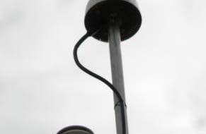
5 Unique Port Area ferry terminal sea channel Photo: HERO/Nordlicht naval port turning area complex user range critical local conditions high h amount of ship traffic perfect test and development environment nereus Brussels 5
6 Organization Research Port Rostock initiative of the government of the German federal state Mecklenburg-Vorpommern Safer and efficient maritime navigation Network for Maritime Applications Research Development nereus Brussels 6
7 Members of the Network Commercial partners Research facilities Combined with provider of infrastructure nereus Brussels 7
8 Structure t Who we are What we do What we want Video nereus Brussels 8


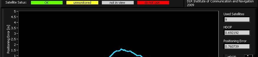
9 Visions i of the Network High precise and reliable positioning within one decimeter in the entire port area in real time Automation of ship control systems via GNSS applications Automation ti of the intermodal transportt of goods Time, cost and emission reduction as well as increase of user security under all operating conditions nereus Brussels 9
10 Fields of Activity Logistics Communication Navigation WG Portal Research Port WG Tracking & Tracing WG Augmentation Systems High precise and reliable positioning of ships, cargo, persons and infrastructure in the harbour area nereus Brussels

 < 10 / na < 1 / na < 0.")
 10 10 10 < 6 Integrity Risk 1e-5/3h 1e-5/3h")
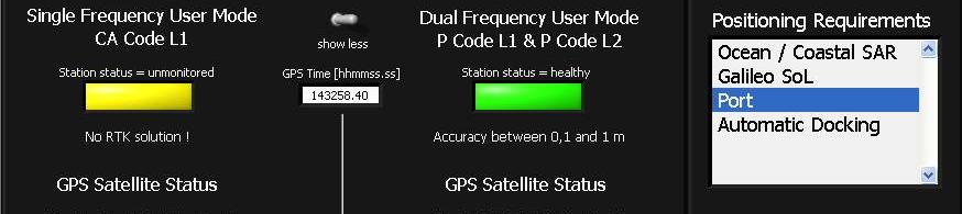
11 Requirements International Maritime Organization (IMO) Maritime positioning and navigation are Safety of Life - applications of existing and future Global Navigation Satellite Systems (GNSS) Ocean/Coastal SAR Port Automatic Docking Galileo SoL Position Error H/V (m) < 10 / na < 1 / na < 0.1 / - < 4 m / < 8 m Alarm Limit (m) m / 18 m Time to Alarm (s) < 6 Integrity Risk 1e-5/3h 1e-5/3h 1e-5/3h 3.5e-7/150s nereus Brussels H = horizontal V = vertical NA = not applicable

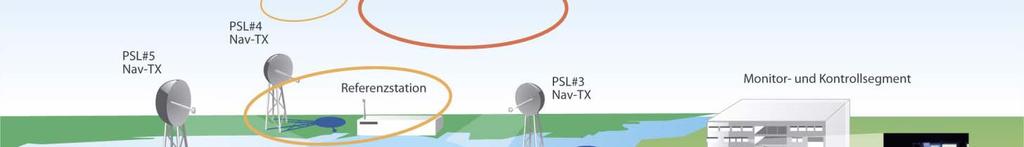
12 Infrastructures t Solution with GNSS-technology SEA GATE Maritime test and development environment nereus Brussels 12


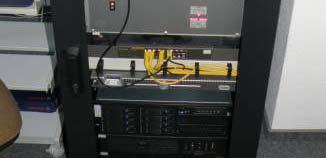
13 SEA GATE 6 pseudolites 1 reference station 1 master control station Preciseness < 0,5m Free accessible signals Operation 24h/7d base mode base mode + correction data nereus Brussels 13
14 M-GBAS Alegro/ASMS accuracy until 1dm phase-based DGNSS (RTK) correction and integrity data Galileo prepared base mode base mode + integrity massage base mode and validation GBAS IMS GBAS GUT GBAS RS nereus Brussels 14


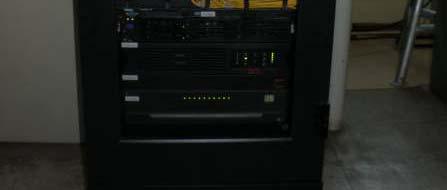
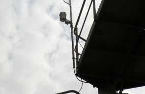
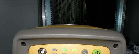


15 M-GBAS Antennas & Weather Sensors GHR1 GHR0 GNSS receiver (TOPCON NET-G3) nereus Brussels 15
16 Experience in Projects SAR SEA GATE EADS RST M-GBAS DLR AGaPaS University Rostock Infrastructure of 6 transmit stations to send Galileo like signals (pseudolites) Evaluation of GNSS signal quality and provision of correction and integrity data (RTK) Self activating rescue system, which detects person who fell overboard and which allows a remote-controlled assurance of the survival conditions ZuMANZ Hochschule Wismar MARSPEED Hochschule Wismar maneuver simulation for prediction of ship performance while varying of ship parameter like helm, propeller p etc. Training simulator for maritime high-speed vehicles, maneuver training nereus Brussels 16
17 Structure t Who we are What we do What we want Video nereus Brussels 17
18 What we want Users of the installed maritime Galileo GBAS in Rostock Users of high precise and reliable positioning in the port area Project partners to realize prototypes t Long term cooperation partners Technical and legal information on GNSS, maritime industry and logistics Information on Galileo test beds in Europe nereus Brussels 18
19 Events April CERGAL Rostock International Symposium on Certification of GNSS Systems & Services May BalticFuture Rostock Workshop Innovative Approaches on Maritime Navigation and Logistics September SMM Hamburg International trade fair on shipbuilding, machinery & marine technology September CAMS Rostock International Conference on Control Applications in Marine Systems nereus Brussels 19
20 Proposal Combined nereus Workshop in Rostock Live demonstration of installed maritime GBAS International projects with involvement of nereus WG GNSS and WG GMES Participation in the 3rd Call of FP7 nereus Brussels 20
21 Video Sea GATE Maritime Galileo Test and Development Environment nereus Brussels 21
22 Contact Thank you for the attention! Find more information on Network for Maritime Applications Dipl.-Kffr. Silvia Westland Phone sw@netmaritime.de
23 List of Abbreviations DLR Deutsches Zentrum fuer Luft- und draumfahrt, ht German Aerospace Center GNSS Global Navigation Satellite System DGNSS Differential GNSS Pseudolites Pseudo-satellite, ground-based transmitter of GNSS signals RTK Real Time Kinematic SEA GATE Maritime Galileo Test and Development Environment M-GBAS Maritime Ground Based Augmentation System AGaPaS Autonomously Acting Rescue Robot For Persons in Distress at Sea ZuMANZ condition based maneuver display for consulting of ship navigation HERO Hafen-Entwicklungsgesellschaft Rostock mbh GMES Global Monitoring for Environment and Security M-V Mecklenburg-Vorpommern IMO International Maritime Organization nereus Brussels 23
GBAS-Technologies for High Precise Safety-Critical Maritime Navigation
 GBAS-Technologies for High Precise Safety-Critical Maritime Navigation S. Schlüter, E. Engler, T. Noack, J. Beckheinrich, A. Hirrle, C. Becker, D. Klähn Abstract As a result of the high quality of positioning
A new Modular and Open Concept for the Maritime Integrated PNT System
 A new Modular and Open Concept for the Maritime Integrated PNT System T. Noack German Aerospace Center Institute of Communications and Navigation www.dlr.de Chart 2 MTS-2012 Maritime Integrated PNT Unit
European GNSS Applications in H2020
 European GNSS Applications in H2020 Countdown to H2020 12.12.2013, Brussels Carmen Aguilera European GNSS Agency Agenda European GNSS Agency EU-GNSS market potential FP7- experience and results H2020 opportunities
Greek Maritime trials
 Greek Maritime trials Liza Panagiotopoulou KTIMATOLOGIO S.A. Greek Maritime trials took place in the framework of GALILEO Future Applications GALA (Galileo Overall Architecture Definition) Work Package
Galileo and GMES Technologies for Maritime Navigation Christoph Günther, DLR
 Galileo and GMES Technologies for Maritime Navigation Christoph Günther, DLR Institut für Kommunikation und Navigation Seite 1 Maritime Safety and Efficiency Avoidance of Collisions based on known position
Performance Evaluation of Differential Global Navigation Satellite System with RTK Corrections
 IOSR Journal of Electronics and Communication Engineering (IOSR-JECE) e-issn: 2278-2834,p- ISSN: 2278-8735.Volume 9, Issue 2, Ver. VI (Mar - Apr. 2014), PP 43-47 Performance Evaluation of Differential
GNSS in Maritime and Education in Egypt
 GNSS in Maritime and Education in Egypt GNSS IN MARITIME PORTS SHIPS PORTS WATERWAYS GNSS maritime applications will help to improve: navigation. Ship operations. Traffic management. Seaport operations.
EGNOS status and performance in the context of marine navigation requirements
 EGNOS status and performance in the context of marine navigation requirements J. Cydejko Gdynia Maritime University, Gdynia, Poland ABSTRACT: The current status of EGNOS (December 2006) is described as
EUPOS - European Position Determination System Status and current issues
 EUPOS - European Position Determination System Status and current issues Office of the International EUPOS Steering Committee Senate Department for Urban Development, Land Berlin, Germany Symposium of
European Satellite Navigation Competition The DLR Special Topic Prize NEXT GENERATION NAVIGATION. Folie 1
 European Satellite Navigation Competition 2010 The DLR Special Topic Prize NEXT GENERATION NAVIGATION Folie 1 Robert Klarner, DLR Technology Marketing, 01/05/2009 DLR German Aerospace Center Research Institution
Long Term Validation of High Precision RTK Positioning Onboard a Ferry Vessel Using the MGBAS in the Research Port of Rostock
 http://www.transnav.eu the International Journal on Marine Navigation and Safety of Sea Transportation Volume 11 Number 3 September 2017 DOI: 10.12716/1001.11.03.06 Long Term Validation of High Precision
Civil Applications of Galileo. Brussels, June 12, 2006 Ir. Peter A. Grognard Founder and CEO, Septentrio nv
 Civil Applications of Galileo Brussels, June 12, 2006 Ir. Peter A. Grognard Founder and CEO, Septentrio nv Company overview Founded January 21, 2000 in Leuven, Belgium Spin-off of Interuniversity MicroElectronics
CLICK HERE TO KNOW MORE
 CLICK HERE TO KNOW MORE Should GNSS Become a National Critical Infrastructure? Ooi Wei Han, Noordin Ahmad, Shahrizal IM National Space Agency (ANGKASA) Ministry of Science, Technology and Innovation (MOSTI)
DRAFT REVISION OF IMO RESOLUTION A.860(20)
") DRAFT REVISION OF IMO RESOLUTION A.860(20) MARITIME POLICY FOR A FUTURE GLOBAL NAVIGATION SATELLITE SYSTEM (GNSS) THE ASSEMBLY, RECALLING Article 15(j) of the Convention on the International Maritime Organization
DRAFT REVISION OF IMO RESOLUTION A.860(20) MARITIME POLICY FOR A FUTURE GLOBAL NAVIGATION SATELLITE SYSTEM (GNSS) THE ASSEMBLY, RECALLING Article 15(j) of the Convention on the International Maritime Organization
Challenges and opportunities in the e-navigation Development. Actual projects.
 Challenges and opportunities in the e-navigation Development. Actual projects. John Erik Hagen, Regional Director Oslo, September 2018 What is e-navigation? Efficient transfer of marine information and
ATTACHMENT E. How to Conduct a GMDSS Inspection.
 Page 1 of 7 NOTE: This document is an excerpt from The Report and Order In the Matter of Amendment of the Commission's Rules Concerning the Inspection of Radio Installations on Large Cargo and Small Passenger
Market strategy update in Maritime segment. This presentation can be interpreted only together with the oral comments accompanying it
 Market strategy update in Maritime segment This presentation can be interpreted only together with the oral comments accompanying it 2 Market sub-segments and applications Recreational navigation: GNSS
Statistical GNSS performance assessment as part of the ALEGRO Ground Based Augmentation System inside Research Harbour Rostock
 Statistical GNSS performance assessment as part of the ALEGRO Ground Based Augmentation System inside Research Harbour Rostock Thoralf Noack & Evelin Engler & Anja Klisch & Stefan Gewies & Carsten Becker
RESOLUTION MSC.233(82) (adopted on 5 December 2006) ADOPTION OF THE PERFORMANCE STANDARDS FOR SHIPBORNE GALILEO RECEIVER EQUIPMENT
 (adopted on 5 December 2006) ADOPTION OF THE PERFORMANCE STANDARDS FOR SHIPBORNE GALILEO RECEIVER EQUIPMENT") MSC 82/24/Add.2 RESOLUTION MSC.233(82) THE MARITIME SAFETY COMMITTEE, RECALLING Article 28(b) of the Convention on the International Maritime Organization concerning the functions of the Committee, RECALLING
MSC 82/24/Add.2 RESOLUTION MSC.233(82) THE MARITIME SAFETY COMMITTEE, RECALLING Article 28(b) of the Convention on the International Maritime Organization concerning the functions of the Committee, RECALLING
GUIDELINES ON THE DESIGN AND USE OF PORTABLE PILOT UNITS INTERNATIONAL MARITIME PILOTS ASSOCIATION
 GUIDELINES ON THE DESIGN AND USE OF PORTABLE PILOT UNITS INTERNATIONAL MARITIME PILOTS ASSOCIATION WITH TECHNICAL INPUT FROM Comité International Radio-Maritime (CIRM) 2 FOREWORD With the increasing use
L AGENCE NATIONALE DES FREQUENCES (ANFR) From Titanic to satellite from Morse to digital Entry in a new era for the maritime community
 From Titanic to satellite from Morse to digital Entry in a new era for the maritime community") L AGENCE NATIONALE DES FREQUENCES (ANFR) From Titanic to satellite from Morse to digital Entry in a new era for the maritime community ITU regional seminar 6-8 June 2018 St-Petersburg, Russian Federation
L AGENCE NATIONALE DES FREQUENCES (ANFR) From Titanic to satellite from Morse to digital Entry in a new era for the maritime community ITU regional seminar 6-8 June 2018 St-Petersburg, Russian Federation
VERY PRECISE SYNCHRONIZATION OF A GROUP OF PSEUDOLITES
 VERY PRECISE SYNCHRONIZATION OF A GROUP OF PSEUDOLITES Werner R. Lange Lange-Electronic GmbH Gernlinden, Germany T.: +49-8142-2845820 WLange@lange-electronic.de Abstract Pseudolites are GNSS transmitters
Overview of the global GNSS market and status of Galileo
 2012 GNSS.asia workshop Overview of the global GNSS market and status of Galileo 6 November, 2012 Taipei Justyna Redelkiewicz, European GNSS Agency European GNNS Agency supports European Commission in
Resilient PNT: From PNT-Unit concept to first realization
 www.dlr.de Chart 1 >Resilient PNT: From PNT Unit concept to first realization> R. Ziebold > e-navigation Underway 1/3/213 Resilient PNT: From PNT-Unit concept to first realization Ralf Ziebold, Z. Dai,
Policy Research Corporation
 Policy Research Corporation SOUND SOLUTIONS BASED ON SCIENTIFIC RESEARCH The role of Maritime Clusters to enhance the strength and development of maritime sectors Country report Germany INTRODUCTION TO
This circular summarizes the various important aspects of the LRIT system with a view to enabling companies to ensure compliance in a timely manner.
 Luxembourg, 29/10/2008 CIRCULAR CAM 02/2008 N/Réf. : AH/63353 Subject : Long-Range Identification and Tracking of Ships (LRIT) To : All ship owners, ship operators and designated persons of Luxembourg
This document describes the IMO e-navigation strategy and recommends a Danish strategy for e-navigation and associated action plan.
 Strategy and action plan for e-navigation This document describes the IMO e-navigation strategy and recommends a Danish strategy for e-navigation and associated action plan. Our reference: JKJ/MAF Case
WARTSILA AUTONOMOUS VESSEL ADVANCES
 WARTSILA AUTONOMOUS VESSEL ADVANCES NAMEPA 28 FEBRUARY 2018 HOUSTON, TX Kevin Humphreys Business Development Manager - Americas Wartsila North America Mobile +1 757 478 8117 kevin.humphreys@wartsila.com
IMO WORLD-WIDE RADIONAVIGATION SYSTEM (WWRNS) GALILEO receiver performance standards. Submitted by the European Commission
 GALILEO receiver performance standards. Submitted by the European Commission") INTERNATIONAL MARITIME ORGANIZATION E IMO SUB-COMMITTEE ON SAFETY OF NAVIGATION 50th session Agenda item 13 2 April 2004 Original: ENGLISH WORLD-WIDE RADIONAVIGATION SYSTEM (WWRNS) GALILEO receiver performance
INTERNATIONAL MARITIME ORGANIZATION E IMO SUB-COMMITTEE ON SAFETY OF NAVIGATION 50th session Agenda item 13 2 April 2004 Original: ENGLISH WORLD-WIDE RADIONAVIGATION SYSTEM (WWRNS) GALILEO receiver performance
Coastal Surveillance. SCANTER Radar Solutions
 Coastal Surveillance SCANTER Radar Solutions Protecting Your Coastlines and Maritime Domain We provide radar coverage of the coastline to detect and track all types of surface vessels and air targets.
European Radio Navigation Plan. Gilles LEQUEUX, European Commission Policy Development and Strategies
 European Radio Navigation Plan Gilles LEQUEUX, European Commission Policy Development and Strategies CONTEXT - BENEFITS Space Strategy for Europe Introduction of EGNSS in EU sectoral policies Better strategic
Monitoring of the Geo-Plasma Environment
 Monitoring of the Geo-Plasma Environment MOPLE N. Jakowski and S. S. M. Stankov MOPLE MOPLE submitted as as EoI EoIfor for FP6 FP6 by: by: Deutsches Zentrum für für Luft- Luft-und und Raumfahrt e.v. e.v.
PROTECTING GPS/GNSS-RELIANT MILITARY SYSTEMS
 PROTECTING GPS/GNSS-RELIANT MILITARY SYSTEMS John Fischer VP Advanced R&D Jon Sinden Product Manager, Rugged PNT 6/21/2018 ABOUT OROLIA A world leader in assured positioning, navigation and timing (PNT)
Status of the European EGNOS and Galileo Programmes. Frank Udnaes Galileo policy and Infrastructure group EC DG-TREN. June 2008
 Status of the European EGNOS and Galileo Programmes Frank Udnaes Galileo policy and Infrastructure group EC DG-TREN EUROPEAN COMMISSION z June 2008 Galileo An infrastructure 30 satellite Constellation
Author s Name Name of the Paper Session. DYNAMIC POSITIONING CONFERENCE October 10-11, 2017 SENSORS SESSION. Sensing Autonomy.
 Author s Name Name of the Paper Session DYNAMIC POSITIONING CONFERENCE October 10-11, 2017 SENSORS SESSION Sensing Autonomy By Arne Rinnan Kongsberg Seatex AS Abstract A certain level of autonomy is already
The role of EGNOS in the recapitalised DGNSS service of WSV - concept and implementation
 The role of EGNOS in the recapitalised DGNSS service of WSV - concept and implementation Tamás Horváth 1, Michael Hoppe 2 1 Alberding GmbH 2 German Federal Waterways and Shipping Administration (WSV) EGNOS
GALILEO Research and Development Activities. Second Call. Area 1A. Statement of Work
 GALILEO Research and Development Activities Second Call Area 1A GNSS Introduction in the Maritime Sector Statement of Work Rue du Luxembourg, 3 B 1000 Brussels Tel +32 2 507 80 00 Fax +32 2 507 80 01 www.galileoju.com
Unmanned on-orbit servicing (OOS), ROKVISS and the TECSAS mission
, ROKVISS and the TECSAS mission") In Proceedings of the 8th ESA Workshop on Advanced Space Technologies for Robotics and Automation 'ASTRA 2004' ESTEC, Noordwijk, The Netherlands, November 2-4, 2004 On-Orbit Servicing (OOS), ROKVISS and
In Proceedings of the 8th ESA Workshop on Advanced Space Technologies for Robotics and Automation 'ASTRA 2004' ESTEC, Noordwijk, The Netherlands, November 2-4, 2004 On-Orbit Servicing (OOS), ROKVISS and
Satellite services for maritime security
 Satellite services for ITS-T Sophia Antipolis 6 June 2007 Jean-Pierre Cauzac, CLS - Collecte Localisation Satellites 35 Are the seas becoming more dangerous? IMB report 2006 shows improvement: 239 piracy
Arctic Navigation Issues. e-nav conference Nordic Institute of Navigation Bergen, March 5 th 2009
 Arctic Navigation Issues e-nav conference Nordic Institute of Navigation Bergen, March 5 th 2009 by Anna B.O. Jensen - AJ Geomatics Jean-Paul Sicard - Rovsing A/S March 2009 1 Outline Reduction of ice
Challenges to and opportunities for activation of the business and R&D sectors in Pomorskie
 Challenges to and opportunities for activation of the business and R&D sectors in Pomorskie Be Smart, Think Blue Conference & Brokerage Event 2016 Adam Mikołajczyk Office of the Marshal of the Pomorskie
The new German Space Strategy makes the space sector fit for the future Dr. Juergen Drescher DLR Washington Office
 The new German Space Strategy makes the space sector fit for the future Dr. Juergen Drescher DLR Washington Office 6th Eilene M. Galloway Symposium Washington D.C., December 1st, 2011 Space Policy of the
New Funding Opportunities to Support Safety of Navigation: EGNOS and Galileo
 New Funding Opportunities to Support Safety of Navigation: EGNOS and Galileo e-navigation Underway 31 January-2 February 2017 GSA 2016 The European GNSS Agency (GSA) today: Staff: about 145 Nationalities:
Autonomous and remotely operated ships
 MARITIME Autonomous and remotely operated ships Presented at DVIS Rasmus Stute 1 SAFER, SMARTER, GREENER Agenda 1. What is it? 2. How to ensure safe implementations? 3. Research projects 4. Is it legal?
Protection Augmentation Toughness and Alternatives of GNSS. Melaha 2016 Concord Al-Salam Hotel Cairo, April 25,2016 Refaat Rashad
 Protection Augmentation Toughness and Alternatives of GNSS Melaha 2016 Concord Al-Salam Hotel Cairo, April 25,2016 Refaat Rashad Road Map of the Presentation 1- How Good are GNSS 2- How Vulnerable are
Record of approved GMDSS radio installation
 (Nov 2015) Record of approved GMDSS radio installation To meet the provisions of the INTERNATIONAL CONVENTION FOR THE SAFETY OF LIFE AT SEA, 1974, AND AMENDMENTS THERETO This form should be kept on board
GSA GNSS Technology Report Main highlights IPIN 2018
 GSA GNSS Technology Report Main highlights IPIN 2018 Justyna Redelkiewicz, European GNSS Agency 25 September 2018, Nantes The European GNSS Agency (GSA) is responsible for market development and operations
Maritime Safety & Security
 Coordinating unit: Teaching unit: Academic year: Degree: ECTS credits: 2018 280 - FNB - Barcelona School of Nautical Studies 742 - CEN - Department of Nautical Sciences and Engineering BACHELOR'S DEGREE
INTERNATIONAL STANDARD
 INTERNATIONAL STANDARD IEC 61993-2 First edition 2001-12 Maritime navigation and radiocommunication equipment and systems Automatic identification systems (AIS) Part 2: Class A shipborne equipment of the
Oportunidades de negocio SECTOR MARÍTIMO
 Oportunidades de negocio SECTOR MARÍTIMO SHIPBUILDING Technology sought for recovering energy from exhaust gases. A multinational shipping enterprise with a registered base in Scotland (UK) is seeking
Evaluation of RTKLIB's Positioning Accuracy Using low-cost GNSS Receiver and ASG-EUPOS
 http://www.transnav.eu the International Journal on Marine Navigation and Safety of Sea Transportation Volume 7 Number 1 March 2013 DOI: 10.12716/1001.07.01.10 Evaluation of RTKLIB's Positioning Accuracy
The Role of Automatic Identification System (AIS) in Enhancing Vessel Traffic Management By Capt. Ehab Ibrahim Etman
 in Enhancing Vessel Traffic Management By Capt. Ehab Ibrahim Etman") The Role of Automatic Identification System (AIS) in Enhancing Vessel Traffic Management By Capt. Ehab Ibrahim Etman Abstract The International Maritime Organization (IMO) adopted a new requirement for
The Role of Automatic Identification System (AIS) in Enhancing Vessel Traffic Management By Capt. Ehab Ibrahim Etman Abstract The International Maritime Organization (IMO) adopted a new requirement for
Canadian Coast Guard Review to Implement a Resilient Position, Navigation and Timing Solution for Canada. Mariners Workshop January 31 st, 2018
 Canadian Coast Guard Review to Implement a Resilient Position, Navigation and Timing Solution for Canada Mariners Workshop January 31 st, 2018 Outline Overview of GNSS use in the marine sector CCG Activities
ANNUAL OF NAVIGATION 19/2012/part 1
 ANNUAL OF NAVIGATION 19/2012/part 1 PAWEŁ BANYŚ, THORALF NOACK, STEFAN GEWIES German Aerospace Center (DLR), Institute of Communications and Navigation (IKN) ASSESSMENT OF AIS VESSEL POSITION REPORT UNDER
ESA/CNES/ARIANESPACE Service Optique CSG, S. Martin. IGNSS 2018 Sydney
 ESA/CNES/ARIANESPACE Service Optique CSG, S. Martin IGNSS 2018 Sydney GALILEO SERVICES Open Service (OS) Freely accessible service for positioning, navigation and timing Public Regulated Service (PRS)
Precise Positioning... what does it mean? Precise GNSS Positioning Not just a niche technology. Chris Rizos 15/12/15
 Precise GNSS Positioning Not just a niche technology Chris Rizos Precise Positioning... what does it mean? 1 Precise Positioning... a spectrum of users... Few mm 1cm 2cm < dm 1dm sub-m Precision agriculture
JOURNAL OF MARITIME RESEARCH. The Architecture of Data Transmission in Inland Navigation
 JOURNAL OF MARITIME RESEARCH Vol XI. No. II (2014) pp 3 7 ISSN: 1697-4040, www.jmr.unican.es The Architecture of Data Transmission in Inland Navigation A. Lisaj 1,2, and P. Majzner 3 ARTICLE INFO Article
Government Agency Perspectives & Initiatives Canadian Coast Guard Laurent Tardif, Director, Safe Shipping
 Unclassified Government Agency Perspectives & Initiatives Canadian Coast Guard Laurent Tardif, Director, Safe Shipping Mariner s Workshop January 23, 2019 1 Overview 1 Context 2 Marine Fees 3 4 5 Update
Korea s Strategy for e-navigation. SMART-Navigation. Presented by. Bu Young, Kim. 28 May Ministry of Oceans and Fisheries Republic of Korea
 Korea s Strategy for e-navigation SMART-Navigation Presented by Bu Young, Kim 28 May 2014 Ministry of Oceans and Fisheries Republic of Korea 1 2 3 4 5 6 1. SMART- Navigation? SMART-Navigation Korea s
Plausibility analysis of navigation related AIS parameter based on time series
 Plausibility analysis of navigation related AIS parameter based on time series Frank Heymann, Thoralf Noack, Paweł Banyś Deutsches Zentrum für Luft und Raumfahrt ev, Neustrelitz, Germany email: frank.heymann@dlr.de
VHF Data Exchange System (VDES)
") VHF Data Exchange System (VDES) ETSI Workshop Future Evolution of Marine Communication 7-8 November 2017 Malcolm Lyman Marketing Manager CML Microcircuits UK With acknowledgments to the members of IALA
VHF Data Exchange System (VDES) ETSI Workshop Future Evolution of Marine Communication 7-8 November 2017 Malcolm Lyman Marketing Manager CML Microcircuits UK With acknowledgments to the members of IALA
Frank Heymann 1.
 Plausibility analysis of navigation related AIS parameter based on time series Frank Heymann 1 1 Deutsches Zentrum für Luft und Raumfahrt ev, Neustrelitz, Germany email: frank.heymann@dlr.de In this paper
EUPOS: Unified GNSS Augmentation Infrastructure and International Cooperation in Central and Eastern Europe
 EUPOS: Unified GNSS Augmentation Infrastructure and International Cooperation in Central and Eastern Europe Senate Department for Urban Development Geodetic Reference Systems Fehrbelliner Platz 1, 10707
EUROPEAN GNSS ADOPTION OPPORTUNITIES IN TRANSPORT WITH FOCUS ON RAIL
 EUROPEAN GNSS ADOPTION OPPORTUNITIES IN TRANSPORT WITH FOCUS ON RAIL Gian Gherardo Calini European GNSS Agency III Workshop GNSS Technology Advances in a Multi-Constellation Framework 22 January 2016 This
Resolution A.1106(29) Adopted on 2 December 2015 (Agenda item 10)
 Adopted on 2 December 2015 (Agenda item 10)") E ASSEMBLY 29th session Agenda item 10 A 29/Res.1106 14 December 2015 Original: ENGLISH Resolution A.1106(29) Adopted on 2 December 2015 (Agenda item 10) REVISED GUIDELINES FOR THE ONBOARD OPERATIONAL
E ASSEMBLY 29th session Agenda item 10 A 29/Res.1106 14 December 2015 Original: ENGLISH Resolution A.1106(29) Adopted on 2 December 2015 (Agenda item 10) REVISED GUIDELINES FOR THE ONBOARD OPERATIONAL
High Precision GNSS in Automotive
 High Precision GNSS in Automotive Jonathan Auld, VP Engineering and Safety 6, March, 2018 2 Global OEM Positioning Solutions and Services for Land, Sea, and Air. GNSS in Automotive Today Today the primary
Jun Shen International Cooperation Center. China Satellite Navigation Office
 Jun Shen (shenjun@beidou.gov.cn) International Cooperation Center Tenth Meeting of the International Committee on Global Navigation Satellite Systems (ICG) November 1-6, 2015 1 Introduction and Background
EUPOS European Position Determination System
 EUPOS European Position Determination System c/o Senate Department for Urban Development, State Berlin, Germany Umea, Sweden, 22 nd 23 rd 2011 The Geodetic Infrastructure in Europe today and tomorrow Slide
Radio Navigation Aids Flight Test Seminar
 Radio Navigation Aids Flight Test Seminar FLIGHT INSPECTION IN THE NEW MILLENNIUM Curt Keedy FAA Flight Inspection Policy and Standards Change, Challenge, and Opportunity CHANGES Global Positioning system
Nigerian Communications Satellite Ltd. (NIGCOMSAT)
") OVERVIEW OF NIGERIAN SATELLITE AUGMENTATION SYSTEM COMMENCING WITH PILOT DEMONSTRATION TO VALIDATE NATIONAL WORK PLAN presented by Dr. Lawal Lasisi Salami, NIGERIAN COMMUNICATIONS SATELLITE LTD UNDER FEDERAL
OVERVIEW OF NIGERIAN SATELLITE AUGMENTATION SYSTEM COMMENCING WITH PILOT DEMONSTRATION TO VALIDATE NATIONAL WORK PLAN presented by Dr. Lawal Lasisi Salami, NIGERIAN COMMUNICATIONS SATELLITE LTD UNDER FEDERAL
Report of Working Group B: Enhancement of Global Navigation Satellite Systems Services Performance
 Report of : Enhancement of Global Navigation Satellite Systems Services Performance 1. The Working Group on Enhancement of Global Navigation Satellite Systems (GNSS) Service Performance (WG-B) of the International
Report of the Working Group B: Enhancement of Global Navigation Satellite Systems (GNSS) Services Performance
 Services Performance") Report of the Working Group B: Enhancement of Global Navigation Satellite Systems (GNSS) Services Performance 1. The Working Group on Enhancement of Global Navigation Satellite Systems (GNSS) Service Performance
Report of the Working Group B: Enhancement of Global Navigation Satellite Systems (GNSS) Services Performance 1. The Working Group on Enhancement of Global Navigation Satellite Systems (GNSS) Service Performance
ITU Service Publications (maritime) and MARS (Maritime mobile Access and Retrieval System)
 and MARS (Maritime mobile Access and Retrieval System)") ITU Service Publications (maritime) and MARS (Maritime mobile Access and Retrieval System) ITU Radiocommunication Bureau Ms. Sujiva Pinnagoda pinnagoda@itu.int BR/TSD/TPR Another BR activity Radiocommunication
ITU Service Publications (maritime) and MARS (Maritime mobile Access and Retrieval System) ITU Radiocommunication Bureau Ms. Sujiva Pinnagoda pinnagoda@itu.int BR/TSD/TPR Another BR activity Radiocommunication
GNSS MONITORING NETWORKS
 SPACE GNSS MONITORING NETWORKS Satellite communications, earth observation, navigation and positioning and control stations indracompany.com GNSS MONITORING NETWORKS GNSS MONITORING NETWORKS Indra s solutions
E-Navigation: Opening the door to the future
 International Association of Marine Aids to Navigation and Lighthouse Authorities E-Navigation: Opening the door to the future E-Navigation Underway North America November 2018 Secretary-General Francis
Challenges and Methods for Integrity Assurance in Future GNSS
 Challenges and Methods for Integrity Assurance in Future GNSS Igor Mozharov Division Head, Information and Analytical Center for PNT, Central Research Institute for Machine Building, Roscosmos igor.mozharov@mcc.rsa.ru
A study of the changing and future skill needs of the maritime and marine sectors. IMP-MED Project Alexandria 25 June 2014
 A study of the changing and future skill needs of the maritime and marine sectors 1 AASTMT & IMP-MED PROJECT 2 FEMIP & Blue Economy: AASTMT Communication April 2013 3 6th Regional Technical Workshop IMP-MED
GEURIW project- use of EGNOS for inland waterways navigation
 DANUBE INFORMATION SERVICES CONFERENCE- DISC 2016 Regenburg, Germany 6-7 th of December 2016 GEURIW project- use of EGNOS for inland waterways navigation Alina Radutu- Romanian Space Agency romanian space
INTERNATIONAL STANDARD
 INTERNATIONAL STANDARD IEC 61097-6 Edition 2.1 2012-01 colour inside Global maritime distress and safety system (GMDSS) Part 6: Narrowband direct-printing telegraph equipment for the reception of navigational
MEDIA IN Media Info 2011
 MEDIA IN Media Info 2011 OVERVIEW Overview Cavendish Group International is delighted to produce Marine Engineering & Offshore Technology, an industry journal dedicated to the Chinese Marine and Offshore
GNSS Training for ITS Developers. Characterisation of EGNSS performances in relationship with the application requirements
 GNSS Training for ITS Developers Characterisation of EGNSS performances in relationship with the application requirements Table of Content egnss for Application: Main Challenges EGNOS and GALILEO Performances
«Current state and prospects of development of commercial application GLONASS/GNSS in the Russian Federation»
 «Current state and prospects of development of commercial application GLONASS/GNSS in the Russian Federation» United Nations SYMPOSIUM TO STRENGTHEN THE PARTNERSHIP WITH INDUSTRY COMMERCIAL APPLICATIONS
GMDSS RADIO INSTALLATION
 Ship s name: N.R. Survey: GMDSS RADIO INSTALLATION (Res. A.1053(27)) INITIAL (Newconstruction) PERIODICAL RENEWAL Sea areas: A1 Methods of maintenance: Duplication of (Reg. IV/12-15) A1+A2 (Reg. IV/15)
e-navigation Underway International February 2016 Kilyong Kim(GMT Co., Ltd.) Co-author : Seojeong Lee(Korea Maritime and Ocean University)
 Co-author : Seojeong Lee(Korea Maritime and Ocean University)") e-navigation Underway International 2016 2-4 February 2016 Kilyong Kim(GMT Co., Ltd.) Co-author : Seojeong Lee(Korea Maritime and Ocean University) Eureka R&D project From Jan 2015 to Dec 2017 15 partners
e-navigation Underway International 2016 2-4 February 2016 Kilyong Kim(GMT Co., Ltd.) Co-author : Seojeong Lee(Korea Maritime and Ocean University) Eureka R&D project From Jan 2015 to Dec 2017 15 partners
DGPS AND EGNOS SYSTEMS IN HYDROGRAPHIC SURVEY ACCURACY ANALYSES AT THE POLISH SEA AREA CEZARY SPECHT
 DGPS AND EGNOS SYSTEMS IN HYDROGRAPHIC SURVEY ACCURACY ANALYSES AT THE POLISH SEA AREA CEZARY SPECHT Polish Naval Academy, 8-3 Gdynia 3, Smidowicza 69 str., Poland C.Specht@amw.gdynia.pl Problem of positioning
Dimov Stojče Ilčev. CNS Systems
 Stratospheric Platform Systems (SPS) Presentation by: Dimov Stojče Ilčev Durban University of Technology (DUT) Space Science Centre (SSC) CNS Systems August 2011 SPS for Mobile CNS Applications Stratospheric
Experiences with Fugro's Real Time GPS/GLONASS Orbit/Clock Decimeter Level Precise Positioning System
 Return to Session Directory DYNAMIC POSITIONING CONFERENCE October 13-14, 2009 Sensors Experiences with Fugro's Real Time GPS/GLONASS Orbit/Clock Decimeter Level Precise Positioning System Ole Ørpen and
Galileo as an instrument of unification of the European railway transport
 Railway Infrastructure Administration Galileo as an instrument of unification of the European railway transport by Hynek Mocek SŽDC, TÚDC - Laboratory of Intelligent Systems Pardubice,, Czech Republic
GMDSS modernisation and e-navigation: spectrum needs
 ETSI Workshop "Future Evolution of Marine Communication", 7-8 November 2017, Sophia Antipolis, France GMDSS modernisation and e-navigation: spectrum needs Karlis Bogens BR Terrestrial Services Department
RULES FOR THE CONSTRUCTION AND CLASSIFICATION OF MOBILE OFFSHORE DRILLING UNITS TITLE MOBILE OFFSHORE DRILLING UNITS NAUTIC AND ELECTRONICS CHAPTERS
 PARTE II RULES FOR THE CONSTRUCTION AND CLASSIFICATION OF MOBILE OFFSHORE DRILLING UNITS TITLE MOBILE OFFSHORE DRILLING UNITS SECTION 8 NAUTIC AND ELECTRONICS CHAPTERS A B C D SCOPE TECHNICAL DOCUMENTATION
JCG GMDSS Symposium NAVDAT : Navigational Data
 JCG GMDSS Symposium 2013 NAVDAT : Navigational Data - System Presentation - Pascal OLIVIER NAVDAT Presentation Page 1/35 From analog to digital in maritime radio communications The current analog radio
02 Issue. e-navigation News. GNSS Vulnerability. Dublin Bay Digital Diamond. e-navigation. Demonstrator Update International. e-navigation.
 CORPORATE SECURITY TEAMWORK EVENTS 02 Issue e-navigation News GNSS Vulnerability Dublin Bay Digital Diamond e-navigation Demonstrator Update International e-navigation update June 2014 www.cil.ie +353
DYNAMIC POSITIONING CONFERENCE October 7-8, Sensors II. Redundancy in Dynamic Positioning Systems Based on Satellite Navigation
 Return to Session Directory DYNAMIC POSITIONING CONFERENCE October 7-8, 2008 Sensors II Redundancy in Dynamic Positioning Systems Based on Satellite Navigation Ole Ørpen, Tor Egil Melgård, Arne Norum Fugro
Autonomous/Unmanned Ships
 Autonomous/Unmanned Ships IFSMA - PRESENTATION 4/18/17 George Quick Slide 1 Good Afternoon, I appreciate the opportunity to say a few words about autonomous or unmanned ships from the perspective of the
Vision and Strategy to Enhance the Safety Management of Small and Medium Ships in the Era of the Fourth Industrial Revolution
 Vision and Strategy to Enhance the Safety Management of Small and Medium Ships in the Era of the Fourth Industrial Revolution International Safety@Sea Conference 2018 Singapore 21 June 2018 Y. S. Lee President
Fisheries and Marine Resources (Automatic Identification System) Regulations
 Regulations") Fisheries and Marine Resources (Automatic Identification System) Regulations 2016 GN No. 116 of 2016 Government Gazette of Mauritius No. 47of 28 May 2016 THE FISHERIES AND MARINE RESOURCES ACT Regulations
Fisheries and Marine Resources (Automatic Identification System) Regulations 2016 GN No. 116 of 2016 Government Gazette of Mauritius No. 47of 28 May 2016 THE FISHERIES AND MARINE RESOURCES ACT Regulations
EGNOS correction transmission via IALA beacons and AIS
 EGNOS correction transmission via IALA beacons and GSA SC24 pilot project results Tamás Horváth Alberding GmbH Danube Information Services Conference DISC 2018 12-13 December 2018, Bratislava, Slovakia
Arctic Shipping Navigating the Legal Landscape for marine infrastructure and Off-Shore Development
 Arctic Shipping Navigating the Legal Landscape for marine infrastructure and Off-Shore Development Peter G. Pamel Partner Connecticut Maritime Association SHIPPING 2012 Hilton Stamford March 21 st, 2012
ANNEX 12. RESOLUTION MSC.74(69) (adopted on 12 May 1998) ADOPTION OF NEW AND AMENDED PERFORMANCE STANDARDS
 (adopted on 12 May 1998) ADOPTION OF NEW AND AMENDED PERFORMANCE STANDARDS") RESOLUTION MSC.74(69) (adopted on 12 May 1998) ADOPTION OF NEW AND AMENDED PERFORMANCE STANDARDS THE MARITIME SAFETY COMMITTEE, RECALLING Article 28(b) of the Convention on the International Maritime Organization
RESOLUTION MSC.74(69) (adopted on 12 May 1998) ADOPTION OF NEW AND AMENDED PERFORMANCE STANDARDS THE MARITIME SAFETY COMMITTEE, RECALLING Article 28(b) of the Convention on the International Maritime Organization
OPERATIONS SEAFARER CERTIFICATION GUIDANCE NOTE SA MARITIME QUALIFICATIONS CODE SHORT RANGE CERTIFICATE (SRC)
") Page 1 of 8 Compiled by Chief Examiner Approved by Senior Radio Examiner OPERATIONS SEAFARER CERTIFICATION GUIDANCE NOTE SA MARITIME QUALIFICATIONS CODE SHORT Page 2 of 8 SHORT : OUTLINE EXAMINATION SYLLABUS
Page 1 of 8 Compiled by Chief Examiner Approved by Senior Radio Examiner OPERATIONS SEAFARER CERTIFICATION GUIDANCE NOTE SA MARITIME QUALIFICATIONS CODE SHORT Page 2 of 8 SHORT : OUTLINE EXAMINATION SYLLABUS