Dimensional Survey Company
|
|
|
- Coleen Freeman
- 5 years ago
- Views:
Transcription

1 Dimensional Survey Company

2 Services Anko Bluepix was founded in 2016 by experienced engineers, each a specialist within different segments of the survey business. Even though Anko Bluepix is a young company Our Mother company Anko AS was established back in Anko Bluepix has a broad in-house survey competence with the goal to be a one-stop shop for our clients. Together we will find a survey method that gives you the best results within your specifications such as accuracy, time efficiency and price. As-built survey of any structure Navigation system control (Heading, Pitch and Roll) DGNSS Health Check ROV survey Vessel survey Rig survey BlueEye Subsea Photogrammetry Offshore Installation Offshore Windmills Subsea structure offset survey and Calibration High precision measurements Reel survey Survey Support during Multibeams installation 3D Laser scanning Establish Global Coordinate points Survey management and consultancy Development of special survey solutions for your projects Drone Survey

3 Anko Bluepix works worldwide
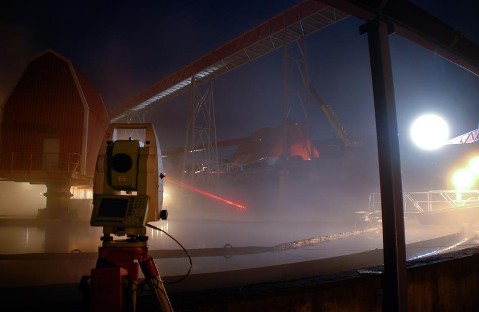
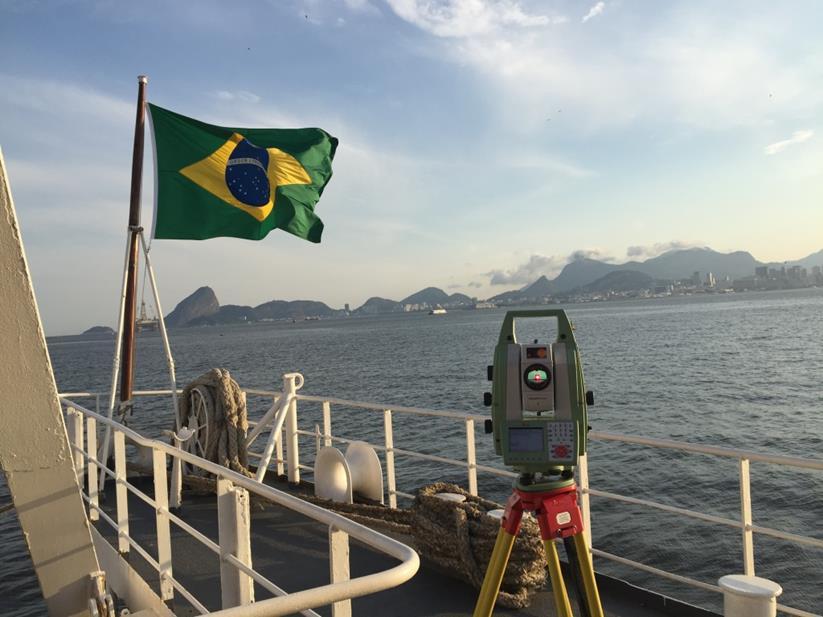
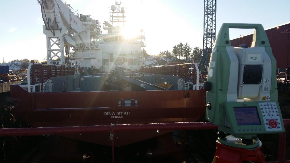
4 Vessel On a vessel it is a great advantage to know the as-built and as-installed position and alignment of all items utilized for operating the vessel. For some items it is even a necessity. Such items might be Cranes, Moon Pool, Tower, Launch Systems, inclination of helideck, structures on deck, Taut Wires, etc.etc. Others are the positioning/navigation systems sensors like Antennae, Motion sensors and sensors at the underside of the vessel like HPR poles and Multi Beams as well as other transducers/transponders. In order to know the position and alignment angles of all items in relationship to each other, one common coordinate reference system must be established on board the vessel. This is a local system made by one axis pointing forward, along or parallel to vessel centerline, one axis pointing towards starboard, one axis pointing upwards, a defined zero-point (CRP, coordinate/common reference point) and a defined reference plane. The three axis are 90 degrees to each other. The CRP can be anywhere but it should be located on a point which enable it to be picked out from the GA drawing of the vessel. The reference plane can be the best fit plane on main deck or a plane best fitted through the draft marks on the hull. The reference system should also be secured for future use by markers on the main structure. By means of a Totalstation, the offsets and installation angles of each item can be measured and tied into the coordinate reference system in order to have all positions and angles related to each other. Finally, a written report consisting of descriptions, definitions, procedure, photos and coordinated tabular/sketches of all points of interest should be issued. Survey by use of Totalstation is a cost- and time efficient solution to your specific needs.


5 ROV On a ROV it is very much the same principles as on a vessel, but it is often the main frame that is used as axis and plane reference. Some multi purpose ROV s have survey frames that are mounted and dismounted, then all axis and plane references are located to this particular frame. By means of a Totalstation, the offsets and installation angles of each item can be measured and tied into the coordinate reference system in order to have all positions and angles related to each other. Finally, a written report consisting of descriptions, definitions, procedure, photos and coordinated tabular/sketches of all points of interest are issued.
 is often used as CRP.")
6 Rigs and Drillships For Drillships it is very much the same principles and survey tasks as for other vessels. For Rigs it is normally the centre lines between the corner columns that are used for establishing the reference axis. Centre turntable (centre well) is often used as CRP. For both, the most commonly surveyed items in addition to the DP systems sensors is the drilling system. This is often position and alignment of the BOP in storage/resting location as well as the drilling system consisting of guide rails and drilling machinery, dolly etc. A typical survey job is therefore to measure and determine the guide rails straightness and the drill string alignment between top drive or crown block and centre turntable on drillfloor. Out of straightness of each guide rail relative to each other as well as out of theoretical dimensions between the rails is mapped. Then adjustments are carried out by the rig personnel and afterwards a new alignment survey is performed in order to verify correct adjustments.

7 Navigation System Control The main purpose with Navigation System Control is to check that the sensors are in good working order. That there are no drift in the sensors. That the software input is correct and to adjust for the installation angles. Vessel With our specially designed software we can control all Attitude sensors and Gyro compasses. Our personnel have many years experience with this work. This is a safe way to control that the right installation angles (C-O values) has been entered into the software and that the different sensors show the same output value. Anko Bluepix will install their equipment onboard the vessel and survey them into the local coordinate reference system. If there is no system onboard Anko Bluepix will establish a new system. Static calibration is preformed at quay side with simultaneously logging of Anko Bluepix and vessel systems. From these loggings a C-O will be calculated. A verification is performed after the values has be put into the vessel system, to verify that everything has been done correctly. Anko Bluepix also offers Dynamic calibration. This is a calibration preformed at open sea. If the client has a tight time schedule we can perform the calibration while in transit. ROV When a new sensor is installed on the ROV the sensor is surveyed to get the position and the installations angles. To verify the function of the sensor a navigation system control should be performed. The most preferred procedure is to set the ROV on land, let the sensors stabilize and start simultaneously logging of Anko Bluepix and ROV systems. C-O can be calculated and entered into the software. Subsea Structure When a Subsea structure is installed subsea, there are often sensors mounted on the structure itself to control the operation. Checking the sensors before load out will document that everything is in order before the operation starts.
8

 Perform a navigation system control on the sensors installed on the structure to document that the")
9 Subsea Structures The main reason for survey of subsea structures prior to load out is to get a complete documentation of the overall construction and items on the structure Important tasks that Anko Bluepix can assist with: A third party control on as-built Connect every sensor and installation piece into one common coordinate reference system Install and survey Photogrammetry markers, so the structure is ready to be surveyed subsea Document that vital installation pieces such as Guide pins, Guide Funnels and Landing Pads are correctly mounted Measure Installation angles on each sensor so they all refer to the same centerline and reference plane (common coordinate reference system) Perform a navigation system control on the sensors installed on the structure to document that the sensors are suitable for the installation work.

10 Underwater Photogrammetry Subsea metrology using Close Range Photogrammetry, a well-proven method. Procedures and equipment have been designed uniquely to ensure easy subsea handling and reduce vessel time to a minimum, without compromising safety and accuracy. The method can be used at any depth. We have called our system BlueEye. Point measurements can be performed with an accuracy of 1 to or better over lengths of more than 100 meters. BlueEye can be applied for any structure where you want survey results, for instance: Spool Metrology Dimensions of small and large structures Geometry of Jackets including nodes and legs Pile survey Guides and mini-posts Dents and damages Straightness, flatness and alignment surveys

11 Offshore Windmills Monopile installation Anko Bluepix provide survey solutions with redundancy for positioning of vessel during monopole installation. Our solution will give monopile position accuracy better than +/- 0.2m and continuous monitoring of verticality during hammering with elevation accuracy +/- 0.1m. Asbuilt documentation delivered shortly after hammering. Transition piece installation Quick, safe and reliable installation of equipment on TP top prior to lifting. Gyro and/or GPS is used for heading and motion monitoring during lifting and jacking. All with redundancy on heading and motion. Also flatness survey of TP flange can be performed. Finally, As-built documentation will be provided. Dimensional Control As-built report
 48130992 Marek Urbaniak Subsea Photogrammetry mu@ankobluepix.")
12 Contact Ronni Holden CEO (+47) Anders Dalehaug Vessel Operations (+47) Marek Urbaniak Subsea Photogrammetry (+47) Headquarters Anko Bluepix AS Luramyrveien Sandnes Norway
Dimensional Survey Company
 Dimensional Survey Company AnkoBluepix was founded in 2016 by experienced engineers, each a specialist within different segments of the survey business. Even though AnkoBluepix is a young company Our Mother
A Subsea Structural Deflection Monitoring System designed by RTS AS, Norway. 51st Marine Measurement Forum Adil Ali Seatronics Limited
 A Subsea Structural Deflection Monitoring System designed by RTS AS, Norway. 51st Marine Measurement Forum Adil Ali Seatronics Limited Seatronics and RTS Seatronics Limited : Established: 1978, Aberdeen-based
Monopile Upending Tool (MP-UT)
") Monopile Upending Tool (MP-UT) Remotely controlled, safe and efficient upending of large monopiles Application + + Construction of Offshore Wind Farms (OWFs) Monopile Foundations Installation Short Description
Monopile Upending Tool (MP-UT) Remotely controlled, safe and efficient upending of large monopiles Application + + Construction of Offshore Wind Farms (OWFs) Monopile Foundations Installation Short Description
Advances in Subsea Integrity Monitoring Systems. Ross Macleod Business Development Director, Ashtead Technology
 Advances in Subsea Integrity Monitoring Systems Ross Macleod Business Development Director, Ashtead Technology Introduction to Ashtead Technology The market leading independent subsea sensor and ROV equipment
Marine Construction Support & Dimensional Control
 Page 1 of 5 Marine Construction Support & Dimensional Control Key Specifications Surface and Subsurface Positioning IRM Support Lay Support Trench Suport Installation Support Metrology As-Built Heavy Lift
Oil & Gas T T S O I L & G A S.
 Oil & Gas T T S O I L & G A S www.tts-marine.com Equipping the offshore industries worldwide TTS is a global enterprise that designs, develops and supplies advanced equipment for offshore rigs and vessels.
Teledyne PDS. Monopile Placement - Laser scan position. Version March 2017
 Monopile Placement - Laser scan position Teledyne PDS Version 2.3.1 March 2017 Teledyne RESON B.V. Stuttgartstraat 42-44 3047 AS Rotterdam The Netherlands Tel.: +31 (0)10 245 15 00 www.teledyne-reson.com
Vincent/Enfield Conductor and Flowbase Installation Review. Roy Grant, TSMarine
 Vincent/Enfield Conductor and Flowbase Installation Review Roy Grant, TSMarine Project scope Offshore installation Mobilised in Dampier (KBSB) on 10 October TSMarine scope is onshore project management
Offshore Drilling Rigs
 Offshore Drilling Rigs Drilling Offshore Drilling Rigs Many of the world s potential reserves of hydrocarbons lie beneath the sea, and the hydrocarbon industry has developed techniques suited to conditions
Hydroacoustic Aided Inertial Navigation System - HAIN A New Reference for DP
 Return to Session Directory Return to Session Directory Doug Phillips Failure is an Option DYNAMIC POSITIONING CONFERENCE October 9-10, 2007 Sensors Hydroacoustic Aided Inertial Navigation System - HAIN
DYNAMIC POSITIONING CONFERENCE October 7-8, Sensors I. Field Applications and Environmental Challenges in the Use of Radascan
 Return to Session Directory DYNAMIC POSITIONING CONFERENCE October 7-8, 28 Sensors I Field Applications and Environmental Challenges in the Use of Radascan Dr. Dominic Pearce Guidance Navigation Ltd. (Leicester,
Mooring Capabilities. Angola Brazil Egypt Equatorial Guinea Malaysia Mexico Norway Singapore United Kingdom United States
 Headquartered in the United States, InterMoor has facilities across the globe: Angola Brazil Egypt Equatorial Guinea Malaysia Mexico Norway Singapore United Kingdom United States Mooring Capabilities For
Angola Brazil Mooring Egypt Equatorial Guinea Capabilities Malaysia Mexico Norway Singapore United Kingdom United States
 Mooring Capabilities InterMoor. The Global Mooring Specialist. Deepwater mooring technology has evolved in the past 20 years, and much of the industry s progress has been pioneered by InterMoor, an Acteon
Mooring Capabilities. Angola Brazil Egypt Equatorial Guinea Malaysia Mexico Norway Singapore United Kingdom United States
 Headquartered in the United States, InterMoor has facilities across the globe: Angola Brazil Egypt Equatorial Guinea Malaysia Mexico Norway Singapore United Kingdom United States Mooring Capabilities For
...make offshore work OFFSHORE PROJECTS
 ...make offshore work OFFSHORE PROJECTS WHO WE ARE SubC Partner is a project oriented offshore company We provide services across a wide value chain, starting from problem assessment, to solution development
Offshore.
 Offshore T T S O F F S H O R E www.tts-marine.com Equipping the offshore industries worldwide The offshore With its long tradition of engineering excellence and knowledge base of advanced technologies,
Including GNSS Based Heading in Inertial Aided GNSS DP Reference System
 Author s Name Name of the Paper Session DYNAMIC POSITIONING CONFERENCE October 9-10, 2012 Sensors II SESSION Including GNSS Based Heading in Inertial Aided GNSS DP Reference System By Arne Rinnan, Nina
INS for life of field
 INS for life of field Mark Carter Business Development Manager : Inertial Oceanology 2012 Positioning Requirements Drilling Construction Pipe Lay IRM Decommissioning Rig DP (Dual Redundant) Site Survey
Next generation WTG foundation and WTG installation. WindDays Rotterdam, 14 June 2018 Arnoud Bosch Engineering Director
 Next generation WTG foundation and WTG installation WindDays Rotterdam, 14 June 2018 Arnoud Bosch Engineering Director 18 June 2018 Subsea 7 Business Units Seaway Heavy Lifting Siem Offshore Contractors
Deep. Navigating the. High Accuracy Positioning Support for Deep Water Construction. Copyright Journal of Ocean Technology 2017
 Navigating the Deep High Accuracy Positioning Support for Deep Water Construction by Will Primavesi, Tamir Frydenrych, and Drew Nicholson ISTOCKPHOTO.COM/CHERT61 The Journal of Ocean Technology, Vol. 12,
Survey Sensors. 18/04/2018 Danny Wake Group Surveyor i-tech Services
 Survey Sensors 18/04/2018 Danny Wake Group Surveyor i-tech Services What do we need sensors for? For pure hydrographic surveying: Depth measurements Hazard identification Seabed composition Tides & currents
Next generation offshore wind tools
 CORPORATE FOCUS Next generation offshore wind tools Construction of offshore wind farms has advanced rapidly over the last few years and is maturing into a market where subsidy funding is diminishing.
AN AIDED NAVIGATION POST PROCESSING FILTER FOR DETAILED SEABED MAPPING UUVS
 MODELING, IDENTIFICATION AND CONTROL, 1999, VOL. 20, NO. 3, 165-175 doi: 10.4173/mic.1999.3.2 AN AIDED NAVIGATION POST PROCESSING FILTER FOR DETAILED SEABED MAPPING UUVS Kenneth Gade and Bjørn Jalving
Increased Safety and Efficiency using 3D Real-Time Sonar for Subsea Construction
 Increased Safety and Efficiency using 3D Real-Time Sonar for Subsea Construction Chief Technology Officer CodaOctopus Products, Ltd. Booth A33a 2D, 3D and Real-Time 3D (4D) Sonars? 2D Imaging 3D Multibeam
MARKSMAN DP-INS DYNAMIC POSITIONING INERTIAL REFERENCE SYSTEM
 cc MARKSMAN DP-INS DYNAMIC POSITIONING INERTIAL REFERENCE SYSTEM Sonardyne s Marksman DP-INS is an advanced navigation-based Position Measuring Equipment (PME) source for dynamically positioned (DP) rigs.
Conductor Installation Services. Today s technology traditional values
 Conductor Installation Services Today s technology traditional values Adding value to the conductor installation process Conductor Installation Services Ltd (CIS) installs well conductors and pile foundations
Suveying Lectures for CE 498
 Suveying Lectures for CE 498 SURVEYING CLASSIFICATIONS Surveying work can be classified as follows: 1- Preliminary Surveying In this surveying the detailed data are collected by determining its locations
Inertial Systems. Ekinox Series TACTICAL GRADE MEMS. Motion Sensing & Navigation IMU AHRS MRU INS VG
 Ekinox Series TACTICAL GRADE MEMS Inertial Systems IMU AHRS MRU INS VG ITAR Free 0.05 RMS Motion Sensing & Navigation AEROSPACE GROUND MARINE EKINOX SERIES R&D specialists usually compromise between high
Product description. High Precision Acoustic Positioning system
 Product description HiPAP 350 system High Precision Acoustic Positioning system Product description 855-164557 /AA000/N/A HiPAP 350 system High Precision Acoustic Positioning system This document describes
OFFSHORE SPECIALIST ENGINEERING SERVICES. ZEE Engineering Consultants
 OFFSHORE SPECIALIST ENGINEERING SERVICES ZEE Engineering Consultants With experienced engineers, with advanced knowledge in FEA modeling and backed by state of the art software, ZEE Engineering Consultants
Latest Evolution of Vessel Lay Equipment, to Meet the Challenges of Deepwater Installations. SUT Perth, 14 th February 2018
 Latest Evolution of Vessel Lay Equipment, to Meet the Challenges of Deepwater Installations SUT Perth, 14 th February 2018 1. TechnipFMC Fleet 2. Skandi Africa: Crane Lay Spread Page footer text 2 TechnipFMC
Floating Systems. Capability & Experience
 Floating Systems Capability & Experience Capability Overview INTECSEA has more than 30 years of extensive experience with all types of floating systems: TLPs, spars, monohulls and semi-submersibles. Key
SWiG Subsea Wireless Group - Presentation to API
 Commercial in Confidence SWiG Subsea Wireless Group - Presentation to API January 14 Commercial in Confidence Agenda About SWiG What is the technology? Where is it used? SWiG family of standards Where
InterMoor Innovation in Action. InterMoor: USA Mexico Brazil Norway Singapore & Malaysia UK West Africa
 InterMoor Innovation in Action InterMoor: USA Mexico Brazil Norway Singapore & Malaysia UK West Africa InterMoor is an Acteon Company linking subsea services 3 InterMoor Services MOORINGS Rig Moves Permanent
Side-Scan Sonar Presentation STS
 Training Module Side-Scan Sonar Presentation STS SIDE-SCAN SONAR SAFETY Training Module Content: This module includes information on: Types of Side-Scan Benefits and Disadvantages System Configuration
2011 Capital Markets Day
 2011 Capital Markets Day Geir Håøy President Kongsberg Maritime WORLD CLASS through people, technology and dedication Kongsberg Maritime Introduction Significant market position within the drilling segment
Subsea Positioning In deep water
 Subsea Positioning In deep water PETRONAS - PETRAD - INTSOK CCOP DEEPWATER SUBSEA TIE-BACK Damai Puri Resort & Spa, Kuching, Sarawak, MALAYSIA 24TH - 26TH January, 2011 Supplier to the oil & gas industry
High Precision Acoustic Positioning HiPAP
 High Precision Acoustic Positioning HiPAP www.kongsberg.com The HiPAP Family: HiPAP 501 HiPAP 451 HiPAP 351 HiPAP 351P series HiPAP 101 Maximizing performance by providing The Full Picture Our mission
Passion at work. Renewables
 Passion at work Renewables Our profile Driven by Our profile challenges Seaway Heavy Lifting is a leading offshore contractor in the global Oil & Gas and Renewables industry, offering tailored T&I and
7 Briefing. Responsible investor
 Issue Responsible investor 7 Briefing Monday, 5 th October 202 In 200, we accepted all 26 recommendations made by the Bly Report our internal investigation into the Deepwater Horizon incident. BP has committed
Dry trees for cost effective solution with the Wellhead Barge: WHB
 Dry trees for cost effective solution with the Wellhead Barge: WHB Benjamin MAURIES SAIPEM PAU, FRANCE 5 7 APRIL 2016 Dry Tree Solution for Mild Environments Dry Tree solutions have been developed and
Gyrocompass and motion sensor. octans. navigation and positioning
 Gyrocompass and motion sensor octans navigation and positioning the best in fog technology The technological heart of is the Fibre-Optic Gyroscope (FOG), the only truly-solid-state answer to rotation sensing.
Navigation System for Microtunneling and Pipejacking N A V 2 4
 Navigation System for Microtunneling and Pipejacking N A V 2 4 Enables horizontally and vertically curved tunnels Supplies precise control information on position - direction - inclination - roll Easy
HiPAP HIGH PRECISION ACOUSTIC POSITIONING
 HiPAP HIGH PRECISION ACOUSTIC POSITIONING OUR MISSION We shall earn the respect and recognition for our dedication to provide innovative and reliable marine electronics that ensure optimal operation at
NORWAY. Norwegian Industrial Property Office (12) APPLICATION (19) NO (21) (13) A1. (51) Int Cl.
 APPLICATION (19) NO (21) (13) A1. (51) Int Cl.") (12) APPLICATION (19) NO (21) 11782 (13) A1 NORWAY (1) Int Cl. E21B 43/00 (06.01) E21B 43/01 (06.01) E21B 43/12 (06.01) Norwegian Industrial Property Office (21) Application nr 11782 (86) Int.application.day
(12) APPLICATION (19) NO (21) 11782 (13) A1 NORWAY (1) Int Cl. E21B 43/00 (06.01) E21B 43/01 (06.01) E21B 43/12 (06.01) Norwegian Industrial Property Office (21) Application nr 11782 (86) Int.application.day
ACTEON FLS - DECOMMISSIONING
 ACTEON FLS - DECOMMISSIONING CLIENT VERSION 15 FEBRUARY 2016 INTRODUCTION TO ACTEON FLS ACTEON FLS Subsea services company Acteon has launched a new service. Acteon Field Life Service (FLS) offers a joined-up
marine, construction, drilling, floating production, decommissioning and renewables industries.
 Maritime Assurance & Consulting Ltd (MAC), a Bureau Veritas Group Company, is a UK-based company with a global reach, offering a comprehensive range of support services to the Dynamic Positioning Assurance
ANTENNA EXPERTS. Website: AP MHz. 2.4 Meters 30dBi. Gain
 ANTENNA EXPERTS E-mail: info@antennaexperts.in Website: www.antennaexperts.in AP-180030 1700 1900 MHz. 2.4 Meters 30dBi. Gain INSTALLATION MANUAL GRID PARABOLIC ANTENNA NOTICE: Installation, maintenance
Kai Installation Instructions
 Kai Installation Instructions Before Beginning Installation Read through the entire instruction thoroughly A minimum of 2 people are required for this assembly These instructions reflect typical assemblies;
SBI VOL. 8 ISSUE ShipBuilding MARINE PROPULSION. EDT Jane. German Production TAILORED INNOVATION. Ndurance & Ndeavor
 SBI VOL. 8 ISSUE 1 2014 MARINE PROPULSION ShipBuilding i n d u s t r y EDT Jane ready to roll German Production TAILORED INNOVATION Ndurance & Ndeavor versatile twins 16 SBI 2014 Volume 8 Issue 1 www.shipbuilding-industry.eu
MAERSK SUPPLY SERVICE. Actively taking part in solving the energy challenges of tomorrow
 MAERSK SUPPLY SERVICE Actively taking part in solving the energy challenges of tomorrow Utilising our marine capabilities, Expanding to new industries At Maersk Supply Service, we use our marine expertise
Inertial Systems. Ekinox 2 Series TACTICAL GRADE MEMS. Motion Sensing & Navigation IMU AHRS MRU INS VG
 Ekinox 2 Series TACTICAL GRADE MEMS Inertial Systems IMU AHRS MRU INS VG ITAR Free 0.02 RMS Motion Sensing & Navigation AEROSPACE GROUND MARINE EKINOX 2 SERIES R&D specialists usually compromise between
June 24, 2010 RPSEA Project 1502 Thomas E. Williams int.com
 June 24, 2010 RPSEA Project 1502 Thomas E. Williams www.nautilus int.com RPSEA 1502 Coiled Tubing from a Small Vessel June 2010 Update Presentation Topics Background Project Objectives System Configuration
Emerging Subsea Networks
 INSTALLING SUBSEA STRUCTURES A SUCCESSFUL CABLE END MODULE CASE STUDY Paul Deslandes (Global Marine Systems Limited), Wayne Smith (Global Marine Systems Limited) Email: paul.deslandes@globalmarinesystems.com
UDW Technology Conference Dan McLeod / John Jacobson Lockheed Martin MS2 July 27, Secure Energy for America
 RPSEA 09121-3300 3300-05 05 Autonomous Inspection of Subsea Facilities Phase I Final Presentation / Phase II Status Report UDW Technology Conference Dan McLeod / John Jacobson Lockheed Martin MS2 July
Surveyors in The Oil & Gas Industry. Walter Jardine Lead Surveyor, BP North Sea Region Hydrofest 13 April 2011
 Surveyors in The Oil & Gas Industry what on earth do those guys do? Walter Jardine Lead Surveyor, BP North Sea Region Hydrofest 13 April 2011 Why Geography Matters in the O&G Industry Around 80% of the
Engineering. Drafting & Design. Regulatory Interface. Project & Construction Management. Marine Operations Services
 Engineering Drafting & Design Regulatory Interface Project & Construction Management Marine Operations Services Corporate Overview EXMAR Offshore is dedicated to the ownership and leasing of offshore assets
IMR in Subsea 7 for Statoil, past and future, the new IMR vessel Seven Viking
 IMR in Subsea 7 for Statoil, past and future, the new IMR vessel Seven Viking th March 20 Bjørn Serck-Hanssen Agenda Agenda IMR Scope of Work Asset Development Drivers for 365 days operation Past - Future
OFFSHORE ANALYSIS & RESEARCH SOLUTIONS HOUSTON PETROLEUM SURVEYORS GROUP PERSONNEL DATA PROCESSING PARTNERSHIPS
 OFFSHORE ANALYSIS & RESEARCH SOLUTIONS HOUSTON PETROLEUM SURVEYORS GROUP KEEPING YOUR PROJECTS IN MOTION OARS-HPSG combines the experience of two highly complementary organizations providing expanded capabilities,
Shared Use of DGPS for DP and Survey Operations
 Gabriel Delgado-Saldivar The Use of DP-Assisted FPSOs for Offshore Well Testing Services DYNAMIC POSITIONING CONFERENCE October 17-18, 2006 Sensors Shared Use of DGPS for Dr. David Russell Subsea 7, Scotland
CASTOR DRILLING SOLUTION AS TAILOR-MADE DRILLING EQUIPMENT, OFFSHORE ENGINEERING SERVICES AND SOLUTIONS.
 CASTOR DRILLING SOLUTION AS TAILOR-MADE DRILLING EQUIPMENT, OFFSHORE ENGINEERING SERVICES AND SOLUTIONS. INNOVATIVE DRILLING TOWER SOLUTION 350T Castor Drilling Tower for Top Hole Drilling, Plug and Abandonment
Company Profile. Facilities
 Company Profile R2Sonic was founded in February 2006 by three veteran underwater acoustical engineers; Jens R. Steenstrup, Mark Chun and Kirk Hobart; with the mission to utilize their experience to bring
IHO Presentation Offshore Renewables
 IHO Presentation Offshore Renewables Don Ventura 22nd November 2012 Fugro s Resources in Renewables Fugro: Consults Geophysical Data Measures Samples Interprets Integrates Geotechnical Data Environmental
Subsea UK 2014 Developments in ROV Technology
 Subsea UK 2014 Developments in ROV Technology Smarter Technologies Enable Smarter Platforms (ROVs) => Improved Offshore Operations Nick Lawson What does an ROV do? Any ROVs primary function is to provide
Reliance Industries Limited. Notice Inviting Expression of Interest
 Reliance Industries Limited Notice Inviting Expression of Interest (RIL/E&P/EOI/2010/02) (Under International Competitive Bidding) For Oil & Gas Field Developments A) Block ALL BLOCKS Reliance Industries
Solutions for a blue planet
 Solutions for a blue planet Optimising the businesses of offshore and shallow water professionals with sustainability as our beacon The world is seeing a steady increase in operations at sea in the energy,
Effective and cost saving CP survey by use of FiGS technology FORCE Technology Norway
 Effective and cost saving CP survey by use of FiGS technology FORCE Technology Norway LEIV ERLING GRYTTEN SALES MANAGER FiGS can be used for all types of FiGS CP survey application areas subsea structures
Acoustic INS aiding NASNet & PHINS
 NAUTRONIX MARINE TECHNOLOGY SOLUTIONS Acoustic INS aiding NASNet & PHINS Sam Hanton Aberdeen Houston Rio Positioning Options Satellites GPS, GLONASS, COMPASS Acoustics LBL, SBL, USBL Relative sensors Laser
The practical differences between the acoustic environment in the North Sea, the Atlantic Ocean and the Caspian Sea. Dave Philip BP Exploration
 The practical differences between the acoustic environment in the North Sea, the Atlantic Ocean and the Caspian Sea Dave Philip BP Exploration Introduction Offshore Surveyors Aims Make all my errors small
Sponsored by. Created and produced by
 Sponsored by Diamond Sponsor Supported by Created and produced by CREATING NEW HORIZONS IN OFFSHORE ENERGY BOSKALIS OFFSHORE ENERGY- FLEET DEVELOPMENTS OFFSHORE ENERGY 2018- RAI AMSTERDAM JACK SPAAN 23
Structure Deflection Monitoring System
 Structure Deflection Monitoring System Generation II All rights reserved. This document may be distributed within receiving entity (from RTS/Seatronics) and utilized as tender documentation. However, due
Riser Installation in Deep & Ultra Deep Water
 Riser Installation in Deep & Ultra Deep Water Frank Lim 38 th Annual Offshore Pipeline Technology Conference Amsterdam, February 2015 Outline Introduction Overview of current deepwater riser systems and
Zenith Line Unconventional Use of an Automatic Total Station
 Zenith Line Unconventional Use of an Automatic Total Station Joel van Cranenbroeck, Director of Technology New Business Division, Leica Geosystems AG, Switzerland Soang Hun OH, Competence Manager Extreme
Procedure, Field Replacement, PCU Kit, 6003A/6004, 2406 & 4003A
 1. Brief Summary: Troubleshooting document for diagnosing a fault with and replacing the PCU assembly on the 6003A/6004, 2406 & 4003A series antennas. 2. Checklist: Verify Initialization N0 Parameter Pedestal
Ranger USBL Acoustic Positioning System for DP Reference and Survey
 Acoustic Positioning System for DP Reference and Survey cc 545000m N 544990m 544980m 544970m 6027910m 6027900m W 6027890m 6027880m S Contents Introduction 01 Ranger USBL System Overview 02 Ranger USBL
BT-4000 LIGHT WORKOVER UNIT
 BT-4000 LIGHT WORKOVER UNIT BT-4000 LIGHT WORKOVER UNIT DESIGNED TO IMPROVE EFFICIENCY DURING WELL INTERVENTION OPERATIONS The BT-4000 LWO is the new generation DP-3 semi-submersible for efficient light
The Oil & Gas Industry Requirements for Marine Robots of the 21st century
 The Oil & Gas Industry Requirements for Marine Robots of the 21st century www.eninorge.no Laura Gallimberti 20.06.2014 1 Outline Introduction: fast technology growth Overview underwater vehicles development
Applanix Products and Solutions for Hydrographic Survey & Marine Applications Maximize Your Productivity!
 Applanix Products and Solutions for Hydrographic Survey & Marine Applications Maximize Your Productivity! Applanix technology and support gives you the advantage: lower costs of deployment, faster times
Injection Molding. System Recommendations
 Bore Application Alignment Notes Injection Molding System Recommendations L-743 Injection Molding Machine Laser The L-743 Ultra-Precision Triple Scan Laser is the ideal instrument to quickly and accurately
ROV/IMR - OFFSHORE SUPPORT VESSEL
 ROV/IMR - OFFSHORE SUPPORT VESSEL FUJIAN MAWEI DESIGN, 86.0M X 20.0M, 100T AHC CRANE, MOONPOOL, ABS +A1 (E), SPS, DPS 2, FIFI 1, ENVIRO, OIL REC Manager NORTRANS OFFSHORE II PTE LTD Class/Notation ABS
HELIX ENERGY SOLUTIONS
 HELIX ENERGY SOLUTIONS OFFSHORE CAPABILITIES www.helixesg.com About Us WELL OPERATIONS SUBSEA WELL INTERVENTION PRODUCTION FACILITIES The purpose-built vessels of our Well Operations business units serve
Crawler Tractors PR 714 PR 764. Product information. Grade control systems
 Crawler Tractors PR 714 PR 764 Product information Grade control systems Grade Control Systems for Crawler Tractors To be successful in spite of ever-increasing time and cost pressures, construction machinery
CODEVINTEC. Miniature and accurate IMU, AHRS, INS/GNSS Attitude and Heading Reference Systems
 45 27 39.384 N 9 07 30.145 E Miniature and accurate IMU, AHRS, INS/GNSS Attitude and Heading Reference Systems Aerospace Land/Automotive Marine Subsea Miniature inertial sensors 0.1 Ellipse Series New
More with Less ROV Solutions to Offshore Challenges
 More with Less ROV Solutions to Offshore Challenges Content Introduction Operational Challenges Global Involvement with government and military agencies VALOR Versatile and Lightweight Observation ROV
Energy Transition Partner. Created and produced by
 Energy Transition Partner Diamond Sponsor Supported by Created and produced by Energy Transition Partner Diamond Sponsor Supported by Created and produced by CREATING NEW HORIZONS IN OFFSHORE ENERGY A
Kongsberg Seatex AS Pirsenteret N-7462 Trondheim Norway POSITION 303 VELOCITY 900 HEADING 910 ATTITUDE 413 HEAVE 888
 WinFrog Device Group: Device Name/Model: Device Manufacturer: Device Data String(s) Output to WinFrog: WinFrog Data String(s) Output to Device: WinFrog Data Item(s) and their RAW record: GPS SEAPATH Kongsberg
Mutineer-Exeter Development Drilling & Completions Challenges Darren Greer & Peter Dodd
 Mutineer-Exeter Development Drilling & Completions Challenges Darren Greer & Peter Dodd (10 March 2005) 1 Outline 1. Project Overview 2. Wells Overview 3. Drilling Challenges Outcomes 4. Completions Challenges
PHINS, An All-In-One Sensor for DP Applications
 DYNAMIC POSITIONING CONFERENCE September 28-30, 2004 Sensors PHINS, An All-In-One Sensor for DP Applications Yves PATUREL IXSea (Marly le Roi, France) ABSTRACT DP positioning sensors are mainly GPS receivers
A marginal field (re-)development using several alternative methodologies 1
development using several alternative methodologies 1") Bart Heijermans Helix ESG Chief Operating Officer Company The Phoenix Update Project A marginal field (re-)development using several alternative methodologies 1 Our Mission Helix Producer I Helix Energy
Bart Heijermans Helix ESG Chief Operating Officer Company The Phoenix Update Project A marginal field (re-)development using several alternative methodologies 1 Our Mission Helix Producer I Helix Energy
DEVICE CONFIGURATION INSTRUCTIONS
 WinFrog Device Group: Device Name/Model: Device Manufacturer: Device Data String(s) Output to WinFrog: WinFrog Data String(s) Output to Device: WinFrog Data Item(s) and their RAW record: GPS POS/MV (NMEA)
Number Object Category Attribute Name Explanation Examples Further comments
 1 STORY 2 GRID 3 COLUMN 2 Story Elevation Absolute elevation for story (the name "story" is prefered over "level", as level is used in e.g. Revit Typically, our elevations for a project are all relative
monopile gripper arms
 monopile gripper arms (MGA) Fixing the position of the monopiles during lowering to the seabed for stability and safety Application + + Construction of Offshore Wind Farms (OWFs) Monopile Foundations Installation
QDV120 Operation and Pointing manual
 QDV120 Operation and Pointing manual MPAD1 Plus OP-080316-E1 page 1 Contents Item Description Page 1.0 Health and Safety for Operators and Installation Staff 3 2.0 Transit case Reflector/Mount/BUC/LNB
Moving Towards a Standardized Interface for Acoustic Inertial Reference Systems
 Author s Name Name of the Paper Session DYNAMIC POSITIONING CONFERENCE October 14-15, 2014 SENSORS SESSION Moving Towards a Standardized Interface for Acoustic Inertial Reference Systems By Mark Carter
Table of contents TEMPORARY WORKS DESIGN BV 1
 Table of contents Table of contents... 1 1 Company... 2 2 Overview of offshore wind design services... 3 2.1 Naval architecture: motion, stability and mooring analyses... 3 2.2 Seafastening equipment...
Emerging Subsea Networks
 FIBRE-TO-PLATFORM CONNECTIVITY, WORKING IN THE 500m ZONE Andrew Lloyd (Global Marine Systems Limited) Email: andrew.lloyd@globalmarinesystems.com Global Marine Systems Ltd, New Saxon House, 1 Winsford
Underwater GPS User Manual
 Underwater GPS Document number W-DN-17002-3 Project Classification - Rev Prepared by Checked by Approved by Short description 1 2017-08-03 T. Trøite O. Skisland T. Trøite Initial 2 2017-08-04 T. Trøite
RISER SYSTEMS. Our world class innovation solving your riser challenges
 RISER SYSTEMS Our world class innovation solving your riser challenges OUR WORLD CLASS INNOVATION SOLVING YOUR RISER contents Riser Analysis 3 Subsea Riser Systems 4 Connectors (Subsea and Surface) Surface
Department of Civil and Environmental Engineering
 Department of Civil and Environmental Engineering CEE213L Surveying & Introduction to GIS Lab SURVEYING LABORATORY NORTH SOUTH UNIVERSITY Center of Excellence in Higher Education The First Private University