Update of BeiDou Navigation Satellite System
|
|
|
- Jacob Welch
- 5 years ago
- Views:
Transcription


1 Update of BeiDou Navigation Satellite System

2 01 03 Development Plan 02 Latest Progress Recent Plans
3 01 03 Development Plan 02 Development Objectives Basic Principles Development Steps Latest Progress System Components Recent Plans
4 BDS is committed - To provide continuous, stable and reliable positioning, navigation and timing services; - To meet the requirements of national security and the development of our society and economy, to accelerate the national informationization construction and the transformation of economic development mode, and to improve both economic and social benefits; - To serve the world and benefit the mankind through joint efforts with other satellite navigation systems across the globe.


5 Openness BDS will provide open services free of charge for direct users, and welcome worldwide applications. Compatibility BDS is devoted to pursue compatibility and interoperability with other satellite navigation systems so as to provide better services for users. Basic Principles Independency BDS will be developed and operated by China independently. Gradualness The deployment of BDS follows a step-by-step pattern in accordance with the actual national technical and economic development circumstances.


6 BeiDou Demonstration System started to provide regional active services. BDS with global passive service capabilities will be accomplished. BDS started to provide regional passive services. 第一步第二步第三步

 Uplink Stations")


7 Space Segment Ground Segment User Segment 5 GEO satellites 3 IGSO satellites 27 MEO satellites Master Control Stations (MCS) Uplink Stations (US) Monitoring Stations (MS) BeiDou terminals Terminals compatible with other navigation satellite systems Four types of services: open, authorized, differential augmentation, and short message services. The nominal positioning accuracy is better than 10 m, timing and velocity accuracy is better than 20 ns and 0.2 m/s respectively.
8 01 03 Development Plan 02 System Construction Recent Plans Application and Popularization International Cooperation Latest Progress


9 Since formal regional service provision on December , BDS has maintained continuous and stable operation. The system service performance can satisfy the nominal requirements, and might be better than 10 m in some areas. B1I Horizontal Positioning Accuracy B1I Elevation Positioning Accuracy

10 URE(m)
 was released. The second open service signal B2I is available. Both Chinese and English versions of above documents are available at http://en.")
11 BDS Open Service Performance Standard (Version 1.0) and BDS Signal In Space Interface Control Document Open Service Signal (Version 2.0) was released. The second open service signal B2I is available. Both Chinese and English versions of above documents are available at

12 National Differential BDS NDBDS will provide not only meter/decimeter-level wide area navigation and positioning services but also centimeter-level real time regional positioning services for China and its neighboring areas.
13 In order to meet the demands of civil aviation users for CAT-I services, design for a dual-frequency multisystem augmentation signal in line with international conventions is underway.
14 igmas & IGMA March 2011, China first proposed the concept of international GNSS Monitoring and Assessment System (igmas). June 2011, China proposed international GNSS Monitoring and Assessment services at the ICG conference in Vienna. September 2011, ICG-6. International GNSS Monitoring and Assessment (IGMA) subworking group co-chaired by China, IGS and Japan was set up with its objective and tasks to promote international GNSS monitoring and assessment activities. We expect to cooperate with other countries/agencies in data sharing, signal monitoring and assessment.


15 System Components 30 tracking stations; 4 signal monitoring stations; 3 data centers; 8 analysis centers; 1 monitoring and assessment centers; 1 product integration and service center; 1 operational control and management center.


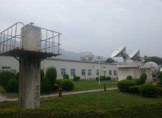


16 Tracking Stations Infrastructure construction of 8 domestic stations have been completed, receiver equipments have been installed.


17 Arctic and Antarctic stations infrastructure construction have been completed and equipped with receiver and network equipment. Stations in Pakistan and Brazil have been equipped with receiver and network equipment.


18 Stations in Russia, Australia, Germany, England, Argentina, Canada, South Africa,etc. are progressing. Data from 40+ IGS stations are involved as well.

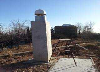
19 Signal monitoring station Apr. 2009, an 7.3m antenna started to work in Xi an; Oct. 2014, an 40m antenna was put into service in Xi an; International cooperation with Canada, Malaysia and Argentina for signal quality monitoring and assessment has been determined.
20 Aiming at providing services with global coverage by around 2020 Deepen the general design scheme Endeavor to make breakthroughs in key technologies, especially new systems and techniques Develop and manufacture the new-generation BDS satellites


21 BDS's unique position reporting feature and short message service has been widely welcomed by different industries; The combination of satellite navigation with mobile communications, internet, etc. make BDS has been applied widely in various fields, such as transportation, finance, meteorology, fishery, etc.


22 Comprehensively advanced the R&D and industrialization of BDS/GNSS compatible basic products, like chip, module, antenna, simulator, navigation software, etc.


23 Transportation National Monitoring Platform For Key Transportation Fishery


24 public operation service platform city emergency management, intelligent transportation, comprehensive law enforcement, people safety guarding service, business car supervision, etc


25 Smart phones Vehicle Navigation


26 Continue to carry out compatibility and interoperability coordination with the U.S. (GPS), Russia (GLONASS), EU(GALILEO), India and Japan, so as to jointly provide better services for users. The First Bilateral Meeting of China-U.S GNSS Cooperation


27


28 Persist in coordination on multilateral platforms like ICG, ITU, etc., to promote co-existence and integrated applications of satellite navigation systems.


29 Take part in ICAO related activities and promote BDS to enter into the ICAO standards as planned. The performance specifications of Ship-borne BeiDou receivers has been formally examined and approved by IMO MSC;BDS has been recognized as one WRNSS. 3GPP technical standard supporting BDS positioning service has been approved. Consistently promote the admission of BDS into the international general data standards for satellite navigation receivers. RTCM NMEA IGS

 initiative and the BDS/GNSS Application")
30 Promote the cooperation with organizations such as APSCO, ESCAP, APEC, UNSPIDER, etc. Continue to promote both the International GNSS Monitoring and Assessment (IGMA) initiative and the BDS/GNSS Application Demonstration and Experience Campaign (BADEC) initiative.


31 Strive to set up cooperation mechanism in satellite navigation applications and other fields with the Asia-Pacific countries. Continue to sponsor BeiDou Tour


32 Encourage academic exchanges, hold China Satellite Navigation Conference in May Support to set up a Regional Center for Space Science and Technology Education Affiliated to the United Nations. Master courses for space application and satellite navigation and the summer school for advanced technology in satellite navigation have been offered each year.
33 01 03 Development Plan 02 System Construction Recent Plans Application and Popularization International Cooperation Latest Progress
34 1. Continue to maintain stable and reliable operation of the system and consistently improve the system service performance 2. Deploy the global constellation with 4-5 new generation BDS satellites to be launched in Construct the National Differential BDS which is scheduled to begin to provide services around 2015


35 1. To encourage innovation of BDS/GNSS application and commercial modes, facilitate interaction, promote industrial and regional demonstration applications 2. To encourage the industrialization of BDS/GNSS products and to accelerate popularization in the mass market through taking advantages of policies and market, and integrating capital, technical and commercial resources 3. To standardize market order, improve the industrial development environment, and promote BDS/GNSS industrialization and internationalization process through product quality supervision, IPR protection and standardization work
36 1. Publish BDS white paper as a comprehensive description of the BDS development concepts and related opinions 2. To advance dialogues and communication with the US, Russia and EU and to deepen cooperation in compatibility and interoperability, monitoring and assessment, augmentation system, application and other fields


37 3. To create a favorable atmosphere for BDS/GNSS cooperation and development, like promoting improvement of the multilateral coordination mechanism with ICG, ITU and other international organizations, coordination on hot international issues, as well as specification formulation 4. To further explore international cooperation channels through establishing coordination mechanism of BDS/GNSS international application and to facilitate BDS/GNSS global applications, as support of BDS/GNSS service capabilities enhancement th -15 th May 2015, 6th China Satellite Navigation Conference in Xi an.
38 BDS continues to provide stable and reliable services and started construction for the third step. Preliminary success has been achieved in BDS application. Mass production has been realized for basic products which have gradually entered into various industries and the mass market. Steady progresses are witnessed in the internationalization process of BDS, and China will further performed its duties and fulfilled its obligations as a core GNSS provider.


39 Thank you!
Operation and Development of BeiDou Navigation Satellite System
 Operation and Development of BeiDou Navigation Satellite System Jing Li IAIN 2015, 20 23 October Prague, Czech Republic 2 01 03 Plan and Policy 02 Status and Near-term Goal International Cooperation 3
Development of BeiDou Navigation Satellite System
 The 8 th Meeting of the International Committee on GNSS Development of BeiDou Navigation Satellite System China Satellite Navigation Office Dubai, UAE November, 2013 Contents Contents 1. Objectives and
Development of BeiDou Navigation Satellite System
 Development of BeiDou Navigation Satellite System May 18 2015 Krasnoyarsk, Russian Federation Contents 1 2 3 4 5 System Overview System Application International Cooperation Recent Plan Summary Contents
China Satellite Navigation Office
 01 03 Development Plan 02 Latest Progress Recent Plan 01 03 Development Plan 02 Development Objectives Basic Principles Development Steps Latest Progress System Components Fundamental Policies Recent Plan
BeiDou: Bring the World and China to Your Doorstep
 IGS Workshop 2012-ICG Working Group A BeiDou: Bring the World and China to Your Doorstep China Satellite Navigation Office 2012.7.25 Olsztyn, Poland 1 Contents I. Development Schemes II. Performance III.
International Cooperation Research Center, China Satellite Navigation Office
 International Cooperation Research Center, ICG-8, Nov 10, 2013 Dubai Overview BeiDou Navigation Satellite System (hereinafter referred to as BDS") has provide regional service by the end of 2012, which
China Satellite Navigation Office
 MA Changdou Kathmandu, Nepal 12December 2016 01 Policy of Development 02 Latest Progress 03 Recent Plan The whitepaper on BDS has been released in June 2016, to interpret its development concepts and propositions.
Jun Shen International Cooperation Center. China Satellite Navigation Office
 Jun Shen (shenjun@beidou.gov.cn) International Cooperation Center Tenth Meeting of the International Committee on Global Navigation Satellite Systems (ICG) November 1-6, 2015 1 Introduction and Background
International GNSS Monitoring & Assessment Service for OS (igmas) ICG September 2011, Tokyo, Japan
 ICG September 2011, Tokyo, Japan") Presentation on igmas FOR WORKING GROUP A International GNSS Monitoring & Assessment Service for OS (igmas) by Xurong Dong International Cooperation Research Centre, CSNO ICG 6 5 9 September 2011, Tokyo,
Presentation on igmas FOR WORKING GROUP A International GNSS Monitoring & Assessment Service for OS (igmas) by Xurong Dong International Cooperation Research Centre, CSNO ICG 6 5 9 September 2011, Tokyo,
Status of COMPASS/BeiDou Development
 Status of COMPASS/BeiDou Development Stanford s 2009 PNT Challenges and Opportunities Symposium October 21-22,2009 Cao Chong China Technical Application Association for GPS Contents 1. Basic Principles
Update on BeiDou Navigation Satellite System
 Update on BeiDou Navigation Satellite System 1 BDS Development 2 Near-term Plans BD-2 System FOC services from December, 2012 (5GEO+5IGSO+4MEO) Two on-orbit backup satellites launched in 2016 (1 IGSO+1
PRELIMINARY PROGRAMME
 ICG EXPERTS MEETING: GLOBAL NAVIGATION SATELLITE SYSTEMS SERVICES 14-18 December 2015 Vienna International Centre, Vienna, Austria Organized by International Committee on Global Navigation Satellite Systems
ASSEMBLY 37TH SESSION
 International Civil Aviation Organization WORKING PAPER A37-WP/195 1 22/9/10 (Information paper) ASSEMBLY 37TH SESSION TECHNICAL COMMISSION Agenda Item 35: The Global Air Traffic Management (ATM) System
10 th APEC TRANSPORTATION MINISTERIAL MEETING 7 th October 2017 Port Moresby, Papua New Guinea Ministerial Statement
 10 th APEC TRANSPORTATION MINISTERIAL MEETING 7 th October 2017 Port Moresby, Papua New Guinea Ministerial Statement 1. We, the Ministers responsible for transportation, met in Port Moresby, Papua New
Status of the European EGNOS and Galileo Programmes. Frank Udnaes Galileo policy and Infrastructure group EC DG-TREN. June 2008
 Status of the European EGNOS and Galileo Programmes Frank Udnaes Galileo policy and Infrastructure group EC DG-TREN EUROPEAN COMMISSION z June 2008 Galileo An infrastructure 30 satellite Constellation
GPS Civil Service Update & U.S. International GNSS Activities
 GPS Civil Service Update & U.S. International GNSS Activities International GNSS (IGNSS) Conference Sydney, Australia Jeffrey Auerbach Office of Space and Advanced Technology U.S. Department of State 06
GNSS Programme. Overview and Status in Europe
 GNSS Programme Overview and Status in Europe Inaugural Forum Satellite Positioning Research and Application Center 23 April 2007 Tokyo Presented by Thomas Naecke (European Commission) Prepared by Daniel
Update of BeiDou System and its Applications
 Update of BeiDou System and its Applications Prof. Dr. WENG Jingnong International School, Beihang University, P. R. China Beidou International Exchange and Training Center Email: wengjn@buaa.edu.cn April
ICG-12 Kyoto Japan WG-B December Dr. Lisa Mazzuca
 ICG-12 Kyoto Japan WG-B December 5 2017 Dr. Lisa Mazzuca MEOSAR: SPACE SEGMENT BDS & Cospas-Sarsat: C-S JC-31 (Oct 2017) China Working Papers BDS 406 MHz MEOSAR REPEATER TECHNOLOGY STATUS (JC31-9/2) Executive
Report on a Multi-GNSS Demonstration project in the Asia/Oceania region
 Report on a Multi-GNSS Demonstration project in the Asia/Oceania region - Asia Oceania is the Showcase of New GNSS Era - Japan Aerospace Exploration Agency ICG 5@Turin, Italy October 19, 2010 1 Back Ground
European GNSS Evolution
 Ref. Ares(204)902599 - /06/204 European GNSS Evolution Hermann Ebner Galileo and EGNOS Programme Management DG Enterprise and Industry Content Introduction 2 2 Major Challenges for EGNSS Evolution 3 EGNSS
Report of the Systems, Signals and Services Working Group (formerly Working Group A)
") ICG/WG-S/NOV2015 Report of the Systems, Signals and Services Working Group (formerly Working Group A) 1. The International Committee on Global Navigation Satellite Systems (ICG) Working Group A (WG-A)
ICG/WG-S/NOV2015 Report of the Systems, Signals and Services Working Group (formerly Working Group A) 1. The International Committee on Global Navigation Satellite Systems (ICG) Working Group A (WG-A)
International Committee on Global Navigation Satellite Systems (ICG) and its Programme on Global Navigation Satellite Systems (GNSS) Applications
 and its Programme on Global Navigation Satellite Systems (GNSS) Applications") and its Programme on Global Navigation Satellite Systems (GNSS) Applications Sharafat Gadimova ICG Executive Secretariat Office for Outer Space Affairs United Nations Office at Vienna a forum to discuss
and its Programme on Global Navigation Satellite Systems (GNSS) Applications Sharafat Gadimova ICG Executive Secretariat Office for Outer Space Affairs United Nations Office at Vienna a forum to discuss
SATELLITE BASED AUGMENTATION SYSTEM (SBAS) FOR AUSTRALIA
 FOR AUSTRALIA") SATELLITE BASED AUGMENTATION SYSTEM (SBAS) FOR AUSTRALIA AN AIN POSITION PAPER SUBMITTED TO VARIOUS GOVERNMENT DEPARTMENTS BY MR KYM OSLEY AM, CSC, EXEC SECRETARY AIN What are GNSS Augmentation Systems?
SATELLITE BASED AUGMENTATION SYSTEM (SBAS) FOR AUSTRALIA AN AIN POSITION PAPER SUBMITTED TO VARIOUS GOVERNMENT DEPARTMENTS BY MR KYM OSLEY AM, CSC, EXEC SECRETARY AIN What are GNSS Augmentation Systems?
International Committee on Global Navigation Satellite Systems
 International Committee on Global Navigation Satellite Systems Training Course on Global Navigation Satellite Systems 14 18 January 2019, Asian Institute of Technology, Bangkok, Thailand Sharafat Gadimova
Principal Investigator Co-Principal Investigator Co-Principal Investigator Prof. Talat Ahmad Vice-Chancellor Jamia Millia Islamia Delhi
 Subject Paper No and Title Module No and Title Module Tag Geology Remote Sensing and GIS Concepts of Global Navigation Satellite RS & GIS XXXIII Principal Investigator Co-Principal Investigator Co-Principal
GPS/WAAS Program Update
 GPS/WAAS Program Update UN/Argentina Workshop on the Applications of GNSS 19-23 March 2018 Cordoba, Argentina GNSS: A Global Navigation Satellite System of Systems Global Constellations GPS (24+3) GLONASS
Nigerian Communications Satellite Ltd. (NIGCOMSAT)
") OVERVIEW OF NIGERIAN SATELLITE AUGMENTATION SYSTEM COMMENCING WITH PILOT DEMONSTRATION TO VALIDATE NATIONAL WORK PLAN presented by Dr. Lawal Lasisi Salami, NIGERIAN COMMUNICATIONS SATELLITE LTD UNDER FEDERAL
OVERVIEW OF NIGERIAN SATELLITE AUGMENTATION SYSTEM COMMENCING WITH PILOT DEMONSTRATION TO VALIDATE NATIONAL WORK PLAN presented by Dr. Lawal Lasisi Salami, NIGERIAN COMMUNICATIONS SATELLITE LTD UNDER FEDERAL
International Committee on Global Navigation Satellite Systems (ICG)
") International Committee on Global Navigation Satellite Systems (ICG) A forum to discuss global navigation satellite systems to benefit people around the world Sharafat Gadimova United Nations Office for
International Committee on Global Navigation Satellite Systems (ICG) A forum to discuss global navigation satellite systems to benefit people around the world Sharafat Gadimova United Nations Office for
GLONASS Status and Modernization
 GLONASS Status and Modernization Ekaterina Oleynik Central Research Institute of Roscosmos Federal Space Agency United Nations/Latvia Workshop on the Applications of Global Navigation Satellite Systems
Joint Declaration of Intent. of the Ministry of Economy, Trade and Industry of Japan, the Ministry of Internal Affairs and Communications of Japan
 Joint Declaration of Intent of the Ministry of Economy, Trade and Industry of Japan, the Ministry of Internal Affairs and Communications of Japan and the Federal Ministry for Economic Affairs and Energy
GLOBAL NAVIGATION SATELLITE SYSTEMS (GNSS) ECE 2526E Tuesday, 24 April 2018
 ECE 2526E Tuesday, 24 April 2018") GLOBAL NAVIGATION SATELLITE SYSTEMS (GNSS) ECE 2526E Tuesday, 24 April 2018 MAJOR GLOBAL NAVIGATION SATELLITE SYSTEMS (GNSS) Global Navigation Satellite System (GNSS) includes: 1. Global Position System
GLOBAL NAVIGATION SATELLITE SYSTEMS (GNSS) ECE 2526E Tuesday, 24 April 2018 MAJOR GLOBAL NAVIGATION SATELLITE SYSTEMS (GNSS) Global Navigation Satellite System (GNSS) includes: 1. Global Position System
King AbdulAziz University. Faculty of Environmental Design. Geomatics Department. Mobile GIS GEOM 427. Lecture 3
 King AbdulAziz University Faculty of Environmental Design Geomatics Department Mobile GIS GEOM 427 Lecture 3 Ahmed Baik, Ph.D. Email: abaik@kau.edu.sa Eng. Fisal Basheeh Email: fbasaheeh@kau.edu.sa GNSS
IGS workshop 2018 Multi-GNSS through Global Collaboration Datum: 29 October - 2 November 2018 Plats: Wuhan, China Deltagare: Tong Ning (I0101)
") 2018-11-19 RESERAPPORT IGS workshop 2018 Multi-GNSS through Global Collaboration Datum: 29 October - 2 November 2018 Plats: Wuhan, China Deltagare: Tong Ning (I0101) Syfte med mötet The workshop programme
2018-11-19 RESERAPPORT IGS workshop 2018 Multi-GNSS through Global Collaboration Datum: 29 October - 2 November 2018 Plats: Wuhan, China Deltagare: Tong Ning (I0101) Syfte med mötet The workshop programme
Comprehensive Study of GNSS Systems
 Quest Journals Journal of Software Engineering and Simulation Volume 3 ~ Issue 2 (2016) pp: 01-06 ISSN(Online) :2321-3795 ISSN (Print):2321-3809 www.questjournals.org Research Paper Comprehensive Study
European GNSS Service Centre (GSC) US Coast Guard Navigation Center (NAVCEN) Cooperation
 US Coast Guard Navigation Center (NAVCEN) Cooperation") European GNSS Service Centre (GSC) US Coast Guard Navigation Center (NAVCEN) Cooperation Boulder, November 2015 European GNSS Agency (GSA) US Coast Guard Navigation Center (NAVCEN) The centres: GSC and
European GNSS Service Centre (GSC) US Coast Guard Navigation Center (NAVCEN) Cooperation Boulder, November 2015 European GNSS Agency (GSA) US Coast Guard Navigation Center (NAVCEN) The centres: GSC and
Challenges and Solutions for GPS Receiver Test
 Challenges and Solutions for GPS Receiver Test Presenter: Mirin Lew January 28, 2010 Agenda GPS technology concepts GPS and GNSS overview Assisted GPS (A-GPS) Basic tests required for GPS receiver verification
ISU Symposium The Public Face of Space Strasbourg, France February A quiet and sustainable success story.
 ISU Symposium The Public Face of Space Strasbourg, France 16 18 February 2010 The International Cospas-Sarsat Programme: A quiet and sustainable success story Dany St-Pierre Cospas-Sarsat Secretariat ISU
Lecture-1 CHAPTER 2 INTRODUCTION TO GPS
 Lecture-1 CHAPTER 2 INTRODUCTION TO GPS 2.1 History of GPS GPS is a global navigation satellite system (GNSS). It is the commonly used acronym of NAVSTAR (NAVigation System with Time And Ranging) GPS (Global
Where Next for GNSS?
 Where Next for GNSS? Professor Terry Moore Professor of Satellite Navigation Nottingham The University of Nottingham Where Next for GNSS Back to the Future? Professor Terry Moore Professor of Satellite
Geoscience & Positioning, Navigation and Timing Services for Canadians
 Geoscience & Positioning, Navigation and Timing Services for Canadians Calvin Klatt, Ph.D. Director and Chief Geodesist Natural Resources Canada / Directeur et géodésien principal Ressources naturelles
Report of the Working Group B: Enhancement of Global Navigation Satellite Systems (GNSS) Services Performance
 Services Performance") Report of the Working Group B: Enhancement of Global Navigation Satellite Systems (GNSS) Services Performance 1. The Working Group on Enhancement of Global Navigation Satellite Systems (GNSS) Service Performance
Report of the Working Group B: Enhancement of Global Navigation Satellite Systems (GNSS) Services Performance 1. The Working Group on Enhancement of Global Navigation Satellite Systems (GNSS) Service Performance
INTERNATIONAL CIVIL AVIATION ORGANIZATION
 INTERNATIONAL CIVIL AVIATION ORGANIZATION AFI PLANNING AND IMPLEMENTATION REGIONAL GROUP EIGHTEENTH MEETING (APIRG/18) Kampala, Uganda (27 30 March 2012) Agenda Item 3: Performance Framework for Regional
General Assembly. United Nations A/AC.105/946
 United Nations A/AC.105/946 General Assembly Distr.: General 16 November 2009 Original: English Committee on the Peaceful Uses of Outer Space Report on the United Nations/Azerbaijan/United States of America/European
Eleventh meeting of the International Committee on Global Navigation Satellite Systems
 United Nations A/AC.105/1134 General Assembly Distr.: General 1 December 2016 Original: English Committee on the Peaceful Uses of Outer Space Eleventh meeting of the International Committee on Global Navigation
GLObal Navigation Satellite System (GLONASS)
") FEDERAL SPACE AGENCY GLObal Navigation Satellite System (GLONASS) Sergey Revnivykh Deputy Director General Central Research Institute of Machine Building Head of PNT Center 4-th meeting of International
FEDERAL SPACE AGENCY GLObal Navigation Satellite System (GLONASS) Sergey Revnivykh Deputy Director General Central Research Institute of Machine Building Head of PNT Center 4-th meeting of International
ICG GNSS Interoperability Workshop A Civil Aviation Perspective
 Approved for Public Release; Distribution Unlimited. 13-1907. ICG GNSS Interoperability Workshop A Civil Aviation Perspective C h r i s t o p h e r J. H e g a r t y A p r i l 2 0 1 3 Disclaimer: The contents
Positioning, location data and GNSS as solution for Autonomous driving
 Positioning, location data and GNSS as solution for Autonomous driving Jarkko Koskinen, Heidi Kuusniemi, Juha Hyyppä, Sarang Thombre and Martti Kirkko-Jaakkola FGI, NLS Definition of the Arctic 66 34 N
Progress of igmas and
 2017 ICG-12 Progress of igmas and IGMA Joint Trial Project igmas TEAM Kyoto Japan 2th Dec. 2017 Contents 1. Introduction 2. Progress of IGMA Joint Trial Project 3. Reference for Monitoring and Assessment
Current status of Quasi-Zenith Satellite System. Japan Aerospace Exploration Agency QZSS Project Team
 Current status of Quasi-Zenith Satellite System Japan Aerospace Exploration Agency QZSS Project Team 1 Quasi-Zenith Satellite System The QZSS is a regional space-based PNT (Positioning, Navigation and
Update on GNSS Time Creation and Distribution - How well does it really work?
 Update on GNSS Time Creation and Distribution - How well does it really work? ITSF November 1, 2016 Prague Marc A. Weiss, Ph.D. Consultant for National Institute of Standards and Technology marcweissconsulting@gmail.com
Status Report on BeiDou International Exchange and Training Center
 Status Report on BeiDou International Exchange and Training Center Associate Prof. Dr. JIN Tian Expert, BeiDou International Exchange and Training Center The UN Regional Centre (RCSSTEAP) in China Deputy
One Source for Positioning Success
 novatel.com One Source for Positioning Success RTK, PPP, SBAS OR DGNSS. NOVATEL CORRECT OPTIMIZES ALL CORRECTION SOURCES, PUTTING MORE POWER, FLEXIBILITY AND CONTROL IN YOUR HANDS. NovAtel CORRECT is the
International Committee on Global Navigation Satellite Systems and its Programme on the Applications of Global Navigation Satellite Systems
 International Committee on Global Navigation Satellite Systems and its Programme on the Applications of Global Navigation Satellite Systems Sharafat Gadimova United Nations Office for Outer Space Affairs
The Mid-term Review of the European Satellite Radio Navigation Programmes Galileo and EGNOS: Questions and Answers
 MEMO/11/26 Brussels, 18 th January 2011 The Mid-term Review of the European Satellite Radio Navigation Programmes Galileo and EGNOS: Questions and Answers See also IP/11/42 For the full text of the Communication
GROUP OF SENIOR OFFICIALS ON GLOBAL RESEARCH INFRASTRUCTURES
 GROUP OF SENIOR OFFICIALS ON GLOBAL RESEARCH INFRASTRUCTURES GSO Framework Presented to the G7 Science Ministers Meeting Turin, 27-28 September 2017 22 ACTIVITIES - GSO FRAMEWORK GSO FRAMEWORK T he GSO
GAGAN-Extension to the Gulf Region. Joint ACAC/ICAO MID Workshop on GNSS 7 th & 8 th November 2017
 GAGAN-Extension to the Gulf Region Joint ACAC/ICAO MID Workshop on GNSS 7 th & 8 th November 2017 P.N.S. KUSHWAHA EXECUTIVE DIRECTOR (CNS P) Airports Authority of India New Delhi Topics covered : 1. GAGAN
International Committee on Global Navigation Satellite Systems (ICG): Building a System of Systems
: Building a System of Systems") International Committee on Global Navigation Satellite Systems (ICG): Building a System of Systems Outline of Presentation Executive Secretariat of the ICG United Nations Office for Outer Space Affairs
International Committee on Global Navigation Satellite Systems (ICG): Building a System of Systems Outline of Presentation Executive Secretariat of the ICG United Nations Office for Outer Space Affairs
Webinar. 9 things you should know about centimeter-level GNSS accuracy
 Webinar 9 things you should know about centimeter-level GNSS accuracy Webinar agenda 9 things you should know about centimeter-level GNSS accuracy 1. High precision GNSS challenges 2. u-blox F9 technology
The European Satellite Radio Navigation Programmes Galileo and EGNOS: Questions and Answers
 MEMO/11/326 Brussels, 23 May 2011 The European Satellite Radio Navigation Programmes Galileo and EGNOS: Questions and Answers What is satellite navigation? Satellite navigation is based on the principle
Global Positioning Systems Directorate
 Space and Missile Systems Center Global Positioning Systems Directorate GPS Program Update to 8 th Stanford PNT Symposium 30 Oct 2014 Col Matt Smitham Deputy Director, GPS Directorate Global Positioning
Indian Regional Navigation Satellite System (IRNSS) / Navigation with Indian Constellation (NavIC) and GPS Aided Geo Augmented Navigation (GAGAN)
 / Navigation with Indian Constellation (NavIC) and GPS Aided Geo Augmented Navigation (GAGAN)") Indian Regional Navigation Satellite System (IRNSS) / Navigation with Indian Constellation (NavIC) and GPS Aided Geo Augmented Navigation (GAGAN) IRNSS-1A Gsat-8 IRNSS 7 November, 2016 Nilesh M. Desai
Indian Regional Navigation Satellite System (IRNSS) / Navigation with Indian Constellation (NavIC) and GPS Aided Geo Augmented Navigation (GAGAN) IRNSS-1A Gsat-8 IRNSS 7 November, 2016 Nilesh M. Desai
APSEC President s Report
 2015/EWG49/008 Agenda Item: 5a APSEC President s Report Purpose: Information Submitted by: APSEC 49 th Energy Working Group Meeting Gyeongju, Korea 22 26 June 2015 Report on APEC Sustainable Energy Center
Report on the United Nations/Croatia Workshop on the Applications of Global Navigation Satellite Systems
 United Nations General Assembly Distr.: General 3 September 2013 Original: English Committee on the Peaceful Uses of Outer Space Report on the United Nations/Croatia Workshop on the Applications of Global
VIIIth European Interparliamentary Space. Mr. Rainer Grohe Executive Director Galileo Joint Undertaking
 The European Institutional Framework for Galileo VIIIth European Interparliamentary Space Conference Mr. Rainer Grohe Executive Director Galileo Joint Undertaking Brussels, 12th June 2006 Galileo Architecture
Status of Multi-GNSS Monitoring Network Establishment
 Status of Multi-GNSS Monitoring Network Establishment Japan Aerospace Exploration Agency Satoshi Kogure ICG-6 6 WG-A/D cross-session session @Tokyo, JAPAN 7 September, 2011 Contents Introduction Overview
International Cospas-Sarsat Programme : From operations to MEOSAR prospects
 International Cospas-Sarsat Programme : From operations to MEOSAR prospects Presented by Jean-Charles CORNILLOU MRCC Corsen director with the help of Michel MARGERY (CNES) & Alex GENICOT (FMCC) UN/USA
GALILEO Research and Development Activities. Second Call. Area 3. Coordination of Galileo Research & Development activities.
 GALILEO Research and Development Activities Second Call Area 3 Coordination of Galileo Research & Development activities Statement of Work Rue du Luxembourg, 3 B 1000 Brussels Tel +32 2 507 80 00 Fax +32
High Precision Applications with BeiDou
 High Precision Applications with BeiDou Lei HUANG Unicore Communications, Inc May 14, 2013 Contents 1 2 3 4 Background Overview of BeiDou high precision products Applications of BeiDou high precision products
GPS-Galileo Time Offset (GGTO) Galileo Implementation Status and Performance. Jörg Hahn
 Galileo Implementation Status and Performance. Jörg Hahn") GPS-Galileo Time Offset (GGTO) Galileo Implementation Status and Performance Jörg Hahn GGTO Galileo Summary Galileo-GPS Timing Offset (GGTO) as a System contribution to achieve tighter interoperability
GPS-Galileo Time Offset (GGTO) Galileo Implementation Status and Performance Jörg Hahn GGTO Galileo Summary Galileo-GPS Timing Offset (GGTO) as a System contribution to achieve tighter interoperability
Space and Missile Systems Center
 Space and Missile Systems Center Global Positioning Systems Directorate GPS Status & Modernization Progress: Service, Satellites, Control Segment, and Military GPS User Equipment 3 Nov 2016 Col Steve Whitney,
THE CURRENT STATUS OF ASIA OCEANIA MULTI-GNSS DEMONSTRATION CAMPAIGN. Multi-GNSS Asia Secretariat June 4 th, th ICG Providers Forum
 THE CURRENT STATUS OF ASIA OCEANIA MULTI-GNSS DEMONSTRATION CAMPAIGN 1 Multi-GNSS Asia Secretariat June 4 th, 2012 8 th ICG Providers Forum ASIA OCEANIA MULTI-GNSS DEMONSTRATION CAMPAIGN Multi-GNSS Monitoring
Indian GNSS Industry Overview Challenges and future prospects
 Indian GNSS Industry Overview Challenges and future prospects Expert Presentation By Dr. S.V. Kibe Consultant, SATCOM & GNSS, Bangalore, India (Former Programme Director, SATNAV,ISRO HQ) On February 20,2013
Technology Transfer and Climate Change: International Flows, Barriers and Frameworks
 Brookings Global Economy and Development Climate Change Trade and Investment Washington, DC June 8, 2008 Technology Transfer and Climate Change: International Flows, Barriers and Frameworks 1 Dr. Brian
Understanding GPS/GNSS
 Understanding GPS/GNSS Principles and Applications Third Edition Contents Preface to the Third Edition Third Edition Acknowledgments xix xxi CHAPTER 1 Introduction 1 1.1 Introduction 1 1.2 GNSS Overview
DEFINING THE FUTURE OF SATELLITE SURVEYING WITH TRIMBLE R-TRACK TECHNOLOGY
 DEFINING THE FUTURE OF SATELLITE SURVEYING WITH TRIMBLE R-TRACK TECHNOLOGY EDMOND NORSE, GNSS PORTFOLIO MANAGER, TRIMBLE SURVEY DIVISION WESTMINSTER, CO USA ABSTRACT In September 2003 Trimble introduced
Presentation to the UN COPUOS STSC LTSSA Workshop. ISO Space Standards. 14 February 2013
 Presentation to the UN COPUOS STSC LTSSA Workshop ISO Space Standards 14 February 2013 by Frederick A. Slane Head, U.S. Delegation ISO TC20/SC14 Executive Director Space Infrastructure Foundation Purpose
Prospect for Global Positioning Augmentation Service by QZSS
 Prospect for Global Positioning Augmentation Service by QZSS Global Positioning Augmentation Service Corporation Director, Yoshikatsu Iotake Feb. 6, 2018 Copyright 2018 Global Positioning Augmentation
New Funding Opportunities to Support Safety of Navigation: EGNOS and Galileo
 New Funding Opportunities to Support Safety of Navigation: EGNOS and Galileo e-navigation Underway 31 January-2 February 2017 GSA 2016 The European GNSS Agency (GSA) today: Staff: about 145 Nationalities:
SDCM present status and future. GLONASS signals development.
 The Eighth Meeting of the International Committee on Global Navigation Satellite Systems, November 9 14, 2013, Dubai SDCM present status and future. GLONASS signals development. Prof. Grigory Stupak, Dr.
GNSS: orbits, signals, and methods
 Part I GNSS: orbits, signals, and methods 1 GNSS ground and space segments Global Navigation Satellite Systems (GNSS) at the time of writing comprise four systems, two of which are fully operational and
European space sector, an industry view
 European space sector, an industry view ( Área reservada a imagen ) Technological and Industrial Capabilities Space, defence and European security - Kouru, 21st september 2006 MIGUEL LLOPIS/ International
Performance Evaluation of Differential Global Navigation Satellite System with RTK Corrections
 IOSR Journal of Electronics and Communication Engineering (IOSR-JECE) e-issn: 2278-2834,p- ISSN: 2278-8735.Volume 9, Issue 2, Ver. VI (Mar - Apr. 2014), PP 43-47 Performance Evaluation of Differential
Dimov Stojče Ilčev. CNS Systems
 Stratospheric Platform Systems (SPS) Presentation by: Dimov Stojče Ilčev Durban University of Technology (DUT) Space Science Centre (SSC) CNS Systems August 2011 SPS for Mobile CNS Applications Stratospheric
GNSS Technology Update
 GNSS Technology Update Speaker: Eric Gakstatter Contributing Editor GPS World Editor - Geospatial Solutions Presented at: Association of Petroleum Surveying & Geomatics Houston, TX April 7, 2015 Agenda
Understanding GPS: Principles and Applications Second Edition
 Understanding GPS: Principles and Applications Second Edition Elliott Kaplan and Christopher Hegarty ISBN 1-58053-894-0 Approx. 680 pages Navtech Part #1024 This thoroughly updated second edition of an
BeiDou Space Service Volume Parameters and its Performance
 BeiDou Space Service Volume Parameters and its Performance Prof. Xingqun ZHAN, Shuai JING Shanghai Jiaotong University, China Xiaoliang WANG China Academy of Space Technology Contents 1 Background and
Policy Partnership on Science, Technology and Innovation Strategic Plan ( ) (Endorsed)
 (Endorsed)") 2015/PPSTI2/004 Agenda Item: 9 Policy Partnership on Science, Technology and Innovation Strategic Plan (2016-2025) (Endorsed) Purpose: Consideration Submitted by: Chair 6 th Policy Partnership on Science,
2015/PPSTI2/004 Agenda Item: 9 Policy Partnership on Science, Technology and Innovation Strategic Plan (2016-2025) (Endorsed) Purpose: Consideration Submitted by: Chair 6 th Policy Partnership on Science,
General Assembly. United Nations A/AC.105/C.1/L.335/Add.4. Draft report
 United Nations General Assembly Distr.: Limited 20 February 2014 Original: English Committee on the Peaceful Uses of Outer Space Scientific and Technical Subcommittee Fifty-first session Vienna, 10-21
MEOSAR & GPS ICG WG-B Vienna Austria, June 2016
 MEOSAR & GPS ICG WG-B Vienna Austria, June 2016 Dr. Lisa Mazzuca, Mission Manager NASA Search and Rescue Office Goddard Space Flight Center 1 Overview Cospas-Sarsat System GNSS-enabled Medium Earth Orbit
Fugro Marinestar Improvements
 Fugro Marinestar Improvements Hans Visser Fugro Intersite B.V. Improvements in Marinestar Positioning Hydro 2016 Warnemünde, 10 November 2016 Overview of presentation The Marinestar GNSS Networks The supplied
The technical contribution of QZSS and GNSS to Tsunami early warning system
 0/17 Tsunami Workshop by Sentinel Asia @Sendai International Center Meeting Room 5 The technical contribution of QZSS and GNSS to Tsunami early warning system July 3, 2012 K. Mutoh, J. Yamashita, and S.
Precise Positioning with Smartphones running Android 7 or later
 Precise Positioning with Smartphones running Android 7 or later * René Warnant, * Cécile Deprez, + Quentin Warnant * University of Liege Geodesy and GNSS + Augmenteo, Plaine Image, Lille (France) Belgian
BDS Real-time Precise Products from WHU and its application in NBASS
 BDS Real-time Precise Products from WHU and its application in NBASS Shi C., Lou YD., Li M., Gu SF., Zhang WX., Zheng F., Li XJ., Song WW., Dai XL., Yi WT. GNSS Research Center of Wuhan University, GRC
Precise Point Positioning with BeiDou
 Precise Point Positioning with BeiDou Ole Ørpen Fugro Satellite Positioning AS Geodesi- og Hydrografidagene Stavanger, 12-13 Nov. 2014 Fugro 2013 Contents The G2 service Galileo Testing 2013 BeiDou Testing
Current Status of the Japanese Quasi-Zenith Satellite System (QZSS)
") Current Status of the Japanese Quasi-Zenith Satellite System (QZSS) 12 November 2008 Koji TERADA QZSS Project Manager Japan Aerospace Exploration Agency Contents Introduction Concept of the QZSS System
Current Status of the Japanese Quasi-Zenith Satellite System (QZSS) 12 November 2008 Koji TERADA QZSS Project Manager Japan Aerospace Exploration Agency Contents Introduction Concept of the QZSS System
Access to Research Infrastructures under Horizon 2020 and beyond
 Access to Research Infrastructures under Horizon 2020 and beyond JEAN MOULIN A presentation based on slides provided by: the European Commission DG Research & Innovation Unit B4 Research Infrastructures
Keeping the universe connected. Enabling a Fully Interoperable GNSS Space Service Volume
 Keeping the universe connected. Enabling a Fully Interoperable GNSS Space Service Volume James J. Miller, Deputy Director, Policy and Strategic Communications, NASA Michael C. Moreau, Ph.D., Navigation
Galileo & EGNOS Programmes Status
 Galileo & EGNOS Programmes Status Ugo Celestino, European Commission EURO-MEDITERRANEAN TRANSPORT FORUM GNSS WORKING GROUP 16 th October 2012 17 October, 2012 The European GNSS Programmes 2 Table of contents
ITI Comment Submission to USTR Negotiating Objectives for a U.S.-Japan Trade Agreement
 ITI Comment Submission to USTR-2018-0034 Negotiating Objectives for a U.S.-Japan Trade Agreement DECEMBER 3, 2018 Introduction The Information Technology Industry Council (ITI) welcomes the opportunity