Status Report on BeiDou International Exchange and Training Center
|
|
|
- Cori Gordon
- 5 years ago
- Views:
Transcription
1 Status Report on BeiDou International Exchange and Training Center Associate Prof. Dr. JIN Tian Expert, BeiDou International Exchange and Training Center The UN Regional Centre (RCSSTEAP) in China Deputy Director, School of Electronic Information and Engineering, Beihang University Dec, 2015
2 2


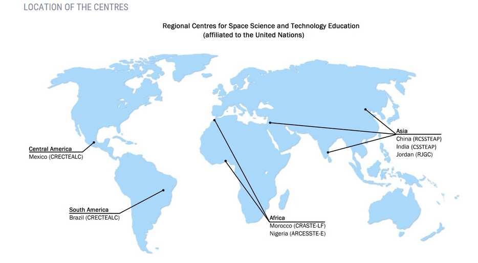
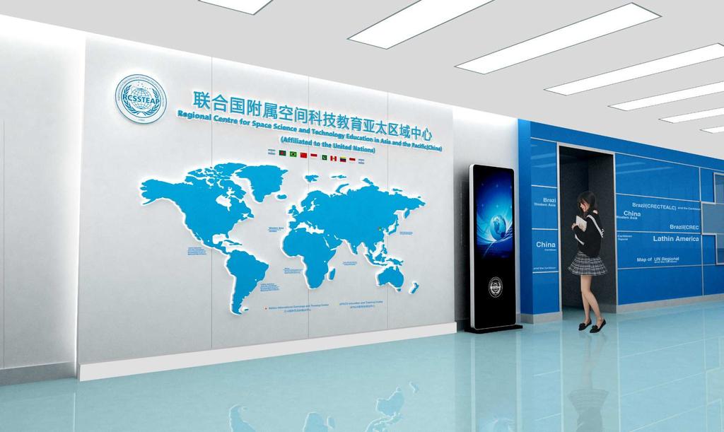
3 New UN Regional Centre / ICG Information Centre Inaugurated on November 17, 2014, Beihang University 3
4 4

5 Annul Work Plan Nov 17,2014, Beijing, China 5
6 Education and training Three Master/ Ph.D Degree Program 2015 Remote Sensing and GIS GNSS Small Satellite Technology Enrollment 17 Recommended by RCSSTEAP 24 Recommended by APSCO 1 Recommended by Partner of RCSSTEAP All courses are offered in English and registration has finished in Sept
 Remote Sensing and GIS technology and")
7 Education and training Three Short Training Program days lectures 1.5 day technical visits 0.5 day participants presentation 1 day lab work 1 day free Satellite Navigation Technology and Applications ( April 19-29) Remote Sensing and GIS technology and Applications (September 14-22) Space Law and Policy workshop ( September 17-25) 7
8 8
9 1 Overview 2 Education and Training 3 Courseware and Tools Conclusion and Recommendation 4 9


10 1 Overview Inaugurated on August 24, 2012, Beihang University 10


11 1 Overview Construction mode CSNOSponsored/Supported Industry/Institutions Participated Built upon University Implement: Mutual benefits, Sustainable Development 11 11
12 1 Overview 2 Education and Training 3 Courseware and Tools Conclusion and Recommendation 4 12
13 2.1 GNSS Degree Program Training Procedures of Master s Program 1 st stage: Course Study in China (9 months) (Leading to Course Completion Certificate of BUAA) Module I: 2 months for fundamental courses Module II: 4 months for major courses Module III: 3 months for pilot project (practice) 2 nd stage: Thesis Research (6-12 months) (Leading to Master s Degree in Engineering of China) I. Advanced Project II. Thesis preparation and Defense III. Graduation and Granting Master s Degree of China 13

14 2.2 GNSS Courses Reference Core Course Class Hrs GNSS Reference System 18 Principle of Global Navigation Satellite Systems 32 GNSS Navigation Signal 18 GNSS Receiver Principles and Design 32 GNSS/INS Integration Navigation 32 Global Satellite Navigation System Applications 18 Satellite Navigation Data Processing 32 GNSS Experiment 18 GNSS New Technologies 18 14


15 2.3 Capacity Building Experiment equipment GNSS Smart Classroom BeiDou Satellite Navigation System Exhibition Hall ( Located at Beihang Aerospace Museum) 15


16 2.3 Capacity Building 16


17 2.3 Capacity Building During discussion and expr., students will improve their Knowledge Basis Thinking Ability and Brain Storm Communication Capability Scientific Spirit VS 17

18 2.3 Capacity Building From PASSIVE to ACTIVE study 18


19 2.3 Capacity Building GNSS Expriment GNSS Signal Relay to Classroom 19
20 1 Overview 2 Education and Training 3 Courseware and Tools Conclusion and Recommendation 4 20

21 3.1 Principle Courseware Courseware: GNSS principle 21


22 3.2 Visualization Tools GNSS constellation/orbit visualization, Link to ICG information Portal 22


23 3.3 Signal Processing Tools Signal Processing for GNSS Antenna Signal Process Signal Analysis Application Antenna Gain Antenna Pattern Standing Wave Ratio Anti-Jamming Signal Acquisition Signal Tracking Signal Decoding Filter Algorithm Time Domain Frequency Domain Eye Diagram Consistency Analysis GNSS Application GNSS IC Chip GNSS Product 23


24 3.3 Signal Processing Tools Software Receiver for GNSS 24


25 3.3 Signal Processing Tools GNSS Satellite Coverage 25


26 3.3 Signal Processing Tools Satellite Orbit and Signal Modulation 26
27 1 Overview 2 Education and Training 3 Courseware and Tools 4 Conclusion and Recommendation 27
28 4.1 Education/Training Program in 2016 GNSS Degree Program in 2016: GNSS, Remote Sensing and GIS, Space Law and Policy Training Program in 2016: GNSS technology and applications Micro Satellite technology and applications Remote Sensing and GIS applications and 28
29 4.2 Conclusion and Recommendations More cooperation in GNSS Education (e.g. textbooks/teaching materials, faculty/students exchange) among ICG member states and UN Regional Centres is needed to satisfy the increasing demands in the use of space technology especially for developing countries. New ICT technologies (e.g. online education/moocs) should pay much more attention nowadays, as it has been changing the way of education and training and also it can reduce education cost and benefit much more people. 29

30 Thank you for your attention Regional Centre for Space Science and Technology Education in Asia and the Pacific(China) (Affiliated to the United Nations) 30
Development of BeiDou Navigation Satellite System
 The 8 th Meeting of the International Committee on GNSS Development of BeiDou Navigation Satellite System China Satellite Navigation Office Dubai, UAE November, 2013 Contents Contents 1. Objectives and
BeiDou: Bring the World and China to Your Doorstep
 IGS Workshop 2012-ICG Working Group A BeiDou: Bring the World and China to Your Doorstep China Satellite Navigation Office 2012.7.25 Olsztyn, Poland 1 Contents I. Development Schemes II. Performance III.
International Cooperation Research Center, China Satellite Navigation Office
 International Cooperation Research Center, ICG-8, Nov 10, 2013 Dubai Overview BeiDou Navigation Satellite System (hereinafter referred to as BDS") has provide regional service by the end of 2012, which
International Committee on Global Navigation Satellite Systems (ICG) and its Programme on Global Navigation Satellite Systems (GNSS) Applications
 and its Programme on Global Navigation Satellite Systems (GNSS) Applications") and its Programme on Global Navigation Satellite Systems (GNSS) Applications Sharafat Gadimova ICG Executive Secretariat Office for Outer Space Affairs United Nations Office at Vienna a forum to discuss
and its Programme on Global Navigation Satellite Systems (GNSS) Applications Sharafat Gadimova ICG Executive Secretariat Office for Outer Space Affairs United Nations Office at Vienna a forum to discuss
GNSS in Maritime and Education in Egypt
 GNSS in Maritime and Education in Egypt GNSS IN MARITIME PORTS SHIPS PORTS WATERWAYS GNSS maritime applications will help to improve: navigation. Ship operations. Traffic management. Seaport operations.
Update of BeiDou Navigation Satellite System
 Update of BeiDou Navigation Satellite System 01 03 Development Plan 02 Latest Progress Recent Plans 01 03 Development Plan 02 Development Objectives Basic Principles Development Steps Latest Progress System
International GNSS Monitoring & Assessment Service for OS (igmas) ICG September 2011, Tokyo, Japan
 ICG September 2011, Tokyo, Japan") Presentation on igmas FOR WORKING GROUP A International GNSS Monitoring & Assessment Service for OS (igmas) by Xurong Dong International Cooperation Research Centre, CSNO ICG 6 5 9 September 2011, Tokyo,
Presentation on igmas FOR WORKING GROUP A International GNSS Monitoring & Assessment Service for OS (igmas) by Xurong Dong International Cooperation Research Centre, CSNO ICG 6 5 9 September 2011, Tokyo,
Operation and Development of BeiDou Navigation Satellite System
 Operation and Development of BeiDou Navigation Satellite System Jing Li IAIN 2015, 20 23 October Prague, Czech Republic 2 01 03 Plan and Policy 02 Status and Near-term Goal International Cooperation 3
International Committee on Global Navigation Satellite Systems (ICG)
") International Committee on Global Navigation Satellite Systems (ICG) A forum to discuss global navigation satellite systems to benefit people around the world Sharafat Gadimova United Nations Office for
International Committee on Global Navigation Satellite Systems (ICG) A forum to discuss global navigation satellite systems to benefit people around the world Sharafat Gadimova United Nations Office for
An IGS-based simulator of ionospheric conditions for GNSS positioning quality assessment
 The United Nations/United States of America Workshop on the International Space Weather Initiative An IGS-based simulator of ionospheric conditions for GNSS positioning quality assessment Renato Filjar
International Committee on Global Navigation Satellite Systems
 International Committee on Global Navigation Satellite Systems Training Course on Global Navigation Satellite Systems 14 18 January 2019, Asian Institute of Technology, Bangkok, Thailand Sharafat Gadimova
Principal Investigator Co-Principal Investigator Co-Principal Investigator Prof. Talat Ahmad Vice-Chancellor Jamia Millia Islamia Delhi
 Subject Paper No and Title Module No and Title Module Tag Geology Remote Sensing and GIS Concepts of Global Navigation Satellite RS & GIS XXXIII Principal Investigator Co-Principal Investigator Co-Principal
GLOBAL POSITIONING SYSTEMS
 GLOBAL POSITIONING SYSTEMS GPS & GIS Fall 2017 Global Positioning Systems GPS is a general term for the navigation system consisting of 24-32 satellites orbiting the Earth, broadcasting data that allows
Ery Fitrianingsih. LAPAN (Lembaga Penerbangan & Antariksa Nasional) Indonesian National Institute of Aeronautics and Space
 Indonesian National Institute of Aeronautics and Space") Ery Fitrianingsih LAPAN (Lembaga Penerbangan & Antariksa Nasional) Indonesian National Institute of Aeronautics and Space As the Indonesian aerospace agency, LAPAN is responsible in aeronautics and space
Ery Fitrianingsih LAPAN (Lembaga Penerbangan & Antariksa Nasional) Indonesian National Institute of Aeronautics and Space As the Indonesian aerospace agency, LAPAN is responsible in aeronautics and space
Report on the United Nations/Croatia Workshop on the Applications of Global Navigation Satellite Systems
 United Nations General Assembly Distr.: General 3 September 2013 Original: English Committee on the Peaceful Uses of Outer Space Report on the United Nations/Croatia Workshop on the Applications of Global
International Committee on Global Navigation Satellite Systems (ICG): Building a System of Systems
: Building a System of Systems") International Committee on Global Navigation Satellite Systems (ICG): Building a System of Systems Outline of Presentation Executive Secretariat of the ICG United Nations Office for Outer Space Affairs
International Committee on Global Navigation Satellite Systems (ICG): Building a System of Systems Outline of Presentation Executive Secretariat of the ICG United Nations Office for Outer Space Affairs
On Development of Recommendations for estimation of electromagnetic environment and interference environment in GNSS frequency bands
 On Development of Recommendations for estimation of electromagnetic environment and interference environment in GNSS frequency bands. Outline proposal on the Recommendations Content Stanislav Kizima ITU-expert,
The United Nations and Outer Space
 The United Nations and Outer Space Mazlan Othman Deputy Director-General, United Nations Office at Vienna (UNOV), and Director, Office for Outer Space Affairs (OOSA) Space is helping us to address some
Technological Innovation : Open Innovation
 Technological Innovation : Open Innovation 10 March 2015 What is open innovation? Open Innovation is a co-create innovation ecosystem: R&D Centers Entrepreneurs Customers Ecosystem Universities End Users
KAIST Master of Science in Electrical Engineering (GPA 4.02/4.3) Feb Feb. 2012
 Feb Feb. 2012") SEONGAH JEONG Work Address Information & Electronics Research Institute Korea Advanced Institute of Science and Technology () Daejeon, Rep. of Korea Tel:+82 42 350 7522, Cell:+82 10 3048 2111 Home Address
SEONGAH JEONG Work Address Information & Electronics Research Institute Korea Advanced Institute of Science and Technology () Daejeon, Rep. of Korea Tel:+82 42 350 7522, Cell:+82 10 3048 2111 Home Address
GNSS Education Activities The University of Tokyo
 GNSS Education Activities The University of Tokyo Dinesh MANANDHAR, Associate Professor Center for Spatial Information Science, The University of Tokyo 6 th NOV 2018 dinesh@iis.u-tokyo.ac.jp Slide : 1
Remote Sensing Science and Sensors for Agricultural Applications
 Remote Sensing Science and Sensors for Agricultural Applications (Feb 20-24, 2018) Venue: Indian Institute of Technology Roorkee, Roorkee-247667, Uttarakhand, India Overview... In the era of smart agriculture,
Development of BeiDou Navigation Satellite System
 Development of BeiDou Navigation Satellite System May 18 2015 Krasnoyarsk, Russian Federation Contents 1 2 3 4 5 System Overview System Application International Cooperation Recent Plan Summary Contents
General Assembly. United Nations A/AC.105/946
 United Nations A/AC.105/946 General Assembly Distr.: General 16 November 2009 Original: English Committee on the Peaceful Uses of Outer Space Report on the United Nations/Azerbaijan/United States of America/European
GBAS FOR ATCO. June 2017
 GBAS FOR ATCO June 2017 Disclaimer This presentation is for information purposes only. It should not be relied on as the sole source of information, and should always be used in the context of other authoritative
Results of Implementation of National Strategy for Research and Application of Space Technology up to 2020 ( )
") Results of Implementation of National Strategy for Research and Application of Space Technology up to 2020 (2016-2017) Dao Ngoc Chien, Ph.D Deputy Director-General Department of High Technologies, Ministry
Results of Implementation of National Strategy for Research and Application of Space Technology up to 2020 (2016-2017) Dao Ngoc Chien, Ph.D Deputy Director-General Department of High Technologies, Ministry
IAA Study Group Status Report
 Responsible Commission: 3 IAA Study Group Status Report Study Number and Title: 3.29 Strategy and Feasibility Assessment of Collision Protection from Asteroid and Comet: Concept, Technology, and Prospect
Space and Missile Systems Center
 Space and Missile Systems Center Global Positioning Systems Directorate GPS Status & Modernization Progress: Service, Satellites, Control Segment, and Military GPS User Equipment 3 Nov 2016 Col Steve Whitney,
Information on the official visit to China of the Director of the United Nations Office for Outer Space Affairs (10-24 April 2017)
") 9 June 2017 English only Committee on the Peaceful Uses of Outer Space Sixtieth session Vienna, 7-16 June 2017 Information on the official visit to China of the Director of the United Nations Office for
9 June 2017 English only Committee on the Peaceful Uses of Outer Space Sixtieth session Vienna, 7-16 June 2017 Information on the official visit to China of the Director of the United Nations Office for
One Source for Positioning Success
 novatel.com One Source for Positioning Success RTK, PPP, SBAS OR DGNSS. NOVATEL CORRECT OPTIMIZES ALL CORRECTION SOURCES, PUTTING MORE POWER, FLEXIBILITY AND CONTROL IN YOUR HANDS. NovAtel CORRECT is the
AI in Europe How could the EC help European society and economy to make the best of this revolution?
 AI in Europe How could the EC help European society and economy to make the best of this revolution? => H2020 - ICT-26-2018-2020 Artificial Intelligence Cécile Huet, PhD Deputy Head of Unit A1 Robotics
Precise Point Positioning with BeiDou
 Precise Point Positioning with BeiDou Ole Ørpen Fugro Satellite Positioning AS Geodesi- og Hydrografidagene Stavanger, 12-13 Nov. 2014 Fugro 2013 Contents The G2 service Galileo Testing 2013 BeiDou Testing
EXPERIMENTAL RESULTS OF LEX CORRECTIONS USING FARMING MACHINE
 Sixth Meeting of the International Committee on Global Navigation Satellite Systems (ICG) EXPERIMENTAL RESULTS OF LEX CORRECTIONS USING FARMING MACHINE Masayuki Kanzaki Hitachi Zosen Corporation Prof.
PROTECTING GPS/GNSS-RELIANT MILITARY SYSTEMS
 PROTECTING GPS/GNSS-RELIANT MILITARY SYSTEMS John Fischer VP Advanced R&D Jon Sinden Product Manager, Rugged PNT 6/21/2018 ABOUT OROLIA A world leader in assured positioning, navigation and timing (PNT)
Table of Contents. 1. Fraunhofer Portugal. 2. Fraunhofer AICOS. 3. Fraunhofer Portugal Challenge. 4. Contacts
 Table of Contents 1. Fraunhofer Portugal 2. Fraunhofer AICOS 3. Fraunhofer Portugal Challenge 4. Contacts 2 1. Fraunhofer Portugal Fraunhofer-Gesellschaft (worldwide) 67 Institutes > 80 Research Units
King AbdulAziz University. Faculty of Environmental Design. Geomatics Department. Mobile GIS GEOM 427. Lecture 3
 King AbdulAziz University Faculty of Environmental Design Geomatics Department Mobile GIS GEOM 427 Lecture 3 Ahmed Baik, Ph.D. Email: abaik@kau.edu.sa Eng. Fisal Basheeh Email: fbasaheeh@kau.edu.sa GNSS
IROST Programmes and Activities
 Iranian Research Organization for Science and Technology )IROST) IROST Programmes and Activities 2016-2017 Prepared by: Dr. Mahmoud Molanejad Acting President for International Cooperation and Fatemeh
Global Navigation Satellite System (GLONASS): Status and Development
: Status and Development") Global Navigation Satellite System (GLONASS): Status and Development Tatiana Mirgorodskaya Information and Analysis Center for Positioning, Navigation and Timing Roscosmos State Corporation UN-Nepal Workshop
Global Navigation Satellite System (GLONASS): Status and Development Tatiana Mirgorodskaya Information and Analysis Center for Positioning, Navigation and Timing Roscosmos State Corporation UN-Nepal Workshop
Status of COMPASS/BeiDou Development
 Status of COMPASS/BeiDou Development Stanford s 2009 PNT Challenges and Opportunities Symposium October 21-22,2009 Cao Chong China Technical Application Association for GPS Contents 1. Basic Principles
SMART COMMUNICATION SATELLITE (SCS) PROJECT OVERVIEW. Jin JIN Space Center, Tsinghua University 2015/8/10
 PROJECT OVERVIEW. Jin JIN Space Center, Tsinghua University 2015/8/10") SMART COMMUNICATION SATELLITE (SCS) PROJECT OVERVIEW Jin JIN Space Center, Tsinghua University 2015/8/10 OUTLINE Overview System Scheme Technical Challenges Flight Results Future 2 1 Overview Tsinghua
SMART COMMUNICATION SATELLITE (SCS) PROJECT OVERVIEW Jin JIN Space Center, Tsinghua University 2015/8/10 OUTLINE Overview System Scheme Technical Challenges Flight Results Future 2 1 Overview Tsinghua
Towards an Arab Knowledge Society. Smart Village, Cairo, Egypt, 30 June 2009
 Address by Mr Koïchiro Matsuura, Director-General of UNESCO, on the occasion of the Launch of UNESCO s Capacity Building Initiatives for Students, Teachers and Knowledge Citizens Towards an Arab Knowledge
International Committee on GNSS: The Way Forward to Provide Positioning, Navigation and Timing Globally
 High Level Forum: Space as a Driver for Socio-Economic Sustainable Development, 20 24 November 2016, Dubai, UAE International Committee on GNSS: The Way Forward to Provide Positioning, Navigation and Timing
Jun Shen International Cooperation Center. China Satellite Navigation Office
 Jun Shen (shenjun@beidou.gov.cn) International Cooperation Center Tenth Meeting of the International Committee on Global Navigation Satellite Systems (ICG) November 1-6, 2015 1 Introduction and Background
Table of Contents. 1. Fraunhofer Portugal. 2. Fraunhofer Portugal AICOS. 3. FhP Challenge Tech Transfer. 4. Contacts
 Table of Contents 1. Fraunhofer Portugal 2. Fraunhofer Portugal AICOS 3. FhP Challenge Tech Transfer 4. Contacts 2 1. Fraunhofer Portugal Fraunhofer-Gesellschaft (Germany) 69 Institutes > 80 Research Units
China Satellite Navigation Office
 01 03 Development Plan 02 Latest Progress Recent Plan 01 03 Development Plan 02 Development Objectives Basic Principles Development Steps Latest Progress System Components Fundamental Policies Recent Plan
Time and frequency transfer methods based on GNSS. LIANG Kun, National Institute of Metrology(NIM), China
, China") Time and frequency transfer methods based on GNSS LIANG Kun, National Institute of Metrology(NIM), China Outline Remote time and frequency transfer GNSS time and frequency transfer methods Data and results
Time and frequency transfer methods based on GNSS LIANG Kun, National Institute of Metrology(NIM), China Outline Remote time and frequency transfer GNSS time and frequency transfer methods Data and results
THE CURRENT STATUS OF ASIA OCEANIA MULTI-GNSS DEMONSTRATION CAMPAIGN
 THE CURRENT STATUS OF ASIA OCEANIA MULTI-GNSS DEMONSTRATION CAMPAIGN 1 7th Meeting of the International Committee on Global Navigation Satellite Systems (ICG) November 5-9, 2012 @Beijing, China ASIA OCEANIA
LEADING DIGITAL TRANSFORMATION AND INNOVATION. Program by Hasso Plattner Institute and the Stanford Center for Professional Development
 LEADING DIGITAL TRANSFORMATION AND INNOVATION Program by Hasso Plattner Institute and the Stanford Center for Professional Development GREETING Digital Transformation: the key challenge for companies and
New Signal Structures for BeiDou Navigation Satellite System
 Stanford's 2014 PNT Symposium New Signal Structures for BeiDou Navigation Satellite System Mingquan Lu, Zheng Yao Tsinghua University 10/29/2014 1 Outline 1 Background and Motivation 2 Requirements and
International Efforts for Transparency and Confidence-Building Measures (TCBM) and Japan s Contribution
 and Japan s Contribution") International Efforts for Transparency and Confidence-Building Measures (TCBM) and Japan s Contribution Atsushi SAITO 4 th March, 2016 1 1. International Rules On Outer Space (1) Committee on the Peaceful
International Efforts for Transparency and Confidence-Building Measures (TCBM) and Japan s Contribution Atsushi SAITO 4 th March, 2016 1 1. International Rules On Outer Space (1) Committee on the Peaceful
Smart Cities Member States Initiative
 Smart Cities Member States Initiative Roadmap towards Collaboration within the European Industrial Initiative on Smart Cities and Communities of the SET-Plan Hans-Günther Schwarz, Austrian Federal Ministry
WE SPECIALIZE IN MILITARY PNT Research Education Engineering
 Defense-Focused Autonomy & Navigation Anywhere, Anytime, Using Anything WE SPECIALIZE IN MILITARY PNT Research Education Engineering RESEARCH THRUST 1 RESEARCH THRUST 2 RESEARCH THRUST 3 Autonomous & Cooperative
BeiDou Next Generation Signal Design and Expected Performance
 International Technical Symposium on Navigation and Timing ENAC, 17 Nov 2015 BeiDou Next Generation Signal Design and Expected Performance Challenges and Proposed Solutions Zheng Yao Tsinghua University
GNSS Signal Structures
 GNSS Signal Structures Tom Stansell Stansell Consulting Tom@Stansell.com Bangkok, Thailand 23 January 2018 S t a n s e l l C o n s u l t i n g RL Introduction It s a pleasure to speak with you this morning.
ENGAGING SPACE TOOLS FOR DEVELOPMENT ON EARTH: CONTRIBUTION OF SPACE TECHNOLOGY AND APPLICATIONS TO THE POST-2015 DEVELOPMENT AGENDA
 ENGAGING SPACE TOOLS FOR DEVELOPMENT ON EARTH: CONTRIBUTION OF SPACE TECHNOLOGY AND APPLICATIONS TO THE POST-2015 DEVELOPMENT AGENDA SIMONETTA DI PIPPO, DIRECTOR United Nations Office for Outer Space Affairs
COMMUNICATIONS FOR MARITIME SAFETY AND EFFICIENCY. Francis Zachariae, Secretary-General, IALA
 COMMUNICATIONS FOR MARITIME SAFETY AND EFFICIENCY Francis Zachariae, Secretary-General, IALA IALA and its Purpose Non profit, international technical association established in 1957 Two Goals aimed at
International Committee on Global Navigation Satellite Systems and its Programme on the Applications of Global Navigation Satellite Systems
 International Committee on Global Navigation Satellite Systems and its Programme on the Applications of Global Navigation Satellite Systems Sharafat Gadimova United Nations Office for Outer Space Affairs
ICG-12 Kyoto Japan WG-B December Dr. Lisa Mazzuca
 ICG-12 Kyoto Japan WG-B December 5 2017 Dr. Lisa Mazzuca MEOSAR: SPACE SEGMENT BDS & Cospas-Sarsat: C-S JC-31 (Oct 2017) China Working Papers BDS 406 MHz MEOSAR REPEATER TECHNOLOGY STATUS (JC31-9/2) Executive
Soil Moisture Observation Utilizing Reflected GNSS Signals
 Soil Moisture Observation Utilizing Reflected GNSS Signals GNSS-R Tech in Soil Moisture New Data Processing Method Prof. Dongkai YANG Joint African/Asia-Pacific UN-Regional Centers and International Training
University of Technology. Control and Systems Eng. Dept. Curriculum Vitae (C.V.)
") University of Technology Control and Dept. Curriculum Vitae (C.V.) Last updated: 1/8/2017 Full name: Assist. Prof. Dr. LAITH JASIM SAUD Gender: Date of birth : Nationality : Place of work : Languages:
University of Technology Control and Dept. Curriculum Vitae (C.V.) Last updated: 1/8/2017 Full name: Assist. Prof. Dr. LAITH JASIM SAUD Gender: Date of birth : Nationality : Place of work : Languages:
THEME MARINE LIFE MONITORING AND PRESENTATION.
 THEME MARINE LIFE MONITORING AND PRESENTATION. Kenya has a coastline of about 500km which is very rich in marine life both animal and plant. This marine life is under threat due to various predators including:-
Fast convergence of Trimble CenterPoint RTX by regional augmentation
 Fast convergence of Trimble CenterPoint RTX by regional augmentation Dr. Ralf Drescher Trimble Terrasat GmbH, Munich EGU General Assembly 2015, Vienna Thursday, 16 April 2015 Outline Introduction CenterPoint
Bring satellites into your lab: GNSS simulators from the T&M expert.
 Bring satellites into your lab: GNSS simulators from the T&M expert. www.rohde-schwarz.com/gnss-solutions Your challenge GNSS receiver tests can only be conclusive when they are performed under realistic
Status of Multi-GNSS Monitoring Network Establishment
 Status of Multi-GNSS Monitoring Network Establishment Japan Aerospace Exploration Agency Satoshi Kogure ICG-6 6 WG-A/D cross-session session @Tokyo, JAPAN 7 September, 2011 Contents Introduction Overview
L76-L GNSS Module Presentation
 L76-L GNSS Module Presentation May, 2016 Quectel Wireless Solutions Co., Ltd. All rights reserved www.quectel.com Contents Highlights Advanced Features Quectel L76-L vs. Competitor s Product Support Package
European GNSS Evolution
 Ref. Ares(204)902599 - /06/204 European GNSS Evolution Hermann Ebner Galileo and EGNOS Programme Management DG Enterprise and Industry Content Introduction 2 2 Major Challenges for EGNSS Evolution 3 EGNSS
Digital Innovation Hubs & Smart Specialisation
 Digital Innovation Hubs & Smart Specialisation Guidance material to prepare for Workshop EIT House (Brussels) 28 Nov 2017 NORTE REGION 1 Portugal PRODUTECH Digital Innovation Hub Platform Scope: National
Space Situational Awareness 2015: GPS Applications in Space
 Space Situational Awareness 2015: GPS Applications in Space James J. Miller, Deputy Director Policy & Strategic Communications Division May 13, 2015 GPS Extends the Reach of NASA Networks to Enable New
Global City Informatization Forum 2014 (GCIF)
") Global City Informatization Forum 2014 (GCIF) Overall Schedule (Draft: 18 June 2014) 1 Background With the rapid development of information technologies since the beginning of the 21 century, intelligent
Global City Informatization Forum 2014 (GCIF) Overall Schedule (Draft: 18 June 2014) 1 Background With the rapid development of information technologies since the beginning of the 21 century, intelligent
Smart Grid Where We Are Today?
 1 Smart Grid Where We Are Today? Meliha B. Selak, P. Eng. IEEE PES DLP Lecturer melihas@ieee.org 2014 IEEE ISGT Asia, Kuala Lumpur 22 nd May 2014 2 Generation Transmission Distribution Load Power System
LEADING DIGITAL TRANSFORMATION AND INNOVATION. Program by Hasso Plattner Institute and the Stanford Center for Professional Development
 LEADING DIGITAL TRANSFORMATION AND INNOVATION Program by Hasso Plattner Institute and the Stanford Center for Professional Development GREETING Digital Transformation: the key challenge for companies and
Enabling Low-Cost Error-Free Wide-Area Passive RFID Real-Time Tracking
 1 Enabling Low-Cost Error-Free Wide-Area Passive Real-Time Tracking Dr Sithamparanathan Sabesan, Dr Michael Crisp, Prof Richard Penty and Prof Ian White Department of Engineering University of Cambridge
Report on GNSS Training
 Report on GNSS Training Course ID: T141-30 Afghanistan, Australia, Austria, Bangladesh, Bhutan, Cambodia, India, Indonesia, Japan, Maldives, Mongolia, Nepal, The Philippines, Sri Lanka, Tajikistan, Thailand,
The TC-OFDM System for Seamless Outdoor & Indoor Positioning in Wide Area
 The TC-OFDM System for Seamless Outdoor & Indoor Positioning in Wide Area Prof. Deng Zhongliang Beijing, China 1. Background 2. TC-OFDM 3. Research Progress 4. Conclusions 2 Emergency Rescue How to save
PRELIMINARY PROGRAMME
 ICG EXPERTS MEETING: GLOBAL NAVIGATION SATELLITE SYSTEMS SERVICES 14-18 December 2015 Vienna International Centre, Vienna, Austria Organized by International Committee on Global Navigation Satellite Systems
IEEE Digital Senses Initiative (DSI) Introduction
 Introduction") (DSI) Introduction Yu Yuan, PhD Chair, IEEE Digital Senses Initiative Email: y.yuan@ieee.org LinkedIn: http://www.linkedin.com/in/dryuyuan Charlotte Kobert Program Manager, IEEE Digital Senses Initiative
(DSI) Introduction Yu Yuan, PhD Chair, IEEE Digital Senses Initiative Email: y.yuan@ieee.org LinkedIn: http://www.linkedin.com/in/dryuyuan Charlotte Kobert Program Manager, IEEE Digital Senses Initiative
BeiDou Space Service Volume Parameters and its Performance
 BeiDou Space Service Volume Parameters and its Performance Prof. Xingqun ZHAN, Shuai JING Shanghai Jiaotong University, China Xiaoliang WANG China Academy of Space Technology Contents 1 Background and
THE CURRENT STATUS OF ASIA OCEANIA MULTI-GNSS DEMONSTRATION CAMPAIGN. Multi-GNSS Asia Secretariat June 4 th, th ICG Providers Forum
 THE CURRENT STATUS OF ASIA OCEANIA MULTI-GNSS DEMONSTRATION CAMPAIGN 1 Multi-GNSS Asia Secretariat June 4 th, 2012 8 th ICG Providers Forum ASIA OCEANIA MULTI-GNSS DEMONSTRATION CAMPAIGN Multi-GNSS Monitoring
Research Article Design and Simulation of a Fully Digitized GNSS Receiver Front-End
 Discrete Dynamics in Nature and Society Volume 211, Article ID 329535, 11 pages doi:1.1155/211/329535 Research Article Design and Simulation of a Fully Digitized GNSS Receiver Front-End Yuan Yu, Qing Chang,
HORIZON 2020 R&I Programme
 European Union HORIZON 2020 R&I Programme New opportunities for EU-Korea cooperation 13 July, 2018 Ju Young KIM Policy Officer in Science, Technology and Delegation of the EU to the RoK 1. EU & Horizon2020
Bring satellites into your lab
 Bring satellites into your lab GNSS simulators from the T&M expert 5215.5042.32 02.01 PDP 1 en www.rohde-schwarz.com/gnss-solutions GNSS-Simulators--------Bring-satellites_fly_5215-5042-32_v0201.indd 7
Potential use of QZSS monitoring station for future research. Kavinda Gunasekara Geoinformatics Center Asian Institute of Technology
 Potential use of QZSS monitoring station for future research Kavinda Gunasekara Geoinformatics Center Asian Institute of Technology Geoinformatics Center Established in 1999 Over 1,600 Graduate students
The technical contribution of QZSS and GNSS to Tsunami early warning system
 0/17 Tsunami Workshop by Sentinel Asia @Sendai International Center Meeting Room 5 The technical contribution of QZSS and GNSS to Tsunami early warning system July 3, 2012 K. Mutoh, J. Yamashita, and S.
Global City Informatization Forum 2014 (GCIF) November 4-6, 2014
 November 4-6, 2014") Global City Informatization Forum 2014 (GCIF) November 4-6, 2014 Shanghai P.R. China 1 Background With the rapid development of information technologies since the beginning of the 21 century, intelligent
Global City Informatization Forum 2014 (GCIF) November 4-6, 2014 Shanghai P.R. China 1 Background With the rapid development of information technologies since the beginning of the 21 century, intelligent
GAMI Global Advanced Manufacturing Institute Students exchange program
 GAMI Global Advanced Manufacturing Institute Students exchange program Sarah Werner October 2017 Dipl.-Wirt.-Ing. Tobias Arndt, M.Sc. General Manager of GAMI / Suzhou SILU Production Engineering Services
Report of the Working Group B: Enhancement of Global Navigation Satellite Systems (GNSS) Services Performance
 Services Performance") Report of the Working Group B: Enhancement of Global Navigation Satellite Systems (GNSS) Services Performance 1. The Working Group on Enhancement of Global Navigation Satellite Systems (GNSS) Service Performance
Report of the Working Group B: Enhancement of Global Navigation Satellite Systems (GNSS) Services Performance 1. The Working Group on Enhancement of Global Navigation Satellite Systems (GNSS) Service Performance
Global Positioning Systems Directorate
 Space and Missile Systems Center Global Positioning Systems Directorate GPS Program Update to 8 th Stanford PNT Symposium 30 Oct 2014 Col Matt Smitham Deputy Director, GPS Directorate Global Positioning
WIPO-WTO Colloquium for Teachers of Intellectual Property
 E WORLD TRADE ORGANIZATION COLLOQUIUM WIPO-WTO/COL/18/INF1.PROV ORIGINAL: ENGLISH DATE: JANUARY 2018 WIPO-WTO Colloquium for Teachers of Intellectual Property organized by the World Intellectual Property
Where Next for GNSS?
 Where Next for GNSS? Professor Terry Moore Professor of Satellite Navigation Nottingham The University of Nottingham Where Next for GNSS Back to the Future? Professor Terry Moore Professor of Satellite
Doctoral College Environmental Informatics
 Doctoral College Environmental Informatics Prof. Schahram Dustdar Head of the Doctoral College Kick-Off Event 12 th March 2013 http://ei.infosys.tuwien.ac.at Agenda Introduction Faculty of Informatics
RESEARCH AND TRAINING UNIT FOR NAVIGATIONAL ELECTRONICS OSMANIA UNIVERSITY, HYDERABAD
 4-Day Short Course on Scientists, Engineers and academicians working in the area of GNSS for more than a decade in the Industry, R&D Labs and Academic Institutes, will deliver the lectures. Technologies
The last 25 years - GPS to multi-gnss: from a military tool to the most widely used civilian positioning solution
 1 The last 25 years - GPS to multi-gnss: from a military tool to the most widely used civilian positioning solution B. Hofmann-Wellenhof Institute of Geodesy / Navigation, Graz University of Technology
Update on BeiDou Navigation Satellite System
 Update on BeiDou Navigation Satellite System 1 BDS Development 2 Near-term Plans BD-2 System FOC services from December, 2012 (5GEO+5IGSO+4MEO) Two on-orbit backup satellites launched in 2016 (1 IGSO+1
Every GNSS receiver processes
 GNSS Solutions: Code Tracking & Pseudoranges GNSS Solutions is a regular column featuring questions and answers about technical aspects of GNSS. Readers are invited to send their questions to the columnist,
GNSS Low-Cost High-Accuracy Receiver (L-CHAR)
") GNSS Low-Cost High-Accuracy Receiver (L-CHAR) Dinesh Manandhar Center for Spatial Information Science The University of Tokyo Contact Information: dinesh@iis.u-tokyo.ac.jp Slide : 1 High Accuracy Receivers
GNSS Low-Cost High-Accuracy Receiver (L-CHAR) Dinesh Manandhar Center for Spatial Information Science The University of Tokyo Contact Information: dinesh@iis.u-tokyo.ac.jp Slide : 1 High Accuracy Receivers
Traceability measurement results of accurate time and frequency in Bosnia and Herzegovina
 INFOTEH-JAHORINA Vol. 11, March 2012. Traceability measurement results of accurate time and frequency in Bosnia and Herzegovina Osman Šibonjić, Vladimir Milojević, Fatima Spahić Institute of Metrology
UNCLASSIFIED. R-1 ITEM NOMENCLATURE PE F: NAVSTAR Global Positioning System User Equipment Space. FY 2011 Total Estimate. FY 2011 OCO Estimate
 Exhibit R-2, RDT&E Budget Item Justification: PB 2011 Air Force DATE: February 2010 COST ($ in Millions) FY 2009 Actual FY 2010 FY 2012 FY 2013 FY 2014 FY 2015 To Program Element 121.798 137.163 165.936
KPI is one of the oldest and biggest technical universities in Ukraine. It was founded in 1898.
 National Technical University of Ukraine Kyiv Polytechnic Institute KPI is one of the oldest and biggest technical universities in Ukraine. It was founded in 1898. OVERVIEW 39 bachelor s, 92 master s,
Professional GNSS solutions in challenging environments
 Professional GNSS solutions in challenging environments Company history 2000 Septentrio is founded as a spin-off from IMEC, world s premier semiconductor research center and still a strong partner & shareholder.
Smart Transmission Grids Operation and Control
 INSTITUTE OF PHYSICAL ENERGETICS Smart Transmission Grids Operation and Control Dr.sc.ing. Anna Mutule Northern Region 2017 Workshop Information, 7-8 December, Latvia Timeline and Project Partners October