China Satellite Navigation Office
|
|
|
- Julius Banks
- 6 years ago
- Views:
Transcription
1

2 01 03 Development Plan 02 Latest Progress Recent Plan
3 01 03 Development Plan 02 Development Objectives Basic Principles Development Steps Latest Progress System Components Fundamental Policies Recent Plan
4 The BeiDou System is committed: - To provide continuous, stable and reliable positioning, navigation and timing services to global users; - To meet the requirements derived from national security, economic and social development sectors, to accelerate IT applications and the transformation of economic development methods, and to improve both economic and social benefits; - To serve the world and benefit the mankind through joint efforts with other navigation satellite systems across the globe.


5 Openness The BeiDou System will offer open services free of charge for global users. Compatibility The BeiDou System is devoted to pursue compatibility and interoperability with other navigation satellite systems, and enable users to obtain better services. Basic Principles Independency Develop and operate BeiDou system independently. Gradualness The establishment of BeiDou System follows a stepwise manner in the light of Chinese actual technical and economic conditions.


6 The BeiDou System has been developing in line with the three-step roadmap and the thinking of from regional to global, and from active to passive, and forms a development path as region-highlighted, world-oriented, with its own features. The 1st step: 1994~2000, provide regional active services The 3rd step: 2013~2020, provide global passive services 第一步第二步第三步 The 2nd step: 2004~2012, provide regional passive services


, the timing accuracy is better")
7 space segment ground segment user segment 5 GEO satellites 3 IGSO satellites 27 MEO satellites Master Control Stations (MCS) Uplink Stations (US) Monitoring Stations (MS) BeiDou terminals Terminals compatible with other GNSS The BeiDou System is comprised of three major components: space segment, ground control segment and user segment. The BeiDou System is able to provide four types of services, namely, open, authorized, wide area differential and short message services. The positioning accuracy is better than 10 meters(the positioning accuracy is better than 5 meters in the regions with low geographic latitude), the timing accuracy is better than 20 nanoseconds, and the velocity accuracy is better than 0.2 meters per second.
8 Provide open services free of charge for users. Maintain and perfect the system constantly, improve service performance continuously, and offer services with higher quality. Release open service performance specifications on schedule, bring the function of government and market to full play, promote innovation, popularization and internationalization of BeiDou/GNSS applications, and lay foundation for the national strategic emerging industries. Adhere to the concept of development and win-win cooperation, realize compatibility and interoperability between BeiDou and other GNSS, give the system efficiency into full play and increase users benefits.
9 01 03 Development Plan 02 System Construction Application Promotion Latest Progress Recent Plan International Cooperation


10 Since formal regional services provision on December , the BeiDou System has maintained continuous and stable operation, and the service performance has met with the specification requirements. B1I Horizontal Positioning Accuracy B1I Elevation Positioning Accuracy
11 The construction of Satellite-Based Augmentation System The BeiDou System will comply with the international civil aviation standards, carry out the design, validation and construction of BeiDou Satellite-Based Augmentation System (BDSBAS), and provide CAT-I services to civil aviation users in China and surrounding areas. So far, the Satellite Based Augmentation System Interoperability Working Group (SBAS IWG) has identified the availability of BeiDou System service in the future SBAS network.

12 The construction of Ground-Based Augmentation System Comply with the principle of unified plan, unified standard, co-construction and sharing, integrate the domestic ground based augmentation resources, and build up a high precision service system, which gives priority to the BeiDou System and is also compatible with other systems.


13 The construction of Ground-Based Augmentation System The R&D and construction of the basic system has been preliminarily completed, while the positioning accuracy is under test, including meter and decimeter level for wide-area real-time services, centimeter level for the areas within Beijing, millimeter level for post-processing services. Overall layout of National framework network reference stations Completed 31 National framework network reference stations


14 The first next-generation BeiDou satellite has been successfully launched on March 30 th, The satellite has adopted advanced signal structure, inter-satellite link and other new technologies, and installed on-board clock with higher accuracy, for the interest of improving service capability comprehensively. Right now, the satellite is undergoing in-orbit test as scheduled, and has preliminarily verified the new technology structure and performance specifications, which meet the designed requirements. The first next-generation BeiDou satellite


15 Promote the R&D and industrialization of fundamental navigation products with independent IPR in an all-round way, with the core as BDS/GNSS compatible chips. the sales volume of BDS/GNSS navigation chip/module has surpassed 6 million pieces the sales volume of high-precision surveying boards has surpassed 85, 000 sets, which amounts to 1/3 of the domestic market share the sales volume of navigation antenna is approximately 3 million sets the sales volume of high-precision antenna is approximately 280, 000 pieces, which amounts to 90% of the domestic market share


16 The research and development of next-generation BDS/GNSS chips which integrate baseband with RF has made great breakthroughs, and will meet global users' demands in the mass market, such as smart phones, PAD, wearable equipment, etc. Smart phones PAD Wearable equipment

17 In view of the significant orientation and fields which have impact on the national welfare, the people's livelihood, and national security, carry out demonstrative applications in selected industries and regions with relevantly large application scales and outstanding marketing prospects. Harbin 18 Demonstration area Shihezi Beijing Weifang Shanxi Jiangsu Xi'an Xinyang Shanghai Mianyang Hefei Hubei Yangtze River Delta Chengdu Hunan Guizhou Zhangzhou Pearl River Delta Totally 750,000 sets of BeiDou terminals have been promoted and applied. Shenzhen


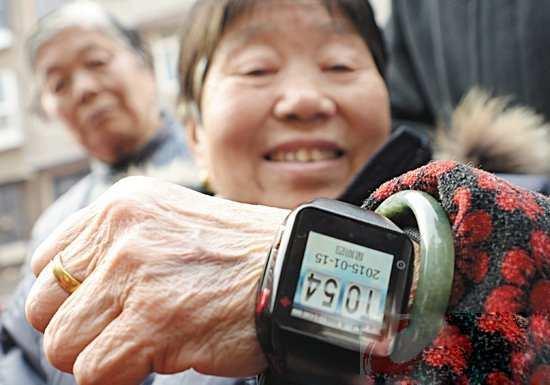


18 Smart phones Wearable equipment Vehicle navigation BeiDou school bus
19 Make research and formulate Some Policies on Promoting Development of BeiDou Satellite Navigation Industry (draft) together with the National Development and Reform Commission, Ministry of Industry and Information Technology, Ministry of Science and Technology, and other institutions. The National Standard System for BeiDou Satellite (Version 1.0) has been reviewed and formulated. 8 national standards have been applied for approval, 18 standards of BeiDou project will be publicized recently. 关于促进北斗卫星导航促进北斗卫星导航产业发展的有关政策 ( 草案 ) 国家北斗卫星导航标准体系 (1.0)


20 Keep coordinating with other navigation satellite systems in the sector of compatibility and interoperability, to jointly provide high quality services for users.


21 The Project Committee on China-Russia GNSS cooperation has been founded, the first bilateral round table meeting on GNSS cooperation has been held, the MOU on China-Russia cooperation in the field of satellite navigation has been signed, the on-site survey have been completed including GLONASS ground stations in China and BeiDou ground stations in Russia, and the joint statement on compatibility and interoperability has also been released.


22 The first bilateral meeting of China- U.S. civil GNSS cooperation has been held, the cooperation mechanism between BeiDou and GPS has been set up, and the Joint Statement between these two systems have been signed.


23 The frequency coordination towards navigation frequency channel between BeiDou and Galileo has been completed, and the cooperation mechanism between these systems are under discussion.


24 Actively undertake international responsibility, promote the compatibility and co-existence among navigation satellite systems. Actively participate in the 9th Meeting of the ICG, IWG, ITU and other GNSS activities organized by the United Nations Deeply join in the coordination of important subjects, such as the compatibility and interoperability among basic systems and Satellite-Bases Augmentation Systems, service performance parameter, GNSS monitoring and assessment, etc.


25 Advocate integrated applications of multiple systems, push forward the BeiDou services to spread abroad and benefit neighboring countries, and include applying BeiDou System into the national strategic planning of jointly building the Silk Road Economic Belt and 21st-Century Maritime Silk Road, namely "One Belt and One Road". Carry out cooperation with Korea, Australia, Indonesia, Pakistan, Thailand, Singapore, the United Arab States, Nigeria, etc. Continue to hold BeiDou ASEAN Tour and BeiDou Asia-Pacific Tour, and promote system applications. Satellite navigation cooperation meeting between China-Australia Visit Egypt for on-site survey in 2015 BeiDou ASEAN Tour Thailand


26 Actively propel the recognition of the BeiDou System in international organizations, such as IMO, ICAO and 3GPP. The Ship-borne BeiDou-based Receivers Performance Standard has been approved by IMO, making the BeiDou System the third navigation satellite system worldwide recognized by IMO.


27 Promote the establishment of BeiDou Working Group affiliated to the 104th professional committee of RTCM. 16 technical standards which support positioning function of the BeiDou System have been approved by the 3rd and 4th Generation Partnership Projects.


28 Encourage academic exchanges, host the China Satellite Navigation Conference, and keep attending other international academic conferences in the field of satellite navigation. In the aspect of International Exchange and Training, CSNO has organized three sessions of Master Program majored in satellite navigation, while 44 trainees from 8 countries in the Asia-Pacific and African areas have been recruited. Three sessions of Summer School on Frontier Technology in the field of satellite navigation have successfully organized, and more than 200 trainees have completed their studies.
29 01 03 Development Plan 02 System Construction Application Promotion Latest Progress Recent Plan International Cooperation
30 1. Keep improving the continuous stability and service accuracy of the BeiDou System, ensure its regional service performance maintain stable and grow better. 2. Launch another 3-4 next-generation BeiDou satellites in 2015, and steadily accelerate the deployment of next-generation global constellation, to lay foundations for serving the areas along the Silk Road Economic Belt and 21st-Century Maritime Silk Road by Complete the construction of 150 reference stations for the frame network of BeiDou ground based augmentation system, and 300 reference stations for regional density network before the end of 2015, and broadcast the correction data, with meter/decimeter-level positioning accuracy available to major regions nationwide, centimeter level to density regions, and millimeter level correction data for postprocessing services. The regional density network will be established within the whole country before the end of 2018.


31 1. Carry out all-round R&D and industrialization of new generation BDS/GNSS fundamental products, to promote mass market applications amount to ten-million units. 2. Bring GNSS to full play in the integration procedure between industrialization and IT applications, push forward all-scale industrial and regional demonstrative applications. 3. Comprehensively implement industrial policies and action plans on products quality monitoring, standardization and IPR protection. Improve the industry chain of satellite navigation.


32 1. Publicize the white paper of the BeiDou System and explain its development concepts, policies and opinions. 2. Perfect the cooperation mechanism among GNSS, deeply participate in the tasks under the ICG, ITU, IMO, ICAO, 3GPP and other international organizations, enhance coordination between BeiDou and GPS, GLONASS, Galileo in the field of compatibility and interoperability. 3. Grasp the opportunity of jointly building the One Belt and One Road national strategy, promote the international applications of BeiDou/GNSS.
33 The BeiDou System has been providing stable services to the Asia-Pacific area, successfully launched the first next-generation BeiDou satellite to verify new technologies, deploy the BeiDou augmentation system from all-round scale, and steadily push forward the construction of BeiDou System. The BeiDou applications market has been preliminarily fostered, expanding from the typical industries to mass market, and the application industry is under fast development. The BeiDou system deeply promotes cooperation among GNSS, and keeps strengthening international exchanges. "BeiDou" becomes one of the Chinese brands.


34 THANKS FOR YOUR ATTENTION AND SUPPORT FOR THE BEIDOU SYSTEM. THANK YOU! CSNO
Development of BeiDou Navigation Satellite System
 Development of BeiDou Navigation Satellite System May 18 2015 Krasnoyarsk, Russian Federation Contents 1 2 3 4 5 System Overview System Application International Cooperation Recent Plan Summary Contents
Operation and Development of BeiDou Navigation Satellite System
 Operation and Development of BeiDou Navigation Satellite System Jing Li IAIN 2015, 20 23 October Prague, Czech Republic 2 01 03 Plan and Policy 02 Status and Near-term Goal International Cooperation 3
Update of BeiDou Navigation Satellite System
 Update of BeiDou Navigation Satellite System 01 03 Development Plan 02 Latest Progress Recent Plans 01 03 Development Plan 02 Development Objectives Basic Principles Development Steps Latest Progress System
Development of BeiDou Navigation Satellite System
 The 8 th Meeting of the International Committee on GNSS Development of BeiDou Navigation Satellite System China Satellite Navigation Office Dubai, UAE November, 2013 Contents Contents 1. Objectives and
China Satellite Navigation Office
 MA Changdou Kathmandu, Nepal 12December 2016 01 Policy of Development 02 Latest Progress 03 Recent Plan The whitepaper on BDS has been released in June 2016, to interpret its development concepts and propositions.
International Cooperation Research Center, China Satellite Navigation Office
 International Cooperation Research Center, ICG-8, Nov 10, 2013 Dubai Overview BeiDou Navigation Satellite System (hereinafter referred to as BDS") has provide regional service by the end of 2012, which
Update on BeiDou Navigation Satellite System
 Update on BeiDou Navigation Satellite System 1 BDS Development 2 Near-term Plans BD-2 System FOC services from December, 2012 (5GEO+5IGSO+4MEO) Two on-orbit backup satellites launched in 2016 (1 IGSO+1
Jun Shen International Cooperation Center. China Satellite Navigation Office
 Jun Shen (shenjun@beidou.gov.cn) International Cooperation Center Tenth Meeting of the International Committee on Global Navigation Satellite Systems (ICG) November 1-6, 2015 1 Introduction and Background
BeiDou: Bring the World and China to Your Doorstep
 IGS Workshop 2012-ICG Working Group A BeiDou: Bring the World and China to Your Doorstep China Satellite Navigation Office 2012.7.25 Olsztyn, Poland 1 Contents I. Development Schemes II. Performance III.
ASSEMBLY 37TH SESSION
 International Civil Aviation Organization WORKING PAPER A37-WP/195 1 22/9/10 (Information paper) ASSEMBLY 37TH SESSION TECHNICAL COMMISSION Agenda Item 35: The Global Air Traffic Management (ATM) System
Status of COMPASS/BeiDou Development
 Status of COMPASS/BeiDou Development Stanford s 2009 PNT Challenges and Opportunities Symposium October 21-22,2009 Cao Chong China Technical Application Association for GPS Contents 1. Basic Principles
International GNSS Monitoring & Assessment Service for OS (igmas) ICG September 2011, Tokyo, Japan
 ICG September 2011, Tokyo, Japan") Presentation on igmas FOR WORKING GROUP A International GNSS Monitoring & Assessment Service for OS (igmas) by Xurong Dong International Cooperation Research Centre, CSNO ICG 6 5 9 September 2011, Tokyo,
Presentation on igmas FOR WORKING GROUP A International GNSS Monitoring & Assessment Service for OS (igmas) by Xurong Dong International Cooperation Research Centre, CSNO ICG 6 5 9 September 2011, Tokyo,
SATELLITE BASED AUGMENTATION SYSTEM (SBAS) FOR AUSTRALIA
 FOR AUSTRALIA") SATELLITE BASED AUGMENTATION SYSTEM (SBAS) FOR AUSTRALIA AN AIN POSITION PAPER SUBMITTED TO VARIOUS GOVERNMENT DEPARTMENTS BY MR KYM OSLEY AM, CSC, EXEC SECRETARY AIN What are GNSS Augmentation Systems?
SATELLITE BASED AUGMENTATION SYSTEM (SBAS) FOR AUSTRALIA AN AIN POSITION PAPER SUBMITTED TO VARIOUS GOVERNMENT DEPARTMENTS BY MR KYM OSLEY AM, CSC, EXEC SECRETARY AIN What are GNSS Augmentation Systems?
GNSS Programme. Overview and Status in Europe
 GNSS Programme Overview and Status in Europe Inaugural Forum Satellite Positioning Research and Application Center 23 April 2007 Tokyo Presented by Thomas Naecke (European Commission) Prepared by Daniel
GLONASS Status and Modernization
 GLONASS Status and Modernization Ekaterina Oleynik Central Research Institute of Roscosmos Federal Space Agency United Nations/Latvia Workshop on the Applications of Global Navigation Satellite Systems
Principal Investigator Co-Principal Investigator Co-Principal Investigator Prof. Talat Ahmad Vice-Chancellor Jamia Millia Islamia Delhi
 Subject Paper No and Title Module No and Title Module Tag Geology Remote Sensing and GIS Concepts of Global Navigation Satellite RS & GIS XXXIII Principal Investigator Co-Principal Investigator Co-Principal
10 th APEC TRANSPORTATION MINISTERIAL MEETING 7 th October 2017 Port Moresby, Papua New Guinea Ministerial Statement
 10 th APEC TRANSPORTATION MINISTERIAL MEETING 7 th October 2017 Port Moresby, Papua New Guinea Ministerial Statement 1. We, the Ministers responsible for transportation, met in Port Moresby, Papua New
European GNSS Evolution
 Ref. Ares(204)902599 - /06/204 European GNSS Evolution Hermann Ebner Galileo and EGNOS Programme Management DG Enterprise and Industry Content Introduction 2 2 Major Challenges for EGNSS Evolution 3 EGNSS
ICG-12 Kyoto Japan WG-B December Dr. Lisa Mazzuca
 ICG-12 Kyoto Japan WG-B December 5 2017 Dr. Lisa Mazzuca MEOSAR: SPACE SEGMENT BDS & Cospas-Sarsat: C-S JC-31 (Oct 2017) China Working Papers BDS 406 MHz MEOSAR REPEATER TECHNOLOGY STATUS (JC31-9/2) Executive
General Assembly. United Nations A/AC.105/946
 United Nations A/AC.105/946 General Assembly Distr.: General 16 November 2009 Original: English Committee on the Peaceful Uses of Outer Space Report on the United Nations/Azerbaijan/United States of America/European
Status of the European EGNOS and Galileo Programmes. Frank Udnaes Galileo policy and Infrastructure group EC DG-TREN. June 2008
 Status of the European EGNOS and Galileo Programmes Frank Udnaes Galileo policy and Infrastructure group EC DG-TREN EUROPEAN COMMISSION z June 2008 Galileo An infrastructure 30 satellite Constellation
ISU Symposium The Public Face of Space Strasbourg, France February A quiet and sustainable success story.
 ISU Symposium The Public Face of Space Strasbourg, France 16 18 February 2010 The International Cospas-Sarsat Programme: A quiet and sustainable success story Dany St-Pierre Cospas-Sarsat Secretariat ISU
GLObal Navigation Satellite System (GLONASS)
") FEDERAL SPACE AGENCY GLObal Navigation Satellite System (GLONASS) Sergey Revnivykh Deputy Director General Central Research Institute of Machine Building Head of PNT Center 4-th meeting of International
FEDERAL SPACE AGENCY GLObal Navigation Satellite System (GLONASS) Sergey Revnivykh Deputy Director General Central Research Institute of Machine Building Head of PNT Center 4-th meeting of International
Nigerian Communications Satellite Ltd. (NIGCOMSAT)
") OVERVIEW OF NIGERIAN SATELLITE AUGMENTATION SYSTEM COMMENCING WITH PILOT DEMONSTRATION TO VALIDATE NATIONAL WORK PLAN presented by Dr. Lawal Lasisi Salami, NIGERIAN COMMUNICATIONS SATELLITE LTD UNDER FEDERAL
OVERVIEW OF NIGERIAN SATELLITE AUGMENTATION SYSTEM COMMENCING WITH PILOT DEMONSTRATION TO VALIDATE NATIONAL WORK PLAN presented by Dr. Lawal Lasisi Salami, NIGERIAN COMMUNICATIONS SATELLITE LTD UNDER FEDERAL
Overview of Intellectual Property Policy and Law of China in 2017
 CPI s Asia Column Presents: Overview of Intellectual Property Policy and Law of China in 2017 By LIU Chuntian 1 & WANG Jiajia 2 (Renmin University of China) October 2018 As China s economic development
DEFINING THE FUTURE OF SATELLITE SURVEYING WITH TRIMBLE R-TRACK TECHNOLOGY
 DEFINING THE FUTURE OF SATELLITE SURVEYING WITH TRIMBLE R-TRACK TECHNOLOGY EDMOND NORSE, GNSS PORTFOLIO MANAGER, TRIMBLE SURVEY DIVISION WESTMINSTER, CO USA ABSTRACT In September 2003 Trimble introduced
Report on the United Nations/Croatia Workshop on the Applications of Global Navigation Satellite Systems
 United Nations General Assembly Distr.: General 3 September 2013 Original: English Committee on the Peaceful Uses of Outer Space Report on the United Nations/Croatia Workshop on the Applications of Global
RESOLUTION MSC.401(95) (Adopted on 8 June 2015) PERFORMANCE STANDARDS FOR MULTI-SYSTEM SHIPBORNE RADIONAVIGATION RECEIVERS
 (Adopted on 8 June 2015) PERFORMANCE STANDARDS FOR MULTI-SYSTEM SHIPBORNE RADIONAVIGATION RECEIVERS") ANNEX 17 MSC 95/22/Add.2 Annex 17, page 1 THE MARITIME SAFETY COMMITTEE, RECALLING Article 28(b) of the Convention on the International Maritime Organization concerning the functions of the Committee,
ANNEX 17 MSC 95/22/Add.2 Annex 17, page 1 THE MARITIME SAFETY COMMITTEE, RECALLING Article 28(b) of the Convention on the International Maritime Organization concerning the functions of the Committee,
GLOBAL NAVIGATION SATELLITE SYSTEMS (GNSS) ECE 2526E Tuesday, 24 April 2018
 ECE 2526E Tuesday, 24 April 2018") GLOBAL NAVIGATION SATELLITE SYSTEMS (GNSS) ECE 2526E Tuesday, 24 April 2018 MAJOR GLOBAL NAVIGATION SATELLITE SYSTEMS (GNSS) Global Navigation Satellite System (GNSS) includes: 1. Global Position System
GLOBAL NAVIGATION SATELLITE SYSTEMS (GNSS) ECE 2526E Tuesday, 24 April 2018 MAJOR GLOBAL NAVIGATION SATELLITE SYSTEMS (GNSS) Global Navigation Satellite System (GNSS) includes: 1. Global Position System
PRELIMINARY PROGRAMME
 ICG EXPERTS MEETING: GLOBAL NAVIGATION SATELLITE SYSTEMS SERVICES 14-18 December 2015 Vienna International Centre, Vienna, Austria Organized by International Committee on Global Navigation Satellite Systems
APSEC President s Report
 2015/EWG49/008 Agenda Item: 5a APSEC President s Report Purpose: Information Submitted by: APSEC 49 th Energy Working Group Meeting Gyeongju, Korea 22 26 June 2015 Report on APEC Sustainable Energy Center
GPS/WAAS Program Update
 GPS/WAAS Program Update UN/Argentina Workshop on the Applications of GNSS 19-23 March 2018 Cordoba, Argentina GNSS: A Global Navigation Satellite System of Systems Global Constellations GPS (24+3) GLONASS
Recommendation 16-A for Committee Decision
 Recommendation 16-A for Committee Decision Information on the works related to the proposed redefinition of UTC (revision of Recommendation 16 (2012) Considering that: the navigation systems have unique
«Current state and prospects of development of commercial application GLONASS/GNSS in the Russian Federation»
 «Current state and prospects of development of commercial application GLONASS/GNSS in the Russian Federation» United Nations SYMPOSIUM TO STRENGTHEN THE PARTNERSHIP WITH INDUSTRY COMMERCIAL APPLICATIONS
SDCM present status and future. GLONASS signals development.
 The Eighth Meeting of the International Committee on Global Navigation Satellite Systems, November 9 14, 2013, Dubai SDCM present status and future. GLONASS signals development. Prof. Grigory Stupak, Dr.
The Mid-term Review of the European Satellite Radio Navigation Programmes Galileo and EGNOS: Questions and Answers
 MEMO/11/26 Brussels, 18 th January 2011 The Mid-term Review of the European Satellite Radio Navigation Programmes Galileo and EGNOS: Questions and Answers See also IP/11/42 For the full text of the Communication
Current status of Quasi-Zenith Satellite System. Japan Aerospace Exploration Agency QZSS Project Team
 Current status of Quasi-Zenith Satellite System Japan Aerospace Exploration Agency QZSS Project Team 1 Quasi-Zenith Satellite System The QZSS is a regional space-based PNT (Positioning, Navigation and
GNSS: orbits, signals, and methods
 Part I GNSS: orbits, signals, and methods 1 GNSS ground and space segments Global Navigation Satellite Systems (GNSS) at the time of writing comprise four systems, two of which are fully operational and
Understanding GPS: Principles and Applications Second Edition
 Understanding GPS: Principles and Applications Second Edition Elliott Kaplan and Christopher Hegarty ISBN 1-58053-894-0 Approx. 680 pages Navtech Part #1024 This thoroughly updated second edition of an
Report of the Working Group B: Enhancement of Global Navigation Satellite Systems (GNSS) Services Performance
 Services Performance") Report of the Working Group B: Enhancement of Global Navigation Satellite Systems (GNSS) Services Performance 1. The Working Group on Enhancement of Global Navigation Satellite Systems (GNSS) Service Performance
Report of the Working Group B: Enhancement of Global Navigation Satellite Systems (GNSS) Services Performance 1. The Working Group on Enhancement of Global Navigation Satellite Systems (GNSS) Service Performance
The European Satellite Radio Navigation Programmes Galileo and EGNOS: Questions and Answers
 MEMO/11/326 Brussels, 23 May 2011 The European Satellite Radio Navigation Programmes Galileo and EGNOS: Questions and Answers What is satellite navigation? Satellite navigation is based on the principle
Update on GNSS Time Creation and Distribution - How well does it really work?
 Update on GNSS Time Creation and Distribution - How well does it really work? ITSF November 1, 2016 Prague Marc A. Weiss, Ph.D. Consultant for National Institute of Standards and Technology marcweissconsulting@gmail.com
ICG GNSS Interoperability Workshop A Civil Aviation Perspective
 Approved for Public Release; Distribution Unlimited. 13-1907. ICG GNSS Interoperability Workshop A Civil Aviation Perspective C h r i s t o p h e r J. H e g a r t y A p r i l 2 0 1 3 Disclaimer: The contents
King AbdulAziz University. Faculty of Environmental Design. Geomatics Department. Mobile GIS GEOM 427. Lecture 3
 King AbdulAziz University Faculty of Environmental Design Geomatics Department Mobile GIS GEOM 427 Lecture 3 Ahmed Baik, Ph.D. Email: abaik@kau.edu.sa Eng. Fisal Basheeh Email: fbasaheeh@kau.edu.sa GNSS
Precise Point Positioning with BeiDou
 Precise Point Positioning with BeiDou Ole Ørpen Fugro Satellite Positioning AS Geodesi- og Hydrografidagene Stavanger, 12-13 Nov. 2014 Fugro 2013 Contents The G2 service Galileo Testing 2013 BeiDou Testing
Report on a Multi-GNSS Demonstration project in the Asia/Oceania region
 Report on a Multi-GNSS Demonstration project in the Asia/Oceania region - Asia Oceania is the Showcase of New GNSS Era - Japan Aerospace Exploration Agency ICG 5@Turin, Italy October 19, 2010 1 Back Ground
Status of Multi-GNSS Monitoring Network Establishment
 Status of Multi-GNSS Monitoring Network Establishment Japan Aerospace Exploration Agency Satoshi Kogure ICG-6 6 WG-A/D cross-session session @Tokyo, JAPAN 7 September, 2011 Contents Introduction Overview
CAMBRIDGE ENVIRONMENT & TECHNOLOGY LTD
 CAMBRIDGE ENVIRONMENT & TECHNOLOGY LTD 剑桥环保科技有限公司 Science, Technology and Innovation 英国的科学, 技术和创新 Yanray Rozier ( Founder & CEO) Direct@Cambridge-environmentandtechnology.com Our Company A bridge to lead
Technical Specifications Document. for. Satellite-Based Augmentation System (SBAS) Testbed
 Testbed") Technical Specifications Document for Satellite-Based Augmentation System (SBAS) Testbed Revision 3 13 June 2017 Table of Contents Acronym Definitions... 3 1. Introduction... 4 2. SBAS Testbed Realisation...
Technical Specifications Document for Satellite-Based Augmentation System (SBAS) Testbed Revision 3 13 June 2017 Table of Contents Acronym Definitions... 3 1. Introduction... 4 2. SBAS Testbed Realisation...
The BOW GNSS Receiver Project
 The BOW GNSS Receiver Project Alex Morrow Alex.Morrow@olin.edu Ziyi Lan Ziyi.Lan@students.olin.edu Franklin W. Olin College of Engineering October 28, 2015 Presentation to Wellesley College 210/28/2015
IMO WORLD-WIDE RADIONAVIGATION SYSTEM (WWRNS) GALILEO receiver performance standards. Submitted by the European Commission
 GALILEO receiver performance standards. Submitted by the European Commission") INTERNATIONAL MARITIME ORGANIZATION E IMO SUB-COMMITTEE ON SAFETY OF NAVIGATION 50th session Agenda item 13 2 April 2004 Original: ENGLISH WORLD-WIDE RADIONAVIGATION SYSTEM (WWRNS) GALILEO receiver performance
INTERNATIONAL MARITIME ORGANIZATION E IMO SUB-COMMITTEE ON SAFETY OF NAVIGATION 50th session Agenda item 13 2 April 2004 Original: ENGLISH WORLD-WIDE RADIONAVIGATION SYSTEM (WWRNS) GALILEO receiver performance
European GNSS Service Centre (GSC) US Coast Guard Navigation Center (NAVCEN) Cooperation
 US Coast Guard Navigation Center (NAVCEN) Cooperation") European GNSS Service Centre (GSC) US Coast Guard Navigation Center (NAVCEN) Cooperation Boulder, November 2015 European GNSS Agency (GSA) US Coast Guard Navigation Center (NAVCEN) The centres: GSC and
European GNSS Service Centre (GSC) US Coast Guard Navigation Center (NAVCEN) Cooperation Boulder, November 2015 European GNSS Agency (GSA) US Coast Guard Navigation Center (NAVCEN) The centres: GSC and
International Committee on Global Navigation Satellite Systems
 International Committee on Global Navigation Satellite Systems Training Course on Global Navigation Satellite Systems 14 18 January 2019, Asian Institute of Technology, Bangkok, Thailand Sharafat Gadimova
Understanding GPS/GNSS
 Understanding GPS/GNSS Principles and Applications Third Edition Contents Preface to the Third Edition Third Edition Acknowledgments xix xxi CHAPTER 1 Introduction 1 1.1 Introduction 1 1.2 GNSS Overview
Lecture-1 CHAPTER 2 INTRODUCTION TO GPS
 Lecture-1 CHAPTER 2 INTRODUCTION TO GPS 2.1 History of GPS GPS is a global navigation satellite system (GNSS). It is the commonly used acronym of NAVSTAR (NAVigation System with Time And Ranging) GPS (Global
International Committee on Global Navigation Satellite Systems (ICG)
") International Committee on Global Navigation Satellite Systems (ICG) A forum to discuss global navigation satellite systems to benefit people around the world Sharafat Gadimova United Nations Office for
International Committee on Global Navigation Satellite Systems (ICG) A forum to discuss global navigation satellite systems to benefit people around the world Sharafat Gadimova United Nations Office for
International Cospas-Sarsat Programme : From operations to MEOSAR prospects
 International Cospas-Sarsat Programme : From operations to MEOSAR prospects Presented by Jean-Charles CORNILLOU MRCC Corsen director with the help of Michel MARGERY (CNES) & Alex GENICOT (FMCC) UN/USA
Progress of igmas and
 2017 ICG-12 Progress of igmas and IGMA Joint Trial Project igmas TEAM Kyoto Japan 2th Dec. 2017 Contents 1. Introduction 2. Progress of IGMA Joint Trial Project 3. Reference for Monitoring and Assessment
Indian GNSS Industry Overview Challenges and future prospects
 Indian GNSS Industry Overview Challenges and future prospects Expert Presentation By Dr. S.V. Kibe Consultant, SATCOM & GNSS, Bangalore, India (Former Programme Director, SATNAV,ISRO HQ) On February 20,2013
Challenges and Solutions for GPS Receiver Test
 Challenges and Solutions for GPS Receiver Test Presenter: Mirin Lew January 28, 2010 Agenda GPS technology concepts GPS and GNSS overview Assisted GPS (A-GPS) Basic tests required for GPS receiver verification
Comprehensive Study of GNSS Systems
 Quest Journals Journal of Software Engineering and Simulation Volume 3 ~ Issue 2 (2016) pp: 01-06 ISSN(Online) :2321-3795 ISSN (Print):2321-3809 www.questjournals.org Research Paper Comprehensive Study
High Precision Applications with BeiDou
 High Precision Applications with BeiDou Lei HUANG Unicore Communications, Inc May 14, 2013 Contents 1 2 3 4 Background Overview of BeiDou high precision products Applications of BeiDou high precision products
Second APEC Ministers' Conference on Regional Science & Technology Cooperation (Seoul, Korea, Nov 13-14, 1996) JOINT COMMUNIQUÉ
 JOINT COMMUNIQUÉ") Second APEC Ministers' Conference on Regional Science & Technology Cooperation (Seoul, Korea, Nov 13-14, 1996) JOINT COMMUNIQUÉ 1. Ministers responsible for science and technology from Australia, Brunei
Second APEC Ministers' Conference on Regional Science & Technology Cooperation (Seoul, Korea, Nov 13-14, 1996) JOINT COMMUNIQUÉ 1. Ministers responsible for science and technology from Australia, Brunei
Australia and the European Union: an agenda for cooperation
 Australia and the European Union: an agenda for cooperation Australia and the European Union: an agenda for future cooperation The 1997 Joint Declaration on Relations between Australia and the European
Guidelines to Promote National Integrated Circuit Industry Development : Unofficial Translation
 Guidelines to Promote National Integrated Circuit Industry Development : Unofficial Translation Ministry of Industry and Information Technology National Development and Reform Commission Ministry of Finance
Current Status of the Japanese Quasi-Zenith Satellite System (QZSS)
") Current Status of the Japanese Quasi-Zenith Satellite System (QZSS) 12 November 2008 Koji TERADA QZSS Project Manager Japan Aerospace Exploration Agency Contents Introduction Concept of the QZSS System
Current Status of the Japanese Quasi-Zenith Satellite System (QZSS) 12 November 2008 Koji TERADA QZSS Project Manager Japan Aerospace Exploration Agency Contents Introduction Concept of the QZSS System
Overview of the global GNSS market and status of Galileo
 2012 GNSS.asia workshop Overview of the global GNSS market and status of Galileo 6 November, 2012 Taipei Justyna Redelkiewicz, European GNSS Agency European GNNS Agency supports European Commission in
Shanghai Association of Shipbuilding Industry (SASIC)
") Shanghai Association of Shipbuilding Industry (SASIC) Shanghai Association of Shipbuilding Industry(SASIC) 1. Brief Introduction Established in 1993 with the approval of Shanghai Civil Affairs Administration,Shanghai
Shanghai Association of Shipbuilding Industry (SASIC) Shanghai Association of Shipbuilding Industry(SASIC) 1. Brief Introduction Established in 1993 with the approval of Shanghai Civil Affairs Administration,Shanghai
SBAS solution GCC, Yemen and Iraq System baseline and performance
 SBAS solution GCC, Yemen and Iraq System baseline and performance ACAC Workshop Rabat 7 & 8 November 2017 1 2017 Thales Alenia Space PROPRIETARY C O M MINFORMATION E R C I A L I N THALES C O ALENIA N F
Developments in Satellite Navigation and Wireless Spectrum
 Developments in Satellite Navigation and Wireless Spectrum Chris Hegarty 14 June 2010 Christopher J. Hegarty, D.Sc. The MITRE Corporation chegarty@mitre.org 781-271-2127 (Tel) The contents of this material
Webinar. 9 things you should know about centimeter-level GNSS accuracy
 Webinar 9 things you should know about centimeter-level GNSS accuracy Webinar agenda 9 things you should know about centimeter-level GNSS accuracy 1. High precision GNSS challenges 2. u-blox F9 technology
IMO WORLDWIDE RADIONAVIGATION SYSTEM (WWRNS) Study on Communication Techniques for High Accuracy DGPS in the Republic of Korea
 Study on Communication Techniques for High Accuracy DGPS in the Republic of Korea") INTERNATIONAL MARITIME ORGANIZATION E IMO SUB-COMMITTEE ON SAFETY OF NAVIGATION 52nd session Agenda item 12 NAV 52/INF.8 12 May 2006 ENGLISH ONLY WORLDWIDE RADIONAVIGATION SYSTEM (WWRNS) Study on Communication
INTERNATIONAL MARITIME ORGANIZATION E IMO SUB-COMMITTEE ON SAFETY OF NAVIGATION 52nd session Agenda item 12 NAV 52/INF.8 12 May 2006 ENGLISH ONLY WORLDWIDE RADIONAVIGATION SYSTEM (WWRNS) Study on Communication
GALILEO Research and Development Activities. Second Call. Area 1A. Statement of Work
 GALILEO Research and Development Activities Second Call Area 1A GNSS Introduction in the Maritime Sector Statement of Work Rue du Luxembourg, 3 B 1000 Brussels Tel +32 2 507 80 00 Fax +32 2 507 80 01 www.galileoju.com
Report of the Systems, Signals and Services Working Group (formerly Working Group A)
") ICG/WG-S/NOV2015 Report of the Systems, Signals and Services Working Group (formerly Working Group A) 1. The International Committee on Global Navigation Satellite Systems (ICG) Working Group A (WG-A)
ICG/WG-S/NOV2015 Report of the Systems, Signals and Services Working Group (formerly Working Group A) 1. The International Committee on Global Navigation Satellite Systems (ICG) Working Group A (WG-A)
One Source for Positioning Success
 novatel.com One Source for Positioning Success RTK, PPP, SBAS OR DGNSS. NOVATEL CORRECT OPTIMIZES ALL CORRECTION SOURCES, PUTTING MORE POWER, FLEXIBILITY AND CONTROL IN YOUR HANDS. NovAtel CORRECT is the
Integrity of Satellite Navigation in the Arctic
 Integrity of Satellite Navigation in the Arctic TODD WALTER & TYLER REID STANFORD UNIVERSITY APRIL 2018 Satellite Based Augmentation Systems (SBAS) in 2018 2 SBAS Networks in 2021? 3 What is Meant by Integrity?
GNSS Signal Structures
 GNSS Signal Structures Tom Stansell Stansell Consulting Tom@Stansell.com Bangkok, Thailand 23 January 2018 S t a n s e l l C o n s u l t i n g RL Introduction It s a pleasure to speak with you this morning.
The Perspective on the Collaboration of Science and Technology between China and the UK
 The Perspective on the Collaboration of Science and Technology between China and the UK Wang Baoqing Minister-Counsellor for Science and Technology Embassy of the People s s Republic of China 17th January,
High Precision Navigation Capabilities(L1-SAIF) and Applications Using Japanese Quasi-Zenith Satellite System (QZSS)
 and Applications Using Japanese Quasi-Zenith Satellite System (QZSS)") High Precision Navigation Capabilities(L1-SAIF) and Applications Using Japanese Quasi-Zenith Satellite System (QZSS) ICG WG-B Application SG Meeting Munich, Germany March 12, 2012 Satellite Positioning
High Precision Navigation Capabilities(L1-SAIF) and Applications Using Japanese Quasi-Zenith Satellite System (QZSS) ICG WG-B Application SG Meeting Munich, Germany March 12, 2012 Satellite Positioning
Positioning, location data and GNSS as solution for Autonomous driving
 Positioning, location data and GNSS as solution for Autonomous driving Jarkko Koskinen, Heidi Kuusniemi, Juha Hyyppä, Sarang Thombre and Martti Kirkko-Jaakkola FGI, NLS Definition of the Arctic 66 34 N
GAGAN-Extension to the Gulf Region. Joint ACAC/ICAO MID Workshop on GNSS 7 th & 8 th November 2017
 GAGAN-Extension to the Gulf Region Joint ACAC/ICAO MID Workshop on GNSS 7 th & 8 th November 2017 P.N.S. KUSHWAHA EXECUTIVE DIRECTOR (CNS P) Airports Authority of India New Delhi Topics covered : 1. GAGAN
The technical contribution of QZSS and GNSS to Tsunami early warning system
 0/17 Tsunami Workshop by Sentinel Asia @Sendai International Center Meeting Room 5 The technical contribution of QZSS and GNSS to Tsunami early warning system July 3, 2012 K. Mutoh, J. Yamashita, and S.
GBAS FOR ATCO. June 2017
 GBAS FOR ATCO June 2017 Disclaimer This presentation is for information purposes only. It should not be relied on as the sole source of information, and should always be used in the context of other authoritative
RAIM Availability prediction
 RAIM Availability prediction Main content 一 Background & research purposes 二 Related research in China and abroad 三 Theory and arithmetic 四 RAIM systems development 五 The vision of the future 1 Background
Perspective of Eastern Global Satellite Navigation Systems
 POSTER 2015, PRAGUE MAY 14 1 Perspective of Eastern Global Satellite Navigation Systems Jiří SVATOŇ Dept. of Radioengineering, Czech Technical University, Technická 2, 166 27 Praha, Czech Republic svatoji2@fel.cvut.cz
Update of BeiDou System and its Applications
 Update of BeiDou System and its Applications Prof. Dr. WENG Jingnong International School, Beihang University, P. R. China Beidou International Exchange and Training Center Email: wengjn@buaa.edu.cn April
The topic we are going to see in this unit, the global positioning system, is not directly related with the computer networks we use everyday, but it
 The topic we are going to see in this unit, the global positioning system, is not directly related with the computer networks we use everyday, but it is indeed a kind of computer network, as the specialised
EGNOS status and performance in the context of marine navigation requirements
 EGNOS status and performance in the context of marine navigation requirements J. Cydejko Gdynia Maritime University, Gdynia, Poland ABSTRACT: The current status of EGNOS (December 2006) is described as
Eleventh meeting of the International Committee on Global Navigation Satellite Systems
 United Nations A/AC.105/1134 General Assembly Distr.: General 1 December 2016 Original: English Committee on the Peaceful Uses of Outer Space Eleventh meeting of the International Committee on Global Navigation
An Industry View on Realistic Benefits for High Precision GNSS Applications due to GNSS Modernisation The Future of High Precision GNSS
 An Industry View on Realistic Benefits for High Precision GNSS Applications due to GNSS Modernisation The Future of High Precision GNSS Bernhard Richter GNSS Business Director at Leica Geosystems 1 Content
GPS Civil Service Update & U.S. International GNSS Activities
 GPS Civil Service Update & U.S. International GNSS Activities International GNSS (IGNSS) Conference Sydney, Australia Jeffrey Auerbach Office of Space and Advanced Technology U.S. Department of State 06
Remarks by Mr. Sun Chengyong. Head of Delegation. Ministry of Science and Technology, China. May 15-16, 2017
 Remarks by Mr. Sun Chengyong Head of Delegation Ministry of Science and Technology, China the 2 nd Annual Multi-Stakeholder Forum on Science, Technology and Innovation for Sustainable Development May 15-16,
DYNAMIC POSITIONING CONFERENCE October 7-8, Sensors II. Redundancy in Dynamic Positioning Systems Based on Satellite Navigation
 Return to Session Directory DYNAMIC POSITIONING CONFERENCE October 7-8, 2008 Sensors II Redundancy in Dynamic Positioning Systems Based on Satellite Navigation Ole Ørpen, Tor Egil Melgård, Arne Norum Fugro
The last 25 years - GPS to multi-gnss: from a military tool to the most widely used civilian positioning solution
 1 The last 25 years - GPS to multi-gnss: from a military tool to the most widely used civilian positioning solution B. Hofmann-Wellenhof Institute of Geodesy / Navigation, Graz University of Technology
GALILEO Research and Development Activities. Second Call. Area 3. Coordination of Galileo Research & Development activities.
 GALILEO Research and Development Activities Second Call Area 3 Coordination of Galileo Research & Development activities Statement of Work Rue du Luxembourg, 3 B 1000 Brussels Tel +32 2 507 80 00 Fax +32
COMMUNICATIONS FOR MARITIME SAFETY AND EFFICIENCY. Francis Zachariae, Secretary-General, IALA
 COMMUNICATIONS FOR MARITIME SAFETY AND EFFICIENCY Francis Zachariae, Secretary-General, IALA IALA and its Purpose Non profit, international technical association established in 1957 Two Goals aimed at
GAGAN Initiatives Jan 18, 2018
 GAGAN Initiatives Jan 18, 2018 Topics covered 1. Brief profile of GAGAN 2. Features / Accuracy of GAGAN System 3. GAGAN Architecture 4. GAGAN services and Coverage 5. GAGAN utilization in aviation sector
CONSIDERATIONS FOR GNSS MEASUREMENTS
 CONSIDERATIONS FOR GNSS MEASUREMENTS Cornel PĂUNESCU 1, Cristian VASILE 2, Cosmin CIUCULESCU 3 1 PhD University of Bucharest, e-mail: cornelpaun@gmail.com 2 Lecturer PhD University of Craiova, cristi_vasile_4you@yahoo.com
VIIIth European Interparliamentary Space. Mr. Rainer Grohe Executive Director Galileo Joint Undertaking
 The European Institutional Framework for Galileo VIIIth European Interparliamentary Space Conference Mr. Rainer Grohe Executive Director Galileo Joint Undertaking Brussels, 12th June 2006 Galileo Architecture
ProMark 3 RTK. White Paper
 ProMark 3 RTK White Paper Table of Contents 1. Introduction... 1 2. ProMark3 RTK Operational Environment... 2 3. BLADE TM : A Unique Magellan Technology for Quicker Convergence... 3 4. ProMark3 RTK Fixed